Click on an image for detailed information
Click on a column heading to sort in ascending or descending order

My
List |
Addition Date
|
Target
|
Mission
|
Instrument
|
Size
|

|
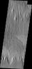
2012-12-04 |
Mars
|
2001 Mars Odyssey
|
THEMIS
|
1332x2934x1 |
|
-
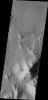
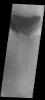
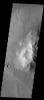
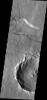
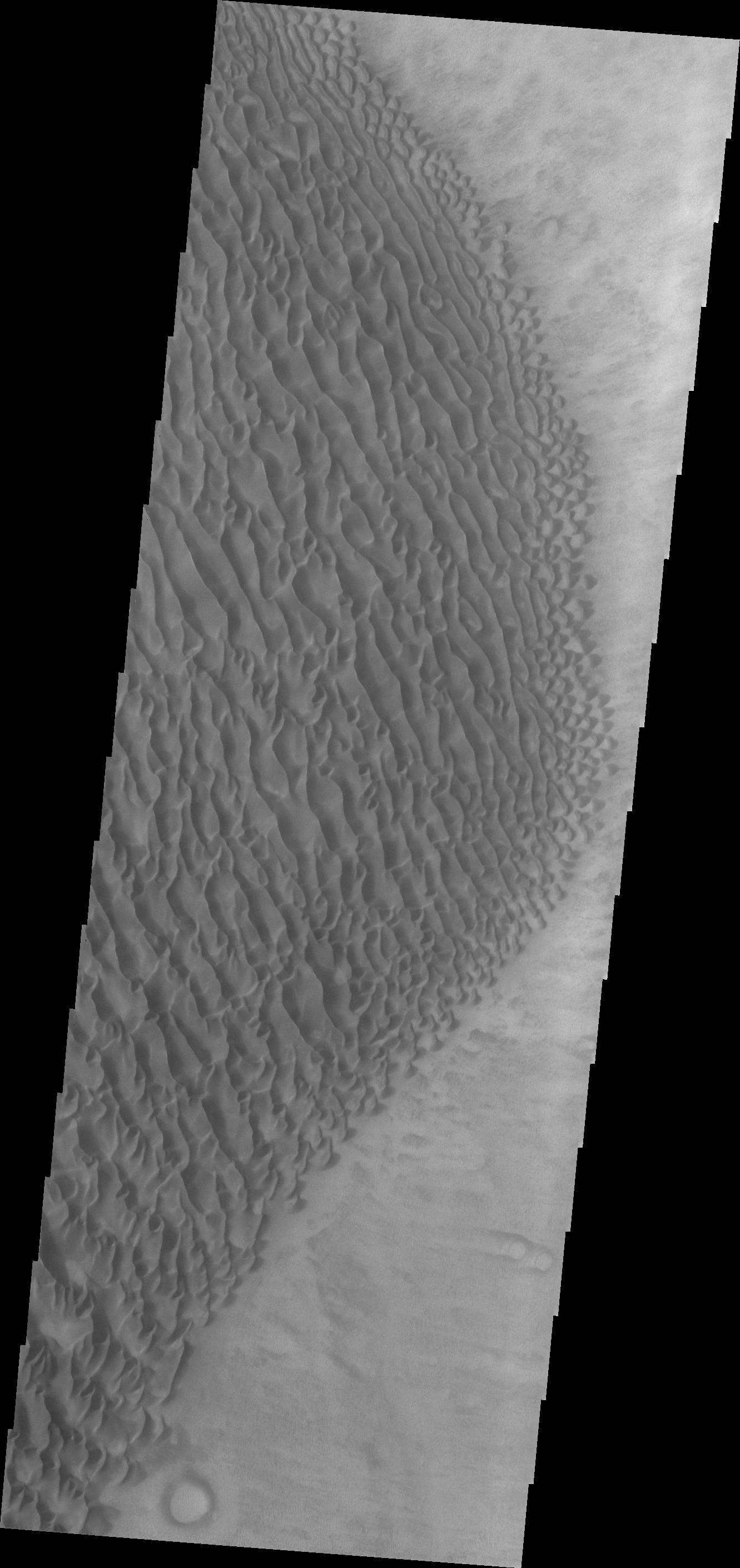
PIA16509:
-
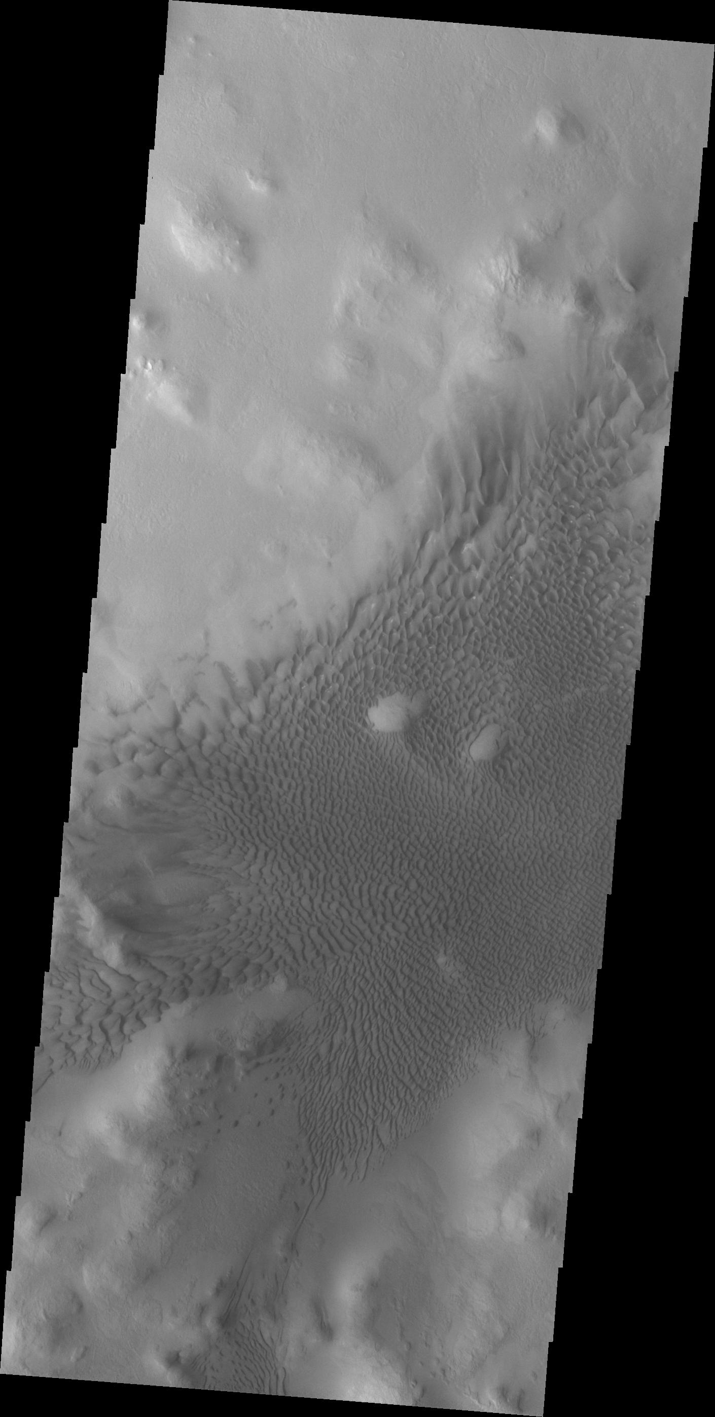
Crater Dunes
Full Resolution:
TIFF
(3.912 MB)
JPEG
(426.4 kB)
|
|
|
2012-12-05 |
Mars
|
2001 Mars Odyssey
|
THEMIS
|
1356x2923x1 |

|
-
PIA16510:
-
Aram Chaos
Full Resolution:
TIFF
(3.968 MB)
JPEG
(420.1 kB)
|
|
|
2012-12-05 |
Mars
|
Mars Reconnaissance Orbiter (MRO)
Mars Science Laboratory (MSL)
|
CTX
HiRISE
|
4985x2619x3 |
|
-
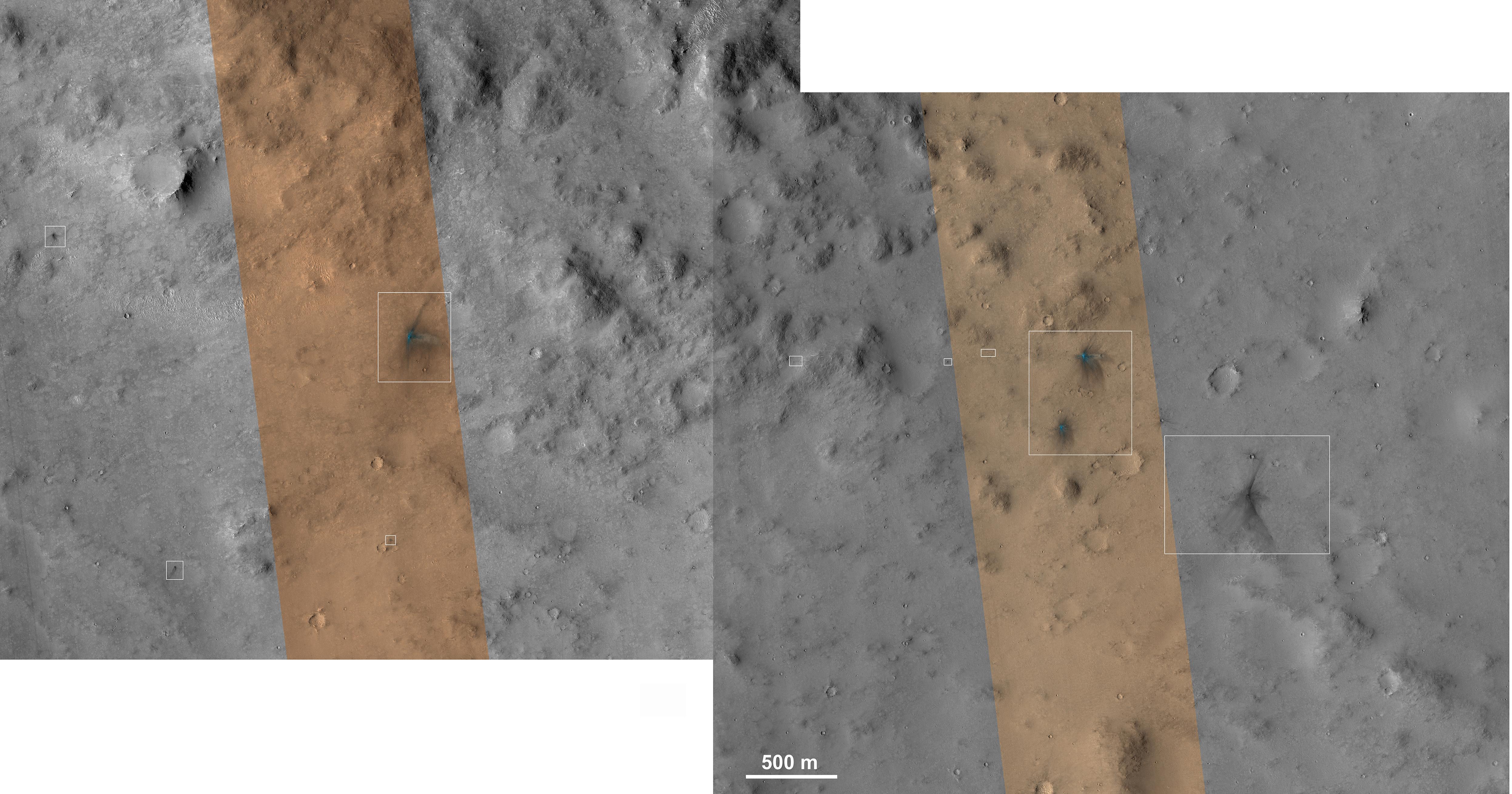
PIA16456:
-
Impact Scars from MSL Cruise Stage and Two Balance Weights
Full Resolution:
TIFF
(39.19 MB)
JPEG
(1.692 MB)
|
|
|
2012-12-06 |
Mars
|
2001 Mars Odyssey
|
THEMIS
|
1374x2776x1 |
|
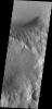
-
PIA16511:
-
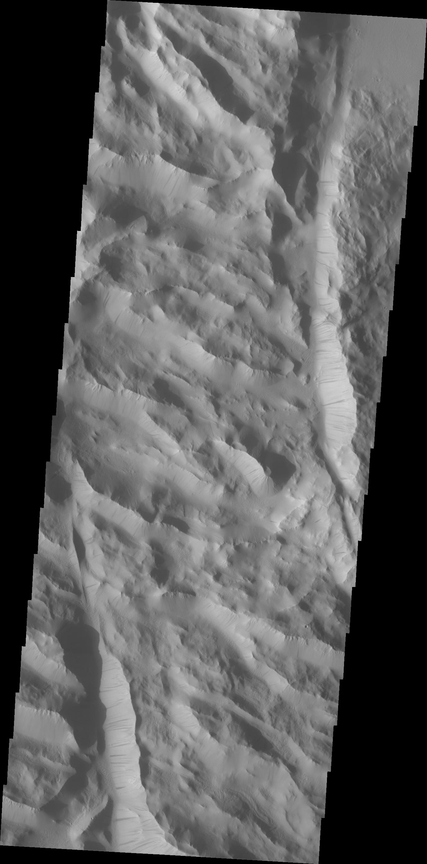
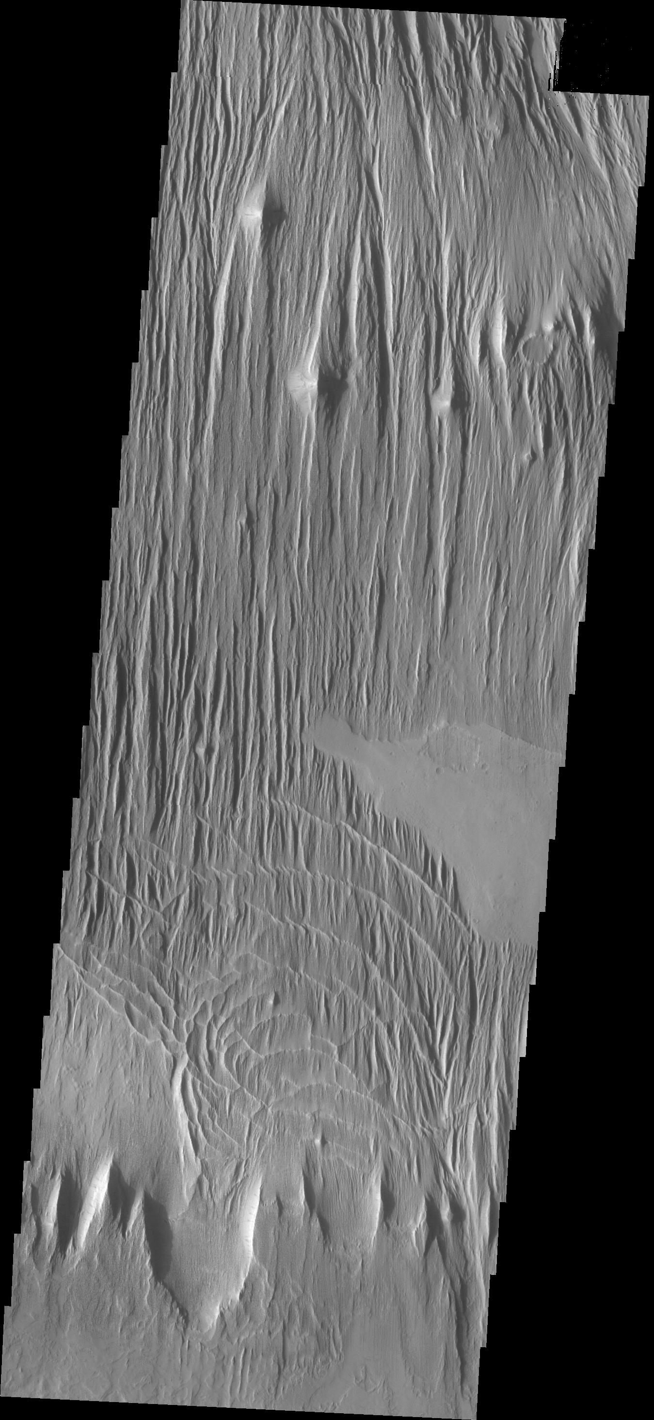
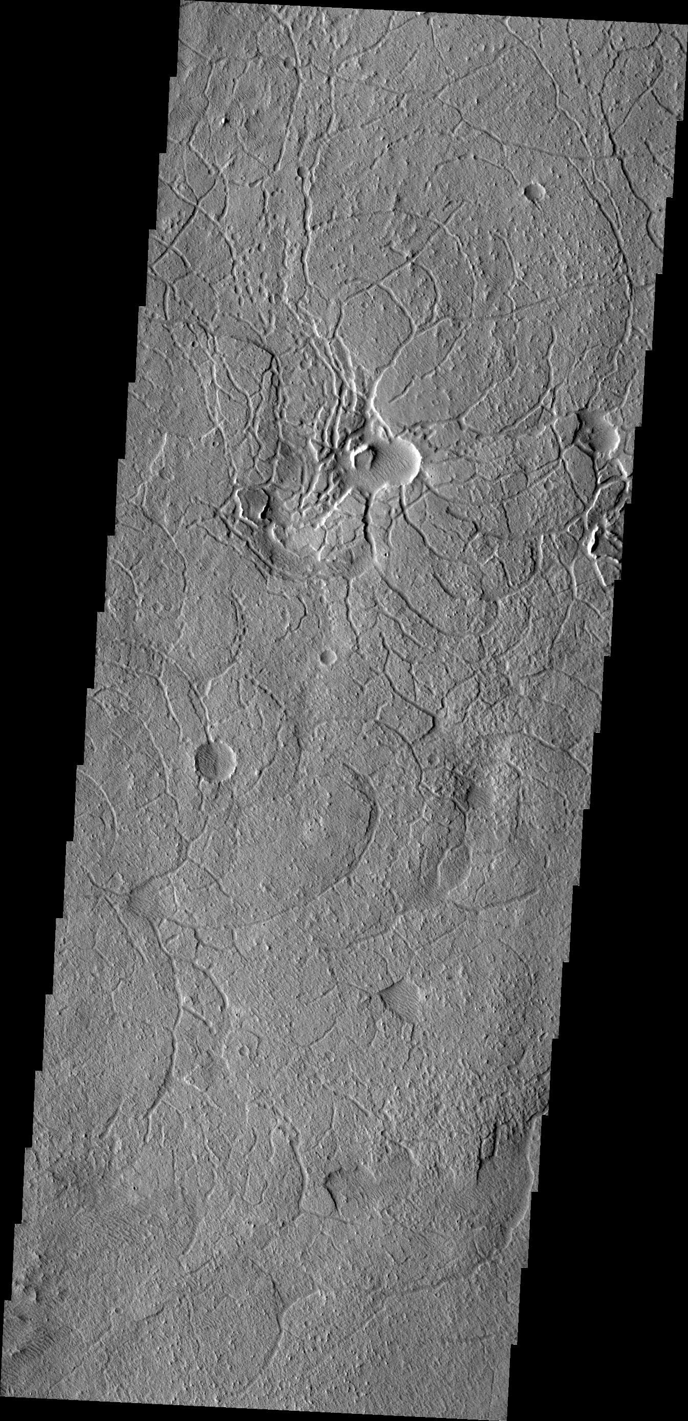
Lycus Sulci
Full Resolution:
TIFF
(3.819 MB)
JPEG
(236.1 kB)
|
|
|
2012-12-07 |
Mars
|
2001 Mars Odyssey
|
THEMIS
|
1410x2796x1 |

|
-
PIA16512:
-
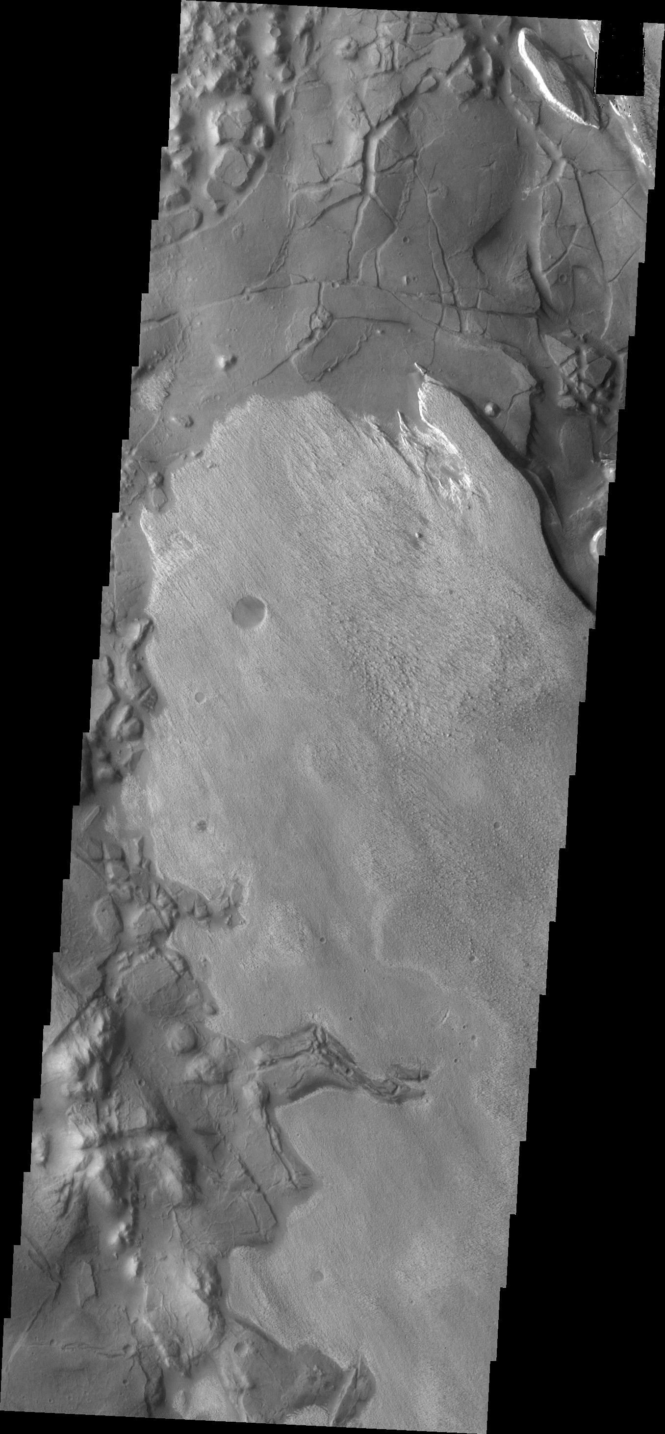
Lyot Crater Dunes
Full Resolution:
TIFF
(3.947 MB)
JPEG
(254.3 kB)
|
|
|
2012-12-10 |
Mars
|
2001 Mars Odyssey
|
THEMIS
|
1370x2925x1 |
|
-
PIA16513:
-
Windstreaks
Full Resolution:
TIFF
(4.012 MB)
JPEG
(517.3 kB)
|
|
|
2012-12-11 |
Mars
|
2001 Mars Odyssey
|
THEMIS
|
1349x2926x1 |
|
-
PIA16592:
-
Wind Erosion
Full Resolution:
TIFF
(3.951 MB)
JPEG
(453.2 kB)
|
|
|
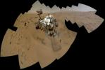
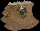
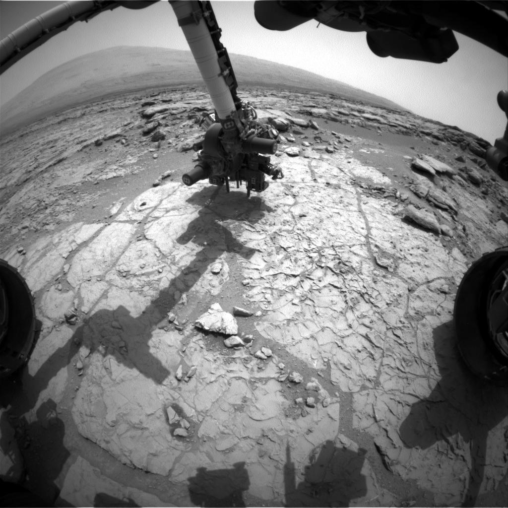
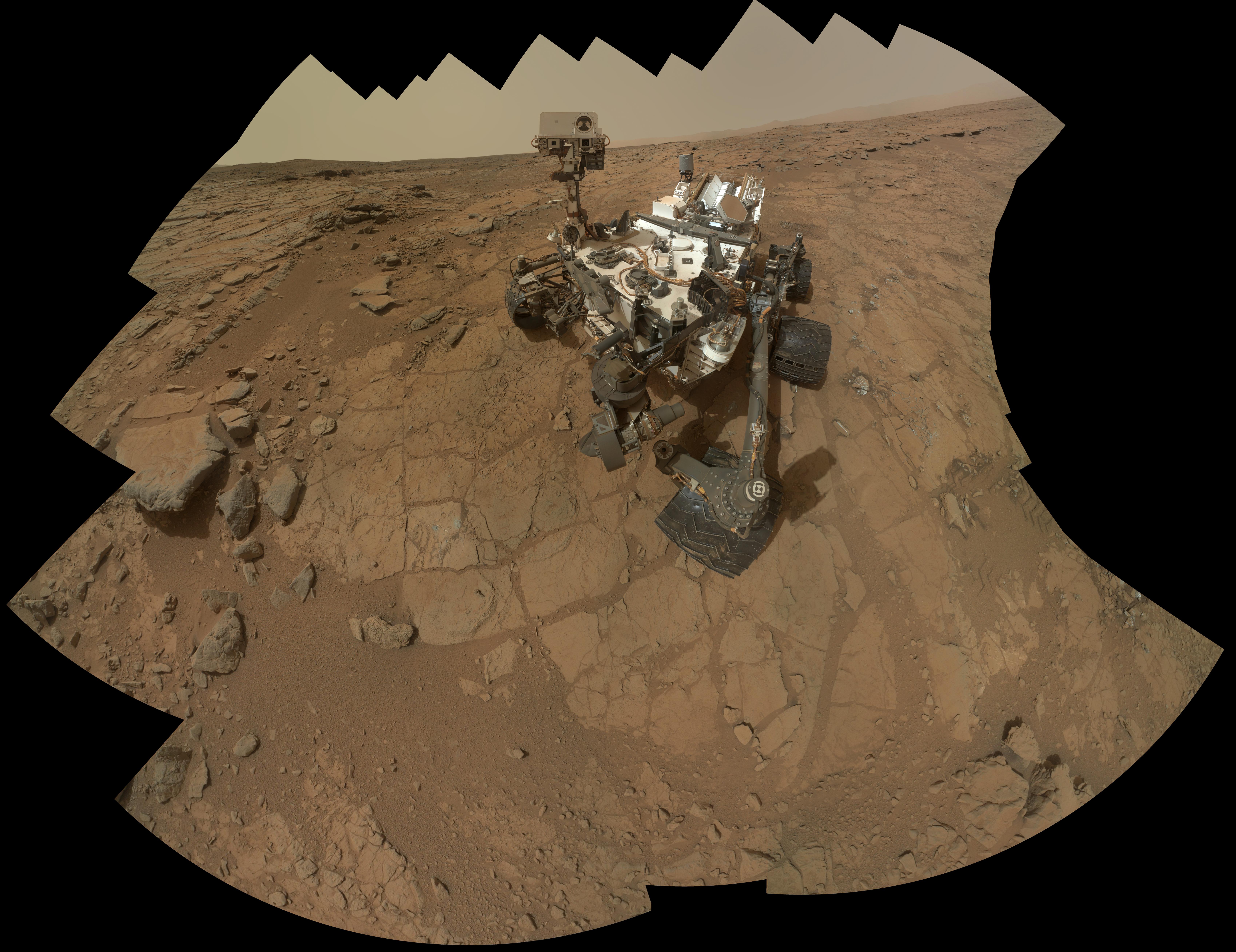
2012-12-11 |
Mars
|
Mars Science Laboratory (MSL)
|
MAHLI
|
6710x4500x3 |
|
-
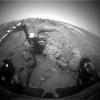
PIA16457:
-
Curiosity Self-Portrait, Wide View
Full Resolution:
TIFF
(90.62 MB)
JPEG
(2.278 MB)
|
|
|
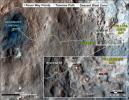
2012-12-11 |
Mars
|
Mars Reconnaissance Orbiter (MRO)
Mars Science Laboratory (MSL)
|
HiRISE
|
3300x2550x3 |
|
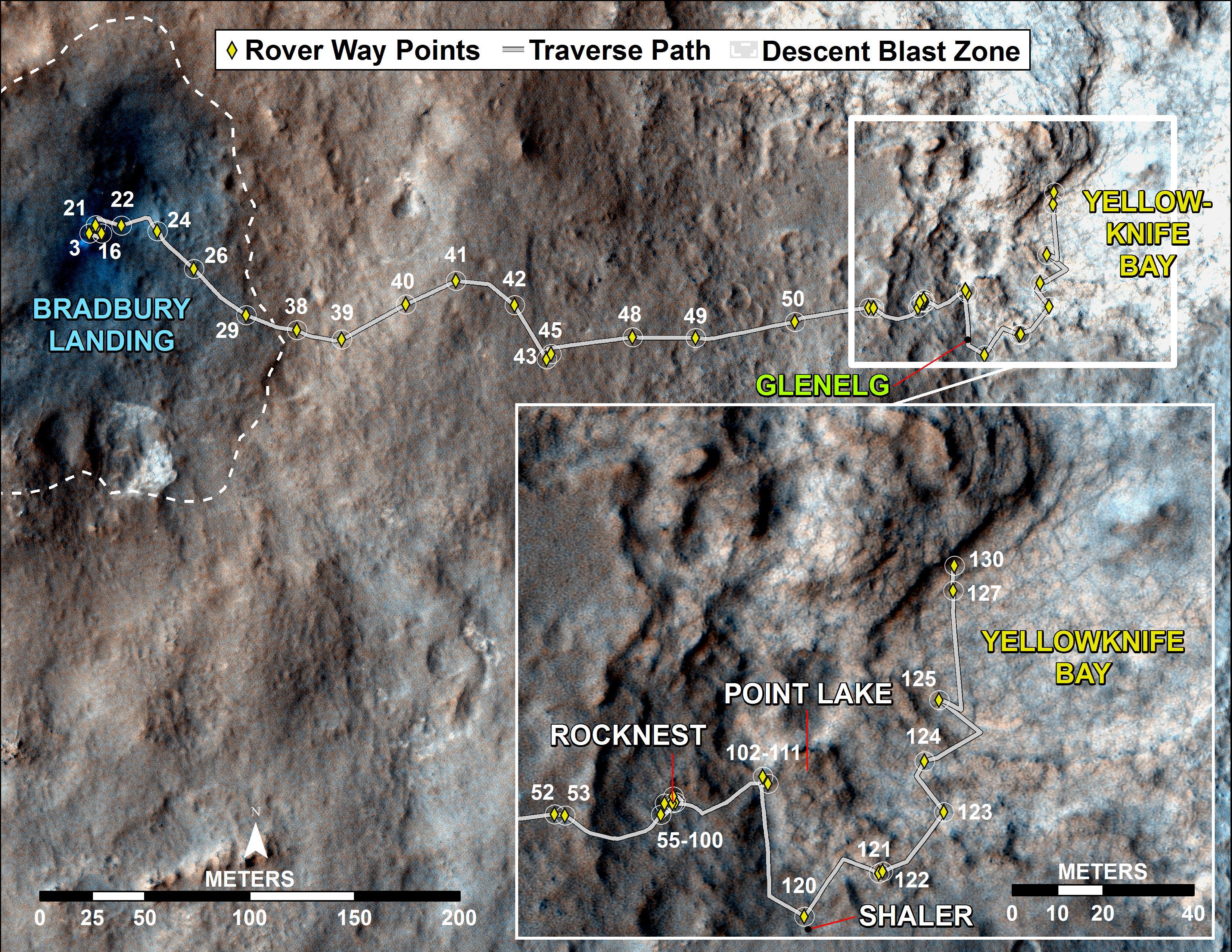
-
PIA16459:
-
Curiosity Traverse Map, Sol 123
Full Resolution:
TIFF
(25.26 MB)
JPEG
(1.748 MB)
|
|
|
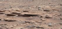
2012-12-11 |
Mars
|
Mars Science Laboratory (MSL)
|
Mastcam
|
2438x1141x3 |
|
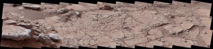
-
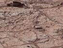
PIA16550:
-
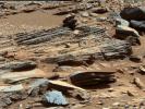
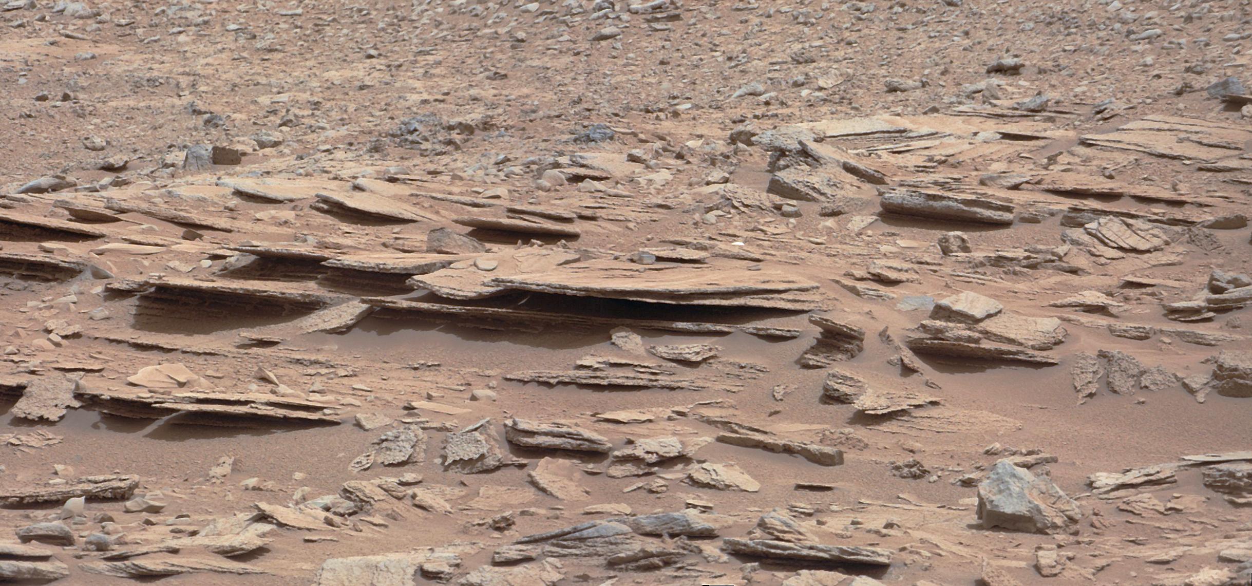
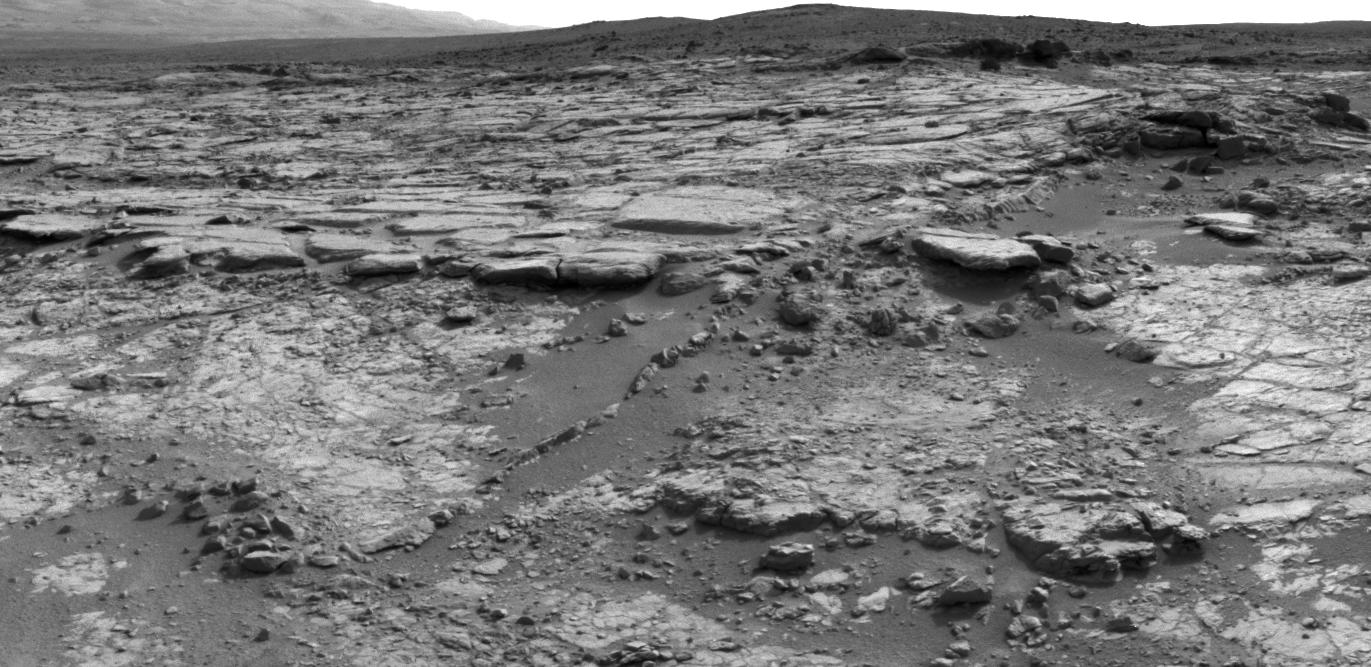
Layered Martian Outcrop 'Shaler' in 'Glenelg' Area
Full Resolution:
TIFF
(8.349 MB)
JPEG
(481.8 kB)
|
|
|
2012-12-11 |
Mars
|
Mars Science Laboratory (MSL)
|
Navcam (MSL)
|
5012x988x1 |

|
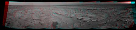
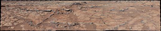
-
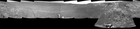
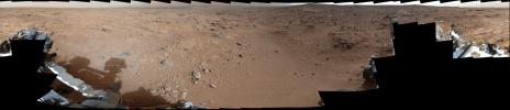
PIA16551:
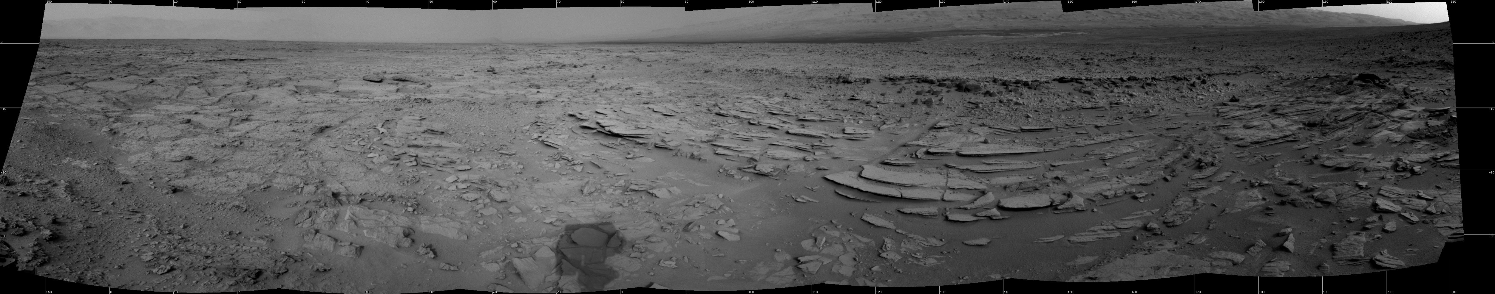
Sol 120 Panorama from Curiosity, near 'Shaler'
Full Resolution:
TIFF
(4.96 MB)
JPEG
(606.5 kB)
|
|
|
2012-12-11 |
Mars
|
Mars Science Laboratory (MSL)
|
Navcam (MSL)
|
5168x1157x3 |
|
-
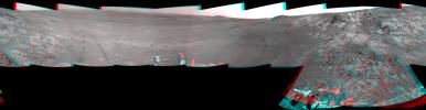
PIA16552:
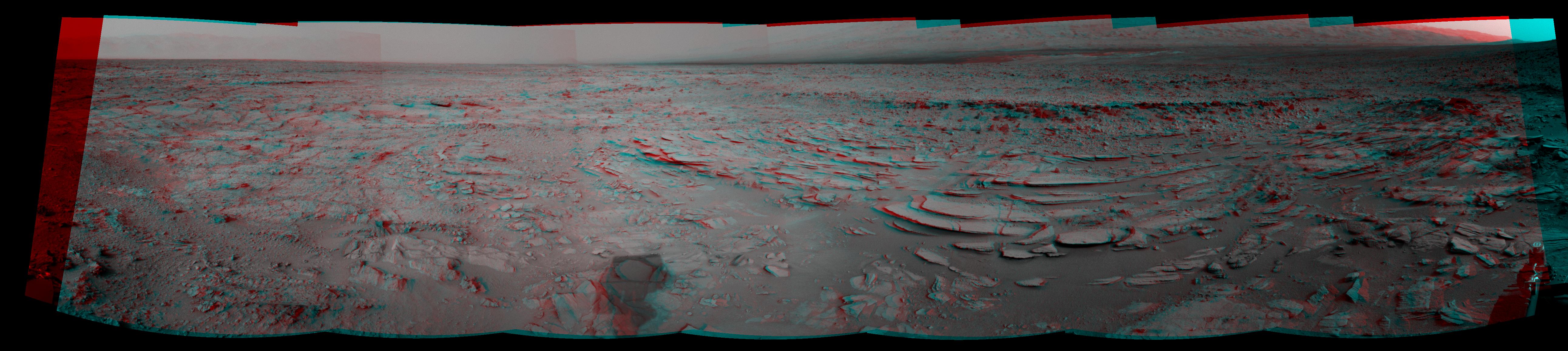
Sol 120 Panorama from Curiosity, near 'Shaler' (Stereo)
Full Resolution:
TIFF
(17.95 MB)
JPEG
(728.3 kB)
|
|
|
2012-12-12 |
Mars
|
2001 Mars Odyssey
|
THEMIS
|
1344x2775x1 |
|
-
PIA16593:
-
Arcuate Fractures
Full Resolution:
TIFF
(3.734 MB)
JPEG
(685.9 kB)
|
|
|
2012-12-13 |
Mars
|
2001 Mars Odyssey
|
THEMIS
|
1368x2920x1 |

|
-
PIA16594:
-
Hargraves Crater Dunes
Full Resolution:
TIFF
(3.999 MB)
JPEG
(230.2 kB)
|
|
|
2012-12-14 |
Mars
|
2001 Mars Odyssey
|
THEMIS
|
1330x2767x1 |
|
-
PIA16595:
-
Ceraunius Tholus
Full Resolution:
TIFF
(3.684 MB)
JPEG
(203.1 kB)
|
|
|
2012-12-17 |
Mars
|
2001 Mars Odyssey
|
THEMIS
|
686x1538x1 |

|
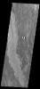
-
PIA16597:
-
Daedalia Planum
Full Resolution:
TIFF
(1.056 MB)
JPEG
(170.7 kB)
|
|
|
2012-12-18 |
Mars
|
2001 Mars Odyssey
|
THEMIS
|
1362x2770x1 |
|
-
PIA16641:
-
Trouvelot Crater Dunes
Full Resolution:
TIFF
(3.777 MB)
JPEG
(290 kB)
|
|
|
2012-12-18 |
Mars
|
Mars Science Laboratory (MSL)
|
Navcam (MSL)
|
1024x1024x1 |

|
-
PIA16553:
-
Looking Back at Entry Into 'Yellowknife Bay'
Full Resolution:
TIFF
(1.05 MB)
JPEG
(138.6 kB)
|
|
|
2012-12-18 |
Mars
|
Mars Reconnaissance Orbiter (MRO)
Mars Science Laboratory (MSL)
|
HiRISE
|
3300x2550x3 |

|
-
PIA16554:
-
Curiosity Traverse Map, Sol 130
Full Resolution:
TIFF
(25.26 MB)
JPEG
(1.761 MB)
|
|
|
2012-12-19 |
Mars
|
2001 Mars Odyssey
|
THEMIS
|
1341x2777x1 |
|
-
PIA16642:
-
Ganges Chasma
Full Resolution:
TIFF
(3.728 MB)
JPEG
(273 kB)
|
|
|
2012-12-19 |
Mars
|
Mars Exploration Rover (MER)
|
Hazcam
|
1024x1024x1 |
|
-
PIA16555:
-
Opportunity Investigation Target "Onaping"
Full Resolution:
TIFF
(1.05 MB)
JPEG
(117.5 kB)
|
|
|
2012-12-19 |
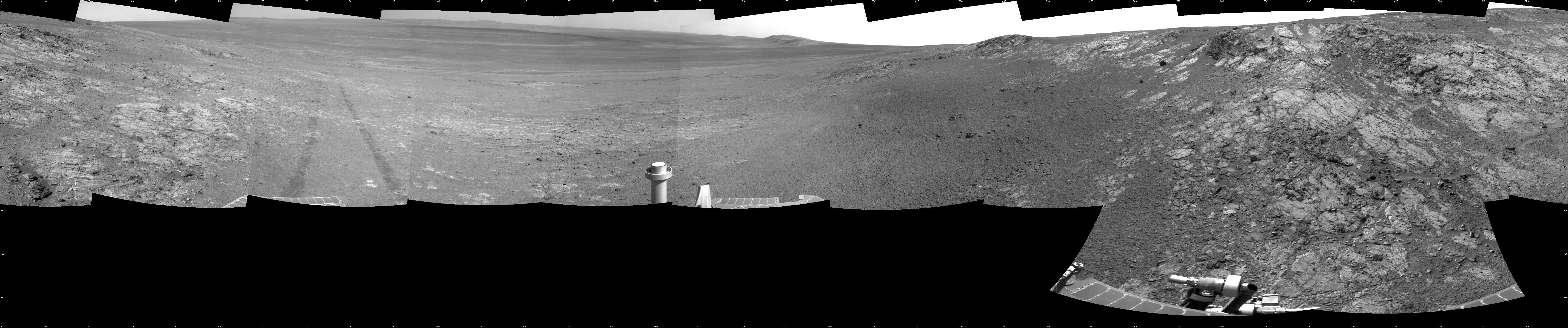
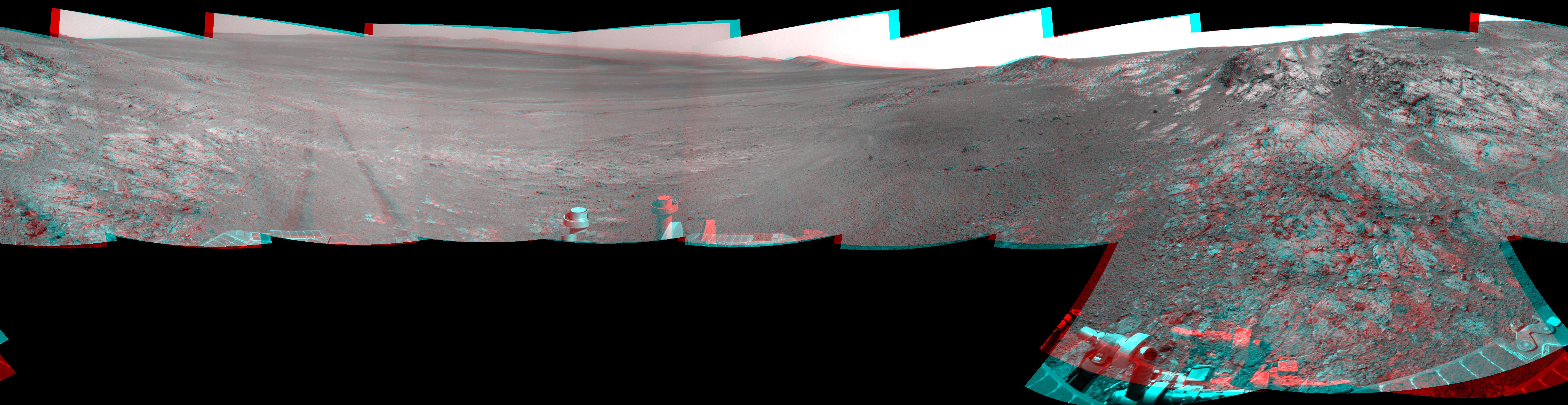
Mars
|
Mars Exploration Rover (MER)
|
Navigation Camera
|
7688x1073x1 |
|
-
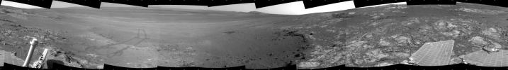
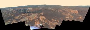
PIA16556:
Opportunity's Surroundings on Sol 3071, on 'Whitewater Lake' Outcrop
Full Resolution:
TIFF
(8.258 MB)
JPEG
(1.138 MB)
|
|
|
2012-12-19 |
Mars
|
Mars Exploration Rover (MER)
|
Navigation Camera
|
7753x1255x3 |
|
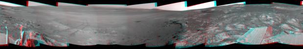
-
PIA16557:
Opportunity's Surroundings on Sol 3071, Stereo View
Full Resolution:
TIFF
(29.2 MB)
JPEG
(1.296 MB)
|
|
|
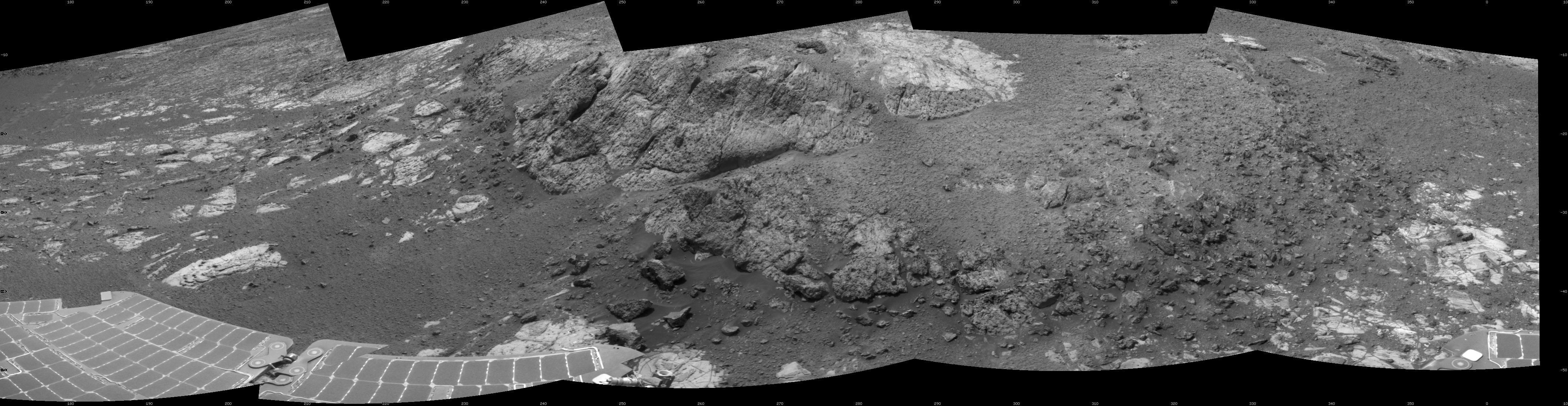
2012-12-19 |
Mars
|
Mars Exploration Rover (MER)
|
Navigation Camera
|
7688x1610x1 |
|
-
PIA16558:
Opportunity's Surroundings on Sol 3105, on 'Matijevic Hill'
Full Resolution:
TIFF
(12.39 MB)
JPEG
(1.516 MB)
|
|
|
2012-12-19 |
Mars
|
Mars Exploration Rover (MER)
|
Navigation Camera
|
7753x2005x3 |
|
-
PIA16559:
Opportunity's Surroundings on Sol 3105, Stereo View
Full Resolution:
TIFF
(46.65 MB)
JPEG
(1.802 MB)
|
|
|
2012-12-19 |
Mars
|
Mars Exploration Rover (MER)
|
Navigation Camera
|
4249x1100x1 |

|
-
PIA16560:
Opportunity at 'Copper Cliff,' Sol 3153
Full Resolution:
TIFF
(4.683 MB)
JPEG
(715.9 kB)
|
|
|
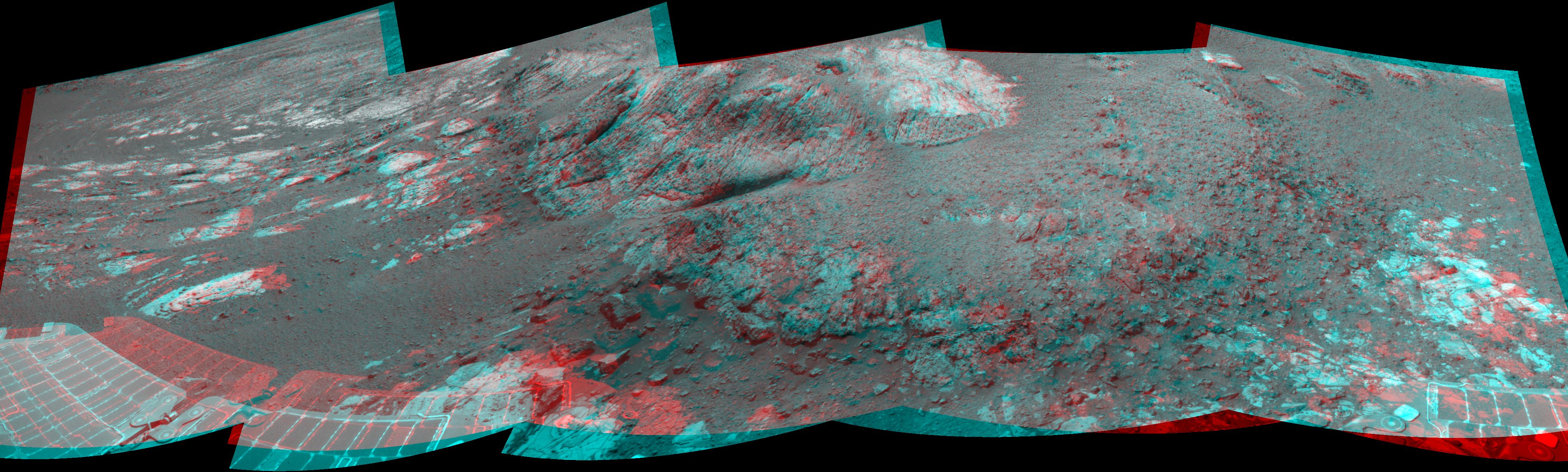
2012-12-19 |
Mars
|
Mars Exploration Rover (MER)
|
Navigation Camera
|
4285x1289x3 |
|
-
PIA16561:
-
Opportunity at 'Copper Cliff,' Sol 3153
Full Resolution:
TIFF
(16.58 MB)
JPEG
(862.8 kB)
|
|
|
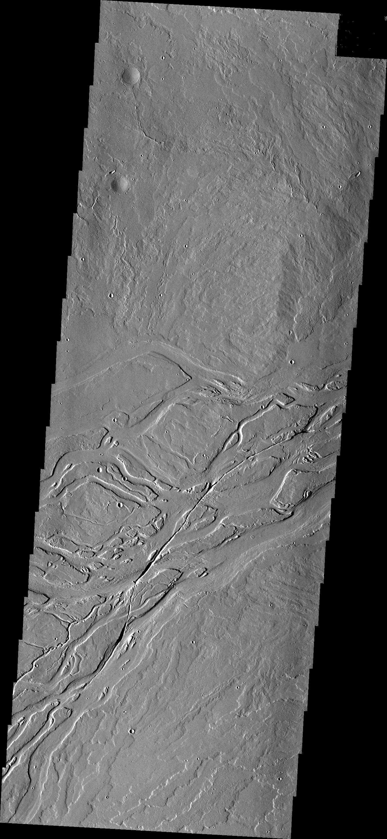
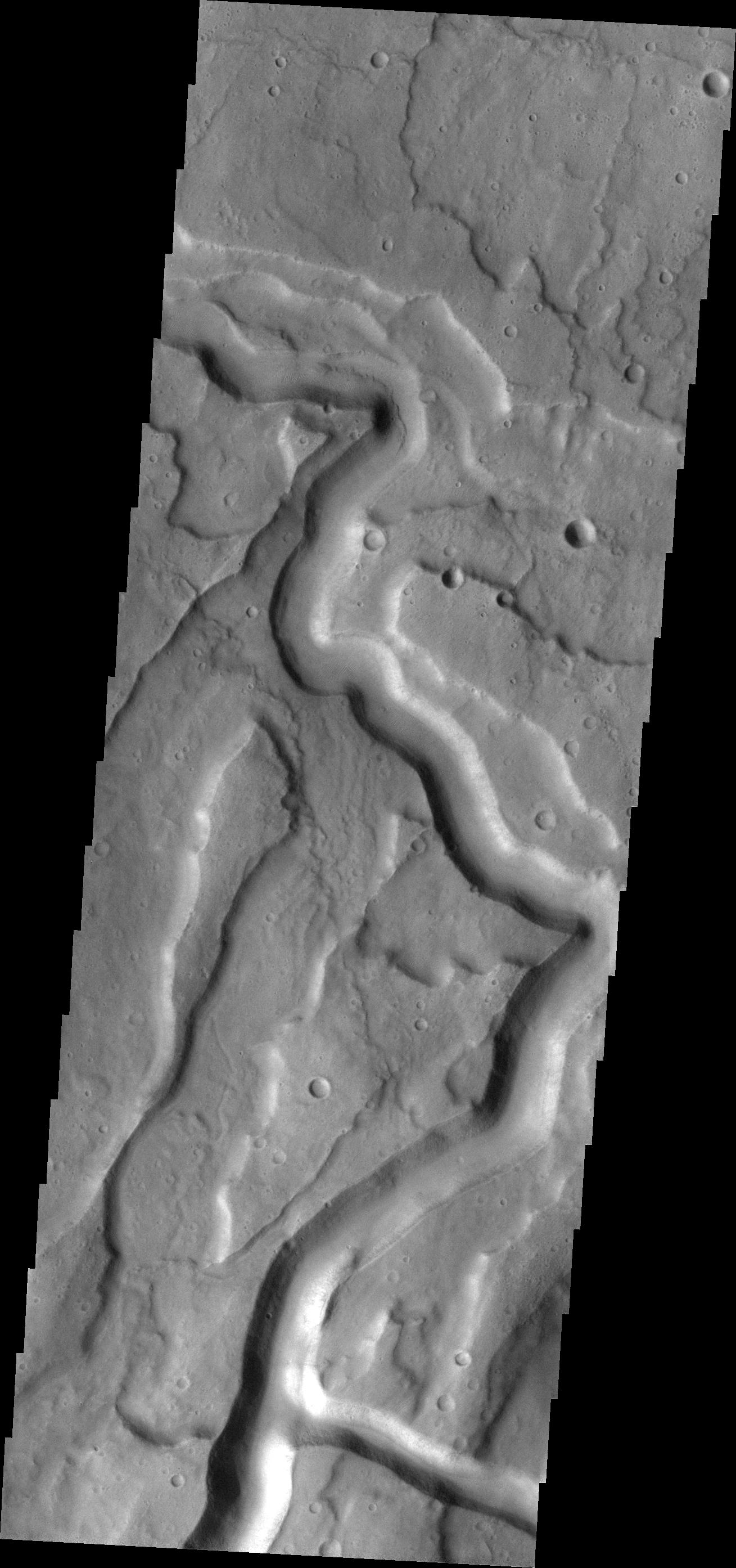
2012-12-20 |
Mars
|
2001 Mars Odyssey
|
THEMIS
|
1346x2918x1 |
|
-
PIA16643:
-
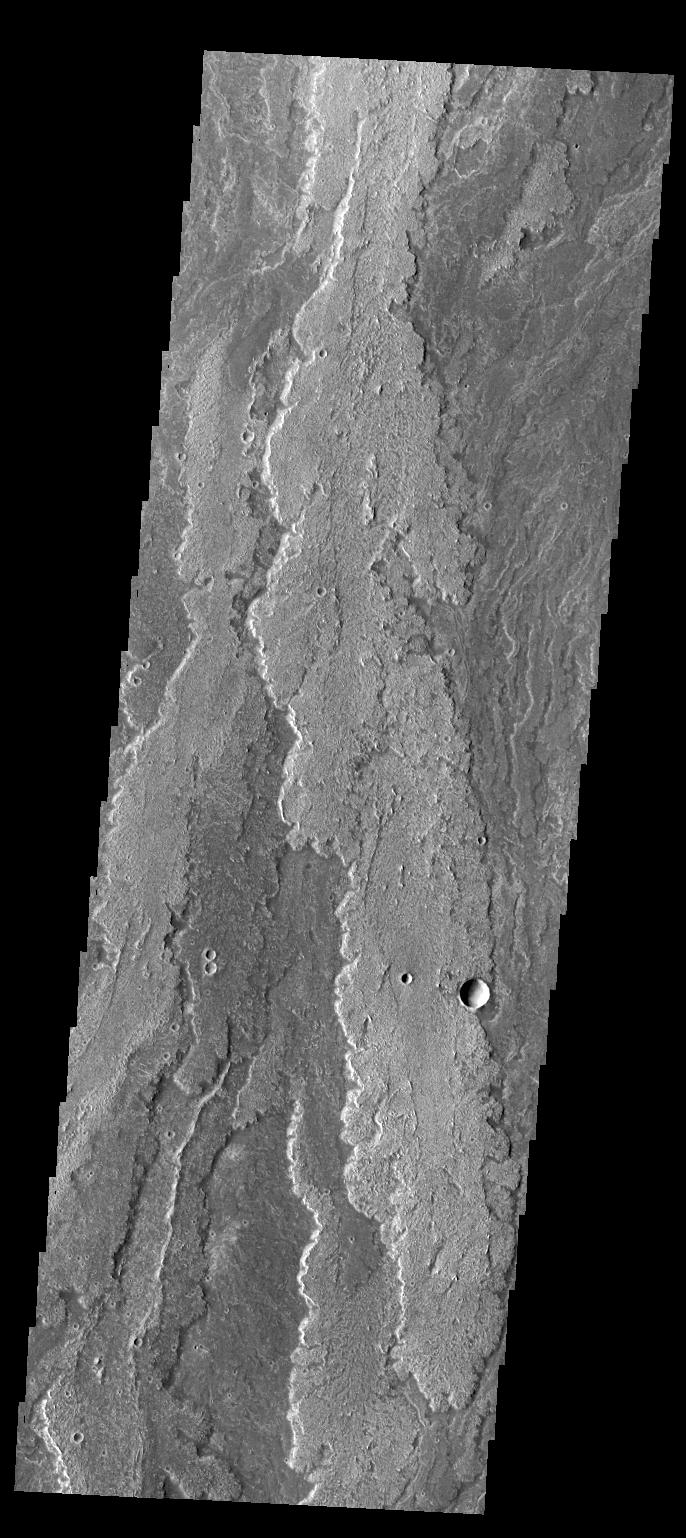
Lava Channels
Full Resolution:
TIFF
(3.932 MB)
JPEG
(596.9 kB)
|
|
|
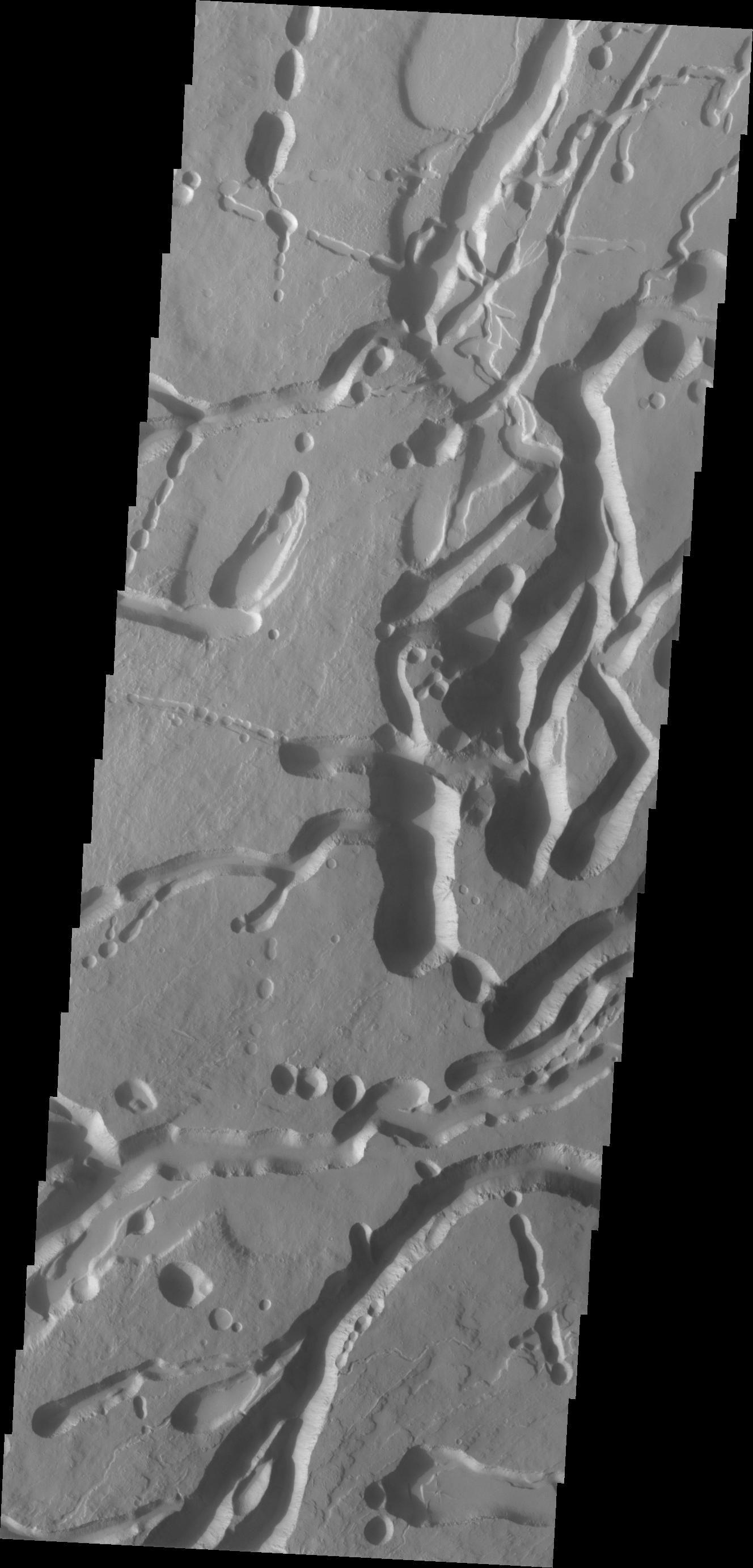
2012-12-21 |
Mars
|
2001 Mars Odyssey
|
THEMIS
|
922x2924x1 |
|
-
PIA16644:
-
South Polar Surface
Full Resolution:
TIFF
(2.699 MB)
JPEG
(628.4 kB)
|
|
|
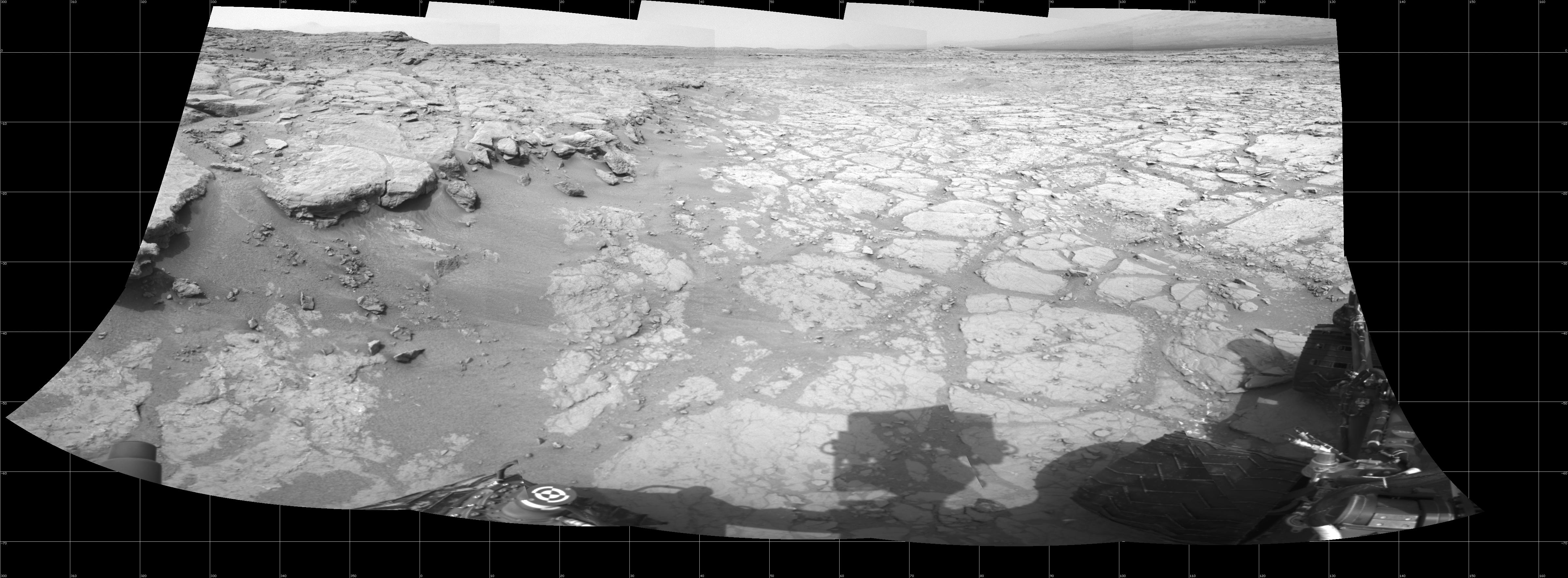
2012-12-21 |
Mars
|
Mars Science Laboratory (MSL)
|
Navcam (MSL)
|
4798x1769x1 |

|
-
PIA16562:
-
At Edge of 'Yellowknife Bay,' Sol 130
Full Resolution:
TIFF
(8.502 MB)
JPEG
(863 kB)
|
|
|
2012-12-24 |
Mars
|
2001 Mars Odyssey
|
THEMIS
|
1374x2919x1 |
|
-
PIA16645:
-
Dunes
Full Resolution:
TIFF
(4.016 MB)
JPEG
(246.7 kB)
|
|
|
2012-12-25 |
Mars
|
2001 Mars Odyssey
|
THEMIS
|
937x2931x1 |
|
-
PIA16646:
-
Polar Layers
Full Resolution:
TIFF
(2.75 MB)
JPEG
(261.3 kB)
|
|
|
2012-12-26 |
Mars
|
2001 Mars Odyssey
|
THEMIS
|
1328x2766x1 |
|
-
PIA16647:
-
Ascraeus Mons
Full Resolution:
TIFF
(3.677 MB)
JPEG
(250.9 kB)
|
|
|
2012-12-27 |
Mars
|
2001 Mars Odyssey
|
THEMIS
|
1331x2820x1 |

|
-
PIA16648:
-
Proctor Crater Dunes
Full Resolution:
TIFF
(3.757 MB)
JPEG
(255.5 kB)
|
|
|
2012-12-28 |
Mars
|
2001 Mars Odyssey
|
THEMIS
|
698x1542x1 |
|
-
PIA16649:
-
Dunes
Full Resolution:
TIFF
(1.078 MB)
JPEG
(53.19 kB)
|
|
|
2012-12-31 |
Mars
|
2001 Mars Odyssey
|
THEMIS
|
1319x2771x1 |

|
-
PIA16650:
-
Lava Channels
Full Resolution:
TIFF
(3.659 MB)
JPEG
(632.1 kB)
|
|
|
2013-01-01 |
Mars
|
2001 Mars Odyssey
|
THEMIS
|
1344x2919x1 |
|
-
PIA16651:
-
Olympus Mons Escarpment
Full Resolution:
TIFF
(3.927 MB)
JPEG
(450 kB)
|
|
|
2013-01-02 |
Mars
|
2001 Mars Odyssey
|
THEMIS
|
1359x2771x1 |

|
-
PIA16652:
-
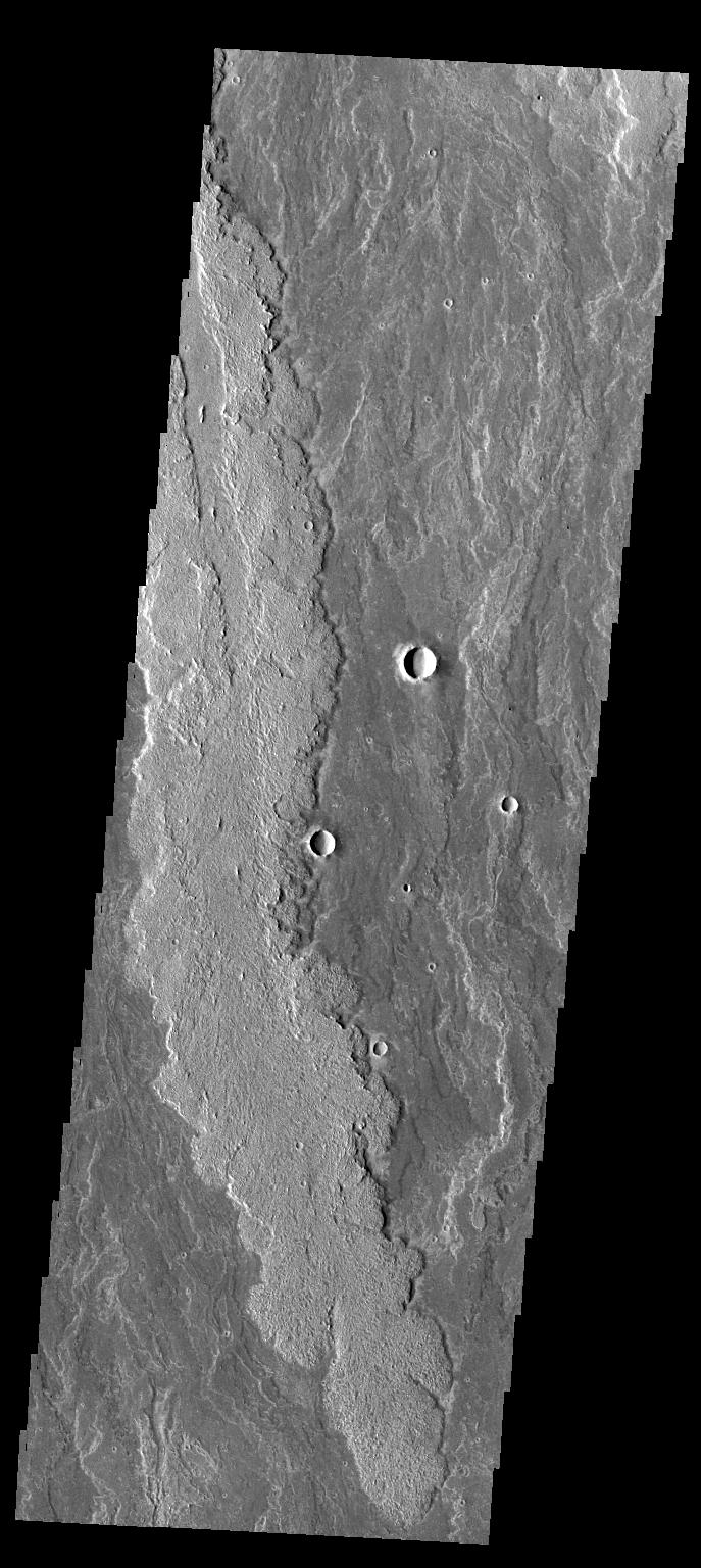
Streamlined Islands
Full Resolution:
TIFF
(3.77 MB)
JPEG
(659.2 kB)
|
|
|
2013-01-02 |
Mars
|
Mars Science Laboratory (MSL)
|
Mastcam
|
15338x3300x3 |
|
-
PIA16563:
Panoramic View From Near "Point Lake" in Gale Crater, Sol 106
Full Resolution:
TIFF
(151.9 MB)
JPEG
(7.168 MB)
|
|
|
2013-01-03 |
Mars
|
2001 Mars Odyssey
|
THEMIS
|
701x1543x1 |
|
-
PIA16653:
-
Nili Patera Dunes
Full Resolution:
TIFF
(1.083 MB)
JPEG
(106.8 kB)
|
|
|
2013-01-04 |
Mars
|
2001 Mars Odyssey
|
THEMIS
|
927x2775x1 |
|
-
PIA16654:
-
South Polar Surface
Full Resolution:
TIFF
(2.575 MB)
JPEG
(468.5 kB)
|
|
|
2013-01-04 |
Mars
|
Mars Science Laboratory (MSL)
|
Navcam (MSL)
|
1371x667x1 |

|
-
PIA16564:
-
'Snake River' Rock Feature Viewed by Curiosity Mars Rover
Full Resolution:
TIFF
(915.7 kB)
JPEG
(179.5 kB)
|
|
|
2013-01-07 |
Mars
|
2001 Mars Odyssey
|
THEMIS
|
698x1541x1 |
|
-
PIA16655:
-
Danielson Crater Dunes
Full Resolution:
TIFF
(1.077 MB)
JPEG
(93.23 kB)
|
|
|
2013-01-07 |
Mars
|
Mars Science Laboratory (MSL)
|
MAHLI
|
1602x1195x3 |
|
-
PIA16565:
-
First Use of Mars Rover Curiosity's Dust Removal Tool
Full Resolution:
TIFF
(5.745 MB)
JPEG
(493.3 kB)
|
|
|
2013-01-07 |
Mars
|
Mars Science Laboratory (MSL)
|
MAHLI
|
1605x1196x3 |
|
-
PIA16566:
-
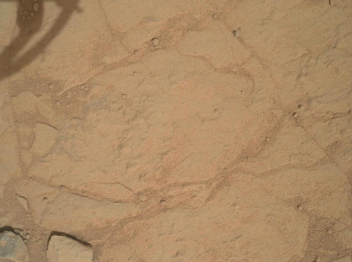
Close-up of Brushed Area on Martian Rock Target 'Ekwir_1'
Full Resolution:
TIFF
(5.761 MB)
JPEG
(619.5 kB)
|
|
|
2013-01-08 |
Mars
|
2001 Mars Odyssey
|
THEMIS
|
684x1537x1 |
|
-
PIA16656:
-
Dark Slope Streaks
Full Resolution:
TIFF
(1.053 MB)
JPEG
(79.4 kB)
|
|
|
2013-01-09 |
Mars
|
2001 Mars Odyssey
|
THEMIS
|
1328x2776x1 |
|
-
PIA16657:
-
Sand Dunes
Full Resolution:
TIFF
(3.69 MB)
JPEG
(295.1 kB)
|
|
|
2013-01-10 |
Mars
|
2001 Mars Odyssey
|
THEMIS
|
687x1537x1 |
|
-
PIA16658:
-
Arsia Mons Flows
Full Resolution:
TIFF
(1.057 MB)
JPEG
(164.1 kB)
|
|
|
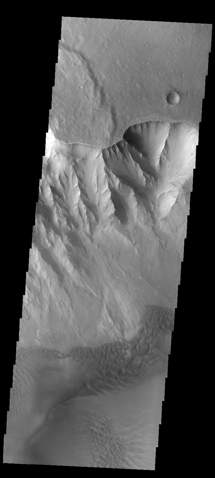
2013-01-11 |
Mars
|
2001 Mars Odyssey
|
THEMIS
|
1311x2803x1 |

|
-
PIA16659:
-
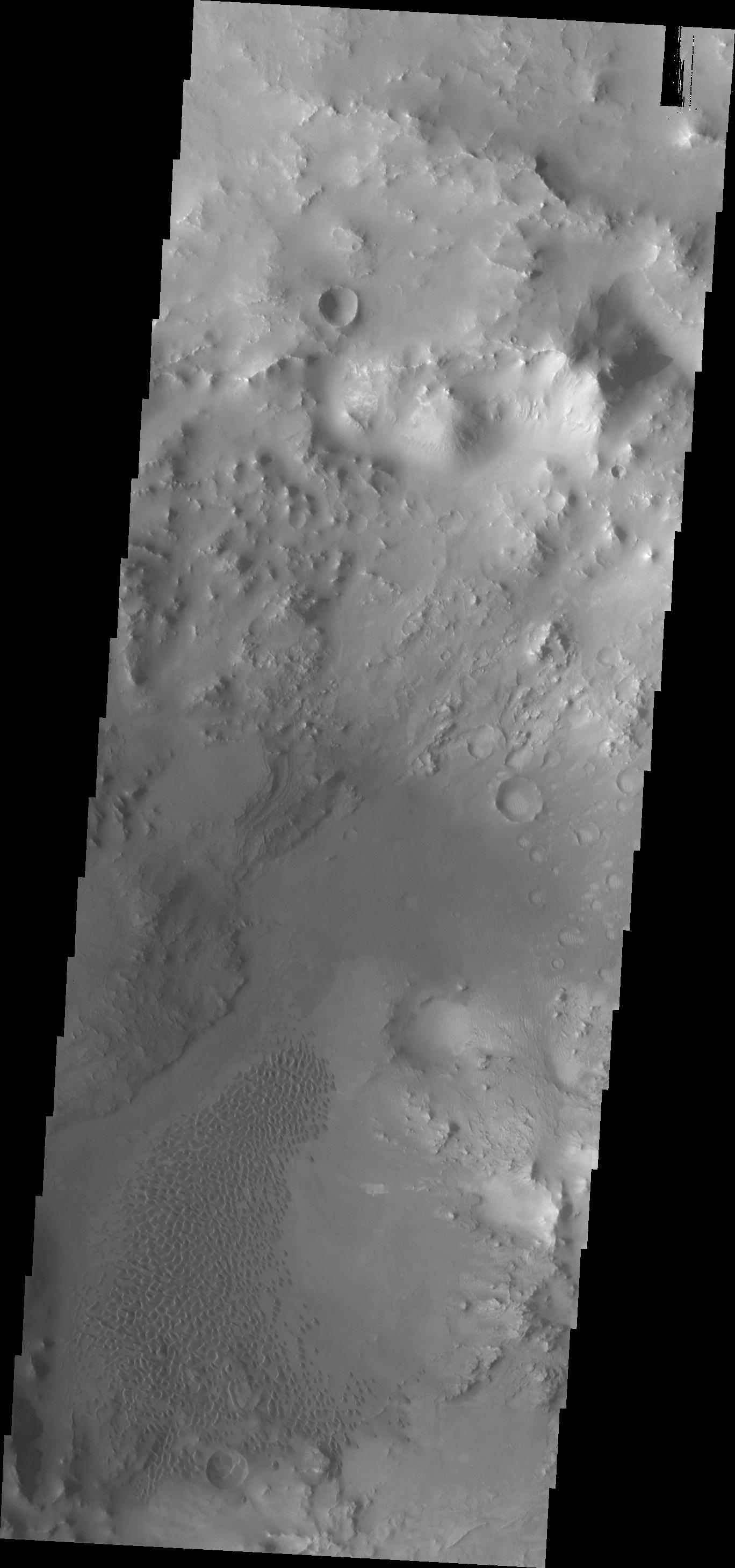
Bunge Gullies
Full Resolution:
TIFF
(3.679 MB)
JPEG
(312.9 kB)
|
|
|
2013-01-14 |
Mars
|
2001 Mars Odyssey
|
THEMIS
|
687x1538x1 |
|
-
PIA16660:
-
Daedalia Planum
Full Resolution:
TIFF
(1.058 MB)
JPEG
(146.5 kB)
|
|
|
2013-01-15 |
Mars
|
2001 Mars Odyssey
|
THEMIS
|
1308x2764x1 |
|
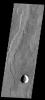
-
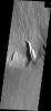
PIA16742:
-
Fracture
Full Resolution:
TIFF
(3.619 MB)
JPEG
(279.7 kB)
|
|
|
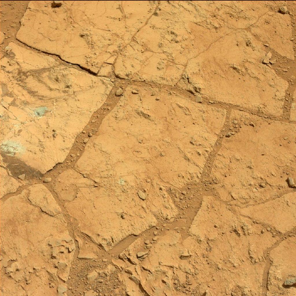
2013-01-15 |
Mars
|
Mars Science Laboratory (MSL)
|
Mastcam
|
3483x2651x3 |
|
-
PIA16567:
-
'John Klein' Site Selected for Curiosity's Drill Debut
Full Resolution:
TIFF
(27.71 MB)
JPEG
(1.787 MB)
|
|
|
2013-01-15 |
Mars
|
Mars Science Laboratory (MSL)
|
Mastcam
|
12858x6312x3 |
|
-
PIA16568:
-
Diversity in Vicinity of Curiosity's First Drilling Target
Full Resolution:
TIFF
(243.5 MB)
JPEG
(12.8 MB)
|
|
|
2013-01-15 |
Mars
|
Mars Science Laboratory (MSL)
|
Mastcam
|
4977x3714x3 |
|
-
PIA16569:
-
'Yellowknife Bay' Veins and Concretions
Full Resolution:
TIFF
(55.48 MB)
JPEG
(2.37 MB)
|
|
|
2013-01-15 |
Mars
|
Mars Science Laboratory (MSL)
|
Mastcam
|
19590x2421x3 |

|
-
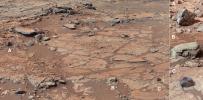
PIA16700:
Wide View of 'Shaler' Outcrop, Sol 120
Full Resolution:
TIFF
(142.3 MB)
JPEG
(8.299 MB)
|
|
|
2013-01-15 |
Mars
|
Mars Science Laboratory (MSL)
|
Mastcam
|
14049x2720x3 |
|
-
PIA16701:
View from Inside 'Yellowknife Bay'
Full Resolution:
TIFF
(114.7 MB)
JPEG
(7.851 MB)
|
|
|
2013-01-15 |
Mars
|
Mars Science Laboratory (MSL)
|
Mastcam
|
14016x3249x3 |
|
-
PIA16702:
Neighborhood for Curiosity's First Drilling Campaign
Full Resolution:
TIFF
(136.6 MB)
JPEG
(7.141 MB)
|
|
|
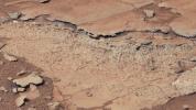
2013-01-15 |
Mars
|
Mars Science Laboratory (MSL)
|
Mastcam
|
1344x1200x3 |
|
-
PIA16705:
-
Veins in 'Sheepbed' Outcrop
Full Resolution:
TIFF
(4.84 MB)
JPEG
(456.9 kB)
|
|
|
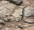
2013-01-15 |
Mars
|
Mars Science Laboratory (MSL)
|
Mastcam
|
1501x844x3 |
|
-
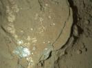
PIA16706:
-
Spherules in 'Yellowknife Bay'
Full Resolution:
TIFF
(3.802 MB)
JPEG
(203.7 kB)
|
|
|
2013-01-15 |
Mars
|
Mars Science Laboratory (MSL)
|
Mastcam
|
1227x919x3 |
|
-
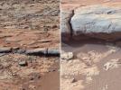
PIA16707:
-
'Shaler' Unit's Evidence of Stream Flow
Full Resolution:
TIFF
(3.384 MB)
JPEG
(232.4 kB)
|
|
|
2013-01-15 |
Mars
|
Mars Science Laboratory (MSL)
|
REMS
|
3300x2550x3 |
|
-
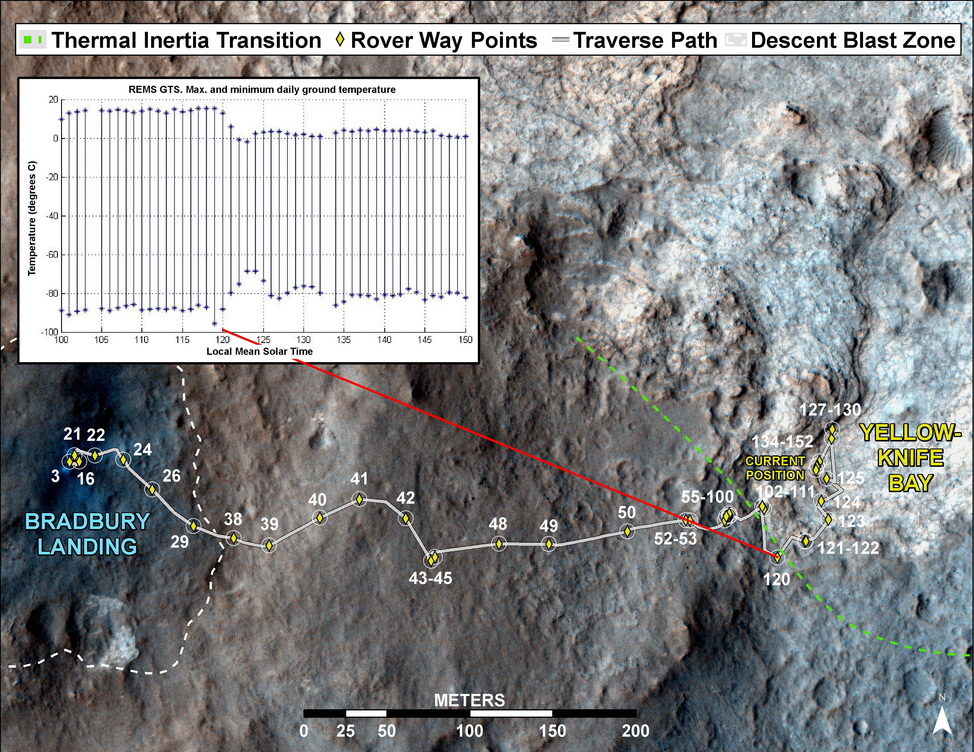
PIA16708:
-
Curiosity's Traverse into Different Terrain
Full Resolution:
TIFF
(25.26 MB)
JPEG
(1.779 MB)
|
|
|
2013-01-15 |
Mars
|
Mars Science Laboratory (MSL)
|
ChemCam
|
3391x4134x3 |
|
-
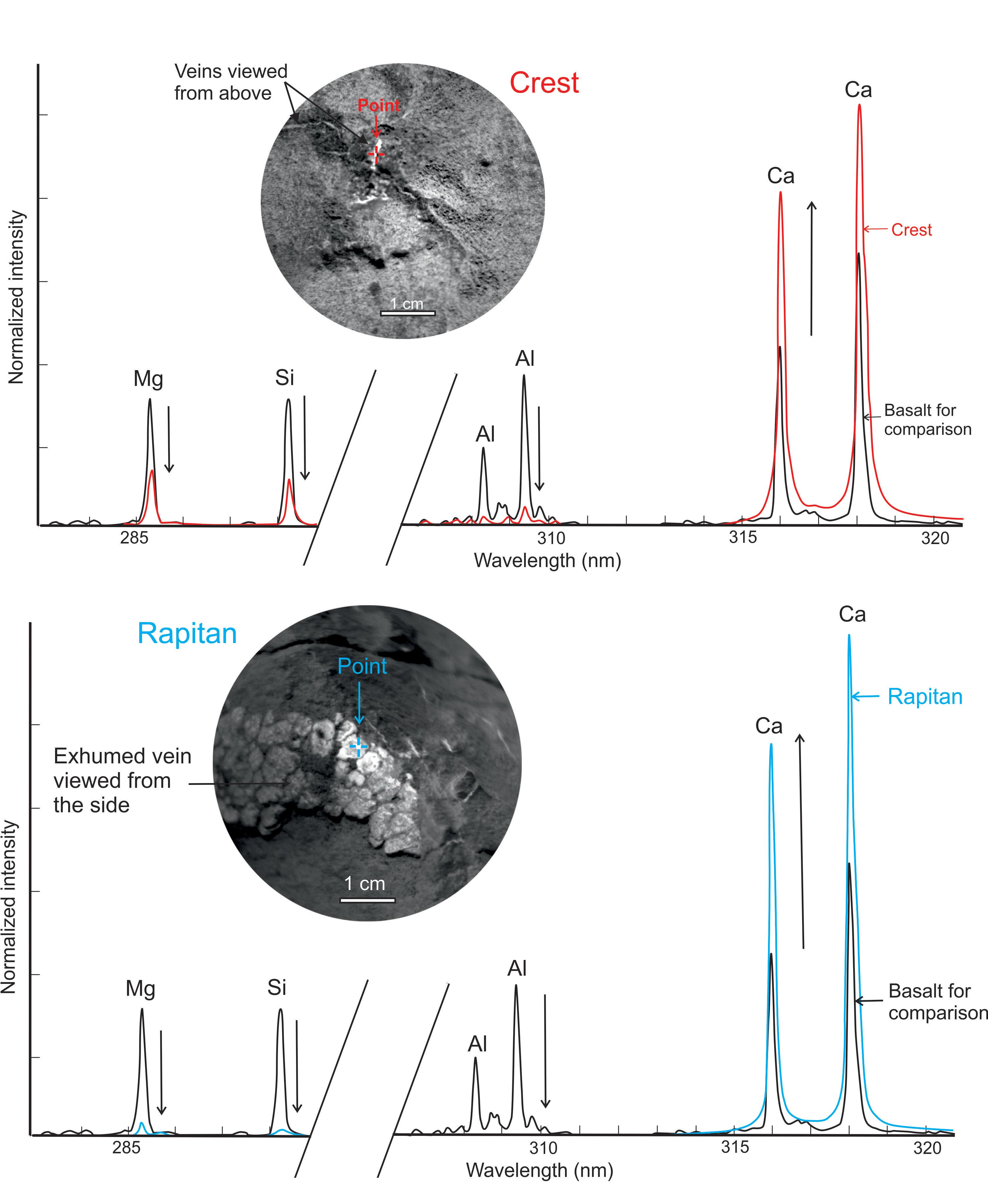
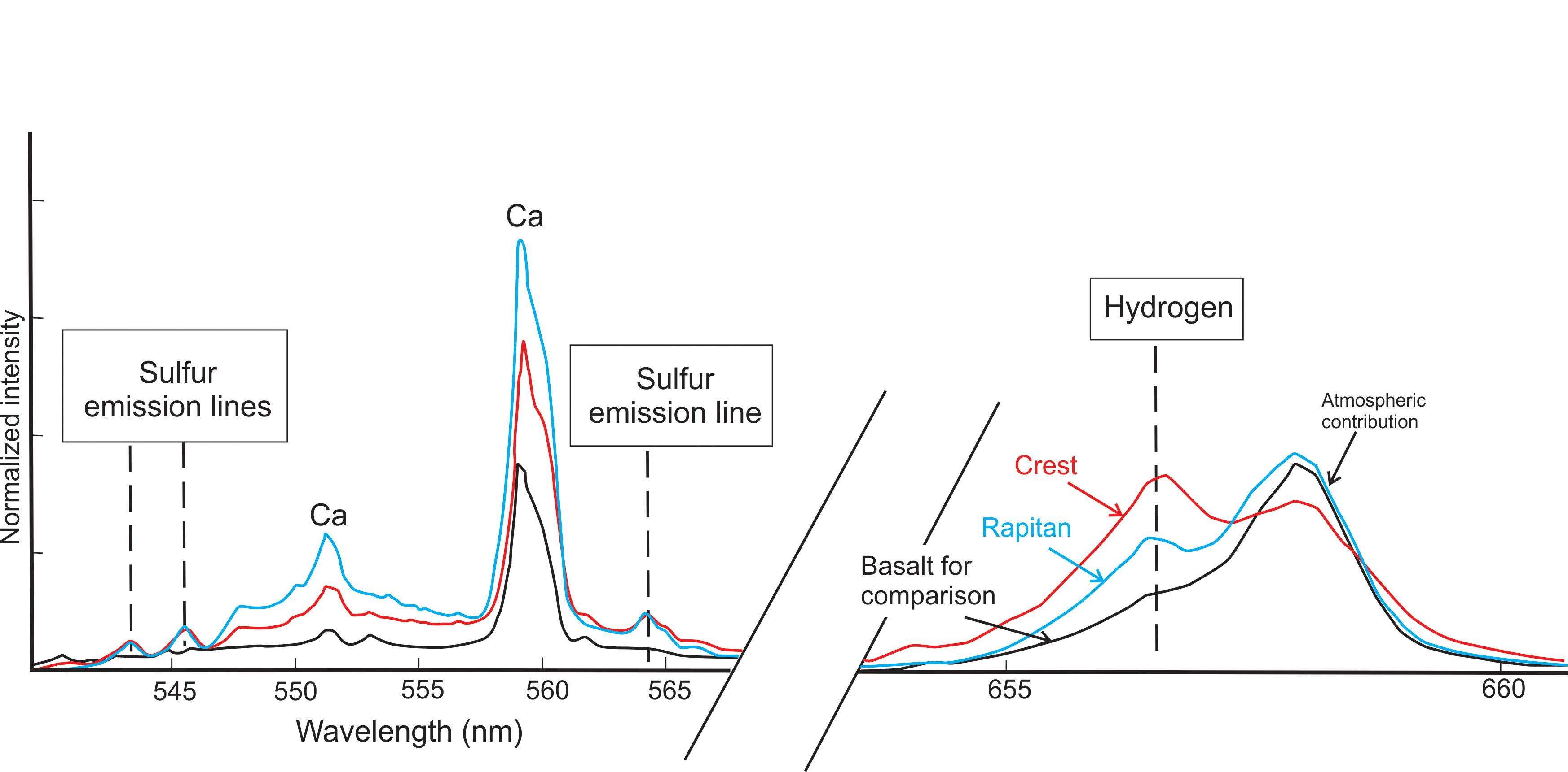
PIA16615:
-
Calcium-Rich Veins in Martian Rocks
Full Resolution:
TIFF
(42.07 MB)
JPEG
(715 kB)
|
|
|
2013-01-15 |
Mars
|
Mars Science Laboratory (MSL)
|
ChemCam
|
3492x1722x3 |
|
-
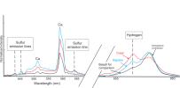
PIA16616:
-
Signs of Hydrated Calcium Sulfates in Martian Rocks
Full Resolution:
TIFF
(18.05 MB)
JPEG
(279.5 kB)
|
|
|
2013-01-15 |
Mars
|
Mars Science Laboratory (MSL)
|
ChemCam
|
3556x1653x3 |
|
-
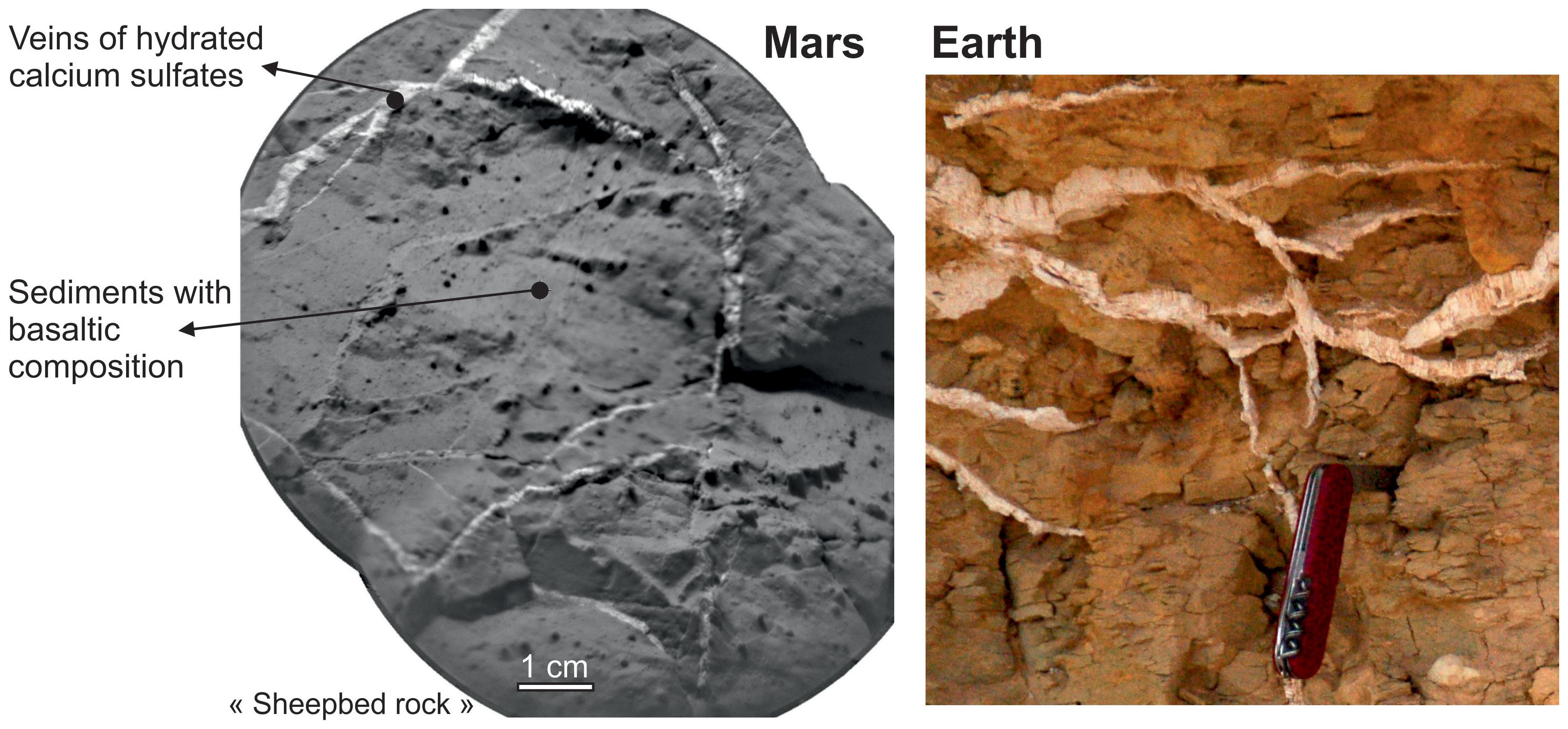
PIA16617:
-
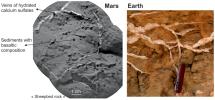
Veins in Rocks on Mars and Earth
Full Resolution:
TIFF
(17.64 MB)
JPEG
(551 kB)
|
|
|
2013-01-15 |
Mars
|
Mars Science Laboratory (MSL)
|
MARDI
|
615x458x3 |
|
-
PIA16618:
-
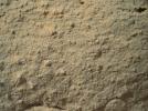
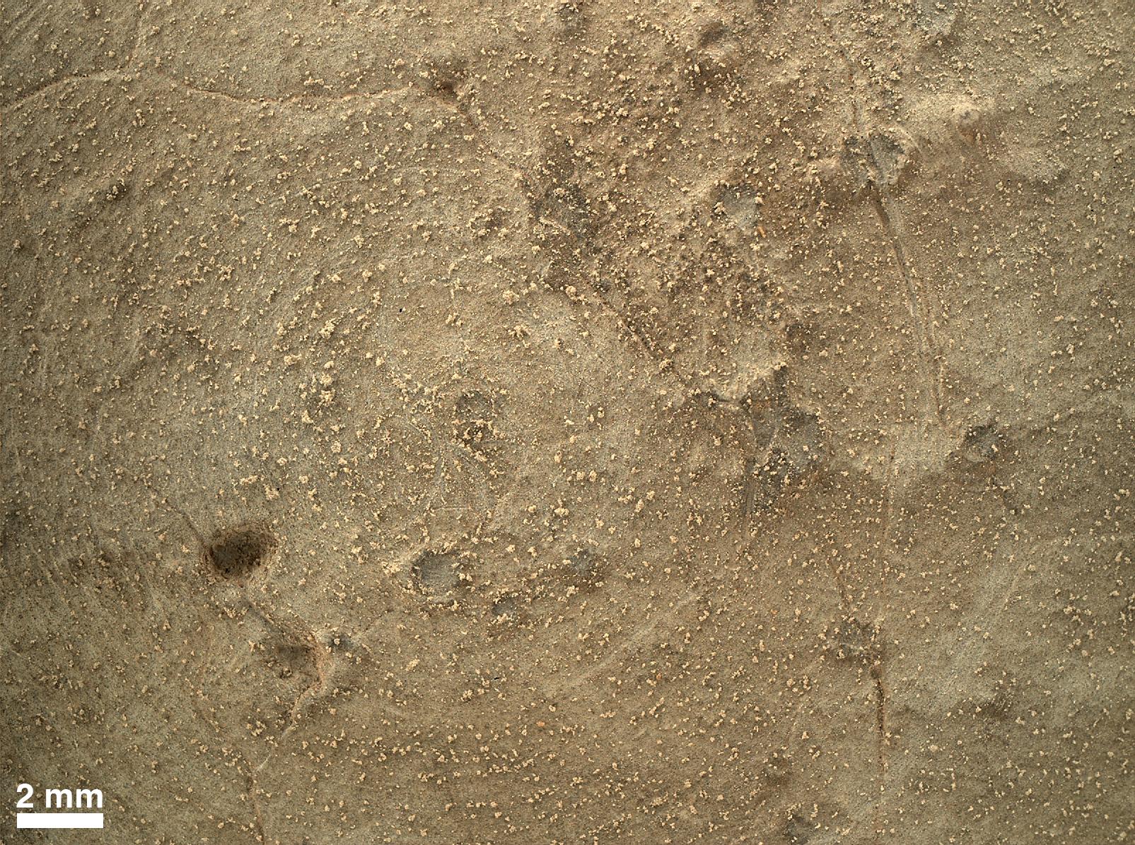
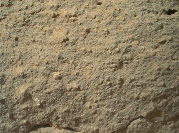
Texture of 'Gillespie Lake' Rock
Full Resolution:
TIFF
(845.5 kB)
JPEG
(62.47 kB)
|
|
|
2013-01-15 |
Mars
|
Mars Science Laboratory (MSL)
|
MAHLI
|
1182x882x3 |
|
-
PIA16619:
-
Before and After a Little Dusting

Full Resolution:
TIFF
(1.045 MB)
JPEG
(145.7 kB)
|
|
|
2013-01-16 |
Mars
|
2001 Mars Odyssey
|
THEMIS
|
1323x2778x1 |

|
-
PIA16743:
-
Lava Flows
Full Resolution:
TIFF
(3.679 MB)
JPEG
(482.3 kB)
|
|
|
2013-01-17 |
Mars
|
2001 Mars Odyssey
|
THEMIS
|
941x2773x1 |
|
-
PIA16744:
-
South Polar Layers
Full Resolution:
TIFF
(2.612 MB)
JPEG
(204.4 kB)
|
|
|
2013-01-18 |
Mars
|
2001 Mars Odyssey
|
THEMIS
|
934x2769x1 |
|
-
PIA16745:
-
South Pole
Full Resolution:
TIFF
(2.589 MB)
JPEG
(502.8 kB)
|
|
|
2013-01-20 |
Mars
|
Mars Reconnaissance Orbiter (MRO)
|
HiRISE
|
612x431x3 |
|
-
PIA16710:
-
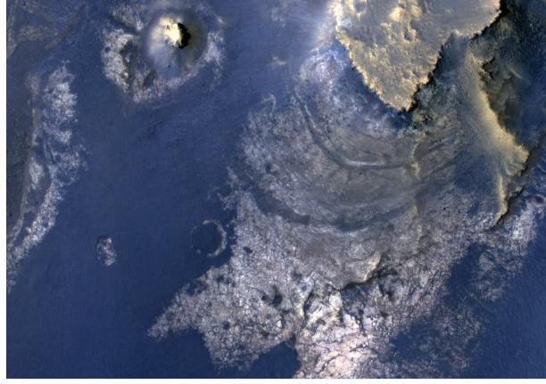
Layers with Carbonate Content Inside McLaughlin Crater on Mars
Full Resolution:
TIFF
(791.8 kB)
JPEG
(45.18 kB)
|
|
|
2013-01-21 |
Mars
|
2001 Mars Odyssey
|
THEMIS
|
1324x2774x1 |

|
-
PIA16746:
-
Dittaino Valles
Full Resolution:
TIFF
(3.677 MB)
JPEG
(357.2 kB)
|
|
|
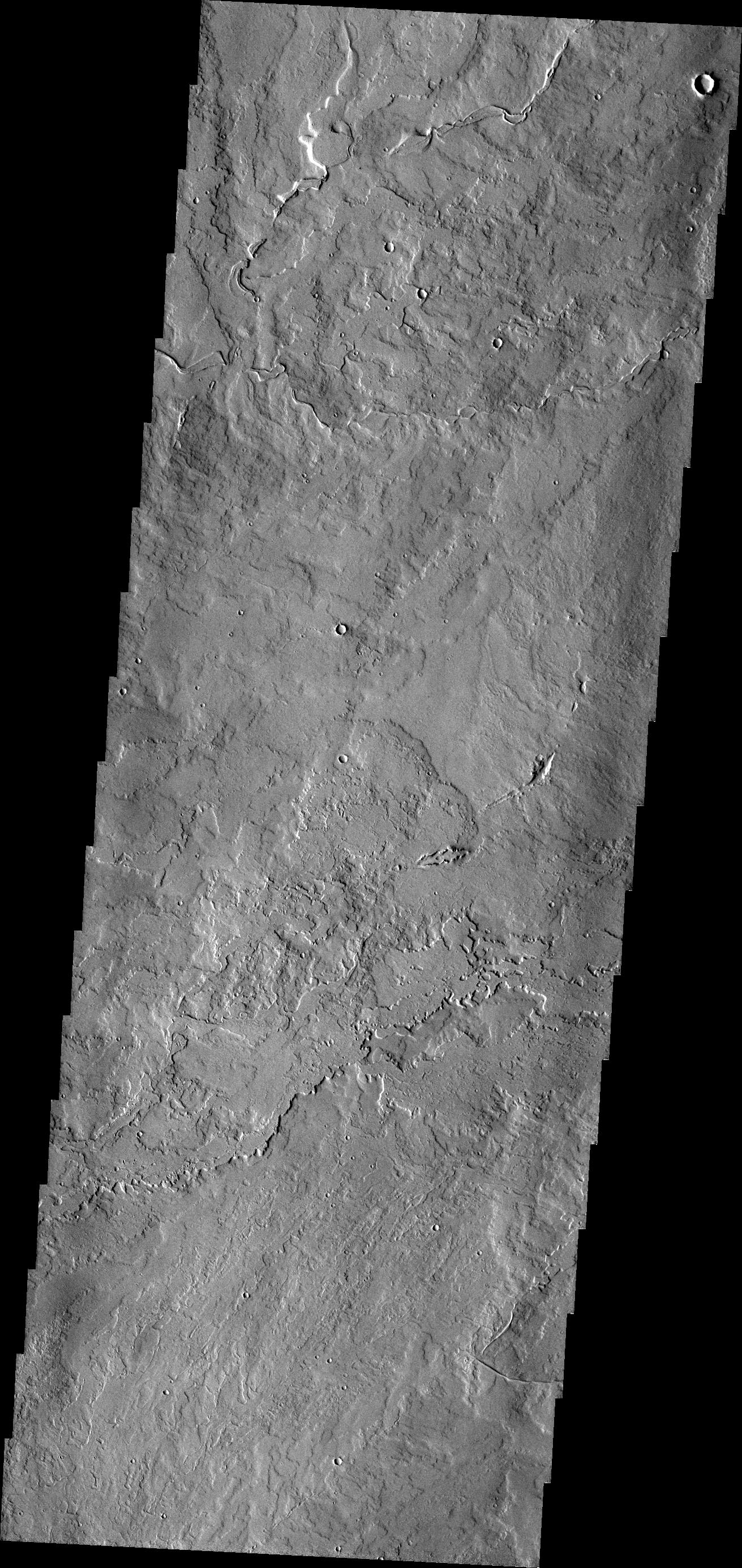
2013-01-22 |
Mars
|
2001 Mars Odyssey
|
THEMIS
|
1313x2810x1 |
|
-
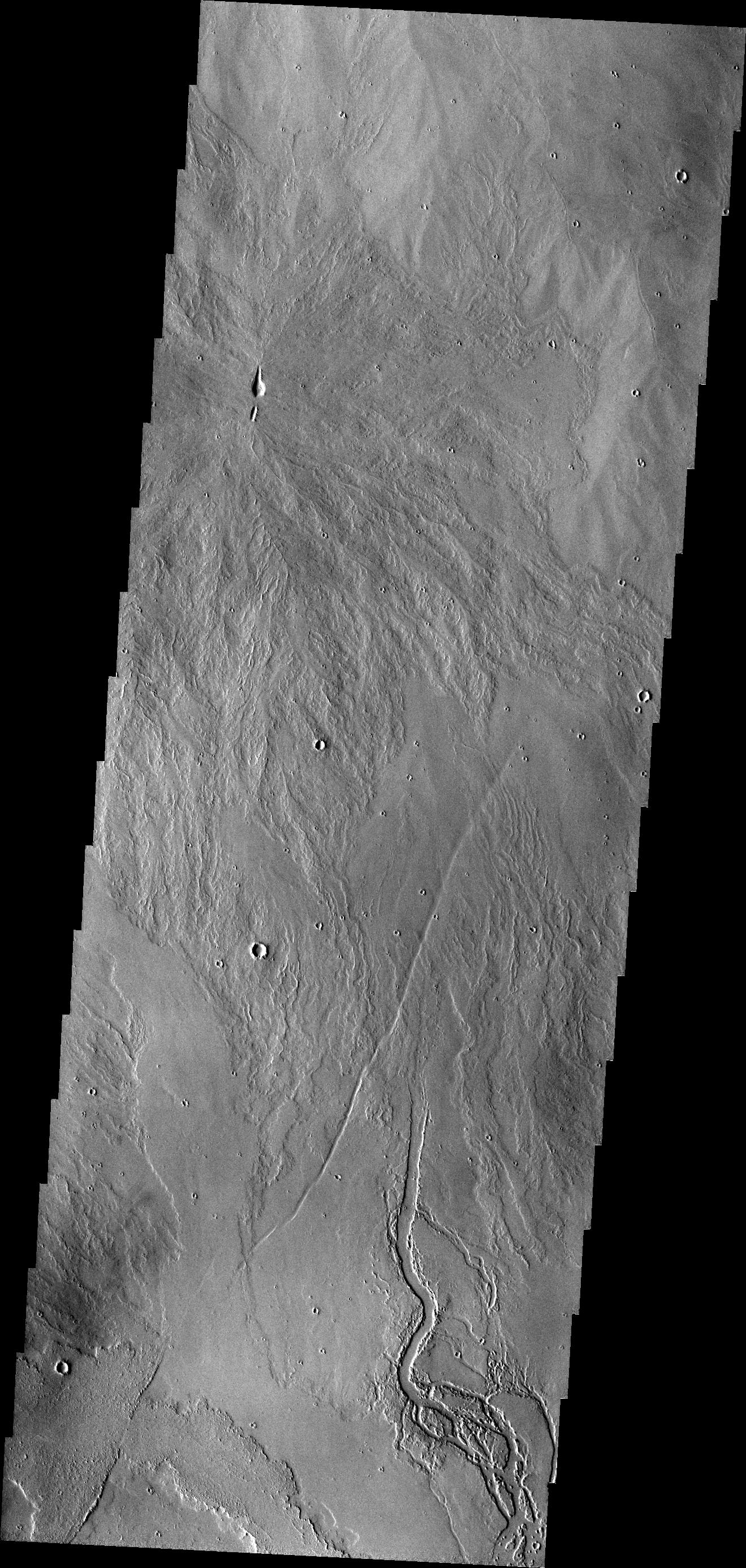
PIA16747:
-
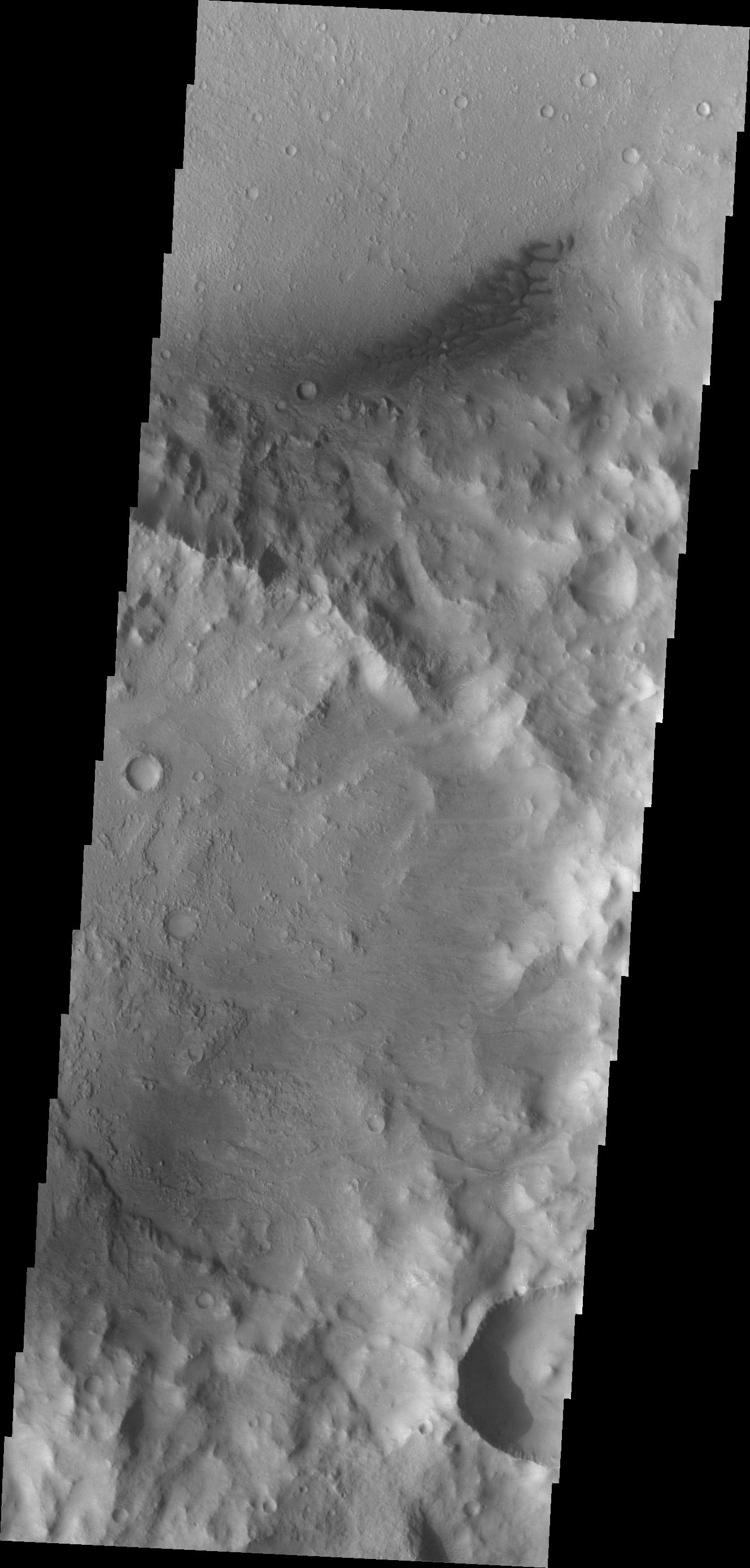
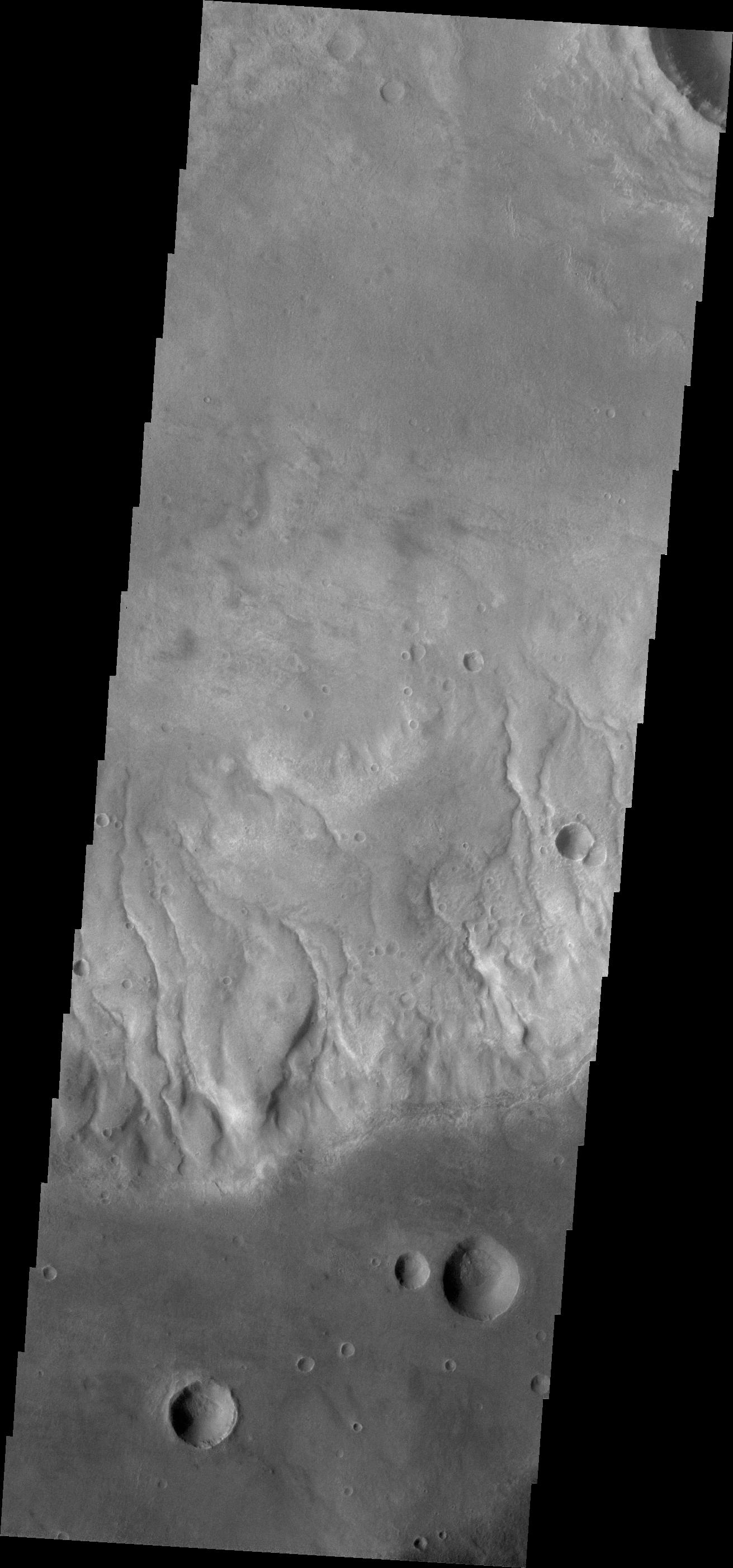
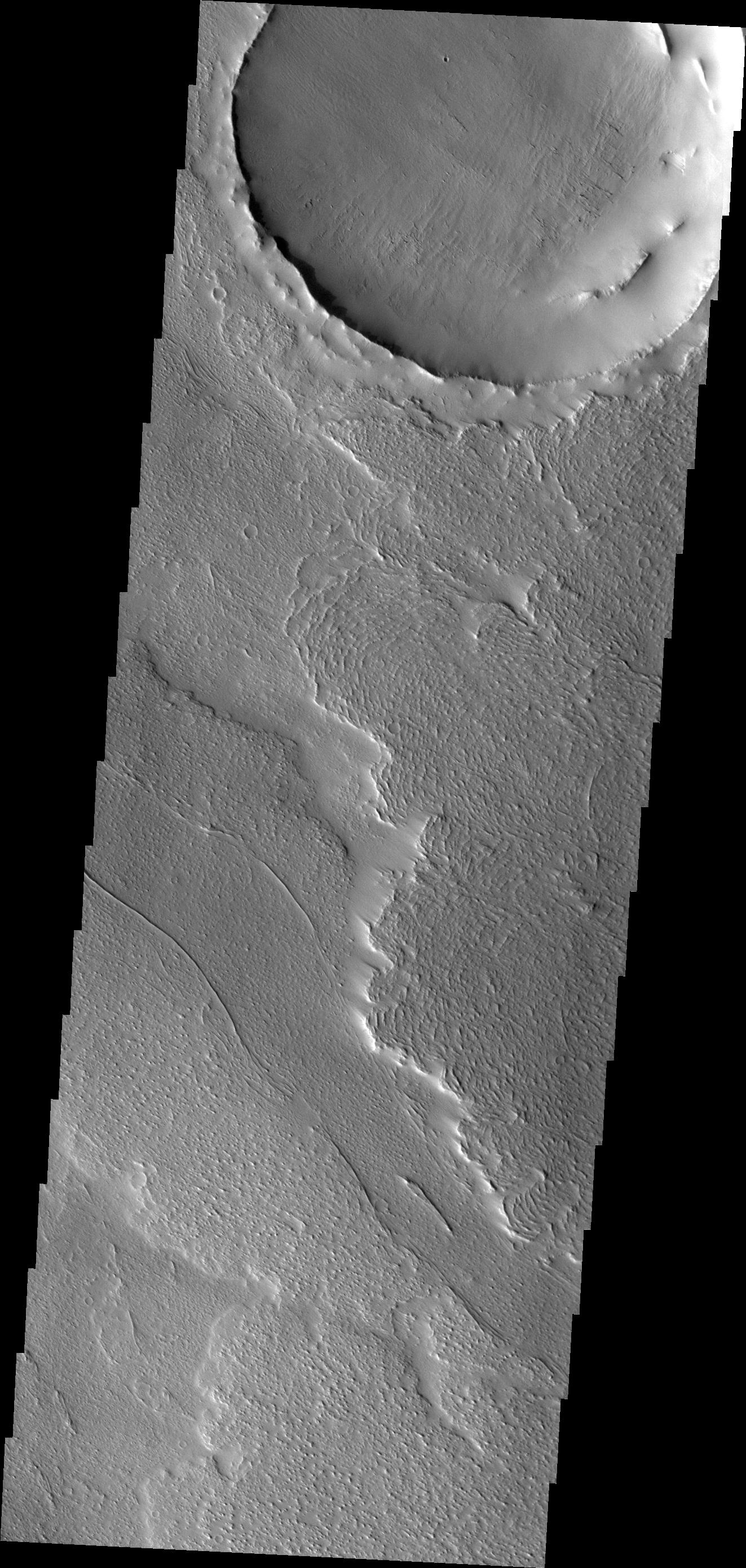
Fractures and Channels
Full Resolution:
TIFF
(3.694 MB)
JPEG
(446.1 kB)
|
|
|
2013-01-22 |
Mars
|
Mars Exploration Rover (MER)
|
Panoramic Camera
|
14823x5000x3 |
|
-
PIA16703:
-
'Matijevic Hill' Panorama for Rover's Ninth Anniversary
Full Resolution:
TIFF
(222.4 MB)
JPEG
(6.068 MB)
|
|
|
2013-01-22 |
Mars
|
Mars Exploration Rover (MER)
|
Panoramic Camera
|
14823x5000x3 |
|
-
PIA16704:
-
'Matijevic Hill' Panorama for Rover's Ninth Anniversary (False Color)
Full Resolution:
TIFF
(222.4 MB)
JPEG
(8.17 MB)
|
|
|
2013-01-22 |
Mars
|
Mars Exploration Rover (MER)
|
Panoramic Camera
|
14669x5000x3 |

|
-
PIA16709:
-
'Matijevic Hill' Panorama for Rover's Ninth Anniversary (Stereo)
Full Resolution:
TIFF
(220.1 MB)
JPEG
(7.268 MB)
|
|
|
2013-01-23 |
Mars
|
2001 Mars Odyssey
|
THEMIS
|
1326x2775x1 |

|
-
PIA16749:
-
Mega Gully
Full Resolution:
TIFF
(3.684 MB)
JPEG
(186 kB)
|
|
|
2013-01-24 |
Mars
|
Mars Science Laboratory (MSL)
|
MAHLI
|
1605x1195x3 |
|
-
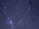
PIA16711:
-
MAHLI's First Night Imaging of Martian Rock, White Lighting
Full Resolution:
TIFF
(5.756 MB)
JPEG
(338.6 kB)
|
|
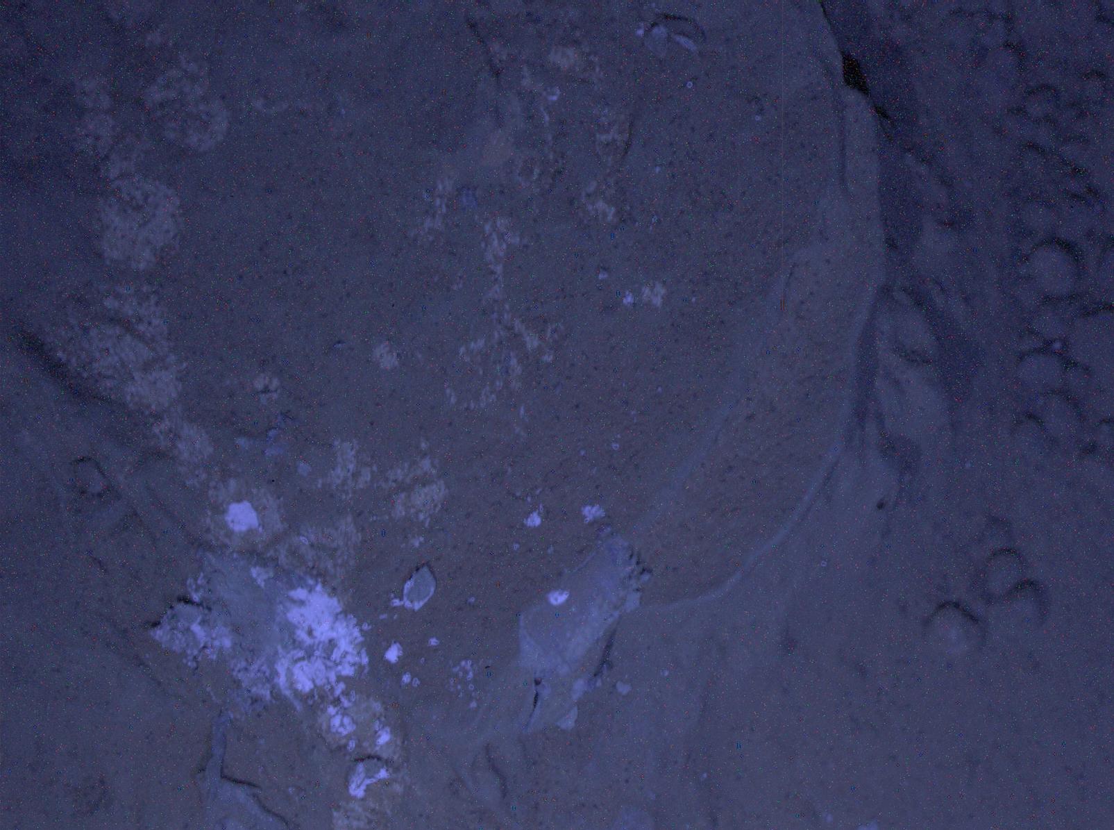
|
2013-01-24 |
Mars
|
Mars Science Laboratory (MSL)
|
MAHLI
|
1605x1195x3 |
|
-
PIA16712:
-
MAHLI's First Night Imaging of Martian Rock Under Ultraviolet Lighting
Full Resolution:
TIFF
(5.756 MB)
JPEG
(248.6 kB)
|
|
|
2013-01-24 |
Mars
|
Mars Science Laboratory (MSL)
|
MAHLI
|
1604x1195x3 |

|
-
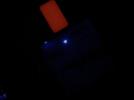
PIA16713:
-
First Night Image of MAHLI Calibration Target in White Lighting
Full Resolution:
TIFF
(5.752 MB)
JPEG
(219.8 kB)
|
|
|
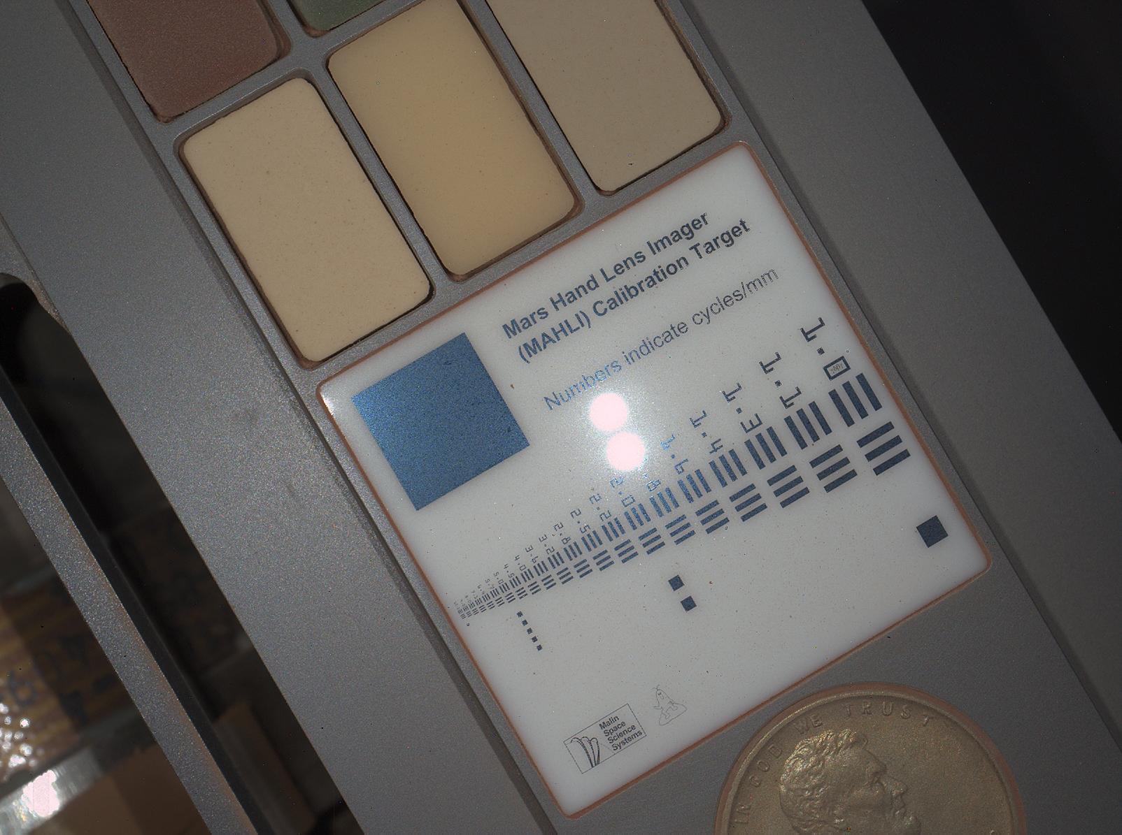
2013-01-24 |
Mars
|
Mars Science Laboratory (MSL)
|
MAHLI
|
1604x1195x3 |
|
-
PIA16714:
-
First Night Image of MAHLI Calibration Target Under Ultraviolet Lights
Full Resolution:
TIFF
(5.752 MB)
JPEG
(104.3 kB)
|
|
|
2013-01-24 |
Mars
|
2001 Mars Odyssey
|
THEMIS
|
1311x2772x1 |
|
-
PIA16750:
-
Pavonis Mons
Full Resolution:
TIFF
(3.638 MB)
JPEG
(642.1 kB)
|
|
|
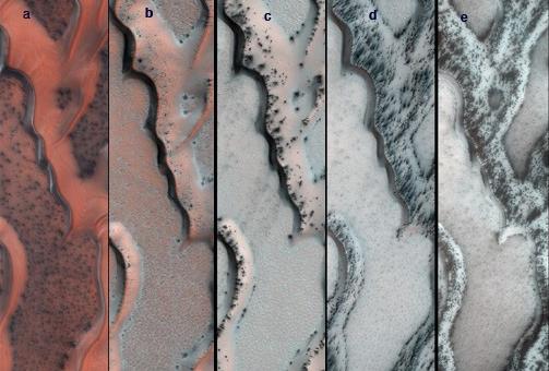
2013-01-24 |
Mars
|
Mars Reconnaissance Orbiter (MRO)
|
HiRISE
|
503x340x3 |
|
-
PIA16715:
-
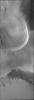
Seasonal Changes on Far-Northern Mars
Full Resolution:
TIFF
(513.5 kB)
JPEG
(35.91 kB)
|
|
|
2013-01-25 |
Mars
|
2001 Mars Odyssey
|
THEMIS
|
1339x2775x1 |
|
-
PIA16751:
-
Wind Erosion
Full Resolution:
TIFF
(3.72 MB)
JPEG
(604 kB)
|
|
|
2013-01-28 |
Mars
|
2001 Mars Odyssey
|
THEMIS
|
1332x2773x1 |

|
-
PIA16773:
-
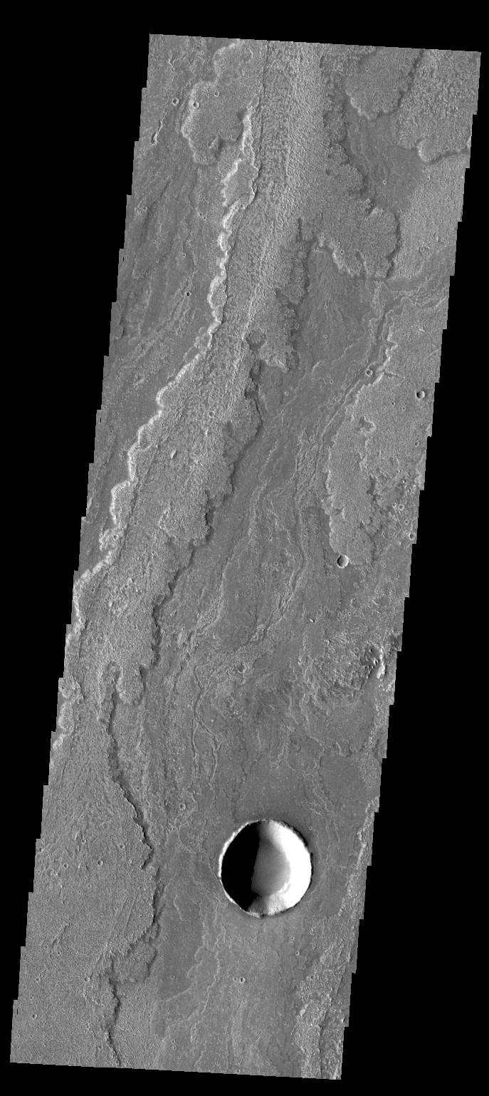
Channel
Full Resolution:
TIFF
(3.698 MB)
JPEG
(378 kB)
|
|
|
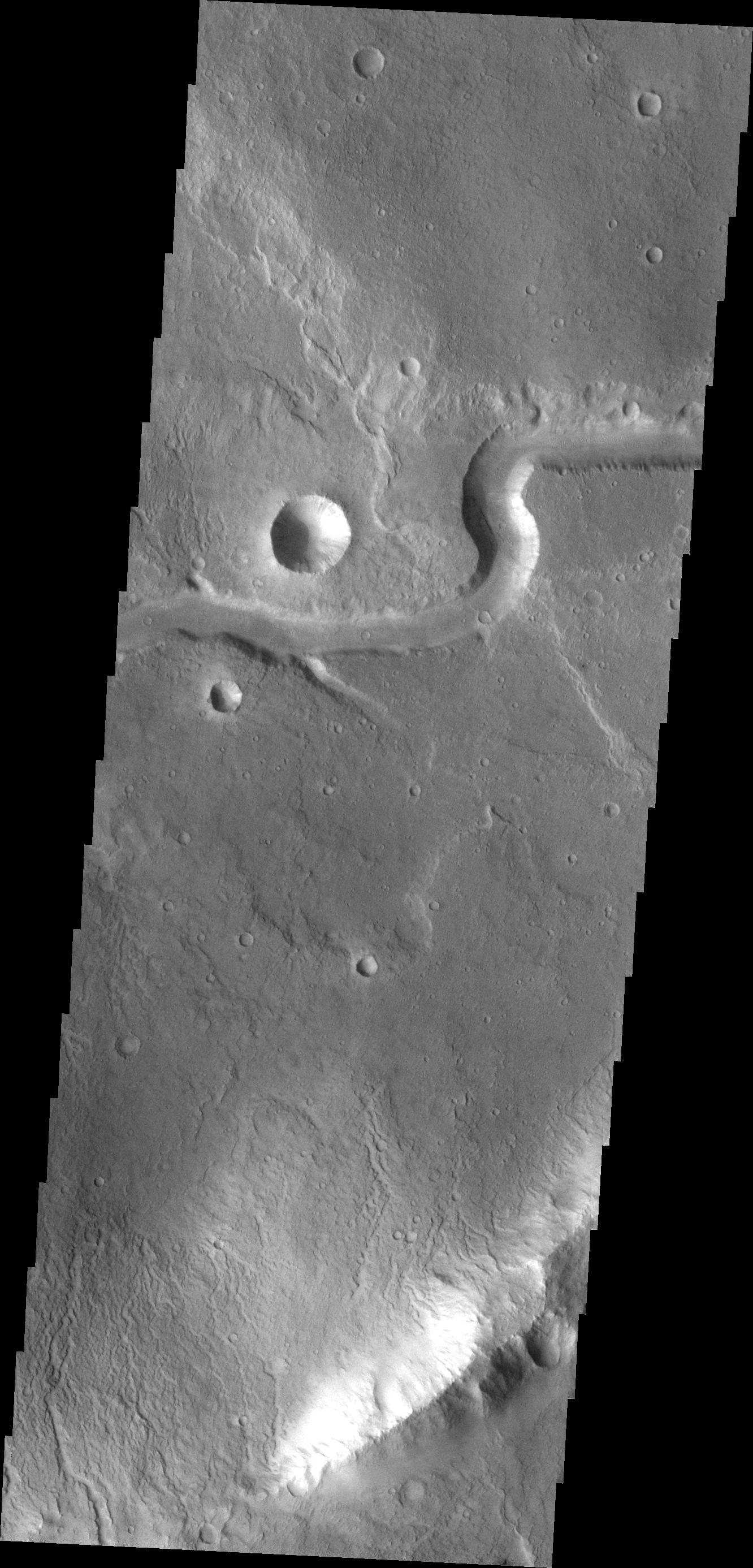
2013-01-28 |
Mars
|
Mars Science Laboratory (MSL)
|
Hazcam (MSL)
|
1024x1024x1 |

|
-
PIA16716:
-
Curiosity's Drill in Place for Load Testing Before Drilling
Full Resolution:
TIFF
(1.05 MB)
JPEG
(162.2 kB)
|
|
|
2013-01-29 |
Mars
|
2001 Mars Odyssey
|
THEMIS
|
1328x2770x1 |
|
-
PIA16779:
-
Ascraeus Mons
Full Resolution:
TIFF
(3.682 MB)
JPEG
(528.7 kB)
|
|
|
2013-01-30 |
Mars
|
2001 Mars Odyssey
|
THEMIS
|
1320x2790x1 |
|
-
PIA16780:
-
Holden Crater Dunes
Full Resolution:
TIFF
(3.687 MB)
JPEG
(409.4 kB)
|
|
|
2013-01-31 |
Mars
|
2001 Mars Odyssey
|
THEMIS
|
685x1539x1 |
|
-
PIA16781:
-
Daedalia Planum
Full Resolution:
TIFF
(1.056 MB)
JPEG
(178.8 kB)
|
|
|
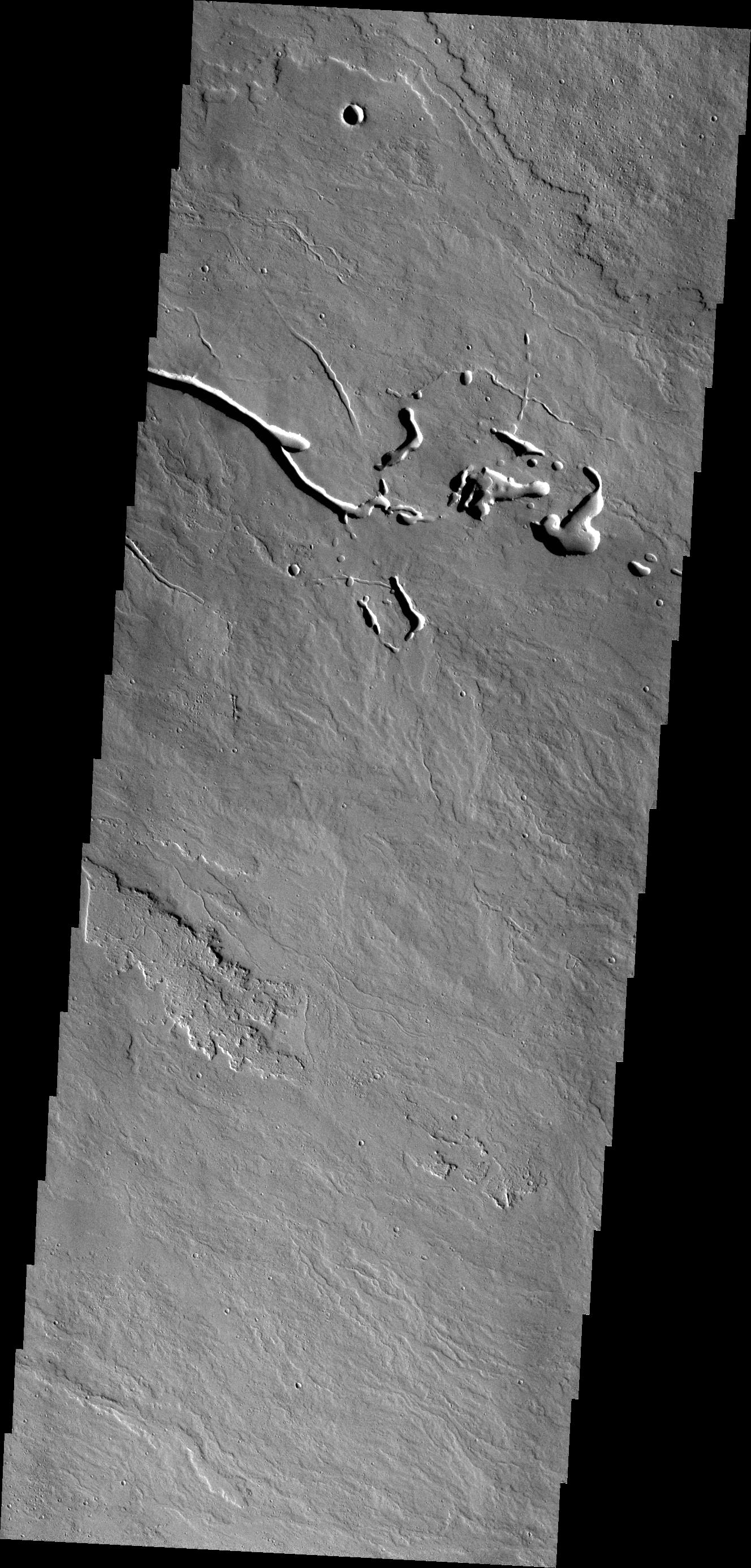
2013-02-01 |
Mars
|
2001 Mars Odyssey
|
THEMIS
|
1355x2921x1 |
|
-
PIA16782:
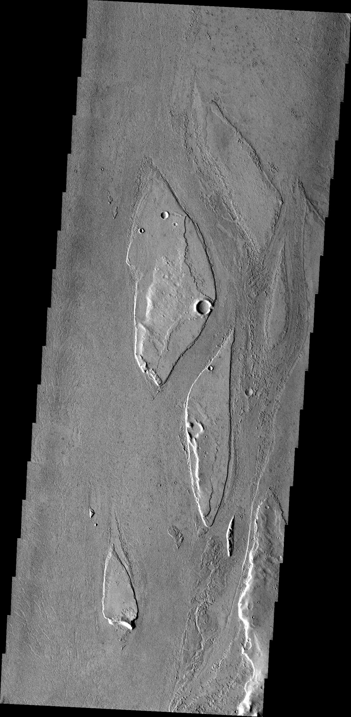
-
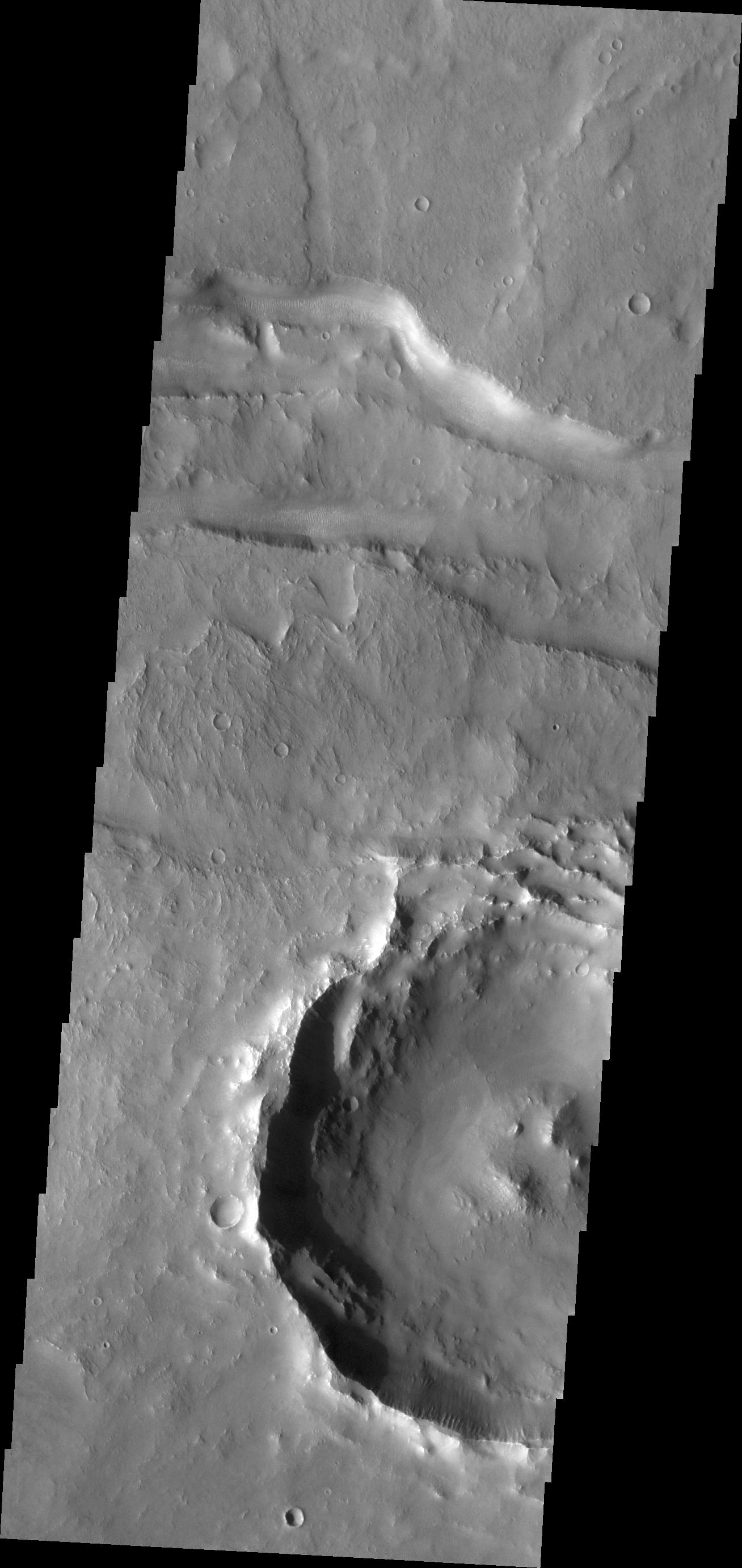
Channel
Full Resolution:
TIFF
(3.962 MB)
JPEG
(450.4 kB)
|
|
|
2013-02-04 |
Mars
|
2001 Mars Odyssey
|
THEMIS
|
692x1539x1 |
|
-
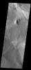
PIA16246:
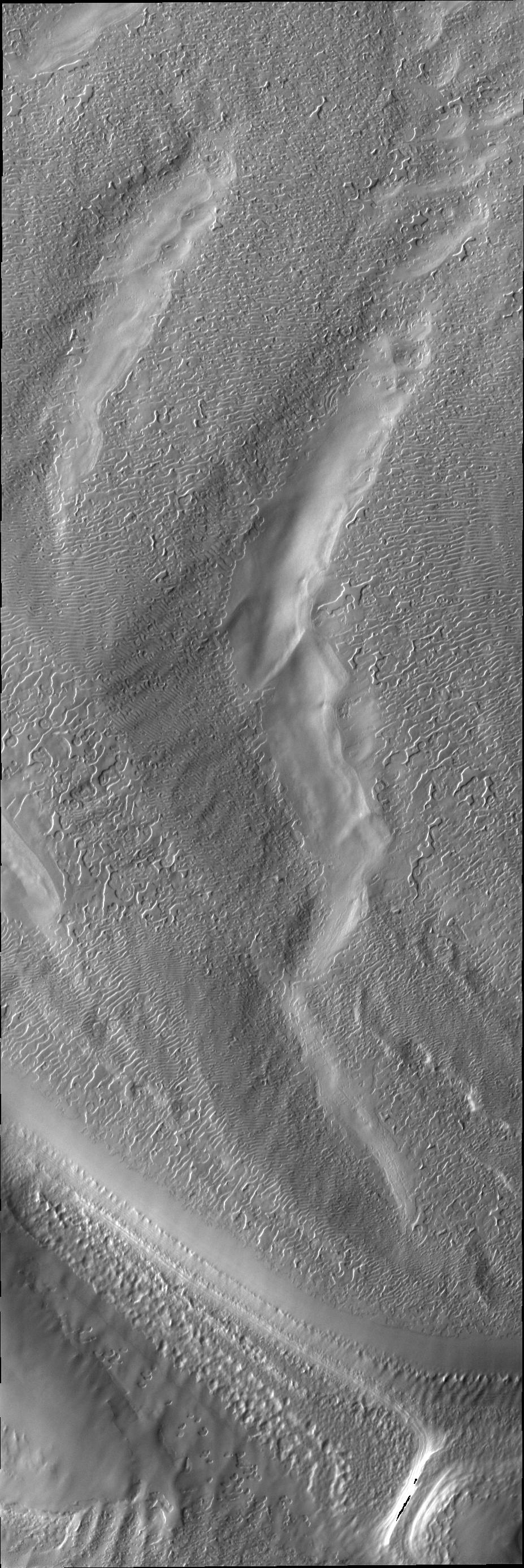
-
Juventae Chasma Dunes
Full Resolution:
TIFF
(1.066 MB)
JPEG
(84.95 kB)
|
|
|
2013-02-04 |
Mars
|
Mars Science Laboratory (MSL)
|
ChemCam
|
750x750x1 |
|
-
PIA16718:
-
Drill Bit Tip on Mars Rover Curiosity, Side View
Full Resolution:
TIFF
(563.3 kB)
JPEG
(32.42 kB)
|
|
|
2013-02-04 |
Mars
|
Mars Science Laboratory (MSL)
|
ChemCam
|
750x750x1 |
|
-
PIA16719:
-
Drill Bit Tip on Mars Rover Curiosity, Head-on View
Full Resolution:
TIFF
(563.3 kB)
JPEG
(34.13 kB)
|
|
|
2013-02-04 |
Mars
|
Mars Science Laboratory (MSL)
|
MAHLI
|
1605x1196x3 |

|
-
PIA16717:
-
Preparatory Test for First Rock Drilling by Mars Rover Curiosity
Full Resolution:
TIFF
(5.761 MB)
JPEG
(532.8 kB)
|
|
|
2013-02-05 |
Mars
|
2001 Mars Odyssey
|
THEMIS
|
699x1542x1 |
|
-
PIA16247:
-
Meroe Patera Dunes
Full Resolution:
TIFF
(1.079 MB)
JPEG
(150.8 kB)
|
|
|
2013-02-06 |
Mars
|
2001 Mars Odyssey
|
THEMIS
|
1309x2787x1 |

|
-
PIA16248:
-
Tyrrhena Fossae
Full Resolution:
TIFF
(3.652 MB)
JPEG
(332.2 kB)
|
|
|
2013-02-07 |
Mars
|
2001 Mars Odyssey
|
THEMIS
|
1311x2930x1 |
|
-
PIA16249:
-
Landslide Deposits
Full Resolution:
TIFF
(3.845 MB)
JPEG
(184.6 kB)
|
|
|
2013-02-07 |
Mars
|
Mars Science Laboratory (MSL)
|
MAHLI
|
1563x1200x3 |
|
-
PIA16760:
-
Preparatory Test of Drilling on Mars Generates Rock Powder
Full Resolution:
TIFF
(5.629 MB)
JPEG
(300 kB)
|
|
|
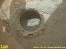
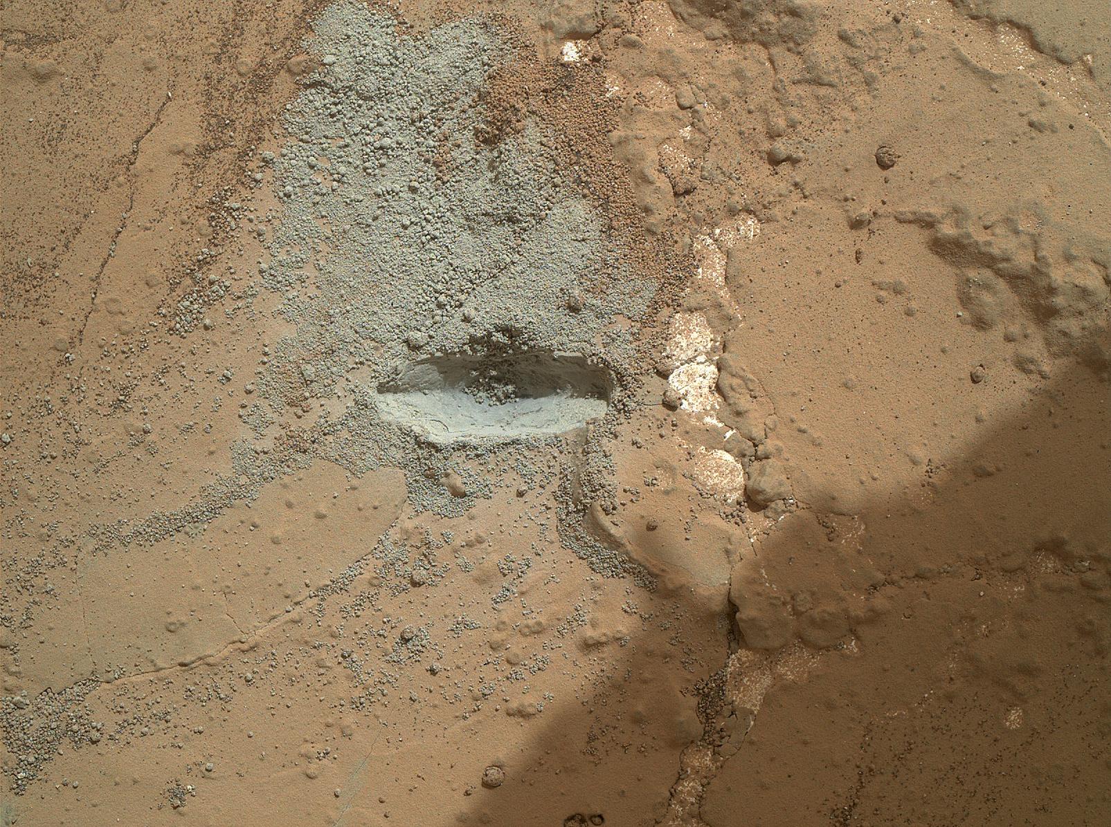
2013-02-07 |
Mars
|
Mars Science Laboratory (MSL)
|
MAHLI
|
1584x1184x3 |
|
-
PIA16761:
-
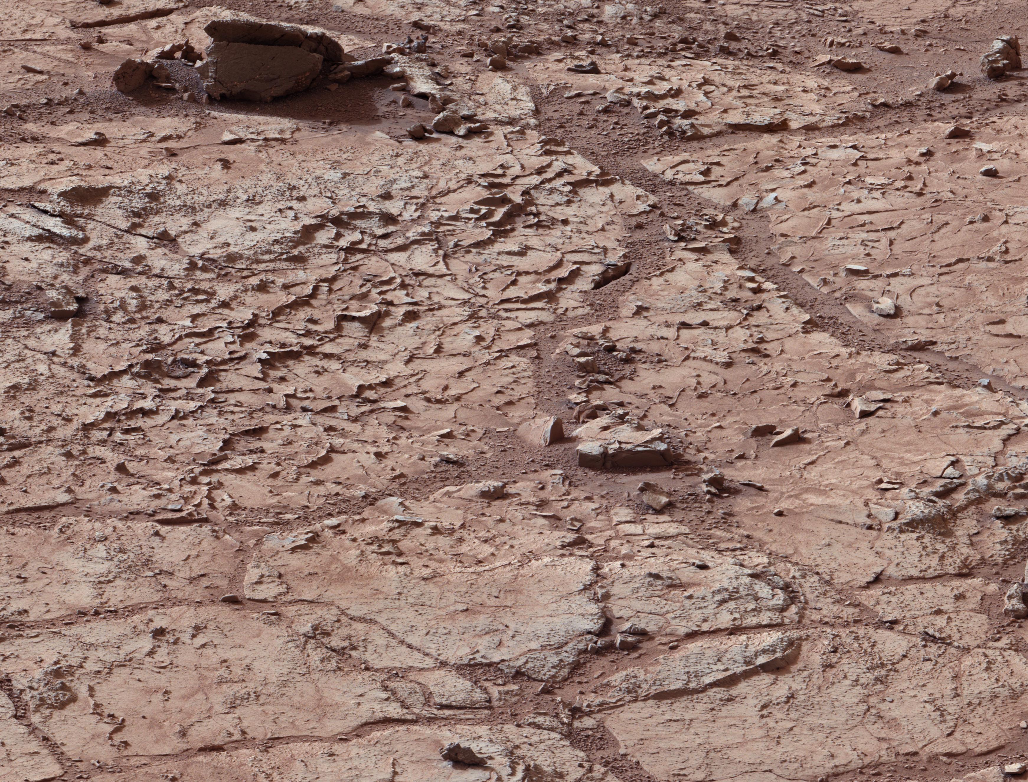
Close-Up After Preparatory Test of Drilling on Mars
Full Resolution:
TIFF
(5.628 MB)
JPEG
(519.8 kB)
|
|
|
2013-02-07 |
Mars
|
Mars Science Laboratory (MSL)
|
Mastcam
|
1024x1024x3 |
|
-
PIA16762:
-
Before-and-After Blink of Curiosity 'Mini Drill' into Mars Rock
Full Resolution:
TIFF
(1.051 MB)
JPEG
(216.1 kB)
|
|
|
2013-02-07 |
Mars
|
Mars Science Laboratory (MSL)
|
MAHLI
|
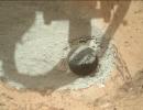
6795x5234x3 |
|
-
PIA16763:
-
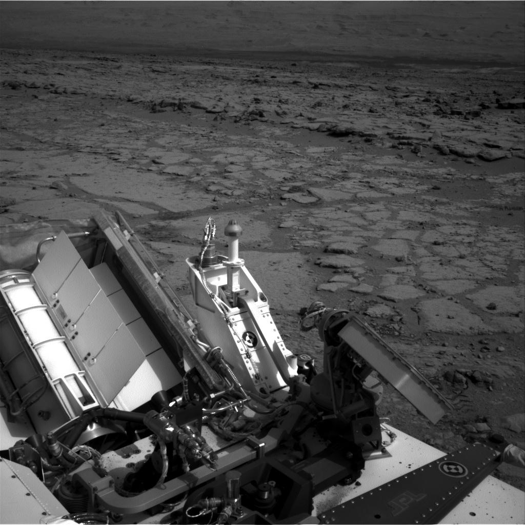
Curiosity Rover's Self Portrait at 'John Klein' Drilling Site
Full Resolution:
TIFF
(106.7 MB)
JPEG
(2.865 MB)
|


