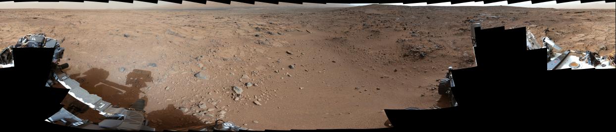
This panorama is a mosaic of images taken by the Mast Camera (Mastcam) on the NASA Mars rover Curiosity during the 106th Martian day, or sol, of the mission (Nov. 22, 2012). The rover was near a location called "Point Lake" for an overlook of a shallow depression called "Yellowknife Bay" which is in the left third of this scene, in the middle distance.
The image spans 360 degrees, with south at the center. It has been white-balanced to show what the rocks and soils in it would look like if they were on Earth.
Malin Space Science Systems, San Diego, developed, built and operates Mastcam. JPL, a division of the California Institute of Technology, Pasadena, manages the Mars Science Laboratory Project for NASA's Science Mission Directorate, Washington. JPL designed and built the project's Curiosity rover.
For more about NASA's Curiosity mission, visit: http://www.jpl.nasa.gov/msl, http://www.nasa.gov/mars, and http://mars.jpl.nasa.gov/msl.
Photojournal Note: Also available is the full resolution TIFF file PIA16563_full.tif. This file may be too large to view from a browser; it can be downloaded onto your desktop by right-clicking on the previous links and viewed with image viewing software.