Click on an image for detailed information
Click on a column heading to sort in ascending or descending order

My
List |
Addition Date
|
Target
|
Mission
|
Instrument
|
Size
|

|
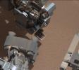
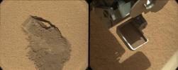
2012-10-08 |
Mars
|
Mars Science Laboratory (MSL)
|
Mastcam
|
1400x1024x3 |

|
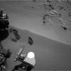
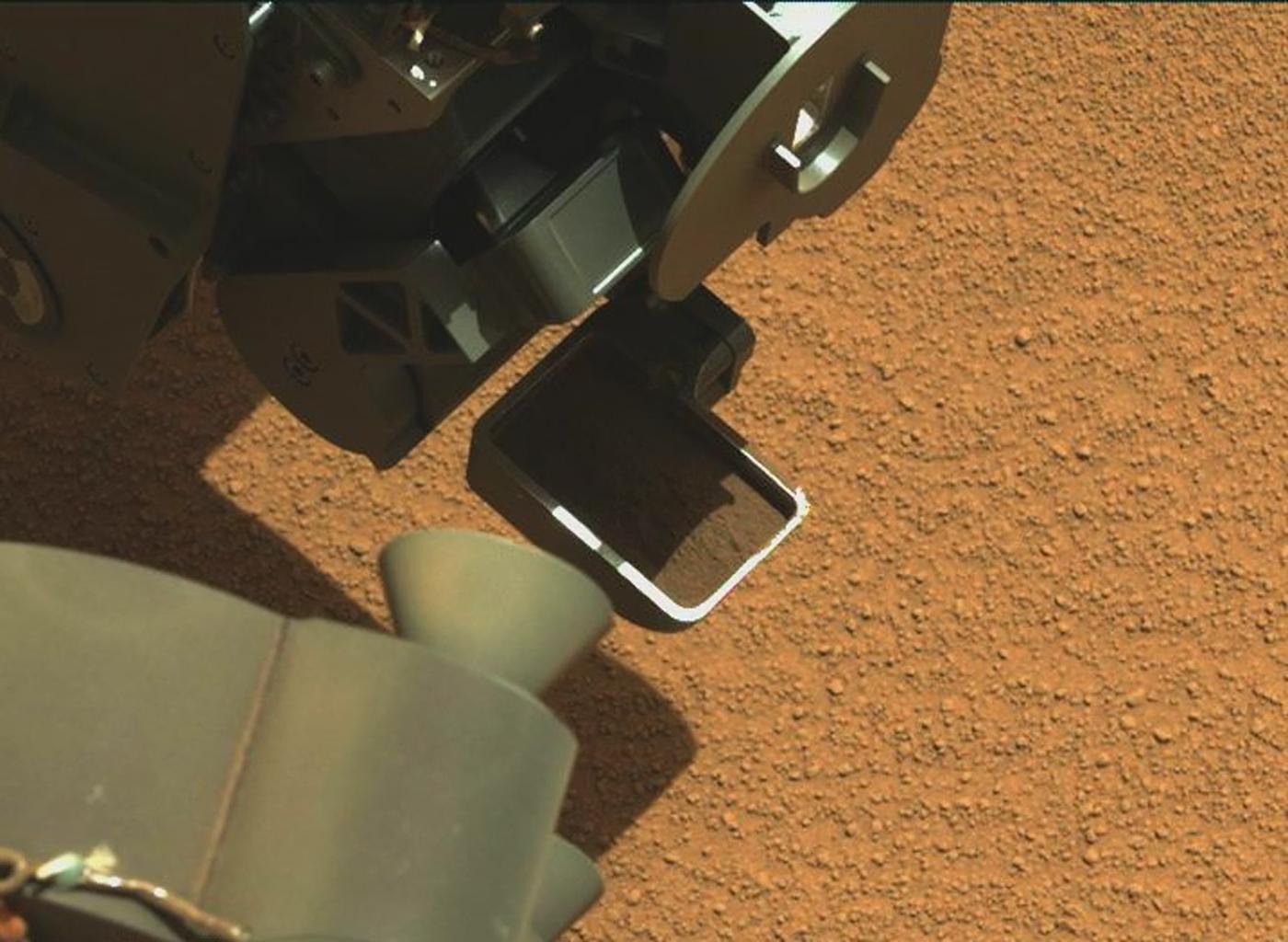
-
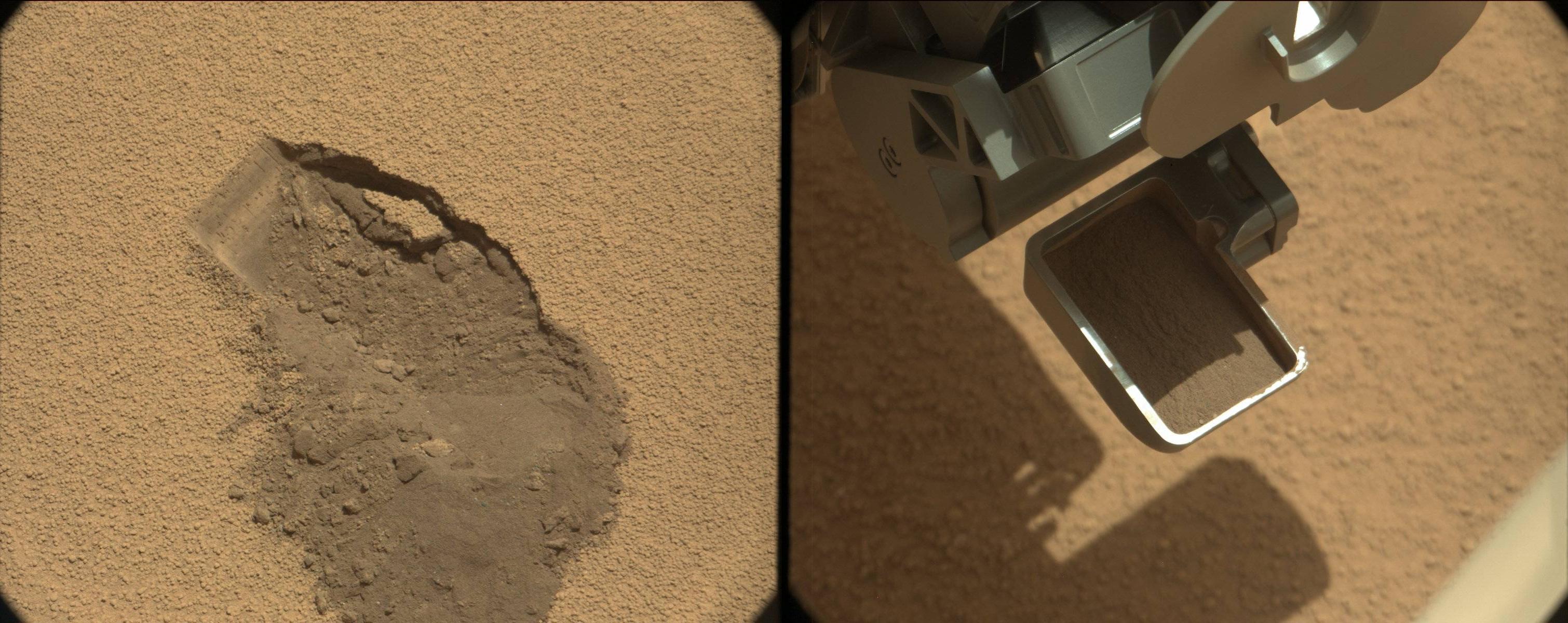
PIA16224:
-
Curiosity's First Scoop of Mars, in Vibration Movie

Full Resolution:
TIFF
(4.303 MB)
JPEG
(148.8 kB)
|
|
|
2012-10-08 |
Mars
|
Mars Science Laboratory (MSL)
|
Mastcam
|
1345x1200x3 |
|
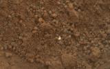
-
PIA16225:
-
View of Curiosity's First Scoop Also Shows Bright Object
Full Resolution:
TIFF
(4.844 MB)
JPEG
(242.9 kB)
|
|
|
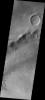
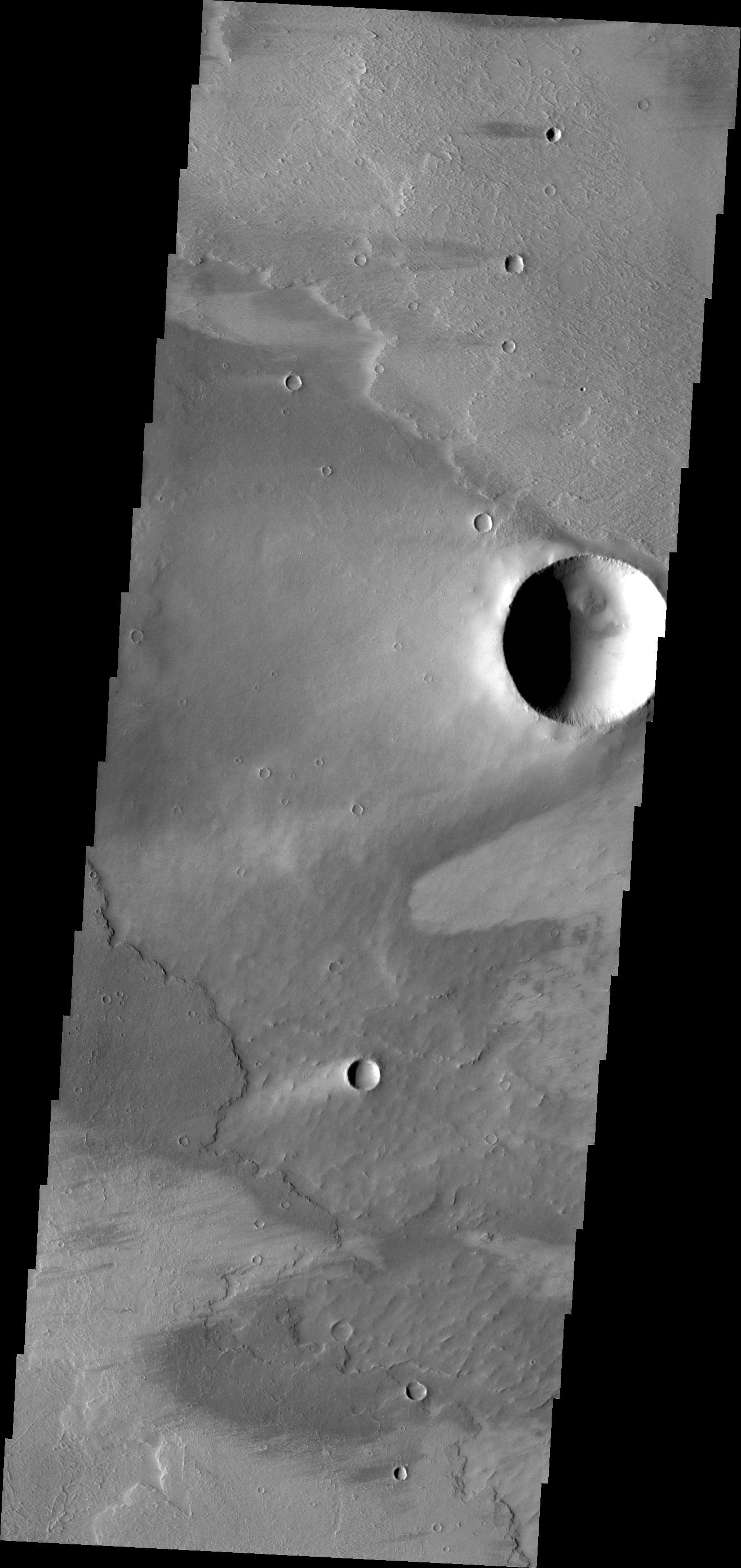
2012-10-09 |
Mars
|
2001 Mars Odyssey
|
THEMIS
|
1133x2748x1 |

|
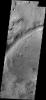
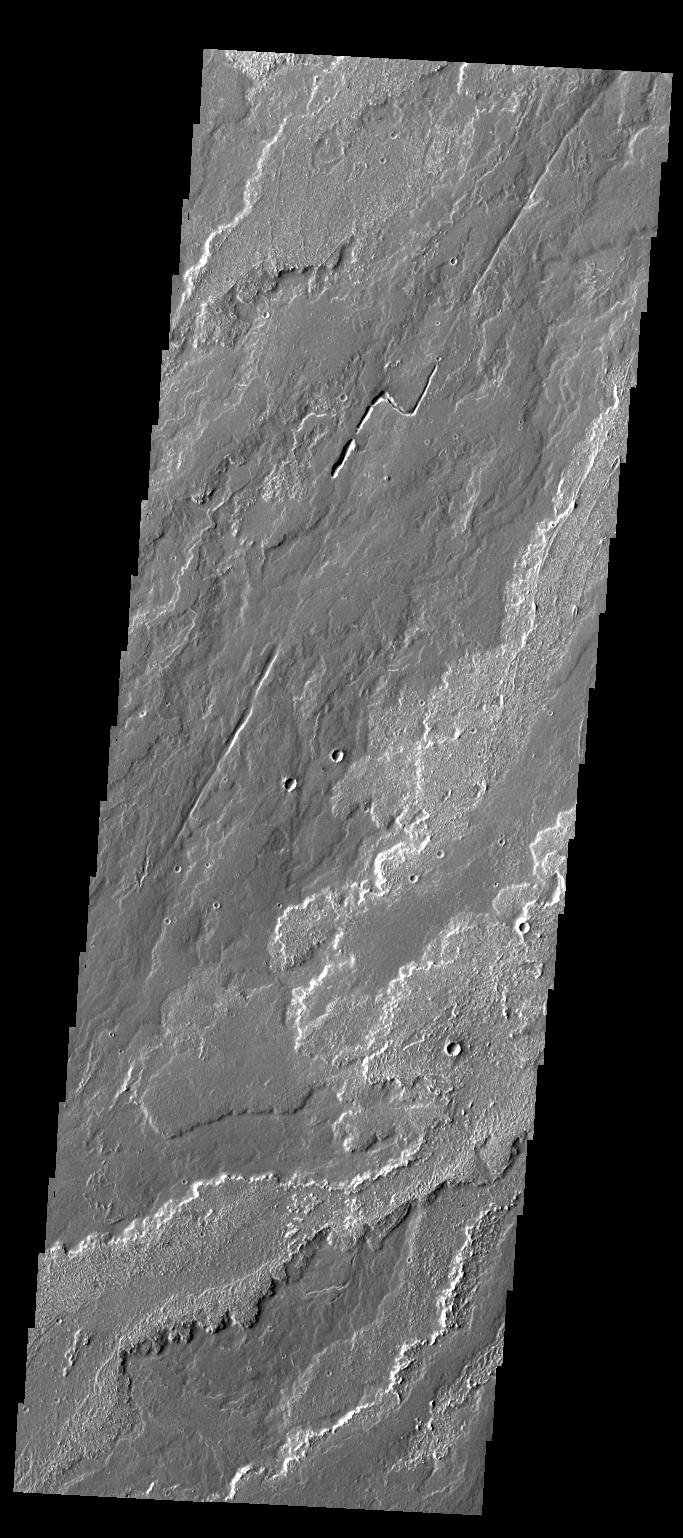
-
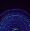
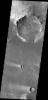
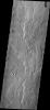
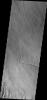
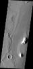
PIA16320:
-
Olympia Undae
Full Resolution:
TIFF
(3.117 MB)
JPEG
(379 kB)
|
|
|
2012-10-10 |
Mars
|
2001 Mars Odyssey
|
THEMIS
|
683x1538x1 |

|
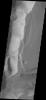
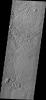
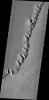
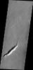
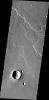
-
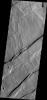
PIA16321:
-
Daedalia Planum
Full Resolution:
TIFF
(1.052 MB)
JPEG
(163.6 kB)
|
|
|
2012-10-10 |
Mars
|
Mars Reconnaissance Orbiter (MRO)
Mars Science Laboratory (MSL)
|
HiRISE
|
398x408x3 |
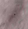
|
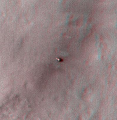
-
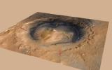
PIA16208:
-
Curiosity at Bradbury Landing Site in 3-D
Full Resolution:
TIFF
(487.5 kB)
JPEG
(17.84 kB)
|
|
|
2012-10-10 |
Mars
|
Mars Reconnaissance Orbiter (MRO)
Mars Science Laboratory (MSL)
|
HiRISE
|
950x795x3 |
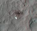
|
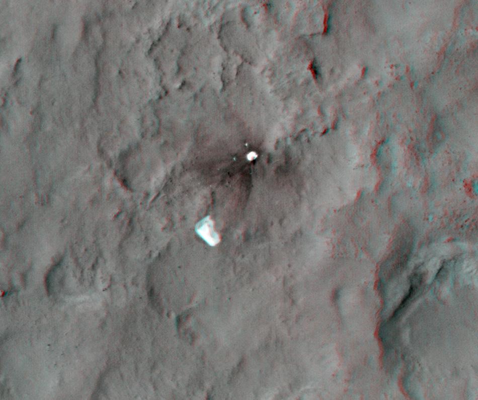
-
PIA16209:
-
Parachute and Back Shell in 3-D
Full Resolution:
TIFF
(2.267 MB)
JPEG
(87.85 kB)
|
|
|
2012-10-10 |
Mars
|
Mars Reconnaissance Orbiter (MRO)
Mars Science Laboratory (MSL)
|
HiRISE
|
2414x1387x3 |
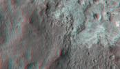
|
-
PIA16210:
-
'Glenelg' in 3-D
Full Resolution:
TIFF
(10.05 MB)
JPEG
(554.1 kB)
|
|
|
2012-10-10 |
Mars
|
Mars Science Laboratory (MSL)
|
Mastcam
|
3020x1200x3 |
|
-
PIA16226:
-
First Scoop by Curiosity, Sol 61 Views
Full Resolution:
TIFF
(10.88 MB)
JPEG
(479.7 kB)
|
|
|
2012-10-11 |
Mars
|
2001 Mars Odyssey
|
THEMIS
|
1313x2935x1 |
|
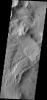
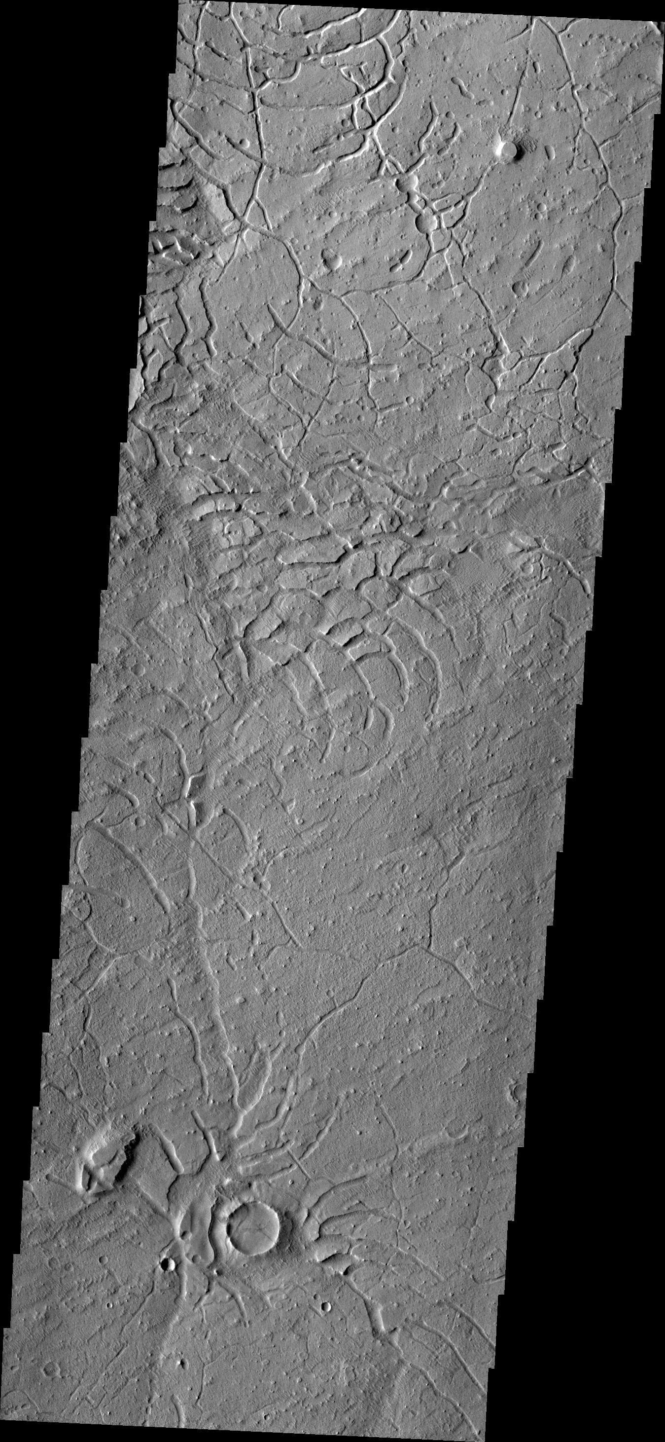
-
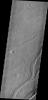
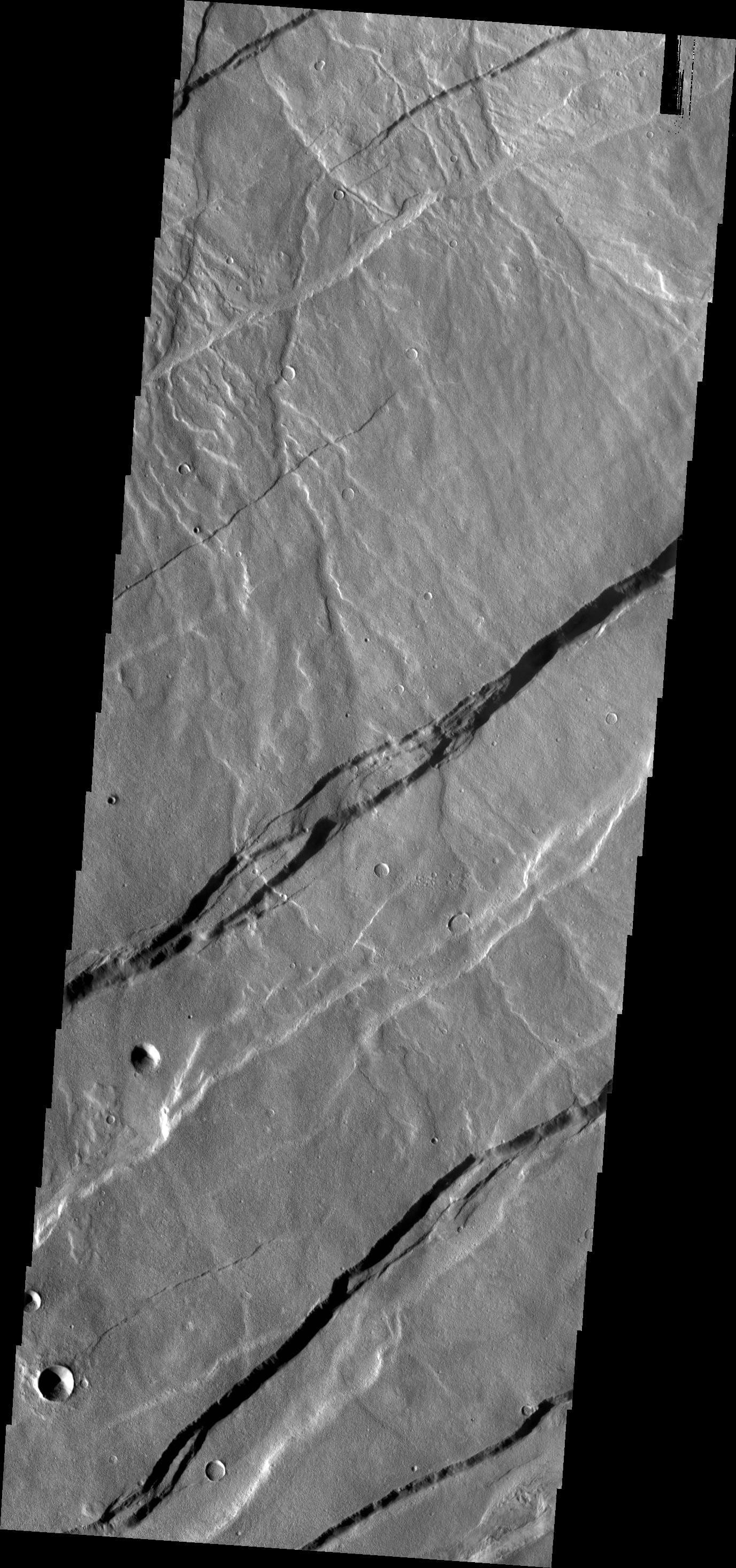
PIA16322:
-
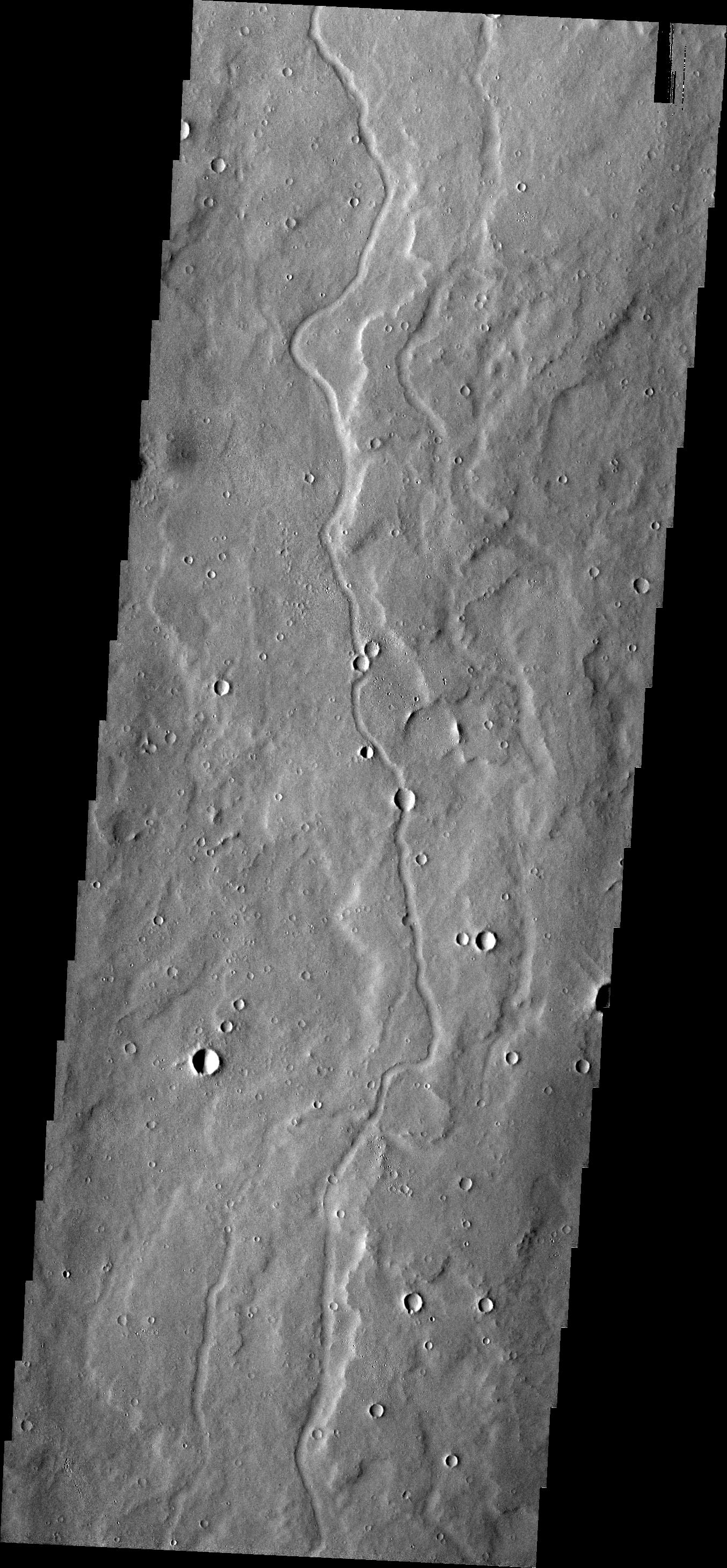
Channels
Full Resolution:
TIFF
(3.858 MB)
JPEG
(302.9 kB)
|
|
|
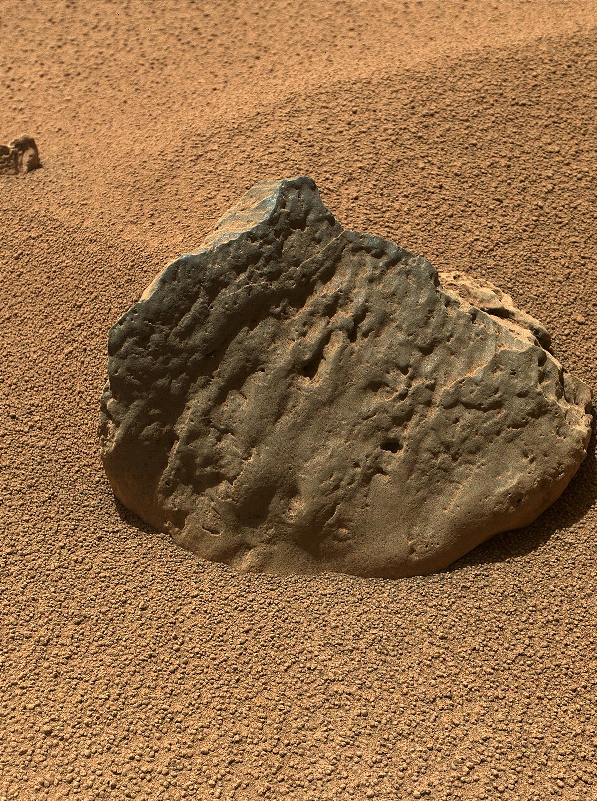
2012-10-11 |
Mars
|
Mars Science Laboratory (MSL)
|
ChemCam
Mastcam
|
2668x2668x3 |
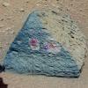
|
-
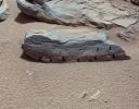
PIA16192:
-
Target: Jake Matijevic Rock
Full Resolution:
TIFF
(21.36 MB)
JPEG
(1.126 MB)
|
|
|
2012-10-11 |
Mars
|
Mars Science Laboratory (MSL)
|
MAHLI
|
1579x1180x3 |
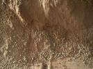
|
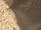
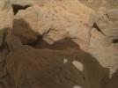
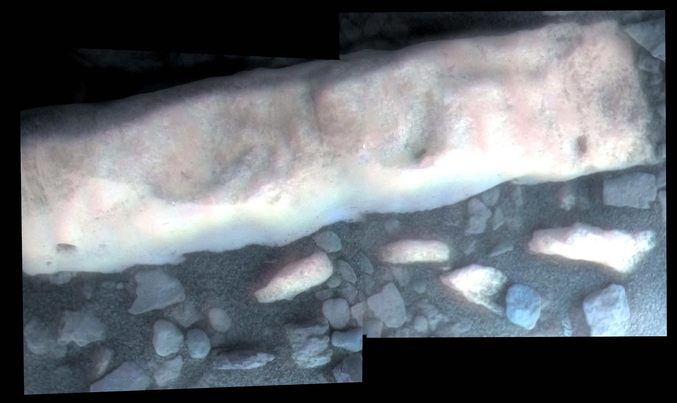
-
PIA16193:
-
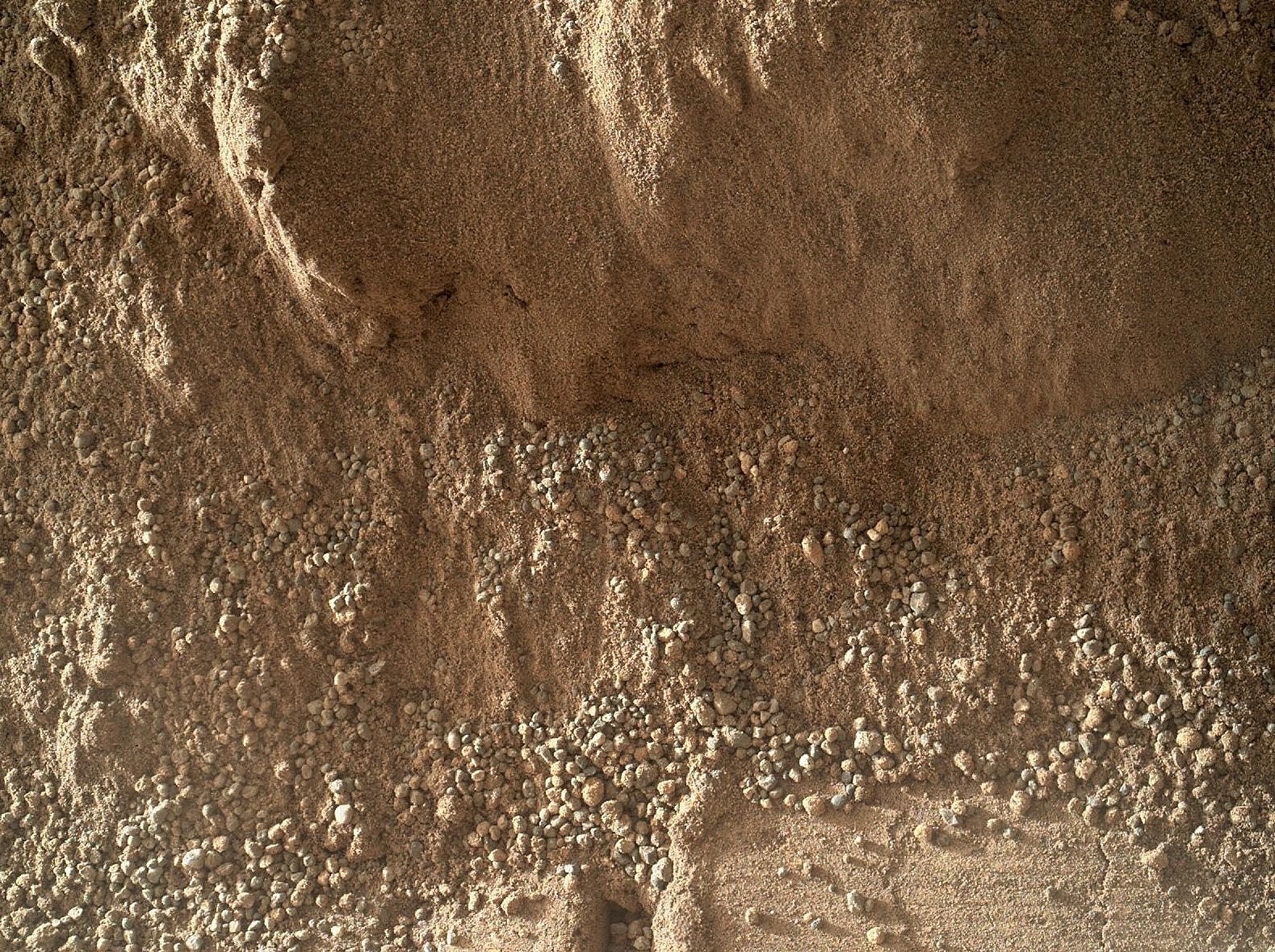
High-Resolution View of Cross-Section Through a Mars Ripple
Full Resolution:
TIFF
(5.592 MB)
JPEG
(611.4 kB)
|
|
|
2012-10-11 |
Mars
|
Mars Science Laboratory (MSL)
|
CHIMRA
Mastcam
|
1498x1199x3 |

|
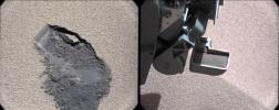
-
PIA16194:
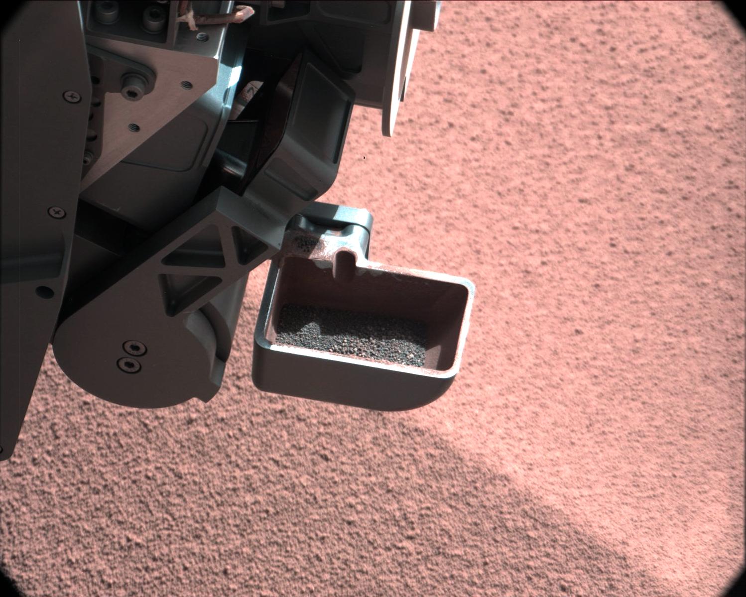
-
Too Big for the Sieve
Full Resolution:
TIFF
(5.39 MB)
JPEG
(229.6 kB)
|
|
|
2012-10-11 |
Mars
|
Mars Science Laboratory (MSL)
|
CHIMRA
Mastcam
|
1506x1200x3 |
|
-
PIA16195:
-
Sand Filtered through Curiosity's Sieve
Full Resolution:
TIFF
(5.424 MB)
JPEG
(113.8 kB)
|
|
|
2012-10-11 |
Mars
|
Mars Science Laboratory (MSL)
|
CHIMRA
Mastcam
|
1547x1200x3 |
|
-
PIA16196:
-
Thanks for the Scrub
Full Resolution:
TIFF
(5.571 MB)
JPEG
(161.2 kB)
|
|
|
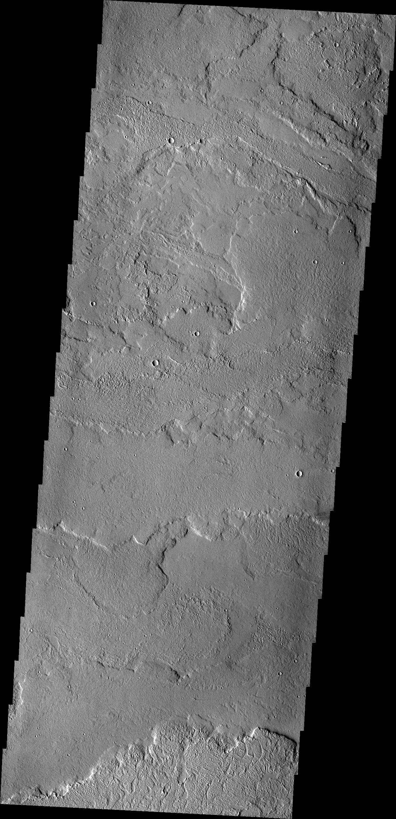
2012-10-12 |
Mars
|
2001 Mars Odyssey
|
THEMIS
|
1324x2772x1 |
|
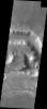
-
PIA16323:
-
Landslide
Full Resolution:
TIFF
(3.674 MB)
JPEG
(220.2 kB)
|
|
|
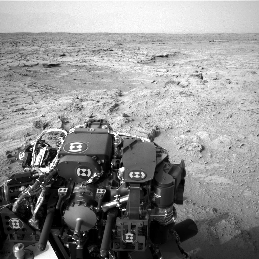
2012-10-12 |
Mars
|
Mars Science Laboratory (MSL)
|
Navcam (MSL)
|
7703x2198x1 |

|
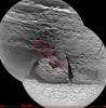
-
PIA16227:
Curiosity's Location During First Scooping
Full Resolution:
TIFF
(16.95 MB)
JPEG
(1.911 MB)
|
|
|
2012-10-15 |
Mars
|
2001 Mars Odyssey
|
THEMIS
|
1336x2928x1 |
|
-
PIA16324:
-
Dark Slope Streaks
Full Resolution:
TIFF
(3.916 MB)
JPEG
(307.1 kB)
|
|
|
2012-10-15 |
Mars
|
Mars Science Laboratory (MSL)
|
MAHLI
|
1608x1199x3 |
|
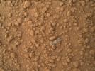
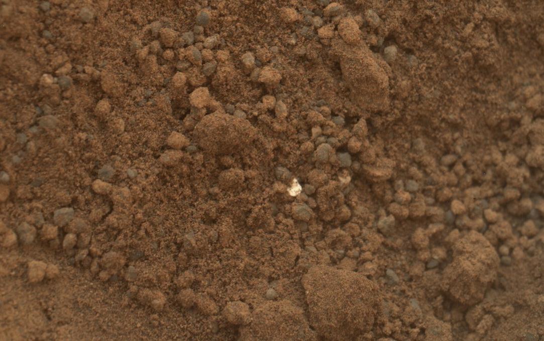
-
PIA16229:
-
Bright Particle of Martian Origin in Scoop Hole
Full Resolution:
TIFF
(5.786 MB)
JPEG
(288 kB)
|
|
|
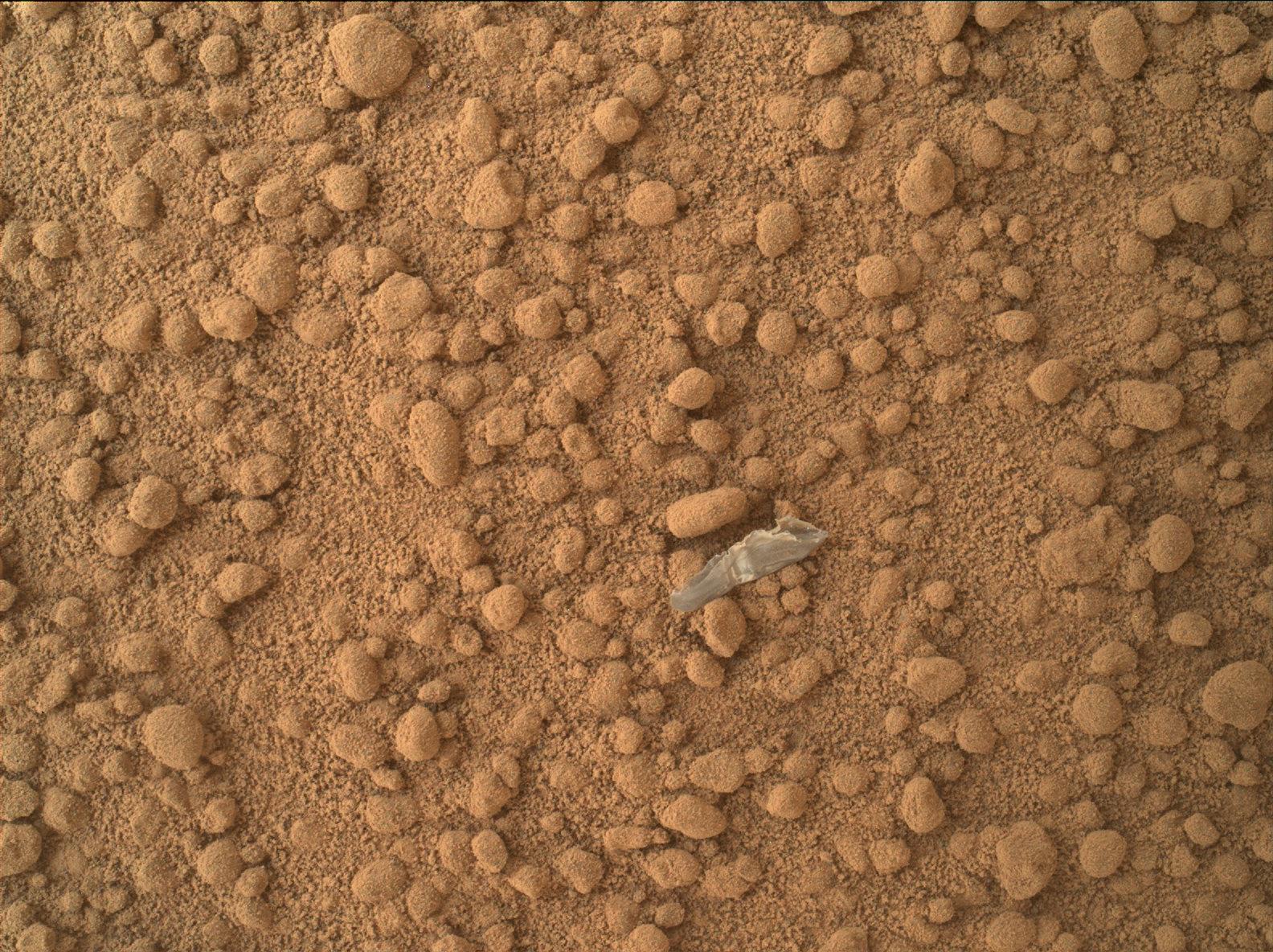
2012-10-15 |
Mars
|
Mars Science Laboratory (MSL)
|
MAHLI
|
1584x1184x3 |
|
-
PIA16230:
-
Small Debris on the Ground Beside Curiosity
Full Resolution:
TIFF
(5.628 MB)
JPEG
(485.9 kB)
|
|
|
2012-10-16 |
Mars
|
2001 Mars Odyssey
|
THEMIS
|
1289x2778x1 |
|
-
PIA16325:
-
Noctis Labyrinthus
Full Resolution:
TIFF
(3.585 MB)
JPEG
(134.1 kB)
|
|
|
2012-10-17 |
Mars
|
2001 Mars Odyssey
|
THEMIS
|
1313x2781x1 |
|
-
PIA16326:
-
Wind and Water
Full Resolution:
TIFF
(3.655 MB)
JPEG
(299.9 kB)
|
|
|
2012-10-18 |
Mars
|
2001 Mars Odyssey
|
THEMIS
|
1327x2773x1 |

|
-
PIA16327:
-
Butterfly Ejecta
Full Resolution:
TIFF
(3.684 MB)
JPEG
(342.6 kB)
|
|
|
2012-10-18 |
Mars
|
Mars Science Laboratory (MSL)
|
Navcam (MSL)
|
1024x1024x1 |
|
-
PIA16231:
-
Curiosity's First Three Bites Into Martian Ground
Full Resolution:
TIFF
(1.05 MB)
JPEG
(161.7 kB)
|
|
|
2012-10-18 |
Mars
|
Mars Science Laboratory (MSL)
|
Mastcam
|
1347x975x3 |

|
-
PIA16232:
-
First Sample Placed on Curiosity's Observation Tray
Full Resolution:
TIFF
(3.942 MB)
JPEG
(114.9 kB)
|
|
|
2012-10-18 |
Mars
|
Mars Science Laboratory (MSL)
|
MAHLI
|
1083x678x3 |
|
-
PIA16233:
-
Bright Particle in Hole Dug by Scooping of Martian Soil
Full Resolution:
TIFF
(2.204 MB)
JPEG
(122.5 kB)
|
|
|
2012-10-19 |
Mars
|
2001 Mars Odyssey
|
THEMIS
|
1347x2921x1 |
|
-
PIA16328:
-
Nili Fossae
Full Resolution:
TIFF
(3.939 MB)
JPEG
(373.8 kB)
|
|
|
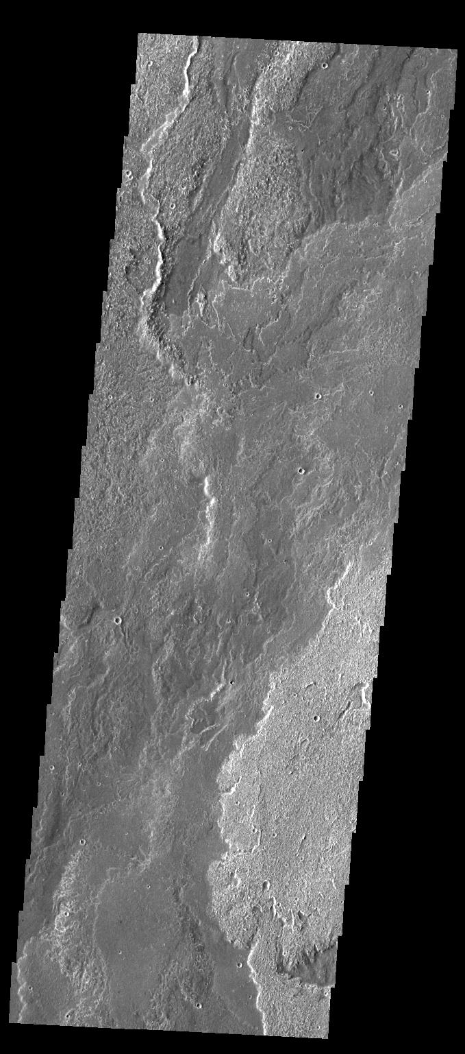
2012-10-22 |
Mars
|
2001 Mars Odyssey
|
THEMIS
|
1349x2923x1 |
|
-
PIA16329:
-
Arcuate Fratures
Full Resolution:
TIFF
(3.947 MB)
JPEG
(653.8 kB)
|
|
|
2012-10-22 |
Mars
|
Mars Science Laboratory (MSL)
|
ChemCam
|
720x720x1 |
|
-
PIA16234:
-
Laser Hit on Martian Sand Target, Before and After
Full Resolution:
TIFF
(519.1 kB)
JPEG
(102.3 kB)
|
|
|
2012-10-23 |
Mars
|
2001 Mars Odyssey
|
THEMIS
|
1291x2774x1 |
|
-
PIA16330:
-
Tharsis Volcanics
Full Resolution:
TIFF
(3.585 MB)
JPEG
(542.1 kB)
|
|
|
2012-10-24 |
Mars
|
2001 Mars Odyssey
|
THEMIS
|
1160x1576x1 |

|
-
PIA16331:
-
Dark Slope Streaks
Full Resolution:
TIFF
(1.83 MB)
JPEG
(109.1 kB)
|
|
|
2012-10-25 |
Mars
|
2001 Mars Odyssey
|
THEMIS
|
1348x2924x1 |

|
-
PIA16332:
-
Enipeus Vallis
Full Resolution:
TIFF
(3.946 MB)
JPEG
(549.8 kB)
|
|
|
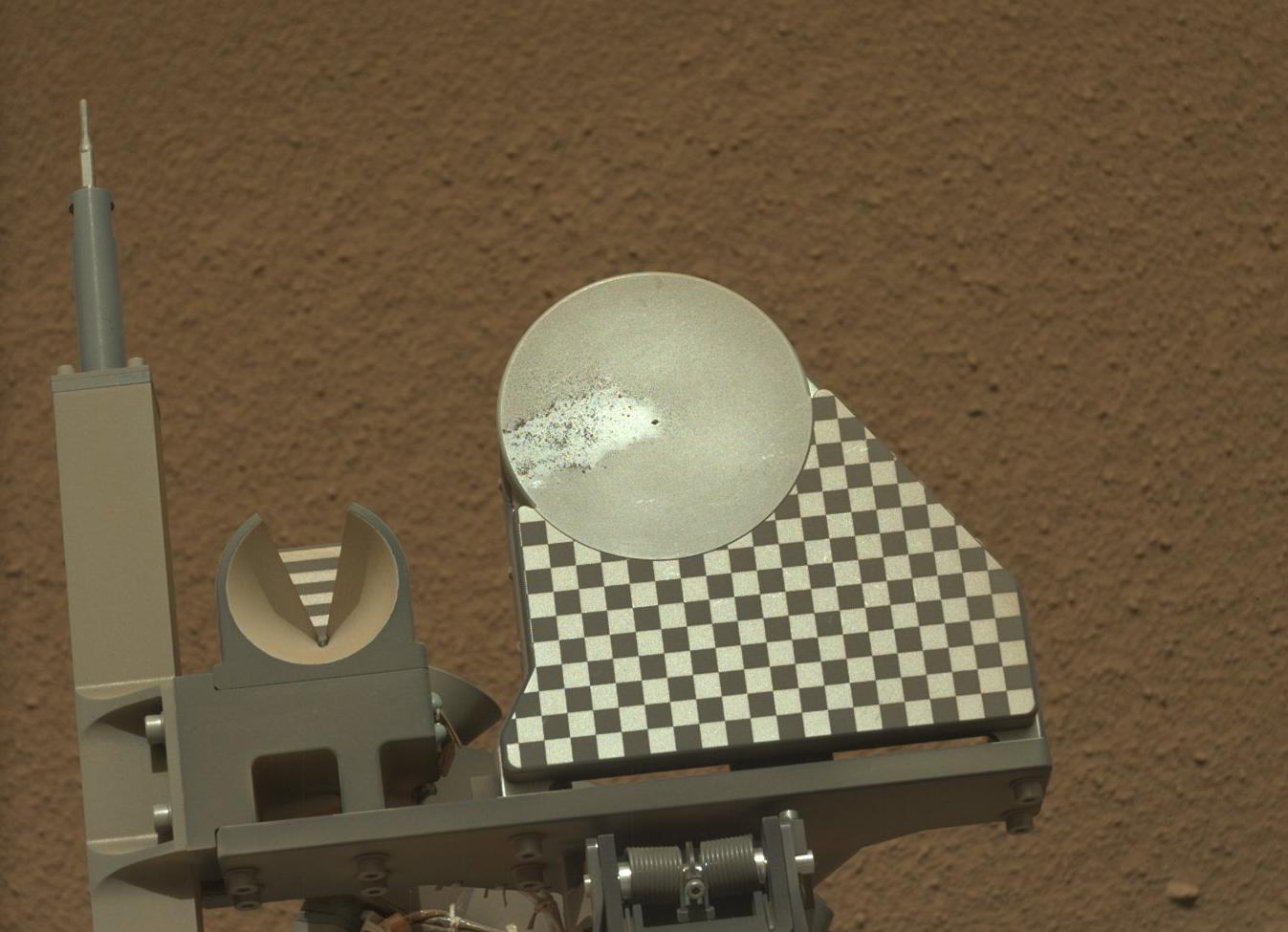
2012-10-25 |
Mars
|
Mars Science Laboratory (MSL)
|
Navcam (MSL)
|
438x200x1 |
|
-
PIA16235:
-
Scooped Material on Rover's Observation Tray
Full Resolution:
TIFF
(87.91 kB)
JPEG
(14.34 kB)
|
|
|
2012-10-26 |
Mars
|
2001 Mars Odyssey
|
THEMIS
|
1315x2782x1 |

|
-
PIA16333:
-
Windstreaks
Full Resolution:
TIFF
(3.662 MB)
JPEG
(327.2 kB)
|
|
|
2012-10-29 |
Mars
|
2001 Mars Odyssey
|
THEMIS
|
943x2940x1 |
|
-
PIA16334:
-
South Pole
Full Resolution:
TIFF
(2.776 MB)
JPEG
(240.8 kB)
|
|
|
2012-10-29 |
Mars
|
Mars Science Laboratory (MSL)
|
MAHLI
|
1196x1605x3 |

|
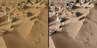
-
PIA16236:
-
Rock 'Et-Then' Near Curiosity, Sol 82
Full Resolution:
TIFF
(5.761 MB)
JPEG
(666.8 kB)
|
|
|
2012-10-29 |
Mars
|
Mars Science Laboratory (MSL)
|
MAHLI
|
1584x1184x3 |
|
-
PIA16237:
-
Rock 'Burwash' Near Curiosity, Sol 82
Full Resolution:
TIFF
(5.628 MB)
JPEG
(445.3 kB)
|
|
|
2012-10-30 |
Mars
|
2001 Mars Odyssey
|
THEMIS
|
1341x2774x1 |
|
-
PIA16335:
-
Tharsis Volcanics
Full Resolution:
TIFF
(3.724 MB)
JPEG
(708 kB)
|
|
|
2012-10-30 |
Mars
|
Mars Science Laboratory (MSL)
|
CheMin
Mastcam
|
3027x1200x3 |
|
-
PIA16173:
-
Curiosity Digs In
Full Resolution:
TIFF
(10.9 MB)
JPEG
(660.7 kB)
|
|
|
2012-10-30 |
Mars
|
Mars Science Laboratory (MSL)
|
CheMin
Mastcam
|
2316x1152x3 |
|
-
PIA16174:
-
Wind-Blown Martian Sand
Full Resolution:
TIFF
(8.007 MB)
JPEG
(530.1 kB)
|
|
|
2012-10-30 |
Mars
|
Mars Science Laboratory (MSL)
|
CheMin
|
582x600x3 |
|
-
PIA16217:
-
First X-ray View of Martian Soil
Full Resolution:
TIFF
(351.3 kB)
JPEG
(157.3 kB)
|
|
|
2012-10-31 |
Mars
|
2001 Mars Odyssey
|
THEMIS
|
1349x2773x1 |
|
-
PIA16336:
-
Uranius Dorsum
Full Resolution:
TIFF
(3.745 MB)
JPEG
(511.3 kB)
|
|
|
2012-10-31 |
Mars
|
2001 Mars Odyssey
|
THEMIS
|
1349x2773x1 |
|
-
PIA16269:
-
Uranius Dorsum
Full Resolution:
TIFF
(3.745 MB)
JPEG
(511.3 kB)
|
|
|
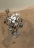
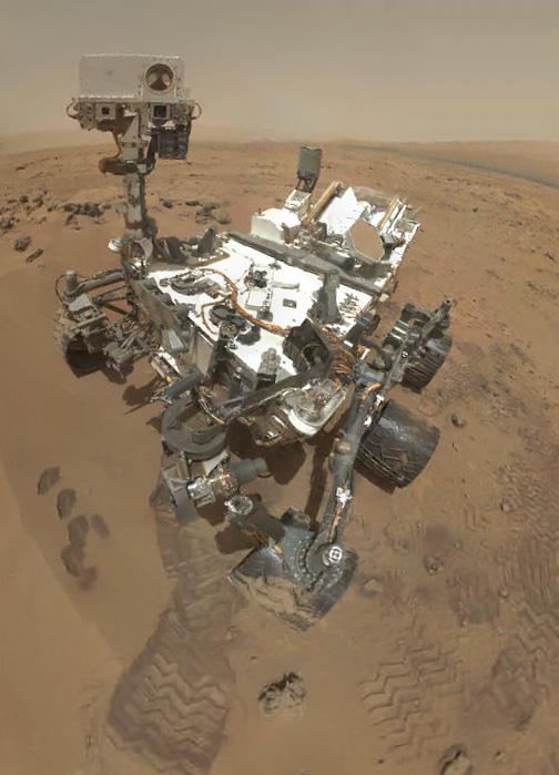
2012-11-01 |
Mars
|
Mars Science Laboratory (MSL)
|
MAHLI
|
504x699x3 |
|
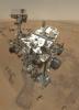
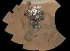
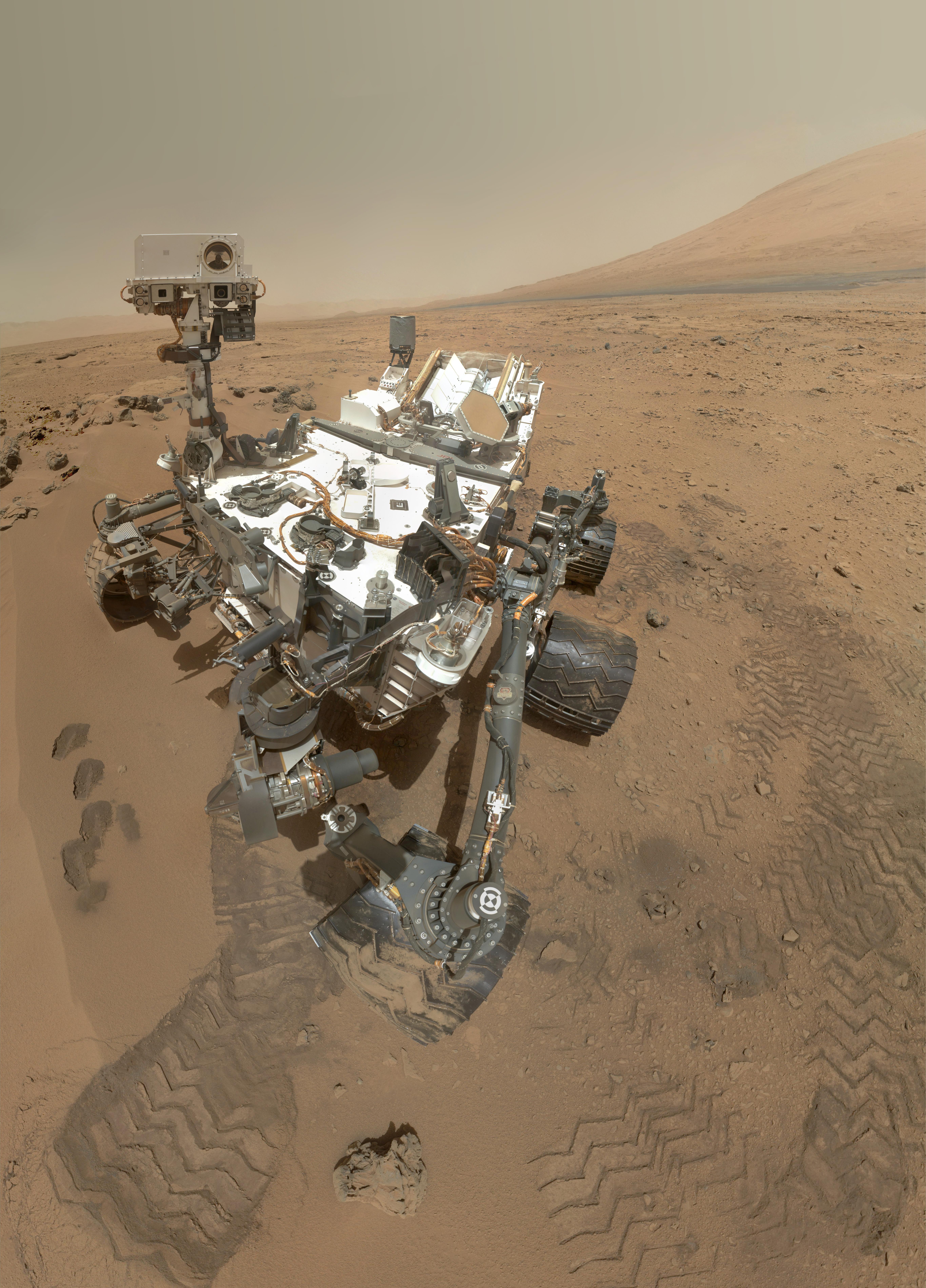
-
PIA16238:
-
Preliminary Self-Portrait of Curiosity by Rover's Arm Camera
Full Resolution:
TIFF
(1.057 MB)
JPEG
(45.02 kB)
|
|
|
2012-11-01 |
Mars
|
2001 Mars Odyssey
|
THEMIS
|
1350x2985x1 |
|
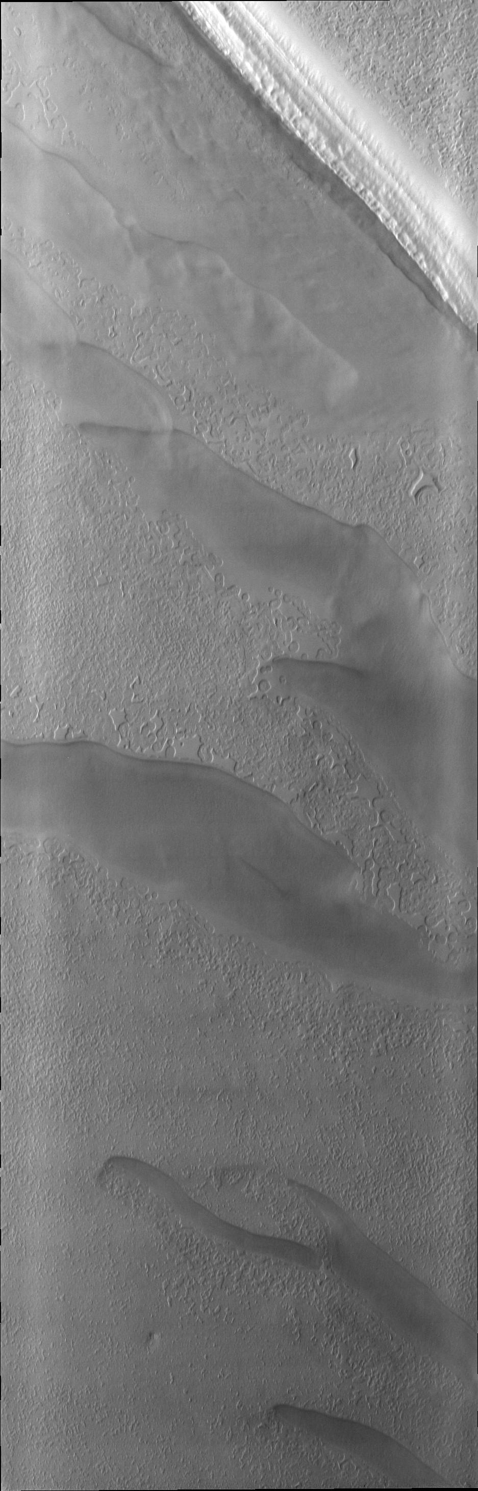
-
PIA16337:
-
Brashear Dunes
Full Resolution:
TIFF
(4.034 MB)
JPEG
(356 kB)
|
|
|
2012-11-01 |
Mars
|
Mars Science Laboratory (MSL)
|
MAHLI
|
5463x7595x3 |
|
-
PIA16239:
-
High-Resolution Self-Portrait by Curiosity Rover Arm Camera
Full Resolution:
TIFF
(124.5 MB)
JPEG
(3.831 MB)
|
|
|
2012-11-02 |
Mars
|
2001 Mars Odyssey
|
THEMIS
|
937x2920x1 |
|
-
PIA16338:
-
South Pole
Full Resolution:
TIFF
(2.739 MB)
JPEG
(313.1 kB)
|
|
|
2012-11-05 |
Mars
|
2001 Mars Odyssey
|
THEMIS
|
1342x2770x1 |
|
-
PIA16339:
-
Maja Valles
Full Resolution:
TIFF
(3.721 MB)
JPEG
(313.9 kB)
|
|
|
2012-11-06 |
Mars
|
2001 Mars Odyssey
|
THEMIS
|
1331x2772x1 |
|
-
PIA16437:
-
Syrtis Major
Full Resolution:
TIFF
(3.693 MB)
JPEG
(283.7 kB)
|
|
|
2012-11-07 |
Mars
|
2001 Mars Odyssey
|
THEMIS
|
1303x2941x1 |
|
-
PIA16439:
-
Her Desher Vallis
Full Resolution:
TIFF
(3.836 MB)
JPEG
(344 kB)
|
|
|
2012-11-08 |
Mars
|
2001 Mars Odyssey
|
THEMIS
|
1304x2772x1 |
|
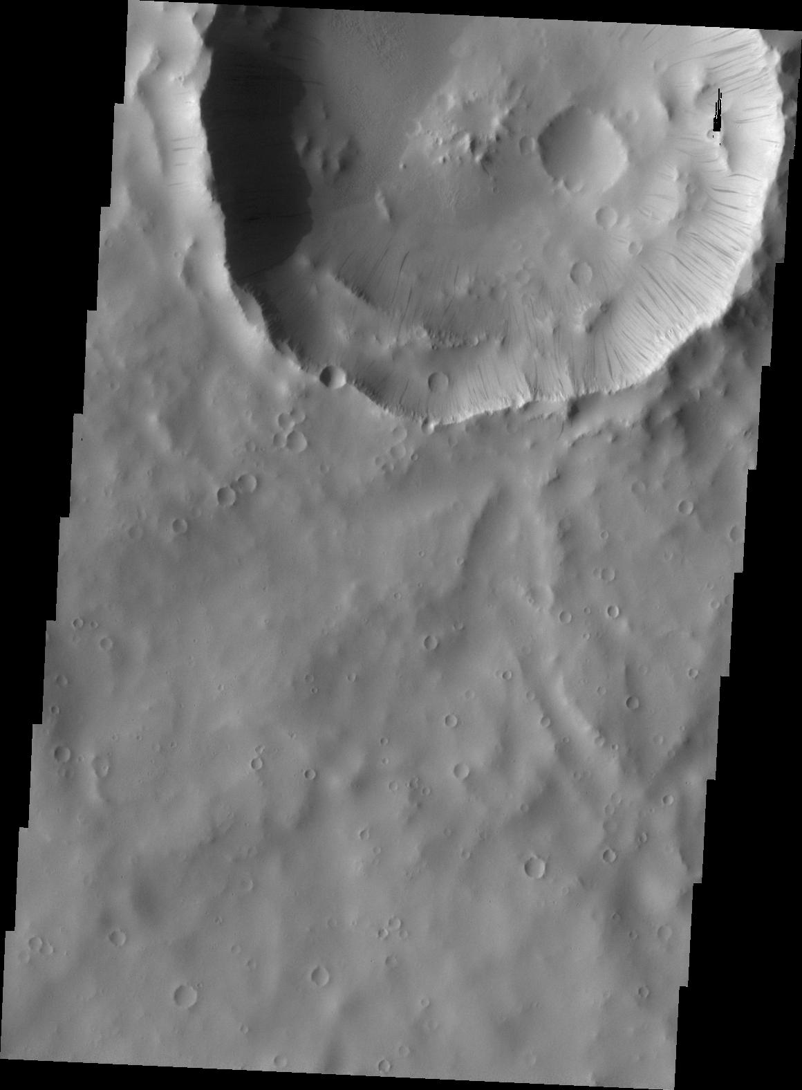
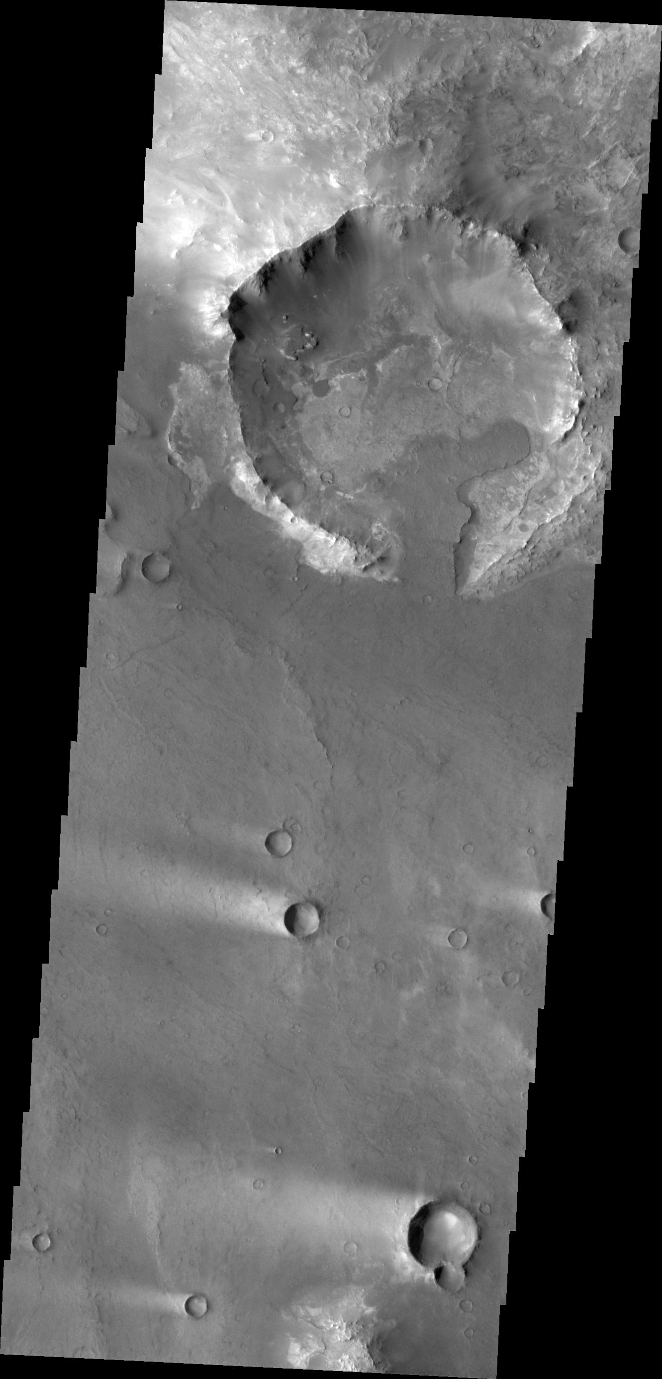
-
PIA16470:
-
Volcanic Vent
Full Resolution:
TIFF
(3.619 MB)
JPEG
(370.4 kB)
|
|
|
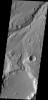
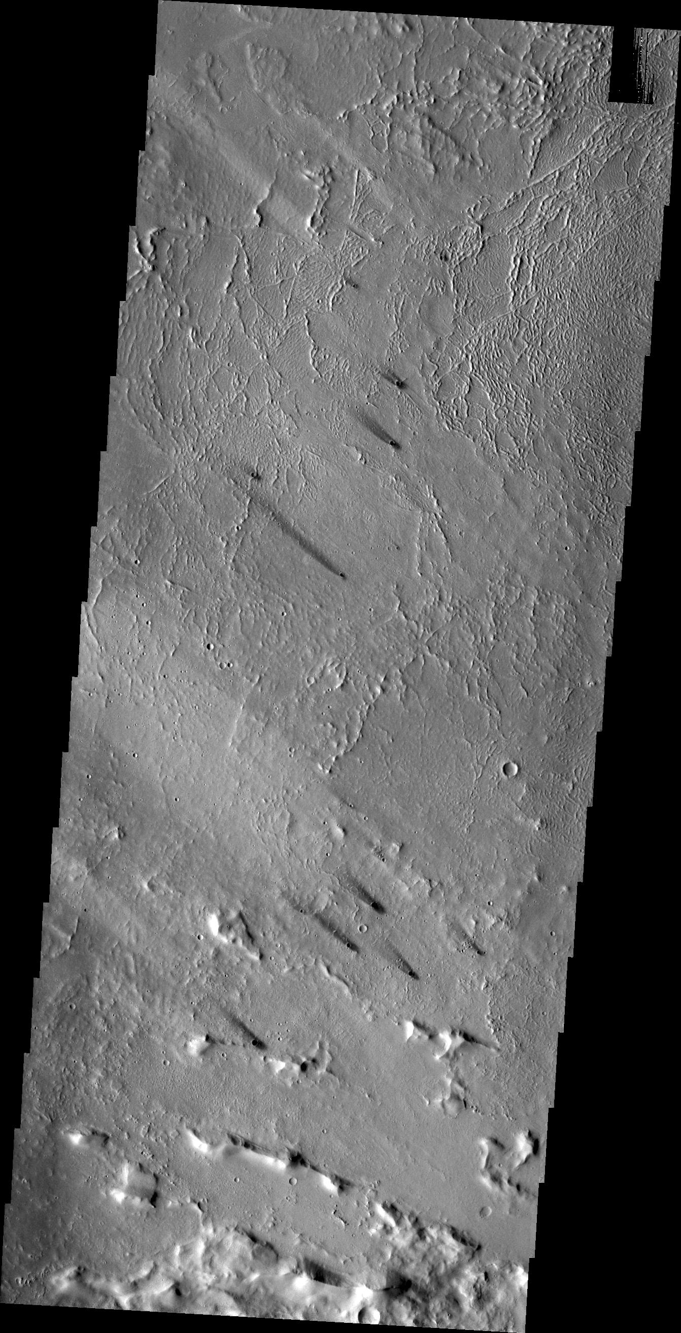
2012-11-09 |
Mars
|
2001 Mars Odyssey
|
THEMIS
|
1335x2773x1 |
|
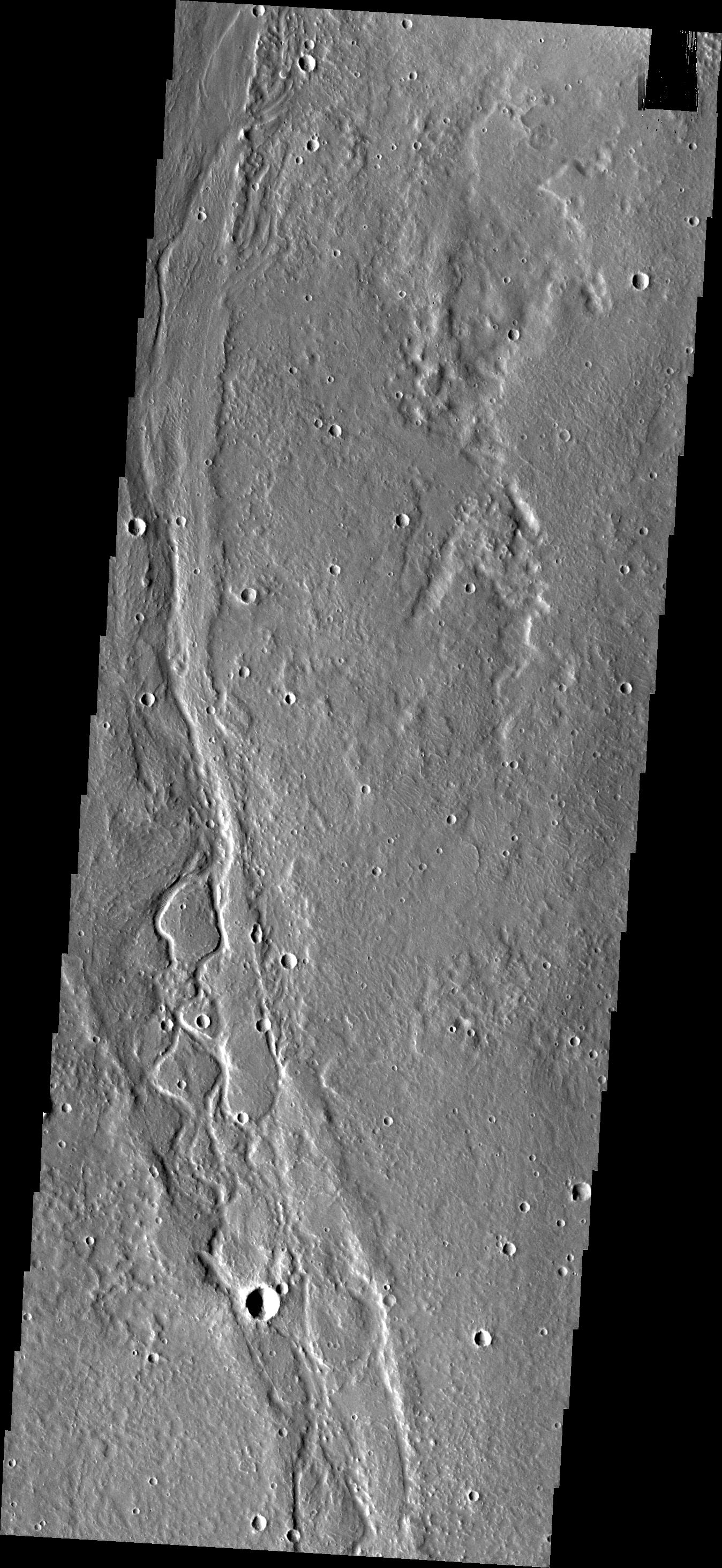
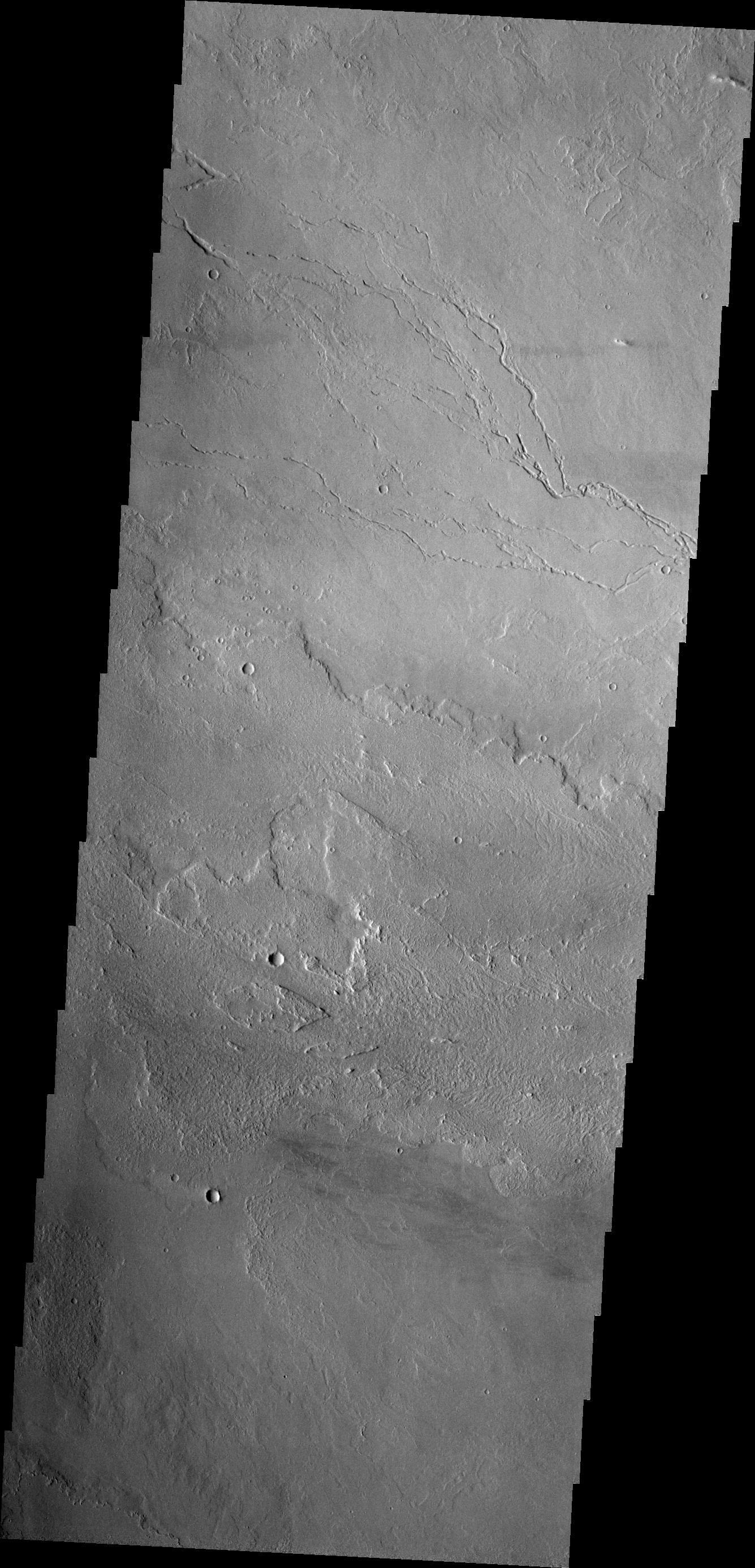
-
PIA16471:
-
Lava Channels
Full Resolution:
TIFF
(3.706 MB)
JPEG
(484 kB)
|
|
|
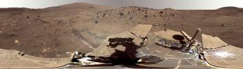
2012-11-09 |
Mars
|
Mars Exploration Rover (MER)
|
Panoramic Camera
|
11174x3162x3 |

|
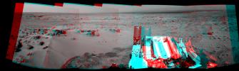
-
PIA16440:
Spirit Mars Rover in 'McMurdo' Panorama
Full Resolution:
TIFF
(106 MB)
JPEG
(3.946 MB)
|
|
|
2012-11-09 |
Mars
|
Mars Exploration Rover (MER)
|
Panoramic Camera
|
11174x3162x3 |
|
-
PIA16441:
Spirit Mars Rover in 'McMurdo' Panorama (False Color)
Full Resolution:
TIFF
(106 MB)
JPEG
(4.81 MB)
|
|
|
2012-11-09 |
Mars
|
Mars Exploration Rover (MER)
|
Panoramic Camera
|
12953x12953x3 |
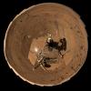
|
-
PIA16442:
-
Spirit Mars Rover in 'McMurdo' Panorama, Polar Projection
Full Resolution:
TIFF
(503.4 MB)
JPEG
(12.15 MB)
|
|
|
2012-11-09 |
Mars
|
Mars Exploration Rover (MER)
|
Panoramic Camera
|
12953x12953x3 |
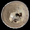
|
-
PIA16443:
-
Spirit Mars Rover in 'McMurdo' Panorama, Polar Projection (False Color)
Full Resolution:
TIFF
(503.4 MB)
JPEG
(15.03 MB)
|
|
|
2012-11-12 |
Mars
|
2001 Mars Odyssey
|
THEMIS
|
1341x2771x1 |
|
-
PIA16472:
-
Young Crater
Full Resolution:
TIFF
(3.72 MB)
JPEG
(535.1 kB)
|
|
|
2012-11-12 |
Mars
|
Mars Exploration Rover (MER)
|
Panoramic Camera
|
2233x1330x3 |
|
-
PIA16444:
-
'Homestake' Vein on 'Cape York,' Color Enhanced
Full Resolution:
TIFF
(8.913 MB)
JPEG
(204.2 kB)
|
|
|
2012-11-12 |
Mars
|
Mars Exploration Rover (MER)
|
Panoramic Camera
|
1024x1024x3 |
|
-
PIA16445:
-
'Whitewater Lake' Rock Viewed by Opportunity
Full Resolution:
TIFF
(3.147 MB)
JPEG
(214.2 kB)
|
|
|
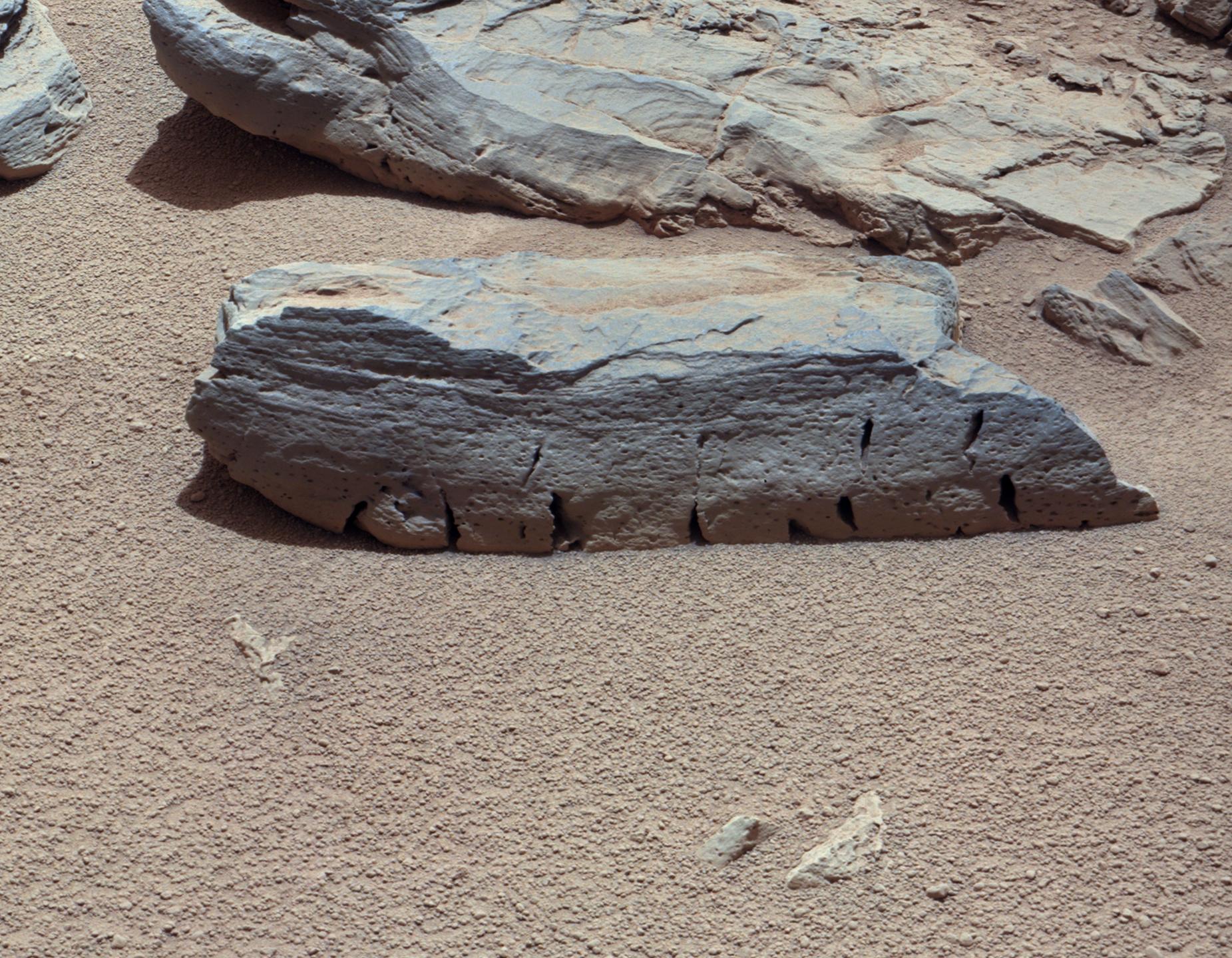
2012-11-13 |
Mars
|
2001 Mars Odyssey
|
THEMIS
|
1213x3061x1 |

|
-
PIA16473:
-
Dust Devil Tracks
Full Resolution:
TIFF
(3.717 MB)
JPEG
(491.9 kB)
|
|
|
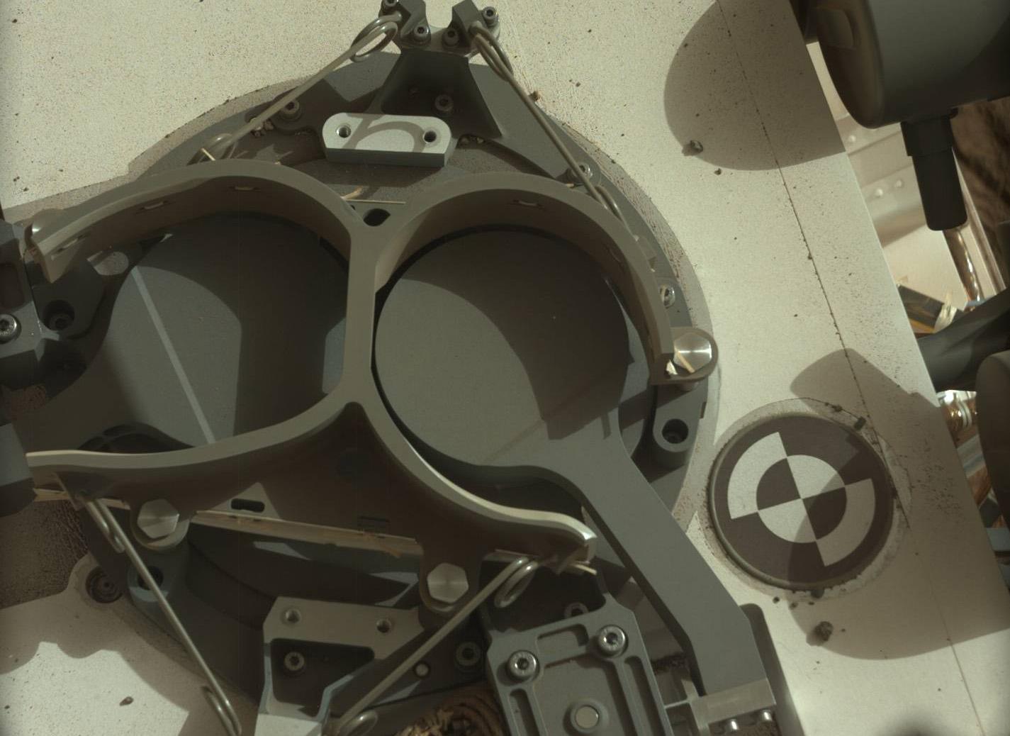
2012-11-13 |
Mars
|
Mars Science Laboratory (MSL)
|
SAM
|
1425x1038x3 |
|
-
PIA16446:
-
Inlet Covers for Sample Analysis at Mars
Full Resolution:
TIFF
(4.439 MB)
JPEG
(128.1 kB)
|
|
|
2012-11-14 |
Mars
|
2001 Mars Odyssey
|
THEMIS
|
1342x2626x1 |
|
-
PIA16495:
-
Windstreaks
Full Resolution:
TIFF
(3.528 MB)
JPEG
(514.3 kB)
|
|
|
2012-11-15 |
Mars
|
2001 Mars Odyssey
|
THEMIS
|
1354x2919x1 |
|
-
PIA16496:
-
Channels
Full Resolution:
TIFF
(3.956 MB)
JPEG
(591 kB)
|
|
|
2012-11-15 |
Mars
|
Mars Science Laboratory (MSL)
|
REMS
|
2004x1250x3 |
|
-
PIA16475:
-
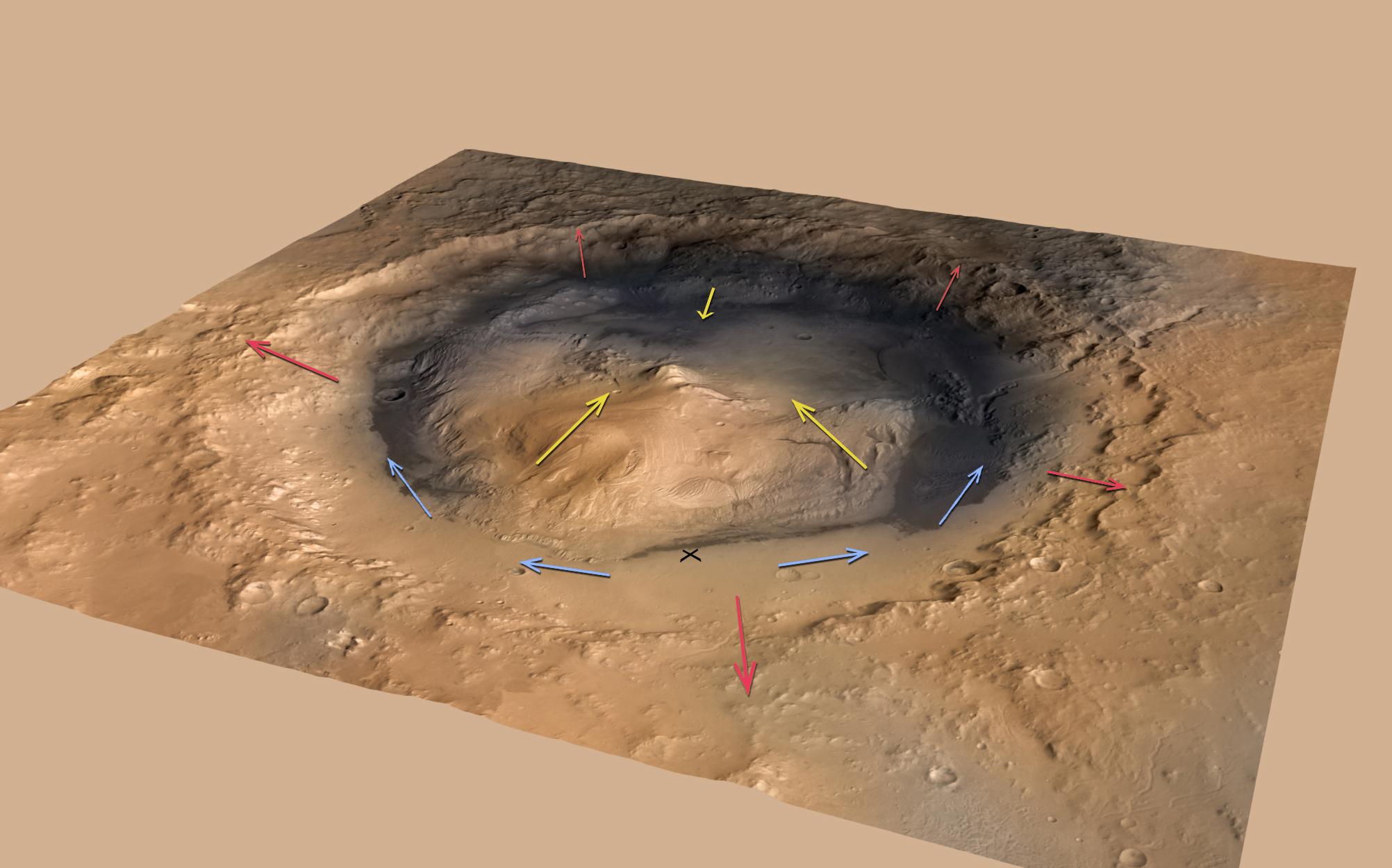
Mountain Winds at Gale Crater
Full Resolution:
TIFF
(7.518 MB)
JPEG
(187.4 kB)
|
|
|
2012-11-15 |
Mars
|
Mars Science Laboratory (MSL)
|
REMS
|
2154x1986x3 |
|
-
PIA16476:
-
Signs of a Whirlwind in Gale Crater
Full Resolution:
TIFF
(12.84 MB)
JPEG
(224 kB)
|
|
|
2012-11-15 |
Mars
|
Mars Science Laboratory (MSL)
|
REMS
|
2999x2249x3 |
|
-
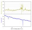
PIA16477:
-
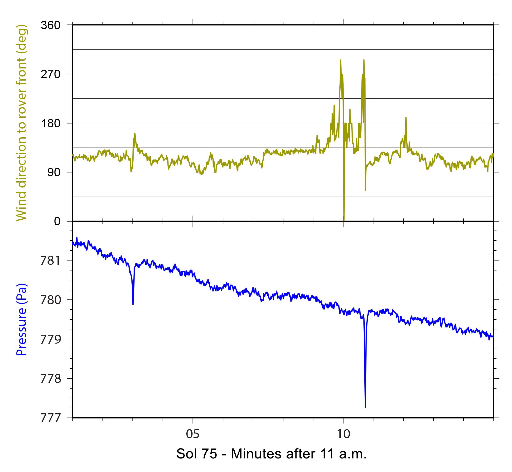
Pressure Cycles on Mars
Full Resolution:
TIFF
(20.24 MB)
JPEG
(262.7 kB)
|
|
|
2012-11-15 |
Mars
|
Mars Science Laboratory (MSL)
|
|
1286x994x3 |
|
-
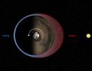
PIA16478:
-
Thermal Tides at Mars
Full Resolution:
TIFF
(3.836 MB)
JPEG
(97.88 kB)
|
|
|
2012-11-15 |
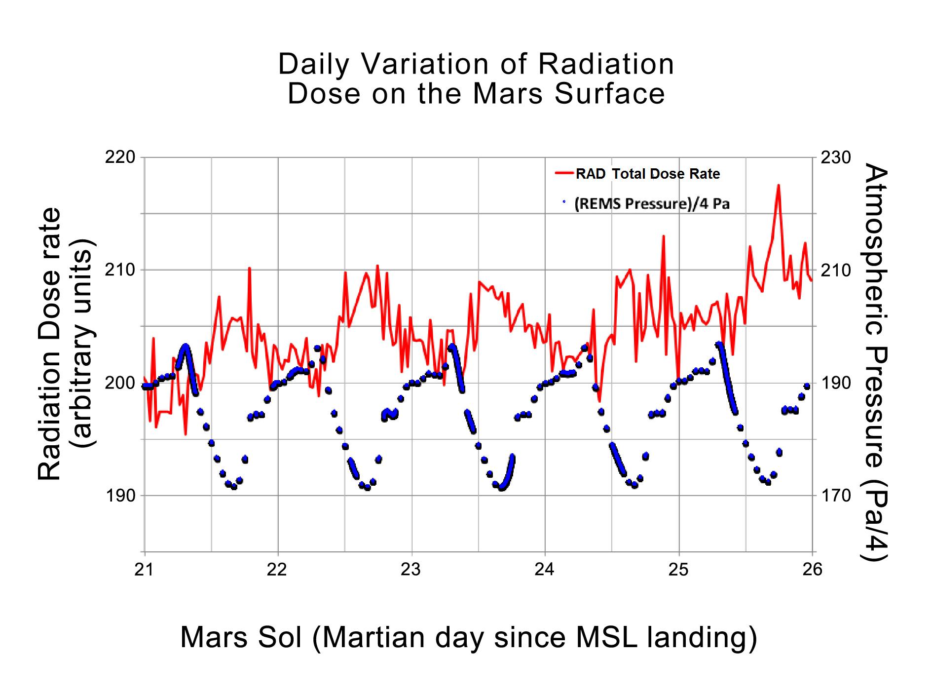
Mars
|
Mars Science Laboratory (MSL)
|
RAD
REMS
|
1889x1412x3 |
|
-
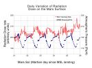
PIA16479:
-
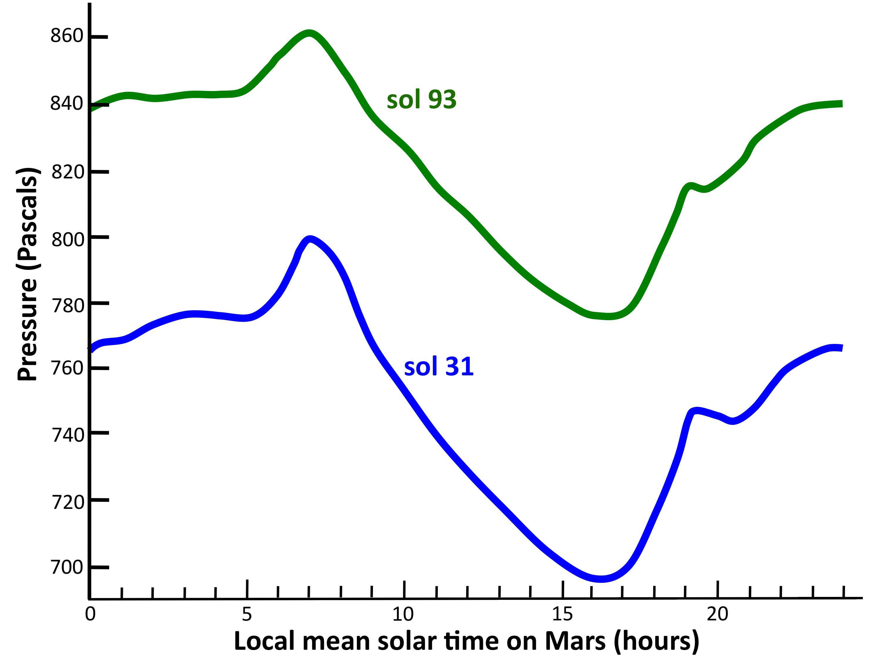
Daily Cycles of Radiation and Pressure at Gale Crater
Full Resolution:
TIFF
(8.005 MB)
JPEG
(215.1 kB)
|
|
|
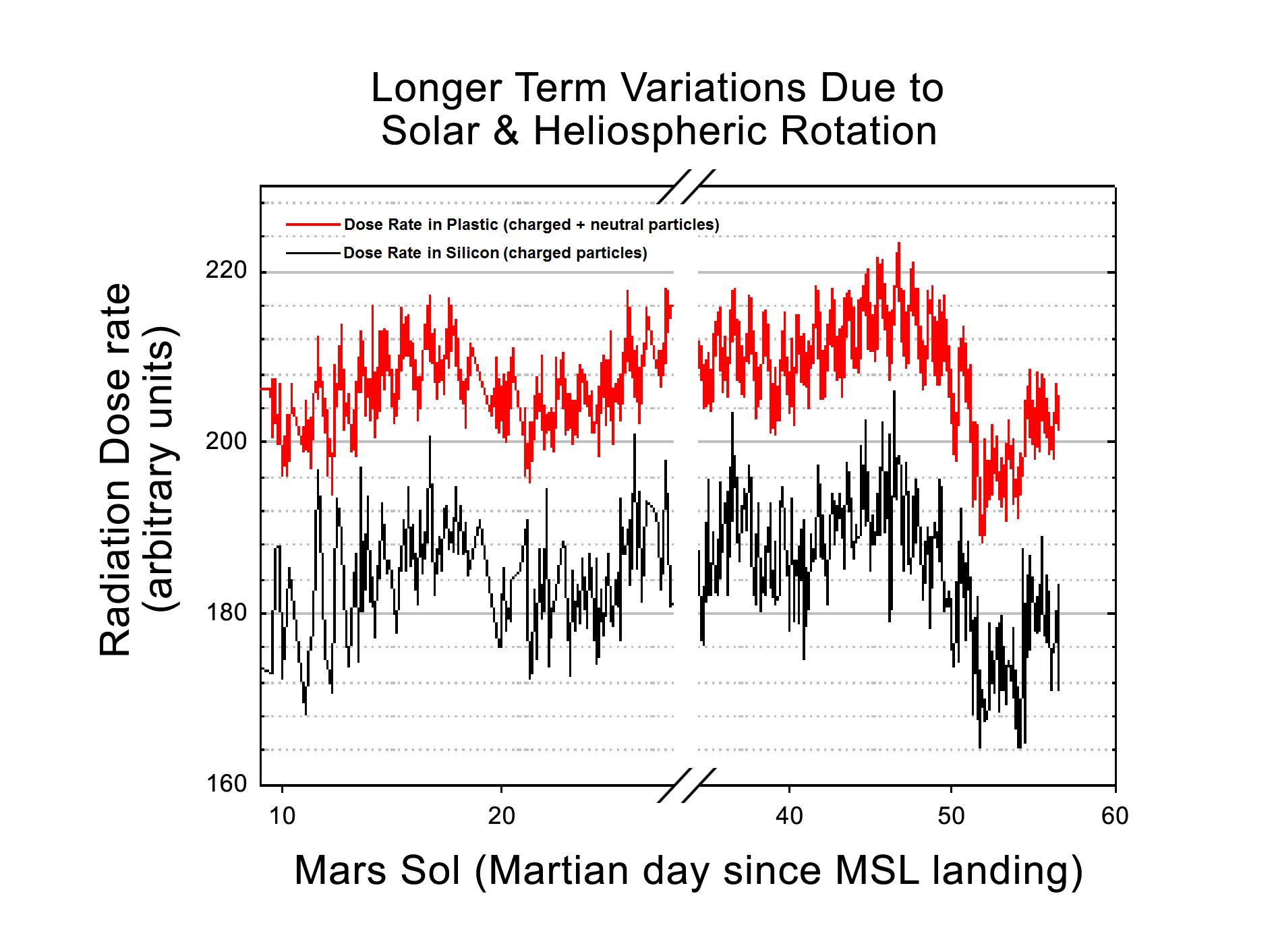
2012-11-15 |
Mars
|
Mars Science Laboratory (MSL)
|
RAD
|
1889x1412x3 |
|
-
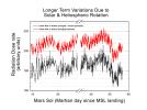
PIA16480:
-
Longer-Term Radiation Variations at Gale Crater
Full Resolution:
TIFF
(8.005 MB)
JPEG
(256.9 kB)
|
|
|
2012-11-15 |
Mars
|
Mars Science Laboratory (MSL)
|
Navcam (MSL)
|
1024x1024x1 |

|
-
PIA16199:
-
Five Bites Into Mars
Full Resolution:
TIFF
(1.05 MB)
JPEG
(120.5 kB)
|
|
|
2012-11-16 |
Mars
|
2001 Mars Odyssey
|
THEMIS
|
1339x2922x1 |
|
-
PIA16497:
-
Channel
Full Resolution:
TIFF
(3.917 MB)
JPEG
(366.8 kB)
|
|
|
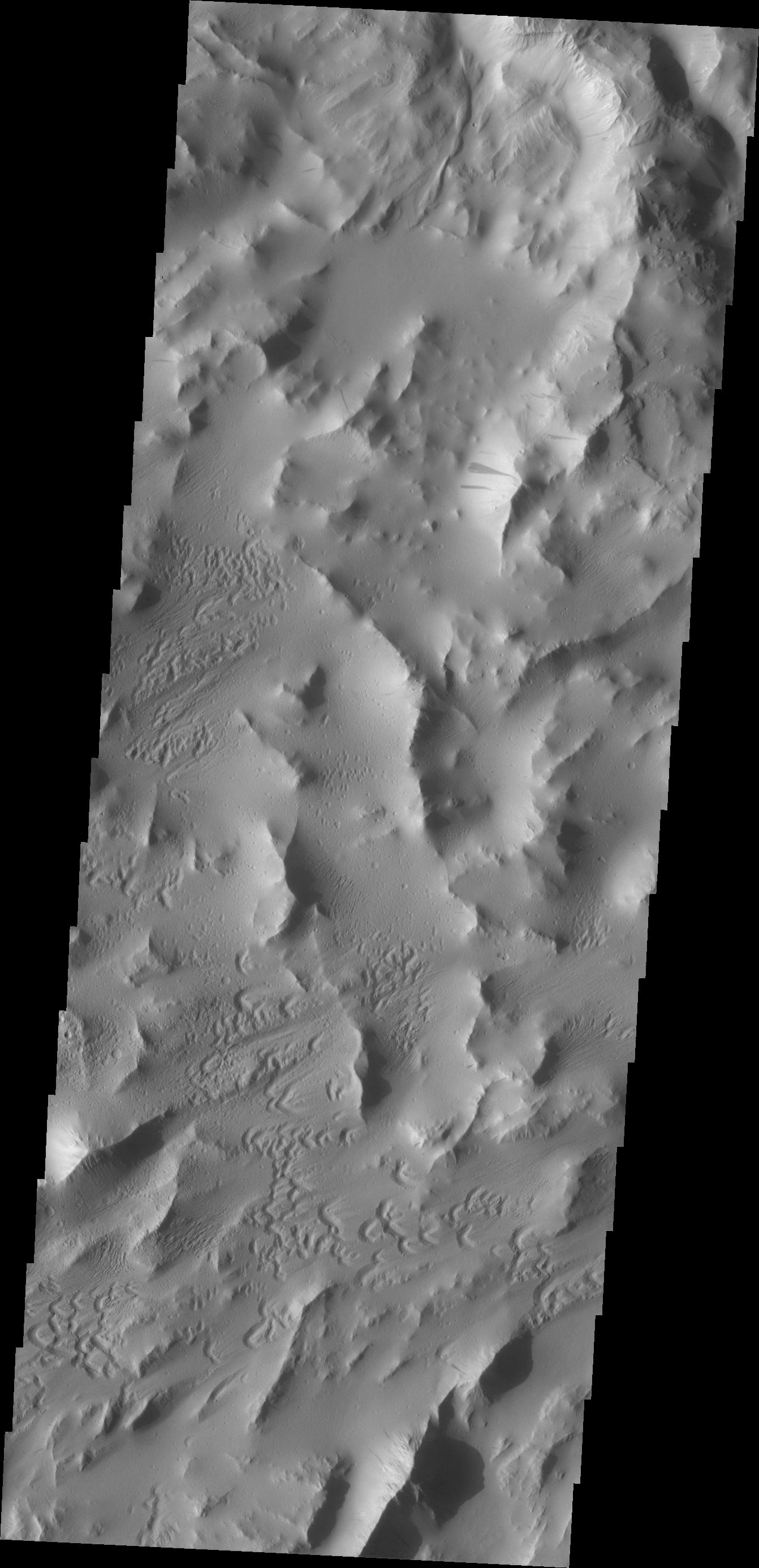
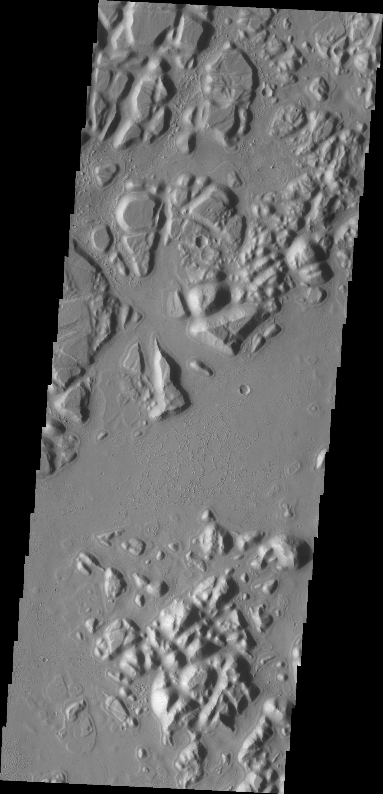
2012-11-19 |
Mars
|
2001 Mars Odyssey
|
THEMIS
|
679x1537x1 |

|
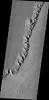
-
PIA16498:
-
Daedalia Planum
Full Resolution:
TIFF
(1.045 MB)
JPEG
(168.8 kB)
|
|
|
2012-11-20 |
Mars
|
2001 Mars Odyssey
|
THEMIS
|
1376x2930x1 |
|
-
PIA16499:
-
Alba Mons Fractures
Full Resolution:
TIFF
(4.037 MB)
JPEG
(525.3 kB)
|
|
|
2012-11-20 |
Mars
|
Mars Science Laboratory (MSL)
|
Navcam (MSL)
|
1024x1024x1 |

|
-
PIA16447:
-
Post-Drive View on Curiosity's Sol 102
Full Resolution:
TIFF
(1.05 MB)
JPEG
(179.7 kB)
|
|
|
2012-11-20 |
Mars
|
Mars Science Laboratory (MSL)
|
Navcam (MSL)
|
3707x996x1 |

|
-
PIA16448:
Curiosity's Eastward View After Sol 100 Drive
Full Resolution:
TIFF
(3.696 MB)
JPEG
(460.2 kB)
|
|
|
2012-11-20 |
Mars
|
Mars Science Laboratory (MSL)
|
Navcam (MSL)
|
3893x1162x3 |
|
-
PIA16449:
-
Curiosity's Eastward View After Sol 100 Drive, Stereo
Full Resolution:
TIFF
(13.58 MB)
JPEG
(640.8 kB)
|
|
|
2012-11-21 |
Mars
|
2001 Mars Odyssey
|
THEMIS
|
1341x2770x1 |
|
-
PIA16500:
-
Lava Channels
Full Resolution:
TIFF
(3.718 MB)
JPEG
(603.7 kB)
|
|
|
2012-11-21 |
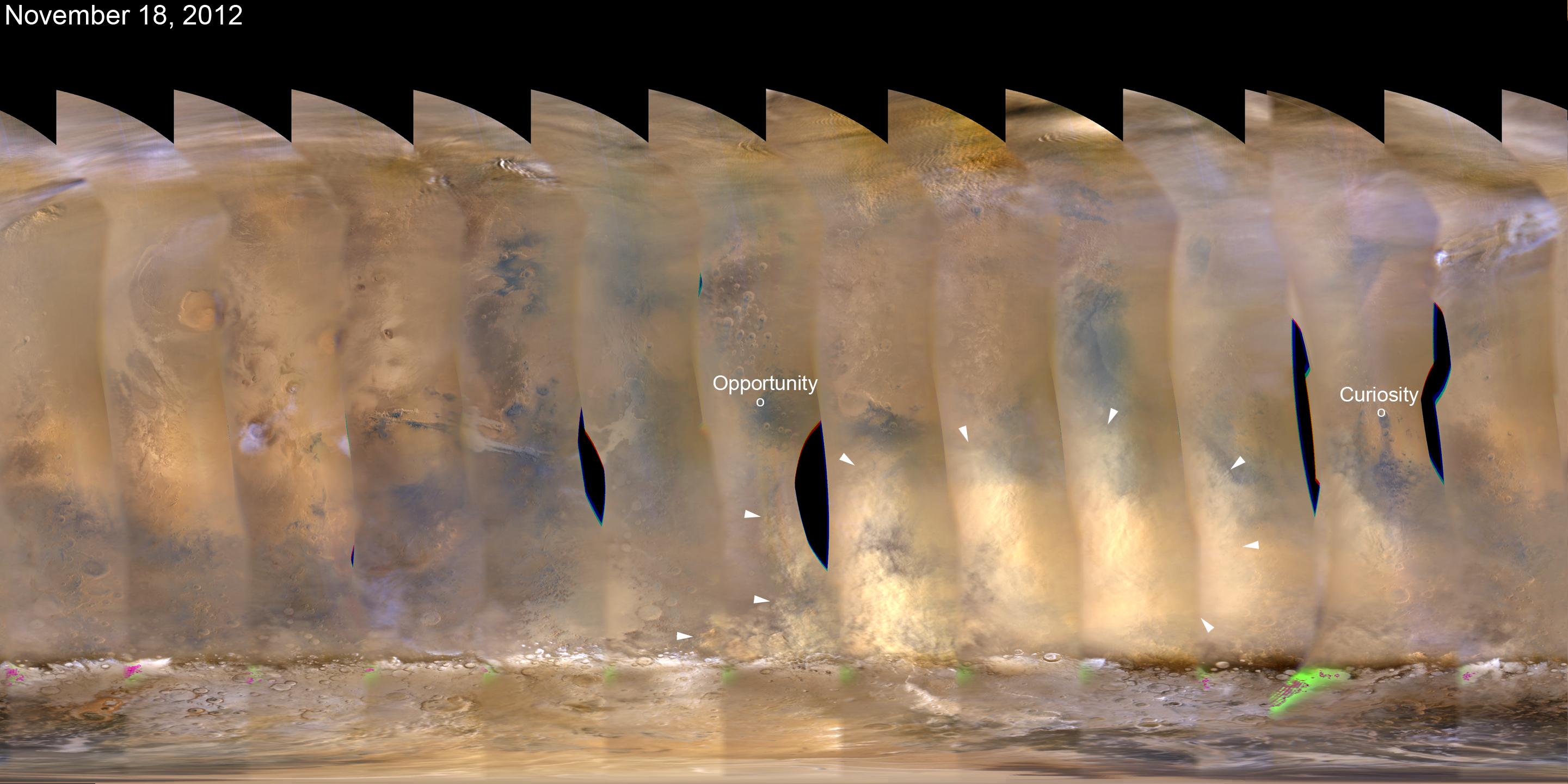
Mars
|
Mars Reconnaissance Orbiter (MRO)
|
MARCI
|
2881x1441x3 |
|
-
PIA16450:
-
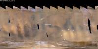
Martian Dust Storm, Nov. 18, 2012
Full Resolution:
TIFF
(12.46 MB)
JPEG
(314.4 kB)
|
|
|
2012-11-22 |
Mars
|
2001 Mars Odyssey
|
THEMIS
|
1342x2773x1 |

|
-
PIA16501:
-
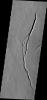
Lycus Sulci
Full Resolution:
TIFF
(3.725 MB)
JPEG
(287.8 kB)
|
|
|
2012-11-23 |
Mars
|
2001 Mars Odyssey
|
THEMIS
|
1336x2772x1 |

|
-
PIA16502:
-
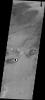
Echus Chaos
Full Resolution:
TIFF
(3.707 MB)
JPEG
(308.7 kB)
|
|
|
2012-11-26 |
Mars
|
2001 Mars Odyssey
|
THEMIS
|
1314x2768x1 |
|
-
PIA16503:
-
Lava Channels
Full Resolution:
TIFF
(3.641 MB)
JPEG
(470.1 kB)
|
|
|
2012-11-26 |
Mars
|
Mars Science Laboratory (MSL)
|
ChemCam
|
1295x1317x3 |
|
-
PIA16451:
-
Mars Rock 'Rocknest 3' Imaged by Curiosity's ChemCam
Full Resolution:
TIFF
(5.119 MB)
JPEG
(177.2 kB)
|
|
|
2012-11-26 |
Mars
|
Mars Science Laboratory (MSL)
|
Mastcam
|
1851x1440x3 |
|
-
PIA16452:
-
A Martian Rock Called 'Rocknest 3'
Full Resolution:
TIFF
(7.999 MB)
JPEG
(538.1 kB)
|
|
|
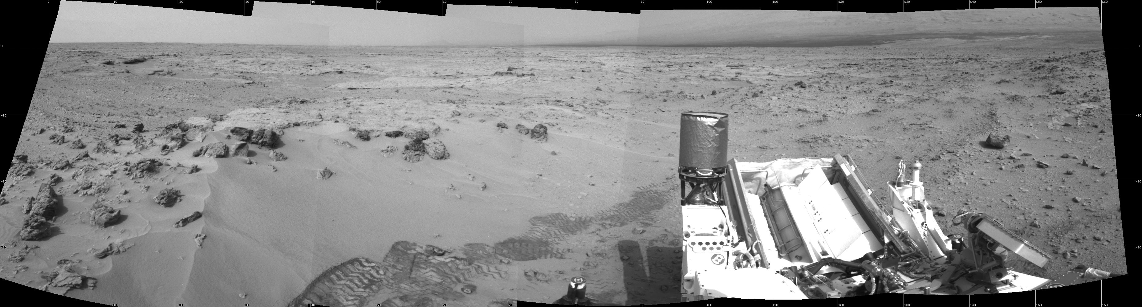
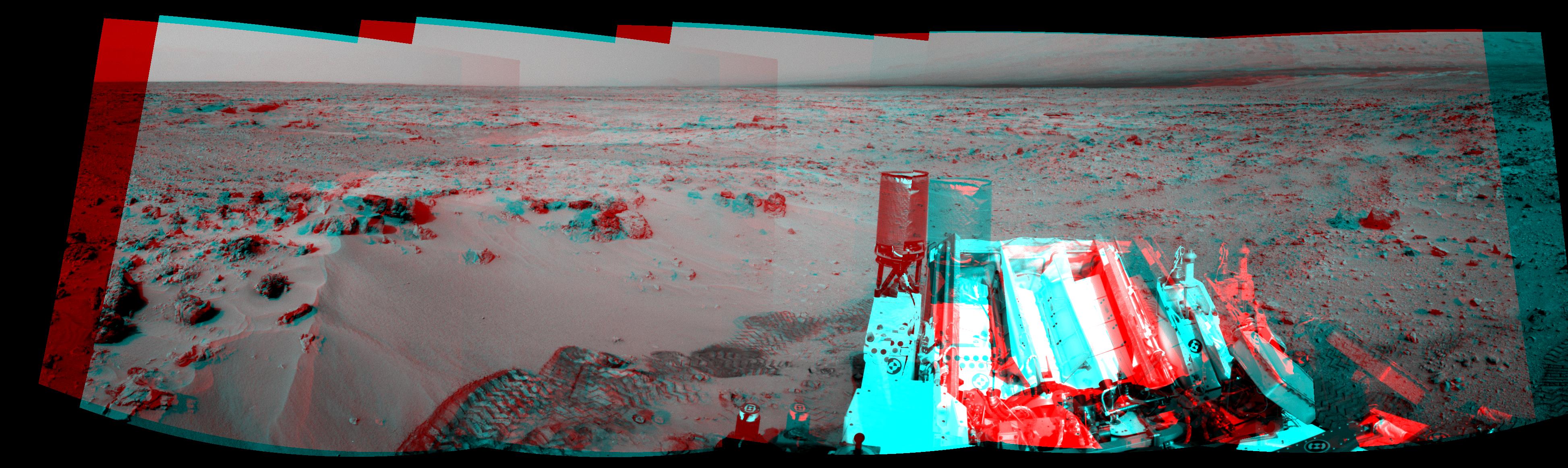
2012-11-26 |
Mars
|
Mars Science Laboratory (MSL)
|
Mastcam
|
13726x3008x3 |
|
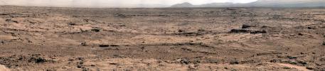
-
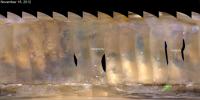
PIA16453:
Panoramic View From 'Rocknest' Position of Curiosity Mars Rover
Full Resolution:
TIFF
(123.9 MB)
JPEG
(7.811 MB)
|
|
|
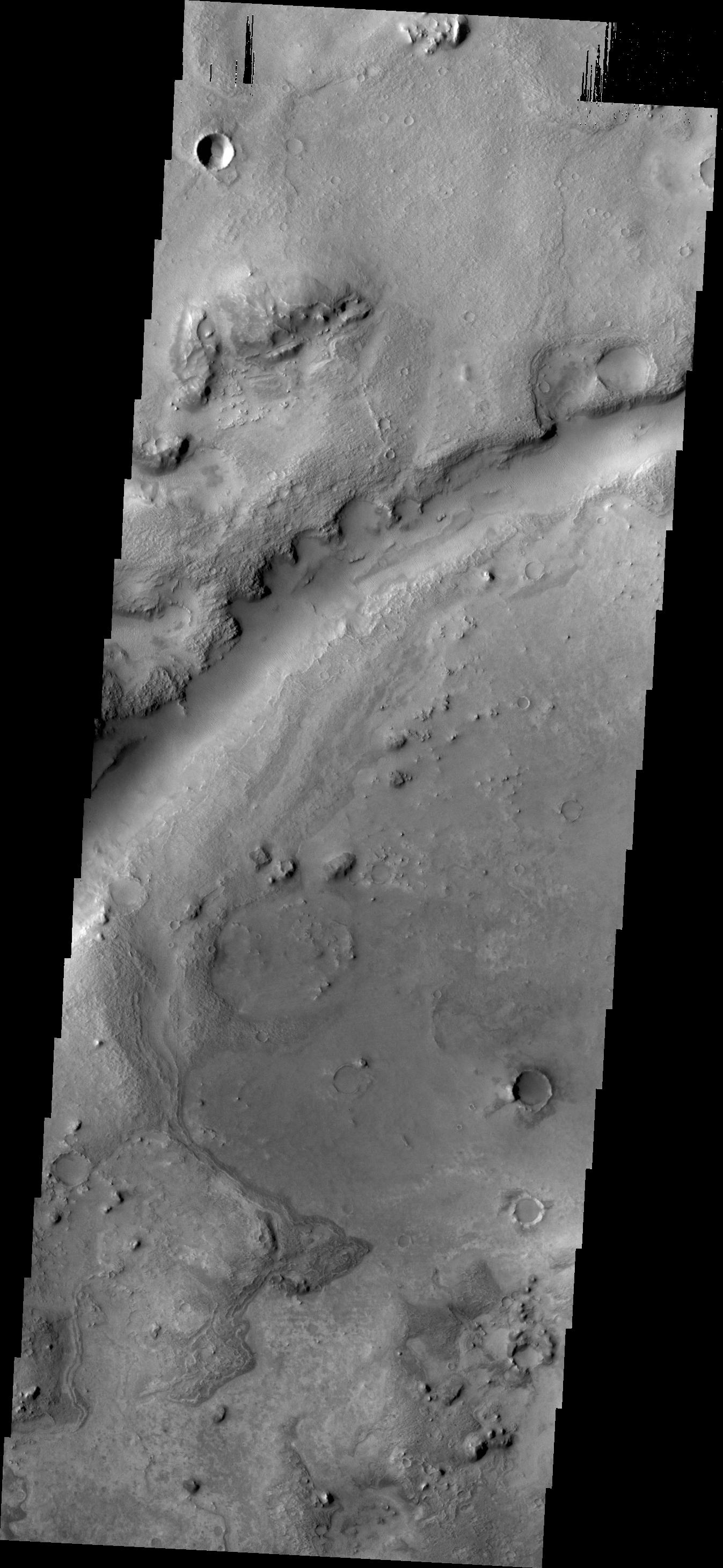
2012-11-27 |
Mars
|
2001 Mars Odyssey
|
THEMIS
|
1405x2931x1 |

|
-
PIA16504:
-
Tempe Terra
Full Resolution:
TIFF
(4.123 MB)
JPEG
(405.5 kB)
|
|
|
2012-11-27 |
Mars
|
Mars Reconnaissance Orbiter (MRO)
|
MARCI
|
2881x1441x3 |
|
-
PIA16454:
-
Regional Dust Storm Weakening, Nov. 25, 2012
Full Resolution:
TIFF
(12.46 MB)
JPEG
(266 kB)
|
|
|
2012-11-27 |
Mars
|
Mars Science Laboratory (MSL)
|
REMS
|
2999x2249x3 |
|
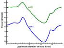
-
PIA16455:
-
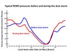
Atmospheric Pressure Patterns Before and During Dust Storm
Full Resolution:
TIFF
(20.24 MB)
JPEG
(324.8 kB)
|
|
|
2012-11-28 |
Mars
|
2001 Mars Odyssey
|
THEMIS
|
1312x2770x1 |
|
-
PIA16505:
-
Lava Channels
Full Resolution:
TIFF
(3.638 MB)
JPEG
(415.4 kB)
|
|
|
2012-11-29 |
Mars
|
2001 Mars Odyssey
|
THEMIS
|
1323x2934x1 |
|
-
PIA16506:
-
Windstreaks
Full Resolution:
TIFF
(3.886 MB)
JPEG
(542.1 kB)
|
|
|
2012-11-30 |
Mars
|
2001 Mars Odyssey
|
THEMIS
|
1351x2774x1 |
|
-
PIA16507:
-
Streamlined Island
Full Resolution:
TIFF
(3.752 MB)
JPEG
(389.4 kB)
|
|
|
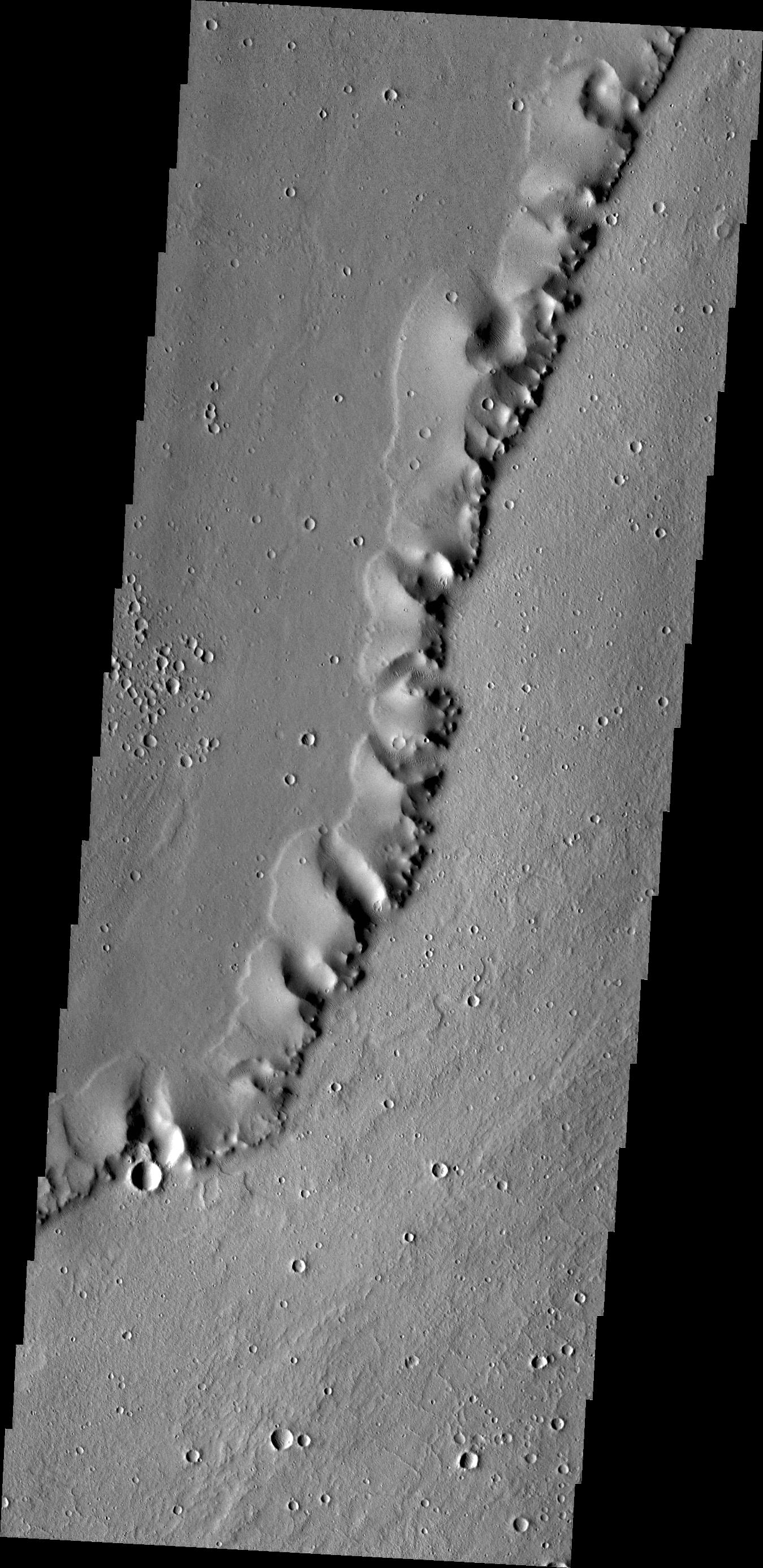
2012-12-03 |
Mars
|
2001 Mars Odyssey
|
THEMIS
|
1347x2772x1 |
|
-
PIA16508:
-
Channels
Full Resolution:
TIFF
(3.738 MB)
JPEG
(398.1 kB)
|
|
|
2012-12-03 |
Mars
|
Mars Science Laboratory (MSL)
|
MAHLI
|
11119x8056x3 |
|
-
PIA16468:
-
Curiosity's 'Rocknest' Workplace
Full Resolution:
TIFF
(268.8 MB)
JPEG
(7.885 MB)
|
|
|
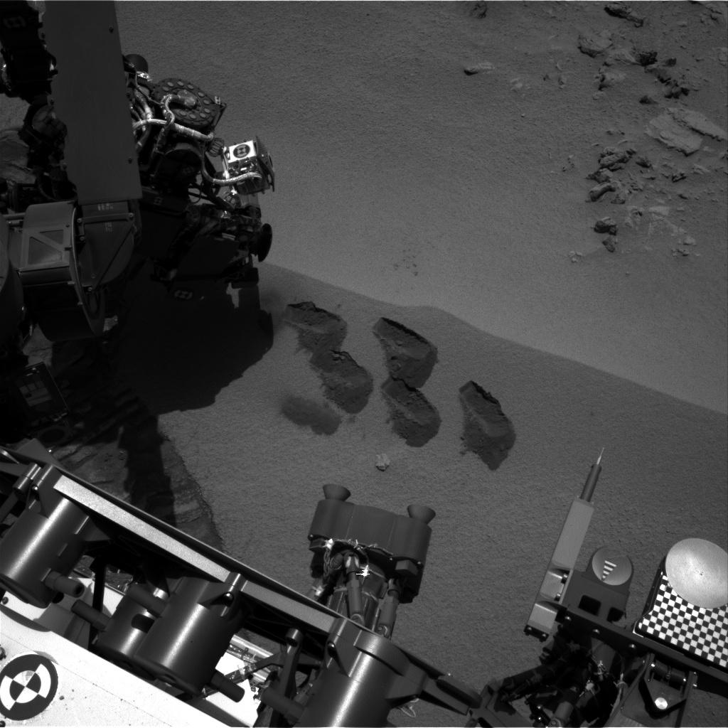
2012-12-03 |
Mars
|
Mars Science Laboratory (MSL)
|
MAHLI
|
1234x860x3 |
|
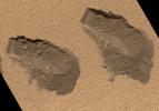
-
PIA16469:
-
Scoop Marks in the Sand at 'Rocknest'
Full Resolution:
TIFF
(3.185 MB)
JPEG
(319.1 kB)
|
|
|
2012-12-03 |
Mars
|
Mars Science Laboratory (MSL)
|
MAHLI
|
1248x706x3 |
|
-
PIA16570:
-
Windblown Sand from the 'Rocknest' Drift
Full Resolution:
TIFF
(2.644 MB)
JPEG
(255.2 kB)
|
|
|
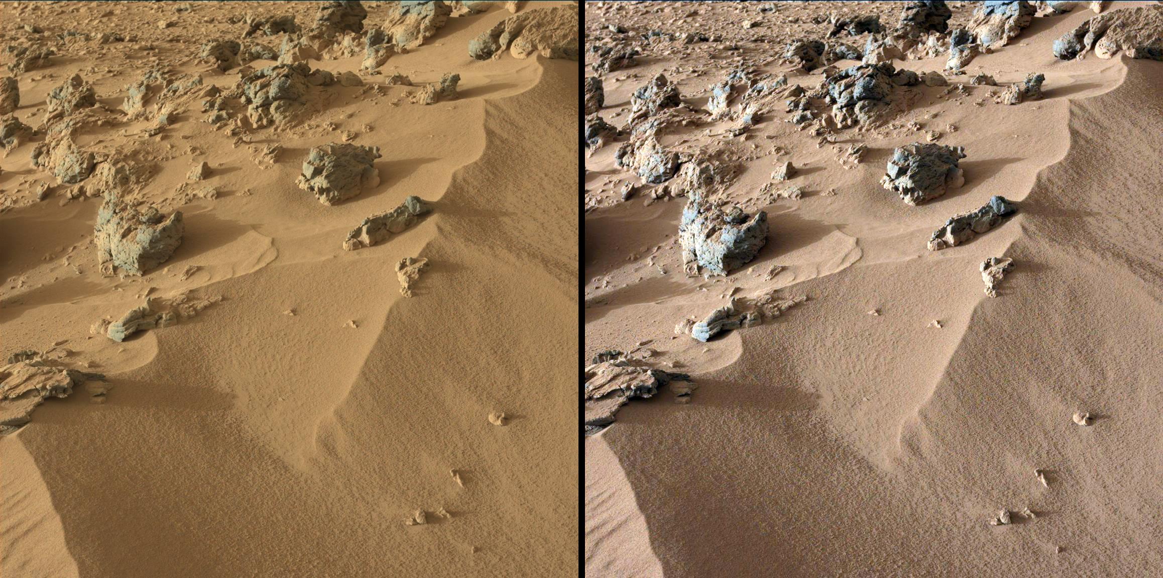
2012-12-03 |
Mars
|
Mars Science Laboratory (MSL)
|
|
1809x1332x3 |
|
-
PIA16571:
-
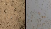
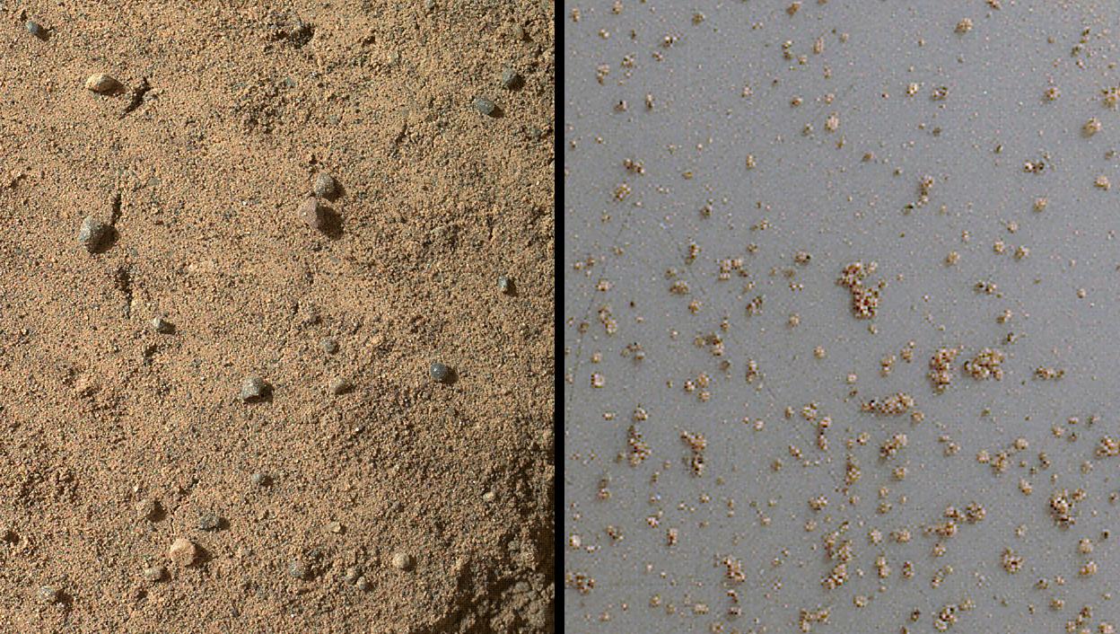
A Sampling of Martian Soils
Full Resolution:
TIFF
(7.232 MB)
JPEG
(328.1 kB)
|
|
|
2012-12-03 |
Mars
|
Mars Science Laboratory (MSL)
|
Alpha Particle X-ray Spectrometer (MSL)
|
1600x1200x3 |
|
-
PIA16572:
-
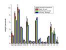
Inspecting Soils Across Mars
Full Resolution:
TIFF
(5.762 MB)
JPEG
(141.9 kB)
|
|
|
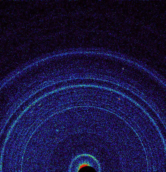
2012-12-03 |
Mars
|
Mars Science Laboratory (MSL)
|
SAM
|
1721x1322x3 |
|
-
PIA16573:
-
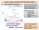
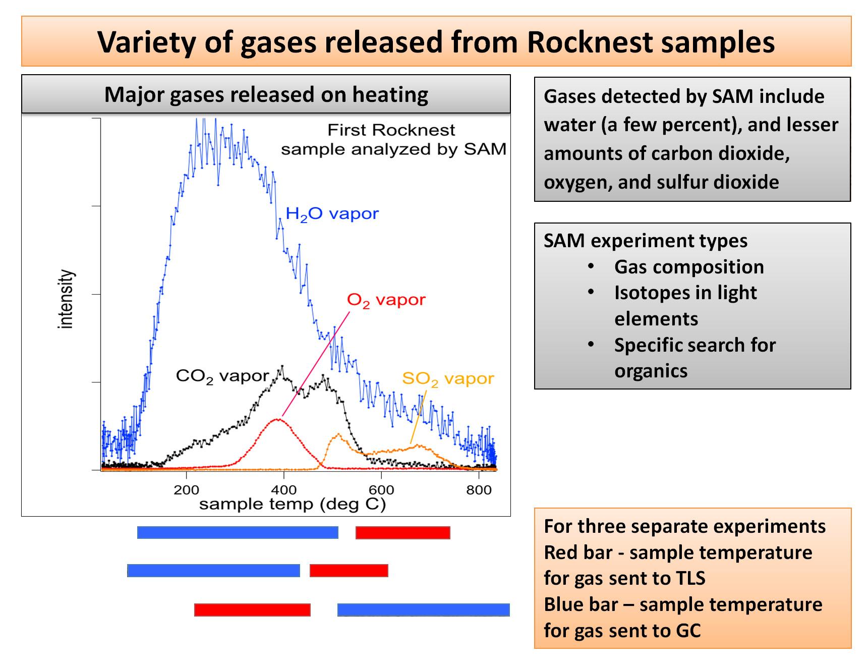
Heating Martian Sand Grains
Full Resolution:
TIFF
(6.828 MB)
JPEG
(240 kB)
|
|
|
2012-12-03 |
Mars
|
Mars Science Laboratory (MSL)
|
SAM
|
1600x1200x3 |
|
-
PIA16574:
-
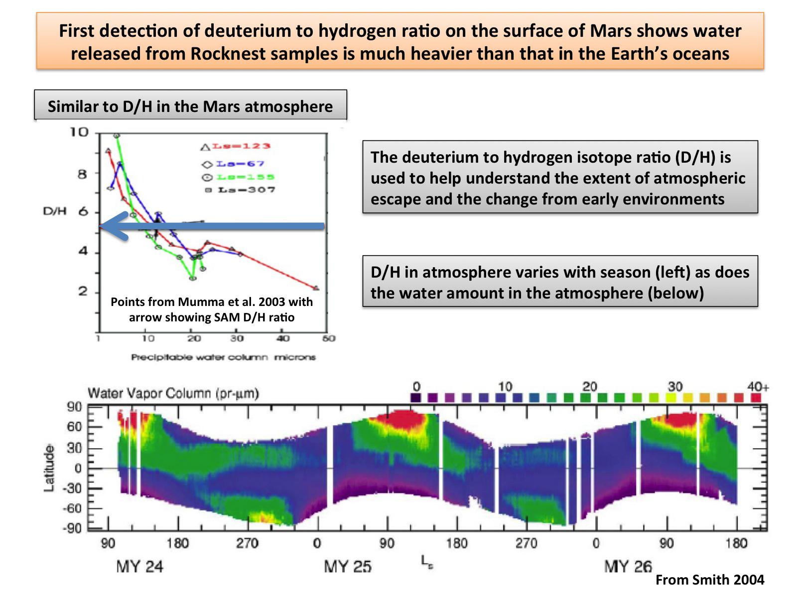
Atmospheric Loss on Mars
Full Resolution:
TIFF
(5.762 MB)
JPEG
(216.4 kB)
|
|
|
2012-12-03 |
Mars
|
Mars Science Laboratory (MSL)
|
SAM
|
1600x1200x3 |
|
-
PIA16575:
-
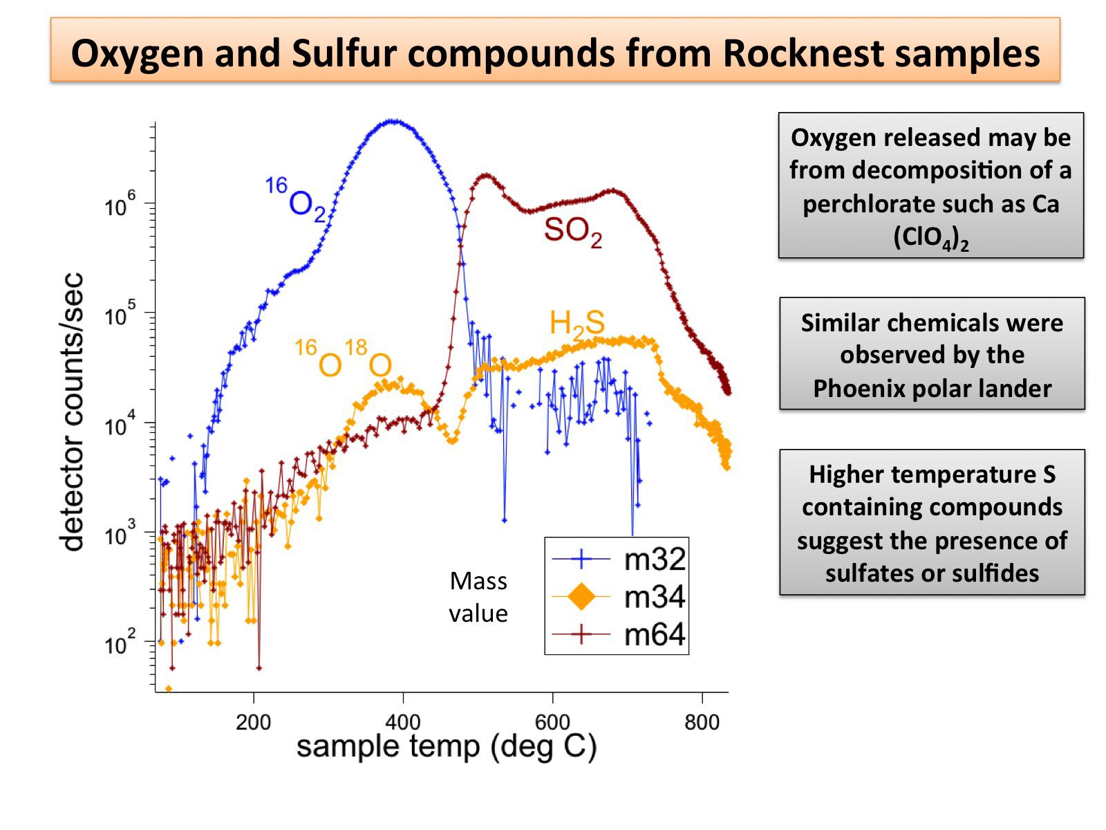
Signs of Perchlorates and Sulfur Containing Compounds
Full Resolution:
TIFF
(5.762 MB)
JPEG
(189.8 kB)
|
|
|
2012-12-03 |
Mars
|
Mars Science Laboratory (MSL)
|
SAM
|
1600x1200x3 |
|
-
PIA16576:
-
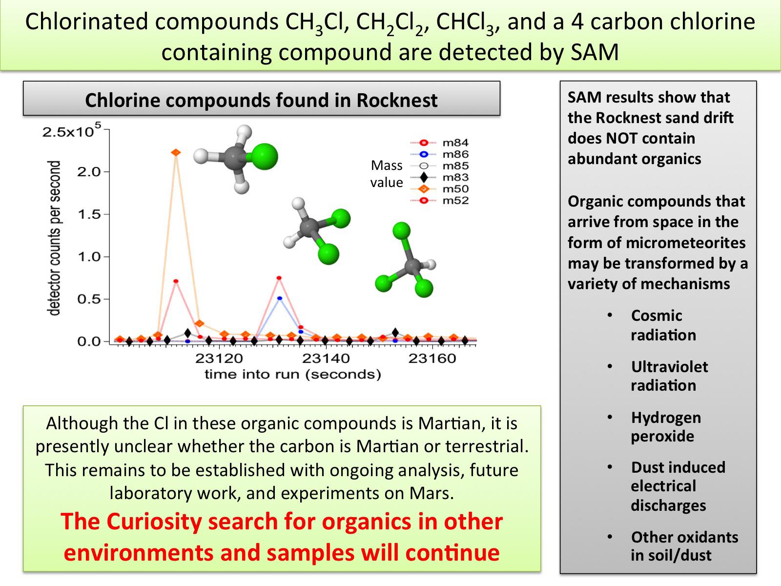
Chlorinated Compounds at 'Rocknest'
Full Resolution:
TIFF
(5.762 MB)
JPEG
(253.8 kB)
|
|
|
2012-12-03 |
Mars
|
Mars Reconnaissance Orbiter (MRO)
Mars Science Laboratory (MSL)
|
HiRISE
|
3300x2550x3 |
|
-
PIA16577:
-
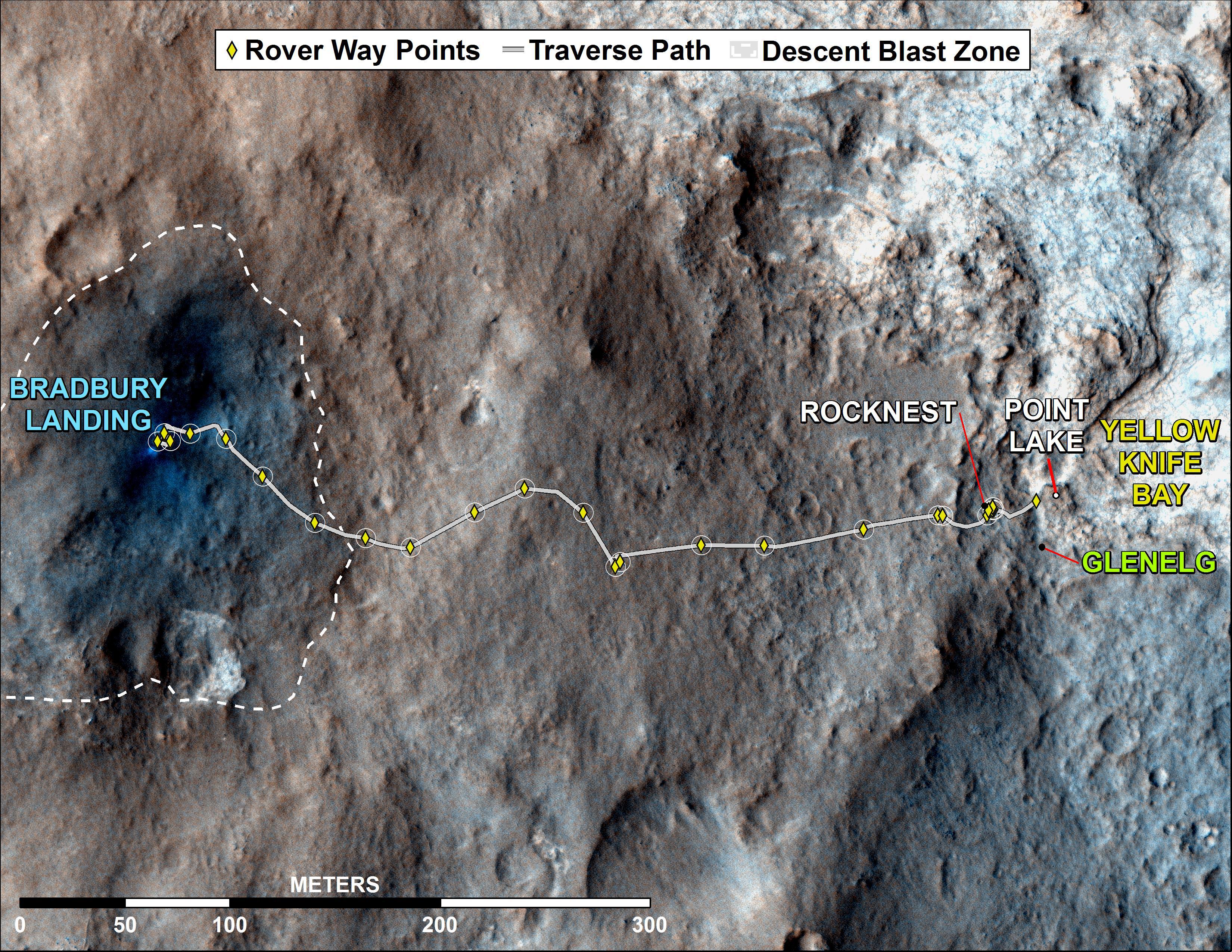
Curiosity Rover's Traverse, August through November 2012
Full Resolution:
TIFF
(25.26 MB)
JPEG
(1.893 MB)
|


