PDS logoPlanetary Data System
PDS Information
Find a Node - Use these links to navigate to any of the 8 publicly accessible PDS Nodes.

This bar indicates that you are within the PDS enterprise which includes 6 science discipline nodes and 2 support nodes which are overseen by the Project Management Office at NASA's Goddard Space Flight Center (GSFC). Each node is led by an expert in the subject discipline, supported by an advisory group of other practitioners of that discipline, and subject to selection and approval under a regular NASA Research Announcement.
Click here to return to the Photojournal Home Page Click here to view a list of Photojournal Image Galleries Photojournal_inner_header
Latest Images  |  Spacecraft & Technology  |  Animations  |  Space Images App  |  Feedback  |  Photojournal Search  
My Favorite Images from the Planetary Photojoural
I have 10 images in my list


The first time you select an image to My List, a separate browser window will open. This page will list the set of images you have selected as favorites from the Photojournal. This list is kept for a short period of time, approximately 60 days. The way we associate you with your list is through a persistent cookie left on your computer. This cookie is nothing more than a unique key that allows the Photojournal to make this association. Once created, this list is only modifiable from the same computer. Information stored in the cookie on your computer is used by the Photojournal server only during your session. If you configure your Web browser not to use cookies, you will not be able to create and refer back to a personal list of favorite images. To view your current list, click on a marked entry for your list from the catalog page, or add another favorite. For more information, see JPL's Privacy Policy.
My
List
Catalog # Target Mission Instrument Addition Date Size
Remove Image from Favorite List PIA25108 Mars 2001 Mars Odyssey
THEMIS
2022-01-19 603x2716x1
This image from NASA's Mars Odyssey shows part of a central pit crater located in Hesperia Planum.
Title:
Shadows
Remove Image from Favorite List PIA13128 Wide-field Infrared Survey Explorer (WISE)
WISE Telescope
2010-09-21 4801x4801x3
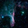
Gripped in the claw of the constellation Scorpius sits the reflection nebula DG 129, a cloud of gas and dust that reflects light from nearby, bright stars. This infrared view of the nebula was captured by NASA's Wide-field Infrared Survey Explorer.
Title:
In the Grip of the Scorpion's Claw
Remove Image from Favorite List PIA18291 Titan Cassini-Huygens
ISS - Wide Angle
2014-11-03 1024x1024x1
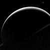
The view from NASA's Cassini orbiter shows Titan's crescent nearly encircling Saturn's disk due to the small haze particles high in its atmosphere refracting the incoming light of the distant Sun.
Title:
Mimicking the Moon
Remove Image from Favorite List PIA22674 Ceres Dawn
Framing Camera
2018-08-24 1024x1024x1
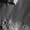
This image from NASA's Dawn spacecraft of boulders along Urvara Crater's wall was obtained from an altitude of about 28 miles (45 kilometers) above Ceres' surface.
Title:
Boulders Along Urvara Crater's Wall
Remove Image from Favorite List PIA13041 Earth Aqua
AIRS
2010-04-15 900x695x3
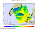
NASA's Aqua satellite flew over the volcano on April 15, capturing this image of the ash plume. The image shows the ash cloud being carried over the Shetland Islands and onward to Europe.
Title:
NASA's AIRS Instrument Captures Ash Cloud from Icelandic Volcano
Remove Image from Favorite List PIA01737 Earth Spaceborne Imaging Radar-C/X-Band Synthetic Aperture Radar
1999-05-01 756x2688x3
This NASA Spaceborne Imaging Radar-C/X-band Synthetic Aperture Radar color composite shows a portion of the Weddell Sea, which is adjacent to the continent of Antarctica.
Title:
Space Radar Image of Weddell Sea, Antarctica
Remove Image from Favorite List PIA23800 Earth Terra
ASTER
2020-09-01 2500x1725x3
Captured by the ASTER instrument aboard NASA's Terra satellite, this false-color map shows the burn area of the River and Carmel fires in Monterey County, California.
Title:
ASTER Gets a Birdseye View of the Carmel and River Fire Burn Areas
Remove Image from Favorite List PIA05542 Mars Mars Exploration Rover (MER)
Panoramic Camera
2004-03-11 1250x820x1
This image taken by NASA's Mars Exploration Rover Spirit shows the rocky road the rover traversed away from the rim of the crater called 'Bonneville.' To the upper right is the rock dubbed 'Hole Point.'
Title:
The Rocky Road to the Crater Rim
Remove Image from Favorite List PIA23380 Mars Mars Reconnaissance Orbiter (MRO)
CRISM
CTX
2019-11-12 3639x2535x3
Color has been added to highlight minerals in this image of Jezero Crater on Mars, the landing site for NASA's Mars 2020 mission. The green color represents minerals called carbonates, which are especially good at preserving fossilized life on Earth.
Title:
Jezero Crater Minerals
Remove Image from Favorite List PIA16550 Mars Mars Science Laboratory (MSL)
Mastcam
2012-12-11 2438x1141x3
The NASA Mars rover Curiosity used its Mast Camera (Mastcam) during the mission's 120th Martian day, or sol (Dec. 7, 2012), to record this view of a rock outcrop informally named 'Shaler.'
Title:
Layered Martian Outcrop 'Shaler' in 'Glenelg' Area