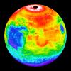
My
List |
Addition Date
|
Target
|
Mission
|
Instrument
|
Size
|

|
1999-06-23 |
Mars
|
Mars Global Surveyor (MGS)
|
Magnetometer
|
1700x1144x3 |
|
-
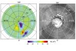
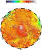
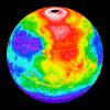
PIA02050:
-
North Polar Magnetic Anomaly Map (MAG/ER)
Full Resolution:
TIFF
(1.938 MB)
JPEG
(213.7 kB)
|
|
|
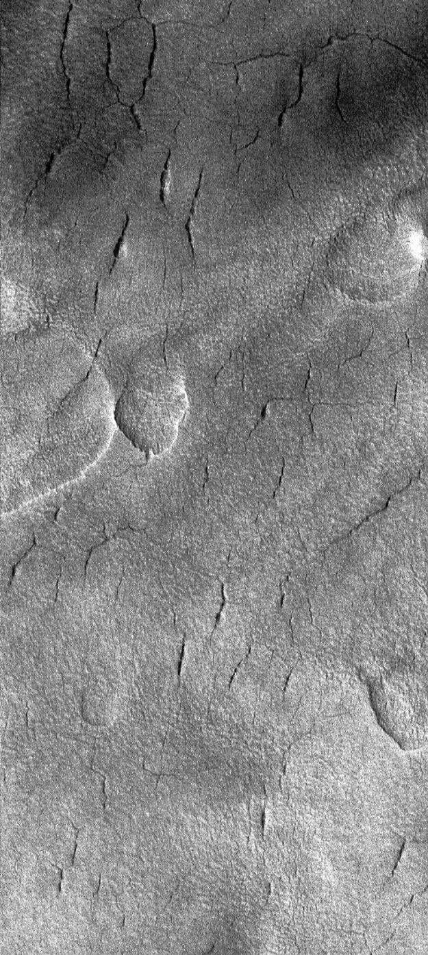
1999-06-18 |
Mars
|
Mars Global Surveyor (MGS)
|
Mars Orbiter Camera (MOC)
|
625x1394x1 |
|
-
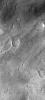
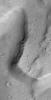
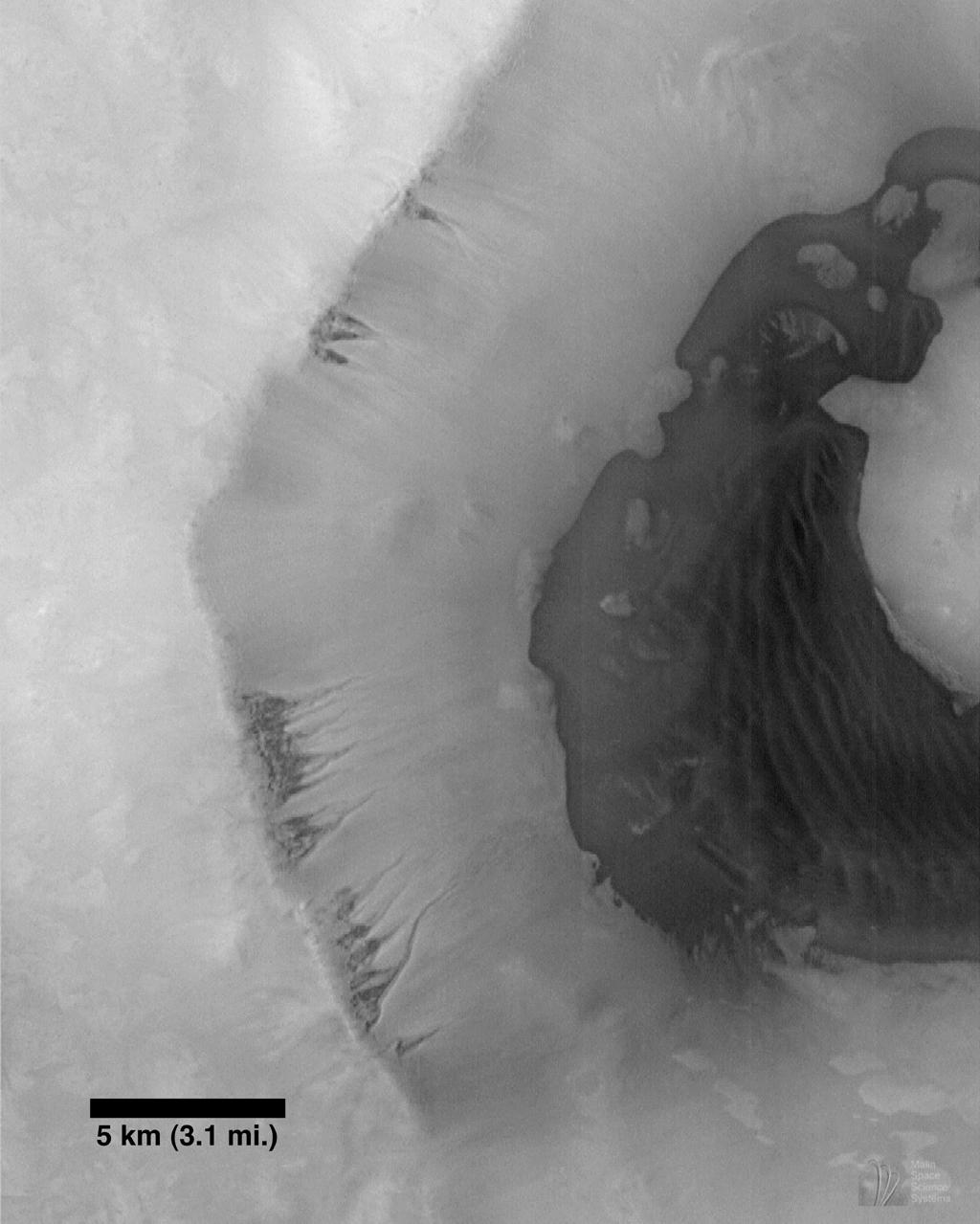
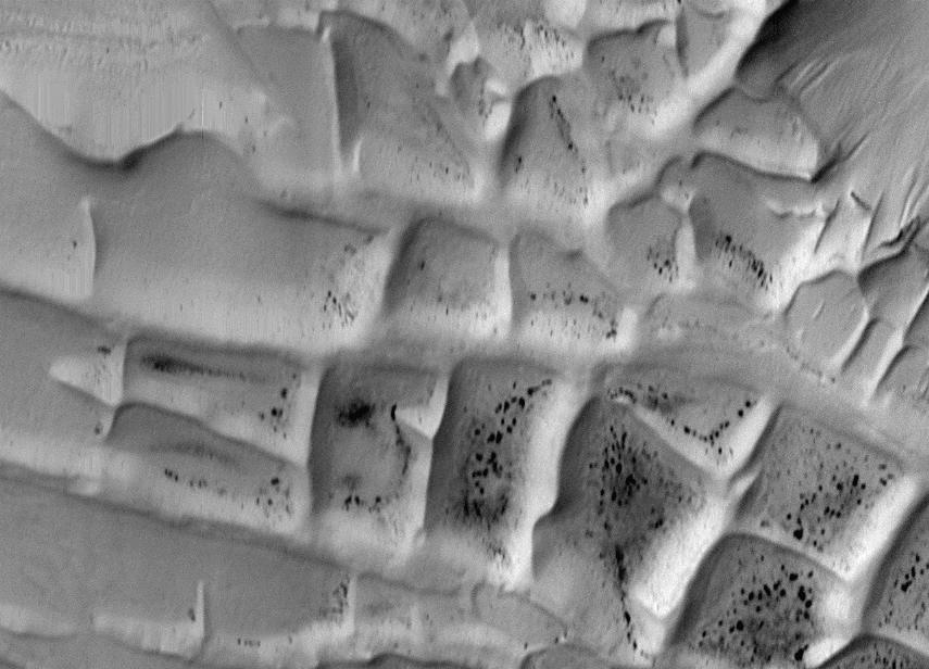
PIA01343:
-
Cracks in Utopia
Full Resolution:
TIFF
(850.2 kB)
JPEG
(266.7 kB)
|
|
|
1999-06-18 |
Mars
|
Mars Global Surveyor (MGS)
|
Mars Orbiter Camera (MOC)
|
634x761x1 |

|
-
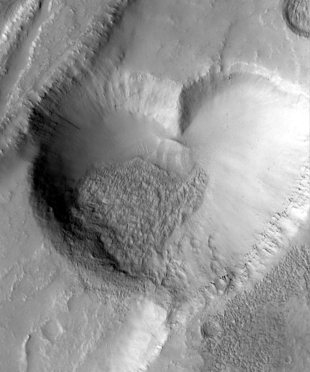
PIA01342:
-
From Mars, With Love
Full Resolution:
TIFF
(397.4 kB)
JPEG
(64.71 kB)
|
|
|
1999-05-27 |
Mars
|
Mars Global Surveyor (MGS)
|
MOLA
|
2700x3075x3 |
|
-
PIA02040:
-
Science Magazine Cover Image
Full Resolution:
TIFF
(12.35 MB)
JPEG
(948.9 kB)
|
|
|
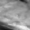
1999-05-27 |
Mars
|
Mars Global Surveyor (MGS)
|
MOLA
|
2545x2023x3 |
|
-
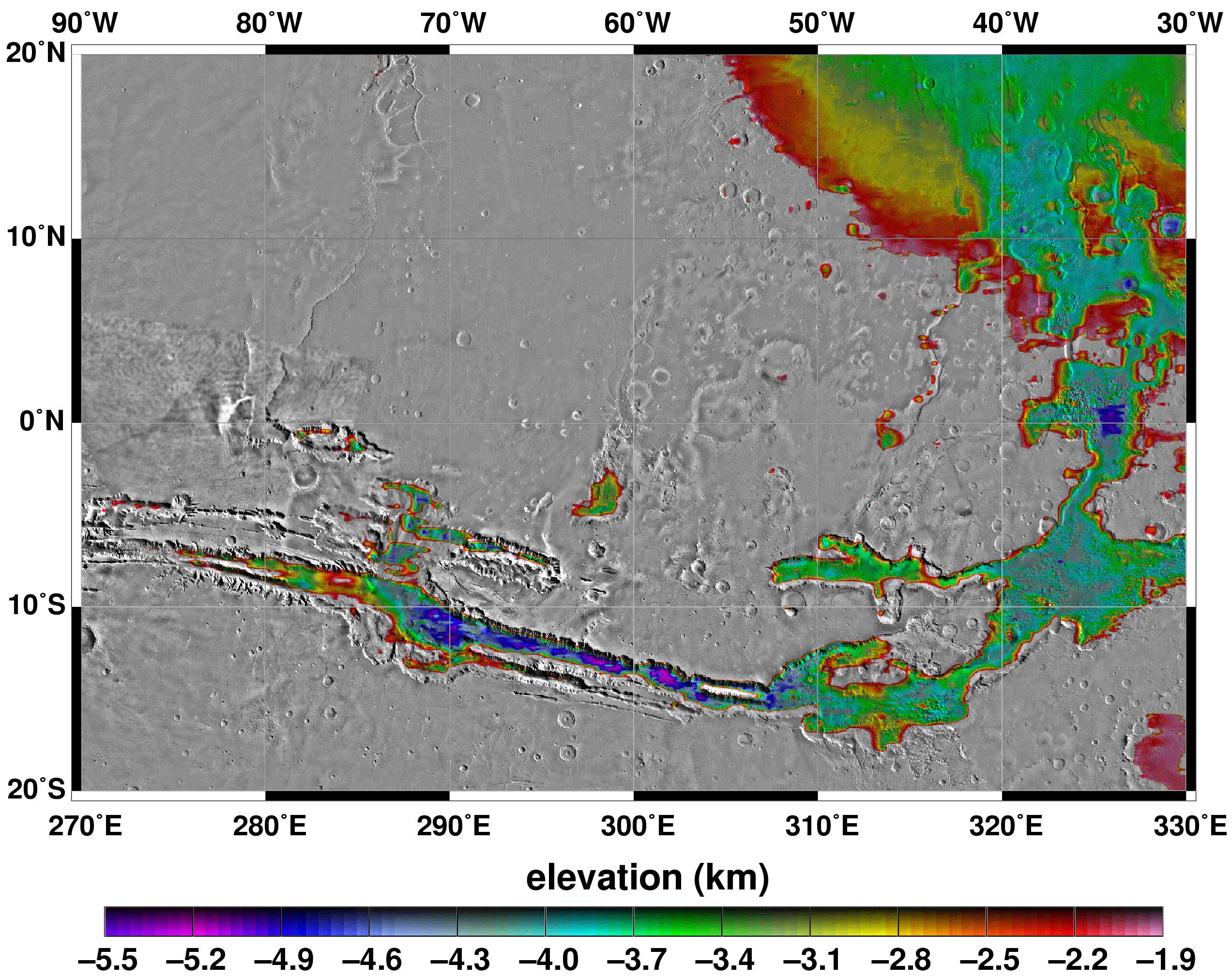
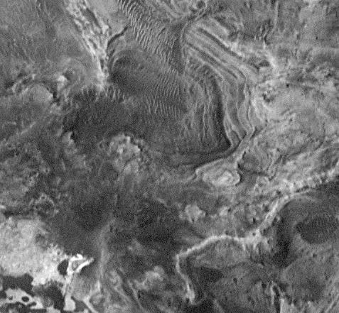
PIA02039:
-
Elevations Within the Floor of the Valles Marineris
Full Resolution:
TIFF
(7.378 MB)
JPEG
(1.035 MB)
|
|
|
1999-05-27 |
Mars
|
Mars Global Surveyor (MGS)
|
MOLA
|
2257x2719x3 |
|
-
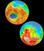
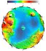
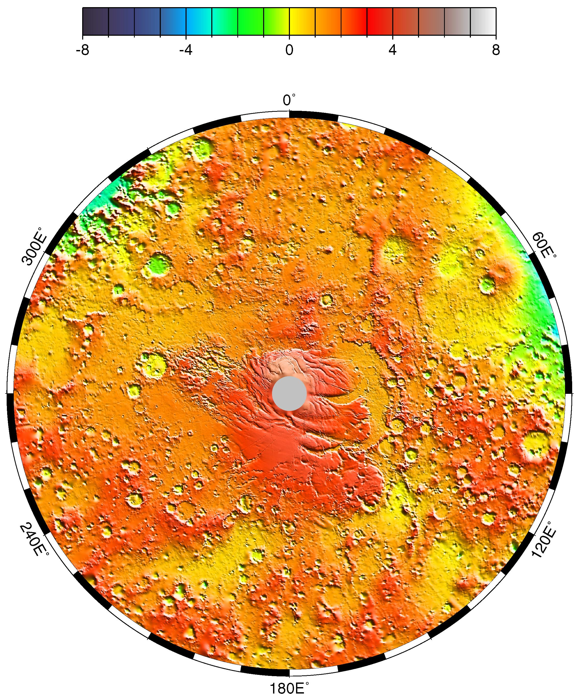
PIA02037:
-
Polar Stereographic Projection
Full Resolution:
TIFF
(13.35 MB)
JPEG
(1.042 MB)
|
|
|
1999-05-27 |
Mars
|
Mars Global Surveyor (MGS)
|
MOLA
|
2335x2617x3 |
|
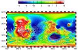
-
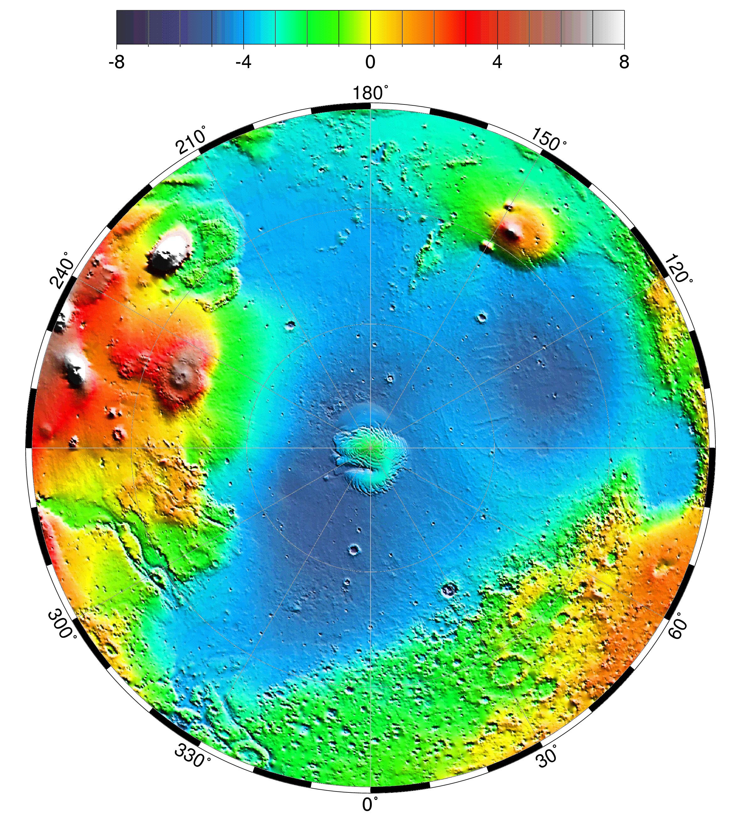
PIA02036:
-
Lambert Equal-Area Projection of Pole-to-Equator
Full Resolution:
TIFF
(12.39 MB)
JPEG
(1.28 MB)
|
|
|
1999-05-27 |
Mars
|
Mars Global Surveyor (MGS)
|
MOLA
|
2761x1759x3 |
|
-
PIA02035:
-
Map of Mars' Topography
Full Resolution:
TIFF
(10.08 MB)
JPEG
(1.115 MB)
|
|
|
1999-05-27 |
Mars
|
Mars Global Surveyor (MGS)
|
MOLA
|
1909x2353x3 |
|
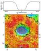
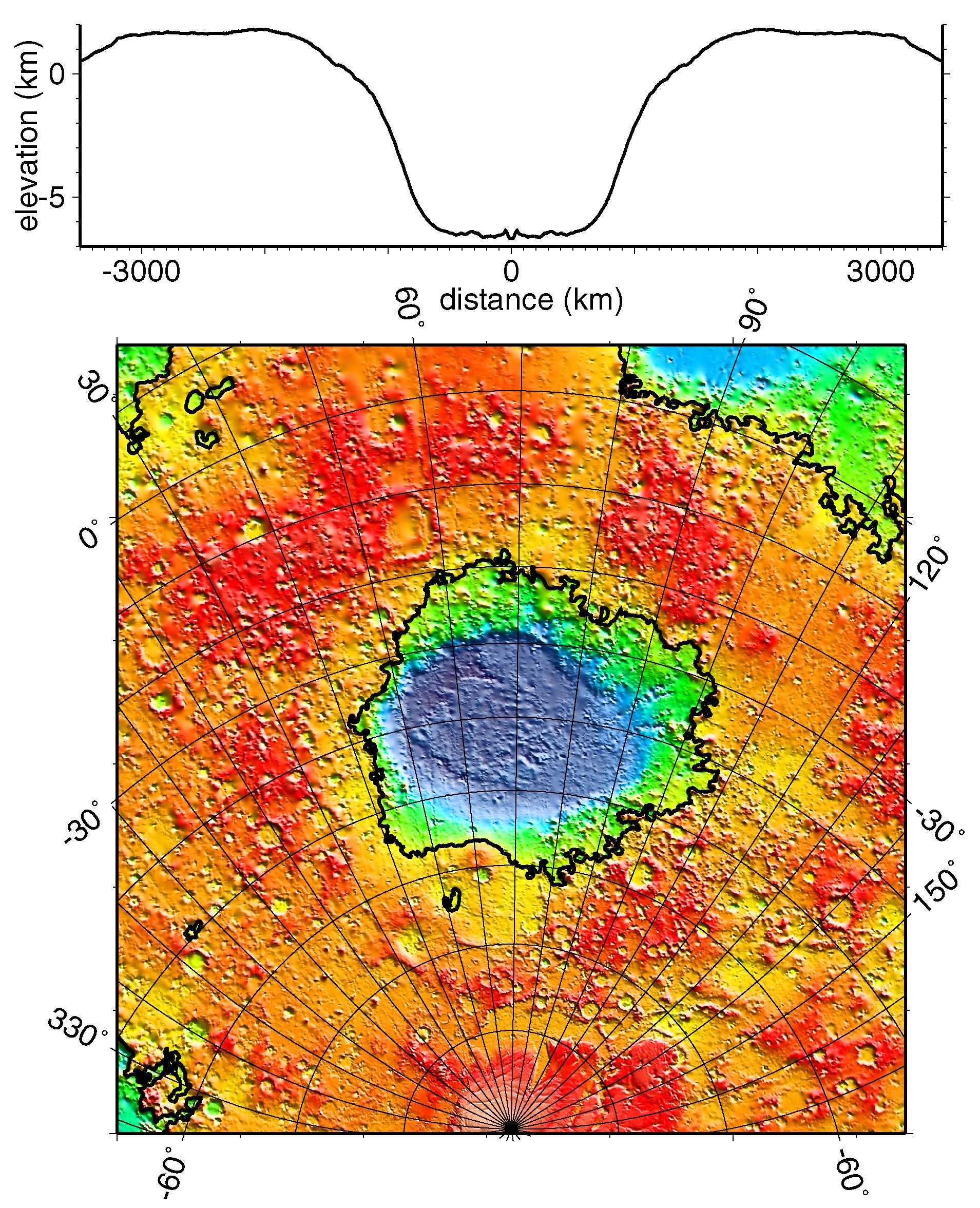
-
PIA02033:
-
Regional Topographic Model of the Hellas Basin
Full Resolution:
TIFF
(8.461 MB)
JPEG
(901.7 kB)
|
|
|
1999-05-27 |
Mars
|
Mars Global Surveyor (MGS)
|
MOLA
|
2497x2221x3 |
|
-
PIA02031:
-
Maps of Mars Global Topography
Full Resolution:
TIFF
(11.74 MB)
JPEG
(1.145 MB)
|
|
|
1999-05-26 |
Mars
|
Mars Global Surveyor (MGS)
|
Mars Orbiter Camera (MOC)
|
400x400x3 |
|
-
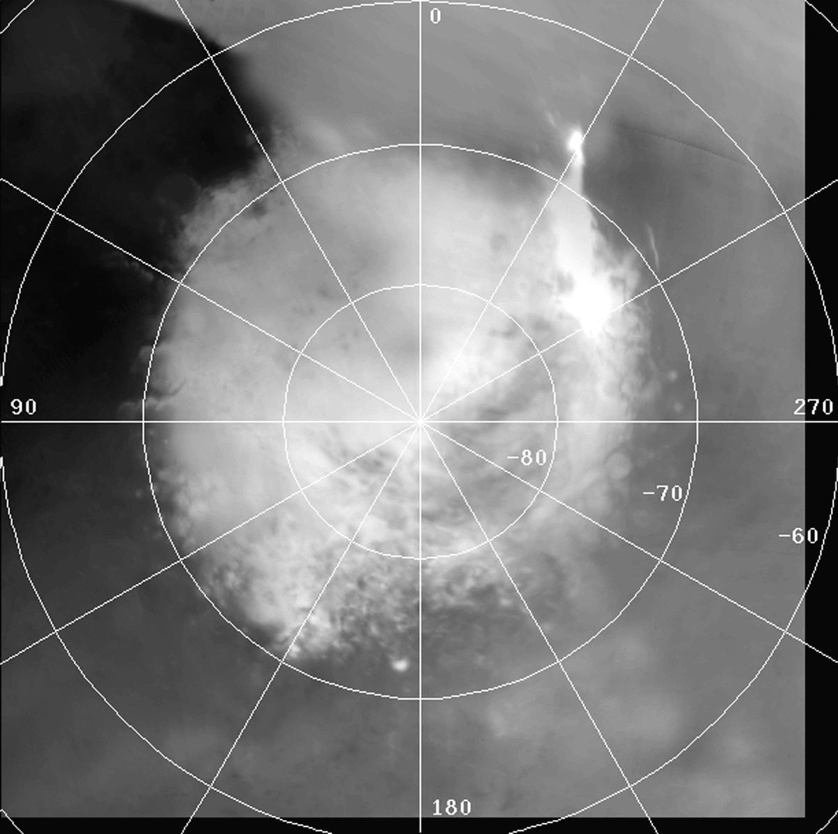
PIA02029:
-
Clouds in North Polar Region Tracked by MOC Over Five Day Period

Full Resolution:
|
|
|
1999-05-20 |
Mars
|
Mars Global Surveyor (MGS)
|
Mars Orbiter Camera (MOC)
|
640x480x3 |

|
-
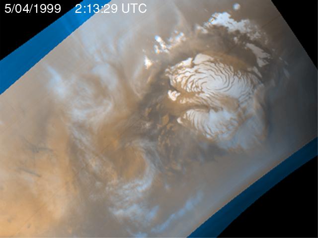
PIA02028:
-
Martian Storm 05/04/99
Full Resolution:
TIFF
(741.8 kB)
JPEG
(27.8 kB)
|
|
|
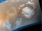
1999-05-20 |
Mars
|
Mars Global Surveyor (MGS)
|
Mars Orbiter Camera (MOC)
|
640x480x3 |
|
-
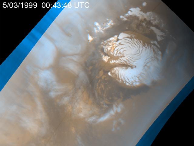
PIA02027:
-
Martian Storm 05/03/99
Full Resolution:
TIFF
(733.7 kB)
JPEG
(27.93 kB)
|
|
|
1999-05-20 |
Mars
|
Mars Global Surveyor (MGS)
|
Mars Orbiter Camera (MOC)
|
640x480x3 |
|
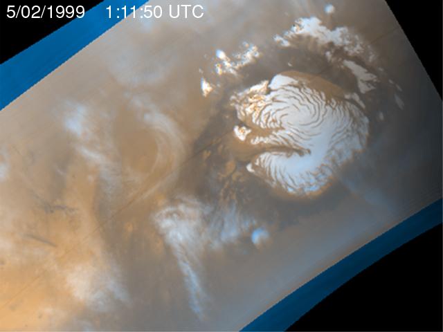
-
PIA02026:
-
Martian Storm 05/02/99
Full Resolution:
TIFF
(726.7 kB)
JPEG
(27.11 kB)
|
|
|
1999-05-20 |
Mars
|
Mars Global Surveyor (MGS)
|
Mars Orbiter Camera (MOC)
|
640x480x3 |
|
-
PIA02025:
-
Martian Storm 05/01/99
Full Resolution:
TIFF
(710.3 kB)
JPEG
(25.55 kB)
|
|
|
1999-05-20 |
Mars
|
Mars Global Surveyor (MGS)
|
Mars Orbiter Camera (MOC)
|
640x480x3 |

|
-
PIA02024:
-
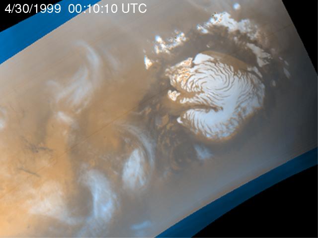
Martian Storm 04/30/99
Full Resolution:
TIFF
(732.2 kB)
JPEG
(27.26 kB)
|
|
|
1999-05-17 |
Mars
|
Mars Global Surveyor (MGS)
|
Mars Orbiter Camera (MOC)
|
685x856x3 |
|
-
PIA02023:
-
The Geodesy Campaign
Full Resolution:
TIFF
(1.522 MB)
JPEG
(68.92 kB)
|
|
|
1999-05-17 |
Mars
|
Mars Global Surveyor (MGS)
|
Mars Orbiter Camera (MOC)
|
1024x980x1 |
|
-
PIA02022:
-
The Geodesy Campaign
Full Resolution:
TIFF
(454.5 kB)
JPEG
(199 kB)
|
|
|
1999-05-06 |
Mars
|
Mars Global Surveyor (MGS)
|
Thermal Emission Spectrometer
|
300x300x3 |
|
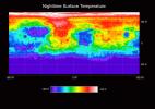
-
PIA02016:
-
Martian Temperatures Measured by the Thermal Emission Spectrometer (TES). Isidis Planitia View
Full Resolution:
TIFF
(30.37 kB)
JPEG
(23.21 kB)
|
|
|
1999-05-06 |
Mars
|
Mars Global Surveyor (MGS)
|
Thermal Emission Spectrometer
|
300x300x3 |
|
-
PIA02015:
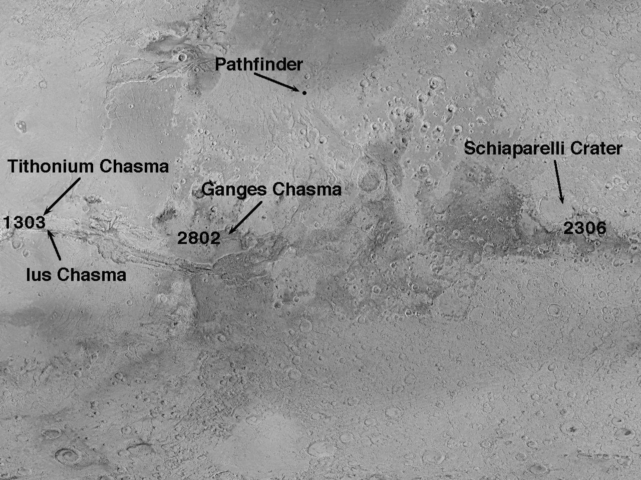
-
Martian Temperatures Measured by the Thermal Emission Spectrometer (TES). Pathfinder Landing Aite View
Full Resolution:
TIFF
(32.88 kB)
JPEG
(23.63 kB)
|
|
|
1999-05-06 |
Mars
|
Mars Global Surveyor (MGS)
|
Thermal Emission Spectrometer
|
2362x1667x3 |
|
-
PIA02014:
-
Temperature of the Martian Surface
Full Resolution:
TIFF
(1.195 MB)
JPEG
(434.8 kB)
|
|
|
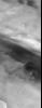
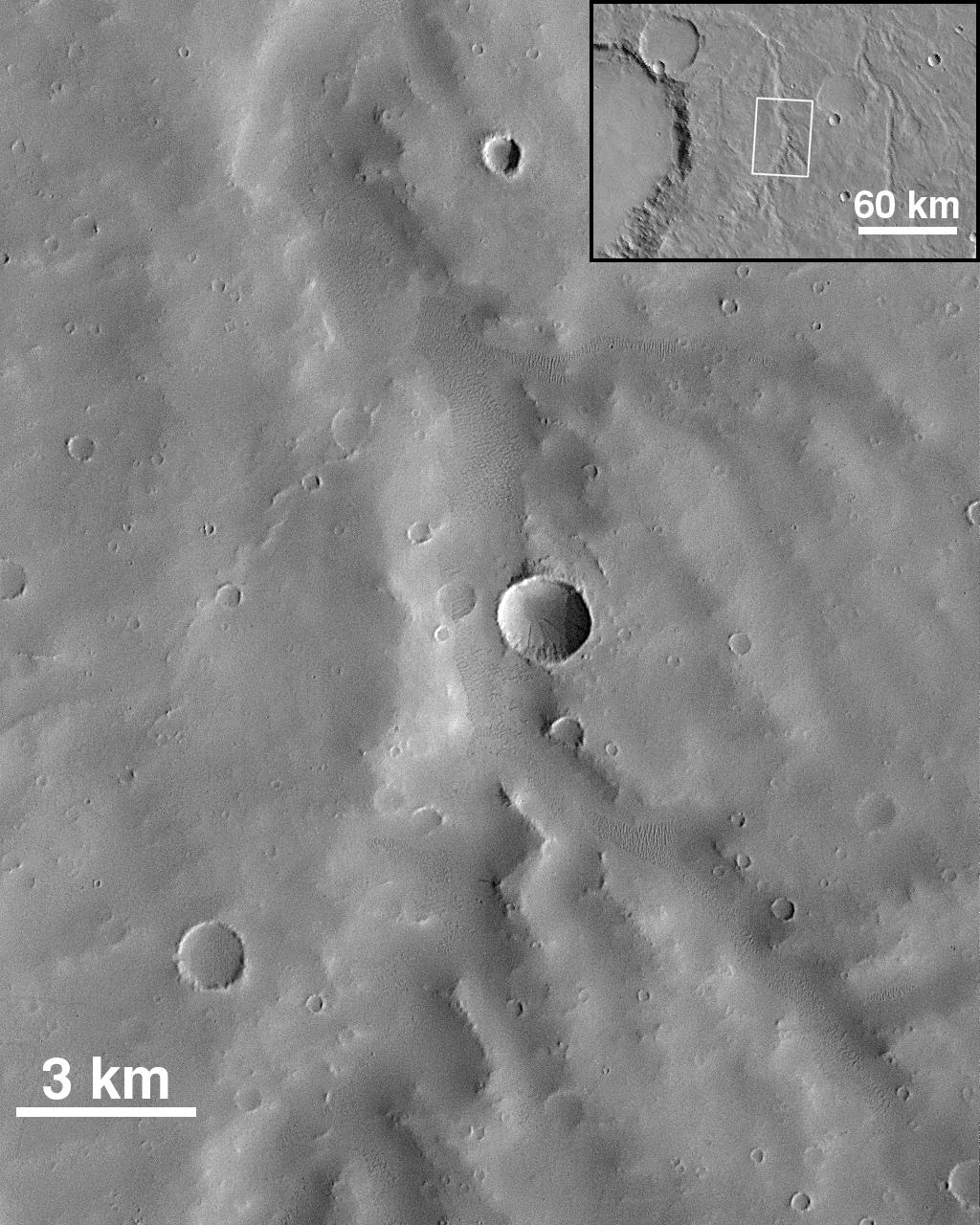
1999-05-04 |
Mars
|
Mars Global Surveyor (MGS)
|
Mars Orbiter Camera (MOC)
|
672x1330x1 |
|
-
PIA02012:
-
Lower Northeastern Flank of Tyrrhena Patera
Full Resolution:
TIFF
(903.5 kB)
JPEG
(153.2 kB)
|
|
|
1999-05-03 |
Mars
|
Mars Global Surveyor (MGS)
|
Magnetometer
|
1152x879x3 |
|
-
PIA02008:
-
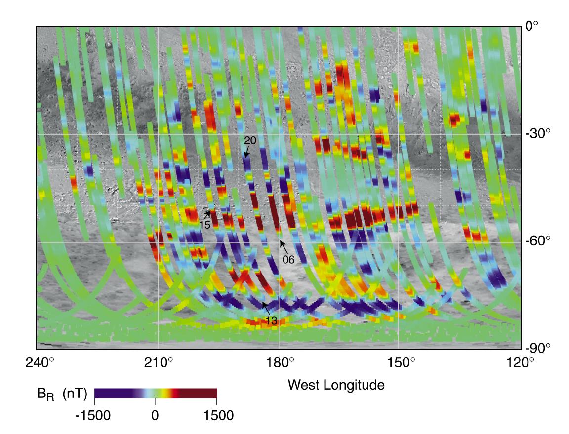
Magnetic Strips Preserve Record of Ancient Mars
Full Resolution:
TIFF
(1.369 MB)
JPEG
(147.9 kB)
|
|
|
1999-03-29 |
Mars
|
Mars Global Surveyor (MGS)
|
Mars Orbiter Camera (MOC)
|
1006x1240x1 |
|
-
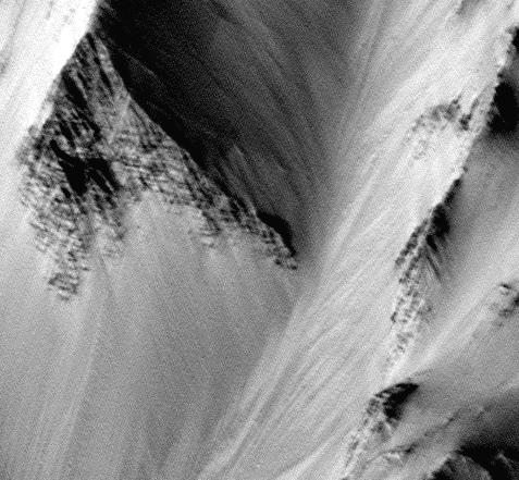
PIA01690:
-
Wind Streaks on Daedalia Planum
Full Resolution:
TIFF
(1.067 MB)
JPEG
(161.6 kB)
|
|
|
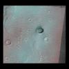
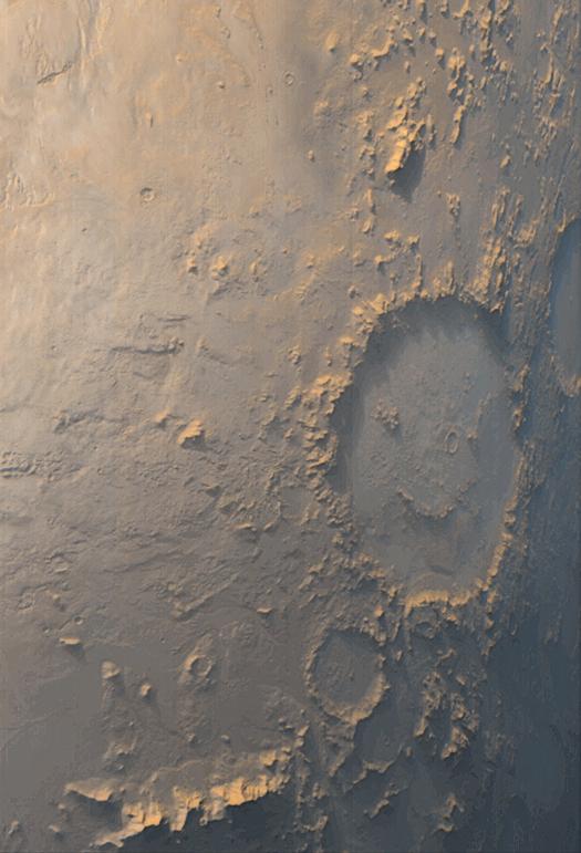
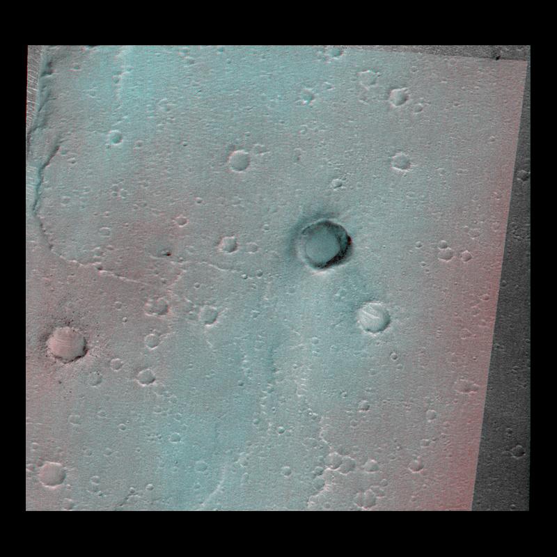
1999-03-13 |
Mars
|
Mars Global Surveyor (MGS)
|
Mars Orbiter Camera (MOC)
|
525x771x3 |

|
-
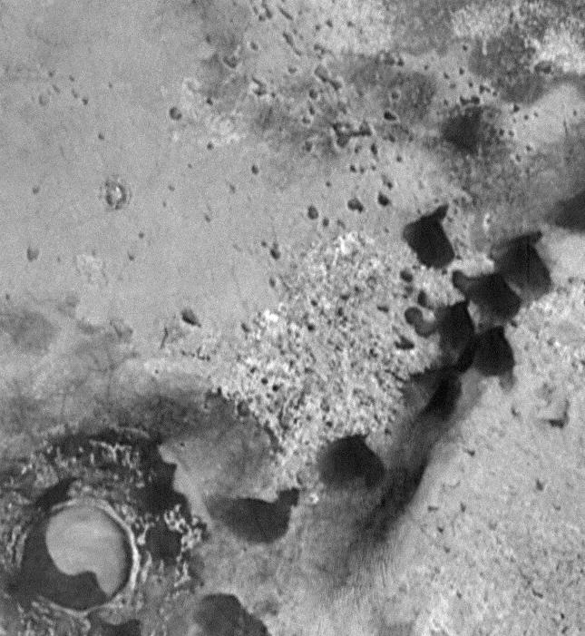
PIA01676:
-
"Happy Face" Crater Greets MGS at the Start of the Mapping
Full Resolution:
TIFF
(1.089 MB)
JPEG
(54.33 kB)
|
|
|
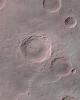
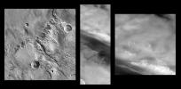
1999-02-19 |
Mars
|
Mars Global Surveyor (MGS)
|
Mars Orbiter Camera (MOC)
|
1024x1280x1 |
|
-
PIA01508:
-
Small Valley Network Near Schiaparelli Crater
Full Resolution:
TIFF
(1.251 MB)
JPEG
(239.5 kB)
|
|
|
1999-02-19 |
Mars
|
Mars Global Surveyor (MGS)
|
Mars Orbiter Camera (MOC)
|
1023x1300x1 |
|
-
PIA01507:
-
Dissected Terrain Near Parana Valles
Full Resolution:
TIFF
(1.424 MB)
JPEG
(293.4 kB)
|
|
|
1999-02-19 |
Mars
|
Mars Global Surveyor (MGS)
|
Mars Orbiter Camera (MOC)
|
1424x1894x1 |
|
-
PIA01506:
-
Channels on Bakhuysen Crater Wall
Full Resolution:
TIFF
(2.797 MB)
JPEG
(518.9 kB)
|
|
|
1999-02-19 |
Mars
|
Mars Global Surveyor (MGS)
|
Mars Orbiter Camera (MOC)
|
1024x1298x1 |
|
-
PIA01505:
-
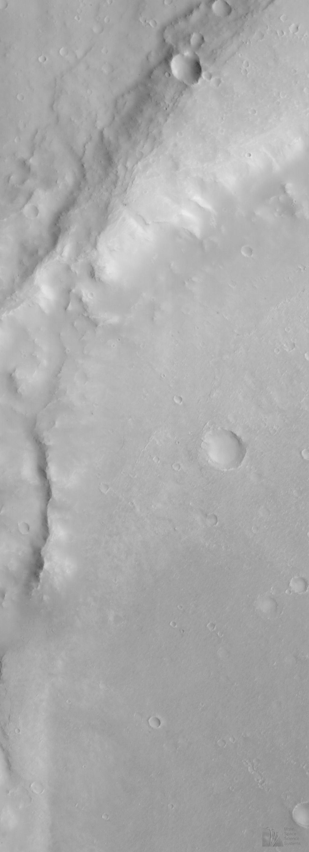
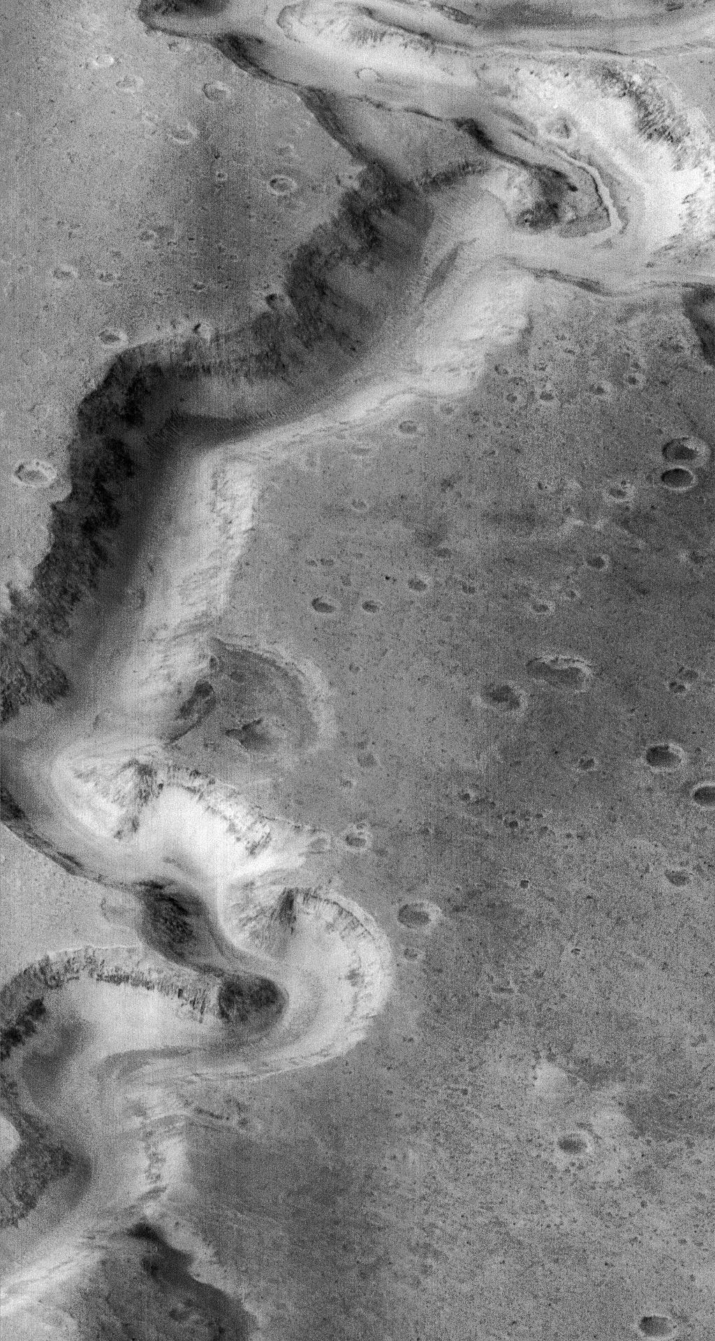
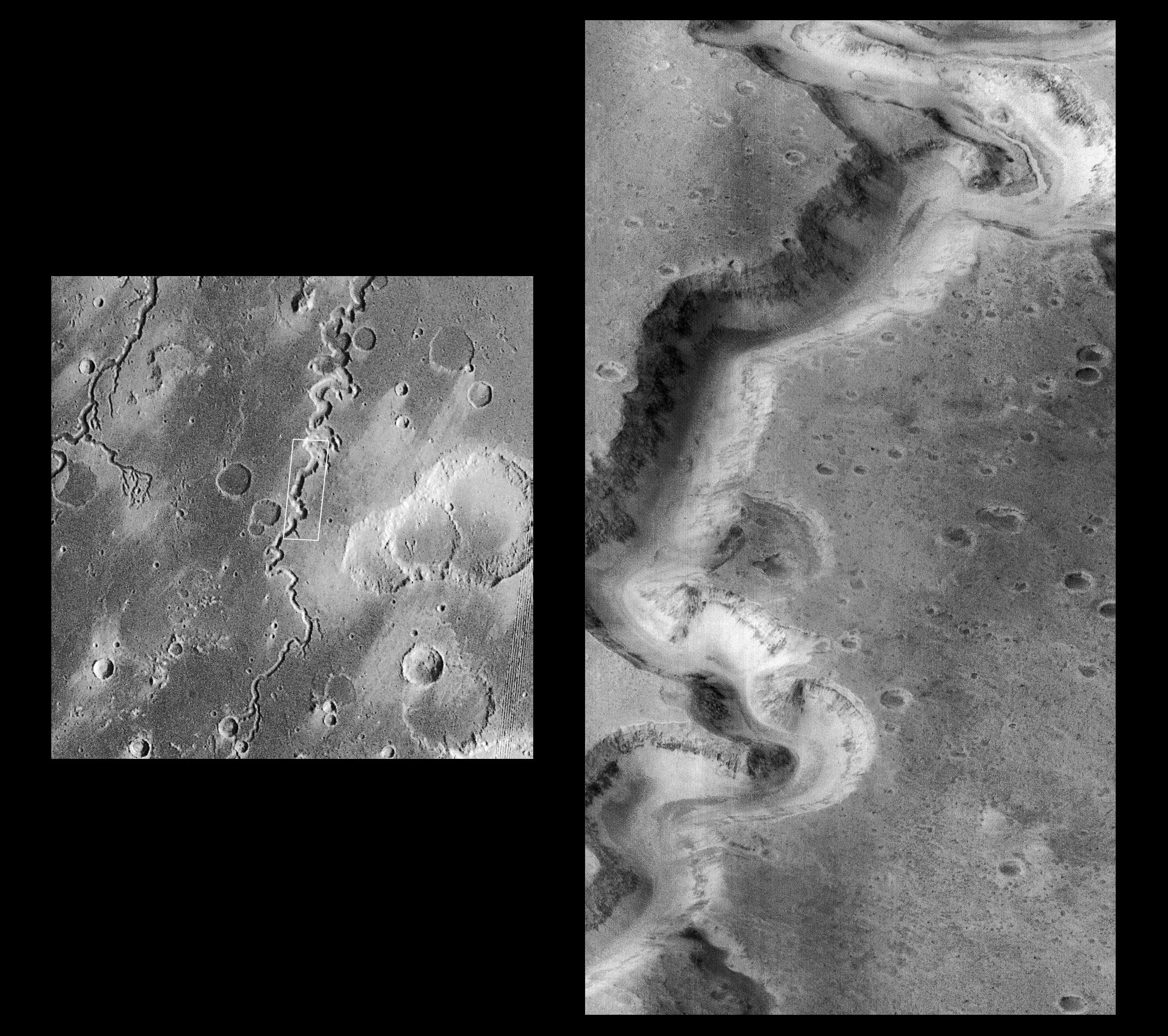
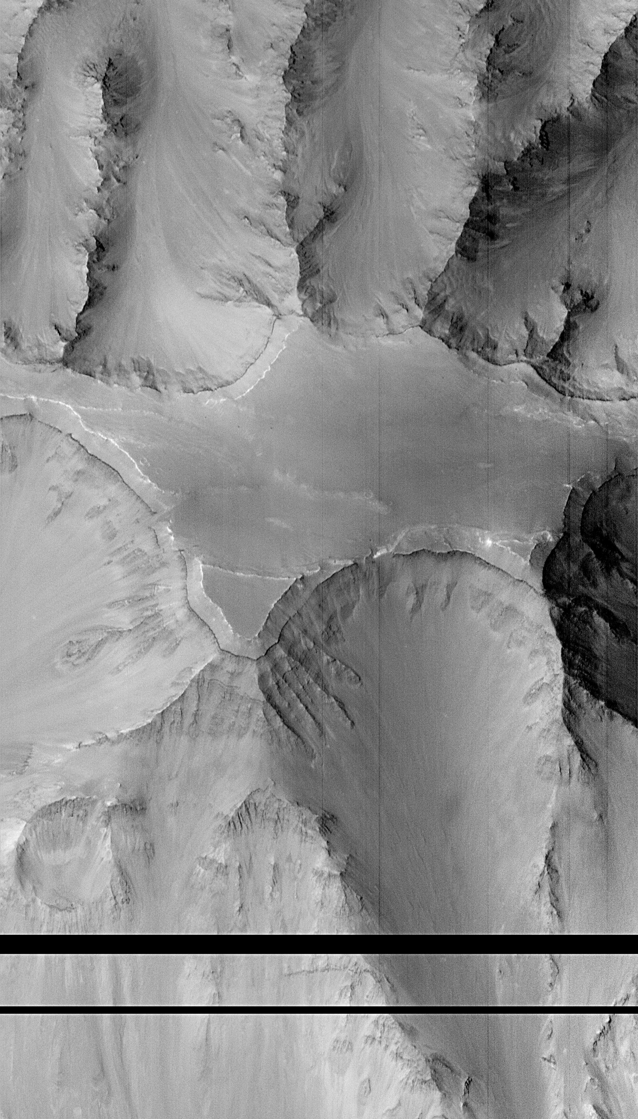
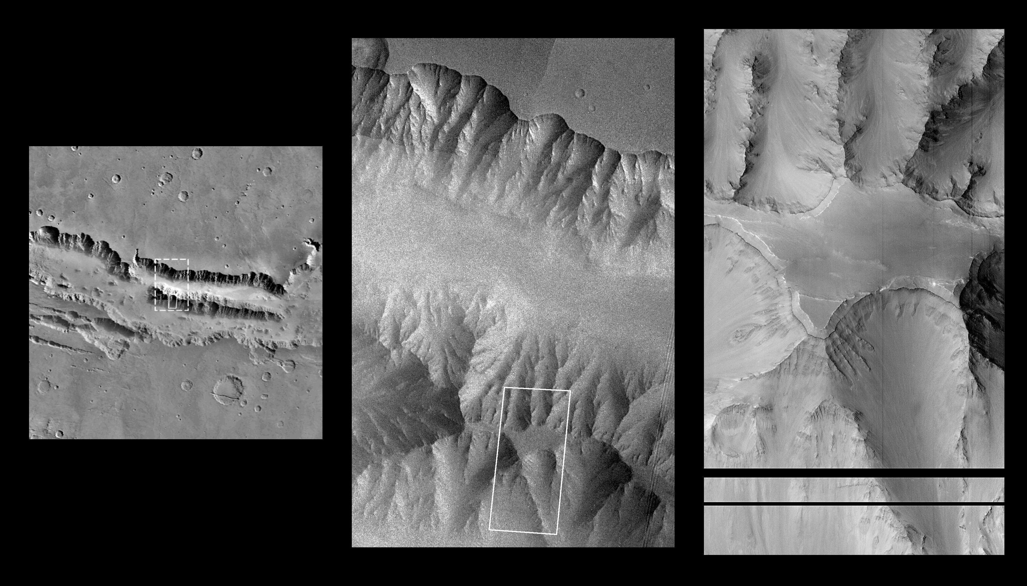
Corasis Fossae Valley
Full Resolution:
TIFF
(1.148 MB)
JPEG
(203.2 kB)
|
|
|
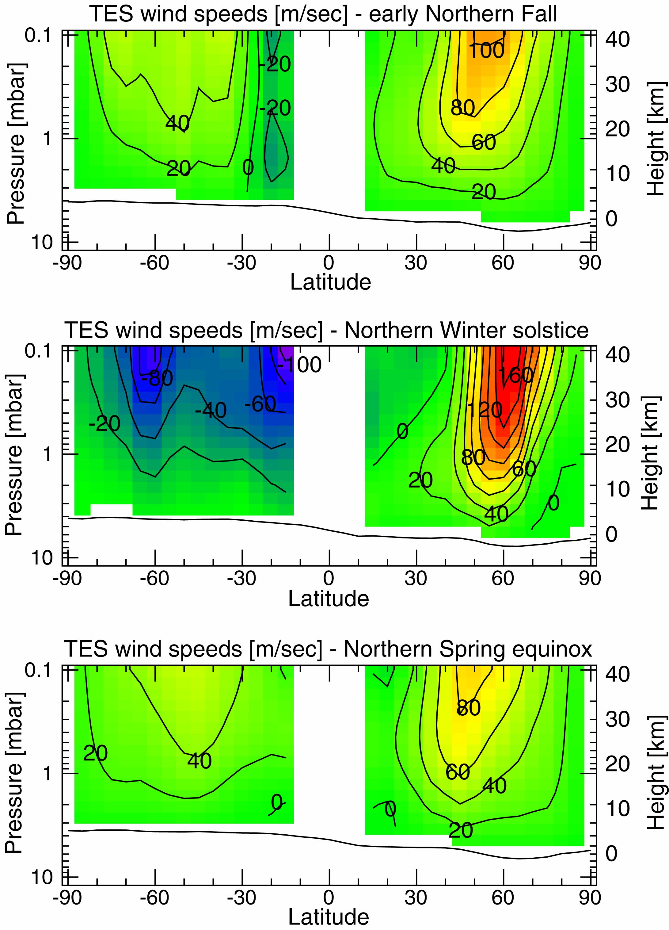
1999-01-07 |
Mars
|
Mars Global Surveyor (MGS)
|
Thermal Emission Spectrometer
|
2183x3033x3 |

|
-
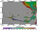
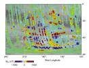
PIA01340:
-
Measurements of the Martian Winds for Three Seasons
Full Resolution:
TIFF
(1.057 MB)
JPEG
(602.2 kB)
|
|
|
1999-01-07 |
Mars
|
Mars Global Surveyor (MGS)
|
Thermal Emission Spectrometer
|
2967x2382x3 |
|
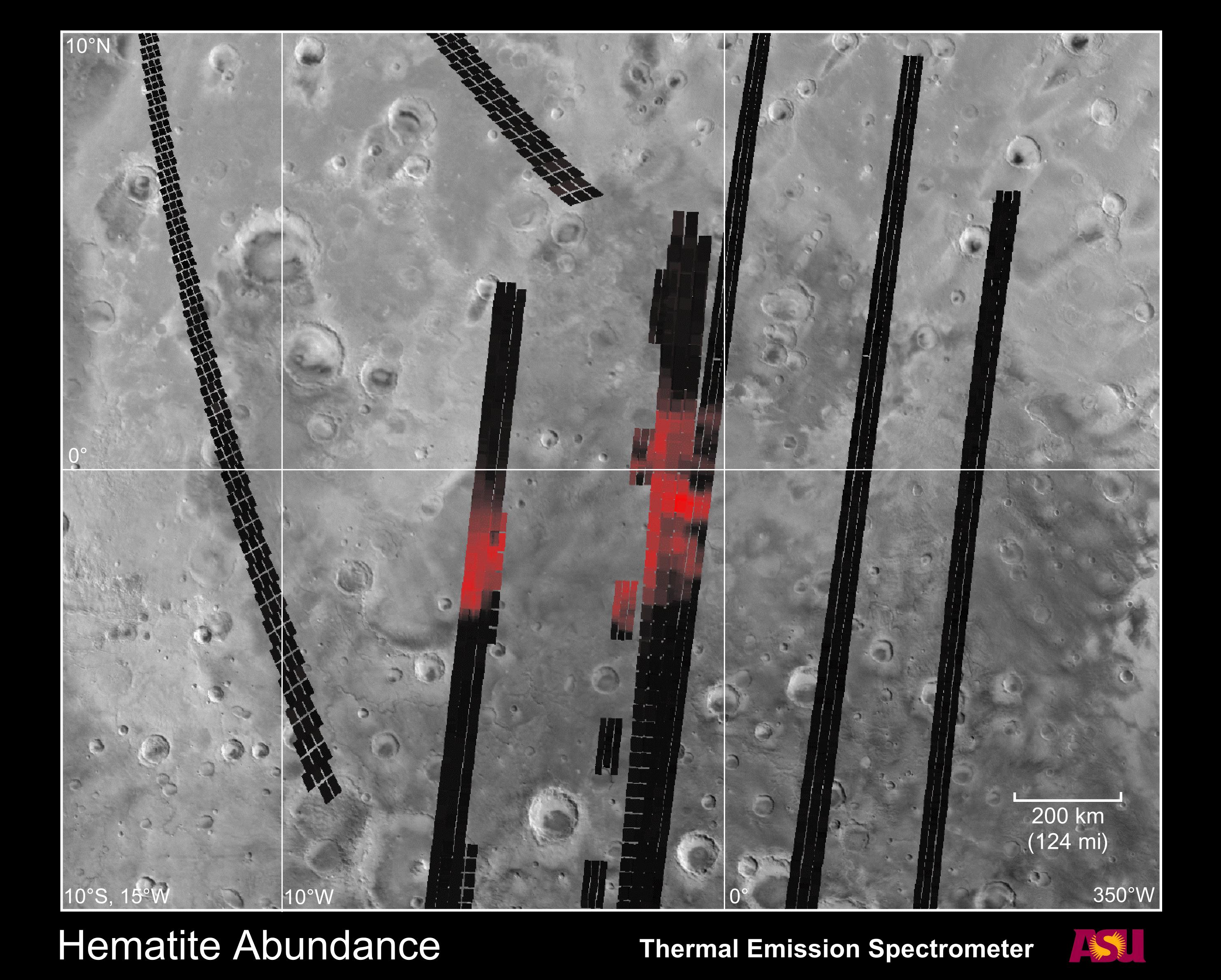
-
PIA01339:
-
Hematite Abundance on Martian Surface
Full Resolution:
TIFF
(2.506 MB)
JPEG
(846.8 kB)
|
|
|
1999-01-07 |
Mars
|
Mars Global Surveyor (MGS)
|
MOLA
|
3042x2292x3 |
|
-
PIA01338:
-
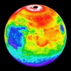
Elevation Measurement Profile of Mars
Full Resolution:
TIFF
(142 kB)
JPEG
(406.8 kB)
|
|
|
1999-01-07 |
Mars
|
Mars Global Surveyor (MGS)
|
MOLA
|
2560x1920x3 |
|
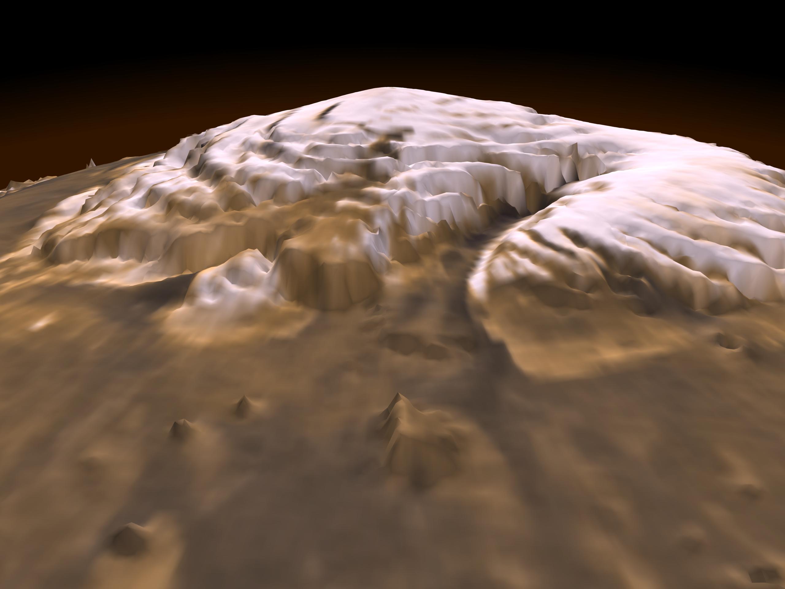
-
PIA01337:
-
Laser Provides First 3-D View of Mars' North Pole
Full Resolution:
TIFF
(8.414 MB)
JPEG
(200.6 kB)
|
|
|
1998-12-10 |
Mars
|
Mars Global Surveyor (MGS)
|
Mars Orbiter Camera (MOC)
|
512x1223x1 |
|
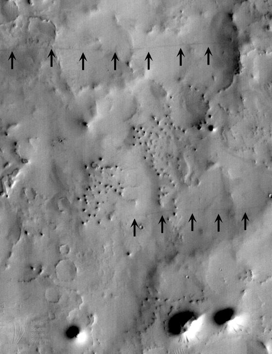
-
PIA01499:
-
Mars Water: Valley Networks
Full Resolution:
TIFF
(582.1 kB)
JPEG
(93.9 kB)
|
|
|
1998-09-26 |
Mars
|
Mars Global Surveyor (MGS)
|
Mars Orbiter Camera (MOC)
|
418x888x1 |
|
-
PIA01468:
-
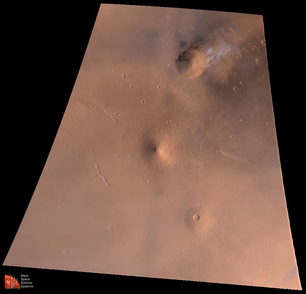
Small Volcano in Tempe Terra
Full Resolution:
TIFF
(384 kB)
JPEG
(80.91 kB)
|
|
|
1998-07-31 |
Mars
|
Mars Global Surveyor (MGS)
|
Mars Orbiter Camera (MOC)
|
560x730x1 |
|
-
PIA01463:
-
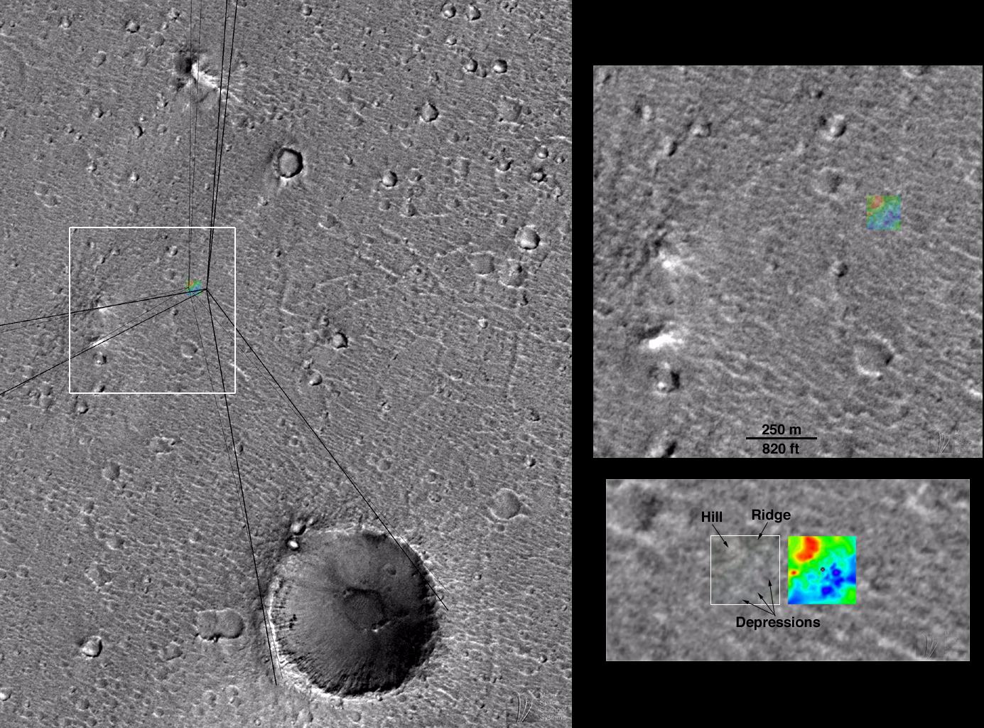
SUV Tracks On Mars? The "Devil" is in the Details
Full Resolution:
TIFF
(367.8 kB)
JPEG
(52.76 kB)
|
|
|
1998-07-20 |
Mars
|
Mars Global Surveyor (MGS)
|
Mars Orbiter Camera (MOC)
|
1027x987x3 |
|
-
PIA01457:
-
Elysium Mons Volcanic Region
Full Resolution:
TIFF
(1.699 MB)
JPEG
(51.09 kB)
|
|
|
1998-07-20 |
Mars
|
Mars Global Surveyor (MGS)
|
Mars Orbiter Camera (MOC)
|
256x3040x1 |

|
-
PIA01455:
-
Elysium Mons Volcano
Full Resolution:
TIFF
(804.2 kB)
JPEG
(150.6 kB)
|
|
|
1998-07-03 |
Mars
|
Mars Global Surveyor (MGS)
|
Mars Orbiter Camera (MOC)
|
1385x1024x3 |
|
-
PIA01447:
-
Mars Pathfinder First Anniversary Special -- Refined Landing Site Location
Full Resolution:
TIFF
(2.262 MB)
JPEG
(289.2 kB)
|
|
|
1998-07-03 |
Mars
|
Mars Global Surveyor (MGS)
|
Mars Orbiter Camera (MOC)
|
512x512x1 |
|
-
PIA01446:
-
Windblown Dunes on the Floor of Herschel Impact Basin
Full Resolution:
TIFF
(119.6 kB)
JPEG
(35.75 kB)
|
|
|
1998-07-03 |
Mars
|
Mars Global Surveyor (MGS)
|
Mars Orbiter Camera (MOC)
|
1024x2816x1 |
|
-
PIA01445:
-
Eroded Crater Adjacent to Huygens Impact Basin
Full Resolution:
TIFF
(1.517 MB)
JPEG
(151.2 kB)
|
|
|
1998-07-03 |
Mars
|
Mars Global Surveyor (MGS)
|
Mars Orbiter Camera (MOC)
|
1024x1467x1 |
|
-
PIA01444:
-
Cloudy Image of Cerberus Rupes Dark Lineation
Full Resolution:
TIFF
(815.1 kB)
JPEG
(348.6 kB)
|
|
|
1998-07-03 |
Mars
|
Mars Global Surveyor (MGS)
|
Mars Orbiter Camera (MOC)
|
800x800x3 |
|
-
PIA01443:
-
Mars Orbiter Camera Acquires High Resolution Stereoscopic Images of the Viking One Landing Site
Full Resolution:
TIFF
(1.416 MB)
JPEG
(83.23 kB)
|
|
|
1998-07-03 |
Mars
|
Mars Global Surveyor (MGS)
|
Mars Orbiter Camera (MOC)
|
1600x500x1 |
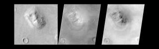
|
-
PIA01442:
-
Mars Orbiter Camera Views the "Face on Mars" - Comparison with Viking
Full Resolution:
TIFF
(423.4 kB)
JPEG
(62.18 kB)
|
|
|
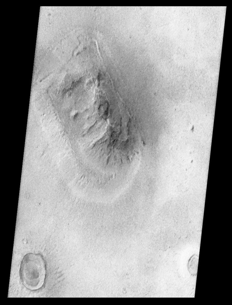
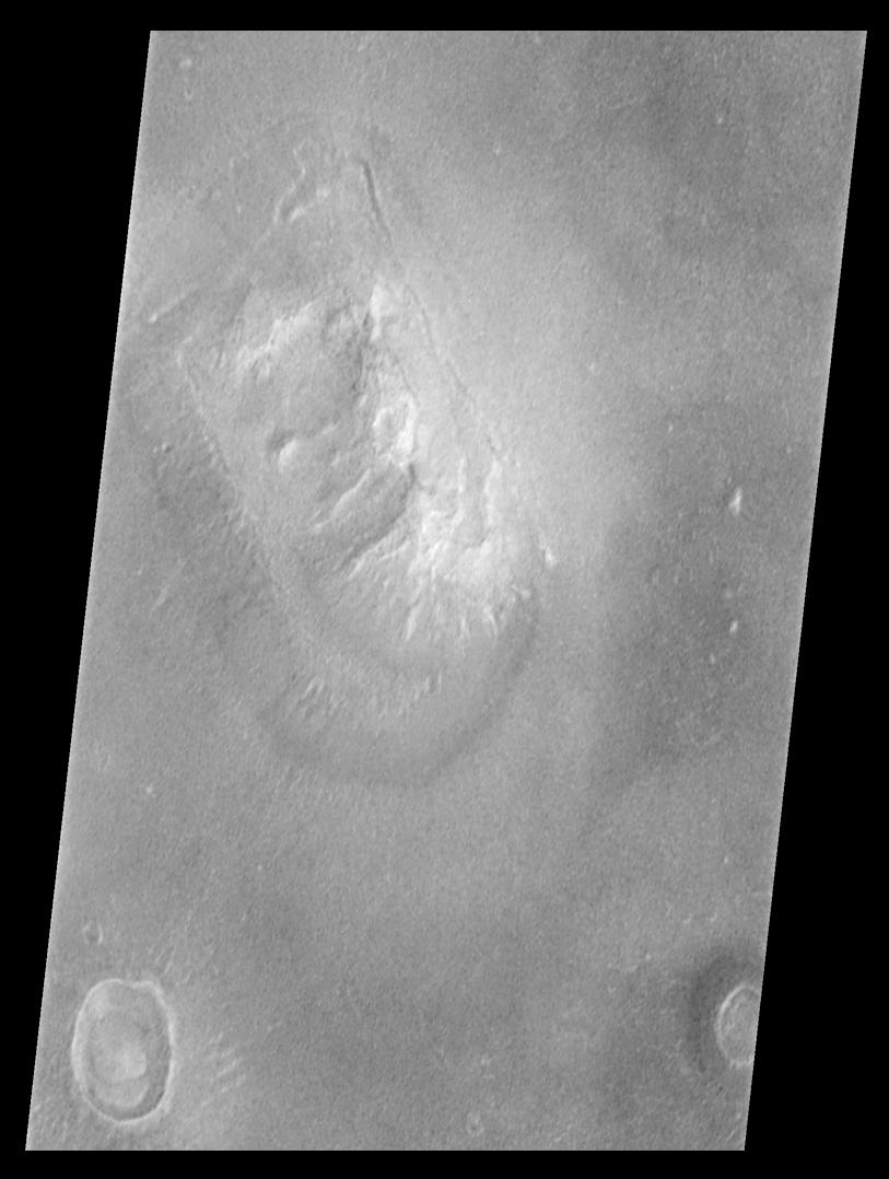
1998-07-03 |
Mars
|
Mars Global Surveyor (MGS)
|
Mars Orbiter Camera (MOC)
|
815x1072x1 |
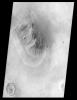
|
-
PIA01441:
-
Mars Orbiter Camera Views the "Face on Mars" - calibrated, contrast enhanced, filtered, brightness-inverted
Full Resolution:
TIFF
(570.9 kB)
JPEG
(93.52 kB)
|
|
|
1998-07-03 |
Mars
|
Mars Global Surveyor (MGS)
|
Mars Orbiter Camera (MOC)
|
813x1078x1 |
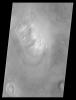
|
-
PIA01440:
-
Mars Orbiter Camera Views the "Face on Mars" - calibrated, contrast enhanced, filtered
Full Resolution:
TIFF
(540.3 kB)
JPEG
(78.83 kB)
|
|
|
1998-07-03 |
Mars
|
Mars Global Surveyor (MGS)
|
Mars Orbiter Camera (MOC)
|
1800x1899x1 |

|
-
PIA01439:
-
Mars Orbiter Camera Views the "Face on Mars" - Best View from Viking
Full Resolution:
TIFF
(1.696 MB)
JPEG
(251.2 kB)
|
|
|
1998-07-03 |
Mars
|
Mars Global Surveyor (MGS)
|
Mars Orbiter Camera (MOC)
|
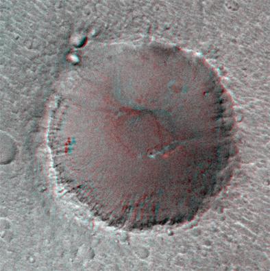
394x395x3 |
|
-
PIA01438:
-
Pathfinder Landing Site Observed by Mars Orbiter Camera - "Big Crater" in Stereo View
Full Resolution:
TIFF
(473.4 kB)
JPEG
(31.69 kB)
|
|
|
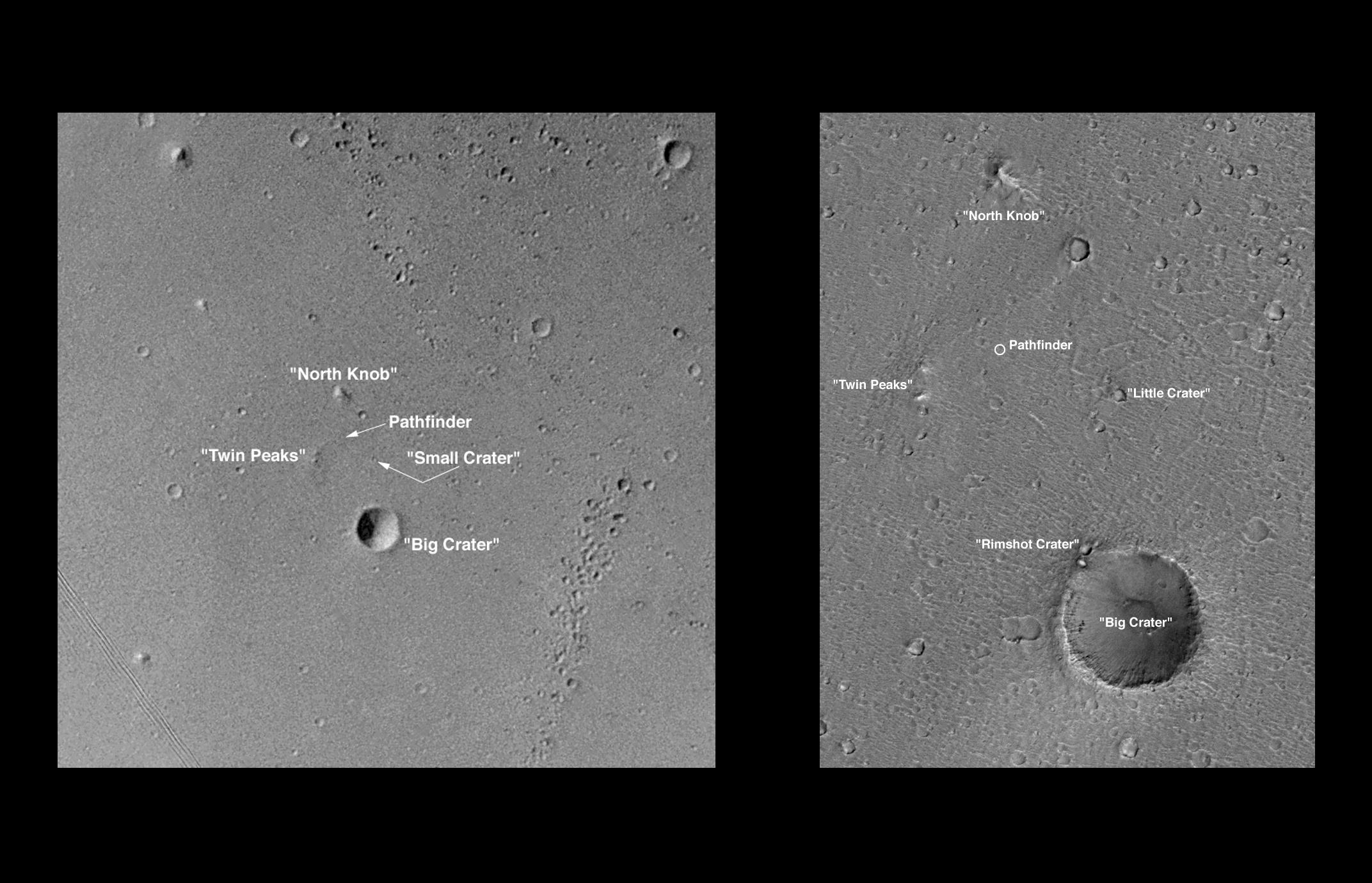
1998-07-03 |
Mars
|
Mars Global Surveyor (MGS)
|
Mars Orbiter Camera (MOC)
|
2144x1380x1 |
|
-
PIA01437:
-
Pathfinder Landing Site Observed by Mars Orbiter Camera
Full Resolution:
TIFF
(1.715 MB)
JPEG
(323.3 kB)
|
|
|
1998-06-15 |
Mars
|
Mars Global Surveyor (MGS)
|
Mars Orbiter Camera (MOC)
|
434x628x3 |
|
-
PIA01436:
-
Detailed Cloud Patterns in Martian Northern Hemisphere
Full Resolution:
TIFF
(633 kB)
JPEG
(17.68 kB)
|
|
|
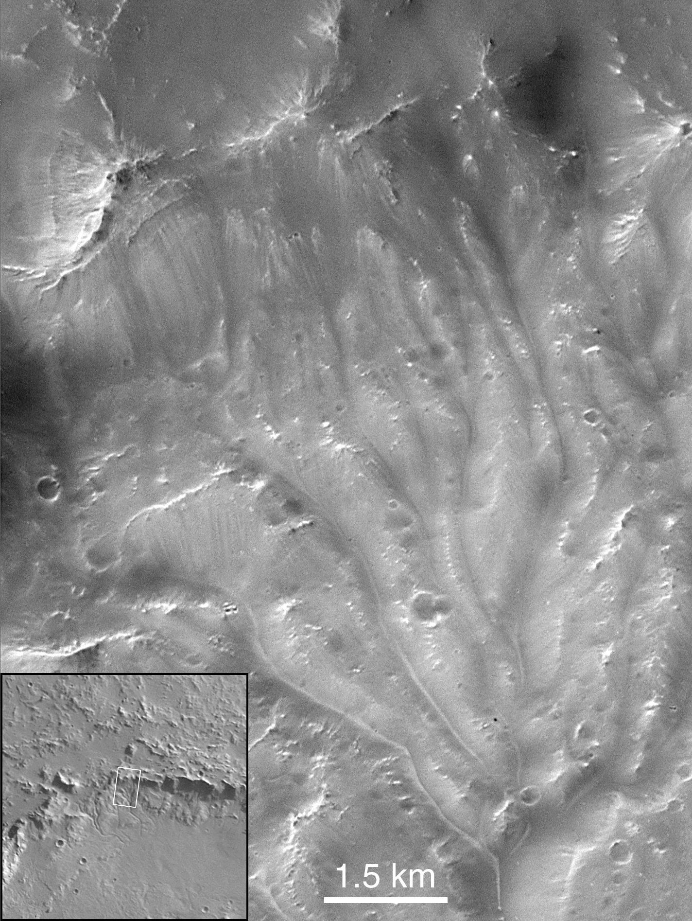
1998-06-15 |
Mars
|
Mars Global Surveyor (MGS)
|
Mars Orbiter Camera (MOC)
|
689x437x3 |
|
-
PIA01435:
-
Winter Morning in Northern Tharsis
Full Resolution:
TIFF
(650.9 kB)
JPEG
(21.7 kB)
|
|
|
1998-06-15 |
Mars
|
Mars Global Surveyor (MGS)
|
Mars Orbiter Camera (MOC)
|
700x700x1 |
|
-
PIA01434:
-
Small, Fresh Impact Crater With Dark Ejecta
Full Resolution:
TIFF
(229.7 kB)
JPEG
(59.76 kB)
|
|
|
1998-06-15 |
Mars
|
Mars Global Surveyor (MGS)
|
Mars Orbiter Camera (MOC)
|
1024x1279x1 |
|
-
PIA01433:
-
Seepage and Ponding within a Southern Hemisphere Crater
Full Resolution:
TIFF
(1.125 MB)
JPEG
(109.8 kB)
|
|
|
1998-06-15 |
Mars
|
Mars Global Surveyor (MGS)
|
Mars Orbiter Camera (MOC)
|
624x864x3 |
|
-
PIA01432:
-
Opposition Surge: Sunlight Glinting off Mars
Full Resolution:
TIFF
(1.256 MB)
JPEG
(54.42 kB)
|
|
|
1998-06-15 |
Mars
|
Mars Global Surveyor (MGS)
|
Mars Orbiter Camera (MOC)
|
800x800x1 |

|
-
PIA01431:
-
Lava Flows On Ascraeus Mons Volcano
Full Resolution:
TIFF
(419.7 kB)
JPEG
(63.94 kB)
|
|
|
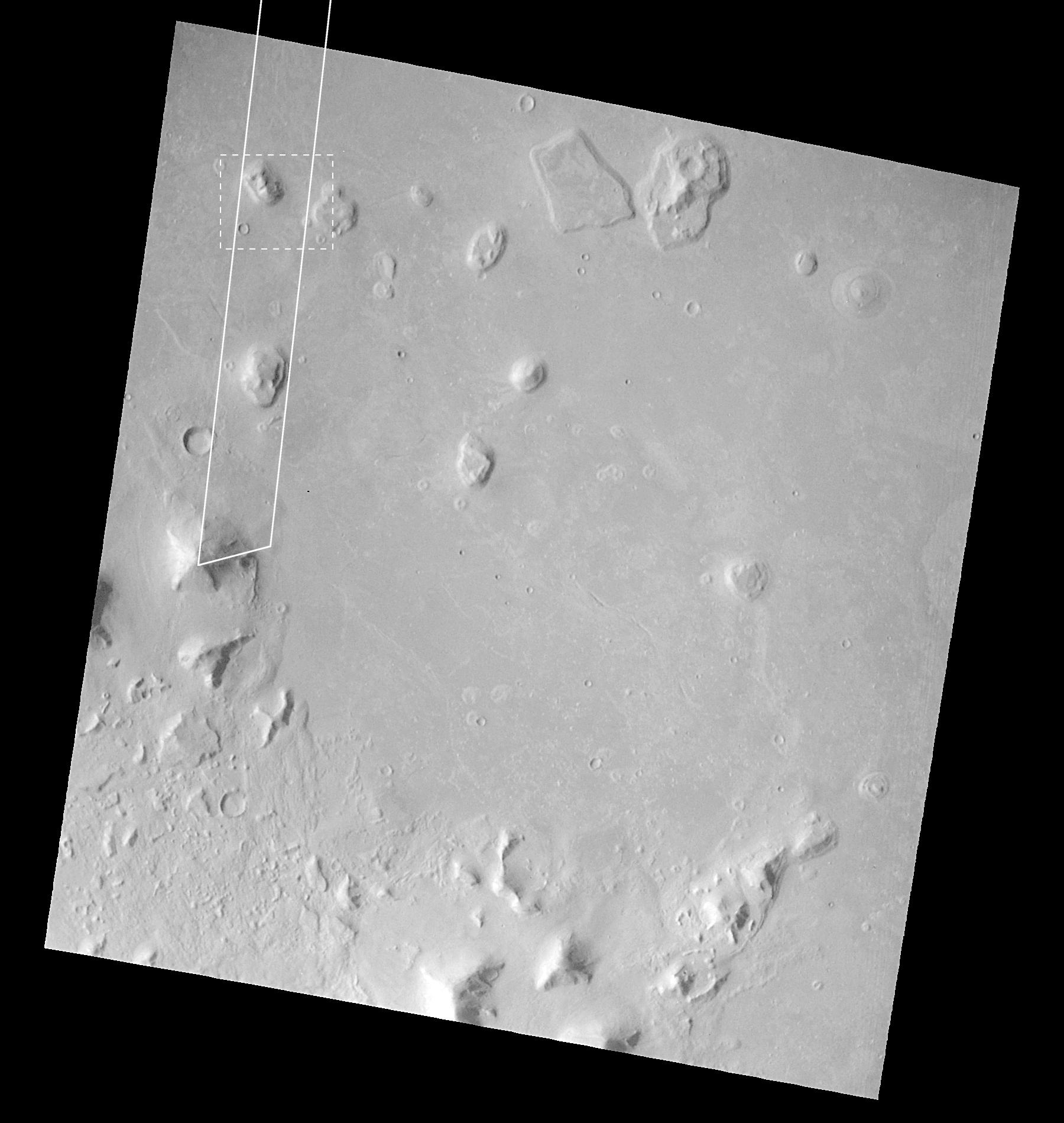
1998-04-24 |
Mars
|
Mars Global Surveyor (MGS)
|
Mars Orbiter Camera (MOC)
|
1250x5000x1 |
|
-
PIA01241:
-
Cydonia Region - Pass #3
Full Resolution:
TIFF
(3.988 MB)
JPEG
(497 kB)
|
|
|
1998-04-23 |
Mars
|
Mars Global Surveyor (MGS)
|
Mars Orbiter Camera (MOC)
|
1356x2034x3 |
|
-
PIA01239:
-
Coprates Catena
Full Resolution:
TIFF
(6.104 MB)
JPEG
(290 kB)
|
|
|
1998-04-23 |
Mars
|
Mars Global Surveyor (MGS)
|
Mars Orbiter Camera (MOC)
|
834x834x3 |

|
-
PIA00993:
-
Olympus Mons in Color
Full Resolution:
TIFF
(1.23 MB)
JPEG
(35.04 kB)
|
|
|
1998-04-14 |
Mars
|
Mars Global Surveyor (MGS)
|
Mars Orbiter Camera (MOC)
|
1250x5000x1 |
|
-
PIA01240:
-
Cydonia Region - Pass #2
Full Resolution:
TIFF
(3.492 MB)
JPEG
(377.3 kB)
|
|
|
1998-04-06 |
Mars
|
Mars Global Surveyor (MGS)
|
Mars Orbiter Camera (MOC)
|
1324x680x1 |
|
-
PIA01237:
-
Cydonia Region - Detail
Full Resolution:
TIFF
(422.9 kB)
JPEG
(90.16 kB)
|
|
|
1998-04-06 |
Mars
|
Mars Global Surveyor (MGS)
|
Mars Orbiter Camera (MOC)
|
1624x5120x1 |
|
-
PIA01236:
-
Cydonia Region
Full Resolution:
TIFF
(4.223 MB)
JPEG
(873.1 kB)
|
|
|
1998-03-13 |
Mars
|
Mars Global Surveyor (MGS)
|
Mars Orbiter Camera (MOC)
|
1356x9216x3 |
|
-
PIA00814:
-
Coprates Chasma
Full Resolution:
TIFF
(23.13 MB)
JPEG
(1.279 MB)
|
|
|
1998-03-13 |
Mars
|
Mars Global Surveyor (MGS)
|
Mars Orbiter Camera (MOC)
|
1200x1194x1 |
|
-
PIA00813:
-
1997 Martian Dust Storm
Full Resolution:
TIFF
(310.8 kB)
JPEG
(77.07 kB)
|
|
|
1998-03-13 |
Mars
|
Mars Global Surveyor (MGS)
|
Mars Orbiter Camera (MOC)
|
1200x1194x3 |
|
-
PIA00812:
-
Clouds over Tharsis
Full Resolution:
TIFF
(439 kB)
JPEG
(75.45 kB)
|
|
|
1998-03-13 |
Mars
|
Mars Global Surveyor (MGS)
|
Mars Orbiter Camera (MOC)
|
1200x1194x1 |

|
-
PIA00811:
-
South Polar Region
Full Resolution:
TIFF
(402.9 kB)
JPEG
(109.9 kB)
|
|
|
1998-03-13 |
Mars
|
Mars Global Surveyor (MGS)
|
Mars Orbiter Camera (MOC)
|
592x568x1 |
|
-
PIA00810:
-
Textures in South Polar Ice Cap #2
Full Resolution:
TIFF
(147.8 kB)
JPEG
(52.01 kB)
|
|
|
1998-03-13 |
Mars
|
Mars Global Surveyor (MGS)
|
Mars Orbiter Camera (MOC)
|
592x568x1 |
|
-
PIA00809:
-
Textures in South Polar Ice Cap #1
Full Resolution:
TIFF
(173.4 kB)
JPEG
(76.65 kB)
|
|
|
1998-03-13 |
Mars
|
Mars Global Surveyor (MGS)
|
Mars Orbiter Camera (MOC)
|
855x616x1 |
|
-
PIA00808:
-
Ridges in Mars' South Polar Region
Full Resolution:
TIFF
(227.3 kB)
JPEG
(73.71 kB)
|
|
|
1998-03-13 |
Mars
|
Mars Global Surveyor (MGS)
|
Mars Orbiter Camera (MOC)
|
477x441x1 |
|
-
PIA00807:
-
Candor Chasma
Full Resolution:
TIFF
(109.9 kB)
JPEG
(47.99 kB)
|
|
|
1998-03-13 |
Mars
|
Mars Global Surveyor (MGS)
|
Mars Orbiter Camera (MOC)
|
477x441x1 |
|
-
PIA00806:
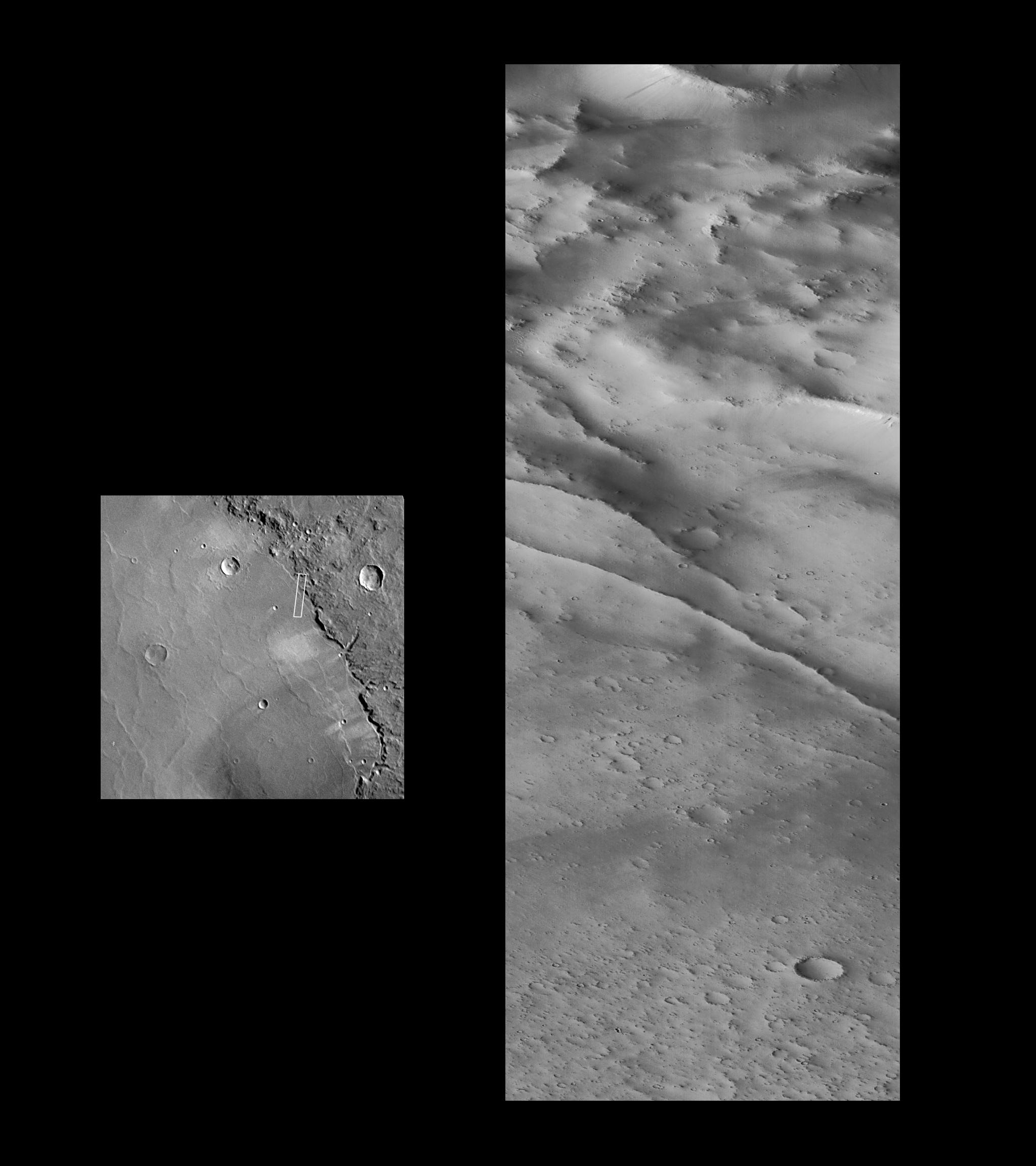
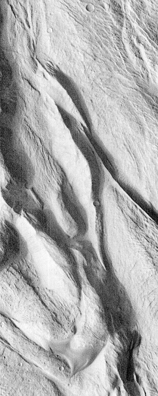
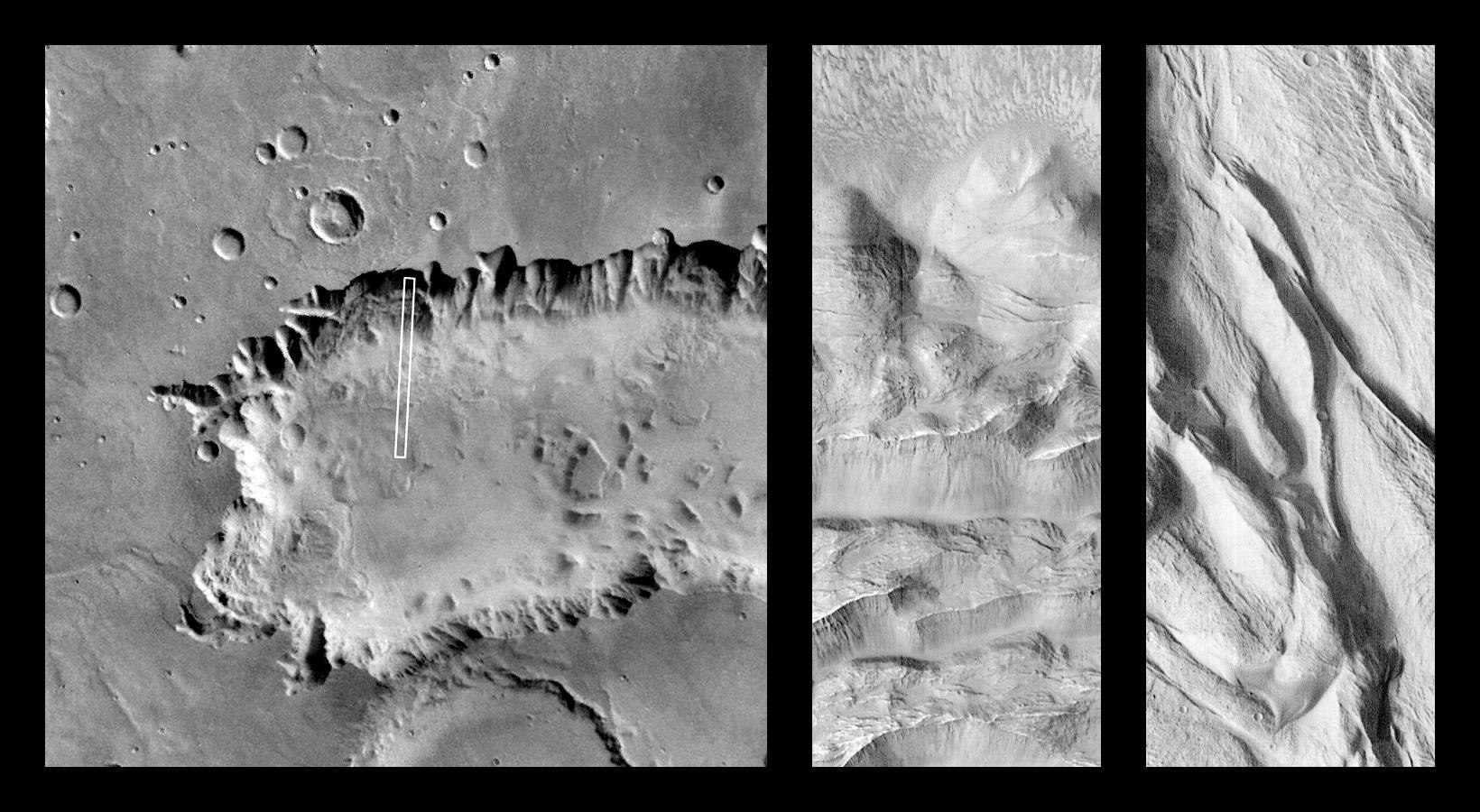
-
Tithonium Chasma/Ius Chasma
Full Resolution:
TIFF
(110.4 kB)
JPEG
(46.77 kB)
|
|
|
1998-03-13 |
Mars
|
Mars Global Surveyor (MGS)
|
Mars Orbiter Camera (MOC)
|
645x701x1 |
|
-
PIA00805:
-
Crommelin Crater #2
Full Resolution:
TIFF
(224.5 kB)
JPEG
(87.85 kB)
|
|
|
1998-03-13 |
Mars
|
Mars Global Surveyor (MGS)
|
Mars Orbiter Camera (MOC)
|
645x701x1 |
|
-
PIA00804:
-
Crommelin Crater #1
Full Resolution:
TIFF
(201.9 kB)
JPEG
(78.6 kB)
|
|
|
1998-03-13 |
Mars
|
Mars Global Surveyor (MGS)
|
Mars Orbiter Camera (MOC)
|
450x699x1 |
|
-
PIA00803:
-
Hebes Chasma #2
Full Resolution:
TIFF
(160 kB)
JPEG
(71.49 kB)
|
|
|
1998-03-13 |
Mars
|
Mars Global Surveyor (MGS)
|
Mars Orbiter Camera (MOC)
|
450x699x1 |
|
-
PIA00802:
-
Hebes Chasma #1
Full Resolution:
TIFF
(155.5 kB)
JPEG
(72.56 kB)
|
|
|
1998-03-13 |
Mars
|
Mars Global Surveyor (MGS)
|
Mars Orbiter Camera (MOC)
|
573x906x1 |
|
-
PIA00801:
-
Medusae Fossae #2
Full Resolution:
TIFF
(280.2 kB)
JPEG
(129.4 kB)
|
|
|
1998-03-13 |
Mars
|
Mars Global Surveyor (MGS)
|
Mars Orbiter Camera (MOC)
|
573x906x1 |
|
-
PIA00800:
-
Medusae Fossae #1
Full Resolution:
TIFF
(291.2 kB)
JPEG
(136.8 kB)
|
|
|
1998-02-12 |
Mars
|
Mars Global Surveyor (MGS)
|
Mars Orbiter Camera (MOC)
|
2048x2048x1 |
|
-
PIA01174:
-
MOC View of Mars98 Landing Zone - 1/16/98
Full Resolution:
TIFF
(2.552 MB)
JPEG
(522.4 kB)
|
|
|
1998-02-12 |
Mars
|
Mars Global Surveyor (MGS)
|
Mars Orbiter Camera (MOC)
|
2048x2048x1 |
|
-
PIA01173:
-
MOC View of Mars98 Landing Zone - 1/16/98
Full Resolution:
TIFF
(2.498 MB)
JPEG
(512.8 kB)
|
|
|
1998-02-12 |
Mars
|
Mars Global Surveyor (MGS)
|
Mars Orbiter Camera (MOC)
|
2048x2048x1 |
|
-
PIA01172:
-
MOC View of Mars98 Landing Zone - 12/24/97
Full Resolution:
TIFF
(2.689 MB)
JPEG
(534.9 kB)
|
|
|
1998-02-12 |
Mars
|
Mars Global Surveyor (MGS)
|
Mars Orbiter Camera (MOC)
|
2048x2048x1 |

|
-
PIA01171:
-
MOC View of Mars98 Landing Zone - 12/24/97
Full Resolution:
TIFF
(2.332 MB)
JPEG
(290.9 kB)
|
|
|
1998-02-12 |
Mars
|
Mars Global Surveyor (MGS)
|
Mars Orbiter Camera (MOC)
|
1024x1920x1 |

|
-
PIA01170:
-
Nanedi Vallis: Sustained Water Flow? - High Resolution Image
Full Resolution:
TIFF
(1.867 MB)
JPEG
(566.3 kB)
|
|
|
1998-02-12 |
Mars
|
Mars Global Surveyor (MGS)
|
Mars Orbiter Camera (MOC)
|
2254x2000x1 |
|
-
PIA01169:
-
Nanedi Vallis: Sustained Water FLow?
Full Resolution:
TIFF
(2.886 MB)
JPEG
(848.3 kB)
|
|
|
1998-02-12 |
Mars
|
Mars Global Surveyor (MGS)
|
Mars Orbiter Camera (MOC)
|
2048x3591x1 |
|
-
PIA01168:
-
Layers within the Valles Marineris: Clues to the Ancient Crust of Mars - High Resolution Image
Full Resolution:
TIFF
(8.157 MB)
JPEG
(1.694 MB)
|
|
|
1998-02-12 |
Mars
|
Mars Global Surveyor (MGS)
|
Mars Orbiter Camera (MOC)
|
3500x2000x1 |
|
-
PIA01167:
-
Layers within the Valles Marineris: Clues to the Ancient Crust of Mars
Full Resolution:
TIFF
(4.837 MB)
JPEG
(953.8 kB)
|
|
|
1998-02-12 |
Mars
|
Mars Global Surveyor (MGS)
|
Mars Orbiter Camera (MOC)
|
1024x6378x1 |
|
-
PIA01162:
-
Flow-ejecta Crater in Icaria Planum - High Resolution Image
Full Resolution:
TIFF
(6.383 MB)
JPEG
(1.424 MB)
|
|
|
1998-02-12 |
Mars
|
Mars Global Surveyor (MGS)
|
Mars Orbiter Camera (MOC)
|
1536x2304x1 |

|
-
PIA01161:
-
Flow-ejecta Crater in Icaria Planum
Full Resolution:
TIFF
(949.5 kB)
JPEG
(177.6 kB)
|
|
|
1998-02-12 |
Mars
|
Mars Global Surveyor (MGS)
|
Mars Orbiter Camera (MOC)
|
1024x6144x1 |

|
-
PIA01160:
-
Medusae Fossae Formation - High Resolution Image
Full Resolution:
TIFF
(5.934 MB)
JPEG
(1.246 MB)
|
|
|
1998-02-12 |
Mars
|
Mars Global Surveyor (MGS)
|
Mars Orbiter Camera (MOC)
|
1536x2304x1 |
|
-
PIA01159:
-
Medusae Fossae Formation
Full Resolution:
TIFF
(1.031 MB)
JPEG
(242 kB)
|
|
|
1998-02-12 |
Mars
|
Mars Global Surveyor (MGS)
|
Mars Orbiter Camera (MOC)
|
1024x2688x1 |
|
-
PIA01158:
-
Schiaparelli Crater Rim and Interior Deposits - High Resolution Image
Full Resolution:
TIFF
(1.78 MB)
JPEG
(277.8 kB)
|
|
|
1998-02-12 |
Mars
|
Mars Global Surveyor (MGS)
|
Mars Orbiter Camera (MOC)
|
2048x2304x1 |
|
-
PIA01157:
-
Schiaparelli Crater Rim and Interior Deposits
Full Resolution:
TIFF
(1.754 MB)
JPEG
(278 kB)
|
|
|
1998-02-12 |
Mars
|
Mars Global Surveyor (MGS)
|
Mars Orbiter Camera (MOC)
|
295x4988x1 |

|
-
PIA01156:
-
Flow Ejecta and Slope Landslides in Small Crater - High Resolution Image
Full Resolution:
TIFF
(1.57 MB)
JPEG
(390 kB)
|
|
|
1998-02-12 |
Mars
|
Mars Global Surveyor (MGS)
|
Mars Orbiter Camera (MOC)
|
1536x2304x1 |
|
-
PIA01155:
-
Flow Ejecta and Slope Landslides in Small Crater
Full Resolution:
TIFF
(561.2 kB)
JPEG
(117.8 kB)
|
|
|
1998-02-12 |
Mars
|
Mars Global Surveyor (MGS)
|
Mars Orbiter Camera (MOC)
|
1100x1100x3 |
|
-
PIA01163:
-
A Regional View of Mars on Orbit 63
Full Resolution:
TIFF
(1.748 MB)
JPEG
(66.47 kB)
|
|
|
1997-11-10 |
Mars
|
Mars Global Surveyor (MGS)
|
Mars Orbiter Camera (MOC)
|
1280x960x1 |

|
-
PIA01030:
-
Mars Orbiter Camera High Resolution Images: Some Results From The First 6 Weeks In Orbit
Full Resolution:
TIFF
(1.248 MB)
JPEG
(298.2 kB)
|
|
|
1997-11-10 |
Mars
|
Mars Global Surveyor (MGS)
|
Mars Orbiter Camera (MOC)
|
512x1280x1 |

|
-
PIA01029:
-
Complex Floor Deposits Within Western Ganges Chasma, Valles Marineris - High Resolution Image
Full Resolution:
TIFF
(738.5 kB)
JPEG
(174.5 kB)
|
|
|
1997-11-10 |
Mars
|
Mars Global Surveyor (MGS)
|
Mars Orbiter Camera (MOC)
|
512x1280x1 |
|
-
PIA01028:
-
Complex Floor Deposits Within Western Ganges Chasma, Valles Marineris - High Resolution Image
Full Resolution:
TIFF
(635.6 kB)
JPEG
(139 kB)
|
|
|
1997-11-10 |
Mars
|
Mars Global Surveyor (MGS)
|
Mars Orbiter Camera (MOC)
|
1640x900x1 |
|
-
PIA01027:
-
Complex Floor Deposits Within Western Ganges Chasma, Valles Marineris
Full Resolution:
TIFF
(1.183 MB)
JPEG
(230.3 kB)
|
|
|
1997-11-10 |
Mars
|
Mars Global Surveyor (MGS)
|
Mars Orbiter Camera (MOC)
|
2048x2048x1 |
|
-
PIA01026:
-
Valley and Surrounding Terrain Adjacent to Schiaparelli Crater - High Resolution Image
Full Resolution:
TIFF
(2.249 MB)
JPEG
(297.8 kB)
|
|
|
1997-11-10 |
Mars
|
Mars Global Surveyor (MGS)
|
Mars Orbiter Camera (MOC)
|
1024x2688x1 |
|
-
PIA01025:
-
Valley and Surrounding Terrain Adjacent to Schiaparelli Crater - High Resolution Image
Full Resolution:
TIFF
(1.424 MB)
JPEG
(197 kB)
|
|
|
1997-11-10 |
Mars
|
Mars Global Surveyor (MGS)
|
Mars Orbiter Camera (MOC)
|
2023x996x1 |
|
-
PIA01024:
-
Valley and Surrounding Terrain Adjacent to Schiaparelli Crater
Full Resolution:
TIFF
(1.266 MB)
JPEG
(185.7 kB)
|
 Planetary Data System


