My
List |
Addition Date
|
Target
|
Mission
|
Instrument
|
Size
|

|
1997-11-10 |
Mars
|
Mars Global Surveyor (MGS)
|
Mars Orbiter Camera (MOC)
|
1706x1280x1 |
|
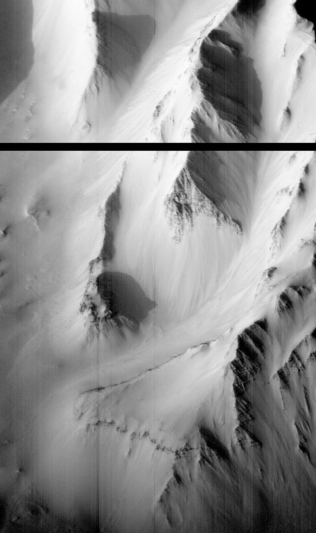
-
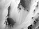
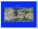
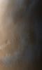
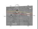
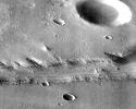
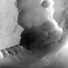
PIA01023:
-
Western Tithonium Chasma/Ius Chasma, Valles Marineris - High Resolution Image
Full Resolution:
TIFF
(1.89 MB)
JPEG
(259.4 kB)
|
|
|
1997-11-10 |
Mars
|
Mars Global Surveyor (MGS)
|
Mars Orbiter Camera (MOC)
|
1024x1728x1 |
|
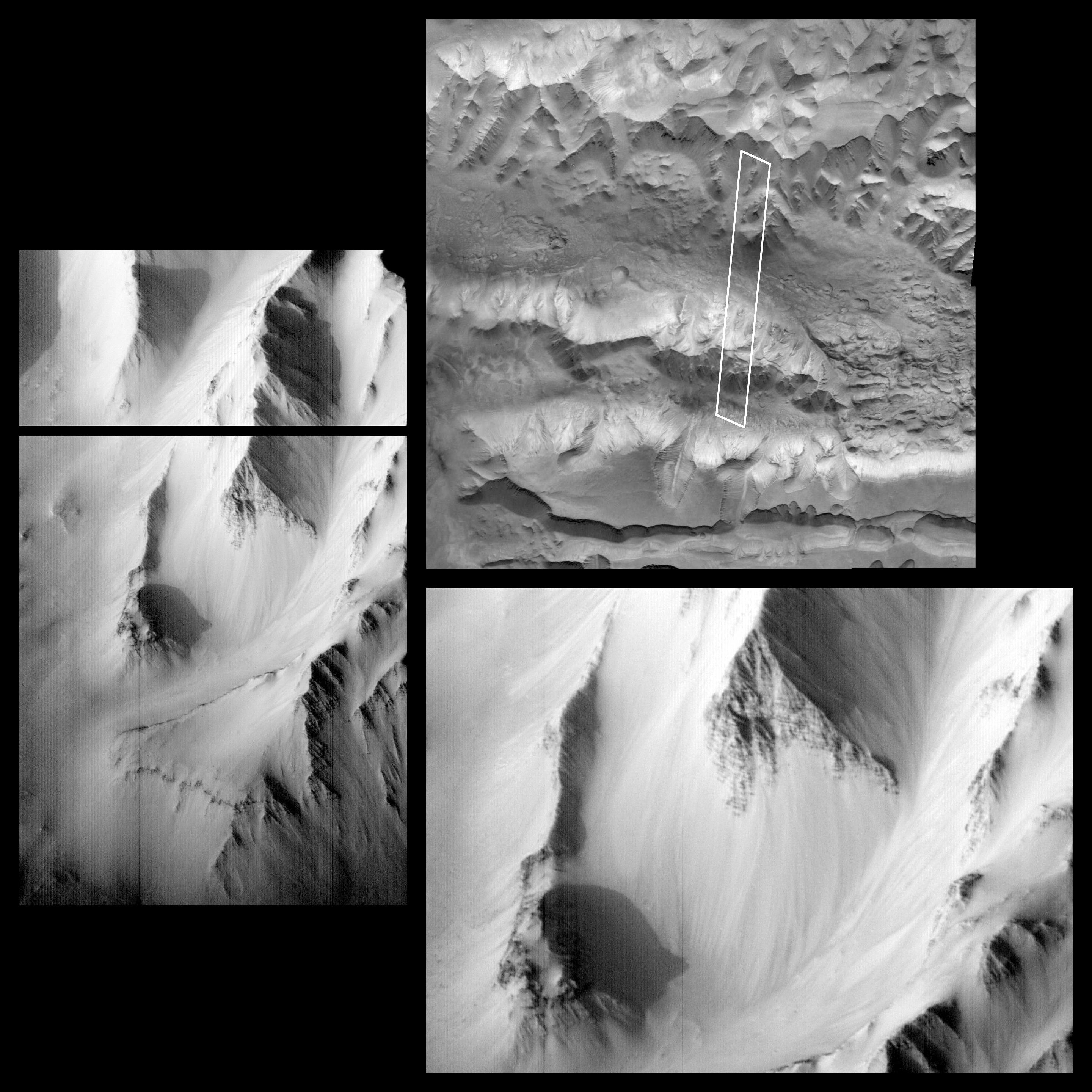
-
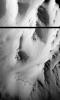
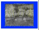
PIA01022:
-
Western Tithonium Chasma/Ius Chasma, Valles Marineris - High Resolution Image
Full Resolution:
TIFF
(1.698 MB)
JPEG
(268.3 kB)
|
|
|
1997-11-10 |
Mars
|
Mars Global Surveyor (MGS)
|
Mars Orbiter Camera (MOC)
|
2880x2880x1 |
|
-
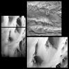
PIA01021:
-
Western Tithonium Chasma/Ius Chasma, Valles Marineris
Full Resolution:
TIFF
(5.33 MB)
JPEG
(771.9 kB)
|
|
|
1997-11-10 |
Mars
|
Mars Global Surveyor (MGS)
|
Thermal Emission Spectrometer
|
524x424x3 |
|
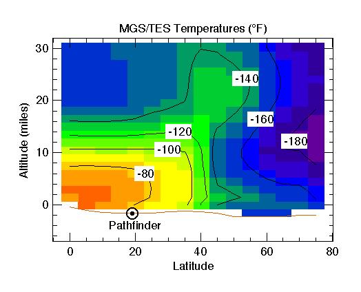
-
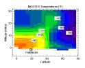
PIA01020:
-
MGS/TES Temperatures
Full Resolution:
TIFF
(17.04 kB)
JPEG
(32.43 kB)
|
|
|
1997-11-10 |
Mars
|
Mars Global Surveyor (MGS)
|
Thermal Emission Spectrometer
|
1400x1000x3 |
|
-
PIA01019:
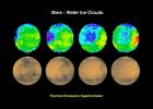
-
Mars - Water Ice Clouds
Full Resolution:
TIFF
(1.695 MB)
JPEG
(147.2 kB)
|
|
|
1997-11-10 |
Mars
|
Mars Global Surveyor (MGS)
|
Thermal Emission Spectrometer
|
1872x1224x3 |

|
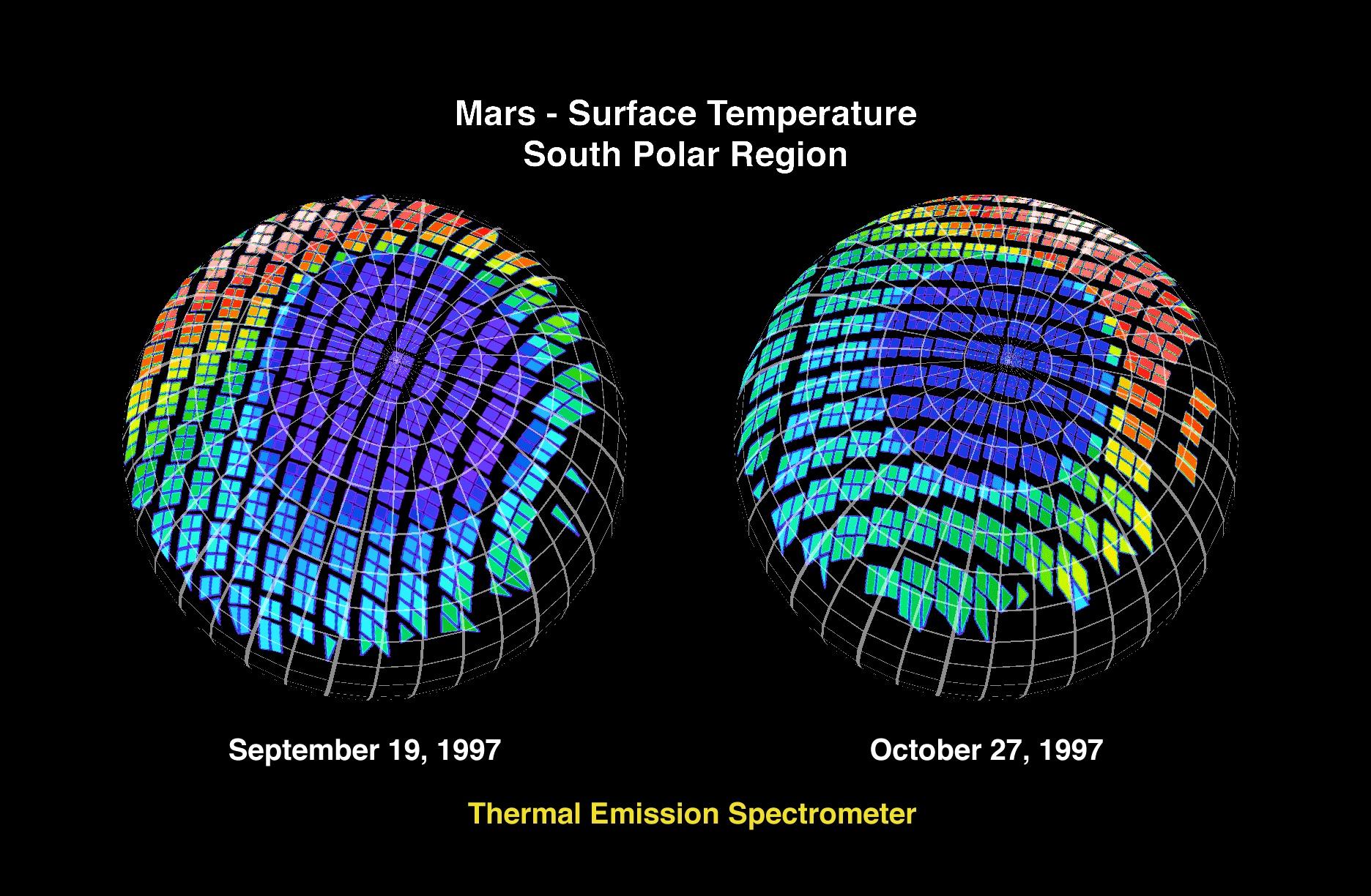
-
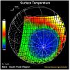
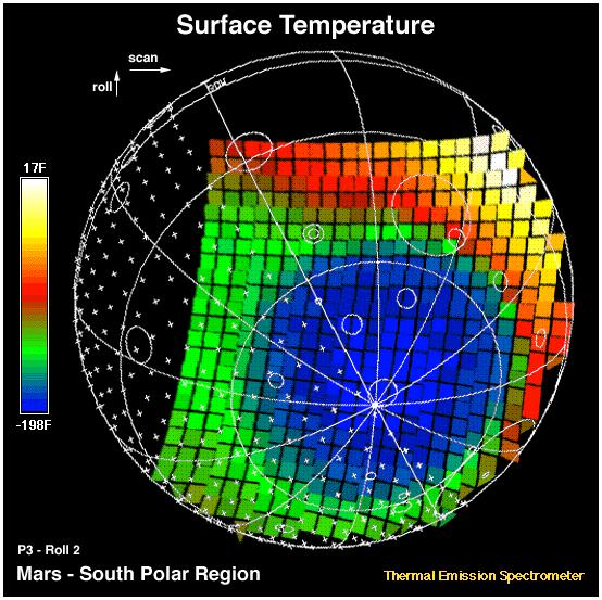
PIA01018:
-
Mars - Surface Temperature South Polar Region
Full Resolution:
TIFF
(2.253 MB)
JPEG
(360.5 kB)
|
|
|
1997-11-10 |
Mars
|
Mars Global Surveyor (MGS)
|
Thermal Emission Spectrometer
|
1409x1091x3 |
|
-
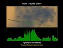
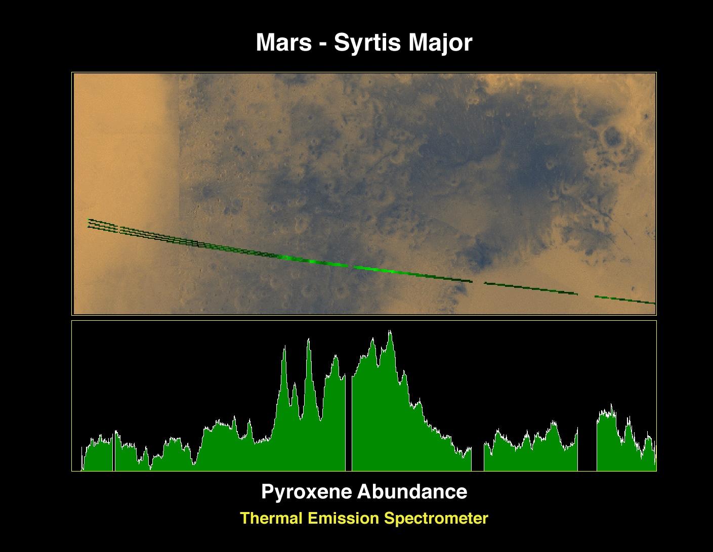
PIA01017:
-
Pyroxene at Syrtis Major
Full Resolution:
TIFF
(1.821 MB)
JPEG
(127.5 kB)
|
|
|
1997-11-10 |
Mars
|
Mars Global Surveyor (MGS)
|
Magnetometer
|
972x744x3 |
|
-
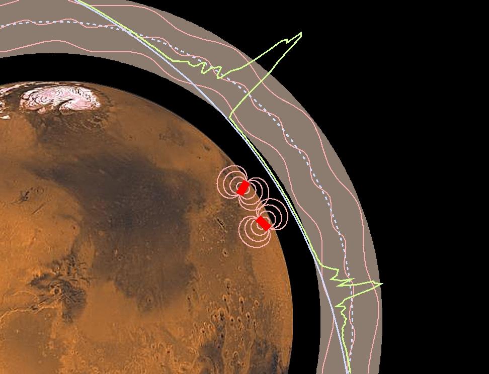
PIA01016:
-
Magnetic Anomalies on Mars
Full Resolution:
TIFF
(1.073 MB)
JPEG
(78.09 kB)
|
|
|
1997-11-10 |
Mars
|
Mars Global Surveyor (MGS)
|
Magnetometer
|
996x746x3 |
|
-
PIA01015:
-
Martian Ionosphere
Full Resolution:
TIFF
(567.3 kB)
JPEG
(56.81 kB)
|
|
|
1997-11-10 |
Mars
|
Mars Global Surveyor (MGS)
|
MOLA
|
3300x2550x3 |
|
-
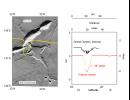
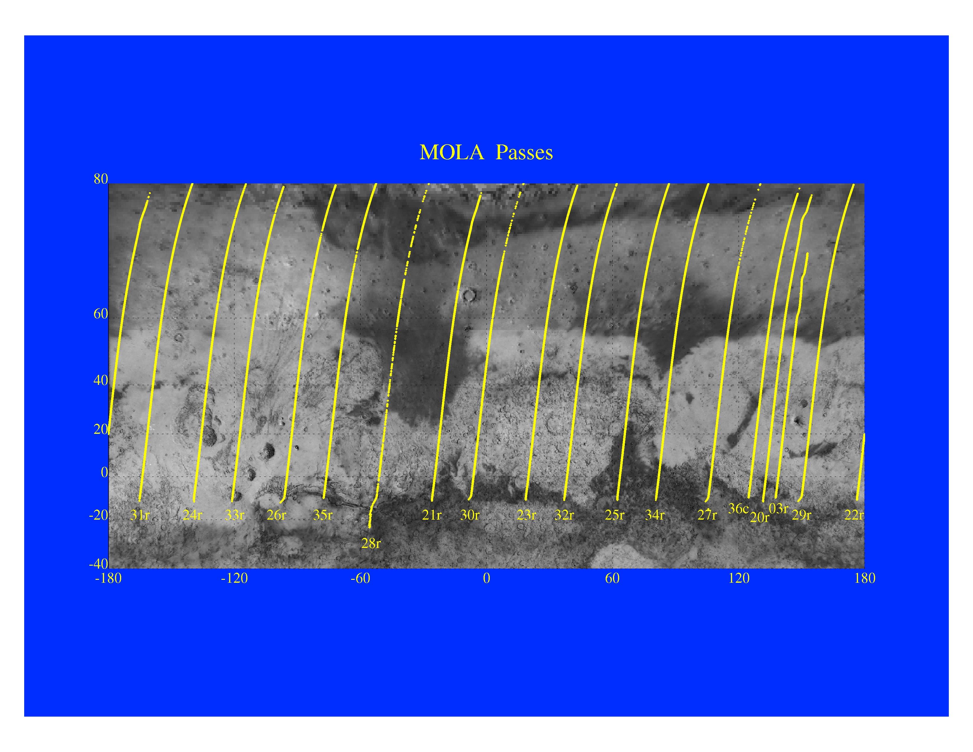
PIA01014:
-
Mars Orbiter Laser Altimeter Passes
Full Resolution:
TIFF
(3.582 MB)
JPEG
(723.3 kB)
|
|
|
1997-11-10 |
Mars
|
Mars Global Surveyor (MGS)
|
MOLA
|
3300x2550x3 |
|
-
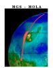
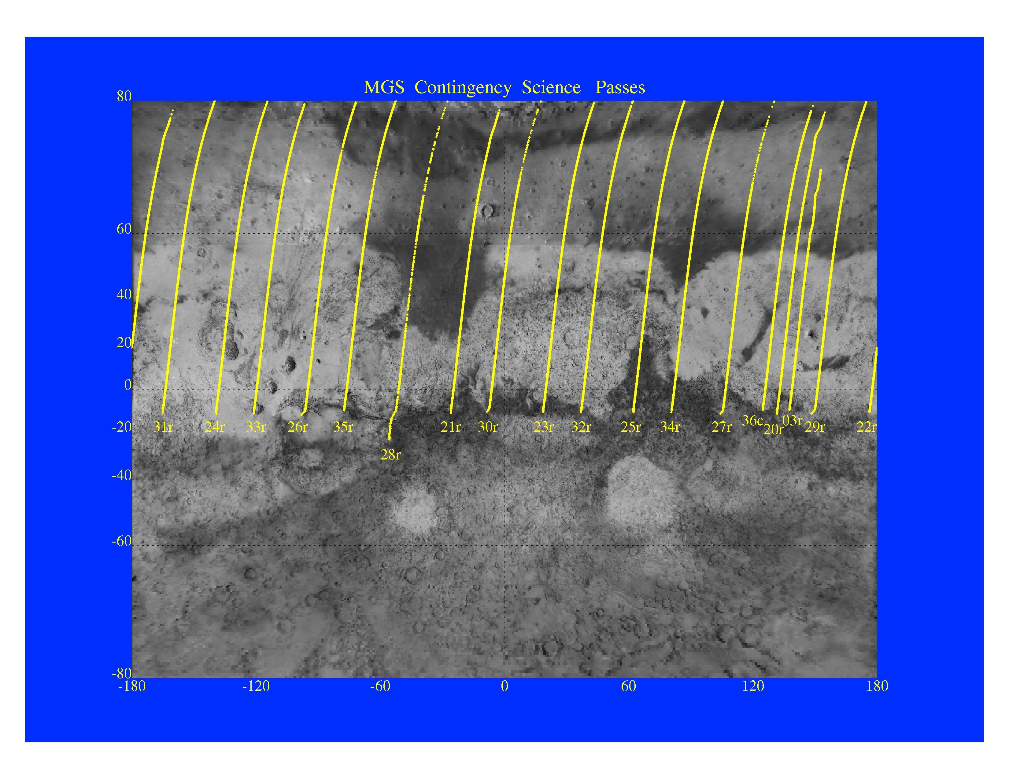
PIA01013:
-
MGS Contingency Science Passes
Full Resolution:
TIFF
(4.409 MB)
JPEG
(879.4 kB)
|
|
|
1997-11-10 |
Mars
|
Mars Global Surveyor (MGS)
|
MOLA
|
3300x2550x3 |
|
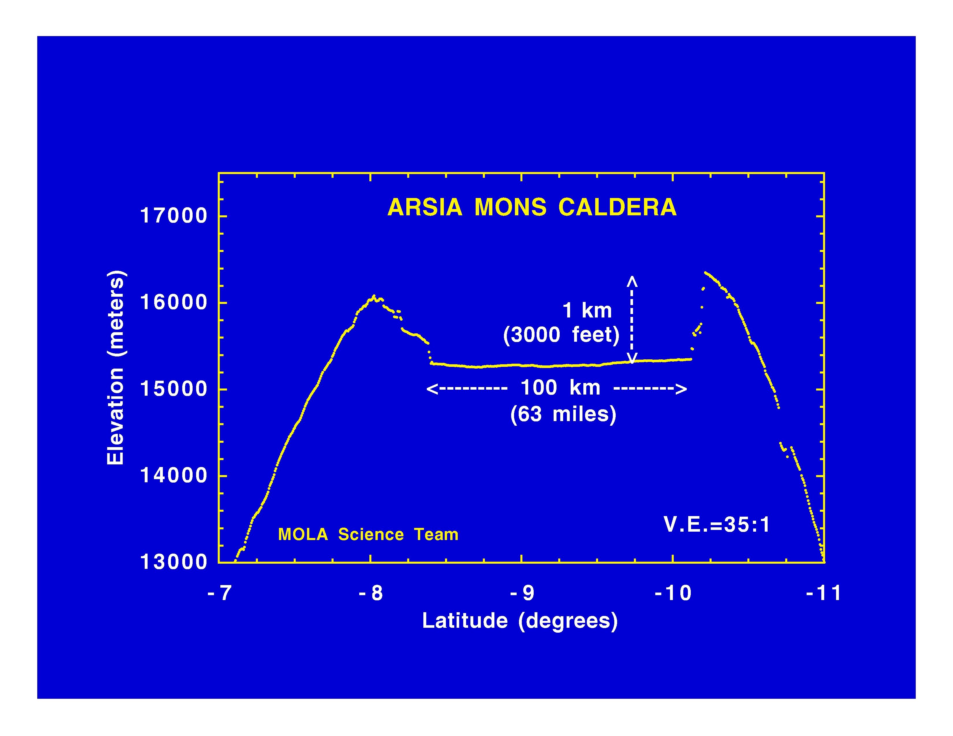
-
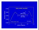
PIA01012:
-
Arsia Mons Caldera
Full Resolution:
TIFF
(534.1 kB)
JPEG
(365.8 kB)
|
|
|
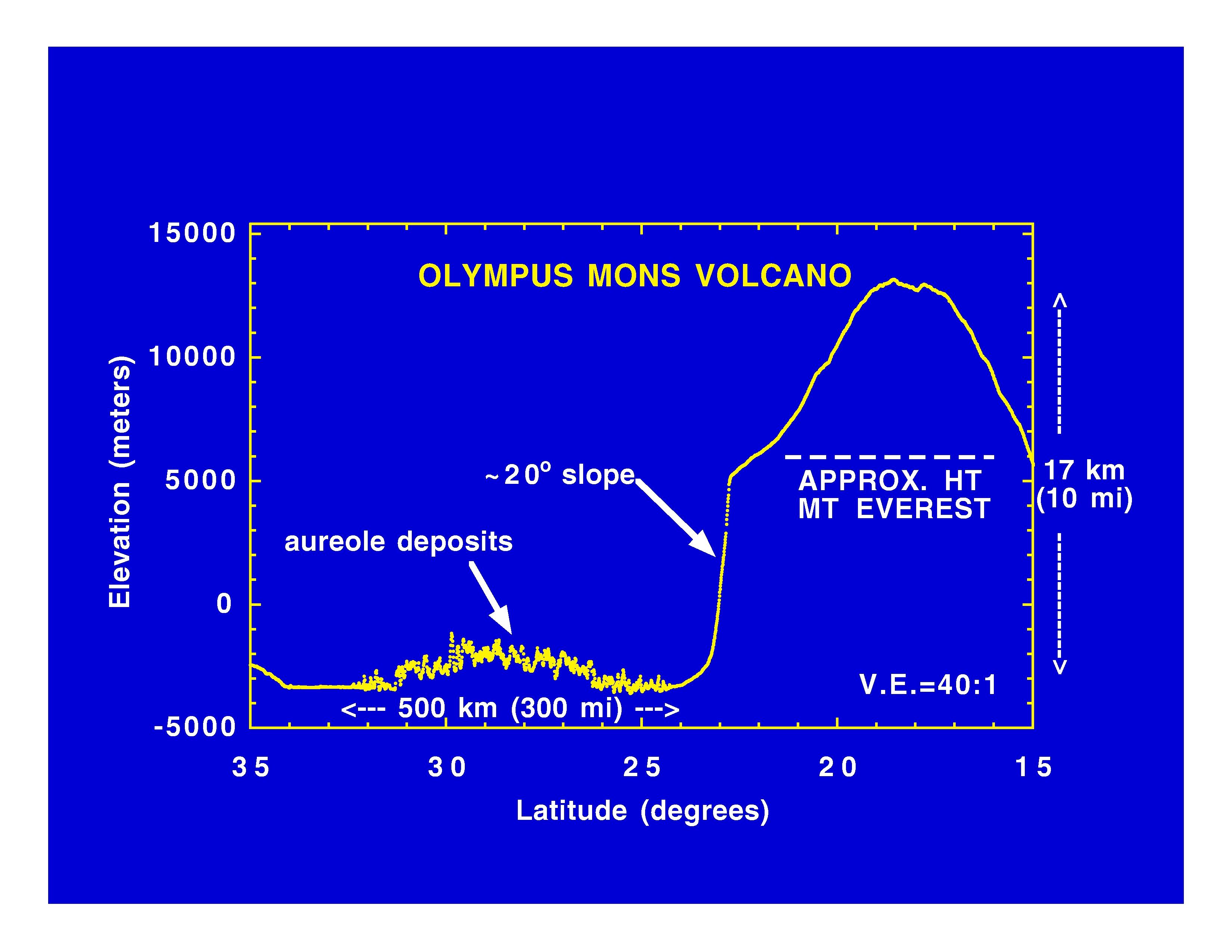
1997-11-10 |
Mars
|
Mars Global Surveyor (MGS)
|
MOLA
|
3300x2550x3 |
|
-
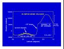
PIA01011:
-
Olympus Mons Volcano
Full Resolution:
TIFF
(625.4 kB)
JPEG
(414.7 kB)
|
|
|
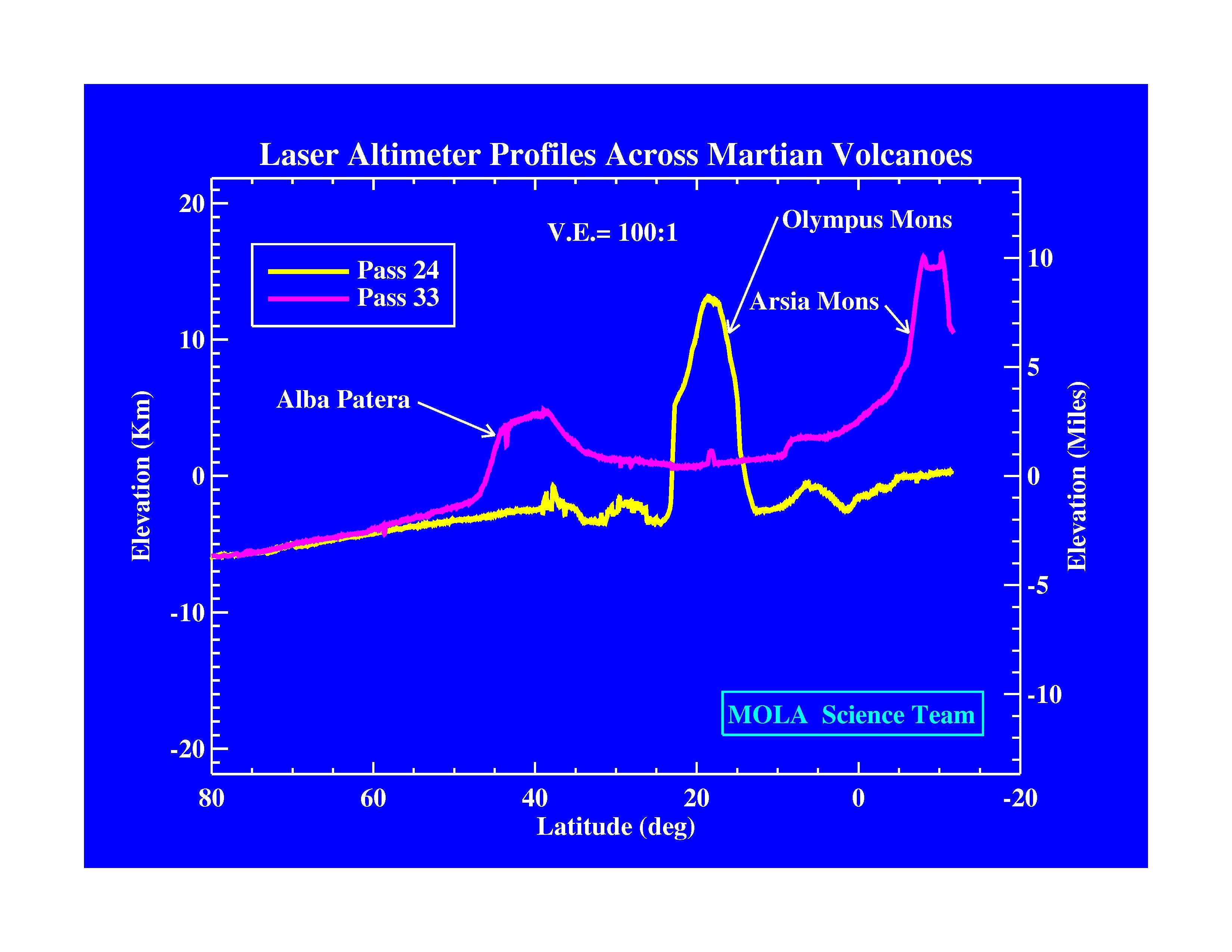
1997-11-10 |
Mars
|
Mars Global Surveyor (MGS)
|
MOLA
|
3300x2550x3 |
|
-
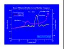
PIA01010:
-
Laser Altimeter Profiles Across Martian Volcanoes
Full Resolution:
TIFF
(677.9 kB)
JPEG
(424.4 kB)
|
|
|
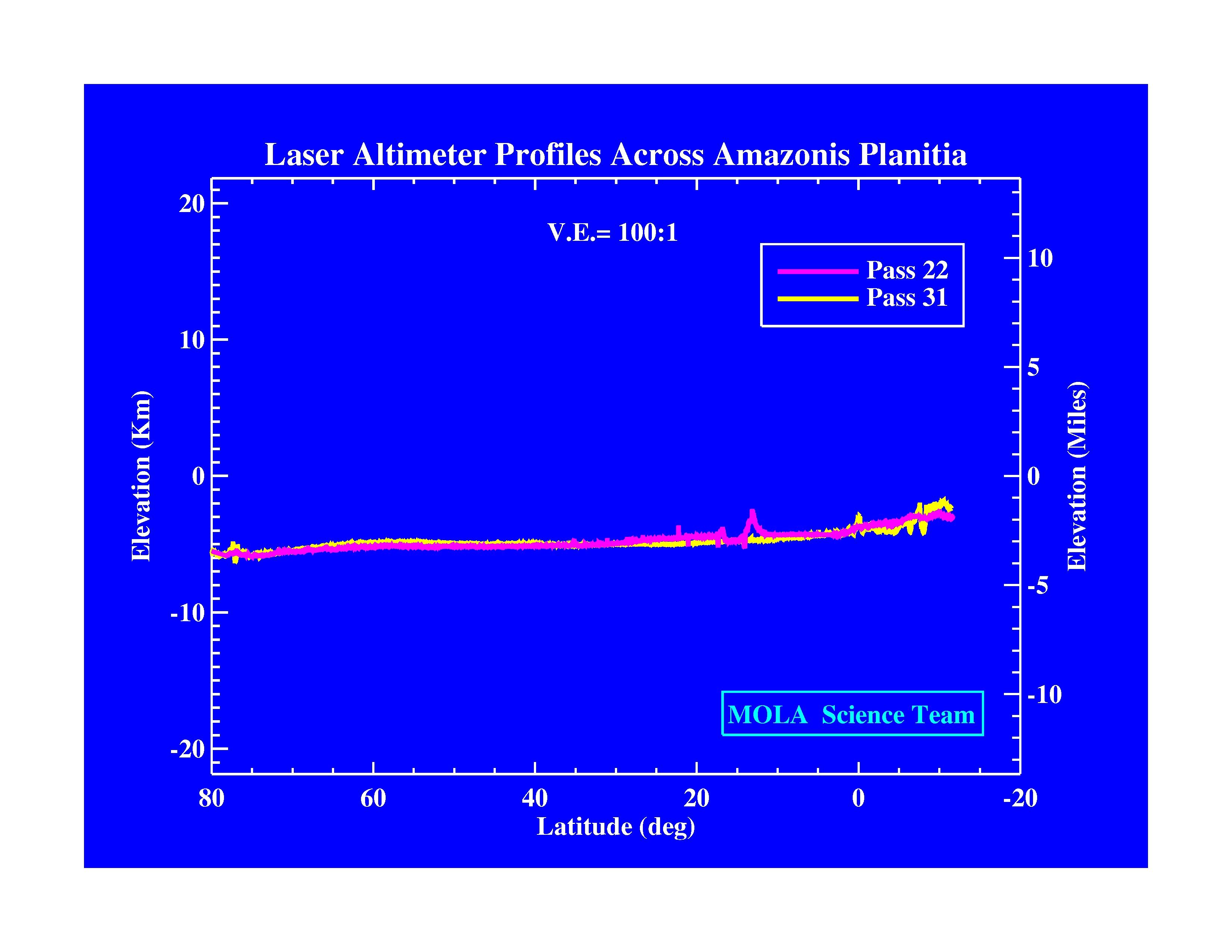
1997-11-10 |
Mars
|
Mars Global Surveyor (MGS)
|
MOLA
|
3300x2550x3 |
|
-
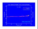
PIA01009:
-
Laser Altimeter Profiles Across Amazonis Planitia
Full Resolution:
TIFF
(530.8 kB)
JPEG
(371.9 kB)
|
|
|
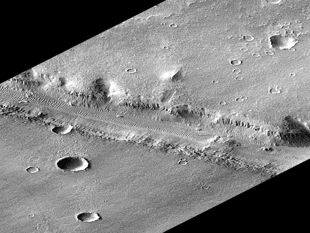
1997-10-15 |
Mars
|
Mars Global Surveyor (MGS)
|
Mars Orbiter Camera (MOC)
|
1023x608x3 |
|
-
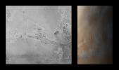
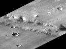
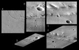
PIA00992:
-
Valles Marineris
Full Resolution:
TIFF
(956.1 kB)
JPEG
(68.46 kB)
|
|
|
1997-10-15 |
Mars
|
Mars Global Surveyor (MGS)
|
Mars Orbiter Camera (MOC)
|
928x1552x3 |
|
-
PIA00991:
-
Valles Marineris
Full Resolution:
TIFF
(3.993 MB)
JPEG
(82.71 kB)
|
|
|
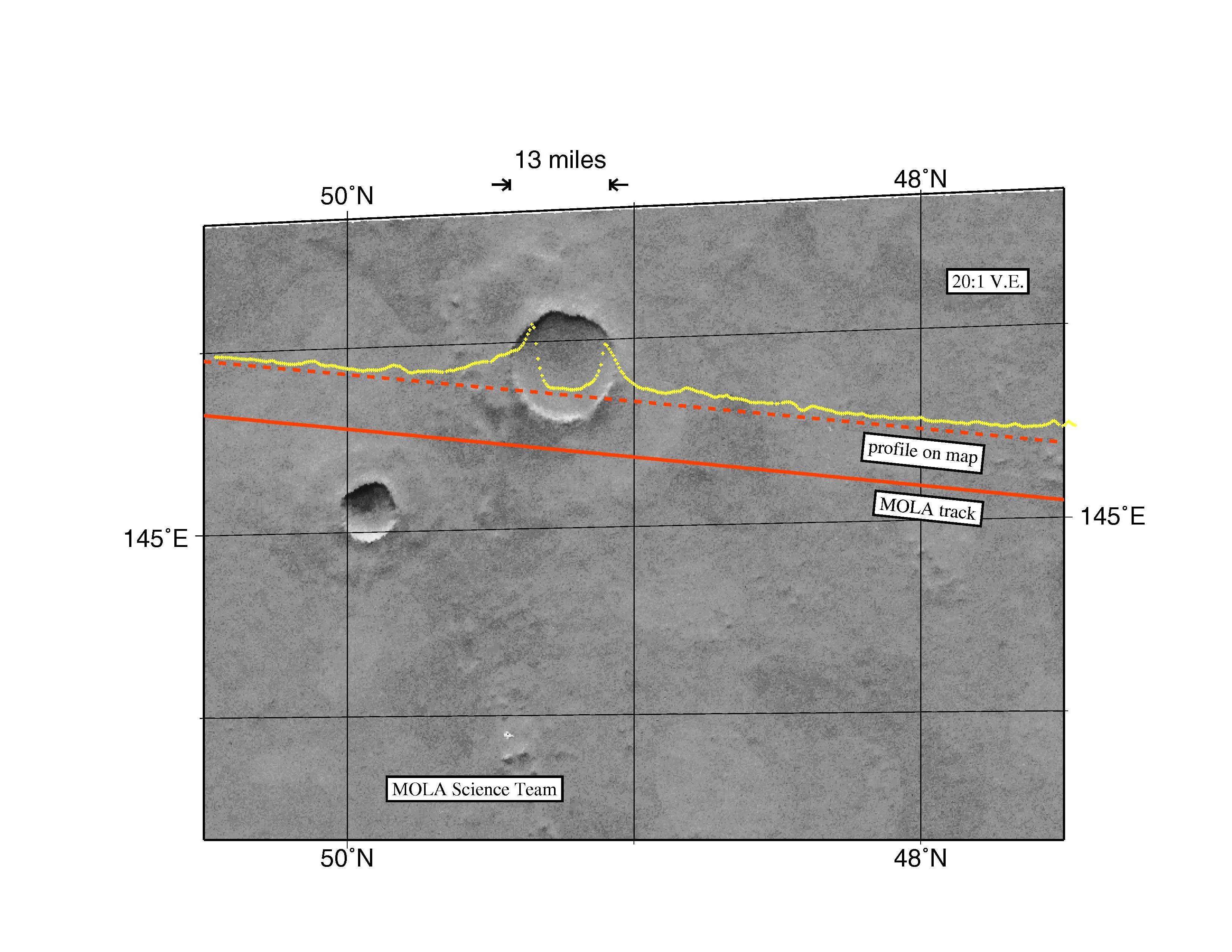
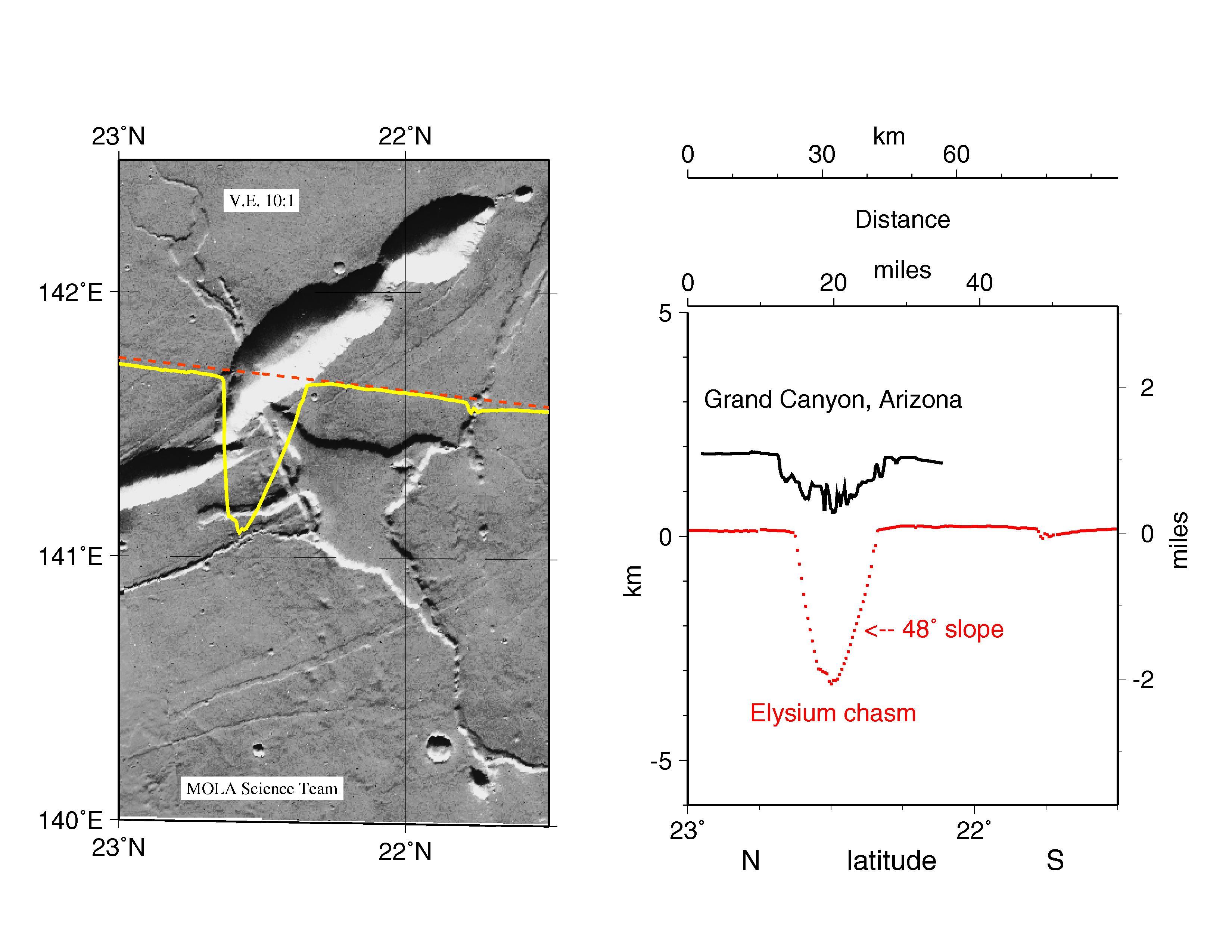
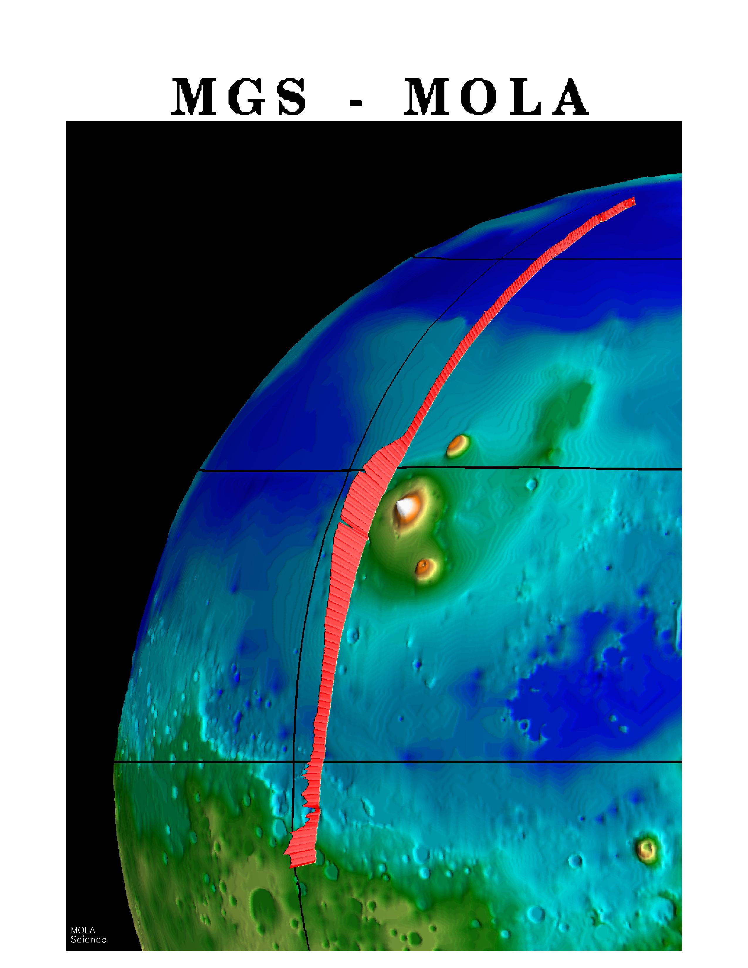
1997-10-13 |
Mars
|
Mars Global Surveyor (MGS)
|
MOLA
|
3300x2550x3 |
|
-
PIA00959:
-
MGS Mars Orbiter Laser Altimeter Topographic Profile of Impact Crater
Full Resolution:
TIFF
(5.47 MB)
JPEG
(741 kB)
|
|
|
1997-10-13 |
Mars
|
Mars Global Surveyor (MGS)
|
MOLA
|
3300x2550x3 |
|
-
PIA00960:
-
MGS Mars Orbiter Laser Altimeter (MOLA) - Mars/Earth Relief Comparison
Full Resolution:
TIFF
(3.639 MB)
JPEG
(615.3 kB)
|
|
|
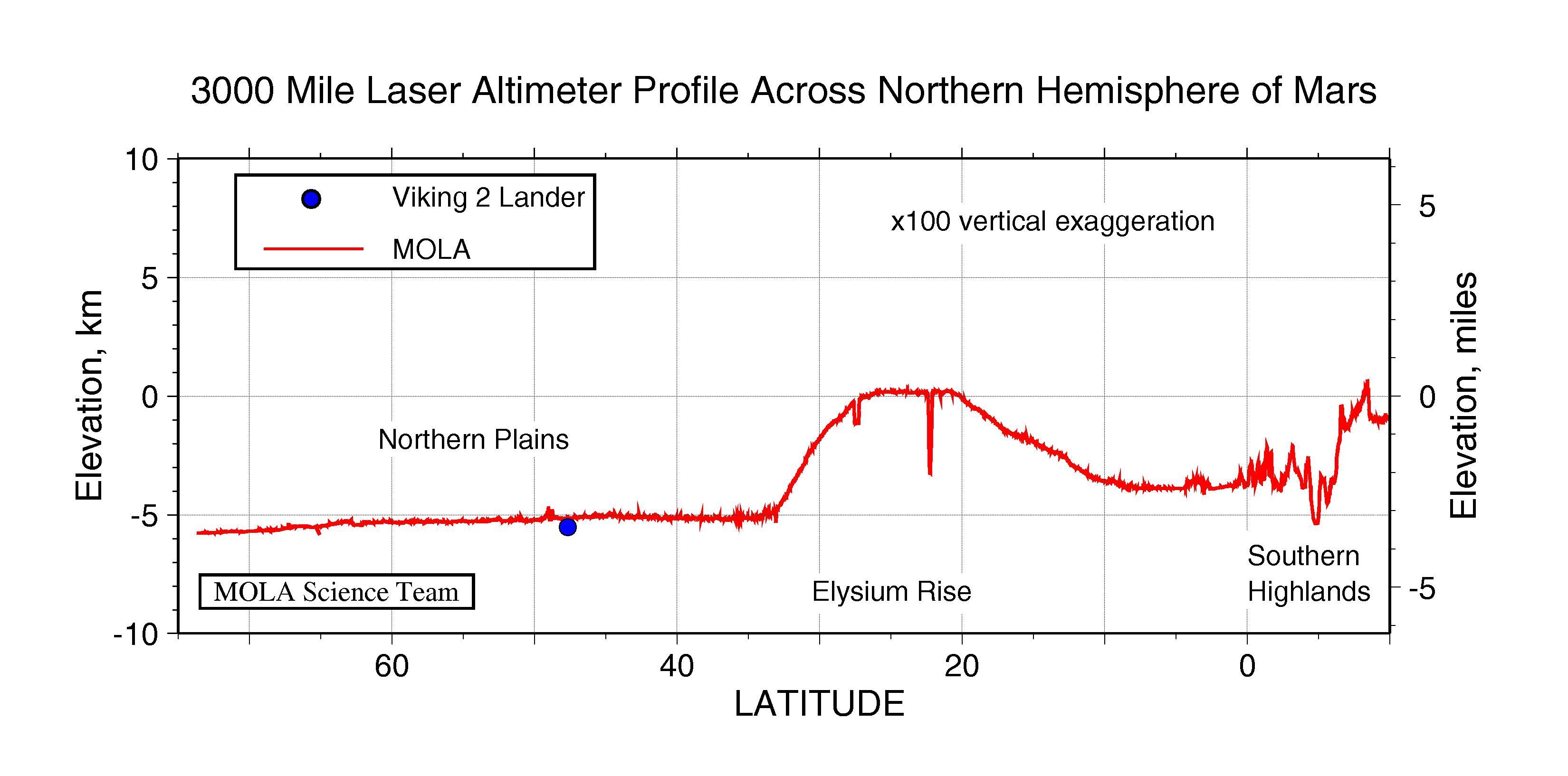
1997-10-13 |
Mars
|
Mars Global Surveyor (MGS)
|
MOLA
|
3300x1634x3 |

|
-
PIA00958:
-
3000 Mile Laser Altimeter Profile Across Northern Hemisphere of Mars
Full Resolution:
TIFF
(730.3 kB)
JPEG
(341 kB)
|
|
|
1997-10-13 |
Mars
|
Mars Global Surveyor (MGS)
|
MOLA
|
2550x3300x3 |
|
-
PIA00957:
-
MGS Mars Orbiter Laser (MOLA) Surface Topography of Northern Hemisphere
Full Resolution:
TIFF
(8.502 MB)
JPEG
(439.4 kB)
|
|
|
1997-10-13 |
Mars
|
Mars Global Surveyor (MGS)
|
Magnetometer
|
715x572x3 |
|
-
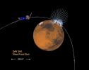
PIA00949:
-
Magnetic Sources in the Crust of Mars
Full Resolution:
TIFF
(360.8 kB)
JPEG
(50.93 kB)
|
|
|
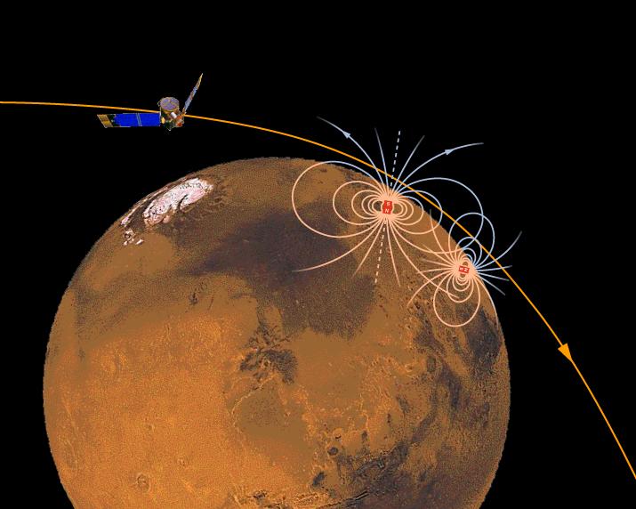
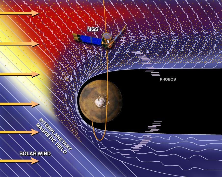
1997-10-13 |
Mars
|
Mars Global Surveyor (MGS)
|
Magnetometer
|
905x723x3 |
|
-
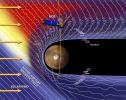
PIA00948:
-
Mars and the Solar Wind
Full Resolution:
TIFF
(1.197 MB)
JPEG
(146.1 kB)
|
|
|
1997-10-13 |
Mars
|
Mars Global Surveyor (MGS)
|
Magnetometer
|
861x689x3 |

|
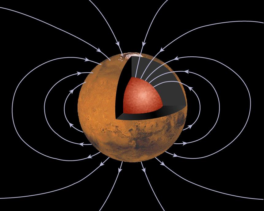
-
PIA00947:
-
Mars' Inner Core
Full Resolution:
TIFF
(232.6 kB)
JPEG
(51.04 kB)
|
|
|
1997-10-13 |
Mars
|
Mars Global Surveyor (MGS)
|
Magnetometer
|
762x609x3 |
|
-
PIA00946:
-
Orientation and Magnitude of Mars' Magnetic Field
Full Resolution:
TIFF
(178.7 kB)
JPEG
(31.52 kB)
|
|
|
1997-10-02 |
Mars
|
Mars Global Surveyor (MGS)
|
Mars Orbiter Camera (MOC)
|
630x504x1 |
|
-
PIA00943:
-
Subsection of Nirgal Vallis Image
Full Resolution:
TIFF
(325.3 kB)
JPEG
(101.6 kB)
|
|
|
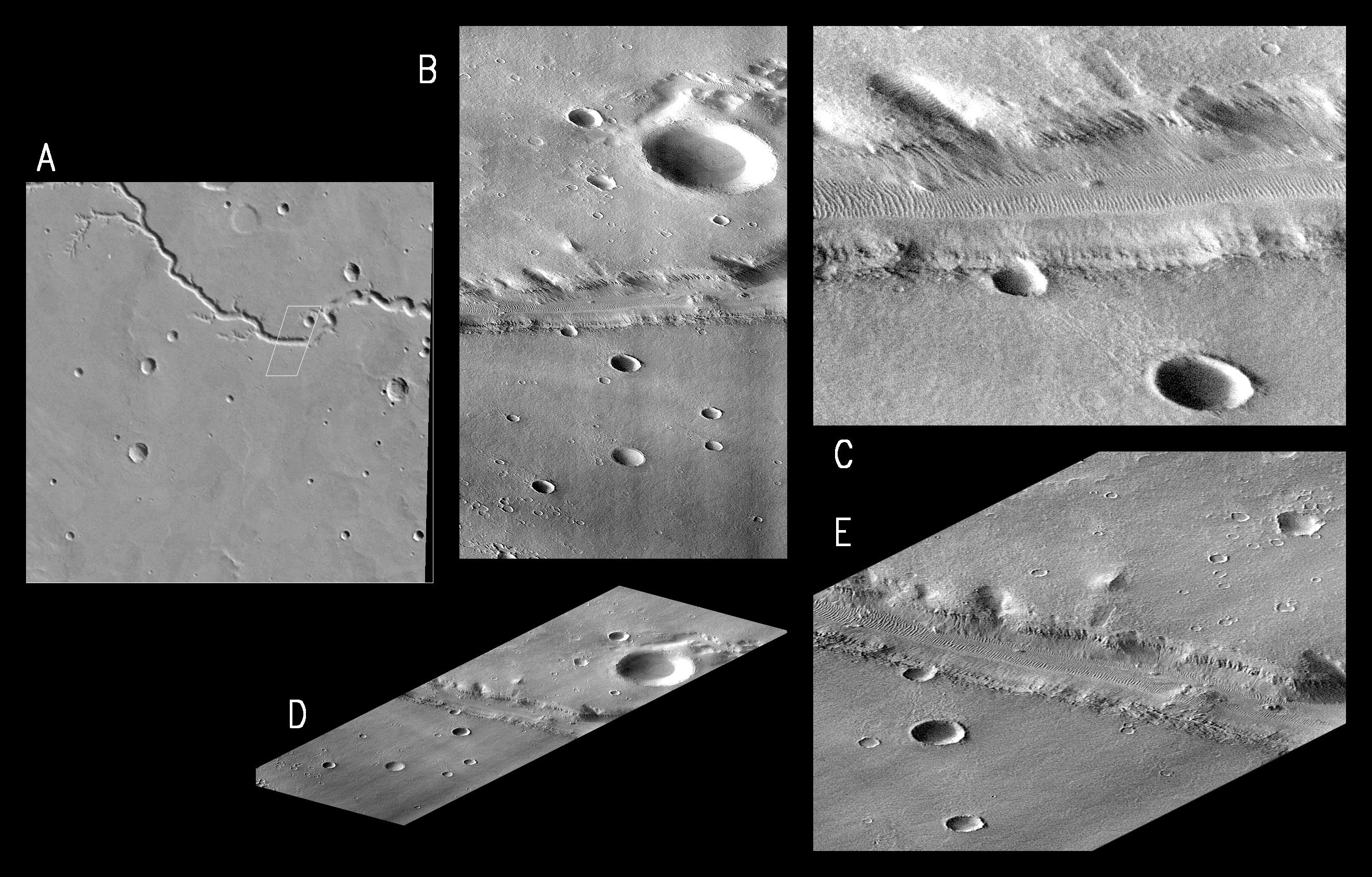
1997-10-02 |
Mars
|
Mars Global Surveyor (MGS)
|
Mars Orbiter Camera (MOC)
|
1024x768x1 |
|
-
PIA00944:
-
Rotated Perspective View of Nirgal Vallis
Full Resolution:
TIFF
(625.1 kB)
JPEG
(193.6 kB)
|
|
|
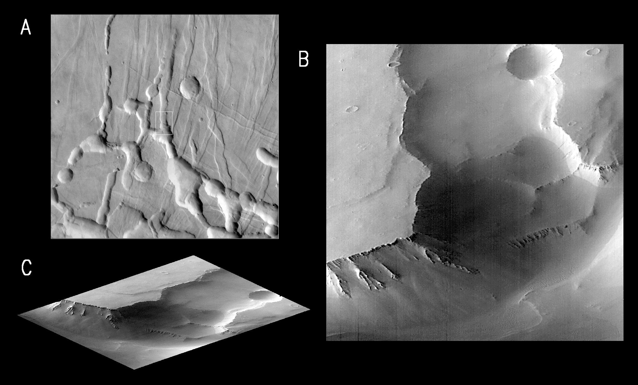
1997-10-02 |
Mars
|
Mars Global Surveyor (MGS)
|
Mars Orbiter Camera (MOC)
|
1024x1024x1 |
|
-
PIA00945:
-
MGS Views of Labyrinthus Noctis
Full Resolution:
TIFF
(588.8 kB)
JPEG
(124.5 kB)
|
|
|
1997-10-02 |
Mars
|
Mars Global Surveyor (MGS)
|
Mars Orbiter Camera (MOC)
|
2637x1686x1 |
|
-
PIA00942:
-
MGS Views of Nirgal Vallis
Full Resolution:
TIFF
(2.573 MB)
JPEG
(722.7 kB)
|
|
|
1997-10-02 |
Mars
|
Mars Global Surveyor (MGS)
|
Mars Orbiter Camera (MOC)
|
2198x1328x1 |

|
-
PIA00941:
-
MGS Views of Labyrinthus Noctis
Full Resolution:
TIFF
(1.163 MB)
JPEG
(260.3 kB)
|
|
|
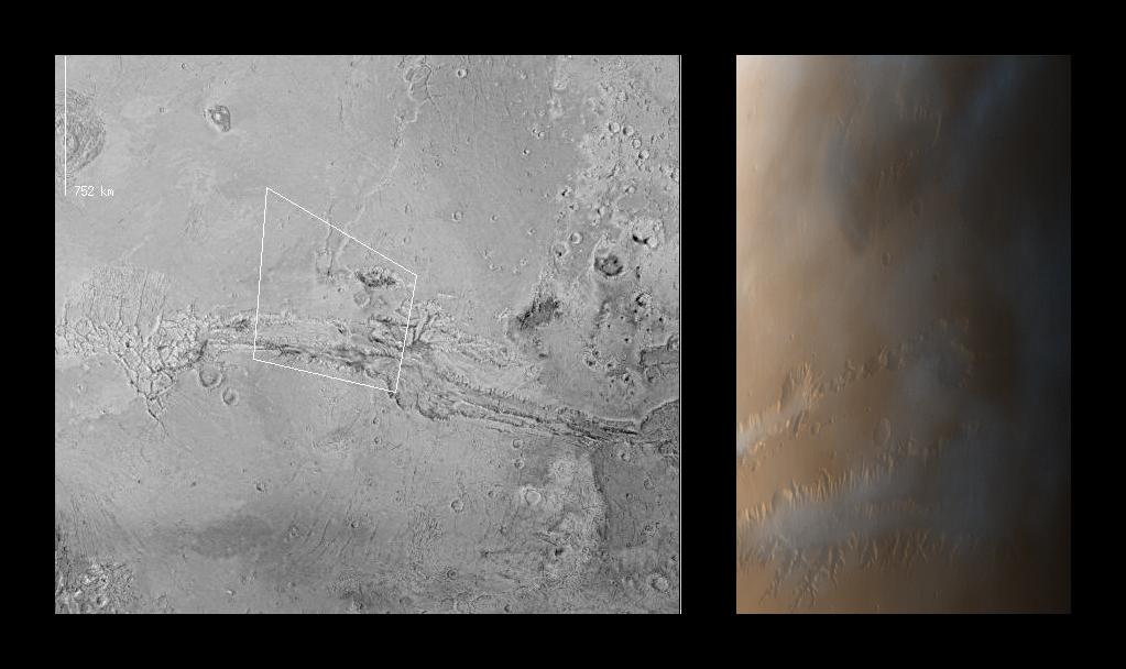
1997-09-24 |
Mars
|
Mars Global Surveyor (MGS)
|
Thermal Emission Spectrometer
|
554x553x3 |
|
-
PIA00937:
-
MGS Thermal Emission Spectrometer Image
Full Resolution:
TIFF
(90.26 kB)
JPEG
(80.87 kB)
|
|
|
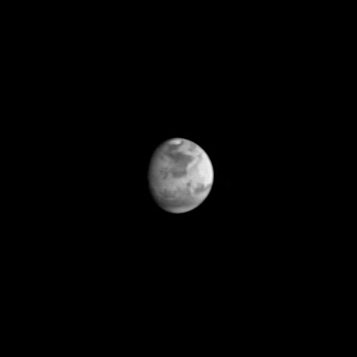
1997-09-10 |
Mars
|
Mars Global Surveyor (MGS)
|
Mars Orbiter Camera (MOC)
|
512x512x1 |
|
-
PIA00936:
-
MGS Approach Image - 127.2° W Longitude
Full Resolution:
TIFF
(48.34 kB)
JPEG
(9.972 kB)
|
|
|
1997-09-10 |
Mars
|
Mars Global Surveyor (MGS)
|
Mars Orbiter Camera (MOC)
|
512x512x1 |
|
-
PIA00935:
-
MGS Approach Image - 37.2° W Longitude
Full Resolution:
TIFF
(47.3 kB)
JPEG
(9.643 kB)
|
|
|
1997-09-10 |
Mars
|
Mars Global Surveyor (MGS)
|
Mars Orbiter Camera (MOC)
|
512x512x1 |
|
-
PIA00934:
-
MGS Approach Image - 307.3° W Longitude
Full Resolution:
TIFF
(46.05 kB)
JPEG
(9.347 kB)
|
|
|
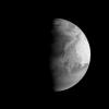
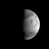
1997-09-10 |
Mars
|
Mars Global Surveyor (MGS)
|
Mars Orbiter Camera (MOC)
|
512x512x1 |
|
-
PIA00933:
-
MGS Approach Image - 217.4° W Longitude
Full Resolution:
TIFF
(45.74 kB)
JPEG
(9.268 kB)
|
|
|
1997-09-10 |
Mars
|
Mars Global Surveyor (MGS)
|
Mars Orbiter Camera (MOC)
|
512x512x1 |
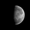
|
-
PIA00932:
-
MGS Approach Image - 82.1° W Longitude
Full Resolution:
TIFF
(44.85 kB)
JPEG
(9.484 kB)
|
|
|
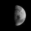
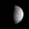
1997-09-10 |
Mars
|
Mars Global Surveyor (MGS)
|
Mars Orbiter Camera (MOC)
|
512x512x1 |

|
-
PIA00931:
-
MGS Approach Image - 352.2° W Longitude
Full Resolution:
TIFF
(44.39 kB)
JPEG
(9.87 kB)
|
|
|
1997-09-10 |
Mars
|
Mars Global Surveyor (MGS)
|
Mars Orbiter Camera (MOC)
|
512x512x1 |
|
-
PIA00930:
-
MGS Approach Image - 262.3° W Longitude
Full Resolution:
TIFF
(42.21 kB)
JPEG
(8.863 kB)
|
|
|
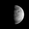
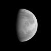
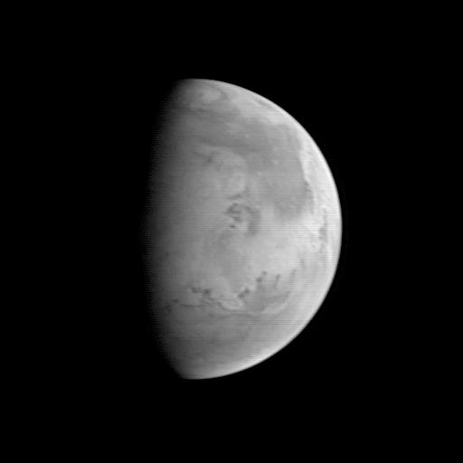
1997-09-10 |
Mars
|
Mars Global Surveyor (MGS)
|
Mars Orbiter Camera (MOC)
|
512x512x1 |
|
-
PIA00929:
-
MGS Approach Image - 172.4° W Longitude
Full Resolution:
TIFF
(42.96 kB)
JPEG
(8.111 kB)
|
|
|
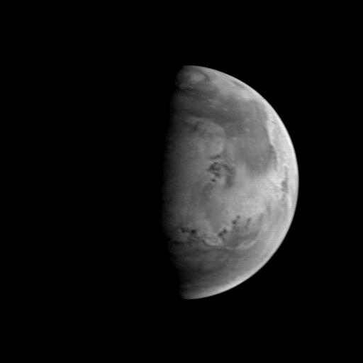
1997-08-22 |
Mars
|
Mars Global Surveyor (MGS)
|
Mars Orbiter Camera (MOC)
|
512x512x1 |

|
-
PIA00912:
-
MGS Approach Image - Elysium Region
Full Resolution:
TIFF
(54.8 kB)
JPEG
(9.524 kB)
|
|
|
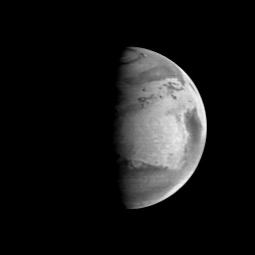
1997-08-22 |
Mars
|
Mars Global Surveyor (MGS)
|
Mars Orbiter Camera (MOC)
|
512x512x1 |
|
-
PIA00911:
-
MGS Approach Image - Chryse Planitia
Full Resolution:
TIFF
(52.54 kB)
JPEG
(9.599 kB)
|
|
|
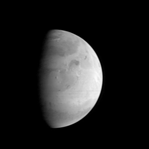
1997-08-22 |
Mars
|
Mars Global Surveyor (MGS)
|
Mars Orbiter Camera (MOC)
|
512x512x1 |

|
-
PIA00910:
-
MGS Approach Image - Syrtis Major Region
Full Resolution:
TIFF
(54.19 kB)
JPEG
(9.769 kB)
|
|
|
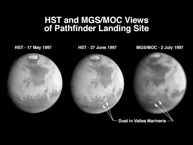
1997-07-04 |
Mars
|
Mars Global Surveyor (MGS)
|
Mars Orbiter Camera (MOC)
|
640x480x1 |
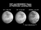
|
-
PIA00607:
-
Hubble and Mars Global Surveyor Views of Dust Storm on Mars
Full Resolution:
TIFF
(86.26 kB)
JPEG
(27.45 kB)
|
|
|
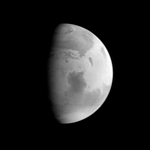
1997-07-04 |
Mars
|
Mars Global Surveyor (MGS)
|
Mars Orbiter Camera (MOC)
|
512x512x1 |

|
-
PIA00606:
-
Mars Global Surveyor Approach Image
Full Resolution:
TIFF
(8.131 kB)
JPEG
(4.696 kB)
|
 Planetary Data System


