Click on an image for detailed information
Click on a column heading to sort in ascending or descending order

My
List |
Addition Date
|
Target
|
Mission
|
Instrument
|
Size
|

|
2006-06-15 |
Mars
|
Mars Exploration Rover (MER)
|
Microscopic Imager
Panoramic Camera
|
2116x1846x3 |

|
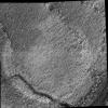
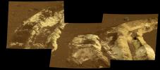
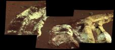
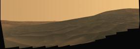
-
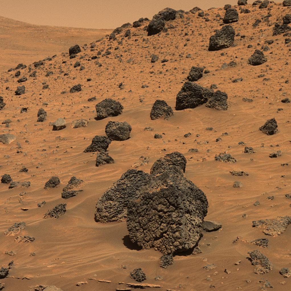
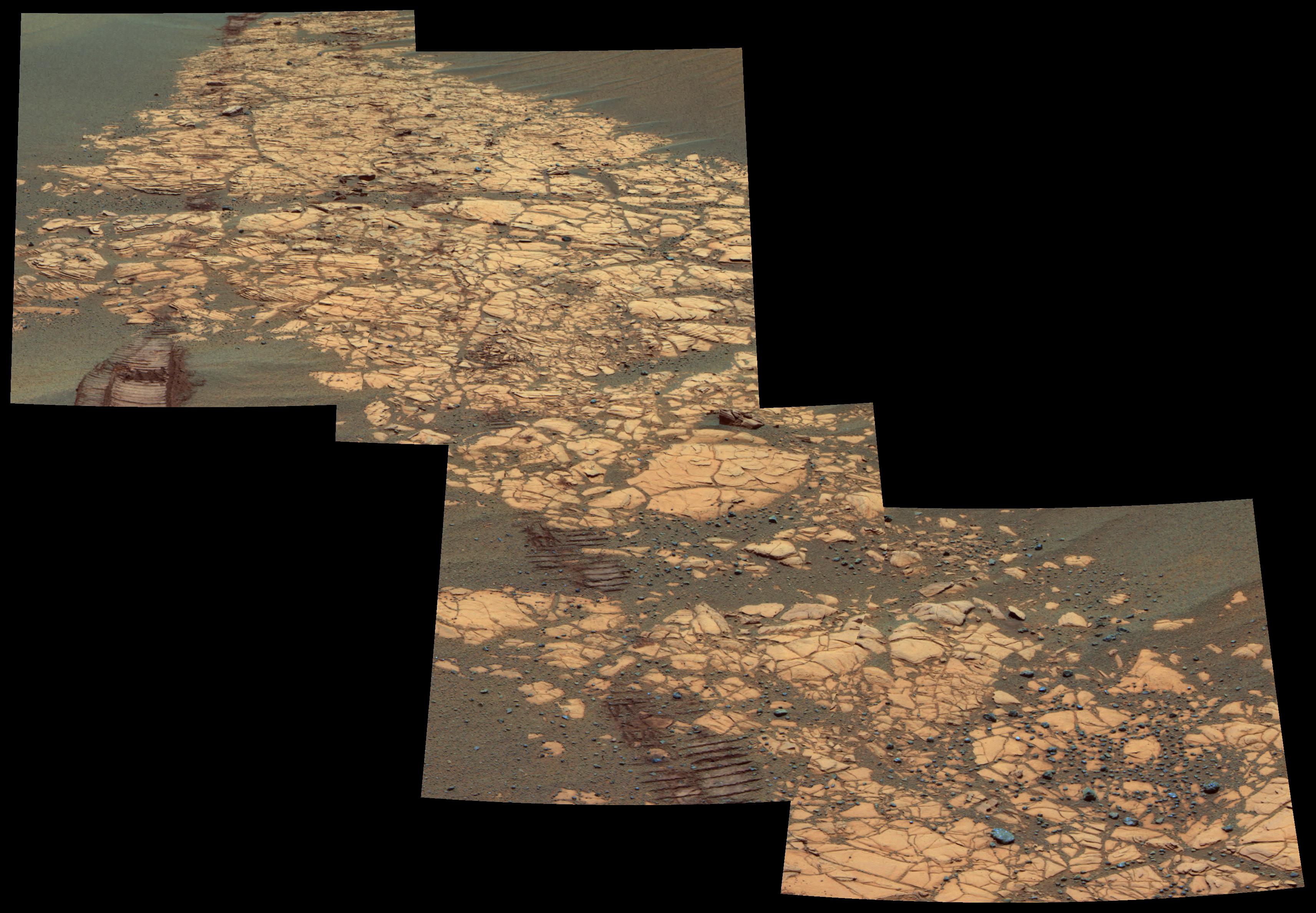
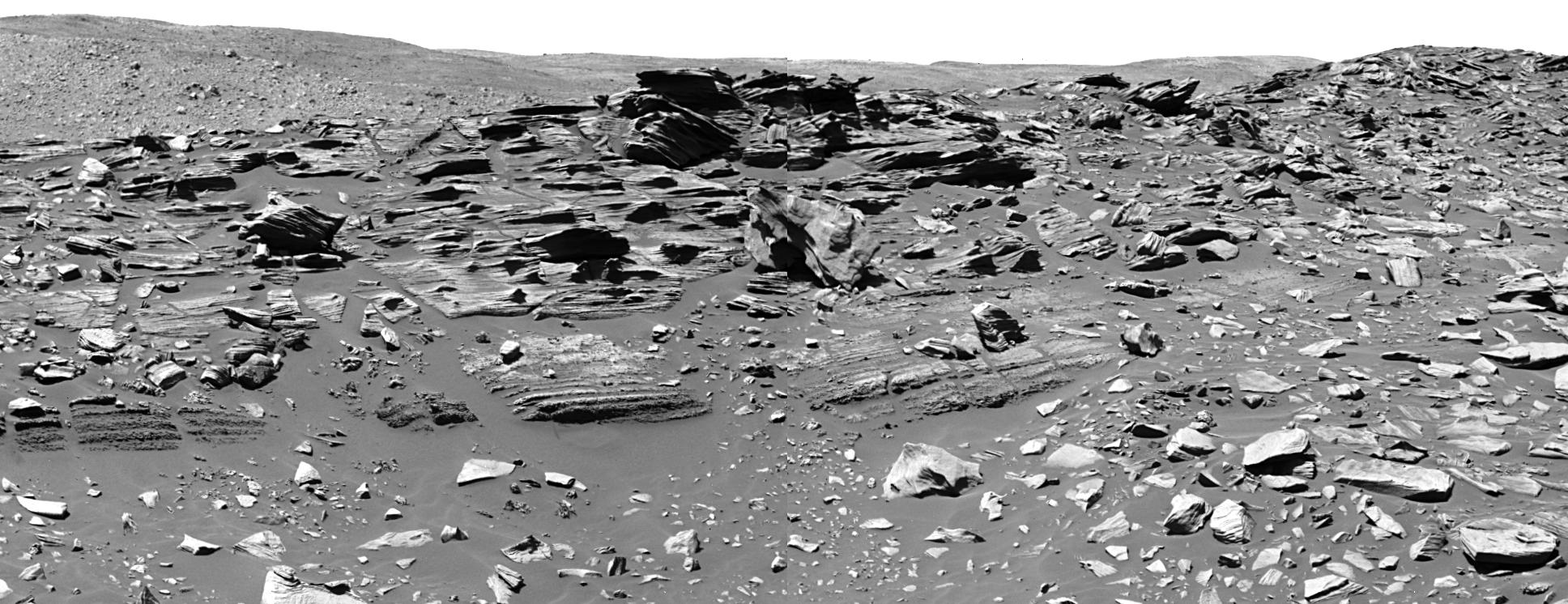
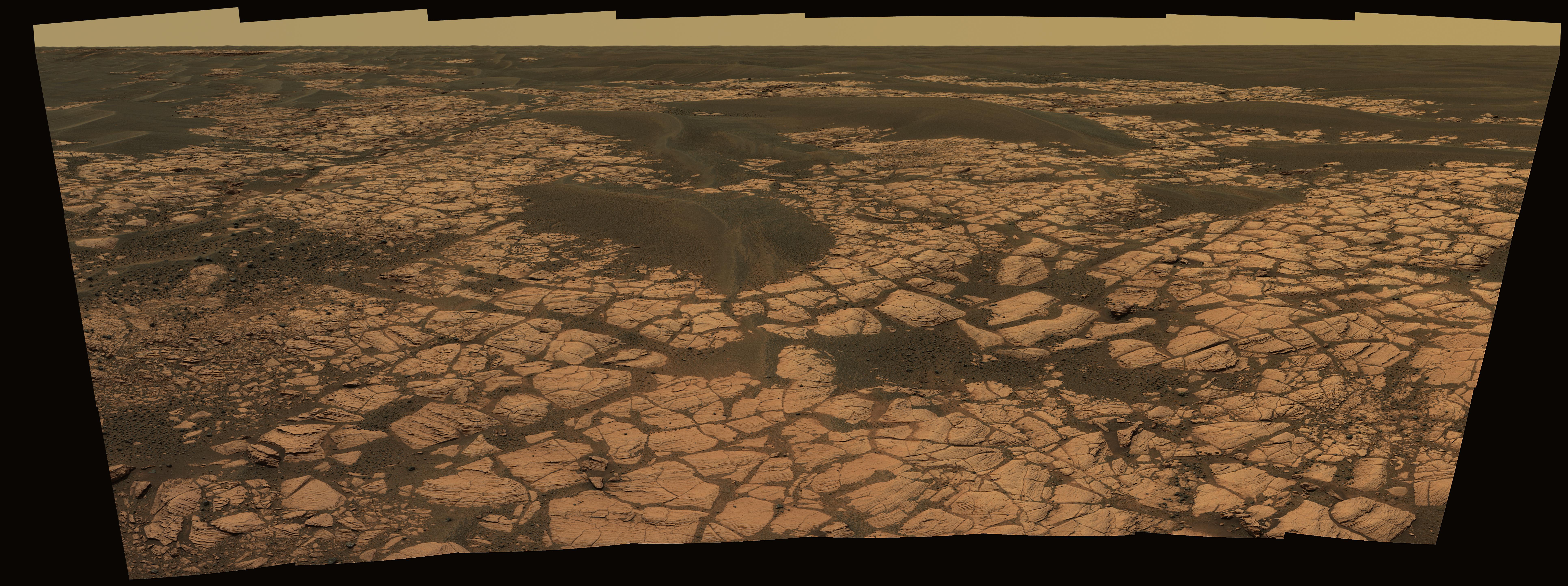
PIA08543:
-
A Peek into 'Alamogordo Creek'
Full Resolution:
TIFF
(11.73 MB)
JPEG
(535.4 kB)
|
|
|
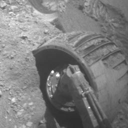
2006-06-09 |
Mars
|
Mars Exploration Rover (MER)
|
Hazcam
|
512x496x1 |
|
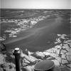
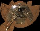
-
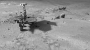
PIA08532:
-
Opportunity Rolls Free Again (Four Wheels)

Full Resolution:
TIFF
(254.4 kB)
JPEG
(29.26 kB)
|
|
|
2006-06-09 |
Mars
|
Mars Exploration Rover (MER)
|
Hazcam
|
256x256x1 |
|
-
PIA08531:
-
Opportunity Rolls Free Again (Left Front Wheel)
Full Resolution:
TIFF
(65.83 kB)
JPEG
(10.84 kB)
|
|
|
2006-06-09 |
Mars
|
Mars Exploration Rover (MER)
|
Hazcam
|
256x256x1 |

|
-
PIA08530:
-
Opportunity Rolls Free Again (Right Front Wheel)
Full Resolution:
TIFF
(65.83 kB)
JPEG
(10.29 kB)
|
|
|
2006-06-09 |
Mars
|
Mars Exploration Rover (MER)
|
Panoramic Camera
|
710x568x3 |
|
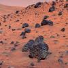
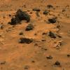
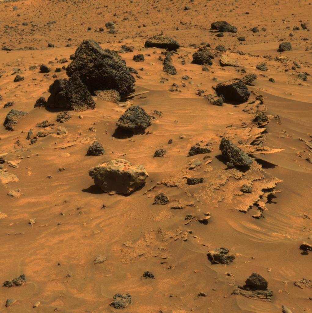
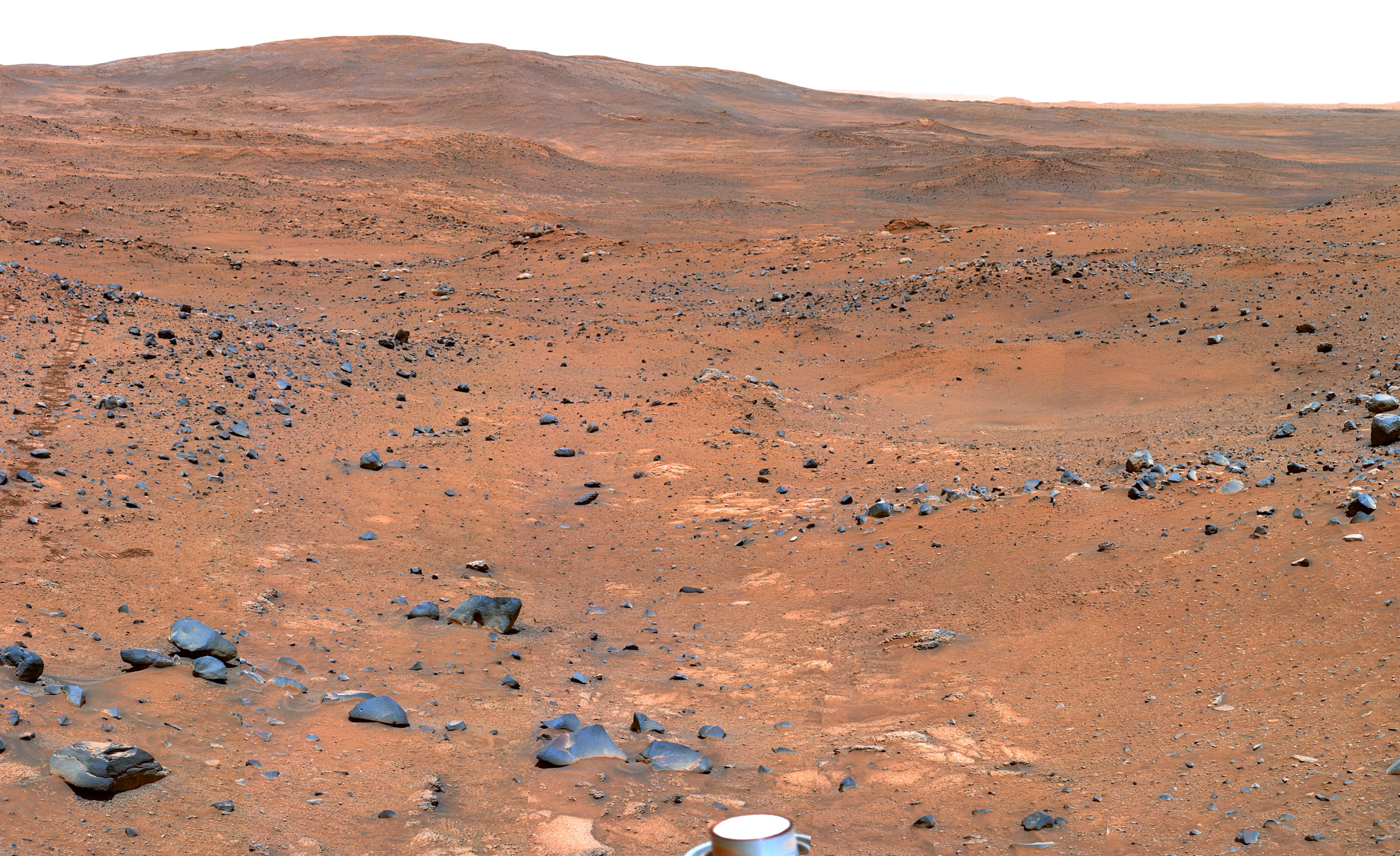
-
PIA08529:
-
Possible Meteorite in 'Columbia Hills' on Mars
Full Resolution:
TIFF
(1.212 MB)
JPEG
(61.88 kB)
|
|
|
2006-06-09 |
Mars
|
Mars Exploration Rover (MER)
|
Panoramic Camera
|
709x568x3 |
|
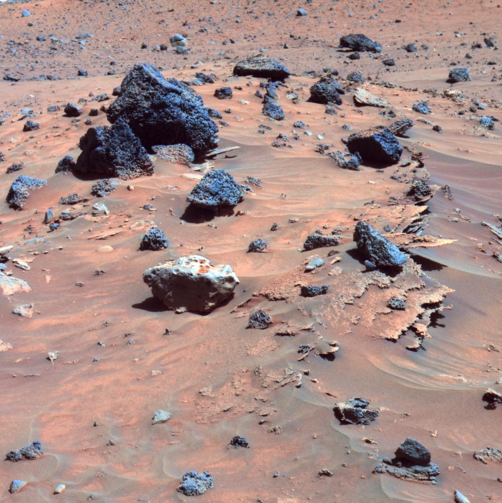
-
PIA08528:
-
Possible Meteorite in 'Columbia Hills' on Mars (False Color)
Full Resolution:
TIFF
(1.21 MB)
JPEG
(78.29 kB)
|
|
|
2006-06-09 |
Mars
|
Mars Exploration Rover (MER)
|
Panoramic Camera
|
3341x1176x3 |

|
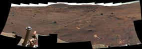
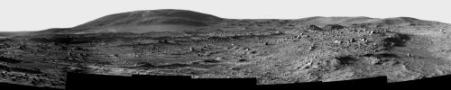
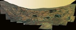
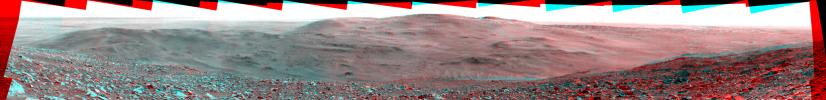
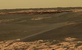
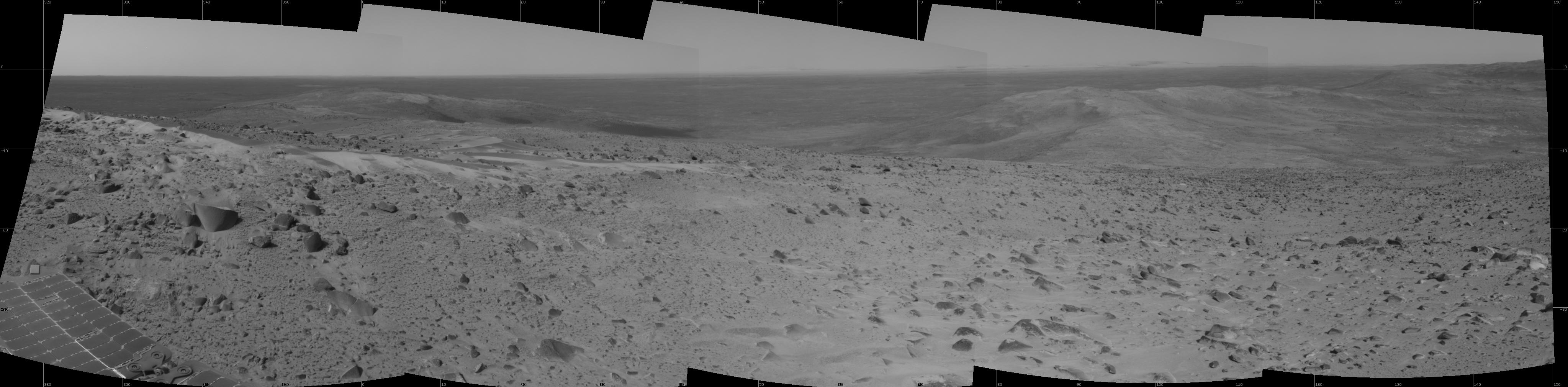
-
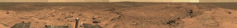
PIA08527:
-
View Northward from Spirit's Winter Roost
Full Resolution:
TIFF
(11.79 MB)
JPEG
(415.8 kB)
|
|
|
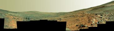
2006-06-09 |
Mars
|
Mars Exploration Rover (MER)
|
Panoramic Camera
|
3341x1176x3 |
|
-
PIA08526:
-
View Northward from Spirit's Winter Roost (False Color)
Full Resolution:
TIFF
(11.79 MB)
JPEG
(465.8 kB)
|
|
|
2006-05-30 |
Mars
|
Mars Exploration Rover (MER)
|
Microscopic Imager
|
2030x2034x1 |
|
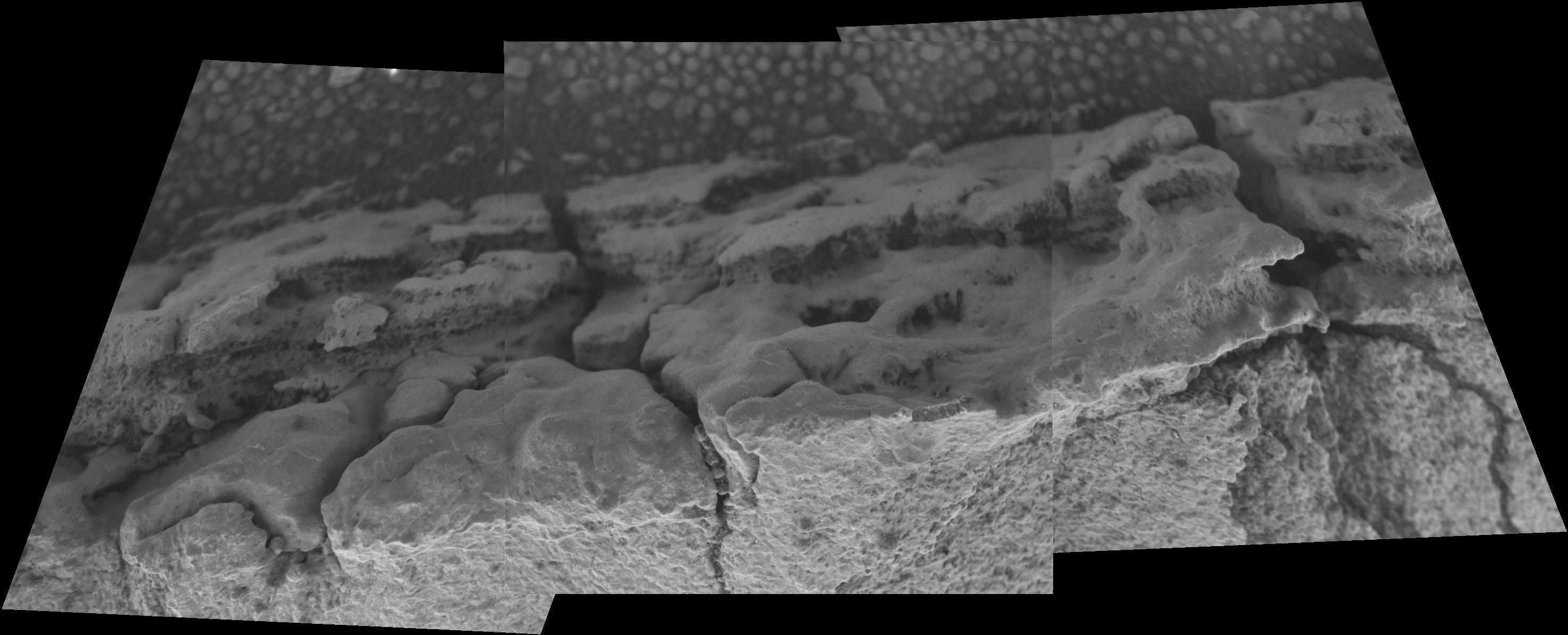
-
PIA08499:
-
Close-Up of 'Cheyenne'
Full Resolution:
TIFF
(4.133 MB)
JPEG
(823.2 kB)
|
|
|
2006-05-30 |
Mars
|
Mars Exploration Rover (MER)
|
Navigation Camera
|
12878x6192x1 |
|
-
PIA08497:
-
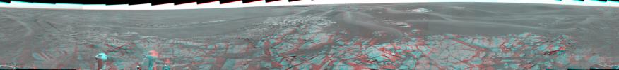
Disturbed Soil Along the Path from 'Tyrone'(Panorama)
Full Resolution:
TIFF
(79.74 MB)
JPEG
(3.089 MB)
|
|
|
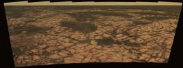
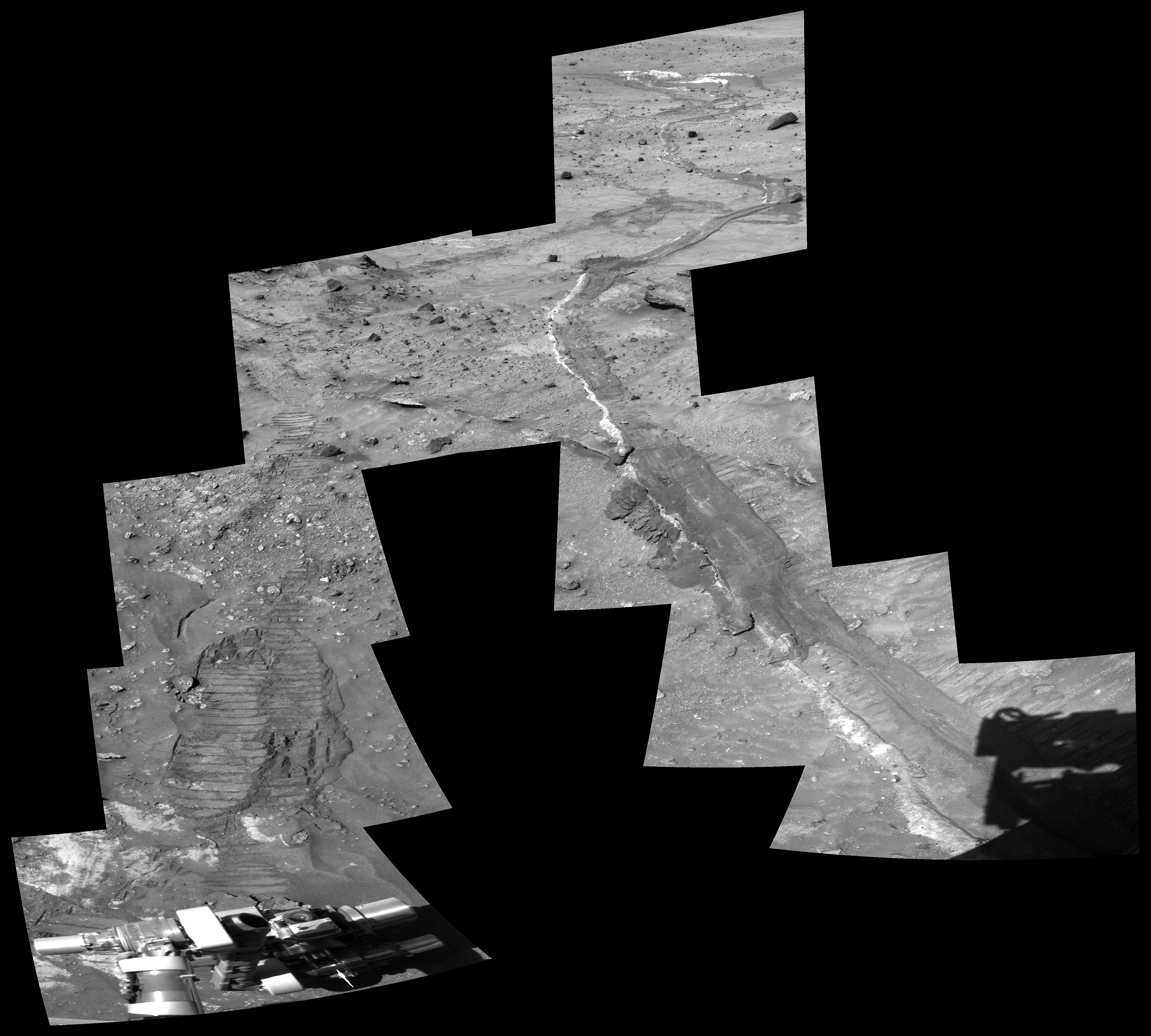
2006-05-30 |
Mars
|
Mars Exploration Rover (MER)
|
Panoramic Camera
|
4658x4194x1 |

|
-
PIA08495:
-
Disturbed Soil Along the Path from 'Tyrone' (Close-Up)
Full Resolution:
TIFF
(19.57 MB)
JPEG
(1.498 MB)
|
|
|
2006-05-24 |
Mars
|
Mars Exploration Rover (MER)
|
Navigation Camera
|
2701x1046x1 |
|
-
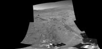
PIA08480:
-
Opportunity's Outcrop Outing
Full Resolution:
TIFF
(2.828 MB)
JPEG
(354.3 kB)
|
|
|
2006-05-19 |
Mars
|
Mars Exploration Rover (MER)
|
Panoramic Camera
|
1968x1016x3 |
|
-
PIA08467:
-
Cobbles in Troughs Between Meridiani Ripples
Full Resolution:
TIFF
(6.007 MB)
JPEG
(157.5 kB)
|
|
|
2006-05-19 |
Mars
|
Mars Exploration Rover (MER)
|
Panoramic Camera
|
1968x1016x3 |
|
-
PIA08466:
-
Cobbles in Troughs Between Meridiani Ripples (False Color)
Full Resolution:
TIFF
(6.007 MB)
JPEG
(349.2 kB)
|
|
|
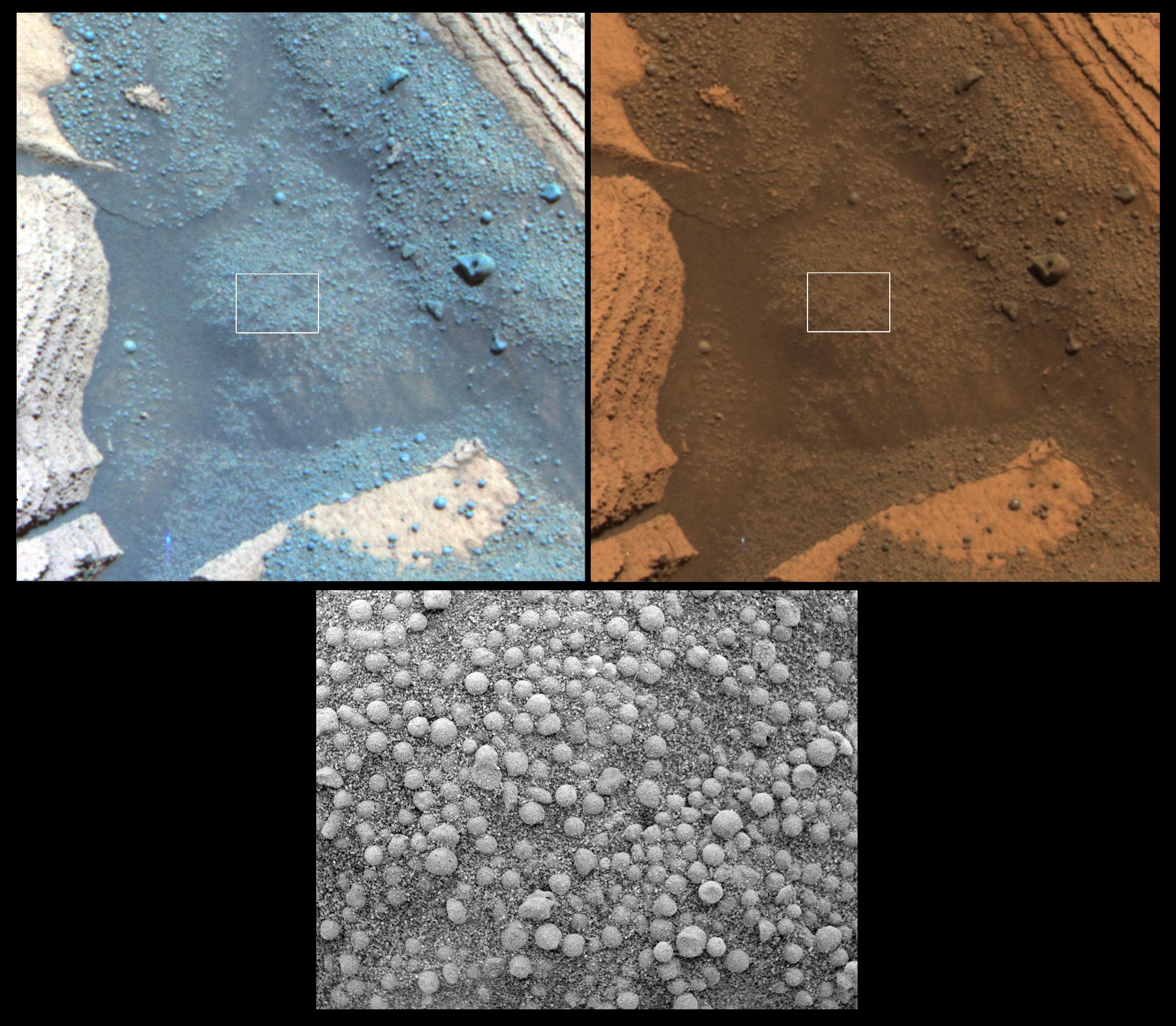
2006-05-12 |
Mars
|
Mars Exploration Rover (MER)
|
Microscopic Imager
|
1847x1892x1 |
|
-
PIA08455:
-
Looking for Changes in Soil over Time
Full Resolution:
TIFF
(3.499 MB)
JPEG
(527.5 kB)
|
|
|
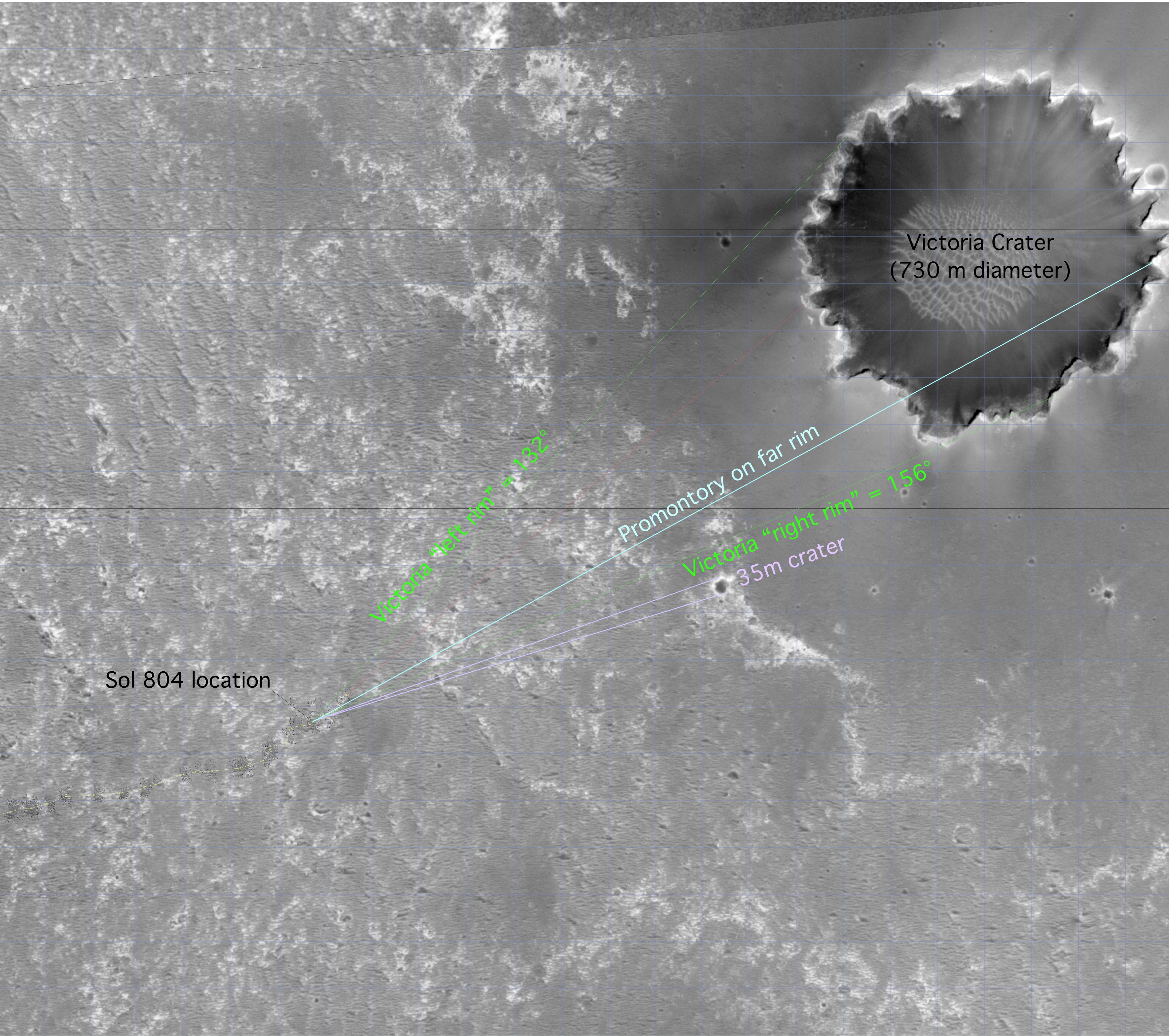
2006-05-08 |
Mars
|
Mars Global Surveyor (MGS)
Mars Exploration Rover (MER)
|
Mars Orbiter Camera (MOC)
|
4973x4407x3 |
|
-
PIA08447:
-
'Victoria' on Opportunity's Horizon (Orbital View)
Full Resolution:
TIFF
(65.75 MB)
JPEG
(2.126 MB)
|
|
|
2006-05-08 |
Mars
|
Mars Exploration Rover (MER)
|
Panoramic Camera
|
4080x1409x1 |

|
-
PIA08446:
-
Stretched View Showing 'Victoria'
Full Resolution:
TIFF
(5.755 MB)
JPEG
(555.5 kB)
|
|
|
2006-05-05 |
Mars
|
Mars Exploration Rover (MER)
|
Panoramic Camera
|
1022x1024x3 |

|
-
PIA08440:
-
Spirit Beholds Bumpy Boulder
Full Resolution:
TIFF
(3.144 MB)
JPEG
(188.7 kB)
|
|
|
2006-05-05 |
Mars
|
Mars Exploration Rover (MER)
|
Panoramic Camera
|
1022x1024x3 |
|
-
PIA08439:
-
Spirit Beholds Bumpy Boulder (False Color)
Full Resolution:
TIFF
(3.144 MB)
JPEG
(201.7 kB)
|
|
|
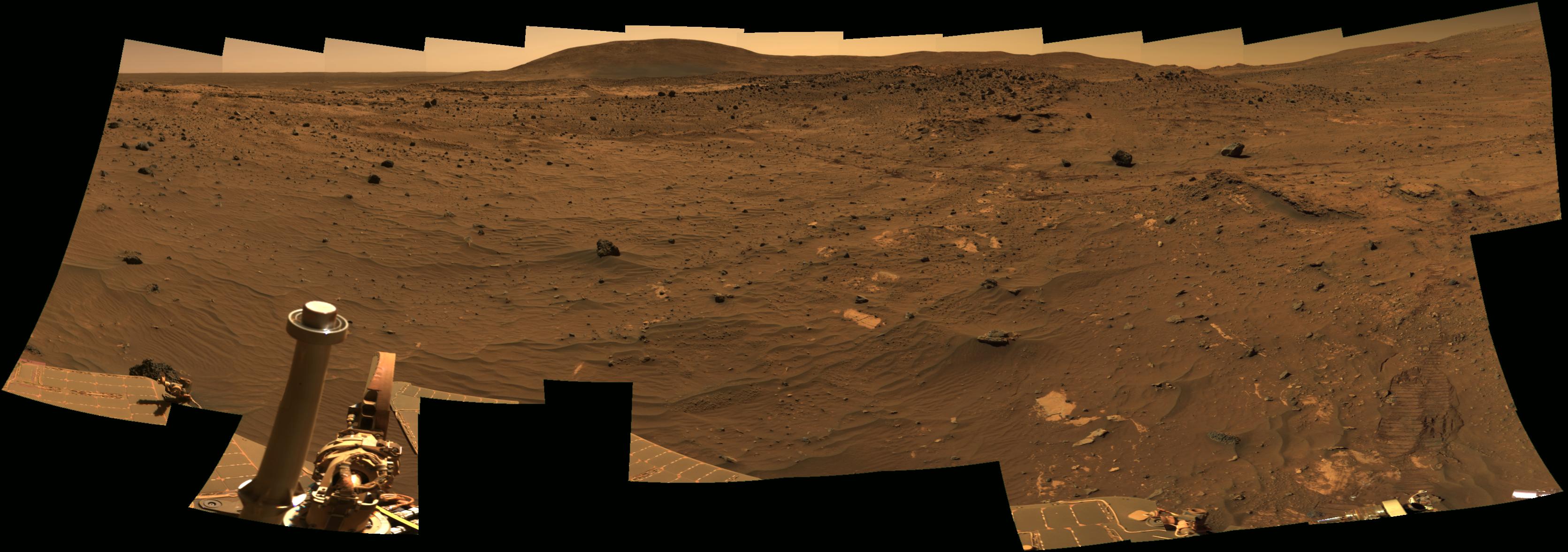
2006-05-01 |
Mars
|
Mars Exploration Rover (MER)
|
Navigation Camera
|
1024x1024x1 |
|
-
PIA08424:
-
Rolling Ripple
Full Resolution:
TIFF
(1.05 MB)
JPEG
(183 kB)
|
|
|
2006-05-01 |
Mars
|
Mars Exploration Rover (MER)
|
Panoramic Camera
|
12000x2401x1 |
|
-
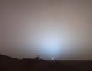
PIA08423:
Low Sun from 'Low Ridge'
Full Resolution:
TIFF
(28.81 MB)
JPEG
(3.056 MB)
|
|
|
2006-04-25 |
Mars
|
Mars Exploration Rover (MER)
|
Navigation Camera
|
7466x2124x1 |

|
-
PIA08096:
Spirit Greets New Terrain, New Season on Mars
Full Resolution:
TIFF
(15.88 MB)
JPEG
(1.608 MB)
|
|
|
2006-04-24 |
Mars
|
Mars Exploration Rover (MER)
|
Panoramic Camera
|
1021x1024x3 |
|
-
PIA08095:
-
Spirit Scans Winter Haven
Full Resolution:
TIFF
(3.141 MB)
JPEG
(143.4 kB)
|
|
|
2006-04-24 |
Mars
|
Mars Exploration Rover (MER)
|
Panoramic Camera
|
1022x1024x3 |
|
-
PIA08094:
-
Spirit Scans Winter Haven (False Color)
Full Resolution:
TIFF
(3.144 MB)
JPEG
(181.1 kB)
|
|
|
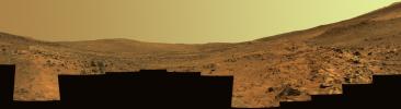
2006-04-19 |
Mars
|
Mars Exploration Rover (MER)
|
Panoramic Camera
|
3425x2377x3 |
|
-
PIA08084:
-
Paved Path for Opportunity
Full Resolution:
TIFF
(24.42 MB)
JPEG
(839.8 kB)
|
|
|
2006-04-11 |
Mars
|
Mars Exploration Rover (MER)
|
Panoramic Camera
|
1024x1024x3 |
|
-
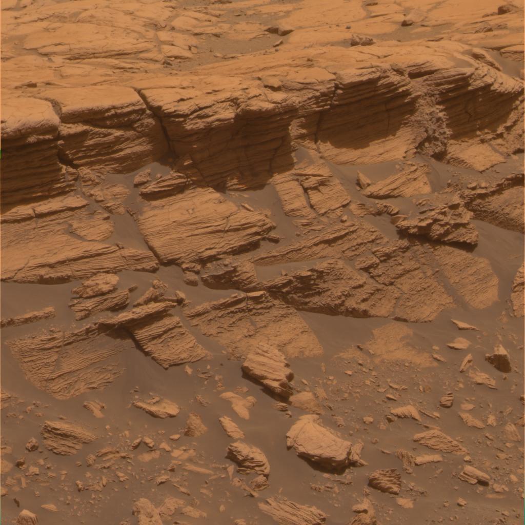
PIA08065:
-
Stack of Layers at 'Payson' in Meridiani Planum
Full Resolution:
TIFF
(3.15 MB)
JPEG
(137.9 kB)
|
|
|
2006-04-11 |
Mars
|
Mars Exploration Rover (MER)
|
Panoramic Camera
|
512x512x3 |

|
-
PIA08064:
-
Coarse Layering at 'Home Plate'
Full Resolution:
TIFF
(787.5 kB)
JPEG
(40.67 kB)
|
|
|
2006-04-11 |
Mars
|
Mars Exploration Rover (MER)
|
Panoramic Camera
|
512x512x3 |
|
-
PIA08063:
-
'Home Plate' Evidence for an Explosive Past
Full Resolution:
TIFF
(787.5 kB)
JPEG
(38.55 kB)
|
|
|
2006-04-04 |
Mars
|
Mars Exploration Rover (MER)
|
Panoramic Camera
|
2883x1268x3 |
|
-
PIA08039:
-
Bright Soil Near 'McCool'
Full Resolution:
TIFF
(10.97 MB)
JPEG
(344.2 kB)
|
|
|
2006-04-04 |
Mars
|
Mars Exploration Rover (MER)
|
Panoramic Camera
|
2883x1268x3 |
|
-
PIA08038:
-
Bright Soil Near 'McCool' (False Color)
Full Resolution:
TIFF
(10.97 MB)
JPEG
(421.4 kB)
|
|
|
2006-04-04 |
Mars
|
Mars Exploration Rover (MER)
|
Panoramic Camera
|
2883x1268x3 |
|
-
PIA08037:
-
Bright Soil Near 'McCool' (3-D)
Full Resolution:
TIFF
(10.97 MB)
JPEG
(409.2 kB)
|
|
|
2006-03-23 |
Mars
|
Mars Exploration Rover (MER)
|
Navigation Camera
|
1024x1024x1 |
|
-
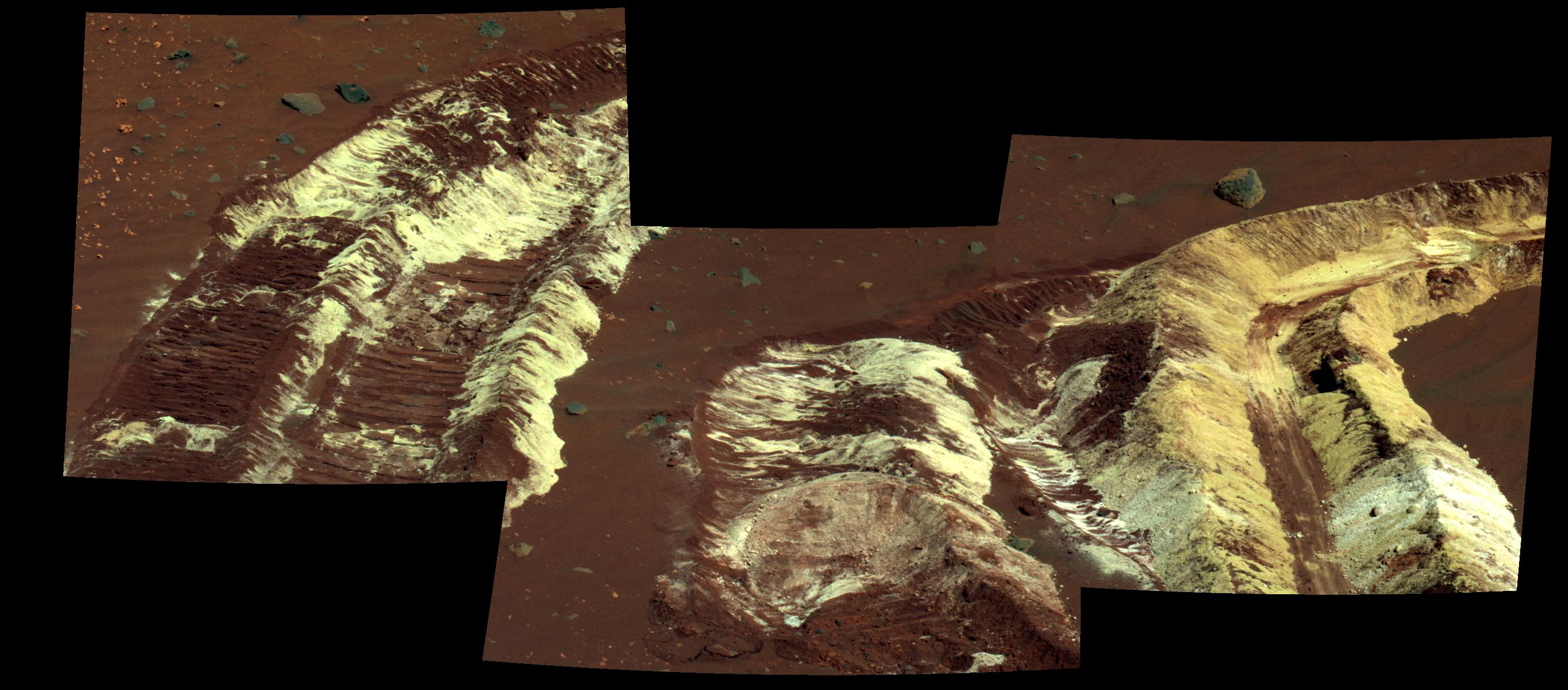
PIA08012:
-
Bright Soil Near 'McCool': Salty Deja Vu?
Full Resolution:
TIFF
(1.05 MB)
JPEG
(167.2 kB)
|
|
|
2006-03-21 |
Mars
|
Mars Exploration Rover (MER)
|
Panoramic Camera
|
1021x1024x3 |
|
-
PIA02055:
-
Spirit Says Goodbye to 'Home Plate'
Full Resolution:
TIFF
(3.141 MB)
JPEG
(199.8 kB)
|
|
|
2006-03-21 |
Mars
|
Mars Exploration Rover (MER)
|
Panoramic Camera
|
1021x1024x3 |
|
-
PIA02044:
-
Spirit Says Goodbye to 'Home Plate' (False Color)
Full Resolution:
TIFF
(3.141 MB)
JPEG
(246.2 kB)
|
|
|
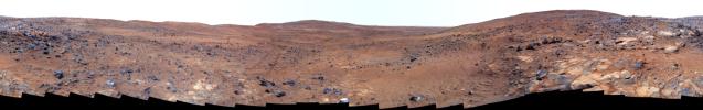
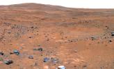
2006-03-07 |
Mars
|
Mars Exploration Rover (MER)
|
Panoramic Camera
|
5295x1950x3 |

|
-
PIA02696:
-
'Payson' Panorama by Opportunity
Full Resolution:
TIFF
(30.98 MB)
JPEG
(854.9 kB)
QTVR
(969.6 kB)
|
|
|
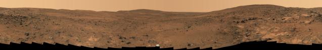
2006-03-07 |
Mars
|
Mars Exploration Rover (MER)
|
Panoramic Camera
|
5295x1950x3 |
|
-
PIA02695:
-
'Payson' Panorama in False Color
Full Resolution:
TIFF
(30.98 MB)
JPEG
(1.13 MB)
|
|
|
2006-03-06 |
Mars
|
Mars Exploration Rover (MER)
|
Panoramic Camera
|
10860x4315x3 |
|
-
PIA02690:
-
'Gibson' Panorama by Spirit at 'Home Plate'
Full Resolution:
TIFF
(140.6 MB)
JPEG
(3.571 MB)
QTVR
(3.958 MB)
|
|
|
2006-03-06 |
Mars
|
Mars Exploration Rover (MER)
|
Panoramic Camera
|
10860x4315x3 |
|
-
PIA02689:
-
'Gibson' Panorama by Spirit at 'Home Plate' (False Color)
Full Resolution:
TIFF
(140.6 MB)
JPEG
(5.054 MB)
|
|
|
2006-03-06 |
Mars
|
Mars Exploration Rover (MER)
|
Panoramic Camera
|
10525x2877x3 |
|
-
PIA02688:
Spirit's 'Paige' Panorama of the Interior of 'Home Plate'
Full Resolution:
TIFF
(90.84 MB)
JPEG
(2.646 MB)
QTVR
(2.964 MB)
|
|
|
2006-03-06 |
Mars
|
Mars Exploration Rover (MER)
|
Panoramic Camera
|
10525x2877x3 |
|
-
PIA02687:
Spirit's 'Paige' Panorama of the Interior of 'Home Plate' (False Color)
Full Resolution:
TIFF
(90.84 MB)
JPEG
(3.327 MB)
|
|
|
2006-03-06 |
Mars
|
Mars Exploration Rover (MER)
|
Panoramic Camera
Rock Abrasion Tool (RAT)
|
1021x1024x3 |

|
-
PIA02686:
-
Spirit Studies Rock Outcrop at 'Home Plate'
Full Resolution:
TIFF
(3.141 MB)
JPEG
(224.1 kB)
|
|
|
2006-03-01 |
Mars
|
Mars Exploration Rover (MER)
|
Navigation Camera
|
7466x1547x1 |
|
-
PIA02399:
Rover Team Decides: Safety First
Full Resolution:
TIFF
(11.56 MB)
JPEG
(732.8 kB)
|
|
|
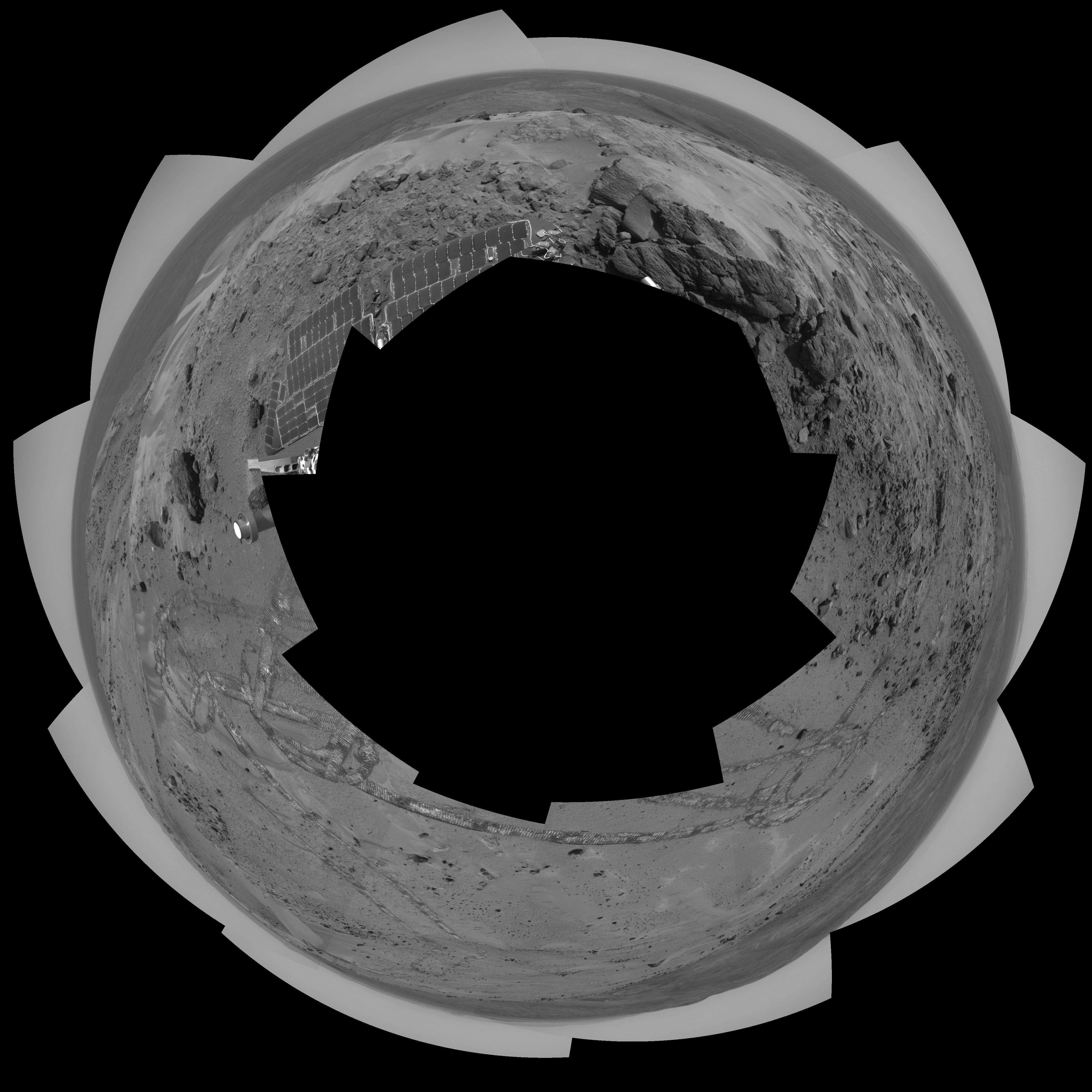
2006-02-17 |
Mars
|
Mars Exploration Rover (MER)
|
Panoramic Camera
|
1936x746x1 |

|
-
PIA02187:
-
Spirit Hits a Home Run
Full Resolution:
TIFF
(1.446 MB)
JPEG
(298.5 kB)
|
|
|
2006-02-17 |
Mars
|
Mars Exploration Rover (MER)
|
Microscopic Imager
|
2948x1193x1 |

|
-
PIA02186:
-
Revealing Roosevelt
Full Resolution:
TIFF
(3.522 MB)
JPEG
(269.1 kB)
|
|
|
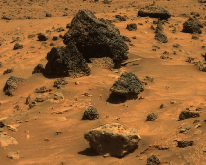
2006-02-02 |
Mars
|
Mars Exploration Rover (MER)
|
Microscopic Imager
|
1024x1024x1 |
|
-
PIA02157:
-
Hardened Lava Meets Wind on Mars
Full Resolution:
TIFF
(1.05 MB)
JPEG
(190.6 kB)
|
|
|
2006-02-02 |
Mars
|
Mars Exploration Rover (MER)
|
Navigation Camera
|
1024x1024x1 |
|
-
PIA02156:
-
Opportunity's Arm in 'Hover-Stow' Position
Full Resolution:
TIFF
(1.05 MB)
JPEG
(147.6 kB)
|
|
|
2006-01-27 |
Mars
|
Mars Exploration Rover (MER)
|
Panoramic Camera
|
1020x1024x3 |

|
-
PIA06102:
-
Gusev Rocks Solidified from Lava (Approximate True Color)
Full Resolution:
TIFF
(3.138 MB)
JPEG
(157.1 kB)
|
|
|
2006-01-27 |
Mars
|
Mars Exploration Rover (MER)
|
Panoramic Camera
|
1020x1024x3 |
|
-
PIA06101:
-
Gusev Rocks Solidified from Lava (False Color)
Full Resolution:
TIFF
(3.138 MB)
JPEG
(184 kB)
|
|
|
2006-01-27 |
Mars
|
Mars Exploration Rover (MER)
|
Panoramic Camera
|
993x1024x3 |
|
-
PIA06091:
-
Gusev Rocks Solidified from Lava (3-D)
Full Resolution:
TIFF
(3.055 MB)
JPEG
(199.2 kB)
|
|
|
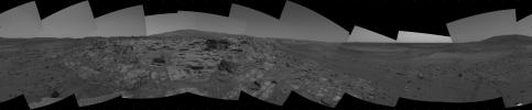
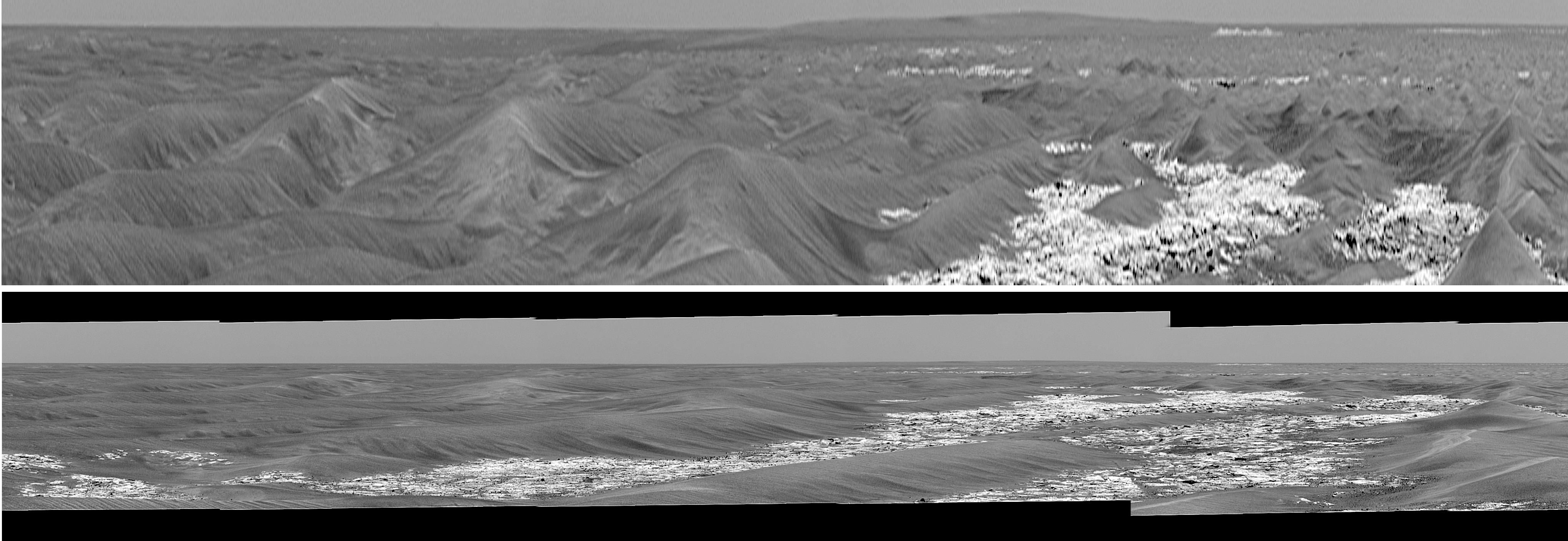
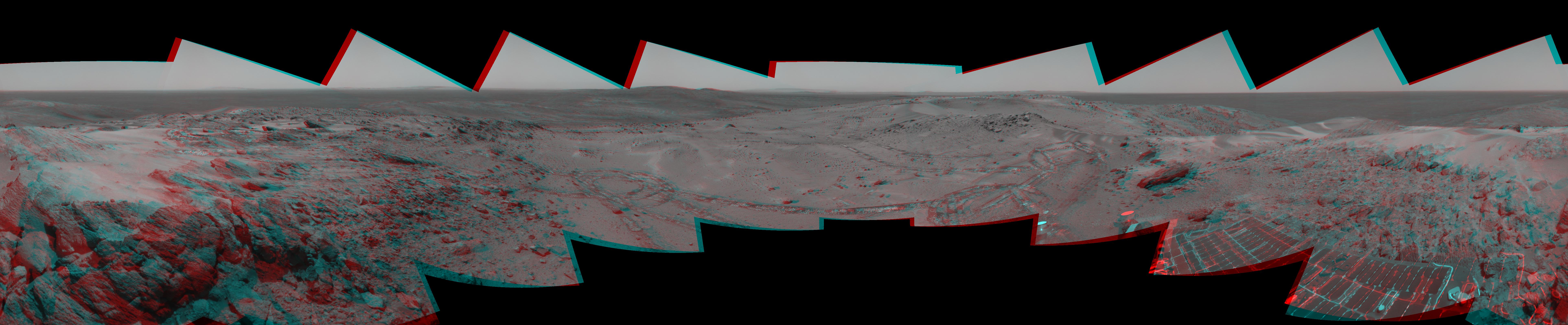
2006-01-25 |
Mars
|
Mars Exploration Rover (MER)
|
Panoramic Camera
|
26306x3000x3 |
|
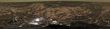
-
PIA03695:
Erebus Panorama in Stereo
Full Resolution:
TIFF
(236.8 MB)
JPEG
(11.83 MB)
|
|
|
2006-01-24 |
Mars
|
Mars Global Surveyor (MGS)
Mars Exploration Rover (MER)
|
Mars Orbiter Camera (MOC)
|
1442x4116x3 |
|
-
PIA03691:
-
2 Years on Mars! Meridiani Planum Features Investigated by the Rover,
Opportunity
Full Resolution:
TIFF
(17.84 MB)
JPEG
(981 kB)
|
|
|
2006-01-19 |
Mars
|
Mars Exploration Rover (MER)
|
Panoramic Camera
|
1024x1024x3 |
|
-
PIA03684:
-
Salty Expression
Full Resolution:
TIFF
(3.15 MB)
JPEG
(139.5 kB)
|
|
|
2006-01-06 |
Mars
|
Mars Exploration Rover (MER)
|
Panoramic Camera
|
1016x1024x1 |
|
-
PIA03279:
-
'Festoon' Pattern in Meridiani Outcrop
Full Resolution:
TIFF
(1.042 MB)
JPEG
(319.1 kB)
|
|
|
2006-01-04 |
Mars
|
Mars Exploration Rover (MER)
|
Panoramic Camera
|
11627x11627x3 |

|
-
PIA03275:
-
Still Shining After All This Time (Polar)
Full Resolution:
TIFF
(405.6 MB)
JPEG
(10.19 MB)
|
|
|
2006-01-04 |
Mars
|
Mars Exploration Rover (MER)
|
Panoramic Camera
|
9706x3399x3 |
|
-
PIA03274:
-
Intricately Rippled Sand Deposits
Full Resolution:
TIFF
(98.97 MB)
JPEG
(1.63 MB)
QTVR
(1.836 MB)
|
|
|
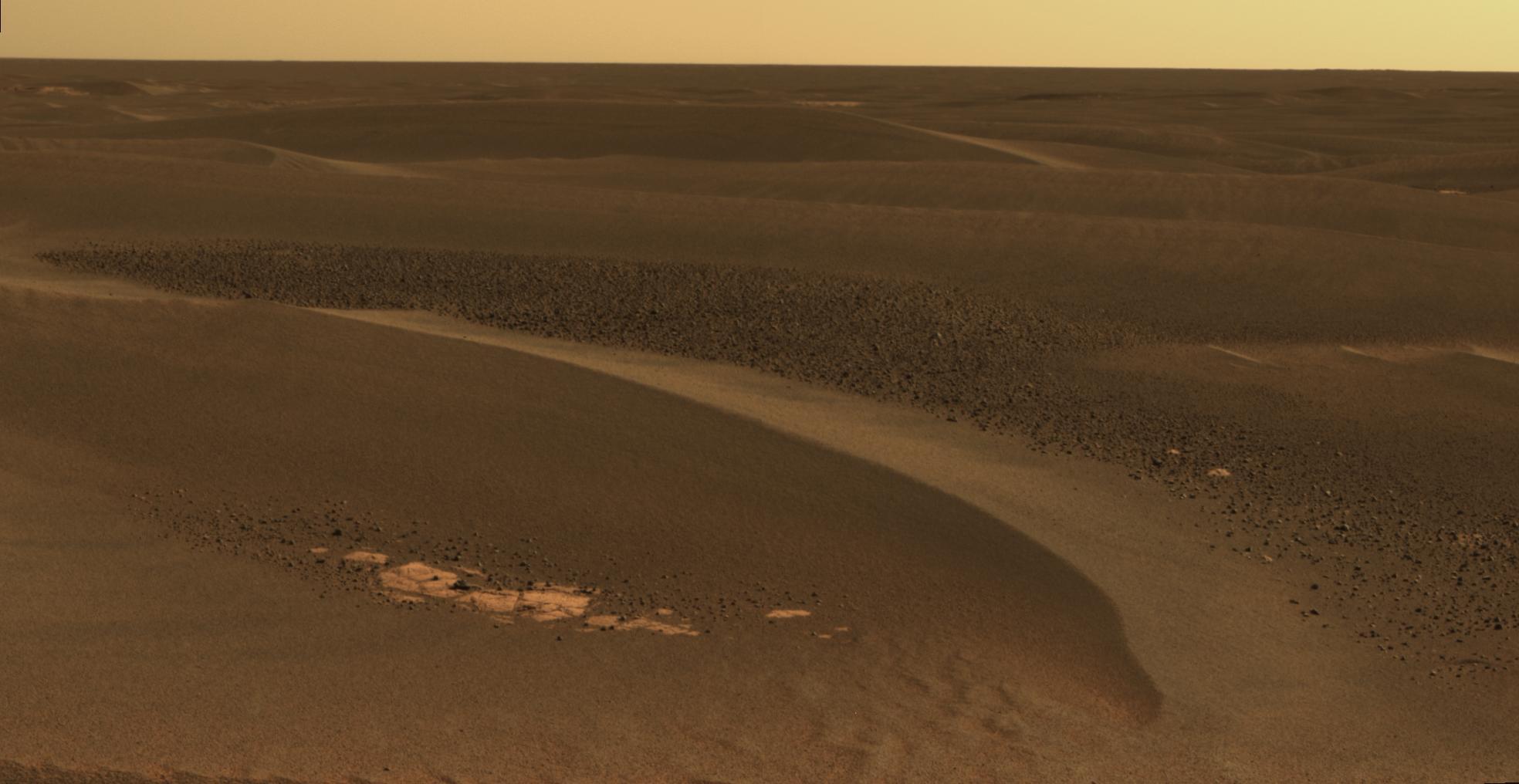
2006-01-04 |
Mars
|
Mars Exploration Rover (MER)
|
Panoramic Camera
|
10000x10000x3 |

|
-
PIA03273:
-
Bird's-Eye View of Opportunity at 'Erebus' (Vertical)
Full Resolution:
TIFF
(300 MB)
JPEG
(7.594 MB)
|
|
|
2006-01-04 |
Mars
|
Mars Exploration Rover (MER)
|
Panoramic Camera
|
6515x5052x3 |
|
-
PIA03272:
-
Still Shining After All This Time (Vertical)
Full Resolution:
TIFF
(98.74 MB)
JPEG
(2.741 MB)
|
|
|
2006-01-03 |
Mars
|
Mars Exploration Rover (MER)
|
Panoramic Camera
|
12097x12097x3 |

|
-
PIA03271:
-
Bird's-Eye View of Opportunity at 'Erebus' (Polar)
Full Resolution:
TIFF
(439 MB)
JPEG
(9.879 MB)
|
|
|
2006-01-03 |
Mars
|
Mars Exploration Rover (MER)
|
Panoramic Camera
|
22780x5996x3 |
|
-
PIA03270:
On the Rim of 'Erebus'
Full Resolution:
TIFF
(409.8 MB)
JPEG
(12.06 MB)
QTVR
(13.3 MB)
|
|
|
2006-01-03 |
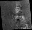
Mars
|
Mars Global Surveyor (MGS)
Mars Exploration Rover (MER)
|
Mars Orbiter Camera (MOC)
|
892x444x1 |

|
-
PIA03255:
-
Spirit on "Husband Hill," with 2004 Comparison
Full Resolution:
TIFF
(396.7 kB)
JPEG
(45.25 kB)
|
|
|
2006-01-03 |
Mars
|
Mars Global Surveyor (MGS)
Mars Exploration Rover (MER)
|
Mars Orbiter Camera (MOC)
|
6700x6065x3 |

|
-
PIA03254:
-
Spirit's Neighborhood in 'Columbia Hills,' in Stereo
Full Resolution:
TIFF
(121.9 MB)
JPEG
(2.885 MB)
|
|
|
2006-01-03 |
Mars
|
Mars Global Surveyor (MGS)
Mars Exploration Rover (MER)
|
Mars Orbiter Camera (MOC)
|
6492x6065x1 |
|
-
PIA03253:
-
Spirit Rover on 'Husband Hill'
Full Resolution:
TIFF
(39.42 MB)
JPEG
(4.319 MB)
|
|
|
2005-12-23 |
Mars
|
Mars Exploration Rover (MER)
|
Panoramic Camera
|
13220x3440x3 |

|
-
PIA03252:
Sweeping View of the "Columbia Hills" and Gusev Crater (Approximate True Color)
Full Resolution:
TIFF
(136.4 MB)
JPEG
(5.799 MB)
QTVR
(6.535 MB)
|
|
|
2005-12-23 |
Mars
|
Mars Exploration Rover (MER)
|
Panoramic Camera
|
13220x3440x3 |

|
-
PIA03251:
Sweeping View of the "Columbia Hills" and Gusev Crater (False Color)
Full Resolution:
TIFF
(136.4 MB)
JPEG
(7.784 MB)
|
|
|
2005-12-23 |
Mars
|
Mars Exploration Rover (MER)
|
Panoramic Camera
|
10451x1263x3 |
|
-
PIA03250:
Sweeping View of the "Columbia Hills" and Gusev Crater (3-D)
Full Resolution:
TIFF
(39.6 MB)
JPEG
(2.541 MB)
|
|
|
2005-12-14 |
Mars
|
Mars Exploration Rover (MER)
|
Panoramic Camera
|
22348x3504x3 |
|
-
PIA03641:
Descent from the Summit of 'Husband Hill' (False Color)
Full Resolution:
TIFF
(234.9 MB)
JPEG
(13.1 MB)
|
|
|
2005-12-14 |
Mars
|
Mars Exploration Rover (MER)
|
Panoramic Camera
|
22348x3504x3 |
|
-
PIA03640:
Descent from the Summit of 'Husband Hill'
Full Resolution:
TIFF
(234.9 MB)
JPEG
(9.508 MB)
QTVR
(10.52 MB)
|
|
|
2005-12-05 |
Mars
|
Mars Exploration Rover (MER)
|
Panoramic Camera
|
4705x2877x3 |
|
-
PIA03623:
-
Partial 'Seminole' Panorama
Full Resolution:
TIFF
(40.61 MB)
JPEG
(1.825 MB)
|
|
|
2005-12-05 |
Mars
|
Mars Exploration Rover (MER)
|
Panoramic Camera
|
952x587x3 |
|
-
PIA03622:
-
Rim of 'Erebus'
Full Resolution:
TIFF
(1.679 MB)
JPEG
(94.88 kB)
|
|
|
2005-12-05 |
Mars
|
Mars Exploration Rover (MER)
|
Panoramic Camera
|
7726x2890x3 |
|
-
PIA03621:
-
Opportunity's 'Olympia' Panorama
Full Resolution:
TIFF
(66.98 MB)
JPEG
(3.024 MB)
QTVR
(3.349 MB)
|
|
|
2005-12-05 |
Mars
|
Mars Exploration Rover (MER)
|
Panoramic Camera
|
4705x2877x3 |
|
-
PIA03617:
-
Partial 'Seminole' Panorama (False Color)
Full Resolution:
TIFF
(40.61 MB)
JPEG
(2.511 MB)
|
|
|
2005-12-05 |
Mars
|
2001 Mars Odyssey
Mars Global Surveyor (MGS)
Mars Exploration Rover (MER)
|
Descent Image Motion Estimation System (DIMES)
Mars Orbiter Camera
Thermal Emission Imaging System
|
1411x2043x3 |
|
-
PIA03616:
-
Partway to 'Victoria'
Full Resolution:
TIFF
(8.665 MB)
JPEG
(265.7 kB)
|
|
|
2005-12-05 |
Mars
|
Mars Exploration Rover (MER)
|
Panoramic Camera
|
1024x1024x1 |
|
-
PIA03615:
-
Meteor Search by Spirit, Sol 668
Full Resolution:
TIFF
(1.05 MB)
JPEG
(308.9 kB)
|
|
|
2005-12-05 |
Mars
|
Mars Exploration Rover (MER)
|
Panoramic Camera
|
3712x1120x1 |
|
-
PIA03614:
-
'Algonquin' Outcrop on Spirit's Sol 680
Full Resolution:
TIFF
(4.162 MB)
JPEG
(831.7 kB)
|
|
|
2005-12-05 |
Mars
|
Mars Exploration Rover (MER)
|
Panoramic Camera
|
1024x1024x1 |
|
-
PIA03613:
-
Meteor Search by Spirit, Sol 643
Full Resolution:
TIFF
(1.05 MB)
JPEG
(329.8 kB)
|
|
|
2005-12-05 |
Mars
|
Mars Exploration Rover (MER)
|
Panoramic Camera
|
22348x6547x3 |

|
-
PIA03610:
-
Summit Panorama with Rover Deck
Full Resolution:
TIFF
(438.9 MB)
JPEG
(10.62 MB)
QTVR
(1.233 MB)
|
|
|
2005-12-05 |
Mars
|
Mars Global Surveyor (MGS)
Mars Exploration Rover (MER)
2001 Mars Odyssey
|
Descent Image Motion Estimation System (DIMES)
Mars Orbiter Camera
Thermal Emission Imaging System
|
1415x2044x3 |
|
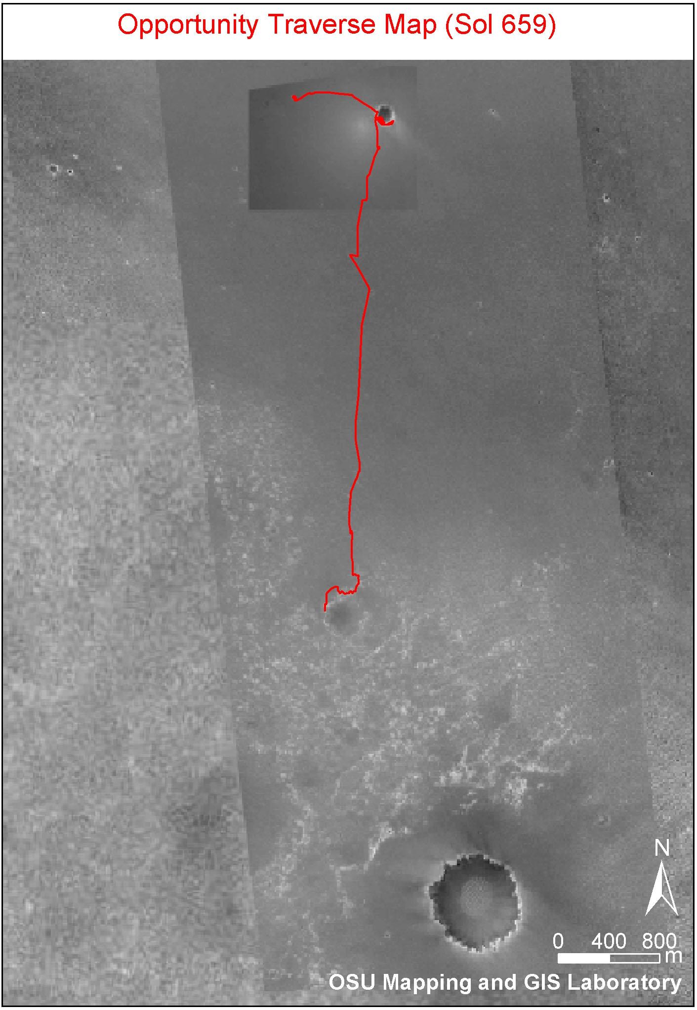
-
PIA03609:
-
Opportunity Traverse Map, Sol 656
Full Resolution:
TIFF
(8.693 MB)
JPEG
(249.9 kB)
|
|
|
2005-12-05 |
Mars
|
Mars Global Surveyor (MGS)
Mars Exploration Rover (MER)
|
Mars Orbiter Camera (MOC)
|
1039x691x3 |

|
-
PIA03624:
-
Spirit Traverse Map, Sol 680
Full Resolution:
TIFF
(2.157 MB)
JPEG
(131 kB)
|
|
|
2005-12-05 |
Mars
|
Mars Exploration Rover (MER)
|
|
896x549x3 |

|
-
PIA03608:
-
Solar-Panel Dust Accumulation and Cleanings
Full Resolution:
TIFF
(494.2 kB)
JPEG
(57.98 kB)
|
|
|
2005-12-05 |
Mars
|
Mars Exploration Rover (MER)
|
|
911x623x3 |
|
-
PIA03607:
-
Solar Power on Mars
Full Resolution:
TIFF
(570 kB)
JPEG
(84.61 kB)
|
|
|
2005-11-28 |
Mars
|
Mars Exploration Rover (MER)
|
Navigation Camera
Panoramic Camera
|
1024x1024x3 |
|
-
PIA03576:
-
Windblown Ripple 'Scylla'
Full Resolution:
TIFF
(3.15 MB)
JPEG
(163.9 kB)
|
|
|
2005-11-22 |
Mars
|
Mars Exploration Rover (MER)
|
Navigation Camera
|
1143x920x3 |
|
-
PIA03234:
-
Simulated View for Rover Activity Planning
Full Resolution:
TIFF
(1.054 MB)
JPEG
(153.5 kB)
|
|
|
2005-11-21 |
Mars
|
Mars Exploration Rover (MER)
|
Panoramic Camera
|
9805x2290x3 |
|
-
PIA03233:
'East Basin' Panorama
Full Resolution:
TIFF
(67.36 MB)
JPEG
(2.49 MB)
QTVR
(2.787 MB)
|
|
|
2005-11-21 |
Mars
|
Mars Exploration Rover (MER)
|
Panoramic Camera
|
2486x1914x3 |
|
-
PIA03232:
-
Special-Effects Spirit Silhouetted on "Jibsheet"
Full Resolution:
TIFF
(14.29 MB)
JPEG
(106.8 kB)
|
|
|
2005-11-21 |
Mars
|
Mars Exploration Rover (MER)
|
Panoramic Camera
|
12787x6607x3 |

|
-
PIA03231:
-
Special-Effects Spirit on Flank of "Husband Hill"
Full Resolution:
TIFF
(253.5 MB)
JPEG
(4.248 MB)
|
|
|
2005-11-21 |
Mars
|
Mars Exploration Rover (MER)
|
Navigation Camera
|
2400x1350x3 |
|
-
PIA03230:
-
Special-Effects Spirit in "Columbia Hills"
Full Resolution:
TIFF
(3.245 MB)
JPEG
(289.5 kB)
|
|
|
2005-11-15 |
Mars
|
Mars Exploration Rover (MER)
|
Microscopic Imager
Rock Abrasion Tool (RAT)
|
2292x2154x1 |

|
-
PIA03202:
-
A Closer Look at 'Kalavrita'
Full Resolution:
TIFF
(4.943 MB)
JPEG
(606.8 kB)
|
|
|
2005-11-15 |
Mars
|
Mars Exploration Rover (MER)
|
Panoramic Camera
|
892x871x1 |
|
-
PIA03201:
-
'Mars-shine'
Full Resolution:
TIFF
(777.9 kB)
JPEG
(64.48 kB)
|
|
|
2005-11-11 |
Mars
|
Mars Exploration Rover (MER)
|
Panoramic Camera
|
7466x1085x1 |

|
-
PIA03194:
A Sense of Place
Full Resolution:
TIFF
(8.11 MB)
JPEG
(1.174 MB)
|
|
|
2005-11-07 |
Mars
|
Mars Exploration Rover (MER)
|
Panoramic Camera
|
22348x2697x3 |
|
-
PIA03095:
'Everest' Panorama; 20-20 Vision
Full Resolution:
TIFF
(180.8 MB)
JPEG
(6.484 MB)
QTVR
(7.545 MB)
|
|
|
2005-10-26 |
Mars
|
Mars Exploration Rover (MER)
|
Panoramic Camera
|
4158x1050x1 |
|
-
PIA03070:
Stargazing at 'Husband Hill Observatory' on Mars
Full Resolution:
TIFF
(4.375 MB)
JPEG
(184.5 kB)
|
|
|
2005-10-22 |
Mars
|
Mars Exploration Rover (MER)
|
Panoramic Camera
|
901x1008x1 |
|
-
PIA03065:
-
Dodging the Drifts
Full Resolution:
TIFF
(909.3 kB)
JPEG
(99.04 kB)
|
|
|
2005-10-21 |
Mars
|
Mars Exploration Rover (MER)
|
Navigation Camera
|
4093x4093x1 |

|
-
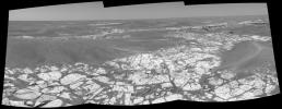
PIA03064:
-
After Conquering 'Husband Hill,' Spirit Moves On (Polar)
Full Resolution:
TIFF
(16.77 MB)
JPEG
(1.04 MB)
|
|
|
2005-10-21 |
Mars
|
Mars Exploration Rover (MER)
|
Navigation Camera
|
2000x2000x1 |
|
-
PIA03063:
-
After Conquering 'Husband Hill,' Spirit Moves On (Vertical)
Full Resolution:
TIFF
(4.004 MB)
JPEG
(336.1 kB)
|
|
|
2005-10-21 |
Mars
|
Mars Exploration Rover (MER)
|
Navigation Camera
|
4225x1199x3 |
|
-
PIA03062:
After Conquering 'Husband Hill,' Spirit Moves On (Stereo)
Full Resolution:
TIFF
(15.2 MB)
JPEG
(466.6 kB)
|
|
|
2005-10-21 |
Mars
|
Mars Exploration Rover (MER)
|
Navigation Camera
|
4094x1010x1 |

|
-
PIA03061:
After Conquering 'Husband Hill,' Spirit Moves On
Full Resolution:
TIFF
(4.139 MB)
JPEG
(401.8 kB)
|
|
|
2005-10-21 |
Mars
|
Mars Exploration Rover (MER)
|
Navigation Camera
|
4000x4000x1 |
|
-
PIA03060:
-
Looking Back at Spirit's Trail to the Summit (Polar)
Full Resolution:
TIFF
(16.02 MB)
JPEG
(936.8 kB)
|
|
|
2005-10-21 |
Mars
|
Mars Exploration Rover (MER)
|
Navigation Camera
|
4257x4257x1 |
|
-
PIA03059:
-
Looking Back at Spirit's Trail to the Summit (Vertical)
Full Resolution:
TIFF
(18.16 MB)
JPEG
(1.088 MB)
|
|
|
2005-10-21 |
Mars
|
Mars Exploration Rover (MER)
|
Navigation Camera
|
7704x1600x3 |
|
-
PIA03058:
Looking Back at Spirit's Trail to the Summit (Stereo)
Full Resolution:
TIFF
(36.98 MB)
JPEG
(1.043 MB)
|
|
|
2005-10-21 |
Mars
|
Mars Exploration Rover (MER)
|
Navigation Camera
|
7466x1208x1 |
|
-
PIA03057:
Looking Back at Spirit's Trail to the Summit
Full Resolution:
TIFF
(9.029 MB)
JPEG
(824.6 kB)
|


