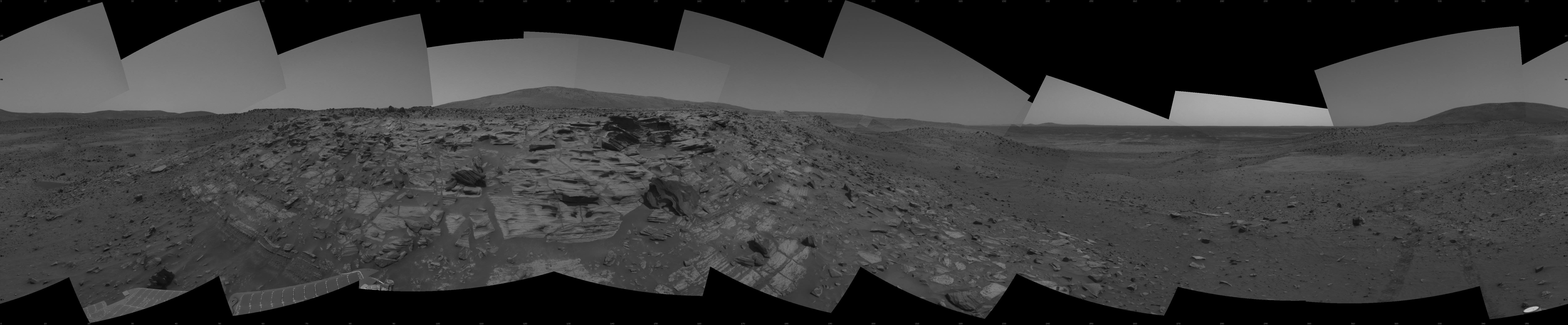
NASA's Mars Exploration Rover Spirit recorded this view while approaching the northwestern edge of "Home Plate," a circular plateau-like area of bright, layered outcrop material roughly 80 meters (260 feet) in diameter. The images combined into this mosaic were taken by Spirit's navigation camera during the rover's 746th, 748th and 750th Martian days, or sols (Feb. 7, 9 and 11, 2006).
With Martian winter closing in, engineers and scientists working with NASA's Mars Exploration Rover Spirit decided to play it safe for the time being rather than attempt to visit the far side of Home Plate in search of rock layers that might show evidence of a past watery environment. This feature has been one of the major milestones of the mission. Though it's conceivable that rock layers might be exposed on the opposite side, sunlight is diminishing on the rover's solar panels and team members chose not to travel in a counterclockwise direction that would take the rover to the west and south slopes of the plateau. Slopes in that direction are hidden from view and team members chose, following a long, thorough discussion, to have the rover travel clockwise and remain on north-facing slopes rather than risk sending the rover deeper into unknown terrain.
In addition to studying numerous images from Spirit's cameras, team members studied three-dimensional models created with images from the Mars Orbiter Camera on NASA's Mars Globel Surveyor orbiter. The models showed a valley on the southern side of Home Plate, the slopes of which might cause the rover's solar panels to lose power for unknown lengths of time. In addition, images from Spirit's cameras showed a nearby, talus-covered section of slope on the west side of Home Plate, rather than exposed rock layers scientists eventually hope to investigate.
Home Plate has been on the rover's potential itinerary since the early days of the mission, when it stood out in images taken by the Mars Orbiter Camera shortly after the rover landed on Mars. Spirit arrived at Home Plate after traveling 4 miles (6.4 kilometers) across the plains of Gusev Crater, up the slopes of "West Spur" and "Husband Hill," and down again. Scientists are studying the origin of the layering in the outcrop using the Athena science instruments on the rover's arm.
