Your search criteria found
1931
images
Mission
Go to PIAxxxxx:
Refine this list of images by:
Target:
Earth
Mars
Mercury
Moon
Phobos
Sun
Mission:
Mariner Venus Mercury (Mariner 10)
Mars Exploration Rover (MER)
Spacecraft:
2001 Mars Odyssey
Mariner 10
Mars Global Surveyor Orbiter
Mars Reconnaissance Orbiter (MRO)
Opportunity
Spirit
Instrument:
Alpha Particle X-ray Spectrometer
Capture Magnet
Context Camera (CTX)
Descent Image Motion Estimation System (DIMES)
Hazard Avoidance Camera
High Resolution Imaging Science Experiment (HiRISE)
High Resolution Instrument (HRI)
Mars Color Imager (MARCI)
Mars Orbiter Camera (MOC)
Microscopic Imager
Miniature Thermal Emission Spectrometer
Moessbauer Spectrometer
Navigation Camera
Panoramic Camera
Rock Abrasion Tool (RAT)
Thermal Emission Imaging System
Thermal Emission Spectrometer
Click on an image for detailed information
Click on a column heading to sort in ascending or descending order
My
List
Addition Date
Target
Mission
Instrument
Size
2004-02-14
Mars
Mars Exploration Rover (MER)
Microscopic Imager
Moessbauer Spectrometer
974x974x3
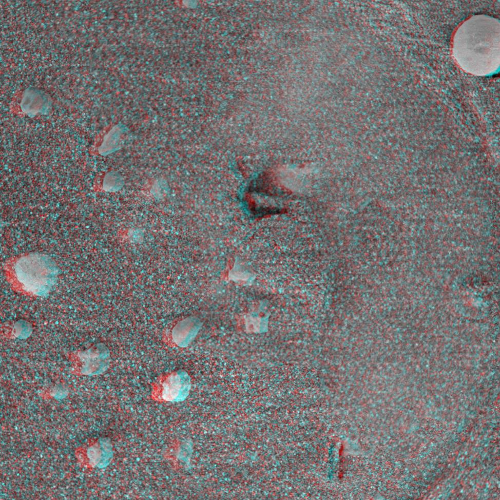
PIA05287:
Moessbauer Footprint in the Soil
Full Resolution:
TIFF
(2.636 MB)
JPEG
(227.1 kB)
2004-02-14
Mars
Mars Exploration Rover (MER)
Microscopic Imager
512x512x1
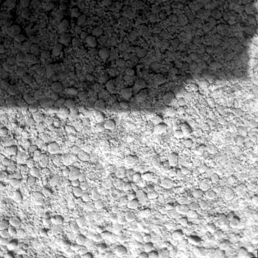
PIA05288:
Ground Inspection
Full Resolution:
TIFF
(262.6 kB)
JPEG
(57.54 kB)
2005-09-29
Mars
Mars Exploration Rover (MER)
Microscopic Imager
512x512x1
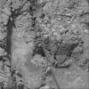
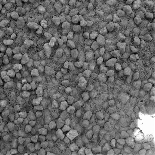
PIA06410:
Angular Grains of Sand Hint at Short Transport Distance
Full Resolution:
TIFF
(262.6 kB)
JPEG
(57.79 kB)
2004-02-14
Mars
Mars Exploration Rover (MER)
Miniature Thermal Emission Spectrometer
Panoramic Camera
5781x731x3
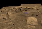
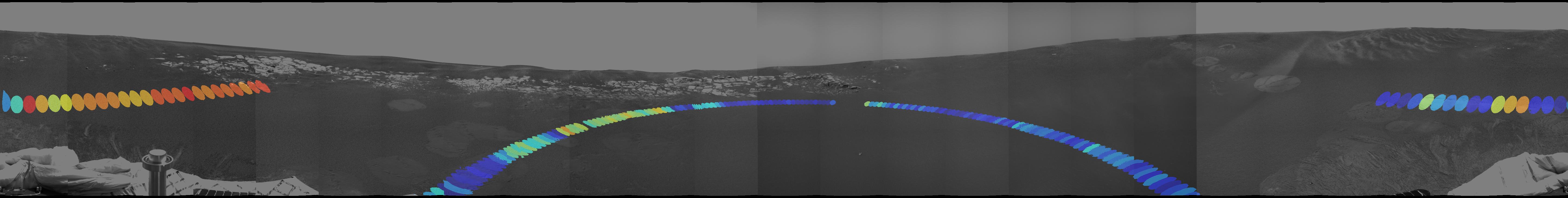
PIA05289:
Red Marks the Spot
Full Resolution:
TIFF
(3.704 MB)
JPEG
(299.6 kB)
2004-02-15
Mars
Mars Exploration Rover (MER)
Panoramic Camera
1025x1025x3
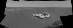
PIA05290:
Sailing to White Boat
Full Resolution:
TIFF
(3.156 MB)
JPEG
(177.1 kB)
2004-02-16
Mars
Mars Exploration Rover (MER)
Hazcam
1024x1024x1
PIA05291:
After a U-Turn
Full Resolution:
TIFF
(930.2 kB)
JPEG
(115.3 kB)
2004-02-17
Mars
Mars Exploration Rover (MER)
Hazcam
Navigation Camera
2000x2000x1
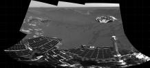
PIA05300:
Track-and-Trench
Full Resolution:
TIFF
(1.403 MB)
JPEG
(198.3 kB)
2004-02-17
Mars
Mars Exploration Rover (MER)
Hazcam
Navigation Camera
5405x5405x1
PIA05301:
Track-and-Trench 2
Full Resolution:
TIFF
(10.22 MB)
JPEG
(1.208 MB)
2004-02-17
Mars
Mars Exploration Rover (MER)
Moessbauer Spectrometer
Panoramic Camera
835x569x1
PIA05302:
Moessbauer Close-Up
Full Resolution:
TIFF
(364.3 kB)
JPEG
(38.28 kB)
2004-02-17
Mars
Mars Exploration Rover (MER)
Microscopic Imager
Moessbauer Spectrometer
723x1005x3
PIA05303:
Map of Moessbauer Placement
Full Resolution:
TIFF
(2.133 MB)
JPEG
(95.85 kB)
2004-02-17
Mars
Mars Exploration Rover (MER)
Hazcam
1025x947x1
PIA05305:
Fresh Soil for Inspection
Full Resolution:
TIFF
(811.3 kB)
JPEG
(89.32 kB)
2004-02-17
Mars
Mars Exploration Rover (MER)
Hazcam
1431x953x1
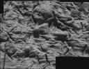
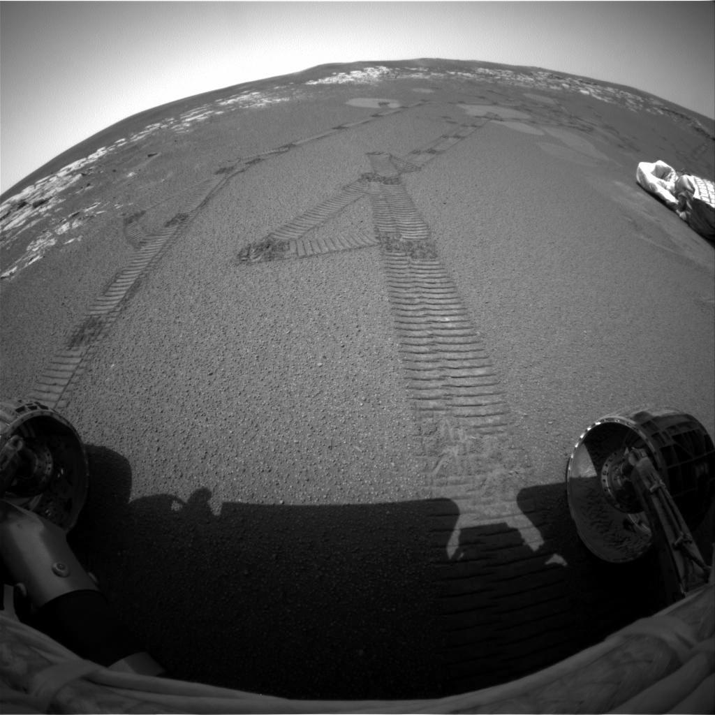
PIA05306:
Peeling Back the Layers of Mars
Full Resolution:
TIFF
(1.184 MB)
JPEG
(140.7 kB)
2004-02-17
Mars
Mars Exploration Rover (MER)
Hazcam
1022x624x1
PIA05307:
What Lies Beneath
Full Resolution:
TIFF
(566.1 kB)
JPEG
(67.3 kB)
2004-02-17
Mars
Mars Exploration Rover (MER)
692x609x3
PIA05309:
Opportunity Digs
Full Resolution:
TIFF
(340 kB)
JPEG
(31.04 kB)
2004-02-17
Mars
Mars Exploration Rover (MER)
904x469x3
PIA05310:
The Road Less Traveled
Full Resolution:
TIFF
(394 kB)
JPEG
(36.64 kB)
2004-02-17
Mars
Mars Exploration Rover (MER)
Hazcam
Navigation Camera
5087x2160x1
PIA05311:
Opportunity Trenches Martian Soil
Full Resolution:
TIFF
(6.251 MB)
JPEG
(739.6 kB)
2004-02-17
Mars
Mars Exploration Rover (MER)
Navigation Camera
4476x1734x1
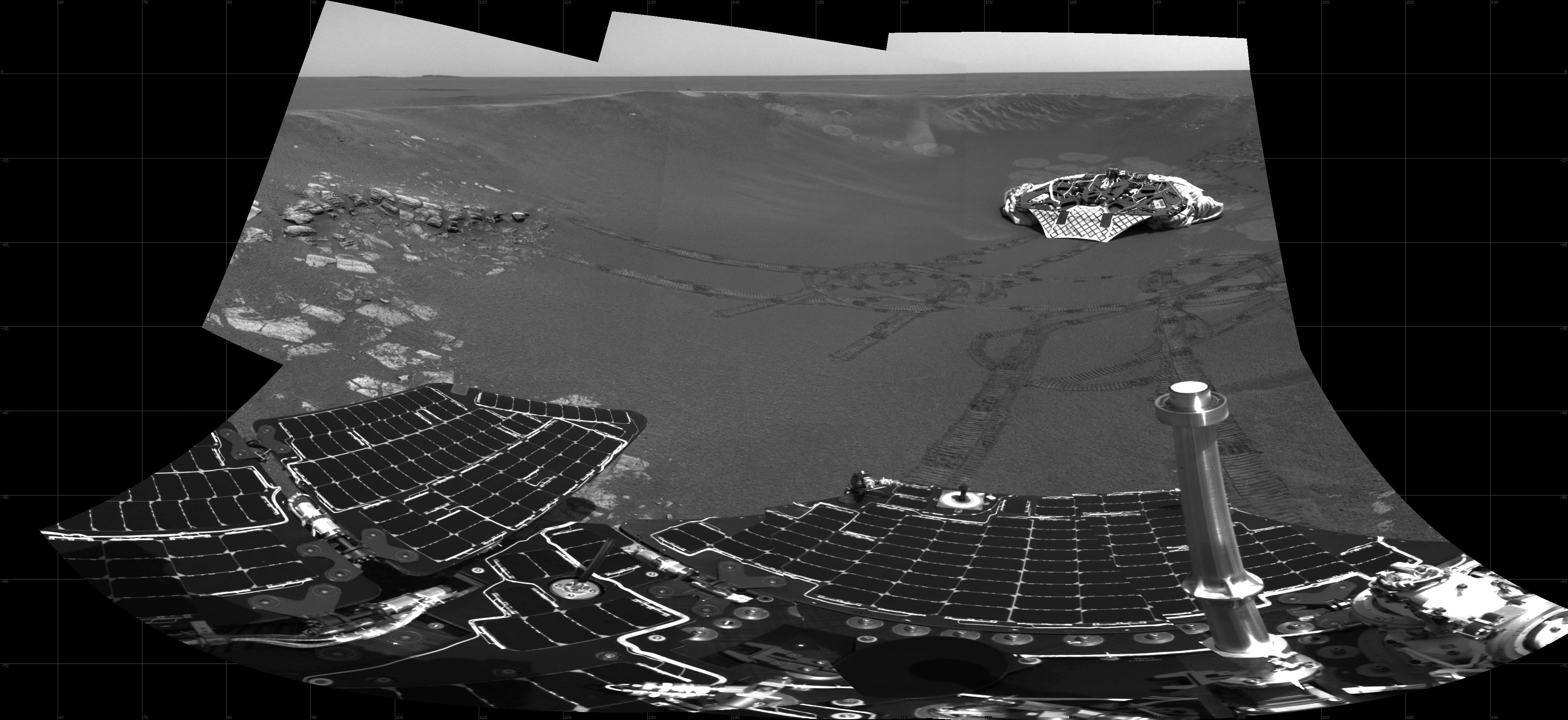
PIA05312:
At Home in the Crater
Full Resolution:
TIFF
(3.667 MB)
JPEG
(423.4 kB)
2004-02-17
Mars
Mars Exploration Rover (MER)
Microscopic Imager
Moessbauer Spectrometer
1024x1024x1
PIA05313:
Mark of the Moessbauer
Full Resolution:
TIFF
(1.05 MB)
JPEG
(198.9 kB)
2004-02-18
Mars
Mars Exploration Rover (MER)
Panoramic Camera
3897x1100x1
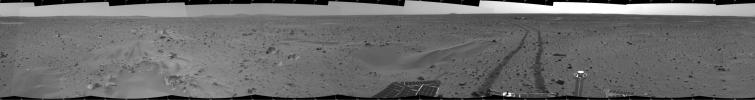
PIA05314:
Spirit Spies "Bonneville"
Full Resolution:
TIFF
(3.195 MB)
JPEG
(569.4 kB)
2004-02-18
Mars
Mars Exploration Rover (MER)
Navigation Camera
7466x989x1
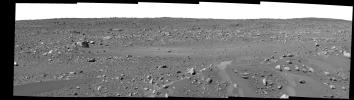
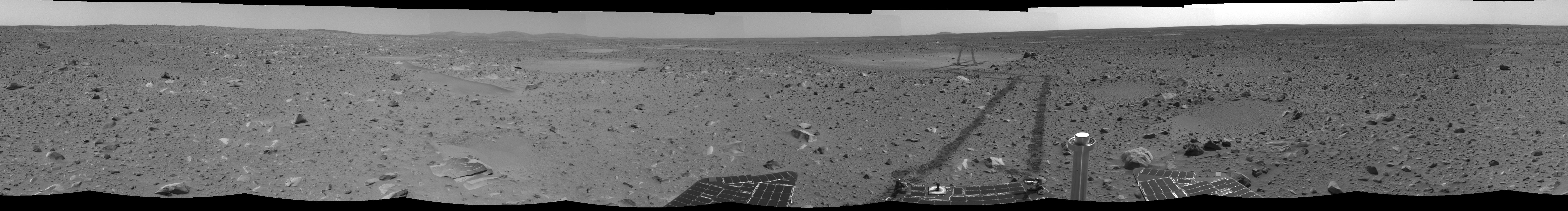
PIA05315:
Spirit Keeps Rolling
Full Resolution:
TIFF
(5.752 MB)
JPEG
(947.1 kB)
2004-02-18
Mars
Mars Exploration Rover (MER)
Hazcam
544x624x7
PIA05308:
Dragging Its Foot
Full Resolution:
2004-02-18
Mars
Mars Exploration Rover (MER)
Descent Image Motion Estimation System (DIMES)
Navigation Camera
Panoramic Camera
979x709x3
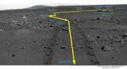
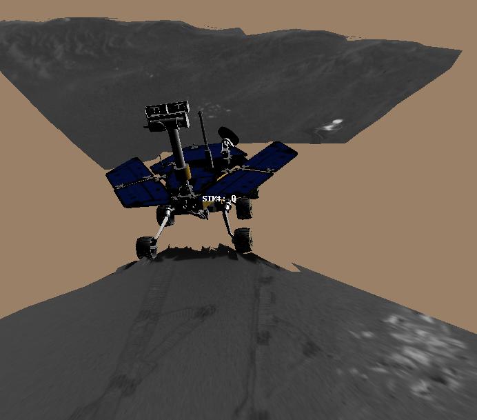
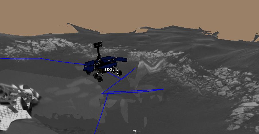
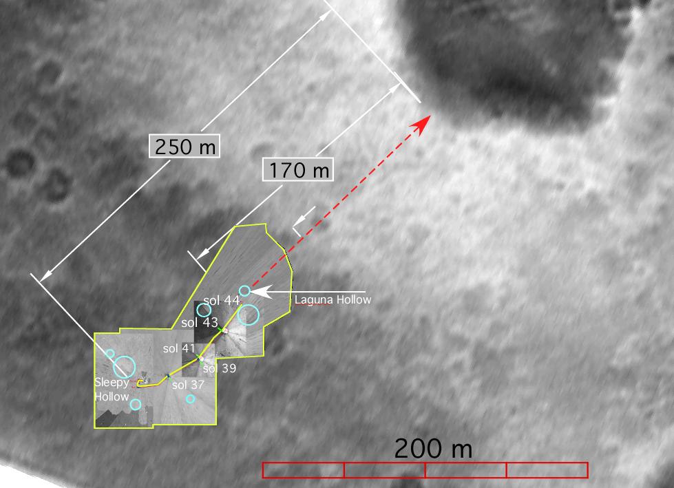
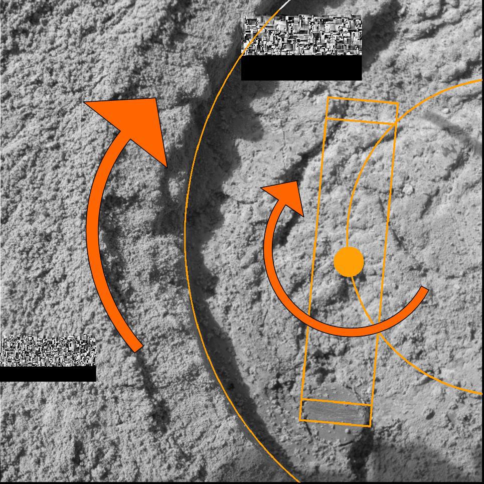
PIA05317:
Spirit's Path to Bonneville
Full Resolution:
TIFF
(861.8 kB)
JPEG
(75.48 kB)
2004-02-18
Mars
Mars Exploration Rover (MER)
Hazcam
1024x1024x1
PIA05318:
Spirit Does a "Jig" at Laguna Hollow
Full Resolution:
TIFF
(809.7 kB)
JPEG
(76.45 kB)
2004-02-18
Mars
Mars Exploration Rover (MER)
Microscopic Imager
1024x1024x1
PIA05319:
The Trench Throws a Dirt Clod at Scientists
Full Resolution:
TIFF
(1.05 MB)
JPEG
(193.5 kB)
2004-02-19
Mars
Mars Exploration Rover (MER)
Microscopic Imager
1024x1024x1
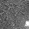
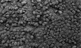
PIA05324:
Tiny Pebbles
Full Resolution:
TIFF
(1.05 MB)
JPEG
(288.2 kB)
2004-02-19
Mars
Mars Exploration Rover (MER)
Microscopic Imager
Navigation Camera
1508x853x1
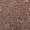
PIA05325:
Taking a Deeper Look
Full Resolution:
TIFF
(861.1 kB)
JPEG
(132.6 kB)
2004-02-19
Mars
Mars Exploration Rover (MER)
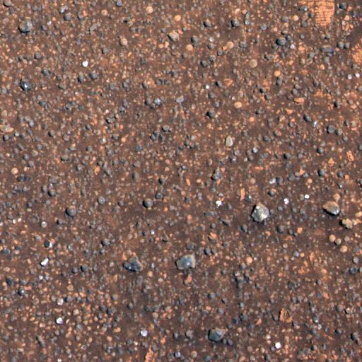
Microscopic Imager
1024x1024x1
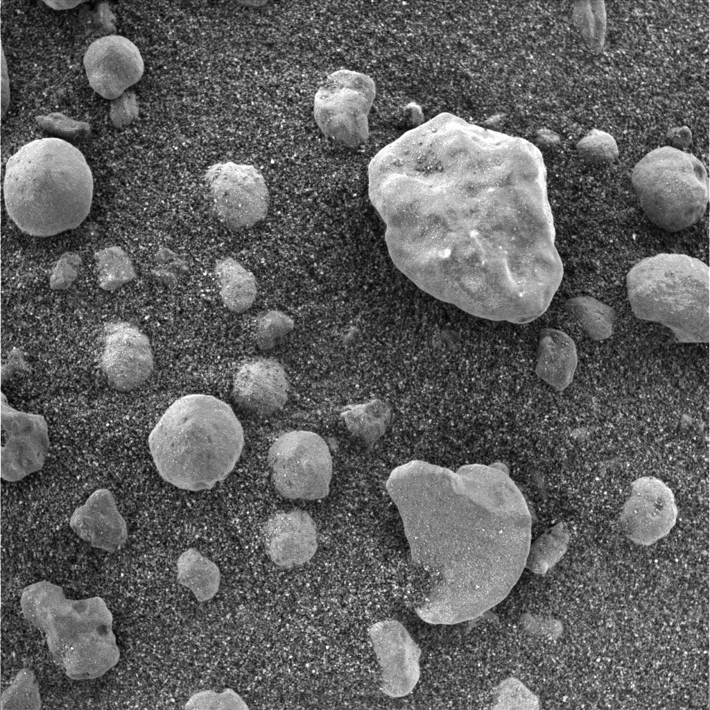
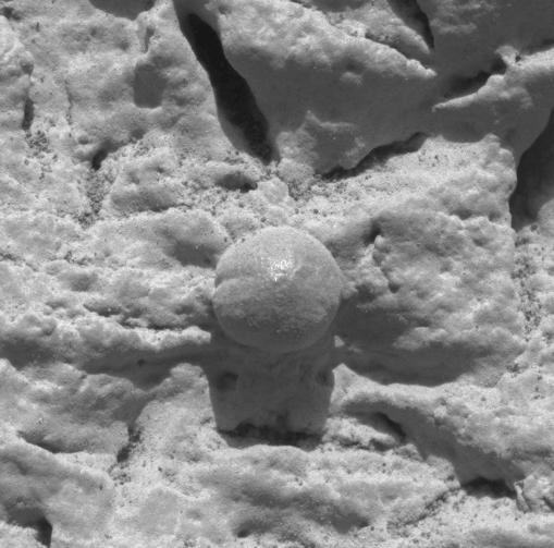
PIA05326:
The Mystery of the Sparkling Spheres
Full Resolution:
TIFF
(1.05 MB)
JPEG
(317.9 kB)
2004-02-19
Mars
Mars Exploration Rover (MER)
Microscopic Imager
Moessbauer Spectrometer
1024x1024x1
PIA05327:
Moessbauer Nose Print
Full Resolution:
TIFF
(913.4 kB)
JPEG
(146.4 kB)
2004-02-19
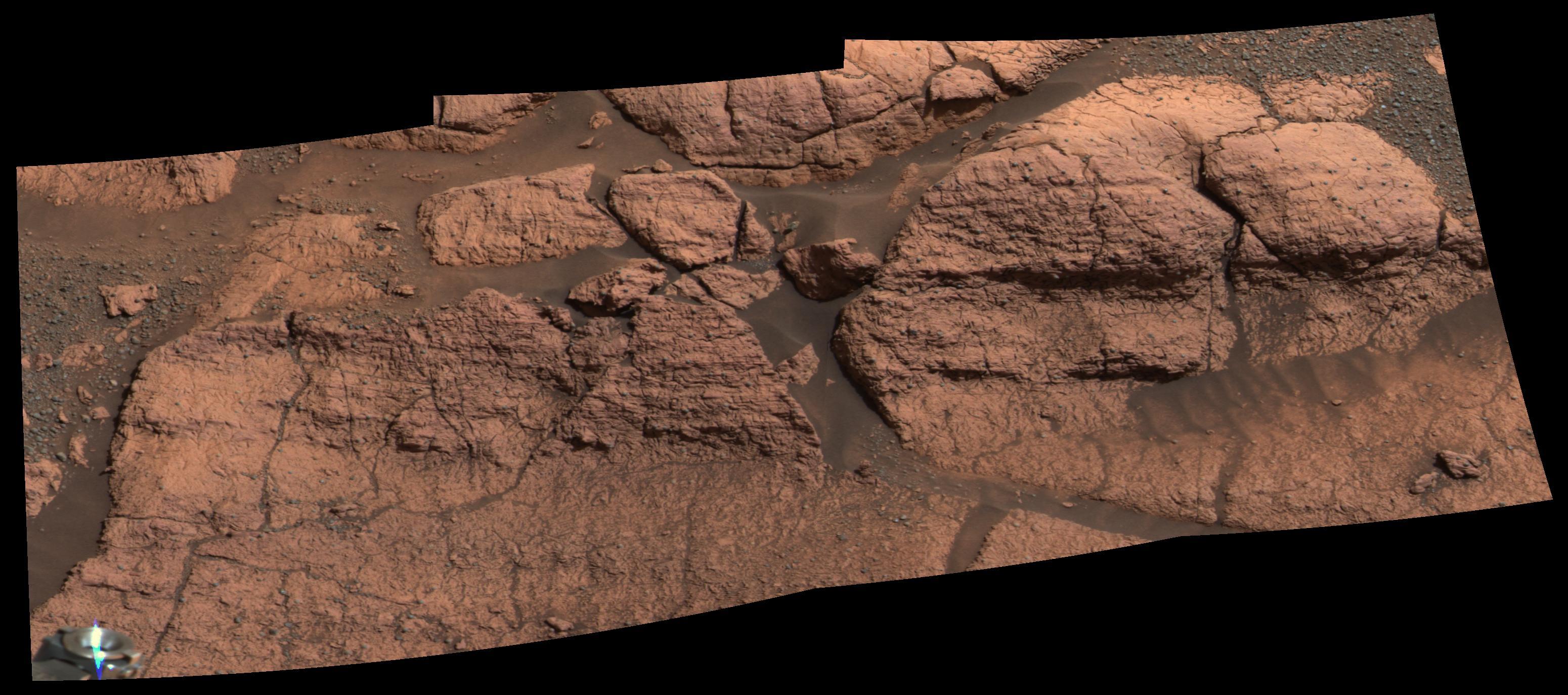
Mars
Mars Exploration Rover (MER)
Microscopic Imager
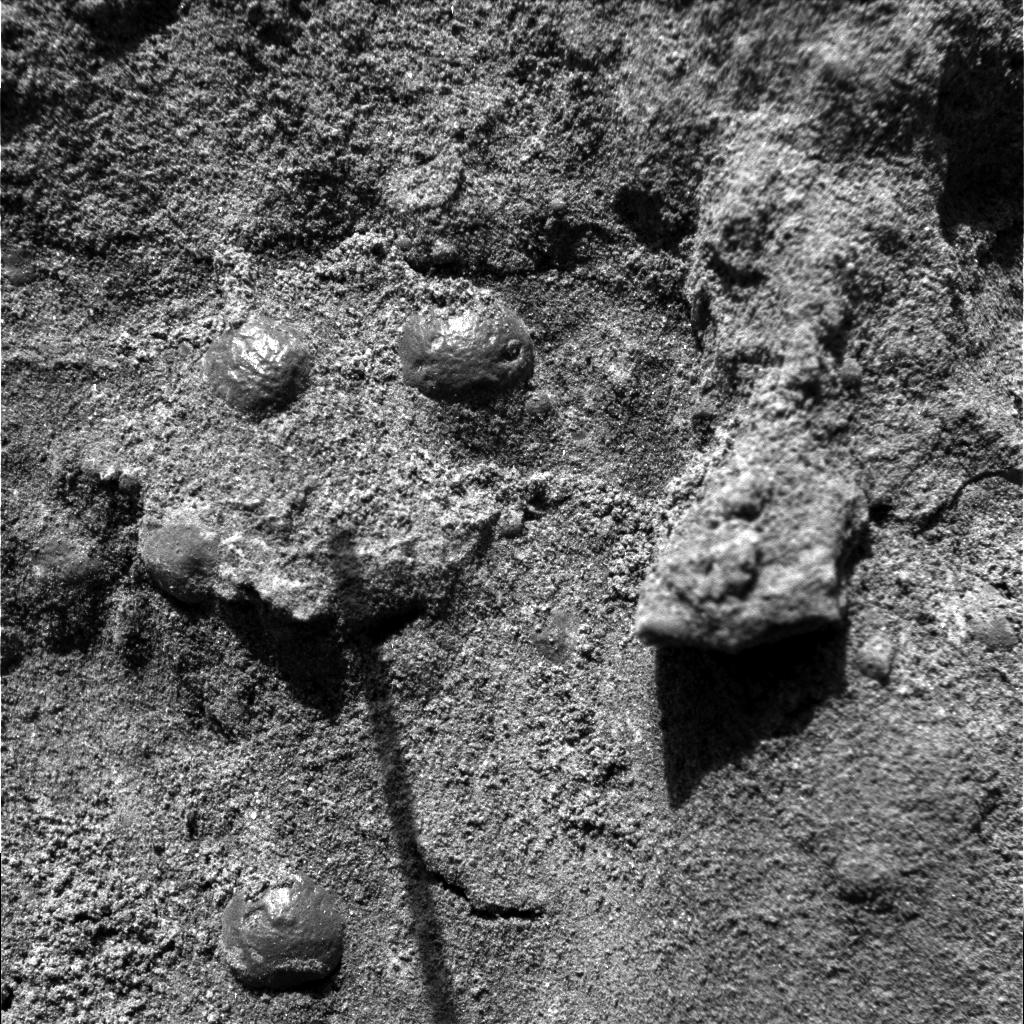
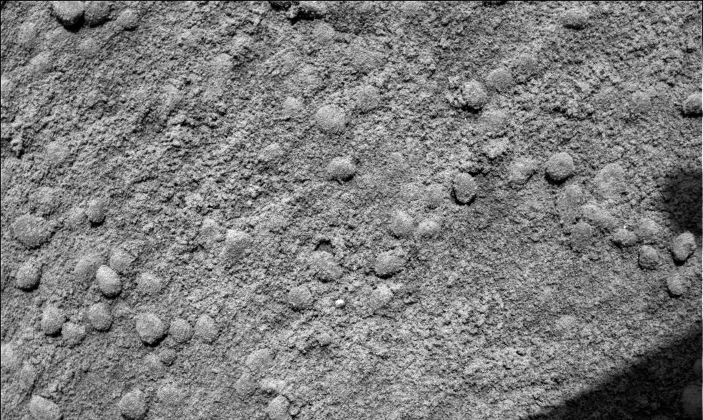
1735x2272x1
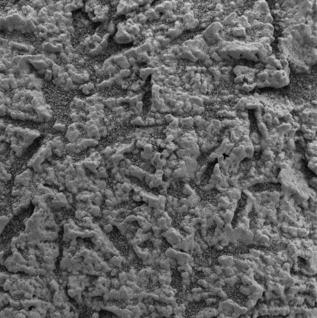
PIA05331:
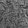
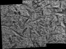
"Stucco" Walls
Full Resolution:
TIFF
(2.167 MB)
JPEG
(443.7 kB)
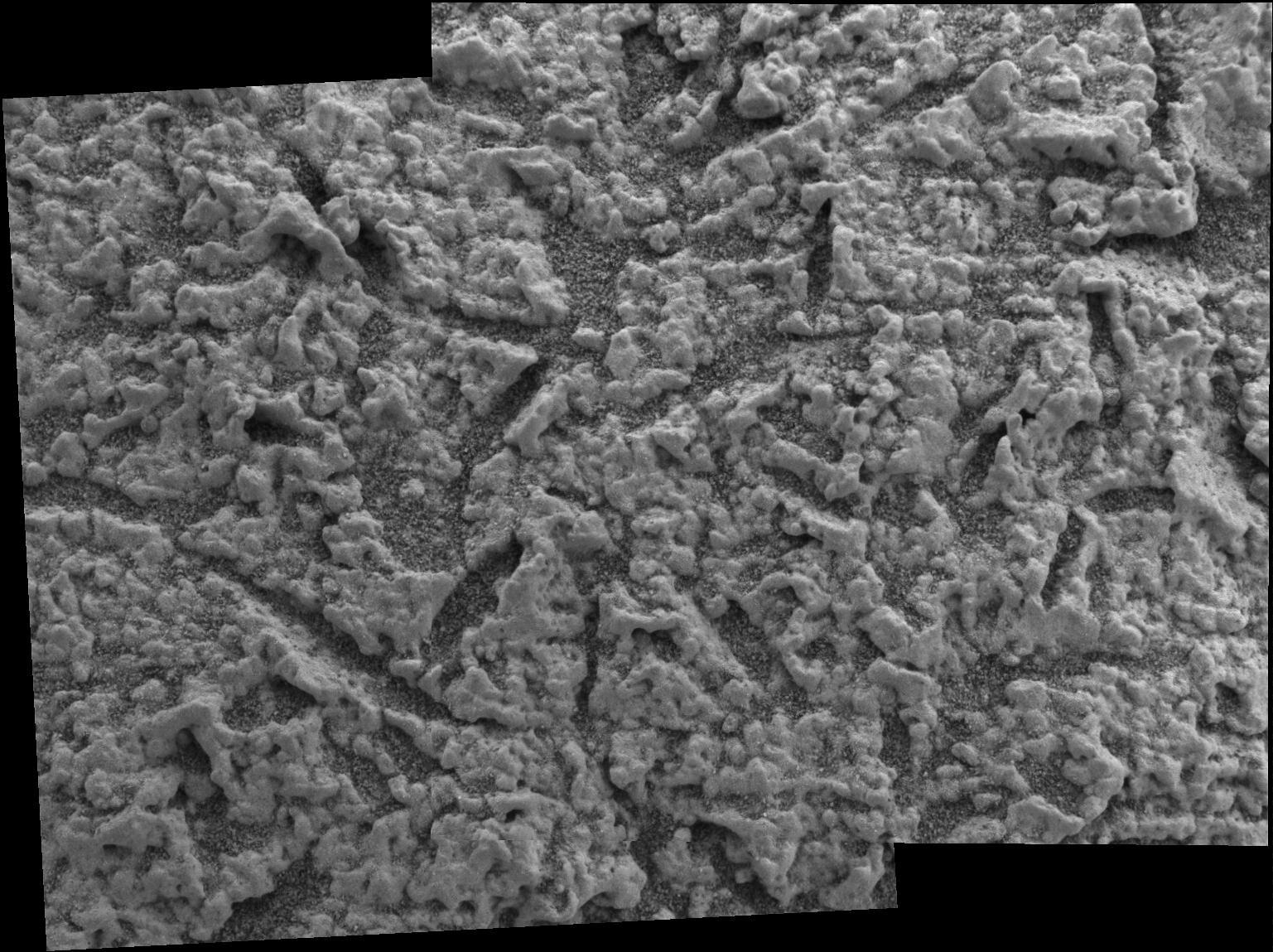
2004-02-19
Mars
Mars Exploration Rover (MER)
Microscopic Imager
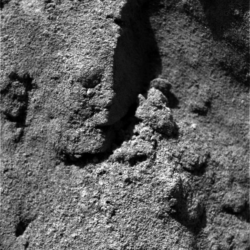
1024x1024x1
PIA05332:
"Stucco" Walls-2
Full Resolution:
TIFF
(1.05 MB)
JPEG
(232.7 kB)
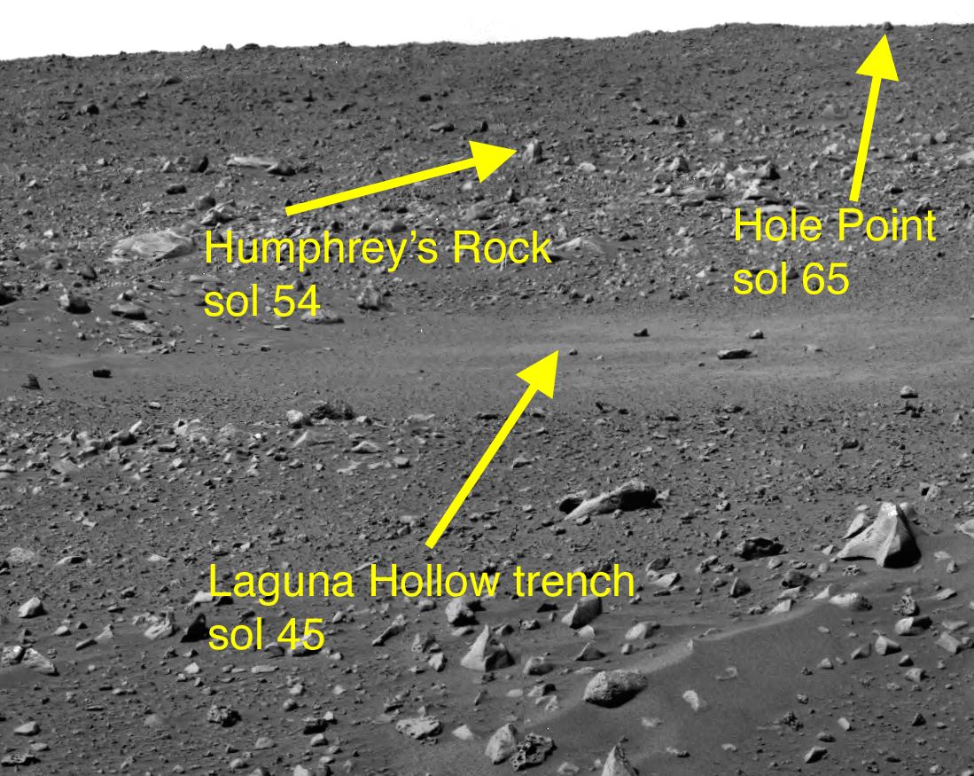
2004-02-19
Mars
Mars Exploration Rover (MER)
Hazcam
1024x1024x1
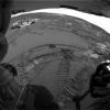
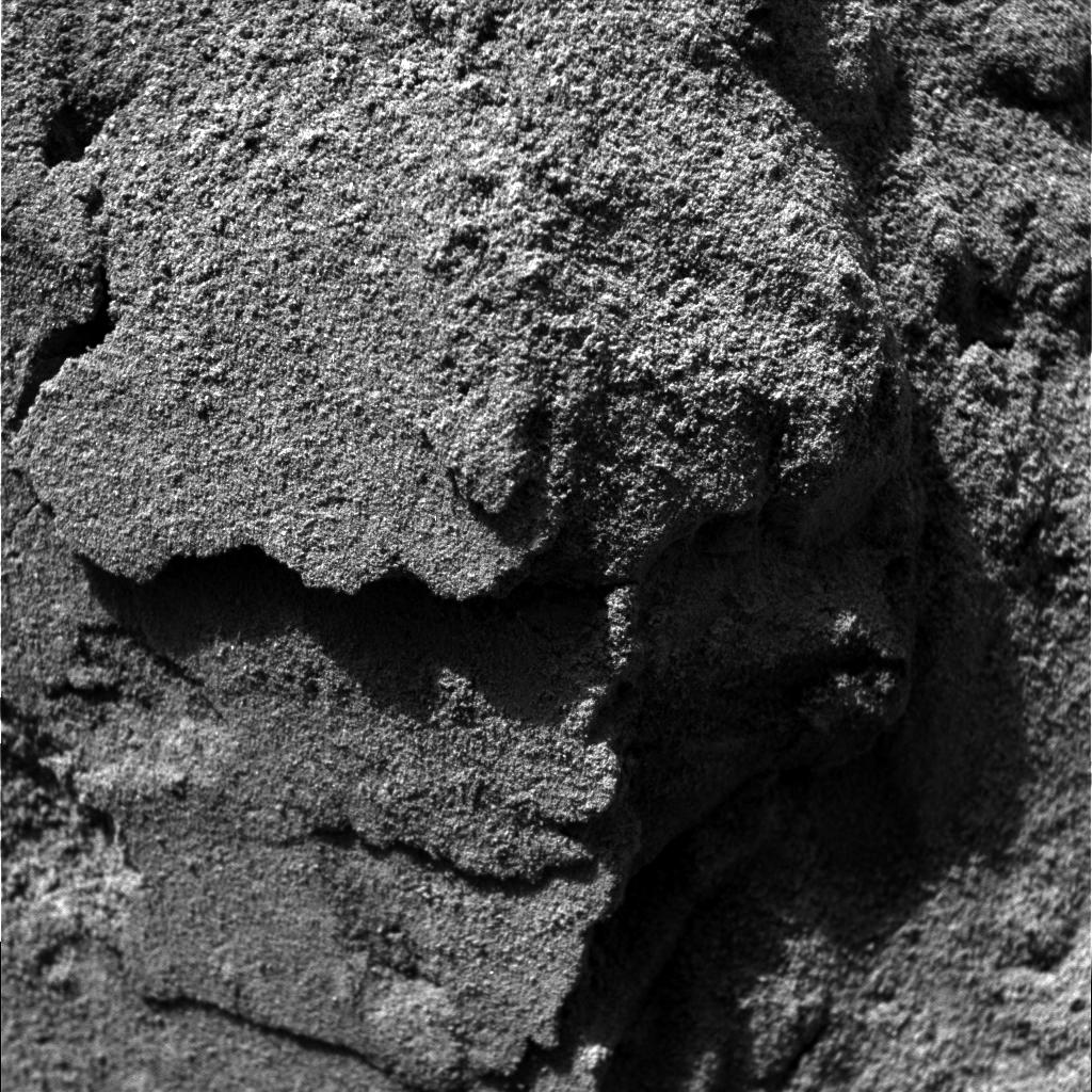
PIA05333:
Wiggling Its Way to Discovery
Full Resolution:
TIFF
(1.05 MB)
JPEG
(262.5 kB)
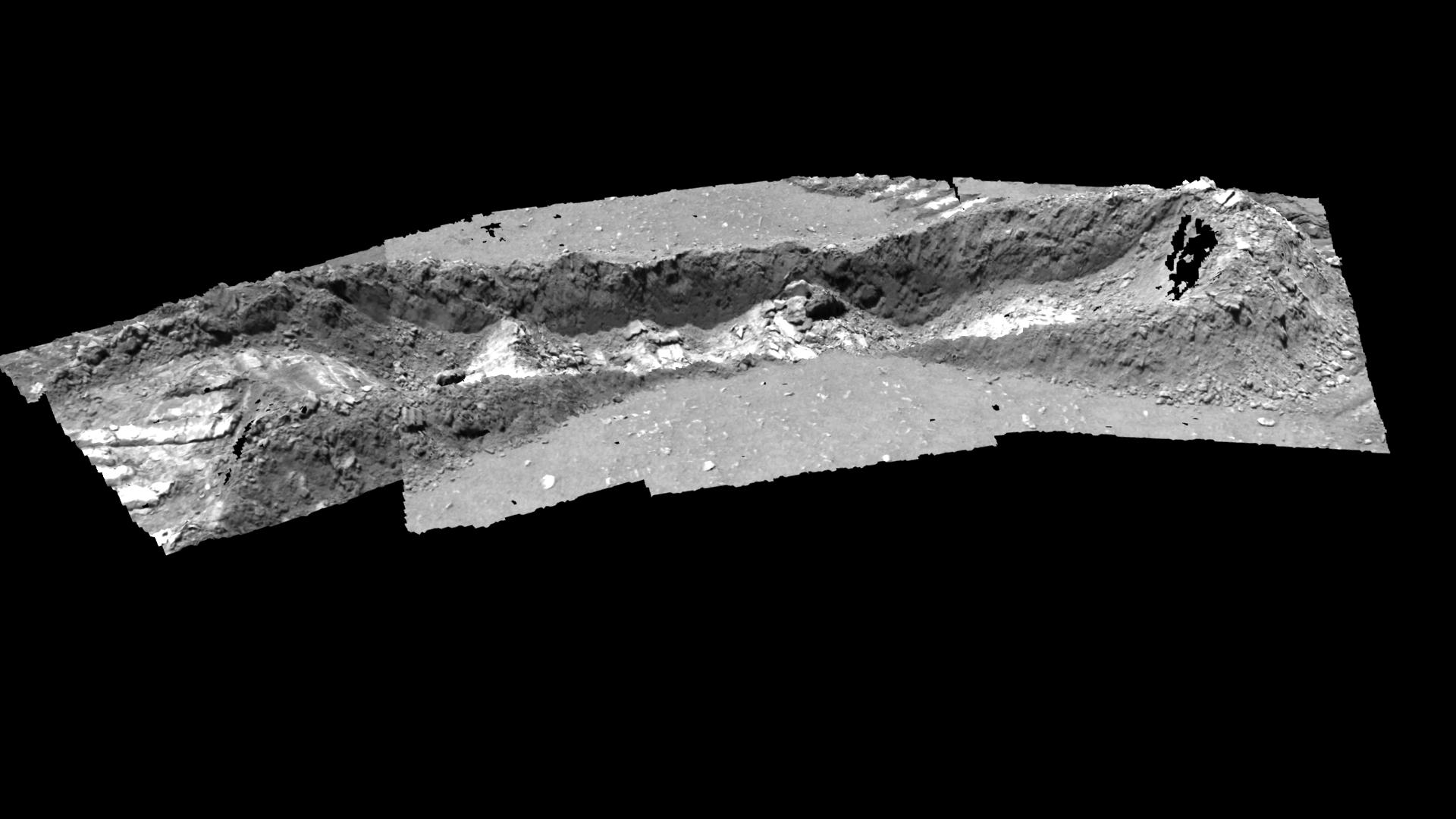
2004-02-19
Mars
Mars Exploration Rover (MER)
Hazcam
1024x1024x1
PIA05321:
Wiggling Its Way to Discovery
Full Resolution:
TIFF
(912.8 kB)
JPEG
(97.27 kB)
2004-02-19
Mars
Mars Exploration Rover (MER)
Alpha Particle X-ray Spectrometer
1092x724x3
PIA05322:
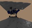
Grooving in Trenchtown (computer animation)
Full Resolution:
TIFF
(1.137 MB)
JPEG
(77.74 kB)
2004-02-19
Mars
Mars Exploration Rover (MER)
Hazcam
512x512x9
PIA05323:
Grooving in Trenchtown
Full Resolution:
2004-02-19
Mars
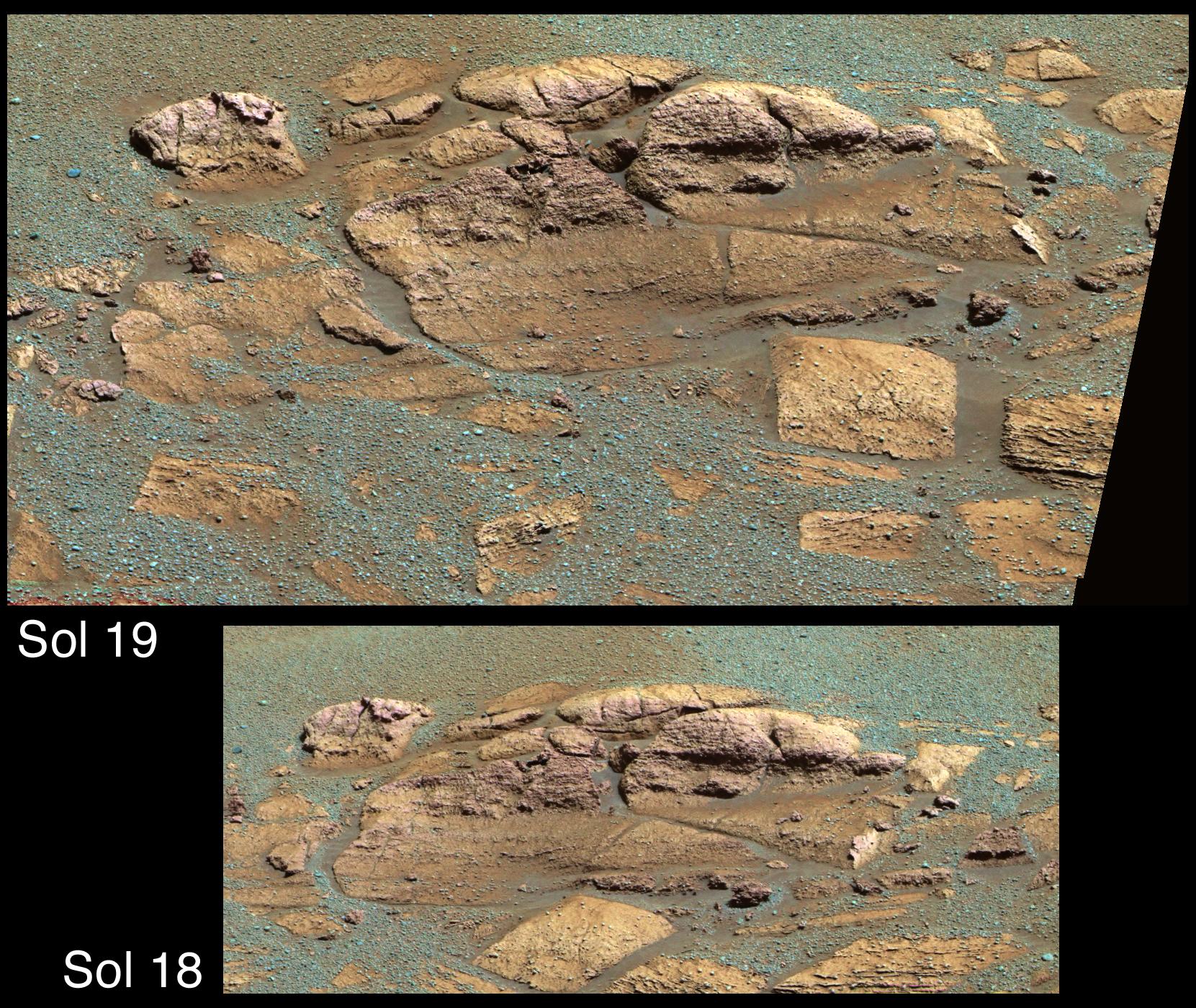
Mars Exploration Rover (MER)
Panoramic Camera
13884x3356x1
PIA05328:
Charlie Flats and El Capitan
Full Resolution:
TIFF
(25.4 MB)
JPEG
(6.156 MB)
2004-02-19
Mars
Mars Exploration Rover (MER)
Panoramic Camera
1024x1024x3
PIA05330:
'Laguna Hollow'Undisturbed
Full Resolution:
TIFF
(3.15 MB)
JPEG
(136.2 kB)
2004-02-20
Mars
Mars Exploration Rover (MER)
Hazcam
1024x1024x1
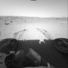
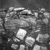
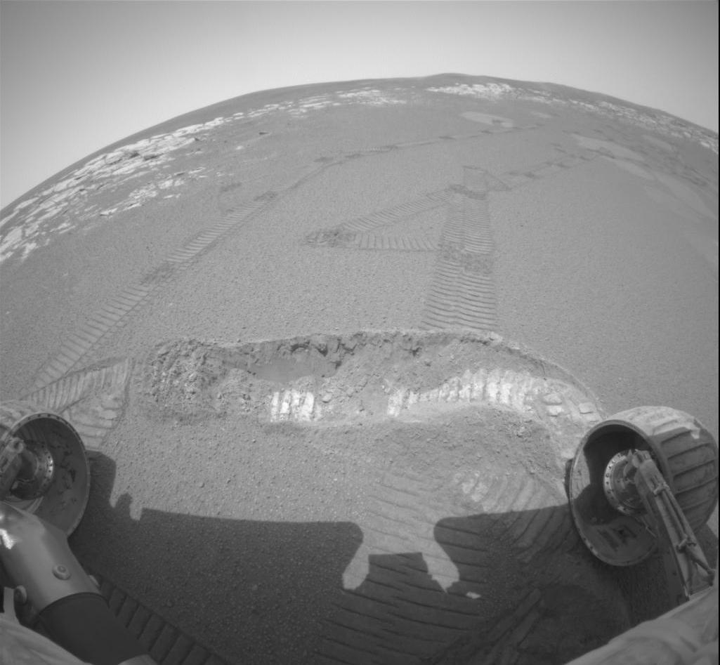
PIA05337:
Spirit Digs a Trench
Full Resolution:
TIFF
(1.018 MB)
JPEG
(127.5 kB)
2004-02-20
Mars
Mars Exploration Rover (MER)
Panoramic Camera
Rock Abrasion Tool (RAT)
1274x896x3
PIA05338:
Plotting and Scheming
Full Resolution:
TIFF
(2.938 MB)
JPEG
(208 kB)
2004-02-22
Mars
Mars Exploration Rover (MER)
Hazcam
512x512x1
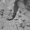
PIA05339:
Spirit Shadow over Laguna Trench
Full Resolution:
TIFF
(254.3 kB)
JPEG
(29.59 kB)
2004-02-24
Mars
Mars Exploration Rover (MER)
Panoramic Camera
1871x1022x3
PIA05441:
Covered Ground
Full Resolution:
TIFF
(2.336 MB)
JPEG
(422.8 kB)
2004-02-24
Mars
Mars Exploration Rover (MER)
Hazcam
Rock Abrasion Tool (RAT)
512x512x1
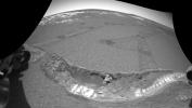
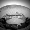
PIA05442:
Opportunity at El Capitan
Full Resolution:
TIFF
(262.6 kB)
JPEG
(38.01 kB)
2004-02-24
Mars
Mars Exploration Rover (MER)
Hazcam
1024x624x11
PIA05344:
Breaking Martian Ground
Full Resolution:
2004-02-24
Mars
Mars Exploration Rover (MER)
Hazcam
512x512x10
PIA05345:
Draped in the Rover's Shadow
Full Resolution:
2004-02-25
Mars
Mars Exploration Rover (MER)
Microscopic Imager
Rock Abrasion Tool (RAT)
963x963x1
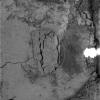
PIA05445:
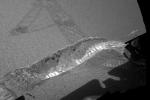
Opportunity Slices into the Surface of Mars
Full Resolution:
TIFF
(928.6 kB)
JPEG
(207.1 kB)
2004-02-25
Mars
Mars Exploration Rover (MER)
Microscopic Imager
Rock Abrasion Tool (RAT)
965x965x3
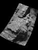
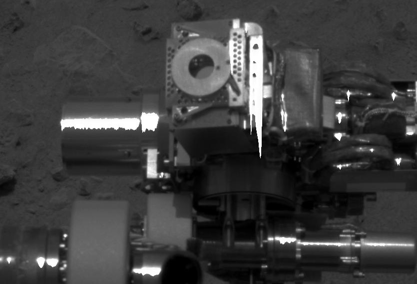
PIA05446:
Grinding Wheel Profile
Full Resolution:
TIFF
(1.878 MB)
JPEG
(226.9 kB)
2004-02-26
Mars
Mars Exploration Rover (MER)
Panoramic Camera
1024x1024x3
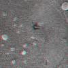
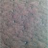
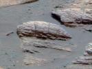
PIA05453:
Are They Telltale Ripples?
Full Resolution:
TIFF
(2.633 MB)
JPEG
(215 kB)
2004-02-26
Mars
Mars Exploration Rover (MER)
Panoramic Camera
1012x818x3
PIA05452:
Ripples or Dunes?
Full Resolution:
TIFF
(2.384 MB)
JPEG
(93.27 kB)
2004-02-26
Mars
Mars Exploration Rover (MER)
Panoramic Camera
360x240x101
PIA05343:
The Sun Sets on Mars
Full Resolution:
2004-02-26
Mars
Mars Exploration Rover (MER)
Panoramic Camera
5857x1185x1
PIA05449:
The Bumpy Road Ahead
Full Resolution:
TIFF
(5.548 MB)
JPEG
(845.4 kB)
2004-02-26
Mars
Mars Exploration Rover (MER)
Navigation Camera
7466x1008x1
PIA05450:
Long and Winding Road
Full Resolution:
TIFF
(6.214 MB)
JPEG
(966.5 kB)
2004-02-26
Mars
Mars Exploration Rover (MER)
Panoramic Camera
2560x1022x3
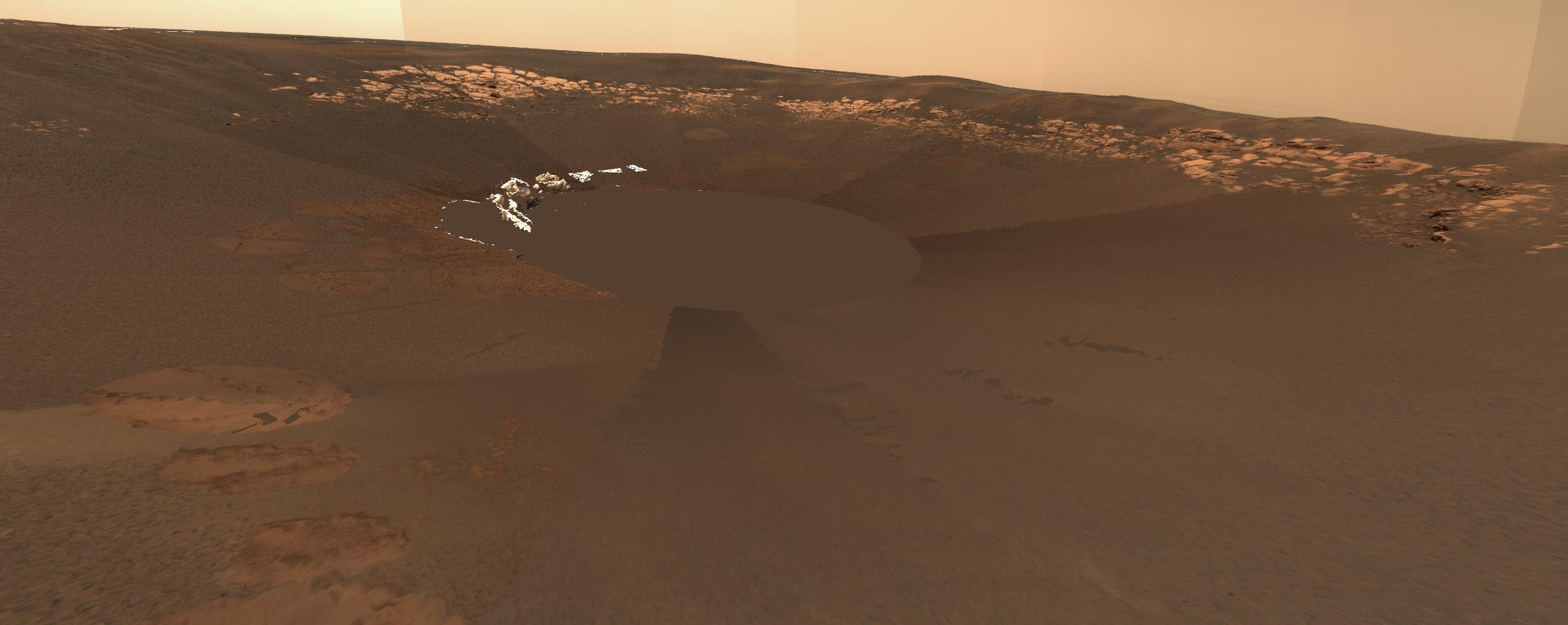
PIA05451:
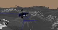
Opportunity Landing Spot Panorama (3-D Model)
Full Resolution:
TIFF
(4.896 MB)
JPEG
(191 kB)
2004-02-26
Mars
Mars Exploration Rover (MER)
Microscopic Imager
1024x612x1
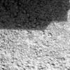
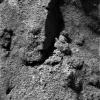
PIA05454:
The Answer is in the Crests and Troughs
Full Resolution:
TIFF
(627.5 kB)
JPEG
(202.1 kB)
2004-02-26
Mars
Mars Exploration Rover (MER)
Microscopic Imager
1024x612x1
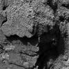
PIA05455:
The Answer is in the Crests and Troughs -2
Full Resolution:
TIFF
(627.5 kB)
JPEG
(140.4 kB)
2004-02-26
Mars
Mars Exploration Rover (MER)
Panoramic Camera
512x512x3
PIA05456:
Charlie Flats
Full Resolution:
TIFF
(787.5 kB)
JPEG
(66.55 kB)
2004-02-26
Mars
Mars Exploration Rover (MER)
Panoramic Camera
1661x1400x3
PIA05457:
El Capitan
Full Resolution:
TIFF
(5.975 MB)
JPEG
(551.8 kB)
2004-02-27
Mars
Mars Exploration Rover (MER)
Hazcam
Rock Abrasion Tool (RAT)
1024x1024x1
PIA05459:
Circular Signs of the Rock Abrasion Tool
Full Resolution:
TIFF
(1.023 MB)
JPEG
(133.8 kB)
2004-02-27
Mars
Mars Exploration Rover (MER)
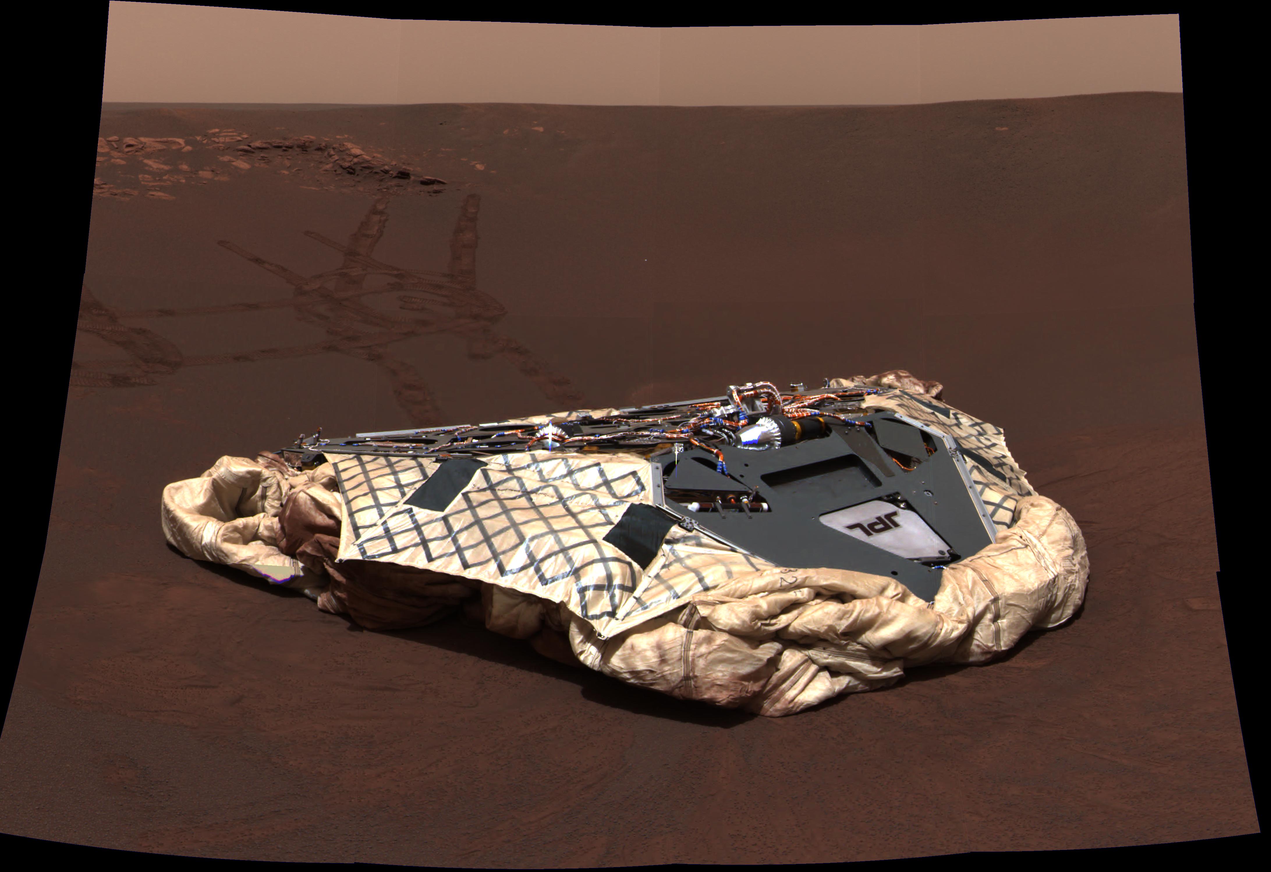
Panoramic Camera
4367x2997x3
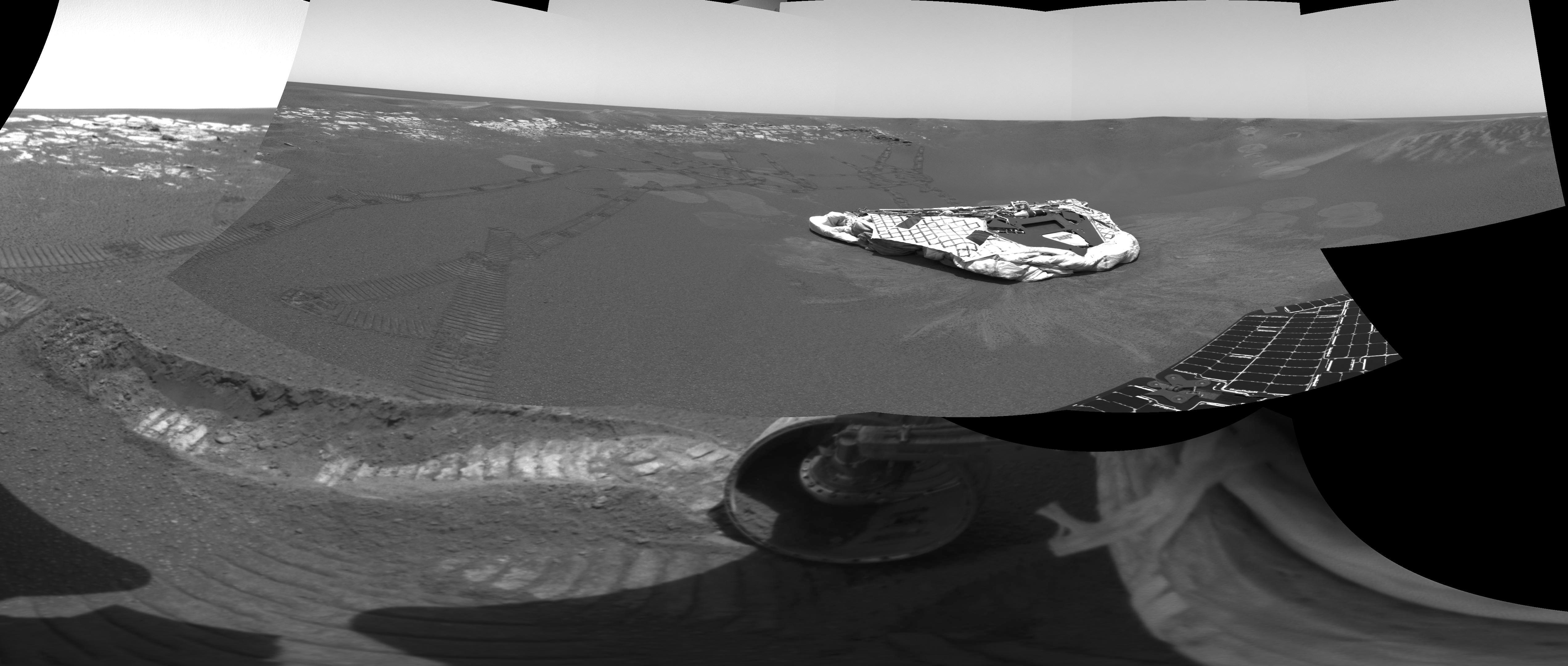
PIA05460:
Opportunity's Empty Nest
Full Resolution:
TIFF
(24.87 MB)
JPEG
(741.8 kB)
2004-02-27
Mars
Mars Exploration Rover (MER)
Panoramic Camera
1113x731x3
PIA05461:
Pre-Planning the "Last Chance"
Full Resolution:
TIFF
(852.1 kB)
JPEG
(152.5 kB)
2004-03-02
Mars
Mars Exploration Rover (MER)
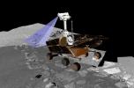
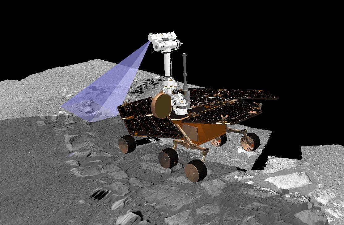
Alpha Particle X-ray Spectrometer
1920x1080x3
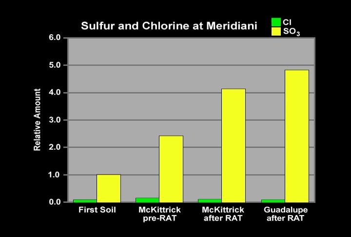
PIA05467:
History Leaves Salts Behind
Full Resolution:
TIFF
(600.3 kB)
JPEG
(143.3 kB)
2004-03-02
Mars
Mars Exploration Rover (MER)
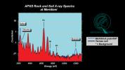
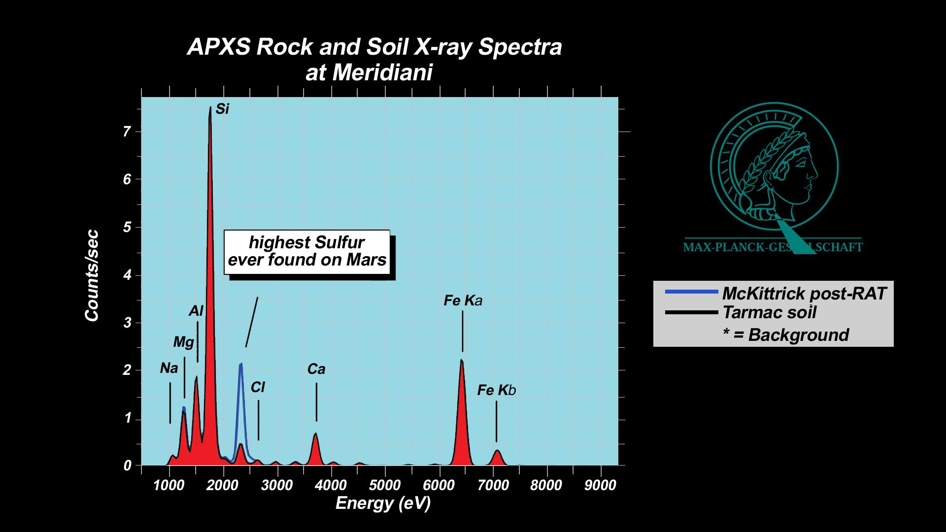
Alpha Particle X-ray Spectrometer
Rock Abrasion Tool (RAT)
1920x1080x3
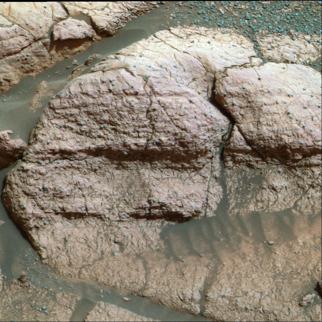
PIA05468:
"McKittrick" Rich in Sulfur
Full Resolution:
TIFF
(546.9 kB)
JPEG
(137.5 kB)
2004-03-02
Mars
Mars Exploration Rover (MER)
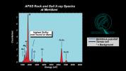
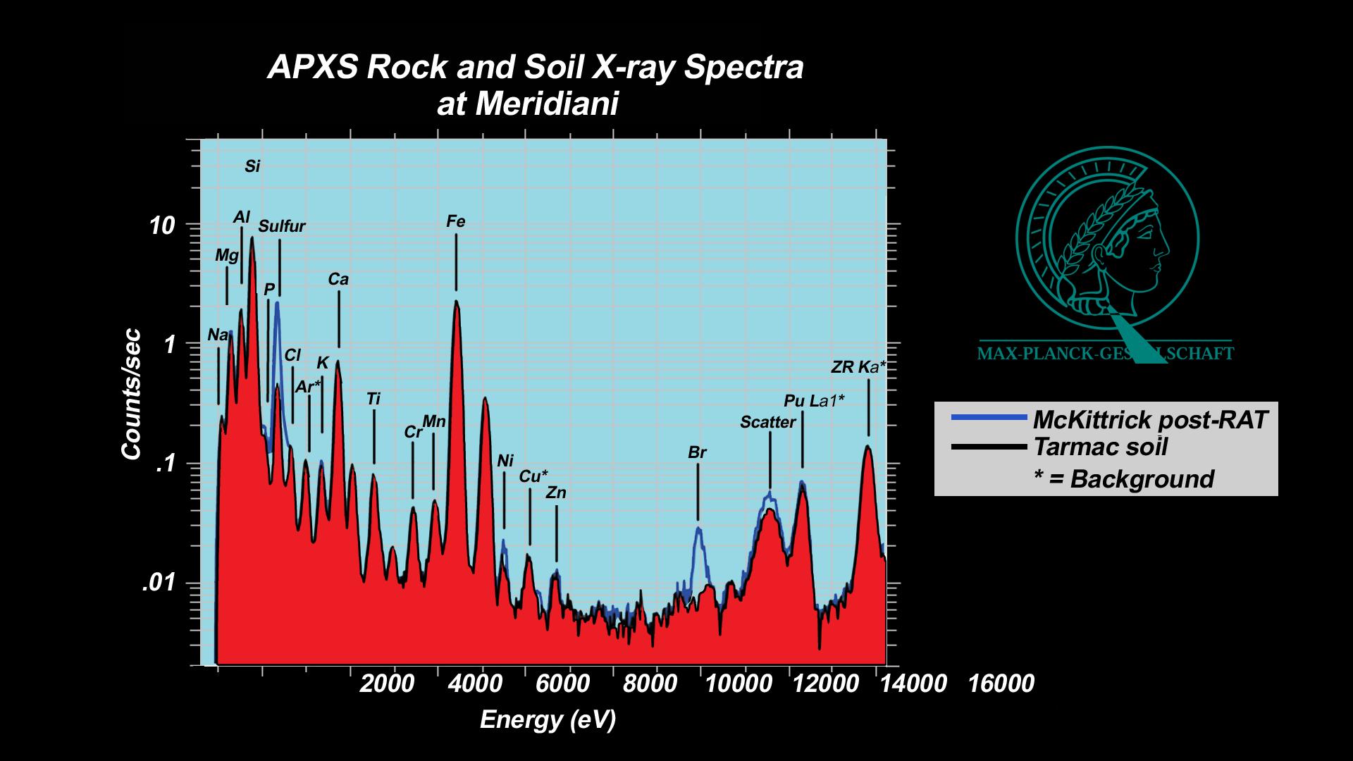
Alpha Particle X-ray Spectrometer
Rock Abrasion Tool (RAT)
1920x1080x3
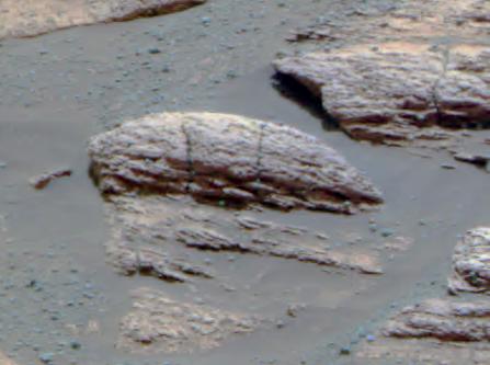
PIA05469:
Salty Martian Rock
Full Resolution:
TIFF
(597 kB)
JPEG
(161.6 kB)
2004-03-02
Mars
Mars Exploration Rover (MER)
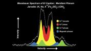
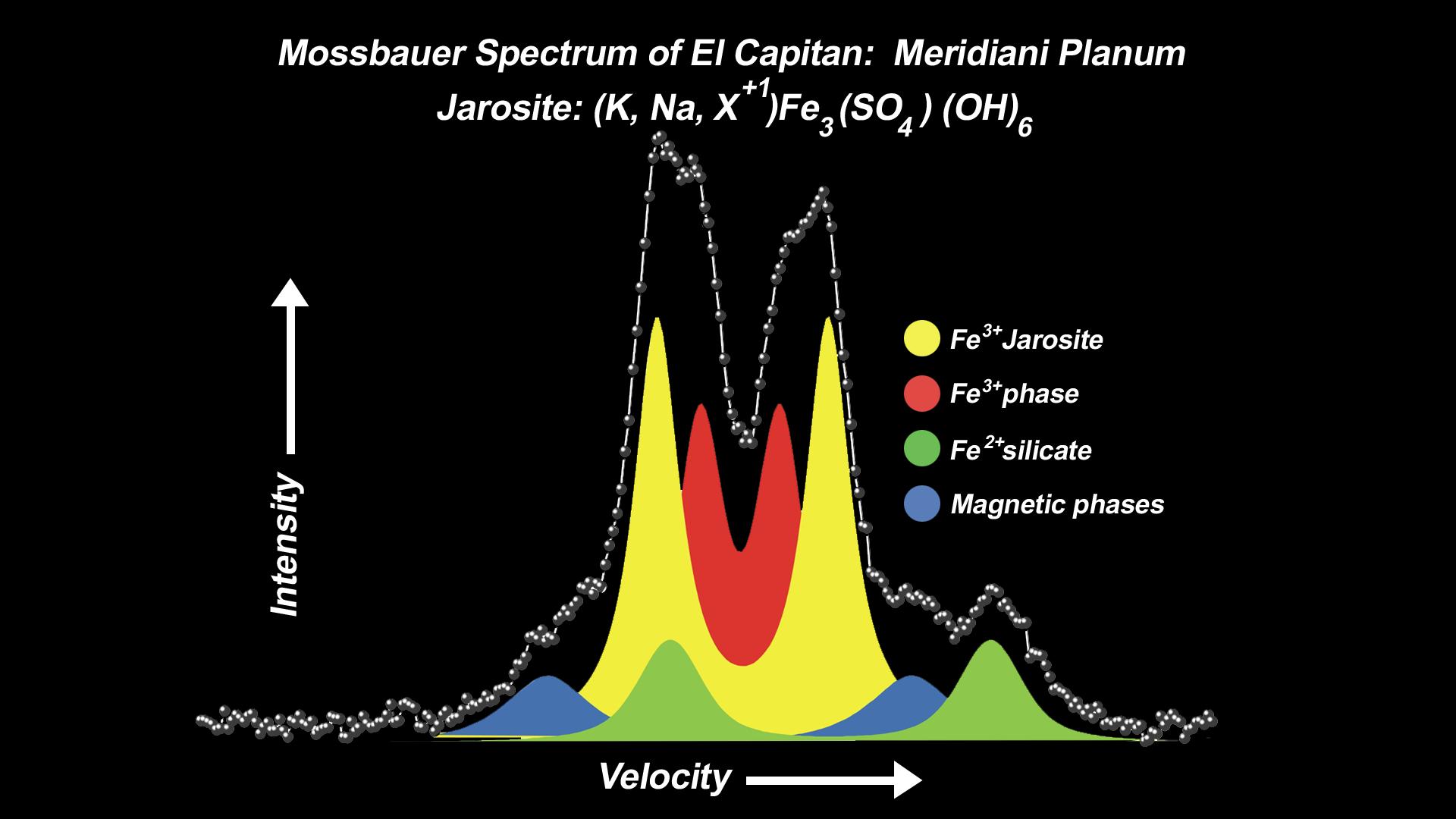
Moessbauer Spectrometer
1920x1080x3
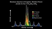
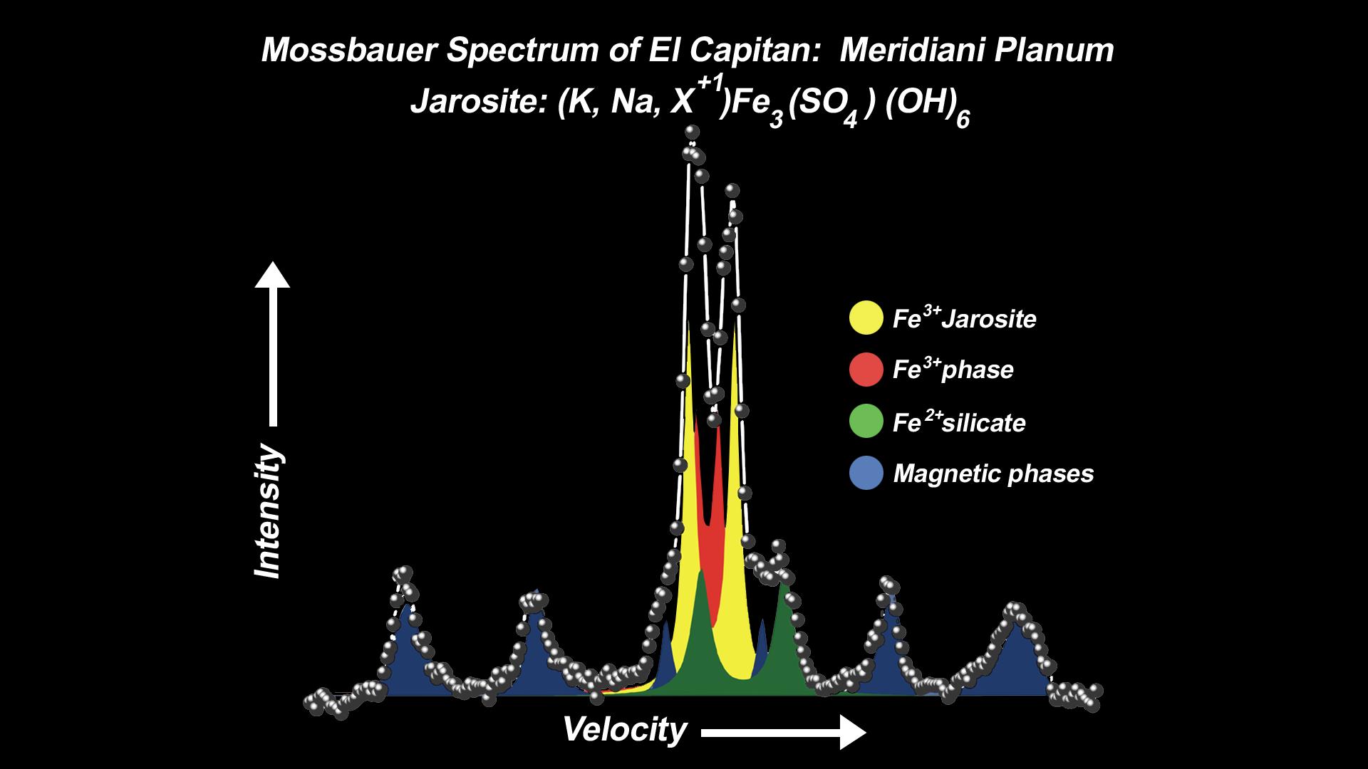
PIA05470:
Mineral Tells Tale of Watery Past
Full Resolution:
TIFF
(427.8 kB)
JPEG
(118.6 kB)
2004-03-02
Mars
Mars Exploration Rover (MER)
Moessbauer Spectrometer
1920x1080x3
PIA05471:
Mineral Tells Tale of Watery Past-2
Full Resolution:
TIFF
(402.9 kB)
JPEG
(116.1 kB)
2004-03-02
Mars
Mars Exploration Rover (MER)
Miniature Thermal Emission Spectrometer
1920x1080x3
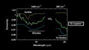
PIA05472:
"El Capitan" Exposed!
Full Resolution:
TIFF
(436.2 kB)
JPEG
(107.3 kB)
2004-03-02
Mars
Mars Exploration Rover (MER)
Microscopic Imager
732x733x1
PIA05473:
Focused on Robert E
Full Resolution:
TIFF
(462.5 kB)
JPEG
(43.92 kB)
2004-03-02
Mars
Mars Exploration Rover (MER)
Microscopic Imager
431x428x1
PIA05474:
Focus on El Capitan
Full Resolution:
TIFF
(184.9 kB)
JPEG
(31.96 kB)
2004-03-02
Mars
Mars Exploration Rover (MER)
Microscopic Imager
509x503x1
PIA05475:
Focus on El Capitan-2
Full Resolution:
TIFF
(256.5 kB)
JPEG
(41.59 kB)
2004-03-02
Mars
Mars Exploration Rover (MER)
Microscopic Imager
1021x1024x1
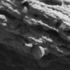
PIA05476:
Focus on El Capitan-3
Full Resolution:
TIFF
(1.047 MB)
JPEG
(208.7 kB)
2004-03-02
Mars
Mars Exploration Rover (MER)
Navigation Camera
3940x1809x1
PIA05477:
Over Here, Over There
Full Resolution:
TIFF
(3.206 MB)
JPEG
(608.7 kB)
2004-03-02
Mars
Mars Exploration Rover (MER)
Panoramic Camera
1024x1024x3
PIA05478:
The Texture of El Capitan
Full Resolution:
TIFF
(3.15 MB)
JPEG
(192.8 kB)
2004-03-02
Mars
Mars Exploration Rover (MER)
Microscopic Imager
1628x1272x1
PIA05479:
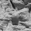
Focus on Guadalupe
Full Resolution:
TIFF
(2 MB)
JPEG
(293.3 kB)
2004-03-02
Mars
Mars Exploration Rover (MER)
Microscopic Imager
1022x1023x1
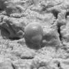
PIA05480:
Larger Grains Suggest Presence of Fluid
Full Resolution:
TIFF
(1.047 MB)
JPEG
(188.8 kB)
2004-03-02
Mars
Mars Exploration Rover (MER)
Alpha Particle X-ray Spectrometer
Rock Abrasion Tool (RAT)
720x486x3
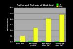
PIA05483:
A Trail of Salts
Full Resolution:
TIFF
(110.4 kB)
JPEG
(29.02 kB)
2004-03-02
Mars
Mars Exploration Rover (MER)
Panoramic Camera
1278x352x3
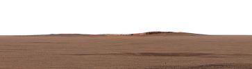
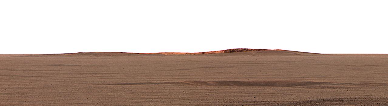
PIA05484:
Opportunity Spies "Endurance" on the Horizon
Full Resolution:
TIFF
(712.3 kB)
JPEG
(41.42 kB)
2004-03-02
Mars
Mars Exploration Rover (MER)
Microscopic Imager
817x617x1
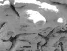
PIA05481:
Which Came First? Vug or Spherule?
Full Resolution:
TIFF
(349.5 kB)
JPEG
(42.63 kB)
2004-03-02
Mars
Mars Exploration Rover (MER)
Panoramic Camera
447x333x3
PIA05482:
Ripples in Rocks Point to Water
Full Resolution:
TIFF
(427 kB)
JPEG
(21.8 kB)
2004-03-02
Mars
Mars Exploration Rover (MER)
Panoramic Camera
3100x1373x3
PIA05492:
"El Capitan's" Scientific Gems
Full Resolution:
TIFF
(9.472 MB)
JPEG
(495.7 kB)
2004-03-02
Mars
Mars Exploration Rover (MER)
Microscopic Imager
1537x1149x1
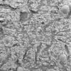
PIA05493:
Vugs Provide Clues to Martian Past
Full Resolution:
TIFF
(1.768 MB)
JPEG
(299.4 kB)
2004-03-03
Mars
Mars Exploration Rover (MER)
Hazcam
256x256x1
PIA05494:
A View of Opportunity's Dance Moves
Full Resolution:
TIFF
(65.83 kB)
JPEG
(11.85 kB)
2004-03-03
Mars
Mars Exploration Rover (MER)
Microscopic Imager
Navigation Camera
Rock Abrasion Tool (RAT)
1024x1024x1
PIA05495:
Evidence of a Water-Soaked Past
Full Resolution:
TIFF
(1.05 MB)
JPEG
(226 kB)
2004-03-04
Mars
Mars Exploration Rover (MER)
Microscopic Imager
1024x1024x1
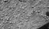
PIA05496:
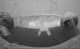
Mars Magnet Hits the Bull's-Eye
Full Resolution:
TIFF
(1.028 MB)
JPEG
(168.7 kB)
2004-03-04
Mars
Mars Exploration Rover (MER)
Panoramic Camera
1024x1024x1
PIA05497:
Accidental Art
Full Resolution:
TIFF
(988.2 kB)
JPEG
(166.1 kB)
2004-03-05
Mars
Mars Exploration Rover (MER)
Navigation Camera
Rock Abrasion Tool (RAT)
956x962x1
PIA05499:
A Hole in Humphrey
Full Resolution:
TIFF
(872.7 kB)
JPEG
(125.7 kB)
2004-03-11
Mars
Mars Exploration Rover (MER)
Navigation Camera
2486x681x1
PIA05538:
A Deep Dish for Discovery
Full Resolution:
TIFF
(1.569 MB)
JPEG
(226.2 kB)
2004-03-11
Mars
Mars Exploration Rover (MER)
Navigation Camera
1099x875x3
PIA05539:
Three Stops Ahead
Full Resolution:
TIFF
(1.367 MB)
JPEG
(199.5 kB)
2004-03-11
Mars
Mars Exploration Rover (MER)
Panoramic Camera
1920x1080x1
PIA05540:
Trenching Martian Ground
Full Resolution:
TIFF
(704.9 kB)
JPEG
(142.9 kB)
2004-03-12
Mars
Mars Exploration Rover (MER)
Miniature Thermal Emission Spectrometer
Panoramic Camera
5155x786x3
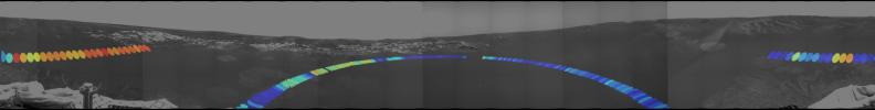
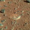
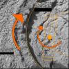
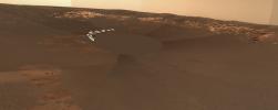
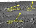
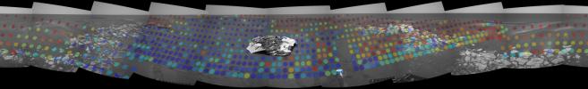
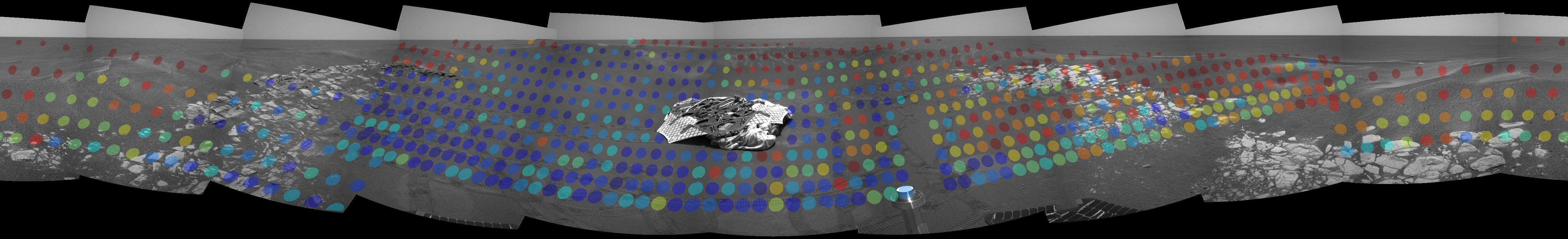
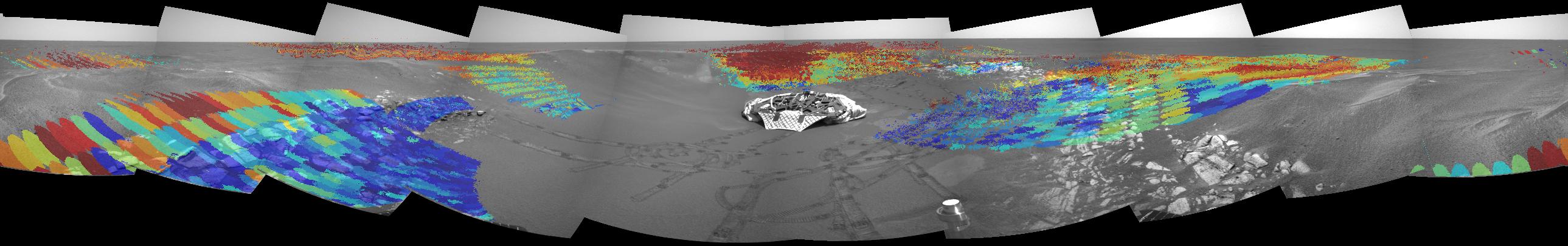
PIA05548:
Here-a-Hematite, There-a-Hematite
Full Resolution:
TIFF
(5.278 MB)
JPEG
(488.5 kB)
2004-03-11
Mars
Mars Exploration Rover (MER)
Panoramic Camera
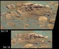
1337x930x1
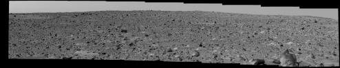
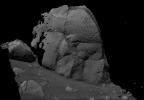
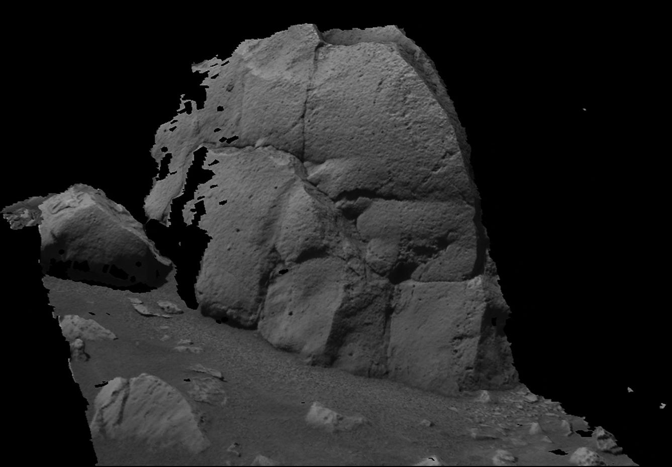
PIA05541:
'Humphrey' Like You've Never Seen It
Full Resolution:
TIFF
(749.4 kB)
JPEG
(91.76 kB)
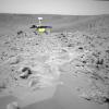
2004-03-11
Mars
Mars Exploration Rover (MER)
Panoramic Camera
1250x820x1
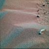
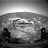
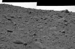
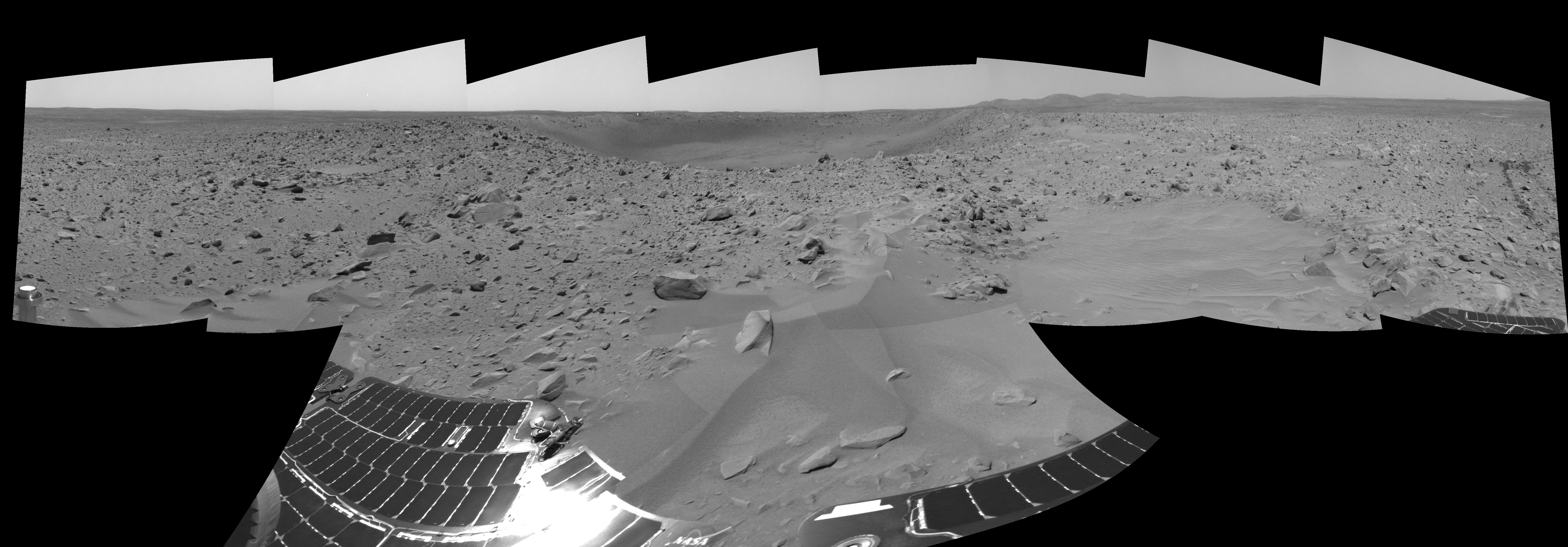
PIA05542:
The Rocky Road to the Crater Rim
Full Resolution:
TIFF
(790.9 kB)
JPEG
(155 kB)
2004-03-11
Mars
Mars Exploration Rover (MER)
Navigation Camera
702x668x3
PIA05543:
A Steep Climb
Full Resolution:
TIFF
(590 kB)
JPEG
(59.89 kB)
2004-03-11
Mars
Mars Exploration Rover (MER)
Navigation Camera
800x800x3
PIA05544:
King of the Crater Ledge
Full Resolution:
TIFF
(970.2 kB)
JPEG
(88.62 kB)
2004-03-11
Mars
Mars Exploration Rover (MER)
Navigation Camera
6616x2308x1
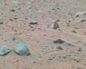
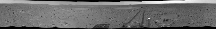
PIA05545:
'Bonneville' and Beyond
Full Resolution:
TIFF
(8.705 MB)
JPEG
(1.271 MB)
2004-03-11
Mars Exploration Rover (MER)
Panoramic Camera
1024x1024x1
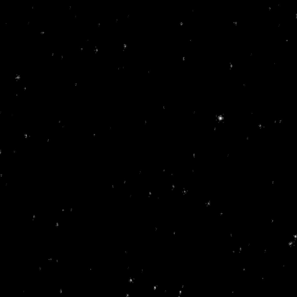
PIA05546:
Stars in Orion as Seen from Mars
Full Resolution:
TIFF
(71.62 kB)
JPEG
(17.04 kB)
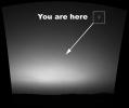
2004-03-11
Earth
Mars Exploration Rover (MER)
Navigation Camera
Panoramic Camera
1194x1007x1
PIA05547:
You are here: Earth as seen from Mars
Full Resolution:
TIFF
(711 kB)
JPEG
(55.18 kB)
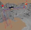
2004-03-12
Mars
Mars Exploration Rover (MER)
Miniature Thermal Emission Spectrometer
Navigation Camera
2578x405x3
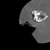
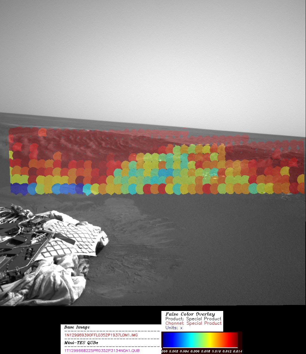
PIA05549:
Patches of Hematite
Full Resolution:
TIFF
(1.483 MB)
JPEG
(160 kB)
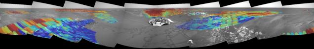
2004-03-12
Mars
Mars Exploration Rover (MER)
Miniature Thermal Emission Spectrometer
1024x1184x3
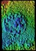
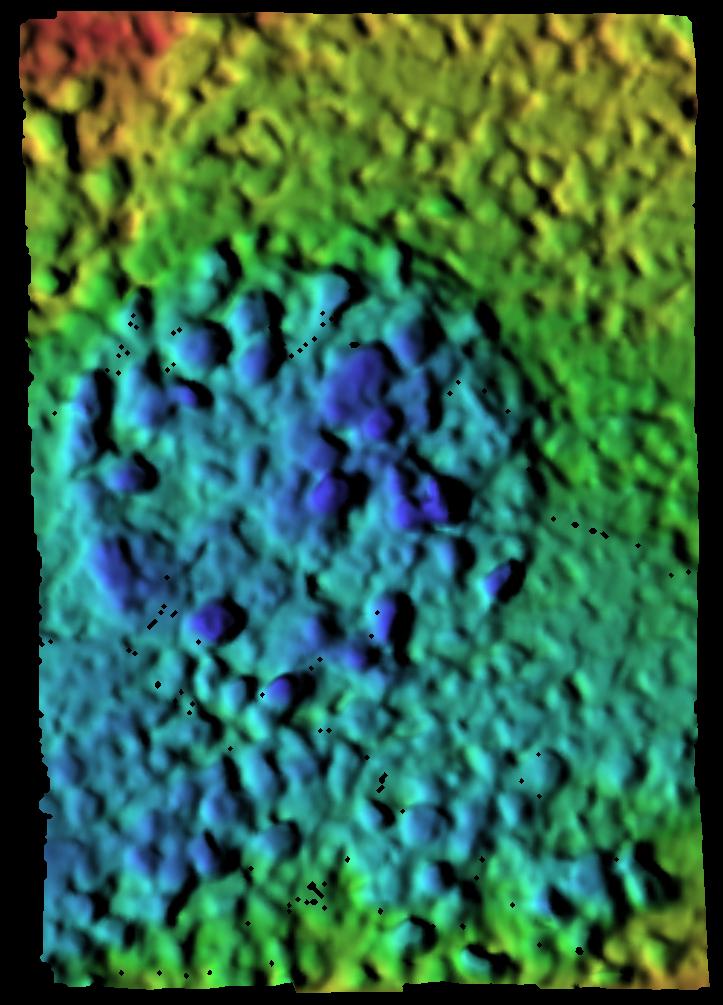
PIA05550:
Hematite Abundance Map at Echo
Full Resolution:
TIFF
(1.67 MB)
JPEG
(138.7 kB)
2004-03-12
Mars Exploration Rover (MER)
Panoramic Camera
1024x1024x1
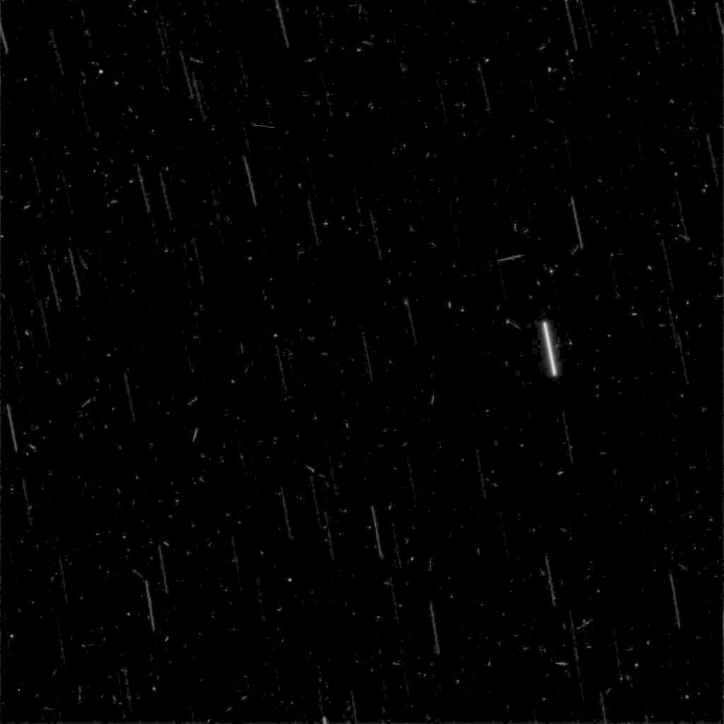
PIA05551:
Stars and Cosmic Rays Observed from Mars
Full Resolution:
TIFF
(145.9 kB)
JPEG
(53.38 kB)
2004-03-12
Sol (our sun)
Mars Exploration Rover (MER)
Panoramic Camera
360x360x5
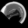
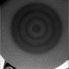
PIA05553:
Martian Moon Blocks Sun
Full Resolution:
2004-03-12
Sol (our sun)
Mars Exploration Rover (MER)
Panoramic Camera
360x360x5
PIA05556:
Deimos Crosses Face of Sun
Full Resolution:
2004-03-12
Mars Exploration Rover (MER)
Navigation Camera
Panoramic Camera
1174x1041x1
PIA05557:
It's a Bird, It's a Plane, It's a... Spacecraft?
Full Resolution:
TIFF
(600.2 kB)
JPEG
(54.38 kB)
1-100
101-200
201-300
301-400
401-500
501-600
601-700
701-800
801-900
901-1000
Currently displaying images:
401 - 500
of 1931


