My
List |
Addition Date
|
Target
|
Mission
|
Instrument
|
Size
|

|
2004-02-09 |
Mars
|
2001 Mars Odyssey
Mars Exploration Rover (MER)
|
|
1000x750x3 |
|
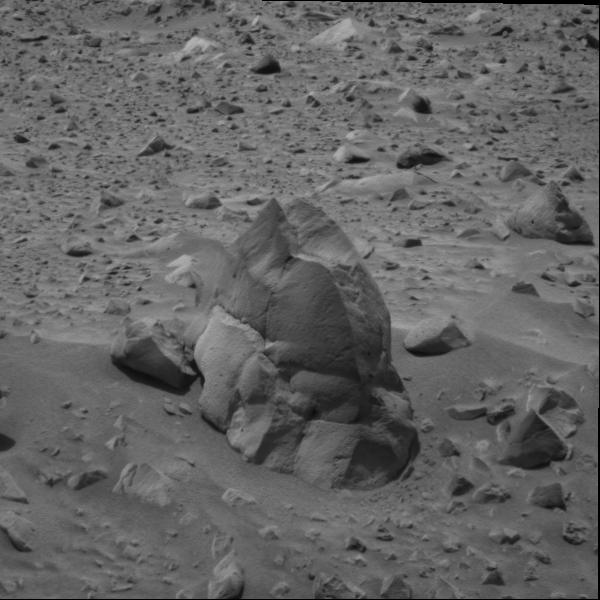
-
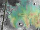
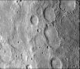
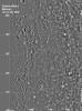
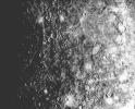
PIA05224:
-
Found You!
Full Resolution:
TIFF
(768.7 kB)
JPEG
(101.3 kB)
|
|
|
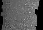
2008-09-22 |
Mars
|
2001 Mars Odyssey
Mars Exploration Rover (MER)
|
THEMIS
|
1830x1857x1 |
|
-
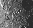
PIA11185:
-
Bigger Crater Farther South of 'Victoria' on Mars
Full Resolution:
TIFF
(3.402 MB)
JPEG
(478.3 kB)
|
|
|
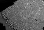
2004-01-13 |
Mars
|
2001 Mars Odyssey
Mars Global Surveyor (MGS)
Mars Exploration Rover (MER)
|
Mars Orbiter Camera (MOC)
Thermal Emission Imaging System
|
720x540x3 |
|
-
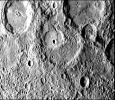
PIA05055:
-
Right on Target
Full Resolution:
TIFF
(337.8 kB)
JPEG
(41.77 kB)
|
|
|
2004-01-13 |
Mars
|
2001 Mars Odyssey
Mars Global Surveyor (MGS)
Mars Exploration Rover (MER)
|
Mars Orbiter Camera (MOC)
Thermal Emission Imaging System
|
720x540x3 |
|
-
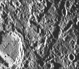
PIA05056:
-
Right on Target-2
Full Resolution:
TIFF
(302 kB)
JPEG
(36.3 kB)
|
|
|
2004-01-23 |
Mars
|
2001 Mars Odyssey
Mars Global Surveyor (MGS)
Mars Exploration Rover (MER)
|
THEMIS
THEMIS
|
640x480x3 |
|
-
PIA05154:
-
Targeting a Hematite-rich Terrain
Full Resolution:
TIFF
(922.8 kB)
JPEG
(52.31 kB)
|
|
|
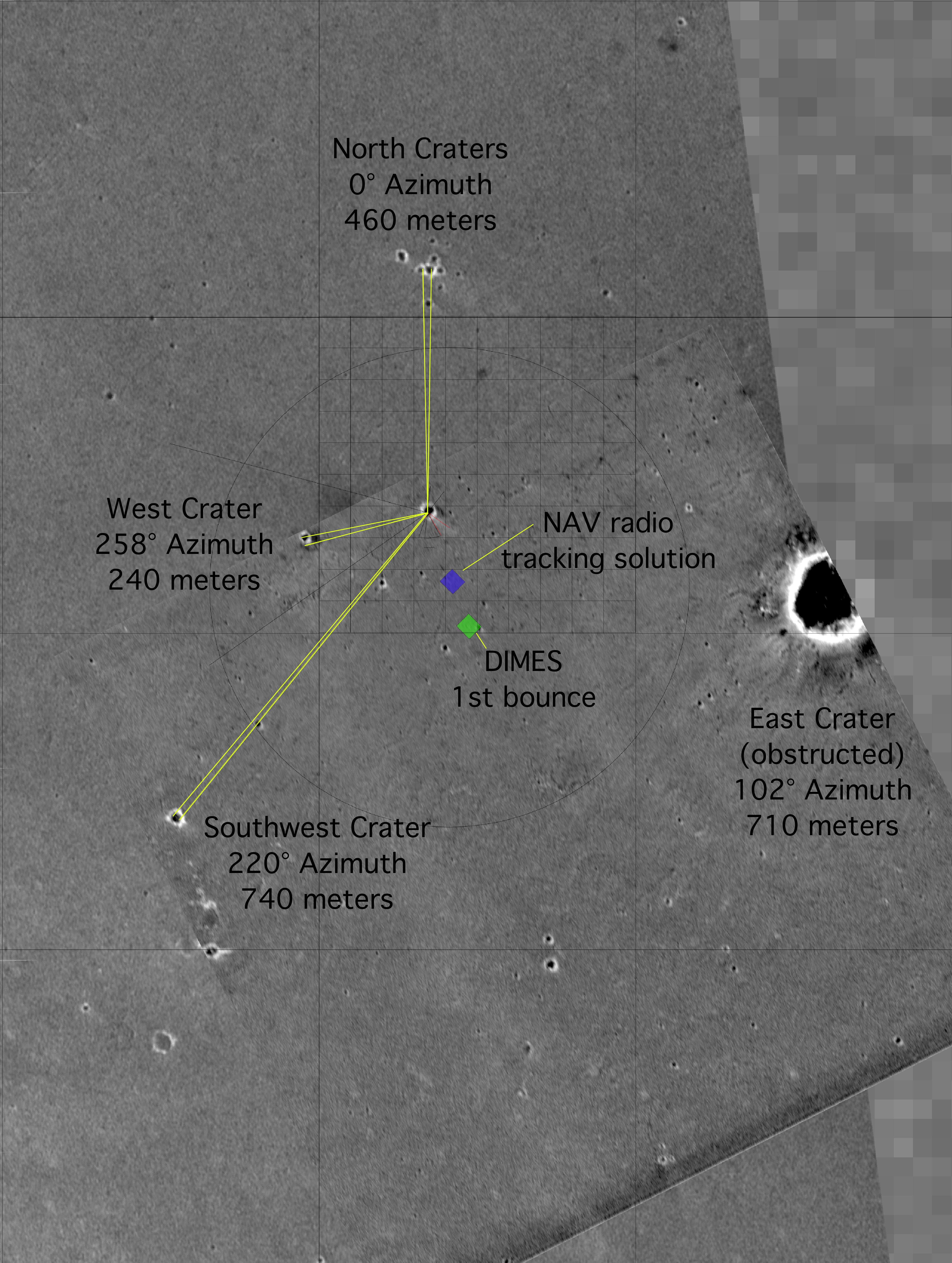
2004-02-09 |
Mars
|
2001 Mars Odyssey
Mars Global Surveyor (MGS)
Mars Exploration Rover (MER)
|
Descent Image Motion Estimation System (DIMES)
Mars Orbiter Camera (MOC)
Thermal Emission Imaging System
|
4000x5308x3 |
|
-
PIA05228:
-
"X" Marks the Spot
Full Resolution:
TIFF
(11.63 MB)
JPEG
(2.084 MB)
|
|
|
2004-03-18 |
Mars
|
2001 Mars Odyssey
Mars Global Surveyor (MGS)
Mars Exploration Rover (MER)
|
Mars Orbiter Camera (MOC)
Thermal Emission Imaging System
|
1051x681x3 |

|
-
PIA05581:
-
To 'Bonneville' and Beyond
Full Resolution:
TIFF
(2.15 MB)
JPEG
(98.5 kB)
|
|
|
2004-03-19 |
Mars
|
2001 Mars Odyssey
Mars Global Surveyor (MGS)
Mars Exploration Rover (MER)
|
Mars Orbiter Camera (MOC)
Thermal Emission Imaging System
|
1920x1080x3 |
|
-
PIA05590:
-
Ma'adim Vallis From the Top
Full Resolution:
TIFF
(1.295 MB)
JPEG
(85.07 kB)
|
|
|
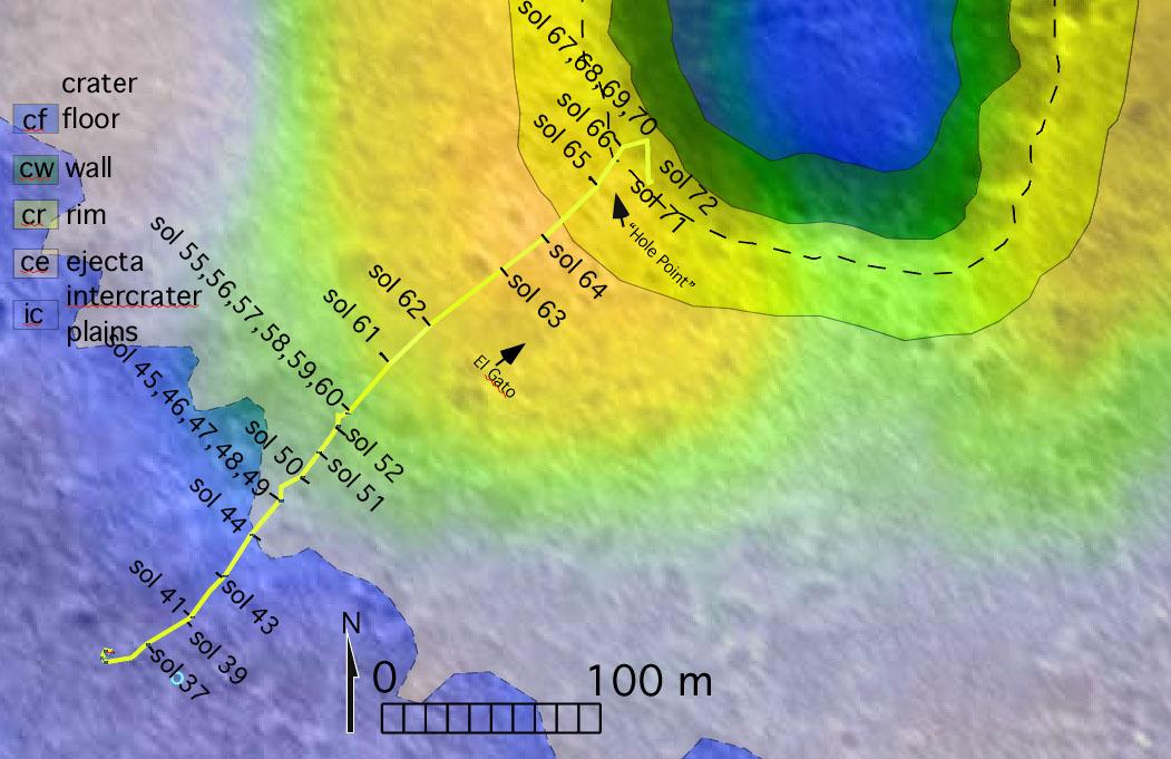
2004-04-28 |
Mars
|
2001 Mars Odyssey
Mars Global Surveyor (MGS)
Mars Exploration Rover (MER)
|
Mars Orbiter Camera (MOC)
Thermal Emission Imaging System
|
647x485x3 |
|
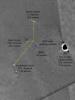
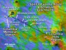
-
PIA05834:
-
Spirit's Express Route to 'Columbia Hills'
Full Resolution:
TIFF
(942.6 kB)
JPEG
(81.41 kB)
|
|
|
2004-04-29 |
Mars
|
2001 Mars Odyssey
Mars Global Surveyor (MGS)
Mars Exploration Rover (MER)
|
Mars Orbiter Camera (MOC)
Thermal Emission Imaging System
|
671x455x3 |

|
-
PIA05836:
-
Confirming Predictions
Full Resolution:
TIFF
(917.1 kB)
JPEG
(56.25 kB)
|
|
|
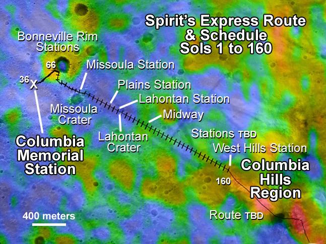
2004-07-16 |
Mars
|
2001 Mars Odyssey
Mars Global Surveyor (MGS)
Mars Exploration Rover (MER)
|
Mars Orbiter Camera (MOC)
Thermal Emission Spectrometer
|
1183x638x3 |
|
-
PIA06688:
-
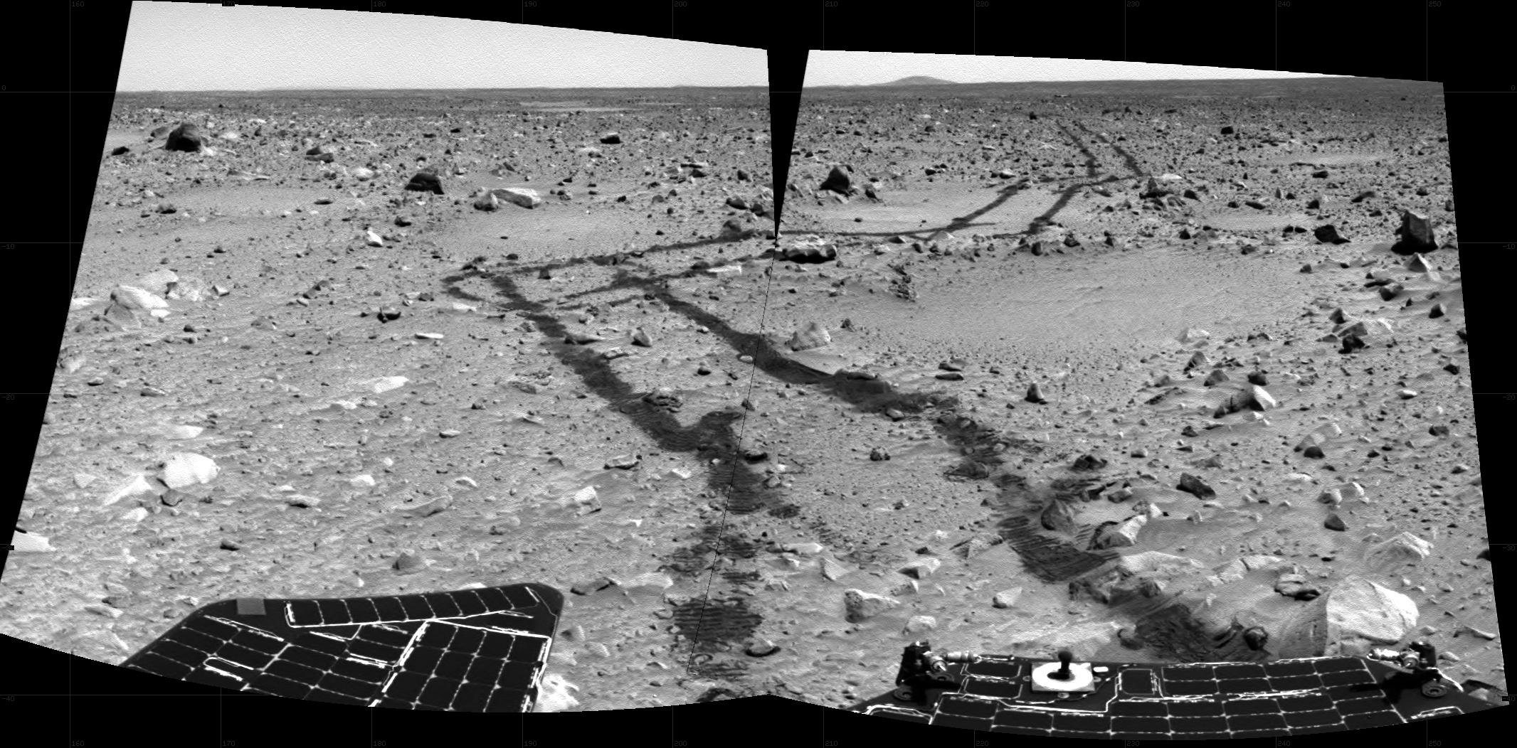
Spirit Traverse Map
Full Resolution:
TIFF
(2.267 MB)
JPEG
(102.9 kB)
|
|
|
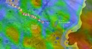
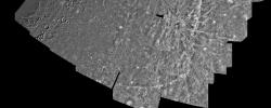
2005-12-05 |
Mars
|
2001 Mars Odyssey
Mars Global Surveyor (MGS)
Mars Exploration Rover (MER)
|
Descent Image Motion Estimation System (DIMES)
Mars Orbiter Camera
Thermal Emission Imaging System
|
1411x2043x3 |
|
-
PIA03616:
-
Partway to 'Victoria'
Full Resolution:
TIFF
(8.665 MB)
JPEG
(265.7 kB)
|
|
|
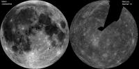
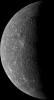
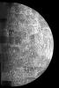
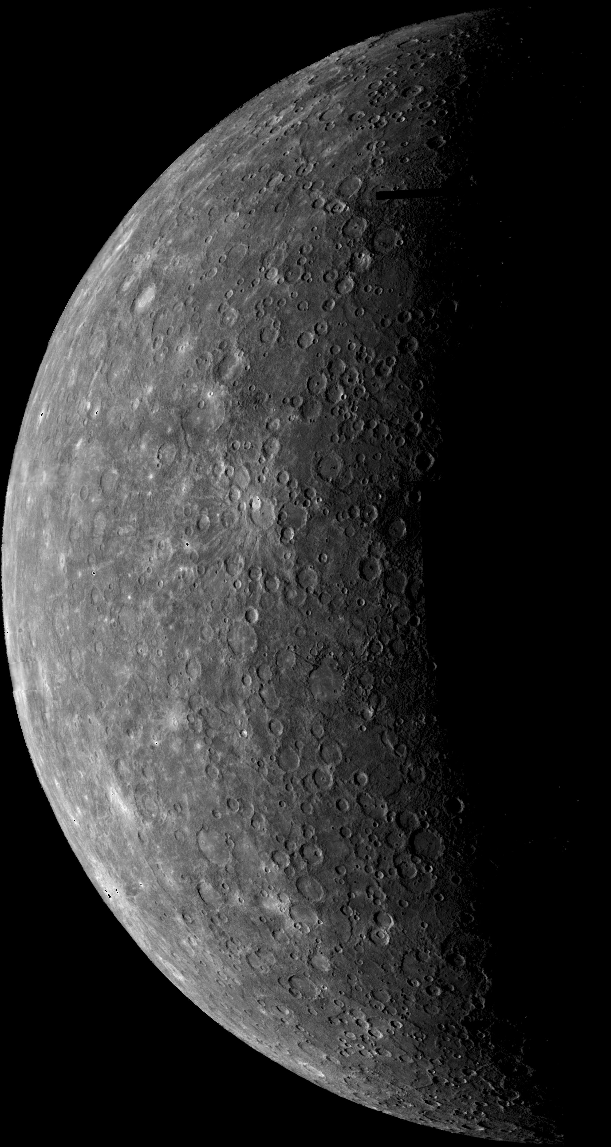
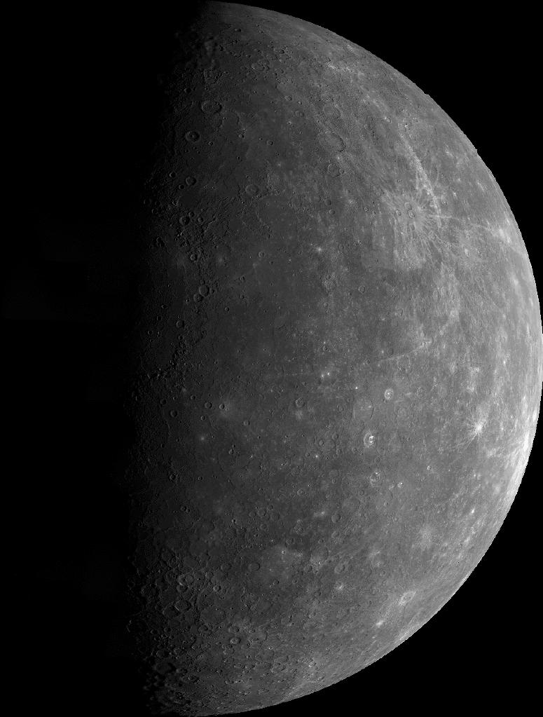
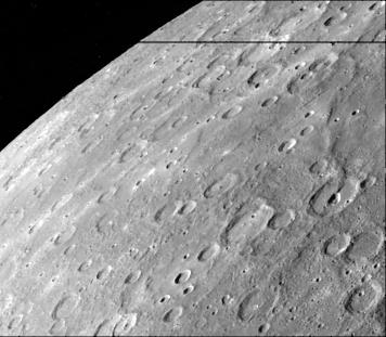
2011-09-26 |
Mercury
|
Clementine
MESSENGER
Mariner Venus Mercury (Mariner 10)
|
|
1248x624x1 |
|
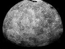
-
PIA14823:
-
The Whole of the Moon
Full Resolution:
TIFF
(779.8 kB)
JPEG
(103.9 kB)
|
|
|
1996-09-19 |
Mercury
|
Mariner Venus Mercury (Mariner 10)
|
|
9999x4000x1 |
|
-
PIA00066:
-
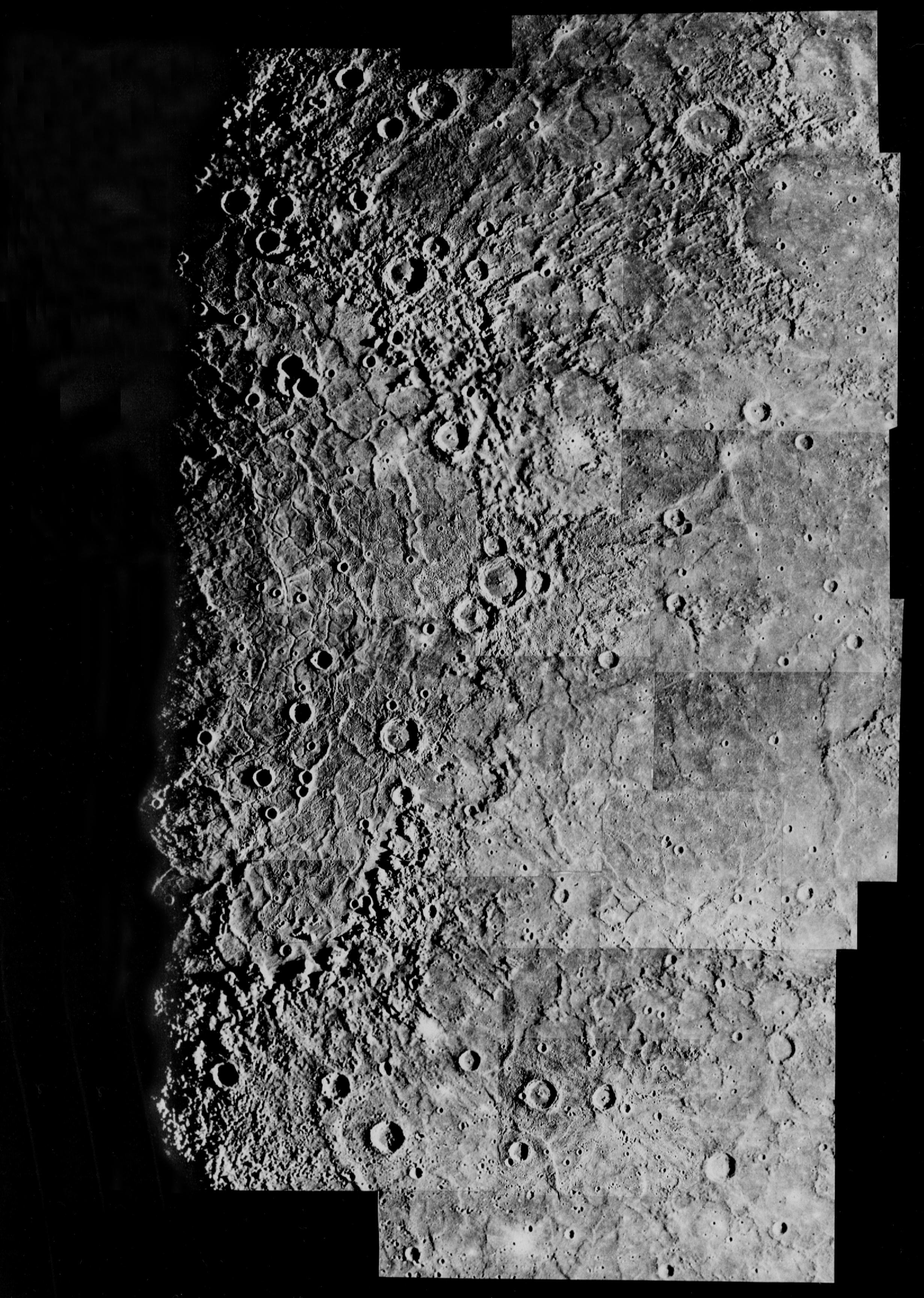
Mercury: Photomosaic of the Shakespeare Quadrangle (Northern Half) H-3
Full Resolution:
TIFF
(22.21 MB)
JPEG
(3.949 MB)
|
|
|
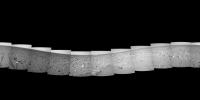
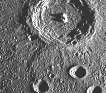
1996-09-23 |
Mercury
|
Mariner Venus Mercury (Mariner 10)
|
|
9999x4000x1 |
|
-
PIA00067:
-
Mercury: Photomosaic of the Shakespeare Quadrangle of Mercury (Southern Half) H-3
Full Resolution:
TIFF
(23.99 MB)
JPEG
(3.867 MB)
|
|
|
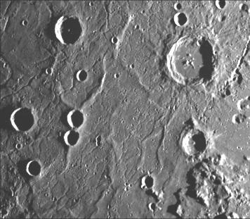
1996-09-23 |
Mercury
|
Mariner Venus Mercury (Mariner 10)
|
|
7200x5000x1 |
|
-
PIA00068:
-
Mercury: Photomosaic of the Tolstoj Quadrangle H-8
Full Resolution:
TIFF
(28.77 MB)
JPEG
(4.313 MB)
|
|
|
1999-06-12 |
Mercury
|
Mariner Venus Mercury (Mariner 10)
|
|
2599x4878x1 |
|
-
PIA00437:
-
Planet Mercury
Full Resolution:
TIFF
(6.034 MB)
JPEG
(1.056 MB)
|
|
|
2000-01-19 |
Mercury
|
Mariner Venus Mercury (Mariner 10)
|
|
7200x5000x1 |

|
-
PIA02236:
-
Mercury: Photomosaic of the Kuiper Quadrangle H-6
Full Resolution:
TIFF
(34.03 MB)
JPEG
(5.16 MB)
|
|
|
2000-01-26 |
Mercury
|
Mariner Venus Mercury (Mariner 10)
|
|
7200x5000x1 |
|
-
PIA02237:
-
Mercury: Photomosaic of the Michelangelo Quadrangle H-12
Full Resolution:
TIFF
(33.55 MB)
JPEG
(6.082 MB)
|
|
|
2000-02-10 |
Mercury
|
Mariner Venus Mercury (Mariner 10)
|
|
5990x4162x1 |
|
-
PIA02243:
-
Mercury: Photomosaic of Borealis Quadrangle H-1
Full Resolution:
TIFF
(18.07 MB)
JPEG
(3.134 MB)
|
|
|
2000-04-01 |
Mercury
|
Mariner Venus Mercury (Mariner 10)
|
|
7200x5000x1 |
|
-
PIA02255:
-
Mercury: Beethoven Quadrangle, H-7
Full Resolution:
TIFF
(34.98 MB)
JPEG
(7.329 MB)
|
|
|
1999-10-07 |
Mercury
|
Mariner Venus Mercury (Mariner 10)
|
|
356x311x1 |
|
-
PIA02407:
-
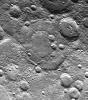
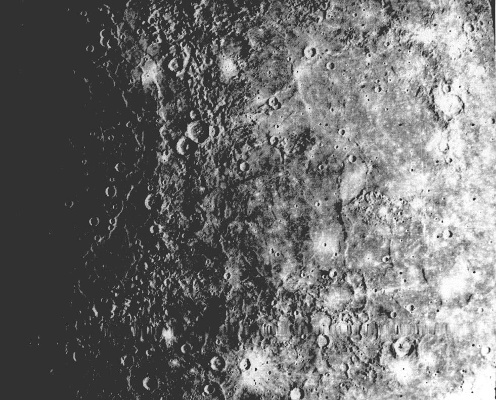
Mercury's Heavily Cratered Surface
Full Resolution:
TIFF
(122.7 kB)
JPEG
(27.52 kB)
|
|
|
1999-10-08 |
Mercury
|
Mariner Venus Mercury (Mariner 10)
|
|
356x311x1 |

|
-
PIA02408:
-
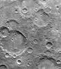
Mercury's Cratered Terrain
Full Resolution:
TIFF
(132 kB)
JPEG
(39.23 kB)
|
|
|
1999-10-08 |
Mercury
|
Mariner Venus Mercury (Mariner 10)
|
|
356x311x1 |

|
-
PIA02409:
-
Fresh Crater in Center of Older Crater Basin
Full Resolution:
TIFF
(122.4 kB)
JPEG
(33.28 kB)
|
|
|
1999-10-08 |
Mercury
|
Mariner Venus Mercury (Mariner 10)
|
|
356x311x1 |
|
-
PIA02410:
-
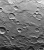
Mercury's Densely Cratered Surface
Full Resolution:
TIFF
(114.2 kB)
JPEG
(35.76 kB)
|
|
|
1999-10-08 |
Mercury
|
Mariner Venus Mercury (Mariner 10)
|
|
356x311x1 |
|
-
PIA02411:
-
Kuiper Crater
Full Resolution:
TIFF
(119.4 kB)
JPEG
(24.06 kB)
|
|
|
1999-10-08 |
Mercury
|
Mariner Venus Mercury (Mariner 10)
|
|
356x311x1 |

|
-
PIA02412:
-
Uncratered Area on Mercury
Full Resolution:
TIFF
(111.4 kB)
JPEG
(22.98 kB)
|
|
|
1999-10-07 |
Mercury
|
Mariner Venus Mercury (Mariner 10)
|
|
300x352x1 |
|
-
PIA02413:
-
Hero Rupes Scarp
Full Resolution:
TIFF
(84.82 kB)
JPEG
(25.27 kB)
|
|
|
1999-10-08 |
Mercury
|
Mariner Venus Mercury (Mariner 10)
|
|
348x302x1 |
|
-
PIA02414:
-
Similarities to Lunar Highlands
Full Resolution:
TIFF
(103.2 kB)
JPEG
(29.14 kB)
|
|
|
1999-10-08 |
Mercury
|
Mariner Venus Mercury (Mariner 10)
|
|
335x250x1 |

|
-
PIA02415:
-
Mercury's South Pole
Full Resolution:
TIFF
(68.84 kB)
JPEG
(18.31 kB)
|
|
|
1999-10-07 |
Mercury
|
Mariner Venus Mercury (Mariner 10)
|
|
208x655x1 |
|
-
PIA02416:
-
High Resolution View of Mercury
Full Resolution:
TIFF
(82.71 kB)
JPEG
(29.06 kB)
|
|
|
1999-10-08 |
Mercury
|
Mariner Venus Mercury (Mariner 10)
|
|
220x700x1 |
|
-
PIA02417:
-
Discovery Rupes Scarp
Full Resolution:
TIFF
(157.3 kB)
JPEG
(33.2 kB)
|
|
|
1999-10-07 |
Mercury
|
Mariner Venus Mercury (Mariner 10)
|
|
775x1023x1 |
|
-
PIA02418:
-
Outgoing Hemisphere
Full Resolution:
TIFF
(243.7 kB)
JPEG
(87.01 kB)
|
|
|
2000-01-14 |
Mercury
|
Mariner Venus Mercury (Mariner 10)
|
|
356x311x1 |

|
-
PIA02419:
-
Interior Peaks and Hilly Floored Crater
Full Resolution:
TIFF
(111.5 kB)
JPEG
(30.81 kB)
|
|
|
2000-01-14 |
Mercury
|
Mariner Venus Mercury (Mariner 10)
|
|
356x311x1 |

|
-
PIA02420:
-
Terraced Craters
Full Resolution:
TIFF
(110.3 kB)
JPEG
(30.23 kB)
|
|
|
2000-01-15 |
Mercury
|
Mariner Venus Mercury (Mariner 10)
|
|
356x311x1 |
|
-
PIA02421:
-
Hummocky and Smooth Plains
Full Resolution:
TIFF
(94.22 kB)
JPEG
(23.27 kB)
|
|
|
2000-01-15 |
Mercury
|
Mariner Venus Mercury (Mariner 10)
|
|
356x311x1 |
|
-
PIA02422:
-
Ridges and Fractures on Floor of Caloris Basin
Full Resolution:
TIFF
(105.2 kB)
JPEG
(27.98 kB)
|
|
|
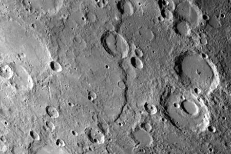
2000-01-14 |
Mercury
|
Mariner Venus Mercury (Mariner 10)
|
|
356x311x1 |
|
-
PIA02423:
-
Crater Chain Groves Inside Larger Craters
Full Resolution:
TIFF
(113.7 kB)
JPEG
(30.62 kB)
|
|
|
2000-01-15 |
Mercury
|
Mariner Venus Mercury (Mariner 10)
|
|
356x311x1 |
|
-
PIA02424:
-
Large Mercurian Crater
Full Resolution:
TIFF
(125.8 kB)
JPEG
(37.24 kB)
|
|
|
2000-01-15 |
Mercury
|
Mariner Venus Mercury (Mariner 10)
|
|
356x311x1 |
|
-
PIA02425:
-
Young Craters on Smooth Plains
Full Resolution:
TIFF
(117 kB)
JPEG
(28.4 kB)
|
|
|
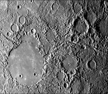
2000-01-15 |
Mercury
|
Mariner Venus Mercury (Mariner 10)
|
|
356x311x1 |
|
-
PIA02426:
-
Lobate Scarps within the Hummocky Plains East of Caloris Basin
Full Resolution:
TIFF
(98.12 kB)
JPEG
(23.91 kB)
|
|
|
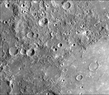
2000-01-14 |
Mercury
|
Mariner Venus Mercury (Mariner 10)
|
|
356x311x1 |
|
-
PIA02427:
-
Northeastern Quadrant of the Caloris Basin
Full Resolution:
TIFF
(113.1 kB)
JPEG
(29.34 kB)
|
|
|
2000-01-14 |
Mercury
|
Mariner Venus Mercury (Mariner 10)
|
|
356x311x1 |
|
-
PIA02428:
-
Lineated Terrain
Full Resolution:
TIFF
(101.8 kB)
JPEG
(24.36 kB)
|
|
|
2000-01-14 |
Mercury
|
Mariner Venus Mercury (Mariner 10)
|
|
356x311x1 |
|
-
PIA02429:
-
Prominent Rayed Craters
Full Resolution:
TIFF
(88.45 kB)
JPEG
(21.94 kB)
|
|
|
2000-01-15 |
Mercury
|
Mariner Venus Mercury (Mariner 10)
|
|
356x311x1 |
|
-
PIA02430:
-
Antoniadi Ridge
Full Resolution:
TIFF
(104.4 kB)
JPEG
(22.63 kB)
|
|
|
2000-01-15 |
Mercury
|
Mariner Venus Mercury (Mariner 10)
|
|
356x311x1 |
|
-
PIA02431:
-
Curved Lobate Scarp on Crater Floor
Full Resolution:
TIFF
(115.2 kB)
JPEG
(31.98 kB)
|
|
|
2000-01-15 |
Mercury
|
Mariner Venus Mercury (Mariner 10)
|
|
356x311x1 |
|
-
PIA02432:
-
Crater Rim Offset 10 Kilometers by Scarp
Full Resolution:
TIFF
(102.4 kB)
JPEG
(29.09 kB)
|
|
|
2000-01-15 |
Mercury
|
Mariner Venus Mercury (Mariner 10)
|
|
356x311x1 |
|
-
PIA02433:
-
Scarps Confined to Crater Floors
Full Resolution:
TIFF
(122.9 kB)
JPEG
(40.7 kB)
|
|
|
2000-01-15 |
Mercury
|
Mariner Venus Mercury (Mariner 10)
|
|
356x311x1 |
|
-
PIA02434:
-
Crater Rim Offset 10 kilometers by Scarp-High Resolution
Full Resolution:
TIFF
(102.7 kB)
JPEG
(33.59 kB)
|
|
|
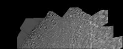
1999-12-07 |
Mercury
|
Mariner Venus Mercury (Mariner 10)
|
|
356x311x1 |

|
-
PIA02438:
-
Heavily Cratered Terrain and Smooth Plain
Full Resolution:
TIFF
(118.4 kB)
JPEG
(25.16 kB)
|
|
|
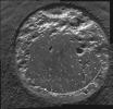
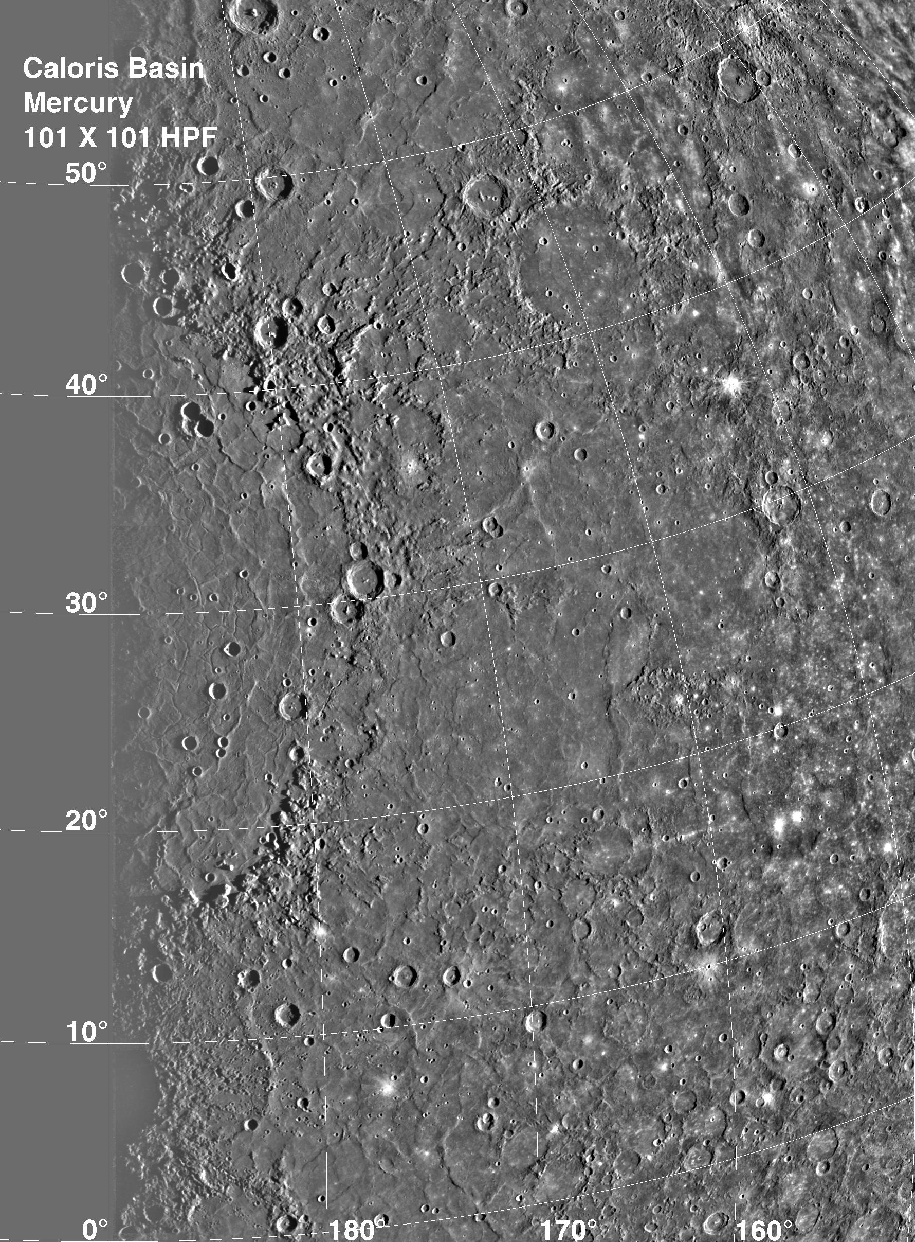
1999-12-07 |
Mercury
|
Mariner Venus Mercury (Mariner 10)
|
|
1780x2414x1 |
|
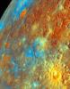
-
PIA02439:
-
Caloris Basin
Full Resolution:
TIFF
(4.033 MB)
JPEG
(822.8 kB)
|
|
|
1999-12-07 |
Mercury
|
Mariner Venus Mercury (Mariner 10)
|
|
213x275x3 |
|
-
PIA02440:
-
Incoming Hemisphere - Enhanced Color
Full Resolution:
TIFF
(224.1 kB)
JPEG
(15.87 kB)
|
|
|
1999-12-21 |
Earth
|
Mariner Venus Mercury (Mariner 10)
|
|
922x749x3 |
|
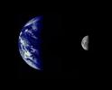
-
PIA02441:
-
Earth and Moon as Viewed by Mariner 10
Full Resolution:
TIFF
(388.4 kB)
JPEG
(32.07 kB)
|
|
|
1999-12-21 |
Moon
|
Mariner Venus Mercury (Mariner 10)
|
|
900x900x1 |
|
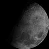
-
PIA02442:
-
Moon's North Pole
Full Resolution:
TIFF
(449.8 kB)
JPEG
(101 kB)
|
|
|
2000-01-18 |
Mercury
|
Mariner Venus Mercury (Mariner 10)
|
|
356x311x1 |
|
-
PIA02443:
-
Smooth Volcanic Plains
Full Resolution:
TIFF
(111.1 kB)
JPEG
(25.89 kB)
|
|
|
2000-01-18 |
Mercury
|
Mariner Venus Mercury (Mariner 10)
|
|
356x311x1 |
|
-
PIA02444:
-
Intercrater Plains and Heavily Cratered Terrain - First Encounter
Full Resolution:
TIFF
(132.2 kB)
JPEG
(33.46 kB)
|
|
|
2000-01-18 |
Mercury
|
Mariner Venus Mercury (Mariner 10)
|
|
356x311x1 |

|
-
PIA02445:
-
Hilly and Lineated Terrain
Full Resolution:
TIFF
(132.5 kB)
JPEG
(35.07 kB)
|
|
|
2000-01-18 |
Mercury
|
Mariner Venus Mercury (Mariner 10)
|
|
450x300x1 |

|
-
PIA02446:
-
Discovery Scarp
Full Resolution:
TIFF
(151.6 kB)
JPEG
(32.39 kB)
|
|
|
2000-01-18 |
Mercury
|
Mariner Venus Mercury (Mariner 10)
|
|
356x311x1 |
|
-
PIA02447:
-
Scarps Confined to Crater Floors - High Resolution
Full Resolution:
TIFF
(123 kB)
JPEG
(27.34 kB)
|
|
|
2000-08-05 |
Mercury
|
Mariner Venus Mercury (Mariner 10)
|
|
356x311x1 |
|
-
PIA02936:
-
Double Ring Craters
Full Resolution:
TIFF
(113.5 kB)
JPEG
(22.84 kB)
|
|
|
2000-08-05 |
Mercury
|
Mariner Venus Mercury (Mariner 10)
|
|
356x311x1 |
|
-
PIA02937:
-
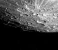
Heavily Cratered Terrain at South Pole
Full Resolution:
TIFF
(113.5 kB)
JPEG
(30.36 kB)
|
|
|
2000-08-05 |
Mercury
|
Mariner Venus Mercury (Mariner 10)
|
|
311x356x1 |
|
-
PIA02938:
-
Field of Bright Rays
Full Resolution:
TIFF
(111.9 kB)
JPEG
(27.13 kB)
|
|
|
2000-08-05 |
Mercury
|
Mariner Venus Mercury (Mariner 10)
|
|
311x356x1 |
|
-
PIA02939:
-
Dark-rimmed Crater and Extensive Ejecta Blanket
Full Resolution:
TIFF
(99.5 kB)
JPEG
(29.08 kB)
|
|
|
2000-08-05 |
Mercury
|
Mariner Venus Mercury (Mariner 10)
|
|
311x356x1 |
|
-
PIA02940:
-
Densely Cratered Region
Full Resolution:
TIFF
(109.1 kB)
JPEG
(27.48 kB)
|
|
|
2000-08-05 |
Mercury
|
Mariner Venus Mercury (Mariner 10)
|
|
356x311x1 |
|
-
PIA02941:
-
Mercury's South Pole
Full Resolution:
TIFF
(77.98 kB)
JPEG
(20.02 kB)
|
|
|
2000-08-05 |
Mercury
|
Mariner Venus Mercury (Mariner 10)
|
|
311x356x1 |
|
-
PIA02942:
-
Large Double-ringed Basin
Full Resolution:
TIFF
(117.7 kB)
JPEG
(34.08 kB)
|
|
|
2000-08-06 |
Mercury
|
Mariner Venus Mercury (Mariner 10)
|
|
356x311x1 |

|
-
PIA02943:
-
300 Kilometer Long Scarp
Full Resolution:
TIFF
(113.5 kB)
JPEG
(27.96 kB)
|
|
|
2000-08-05 |
Mercury
|
Mariner Venus Mercury (Mariner 10)
|
|
311x356x1 |
|
-
PIA02944:
-
Small Craters Peppering South Polar Region
Full Resolution:
TIFF
(96.85 kB)
JPEG
(28.49 kB)
|
|
|
2000-08-05 |
Mercury
|
Mariner Venus Mercury (Mariner 10)
|
|
311x356x1 |
|
-
PIA02945:
-
South Pole - Ridges, Scarps, Craters
Full Resolution:
TIFF
(104.6 kB)
JPEG
(28.32 kB)
|
|
|
2000-08-05 |
Mercury
|
Mariner Venus Mercury (Mariner 10)
|
|
311x356x1 |
|
-
PIA02946:
-
Large Circular Basin Flooded and then Cratered
Full Resolution:
TIFF
(63.02 kB)
JPEG
(21.13 kB)
|
|
|
2000-08-05 |
Mercury
|
Mariner Venus Mercury (Mariner 10)
|
|
356x311x1 |

|
-
PIA02947:
-
Intercrater Plains and Heavily Cratered Terrain
Full Resolution:
TIFF
(105.1 kB)
JPEG
(24.31 kB)
|
|
|
2000-08-05 |
Mercury
|
Mariner Venus Mercury (Mariner 10)
|
|
356x311x1 |
|
-
PIA02948:
-
Old Basin Filled by Smooth Plains
Full Resolution:
TIFF
(103.3 kB)
JPEG
(24.26 kB)
|
|
|
2000-08-05 |
Mercury
|
Mariner Venus Mercury (Mariner 10)
|
|
356x311x1 |
|
-
PIA02949:
-
Small Craters Engulfed by Smooth Plains
Full Resolution:
TIFF
(96.03 kB)
JPEG
(31.69 kB)
|
|
|
2000-08-24 |
Mercury
|
Mariner Venus Mercury (Mariner 10)
|
|
1000x778x1 |
|
-
PIA02961:
-
Mercury at First Encounter Closest Approach
Full Resolution:
TIFF
(917.1 kB)
JPEG
(162 kB)
|
|
|
2000-08-24 |
Mercury
|
Mariner Venus Mercury (Mariner 10)
|
|
981x792x1 |
|
-
PIA02962:
-
Large Circular Basin - 1300-km diameter
Full Resolution:
TIFF
(609.1 kB)
JPEG
(154.3 kB)
|
|
|
2001-01-11 |
Mercury
|
Mariner Venus Mercury (Mariner 10)
|
|
2743x2086x1 |
|
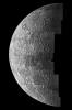
-
PIA03101:
-
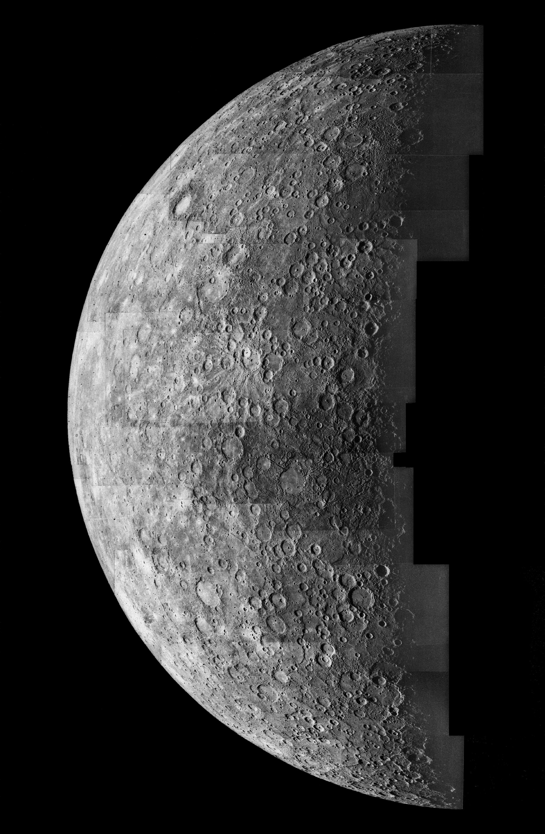
Mercury's Southern Hemisphere
Full Resolution:
TIFF
(4.839 MB)
JPEG
(1.288 MB)
|
|
|
2001-01-11 |
Mercury
|
Mariner Venus Mercury (Mariner 10)
|
|
2463x3457x1 |
|
-
PIA03102:
-
Mercury's Caloris Basin
Full Resolution:
TIFF
(7.069 MB)
JPEG
(1.353 MB)
|
|
|
2001-01-17 |
Mercury
|
Mariner Venus Mercury (Mariner 10)
|
|
2158x3300x1 |
|
-
PIA03103:
-
Photomosaic of Mercury - Inbound View
Full Resolution:
TIFF
(4.475 MB)
JPEG
(885.4 kB)
|
|
|
2001-01-18 |
Mercury
|
Mariner Venus Mercury (Mariner 10)
|
|
2209x3303x1 |
|
-
PIA03104:
-
Photomosaic of Mercury - Outbound View
Full Resolution:
TIFF
(6.432 MB)
JPEG
(1.187 MB)
|
|
|
2004-03-10 |
Mars
|
Mars Exploration Rover (MER)
|
Navigation Camera
|
2132x1052x1 |

|
-
PIA05525:
-
A Long Way From Home
Full Resolution:
TIFF
(1.478 MB)
JPEG
(390.3 kB)
|
|
|
2004-03-10 |
Mars
|
Mars Exploration Rover (MER)
|
Navigation Camera
|
5784x2892x1 |
|
-
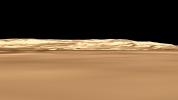
PIA05524:
-
A Glimpse of What's to Come
Full Resolution:
TIFF
(4.584 MB)
JPEG
(838.1 kB)
|
|
|
2004-03-09 |
Mars
|
Mars Exploration Rover (MER)
|
Microscopic Imager
Rock Abrasion Tool (RAT)
|
1934x1862x1 |
|
-
PIA05523:
-
The Biggest Microscopic Image Ever
Full Resolution:
TIFF
(3.56 MB)
JPEG
(602.5 kB)
|
|
|
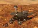
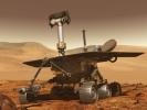
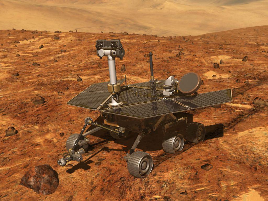
2002-12-21 |
|
Mars Exploration Rover (MER)
|
|
1024x768x3 |
|
-
PIA04239:
-
Artist's Concept of Mars Exploration Rover
Full Resolution:
TIFF
(2.363 MB)
JPEG
(149.3 kB)
|
|
|
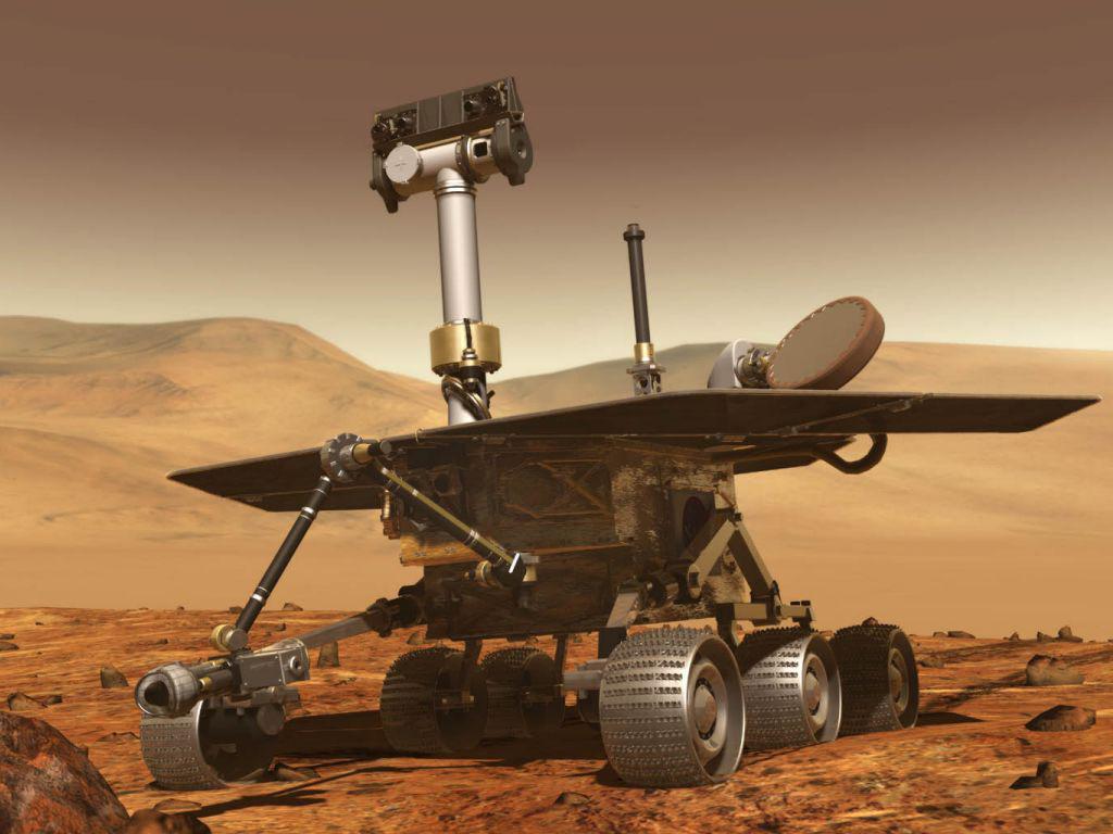
2002-12-21 |
|
Mars Exploration Rover (MER)
|
|
1024x768x3 |
|
-
PIA04240:
-
Artist's Concept of Mars Exploration Rover
Full Resolution:
TIFF
(1.61 MB)
JPEG
(84.21 kB)
|
|
|
2004-02-28 |
Mars
|
Mars Exploration Rover (MER)
|
Navigation Camera
|
600x600x1 |

|
-
PIA05466:
-
Heading for Humphrey
Full Resolution:
TIFF
(358 kB)
JPEG
(50.53 kB)
|
|
|
2004-03-09 |
Mars
|
Mars Exploration Rover (MER)
|
Microscopic Imager
Rock Abrasion Tool (RAT)
|
1024x1024x8 |
|
-
PIA05522:
-
Focus on "Humphrey"

Full Resolution:
|
|
|
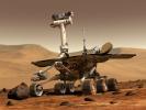
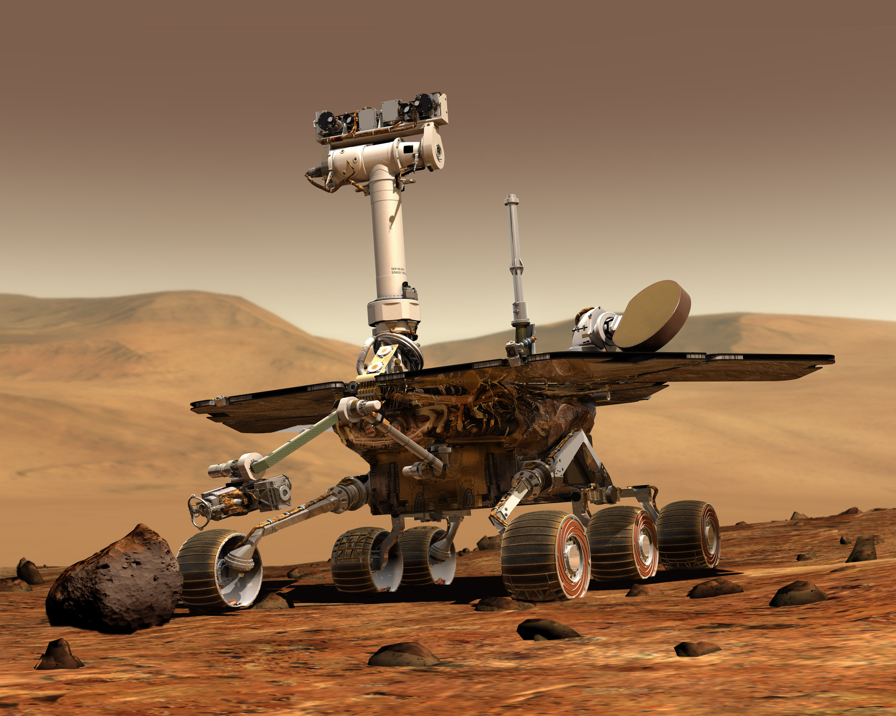
2003-02-26 |
|
Mars Exploration Rover (MER)
|
|
3000x2400x3 |
|
-
PIA04413:
-
Artist's Concept of Rover on Mars
Full Resolution:
TIFF
(11.77 MB)
JPEG
(877.8 kB)
|
|
|
2003-02-26 |
|
Mars Exploration Rover (MER)
|
|
1960x3008x3 |
|
-
PIA04414:
-
Rover 1 in Cruise Stage
Full Resolution:
TIFF
(17.71 MB)
JPEG
(747.5 kB)
|
|
|
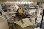
2003-02-26 |
|
Mars Exploration Rover (MER)
|
|
1307x1149x3 |

|
-
PIA04415:
-
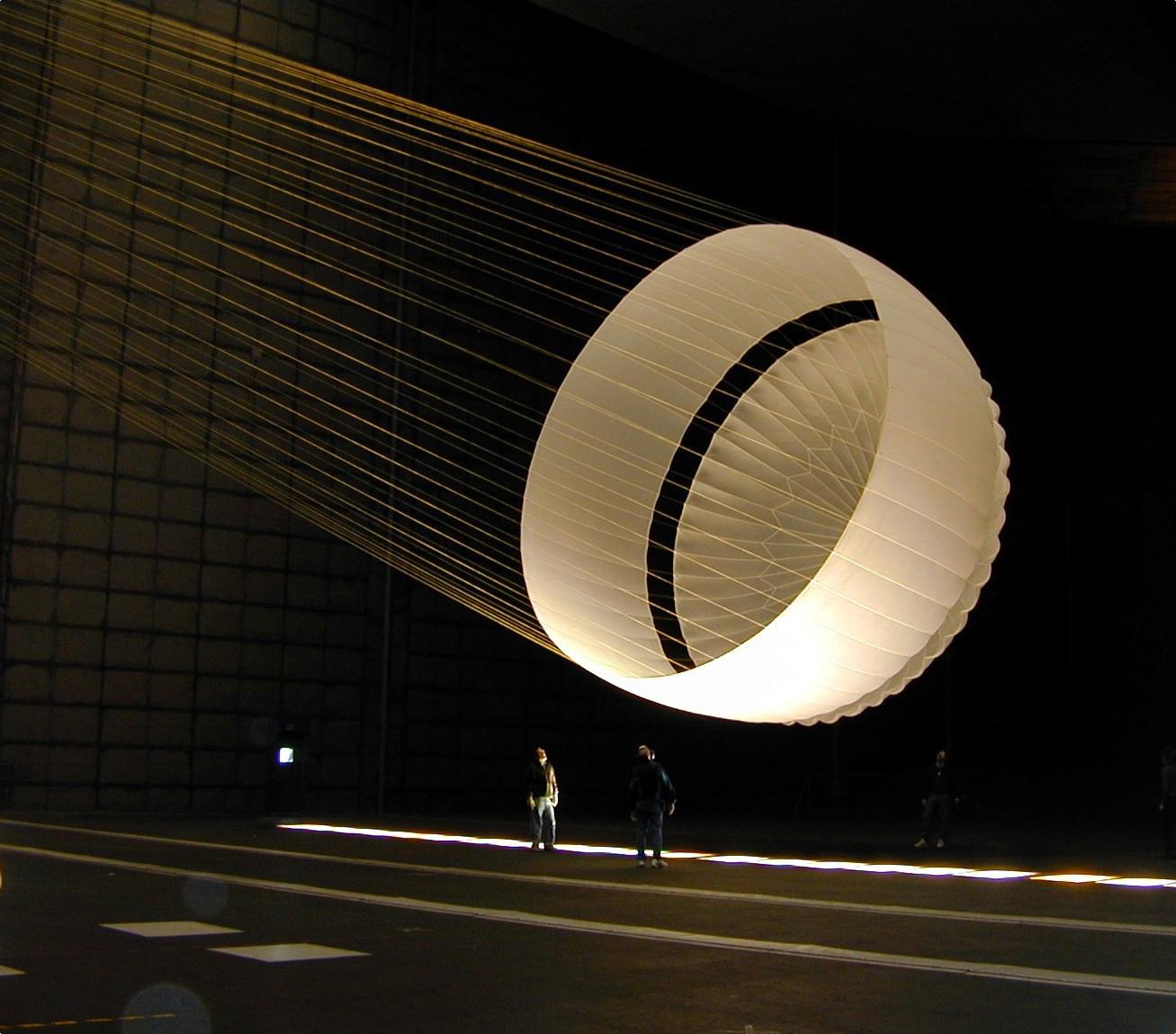
Parachute Test
Full Resolution:
TIFF
(3.227 MB)
JPEG
(145.3 kB)
|
|
|
2003-02-26 |
|
Mars Exploration Rover (MER)
|
|
3008x1960x3 |
|
-
PIA04416:
-
Rover 1 and Lander
Full Resolution:
TIFF
(17.69 MB)
JPEG
(847.1 kB)
|
|
|
2003-02-26 |
|
Mars Exploration Rover (MER)
|
|
3008x1960x3 |
|
-
PIA04417:
-
Rover 1 and Lander
Full Resolution:
TIFF
(17.69 MB)
JPEG
(956.1 kB)
|
|
|
2003-02-26 |
|
Mars Exploration Rover (MER)
|
|
3008x1960x3 |
|
-
PIA04418:
-
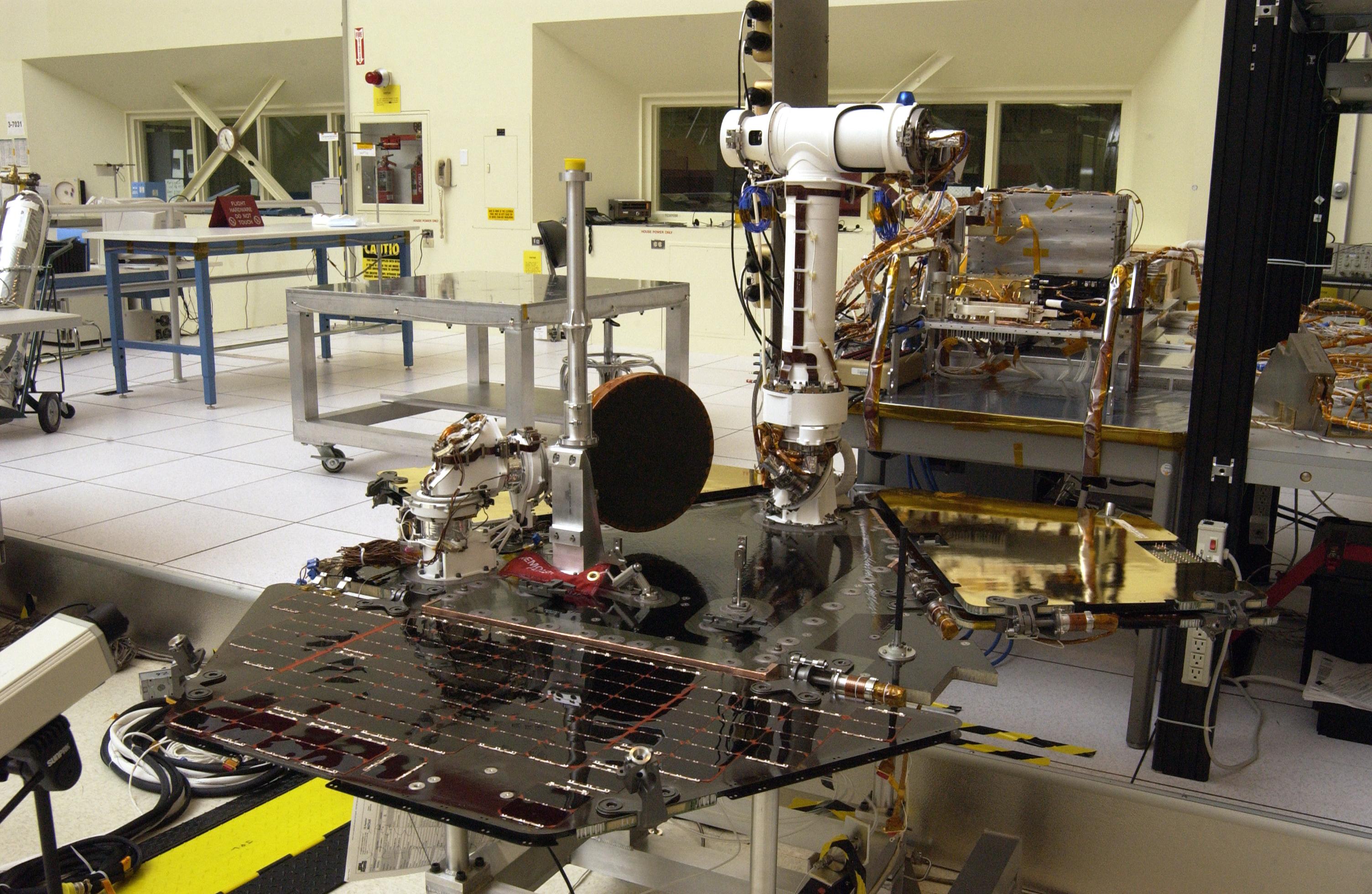
Rover 2 Assembly
Full Resolution:
TIFF
(17.69 MB)
JPEG
(821.7 kB)
|
|
|
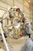
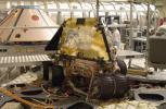
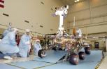
2003-02-26 |
|
Mars Exploration Rover (MER)
|
|
1849x2598x3 |
|
-
PIA04419:
-
Environmental Testing
Full Resolution:
TIFF
(13.88 MB)
JPEG
(727.4 kB)
|
|
|
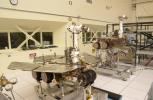
2003-02-26 |
|
Mars Exploration Rover (MER)
|
|
3008x1960x3 |
|
-
PIA04420:
-
Rover 2 Driving Test
Full Resolution:
TIFF
(16.73 MB)
JPEG
(605.7 kB)
|
|
|
2003-02-26 |
|
Mars Exploration Rover (MER)
|
|
3008x1960x3 |
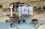
|
-
PIA04421:
-
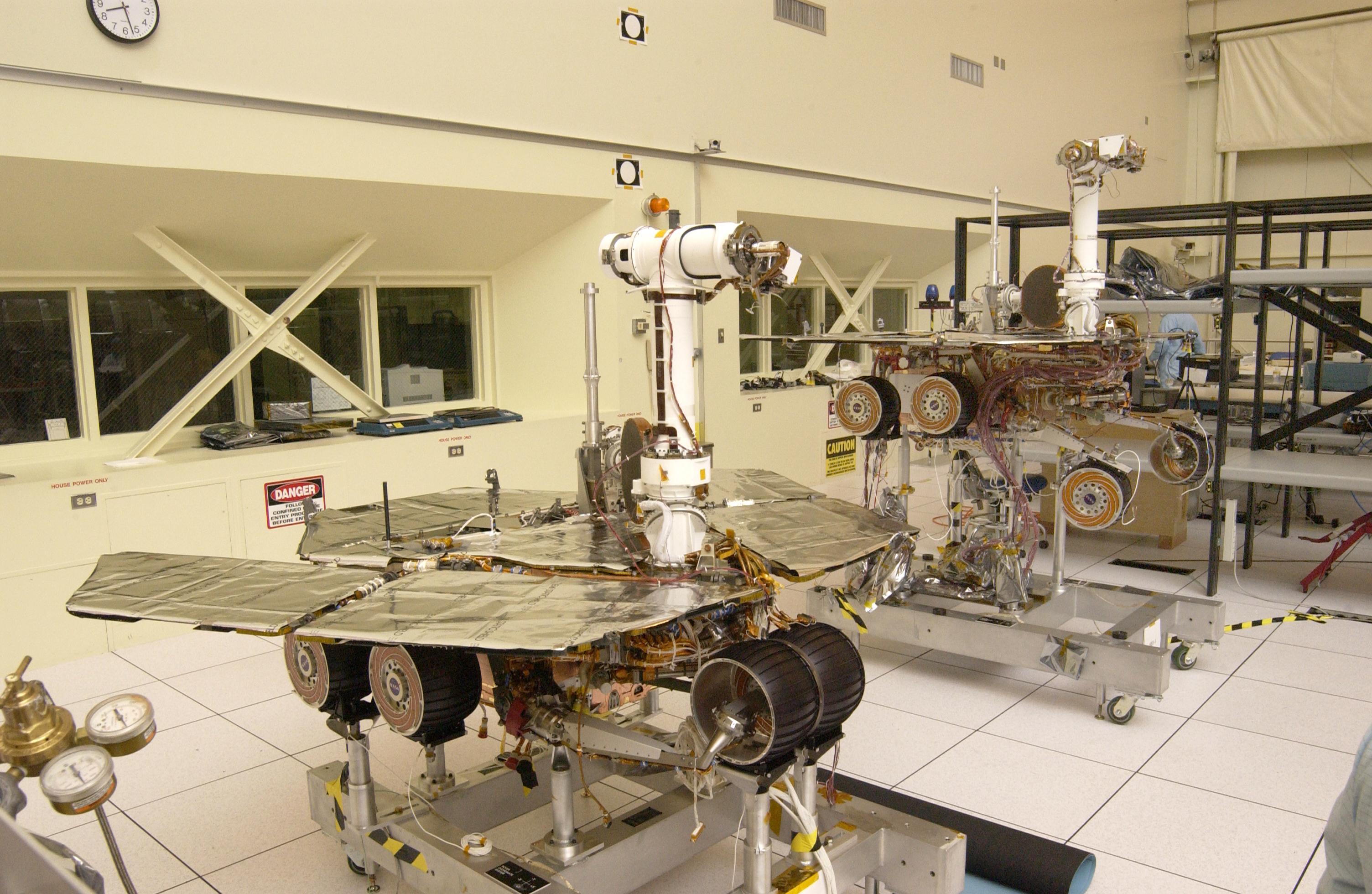
Rover Family Photo
Full Resolution:
TIFF
(17.11 MB)
JPEG
(647.3 kB)
|
|
|
2003-02-26 |
|
Mars Exploration Rover (MER)
|
|
3008x1960x3 |
|
-
PIA04422:
-
Rovers and Sojourner
Full Resolution:
TIFF
(16.51 MB)
JPEG
(629.1 kB)
|
|
|
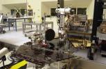
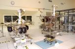
2003-02-26 |
|
Mars Exploration Rover (MER)
|
|
3008x1960x3 |
|
-
PIA04424:
-
2 Stages of Deployment
Full Resolution:
TIFF
(17.34 MB)
JPEG
(722.3 kB)
|
|
|
2003-02-26 |
|
Mars Exploration Rover (MER)
|
|
752x478x3 |

|
-
PIA04425:
-
Robotic Arm of Rover 1
Full Resolution:
TIFF
(1.08 MB)
JPEG
(76.43 kB)
|
|
|
2003-02-26 |
|
Mars Exploration Rover (MER)
|
|
3008x1960x3 |
|
-
PIA04426:
-
Rover 1 Solar Arrays
Full Resolution:
TIFF
(16.76 MB)
JPEG
(652.8 kB)
|
|
|
2003-02-26 |
|
Mars Exploration Rover (MER)
|
|
3008x1960x3 |

|
-
PIA04427:
-
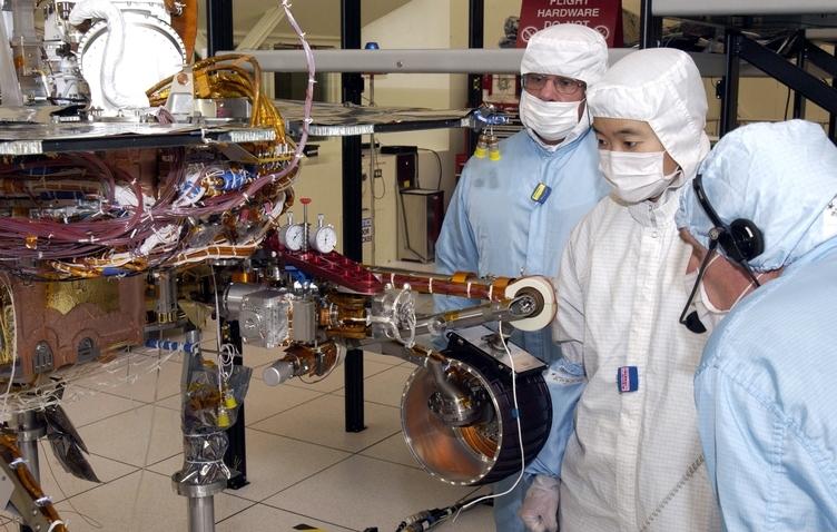
Adjustments to Rover 1
Full Resolution:
TIFF
(16.42 MB)
JPEG
(628.6 kB)
|
 Planetary Data System


