My
List |
Addition Date
|
Target
|
Mission
|
Instrument
|
Size
|

|
2019-08-29 |
Earth
|
CloudSat
|
Cloud Profiling Radar (CPR)
|
1632x918x3 |

|
-
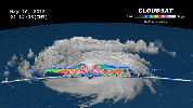
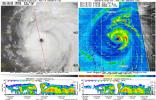
PIA23359:
-
NASA's CloudSat Images Dorian in 3D
Full Resolution:
TIFF
(1.707 MB)
JPEG
(97.89 kB)
|
|
|
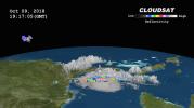
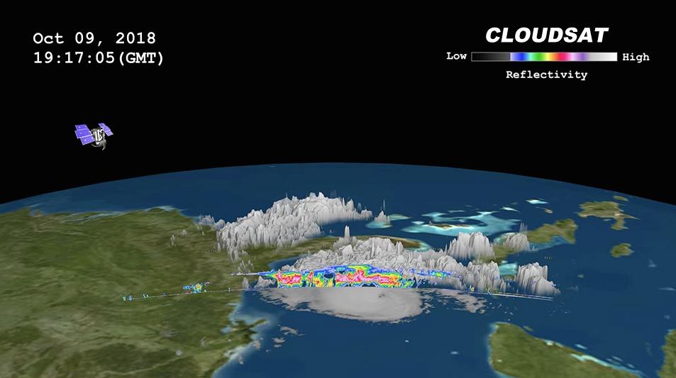
2018-10-11 |
Earth
|
CloudSat
|
Cloud Profiling Radar (CPR)
|
953x533x3 |
|
-
PIA22753:
-
NASA's CloudSat Passes Over Hurricane Michael
Full Resolution:
TIFF
(720.4 kB)
JPEG
(50.54 kB)
|
|
|
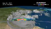
2017-09-20 |
Earth
|
CloudSat
|
Cloud Profiling Radar (CPR)
|
1672x938x3 |
|
-
PIA21961:
-
Taking a 3-D Slice of Hurricane Maria's Cloud Structure
Full Resolution:
TIFF
(1.581 MB)
JPEG
(63.81 kB)
|
|
|
2017-09-08 |
Earth
|
CloudSat
|
Cloud Profiling Radar (CPR)
|
1672x938x3 |

|
-
PIA21947:
-
Powerful Hurricane Irma Seen in 3D by NASA's CloudSat
Full Resolution:
TIFF
(1.206 MB)
JPEG
(50.3 kB)
|
|
|
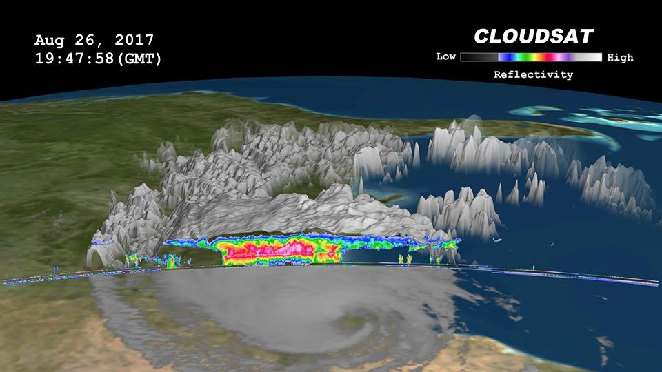
2017-08-29 |
Earth
|
CloudSat
|
Cloud Profiling Radar (CPR)
|
960x540x3 |
|
-
PIA17392:
-
NASA's CloudSat Sees Tropical Storm Harvey in 3D
Full Resolution:
TIFF
(1.012 MB)
JPEG
(68.11 kB)
|
|
|
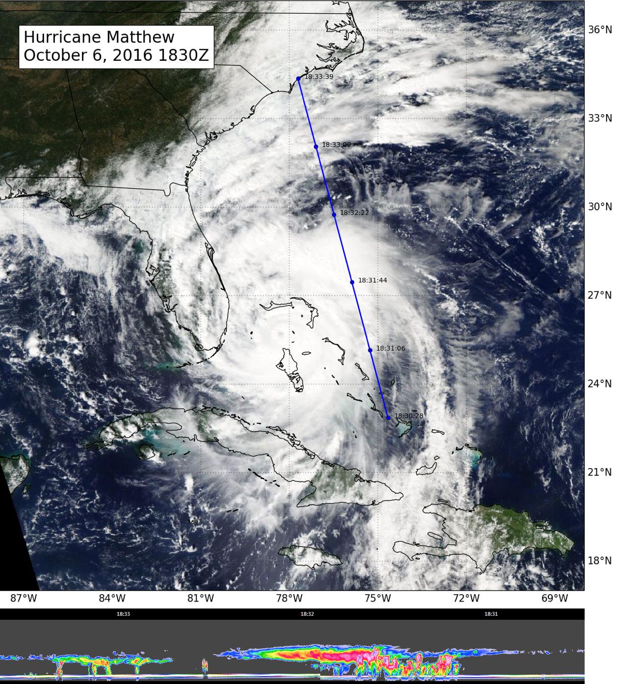
2016-10-07 |
Earth
|
CloudSat
|
Cloudsat
|
1258x1395x3 |
|
-
PIA21095:
-
CloudSat Takes a 3D Slice of Hurricane Matthew
Full Resolution:
TIFF
(4.619 MB)
JPEG
(337.9 kB)
|
|
|
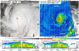
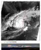
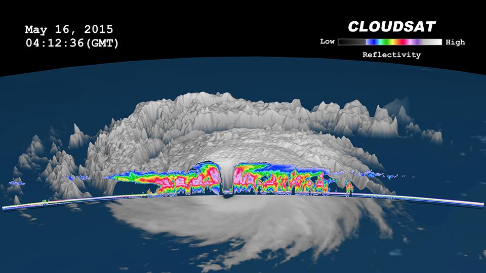
2015-05-22 |
Earth
|
CloudSat
|
MODIS
|
960x540x3 |
|
-
PIA19475:
-
NASA's CloudSat Peers Into the Eye of Powerful Typhoon Dolphin

Full Resolution:
TIFF
(1.556 MB)
JPEG
(61.88 kB)
|
|
|
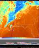
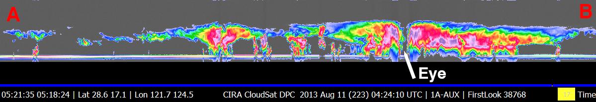
2013-08-22 |
Earth
|
CloudSat
|
Cloud Profiling Radar (CPR)
MODIS
|
1199x206x3 |

|
-
PIA17413:
NASA's CloudSat Eyes Powerful Typhoon Utor
Full Resolution:
TIFF
(741.5 kB)
JPEG
(52.9 kB)
|
|
|
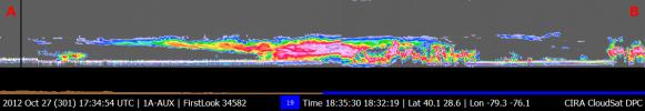
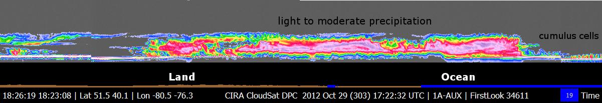
2012-10-30 |
Earth
|
CloudSat
|
Cloud Profiling Radar (CPR)
|
1201x206x3 |
|
-
PIA16201:
CloudSat's View of Hurricane Sandy
Full Resolution:
TIFF
(742.7 kB)
JPEG
(52.4 kB)
|
|
|
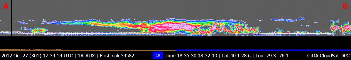
2012-10-29 |
Earth
|
CloudSat
|
Cloud Profiling Radar (CPR)
|
1196x206x3 |
|
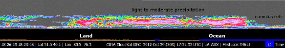
-
PIA16436:
NASA's CloudSat Views Hurricane Sandy
Full Resolution:
TIFF
(739.6 kB)
JPEG
(44.93 kB)
|
|
|
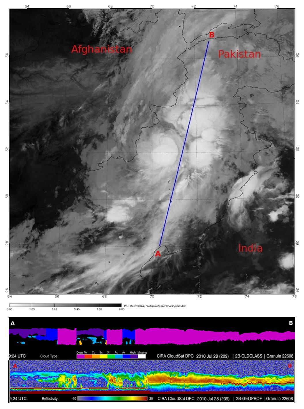
2010-08-19 |
Earth
|
CloudSat
|
Cloud Profiling Radar (CPR)
MODIS
|
1055x1419x3 |

|
-
PIA13340:
-
NASA's CloudSat Spots Beginning of Pakistan Floods
Full Resolution:
TIFF
(4.497 MB)
JPEG
(200.3 kB)
|
|
|
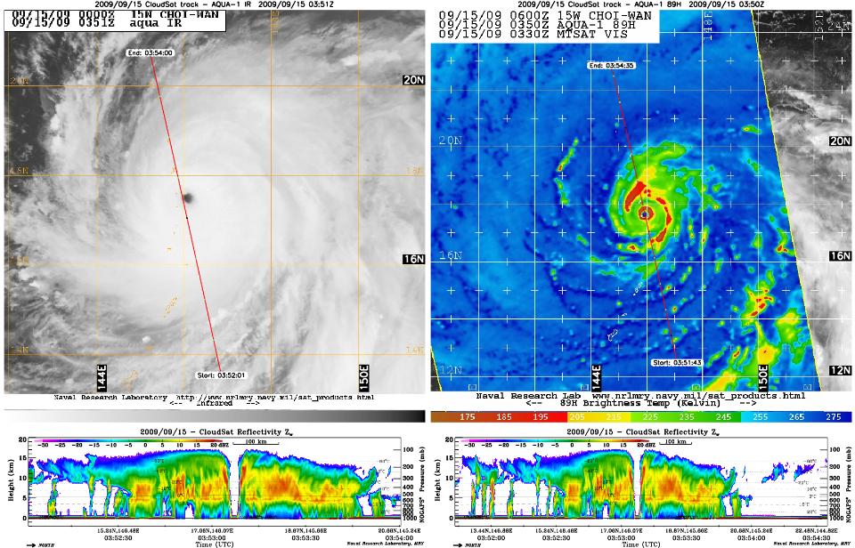
2009-09-15 |
Earth
|
CloudSat
|
AMSR-E
Cloud Profiling Radar (CPR)
MODIS
|
960x616x3 |
|
-
PIA12198:
-
CloudSat Peers Into the Heart of a Super Typhoon
Full Resolution:
TIFF
(1.777 MB)
JPEG
(143.8 kB)
|
|
|
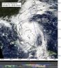
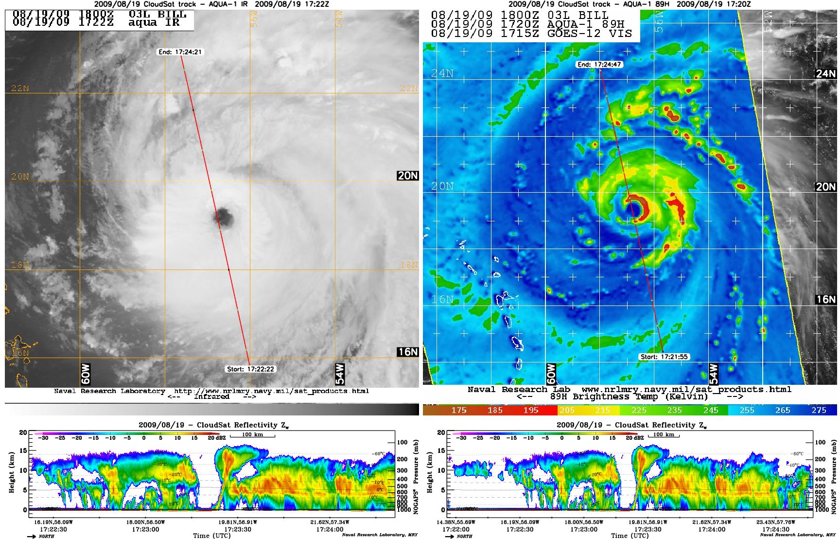
2009-08-21 |
Earth
|
CloudSat
|
AMSR-E
Cloud Profiling Radar (CPR)
MODIS
|
1728x1108x3 |
|
-
PIA12179:
-
Hurricane Bill Eye Overpass
Full Resolution:
TIFF
(5.753 MB)
JPEG
(381.1 kB)
|
|
|
2008-02-08 |
Earth
|
CloudSat
|
Cloud Profiling Radar (CPR)
|
682x850x3 |
|
-
PIA10236:
-
CloudSat Profiles Tornadic Outbreak
Full Resolution:
TIFF
(1.741 MB)
JPEG
(104.8 kB)
|
|
|
2007-06-28 |
Earth
|
CloudSat
|
Cloud Profiling Radar (CPR)
|
1095x542x3 |
|
-
PIA09697:
-
Rain Floods Central Texas
Full Resolution:
TIFF
(1.783 MB)
JPEG
(143.8 kB)
|
|
|
2007-06-07 |
Earth
|
CloudSat
|
Cloud Profiling Radar (CPR)
Moderate Resolution Imaging Spectroradiometer (MODIS)
|
1277x1539x3 |
|
-
PIA09601:
-
Tropical Cyclone Gonu Viewed by CloudSat
Full Resolution:
TIFF
(5.902 MB)
JPEG
(317.8 kB)
|
|
|
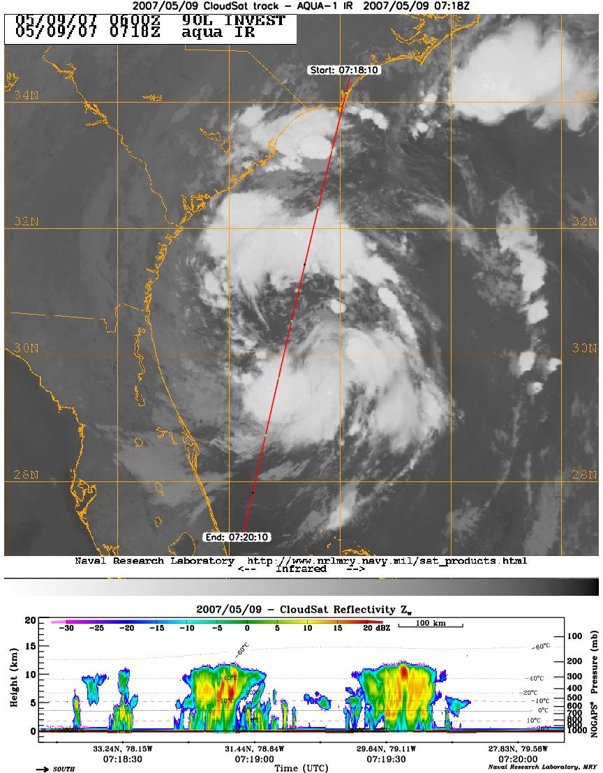
2007-05-10 |
Earth
|
CloudSat
|
Cloud Profiling Radar (CPR)
Moderate Resolution Imaging Spectroradiometer (MODIS)
|
864x1108x3 |
|
-
PIA09379:
-
CloudSat Profiles Tropical Storm Andrea
Full Resolution:
TIFF
(2.875 MB)
JPEG
(159.7 kB)
|
|
|
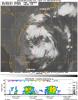
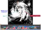
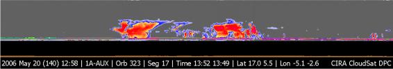
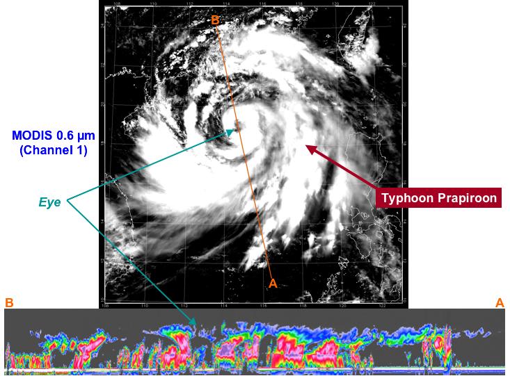
2006-08-09 |
Earth
|
CloudSat
|
Cloud Profiling Radar (CPR)
|
733x541x3 |
|
-
PIA08651:
-
Typhoon Prapiroon viewed by CloudSat
Full Resolution:
TIFF
(1.191 MB)
JPEG
(78.42 kB)
|
|
|
2006-07-25 |
Earth
|
CloudSat
|
Cloud Profiling Radar (CPR)
|
960x498x3 |

|
-
PIA08642:
-
NASA's CloudSat Captures Hurricane Daniel's Transformation
Full Resolution:
TIFF
(1.436 MB)
JPEG
(67.35 kB)
|
|
|
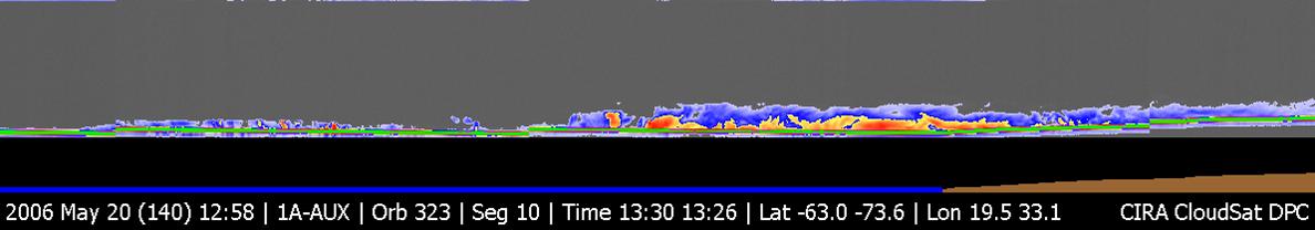
2006-07-13 |
Earth
|
CloudSat
|
Cloud Profiling Radar (CPR)
|
940x162x3 |
|
-
PIA08599:
CloudSat Overflight of Hurricane Bud
Full Resolution:
TIFF
(457.7 kB)
JPEG
(23.5 kB)
|
|
|
2006-06-12 |
Earth
|
CloudSat
|
Cloud Profiling Radar (CPR)
|
600x105x3 |

|
-
PIA08538:
Tropical Storm Alberto, Seen Through New "Eyes"
Full Resolution:
TIFF
(64.85 kB)
JPEG
(13.85 kB)
|
|
|
2006-06-06 |
Earth
|
CloudSat
|
Cloud Profiling Radar (CPR)
|
1194x211x3 |
|
-
PIA08519:
CloudSat Image of Tropical Thunderstorms Over Africa
Full Resolution:
TIFF
(756.9 kB)
JPEG
(39.7 kB)
|
|
|
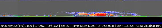
2006-06-06 |
Earth
|
CloudSat
|
Cloud Profiling Radar (CPR)
|
1188x208x3 |
|
-
PIA08518:
CloudSat Image of a Polar Night Storm Near Antarctica
Full Resolution:
TIFF
(742.4 kB)
JPEG
(30.42 kB)
|
|
|
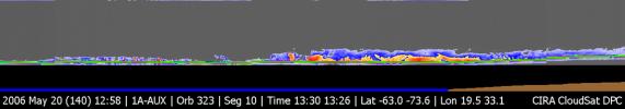
2006-06-06 |
Earth
|
CloudSat
|
Cloud Profiling Radar (CPR)
|
1190x209x3 |
|
-
PIA08517:
CloudSat First Image of a Warm Front Storm Over the Norwegian Sea
Full Resolution:
TIFF
(747.2 kB)
JPEG
(30.16 kB)
|
|
|
2005-10-06 |
|
CloudSat
|
|
5400x8918x3 |

|
-
PIA03015:
-
CloudSat in Orbit Around Earth (Artist's Concept)
Full Resolution:
TIFF
(144.5 MB)
JPEG
(5.395 MB)
|
|
|
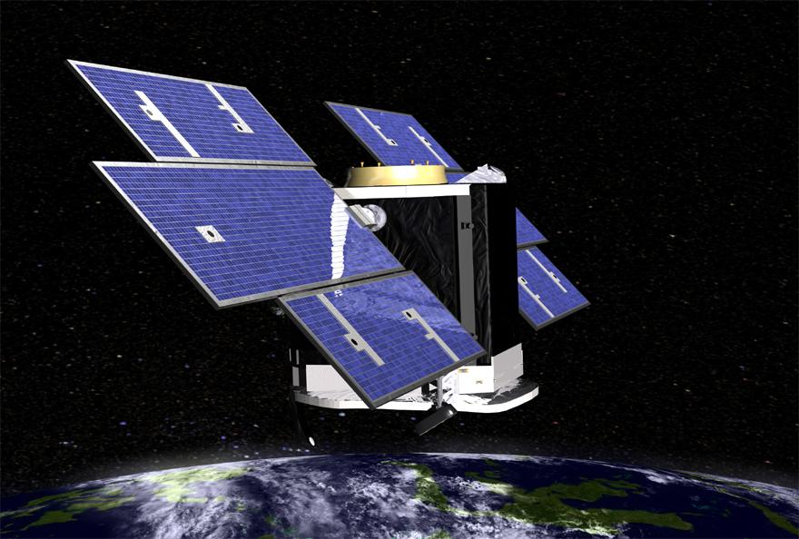
2005-10-05 |
|
CloudSat
|
|
2260x2284x3 |

|
-
PIA03013:
-
CloudSat Studies Clouds (Artist's Concept)
Full Resolution:
TIFF
(15.5 MB)
JPEG
(475.3 kB)
|
|
|
2005-10-05 |
|
CloudSat
|
|
880x594x3 |

|
-
PIA03012:
-
Above Earth 2 (Artist's Concept)
Full Resolution:
TIFF
(1.57 MB)
JPEG
(74.06 kB)
|
|
|
2005-10-05 |
|
CloudSat
|
|
880x594x3 |

|
-
PIA03011:
-
Above Earth (Artist's Concept)
Full Resolution:
TIFF
(1.57 MB)
JPEG
(81.65 kB)
|
|
|
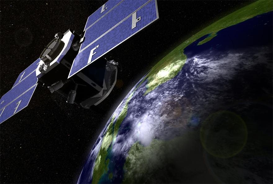
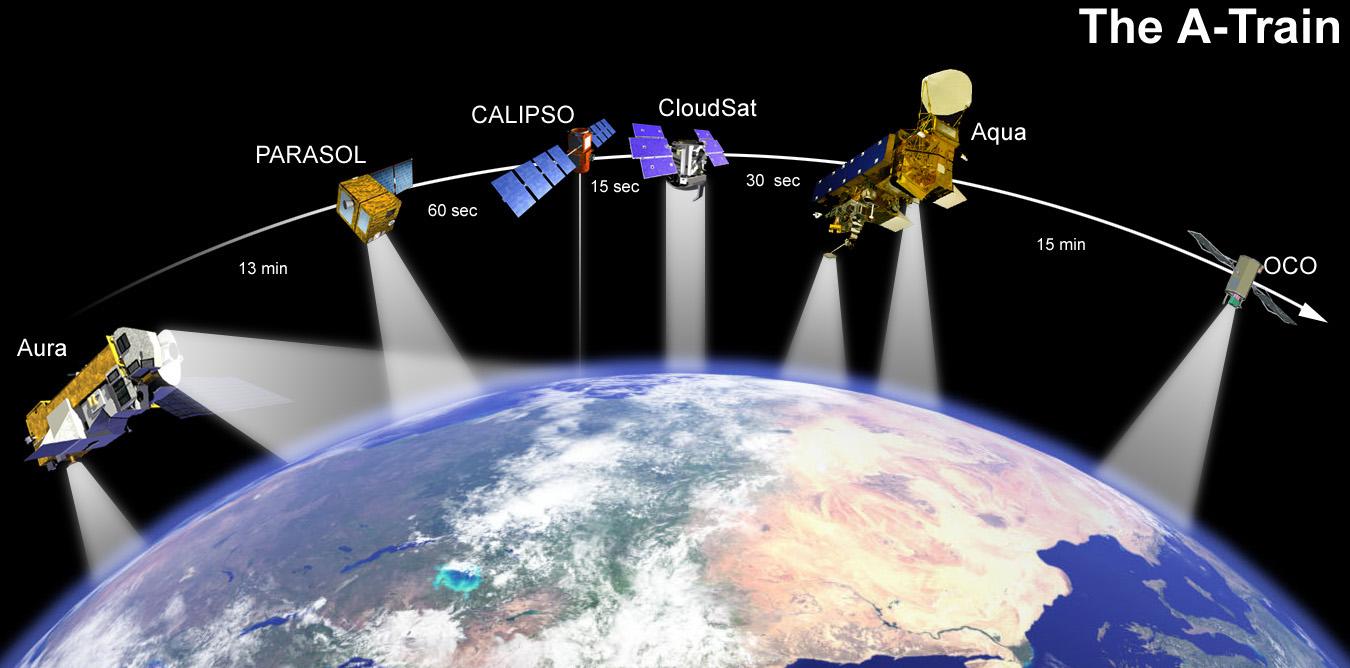
2005-10-04 |
|
CloudSat
|
|
1350x668x3 |
|
-
PIA03010:
-
A-Train (Artist's Concept)
Full Resolution:
TIFF
(2.708 MB)
JPEG
(96.97 kB)
|
|
|
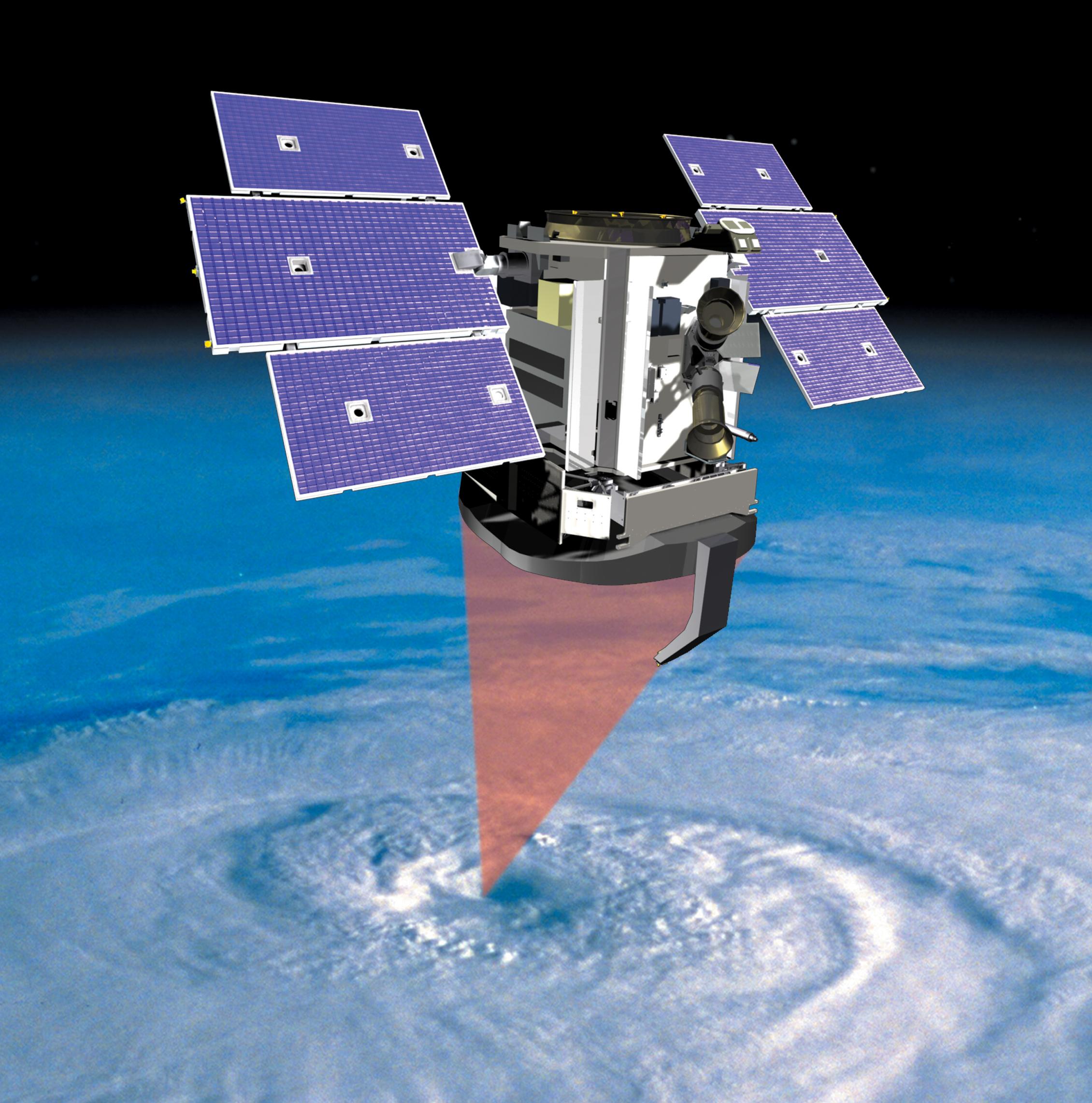
2005-08-26 |
|
CloudSat
|
|
1704x2272x3 |

|
-
PIA06673:
-
CloudSat Preps for Launch at Vandenberg Air Force Base, CA
Full Resolution:
TIFF
(11.63 MB)
JPEG
(577.7 kB)
|
 Planetary Data System


