Your search criteria found 1175 images
Collection Type
Go to PIAxxxxx:
Refine this list of images by:
Target:
Mission:
Spacecraft:
Instrument:
Click on an image for detailed information
Click on a column heading to sort in ascending or descending order
My
List
Addition Date TargetSort Ascending Mission Instrument Size
Add Image to Favorite List 2016-05-11 Earth Aqua
AIRS
914x569x3
Visualization of the formation and evolution of the Antarctic Vortex (ozone hole) over the South Pole from Sept. 1 to Dec. 4, 2014, created using data from NASA's Aqua spacecraft.
PIA20664:
Ozone Hole Formation Over South Pole Observed by NASA's AIRS Animation Icon
Full Resolution:     TIFF (1.122 MB)     JPEG (31.32 kB)
Add Image to Favorite List 2016-10-04 Earth Terra
MISR
493x1040x1
On October 4, 2016, the Multi-angle Imaging SpectroRadiometer (MISR) instrument aboard NASA's Terra satellite passed over Hurricane Matthew . Haiti is completely obscured by Matthew's clouds, but part of the Bahamas is visible to the north.
PIA21070:
Hurricane Matthew over Haiti seen by NASA's MISR Animation Icon
Full Resolution:     TIFF (303.2 kB)     JPEG (32.93 kB)
Add Image to Favorite List 2016-10-14 Earth Aqua
MODIS
VIIRS
1000x1000x3
NASA's CloudSat satellite completed an eye overpass of Hurricane Nicole on Oct. 12, 2016, at 10:55 a.m. PDT (17:55 UTC) as the storm was moving toward Bermuda.
PIA21098:
NASA's CloudSat Looks Hurricane Nicole in the Eye
Full Resolution:     TIFF (2.794 MB)     JPEG (195.4 kB)
Add Image to Favorite List 2017-01-13 Earth Aqua
AIRS
649x464x3
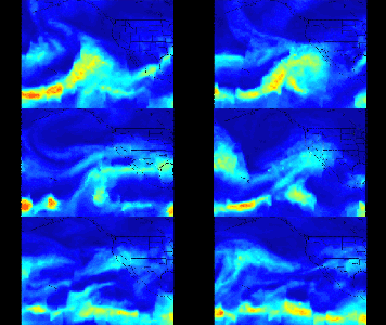
A series of atmospheric rivers that brought drought-relieving rains, heavy snowfall and flooding to California this week is highlighted in this movie frame created with satellite data from the AIRS instrument on NASA's Aqua satellite.
PIA21209:
Series of Storms Battering California Tracked by NASA's AIRS Instrument Animation Icon
Full Resolution:     TIFF (312.2 kB)     JPEG (346.4 kB)
Add Image to Favorite List 2017-04-11 Earth Terra
MISR
2240x3584x3
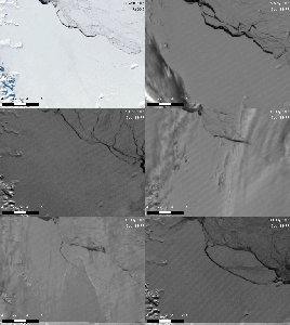
NASA's Terra spacecraft has spied a rift in Antarctica's Larsen C ice shelf, grown to 110 miles long, making it inevitable that an iceberg larger than Rhode Island will soon calve from the ice shelf.
PIA21581:
NASA's MISR Tracks Growth of Rift in the Larsen C Ice Shelf
Full Resolution:     TIFF (13.35 MB)     JPEG (776 kB)
Add Image to Favorite List 2017-06-02 Earth Terra
MISR
447x447x3
On May 28, 2017, at approximately 2:23 p.m. local time, NASA's Terra satellite passed over the tiny Aleutian island of Bogoslof, Alaska, less than 10 minutes after the eruption began.
PIA21655:
NASA's MISR Spots Alaskan Volcano's Latest Eruption Animation Icon
Full Resolution:     TIFF (285 kB)     JPEG (245.2 kB)
Add Image to Favorite List 2017-07-14 Earth Suomi NPP
Terra
MODIS
VIIRS
1805x1350x1
This still from an animation shows the Larsen C Ice Shelf in West Antarctica calved one of the largest icebergs in history between July 10 and 12, 2017.
PIA21785:
Spawning of Massive Antarctic Iceberg Captured by NASA Animation Animation Icon
Full Resolution:     TIFF (1.693 MB)     JPEG (201.4 kB)
Add Image to Favorite List 2017-08-29 Earth CloudSat
Cloud Profiling Radar (CPR)
960x540x3
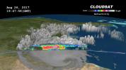
NASA's CloudSat satellite flew over then-Tropical Storm Harvey on Aug. 26, 2017, at 2:45 p.m. CDT (19:45 UTC) as the storm was nearly stationary over south Texas.
PIA17392:
NASA's CloudSat Sees Tropical Storm Harvey in 3D
Full Resolution:     TIFF (1.012 MB)     JPEG (68.11 kB)
Add Image to Favorite List 2017-09-08 Earth CloudSat
Cloud Profiling Radar (CPR)
1672x938x3
NASA's CloudSat satellite flew over Hurricane Irma on Sept. 6, 2017 at 1:45 p.m. EDT (17:45 UTC) as the storm was approaching Puerto Rico in the Atlantic Ocean.
PIA21947:
Powerful Hurricane Irma Seen in 3D by NASA's CloudSat
Full Resolution:     TIFF (1.206 MB)     JPEG (50.3 kB)
Add Image to Favorite List 2017-09-08 Earth Terra
MISR
4715x4843x3
This composite image shows Hurricane Irma as viewed by the central, downward-looking camera (left), as well as the wind speeds (right) superimposed on this image from NASA's Terra spacecraft.
PIA21946:
New NASA Images of Irma's Towering Clouds
Full Resolution:     TIFF (24.52 MB)     JPEG (1.312 MB)
Add Image to Favorite List 2017-09-08 Earth Aqua
AIRS
1920x1080x3
The large-scale structure of clouds in and around Hurricane Irma is seen in this image created with data AIRS instrument on NASA's Aqua satellite. The clouds are typical of tropical areas both nearby and away from tropical cyclones.
PIA21950:
Hurricane Irma's Cloud Structure as Seen by NASA's AIRS
Full Resolution:     TIFF (6.223 MB)     JPEG (323.8 kB)
Add Image to Favorite List 2017-09-19 Earth Terra
MISR
2304x3584x3
On Aug. 21, 2017, as the Moon's shadow passed through the United States, NASA's Terra satellite was capturing images of eastern Wyoming and western Nebraska from its altitude of 438 miles (705 kilometers) above the surface.
PIA21957:
MISR Watches Motion of the Moon's Shadow During Total Solar Eclipse Animation Icon
Full Resolution:     TIFF (12.26 MB)     JPEG (461.1 kB)
Add Image to Favorite List 2017-09-20 Earth CloudSat
Cloud Profiling Radar (CPR)
1672x938x3
NASA's CloudSat satellite flew over Hurricane Maria on Sept. 17, 2017, at 1:23 p.m. EDT (17:23 UTC) as the storm had just strengthened into a hurricane in the Atlantic Ocean.
PIA21961:
Taking a 3-D Slice of Hurricane Maria's Cloud Structure
Full Resolution:     TIFF (1.581 MB)     JPEG (63.81 kB)
Add Image to Favorite List 2018-08-14 Earth Aqua
AIRS
950x534x3
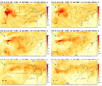
This image is one of a series showing carbon monoxide (in orange/red) from California's massive wildfires drifting east across the U.S. between July 30 and August 7, 2018.
PIA22492:
Carbon Monoxide Transport from California Wildfires, July 30-August 7, 2018 Animation Icon
Full Resolution:     TIFF (452.9 kB)     JPEG (421.9 kB)
Add Image to Favorite List 2018-09-20 Earth CubeSat
790x787x3
This image combines NASA's TEMPEST-D data with a visible image of the storm from NASA's GOES weather satellite revealing the eye of the storm surrounded by towering, intense rain bands.
PIA22652:
Hurricane Florence as Seen from a CubeSat Animation Icon
Full Resolution:     TIFF (1.357 MB)     JPEG (144.5 kB)
Add Image to Favorite List 2018-09-25 Earth CubeSat
478x318x3
This image shows the size of NASA's tiny weather satellite, Raincube, in comparison to the International Space Station. RainCube was deployed into low-Earth orbit from the ISS in July, 2018.
PIA22653:
Mini Mission RainCube is Sent into Earth Orbit
Full Resolution:     TIFF (330.8 kB)     JPEG (210.5 kB)
Add Image to Favorite List 2019-01-31 Earth Aqua
AIRS
1395x783x3
NASA's Atmospheric Infrared Sounder (AIRS) instrument captures a polar vortex moving from Central Canada into the U.S. Midwest from January 20 through January 29, 2019.
PIA22823:
AIRS Captures Polar Vortex
Full Resolution:     TIFF (1.034 MB)     JPEG (81.95 kB)
Add Image to Favorite List 2019-03-21 Earth Terra
MISR
1830x1830x3
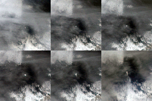
This image sequence shows views from five of nine cameras on the MISR instrument, onboard NASA's Terra satellite, a few minutes after a bright meteor exploded over the Bering Sea on Dec. 18, 2018.
PIA22825:
MISR Images Fireball Over Bering Sea
Full Resolution:     TIFF (10.05 MB)     JPEG (369 kB)
Add Image to Favorite List 2019-05-17 Earth SMAP
1400x787x3
This animation shows a time lapse of sea surface salinity and soil moisture from NASA's Soil Moisture Active Passive (SMAP) satellite from April 2015 through February 2019.
PIA23146:
SMAP Sea Surface Salinity and Soil Moisture Time Lapse
Full Resolution:     TIFF (1.025 MB)     JPEG (82.57 kB)
Add Image to Favorite List 2019-08-23 Earth Aqua
AIRS
1400x787x3
This time series shows carbon monoxide associated with fires from the Amazon region in Brazil from Aug. 8-22, 2019.
PIA23356:
NASA's AIRS Maps Carbon Monoxide from Brazil Fires
Full Resolution:     TIFF (879.2 kB)     JPEG (63.62 kB)
Add Image to Favorite List 2019-08-29 Earth CloudSat
Cloud Profiling Radar (CPR)
1632x918x3
Data from NASA's CloudSat satellite, acquired on Aug., 2019, at 2 p.m. EDT (11 a.m. PDT) was used to make this 3D animation of then-Tropical Storm Dorian. It shows cloud heights extending 9 miles (15 kilometers) into the atmosphere.
PIA23359:
NASA's CloudSat Images Dorian in 3D
Full Resolution:     TIFF (1.707 MB)     JPEG (97.89 kB)
Add Image to Favorite List 2019-09-04 Earth CubeSat
1400x788x3
Hurricane Dorian off the coast of Florida, as seen by the small satellite TEMPEST-D at 2 a.m. EDT on Sep. 3, 2019 (11 p.m PDT on Sept. 2, 2019). The layers in the animation reveal slices of the hurricane from four depths.
PIA23431:
TEMPEST-D CubeSat Sees Hurricane Dorian in 3D
Full Resolution:     TIFF (1.581 MB)     JPEG (105.9 kB)
Add Image to Favorite List 2020-09-15 Earth UAVSAR
1280x720x3
A NASA aircraft equipped with Uninhabited Aerial Vehicle Synthetic Aperture Radar (UAVSAR) flew above California fires on Sept. 3 and 10 to examine the ground below.
PIA24102:
NASA's UAVSAR Flights Observe California Fires
Full Resolution:     TIFF (2.43 MB)     JPEG (81.83 kB)
Add Image to Favorite List 2021-06-07 Earth Orbiting Carbon Observatory (OCO-3)
OCO-3
1041x975x3
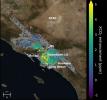
This animation shows the accumulation of data from NASA's OCO-3 instrument used to create a map of carbon dioxide (CO2) concentrations that covers about 50 square miles (80 square kilometers) of the Los Angeles metropolitan area.
PIA24523:
Carbon Dioxide Over the L.A. Metropolitan Area
Full Resolution:     TIFF (2.021 MB)     JPEG (104.3 kB)
Add Image to Favorite List 2021-07-08 Earth Aqua
AIRS
1210x1266x3
The AIRS instrument aboard NASA's Aqua satellite collected temperature readings in the atmosphere and at the surface during an unprecedented heat wave in the Pacific Northwest and western Canada that started around June 26.
PIA24537:
Heat Wave Surface Temperature
Full Resolution:     TIFF (2.168 MB)     JPEG (155.4 kB)
Add Image to Favorite List 2021-07-15 Earth Aqua
AIRS
1210x1266x3
The AIRS instrument aboard NASA's Aqua satellite collected temperature readings in the atmosphere and at the surface during an unprecedented heat wave in the southwestern U.S. from July 1 to July 12, 2021.
PIA23693:
July 2021 Heat Wave Surface Temperature
Full Resolution:     TIFF (2.603 MB)     JPEG (116.2 kB)
Add Image to Favorite List 2021-07-29 Earth ECOSTRESS
827x679x3
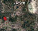
NASA's ECOSTRESS instrument captured ground-surface temperature data over southern Oregon's Bootleg Fire from July 7 to July 22. Areas in red show the fire front, where resources are needed most.
PIA23695:
ECOSTRESS Views 2021 Southern Oregon Bootleg Fire
Full Resolution:     TIFF (1.685 MB)     JPEG (109.8 kB)
Add Image to Favorite List 2021-07-29 Earth ECOSTRESS
731x573x3
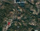
NASA's ECOSTRESS instrument captured ground-surface temperature data over northern California's Dixie Fire from July 15 to July 24. Areas in red show the fire front, where resources are needed most.
PIA23696:
ECOSTRESS Views 2021 Northern California Dixie Fire
Full Resolution:     TIFF (1.257 MB)     JPEG (113.3 kB)
Add Image to Favorite List 2022-01-04 Earth Aqua
AIRS
1664x1740x3
This animation, derived from AIRS instrument data aboard NASA's Aqua satellite, shows a nearly 20-year record of temperature anomalies for two layers in Earth's atmosphere.
PIA24139:
AIRS Temperature Anomalies
Full Resolution:     TIFF (3.235 MB)     JPEG (343.9 kB)
Add Image to Favorite List 2022-11-14 Earth Surface Water and Ocean Topography (SWOT)
1920x1080x3
This animation, created in 2012, shows the increasing clarity and detail of measurements of sea height made by successive satellite altimeters launched by NASA and other agencies over the past four decades.
PIA25561:
SWOT Satellite will Improve Clarity and Detail of Sea Height Measurements
Full Resolution:     TIFF (3.673 MB)     JPEG (154 kB)
Add Image to Favorite List 2023-01-10 Earth Aqua
AIRS
1195x611x3
The AIRS instrument aboard NASA's Aqua satellite captured a series of storms as they dumped record amounts of rain in some parts of California, causing flooding, and damaging infrastructure.
PIA25597:
California Atmospheric River Storms Captured by NASA's AIRS
Full Resolution:     TIFF (1.868 MB)     JPEG (175.8 kB)
Add Image to Favorite List 2023-05-12 Earth Sentinel-6/Jason-CS
875x415x3
This animation shows Kelvin waves moving across the equatorial Pacific Ocean from west to east during March and April, 2023. The signals can be an early sign of El Niño, and were detected by the Sentinel-6 Michael Freilich satellite.
PIA25776:
Early El Niño Signs
Full Resolution:     TIFF (598.3 kB)     JPEG (51.43 kB)
Add Image to Favorite List 2023-08-08 Earth Suomi NPP
VIIRS
1200x675x3
Amid a record heat wave in July, the Phoenix area saw surfaces such as roads and buildings stay hot long after sunset, as documented in NASA-NOAA satellite data that was used to produce this series of maps.
PIA25868:
Phoenix Land-Surface Temperatures Documented Amid Record Heat
Full Resolution:     TIFF (2.431 MB)     JPEG (160.2 kB)
Add Image to Favorite List 2023-08-18 Earth Aqua
AIRS
900x695x3
NASA's Atmospheric Infrared Sounder (AIRS) captured Hurricane Hilary on the morning of Aug. 18, 2023, when it was a Category 4 storm roughly 470 miles (760 kilometers) south of Baja California.
PIA25779:
Hurricane Hilary Captured by NASA's AIRS
Full Resolution:     TIFF (817.3 kB)     JPEG (107.8 kB)
Add Image to Favorite List 2023-10-18 Earth Sentinel-6/Jason-CS
1586x783x3
The maps in the animation show sea levels in the Pacific Ocean during early October of 1997, 2015, and 2023, in the run up to El Niño events.
PIA26099:
Comparing Sea Level During El Niño Events
Full Resolution:     TIFF (303.4 kB)     JPEG (200.3 kB)
Add Image to Favorite List 2023-10-30 Earth SWOT
KaRIn
1920x1080x3
This animation shows global sea level data collected by the Surface Water and Ocean Topography satellite from July 26 to Aug. 16, 2023.
PIA26100:
SWOT's Detailed View of Global Sea Level
Full Resolution:     TIFF (2.393 MB)     JPEG (137.4 kB)
Add Image to Favorite List 2024-04-15 Earth SWOT
KaRIn
1440x1090x3
Water depths in Death Valley's temporary lake ranged between about 3 feet (or 1 meter, shown in dark blue) to less than 1.5 feet (0.5 meters, light yellow) from February through early March.
PIA26184:
SWOT Death Valley Lake Depth
Full Resolution:     TIFF (2.295 MB)     JPEG (265.3 kB)
Add Image to Favorite List 2024-07-19 Earth 1654x1578x3
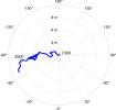
The location of Earth's spin axis moved about 30 feet (10 meters) between 1900 and 2023, as shown in this animation.
PIA26120:
Meandering Path of Earth's Spin Axis
Full Resolution:     TIFF (362.3 kB)     JPEG (108.7 kB)
Add Image to Favorite List 2024-09-27 Earth Aqua
AIRS
900x695x3
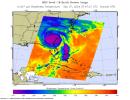
NASA's Atmospheric Infrared Sounder (AIRS) captured an infrared image of Hurricane Helene on Friday, Sept. 27, 2024, at 3:47 a.m. local time, nearly five hours after it made landfall on the Florida coast.
PIA26413:
NASA's AIRS Instrument Captures Hurricane Helene
Full Resolution:     TIFF (805.8 kB)     JPEG (118 kB)
Add Image to Favorite List 2022-11-11 Eagle Nebula Wide-field Infrared Survey Explorer (WISE)
3400x3400x3
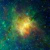
The dusty face of the Eagle Nebula and its surroundings are revealed in this image based on data from NASA's Wide Field Survey Explorer (WISE).
PIA25433:
The Eagle Nebula Observed by WISE
Full Resolution:     TIFF (34.69 MB)     JPEG (1.01 MB)
Add Image to Favorite List 2004-12-13 Dione Cassini-Huygens
Composite Infrared Spectrometer
Imaging Science Subsystem
Ultraviolet Imaging Spectrograph
Visual and Infrared Mapping Spectrometer
452x484x3
This frame from a computer animation shows the observations to be taken by NASA's Cassini spacecraft spanning roughly a nine-hour period surrounding its upcoming flyby of Dione on Dec. 14, 2004.
PIA06149:
Dione Flyby Animation Animation Icon
Full Resolution:
Add Image to Favorite List 2005-03-03 Dione Cassini-Huygens
ISS - Narrow Angle
1016x900x1
In this frame from a movie, NASA's Cassini spacecraft pointed its cameras toward Saturn's moon Dione to witness its distant sibling moon Rhea briefly pass behind in a series of 32 individual frames taken over 17 minutes.
PIA06199:
Cassini's Private Eclipse Animation Icon
Full Resolution:     TIFF (93.28 kB)     JPEG (23.22 kB)
Add Image to Favorite List 2005-10-17 Dione Cassini-Huygens
ISS - Wide Angle
500x500x1
Zooming in closer and closer, this frame from a movie chronicles NASA's Cassini spacecraft targeted flyby of Dione, with Saturn and its lovely rings forming a dramatic backdrop.
PIA07749:
Ice Moon Rendezvous Animation Icon
Full Resolution:     TIFF (250.5 kB)     JPEG (19.76 kB)
Add Image to Favorite List 2015-06-01 Dione Cassini-Huygens
ISS - Narrow Angle
1024x1024x1
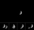
NASA's Cassini spacecraft captured this image when Dione was closer to its camera, making the moon appear much bigger than her larger sister moon, Rhea.
PIA18319:
Dione Dwarfing Rhea Animation Icon
Full Resolution:     TIFF (1.05 MB)     JPEG (73.61 kB)
Add Image to Favorite List 2019-04-04 Deimos Mars Science Laboratory (MSL)
Mastcam
256x256x1
This series of images shows the Martian moon Deimos as it crossed in front of the Sun, as seen by NASA's Curiosity Mars rover on Sunday, March 17, 2019 (the 2,350th Martian day, or sol, of the mission).
PIA23134:
Curiosity Observes Deimos Eclipse: Sol 2350
Full Resolution:     TIFF (52.08 kB)     JPEG (3.197 kB)
Add Image to Favorite List 2024-03-05 Deimos Mars 2020 Rover
Mastcam-Z
1535x917x3
NASA's Perseverance Mars rover used its Mastcam-Z camera to capture the silhouette of Deimos, one of the two Martian moons, as it passed in front of the Sun on Jan. 19, 2024.
PIA26249:
Perseverance Views a Transit of Deimos
Full Resolution:     TIFF (667.5 kB)     JPEG (30.82 kB)
Add Image to Favorite List 2005-07-13 Cygnus W. M. Keck Observatory
Keck I Telescope
640x480x3
This frame from an artist's animation shows the view from a hypothetical moon in orbit around the first known planet to reside in a tight-knit triple-star system. HD 188553 Ab is a gas giant planet, about 1.14 times the mass of Jupiter.
PIA03520:
Land of Three Suns (Artist's Concept Animation) Animation Icon
Full Resolution:     TIFF (23.04 MB)     JPEG (574 kB)
Add Image to Favorite List 2005-07-13 Cygnus W. M. Keck Observatory
Keck I Telescope
3000x2400x3
This frame from an artist's animation shows the clockwork-like orbits of a triple-star system called HD 188753, which was discovered to harbor a gas giant, or 'hot Jupiter,' planet.
PIA03521:
Circus Family of Stars (Artist's Concept) Animation Icon
Full Resolution:     TIFF (21.6 MB)     JPEG (147.3 kB)
Add Image to Favorite List 2005-07-01 Comet Spitzer Space Telescope
646x486x3
This artist's concept depicts one of the most widely accepted theories pertaining to the origin of comets. This image is courtesy of NASA's Spitzer Science Center at the California Institute of Technology, Pasadena, Calif.
PIA02107:
Genesis of a Comet (Artist's Concept) Animation Icon
Full Resolution:     TIFF (943.1 kB)     JPEG (30.67 kB)
Add Image to Favorite List 2014-05-15 Comet Rosetta
OSIRIS
1000x1000x3
This still from a sequence of images shows comet 67P/Churyumov-Gerasimenko moving against the background star field.
PIA18376:
Rosetta's Comet Comes Alive Animation Icon
Full Resolution:     TIFF (1.003 MB)     JPEG (121.1 kB)
Add Image to Favorite List 2014-07-03 Comet NEOWISE
NEOWISE Telescope
1329x957x3
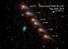
NASA's NEOWISE mission captured this series of pictures of comet C/2012 K1 -- also known as comet Pan-STARRS -- as it swept across our skies on May 20, 2014.
PIA18460:
Infrared View of a Comet and Distant Galaxy Animation Icon
Full Resolution:     TIFF (3.817 MB)     JPEG (142.7 kB)
Add Image to Favorite List 2014-07-17 Comet Rosetta
OSIRIS
480x480x1
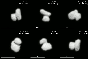
This frame from an animated sequence combined 36 interpolated images of comet 67P/Churyumov-Gerasimenko, each separated by 20 minutes. This comet is the destination for the European Space Agency's Rosetta mission in 2014.
PIA18403:
Rotation and Shape of Rosetta Mission's Target Comet Animation Icon
Full Resolution:     TIFF (230.8 kB)     JPEG (8.872 kB)
Add Image to Favorite List 2014-07-24 Comet Rosetta
OSIRIS
1000x1000x1
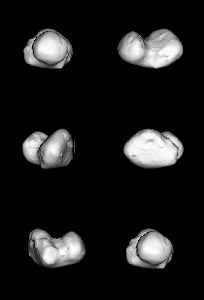
Images of comet 67P/Churyumov-Gerasimenko taken on July 14, 2014, by the OSIRIS imaging system aboard ESA's Rosetta spacecraft have allowed scientists to create this three-dimensional shape model of the nucleus.
PIA18419:
Rotating Shape Model of Rosetta's Comet Target Animation Icon
Full Resolution:     TIFF (1.001 MB)     JPEG (21.47 kB)
Add Image to Favorite List 2014-11-13 Comet Rosetta
OSIRIS
400x400x1
This frame from an animated sequence shows the Rosetta mission's Philae lander descending toward comet 67P/Churyumov-Gerasimenko (not in frame) on Nov. 12, 2014. The images are from the OSIRIS narrow-angle camera on the ESA's Rosetta orbiter.
PIA18877:
Descent to the Surface of a Comet Animation Icon
Full Resolution:     TIFF (160.4 kB)     JPEG (3.961 kB)
Add Image to Favorite List 2015-01-13 Comet NEOWISE
NEOWISE Telescope
1280x720x3
This frame from a movie shows the progression of NASA's NEOWISE survey in the mission's first year following its restart in December 2013. Each dot represents an asteroid or comet that the mission observed.
PIA19101:
One Year of NEOWISE Observations Mapped Animation Icon
Full Resolution:     TIFF (2.766 MB)     JPEG (59.78 kB)
Add Image to Favorite List 2015-08-11 Comet Rosetta
OSIRIS
3000x1000x1
This frame from an animation shows a very strong jet from comet 67P/Churyumov-Gerasimenko captured by Rosetta's OSIRIS on July 29, 2015.
PIA19867:
Rosetta Comet In Action (Animation)
Full Resolution:     TIFF (1.677 MB)     JPEG (171.4 kB)
Add Image to Favorite List 2016-03-24 Comet Goldstone Deep Space Network (DSN)
Goldstone Solar System Radar
960x500x1
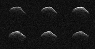
These radar images of comet P/2016 BA14 were taken on March 23, 2016, by scientists using an antenna of NASA's Deep Space Network at Goldstone, California. At the time, the comet was about 2.2 million miles (3.6 million kilometers) from Earth.
PIA20542:
Comet Frozen In Time by NASA Radar Animation Icon
Full Resolution:     TIFF (452.2 kB)     JPEG (109.6 kB)
Add Image to Favorite List 2016-10-07 Comet Kepler
Rosetta
1786x1030x1
NASA's planet-hunting Kepler spacecraft observed the comet during the final month of the Rosetta mission, while the comet was not visible from Earth. This is a frame from an animation composed of images from Kepler of the comet.
PIA21072:
Comet 67P Seen by Kepler Animation Icon
Full Resolution:     TIFF (400.4 kB)     JPEG (46.74 kB)
Add Image to Favorite List 2017-07-25 Comet 1992x1000x3
This frame from an animation portrays a comet as it approaches the inner solar system. Light from the Sun warms the comet core, an object so small it cannot be seen at this scale.
PIA21749:
Comet Illustration (Animation) Animation Icon
Full Resolution:     TIFF (2.536 MB)     JPEG (73.51 kB)
Add Image to Favorite List 2019-04-15 Comet NEOWISE
NEOWISE Telescope
3927x2209x3
This image shows comet C/2018 Y1 Iwamoto as imaged in multiple exposures of infrared light by NASA's Near-Earth Object Wide-field Survey Explorer (NEOWISE) space telescope.
PIA23165:
Comet C/2018 Y1 Iwamoto
Full Resolution:     TIFF (22.3 MB)     JPEG (1.462 MB)
Add Image to Favorite List 2015-07-01 Charon New Horizons
MVIC
938x1458x3
This series of images taken by NASA's New Horizons' Multispectral Visible Imaging Camera (MVIC) shows how Pluto (left) and Charon (right) change in brightness as they rotate over 6.4 Earth days.
PIA19692:
True Color of Pluto and Charon Animation Icon
Full Resolution:     TIFF (1.371 MB)     JPEG (126.7 kB)
Add Image to Favorite List 2015-10-01 Charon New Horizons
LORRI
MVIC
1621x907x1
Images from NASA's New Horizons spacecraft were used to create a flyover video of Pluto's largest moon, Charon. The 'flight' starts with the informally named Mordor (dark) region near Charon's north pole.
PIA19965:
Flying over Charon Animation Icon
Full Resolution:     TIFF (587.9 kB)     JPEG (74.33 kB)
Add Image to Favorite List 2015-01-19 Ceres Dawn
Framing Camera
381x384x1
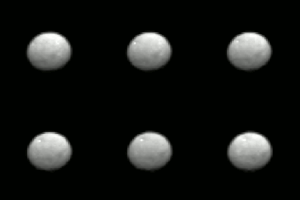
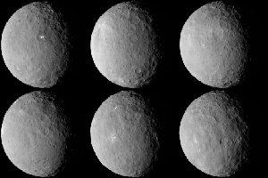
This frame from an animation comes from NASA's Dawn spacecraft as it observed Ceres for an hour on Jan. 13, 2015, from a distance of 238,000 miles (383,000 kilometers).
PIA19168:
Animation of Ceres Animation Icon
Full Resolution:     TIFF (146.7 kB)     JPEG (4.075 kB)
Add Image to Favorite List 2015-01-27 Ceres Dawn
Framing Camera
600x600x1
This frame from an animation of the dwarf planet Ceres was made by combining images taken by the Dawn spacecraft on January 25, 2015. These images of Ceres, and they represent the highest-resolution views to date of the dwarf planet.
PIA19171:
Ceres Sharper Than Ever (Animation) Animation Icon
Full Resolution:     TIFF (360.6 kB)     JPEG (8.974 kB)
Add Image to Favorite List 2015-02-05 Ceres Dawn
Framing Camera
638x476x1
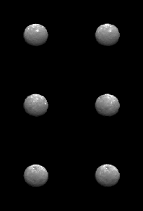
This still from an animation showcases a series of images NASA's Dawn spacecraft took on approach to Ceres on Feb. 4, 2015 at a distance of about 90,000 miles (145,000 kilometers) from the dwarf planet.
PIA19174:
Animation of Ceres Animation Icon
Full Resolution:     TIFF (304.2 kB)     JPEG (19.79 kB)
Add Image to Favorite List 2015-02-06 Ceres Dawn
Framing Camera
441x417x1
This still from an animation showcases a series of images NASA's Dawn spacecraft took on approach to Ceres on Feb. 4, 2015 at a distance of about 90,000 miles (145,000 kilometers) from the dwarf planet.
PIA19180:
Animation of Ceres Animation Icon
Full Resolution:     TIFF (184.3 kB)     JPEG (5.559 kB)
Add Image to Favorite List 2015-02-04 Ceres Dawn
Framing Camera
613x604x1
This is a frame from an animation showcasing a series of images NASA's Dawn spacecraft took on approach to Ceres on Feb. 4, 2015 at a distance of about 90,000 miles (145,000 kilometers) from the dwarf planet.
PIA19182:
Animation of Ceres on Approach Animation Icon
Full Resolution:     TIFF (370.8 kB)     JPEG (8.029 kB)
Add Image to Favorite List 2015-03-02 Ceres Dawn
Framing Camera
488x488x1
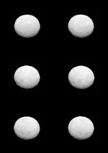
Ceres rotates in this frame from a movie comprised of images taken by NASA's Dawn mission during its approach to the dwarf planet. The images were taken on Feb. 19, 2015, from a distance of nearly 29,000 miles (46,000 kilometers).
PIA18920:
Ceres Awaits Dawn Animation Icon
Full Resolution:     TIFF (238.6 kB)     JPEG (19.38 kB)
Add Image to Favorite List 2015-03-02 Ceres Dawn
Framing Camera
1280x721x1
The surface of Ceres is covered with craters of many shapes and sizes, as seen in this frame from an animation of a map of the dwarf planet's surface as seen by NASA's Dawn spacecraft on Feb. 19, 2015.
PIA18924:
Cratered Surface of Ceres in Motion Animation Icon
Full Resolution:     TIFF (924.1 kB)     JPEG (51.75 kB)
Add Image to Favorite List 2015-04-16 Ceres Dawn
Framing Camera
1002x1035x1
This frame from an animation shows the north pole of dwarf planet Ceres as seen by the Dawn spacecraft on April 10, 2015. Dawn was at a distance of 21,000 miles (33,000 kilometers) when its framing camera took these images.
PIA19317:
Ceres' North Pole Animation Icon
Full Resolution:     TIFF (1.038 MB)     JPEG (34.76 kB)
Add Image to Favorite List 2015-04-20 Ceres Dawn
Framing Camera
1068x1260x1
This frame from an animated sequence of images shows northern terrain on the sunlit side of dwarf planet Ceres as seen by NASA's Dawn spacecraft on April 14 and 15, 2015.
PIA19064:
Settling in at Ceres Animation Icon
Full Resolution:     TIFF (1.347 MB)     JPEG (118.1 kB)
Add Image to Favorite List 2015-05-11 Ceres Dawn
Framing Camera
774x665x1
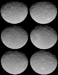
In this closest-yet view of Ceres, the brightest spots within a crater in the northern hemisphere are revealed to be composed of many smaller spots. This frame is from an animation of sequences taken by NASA's Dawn spacecraft on May 4, 2015.
PIA19547:
Ceres RC3 Animation Animation Icon
Full Resolution:     TIFF (515.5 kB)     JPEG (53.2 kB)
Add Image to Favorite List 2015-07-28 Ceres Dawn
Framing Camera
1277x718x3
This frame from an animation shows a color-coded map from NASA's Dawn mission revealing the highs and lows of topography on the surface of dwarf planet Ceres.
PIA19605:
Ceres Topographic Globe Animation Animation Icon
Full Resolution:     TIFF (2.752 MB)     JPEG (46.29 kB)
Add Image to Favorite List 2015-08-06 Ceres Dawn
Framing Camera
1282x721x1
This frame from a video shows the bright spots in Occator crater on dwarf planet Ceres, generated from data from NASA's Dawn spacecraft.
PIA19619:
Ceres Animations: Global View, Occator, Mountain, 3-D View Animation Icon
Full Resolution:     TIFF (231.3 kB)     JPEG (47.12 kB)
Add Image to Favorite List 2015-09-09 Ceres Dawn
Framing Camera
1024x1024x1
This image, made using images taken by NASA's Dawn spacecraft, shows Occator crater on Ceres, home to a collection of intriguing bright spots.
PIA19889:
Dawn Takes a Closer Look at Occator
Full Resolution:     TIFF (950.8 kB)     JPEG (137.1 kB)
Add Image to Favorite List 2015-09-09 Ceres Dawn
Framing Camera
1277x716x1
This still from an animation, made using images taken by NASA's Dawn spacecraft, shows Occator crater on Ceres, home to a collection of intriguing bright spots.
PIA19890:
Circling the Lights of Occator Animation Icon
Full Resolution:     TIFF (238.4 kB)     JPEG (38.01 kB)
Add Image to Favorite List 2015-09-09 Ceres Dawn
Framing Camera
1277x714x3
This still from an animation, made using images taken by NASA's Dawn spacecraft, features a color-coded topographic map of Occator crater on Ceres.
PIA19891:
Circling Occator -- Topographic Animation Animation Icon
Full Resolution:     TIFF (813 kB)     JPEG (39.37 kB)
Add Image to Favorite List 2015-12-09 Ceres Dawn
Framing Camera
1764x1112x3
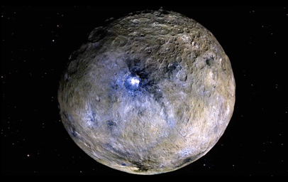
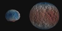
This frame from a video from NASA's Dawn mission shows dwarf planet Ceres in false-color renderings, which highlight differences in surface materials.
PIA20182:
Ceres Rotation and Occator Crater (Video) Animation Icon
Full Resolution:     TIFF (3 MB)     JPEG (221 kB)
Add Image to Favorite List 2016-01-29 Ceres Dawn
1280x720x3
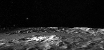
This frame is from a simulated flight of NASA's Dawn over Ceres which emphasizes the most prominent craters, as well as the mountain Ahuna Mons.
PIA20019:
Flight Over Ceres Animation Icon
Full Resolution:     TIFF (1.457 MB)     JPEG (64.87 kB)
Add Image to Favorite List 2016-03-22 Ceres Dawn
Framing Camera
1264x632x1
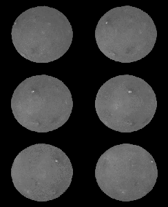
This frame from a movie shows that the brightest area on Ceres, located in Occator Crater, was one of the last features to be imaged as NASA's Dawn progressively built its map.
PIA20356:
Ceres LAMO Coverage Map Animation Icon
Full Resolution:     TIFF (648 kB)     JPEG (186.5 kB)
Add Image to Favorite List 2016-03-22 Ceres Dawn
Framing Camera
640x360x3
NASA's Dawn spacecraft flys over dwarf planet Ceres which Dawn has been orbiting for mre than a year, providing us with fascinating views of an alien world.
PIA20537:
Unveiling Ceres (Animation) Animation Icon
Full Resolution:     TIFF (178.3 kB)     JPEG (18.84 kB)
Add Image to Favorite List 2016-12-15 Ceres Dawn
Framing Camera
1070x536x3
This frame from an animation shows dwarf planet Ceres overlaid with the concentration of hydrogen determined from data acquired by the gamma ray and neutron detector (GRaND) instrument aboard NASA's Dawn spacecraft.
PIA21081:
Water Ice Abundance on Ceres (Animation)
Full Resolution:     TIFF (843.6 kB)     JPEG (52.87 kB)
Add Image to Favorite List 2016-12-15 Ceres Dawn
Framing Camera
436x347x1
This frame from an animation from NASA's Dawn spacecraft shows a crater in the northern polar region of Ceres that is partly in shadow year-round, where bright water ice deposits have been observed in several craters.
PIA21082:
Ceres Persistent Shadow (Animation) Animation Icon
Full Resolution:     TIFF (142.1 kB)     JPEG (32.21 kB)
Add Image to Favorite List 2016-12-15 Ceres Dawn
Framing Camera
516x253x1
This frame from a video captured by NASA's Dawn spacecraft shows a flyover of the intriguing crater named Occator on dwarf planet Ceres. Occator is home to Ceres' brightest area.
PIA21080:
Flight Over Occator (Animation) Animation Icon
Full Resolution:     TIFF (101.6 kB)     JPEG (15.49 kB)
Add Image to Favorite List 2017-03-22 Ceres Dawn
Framing Camera
12500x9600x1
This frame from an animation from NASA's Dawn spacecraft shows how the illumination of Ceres' northern hemisphere varies with the dwarf planet's axial tilt, or obliquity.
PIA21469:
Ceres' Shadowed Craters Over Time Animation Icon
Full Resolution:     TIFF (30.83 MB)     JPEG (5.459 MB)
Add Image to Favorite List 2017-05-16 Ceres Dawn
Framing Camera
690x566x1
This is one frame from a movie made of images taken by NASA's Dawn spacecraft, from a position exactly between the sun and Ceres' surface.
PIA21405:
Ceres During 'Opposition Surge' Animation Icon
Full Resolution:     TIFF (109.3 kB)     JPEG (16.3 kB)
Add Image to Favorite List 2017-10-26 Ceres Dawn
Framing Camera
1400x788x3
NASA's Dawn spacecraft took these images of dwarf planet Ceres. The map overlaid on the right gives scientists hints about Ceres' internal structure.
PIA22083:
Clues to Ceres' Internal Structure Animation Icon
Full Resolution:     TIFF (3.312 MB)     JPEG (485.3 kB)
Add Image to Favorite List 2005-06-10 Cassiopeia A Hubble Space Telescope
Spitzer Space Telescope
IRAC
Visible Light
Chandra X-ray Telescope
1835x1348x3
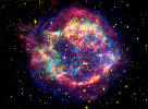
This false-color image from three of NASA's Great Observatories provides one example of a star that died in a fiery supernova blast. Called Cassiopeia A, this supernova remnant is located 10,000 light-years away in the constellation Cassiopeia.
PIA03519:
Cassiopeia A: Death Becomes Her Animation Icon
Full Resolution:     TIFF (7.432 MB)     JPEG (263.6 kB)
Add Image to Favorite List 2006-10-26 Cassiopeia A Spitzer Space Telescope
IRAC
638x477x3
This artist's concept shows the explosion of a massive star, the remains of which are named Cassiopeia A. NASA's Spitzer Space Telescope found evidence that the star exploded with some degree of order.
PIA01902:
Order Amidst Chaos of Star's Explosion (Artist Concept) Animation Icon
Full Resolution:     TIFF (914.2 kB)     JPEG (56.6 kB)
Add Image to Favorite List 2008-05-29 Cassiopeia A Spitzer Space Telescope
641x479x3
A seething cauldron of light appears to bubble and ooze around the remains of a giant star that astronomers have been watching tear itself apart for the last 300 years. Different observations taken over three years by NASA's Spitzer Space Telescope.
PIA10724:
Cauldron of Light Animation Icon
Full Resolution:     TIFF (922.3 kB)     JPEG (21.94 kB)
Add Image to Favorite List 2009-01-06 Cassiopeia A Chandra X-ray Observatory
Spitzer Space Telescope
Chandra X-ray Telescope
IRAC
719x479x3
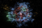
For the first time, a multiwavelength three-dimensional reconstruction of a supernova remnant has been created. This visualization of Cassiopeia A, or Cas A, the result of an explosion approximately 330 years ago, uses data from several NASA telescopes.
PIA11748:
Supernova Remnant in 3-D Animation Icon
Full Resolution:     TIFF (1.035 MB)     JPEG (36.78 kB)
Add Image to Favorite List 2005-05-30 Carina Nebula Spitzer Space Telescope
IRAC
6614x5196x3
These false-color image taken by NASA's Spitzer Space Telescope shows the 'South Pillar' region of the star-forming region called the Carina Nebula.
PIA03515:
All Pillars Point to Eta Animation Icon
Full Resolution:     TIFF (103.1 MB)     JPEG (3.749 MB)
Add Image to Favorite List 2010-02-17 C/2007 Q3 (Siding Spring) Wide-field Infrared Survey Explorer (WISE)
WISE Telescope
1281x717x3
Is it a bird, or a plane? No, it's comet Siding Spring streaking across the sky, as seen by NASA's Wide-field Infrared Survey Explorer, or WISE. An animation is available at the Photojournal.
PIA12836:
Ablaze with Infrared Light Animation Icon
Full Resolution:     TIFF (2.759 MB)     JPEG (39.57 kB)
Add Image to Favorite List 2004-06-30 Atlas Cassini-Huygens
ISS - Narrow Angle
1074x511x56
NASA's Cassini spacecraft has sighted the tiny moon Atlas, which is seen here for the first time since Voyager 1 flew past Saturn in 1980.
PIA06076:
Atlas Found! Animation Icon
Full Resolution:
Add Image to Favorite List 2009-08-06 Asteroid Goldstone Deep Space Network (DSN)
Goldstone Solar System Radar
834x429x37
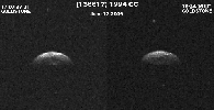
NASA's Deep Space Network, Goldstone radar images show triple asteroid 1994 CC, which consists of a central object approximately 700 meters (2,300 feet) in diameter and two smaller moons that orbit the central body. Animation available at the Photojournal
PIA12134:
Triple Asteroid System Triples Asteroid Observers Interest Animation Icon
Full Resolution:     TIFF (358.4 kB)     JPEG (42.08 kB)
Add Image to Favorite List 2010-05-25 Asteroid Wide-field Infrared Survey Explorer (WISE)
WISE Telescope
640x359x3
This image shows asteroids observed so far by NASA's Wide-field Infrared Survey Explorer. An animation is available at the Photojournal.
PIA13113:
Scanning for Asteroids and Comets Animation Icon
Full Resolution:     TIFF (690.2 kB)     JPEG (16.57 kB)
Add Image to Favorite List 2010-10-04 Asteroid Wide-field Infrared Survey Explorer (WISE)
WISE Telescope
568x561x3
This frame from a video demonstrates how NASA's Wide-field Infrared Survey Explorer surveys asteroids and comets in the solar system. Perspective shown here is looking down from high above Earth's North Pole, a kind of bird's eye view of the solar system.
PIA13435:
Asteroid and Comet Census from WISE
Full Resolution:     TIFF (957.3 kB)     JPEG (61.23 kB)
Add Image to Favorite List 2012-12-14 Asteroid Goldstone Deep Space Network (DSN)
Goldstone Solar System Radar
876x708x1
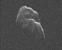
This image of asteroid Toutatis was generated with data collected using NASA's Deep Space Network antenna at Goldstone, Calif., on Dec. 12 and 13, 2012 and indicates that it is an elongated, irregularly shaped object with ridges and perhaps craters.
PIA16599:
Tumbling Asteroid Toutatis Animation Icon
Full Resolution:     TIFF (621.1 kB)     JPEG (124.8 kB)
Add Image to Favorite List 2013-02-15 Asteroid Samford Valley Observatory
799x461x1
This frame from a movie from the Samford Valley Observatory in Brisbane, Australia, shows the progress of asteroid 2012 DA14 across the night sky as it nears its closest approach. It was taken at 12:59 UTC on Feb. 15 (7:59 a.m. EST, or 4:59 a.m. PST).
PIA16735:
Approach of Asteroid 2012 DA14 from Samford Valley Observatory Animation Icon
Full Resolution:     TIFF (368.9 kB)     JPEG (48.69 kB)
Add Image to Favorite List 2013-02-15 Asteroid Siding Spring Observatory
383x710x1
An animated set of images, from the telescope known as the iTelescope.net Siding Spring Observatory, shows asteroid 2012 DA14 as the streak moving from top to bottom in the field of view. The animation is available in the Planetary Photojournal.
PIA16737:
Asteroid 2012 DA14 as Seen from Siding Spring, Australia Animation Icon
Full Resolution:     TIFF (272.4 kB)     JPEG (26.25 kB)
Retrieve Previous Set  Jump to a Previous Set   Jump to a Previous Set   Jump to a Previous Set   Jump to a Previous Set   Jump to a Previous Set   Jump to a Previous Set   Jump to a Previous Set   Jump to a Previous Set   Jump to a Previous Set   Current Set   Retrieve Next Set 
 1-100   101-200   201-300   301-400   401-500   501-600   601-700   701-800   801-900   901-1000 
Currently displaying images: 901 - 1000 of 1175