My
List |
Addition Date
|
Target
|
Mission
|
Instrument
|
Size
|

|
2019-11-12 |
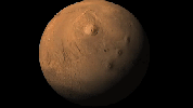
Mars
|
Mars Reconnaissance Orbiter (MRO)
Mars Express (MEX)
Mars Global Surveyor (MGS)
|
CRISM
CTX
MOLA
High Resolution Stereo Camera
|
3663x2535x3 |
|
-
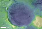
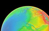
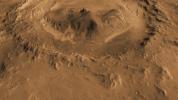
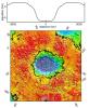
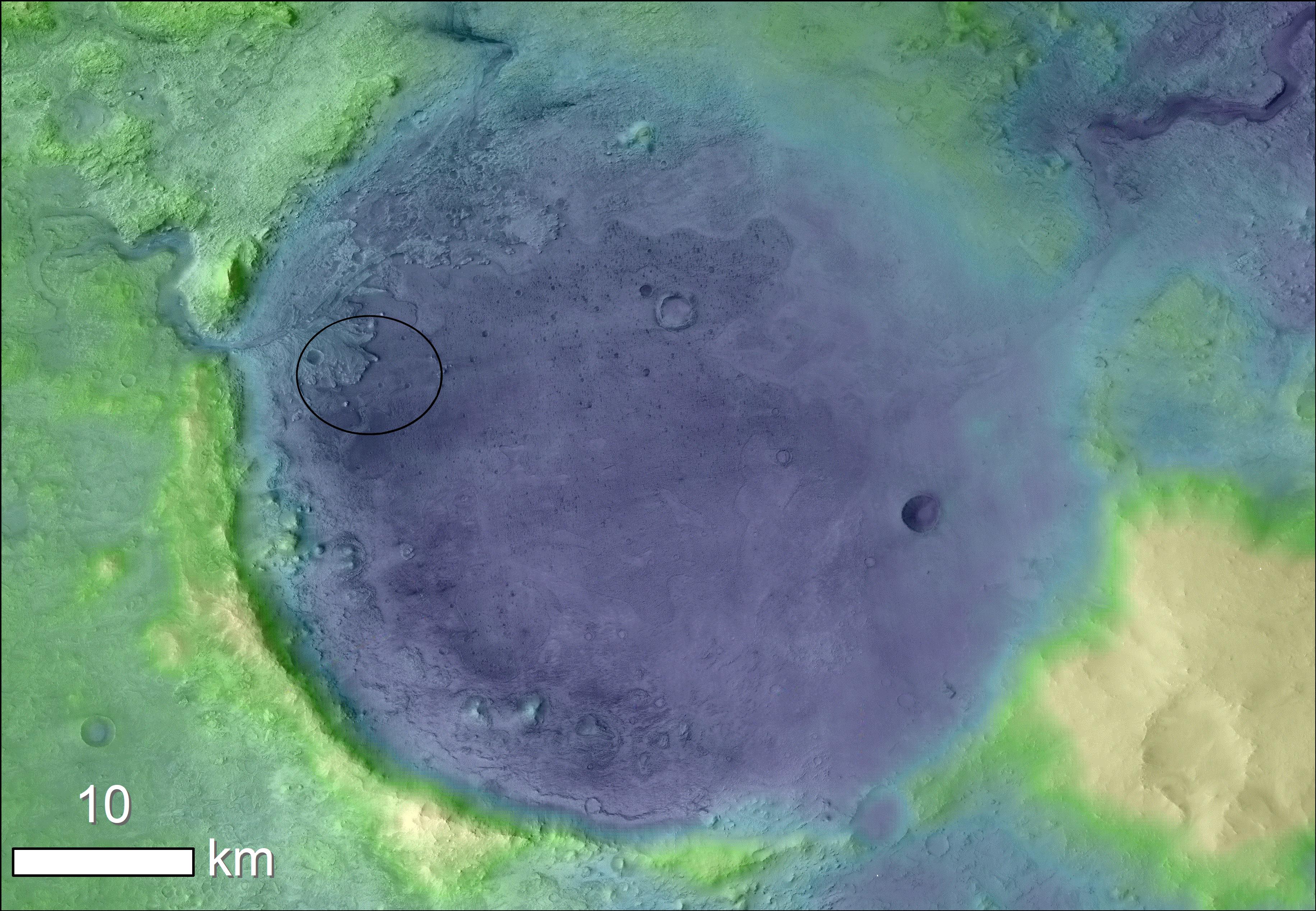
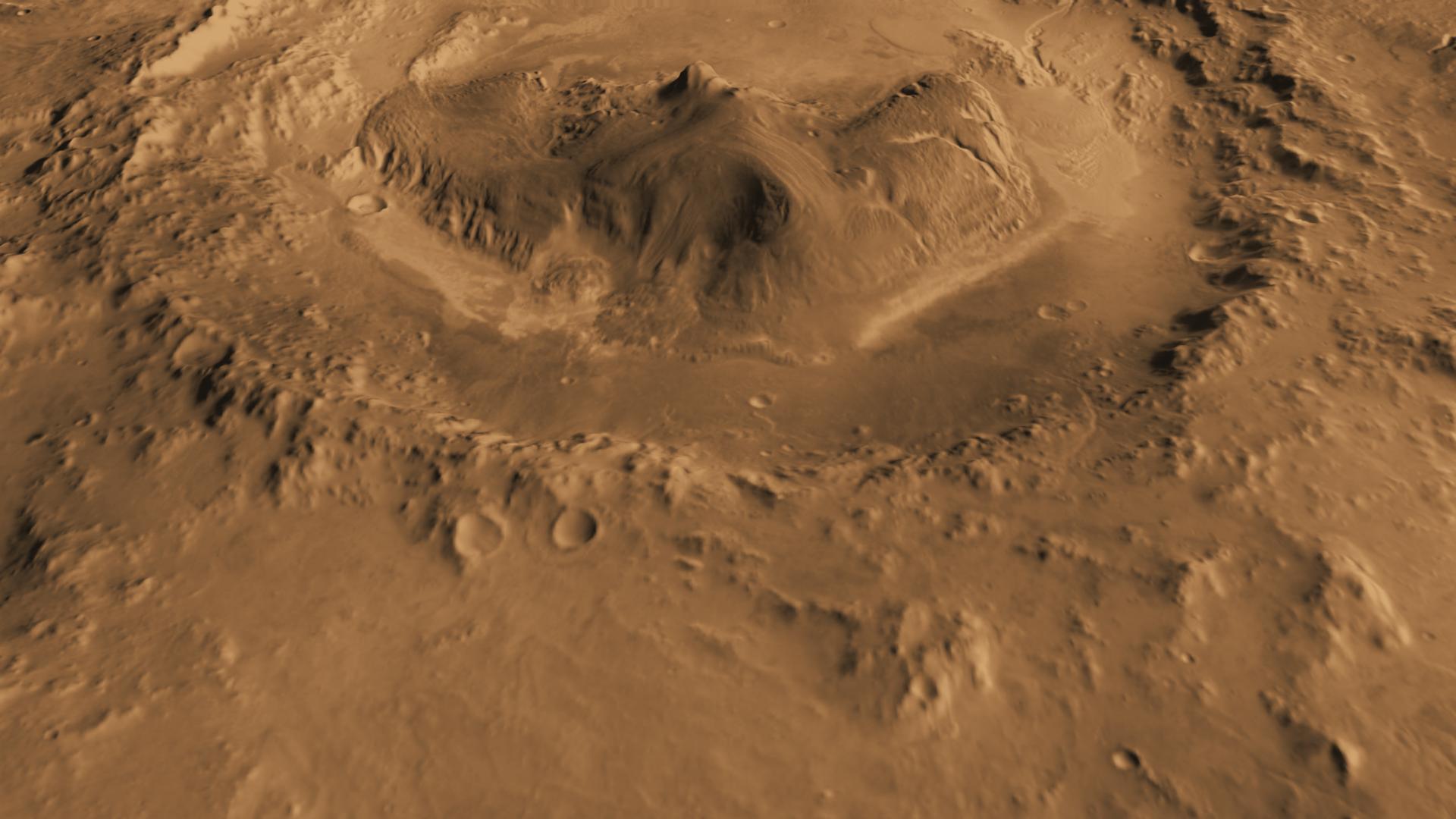
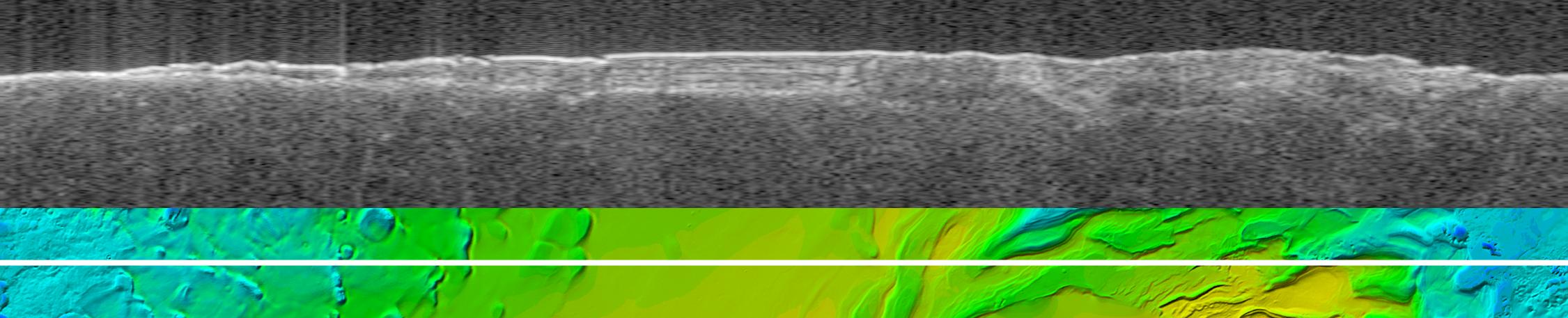
PIA23511:
-
Jezero Crater's Ancient Lakeshore
Full Resolution:
TIFF
(16.31 MB)
JPEG
(2.37 MB)
|
|
|
2016-09-15 |
Mars
|
2001 Mars Odyssey
Mars Global Surveyor (MGS)
|
MOLA
THEMIS
|
1726x2453x3 |
|
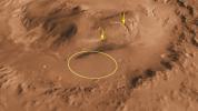
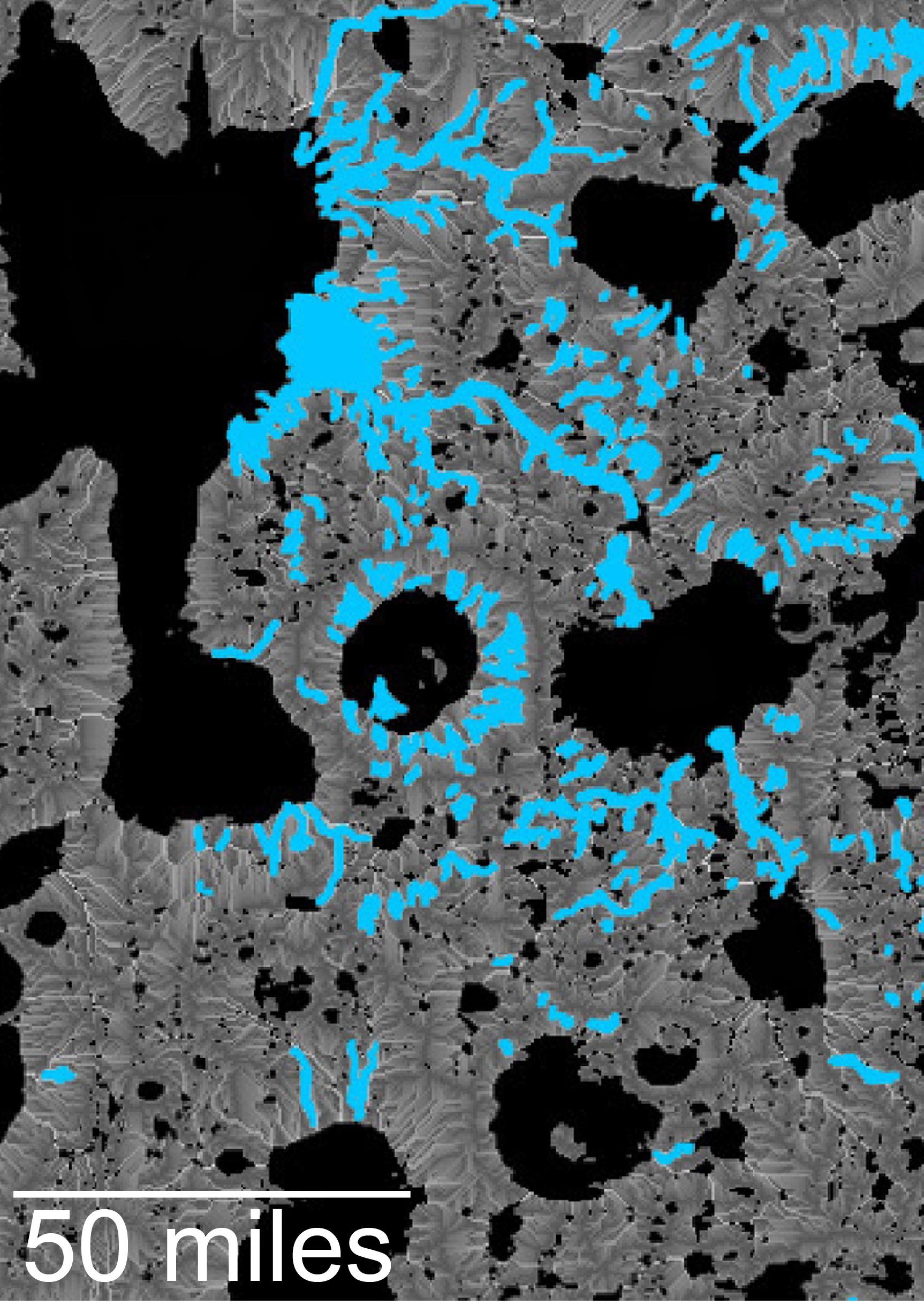
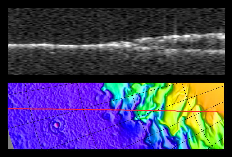
-
PIA20839:
-
Hydrologic Modeling of Relatively Recent Martian Streams and Lake
Full Resolution:
TIFF
(7.388 MB)
JPEG
(549.4 kB)
|
|
|
2016-09-15 |
Mars
|
2001 Mars Odyssey
Mars Global Surveyor (MGS)
|
MOLA
THEMIS
|
1316x1840x3 |

|
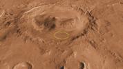
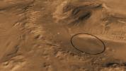
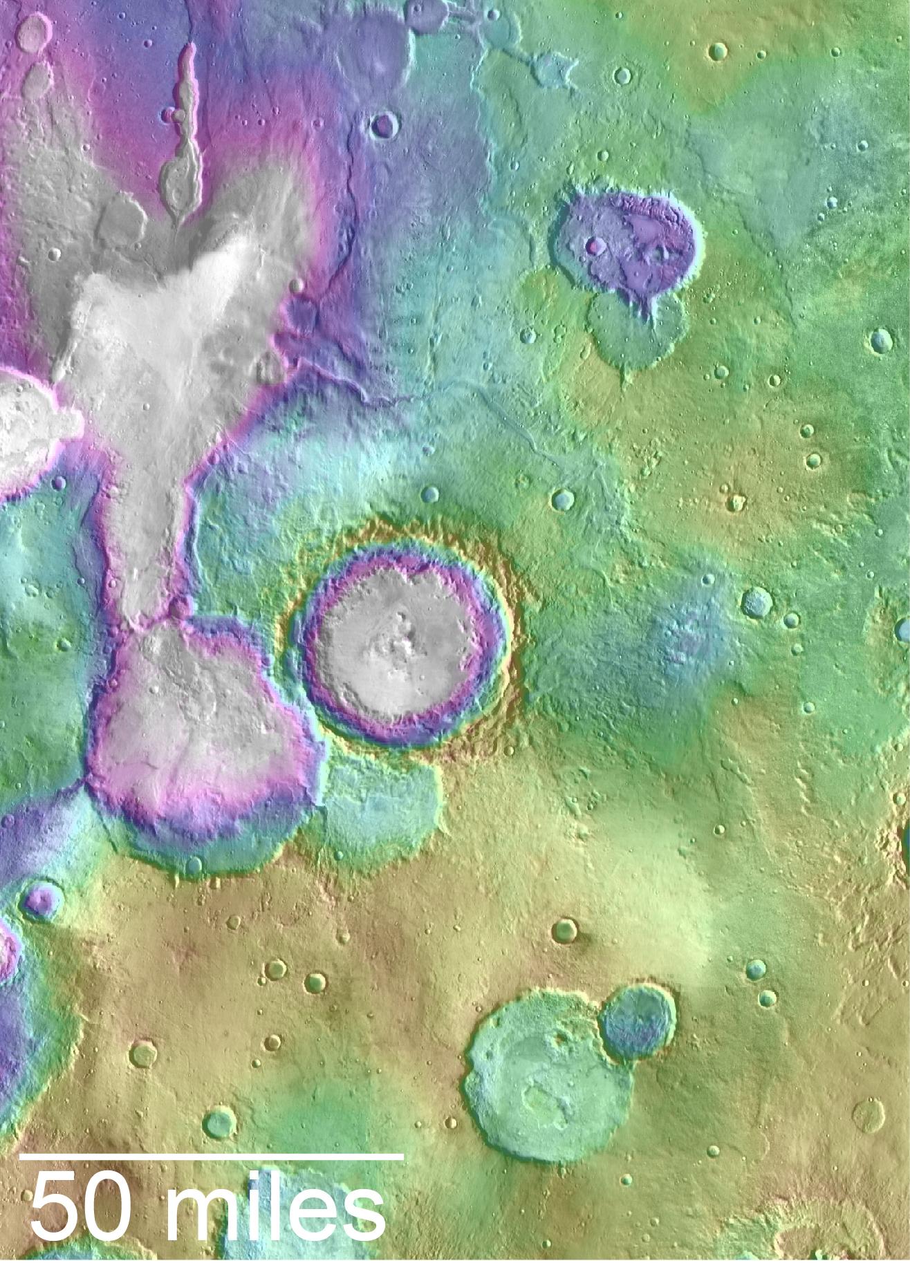
-
PIA20838:
-
Landscape of Former Lakes and Streams on Northern Mars
Full Resolution:
TIFF
(7.267 MB)
JPEG
(409.9 kB)
|
|
|
2016-03-21 |
Mars
|
2001 Mars Odyssey
Mars Global Surveyor (MGS)
Mars Reconnaissance Orbiter (MRO)
|
MOLA
|
2400x2400x3 |
|
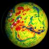
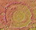
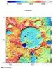
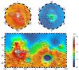
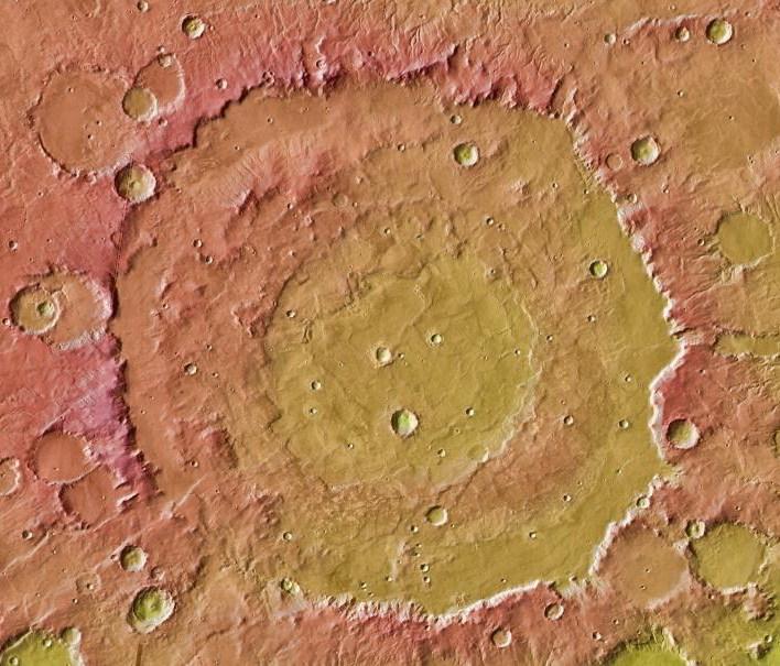
-
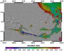
PIA20327:
-
Local Variations in the Gravitational Pull of Mars
Full Resolution:
TIFF
(11.91 MB)
JPEG
(443.7 kB)
|
|
|
2016-03-21 |
Mars
|
2001 Mars Odyssey
Mars Global Surveyor (MGS)
Mars Reconnaissance Orbiter (MRO)
|
MOLA
|
2400x2400x3 |

|
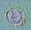
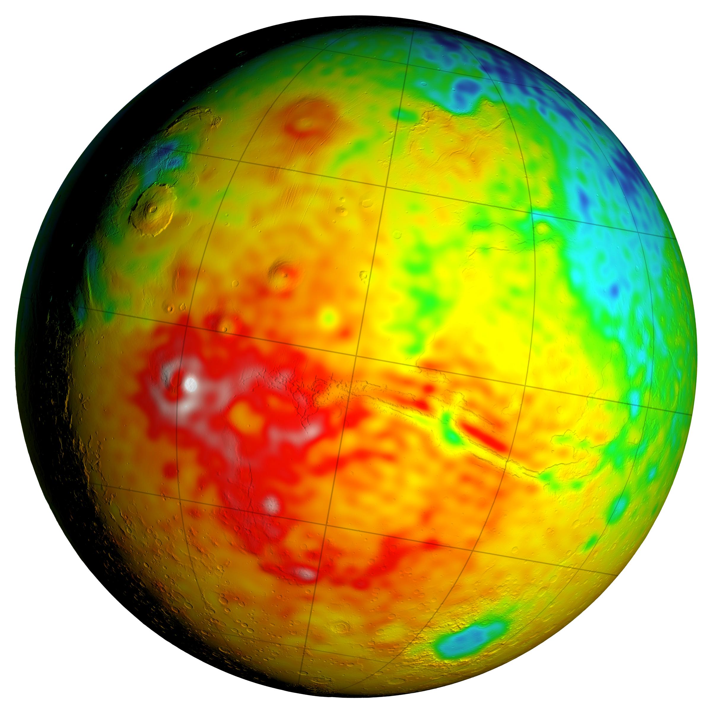
-
PIA20326:
-
Newly Detailed Map of Mars' Crustal Thickness
Full Resolution:
TIFF
(10.76 MB)
JPEG
(398.9 kB)
|
|
|
2016-03-21 |
Mars
|
2001 Mars Odyssey
Mars Global Surveyor (MGS)
Mars Reconnaissance Orbiter (MRO)
|
MOLA
|
3200x1500x3 |
|
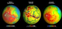
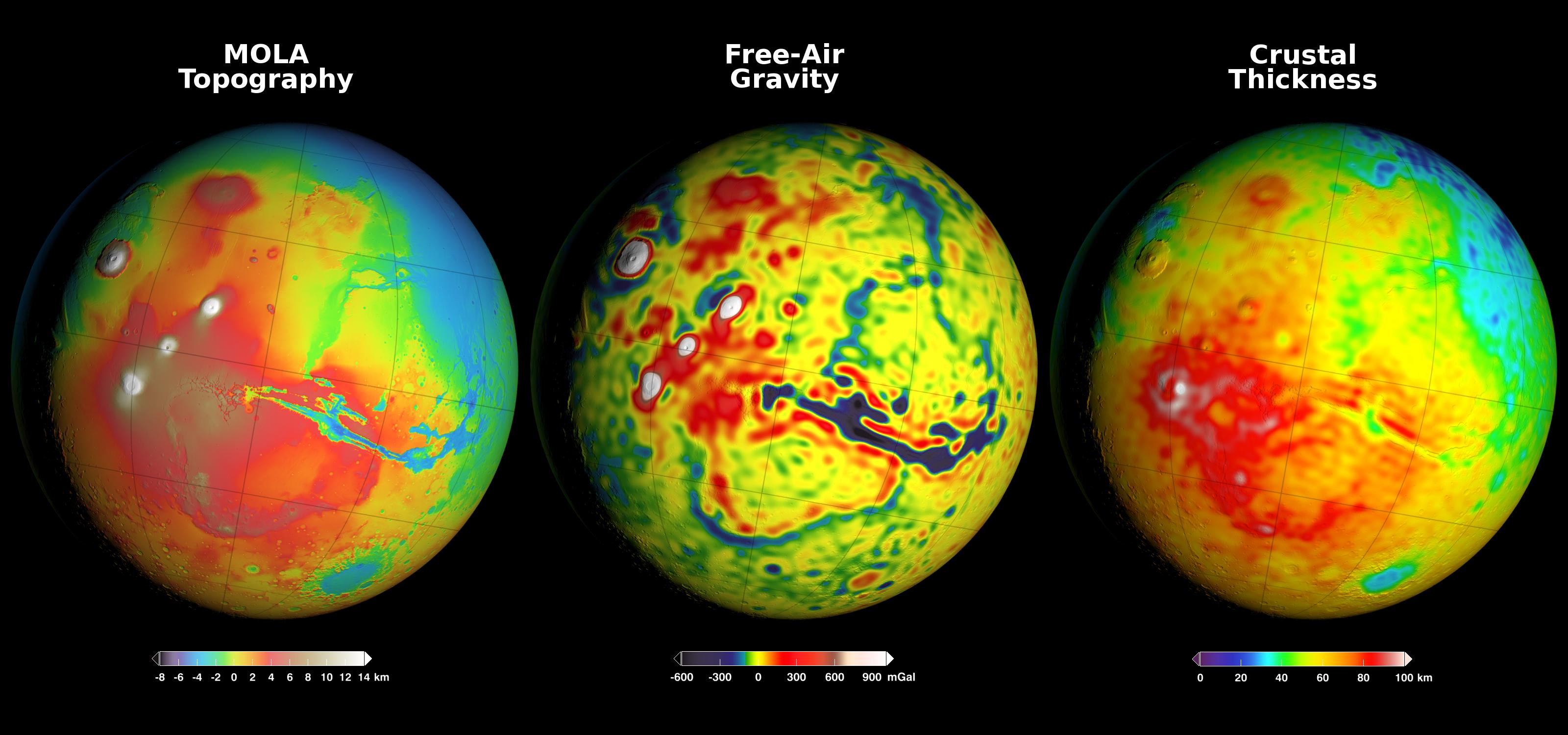
-
PIA20277:
-
Using Gravity and Topography to Map Mars' Crustal Thickness
Full Resolution:
TIFF
(7.902 MB)
JPEG
(358.2 kB)
|
|
|
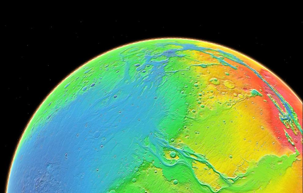
2013-12-10 |
Mars
|
2001 Mars Odyssey
Mars Global Surveyor (MGS)
|
MOLA
THEMIS
|
989x481x3 |
|
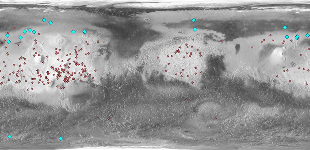
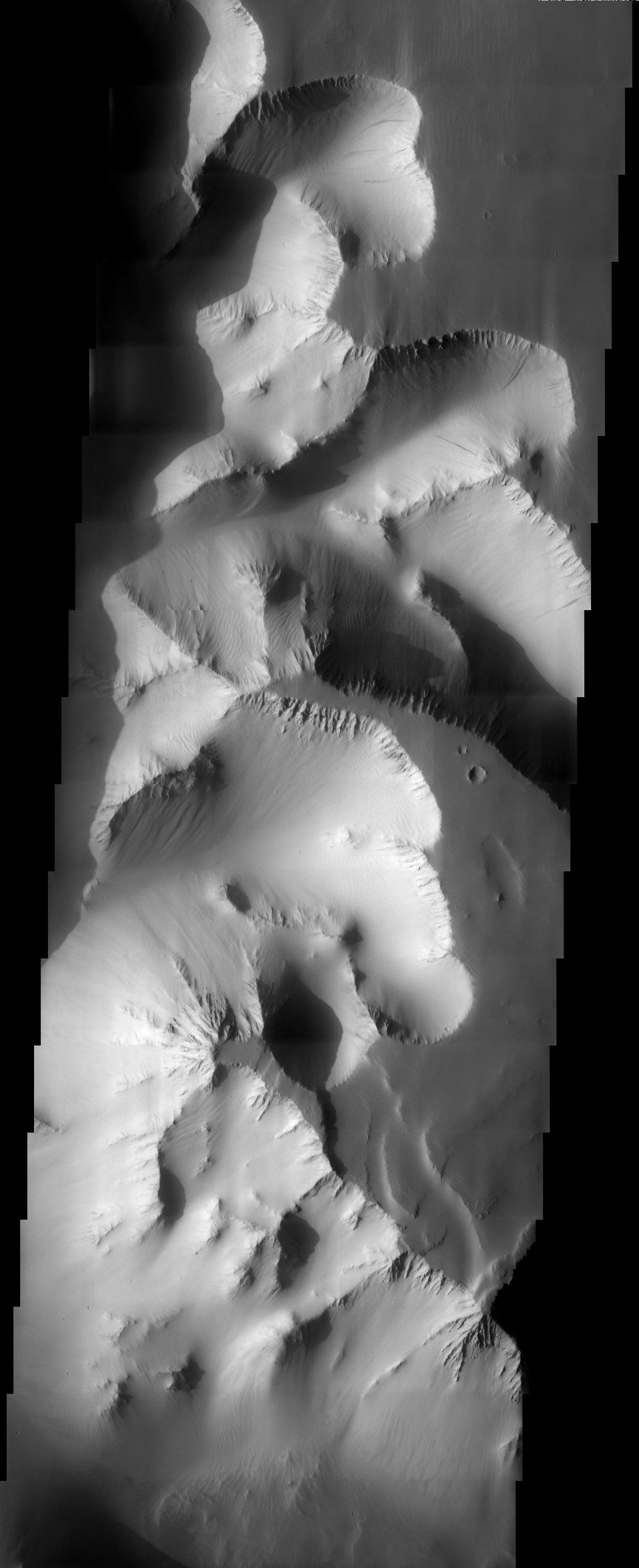
-
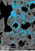
PIA17609:
-
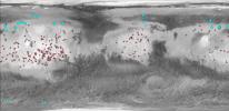
Locations of Ice-Exposing Fresh Craters on Mars
Full Resolution:
TIFF
(1.428 MB)
JPEG
(82.32 kB)
|
|
|
2013-12-10 |
Mars
|
2001 Mars Odyssey
Mars Global Surveyor (MGS)
|
MOLA
THEMIS
|
960x665x3 |
|
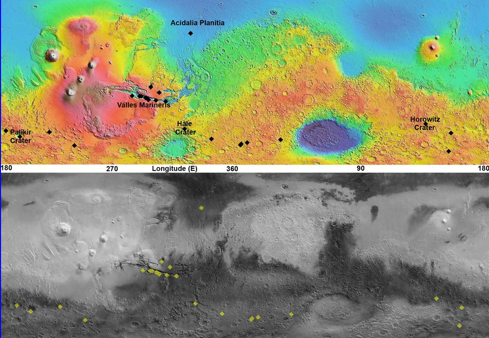
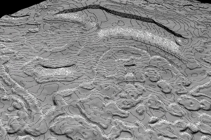
-
PIA17607:
-
Maps of Recurrent Slope Linea Markings on Mars
Full Resolution:
TIFF
(1.916 MB)
JPEG
(143.3 kB)
|
|
|
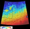
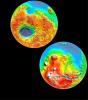
2013-09-04 |
Mars
|
InSight
Mars Global Surveyor (MGS)
|
MOLA
|
4000x2298x3 |
|
-
PIA17357:
-
NASA's Mars Landing Sites, including InSight
Full Resolution:
TIFF
(27.59 MB)
JPEG
(2.27 MB)
|
|
|
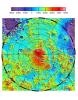
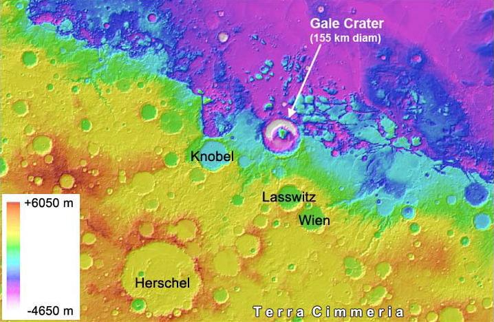
2012-08-02 |
Mars
|
Mars Science Laboratory (MSL)
|
MOLA
|
718x468x3 |
|
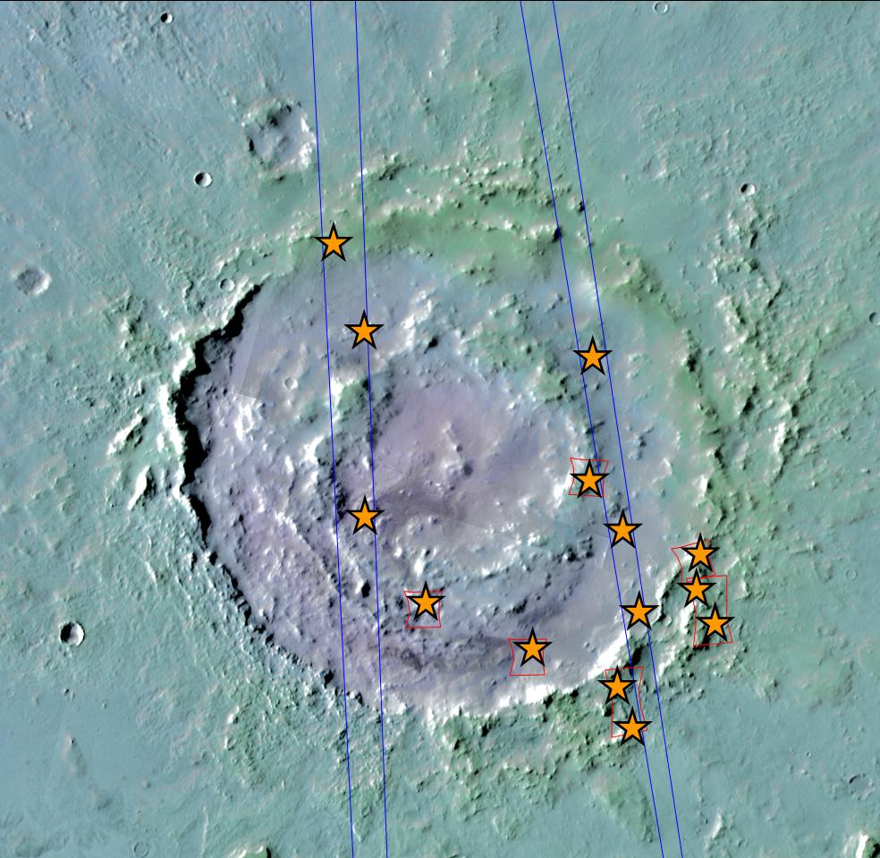
-
PIA15958:
-
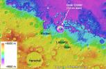
Gale Crater is Low on Mars
Full Resolution:
TIFF
(1.009 MB)
JPEG
(76.15 kB)
|
|
|
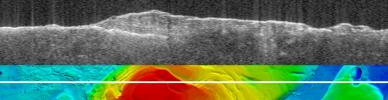
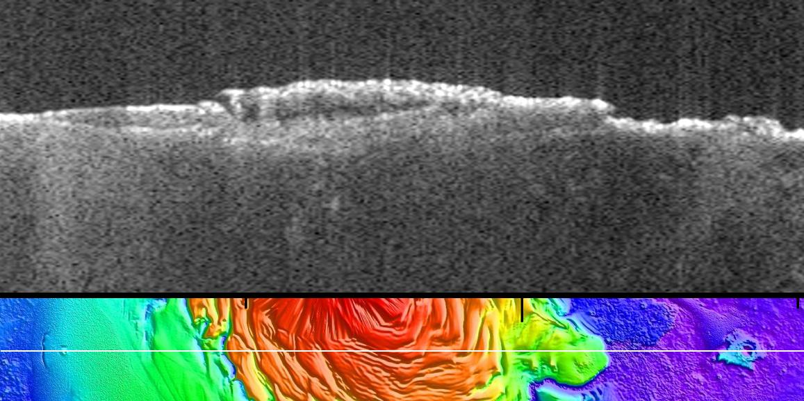
2011-12-19 |
Mars
|
Mars Express (MEX)
Mars Global Surveyor (MGS)
|
MARSIS
MOLA
|
1157x577x3 |

|
-
PIA15117:
-
Radargram of Mars North Polar Plateau from Mars Express
Full Resolution:
TIFF
(2.005 MB)
JPEG
(120 kB)
|
|
|
2011-11-21 |
Mars
|
Mars Global Surveyor (MGS)
|
MOLA
|
989x632x3 |
|
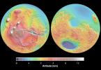
-
PIA15094:
-
Topography of Mars
Full Resolution:
TIFF
(1.878 MB)
JPEG
(81.25 kB)
|
|
|
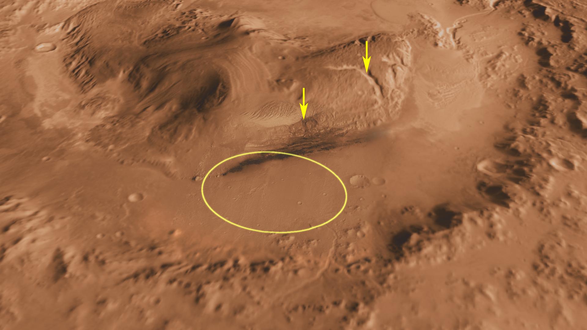
2011-07-22 |
Mars
|
Mars Science Laboratory (MSL)
|
MOLA
THEMIS
|
1920x1080x3 |
|
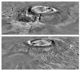
-
PIA14295:
-
Canyons on Mountain Inside Gale Crater
Full Resolution:
TIFF
(6.23 MB)
JPEG
(153.3 kB)
|
|
|
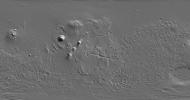
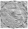
2011-07-22 |
Mars
|
Mars Science Laboratory (MSL)
|
MOLA
THEMIS
|
1920x1080x3 |
|
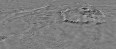
-
PIA14294:
-
Context of Curiosity Landing Site in Gale Crater
Full Resolution:
TIFF
(6.23 MB)
JPEG
(199 kB)
|
|
|
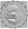
2011-07-22 |
Mars
|
Mars Science Laboratory (MSL)
|
MOLA
|
9600x5400x3 |

|
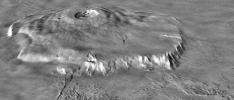
-
PIA14293:
-
Daybreak at Gale Crater
Full Resolution:
TIFF
(155.5 MB)
JPEG
(1.911 MB)
|
|
|
2011-07-22 |
Mars
|
Mars Science Laboratory (MSL)
|
MOLA
THEMIS
|
1920x1080x3 |
|
-
PIA14292:
-
Oblique view of Gale Crater from the Northwest
Full Resolution:
TIFF
(6.23 MB)
JPEG
(141.6 kB)
|
|
|
2011-07-06 |
Mars
|
2001 Mars Odyssey
Mars Global Surveyor (MGS)
Mars Science Laboratory (MSL)
|
MOLA
THEMIS
|
1920x1080x3 |
|
-
PIA14291:
-
Oblique view of Gale Crater from the North
Full Resolution:
TIFF
(6.23 MB)
JPEG
(170.8 kB)
|
|
|
2011-03-08 |
Mars
|
2001 Mars Odyssey
Mars Global Surveyor (MGS)
|
MOLA
THEMIS
|
708x605x3 |
|
-
PIA13801:
-
Nature's Drilling Exposes Deeply Buried Minerals
Full Resolution:
TIFF
(1.287 MB)
JPEG
(85.93 kB)
|
|
|
2010-06-24 |
Mars
|
Viking
Mars Global Surveyor (MGS)
|
MOLA
|
984x960x3 |
|
-
PIA13215:
-
Hydrated Minerals Exposed at Lyot, Northern Mars
Full Resolution:
TIFF
(2.838 MB)
JPEG
(153.2 kB)
|
|
|
2010-05-26 |
Mars
|
Mars Global Surveyor (MGS)
|
Mars Orbiter Camera (MOC)
MOLA
|
1280x1024x3 |
|
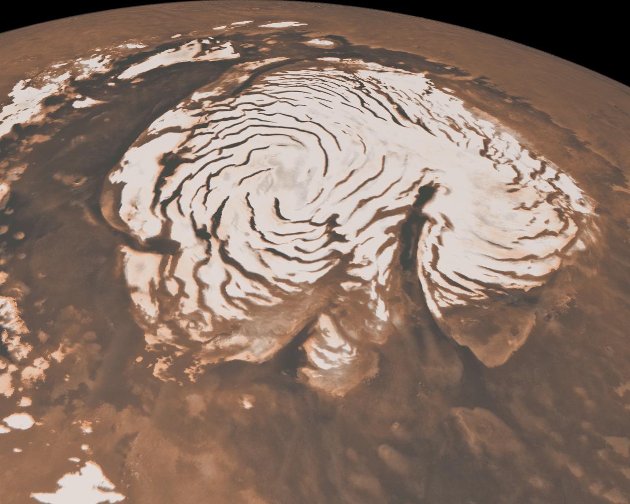
-
PIA13163:
-
Northern Ice Cap of Mars
Full Resolution:
TIFF
(3.936 MB)
JPEG
(141.1 kB)
|
|
|
2008-08-04 |
Mars
|
Mars Global Surveyor (MGS)
Phoenix
|
MOLA
|
640x360x3 |
|
-
PIA11029:
-
Wind-Related Topography in Phoenix's Region of Mars (Animation)

Full Resolution:
TIFF
(692.2 kB)
JPEG
(12.34 kB)
|
|
|
2008-05-26 |
Mars
|
Phoenix
|
MOLA
Surface Stereo Imager (SSI)
|
640x360x3 |

|
-
PIA10694:
-
Phoenix's Position on Mars
Full Resolution:
TIFF
(692.2 kB)
JPEG
(12.07 kB)
|
|
|
2008-05-22 |
Mars
|
Mars Global Surveyor (MGS)
Phoenix
|
MOLA
|
720x486x3 |

|
-
PIA10656:
-
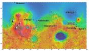
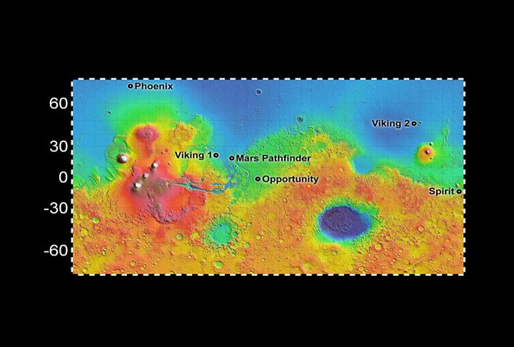
Six Landing Sites on Mars
Full Resolution:
TIFF
(1.051 MB)
JPEG
(44.63 kB)
|
|
|
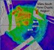
2007-12-11 |
Mars
|
Mars Global Surveyor (MGS)
|
MOLA
Thermal Emission Spectrometer
|
753x697x3 |
|
-
PIA10138:
-
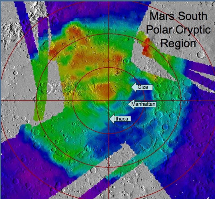
Location of Sites Within 'Cryptic Terrain'
Full Resolution:
TIFF
(1.577 MB)
JPEG
(111.7 kB)
|
|
|
2007-12-11 |
Mars
|
Mars Global Surveyor (MGS)
|
MOLA
|
2502x1320x1 |
|
-
PIA10132:
-
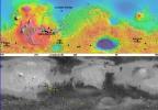
Global View of Mars Topography
Full Resolution:
TIFF
(3.306 MB)
JPEG
(791.3 kB)
|
|
|
2007-08-02 |
Mars
|
Mars Global Surveyor (MGS)
Phoenix
|
MOLA
|
1019x985x3 |
|
-
PIA09945:
-
Topographical Context of Phoenix Landing Region
Full Resolution:
TIFF
(3.015 MB)
JPEG
(137 kB)
|
|
|
2007-08-02 |
Mars
|
Mars Global Surveyor (MGS)
Phoenix
|
MOLA
|
1127x1125x3 |
|
-
PIA09944:
-
Far-Northern Destination for Phoenix Mars Lander
Full Resolution:
TIFF
(3.808 MB)
JPEG
(244.1 kB)
|
|
|
2007-03-15 |
Mars
|
Mars Express (MEX)
Mars Global Surveyor (MGS)
|
MARSIS
Mars Orbiter Laser Altimeter
|
2369x2558x3 |
|
-
PIA09226:
-
Upper Surface of Icy Layers Covering Mars' South Polar Region
Full Resolution:
TIFF
(18.2 MB)
JPEG
(1.033 MB)
|
|
|
2007-03-15 |
Mars
|
Mars Express (MEX)
Mars Global Surveyor (MGS)
|
MARSIS
Mars Orbiter Laser Altimeter
|
2369x2558x3 |
|
-
PIA09225:
-
Lower Boundary of Icy Layers Covering Mars' South Polar Region
Full Resolution:
TIFF
(18.2 MB)
JPEG
(938.3 kB)
|
|
|
2007-03-15 |
Mars
|
Mars Express (MEX)
Mars Global Surveyor (MGS)
|
MARSIS
Mars Orbiter Laser Altimeter
|
2369x2558x3 |
|
-
PIA09224:
-
Thickness of Mars' South Polar Layered Deposits
Full Resolution:
TIFF
(18.2 MB)
JPEG
(462.9 kB)
|
|
|
2007-03-15 |
Mars
|
Mars Express (MEX)
Mars Global Surveyor (MGS)
|
MARSIS
Mars Orbiter Laser Altimeter
|
2251x457x3 |

|
-
PIA09223:
Virtual Slice Through Icy Layered Deposits Near Mars' South Pole
Full Resolution:
TIFF
(3.09 MB)
JPEG
(149.5 kB)
|
|
|
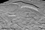
2007-03-15 |
Mars
|
Mars Express (MEX)
Mars Global Surveyor (MGS)
|
MARSIS
Mars Orbiter Laser Altimeter
|
1784x460x3 |
|
-
PIA09222:
Bright Lower Echo in Radargram of South Polar Layered Deposits
Full Resolution:
TIFF
(2.466 MB)
JPEG
(124.4 kB)
|
|
|
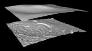
2005-11-30 |
Mars
|
Mars Express (MEX)
Mars Global Surveyor (MGS)
|
Mars Advanced Radar for Subsurface and Ionospheric Sounding
(MARSIS)
Mars Orbiter Laser Altimeter
|
788x683x3 |
|
-
PIA03237:
-
Topographic Map of Chryse Planitia with Location of Possible Buried Basin
Full Resolution:
TIFF
(1.617 MB)
JPEG
(106.2 kB)
|
|
|
2005-11-30 |
Mars
|
Mars Express (MEX)
Mars Global Surveyor (MGS)
|
MARSIS
Mars Orbiter Laser Altimeter
|
979x666x3 |

|
-
PIA03235:
-
Radargram of Mars' North Polar Layered Deposits with Topographic Map
Full Resolution:
TIFF
(1.959 MB)
JPEG
(95.14 kB)
|
|
|
2003-06-17 |
Mars
|
2001 Mars Odyssey
|
MOLA
Thermal Emission Imaging System
|
1239x3043x1 |

|
-
PIA04577:
-
Canyon Walls
Full Resolution:
TIFF
(2.865 MB)
JPEG
(287.6 kB)
|
|
|
2002-10-10 |
Mars
|
Mars Global Surveyor (MGS)
|
Mars Orbiter Camera (MOC)
Mars Orbiter Laser Altimeter
|
879x585x3 |
|
-
PIA03874:
-
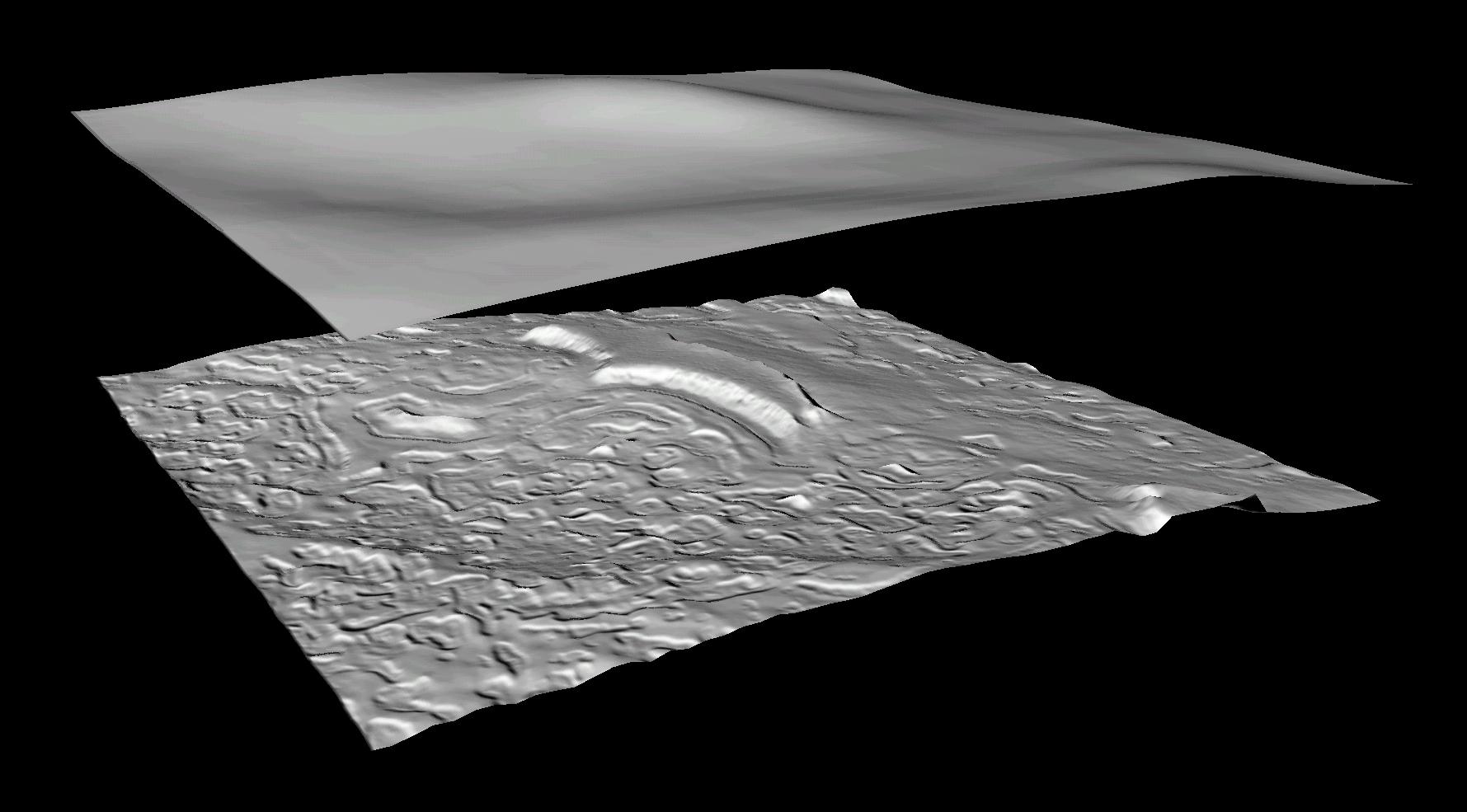
Derived Topographic Model from Mars Global Surveyor Instruments
Full Resolution:
TIFF
(1.123 MB)
JPEG
(193.4 kB)
|
|
|
2002-10-10 |
Mars
|
Mars Global Surveyor (MGS)
|
Mars Orbiter Camera (MOC)
Mars Orbiter Laser Altimeter
|
1779x985x3 |
|
-
PIA03873:
-
Derived Topographic Model from Mars Global Surveyor Instruments
Full Resolution:
TIFF
(1.663 MB)
JPEG
(126.1 kB)
|
|
|
2001-01-17 |
Mars
|
Mars Global Surveyor (MGS)
|
MOLA
|
4000x2769x3 |
|
-
PIA02820:
-
Mars Topography
Full Resolution:
TIFF
(21.78 MB)
JPEG
(1.109 MB)
|
|
|
2000-11-10 |
Mars
|
Mars Global Surveyor (MGS)
|
MOLA
|
11649x5723x3 |
|
-
PIA02993:
-
Mars Orbiter Laser Altimiter (MOLA) Globe
Full Resolution:
TIFF
(158.6 MB)
JPEG
(11 MB)
|
|
|
2000-10-06 |
Mars
|
Mars Global Surveyor (MGS)
|
MOLA
|
669x441x3 |
|
-
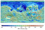
PIA02809:
-
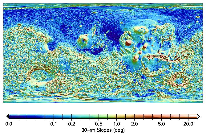
MOLA Global Map of Surface Gradients on Mars
Full Resolution:
TIFF
(254.8 kB)
JPEG
(128.2 kB)
|
|
|
2000-10-06 |
Mars
|
Mars Global Surveyor (MGS)
|
MOLA
|
669x441x3 |
|
-
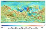
PIA02808:
-
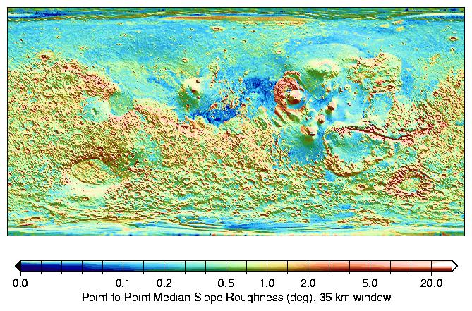
MOLA Global Roughness Map of Mars
Full Resolution:
TIFF
(248.3 kB)
JPEG
(114.3 kB)
|
|
|
2000-09-08 |
Mars
|
Mars Global Surveyor (MGS)
|
MOLA
|
757x995x3 |
|
-
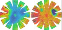
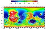
PIA01049:
-
Regional Topographic Views of Mars from MOLA
Full Resolution:
TIFF
(1.717 MB)
JPEG
(157.5 kB)
|
|
|
2000-09-07 |
Mars
|
Mars Global Surveyor (MGS)
|
MOLA
|
2100x900x1 |
|
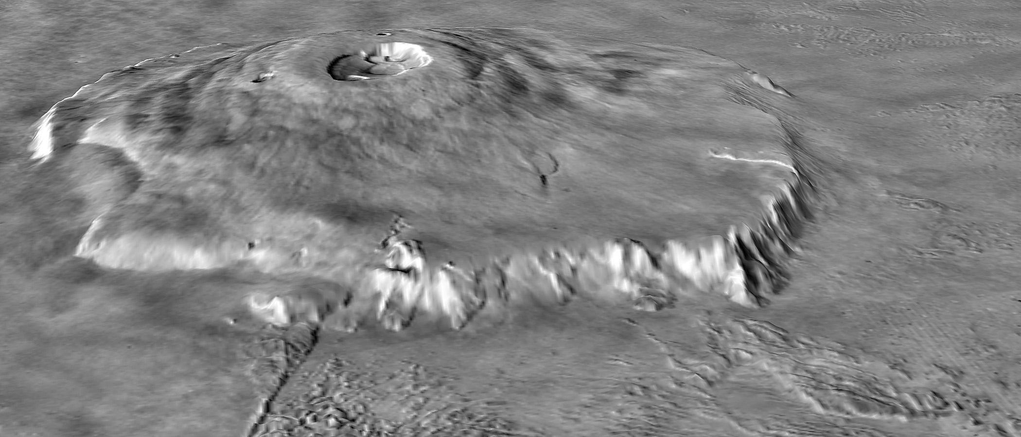
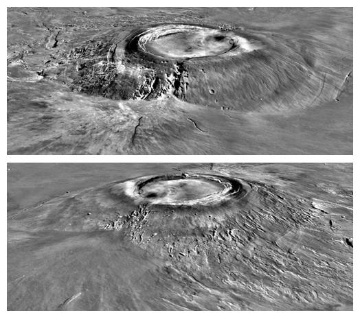
-
PIA02806:
-
Major Martian Volcanoes from MOLA - Olympus Mons
Full Resolution:
TIFF
(1.451 MB)
JPEG
(205 kB)
|
|
|
2000-09-07 |
Mars
|
Mars Global Surveyor (MGS)
|
MOLA
|
2100x900x1 |
|
-
PIA02805:
-
Major Martian Volcanoes from MOLA - Olympus Mons
Full Resolution:
TIFF
(1.538 MB)
JPEG
(270.9 kB)
|
|
|
2000-09-07 |
Mars
|
Mars Global Surveyor (MGS)
|
MOLA
|
524x462x1 |
|
-
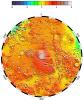
PIA02804:
-
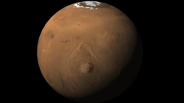
Major Martian Volcanoes from MOLA - Arsia Mons
Full Resolution:
TIFF
(231.1 kB)
JPEG
(52.9 kB)
|
|
|
2000-09-07 |
Mars
|
Mars Global Surveyor (MGS)
|
MOLA
|
524x462x1 |
|
-
PIA02803:
-
Major Martian Volcanoes from MOLA - Alba Patera
Full Resolution:
TIFF
(239.9 kB)
JPEG
(52.87 kB)
|
|
|
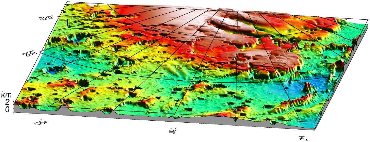
1999-07-06 |
Mars
|
Mars Global Surveyor (MGS)
|
MOLA
|
1280x493x3 |
|
-
PIA02091:
-
Mars '98 Polar landing site
Full Resolution:
TIFF
(1.607 MB)
JPEG
(150 kB)
|
|
|
1999-07-06 |
Mars
|
Mars Global Surveyor (MGS)
|
MOLA
|
910x685x3 |
|
-
PIA02090:
-
MPL LANDING SITE CORRIDOR
Full Resolution:
TIFF
(151.7 kB)
JPEG
(86.71 kB)
|
|
|
1999-07-06 |
Mars
|
Mars Global Surveyor (MGS)
|
MOLA
|
910x670x3 |
|
-
PIA02089:
-
MPL LANDING SITE - DEM
Full Resolution:
TIFF
(172.2 kB)
JPEG
(111.2 kB)
|
|
|
1999-07-06 |
Mars
|
Mars Global Surveyor (MGS)
|
MOLA
|
612x792x3 |
|
-
PIA02088:
-
MOLA TOPOGRAPHIC MAP
Full Resolution:
TIFF
(1.326 MB)
JPEG
(182.1 kB)
|
|
|
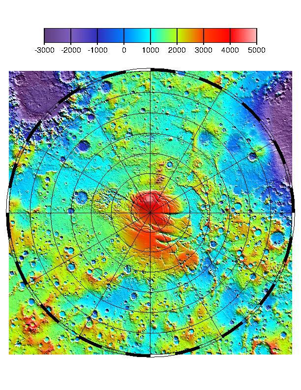
1999-06-23 |
Mars
|
Mars Global Surveyor (MGS)
|
MOLA
|
2468x2592x1 |
|
-
PIA02053:
-
North Polar Topography (MOLA)
Full Resolution:
TIFF
(5.755 MB)
JPEG
(1.378 MB)
|
|
|
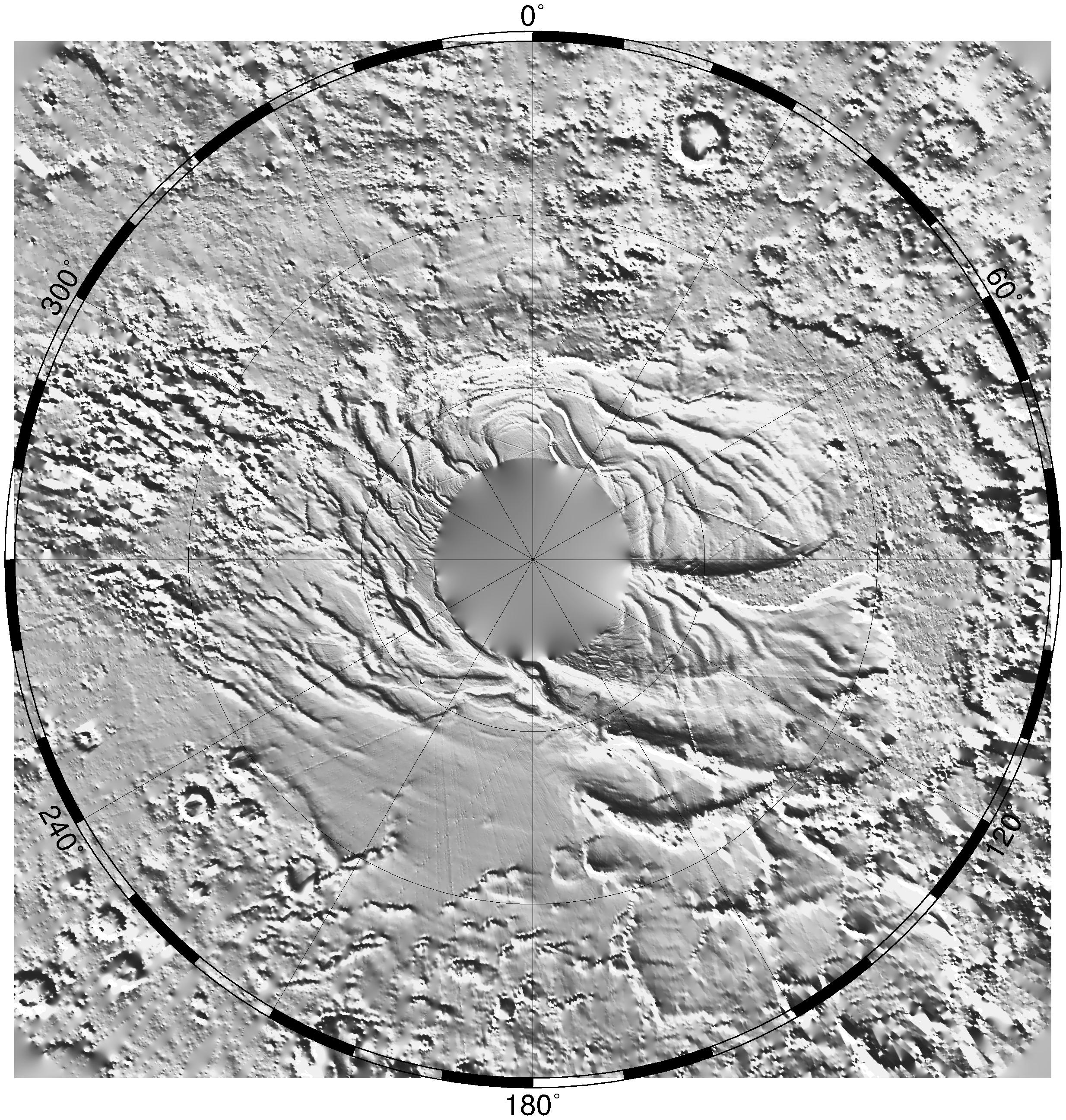
1999-06-23 |
Mars
|
Mars Global Surveyor (MGS)
|
MOLA
|
2468x2592x1 |
|
-
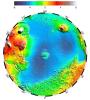
PIA02052:
-
South Polar Topography (MOLA)
Full Resolution:
TIFF
(5.391 MB)
JPEG
(1.241 MB)
|
|
|
1999-05-27 |
Mars
|
Mars Global Surveyor (MGS)
|
MOLA
|
2700x3075x3 |
|
-
PIA02040:
-
Science Magazine Cover Image
Full Resolution:
TIFF
(12.35 MB)
JPEG
(948.9 kB)
|
|
|
1999-05-27 |
Mars
|
Mars Global Surveyor (MGS)
|
MOLA
|
2545x2023x3 |
|
-
PIA02039:
-
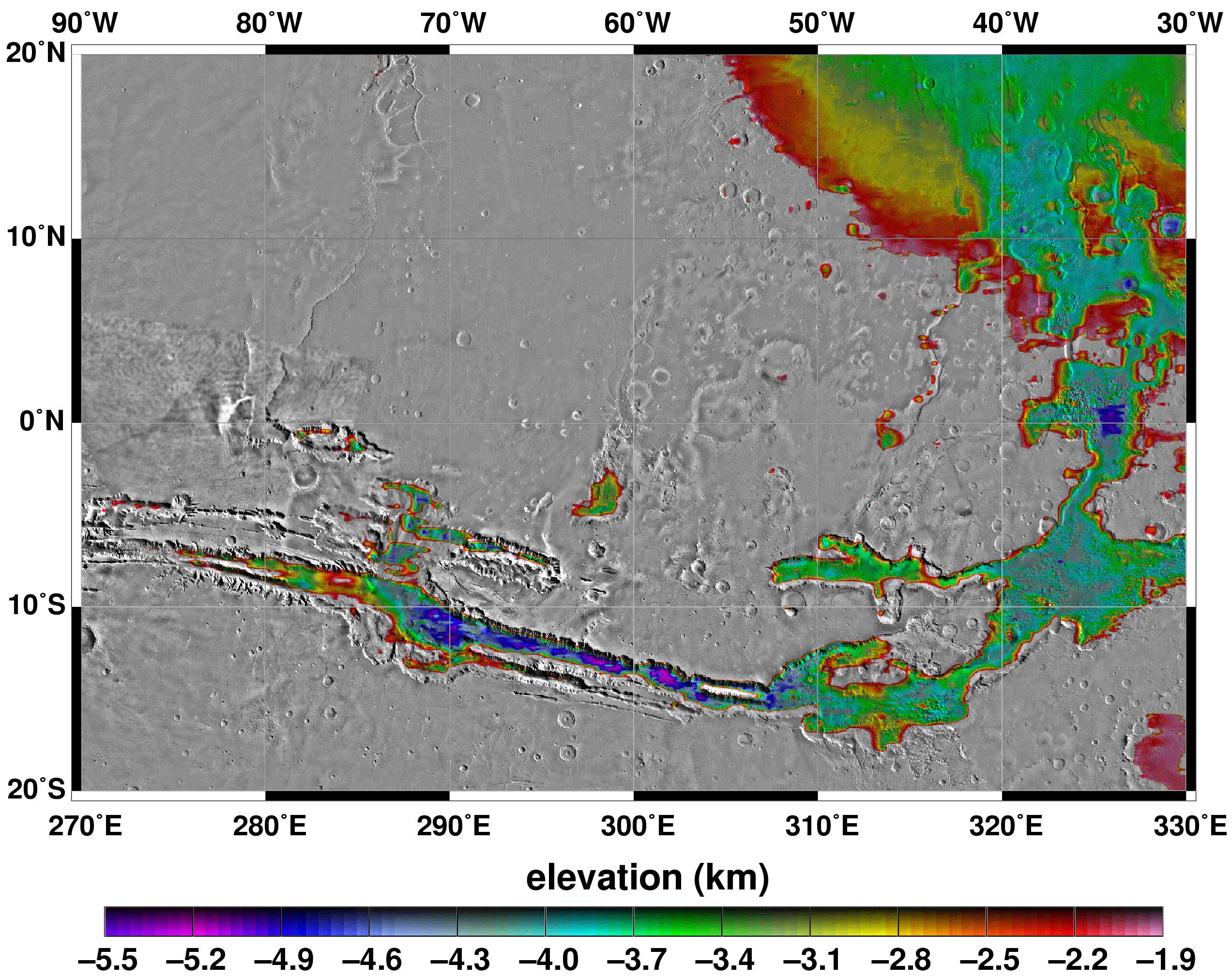
Elevations Within the Floor of the Valles Marineris
Full Resolution:
TIFF
(7.378 MB)
JPEG
(1.035 MB)
|
|
|
1999-05-27 |
Mars
|
Mars Global Surveyor (MGS)
|
MOLA
|
2257x2719x3 |
|
-
PIA02037:
-
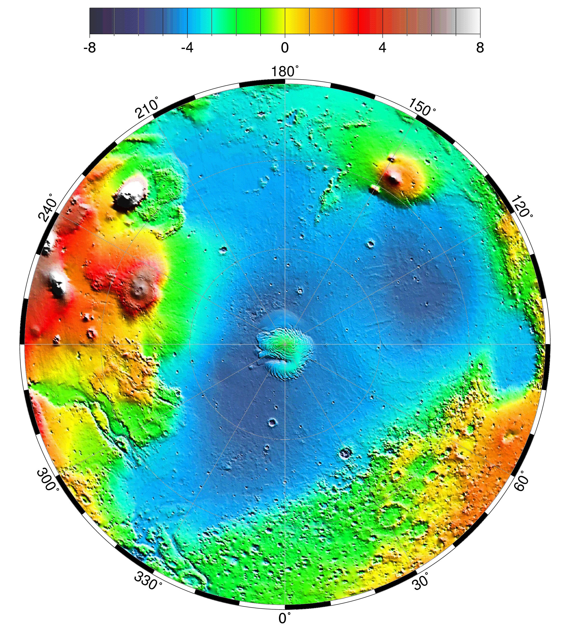
Polar Stereographic Projection
Full Resolution:
TIFF
(13.35 MB)
JPEG
(1.042 MB)
|
|
|
1999-05-27 |
Mars
|
Mars Global Surveyor (MGS)
|
MOLA
|
2335x2617x3 |
|
-
PIA02036:
-
Lambert Equal-Area Projection of Pole-to-Equator
Full Resolution:
TIFF
(12.39 MB)
JPEG
(1.28 MB)
|
|
|
1999-05-27 |
Mars
|
Mars Global Surveyor (MGS)
|
MOLA
|
2761x1759x3 |
|
-
PIA02035:
-
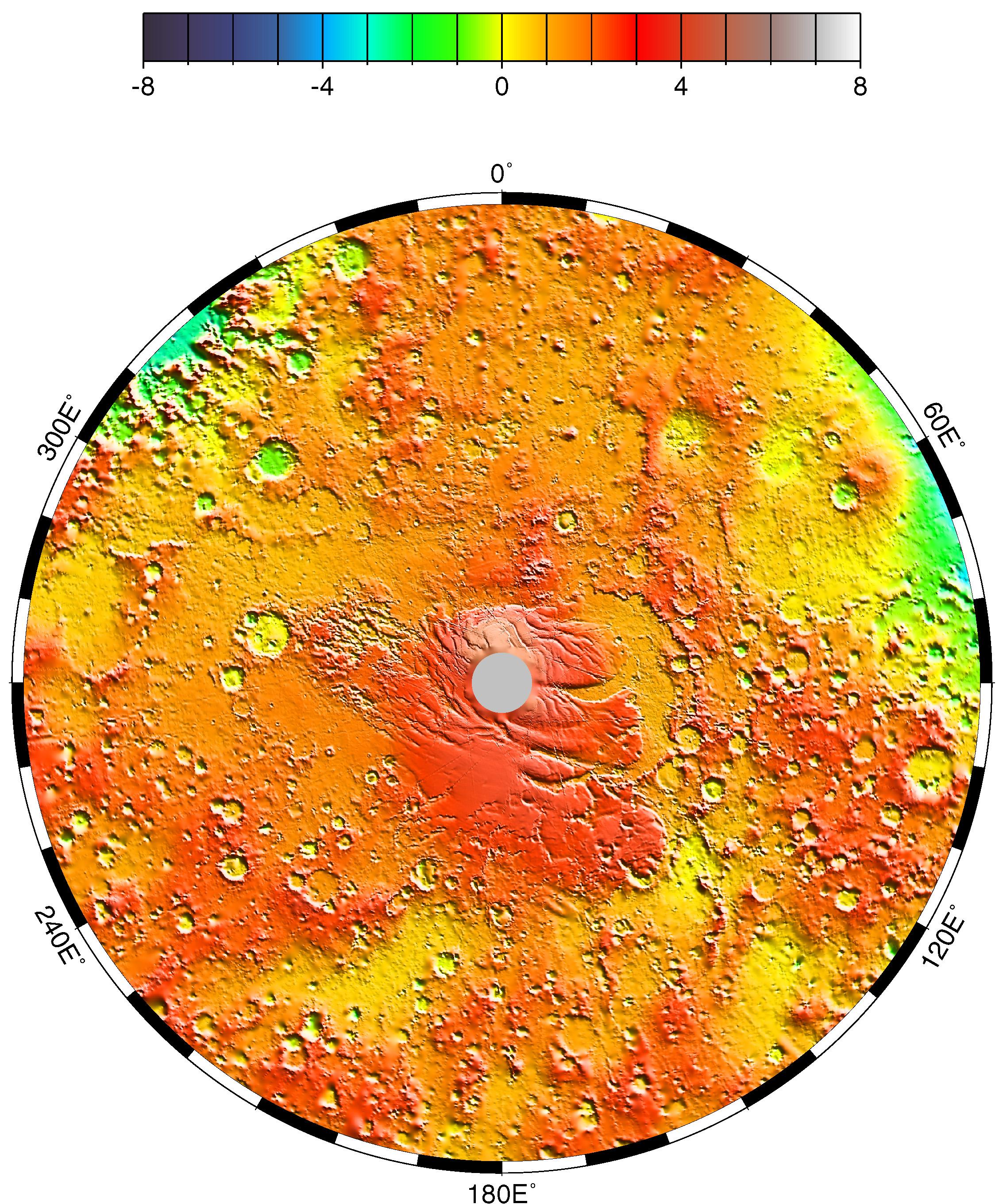
Map of Mars' Topography
Full Resolution:
TIFF
(10.08 MB)
JPEG
(1.115 MB)
|
|
|
1999-05-27 |
Mars
|
Mars Global Surveyor (MGS)
|
MOLA
|
1909x2353x3 |
|
-
PIA02033:
-
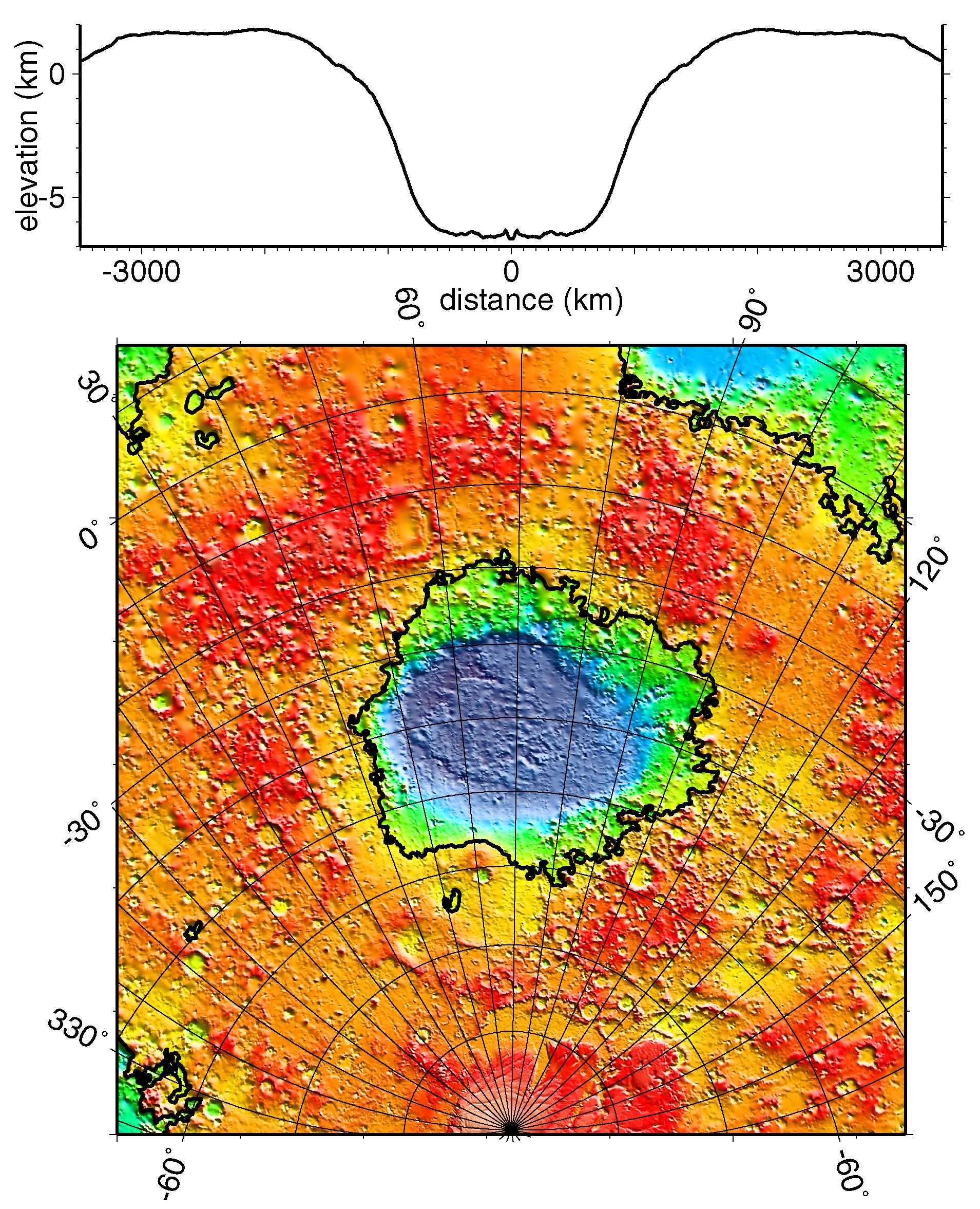
Regional Topographic Model of the Hellas Basin
Full Resolution:
TIFF
(8.461 MB)
JPEG
(901.7 kB)
|
|
|
1999-05-27 |
Mars
|
Mars Global Surveyor (MGS)
|
MOLA
|
2497x2221x3 |
|
-
PIA02031:
-
Maps of Mars Global Topography
Full Resolution:
TIFF
(11.74 MB)
JPEG
(1.145 MB)
|
|
|
1999-01-07 |
Mars
|
Mars Global Surveyor (MGS)
|
MOLA
|
3042x2292x3 |
|
-
PIA01338:
-
Elevation Measurement Profile of Mars
Full Resolution:
TIFF
(142 kB)
JPEG
(406.8 kB)
|
|
|
1999-01-07 |
Mars
|
Mars Global Surveyor (MGS)
|
MOLA
|
2560x1920x3 |
|
-
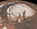
PIA01337:
-
Laser Provides First 3-D View of Mars' North Pole
Full Resolution:
TIFF
(8.414 MB)
JPEG
(200.6 kB)
|
|
|
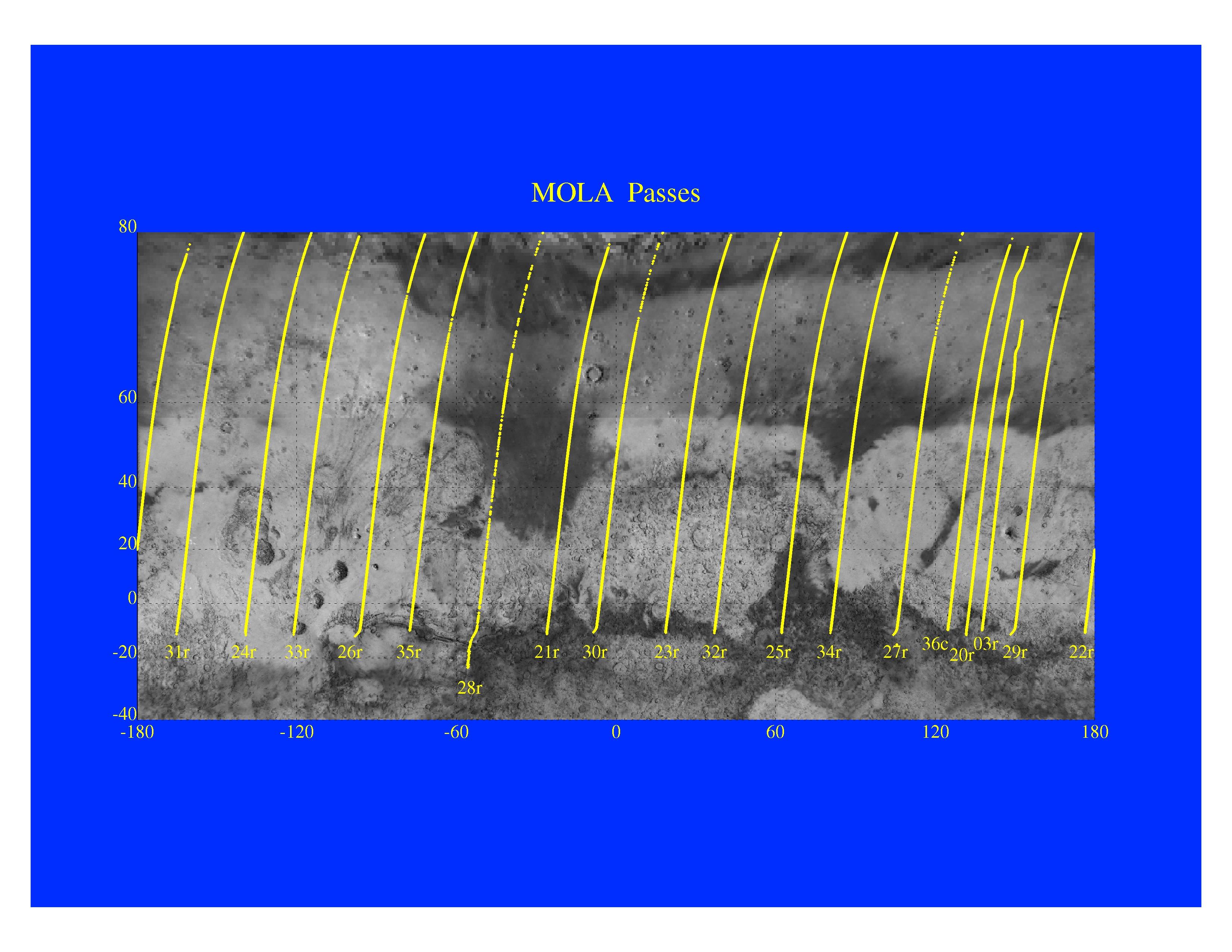
1997-11-10 |
Mars
|
Mars Global Surveyor (MGS)
|
MOLA
|
3300x2550x3 |
|
-
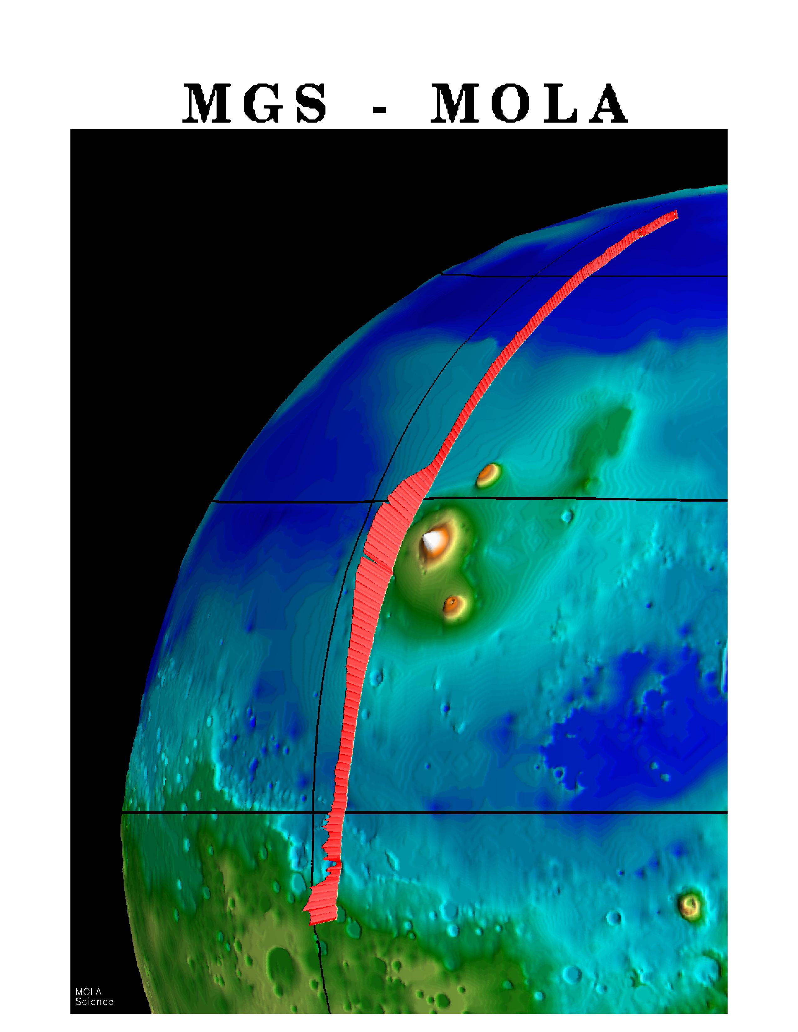
PIA01014:
-
Mars Orbiter Laser Altimeter Passes
Full Resolution:
TIFF
(3.582 MB)
JPEG
(723.3 kB)
|
|
|
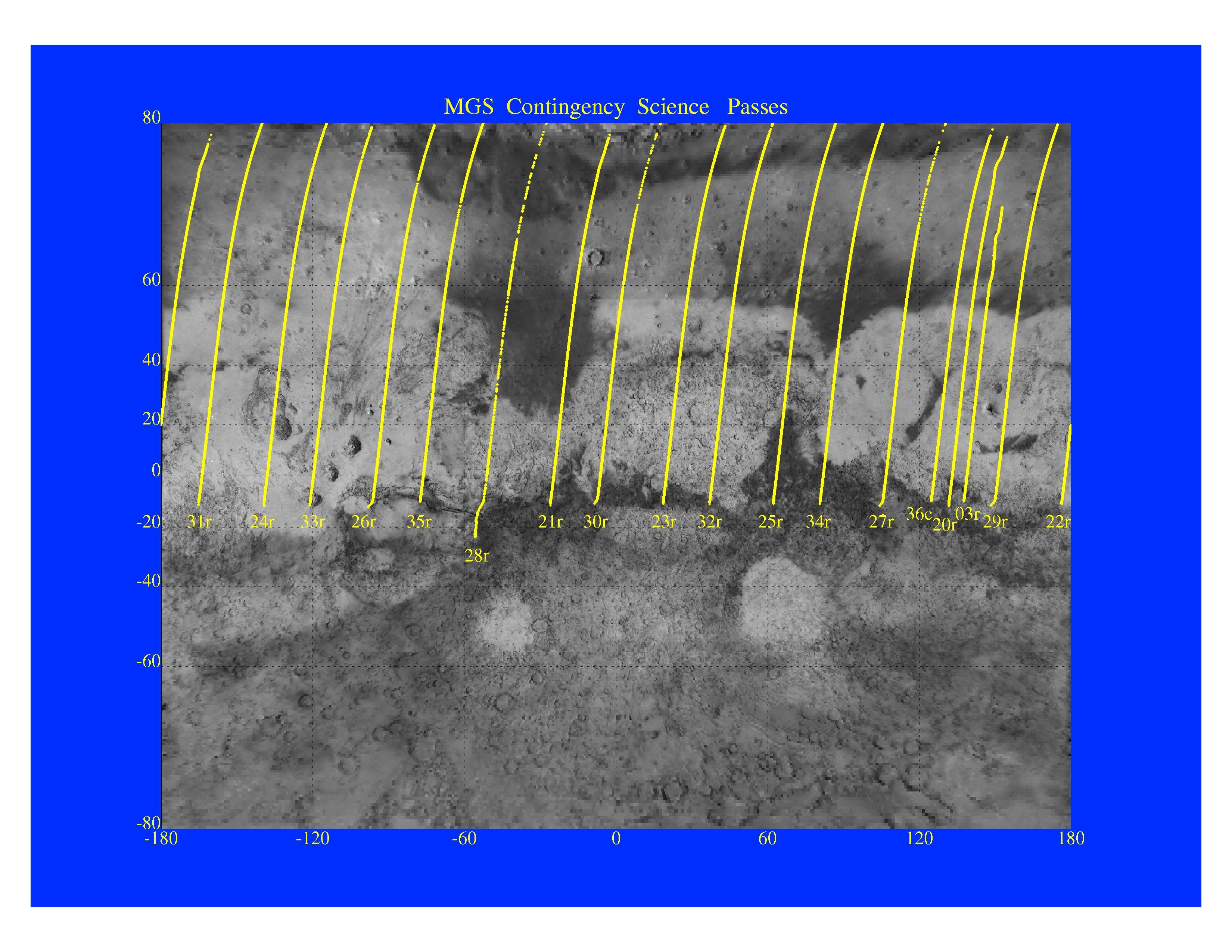
1997-11-10 |
Mars
|
Mars Global Surveyor (MGS)
|
MOLA
|
3300x2550x3 |
|
-
PIA01013:
-
MGS Contingency Science Passes
Full Resolution:
TIFF
(4.409 MB)
JPEG
(879.4 kB)
|
|
|
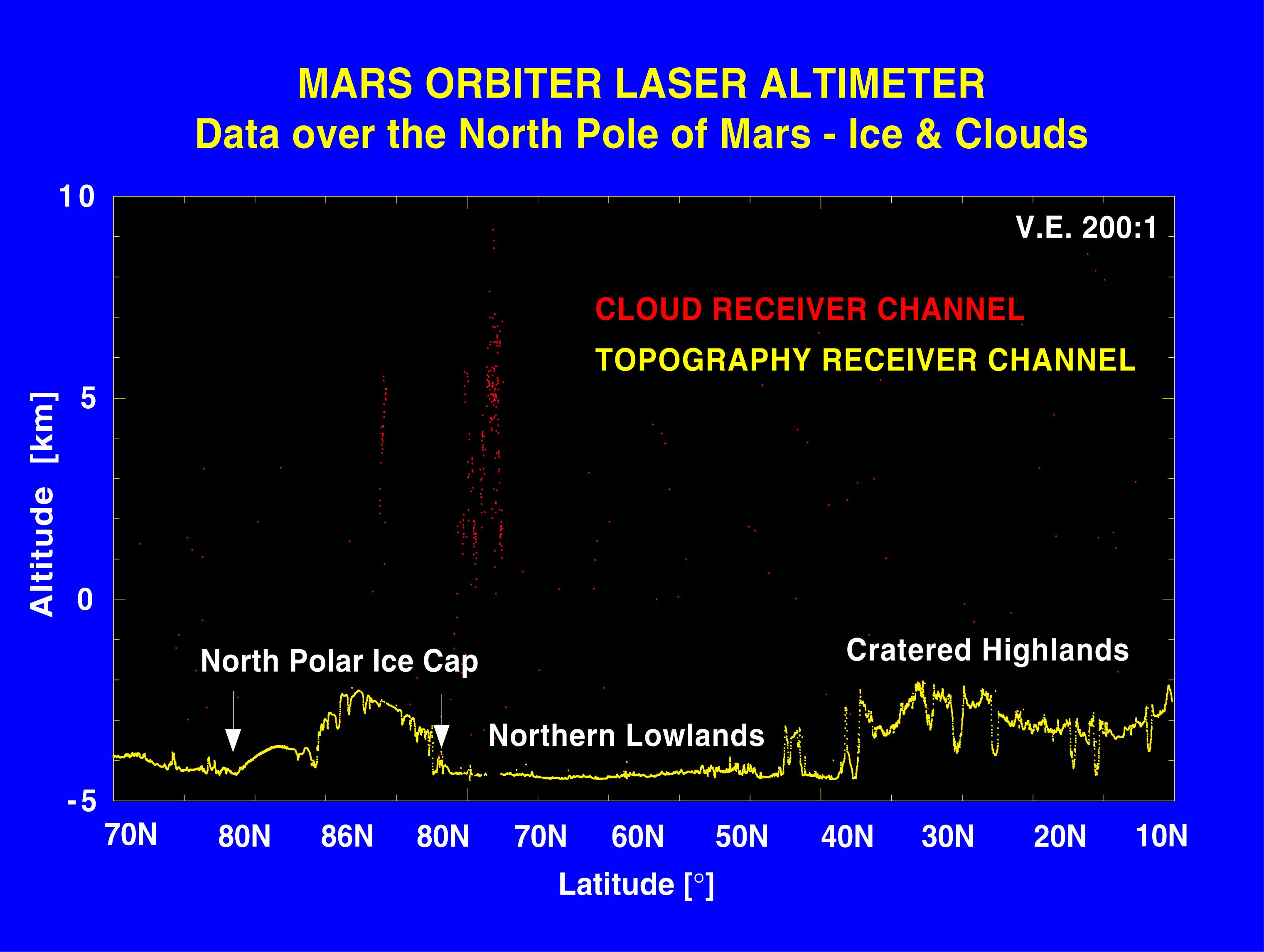
1997-11-10 |
Mars
|
Mars Global Surveyor (MGS)
|
MOLA
|
3300x2550x3 |
|
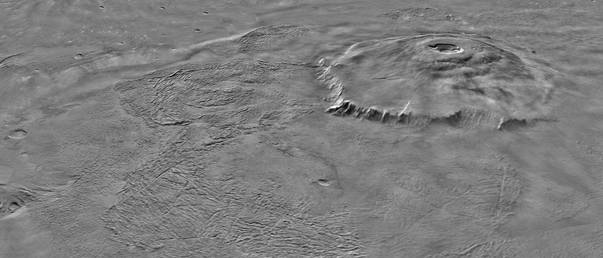
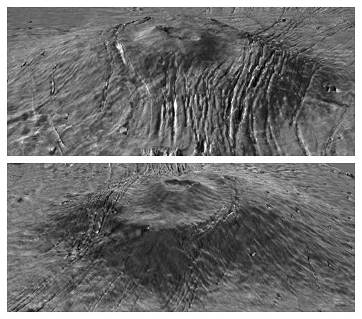
-
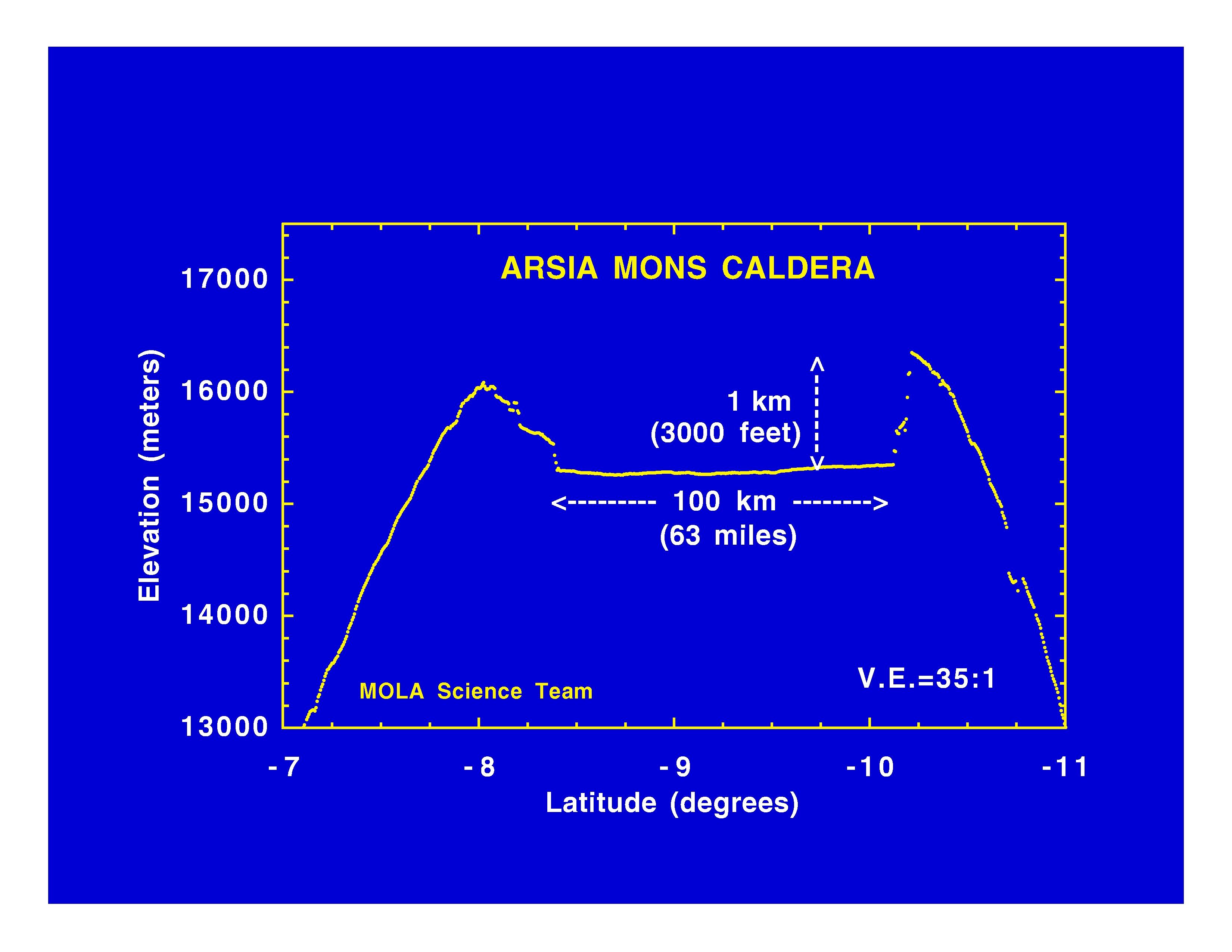
PIA01012:
-
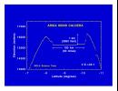
Arsia Mons Caldera
Full Resolution:
TIFF
(534.1 kB)
JPEG
(365.8 kB)
|
|
|
1997-11-10 |
Mars
|
Mars Global Surveyor (MGS)
|
MOLA
|
3300x2550x3 |
|
-
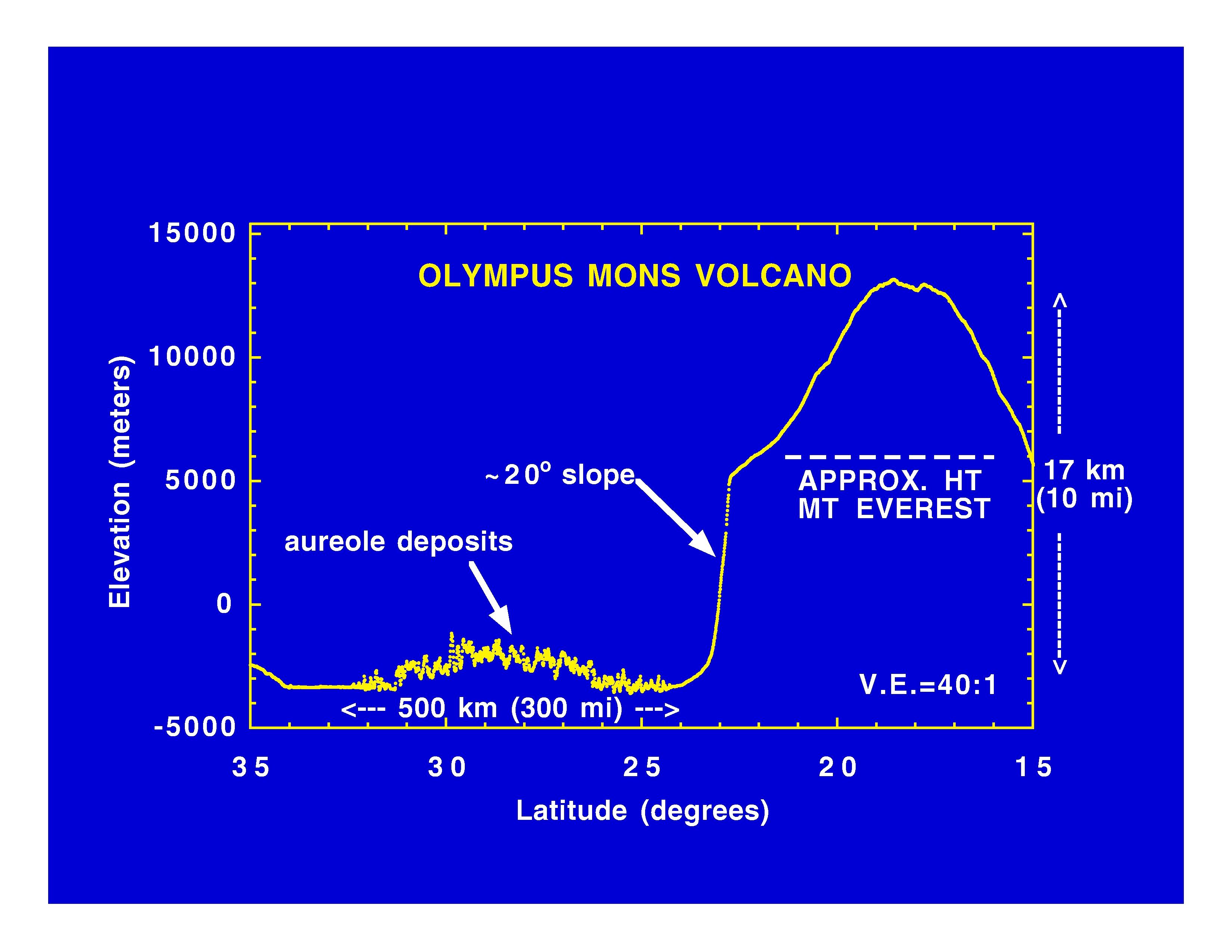
PIA01011:
-
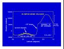
Olympus Mons Volcano
Full Resolution:
TIFF
(625.4 kB)
JPEG
(414.7 kB)
|
|
|
1997-11-10 |
Mars
|
Mars Global Surveyor (MGS)
|
MOLA
|
3300x2550x3 |
|
-
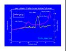
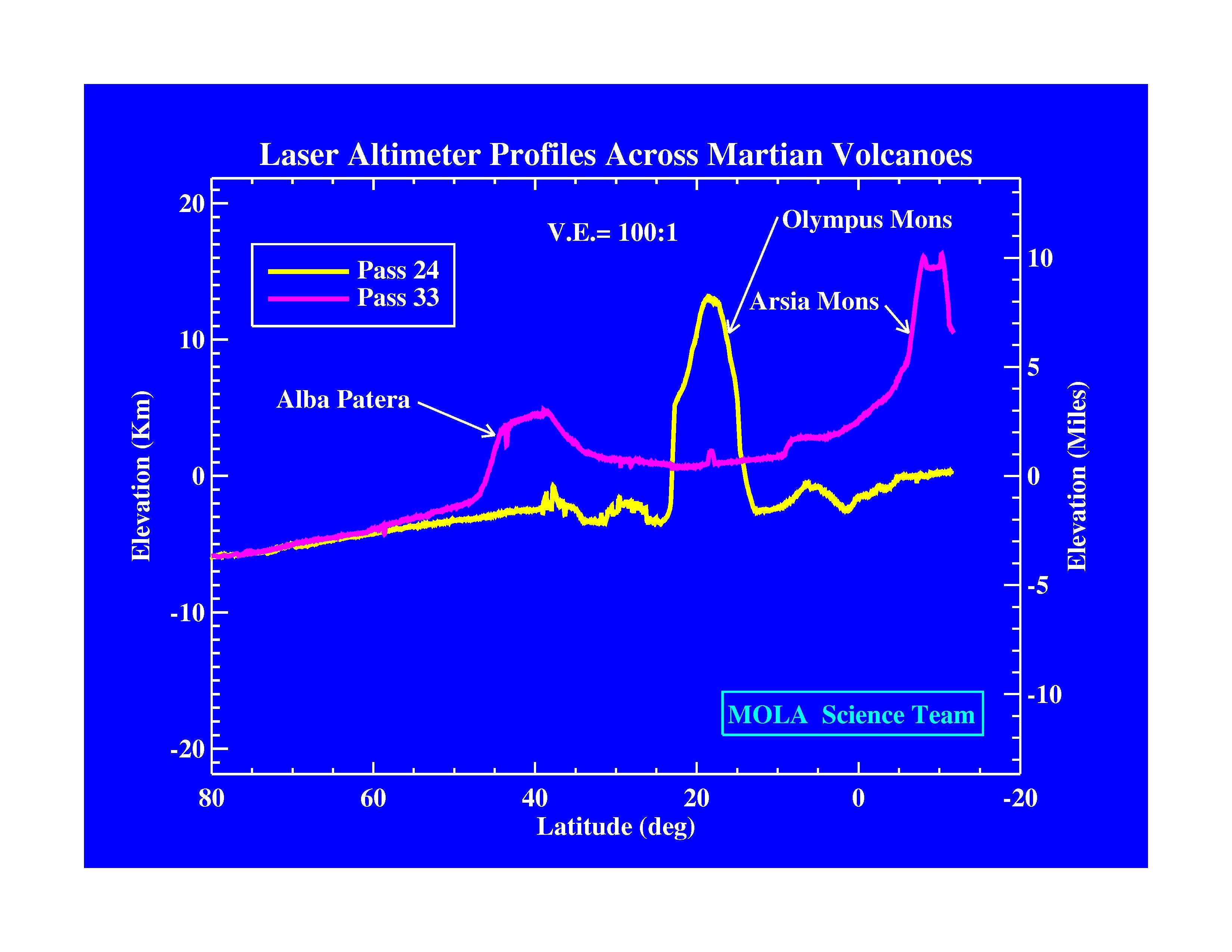
PIA01010:
-
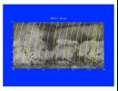
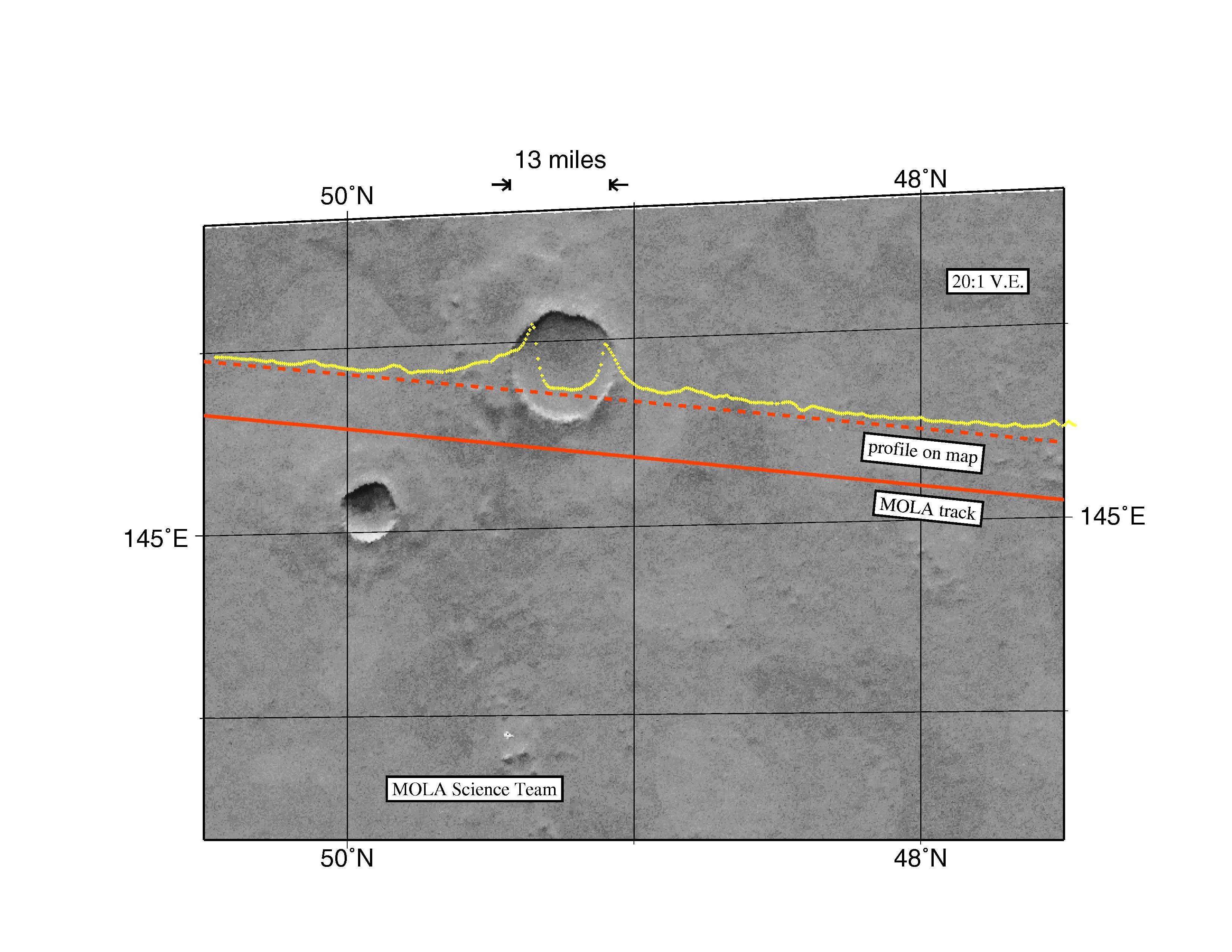
Laser Altimeter Profiles Across Martian Volcanoes
Full Resolution:
TIFF
(677.9 kB)
JPEG
(424.4 kB)
|
|
|
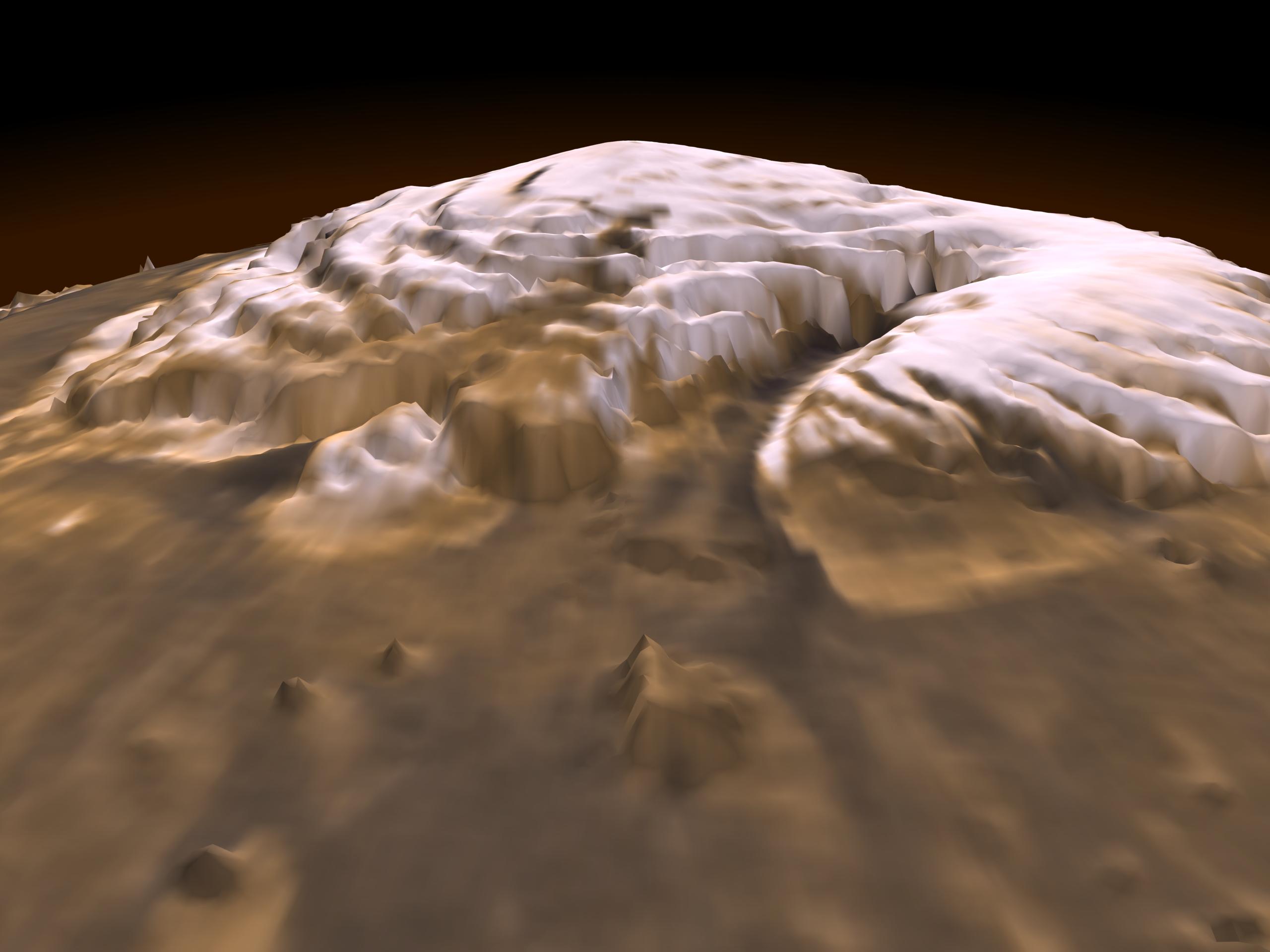
1997-11-10 |
Mars
|
Mars Global Surveyor (MGS)
|
MOLA
|
3300x2550x3 |
|
-
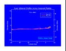
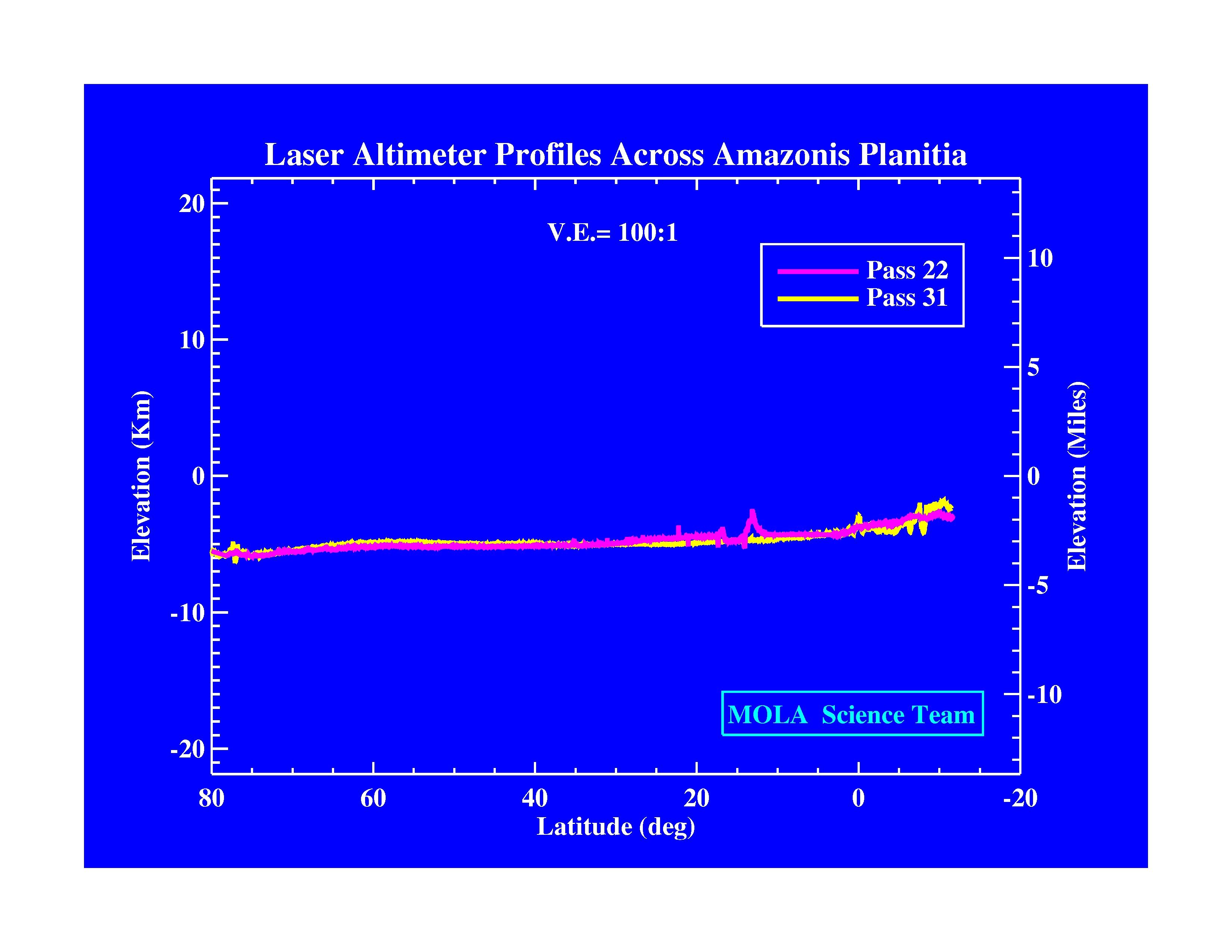
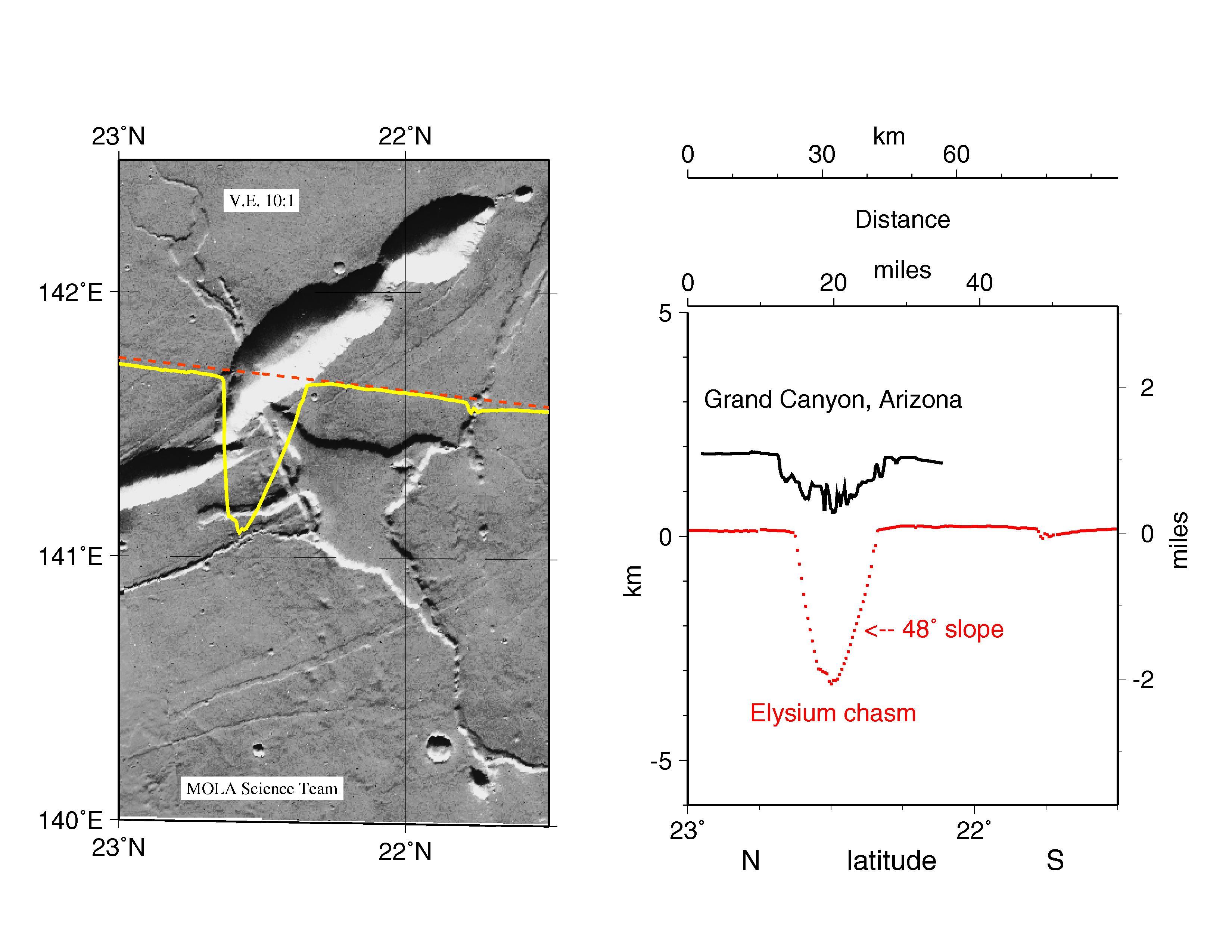
PIA01009:
-
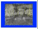
Laser Altimeter Profiles Across Amazonis Planitia
Full Resolution:
TIFF
(530.8 kB)
JPEG
(371.9 kB)
|
|
|
1997-10-13 |
Mars
|
Mars Global Surveyor (MGS)
|
MOLA
|
3300x2550x3 |
|
-
PIA00959:
-
MGS Mars Orbiter Laser Altimeter Topographic Profile of Impact Crater
Full Resolution:
TIFF
(5.47 MB)
JPEG
(741 kB)
|
|
|
1997-10-13 |
Mars
|
Mars Global Surveyor (MGS)
|
MOLA
|
3300x2550x3 |
|
-
PIA00960:
-
MGS Mars Orbiter Laser Altimeter (MOLA) - Mars/Earth Relief Comparison
Full Resolution:
TIFF
(3.639 MB)
JPEG
(615.3 kB)
|
|
|
1997-10-13 |
Mars
|
Mars Global Surveyor (MGS)
|
MOLA
|
3300x1634x3 |

|
-
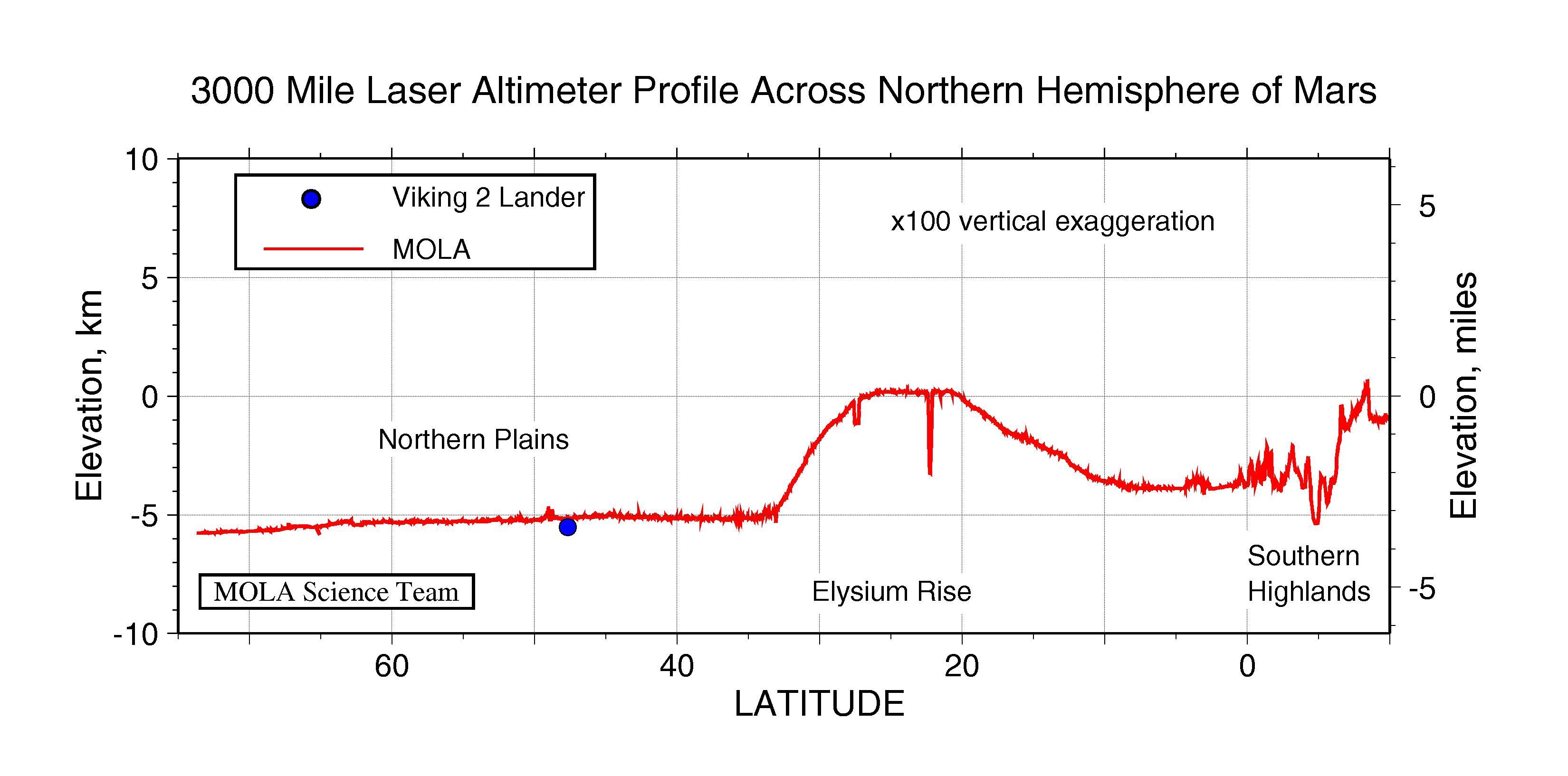
PIA00958:
-
3000 Mile Laser Altimeter Profile Across Northern Hemisphere of Mars
Full Resolution:
TIFF
(730.3 kB)
JPEG
(341 kB)
|
|
|
1997-10-13 |
Mars
|
Mars Global Surveyor (MGS)
|
MOLA
|
2550x3300x3 |
|
-
PIA00957:
-
MGS Mars Orbiter Laser (MOLA) Surface Topography of Northern Hemisphere
Full Resolution:
TIFF
(8.502 MB)
JPEG
(439.4 kB)
|
 Planetary Data System


