PDS logoPlanetary Data System
PDS Information
Find a Node - Use these links to navigate to any of the 8 publicly accessible PDS Nodes.

This bar indicates that you are within the PDS enterprise which includes 6 science discipline nodes and 2 support nodes which are overseen by the Project Management Office at NASA's Goddard Space Flight Center (GSFC). Each node is led by an expert in the subject discipline, supported by an advisory group of other practitioners of that discipline, and subject to selection and approval under a regular NASA Research Announcement.
Click here to return to the Photojournal Home Page Click here to view a list of Photojournal Image Galleries Photojournal_inner_header
Latest Images  |  Spacecraft & Technology  |  Animations  |  Space Images App  |  Feedback  |  Photojournal Search  

PIA11029: Wind-Related Topography in Phoenix's Region of Mars (Animation)
 Target Name:  Mars
 Is a satellite of:  Sol (our sun)
 Mission:  Mars Global Surveyor (MGS)
Phoenix
 Spacecraft:  Mars Global Surveyor Orbiter
 Instrument:  MOLA
 Product Size:  640 x 360 pixels (w x h)
 Produced By:  JPL
 Full-Res TIFF:  PIA11029.tif (692.2 kB)
 Full-Res JPEG:  PIA11029.jpg (12.34 kB)

Click on image above for all movie download options

Original Caption Released with Image:

Click here for animation of PIA11029
Click on image for animation

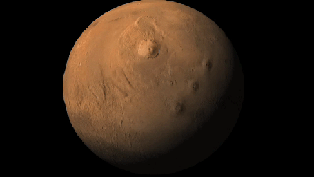
This movie shifts from a global zoom indicating the Phoenix landing area on Mars to a topographical map indicating relative elevations in the landing region. The elevations could affect wind patterns at the site.

In particular, Phoenix is in a broad, shallow valley. The edge of the valley, about 150 meters (500 feet) above the floor, may provide enough of a slope to the east of Phoenix to explain winds coming from the east during nights at the site. Cooler, denser air could be sinking down the slope and toward the lander.

Atmospheric scientists on the Phoenix team are analyzing wind patterns to distiguish effects of nearby topography from larger-scale movement of the atmosphere in the polar region.

The elevation information for this topographical mapping comes from the Mars Orbiter Laser Altimeter on NASA's Mars Global Surveyor orbiter. The blue-coded area is the valley floor. Orange and yellow indicate relatively higher elevations.

The Phoenix Mission is led by the University of Arizona, Tucson, on behalf of NASA. Project management of the mission is by NASA's Jet Propulsion Laboratory, Pasadena, Calif. Spacecraft development is by Lockheed Martin Space Systems, Denver. JPL managed the Mars Global Surveyor mission for the NASA Science Mission Directorate.

Photojournal Note: As planned, the Phoenix lander, which landed May 25, 2008 23:53 UTC, ended communications in November 2008, about six months after landing, when its solar panels ceased operating in the dark Martian winter.

Image Credit:
NASA/JPL-Caltech

Image Addition Date:
2008-08-04