This map shows local variations in Mars' gravitational pull on orbiters, presenting unprecedented detail based on several years of data from tracking three of NASA's Mars orbiters.
The gravitational mapping has been applied to map variations in the thickness of the planet's crust and to deduce information about its deeper interior.
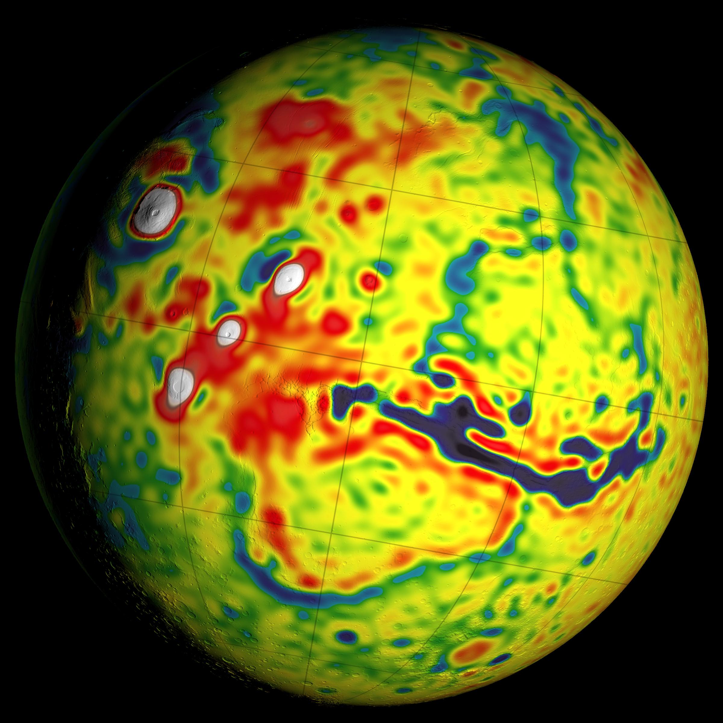
This view of a global map is centered at 90 degrees west longitude, showing portions of the planet that include tall volcanoes on the left and the deep Valles Marineris canyon system just right of center. Additional views of this global map and related maps are available at http://svs.gsfc.nasa.gov/goto?4436.
The data about local variations in Mars' gravity come from many years of using NASA's Deep Space Network to track positions and velocities of NASA's Mars Global Surveyor, Mars Odyssey and Mars Reconnaissance Orbiter. For calculating crustal thickness, this information about local variations in gravity was combined with information about Mars' topography -- the variations is surface elevation such as mountains and canyons. The relationship of this gravity map to maps of topography and crustal thickness is shown in a three-map panel at PIA20277.
The color coding on this map is keyed to values of units of gravity acceleration variability called gals or galileos. The range is from about half a negative gal (dark blue) to one positive gal (white).
