My
List |
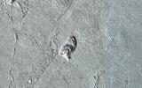
Addition Date
|
Target
|
Mission
|
Instrument
|
Size
|

|
2022-11-25 |
Mars
|
2001 Mars Odyssey
|
THEMIS
|
594x2732x1 |
|
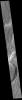
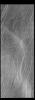
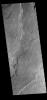
-
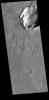
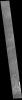
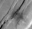
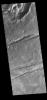
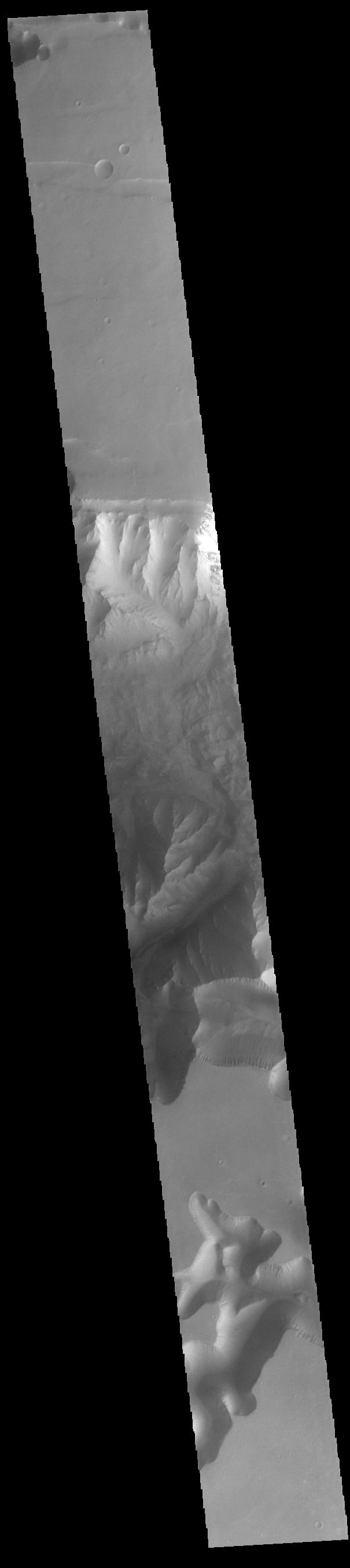
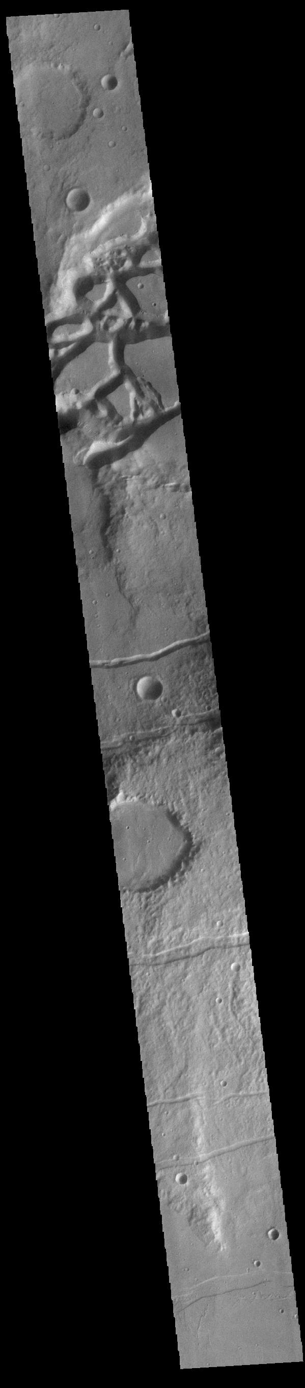
PIA25620:
-
Claritas Fossae
Full Resolution:
TIFF
(769.9 kB)
JPEG
(103 kB)
|
|
|
2022-11-24 |
Mars
|
2001 Mars Odyssey
|
THEMIS
|
678x1422x1 |
|
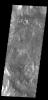
-
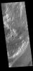
PIA25619:
-
Mangala Fossae
Full Resolution:
TIFF
(718.8 kB)
JPEG
(97.28 kB)
|
|
|
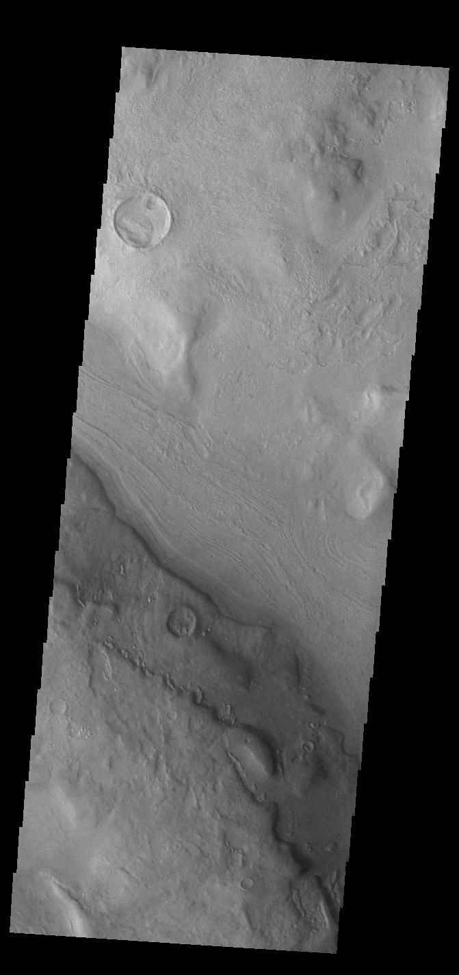
2022-11-23 |
Mars
|
2001 Mars Odyssey
|
THEMIS
|
271x2775x1 |

|
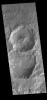
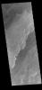
-
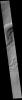
PIA25618:
-
Cavi Angusti
Full Resolution:
TIFF
(700.9 kB)
JPEG
(68.58 kB)
|
|
|
2022-11-23 |
Europa
|
Europa Clipper
|
|
5472x3648x3 |

|
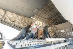
-
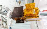
PIA25497:
-
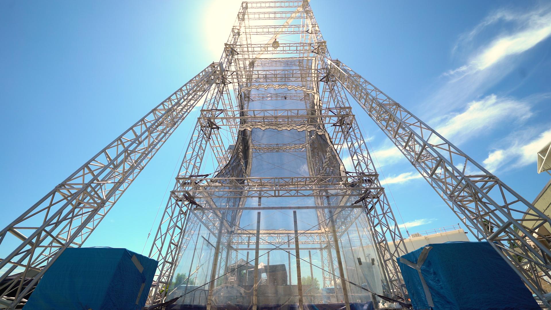
NASA's Europa Clipper Reaction Wheel in Process
Full Resolution:
TIFF
(45.76 MB)
JPEG
(1.575 MB)
|
|
|
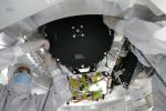
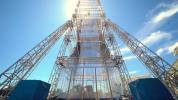
2022-11-23 |
Europa
|
Europa Clipper
|
|
5504x8256x3 |
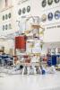
|
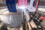
-
PIA25496:
-
NASA's Europa Clipper: Reaction Wheel Installation
Full Resolution:
TIFF
(95.06 MB)
JPEG
(4.362 MB)
|
|
|
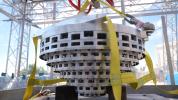
2022-11-23 |
Europa
|
Europa Clipper
|
|
4000x3000x3 |
|
-
PIA25495:
-
NASA's Europa Clipper Reaction Wheels Installed
Full Resolution:
TIFF
(33.67 MB)
JPEG
(1.456 MB)
|
|
|
2022-11-23 |
Europa
|
Europa Clipper
|
|
5472x3648x3 |
|
-
PIA25494:
-
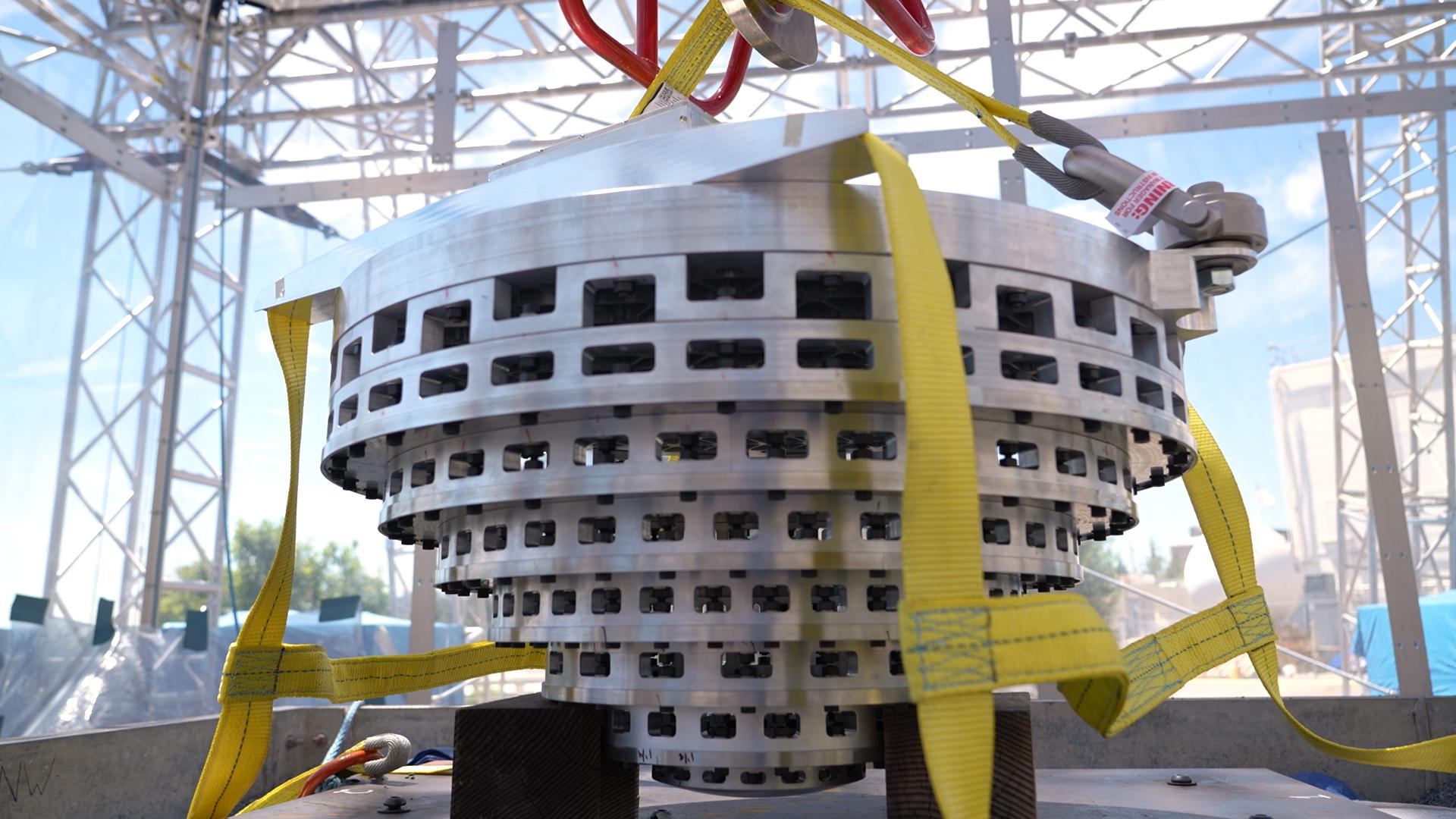
NASA's Europa Clipper Gets Its Reaction Wheels
Full Resolution:
TIFF
(42.04 MB)
JPEG
(1.56 MB)
|
|
|
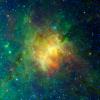
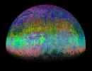
2022-11-22 |
Orion Nebula
|
Herschel Space Observatory
Spitzer Space Telescope
Wide-field Infrared Survey Explorer (WISE)
|
Herschel Telescope
Spitzer Space Telescope
WISE Telescope
|
9036x7646x3 |
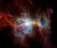
|
-
PIA25434:
-
Orion Nebula in Infrared
Full Resolution:
TIFF
(108.7 MB)
JPEG
(1.603 MB)
|
|
|
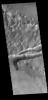
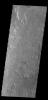
2022-11-22 |
Mars
|
2001 Mars Odyssey
|
THEMIS
|
671x1423x1 |

|
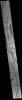
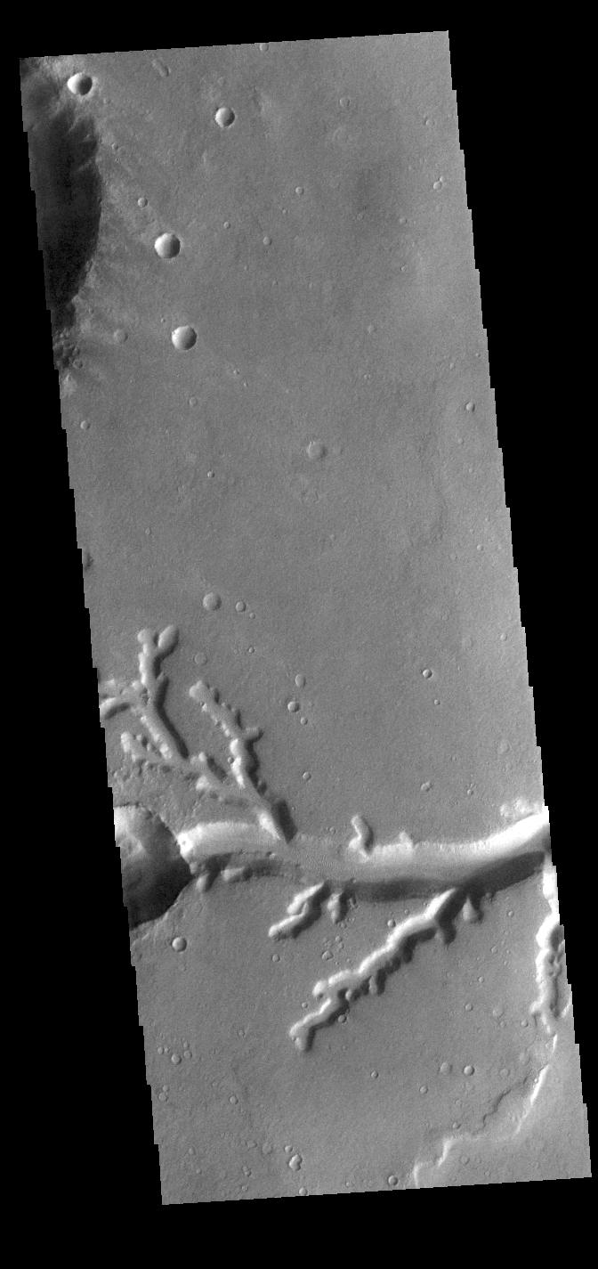
-
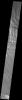
PIA25617:
-
Reull Vallis
Full Resolution:
TIFF
(683.5 kB)
JPEG
(80.14 kB)
|
|
|
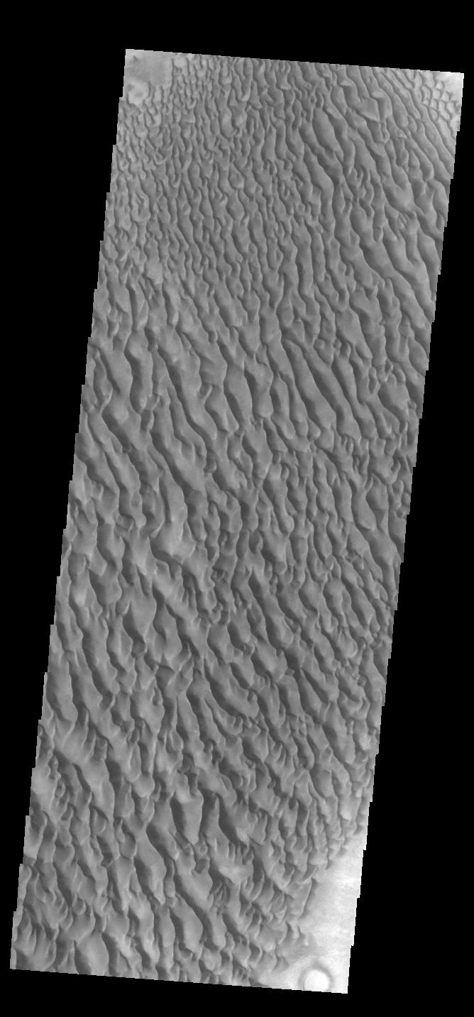
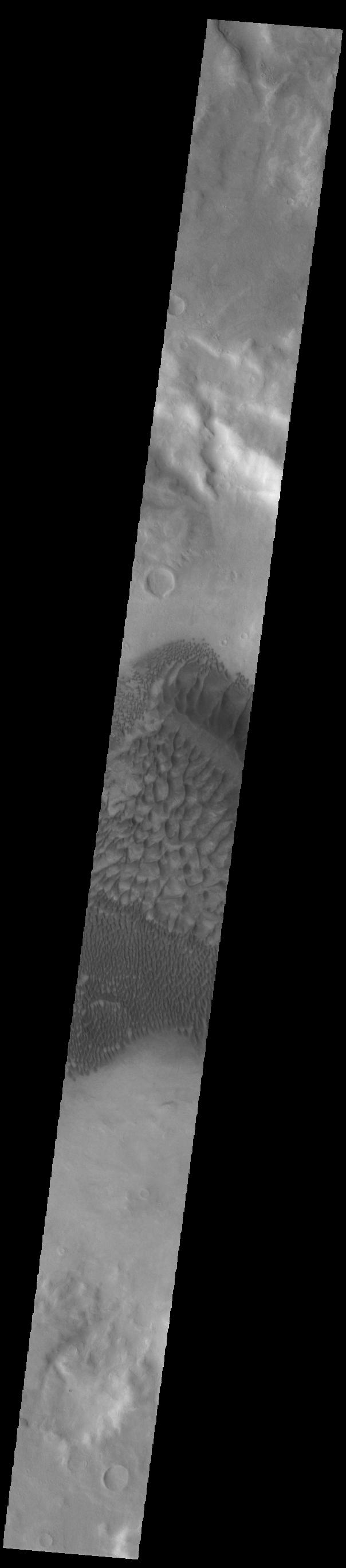
2022-11-21 |
Mars
|
2001 Mars Odyssey
|
THEMIS
|
668x1433x1 |
|
-
PIA25616:
-
Proctor Crater Dunes
Full Resolution:
TIFF
(724.9 kB)
JPEG
(98.68 kB)
|
|
|
2022-11-18 |
Mars
|
2001 Mars Odyssey
|
THEMIS
|
597x2719x1 |

|
-
PIA25615:
-
Daedalia Planum
Full Resolution:
TIFF
(739 kB)
JPEG
(101.5 kB)
|
|
|
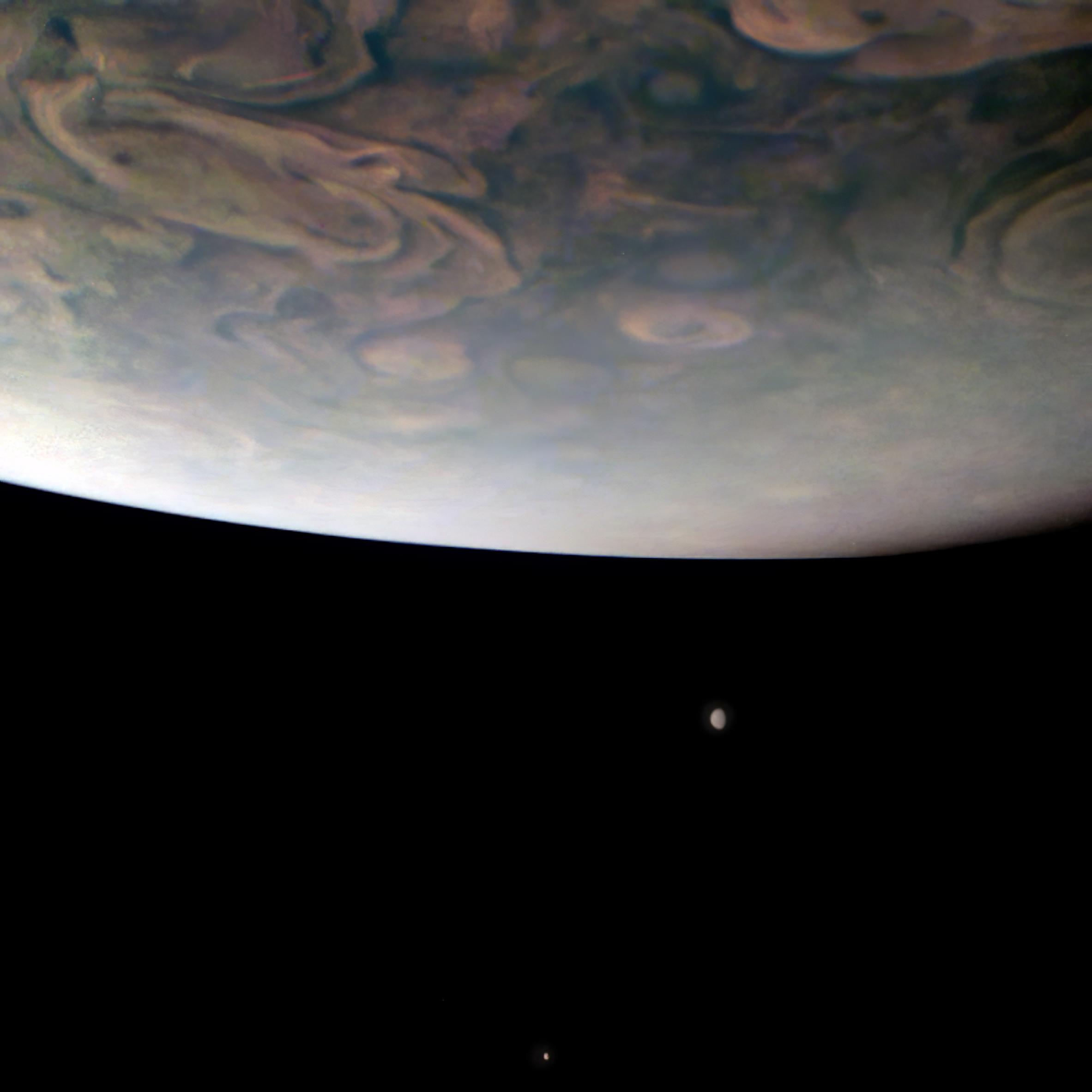
2022-11-17 |
Jupiter
|
Juno
|
JunoCam
|
2365x2365x3 |

|
-
PIA25019:
-
NASA's Juno Mission Spots Two Jovian Moons
Full Resolution:
TIFF
(7.977 MB)
JPEG
(168.7 kB)
|
|
|
2022-11-17 |
Mars
|
Mars 2020 Rover
|
Hazard Avoidance Camera (M2020)
|
5120x2880x3 |
|
-
PIA25339:
-
Jezero Crater's Yori Pass
Full Resolution:
TIFF
(44.26 MB)
JPEG
(2.148 MB)
|
|
|
2022-11-17 |
Mars
|
2001 Mars Odyssey
|
THEMIS
|
490x1397x1 |
|
-
PIA25614:
-
South Polar Cap
Full Resolution:
TIFF
(685.5 kB)
JPEG
(158 kB)
|
|
|
2022-11-16 |
Mars
|
2001 Mars Odyssey
|
THEMIS
|
668x1425x1 |
|
-
PIA25613:
-
Landslides
Full Resolution:
TIFF
(687 kB)
JPEG
(78.1 kB)
|
|
|
2022-11-15 |
Mars
|
2001 Mars Odyssey
|
THEMIS
|
601x2711x1 |
|
-
PIA25612:
-
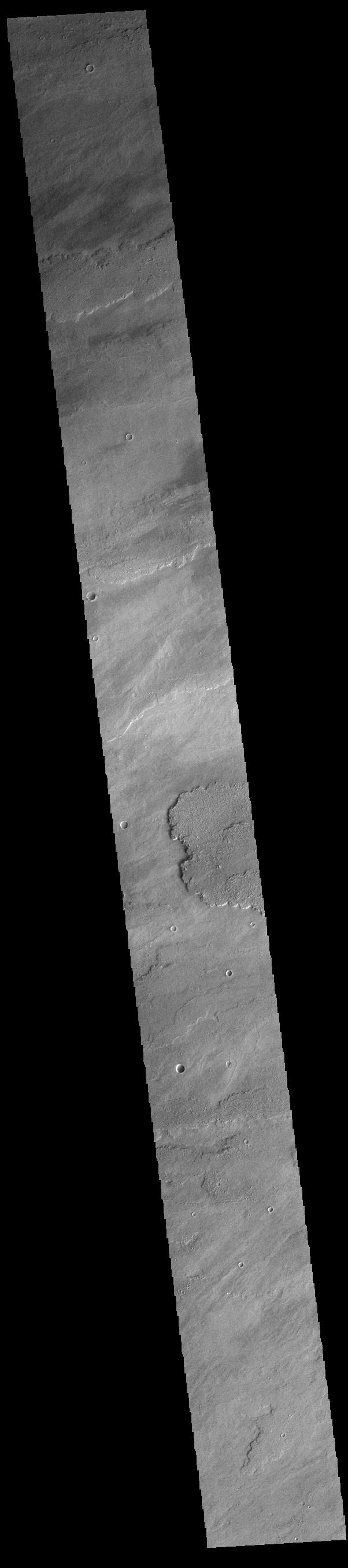
Claritas Fossae
Full Resolution:
TIFF
(749.1 kB)
JPEG
(88.9 kB)
|
|
|
2022-11-14 |
Mars
|
Mars Helicopter
|
|
6000x4326x3 |
|
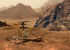
-
PIA25338:
-
NASA's Mars Helicopters: Present, Future, and Proposed
Full Resolution:
TIFF
(67.09 MB)
JPEG
(2.575 MB)
|
|
|
2022-11-14 |
Mars
|
2001 Mars Odyssey
|
THEMIS
|
1319x2683x1 |
|
-
PIA25611:
-
Out of Round
Full Resolution:
TIFF
(2.552 MB)
JPEG
(383.4 kB)
|
|
|
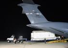
2022-11-14 |
|
Surface Water and Ocean Topography (SWOT)
|
|
8256x5504x3 |
|
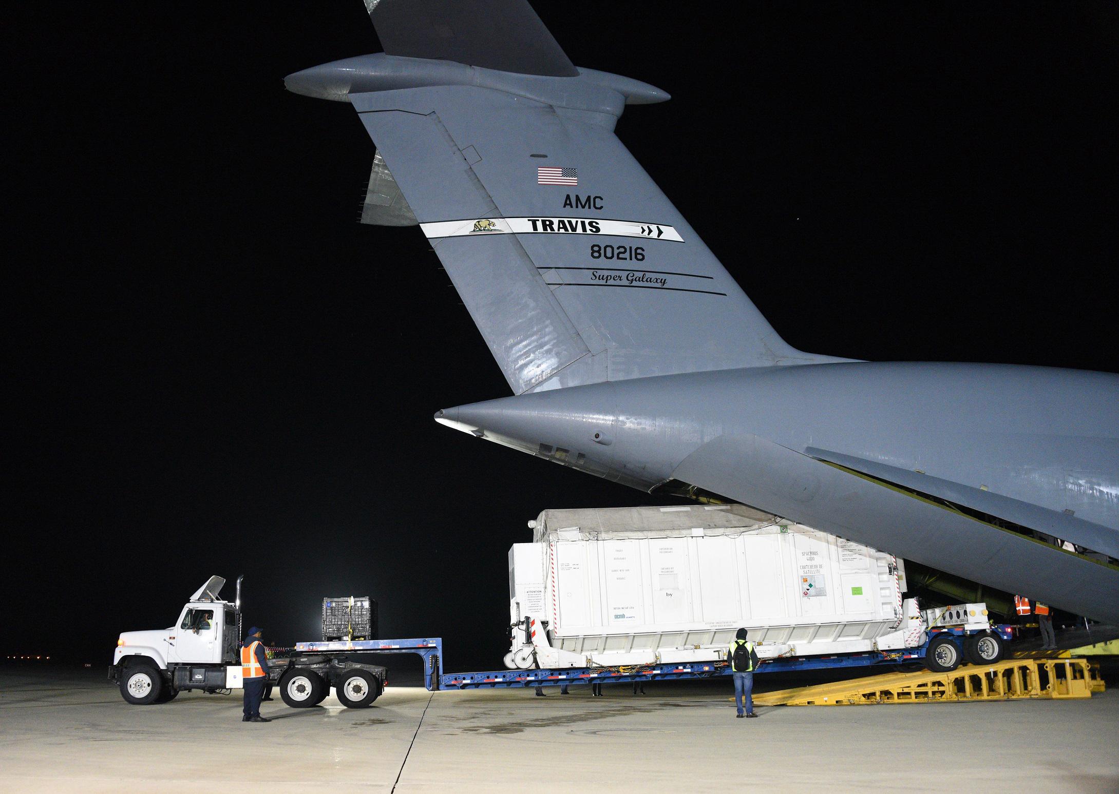
-
PIA25625:
-
SWOT Headed to France on C-17 Aircraft
Full Resolution:
TIFF
(105.8 MB)
JPEG
(5.21 MB)
|
|
|
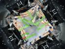
2022-11-14 |
|
Surface Water and Ocean Topography (SWOT)
|
|
8256x5504x3 |
|
-
PIA25624:
-
SWOT Secured for Transport in C-17 Aircraft
Full Resolution:
TIFF
(120.2 MB)
JPEG
(6.204 MB)
|
|
|
2022-11-14 |
|
Surface Water and Ocean Topography (SWOT)
|
KaRIn
|
8889x5000x3 |
|
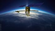
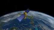
-
PIA25623:
-
SWOT Orbiting Earth (Illustration)
Full Resolution:
TIFF
(77.29 MB)
JPEG
(1.991 MB)
|
|
|
2022-11-14 |
|
Surface Water and Ocean Topography (SWOT)
|
|
2730x1530x3 |

|
-
PIA25622:
-
SWOT Satellite With Solar Arrays in Full View (Illustration)
Full Resolution:
TIFF
(10.28 MB)
JPEG
(431.7 kB)
|
|
|
2022-11-14 |
|
Surface Water and Ocean Topography (SWOT)
|
KaRIn
|
2560x1440x3 |
|
-
PIA25621:
-
SWOT Above Earth (Illustration)
Full Resolution:
TIFF
(6.479 MB)
JPEG
(308.8 kB)
|
|
|
2022-11-14 |
|
Surface Water and Ocean Topography (SWOT)
|
KaRIn
|
2946x1646x3 |

|
-
PIA24530:
-
SWOT in Orbit With View of KaRIn Instrument (Illustration)
Full Resolution:
TIFF
(3.918 MB)
JPEG
(217.8 kB)
|
|
|
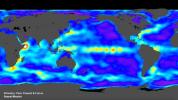
2022-11-14 |
Earth
|
Surface Water and Ocean Topography (SWOT)
|
|
1920x1080x3 |
|
-
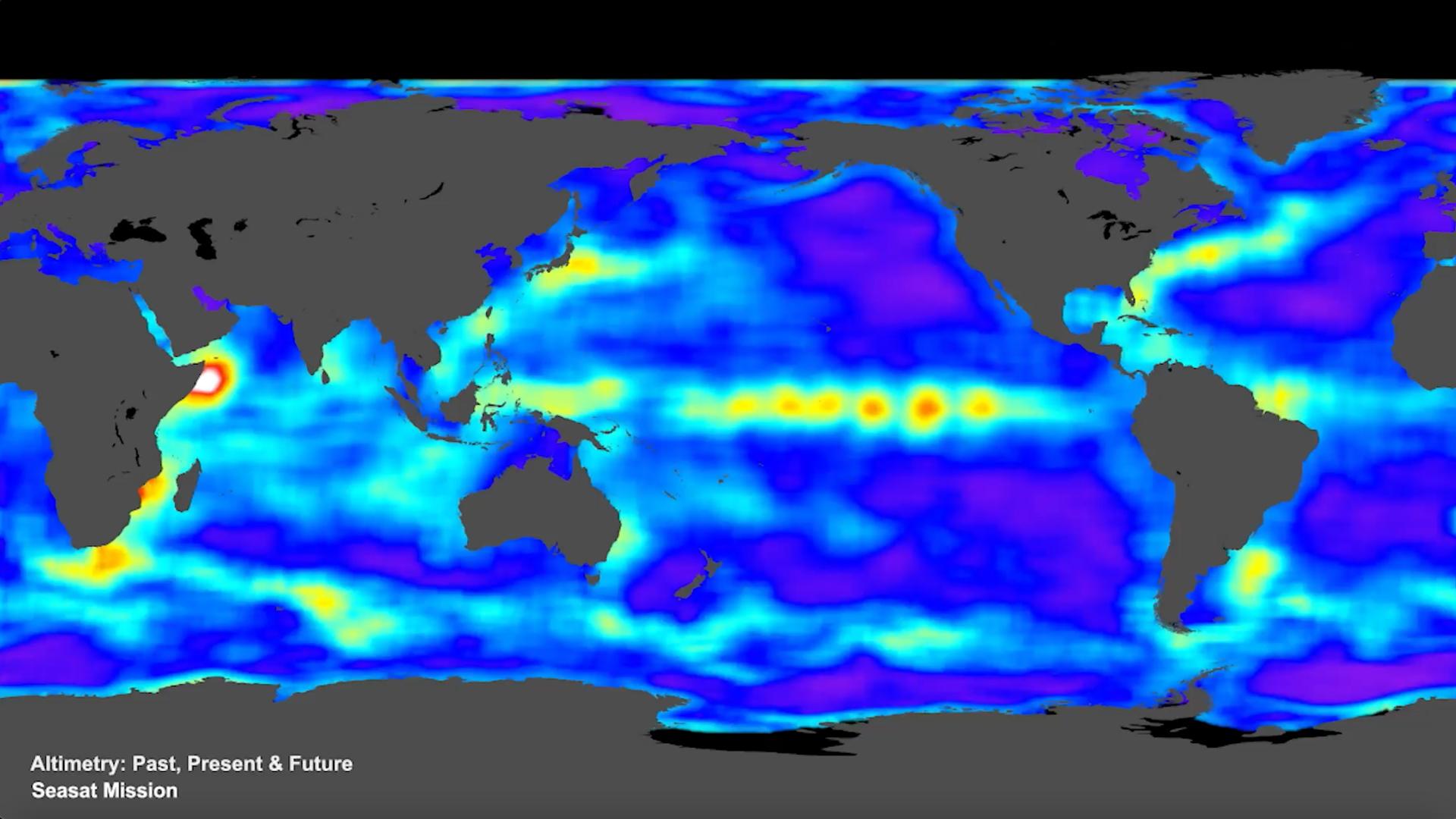
PIA25561:
-
SWOT Satellite will Improve Clarity and Detail of Sea Height Measurements
Full Resolution:
TIFF
(3.673 MB)
JPEG
(154 kB)
|
|
|
2022-11-11 |
Eagle Nebula
|
Wide-field Infrared Survey Explorer (WISE)
|
|
3400x3400x3 |
|
-
PIA25433:
-
The Eagle Nebula Observed by WISE
Full Resolution:
TIFF
(34.69 MB)
JPEG
(1.01 MB)
|
|
|
2022-11-11 |
Mars
|
2001 Mars Odyssey
|
THEMIS
|
666x1397x1 |
|
-
PIA25610:
-
Daedalia Planum
Full Resolution:
TIFF
(746.3 kB)
JPEG
(179.1 kB)
|
|
|
2022-11-10 |
Mars
|
2001 Mars Odyssey
|
THEMIS
|
670x1427x1 |

|
-
PIA25609:
-
Hale Crater
Full Resolution:
TIFF
(693.8 kB)
JPEG
(85.73 kB)
|
|
|
2022-11-09 |
Mars
|
2001 Mars Odyssey
|
THEMIS
|
669x1417x1 |
|
-
PIA25608:
-
Daedalia Planum
Full Resolution:
TIFF
(750.7 kB)
JPEG
(160 kB)
|
|
|
2022-11-08 |
Mars
|
2001 Mars Odyssey
|
THEMIS
|
675x1420x1 |
|
-
PIA25607:
-
Eberswalde Crater
Full Resolution:
TIFF
(734.5 kB)
JPEG
(112.7 kB)
|
|
|
2022-11-07 |
Mars
|
2001 Mars Odyssey
|
THEMIS
|
839x2736x1 |

|
-
PIA25606:
-
Reull Vallis
Full Resolution:
TIFF
(1.392 MB)
JPEG
(165 kB)
|
|
|
2022-11-04 |
Mars
|
2001 Mars Odyssey
|
THEMIS
|
670x1419x1 |
|
-
PIA25605:
-
Daedalia Planum
Full Resolution:
TIFF
(743.6 kB)
JPEG
(146 kB)
|
|
|
2022-11-03 |
Mars
|
Mars 2020 Rover
|
|
1630x1557x3 |
|
-
PIA25337:
-
CacheCam Image of Perseverance's 14th Sample of Martian Rock
Full Resolution:
TIFF
(6.384 MB)
JPEG
(312 kB)
|
|
|
2022-11-03 |
Mars
|
2001 Mars Odyssey
|
THEMIS
|
601x2714x1 |
|
-
PIA25604:
-
Daedalia Planum
Full Resolution:
TIFF
(801.7 kB)
JPEG
(151.3 kB)
|
|
|
2022-11-02 |
Mars
|
2001 Mars Odyssey
|
THEMIS
|
598x2704x1 |

|
-
PIA25603:
-
Arsia Mons
Full Resolution:
TIFF
(715 kB)
JPEG
(91.93 kB)
|
|
|
2022-11-01 |
Mars
|
2001 Mars Odyssey
|
THEMIS
|
677x1428x1 |
|
-
PIA25602:
-
Ladon Valles
Full Resolution:
TIFF
(731.4 kB)
JPEG
(97.36 kB)
|
|
|
2022-10-31 |
Mars
|
2001 Mars Odyssey
|
THEMIS
|
597x2732x1 |
|
-
PIA25601:
-
Dao and Niger Valles
Full Resolution:
TIFF
(771.3 kB)
JPEG
(95.12 kB)
|
|
|
2022-10-28 |
Mars
|
2001 Mars Odyssey
|
THEMIS
|
593x2730x1 |
|
-
PIA25580:
-
Claritas Fossae
Full Resolution:
TIFF
(742.3 kB)
JPEG
(96.72 kB)
|
|
|
2022-10-27 |
Mars
|
Mars Reconnaissance Orbiter (MRO)
|
CTX
|
3351x3083x1 |
|
-
PIA25587:
-
Context Camera Views a Mars Impact Crater in Tempe Terra
Full Resolution:
TIFF
(8.751 MB)
JPEG
(1.998 MB)
|
|
|
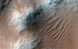
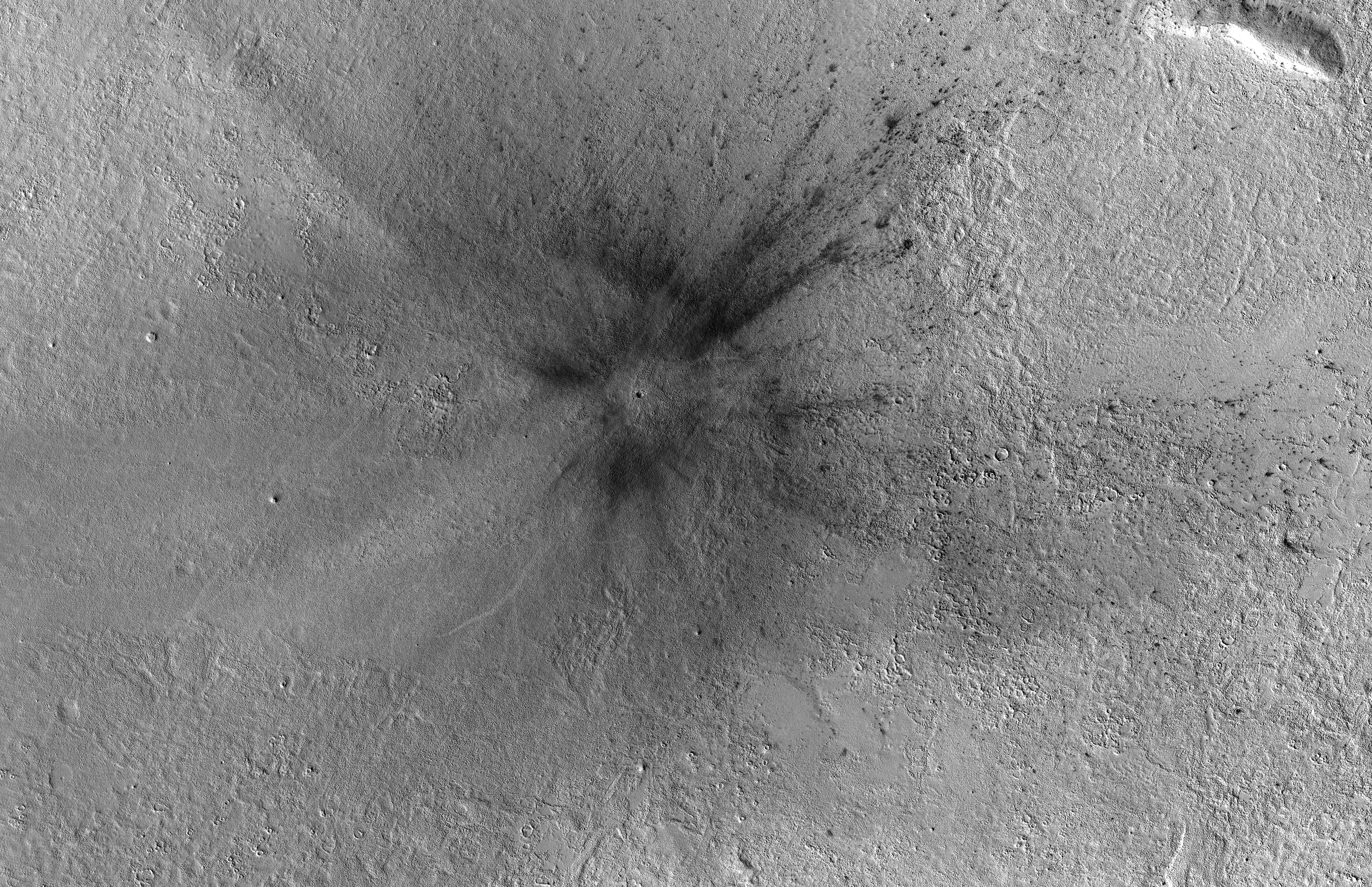
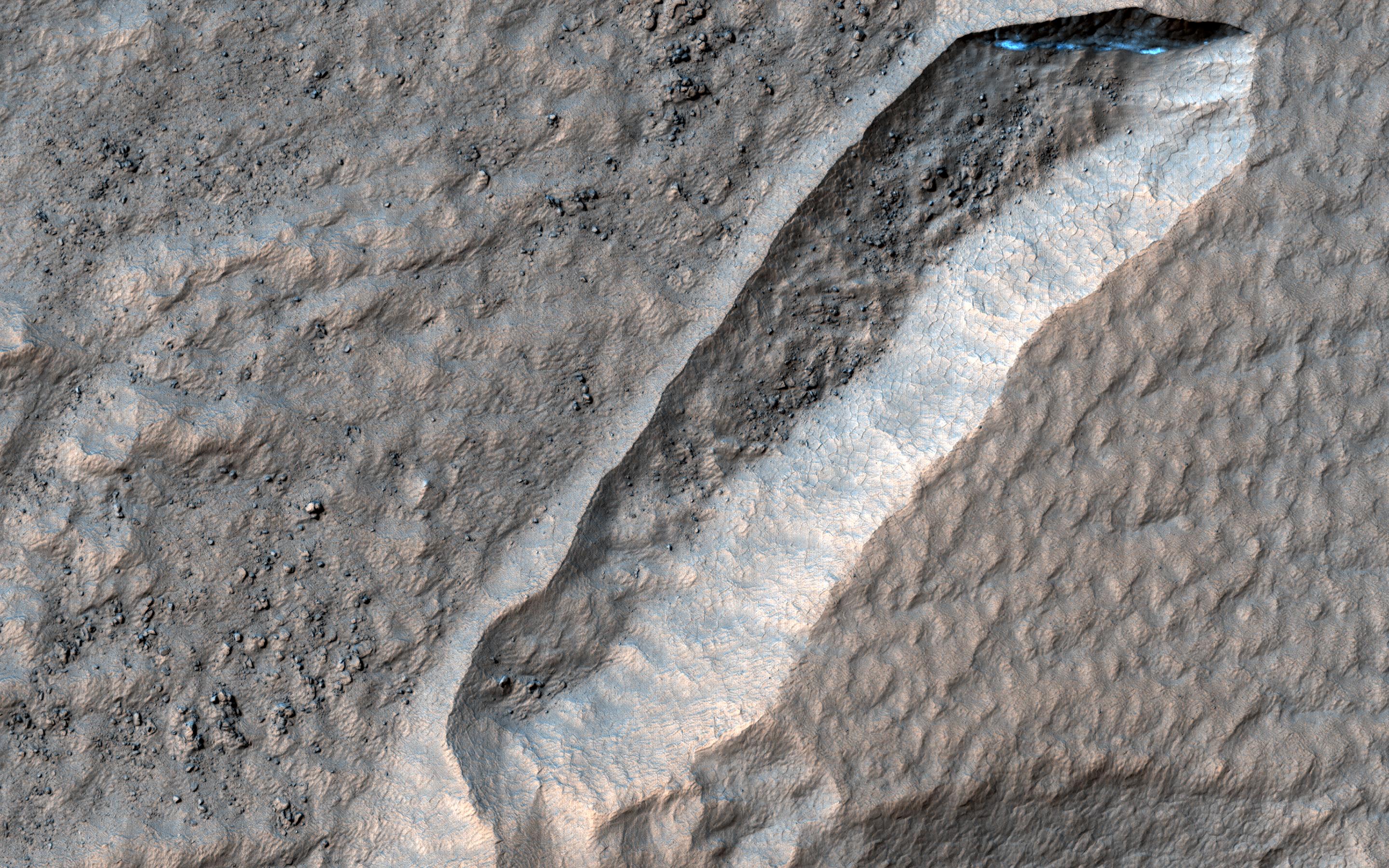
2022-10-27 |
Mars
|
Mars Reconnaissance Orbiter (MRO)
|
HiRISE
|
1200x674x3 |
|
-
PIA25586:
-
Flyover of Mars Impact Using HiRISE Data (Animation)
Full Resolution:
TIFF
(2.057 MB)
JPEG
(69.31 kB)
|
|
|
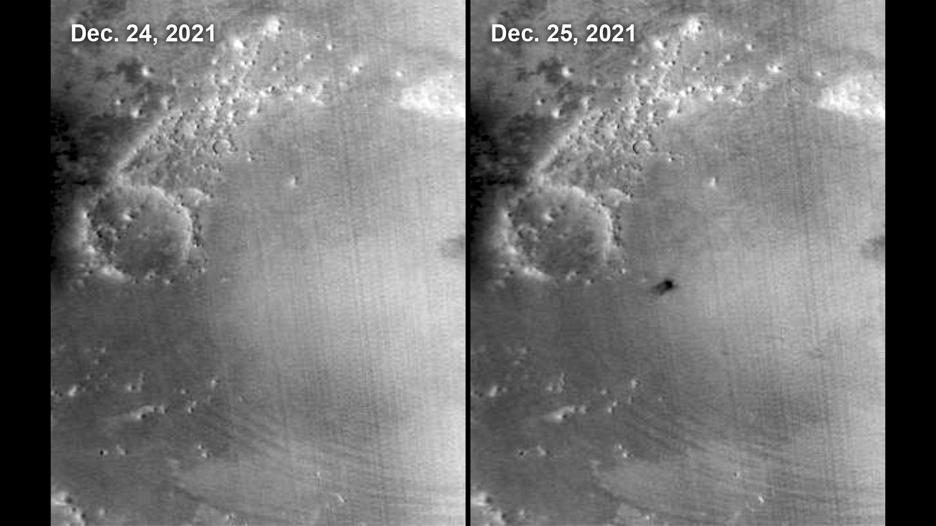
2022-10-27 |
Mars
|
Mars Reconnaissance Orbiter (MRO)
|
MARCI
|
1920x1080x1 |

|
-
PIA25585:
-
MARCI Views a Mars Impact Crater in Amazonis Planitia
Full Resolution:
TIFF
(1.693 MB)
JPEG
(156.5 kB)
|
|
|
2022-10-27 |
Mars
|
Mars Reconnaissance Orbiter (MRO)
|
CTX
|
5448x3523x1 |

|
-
PIA25584:
-
Context Camera Views an Impact Crater in Amazonis Planitia
Full Resolution:
TIFF
(19.22 MB)
JPEG
(5.28 MB)
|
|
|
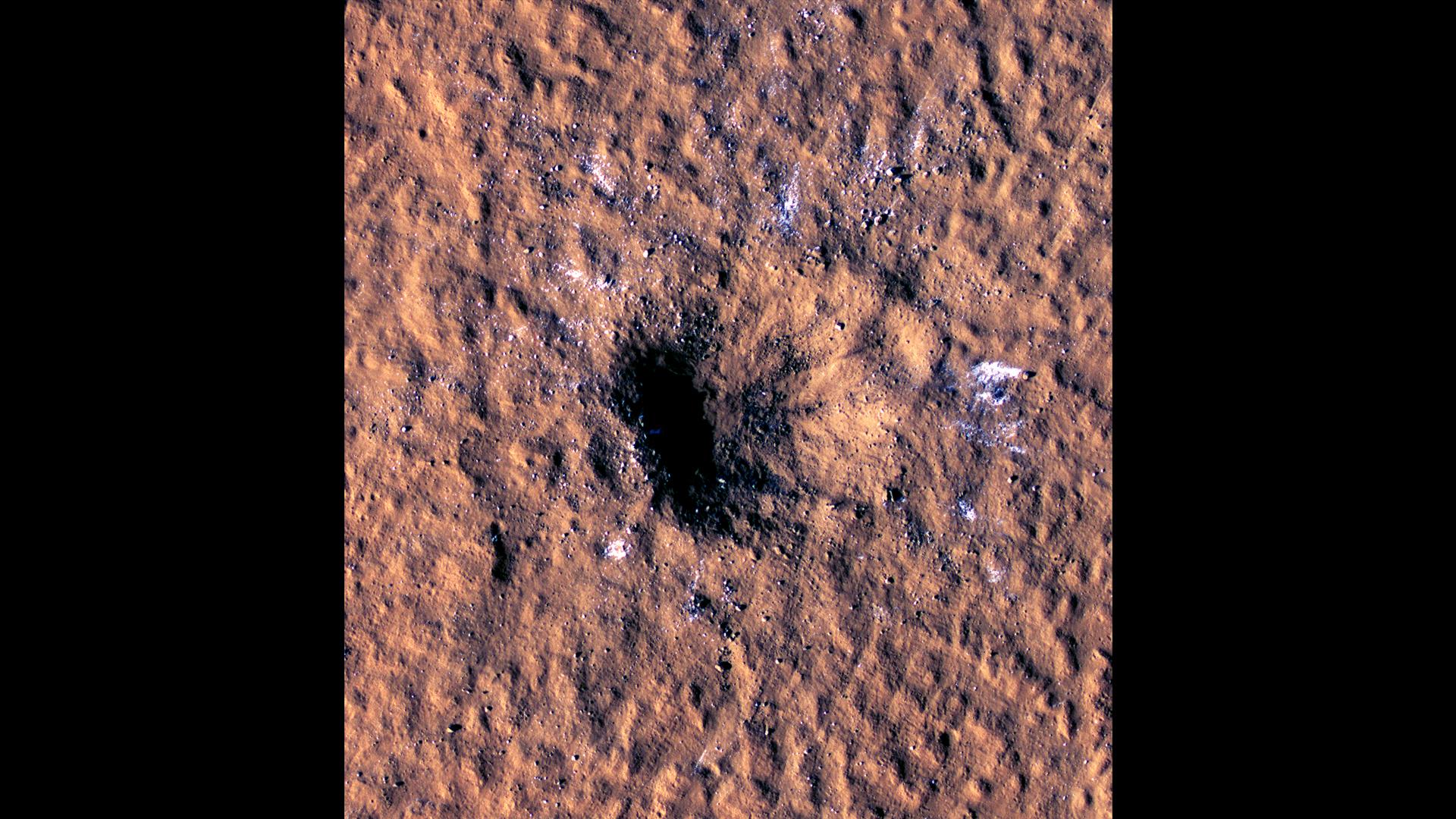
2022-10-27 |
Mars
|
Mars Reconnaissance Orbiter (MRO)
|
HiRISE
|
1920x1080x3 |
|
-
PIA25583:
-
HiRISE Views a Mars Impact Crater Surrounded by Water Ice
Full Resolution:
TIFF
(4.226 MB)
JPEG
(341.2 kB)
|
|
|
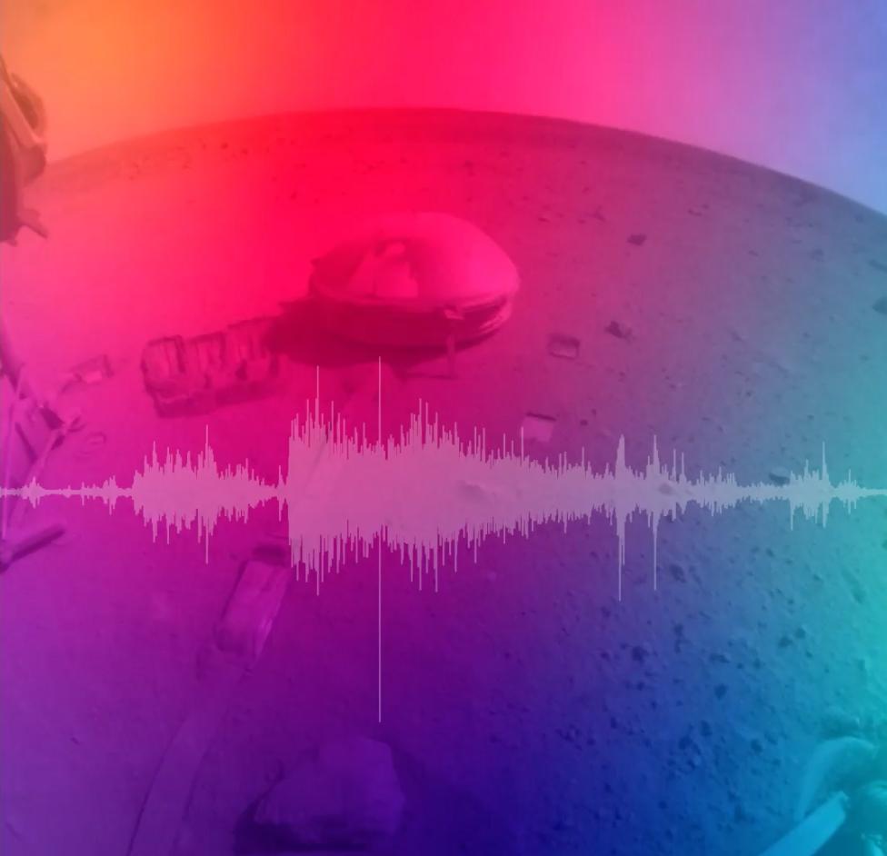
2022-10-27 |
Mars
|
InSight
|
|
976x942x3 |

|
-
PIA25582:
-
NASA's InSight Records the Sound of a Martian Impact
Full Resolution:
TIFF
(2.466 MB)
JPEG
(47.12 kB)
|
|
|
2022-10-27 |
Mars
|
2001 Mars Odyssey
|
THEMIS
|
602x2716x1 |

|
-
PIA25579:
-
Daedalia Planum
Full Resolution:
TIFF
(776.6 kB)
JPEG
(119.2 kB)
|
|
|
2022-10-26 |
Mars
|
2001 Mars Odyssey
|
THEMIS
|
670x1435x1 |
|
-
PIA25578:
-
Peneus Patera
Full Resolution:
TIFF
(740.4 kB)
JPEG
(127.9 kB)
|
|
|
2022-10-25 |
Earth
|
Earth Surface Mineral Dust Source Investigation (EMIT)
|
EMIT
|
1925x834x3 |
|
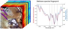
-
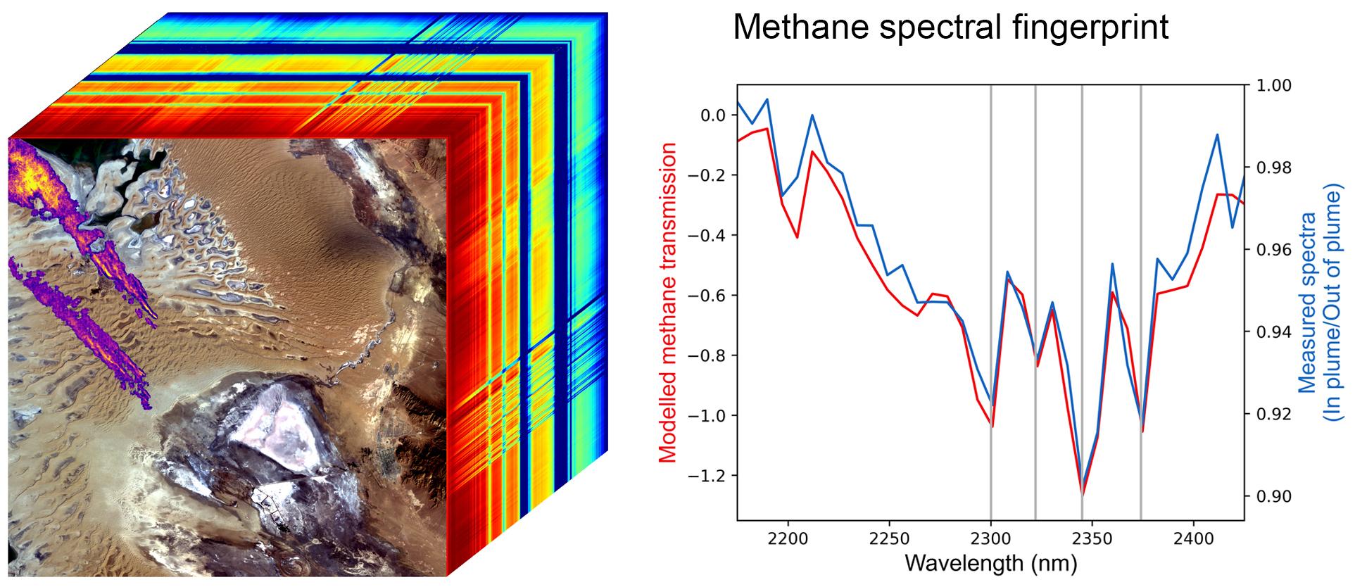
PIA25593:
-
EMIT Methane Spectral Fingerprint
Full Resolution:
TIFF
(2.575 MB)
JPEG
(246.3 kB)
|
|
|
2022-10-25 |
Earth
|
Earth Surface Mineral Dust Source Investigation (EMIT)
|
EMIT
|
1557x834x3 |
|
-
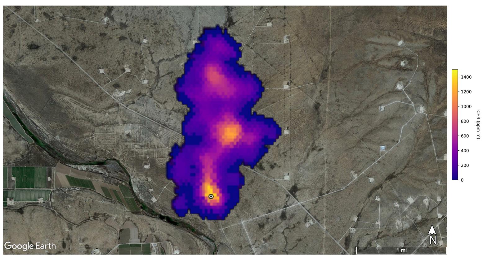
PIA25592:
-
EMIT Spots Methane Hotspots
Full Resolution:
TIFF
(3.464 MB)
JPEG
(204.9 kB)
|
|
|
2022-10-25 |
Mars
|
2001 Mars Odyssey
|
THEMIS
|
605x2709x1 |
|
-
PIA25577:
-
Ius Chasma
Full Resolution:
TIFF
(690.6 kB)
JPEG
(65.92 kB)
|
|
|
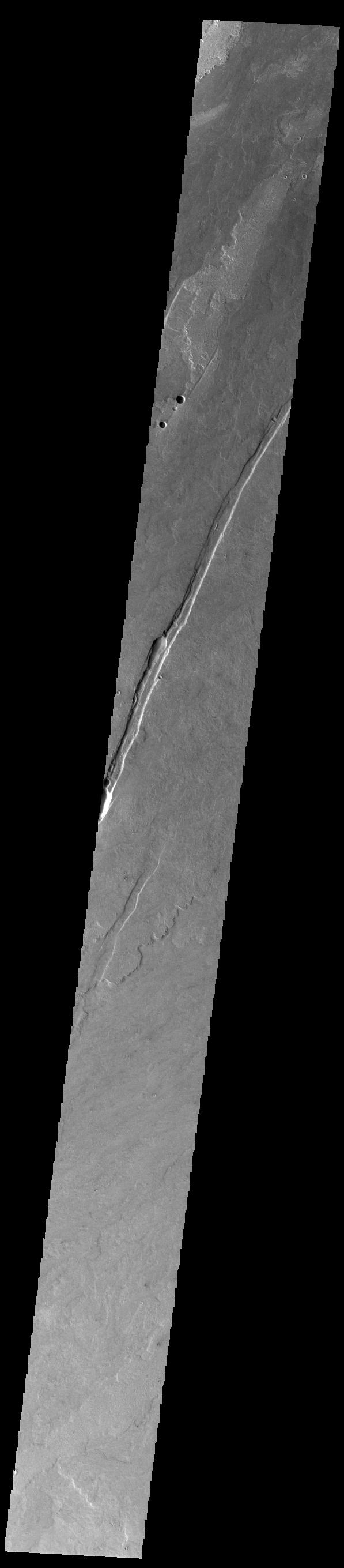
2022-10-24 |
Mars
|
Mars Reconnaissance Orbiter (MRO)
|
HiRISE
|
2880x1800x3 |
|
-
PIA25559:
-
The Tale of a Retreating Scarp
Full Resolution:
TIFF
(15.56 MB)
JPEG
(1.087 MB)
|
|
|
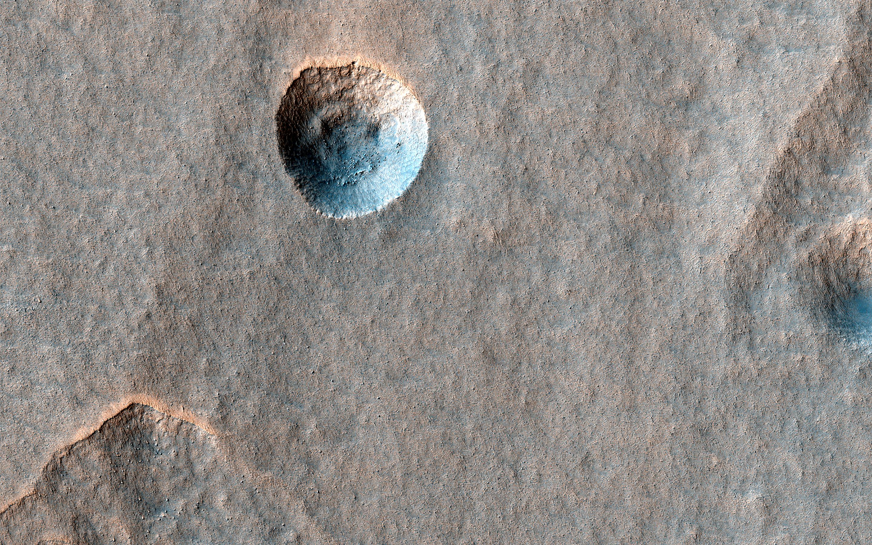
2022-10-24 |
Mars
|
Mars Reconnaissance Orbiter (MRO)
|
HiRISE
|
2880x1800x3 |
|
-
PIA25558:
-
In the Wake of Ancient Lava Flows
Full Resolution:
TIFF
(15.56 MB)
JPEG
(1.204 MB)
|
|
|
2022-10-24 |
Mars
|
Mars Reconnaissance Orbiter (MRO)
|
HiRISE
|
2880x1800x3 |

|
-
PIA25557:
-
A Crater in Scalloped Terrain
Full Resolution:
TIFF
(15.56 MB)
JPEG
(1.619 MB)
|
|
|
2022-10-24 |
Mars
|
Mars Reconnaissance Orbiter (MRO)
|
HiRISE
|
2880x1800x3 |
|
-
PIA25556:
-
Slipping and Sliding in Echus Chaos
Full Resolution:
TIFF
(15.56 MB)
JPEG
(757.9 kB)
|
|
|
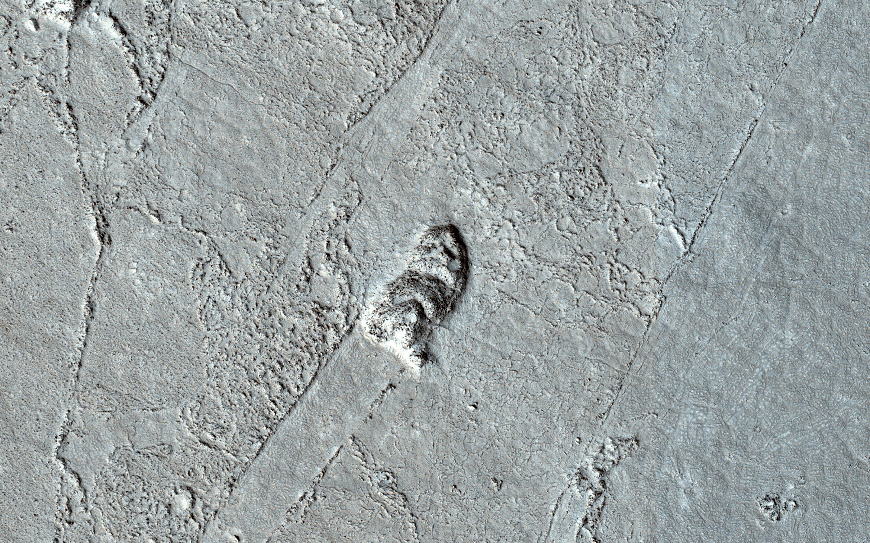
2022-10-24 |
Mars
|
2001 Mars Odyssey
|
THEMIS
|
666x1432x1 |
|
-
PIA25576:
-
Crater Dunes
Full Resolution:
TIFF
(605 kB)
JPEG
(52.71 kB)
|
|
|
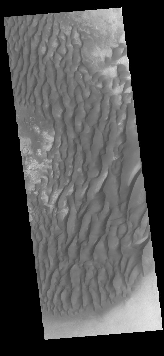
2022-10-21 |
Mars
|
2001 Mars Odyssey
|
THEMIS
|
664x1434x1 |
|
-
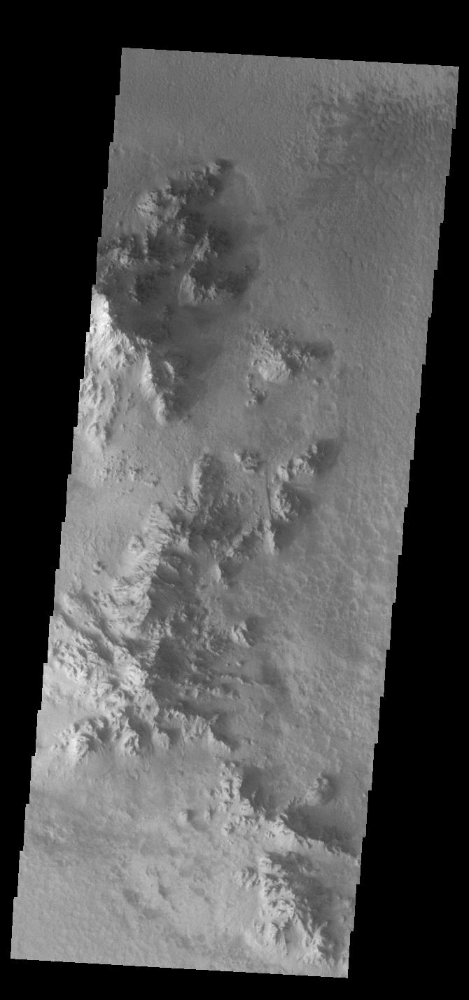
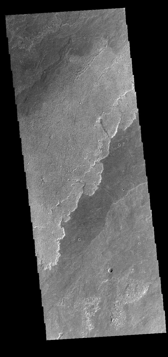
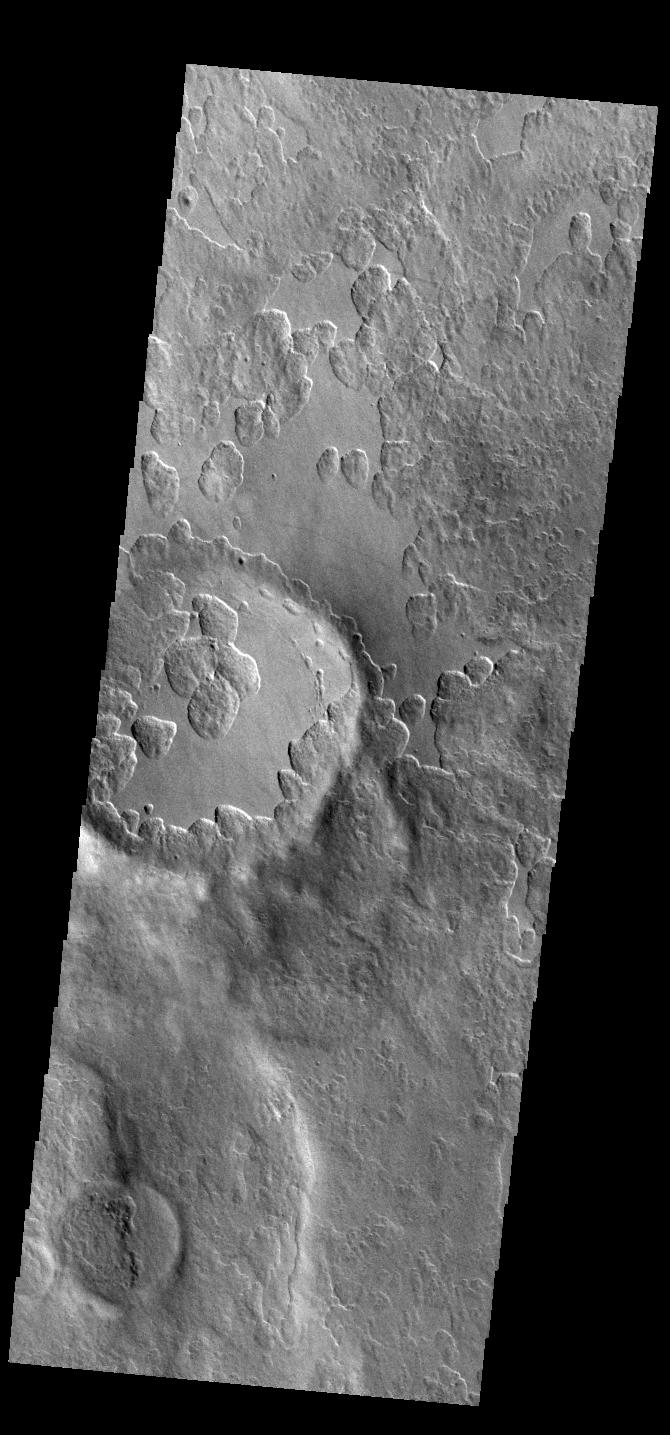
PIA25575:
-
Maunder Crater
Full Resolution:
TIFF
(679.2 kB)
JPEG
(61.77 kB)
|
|
|
2022-10-20 |
|
Simplified High Impact Energy Landing Device (SHIELD)
|
|
1920x1080x3 |
|
-
PIA25581:
-
Bow Launch Drop Tower at JPL
Full Resolution:
TIFF
(6.223 MB)
JPEG
(329.5 kB)
|
|
|
2022-10-20 |
|
Simplified High Impact Energy Landing Device (SHIELD)
|
|
1920x1080x3 |
|
-
PIA25420:
-
SHIELD Prototype Attached to Drop Tower
Full Resolution:
TIFF
(6.021 MB)
JPEG
(236.9 kB)
|
|
|
2022-10-20 |
|
Surface Water and Ocean Topography (SWOT)
|
|
2179x1547x3 |
|
-
PIA25591:
-
SWOT Arrives at Vandenberg Space Force Base
Full Resolution:
TIFF
(7.499 MB)
JPEG
(331.9 kB)
|
|
|
2022-10-20 |
Mars
|
2001 Mars Odyssey
|
THEMIS
|
672x1425x1 |

|
-
PIA25574:
-
Nirgal Vallis
Full Resolution:
TIFF
(699.7 kB)
JPEG
(91.86 kB)
|
|
|
2022-10-19 |
Earth
|
Terra
|
ASTER
|
898x768x3 |
|
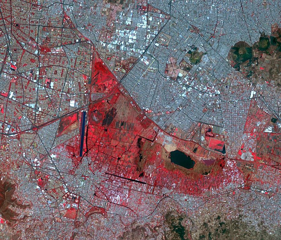
-
PIA25555:
-
Xochimilco, Mexico
Full Resolution:
TIFF
(2.07 MB)
JPEG
(234.4 kB)
|
|
|
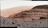
2022-10-19 |
Mars
|
Mars Science Laboratory (MSL)
|
Mastcam
|
1328x1184x3 |
|
-
PIA25418:
-
Curiosity's 36th Drill Hole at Canaima
Full Resolution:
TIFF
(4.172 MB)
JPEG
(254.5 kB)
|
|
|
2022-10-19 |
Mars
|
Mars Science Laboratory (MSL)
|
Navigation Camera (M2020)
|
7696x2165x1 |

|
-
PIA25417:
Curiosity's Navcams View Paraitepuy Pass
Full Resolution:
TIFF
(11.31 MB)
JPEG
(1.471 MB)
|
|
|
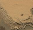
2022-10-19 |
Mars
|
Mars Science Laboratory (MSL)
|
MAHLI
|
3600x2700x3 |
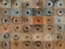
|
-
PIA25416:
-
Curiosity's 36 Drill Holes
Full Resolution:
TIFF
(29.17 MB)
JPEG
(2.337 MB)
|
|
|
2022-10-19 |
Mars
|
Mars Science Laboratory (MSL)
|
Mastcam
|
2073x1226x3 |
|
-
PIA25415:
-
Curiosity's Close-Up of Rocks in Paraitepuy Pass
Full Resolution:
TIFF
(7.414 MB)
JPEG
(582.7 kB)
|
|
|
2022-10-19 |
Mars
|
Mars Science Laboratory (MSL)
|
Mastcam
|
8323x4225x3 |
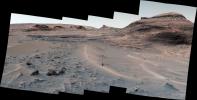
|
-
PIA25414:
-
Curiosity's View of Sand Ridges and Bolívar
Full Resolution:
TIFF
(78.61 MB)
JPEG
(6.244 MB)
|
|
|
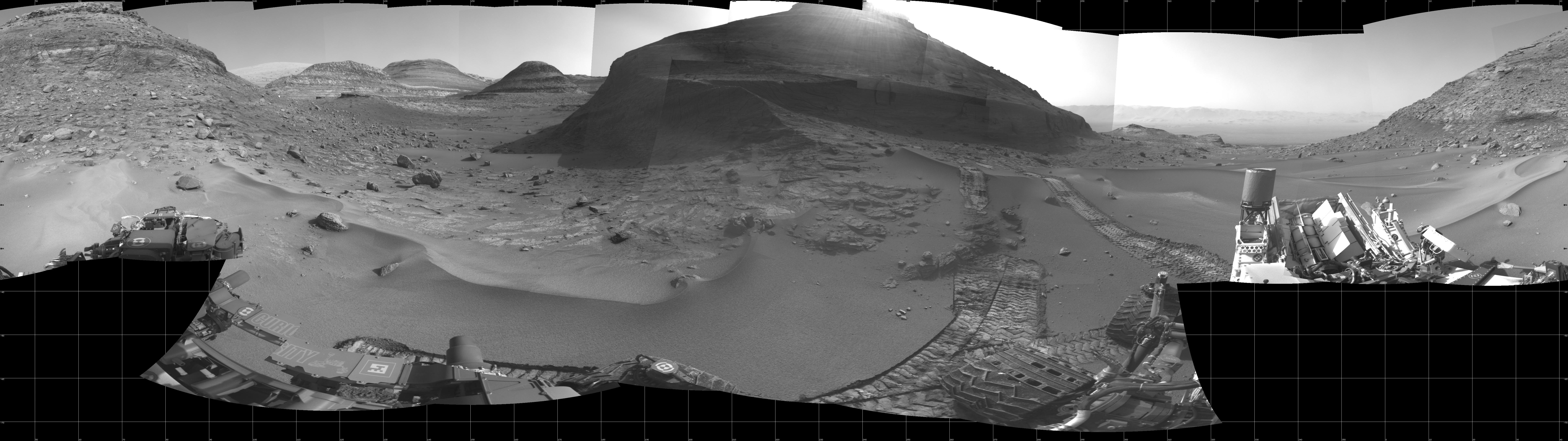
2022-10-19 |
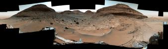
Mars
|
Mars Science Laboratory (MSL)
|
Mastcam
|
29163x8638x3 |
|
-
PIA25413:
-
Curiosity's View of Paraitepuy Pass
Full Resolution:
TIFF
(536.6 MB)
JPEG
(46.38 MB)
|
|
|
2022-10-19 |
Mars
|
2001 Mars Odyssey
|
THEMIS
|
667x1427x1 |
|
-
PIA25573:
-
Ariadnes Colles
Full Resolution:
TIFF
(717.4 kB)
JPEG
(94.25 kB)
|
|
|
2022-10-18 |
|
Surface Water and Ocean Topography (SWOT)
|
|
6048x3749x3 |
|
-
PIA24910:
-
Packing SWOT For Launch
Full Resolution:
TIFF
(53.66 MB)
JPEG
(2.978 MB)
|
|
|
2022-10-18 |
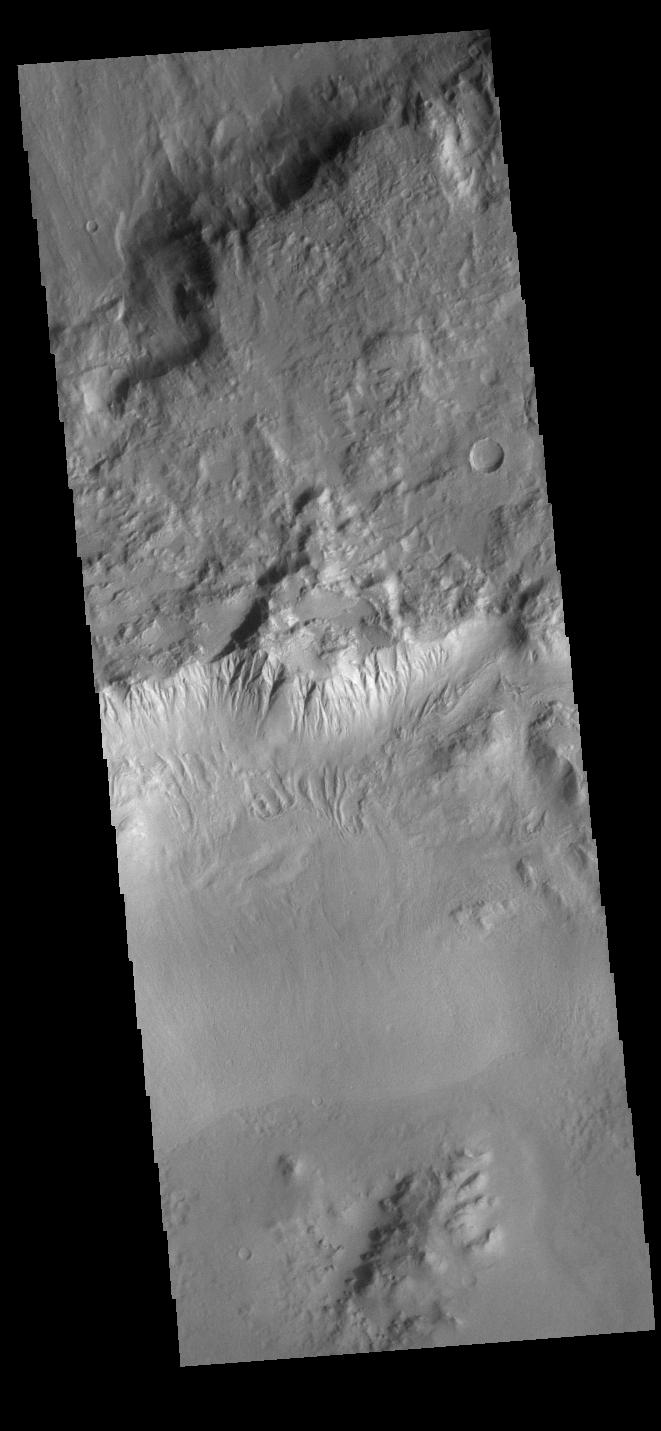
Mars
|
2001 Mars Odyssey
|
THEMIS
|
658x1423x1 |
|
-
PIA25572:
-
Claritas Fossae
Full Resolution:
TIFF
(685.5 kB)
JPEG
(78.26 kB)
|
|
|
2022-10-17 |
Mars
|
2001 Mars Odyssey
|
THEMIS
|
662x1434x1 |

|
-
PIA25571:
-
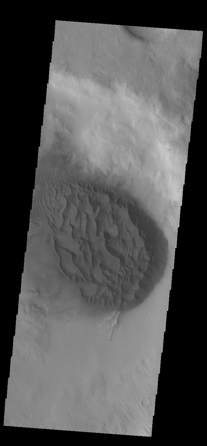
Kaiser Crater Dunes
Full Resolution:
TIFF
(651.4 kB)
JPEG
(63.96 kB)
|
|
|
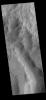
2022-10-14 |
Mars
|
2001 Mars Odyssey
|
THEMIS
|
666x1429x1 |
|
-
PIA25550:
-
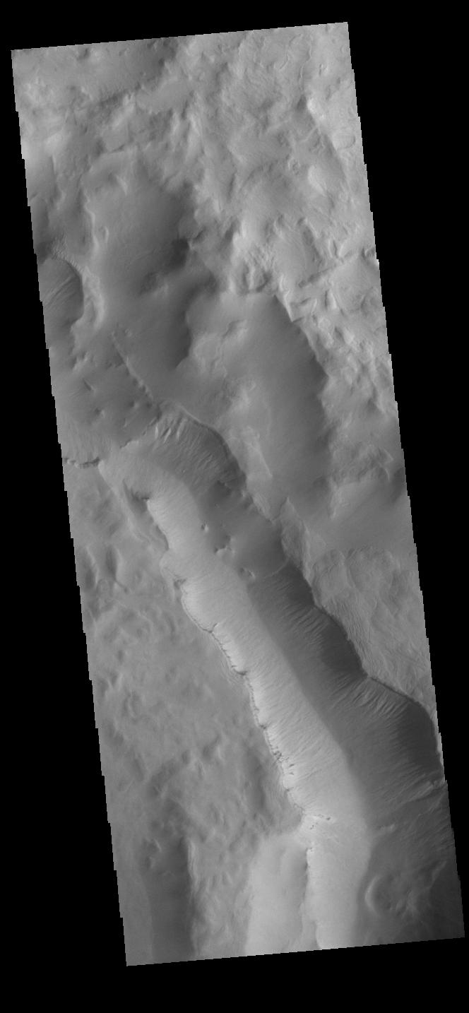
Sirenum Fossae
Full Resolution:
TIFF
(688.9 kB)
JPEG
(85.02 kB)
|
|
|
2022-10-13 |
Phobos
|
Mars 2020 Rover
|
Mastcam-Z
|
1600x1200x1 |
|
-
PIA25419:
-
Perseverance Views Phobos
Full Resolution:
TIFF
(621.7 kB)
JPEG
(65.47 kB)
|
|
|
2022-10-13 |
Mars
|
2001 Mars Odyssey
|
THEMIS
|
604x2737x1 |
|
-
PIA25549:
-
Russell Crater Dunes
Full Resolution:
TIFF
(709.7 kB)
JPEG
(75.72 kB)
|
|
|
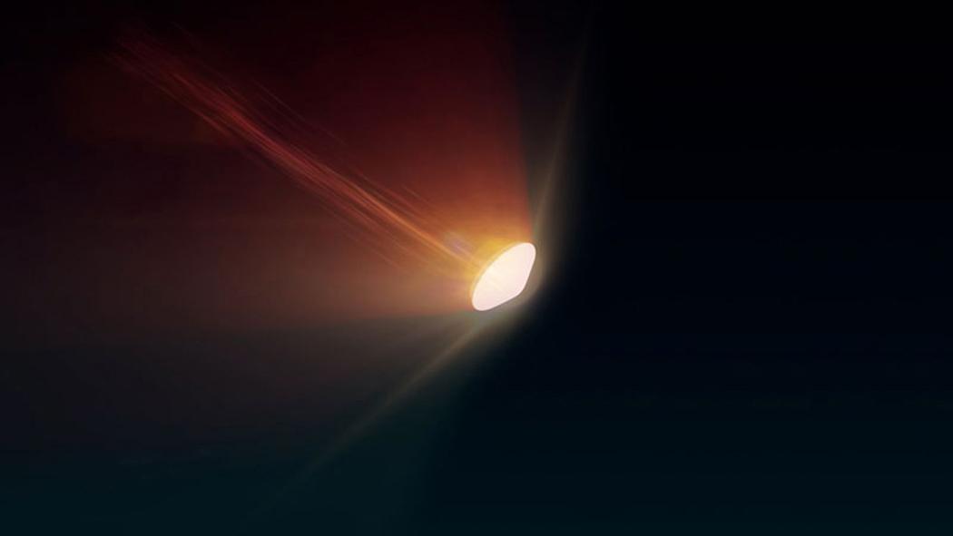
2022-10-12 |
Mars
|
Mars Sample Return (MSR)
|
|
1050x591x3 |

|
-
PIA25336:
-
Mars Earth Entry System Aeroshell at Entry (Illustration)
Full Resolution:
TIFF
(739.4 kB)
JPEG
(17.89 kB)
|
|
|
2022-10-12 |
Earth
|
Earth Surface Mineral Dust Source Investigation (EMIT)
|
EMIT
|
2457x2370x3 |
|
-
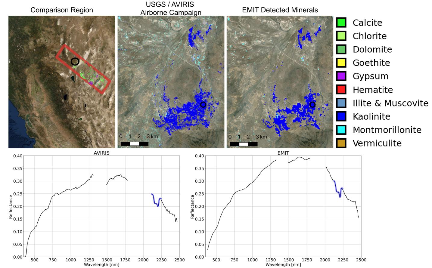
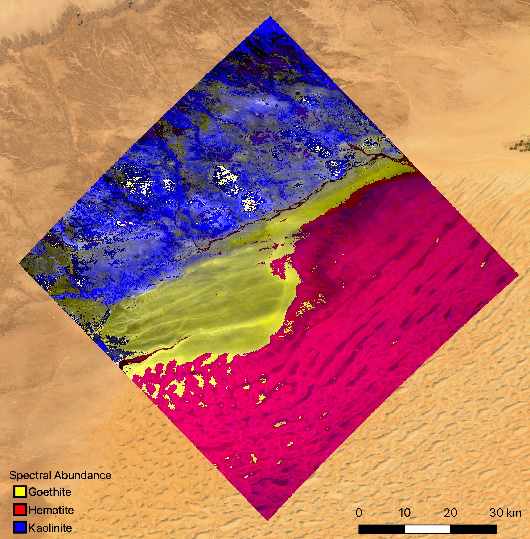
PIA25430:
-
NASA's EMIT Mission Generates Image Cube of Surface Minerals in Southwestern Libya
Full Resolution:
TIFF
(15.61 MB)
JPEG
(788.9 kB)
|
|
|
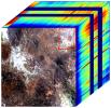
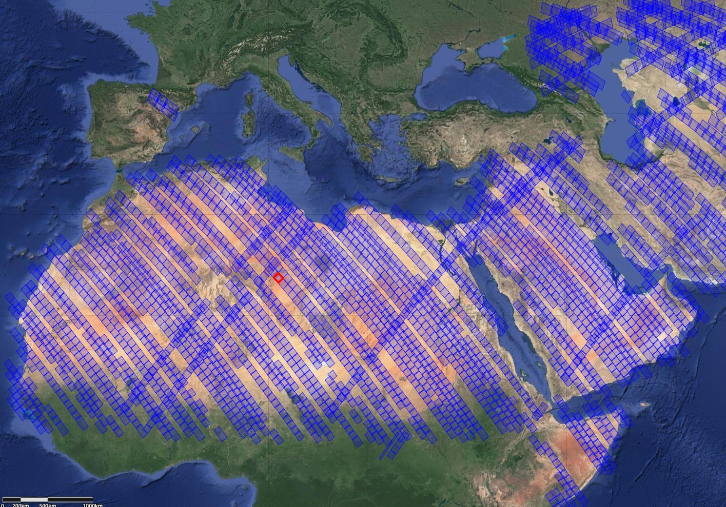
2022-10-12 |
Earth
|
Earth Surface Mineral Dust Source Investigation (EMIT)
|
EMIT
|
1489x1039x3 |

|
-
PIA25429:
-
NASA's EMIT Measures Surface Dust in North Africa, Europe, the Middle East, Central Asia
Full Resolution:
TIFF
(4.643 MB)
JPEG
(393.1 kB)
|
|
|
2022-10-12 |
Earth
|
Earth Surface Mineral Dust Source Investigation (EMIT)
|
EMIT
|
1435x891x3 |

|
-
PIA25428:
-
NASA's EMIT Collects Mineral Maps, Spectral Fingerprints From Nevada
Full Resolution:
TIFF
(1.876 MB)
JPEG
(184.9 kB)
|
|
|
2022-10-12 |
Earth
|
Earth Surface Mineral Dust Source Investigation (EMIT)
|
EMIT
|
774x750x3 |
|
-
PIA25427:
-
NASA's EMIT Generates Image Cube of Surface Minerals in Northwest Nevada
Full Resolution:
TIFF
(1.689 MB)
JPEG
(146.8 kB)
|
|
|
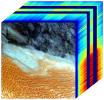
2022-10-12 |
Earth
|
Earth Surface Mineral Dust Source Investigation (EMIT)
|
EMIT
|
2249x2289x3 |

|
-
PIA25424:
-
EMIT Instrument's First Light
Full Resolution:
TIFF
(14.73 MB)
JPEG
(813.9 kB)
|
|
|
2022-10-12 |
Mars
|
2001 Mars Odyssey
|
THEMIS
|
670x1423x1 |
|
-
PIA25548:
-
Sirenum Fossae
Full Resolution:
TIFF
(652.6 kB)
JPEG
(72.94 kB)
|
|
|
2022-10-12 |
Star
|
James Webb Space Telescope
|
Mid-Infrared Instrument (MIRI)
|
2258x1558x3 |

|
-
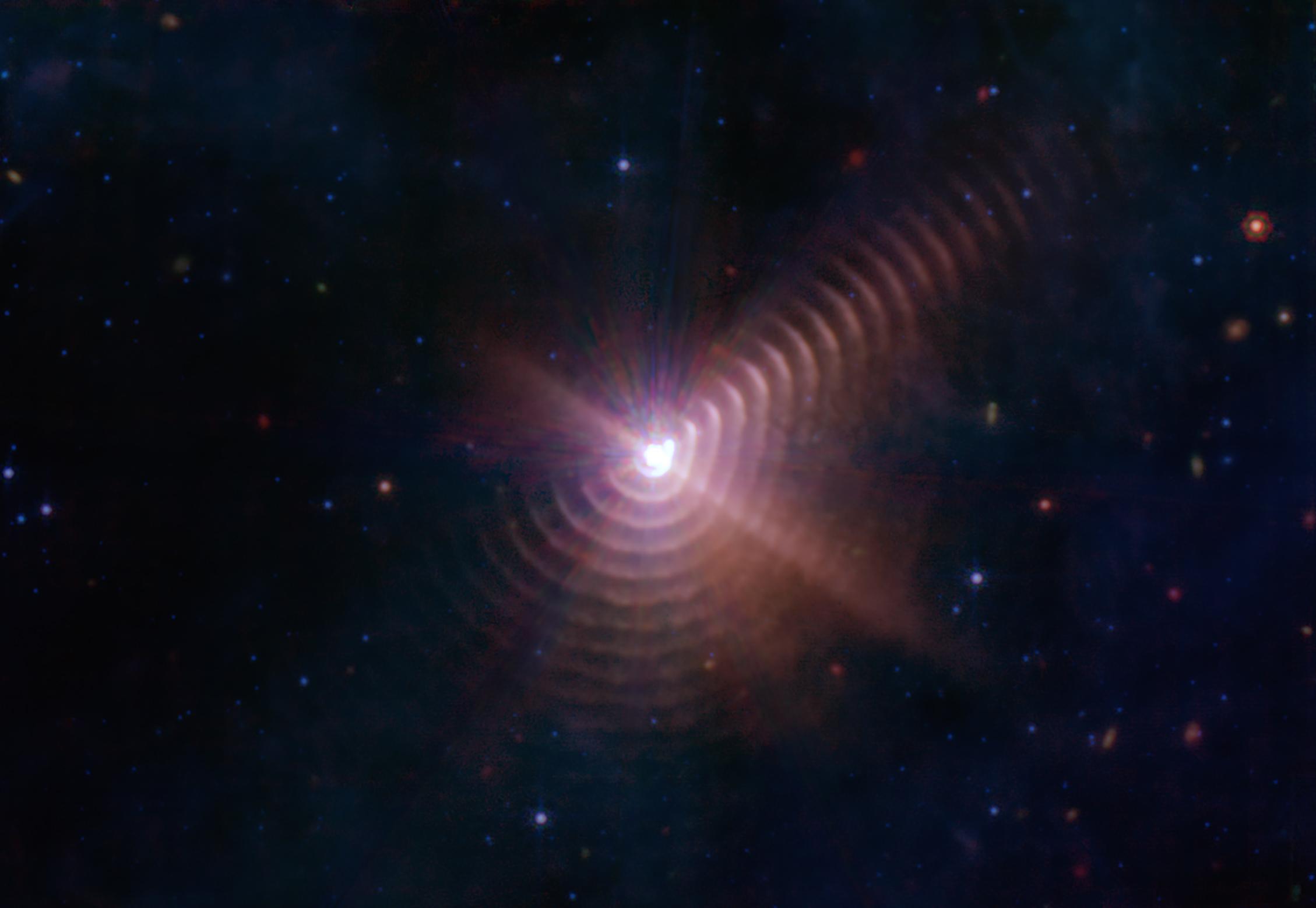
PIA25432:
-
Dust Rings in the Wolf-Rayet 140 System
Full Resolution:
TIFF
(6.995 MB)
JPEG
(122.5 kB)
|
|
|
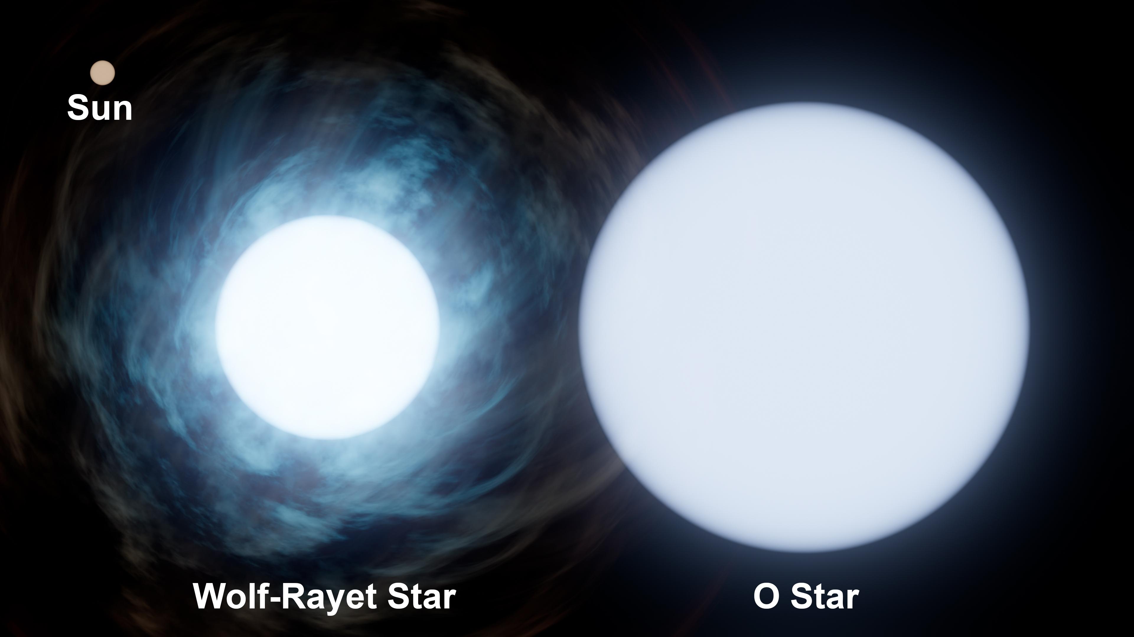
2022-10-12 |
Star
|
|
|
3840x2160x3 |
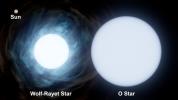
|
-
PIA25431:
-
Comparing Sizes: the Sun and WR 140
Full Resolution:
TIFF
(14.52 MB)
JPEG
(254.8 kB)
|
|
|
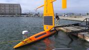
2022-10-11 |
Earth
|
S-MODE
|
|
4032x3024x3 |
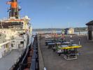
|
-
PIA25524:
-
S-MODE Research Vessel and Marine Robots Prepare for Sea
Full Resolution:
TIFF
(29.16 MB)
JPEG
(1.602 MB)
|
|
|
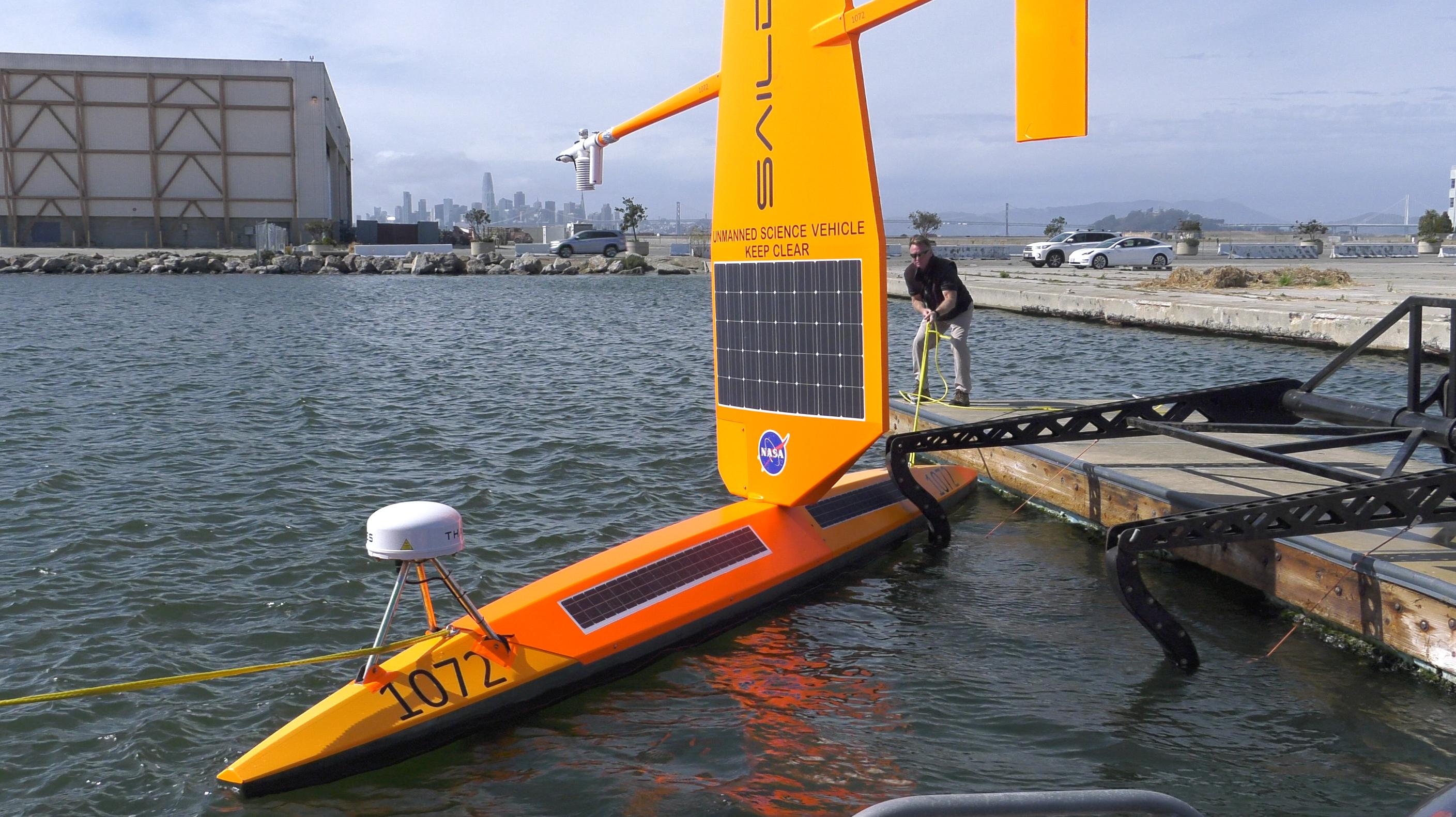
2022-10-11 |
Earth
|
S-MODE
|
|
2817x1582x3 |
|
-
PIA25523:
-
S-MODE Saildrone in San Francisco Waters
Full Resolution:
TIFF
(12.59 MB)
JPEG
(601.8 kB)
|
|
|
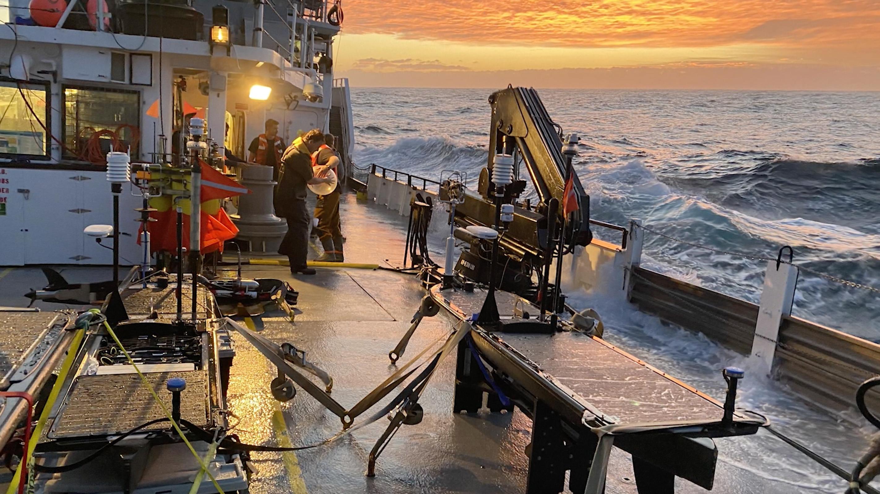
2022-10-11 |
Earth
|
S-MODE
|
|
2844x1599x3 |

|
-
PIA25522:
-
High Seas at Sunset During S-MODE Field Campaign
Full Resolution:
TIFF
(13.65 MB)
JPEG
(611.5 kB)
|
|
|
2022-10-11 |
Mars
|
2001 Mars Odyssey
|
THEMIS
|
662x1432x1 |
|
-
PIA25547:
-
Rabe Crater Dunes
Full Resolution:
TIFF
(673.2 kB)
JPEG
(68.92 kB)
|
|
|
2022-10-10 |
Mars
|
2001 Mars Odyssey
|
THEMIS
|
599x2722x1 |
|
-
PIA25546:
-
Memnonia Fossae
Full Resolution:
TIFF
(780.6 kB)
JPEG
(114.5 kB)
|
|
|
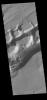
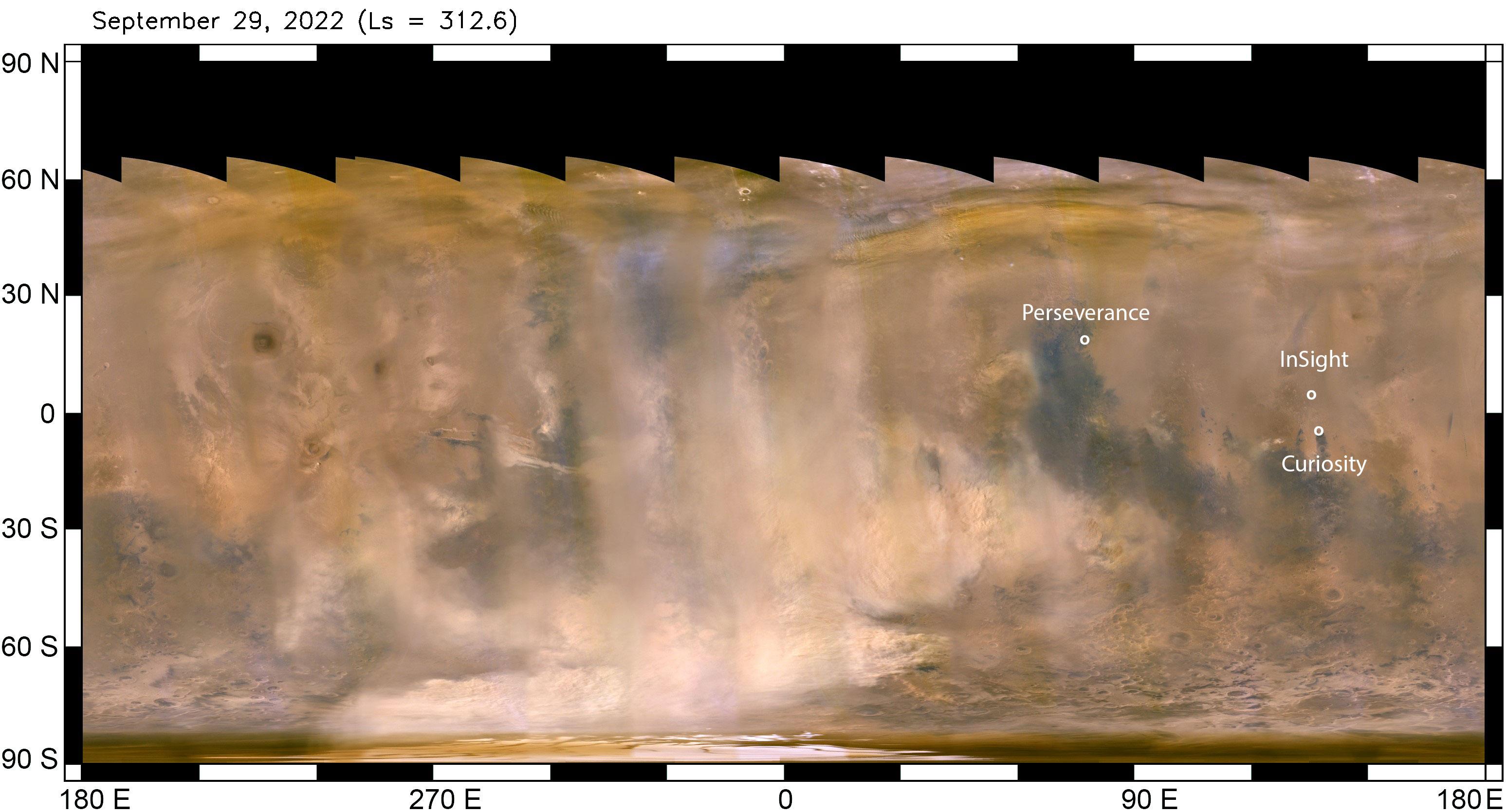
2022-10-07 |
Mars
|
Mars Reconnaissance Orbiter (MRO)
|
MARCI
|
3094x1669x3 |
|
-
PIA25412:
-
Mars Dust Storm in Relation to InSight, Curiosity and Perseverance
Full Resolution:
TIFF
(9.951 MB)
JPEG
(452.4 kB)
|
|
|
2022-10-07 |
Mars
|
2001 Mars Odyssey
|
THEMIS
|
599x2720x1 |
|
-
PIA25545:
-
Mangala Fossae
Full Resolution:
TIFF
(785.7 kB)
JPEG
(111.3 kB)
|
|
|
2022-10-06 |
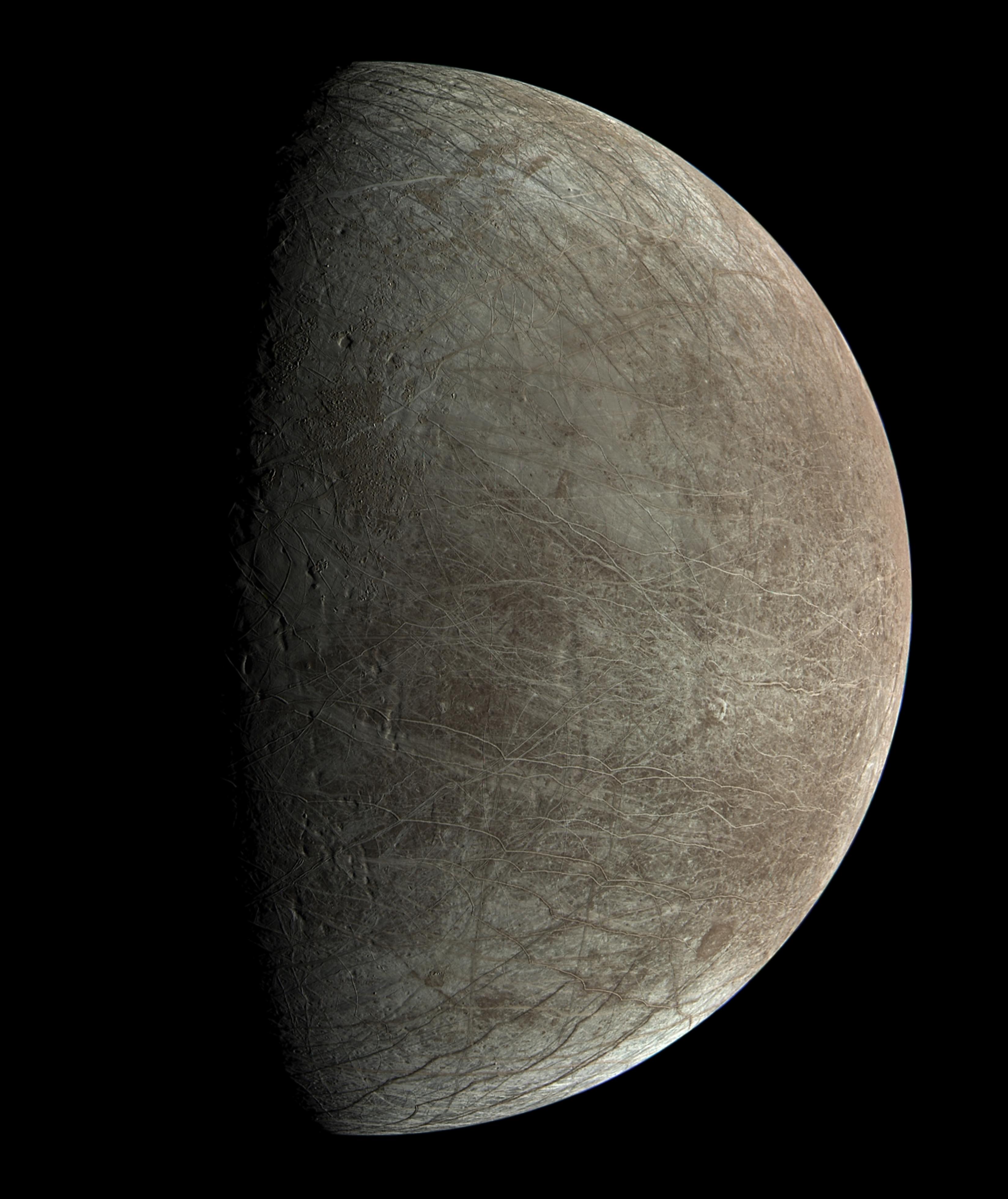
Europa
|
Juno
|
JunoCam
|
2058x1577x3 |
|
-
PIA25335:
-
Candy-Colored JunoCam Image of Europa
Full Resolution:
TIFF
(7.26 MB)
JPEG
(940.8 kB)
|
|
|
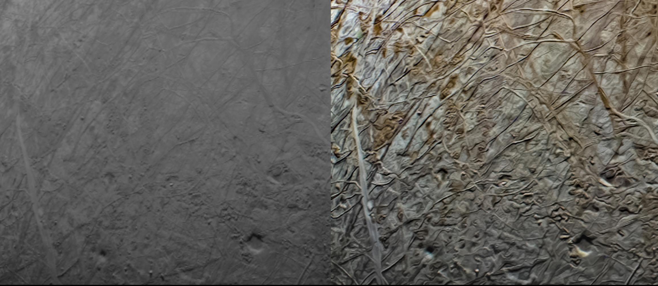
2022-10-06 |
Europa
|
Juno
|
JunoCam
|
3296x3920x3 |
|
-
PIA25334:
-
JunoCam Image of Europa From Flyby
Full Resolution:
TIFF
(19.11 MB)
JPEG
(804.8 kB)
|
|
|
2022-10-06 |
Europa
|
Juno
|
JunoCam
|
2309x1004x3 |
|
-
PIA25333:
-
JunoCam Images of Europa, Before and After
Full Resolution:
TIFF
(4.846 MB)
JPEG
(255.6 kB)
|
|
|
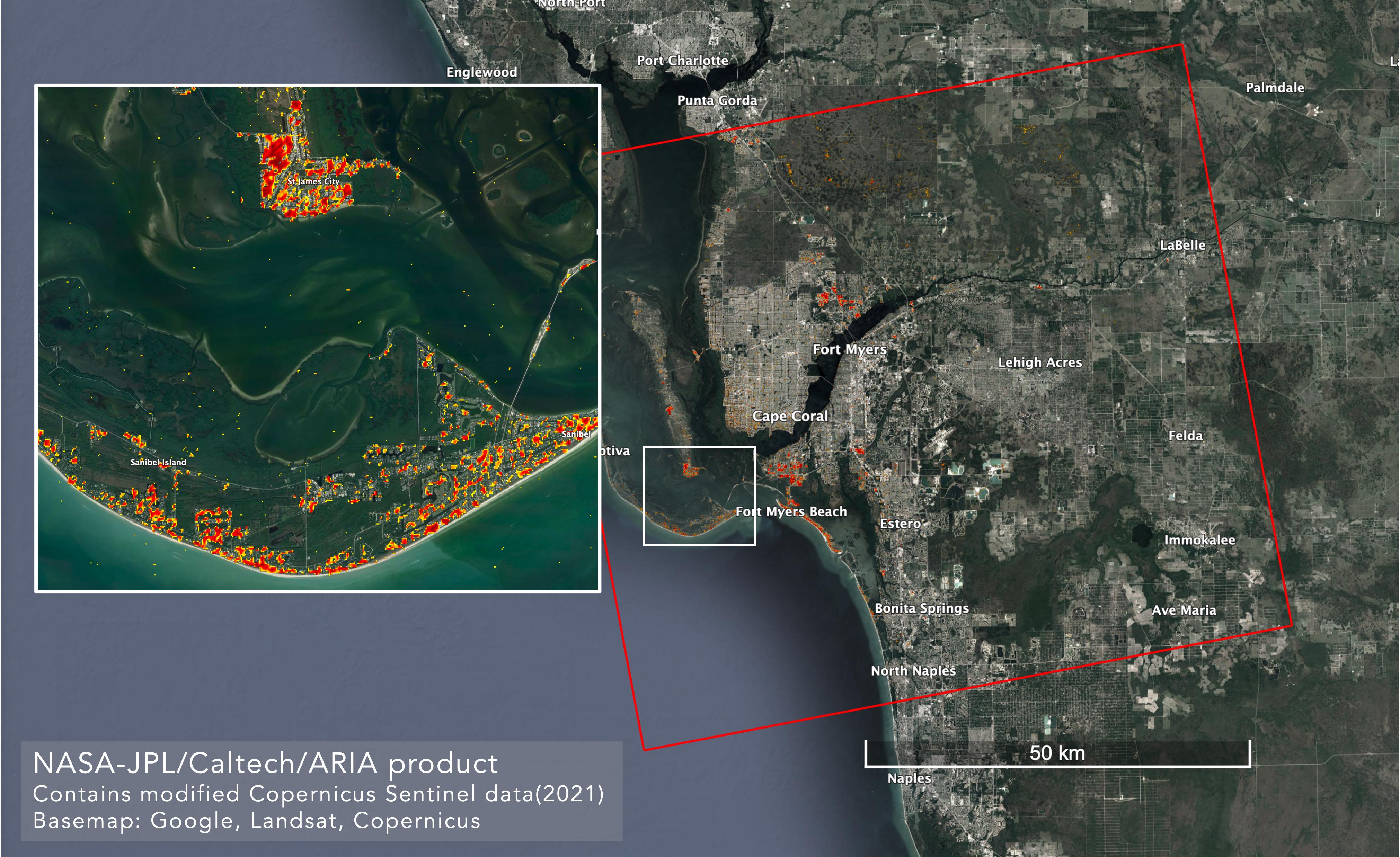
2022-10-06 |
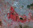
Earth
|
ARIA
|
SAR
|
4042x2475x3 |
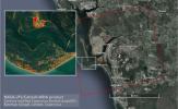
|
-
PIA25426:
-
ARIA Maps Damage in Fort Myers From Hurricane Ian
Full Resolution:
TIFF
(22.59 MB)
JPEG
(1.165 MB)
|
|
|
2022-10-06 |
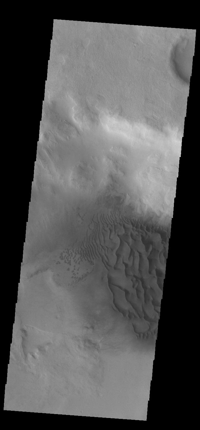
Mars
|
2001 Mars Odyssey
|
THEMIS
|
666x1432x1 |

|
-
PIA25544:
-
Crater Dunes
Full Resolution:
TIFF
(617.7 kB)
JPEG
(56.77 kB)
|
|
|
2022-10-05 |
Europa
|
Juno
|
Stellar Reference Unit (SRU)
|
512x512x1 |

|
-
PIA25332:
-
Juno's Star Camera Sees Europa Close-Up
Full Resolution:
TIFF
(262.6 kB)
JPEG
(69.96 kB)
|
|
|
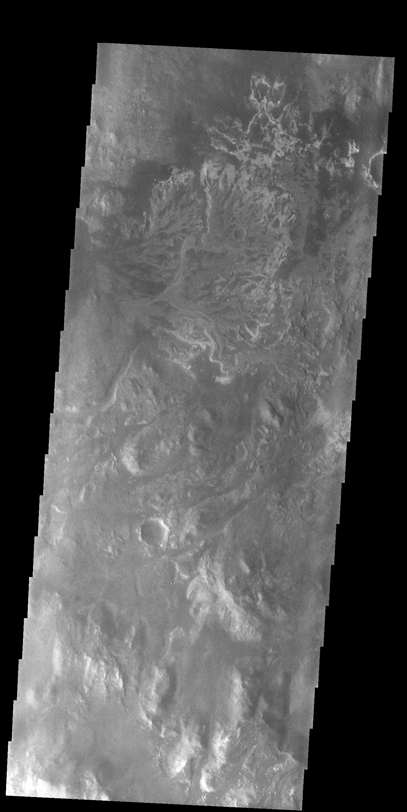
2022-10-05 |
Mars
|
2001 Mars Odyssey
|
THEMIS
|
1330x2651x1 |

|
-
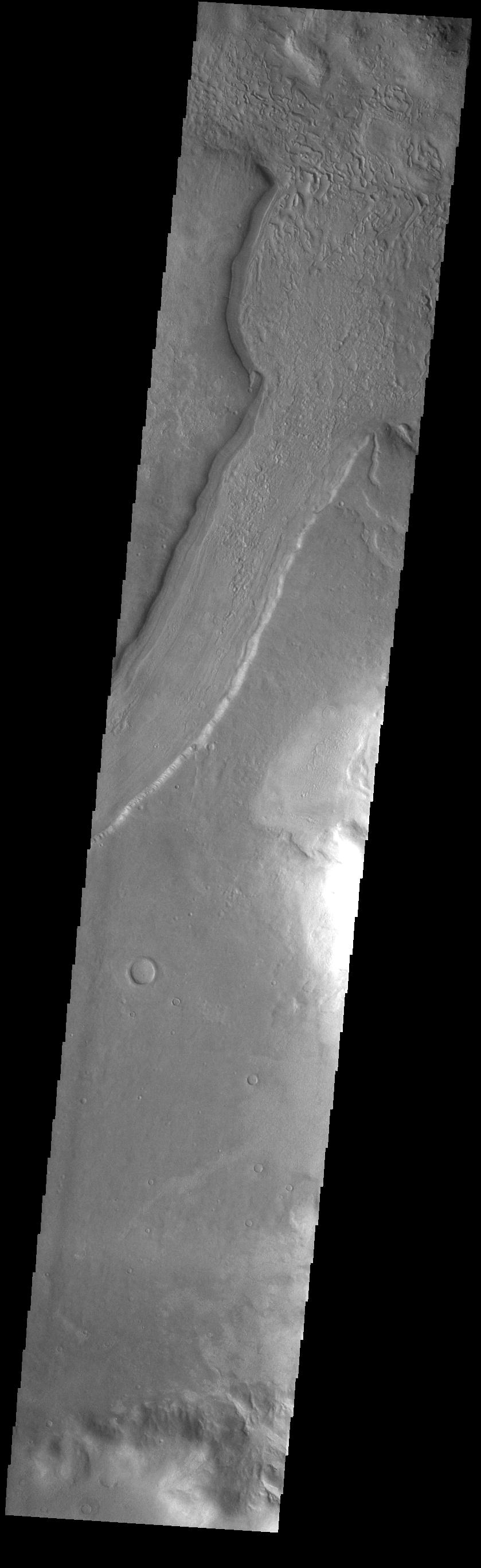
PIA25543:
-
Eberswalde Crater Delta
Full Resolution:
TIFF
(2.651 MB)
JPEG
(374.1 kB)
|
|
|
2022-10-04 |
Mars
|
2001 Mars Odyssey
|
THEMIS
|
661x1431x1 |
|
-
PIA25542:
-
Crater Gullies
Full Resolution:
TIFF
(677.6 kB)
JPEG
(83.6 kB)
|
|
|
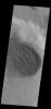
2022-10-03 |
Mars
|
2001 Mars Odyssey
|
THEMIS
|
669x1417x1 |
|
-
PIA25541:
-
Central Pit Crater
Full Resolution:
TIFF
(664 kB)
JPEG
(76.56 kB)
|
|
|
2022-09-30 |
Mars
|
Mars Helicopter
|
|
480x640x1 |

|
-
PIA25331:
-
Navigation Camera Imagery of Ingenuity's Flight 33
Full Resolution:
TIFF
(251.3 kB)
JPEG
(26.57 kB)
|
|
|
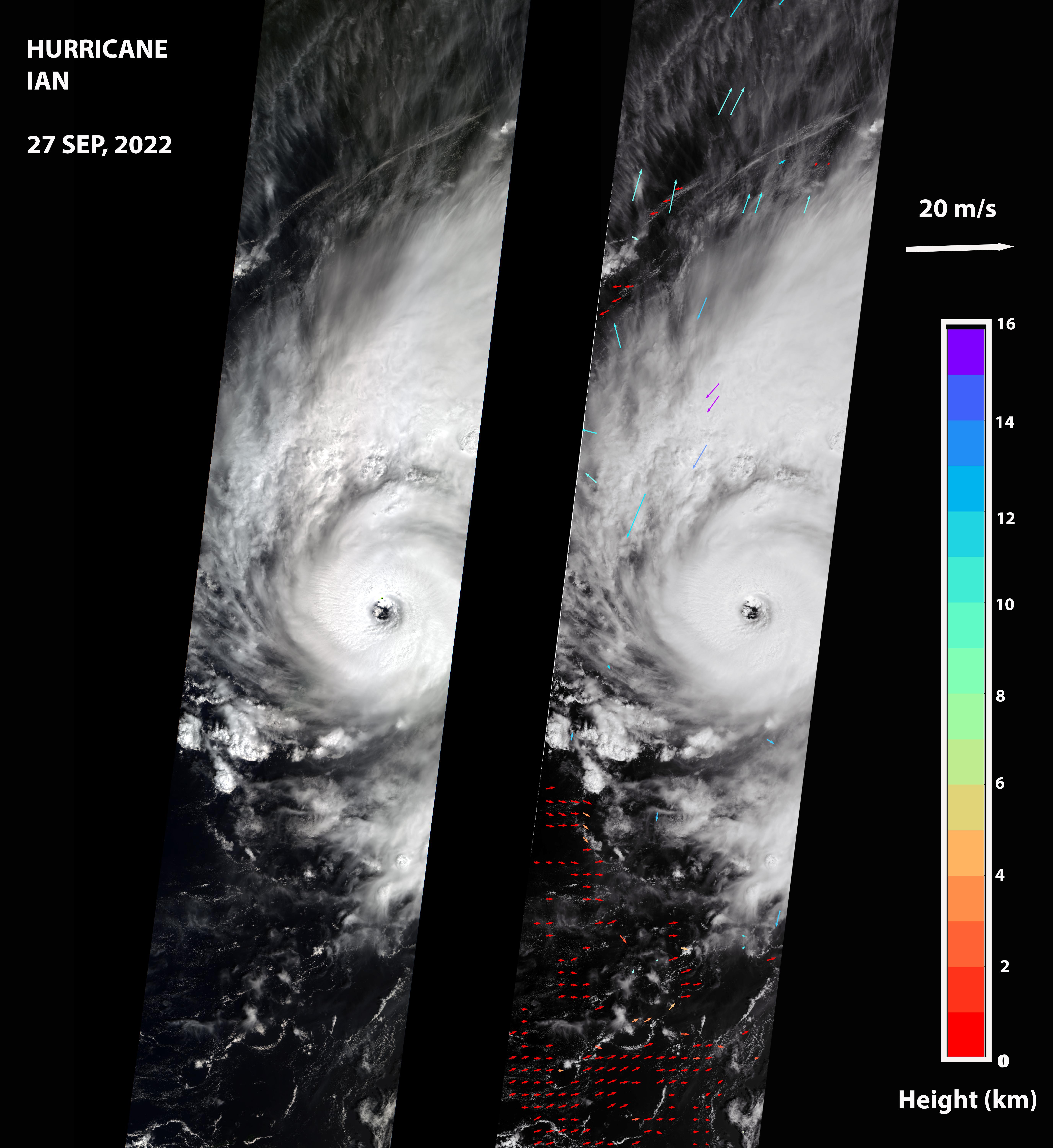
2022-09-30 |
Earth
|
Terra
|
MISR
|
5504x6001x3 |
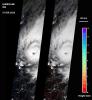
|
-
PIA24909:
-
MISR Captures Hurricane Ian
Full Resolution:
TIFF
(34.94 MB)
JPEG
(1.738 MB)
|
 Planetary Data System


