My
List |
Addition Date
|
Target
|
Mission
|
Instrument
|
Size
|

|
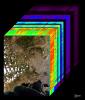
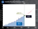
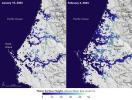
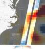
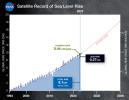
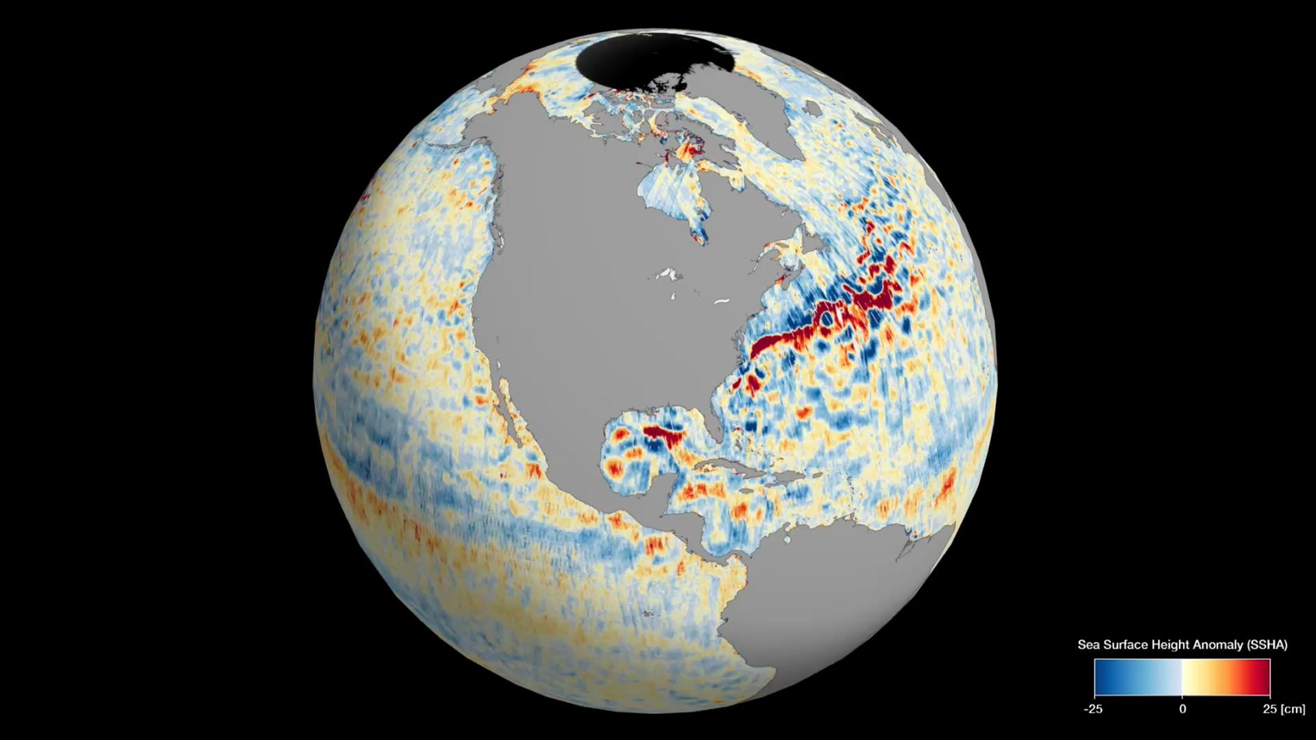
2025-03-13 |
Earth
|
TOPEX/Poseidon
Sentinel-6 Michael Freilich
|
|
3300x2550x3 |

|
-
PIA26189:
-
Satellite Record of Sea Level Rise From 1993 to 2024
Full Resolution:
TIFF
(5.236 MB)
JPEG
(464.9 kB)
|
|
|
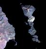
2025-02-24 |
Earth
|
Terra
|
ASTER
|
2202x6214x3 |

|
-
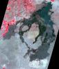
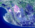
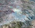
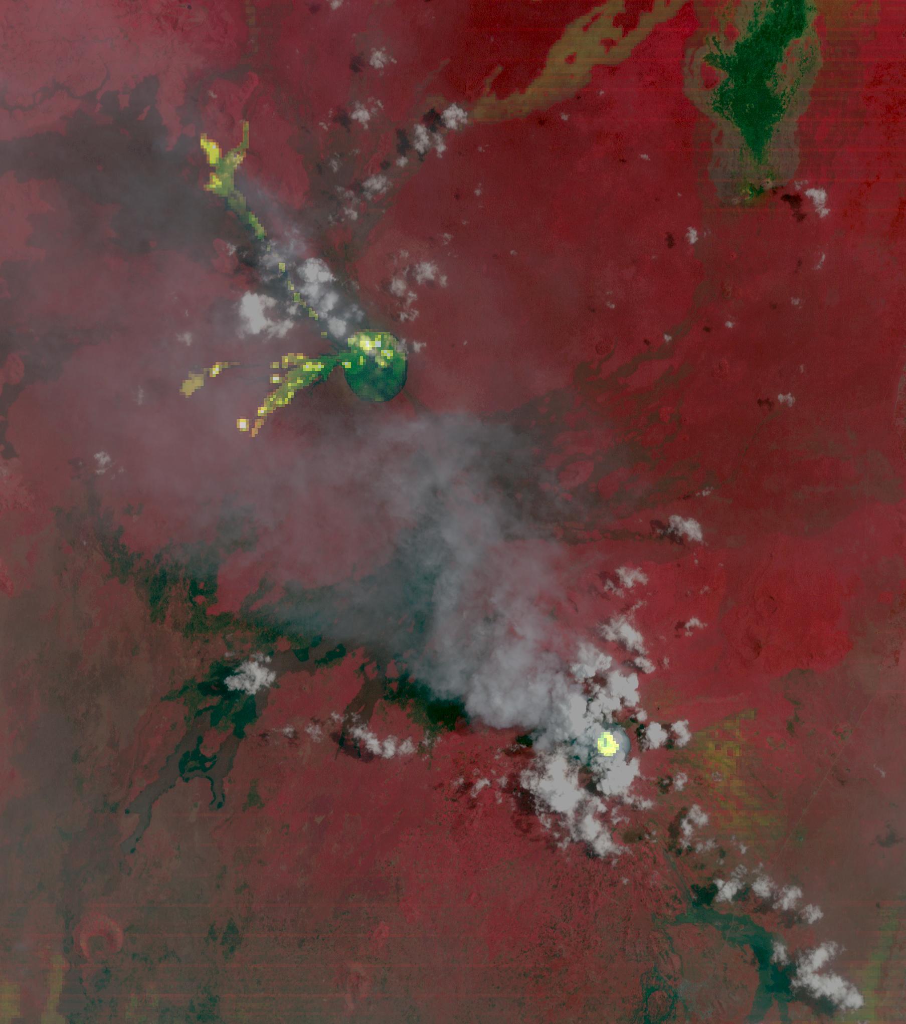
PIA26506:
-
Taal Volcano, Philippines
Full Resolution:
TIFF
(38.24 MB)
JPEG
(1.914 MB)
|
|
|
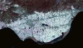
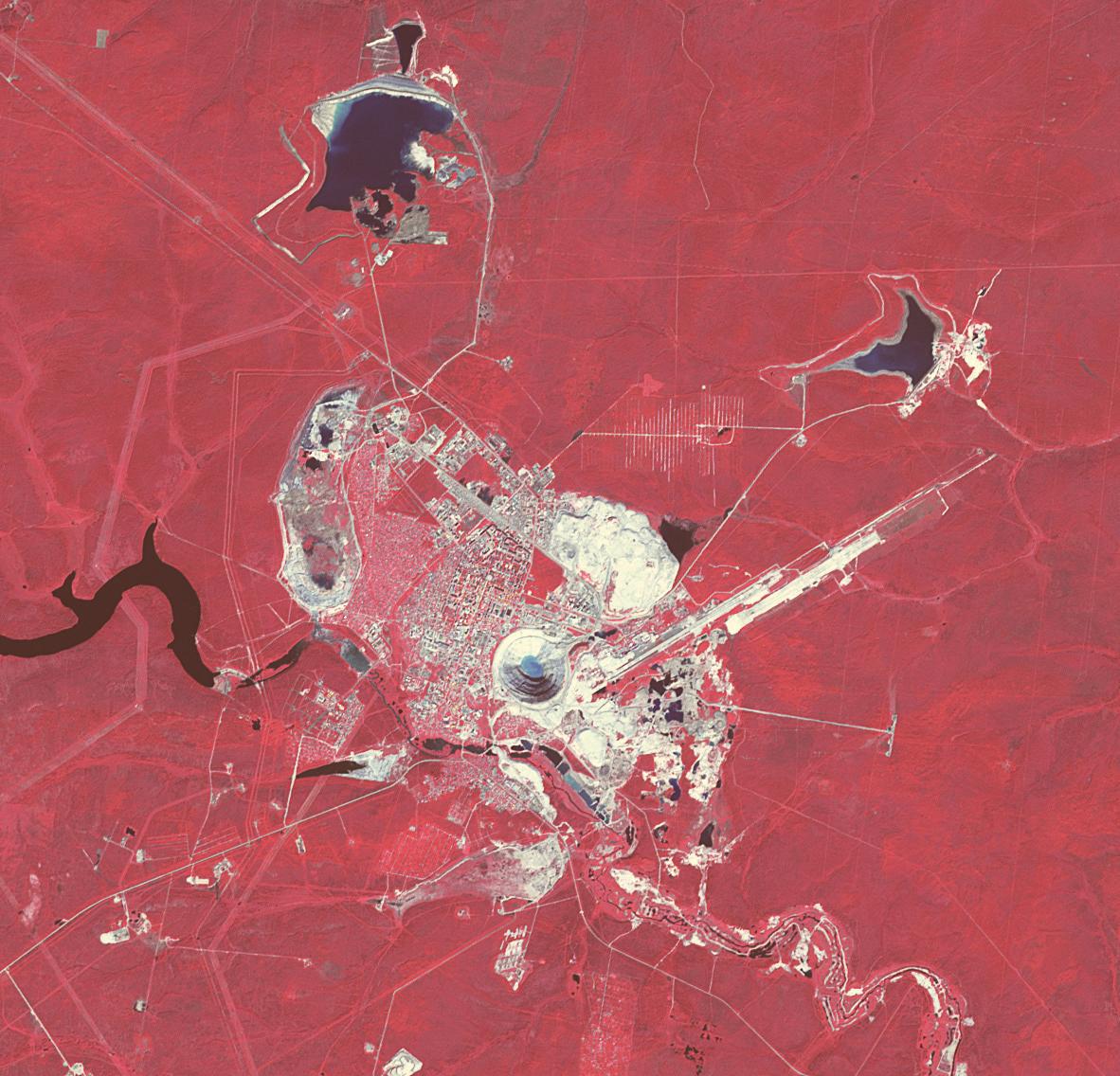
2025-02-11 |
Earth
|
Terra
|
ASTER
|
1435x1918x3 |

|
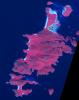
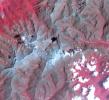
-
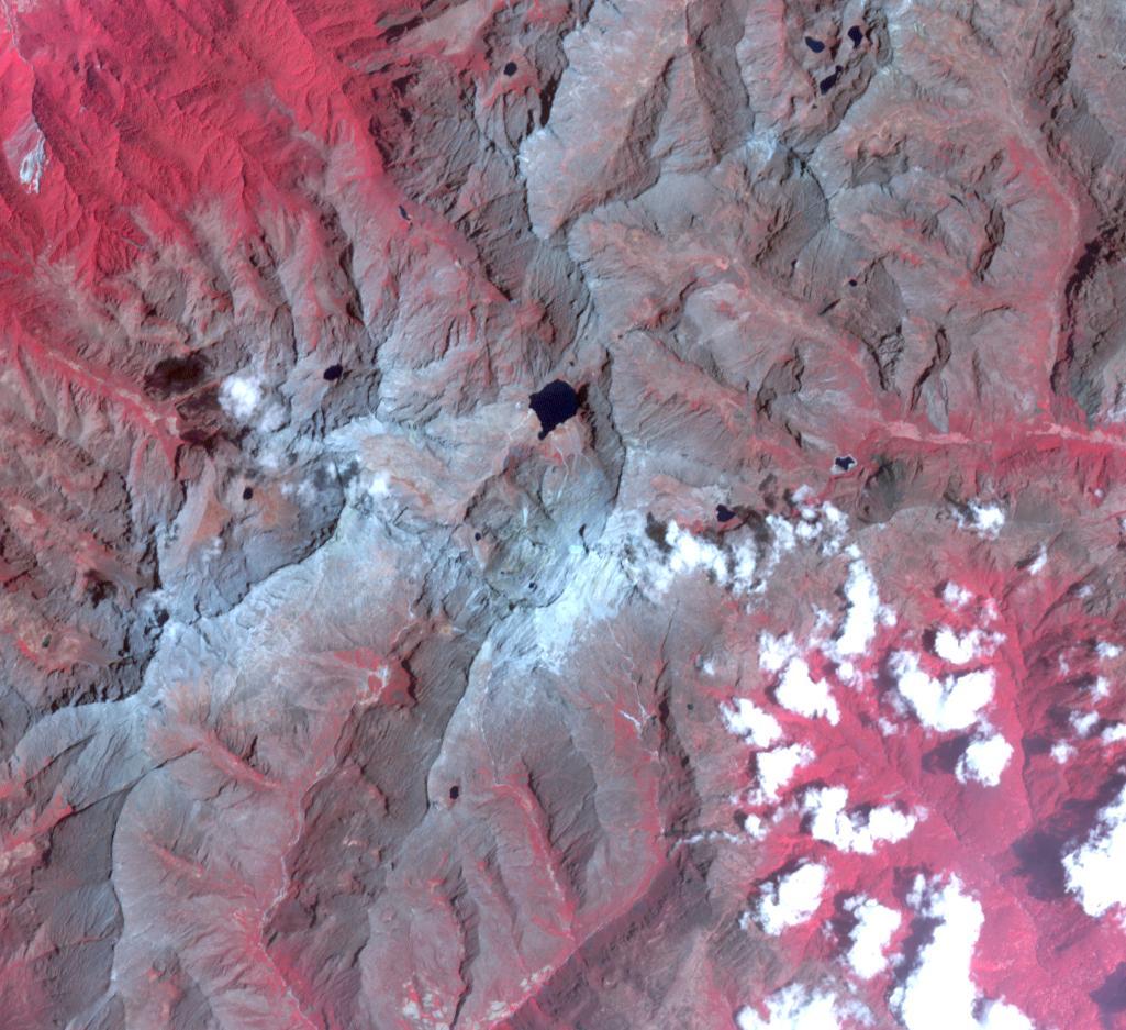
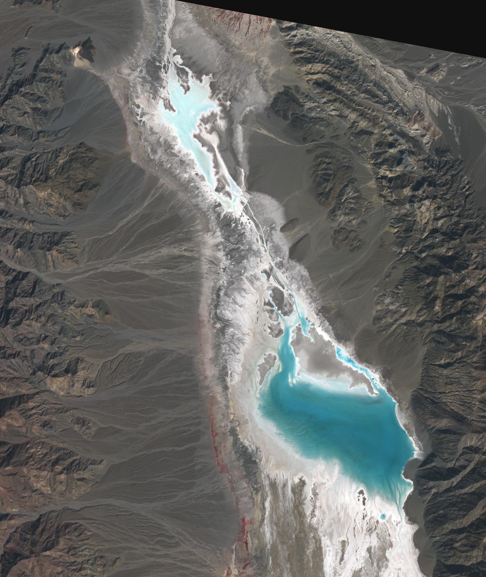
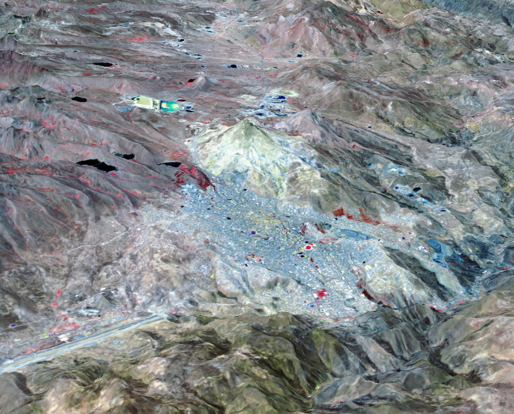
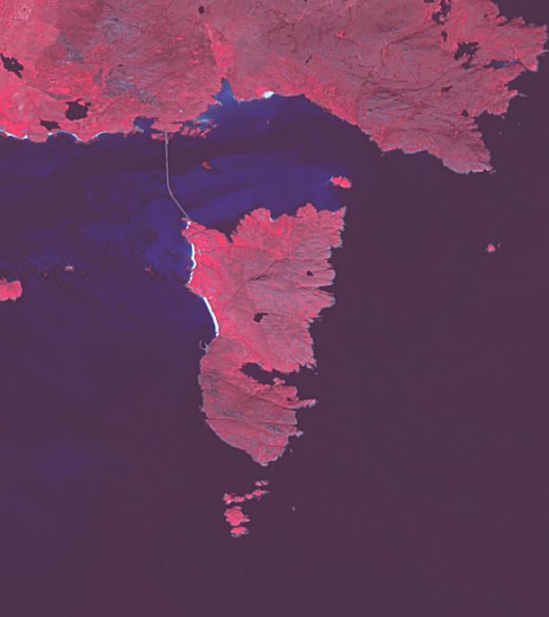
PIA26505:
-
Clayton Valley, NV
Full Resolution:
TIFF
(7.679 MB)
JPEG
(378.5 kB)
|
|
|
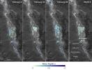
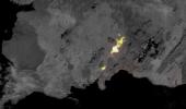
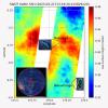
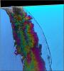
2025-02-10 |
Earth
|
|
InSAR
|
1440x1800x3 |
|
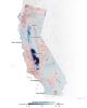
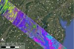
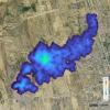
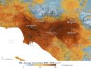
-
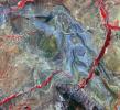
PIA25530:
-
Map of California Subsidence and Uplift
Full Resolution:
TIFF
(3.216 MB)
JPEG
(222.6 kB)
|
|
|
2025-01-31 |
Earth
|
|
UAVSAR
|
1440x1090x3 |
|
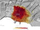
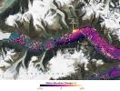
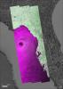
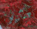
-
PIA26495:
-
NASA Radar Looks at Palos Verdes Landslides
Full Resolution:
TIFF
(2.762 MB)
JPEG
(259.6 kB)
|
|
|
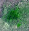
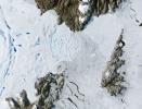
2025-01-30 |
Earth
|
Terra
|
ASTER
|
1922x2378x3 |

|
-
PIA26504:
-
Halemaumau, Kilauea Hawaii
Full Resolution:
TIFF
(12.55 MB)
JPEG
(395.5 kB)
|
|
|
2025-01-06 |
Earth
|
Terra
|
ASTER
|
2805x3876x3 |

|
-
PIA26503:
-
French Overseas Terrritory of Mayotte, Indian Ocean
Full Resolution:
TIFF
(20.02 MB)
JPEG
(840.2 kB)
|
|
|
2024-12-20 |
Earth
|
Terra
|
ASTER
|
1271x1616x3 |
|
-
PIA26502:
-
Barra Airport, Outer Hebrides, U.K.
Full Resolution:
TIFF
(3.589 MB)
JPEG
(132.3 kB)
|
|
|
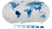
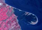
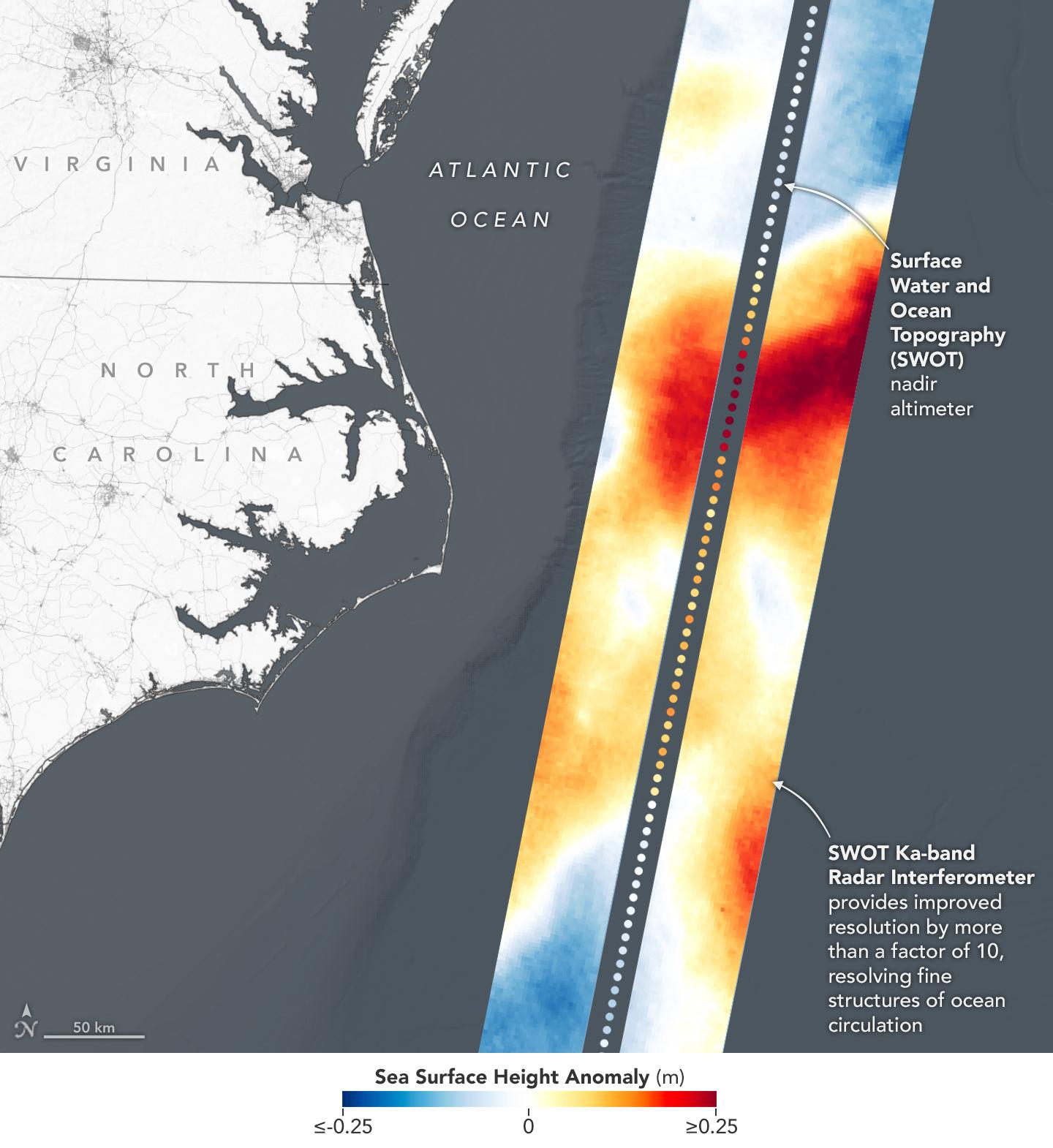
2024-12-17 |
Earth
|
SWOT
|
KaRIn
|
1440x1330x3 |

|
-
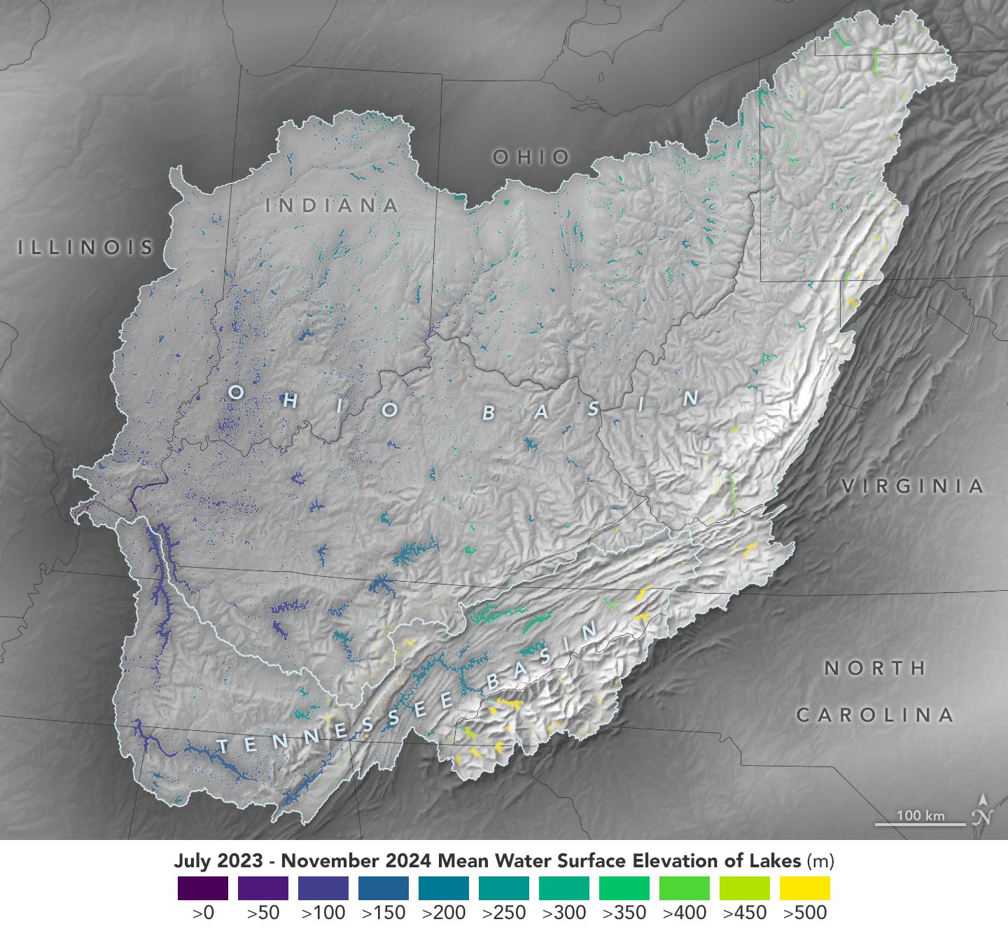
PIA26188:
-
Ohio Basin Lakes Water Levels
Full Resolution:
TIFF
(3.095 MB)
JPEG
(259.9 kB)
|
|
|
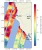
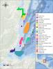
2024-12-11 |
Earth
|
|
|
7831x4404x3 |
|
-
PIA26491:
-
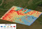
Projections of Saltwater Intrusion in Coastal Watersheds by 2100
Full Resolution:
TIFF
(26.01 MB)
JPEG
(2.08 MB)
|
|
|
2024-11-29 |
Earth
|
Terra
|
ASTER
|
4345x5032x3 |
|
-
PIA26501:
-
Craters of the Moon National Monument, Idaho
Full Resolution:
TIFF
(62.01 MB)
JPEG
(3.164 MB)
|
|
|
2024-11-15 |
Earth
|
Terra
|
ASTER
|
2381x2419x3 |

|
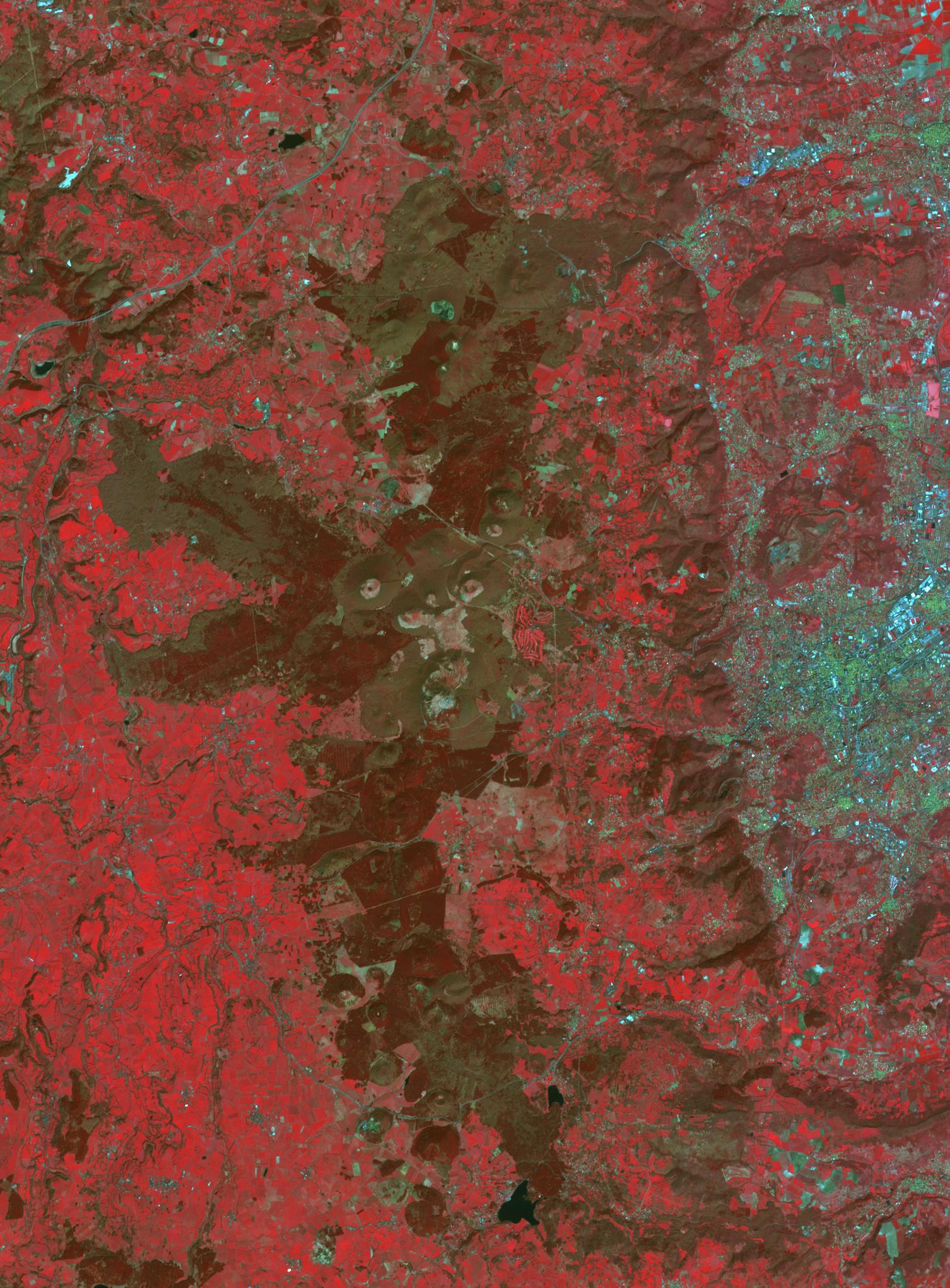
-
PIA26450:
-
Pontic Range, Turkey
Full Resolution:
TIFF
(17.25 MB)
JPEG
(921.4 kB)
|
|
|
2024-11-14 |
Earth
|
Earth Surface Mineral Dust Source Investigation (EMIT)
|
EMIT
|
1771x1179x3 |
|
-
PIA26418:
-
NASA's EMIT Collects Data on Mid-Atlanic Plant Communities
Full Resolution:
TIFF
(6.267 MB)
JPEG
(631.5 kB)
|
|
|
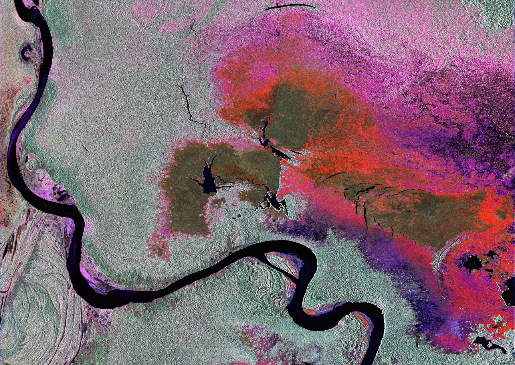
2024-11-14 |
Earth
|
Earth Surface Mineral Dust Source Investigation (EMIT)
|
EMIT
|
1942x1356x3 |
|
-
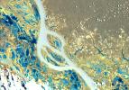
PIA26417:
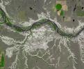
-
NASA's EMIT Scans the Amazon River in Northern Brazil
Full Resolution:
TIFF
(7.903 MB)
JPEG
(575.4 kB)
|
|
|
2024-10-31 |
Earth
|
Terra
|
ASTER
|
1807x2042x3 |
|
-
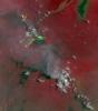
PIA26449:
-
Nyamulagira Volcano, Democratic Republic Congo
Full Resolution:
TIFF
(9.954 MB)
JPEG
(282.2 kB)
|
|
|
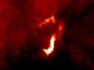
2024-10-31 |
Earth
|
SWOT
|
KaRIn
|
1440x1090x3 |
|
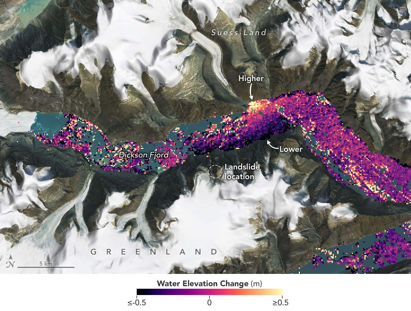
-
PIA26420:
-
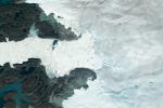
SWOT Captures Planet-Rumbling Greenland Tsunami
Full Resolution:
TIFF
(4.089 MB)
JPEG
(256.9 kB)
|
|
|
2024-10-25 |
Earth
|
Terra
|
ASTER
|
1500x1100x3 |
|
-
PIA26448:
-
Klamath River, OR and CA
Full Resolution:
TIFF
(4.952 MB)
JPEG
(377.9 kB)
|
|
|
2024-10-25 |
Earth
|
Terra
|
ASTER
|
1025x937x3 |
|
-
PIA26447:
-
Humboldt Glacier, Venezuela
Full Resolution:
TIFF
(2.883 MB)
JPEG
(164 kB)
|
|
|
2024-10-17 |
Earth
|
|
|
4928x3264x3 |

|
-
PIA26409:
-
Cryoconite Holes on Matanuska Glacier
Full Resolution:
TIFF
(24.12 MB)
JPEG
(923.8 kB)
|
|
|
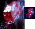
2024-10-10 |
Earth
|
Carbon Mapper Coalition
|
Carbon Mapper Imaging Spectrometer
|
7680x7680x3 |
|
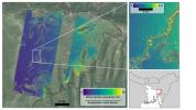
-
PIA26416:
-
Tanager-1 First Methane and Carbon Dioxide Plume Detections
Full Resolution:
TIFF
(161.9 MB)
JPEG
(7.602 MB)
|
|
|
2024-10-09 |
Earth
|
|
ASTER
MODIS
|
1440x1090x3 |
|
-
PIA26415:
-
Particulate Pollution and Warehouses in the Los Angeles Region
Full Resolution:
TIFF
(3.991 MB)
JPEG
(272.1 kB)
|
|
|
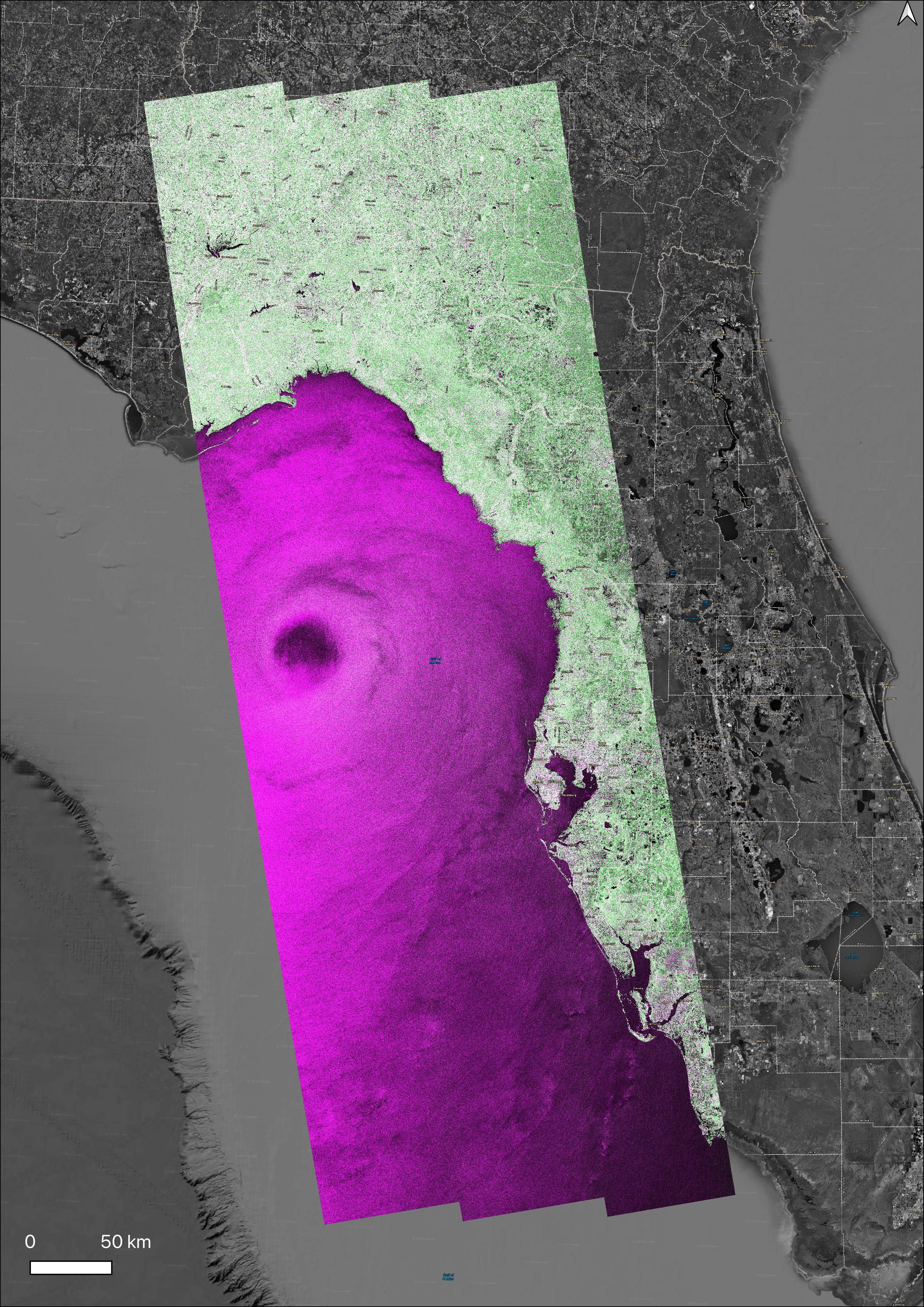
2024-10-02 |
Earth
|
|
SAR
|
2480x3507x3 |
|
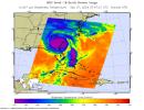
-
PIA26414:
-
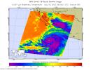
NASA's OPERA Project Generates Radar Image of Hurricane Helene
Full Resolution:
TIFF
(18.81 MB)
JPEG
(2.337 MB)
|
|
|
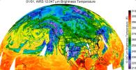
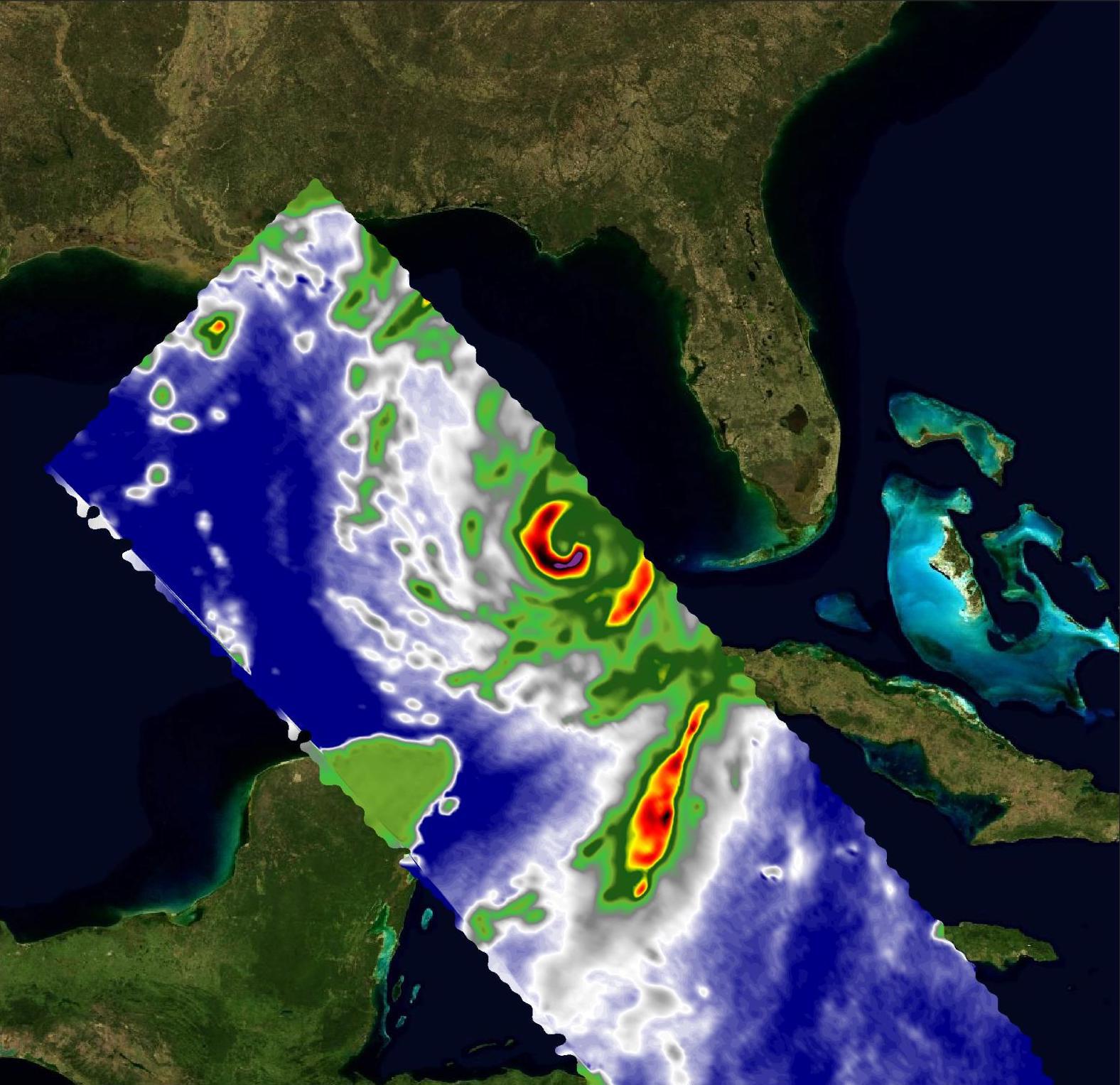
2024-09-27 |
Earth
|
Aqua
|
AIRS
|
900x695x3 |
|
-
PIA26413:
-
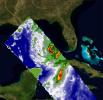
NASA's AIRS Instrument Captures Hurricane Helene
Full Resolution:
TIFF
(805.8 kB)
JPEG
(118 kB)
|
|
|
2024-09-27 |
Earth
|
Terra
|
ASTER
|
1073x1143x3 |
|
-
PIA26395:
-
Araxa Mine, Brazil
Full Resolution:
TIFF
(3.681 MB)
JPEG
(251.1 kB)
|
|
|
2024-09-25 |
Earth
|
Carbon Mapper Coalition
|
Carbon Mapper Imaging Spectrometer
|
1133x1326x3 |
|
-
PIA26412:
-
Tanager-1 First Light
Full Resolution:
TIFF
(2.663 MB)
JPEG
(215.2 kB)
|
|
|
2024-09-13 |
Earth
|
ECOSTRESS
|
|
3507x2480x3 |
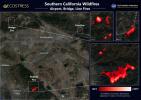
|
-
PIA26187:
-
Southern California Wildfires Captured by NASA's ECOSTRESS
Full Resolution:
TIFF
(19.8 MB)
JPEG
(1.341 MB)
|
|
|
2024-08-30 |
Earth
|
Terra
|
ASTER
|
613x565x3 |
|
-
PIA26394:
-
Terra Cotta Army, China
Full Resolution:
TIFF
(1.04 MB)
JPEG
(103 kB)
|
|
|
2024-08-07 |
Earth
|
Terra
|
ASTER
|
799x773x3 |
|
-
PIA26393:
-
Tofua Island, Tonga Islands
Full Resolution:
TIFF
(1.49 MB)
JPEG
(59.23 kB)
|
|
|
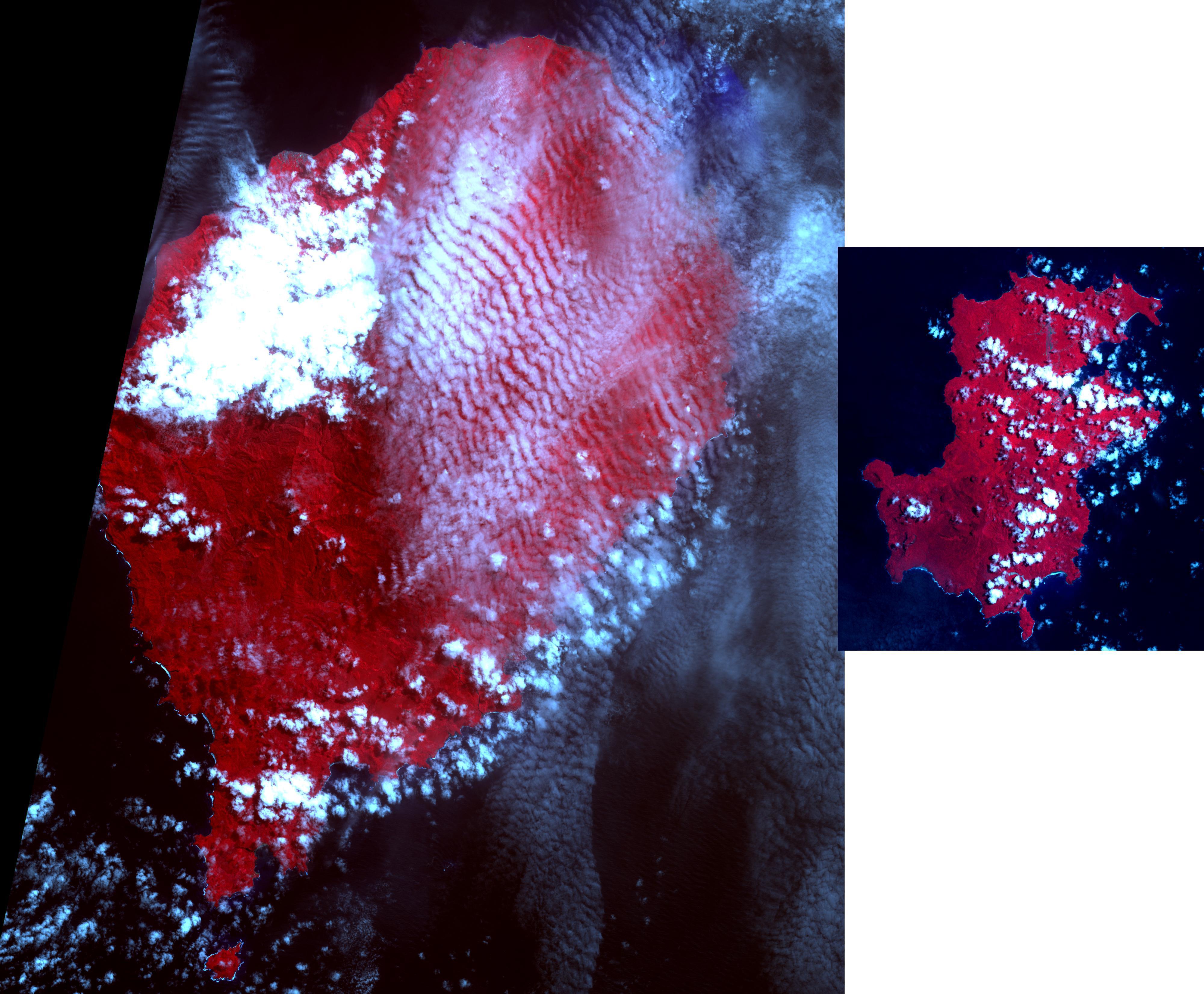
2024-07-19 |
Earth
|
Terra
|
ASTER
|
1777x1921x3 |
|
-
PIA26392:
-
Mount Mabu, Mozambique
Full Resolution:
TIFF
(10.24 MB)
JPEG
(796.9 kB)
|
|
|
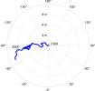
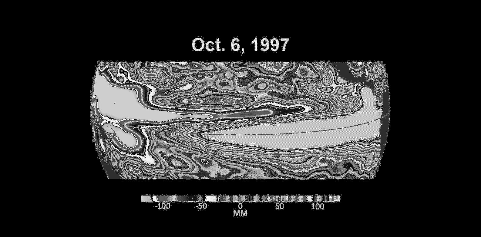
2024-07-19 |
Earth
|
|
|
1654x1578x3 |
|
-
PIA26120:
-
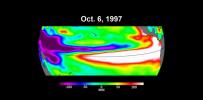
Meandering Path of Earth's Spin Axis
Full Resolution:
TIFF
(362.3 kB)
JPEG
(108.7 kB)
|
|
|
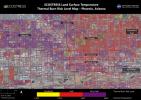
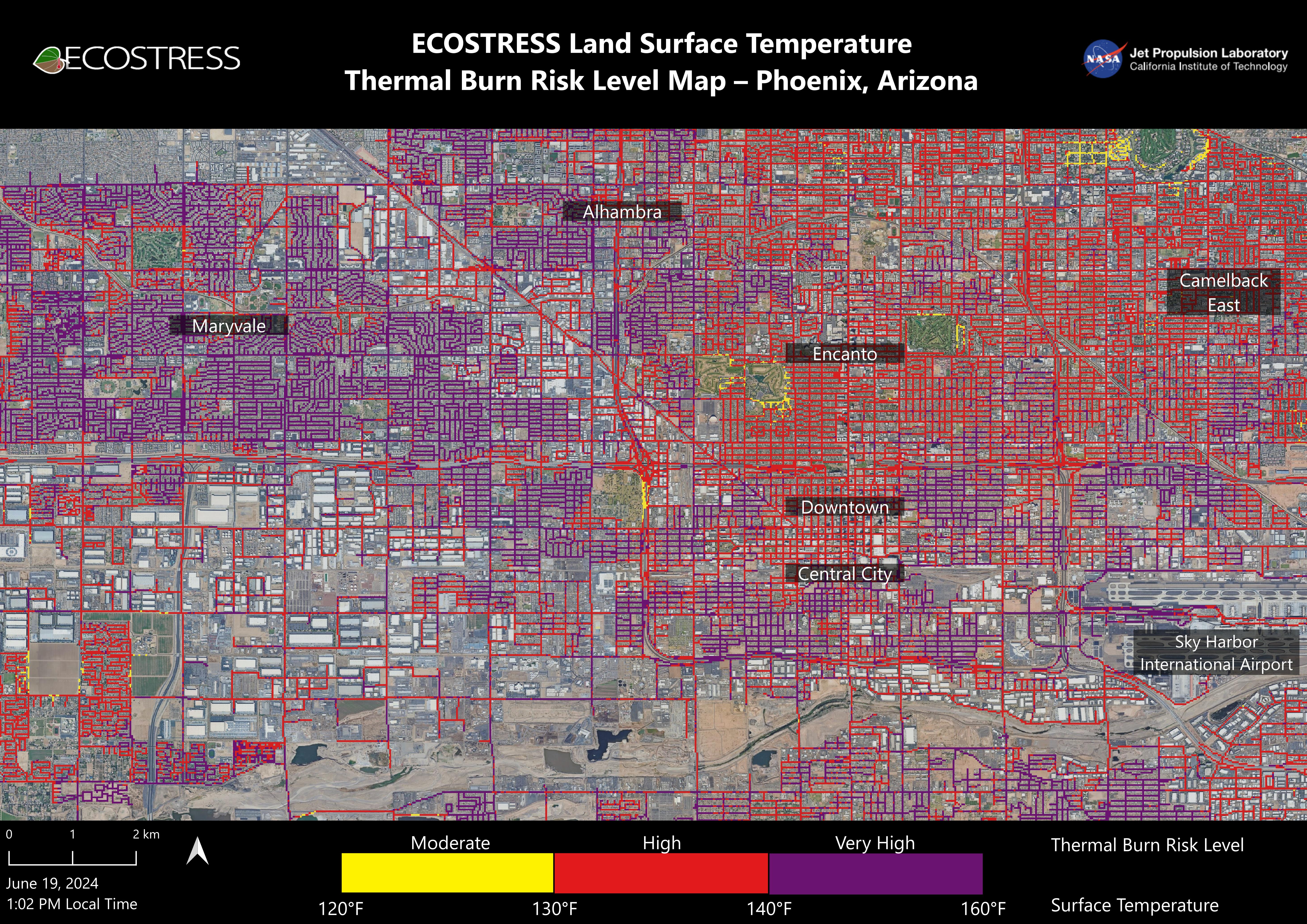
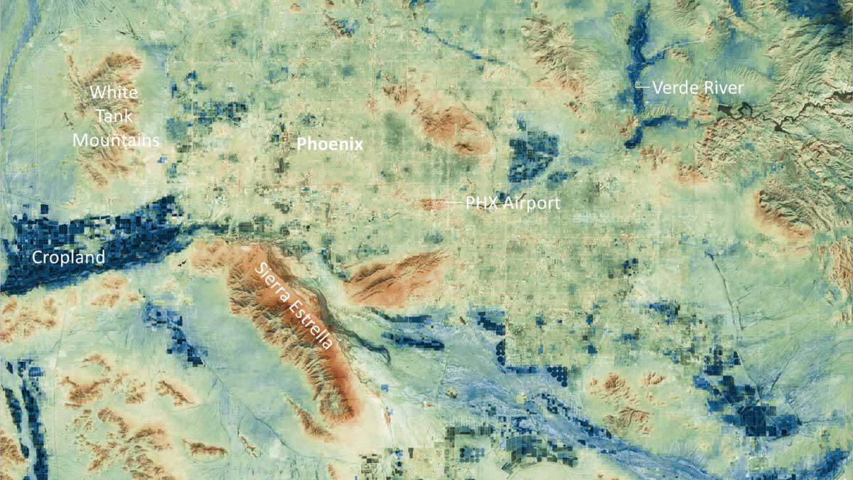
2024-07-02 |
Earth
|
ECOSTRESS
|
ECOSTRESS
|
5846x4133x3 |
|
-
PIA25529:
-
NASA's ECOSTRESS Maps Burn Risk Across Phoenix Streets
Full Resolution:
TIFF
(56.15 MB)
JPEG
(5.17 MB)
|
|
|
2024-06-27 |
Earth
|
Terra
|
ASTER
|
1129x1013x3 |
|
-
PIA26391:
-
Handa Island, Scotland
Full Resolution:
TIFF
(3.026 MB)
JPEG
(189 kB)
|
|
|
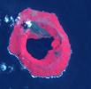
2024-06-21 |
Earth
|
Terra
|
ASTER
|
419x380x3 |

|
-
PIA26326:
-
Fernandina Volcano, Galapagos
Full Resolution:
TIFF
(357.3 kB)
JPEG
(20.66 kB)
|
|
|
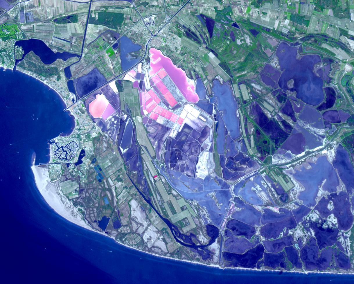
2024-05-30 |
Earth
|
Terra
|
ASTER
|
1219x978x3 |
|
-
PIA26325:
-
Salin-de-Giraud, France
Full Resolution:
TIFF
(3.578 MB)
JPEG
(225.7 kB)
|
|
|
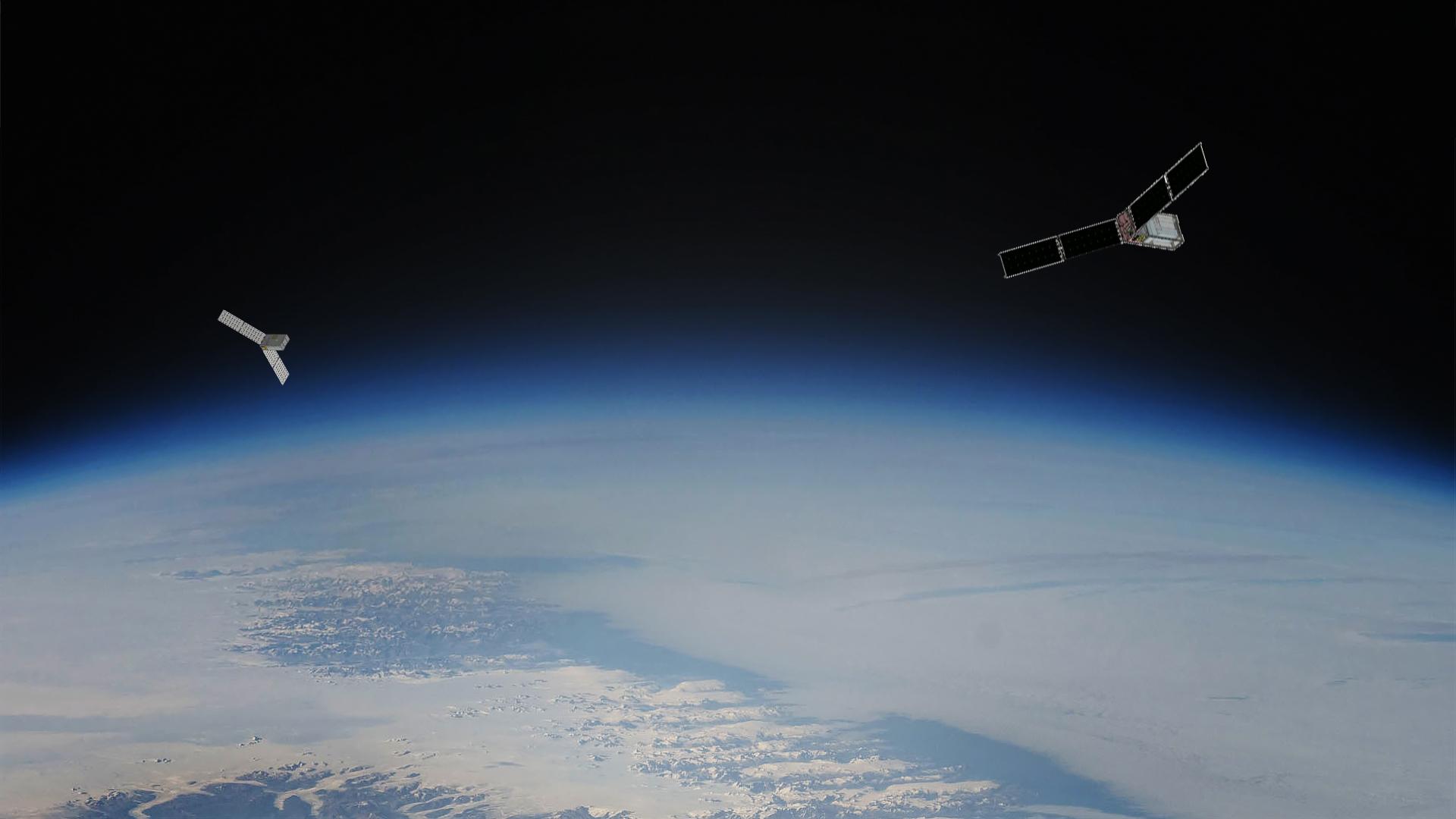
2024-05-21 |
Earth
|
Polar Radiant Energy in the Far-InfraRed Experiment (PREFIRE)
|
|
6720x4480x3 |

|
-
PIA26186:
-
PREFIRE CubeSat Image
Full Resolution:
TIFF
(56.6 MB)
JPEG
(2.543 MB)
|
|
|
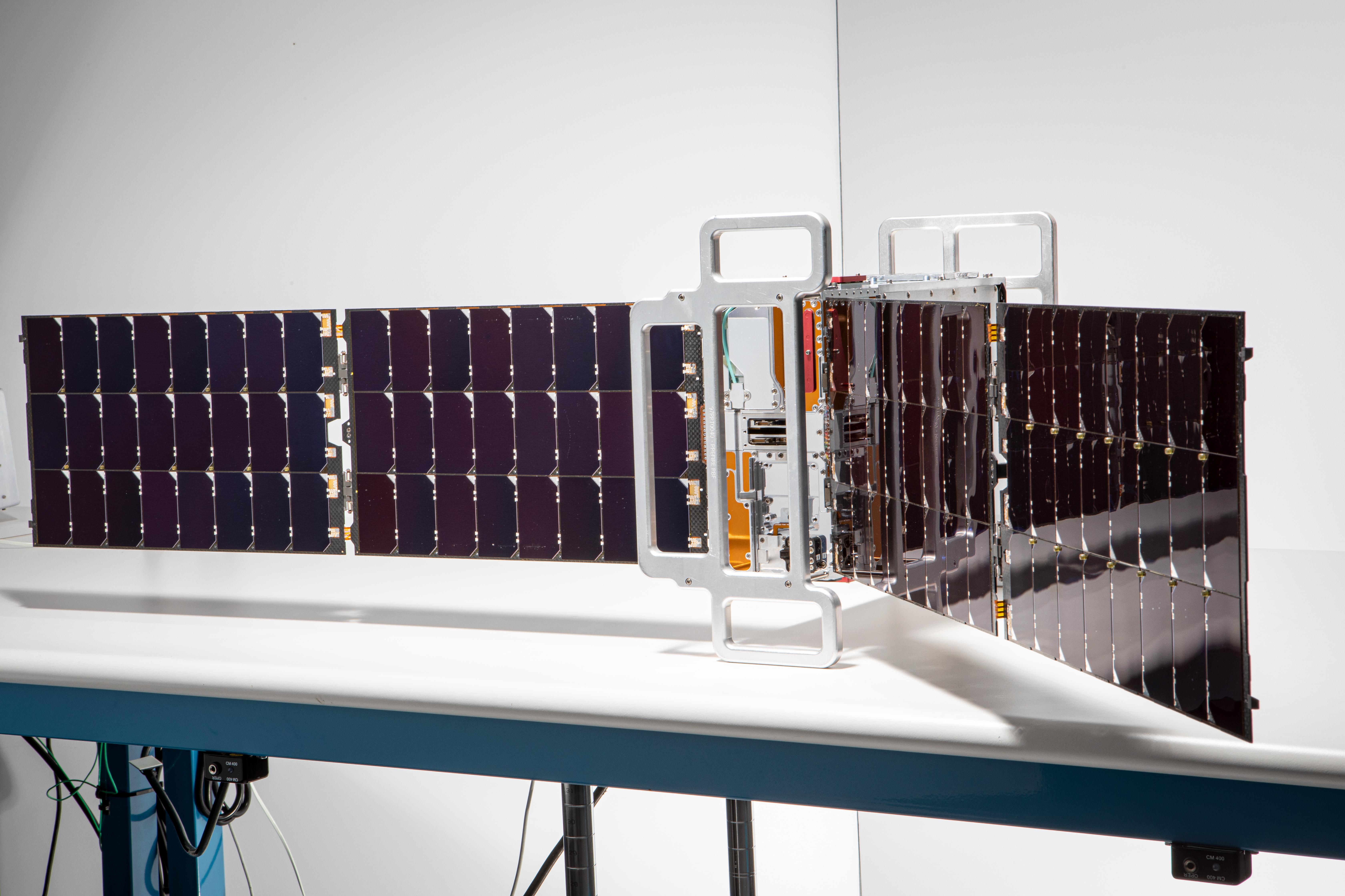
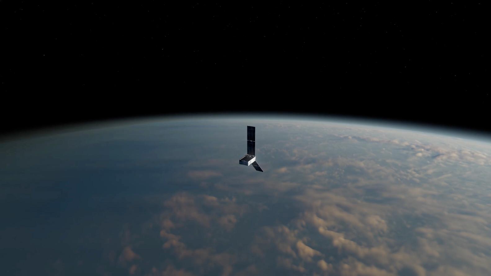
2024-05-15 |
Earth
|
Polar Radiant Energy in the Far-InfraRed Experiment (PREFIRE)
|
|
1583x891x3 |
|
-
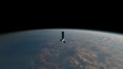
PIA26185:
-
PREFIRE CubeSat in Earth Orbit (Artist's Concept)
Full Resolution:
TIFF
(1.666 MB)
JPEG
(47.7 kB)
|
|
|
2024-05-07 |
Earth
|
SWOT
|
KaRIn
|
4000x2250x3 |
|
-
PIA26343:
-
SWOT Captures Flooding in Bangladesh
Full Resolution:
TIFF
(19.36 MB)
JPEG
(1.312 MB)
|
|
|
2024-04-30 |
Earth
|
Terra
|
ASTER
|
882x726x3 |
|
-
PIA26290:
-
Dinosaur Provincial Park, Canada
Full Resolution:
TIFF
(1.922 MB)
JPEG
(144.4 kB)
|
|
|
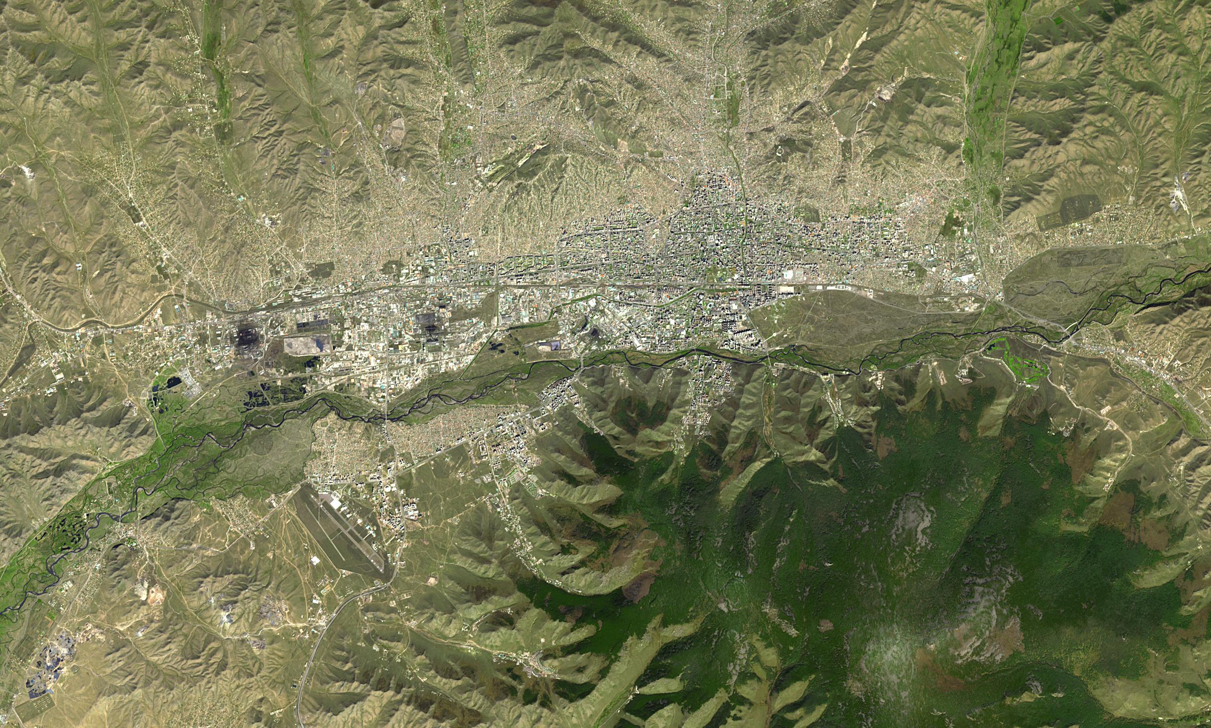
2024-04-26 |
Earth
|
Terra
|
ASTER
|
2441x1468x3 |

|
-
PIA26289:
-
Ulaanbaatar, Mongolia
Full Resolution:
TIFF
(10.75 MB)
JPEG
(854.9 kB)
|
|
|
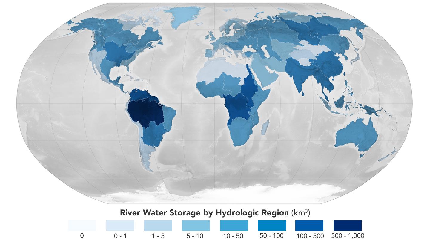
2024-04-26 |
Earth
|
|
|
1440x810x3 |
|
-
PIA26119:
-
Global Accounting of Earth's River Storage and Flow
Full Resolution:
TIFF
(1.377 MB)
JPEG
(104.8 kB)
|
|
|
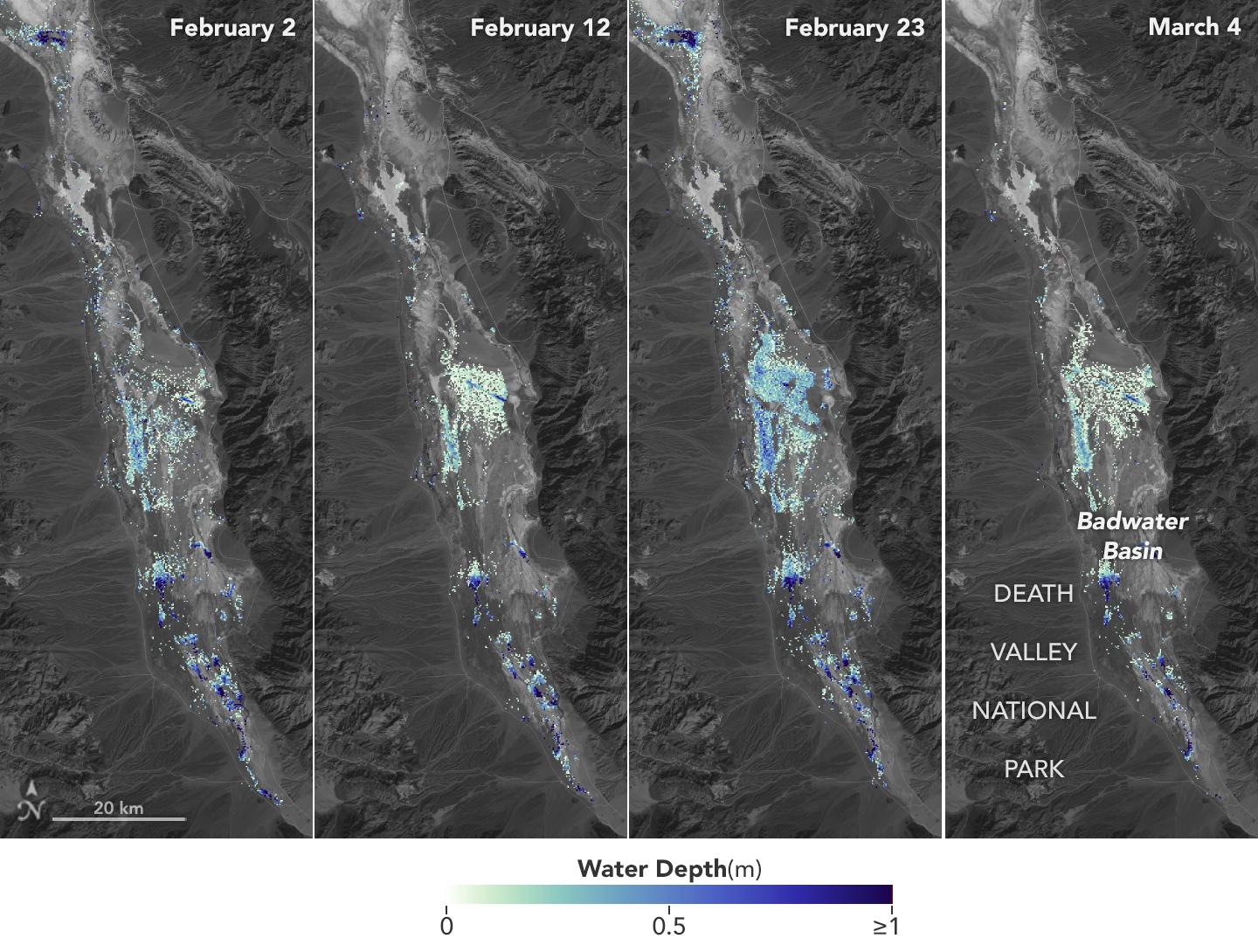
2024-04-15 |
Earth
|
SWOT
|
KaRIn
|
1440x1090x3 |
|
-
PIA26184:
-
SWOT Death Valley Lake Depth
Full Resolution:
TIFF
(2.295 MB)
JPEG
(265.3 kB)
|
|
|
2024-03-29 |
Earth
|
Terra
|
ASTER
|
800x600x3 |
|
-
PIA26288:
-
March 2024 Iceland Eruption
Full Resolution:
TIFF
(958.1 kB)
JPEG
(31.88 kB)
|
|
|
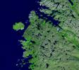
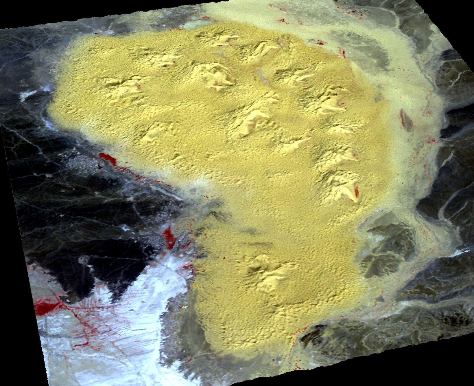
2024-03-26 |
Earth
|
Terra
|
ASTER
|
1639x1333x3 |

|
-
PIA26287:
-
Star Dunes, Morocco
Full Resolution:
TIFF
(6.557 MB)
JPEG
(367.1 kB)
|
|
|
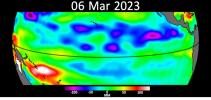
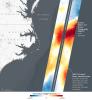
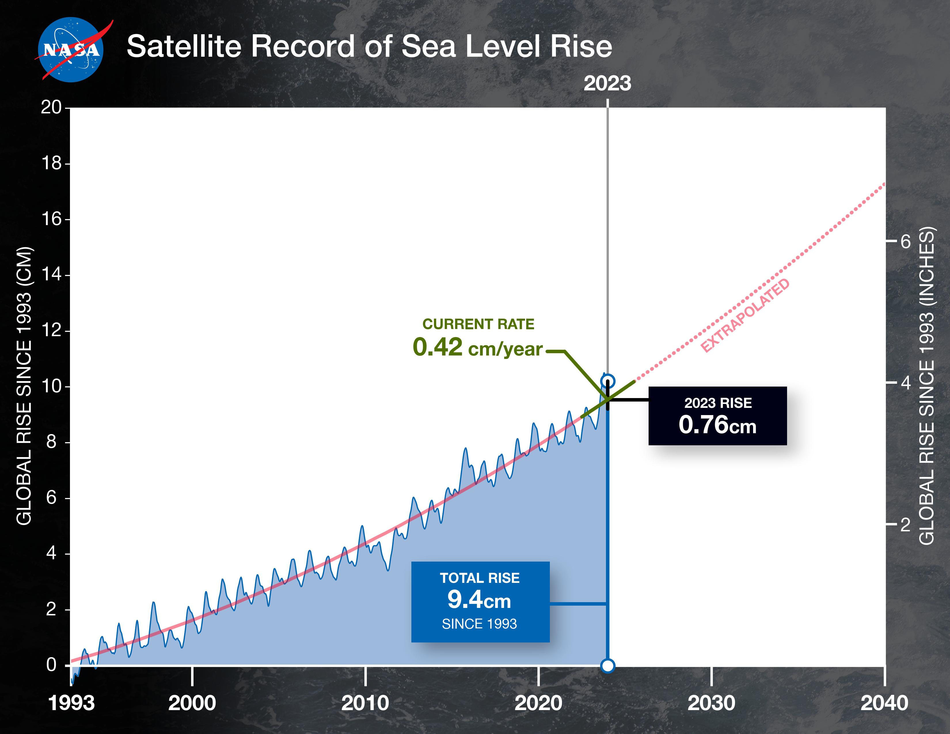
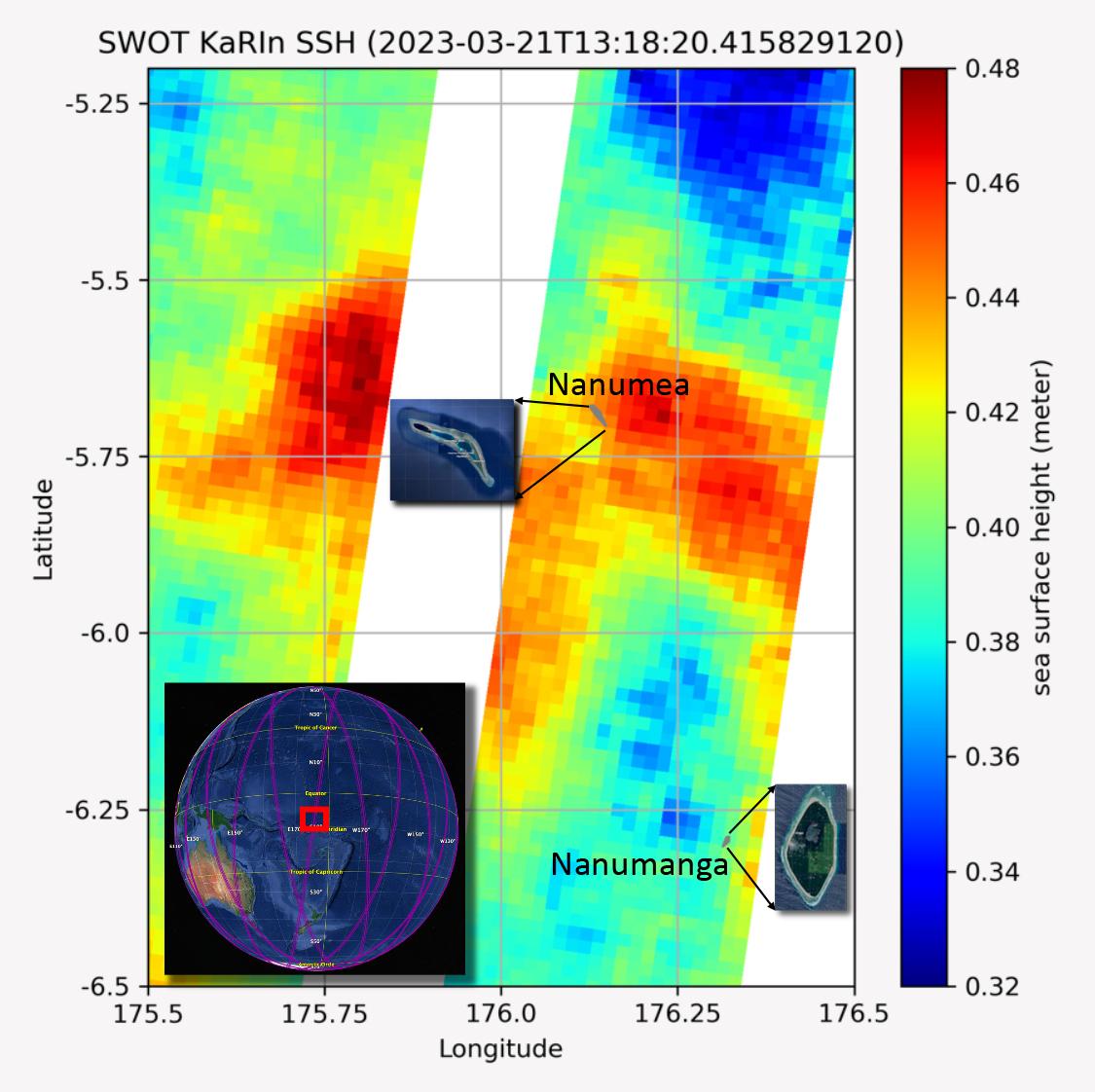
2024-03-21 |
Earth
|
TOPEX/Poseidon
Sentinel-6 Michael Freilich
|
|
3300x2550x3 |
|
-
PIA26183:
-
2023 Sea Level Rise Update
Full Resolution:
TIFF
(5.199 MB)
JPEG
(459.8 kB)
|
|
|
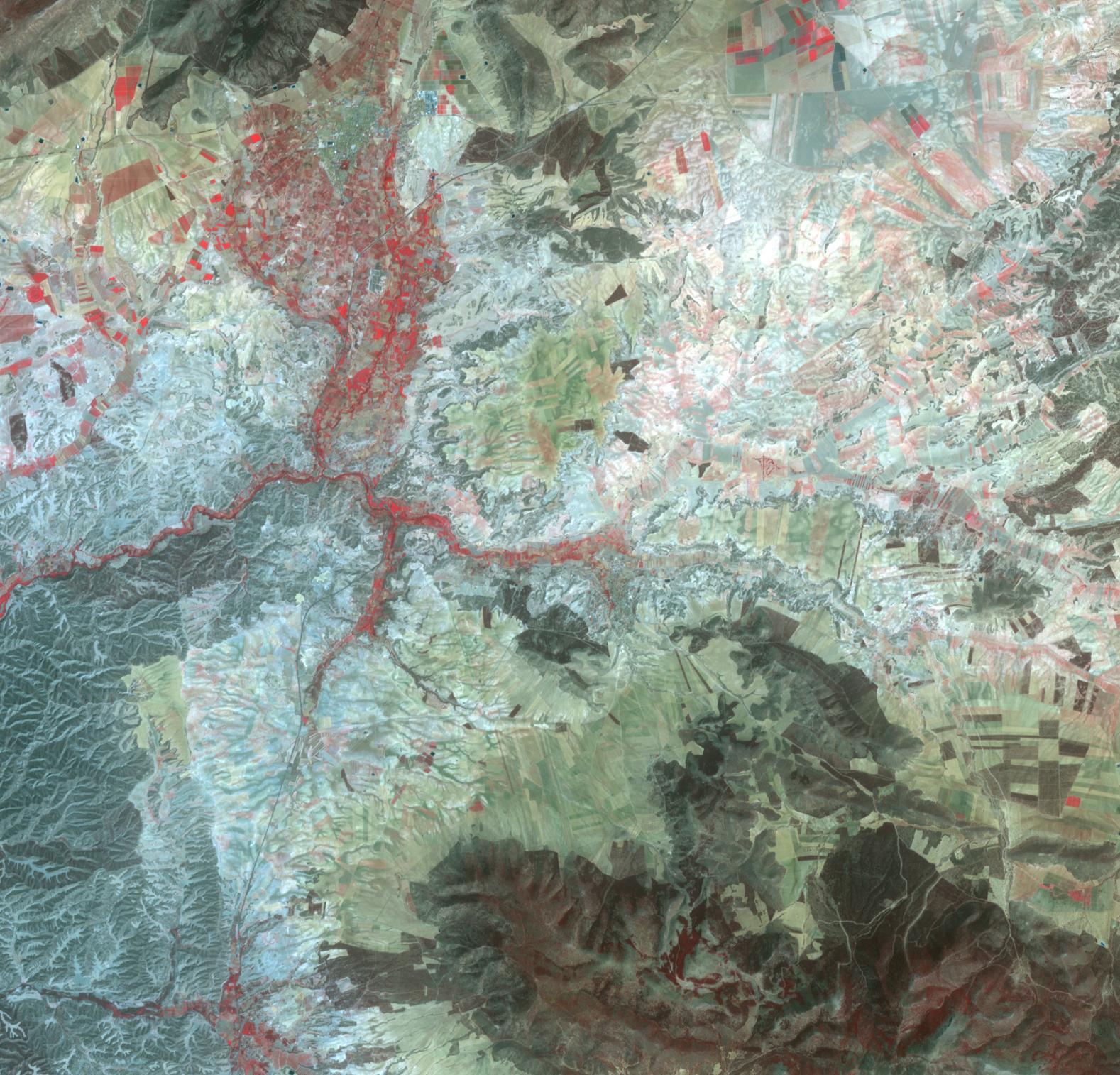
2024-03-21 |
Earth
|
Terra
|
ASTER
|
1578x1514x3 |

|
-
PIA26286:
-
Orce, Spain
Full Resolution:
TIFF
(7.17 MB)
JPEG
(425.4 kB)
|
|
|
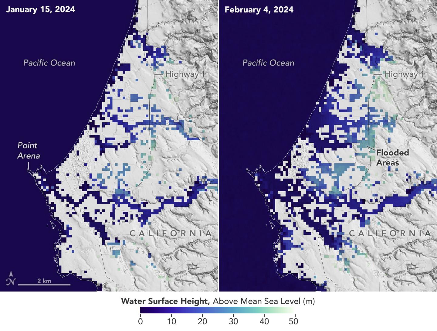
2024-03-05 |
Earth
|
SWOT
|
KaRIn
|
1440x1090x3 |
|
-
PIA26182:
-
California Coastal Flooding Captured in SWOT Data
Full Resolution:
TIFF
(2.527 MB)
JPEG
(255.1 kB)
|
|
|
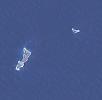
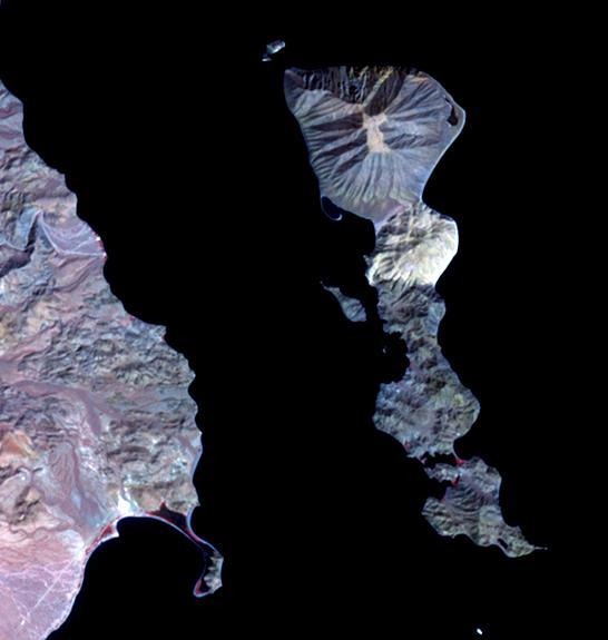
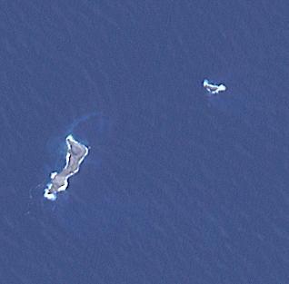
2024-02-27 |
Earth
|
Terra
|
ASTER
|
546x575x3 |
|
-
PIA26284:
-
Smith Island, Gulf of California
Full Resolution:
TIFF
(393.5 kB)
JPEG
(29.75 kB)
|
|
|
2024-02-15 |
Earth
|
Terra
|
ASTER
|
2016x1184x3 |
|
-
PIA26283:
-
Grindavik, Iceland Eruption
Full Resolution:
TIFF
(3.026 MB)
JPEG
(243.4 kB)
|
|
|
2024-01-29 |
Earth
|
Terra
|
ASTER
|
2700x3500x3 |

|
-
PIA26282:
-
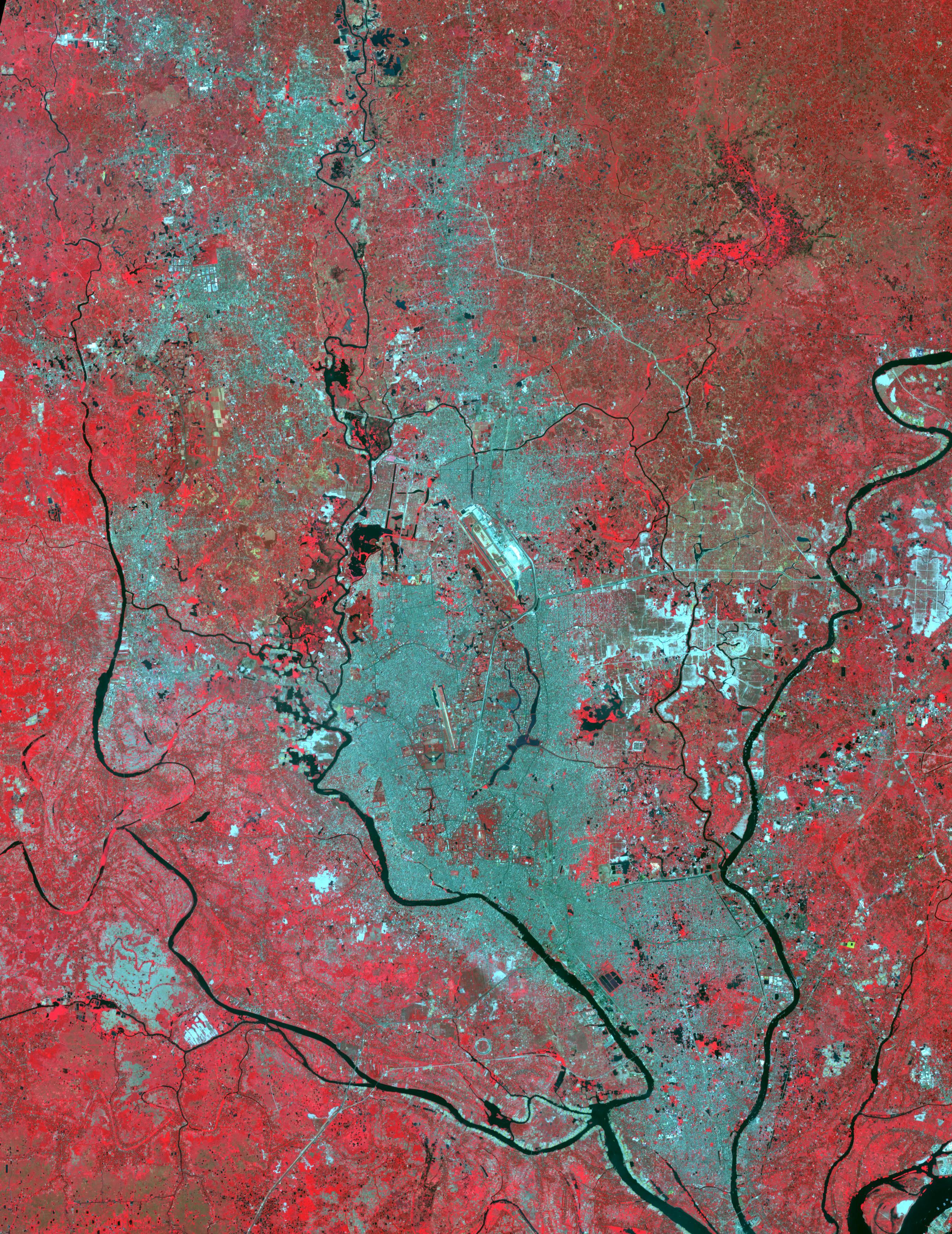
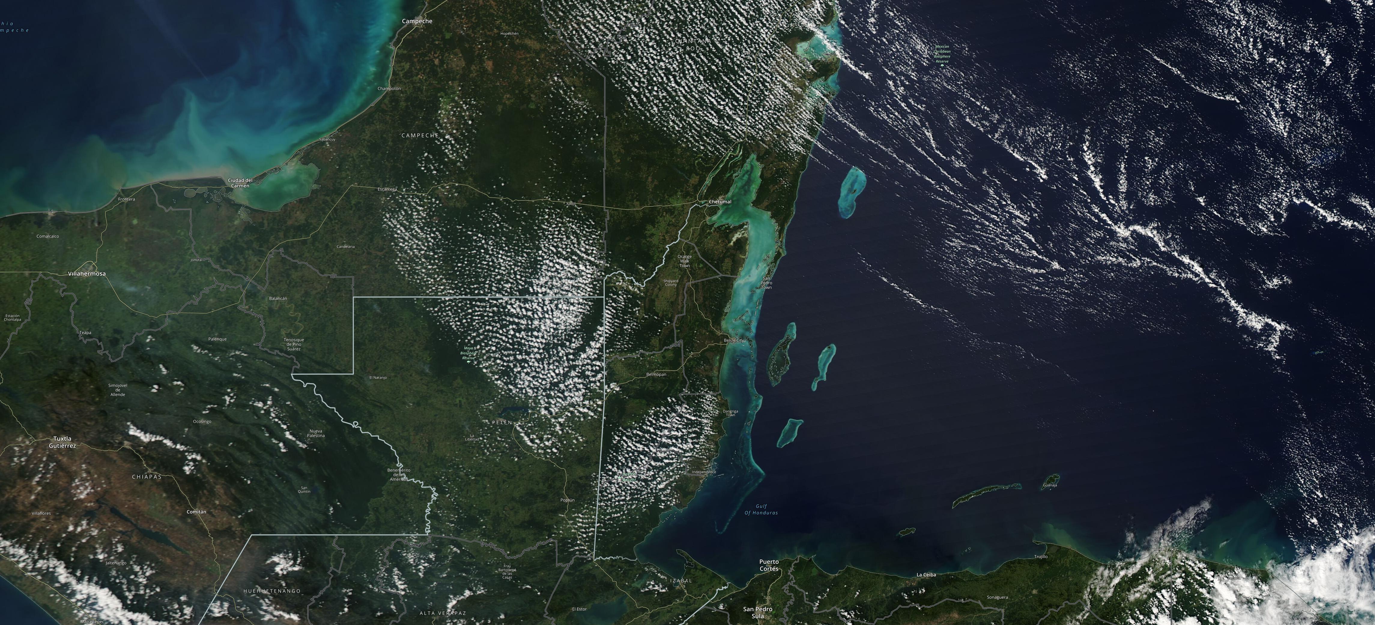
Rupganj, Bangladesh
Full Resolution:
TIFF
(28.36 MB)
JPEG
(2.267 MB)
|
|
|
2024-01-17 |
Earth
|
Landsat
|
|
1440x1100x3 |
|
-
PIA26118:
-
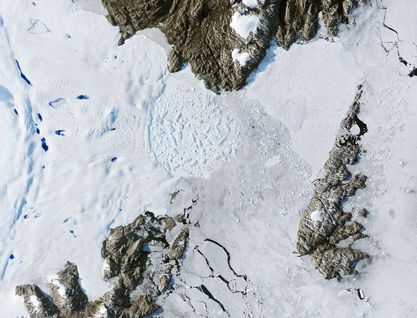
Retreat of Greenland's Zachariae Isstrom Glacier
Full Resolution:
TIFF
(4.298 MB)
JPEG
(315.8 kB)
|
|
|
2024-01-17 |
Earth
|
Landsat
|
|
1440x960x3 |
|
-
PIA26117:
-
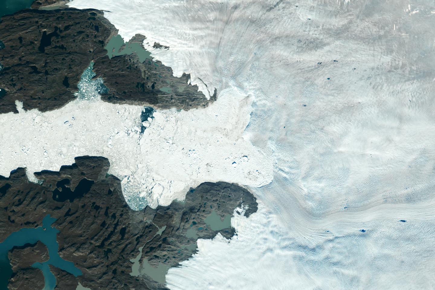
Retreat of Greenland's Jakobshavn Isbrae Glacier
Full Resolution:
TIFF
(4.134 MB)
JPEG
(231.5 kB)
|
|
|
2024-01-11 |
Earth
|
Terra
|
ASTER
|
1348x1320x3 |

|
-
PIA26281:
-
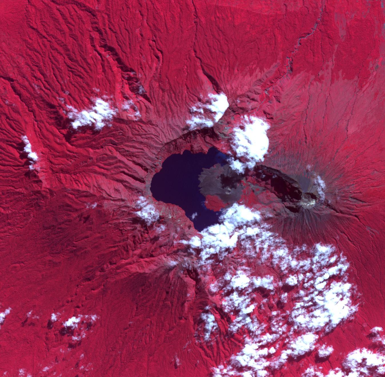
Rinjani Caldera, Indonesia
Full Resolution:
TIFF
(5.34 MB)
JPEG
(286.4 kB)
|
|
|
2023-12-14 |
Earth
|
Terra
|
ASTER
|
1600x1900x3 |

|
-
PIA26197:
-
Badwater, Death Valley
Full Resolution:
TIFF
(7.76 MB)
JPEG
(376.6 kB)
|
|
|
2023-12-11 |
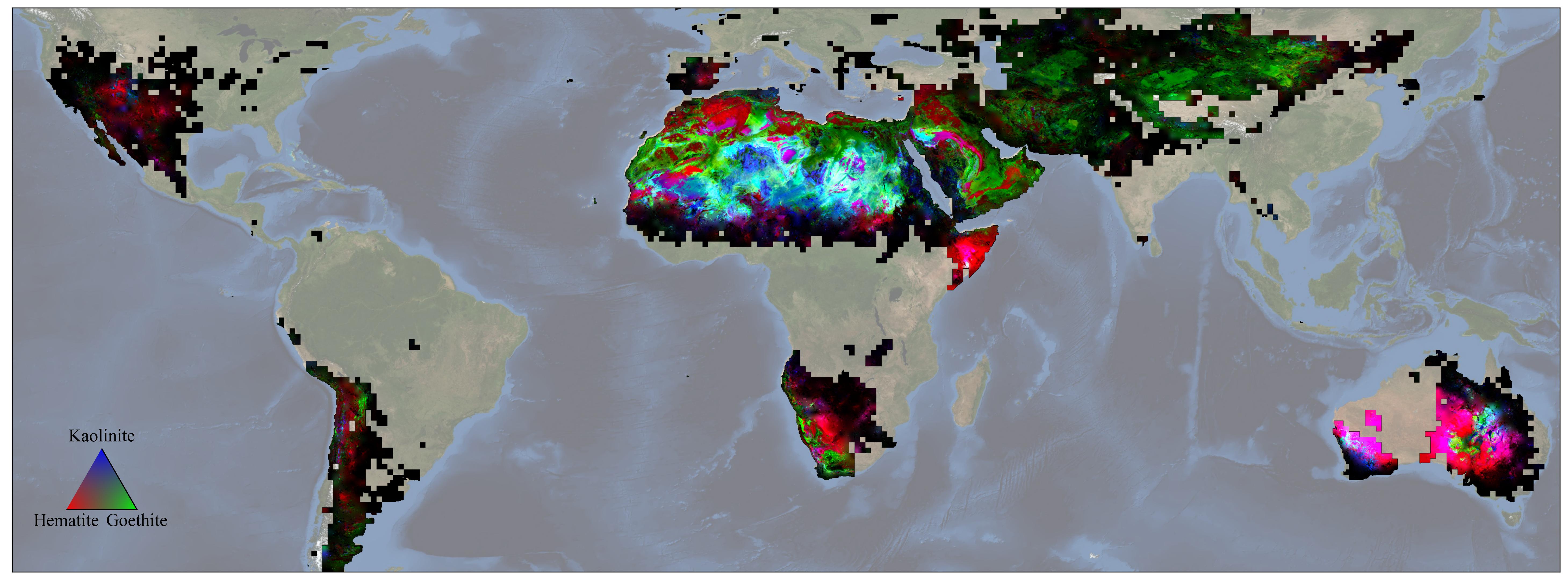
Earth
|
Earth Surface Mineral Dust Source Investigation (EMIT)
|
EMIT
|
5836x2174x3 |
|
-
PIA26116:
-
NASA's EMIT Mission Produces Maps of Arid Region Surface Minerals
Full Resolution:
TIFF
(21.27 MB)
JPEG
(819.1 kB)
|
|
|
2023-11-17 |
Earth
|
Earth Surface Mineral Dust Source Investigation (EMIT)
|
EMIT
|
3499x1700x3 |
|
-
PIA26113:
-
EMIT Identifying Methane Plumes Around the Globe
Full Resolution:
TIFF
(17.85 MB)
JPEG
(1.131 MB)
|
|
|
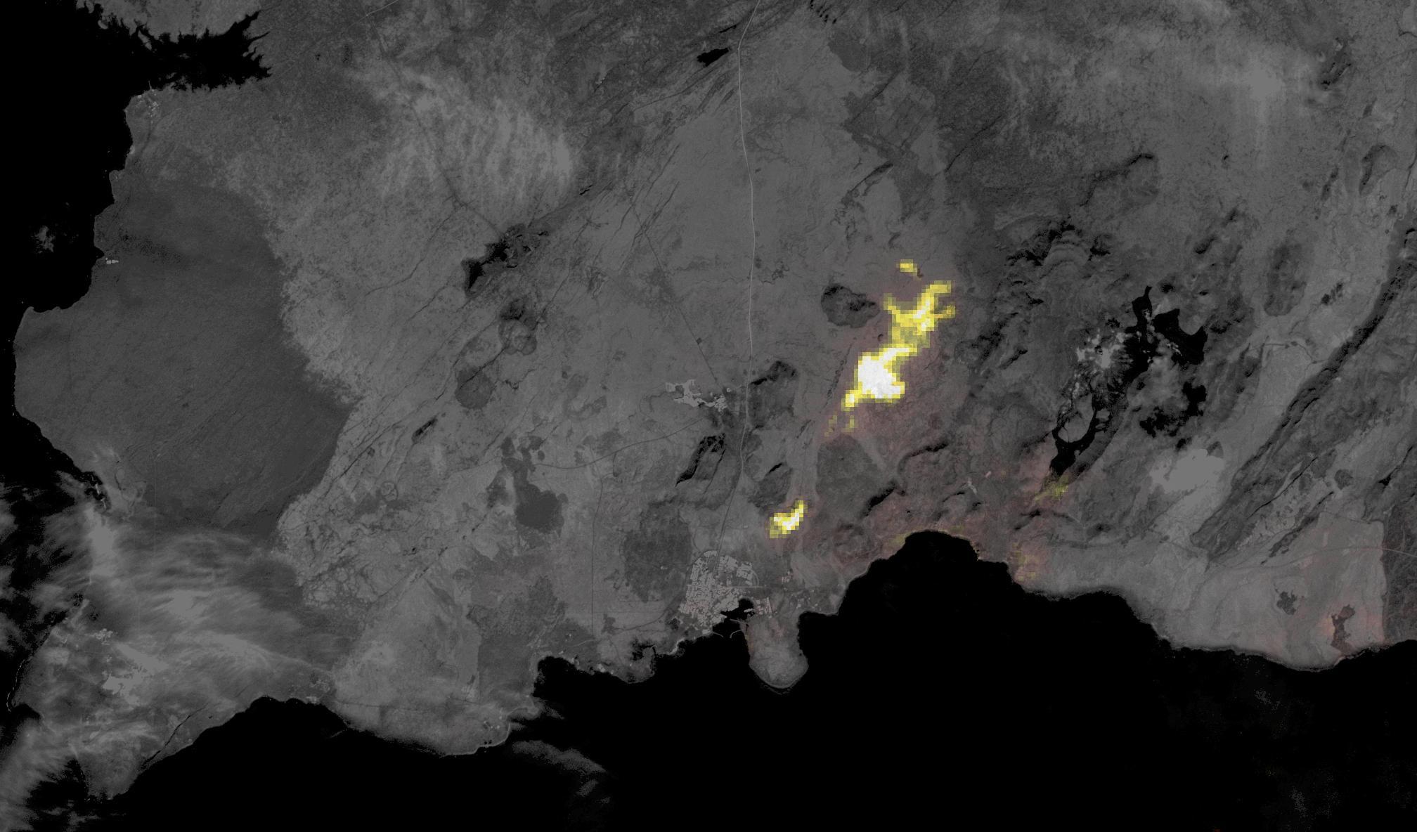
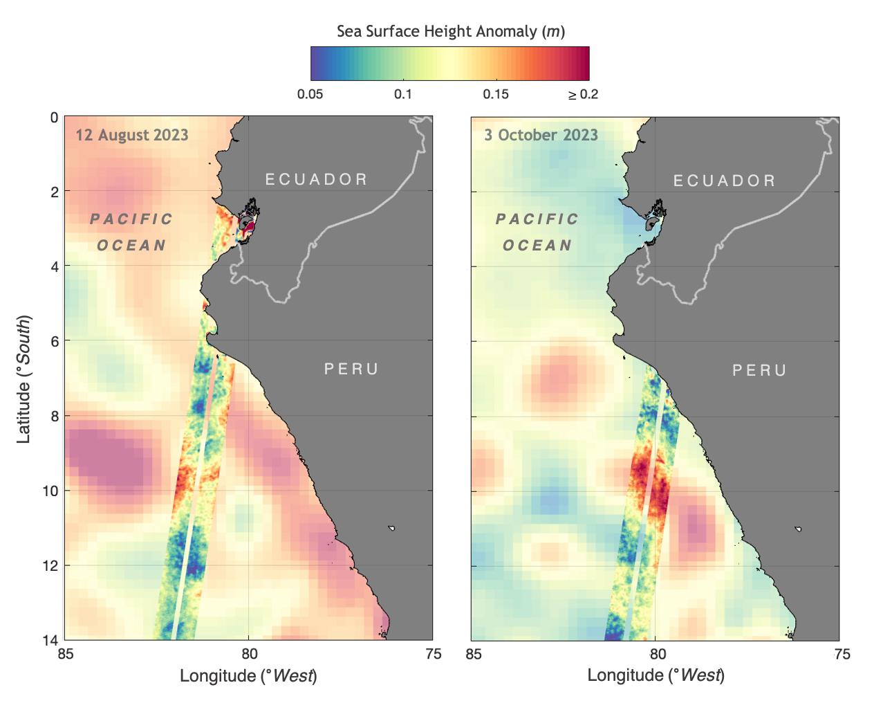
2023-11-08 |
Earth
|
SWOT
|
KaRIn
|
1264x1029x3 |
|
-
PIA26181:
-
SWOT Monitors El Niño off Peru
Full Resolution:
TIFF
(1.206 MB)
JPEG
(101.7 kB)
|
|
|
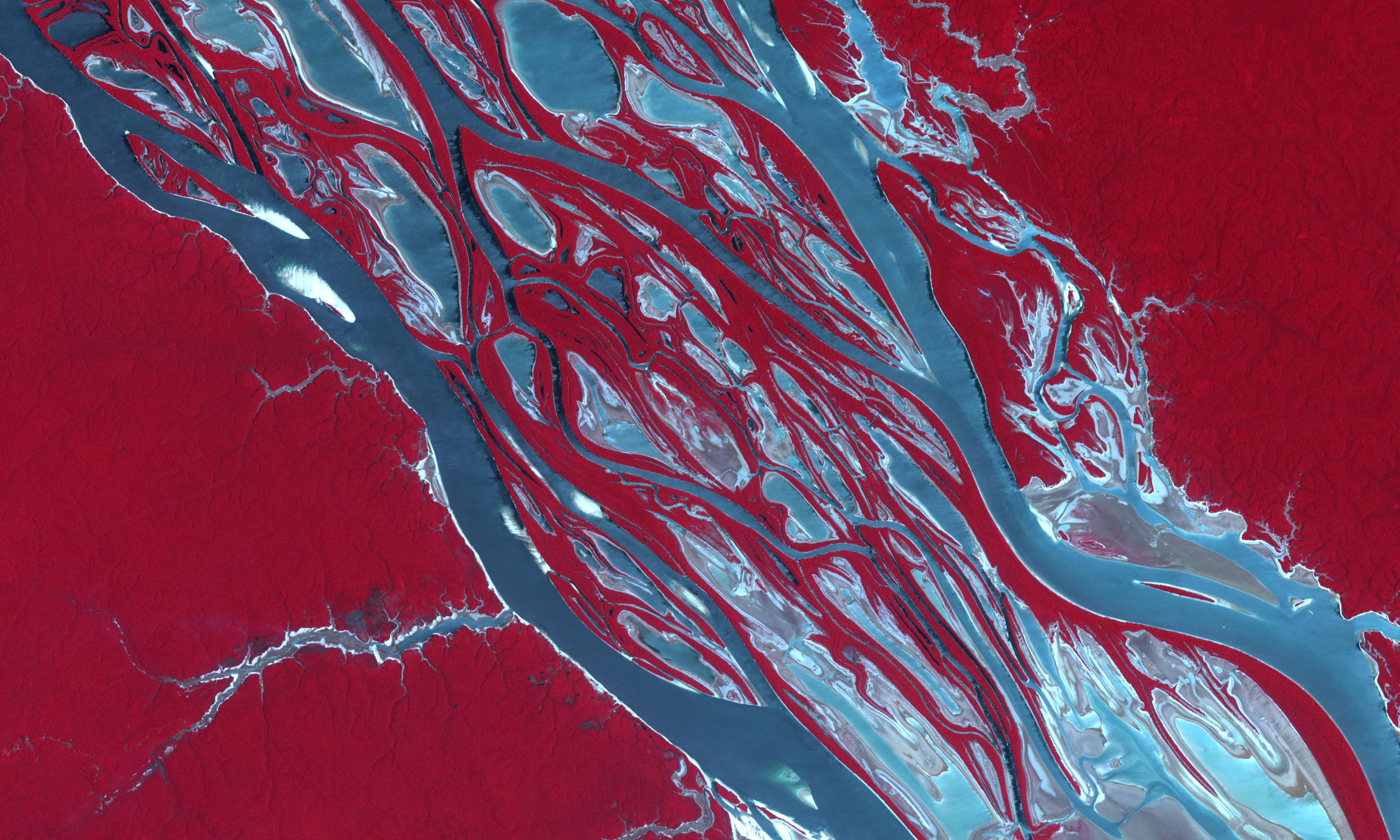
2023-11-03 |
Earth
|
Terra
|
ASTER
|
3000x1800x3 |
|
-
PIA26196:
-
Amazon Drought
Full Resolution:
TIFF
(16.21 MB)
JPEG
(799.4 kB)
|
|
|
2023-10-30 |
Earth
|
SWOT
|
KaRIn
|
1920x1080x3 |

|
-
PIA26100:
-
SWOT's Detailed View of Global Sea Level
Full Resolution:
TIFF
(2.393 MB)
JPEG
(137.4 kB)
|
|
|
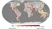
2023-10-27 |
Earth
|
NISAR
|
|
1800x1275x3 |
|
-
PIA26112:
-
Radar Image of Amazonian Flooding Similar to Future NISAR Imagery
Full Resolution:
TIFF
(6.888 MB)
JPEG
(808.4 kB)
|
|
|
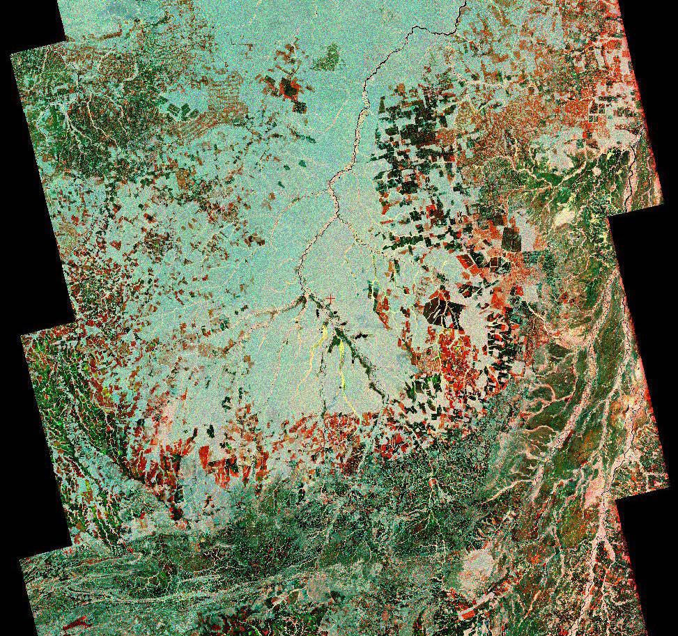
2023-10-27 |
Earth
|
NISAR
|
|
973x913x3 |
|
-
PIA26111:
-
Composite of Brazil's 'Arc of Deforestation' Shows Imagery NISAR Will Produce
Full Resolution:
TIFF
(2.666 MB)
JPEG
(396.6 kB)
|
|
|
2023-10-18 |
Earth
|
Sentinel-6/Jason-CS
|
|
1586x783x3 |
|
-
PIA26099:
-
Comparing Sea Level During El Niño Events
Full Resolution:
TIFF
(303.4 kB)
JPEG
(200.3 kB)
|
|
|
2023-10-18 |
Earth
|
Terra
|
ASTER
|
1528x1825x3 |
|
-
PIA26009:
-
Mar Menor, Spain
Full Resolution:
TIFF
(6.95 MB)
JPEG
(304.1 kB)
|
|
|
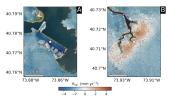
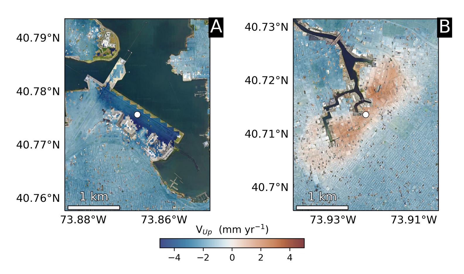
2023-09-27 |
Earth
|
|
InSAR
|
1584x934x3 |
|
-
PIA25528:
-
Hot Spots of Subsidence, Uplift in New York City
Full Resolution:
TIFF
(2.374 MB)
JPEG
(173.7 kB)
|
|
|
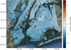
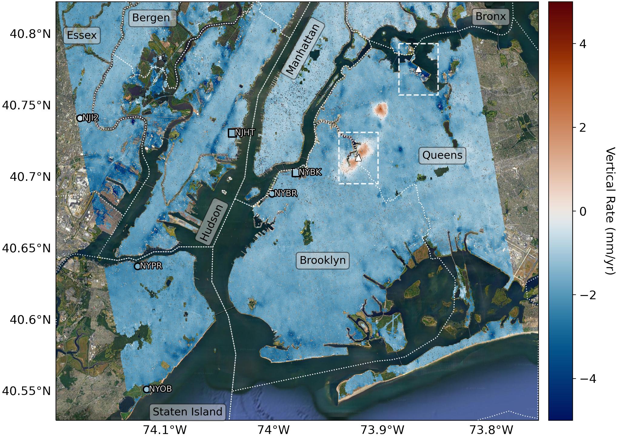
2023-09-27 |
Earth
|
|
InSAR
|
2036x1446x3 |
|
-
PIA25527:
-
Map of New York City Subsidence and Uplift
Full Resolution:
TIFF
(7.442 MB)
JPEG
(516.4 kB)
|
|
|
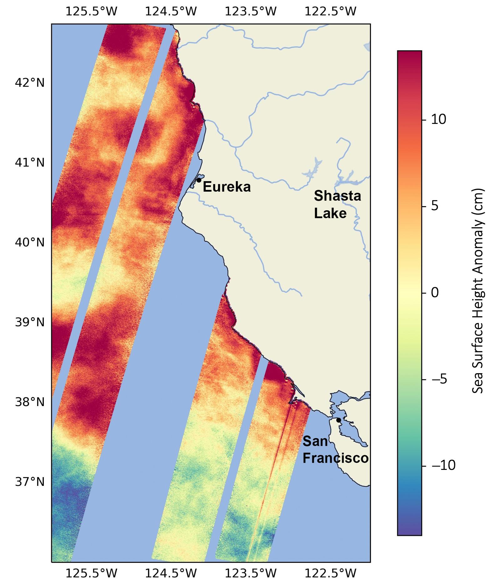
2023-09-19 |
Earth
|
SWOT
|
KaRIn
|
1570x1870x3 |
|
-
PIA26091:
-
SWOT Monitors Warming Waters Off California Coast
Full Resolution:
TIFF
(4.064 MB)
JPEG
(286.6 kB)
|
|
|
2023-09-11 |
Earth
|
Terra
|
ASTER
|
3257x2677x3 |
|
-
PIA26008:
-
Channeled Scablands, Washington
Full Resolution:
TIFF
(26.17 MB)
JPEG
(1.811 MB)
|
|
|
2023-08-30 |
Earth
|
Surface Water and Ocean Topography (SWOT)
|
KaRIn
|
2794x1934x3 |
|
-
PIA25780:
-
SWOT Captures the Yukon River in Alaska
Full Resolution:
TIFF
(16.22 MB)
JPEG
(1.293 MB)
|
|
|
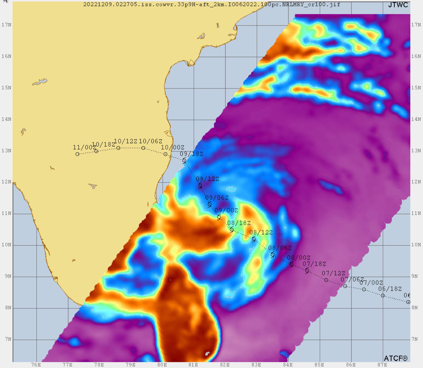
2023-08-29 |
Earth
|
COWVR
|
COWVR
TEMPEST
|
1606x1527x3 |

|
-
PIA25870:
-
COWVR, TEMPEST Capture Vital Data on Hurricane Franklin
Full Resolution:
TIFF
(3.924 MB)
JPEG
(155.7 kB)
|
|
|
2023-08-29 |
Earth
|
COWVR
|
COWVR
TEMPEST
|
1576x1527x3 |
|
-
PIA25569:
-
COWVR, TEMPEST Capture Vital Data on Hurricane Idalia
Full Resolution:
TIFF
(5.962 MB)
JPEG
(250.3 kB)
|
|
|
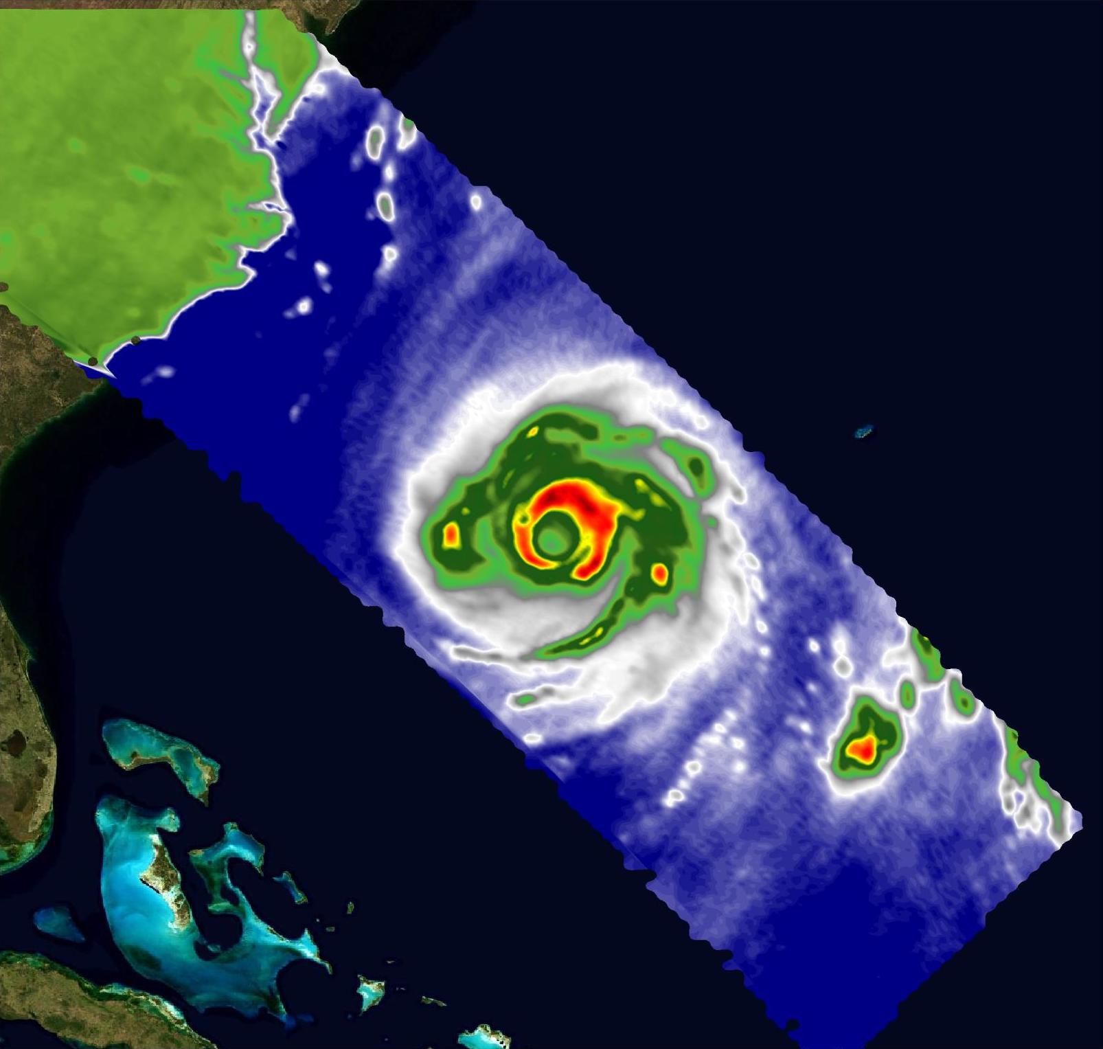
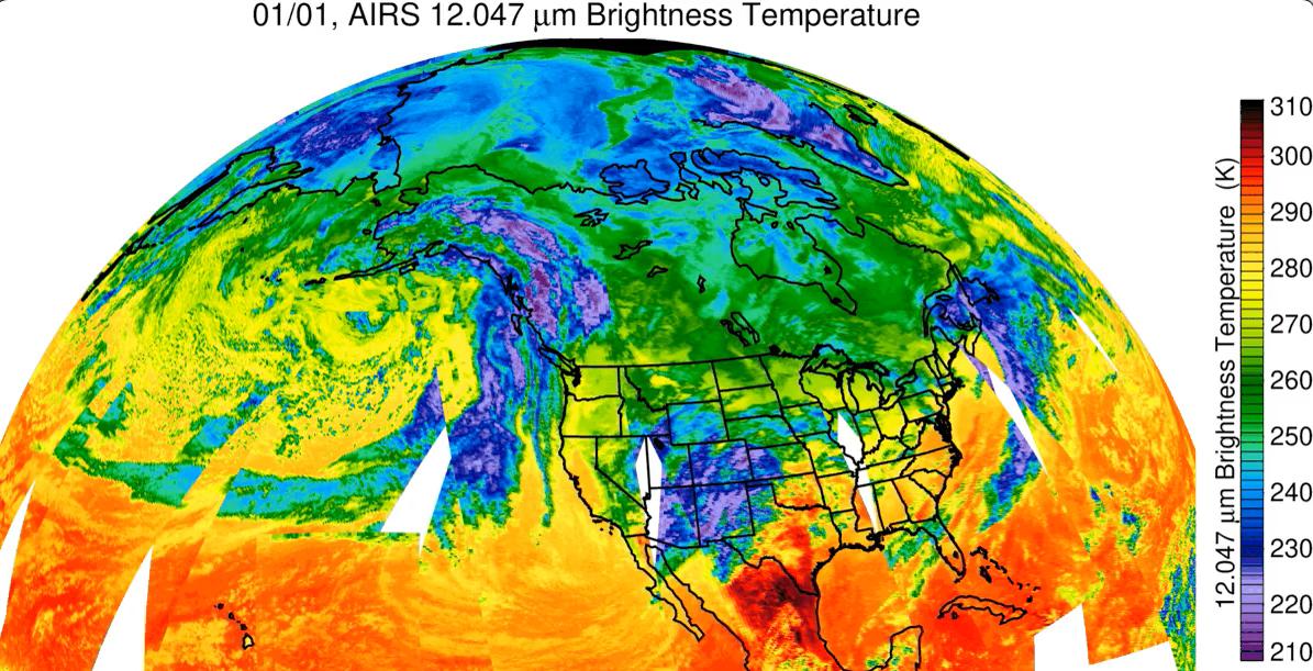
2023-08-18 |
Earth
|
Aqua
|
AIRS
|
900x695x3 |
|
-
PIA25779:
-
Hurricane Hilary Captured by NASA's AIRS
Full Resolution:
TIFF
(817.3 kB)
JPEG
(107.8 kB)
|
|
|
2023-08-17 |
Earth
|
Terra
|
ASTER
|
2557x4344x3 |

|
-
PIA26007:
-
Sulawesi, Indonesia
Full Resolution:
TIFF
(24.91 MB)
JPEG
(1.094 MB)
|
|
|
2023-08-14 |
Earth
|
Polar Radiant Energy in the Far-InfraRed Experiment (PREFIRE)
|
|
1920x1080x3 |
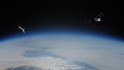
|
-
PIA25778:
-
PREFIRE Satellite Illustration
Full Resolution:
TIFF
(3.12 MB)
JPEG
(92.14 kB)
|
|
|
2023-08-08 |
Earth
|
Terra
|
ASTER
|
318x313x3 |
|
-
PIA26006:
-
Hunga Tonga-Hunga Ha'apai Eruption
Full Resolution:
TIFF
(170 kB)
JPEG
(9.253 kB)
|
|
|
2023-08-08 |
Earth
|
Suomi NPP
|
VIIRS
|
1200x675x3 |

|
-
PIA25868:
-
Phoenix Land-Surface Temperatures Documented Amid Record Heat
Full Resolution:
TIFF
(2.431 MB)
JPEG
(160.2 kB)
|
|
|
2023-07-18 |
Earth
|
Terra
|
ASTER
|
4000x3303x3 |
|
-
PIA25981:
-
Democratic Republic of Sao Tome and Principe
Full Resolution:
TIFF
(27.66 MB)
JPEG
(1.153 MB)
|
|
|
2023-06-27 |
Earth
|
Surface Water and Ocean Topography (SWOT)
|
|
1125x1122x3 |
|
-
PIA25777:
-
SWOT Measures Tuvalu Sea Level
Full Resolution:
TIFF
(1.862 MB)
JPEG
(131.7 kB)
|
|
|
2023-06-22 |
Earth
|
Terra
|
|
2741x2514x3 |
|
-
PIA25946:
-
Folded Rocks, Iran
Full Resolution:
TIFF
(20.68 MB)
JPEG
(1.742 MB)
|
|
|
2023-06-01 |
Earth
|
Terra
|
ASTER
|
1400x1176x3 |

|
-
PIA25896:
-
Najaf, Iraq
Full Resolution:
TIFF
(4.91 MB)
JPEG
(251.8 kB)
|
|
|
2023-05-25 |
Earth
|
Terra
|
ASTER
|
1413x1143x3 |
|
-
PIA25895:
-
Heilongjiang Province, China
Full Resolution:
TIFF
(4.847 MB)
JPEG
(428.6 kB)
|
|
|
2023-05-15 |
Earth
|
|
|
1440x700x3 |

|
-
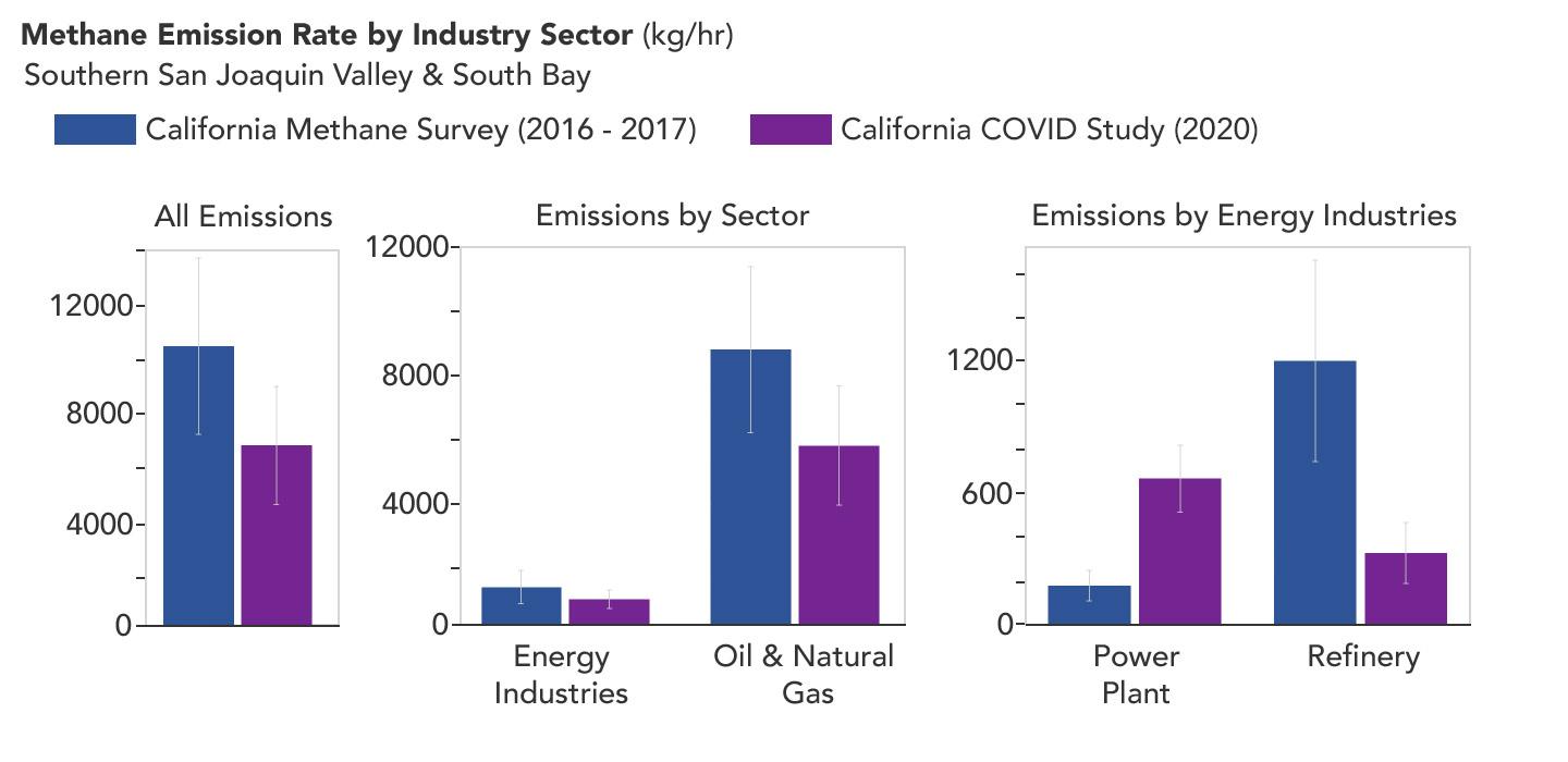
PIA25864:
-
Declining Methane Emissions at California Oil Fields and Refineries
Full Resolution:
TIFF
(325.1 kB)
JPEG
(73.03 kB)
|
|
|
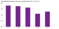
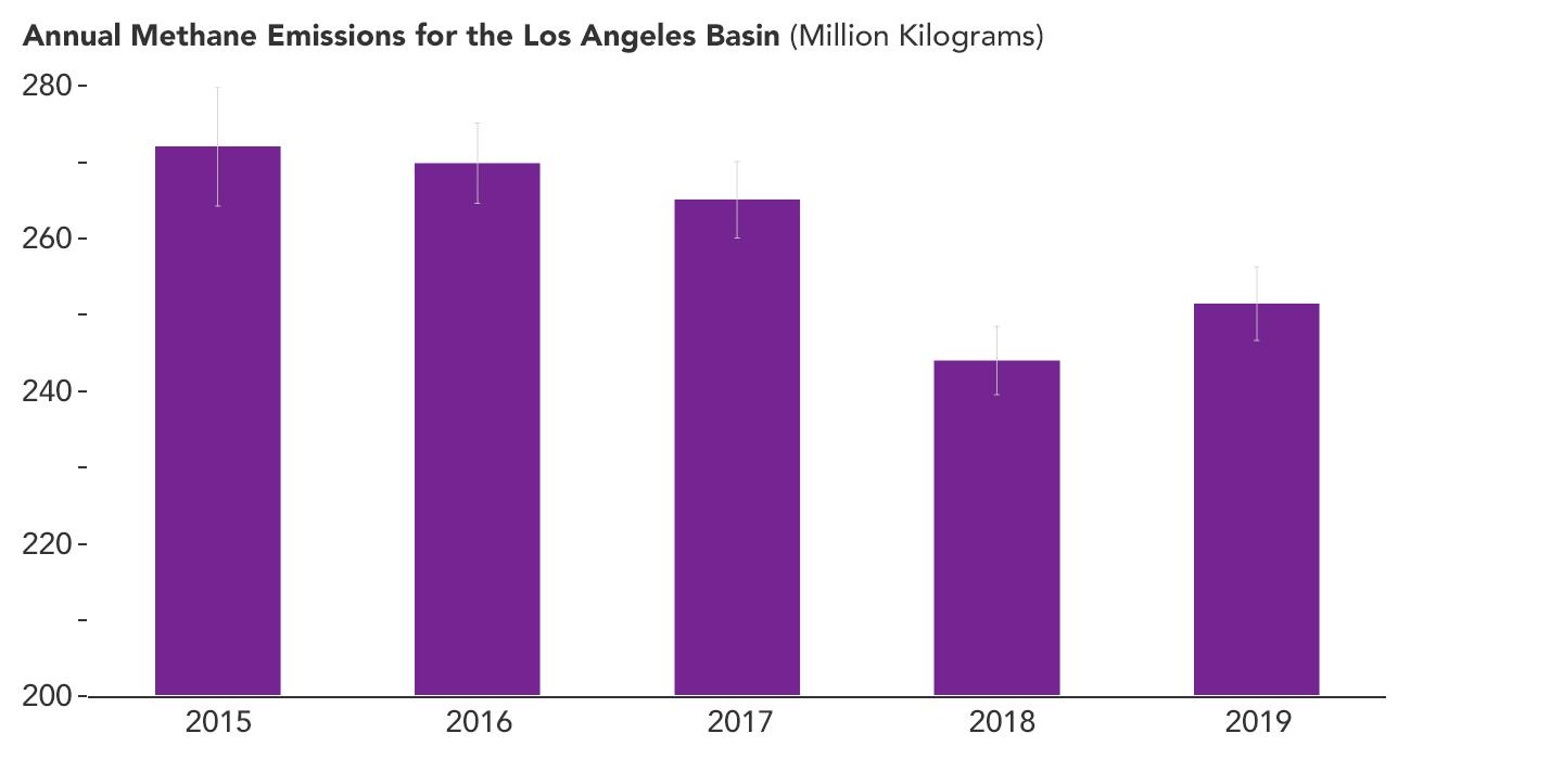
2023-05-15 |
Earth
|
|
|
1440x700x3 |
|
-
PIA25863:
-
Declining Methane Emissions in the Los Angeles Basin
Full Resolution:
TIFF
(181.3 kB)
JPEG
(46.55 kB)
|
|
|
2023-05-12 |
Earth
|
Sentinel-6/Jason-CS
|
|
875x415x3 |
|
-
PIA25776:
-
Early El Niño Signs
Full Resolution:
TIFF
(598.3 kB)
JPEG
(51.43 kB)
|
|
|
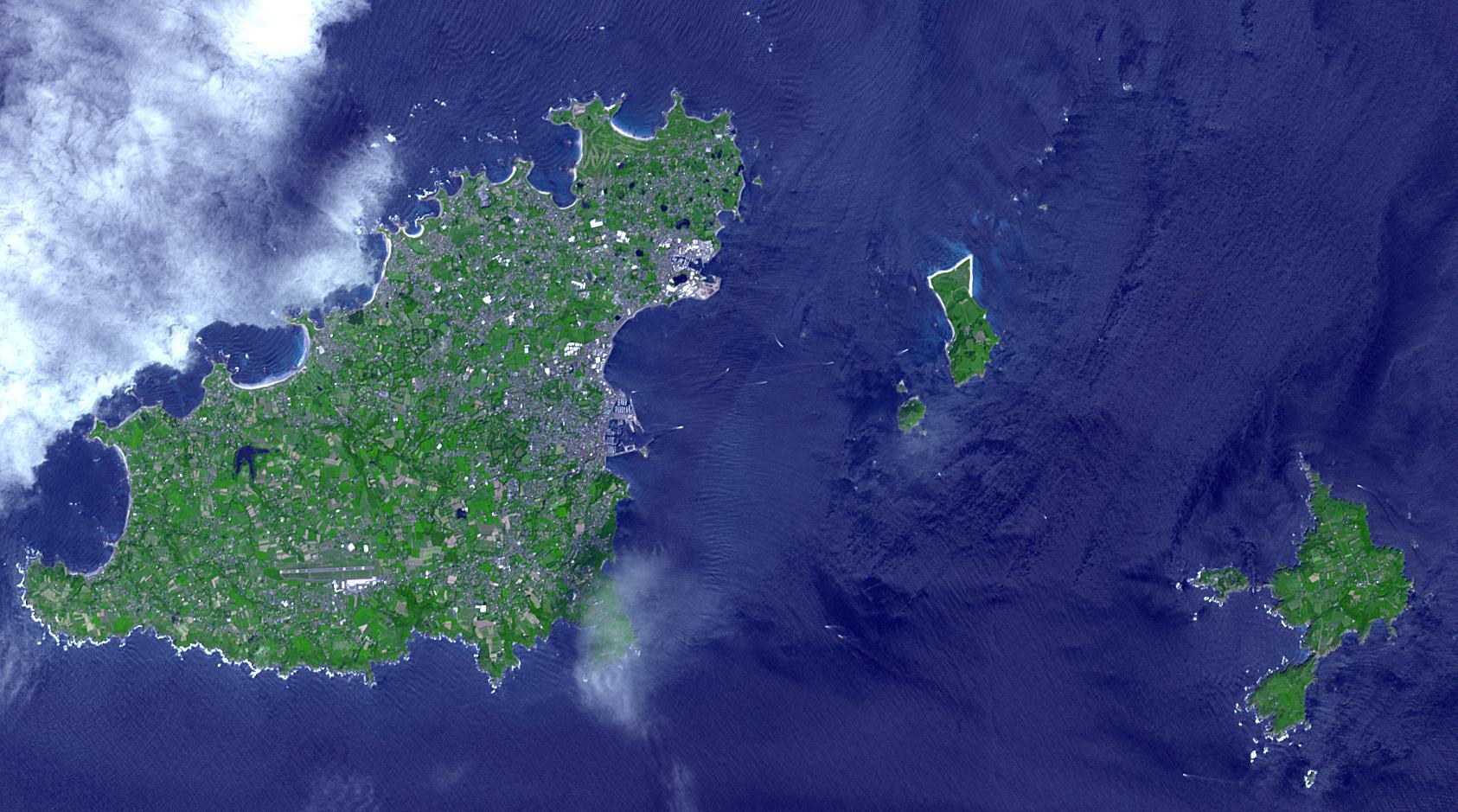
2023-04-27 |
Earth
|
Terra
|
ASTER
|
1686x939x3 |

|
-
PIA25859:
-
Sark, English Channel Islands
Full Resolution:
TIFF
(4.4 MB)
JPEG
(264.4 kB)
|
|
|
2023-04-12 |
Earth
|
Terra
|
ASTER
|
1443x1062x3 |
|
-
PIA25858:
-
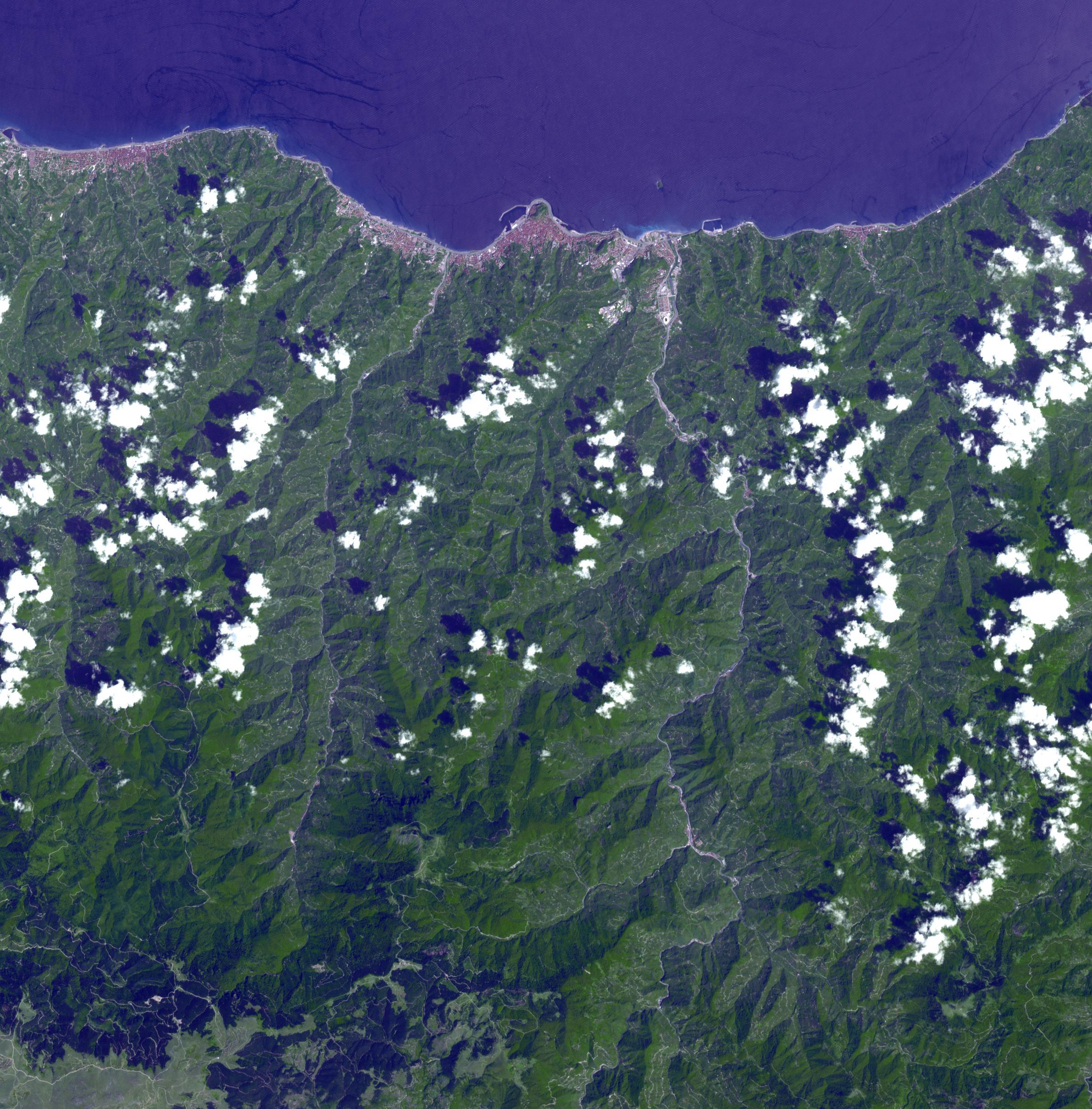
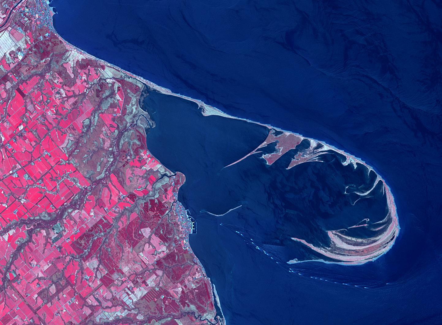
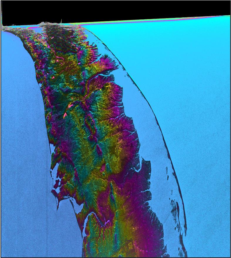
Notsuke Peninsula, Japan
Full Resolution:
TIFF
(4.396 MB)
JPEG
(234.3 kB)
|
|
|
2023-04-05 |
Earth
|
MODIS
|
MODIS
|
2550x3300x3 |
|
-
PIA25862:
-
Map Shows Belizean Protected Areas Assessed for Risk
Full Resolution:
TIFF
(13.96 MB)
JPEG
(683.8 kB)
|
|
|
2023-04-05 |
Earth
|
MODIS
|
MODIS
|
4579x2083x3 |
|
-
PIA25861:
-
Study Uses MODIS Data to Determine Belize Coral Reef Risk
Full Resolution:
TIFF
(22.51 MB)
JPEG
(1.357 MB)
|
|
|
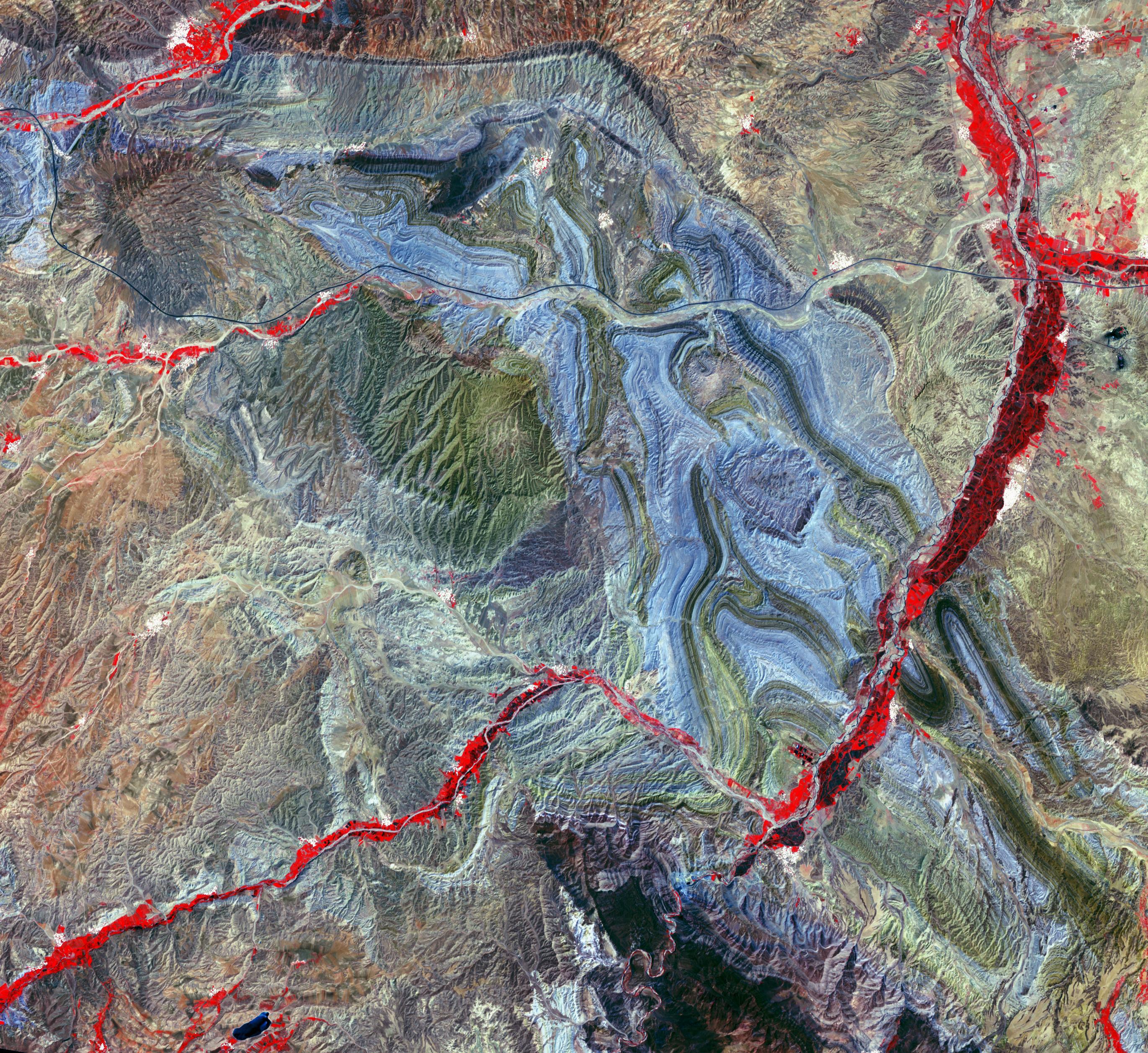
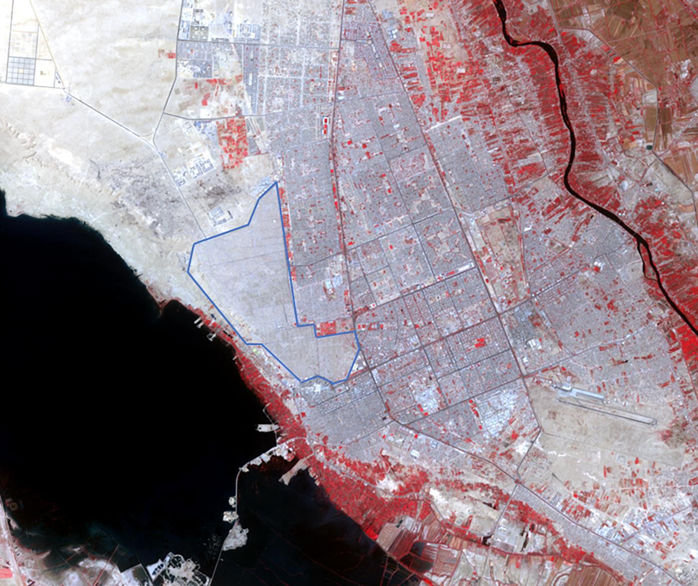
2023-03-24 |
Earth
|
Surface Water and Ocean Topography (SWOT)
|
KaRIn
|
787x879x3 |
|
-
PIA25774:
-
SWOT Satellite's Land 'First Light'
Full Resolution:
TIFF
(2.076 MB)
JPEG
(135.1 kB)
|
|
|
2023-03-24 |
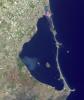
Earth
|
|
|
1440x1570x3 |
|
-
PIA25773:
-
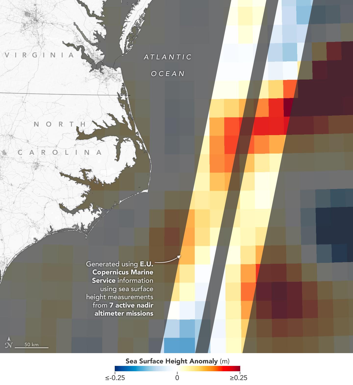
Sea Level Visualization of Gulf Stream
Full Resolution:
TIFF
(2.24 MB)
JPEG
(159 kB)
|
|
|
2023-03-24 |
Earth
|
Surface Water and Ocean Topography (SWOT)
|
KaRIn
|
1440x1570x3 |
|
-
PIA25772:
-
SWOT Satellite's Sea Level 'First Light'
Full Resolution:
TIFF
(2.873 MB)
JPEG
(182.2 kB)
|
|
|
2023-03-23 |
Earth
|
Terra
|
ASTER
|
1182x1136x3 |

|
-
PIA25856:
-
Mir Diamond Mine, Siberia
Full Resolution:
TIFF
(3.907 MB)
JPEG
(209.2 kB)
|
|
|
2023-03-17 |
Earth
|
|
|
3300x2550x3 |
|
-
PIA25775:
-
30 Years of Sea Level Rise
Full Resolution:
TIFF
(5.404 MB)
JPEG
(446.5 kB)
|
|
|
2023-03-16 |
Earth
|
Terra
|
ASTER
|
700x450x3 |
|
-
PIA25800:
-
Chausey, French Channel Islands
Full Resolution:
TIFF
(693.3 kB)
JPEG
(29.65 kB)
|
|
|
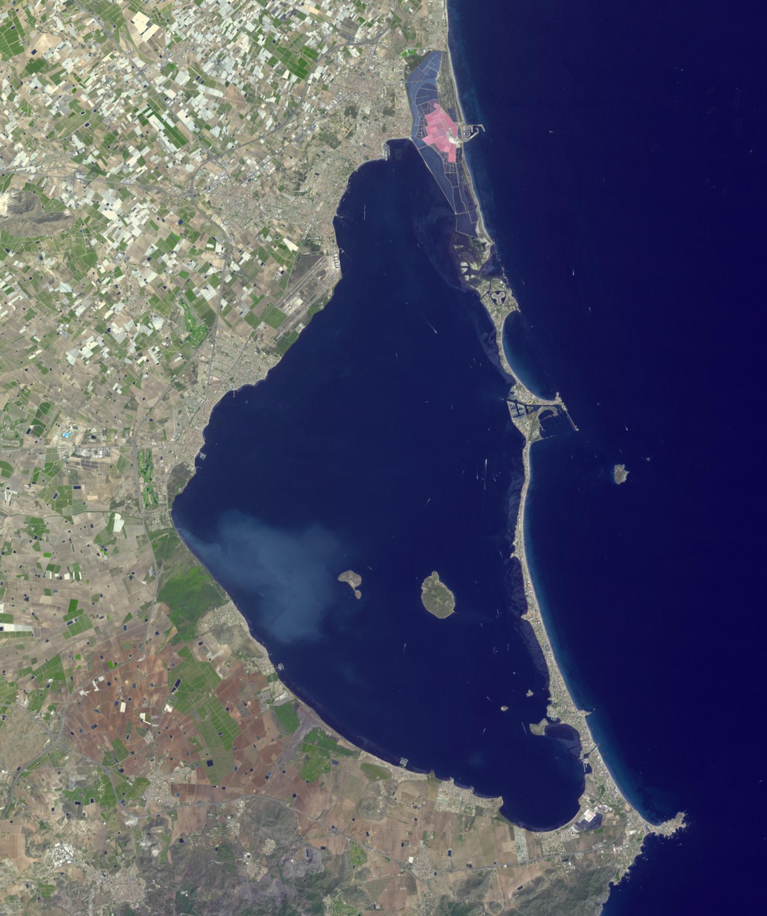
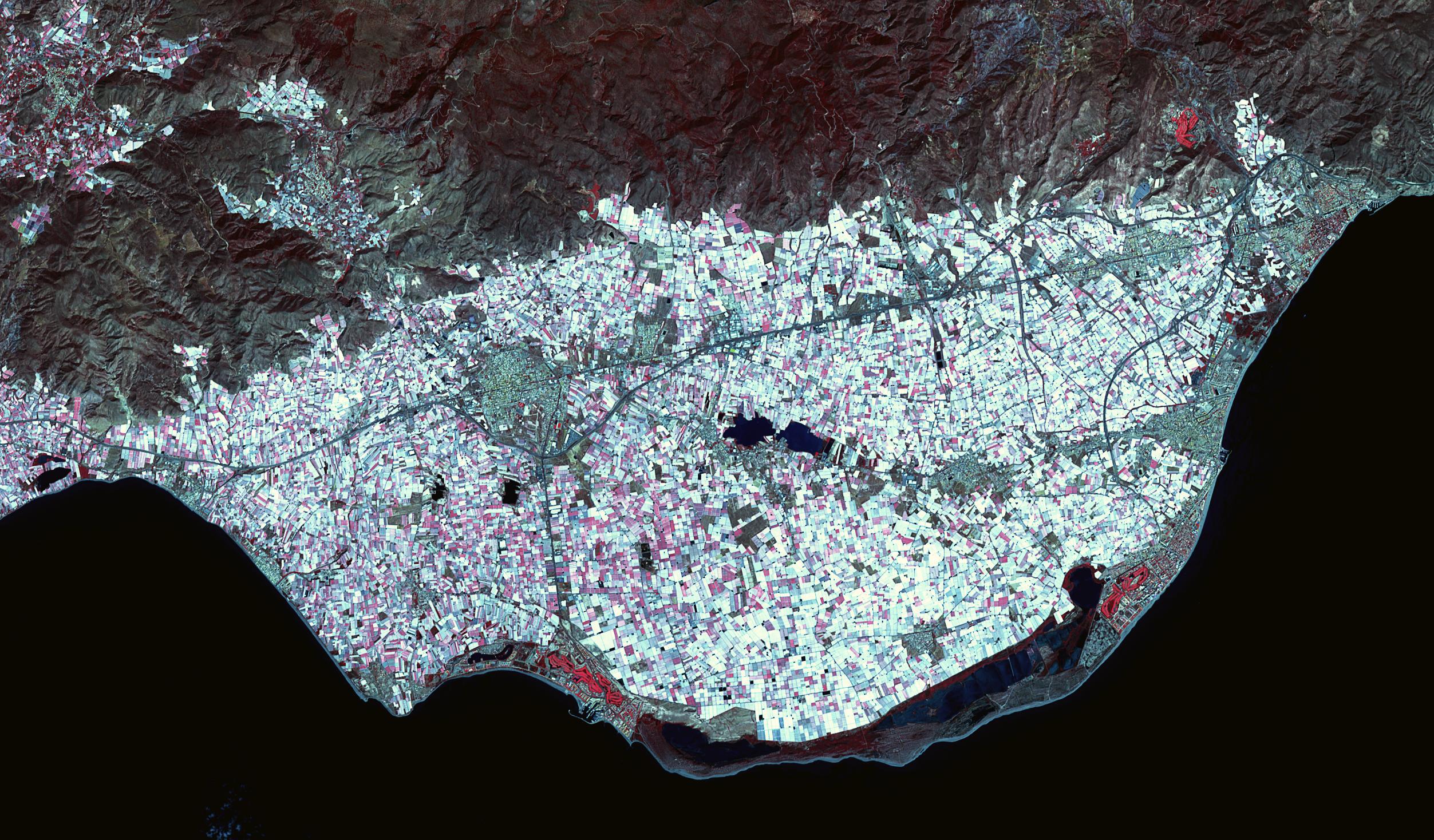
2023-02-27 |
Earth
|
Terra
|
ASTER
|
2505x1468x3 |
|
-
PIA25791:
-
Poniente Almeriense, Spain
Full Resolution:
TIFF
(9.758 MB)
JPEG
(834.8 kB)
|
|
|
2023-02-23 |
Earth
|
COWVR
|
COWVR
TEMPEST
|
1752x1526x3 |

|
-
PIA25565:
-
COWVR, TEMPEST Track Tropical Cyclone Mandous
Full Resolution:
TIFF
(4.653 MB)
JPEG
(210.3 kB)
|
|
|
2023-02-16 |
Earth
|
Terra
|
ASTER
|
1506x2042x3 |
|
-
PIA25798:
-
Chaine des Puys, France
Full Resolution:
TIFF
(9.229 MB)
JPEG
(527 kB)
|
|
|
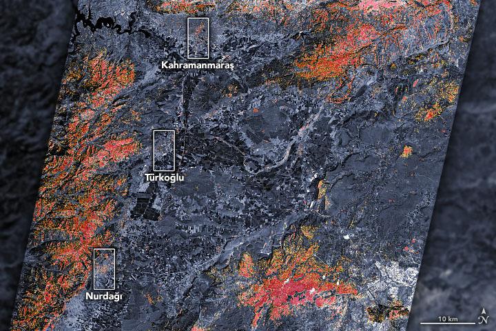
2023-02-09 |
Earth
|
ARIA
|
SAR
|
720x480x3 |

|
-
PIA25564:
-
Satellites Assess Earthquake Damage in Turkey
Full Resolution:
TIFF
(1.037 MB)
JPEG
(126.3 kB)
|
|
|
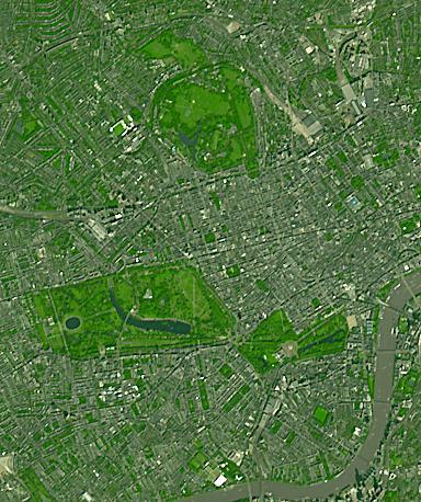
2023-01-24 |
Earth
|
Terra
|
ASTER
|
384x458x3 |
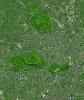
|
-
PIA25706:
-
London, England Parks
Full Resolution:
TIFF
(528 kB)
JPEG
(61.72 kB)
|
|
|
2023-01-10 |
Earth
|
Aqua
|
AIRS
|
1195x611x3 |
|
-
PIA25597:
-
California Atmospheric River Storms Captured by NASA's AIRS
Full Resolution:
TIFF
(1.868 MB)
JPEG
(175.8 kB)
|
|
|
2023-01-10 |
Earth
|
Terra
|
ASTER
|
1657x1335x3 |
|
-
PIA25705:
-
Potosi, Bolivia
Full Resolution:
TIFF
(6.639 MB)
JPEG
(453 kB)
|
|
|
2022-12-22 |
Earth
|
Terra
|
ASTER
|
610x686x3 |

|
-
PIA25639:
-
Eriskay Island, Scotland
Full Resolution:
TIFF
(725.3 kB)
JPEG
(32.02 kB)
|
 Planetary Data System


