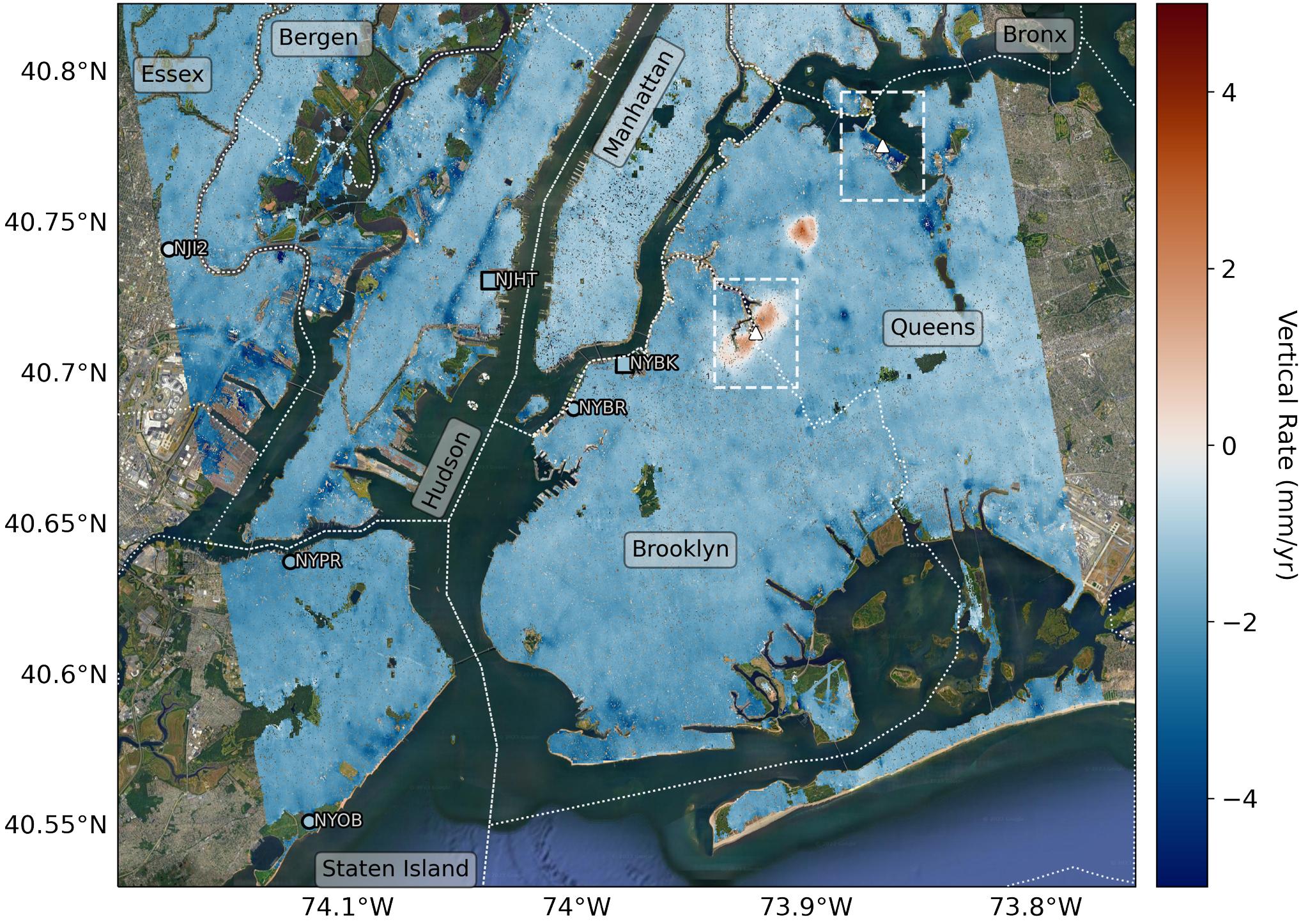
Researchers from NASA's Jet Propulsion Laboratory in Southern California and Rutgers University in New Jersey produced this map in their analysis of upward and downward vertical land motion – also known as uplift and subsidence – across the New York City metropolitan area from 2016 to 2023. Most of the study region was found to be gradually subsiding (indicated here in blue), while isolated locations of uplift (in red) were also observed. The white dotted lines indicate county/borough borders.
The researchers found that on average the metropolitan area subsided by about 0.06 inches (1.6 millimeters) per year – about the same amount that a toenail grows in a month. They mapped the motion in detail and pinpointed neighborhoods and landmarks that were subsiding more rapidly than the average. Causes for the observed motion include natural geologic adjustments that have been unfolding since the most recent ice age, as well as human land-use practices such as the construction of landfills, which make the ground looser and more compressible beneath buildings.
A few locations in Queens and Brooklyn were observed to rise due to activities that may include pollution remediation efforts and groundwater injection.
To create this map, the researchers employed a remote sensing technique called interferometric synthetic aperture radar (InSAR), which combines two or more three-dimensional observations of the same region to reveal surface motion down to fractions of inches. They used the radars on the ESA (European Space Agency) Sentinel-1 satellites, along with advanced data processing methods.
