Using radars on the ESA (European Space Agency) Sentinel-1 satellites, along with advanced data processing techniques, a team of researchers measured upward and downward vertical land motion – also known as uplift and subsidence – across the New York City metropolitan area from 2016 to 2023. They mapped the motion in detail and pinpointed specific locations seen here – an airport runway and part of a Superfund site – that were notably sinking or rising.
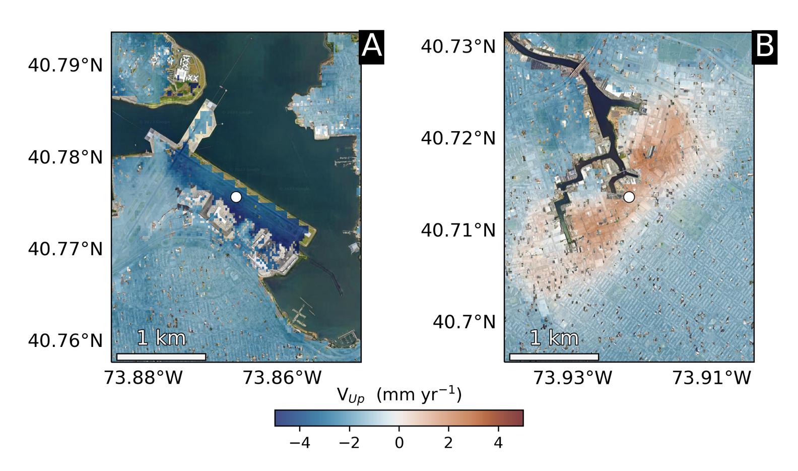
Runway 13/31 at LaGuardia Airport in Queens, left, is co-located with a former landfill and subsiding at a rate of about 0.15 inches (3.7 millimeters) per year.
Part of the Newtown Creek Superfund site in East Williamsburg, Brooklyn, right, is rising unevenly by about 0.06 inches (1.6 millimeters) per year, possibly due to groundwater pumping and treatment activities. The site is undergoing extensive environmental remediation to address decades of pollution, including the Greenpoint oil spill that was discovered in the late 1970s.
The researchers, from NASA's Jet Propulsion Laboratory in Southern California and Rutgers University in New Jersey, found that on average the metropolitan area subsided by about (0.06 inches) (1.6 millimeters) per year – about the same amount that a toenail grows in a month. Causes for the observed motion include natural geologic adjustments that have been unfolding since the most recent ice age, as well as land-use practices such as the construction of landfills, which make the ground looser and more compressible beneath buildings.
To create this map, the researchers employed a remote sensing technique called interferometric synthetic aperture radar (InSAR), which combines two or more three-dimensional observations of the same region to reveal surface motion down to fractions of inches.
