
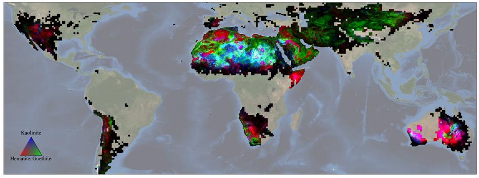
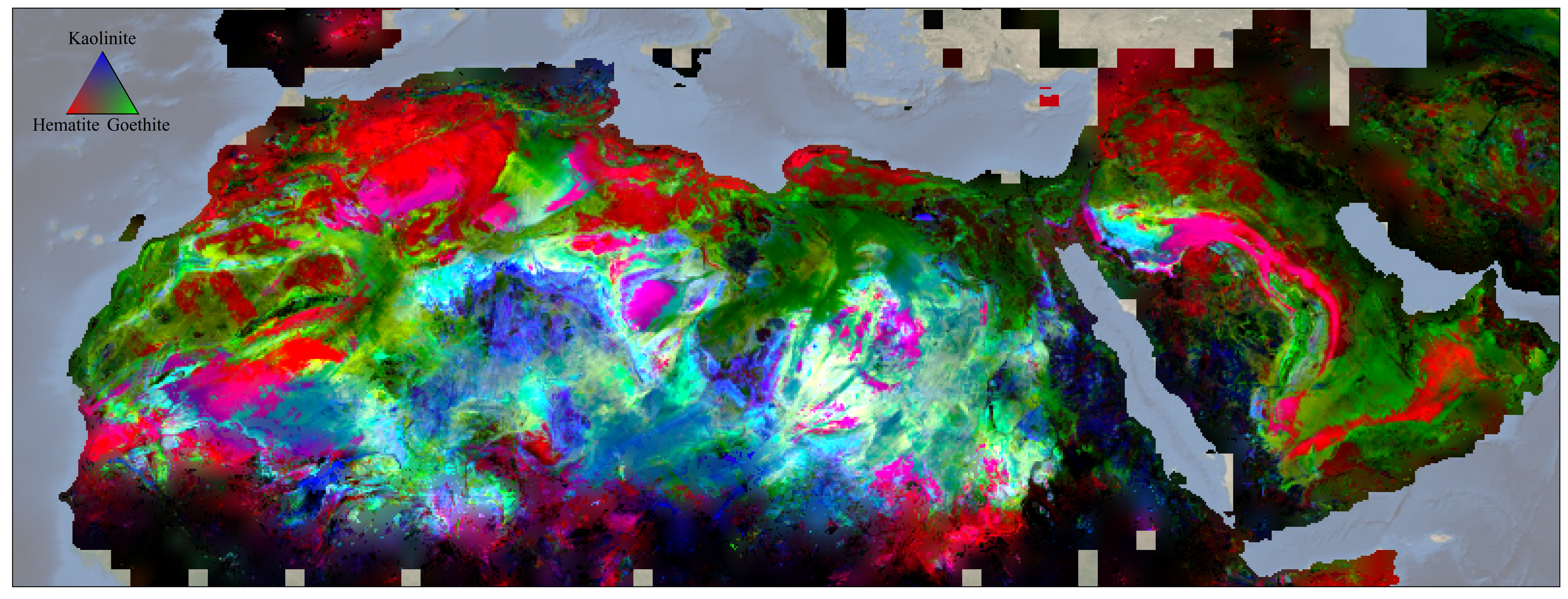
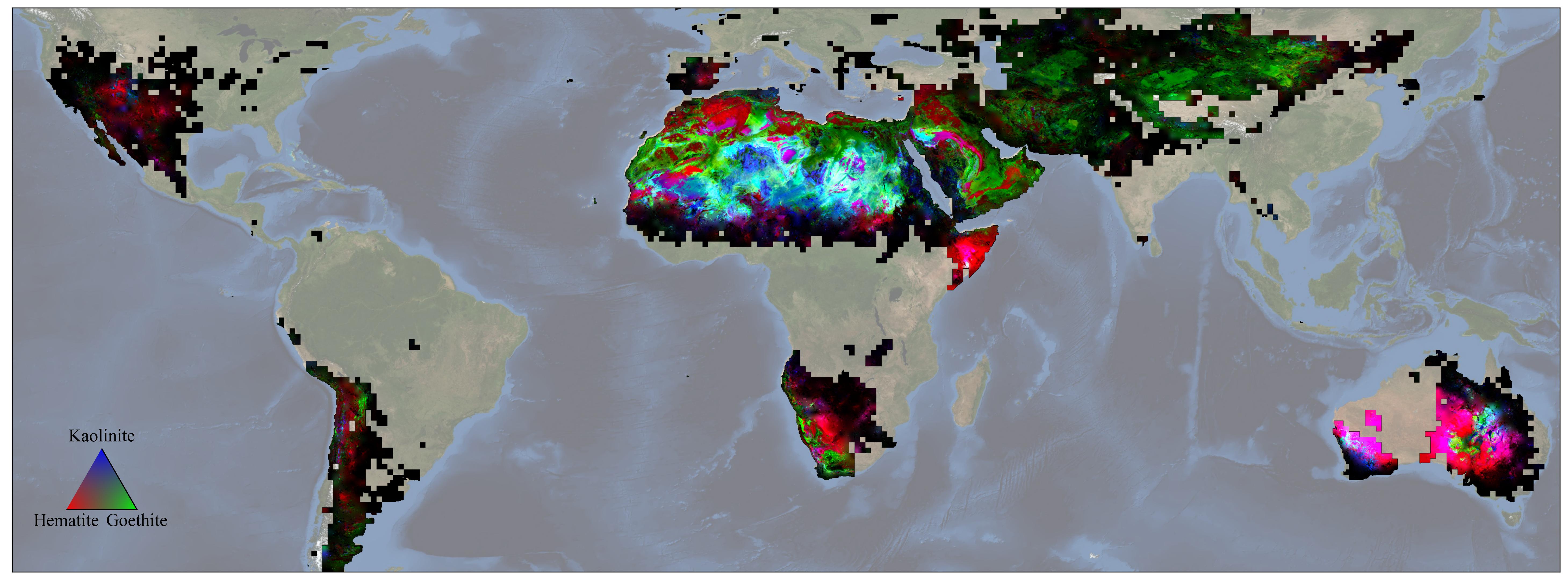
Figure AScientists on NASA's EMIT mission used data from its powerful imaging spectrometer, developed at the agency's Jet Propulsion Laboratory, to map the presence and geographic distributions of three key minerals in the planet's arid regions. The three substances – hematite, goethite, and kaolinite – are thought to have an effect on atmospheric and surface temperatures when wind lofts them into the air, forming dust storms.
The data, collected over the course of a year ending in November 2023, was used to create this map. Red represents hematite, green goethite, and blue kaolinite. Magenta indicates regions with hematite and kaolinite, while yellow shows areas that hematite and goethite, and cyan signifies locations with goethite and kaolinite. White indicates the presence of all three, and black signifies portions of the study area that contain none of them.
In total, EMIT – short for the Earth Surface Mineral Dust Source Investigation – is mapping 10 minerals as part of its prime mission. In addition to hematite, goethite, and kaolinite, it is also monitoring illite, vermiculite, calcite, dolomite, montmorillonite, chlorite, and gypsum.
Launched to the International Space Station in July 2022, EMIT was developed in response to the need for more detailed surface mineral composition information to advance climate science. Researchers know that darker, iron oxide-rich substances, such as hematite and goethite, absorb the Sun's energy and warm the surrounding air, while non-iron-based, whiter substances like kaolinite reflect light and heat, cooling the air.
Whether those effects have a net warming or cooling impact, however, has remained uncertain. The missing piece has been the composition – the color, essentially – of the surface in the places dust typically originates. To date, the mission has captured more than 55,000 "scenes" – 50-by-50-mile (80-by-80-kilometer) images of the surface – in its study area, which includes arid regions within a 6,900-mile-wide (11,000-kilometer-wide) belt between 51.6 degrees north and south latitude.
Figure A is a close-up of a portion of the map, focusing on the presence and distribution of hematite, goethite, and kaolinite in North Africa, including the Sahara, and the Arabian Peninsula.
EMIT was selected from the Earth Venture Instrument-4 solicitation under the Earth Science Division of NASA's Science Mission Directorate and was developed at JPL, which is managed for NASA by Caltech in Pasadena, California. It launched aboard a SpaceX Dragon resupply spacecraft from NASA's Kennedy Space Center in Florida on July 14, 2022. The instrument's data is being delivered to the NASA Land Processes Distributed Active Archive Center (DAAC) for use by other researchers and the public.