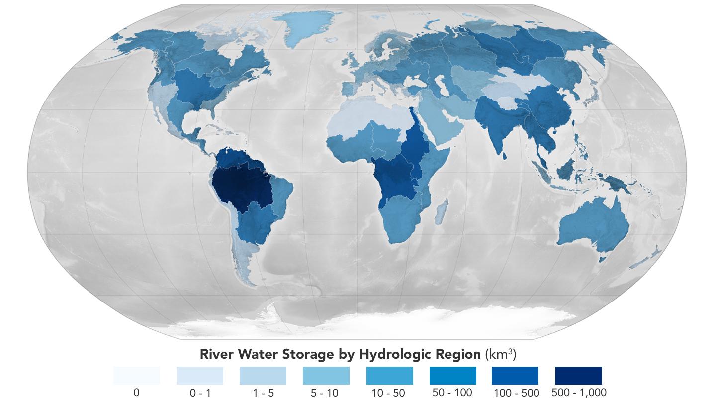
Figure AA paper led by researchers at NASA's Jet Propulsion Laboratory estimates the total volume of water in Earth's rivers – called river storage – on average between 1980 and 2009, and maps out the results for the planet's major hydrological regions. This graphic, adapted from data gathered for the paper, indicates the amount of storage by hydrologic regions that contain one or more river basins, with shades of blue deepening as the amount of storage increases.
The paper, published in Nature Geoscience in April 2024, calculated Earth's river storage at about 539 cubic miles (2,246 cubic kilometers), and found that the Amazon River basin, shown in dark blue in South America, was the region with the most storage, with 204 cubic miles (850 cubic kilometers), or about 38% of the global total.
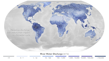
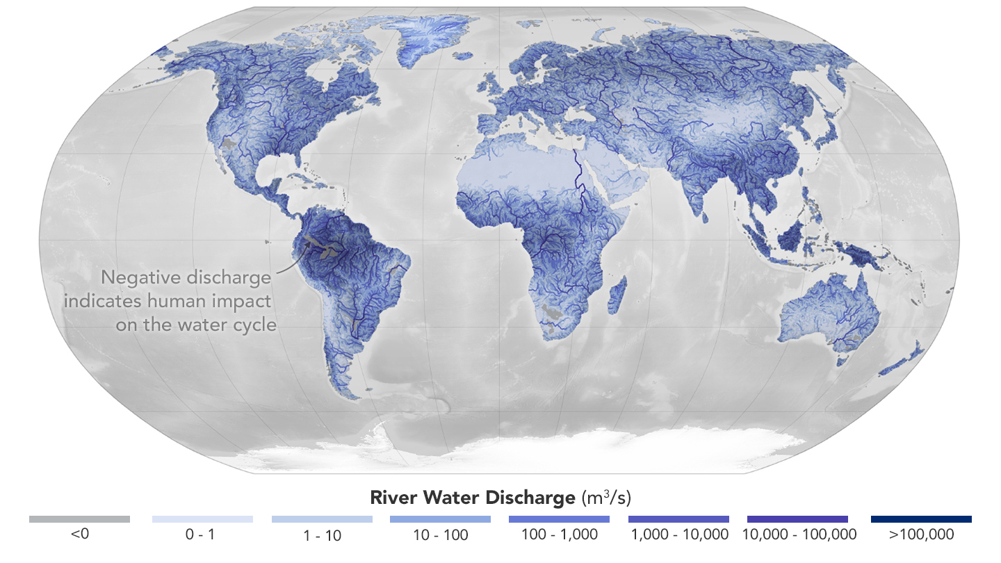
The study also estimated the flow of water through more than 3 million segments of river around the world and identified several locations marked by intense human water use, including parts of the Colorado River basin in the United States, portions of the Amazon basin in South America, the Orange River basin in southern Africa, and the Murray-Darling basin in southeastern Australia. Figure A, likewise based on data gathered for the study, shows these locations as gray areas.
