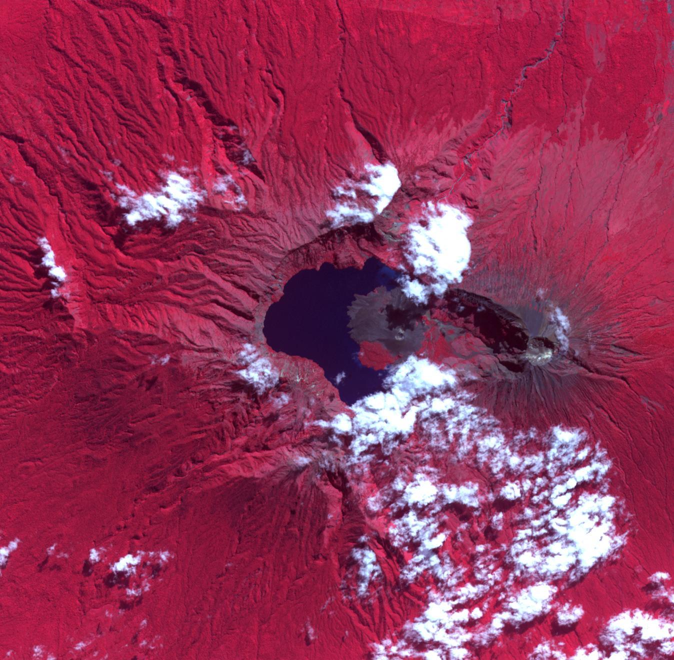
The Rinjani, Indonesia caldera-forming eruption is thought to have occurred in the 13th century. This 1257 Samalas eruption is now considered the likely source of high concentrations of sulfur found in widely dispersed ice core samples and may have been the most powerful volcanic blast since humans learned to write. The massive eruption may have triggered an episode of global cooling and failed harvests. Before this eruption, the Segara Anak caldera was a volcanic mountain named Samalas, which was higher than Rinjani. The image was acquired June 22, 2022, covers an area of 19.8 by 20.2 km, and is located at 8.4 degrees south, 116.4 degrees east.
With its 14 spectral bands from the visible to the thermal infrared wavelength region and its high spatial resolution of about 50 to 300 feet (15 to 90 meters), ASTER images Earth to map and monitor the changing surface of our planet. ASTER is one of five Earth-observing instruments launched Dec. 18, 1999, on Terra. The instrument was built by Japan's Ministry of Economy, Trade and Industry. A joint U.S./Japan science team is responsible for validation and calibration of the instrument and data products.
The broad spectral coverage and high spectral resolution of ASTER provides scientists in numerous disciplines with critical information for surface mapping and monitoring of dynamic conditions and temporal change. Example applications are monitoring glacial advances and retreats; monitoring potentially active volcanoes; identifying crop stress; determining cloud morphology and physical properties; wetlands evaluation; thermal pollution monitoring; coral reef degradation; surface temperature mapping of soils and geology; and measuring surface heat balance.
The U.S. science team is located at NASA's Jet Propulsion Laboratory in Pasadena, Calif. The Terra mission is part of NASA's Science Mission Directorate, Washington.
More information about ASTER is available at http://asterweb.jpl.nasa.gov/.
