Click on an image for detailed information
Click on a column heading to sort in ascending or descending order

My
List |
Addition Date
|
Target
|
Mission
|
Instrument
|
Size
|

|
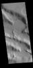
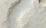
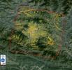
2016-02-09 |
Mars
|
2001 Mars Odyssey
|
THEMIS
|
707x1444x1 |
|
-
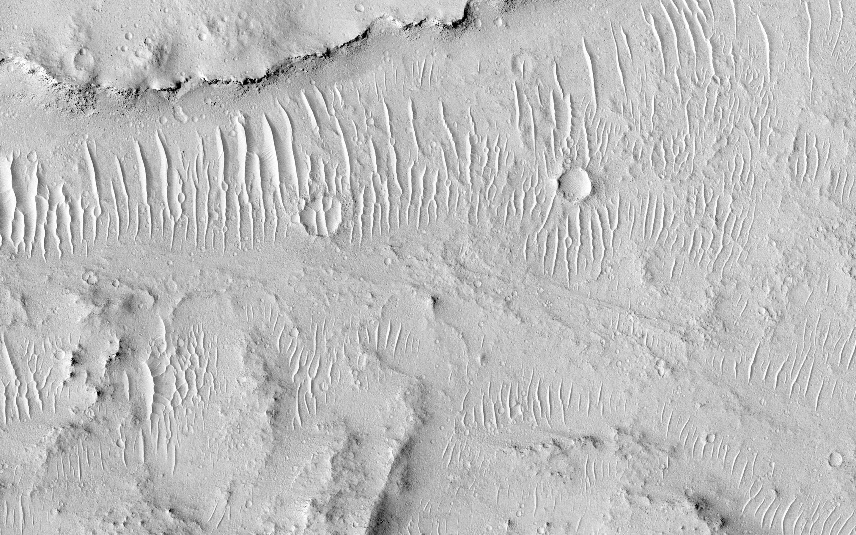
PIA20255:
-
Ridges
Full Resolution:
TIFF
(702.5 kB)
JPEG
(70.3 kB)
|
|
|
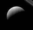
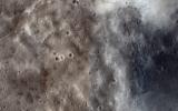
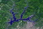
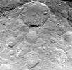
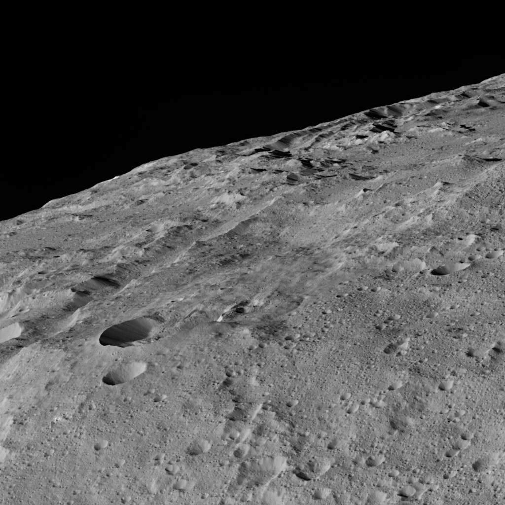
2016-02-05 |
Ceres
|
Dawn
|
Framing Camera
|
1024x1024x1 |

|
-
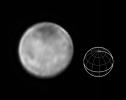
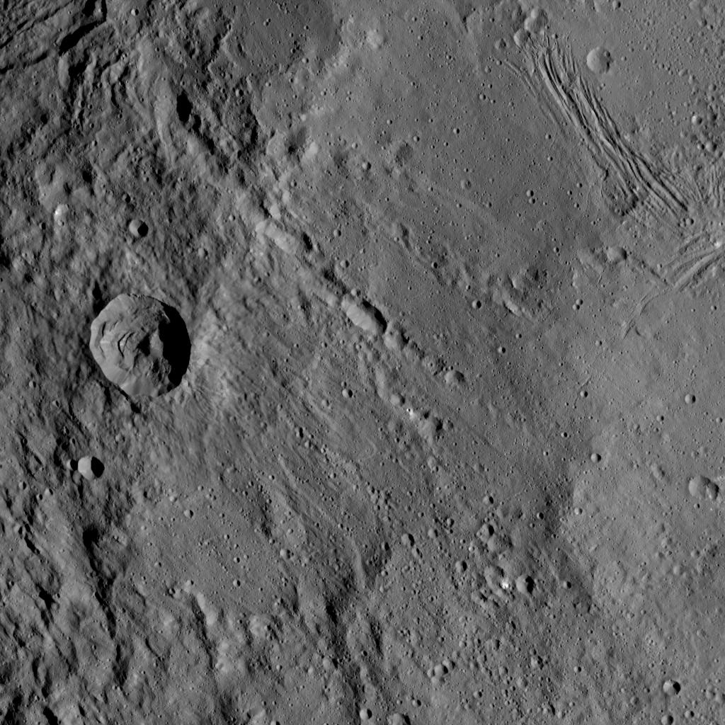
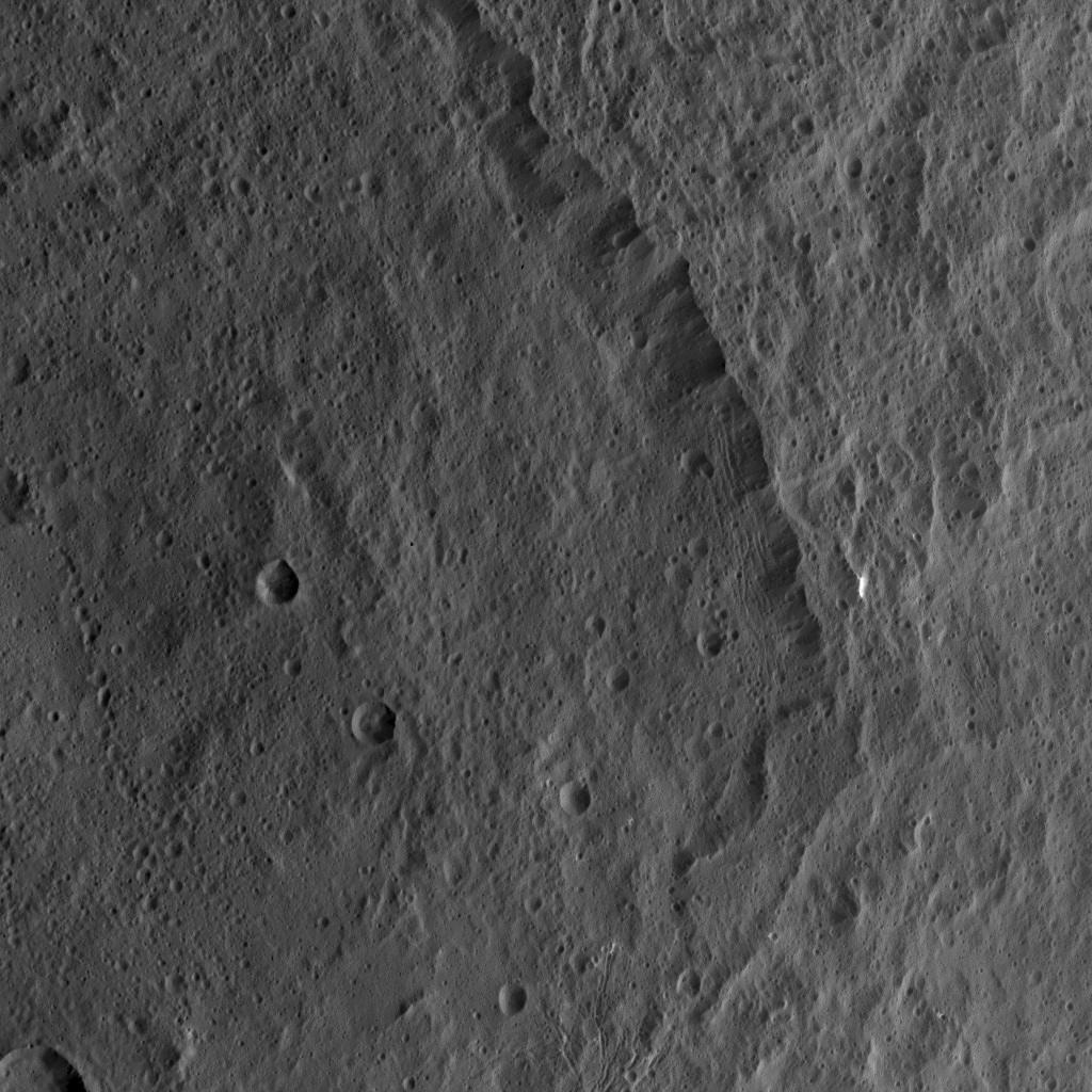
PIA20311:
-
Dawn LAMO Image 21
Full Resolution:
TIFF
(1.022 MB)
JPEG
(182 kB)
|
|
|
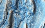
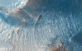
2016-01-27 |
Mars
|
Mars Reconnaissance Orbiter (MRO)
|
HiRISE
|
2880x1800x3 |
|
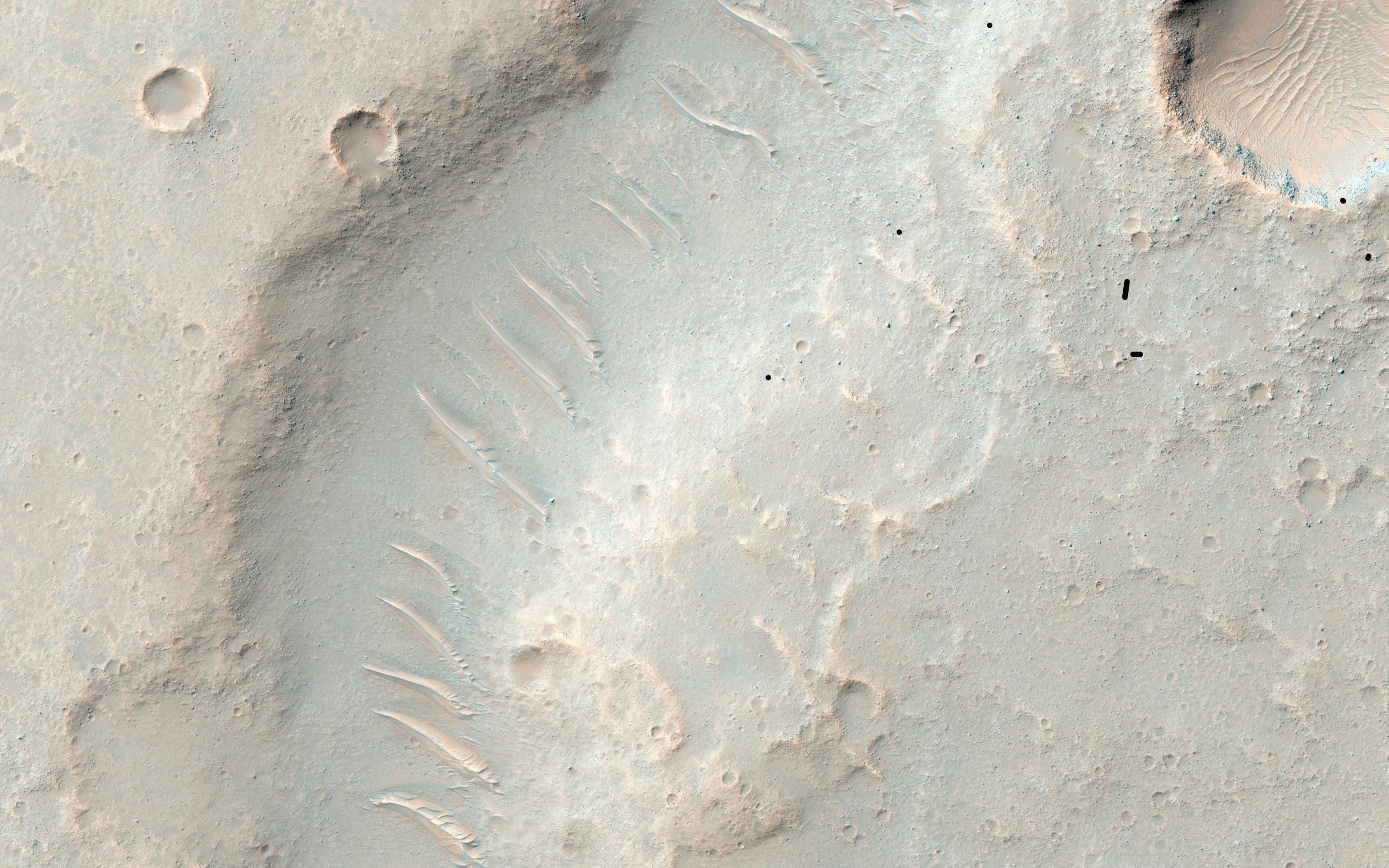
-
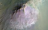
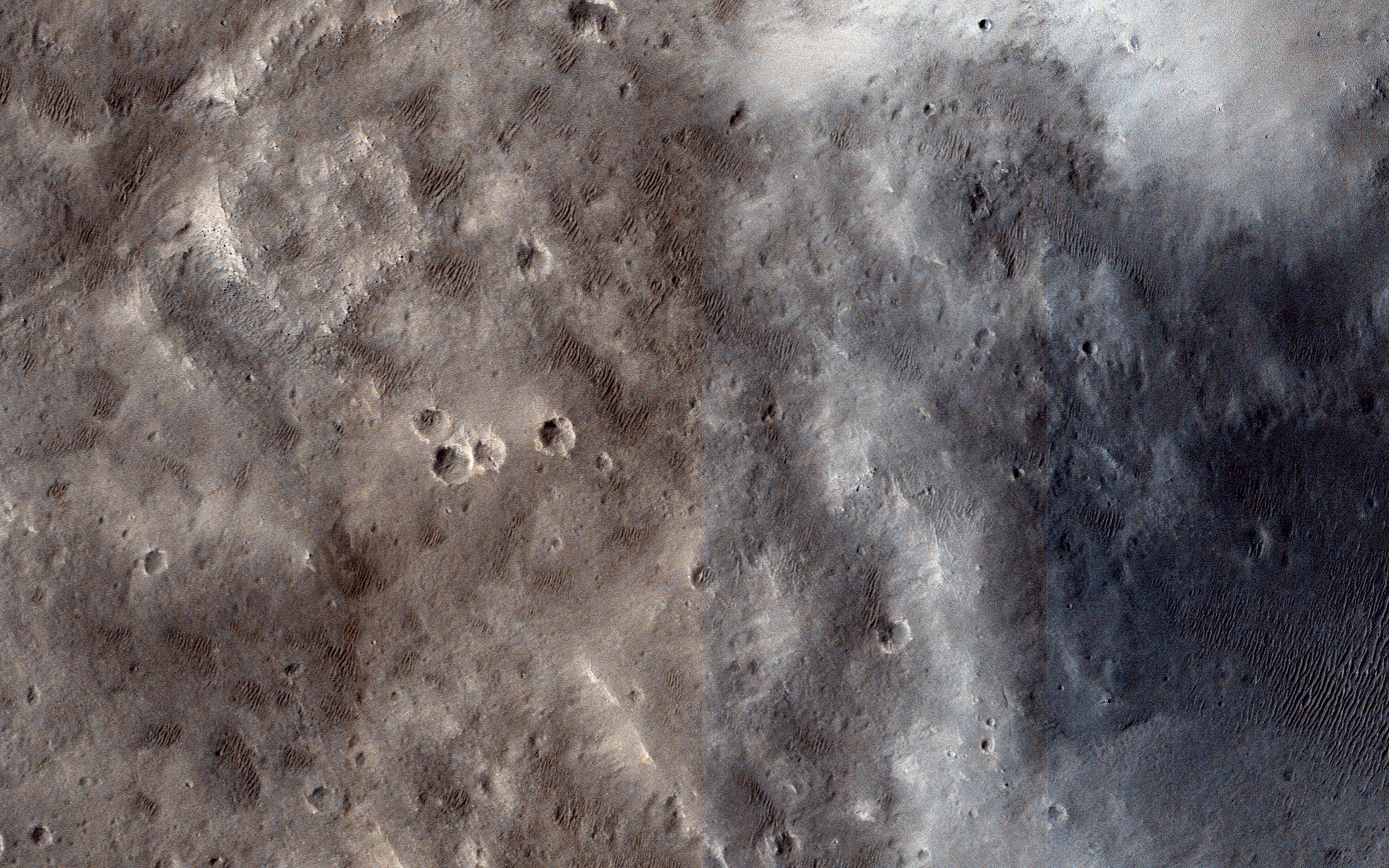
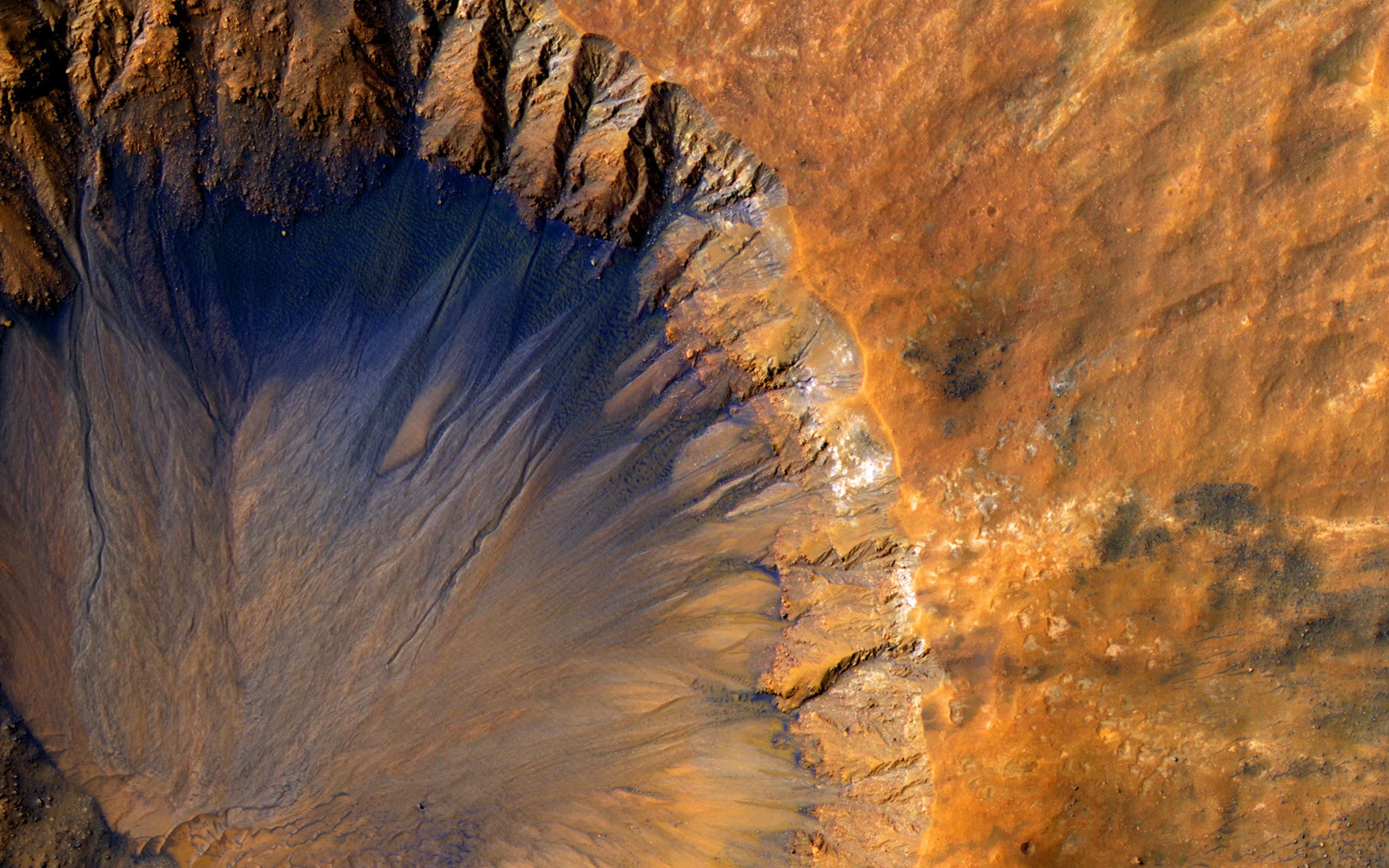
PIA20370:
-
A Tale of Two Flows
Full Resolution:
TIFF
(15.56 MB)
JPEG
(982.3 kB)
|
|
|
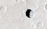
2016-01-27 |
Mars
|
Mars Reconnaissance Orbiter (MRO)
|
HiRISE
|
2880x1800x3 |
|
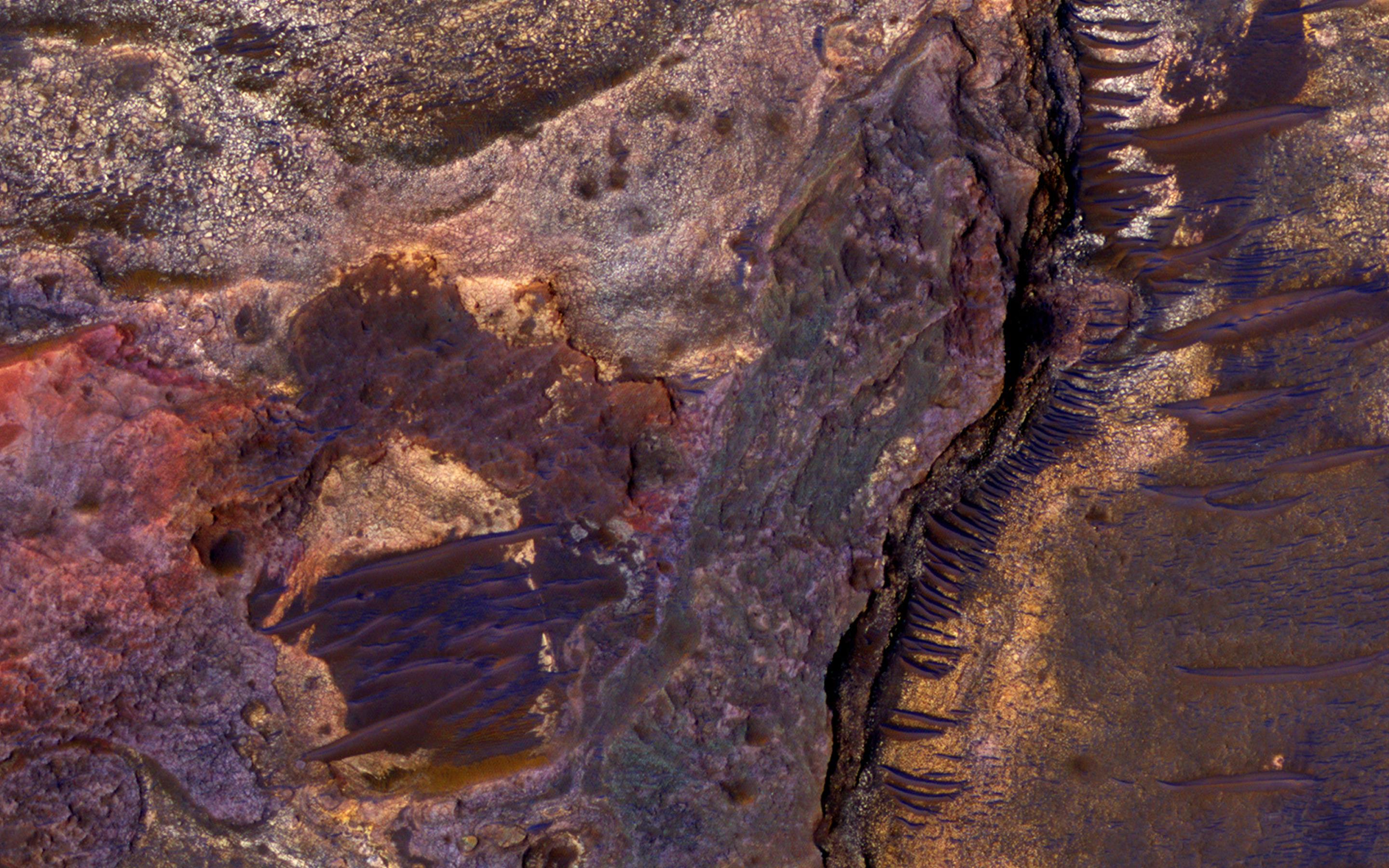
-
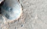
PIA20368:
-
Pit Crater near Elysium Mons
Full Resolution:
TIFF
(11.19 MB)
JPEG
(553.7 kB)
|
|
|
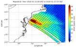
2016-01-25 |
Earth
|
RapidScat
|
ISS-RapidScat
|
751x479x3 |
|
-
PIA20366:
-
Winter Storm Winds in Southern New Jersey, as Viewed by ISS-RapidScat
Full Resolution:
TIFF
(247.3 kB)
JPEG
(74.27 kB)
|
|
|
2016-01-21 |
Earth
|
RapidScat
|
ISS-RapidScat
|
1532x696x3 |
|
-
PIA20365:
-
NASA's RapidScat Observes El Ni�o Blowing in the Winds
Full Resolution:
TIFF
(811.4 kB)
JPEG
(252.2 kB)
|
|
|
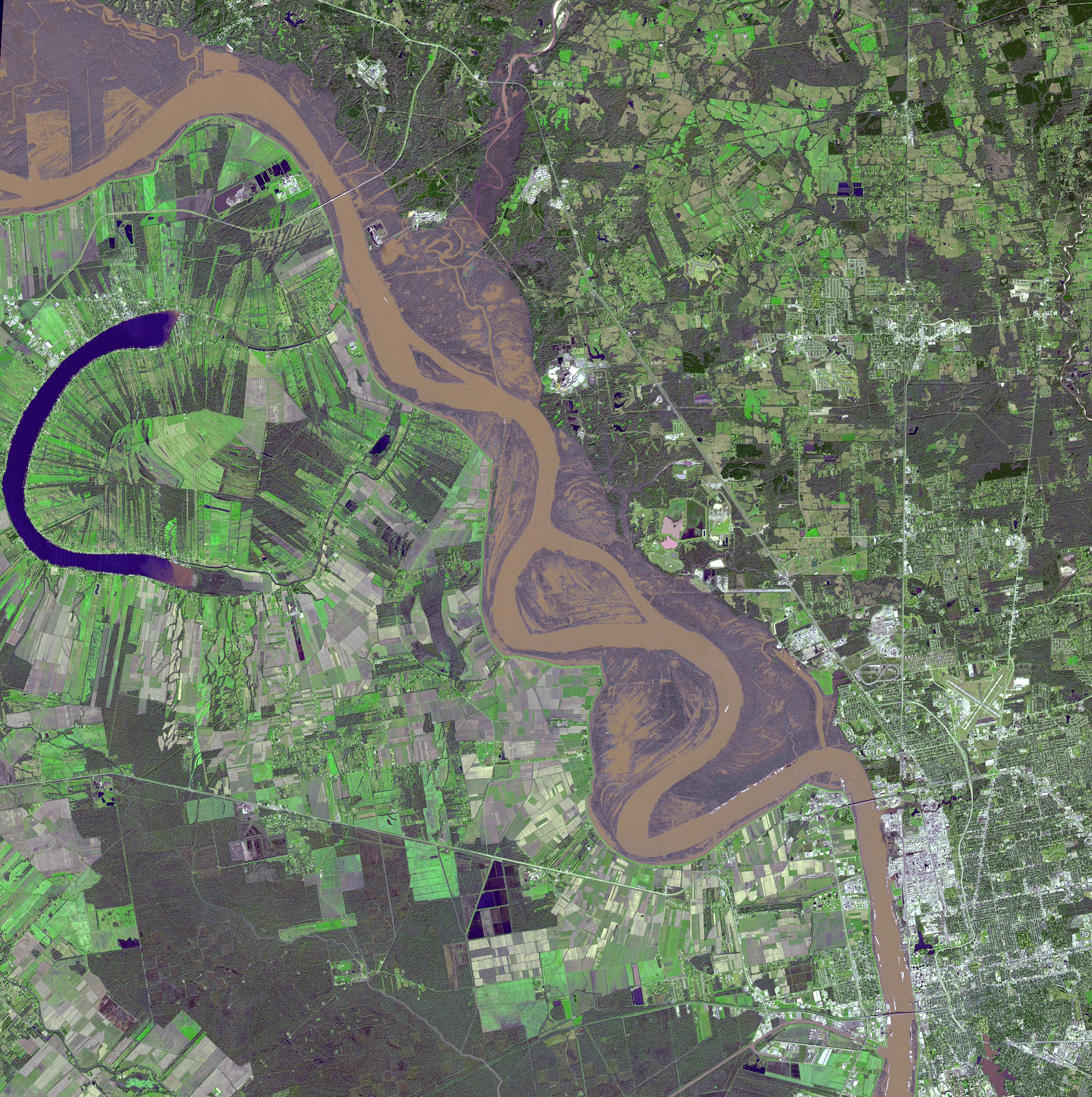
2016-01-20 |
Earth
|
Terra
|
ASTER
|
2532x2544x3 |

|
-
PIA20364:
-
Flooding on the Mississippi River Captured by NASA Spacecraft
Full Resolution:
TIFF
(19.33 MB)
JPEG
(1.766 MB)
|
|
|
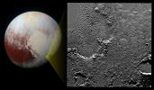
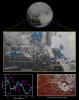
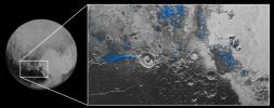
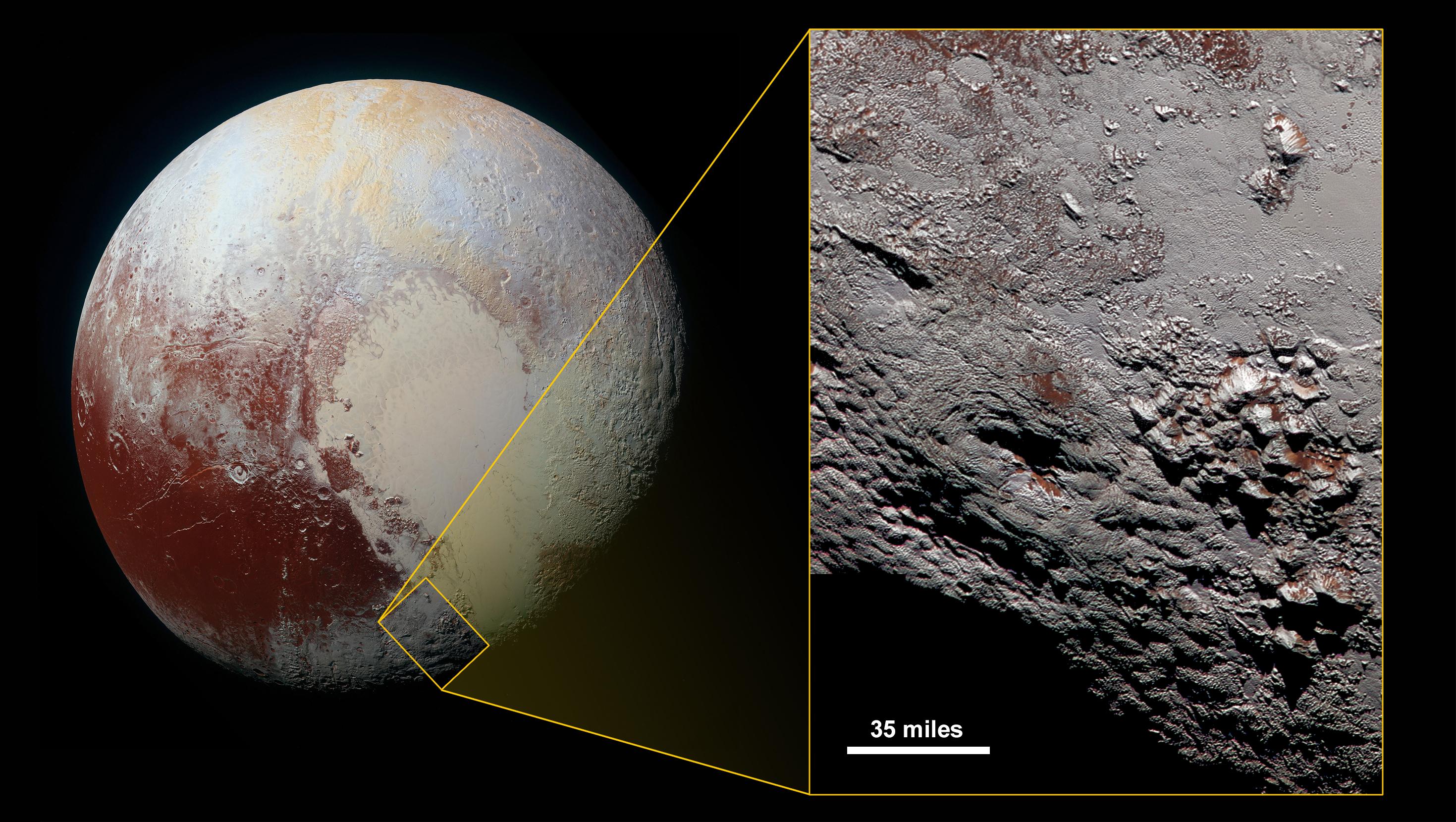
2016-01-14 |
Pluto
|
New Horizons
|
LORRI
MVIC
|
2939x1659x3 |
|
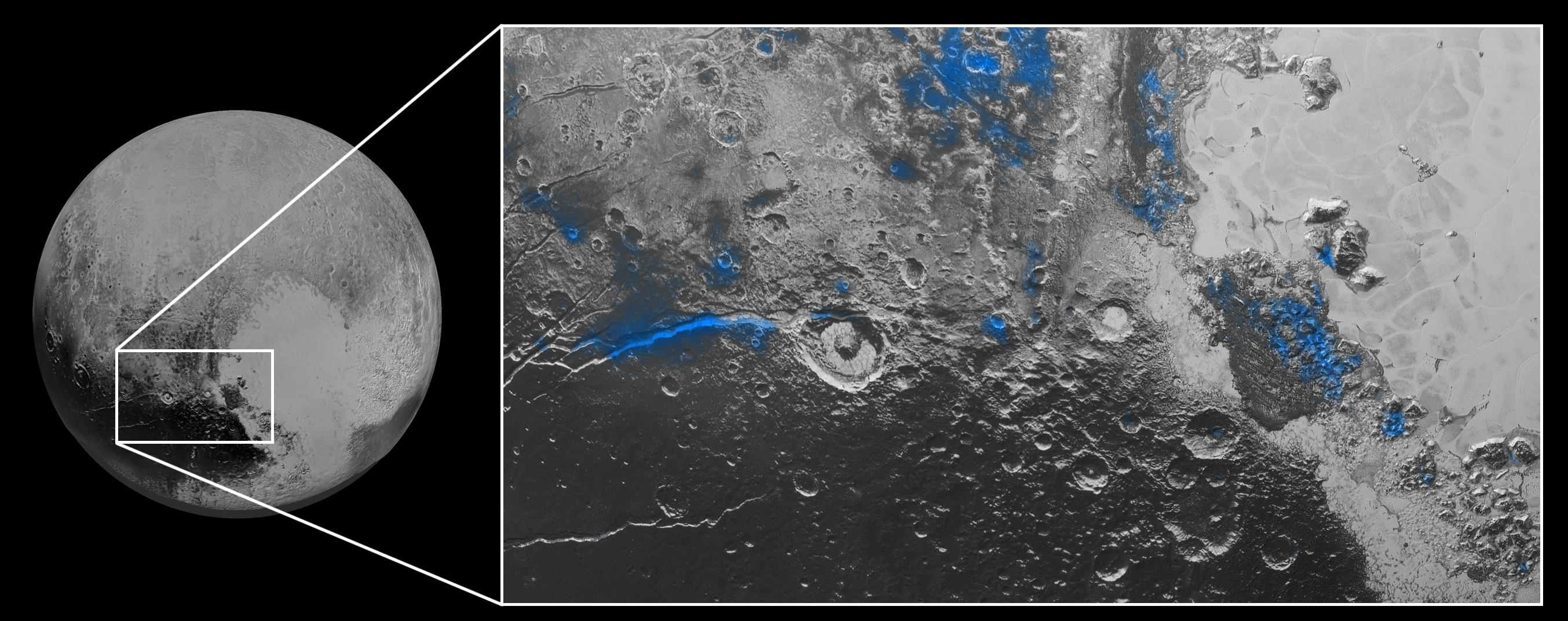
-
PIA20361:
-
Wright's Stuff
Full Resolution:
TIFF
(9.952 MB)
JPEG
(725.2 kB)
|
|
|
2016-01-14 |
Mars
|
Mars Reconnaissance Orbiter (MRO)
|
HiRISE
|
2880x1800x1 |
|
-
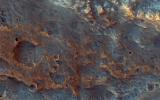
PIA20340:
-
A Young, Fresh Crater in Hellespontus
Full Resolution:
TIFF
(4.722 MB)
JPEG
(525 kB)
|
|
|
2016-01-14 |
Mars
|
Mars Reconnaissance Orbiter (MRO)
|
HiRISE
|
2880x1800x3 |
|
-
PIA20339:
-
Erosion and Deposition in Schaeberle Crater
Full Resolution:
TIFF
(15.56 MB)
JPEG
(820.8 kB)
|
|
|
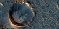
2016-01-14 |
Mars
|
Mars Reconnaissance Orbiter (MRO)
|
HiRISE
|
2880x1800x3 |
|
-
PIA20338:
-
Mars 2020 Candidate Landing Site in McLaughlin Crater
Full Resolution:
TIFF
(15.56 MB)
JPEG
(1.247 MB)
|
|
|
2016-01-14 |
Mars
|
Mars Reconnaissance Orbiter (MRO)
|
HiRISE
|
2880x1800x3 |
|
-
PIA20337:
-
Ancient Rivers
Full Resolution:
TIFF
(15.56 MB)
JPEG
(1.353 MB)
|
|
|
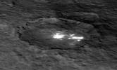
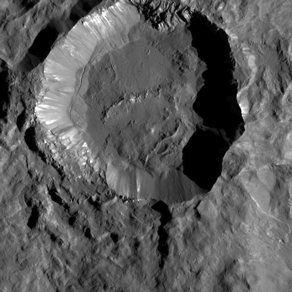
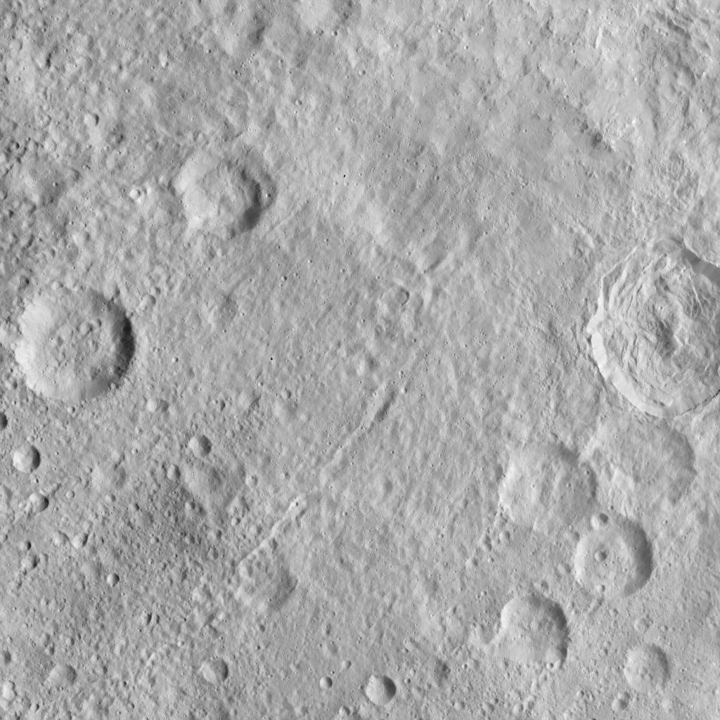
2016-01-12 |
Ceres
|
Dawn
|
Framing Camera
|
1024x1024x1 |
|
-
PIA20194:
-
Crater with Scarps in LAMO
Full Resolution:
TIFF
(1.05 MB)
JPEG
(162.4 kB)
|
|
|
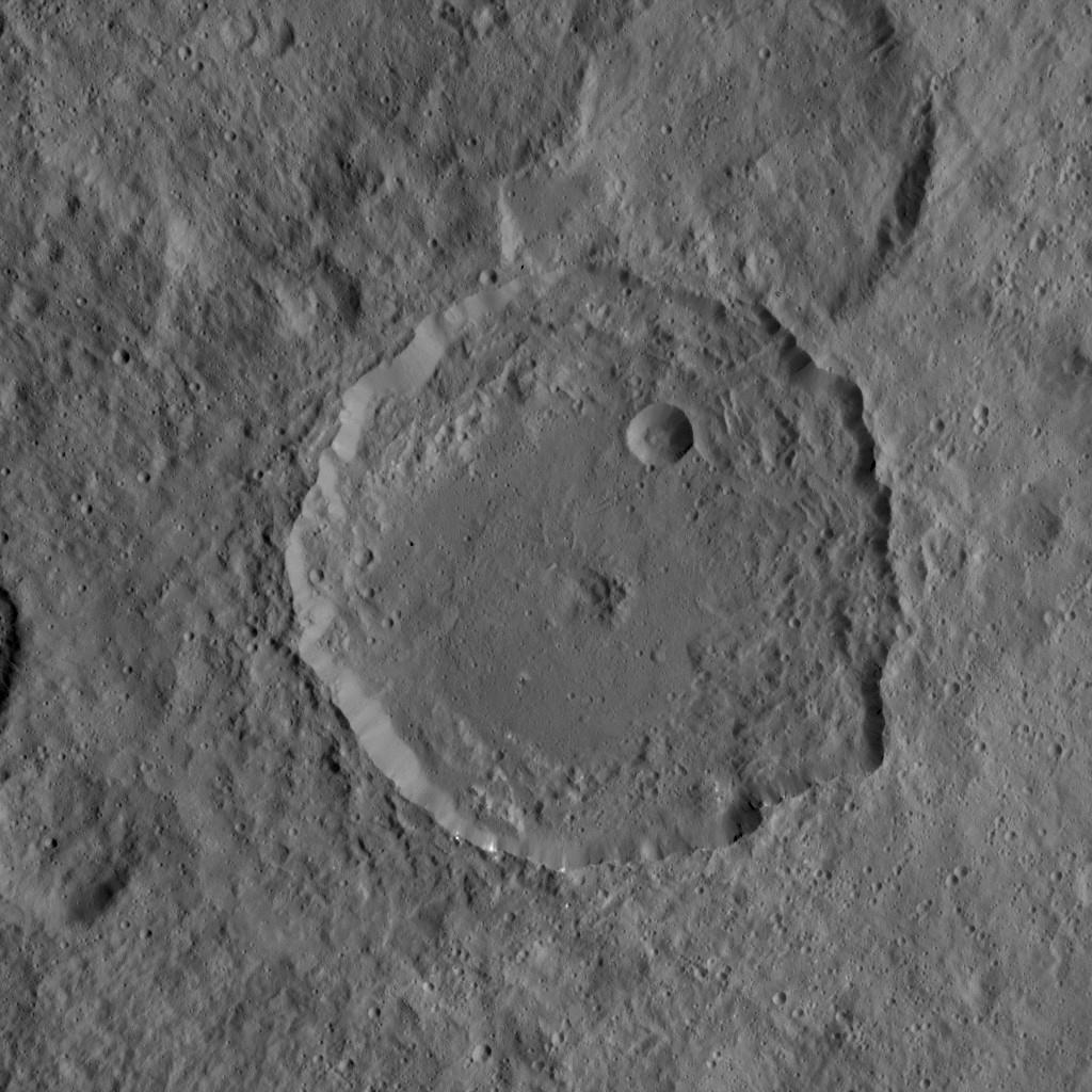
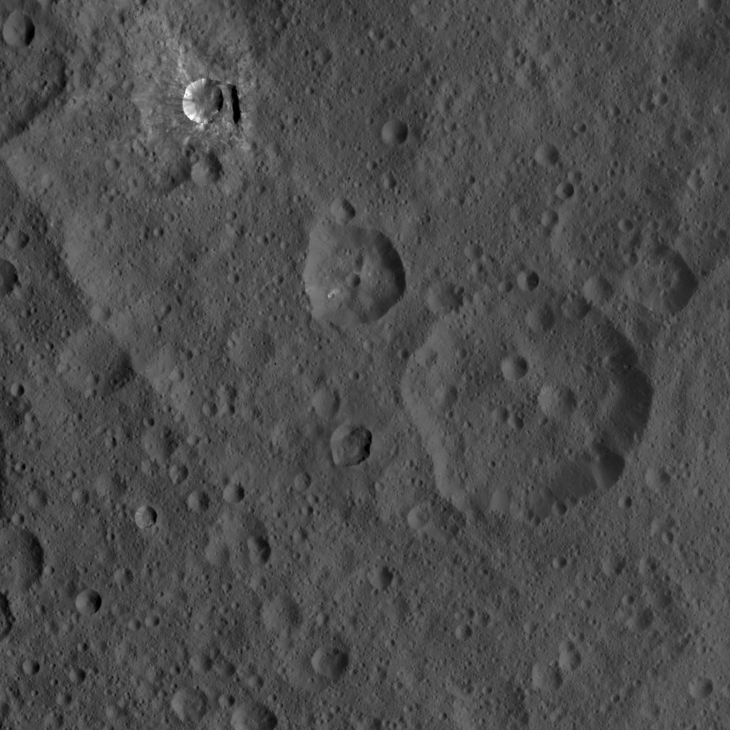
2016-01-12 |
Ceres
|
Dawn
|
Framing Camera
|
1024x1024x1 |
|
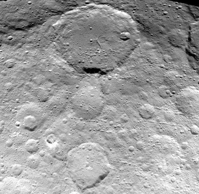
-
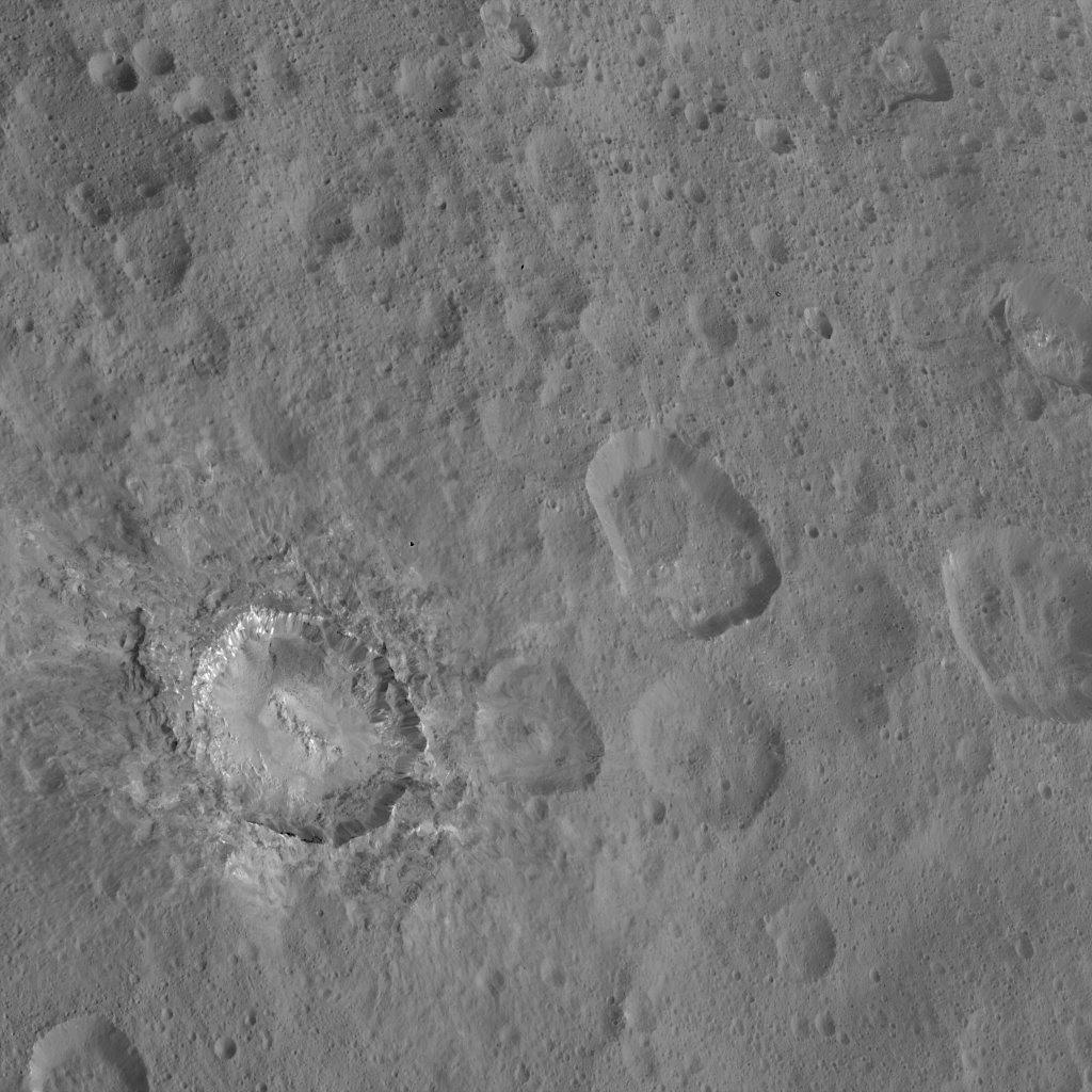
PIA20193:
-
Floor of Dantu Crater from LAMO
Full Resolution:
TIFF
(1.001 MB)
JPEG
(137.8 kB)
|
|
|
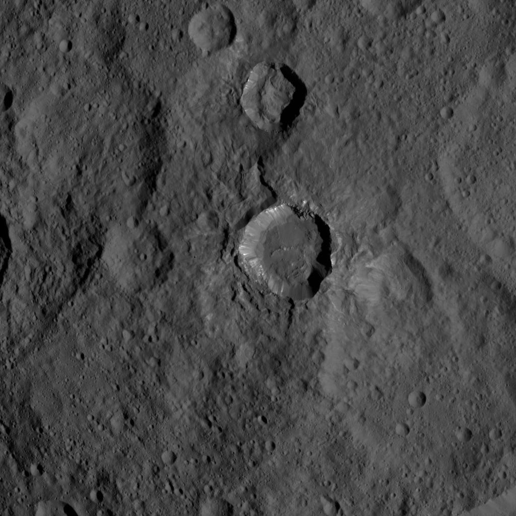
2016-01-12 |
Ceres
|
Dawn
|
Framing Camera
|
1024x1024x1 |
|
-
PIA20192:
-
Kupalo Crater from LAMO
Full Resolution:
TIFF
(1.05 MB)
JPEG
(136.5 kB)
|
|
|
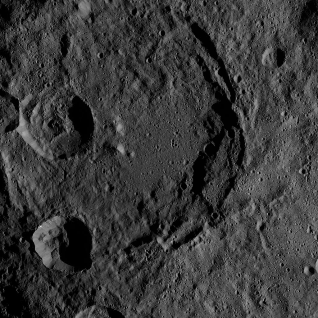
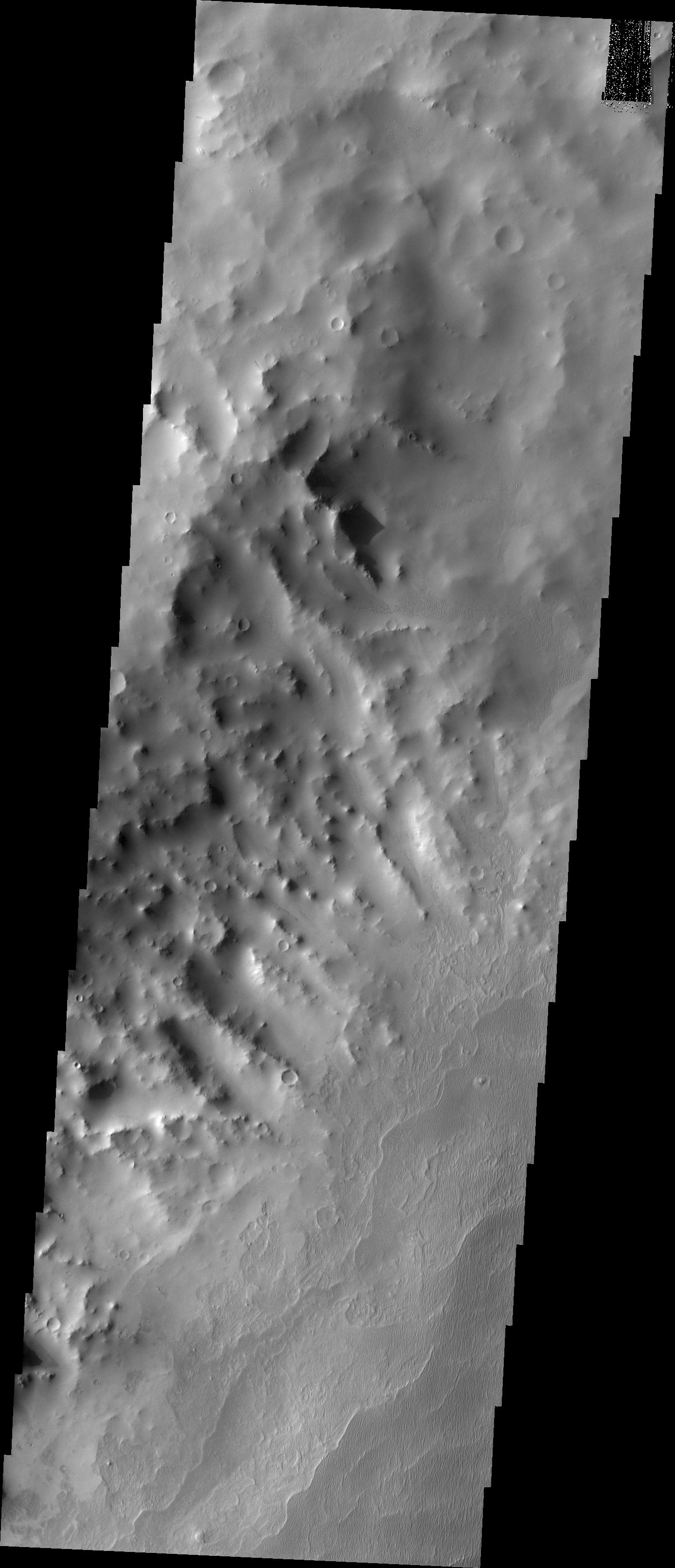
2016-01-11 |
Mars
|
2001 Mars Odyssey
|
THEMIS
|
1438x2655x1 |
|
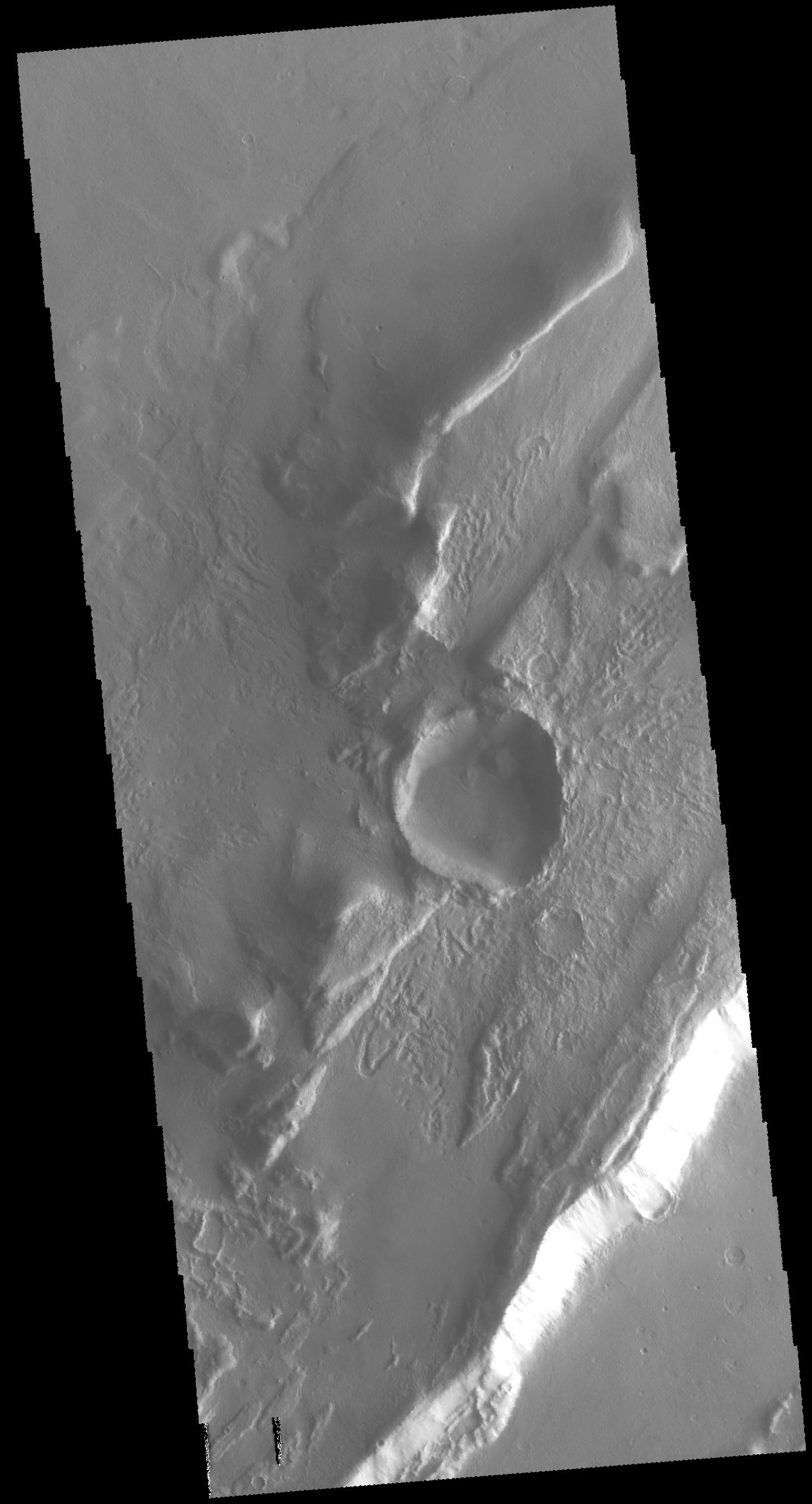
-
PIA20233:
-
Rim Complexities
Full Resolution:
TIFF
(2.777 MB)
JPEG
(334.8 kB)
|
|
|
2015-12-23 |
Mars
|
Mars Reconnaissance Orbiter (MRO)
|
HiRISE
|
2880x1800x1 |

|
-
PIA20290:
-
Boulders on a Landslide
Full Resolution:
TIFF
(5.191 MB)
JPEG
(1.134 MB)
|
|
|
2015-12-23 |
Mars
|
Mars Reconnaissance Orbiter (MRO)
|
HiRISE
|
2880x1800x3 |
|
-
PIA20289:
-
A Frost Enhanced Landscape
Full Resolution:
TIFF
(15.56 MB)
JPEG
(1.378 MB)
|
|
|
2015-12-23 |
Mars
|
Mars Reconnaissance Orbiter (MRO)
|
HiRISE
|
2880x1800x3 |
|
-
PIA20288:
-
Icy Erosion
Full Resolution:
TIFF
(15.14 MB)
JPEG
(754.4 kB)
|
|
|
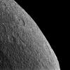
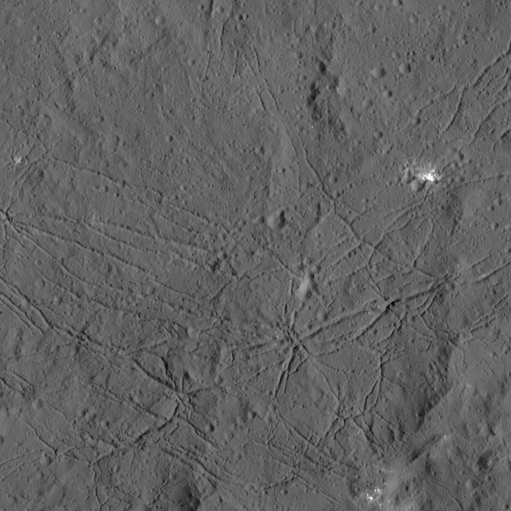
2015-12-22 |
Ceres
|
Dawn
|
Framing Camera
|
1024x1024x1 |

|
-
PIA20186:
-
Dawn LAMO View Around Gerber Catena, Ceres
Full Resolution:
TIFF
(848.8 kB)
JPEG
(136.4 kB)
|
|
|
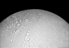
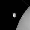
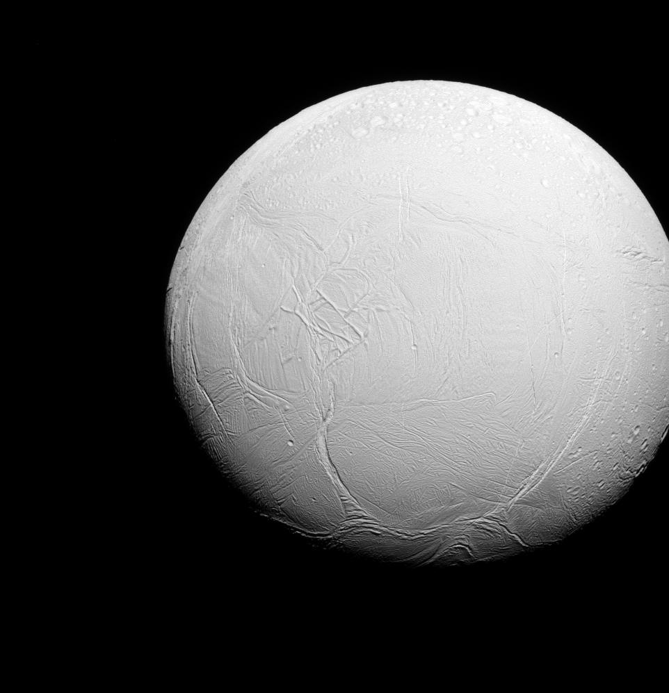
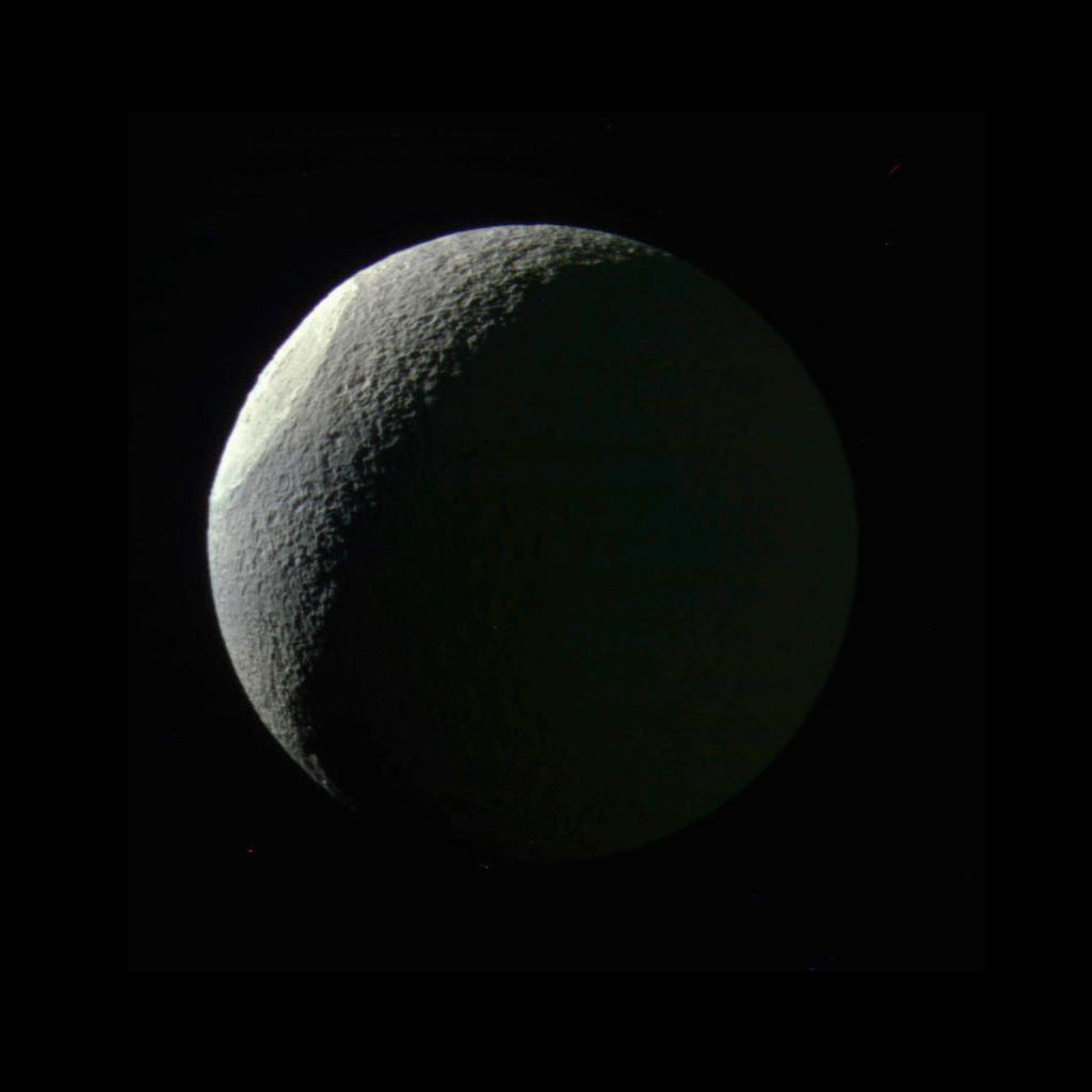
2015-12-21 |
Enceladus
|
Cassini-Huygens
|
ISS - Narrow Angle
|
1023x928x1 |
|
-
PIA18347:
-
Enceladus, Old and New
Full Resolution:
TIFF
(222.3 kB)
JPEG
(39.31 kB)
|
|
|
2015-12-18 |
Pluto
|
New Horizons
|
MVIC
|
1042x1024x1 |
|
-
PIA20287:
-
Pluto's Moon Nix, Half Illuminated
Full Resolution:
TIFF
(476 kB)
JPEG
(26.11 kB)
|
|
|
2015-12-15 |
Ceres
|
Dawn
|
Framing Camera
|
1024x1024x1 |
|
-
PIA20140:
-
Dawn HAMO Image 77
Full Resolution:
TIFF
(1.05 MB)
JPEG
(203.8 kB)
|
|
|
2015-12-14 |
Ceres
|
Dawn
|
Framing Camera
|
1024x1024x1 |
|
-
PIA20139:
-
Dawn HAMO Image 76
Full Resolution:
TIFF
(1.05 MB)
JPEG
(145.5 kB)
|
|
|
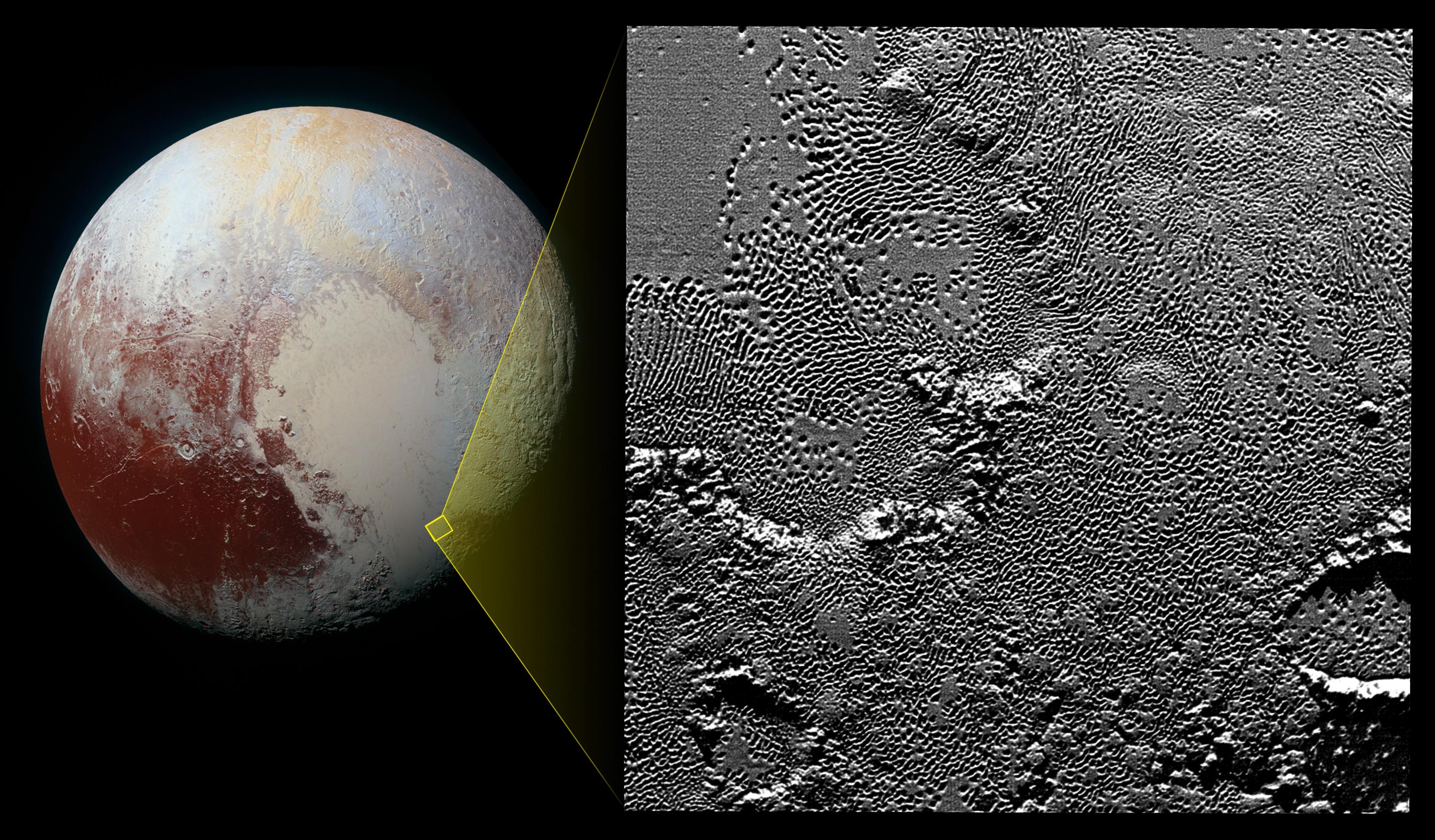
2015-12-10 |
Pluto
|
New Horizons
|
LORRI
MVIC
|
2817x1650x3 |
|
-
PIA20212:
-
Zooming in on Pluto's Pattern of Pits
Full Resolution:
TIFF
(7.873 MB)
JPEG
(866.1 kB)
|
|
|
2015-12-09 |
Ceres
|
Dawn
|
Framing Camera
|
1734x1043x1 |
|
-
PIA20179:
-
Occator Crater in Perspective
Full Resolution:
TIFF
(1.218 MB)
JPEG
(146.3 kB)
|
|
|
2015-12-08 |
Ceres
|
Dawn
|
Framing Camera
|
1024x1024x1 |

|
-
PIA20135:
-
Dawn HAMO Image 72
Full Resolution:
TIFF
(1.05 MB)
JPEG
(224.9 kB)
|
|
|
2015-12-08 |
Earth
|
GRACE
|
K-Band Ranging System
|
3335x3332x3 |
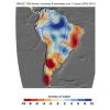
|
-
PIA20205:
-
Cumulative Total South America Freshwater Losses as Seen by NASA's GRACE, 2002-15
Full Resolution:
TIFF
(6.343 MB)
JPEG
(772.7 kB)
|
|
|
2015-12-08 |
Earth
|
GRACE
|
K-Band Ranging System
|
5198x2724x3 |
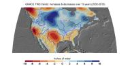
|
-
PIA20204:
-
Cumulative Total U.S. Freshwater Losses as Seen by NASA's GRACE, 2002-15
Full Resolution:
TIFF
(8.747 MB)
JPEG
(1.212 MB)
|
|
|
2015-12-04 |
Titan
|
Cassini-Huygens
|
Visual and Infrared Mapping Spectrometer
|
2002x2002x3 |
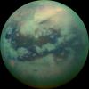
|
-
PIA20016:
-
Peering Through Titan's Haze
Full Resolution:
TIFF
(6.69 MB)
JPEG
(160.3 kB)
|
|
|
2015-12-04 |
Ceres
|
Dawn
|
Framing Camera
|
1024x1024x1 |
|
-
PIA20133:
-
Dawn HAMO Image 70
Full Resolution:
TIFF
(1.05 MB)
JPEG
(208.7 kB)
|
|
|
2015-12-02 |
Ceres
|
Dawn
|
Framing Camera
|
1024x1024x1 |
|
-
PIA20131:
-
Dawn HAMO Image 68
Full Resolution:
TIFF
(1.05 MB)
JPEG
(161.9 kB)
|
|
|
2015-11-30 |
Ceres
|
Dawn
|
Framing Camera
|
1024x1024x1 |
|
-
PIA20129:
-
Dawn HAMO Image 66
Full Resolution:
TIFF
(1.028 MB)
JPEG
(177.6 kB)
|
|
|
2015-11-27 |
Mars
|
Mars Reconnaissance Orbiter (MRO)
|
HiRISE
|
2880x1800x1 |

|
-
PIA20158:
-
A Youthful Crater in the Cydonia Colles Region
Full Resolution:
TIFF
(5.191 MB)
JPEG
(819.4 kB)
|
|
|
2015-11-19 |
Ceres
|
Dawn
|
Framing Camera
|
1024x1024x1 |
|
-
PIA20125:
-
Dawn HAMO Image 63
Full Resolution:
TIFF
(1.05 MB)
JPEG
(232.3 kB)
|
|
|
2015-11-18 |
Ceres
|
Dawn
|
Framing Camera
|
1024x1024x1 |

|
-
PIA20124:
-
Dawn HAMO Image 62
Full Resolution:
TIFF
(1.05 MB)
JPEG
(141.8 kB)
|
|
|
2015-11-17 |
Ceres
|
Dawn
|
Framing Camera
|
1024x1024x1 |
|
-
PIA20123:
-
Dawn HAMO Image 61
Full Resolution:
TIFF
(1.05 MB)
JPEG
(166.9 kB)
|
|
|
2015-11-13 |
Ceres
|
Dawn
|
Framing Camera
|
1024x1024x1 |
|
-
PIA20121:
-
Dawn HAMO Image 59
Full Resolution:
TIFF
(1.05 MB)
JPEG
(194.1 kB)
|
|
|
2015-11-13 |
Mars
|
2001 Mars Odyssey
|
THEMIS
|
714x1439x1 |
|
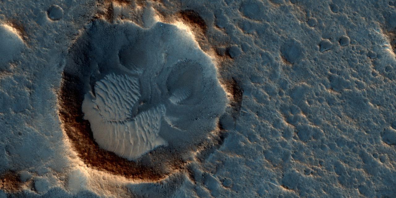
-
PIA20092:
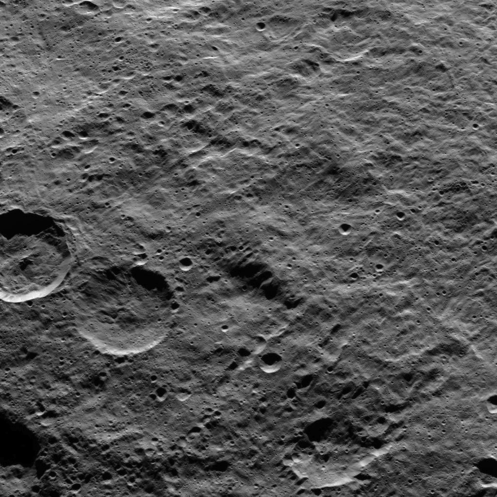
-
Central Pit Crater
Full Resolution:
TIFF
(706.8 kB)
JPEG
(77.56 kB)
|
|
|
2015-11-12 |
Ceres
|
Dawn
|
Framing Camera
|
1024x1024x1 |
|
-
PIA20120:
-
Dawn HAMO Image 58
Full Resolution:
TIFF
(1.029 MB)
JPEG
(134.2 kB)
|
|
|
2015-11-11 |
Ceres
|
Dawn
|
Framing Camera
|
1024x1024x1 |
|
-
PIA20000:
-
Dawn HAMO Image 57
Full Resolution:
TIFF
(1.05 MB)
JPEG
(148.8 kB)
|
|
|
2015-11-11 |
Mars
|
2001 Mars Odyssey
|
THEMIS
|
723x1459x1 |
|
-
PIA20090:
-
Crater Chaos
Full Resolution:
TIFF
(775.6 kB)
JPEG
(96.58 kB)
|
|
|
2015-10-26 |
Enceladus
|
Cassini-Huygens
|
ISS - Narrow Angle
|
962x997x1 |

|
-
PIA18340:
-
A Tale of Two Hemispheres
Full Resolution:
TIFF
(499.7 kB)
JPEG
(77.82 kB)
|
|
|
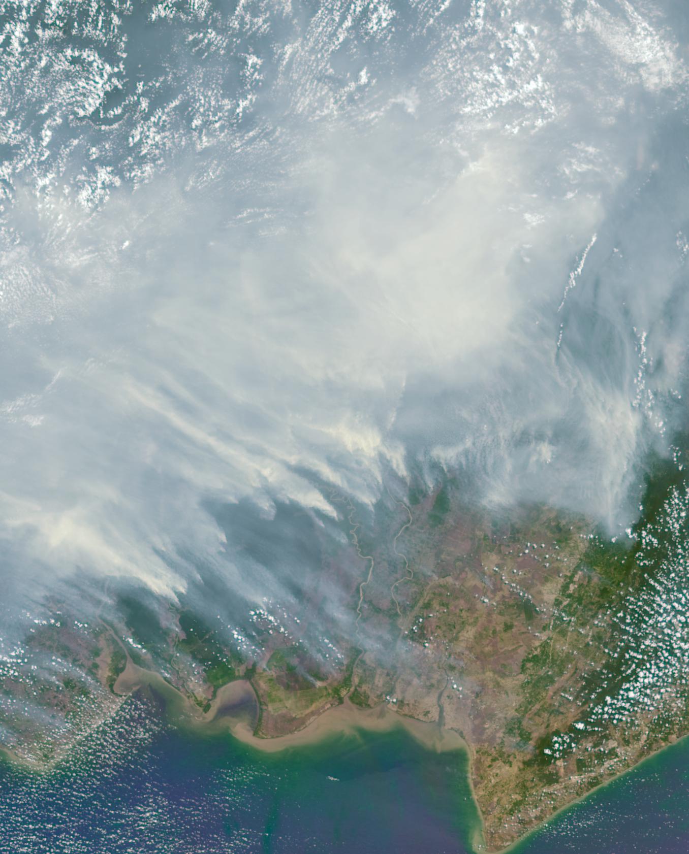
2015-10-21 |
Earth
|
Terra
|
MISR
|
1356x1682x3 |
|
-
PIA11218:
-
Borneo on Fire
Full Resolution:
TIFF
(6.253 MB)
JPEG
(246.6 kB)
|
|
|
2015-10-16 |
Pluto
|
New Horizons
|
LEISA
MVIC
|
3300x4200x3 |
|
-
PIA20030:
-
Water Ice on Pluto
Full Resolution:
TIFF
(15.82 MB)
JPEG
(1.239 MB)
|
|
|
2015-10-16 |
Mars
|
2001 Mars Odyssey
|
THEMIS
|
1325x2774x1 |
|
-
PIA19800:
-
The Martian, Part 5: Schiaparelli Crater Floor
Full Resolution:
TIFF
(3.138 MB)
JPEG
(595.6 kB)
|
|
|
2015-10-15 |
Enceladus
|
Cassini-Huygens
|
ISS - Wide Angle
|
1024x711x1 |
|
-
PIA20010:
-
Craters Crowd the North
Full Resolution:
TIFF
(408.4 kB)
JPEG
(82.01 kB)
|
|
|
2015-10-15 |
Mars
|
2001 Mars Odyssey
|
THEMIS
|
1388x3222x1 |

|
-
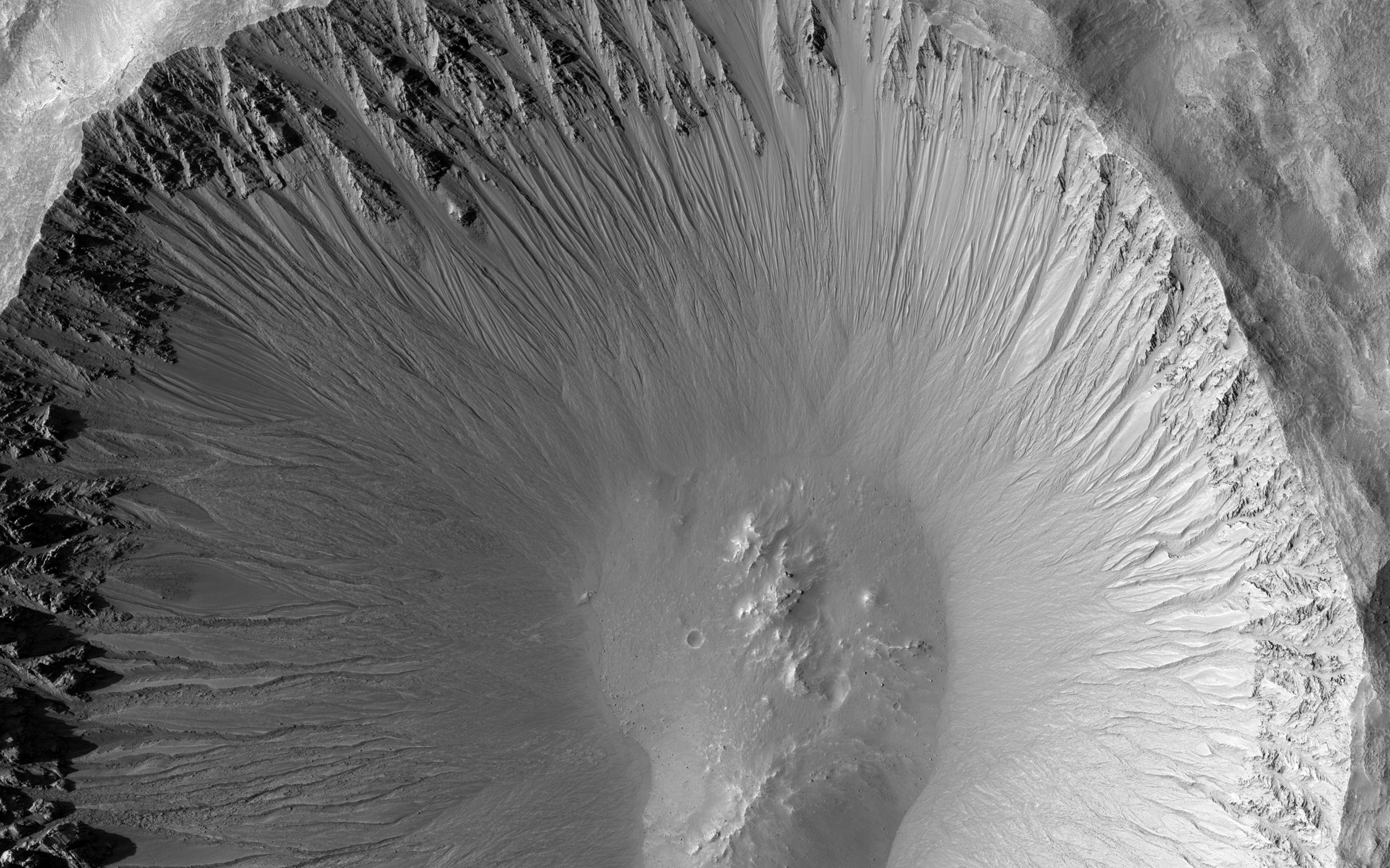
PIA19799:
-
The Martian, Part 4: Schiaparelli Crater Rim
Full Resolution:
TIFF
(3.232 MB)
JPEG
(328.6 kB)
|
|
|
2015-10-14 |
Mars
|
Mars Reconnaissance Orbiter (MRO)
|
HiRISE
|
2880x1800x3 |
|
-
PIA20004:
-
Kasei Valles
Full Resolution:
TIFF
(5.191 MB)
JPEG
(987.8 kB)
|
|
|
2015-10-08 |
Earth
|
SMAP
|
|
1093x1153x3 |
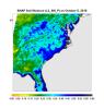
|
-
PIA20001:
-
Devastating Carolina Floods Viewed by NASA's SMAP
Full Resolution:
TIFF
(1.011 MB)
JPEG
(143.8 kB)
|
|
|
2015-10-08 |
Pluto
|
New Horizons
|
LEISA
MVIC
|
2707x1072x3 |
|
-
PIA19963:
-
Water Ice on Pluto
Full Resolution:
TIFF
(3.858 MB)
JPEG
(427.7 kB)
|
|
|
2015-10-05 |
Mars
|
Mars Reconnaissance Orbiter (MRO)
|
HiRISE
|
1280x720x1 |
|
-
PIA19915:
-
Western Edge of Mars' Marth Crater, a Movie Location
Full Resolution:
TIFF
(922.8 kB)
JPEG
(106.5 kB)
|
|
|
2015-10-05 |
Mars
|
Mars Reconnaissance Orbiter (MRO)
|
HiRISE
|
1280x640x3 |
|
-
PIA19913:
-
The Ares 3 Landing Site: Where Science Fact Meets Fiction
Full Resolution:
TIFF
(2.459 MB)
JPEG
(139.8 kB)
|
|
|
2015-09-30 |
Mars
|
Mars Reconnaissance Orbiter (MRO)
|
HiRISE
|
2880x1800x3 |
|
-
PIA19960:
-
Nested Channels near Hellas
Full Resolution:
TIFF
(14.91 MB)
JPEG
(850.1 kB)
|
|
|
2015-09-30 |
Mars
|
Mars Reconnaissance Orbiter (MRO)
|
HiRISE
|
2880x1800x3 |
|
-
PIA19959:
-
Western Edge of Marth Crater
Full Resolution:
TIFF
(15.56 MB)
JPEG
(1.029 MB)
|
|
|
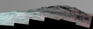
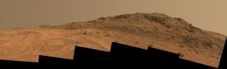
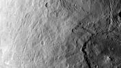
2015-09-25 |
Mars
|
Mars Exploration Rover (MER)
|
Panoramic Camera
|
5595x1758x3 |
|
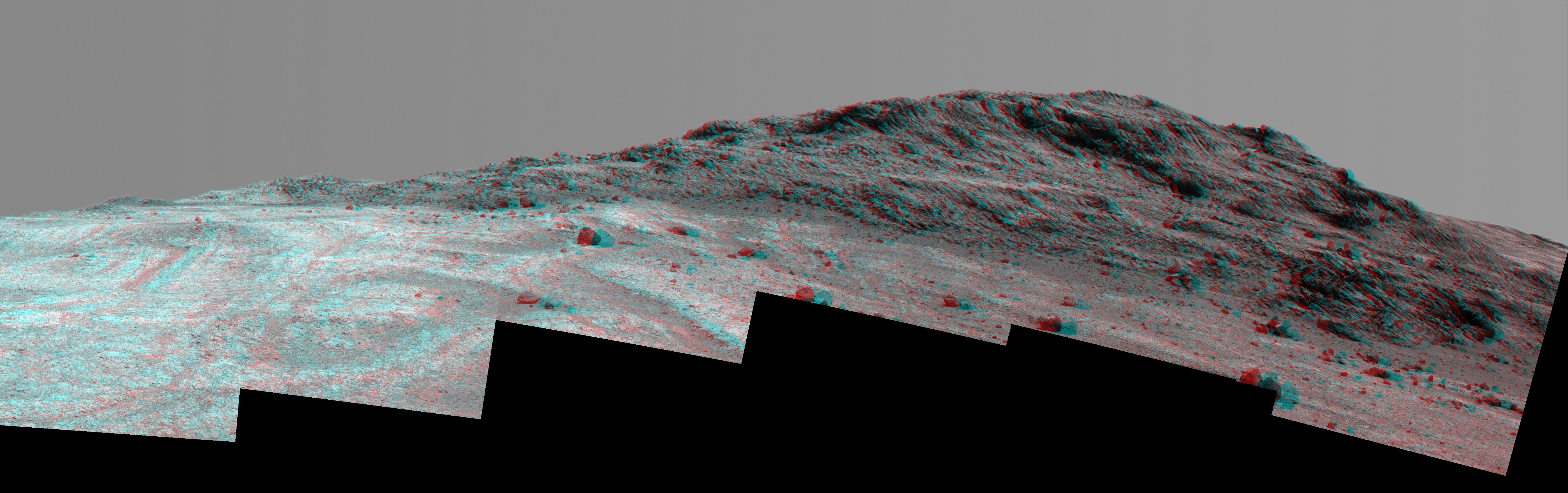
-
PIA19911:
-
'Hinners Point' Above Floor of 'Marathon Valley' on Mars (Stereo)
Full Resolution:
TIFF
(15.79 MB)
JPEG
(1.128 MB)
|
|
|
2015-09-25 |
Mars
|
Mars Exploration Rover (MER)
|
Panoramic Camera
|
5725x1758x3 |
|
-
PIA19820:
-
'Hinners Point' Above Floor of 'Marathon Valley' on Mars (Enhanced Color)
Full Resolution:
TIFF
(23.63 MB)
JPEG
(1.121 MB)
|
|
|
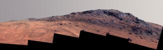
2015-09-25 |
Mars
|
Mars Exploration Rover (MER)
|
Panoramic Camera
|
5725x1758x3 |
|
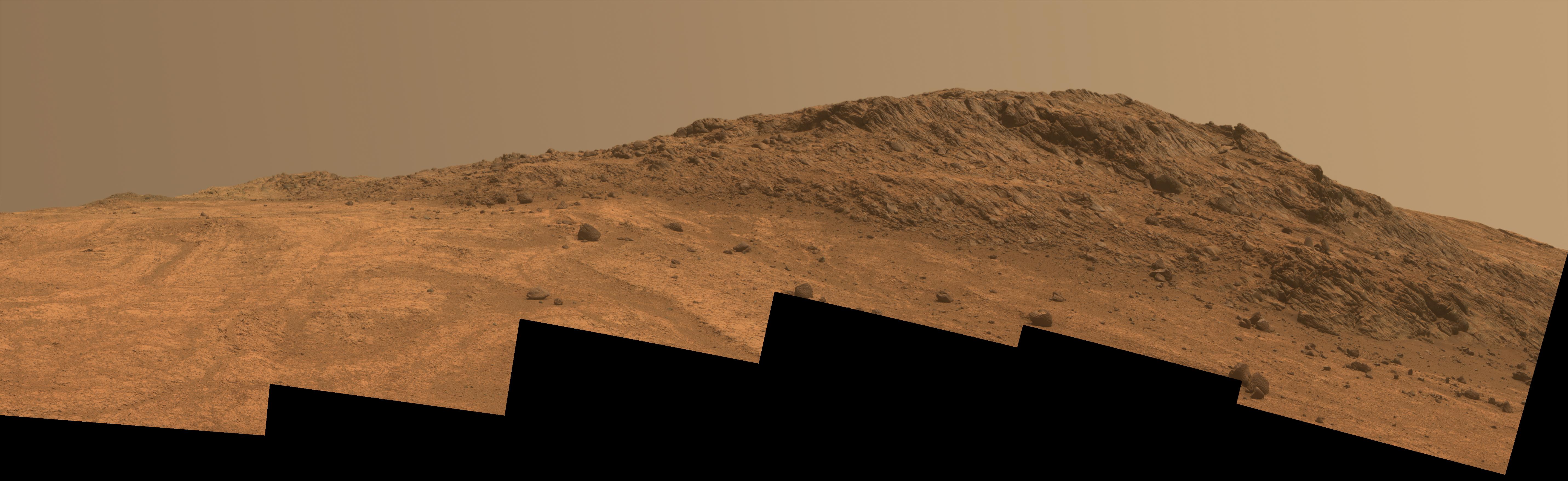
-
PIA19819:
-
'Hinners Point' Above Floor of 'Marathon Valley' on Mars
Full Resolution:
TIFF
(17.46 MB)
JPEG
(839.9 kB)
|
|
|
2015-09-22 |
Mars
|
2001 Mars Odyssey
|
THEMIS
|
1434x2655x1 |

|
-
PIA19780:
-
Tanaica Montes
Full Resolution:
TIFF
(2.449 MB)
JPEG
(242.6 kB)
|
|
|
2015-09-16 |
Mars
|
Mars Reconnaissance Orbiter (MRO)
|
HiRISE
|
2880x1800x3 |
|
-
PIA19940:
-
Possible Sulfates in the Northeast Syrtis Major Region
Full Resolution:
TIFF
(15.56 MB)
JPEG
(881.1 kB)
|
|
|
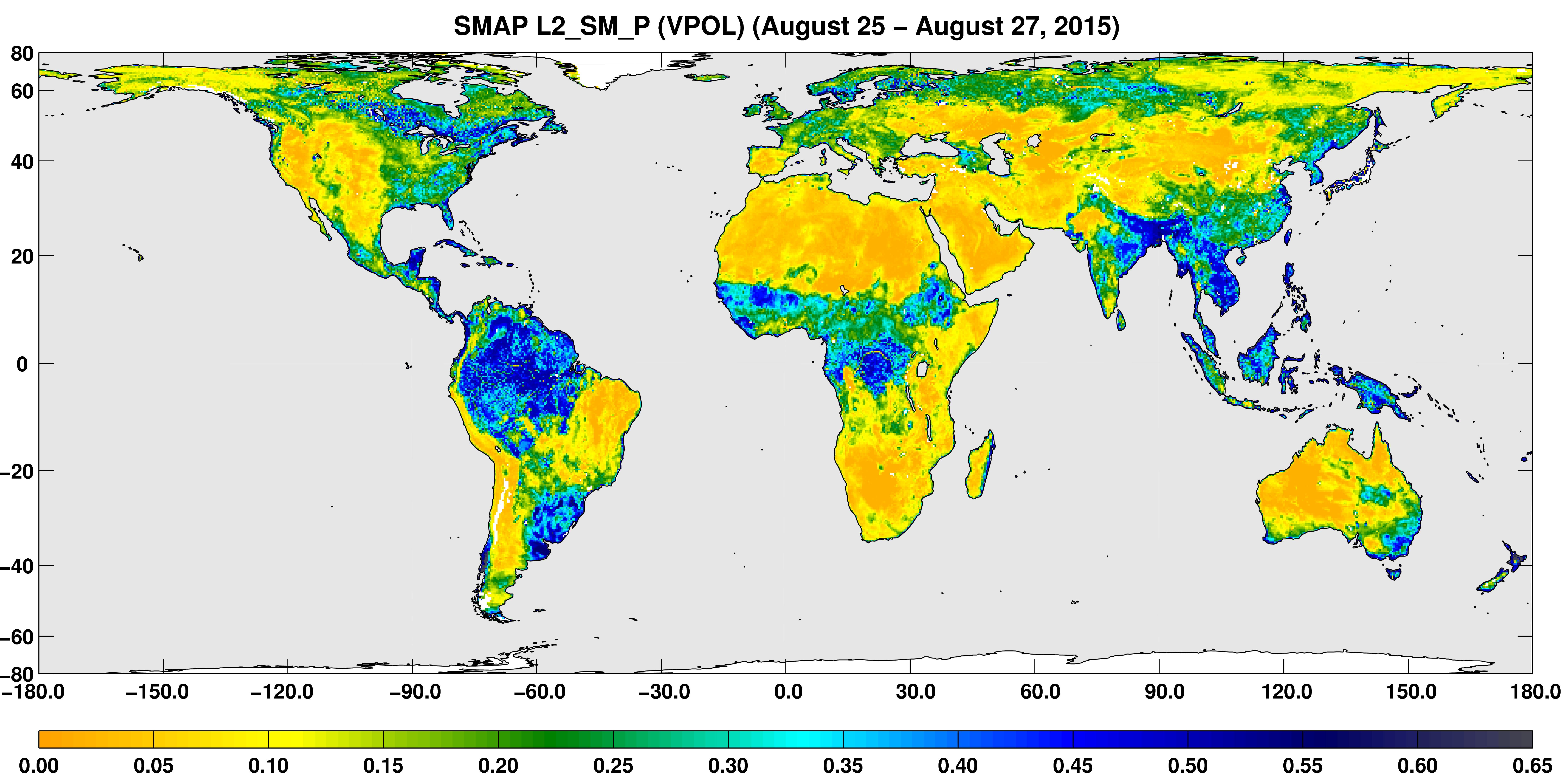
2015-09-02 |
Earth
|
SMAP
|
|
7592x3775x3 |
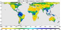
|
-
PIA19877:
-
SMAP Global Map of Surface Soil Moisture (Aug. 25-27, 2015)
Full Resolution:
TIFF
(7.029 MB)
JPEG
(2.248 MB)
|
|
|
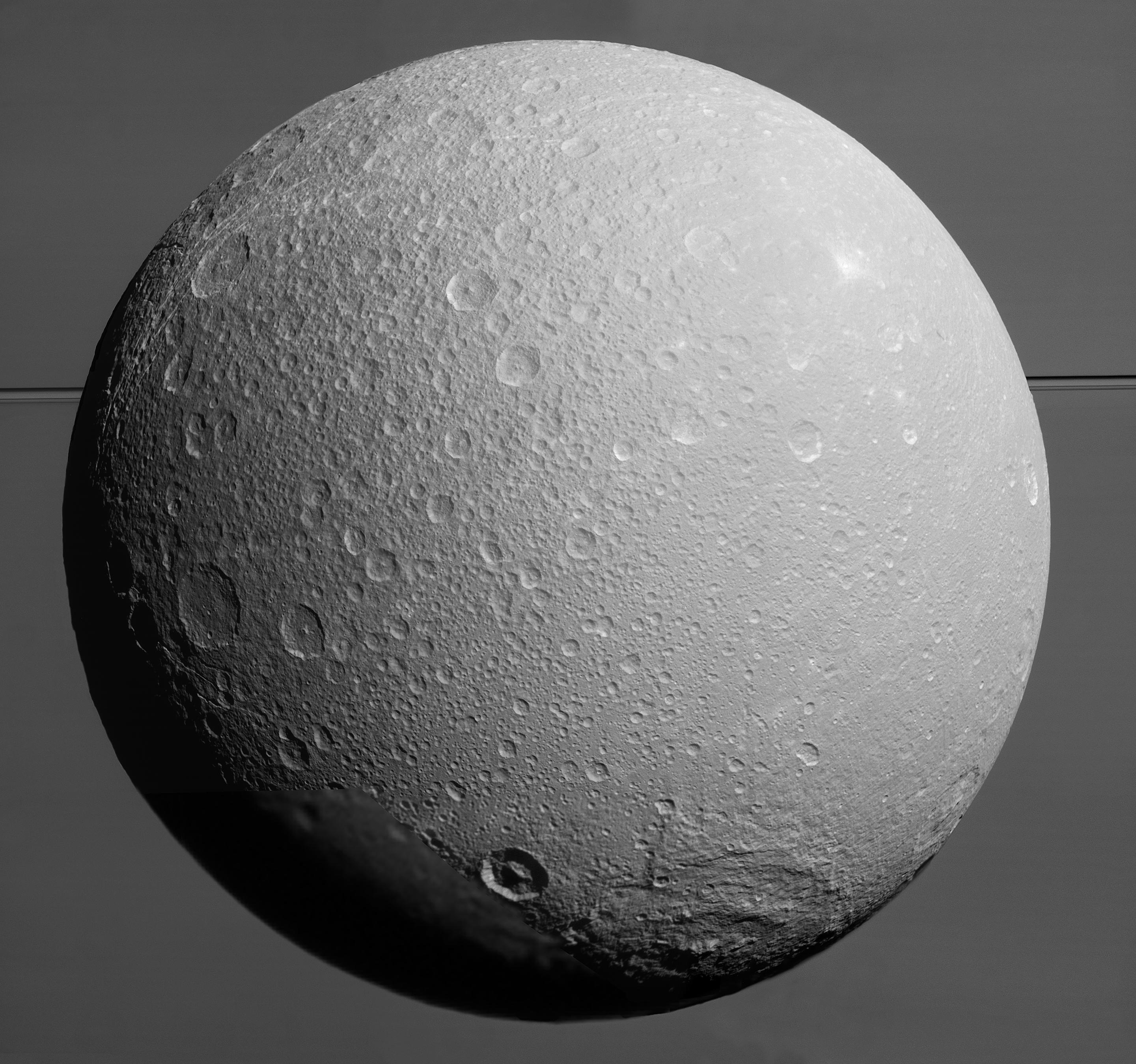
2015-08-20 |
Dione
|
Cassini-Huygens
|
ISS - Wide Angle
|
693x1000x1 |
|
-
PIA19651:
-
Dione's Impact-Battered Icescape
Full Resolution:
TIFF
(631.3 kB)
JPEG
(134.1 kB)
|
|
|
2015-08-20 |
Dione
|
Cassini-Huygens
|
ISS - Narrow Angle
ISS - Wide Angle
|
2881x2698x1 |

|
-
PIA19650:
-
Imminent Approach to Dione
Full Resolution:
TIFF
(7.116 MB)
JPEG
(865.7 kB)
|
|
|
2015-08-20 |
|
Spitzer Space Telescope
|
Spitzer Space Telescope
|
4800x2700x3 |
|
-
PIA19872:
-
NASA's Spitzer 12th Anniversary Space Calendar
Full Resolution:
TIFF
(38.9 MB)
JPEG
(1.945 MB)
|
|
|
2015-08-17 |
Dione
|
Cassini-Huygens
|
ISS - Narrow Angle
|
1024x1024x1 |
|
-
PIA18327:
-
Chasms on Dione
Full Resolution:
TIFF
(1.029 MB)
JPEG
(190.1 kB)
|
|
|
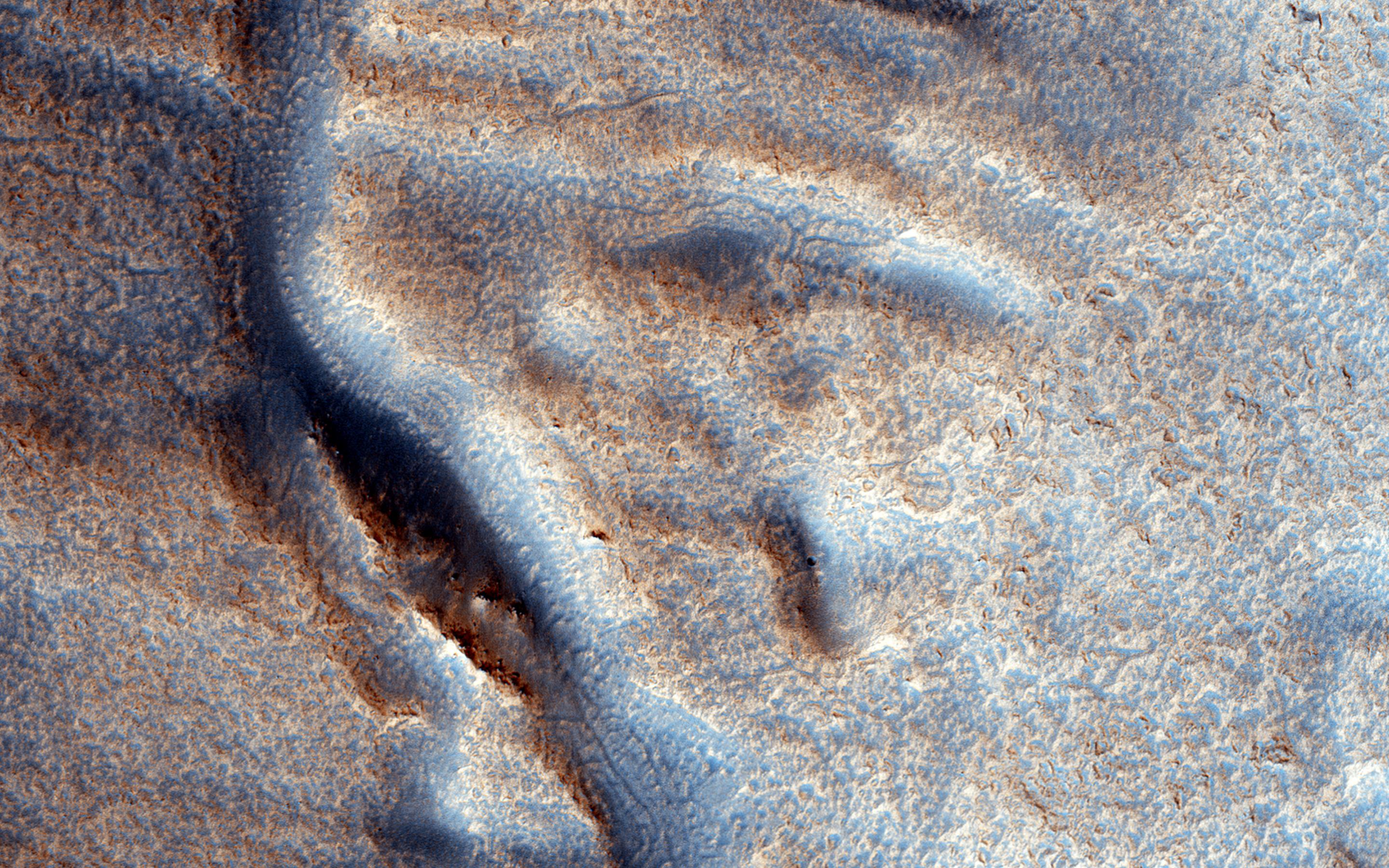
2015-07-29 |
Mars
|
Mars Reconnaissance Orbiter (MRO)
|
HiRISE
|
2880x1800x3 |
|
-
PIA19861:
-
A Fresh Shallow Valley Transitions to an Inverted Channel
Full Resolution:
TIFF
(15.56 MB)
JPEG
(1.045 MB)
|
|
|
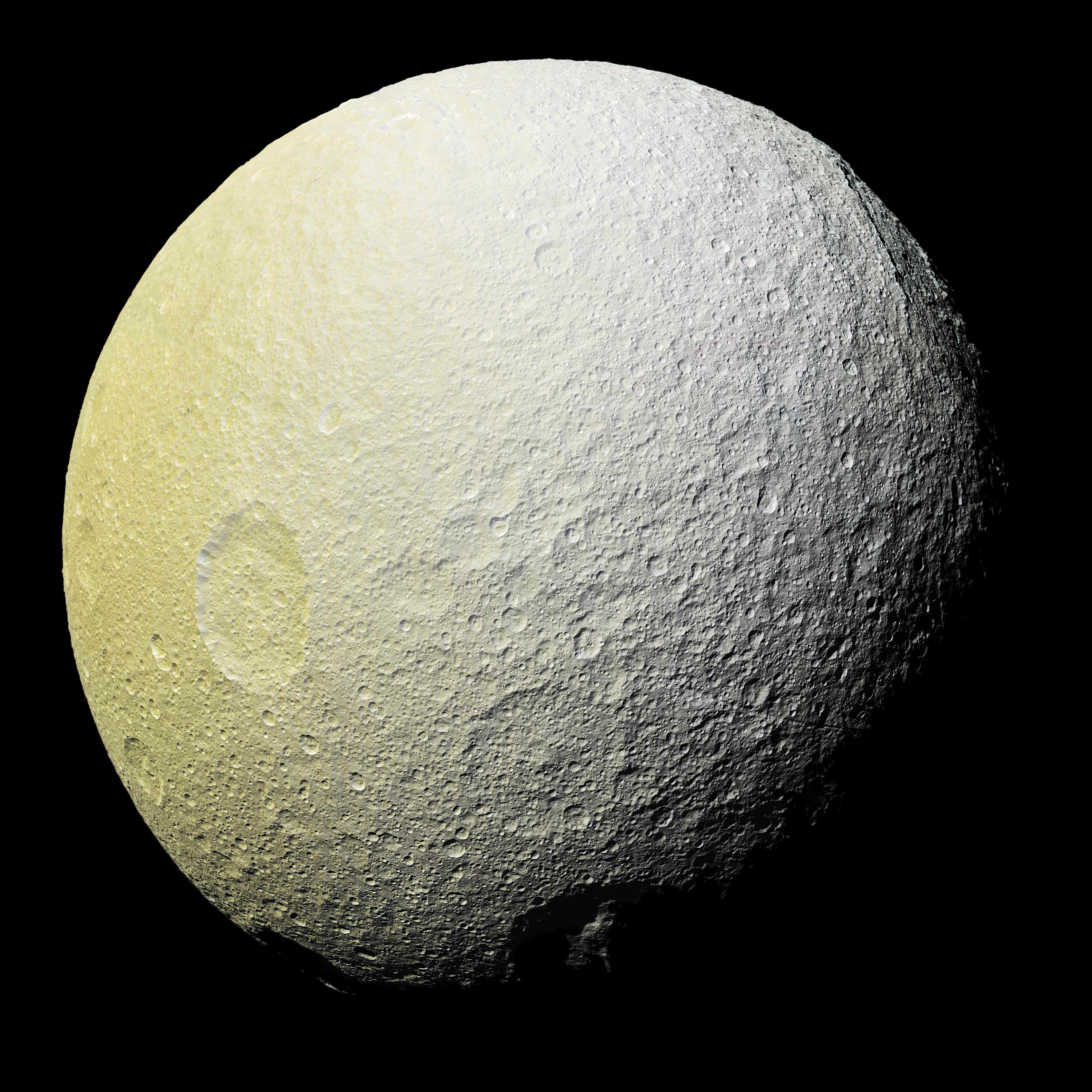
2015-07-29 |
Tethys
|
Cassini-Huygens
|
ISS - Narrow Angle
|
4000x4000x3 |
|
-
PIA19636:
-
The Colors of Tethys I
Full Resolution:
TIFF
(48.02 MB)
JPEG
(1.838 MB)
|
|
|
2015-07-27 |
Tethys
|
Cassini-Huygens
|
Imaging Science Subsystem
|
1024x1024x3 |

|
-
PIA18329:
-
Bright Basin on Tethys
Full Resolution:
TIFF
(3.147 MB)
JPEG
(34.36 kB)
|
|
|
2015-07-15 |
Mars
|
Mars Reconnaissance Orbiter (MRO)
|
HiRISE
|
2880x1800x3 |
|
-
PIA19854:
-
Purple Mountain's Majesty
Full Resolution:
TIFF
(15.56 MB)
JPEG
(731.7 kB)
|
|
|
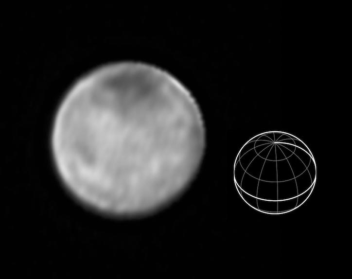
2015-07-10 |
Charon
|
New Horizons
|
LORRI
|
724x574x1 |
|
-
PIA19704:
-
Bright Spots on Charon
Full Resolution:
TIFF
(416.2 kB)
JPEG
(16.72 kB)
|
|
|
2015-07-01 |
Mars
|
Mars Reconnaissance Orbiter (MRO)
|
HiRISE
|
2880x1800x3 |
|
-
PIA19849:
-
Pedestal Crater Development
Full Resolution:
TIFF
(15.56 MB)
JPEG
(764.6 kB)
|
|
|
2015-06-17 |
Mars
|
Mars Reconnaissance Orbiter (MRO)
|
HiRISE
|
2880x1800x3 |
|
-
PIA19845:
-
A Fan-Shaped Landform and Nearby Light-Toned Material
Full Resolution:
TIFF
(15.56 MB)
JPEG
(1.015 MB)
|
|
|
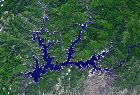
2015-06-17 |
Earth
|
Terra
|
ASTER
|
535x365x3 |
|
-
PIA19492:
-
Lake Shasta, California
Full Resolution:
TIFF
(586.2 kB)
JPEG
(53.4 kB)
|
|
|
2015-06-15 |
Tethys
|
Cassini-Huygens
|
ISS - Wide Angle
|
1024x1024x1 |
|
-
PIA18318:
-
Tethys 'Eyes' Saturn
Full Resolution:
TIFF
(1.05 MB)
JPEG
(30.92 kB)
|
|
|
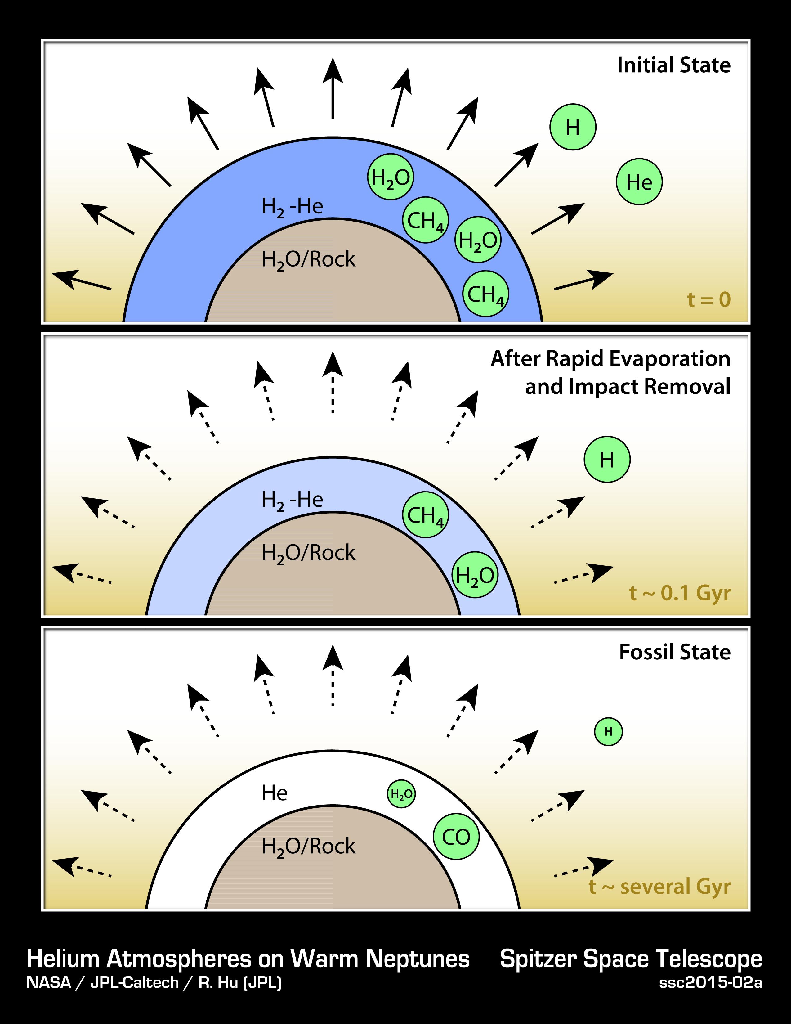
2015-06-11 |
|
Spitzer Space Telescope
|
|
2550x3300x3 |
|
-
PIA19345:
-
How to Make a Helium Atmosphere
Full Resolution:
TIFF
(25.25 MB)
JPEG
(511.4 kB)
|
|
|
2015-06-10 |
Ceres
|
Dawn
|
Framing Camera
|
1891x1068x1 |
|
-
PIA19569:
-
Ceres' Southern Hemisphere in Survey
Full Resolution:
TIFF
(2.022 MB)
JPEG
(278.8 kB)
|
|
|
2015-06-08 |
Mars
|
Mars Reconnaissance Orbiter (MRO)
|
CRISM
|
1551x938x3 |
|
-
PIA19673:
-
Spectral Signals Indicating Impact Glass on Mars
Full Resolution:
TIFF
(4.366 MB)
JPEG
(201.2 kB)
|
|
|
2015-06-08 |
Tethys
|
Cassini-Huygens
|
ISS - Narrow Angle
|
1024x1024x1 |

|
-
PIA18317:
-
Tethys the Target
Full Resolution:
TIFF
(1.05 MB)
JPEG
(146.8 kB)
|
|
|
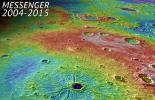
2015-06-03 |
Mercury
|
MESSENGER
|
Mercury Dual Imaging System (MDIS)
|
1222x1865x3 |
|
-
PIA19497:
-
Best Determination of MESSENGER's Impact Location
Full Resolution:
TIFF
(6.84 MB)
JPEG
(235.6 kB)
|
|
|
2015-06-03 |
Mars
|
Mars Reconnaissance Orbiter (MRO)
|
HiRISE
|
2880x1800x3 |
|
-
PIA11777:
-
A Fresh Crater near Sirenum Fossae
Full Resolution:
TIFF
(15.56 MB)
JPEG
(750.4 kB)
|
|
|
2015-06-03 |
Mars
|
Mars Reconnaissance Orbiter (MRO)
|
HiRISE
|
2880x1800x3 |
|
-
PIA11776:
-
A Mysterious Bright Streak on the South Polar Layered Deposits
Full Resolution:
TIFF
(15.56 MB)
JPEG
(1.307 MB)
|
|
|
2015-05-28 |
Ceres
|
Dawn
|
Framing Camera
|
682x665x1 |
|
-
PIA19065:
-
Dawn View from OpNav9
Full Resolution:
TIFF
(454.2 kB)
JPEG
(103 kB)
|
|
|
2015-05-25 |
Rhea
|
Cassini-Huygens
|
ISS - Narrow Angle
|
1020x1020x1 |
|
-
PIA18316:
-
Rhea's Horizon
Full Resolution:
TIFF
(1.042 MB)
JPEG
(146.4 kB)
|
|
|
2015-05-20 |
Mars
|
Mars Reconnaissance Orbiter (MRO)
|
HiRISE
|
2880x1800x3 |
|
-
PIA18562:
-
Sedimentary Rock Layers on a Crater Floor
Full Resolution:
TIFF
(15.56 MB)
JPEG
(773.6 kB)
|
|
|
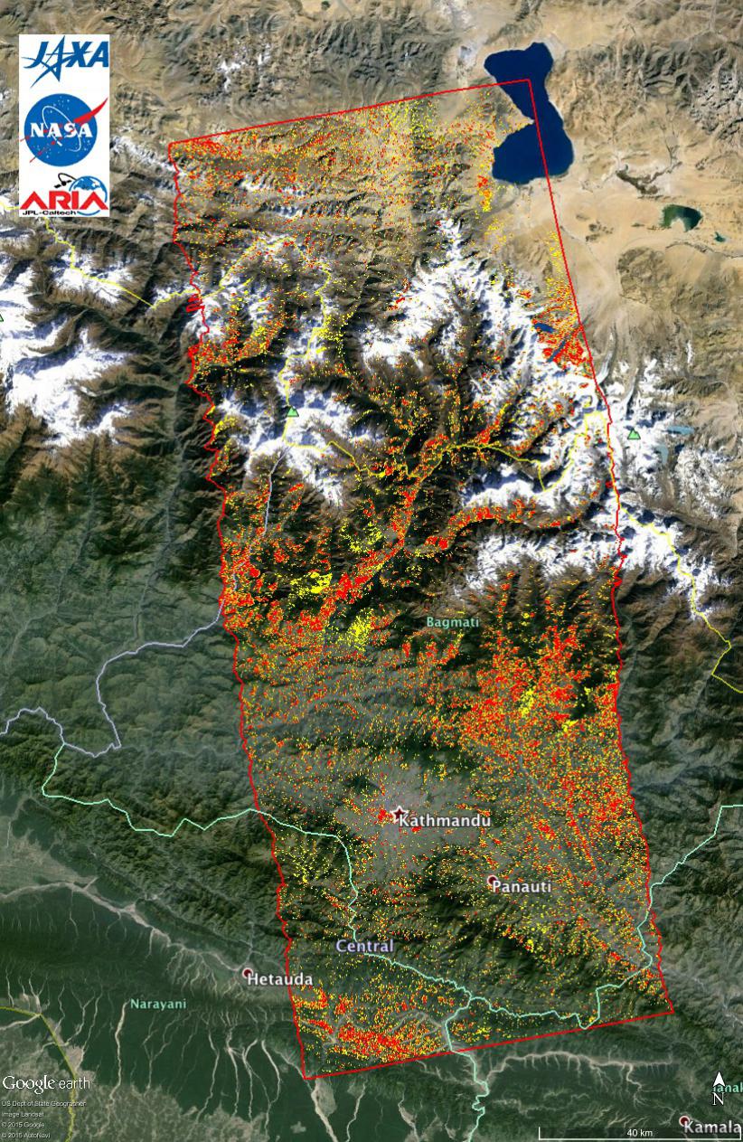
2015-05-11 |
Earth
|
ARIA
|
PALSAR-2
|
822x1263x3 |
|
-
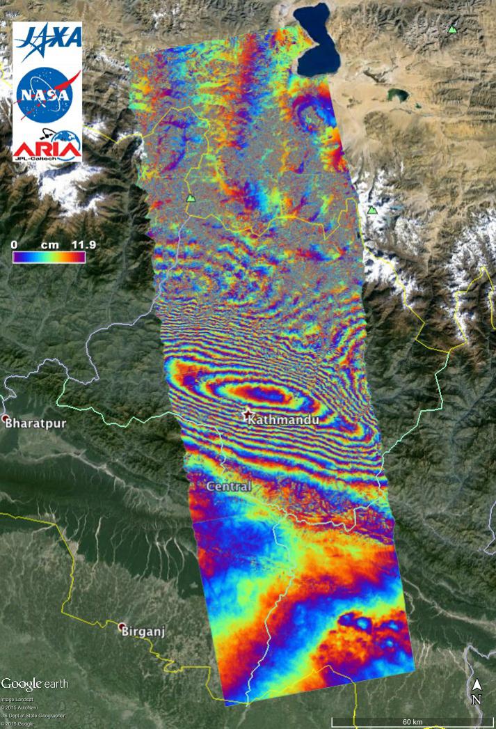
PIA14710:
-
New ALOS-2 Damage Map Assists 2015 Gorkha, Nepal Disaster Response
Full Resolution:
TIFF
(3.116 MB)
JPEG
(307.4 kB)
|
|
|
2015-05-07 |
Earth
|
ARIA
|
PALSAR-2
|
1402x2048x3 |
|
-
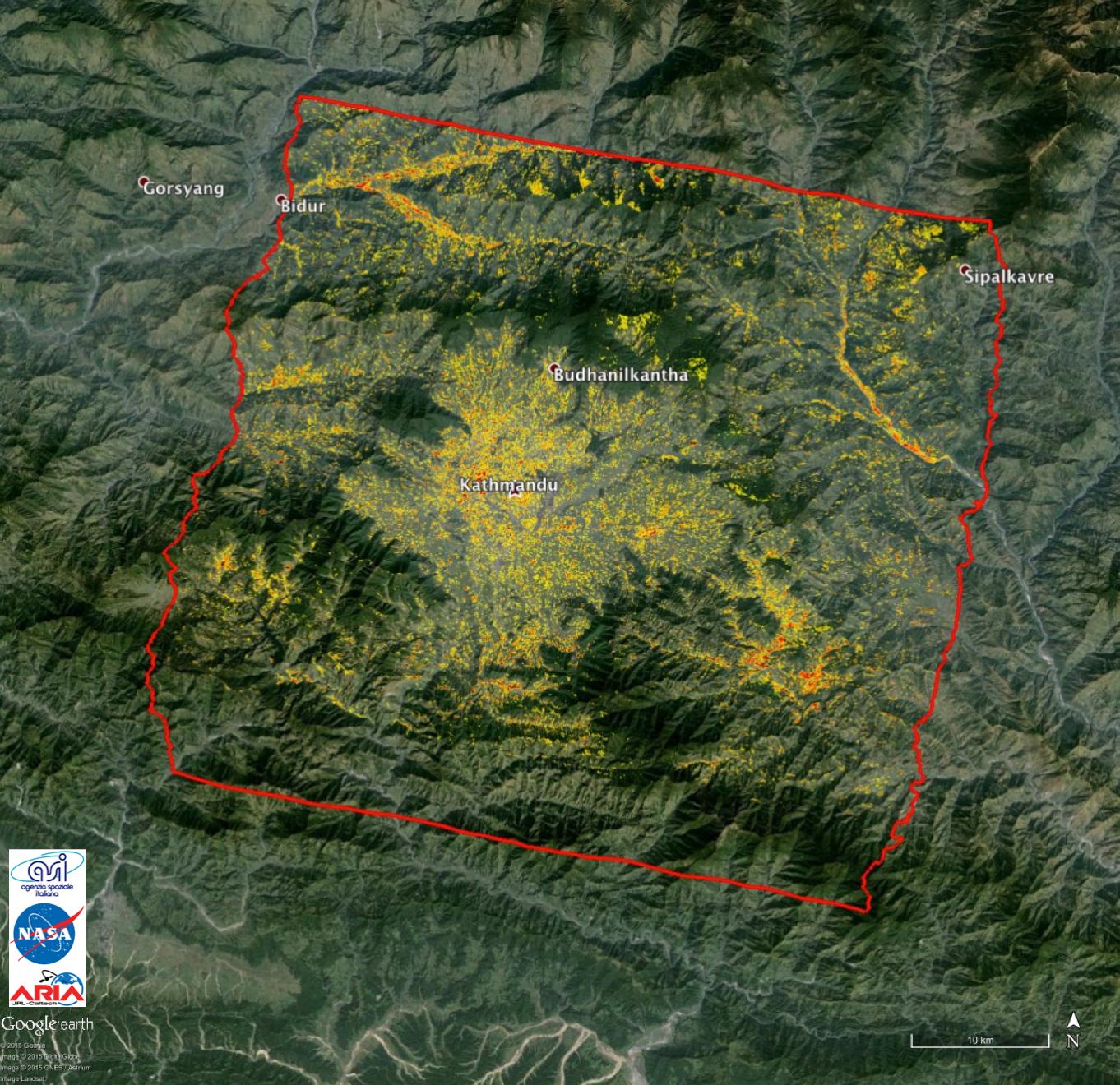
PIA14708:
-
Radar Shows Kathmandu Area Uplifted 5 Feet by Gorkha, Nepal Earthquake
Full Resolution:
TIFF
(8.617 MB)
JPEG
(460.9 kB)
|
|
|
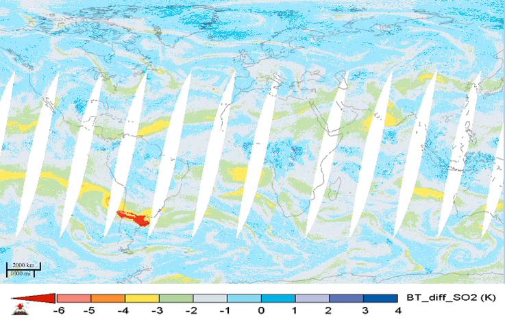
2015-05-07 |
Earth
|
Aqua
|
AIRS
|
737x467x3 |
|
-
PIA19385:
-
NASA's AIRS Instrument Tracks Transport of Sulfur Dioxide from Chilean Volcanic Eruption (Animation)

Full Resolution:
TIFF
(1.033 MB)
JPEG
(69.56 kB)
|
|
|
2015-05-06 |
Mars
|
Mars Reconnaissance Orbiter (MRO)
|
HiRISE
|
2880x1800x3 |
|
-
PIA19456:
-
Slope Streaks on a Dusty Planet
Full Resolution:
TIFF
(15.56 MB)
JPEG
(534.2 kB)
|
|
|
2015-05-04 |
Earth
|
ARIA
|
PALSAR-2
|
713x1047x3 |
|
-
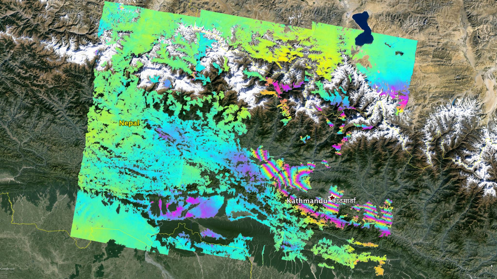
PIA19383:
-
NASA's ARIA Project Provides New Look at Earth Surface Deformation from Nepal Quake
Full Resolution:
TIFF
(2.241 MB)
JPEG
(179.7 kB)
|
|
|
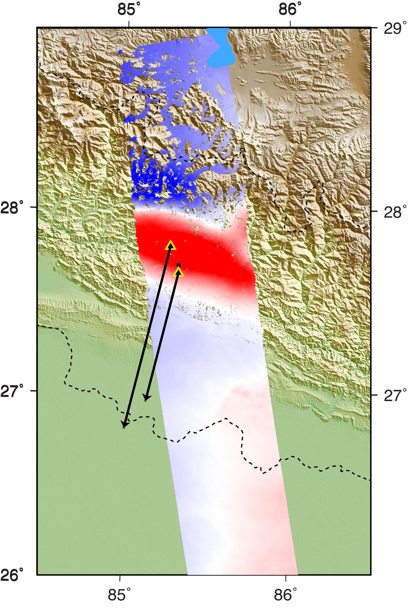
2015-05-02 |
Earth
|
ARIA
|
C-SAR Sensor
|
2048x1152x3 |

|
-
PIA19535:
-
NASA's ARIA Project Maps Deformation of Earth's Surface from Nepal Quake
Full Resolution:
TIFF
(7.08 MB)
JPEG
(600.1 kB)
|
|
|
2015-05-01 |
Earth
|
ARIA
|
X-band Interferometric Synthetic Aperture Radar
|
1362x1320x3 |
|
-
PIA13911:
-
NASA-Generated Damage Map to Assist with 2015 Gorkha, Nepal Earthquake Disaster Response
Full Resolution:
TIFF
(5.396 MB)
JPEG
(349.8 kB)
|
|
|
2015-05-01 |
Mercury
|
MESSENGER
|
Mercury Dual Imaging System (MDIS)
MLA
|
5057x3272x3 |
|
-
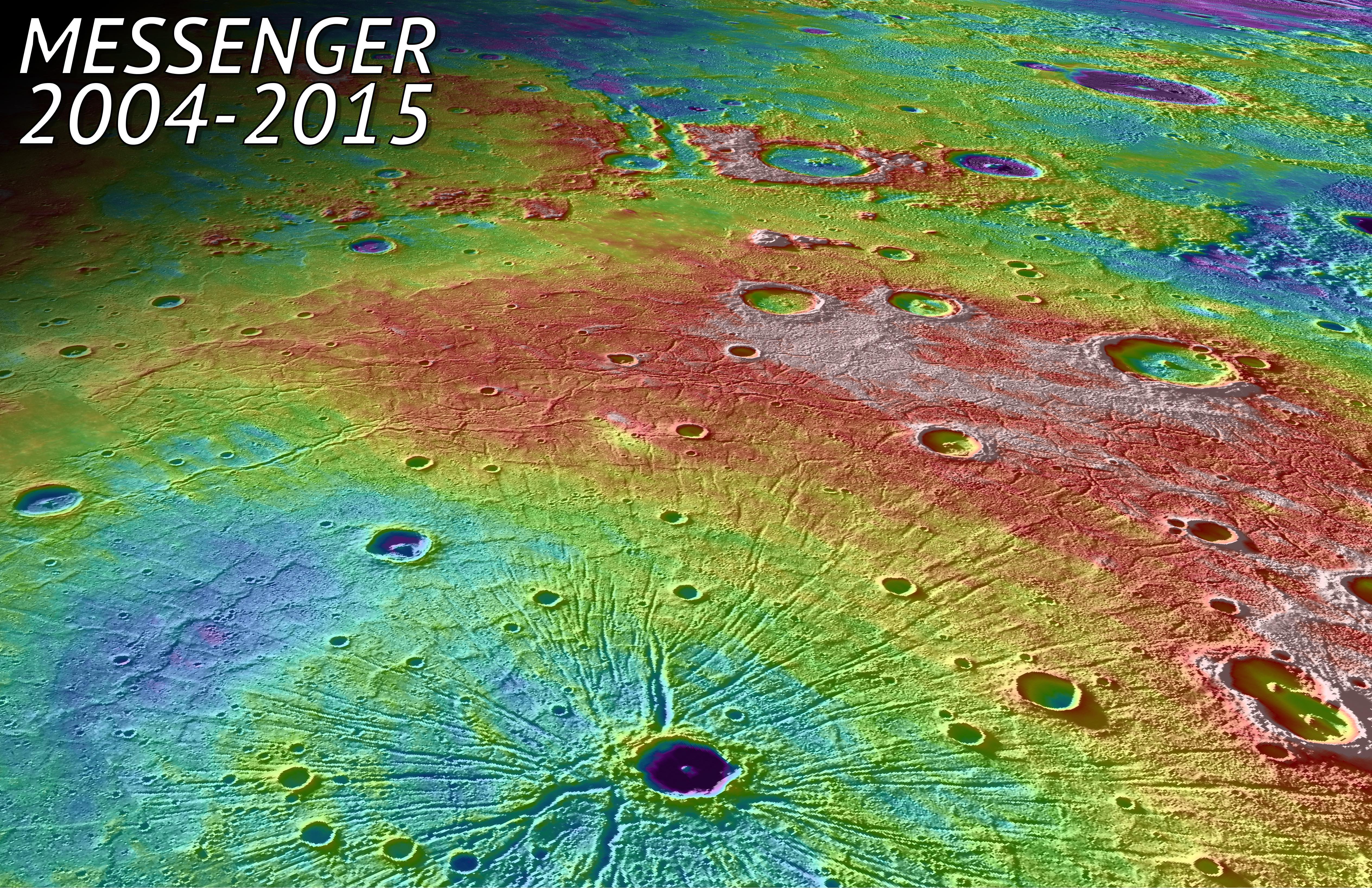
PIA19450:
-
In Tribute
Full Resolution:
TIFF
(49.67 MB)
JPEG
(4.768 MB)
|
|
|
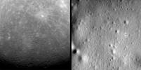
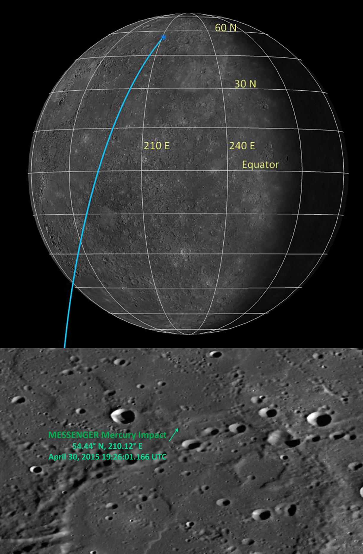
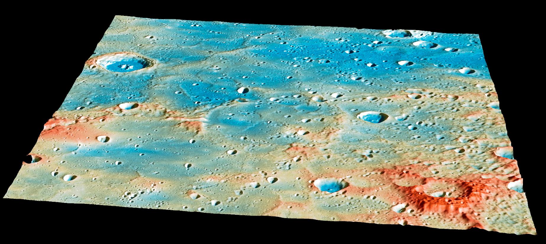
2015-04-30 |
Mercury
|
MESSENGER
|
Mercury Dual Imaging System (MDIS)
|
1030x512x1 |
|
-
PIA19449:
-
From the First to the Last
Full Resolution:
TIFF
(528.2 kB)
JPEG
(118.2 kB)
|
|
|
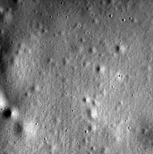
2015-04-30 |
Mercury
|
MESSENGER
|
MDIS - Narrow Angle
|
508x512x1 |
|
-
PIA19448:
-
MESSENGER's Final Image
Full Resolution:
TIFF
(260.6 kB)
JPEG
(76.83 kB)
|
|
|
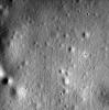
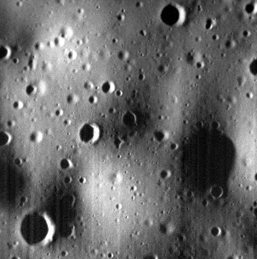
2015-04-30 |
Mercury
|
MESSENGER
|
MDIS - Narrow Angle
|
508x512x1 |
|
-
PIA19445:
-
One of the Last
Full Resolution:
TIFF
(260.6 kB)
JPEG
(57.24 kB)
|
|
|
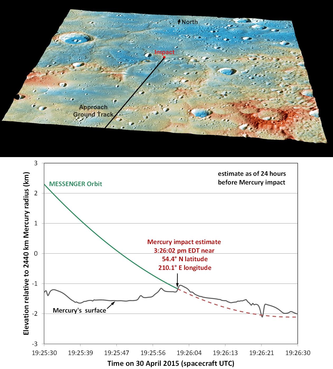
2015-04-29 |
Mercury
|
MESSENGER
|
Mercury Dual Imaging System (MDIS)
MLA
|
1846x826x3 |
|
-
PIA19444:
-
Overview of the Impact Region
Full Resolution:
TIFF
(4.576 MB)
JPEG
(276.7 kB)
|
|
|
2015-04-29 |
Mercury
|
MESSENGER
|
Mercury Dual Imaging System (MDIS)
MLA
|
1262x1400x3 |
|
-
PIA19443:
-
Details of MESSENGER's Impact Location
Full Resolution:
TIFF
(5.302 MB)
JPEG
(218.3 kB)
|
|
|
2015-04-29 |
Mercury
|
MESSENGER
|
MDIS - Narrow Angle
|
508x512x1 |

|
-
PIA19442:
-
Tomorrow
Full Resolution:
TIFF
(260.6 kB)
JPEG
(53.02 kB)
|
|
|
2015-04-29 |
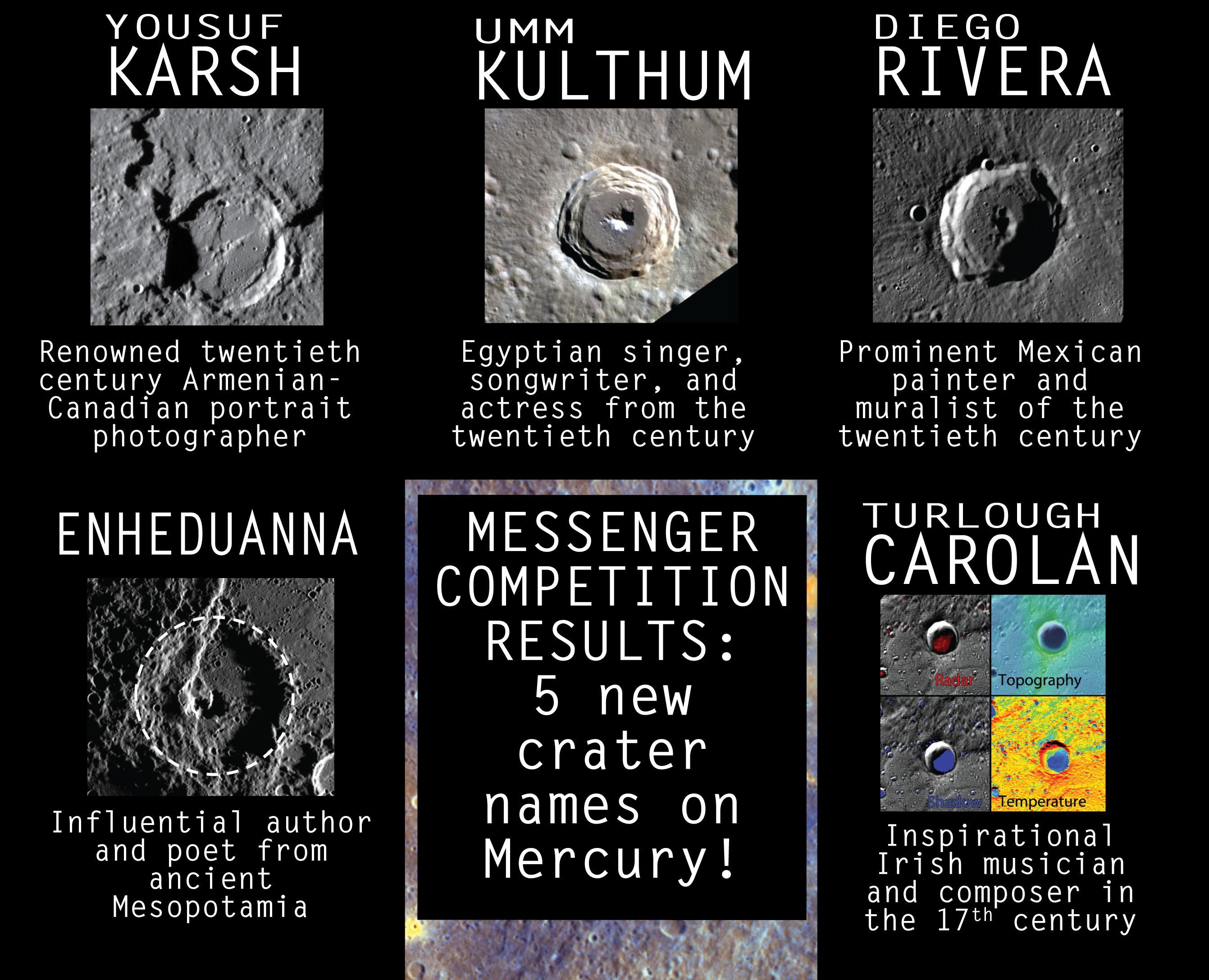
Mercury
|
MESSENGER
|
|
2683x2175x3 |

|
-
PIA19439:
-
Five New Crater Names for Mercury
Full Resolution:
TIFF
(17.51 MB)
JPEG
(599.6 kB)
|
|
|
2015-04-28 |
Mercury
|
MESSENGER
|
MDIS - Narrow Angle
|
1020x1024x1 |
|
-
PIA19438:
-
The Final Days
Full Resolution:
TIFF
(1.046 MB)
JPEG
(211.9 kB)
|


