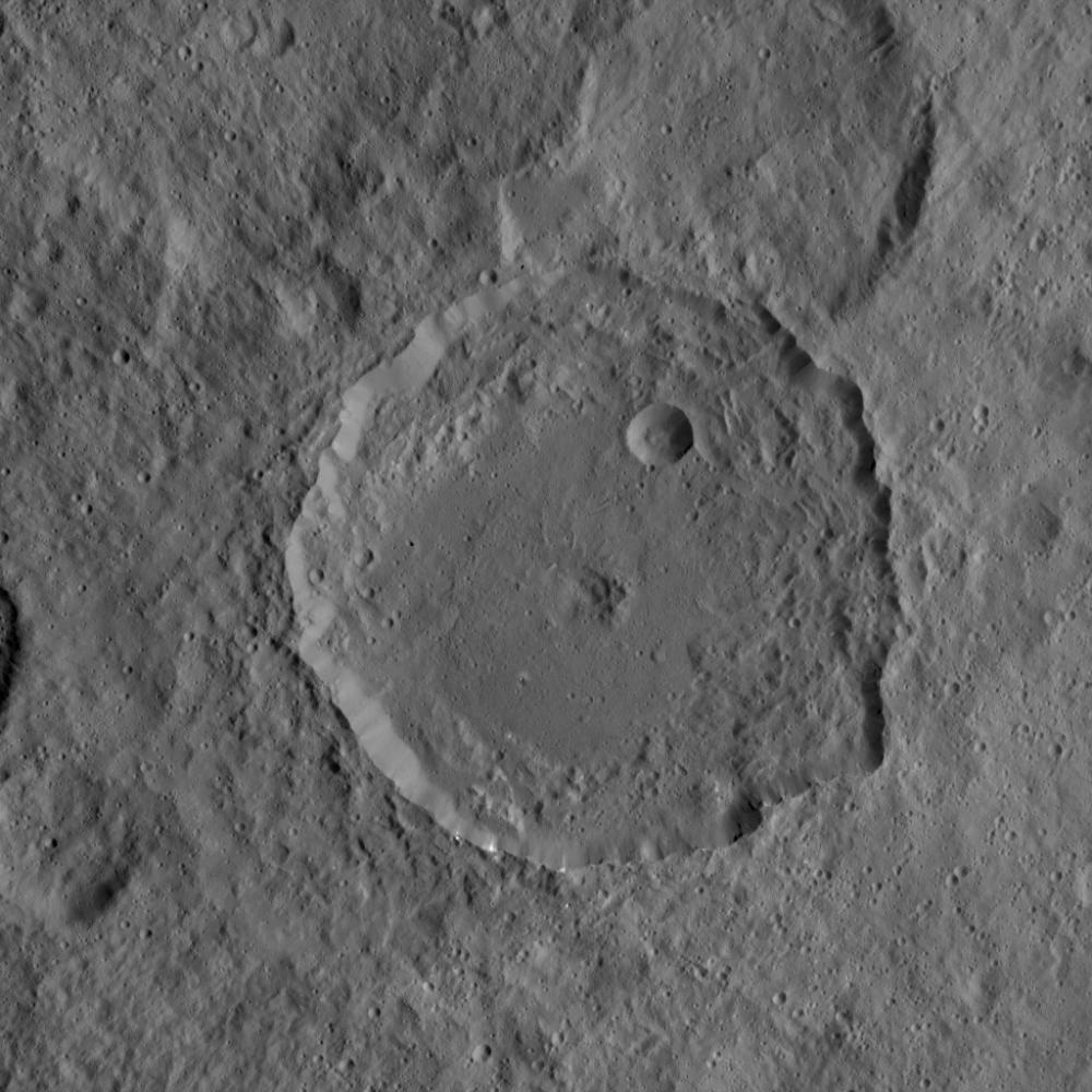
This image from NASA's Dawn mission shows the 52-mile-wide (84 kilometer-wide) crater on Ceres named Gaue. This medium-sized basin has a relatively fresh rim with terraced walls and a smooth floor. In the center of the crater are remnants of an ancient central peak, which has collapsed to a central pit. Impact ejecta from Gaue has coated the surrounding terrain, muting the appearance of older features.
The image is centered at 42 degrees north latitude, 85 degrees east longitude, and was taken from a spacecraft altitude of 926 miles (1,490 kilometers) during Dawn's High Altitude Mapping Orbit (HAMO) phase on Oct. 6, 2015. Image resolution is 394 feet (120 meters) per pixel.
Dawn's mission is managed by JPL for NASA's Science Mission Directorate in Washington. Dawn is a project of the directorate's Discovery Program, managed by NASA's Marshall Space Flight Center in Huntsville, Alabama. UCLA is responsible for overall Dawn mission science. Orbital ATK, Inc., in Dulles, Virginia, designed and built the spacecraft. The German Aerospace Center, the Max Planck Institute for Solar System Research, the Italian Space Agency and the Italian National Astrophysical Institute are international partners on the mission team. For a complete list of acknowledgments, see http://dawn.jpl.nasa.gov/mission.
For more information about the Dawn mission, visit http://dawn.jpl.nasa.gov.