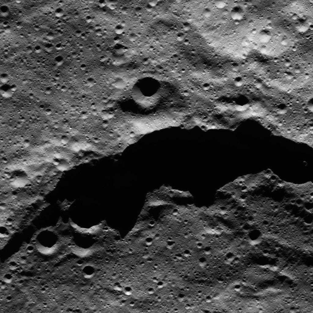
The image from NASA's Dawn spacecraft shows the northeast rim of Sintana Crater on Ceres. The crater's steep rim is shadowed in this particular view. The crater density along this area of Sintana's rim (both interior and exterior) appears to be roughly the same, and is dominated by small impacts.
Sintana was imaged earlier in Dawn's mission, from higher altitude, in PIA20149. The crater is named for a deity from Colombia said to have produced fertile black earth for sowing crops.
The image is centered at approximately 45.6 degrees south latitude, 49.2 degrees east longitude. Dawn captured the scene on Jan. 1, 2016, from its low-altitude mapping orbit (LAMO), at an altitude of 234 miles (376 kilometers) above Ceres. The image resolution is 115 feet (35 meters) per pixel.
Dawn's mission is managed by JPL for NASA's Science Mission Directorate in Washington. Dawn is a project of the directorate's Discovery Program, managed by NASA's Marshall Space Flight Center in Huntsville, Alabama. UCLA is responsible for overall Dawn mission science. Orbital ATK, Inc., in Dulles, Virginia, designed and built the spacecraft. The German Aerospace Center, the Max Planck Institute for Solar System Research, the Italian Space Agency and the Italian National Astrophysical Institute are international partners on the mission team. For a complete list of acknowledgments, see http://dawn.jpl.nasa.gov/mission.
For more information about the Dawn mission, visit http://dawn.jpl.nasa.gov.
