My
List |
Addition Date
|
Target
|
Mission
|
Instrument
|
Size
|

|
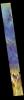
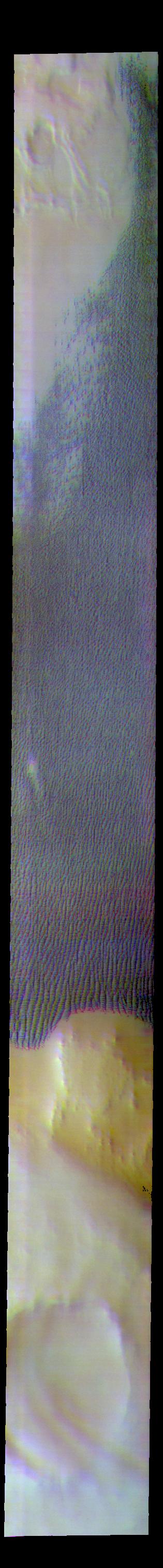
2018-10-02 |
Mars
|
2001 Mars Odyssey
|
THEMIS
|
644x2703x3 |
|
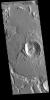
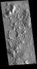
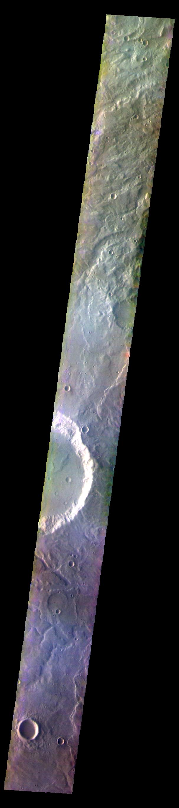
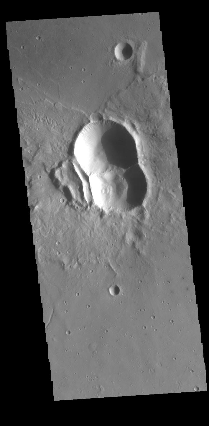
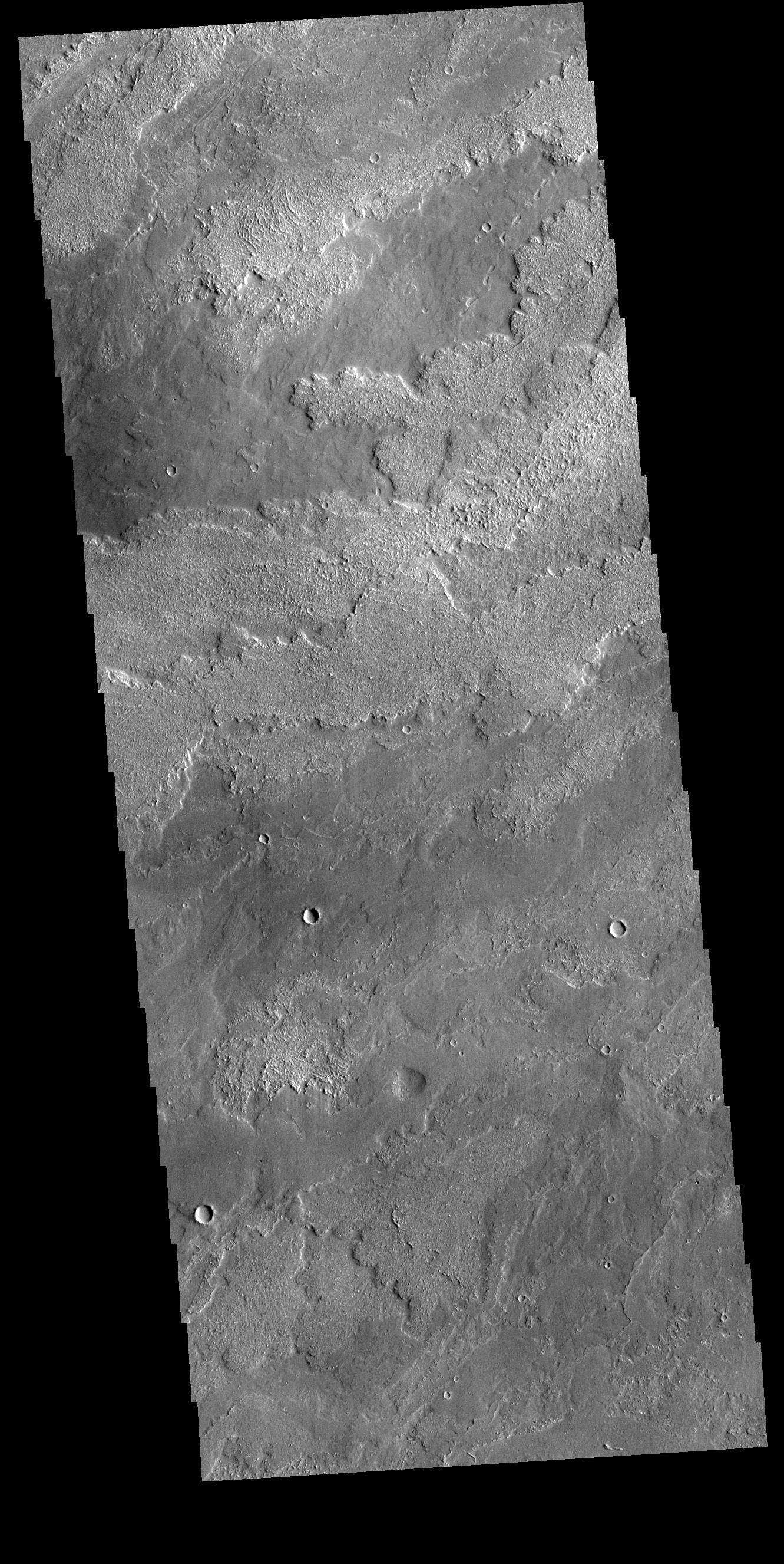
-
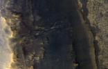
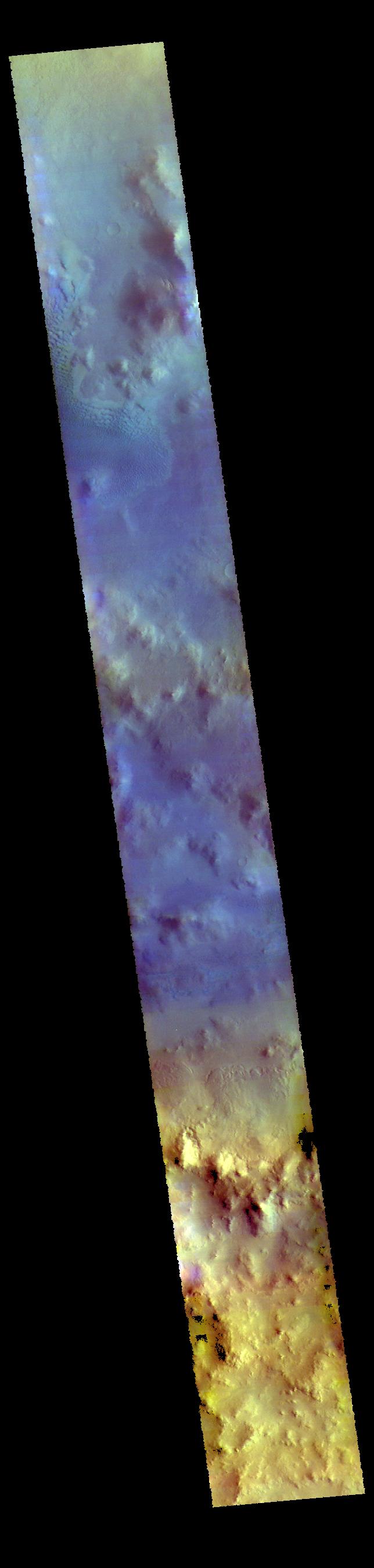
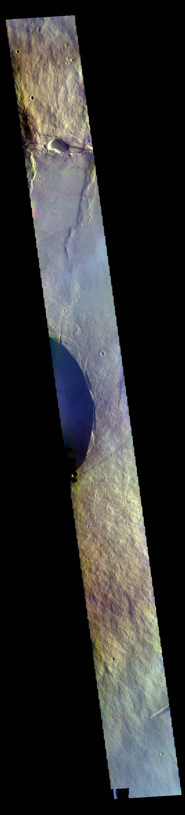
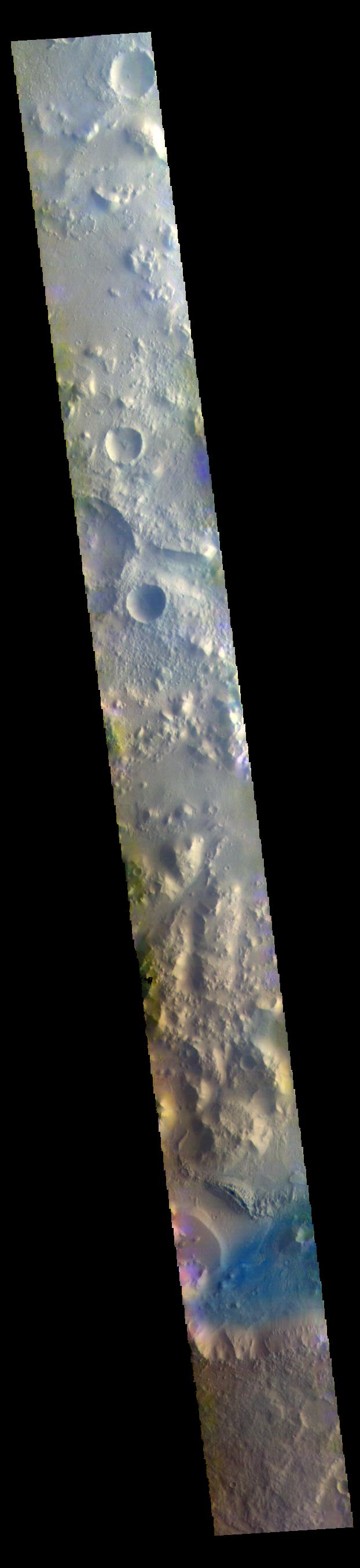
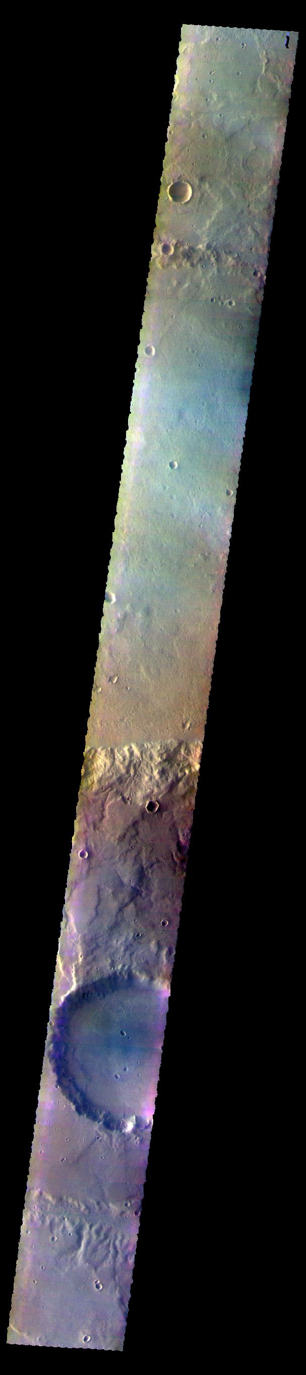
PIA22731:
-
Lyot Crater - False Color
Full Resolution:
TIFF
(2.392 MB)
JPEG
(112.3 kB)
|
|
|
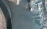
2018-10-01 |
Mars
|
Mars Reconnaissance Orbiter (MRO)
|
HiRISE
|
2880x1800x3 |
|
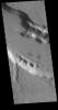
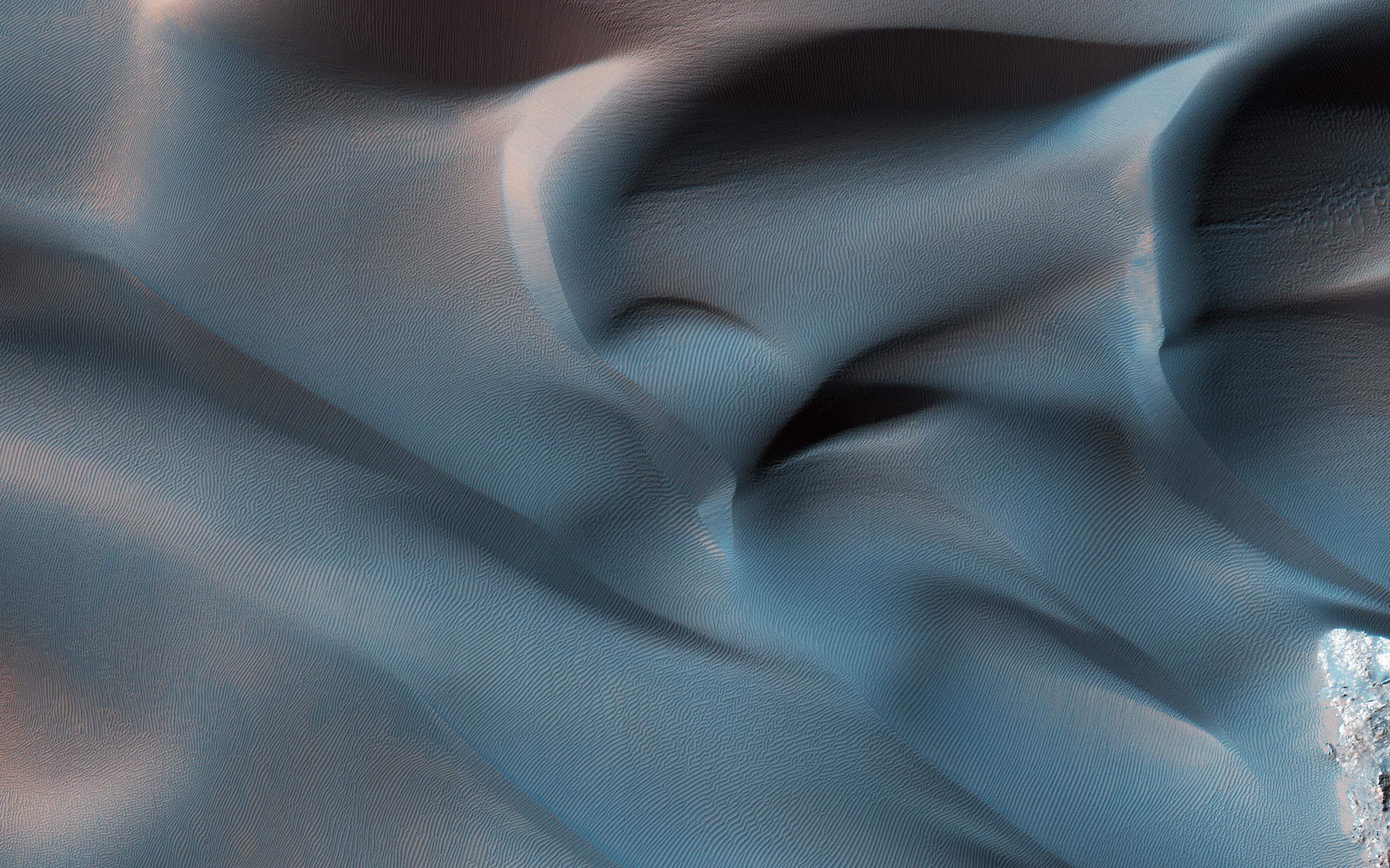
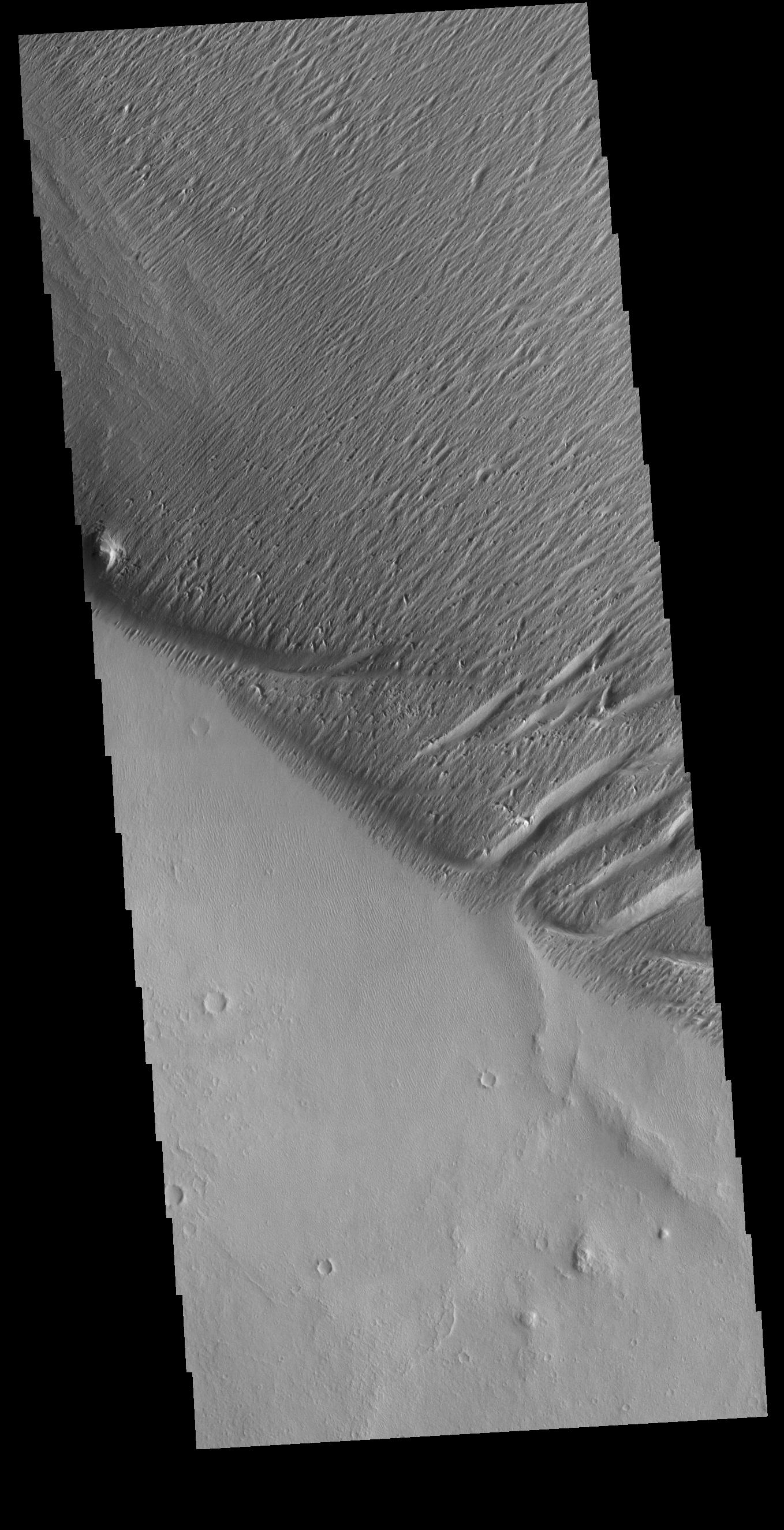
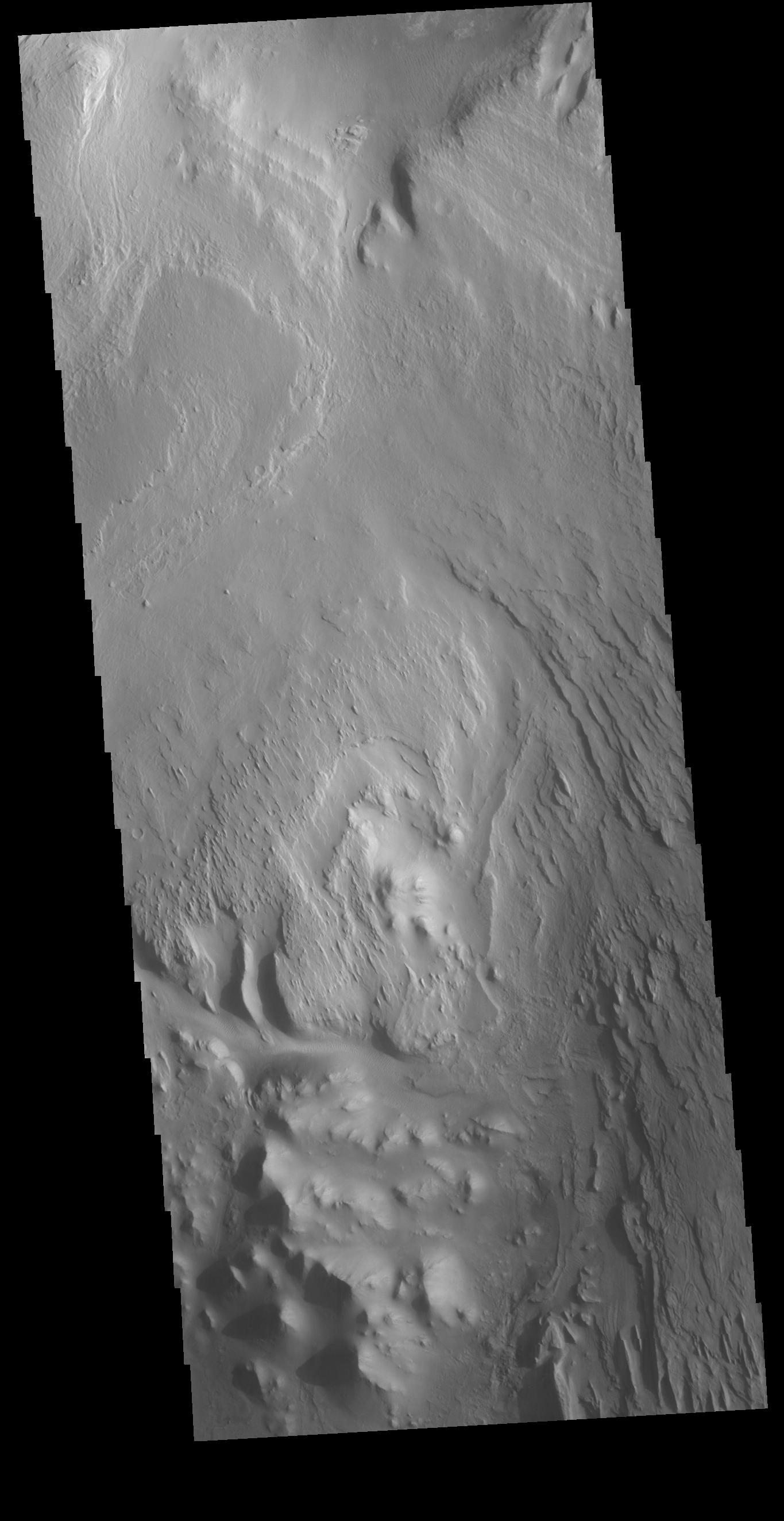
-
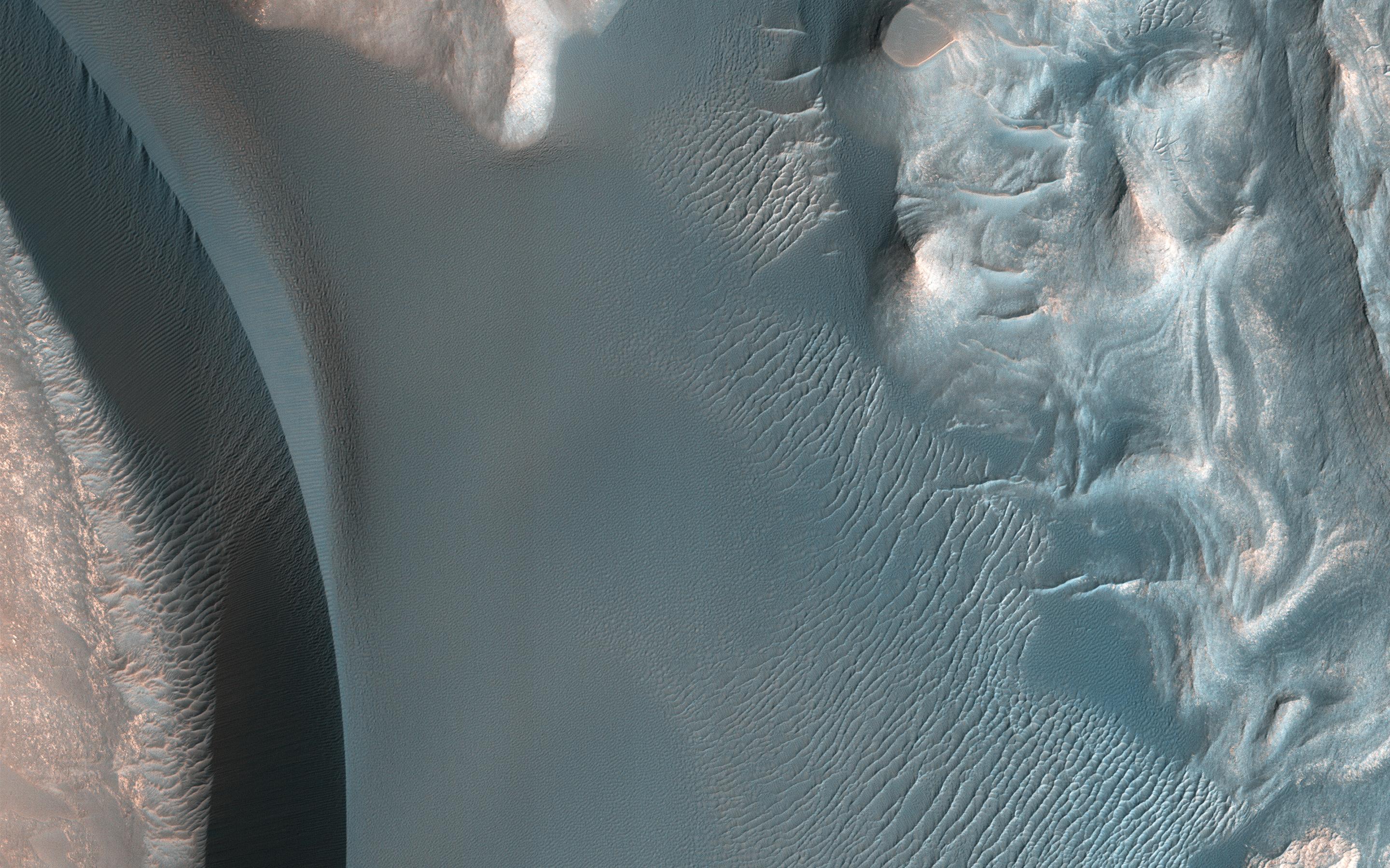
PIA22785:
-
Summit Dunes and Their Sand Sources
Full Resolution:
TIFF
(15.56 MB)
JPEG
(929.3 kB)
|
|
|
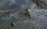
2018-10-01 |
Mars
|
Mars Reconnaissance Orbiter (MRO)
|
HiRISE
|
2880x1800x3 |
|
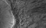
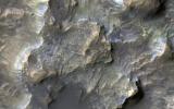
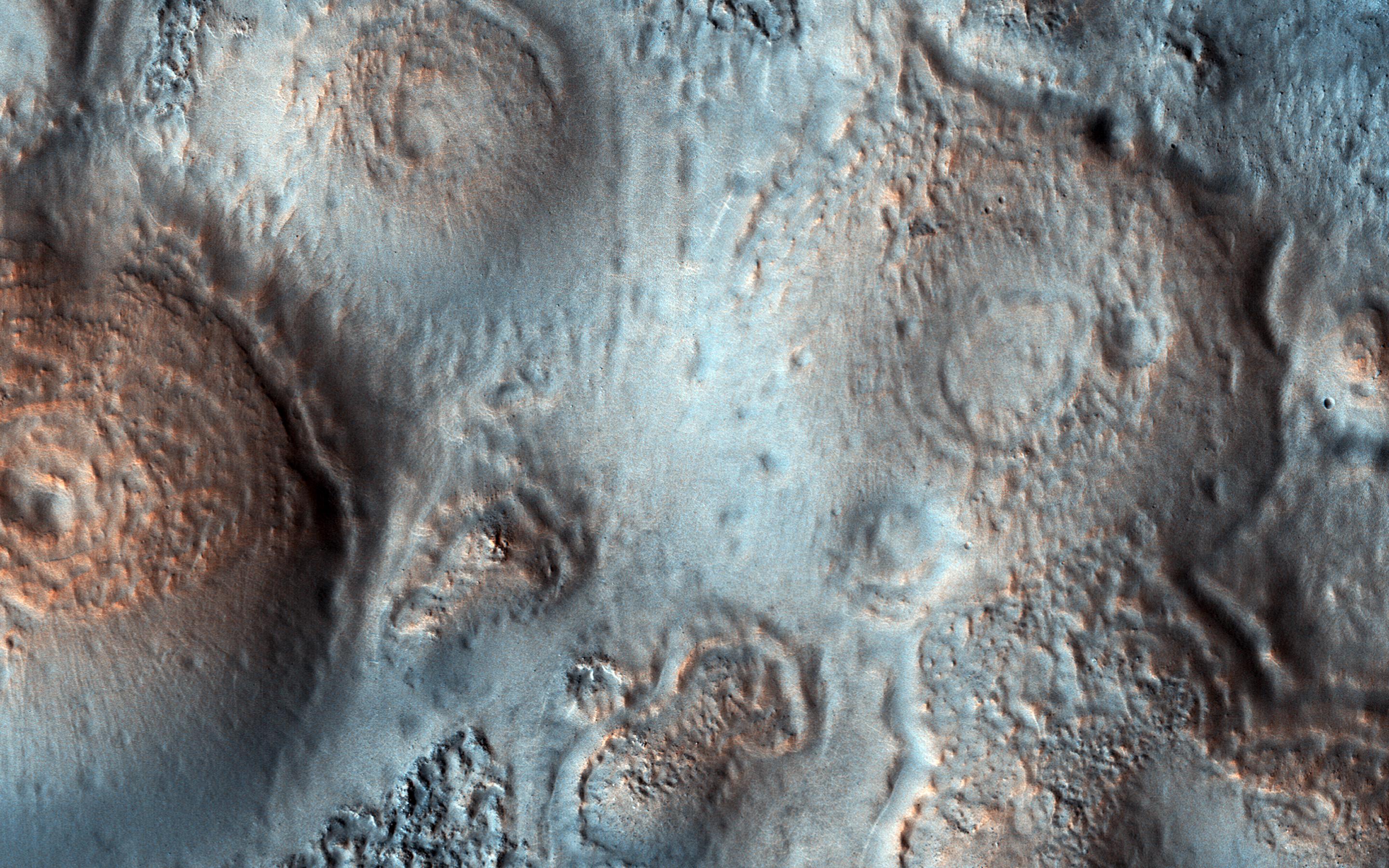
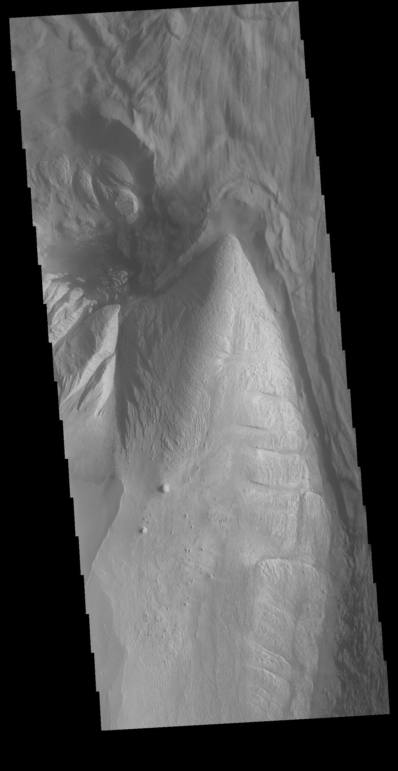
-
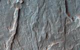
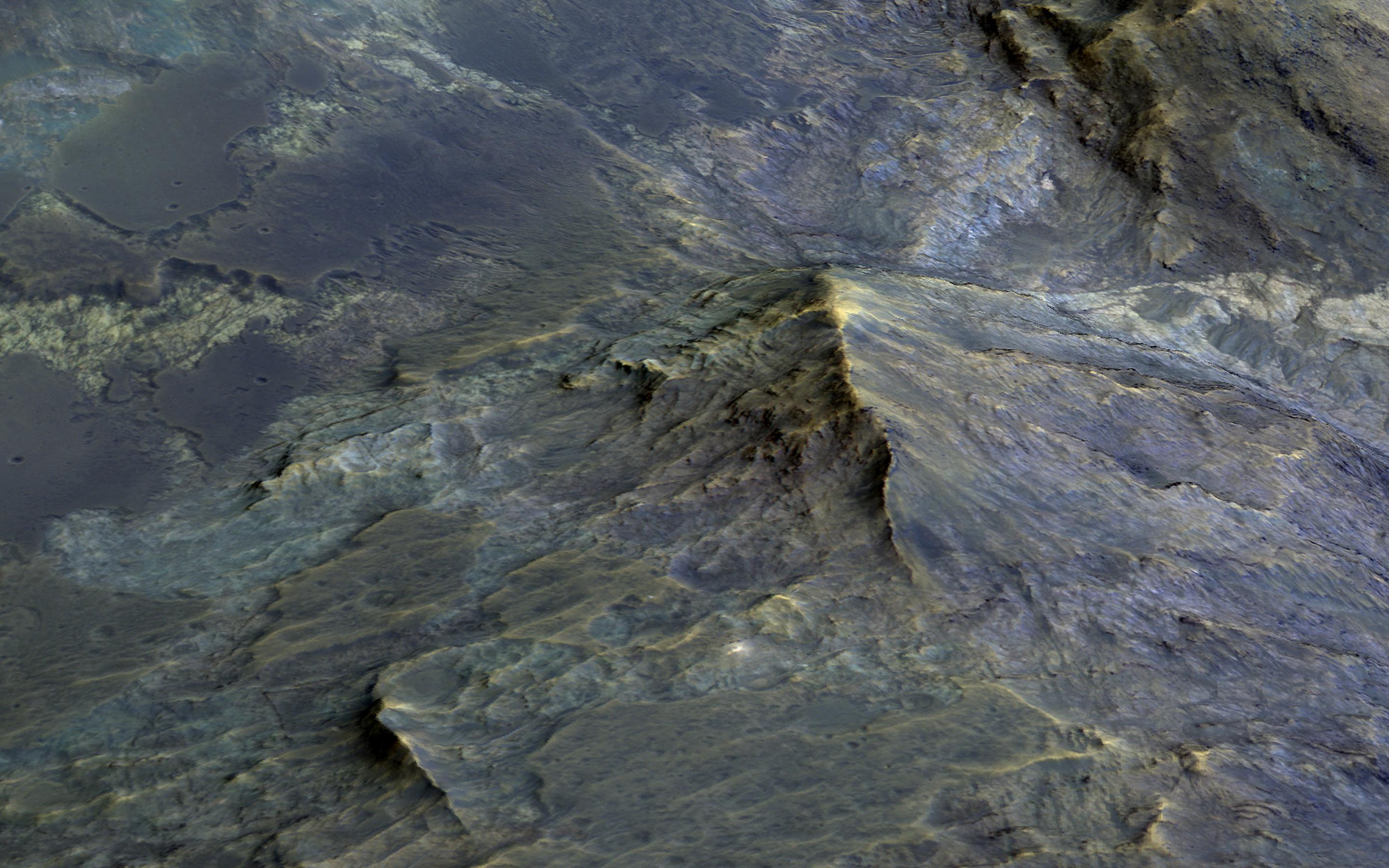
PIA22784:
-
Tell-Tale Bedrock in Tyrrhena Terra
Full Resolution:
TIFF
(14.97 MB)
JPEG
(613.2 kB)
|
|
|
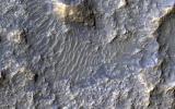
2018-10-01 |
Mars
|
Mars Reconnaissance Orbiter (MRO)
|
HiRISE
|
2880x1800x3 |

|
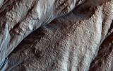
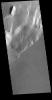
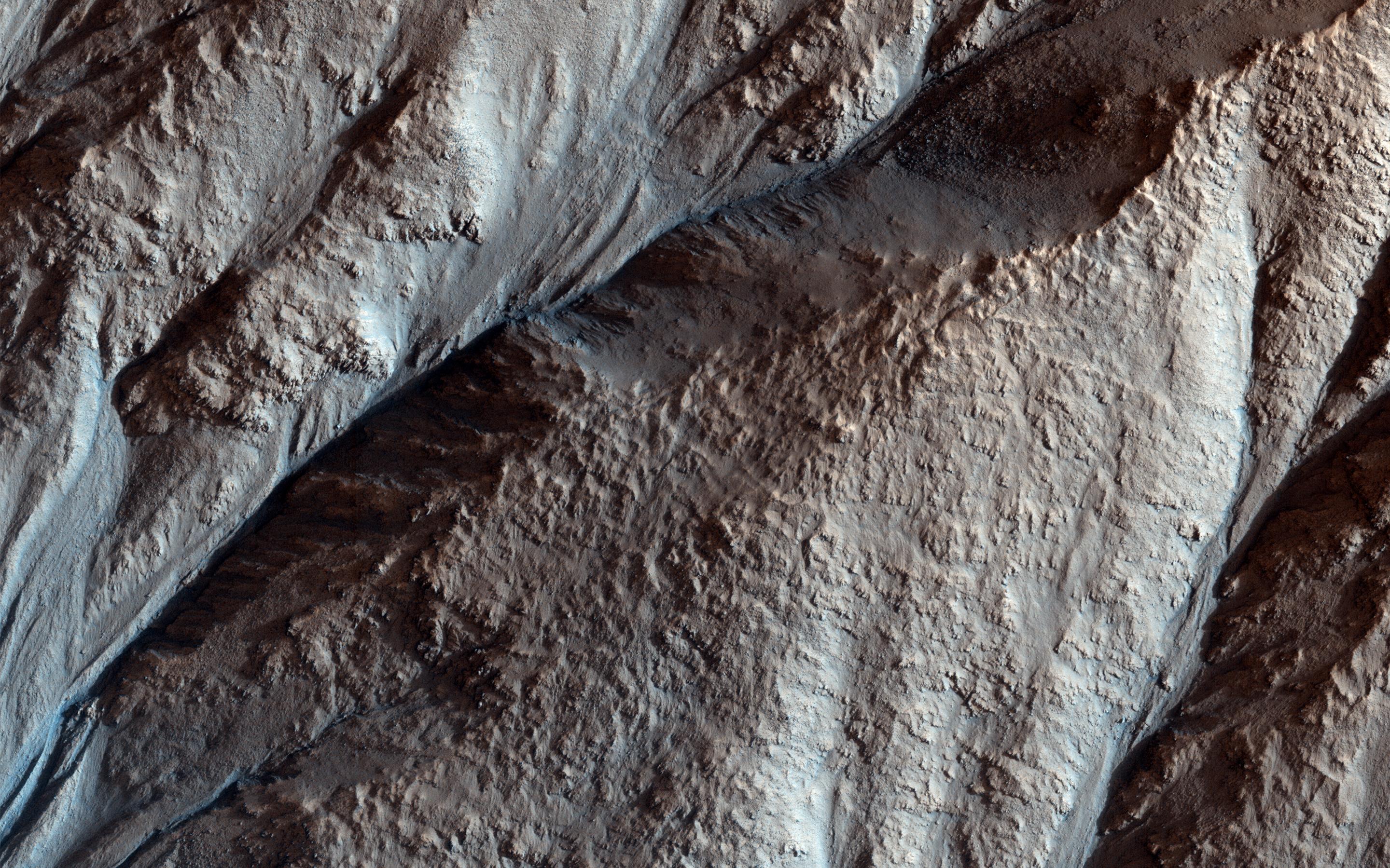
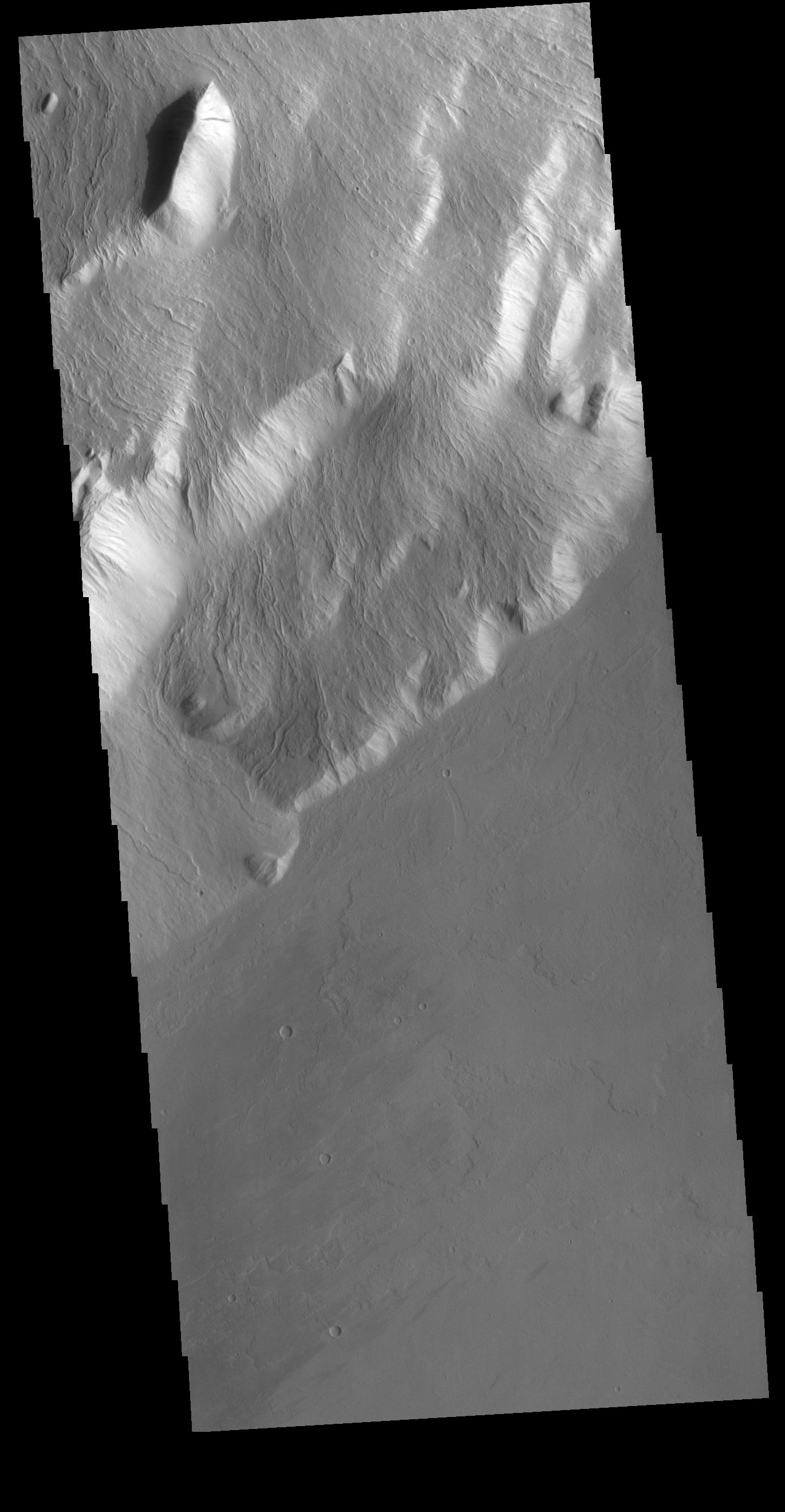
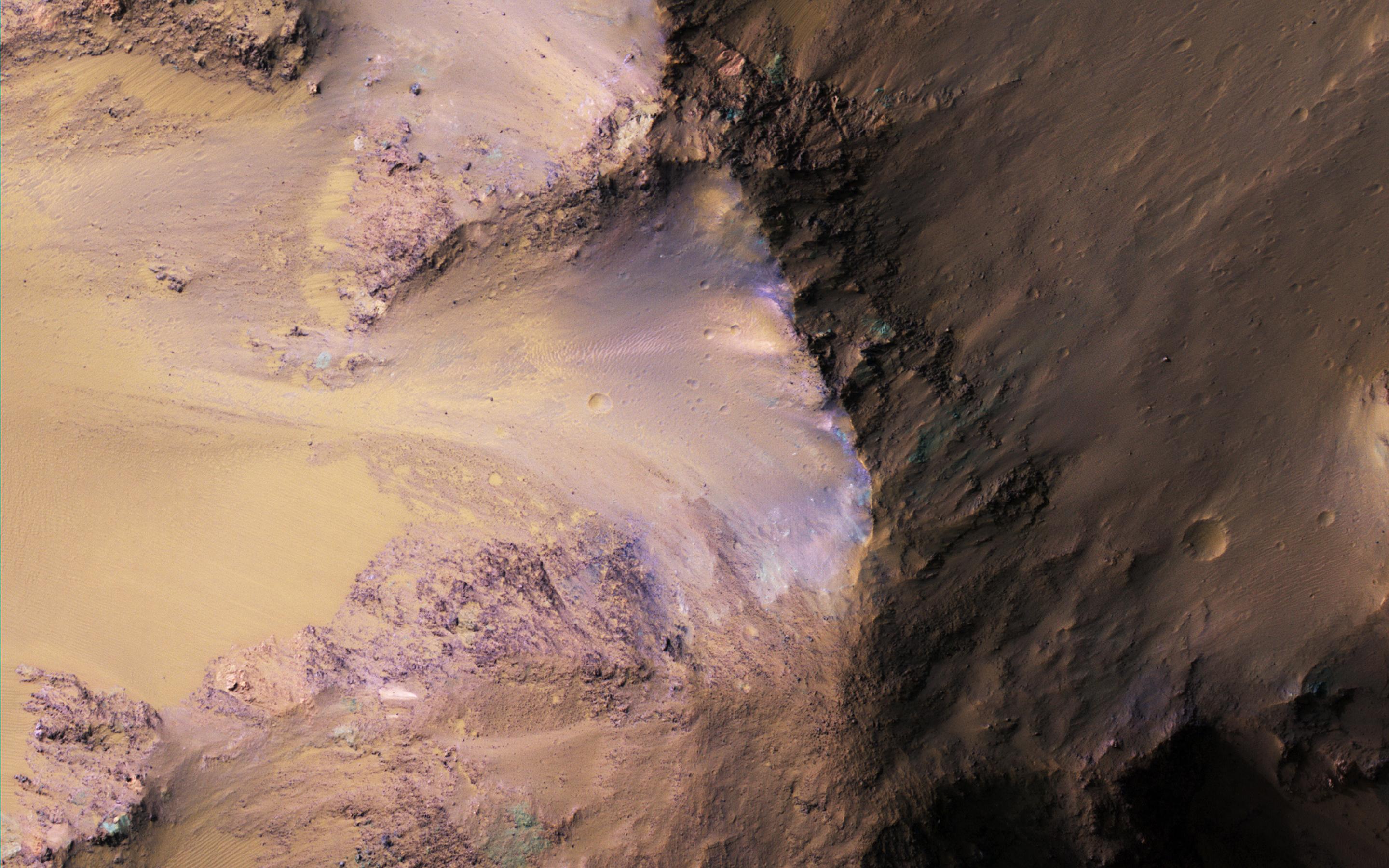
-
PIA22783:
-
The Velvety Blue Dunes of Melas Chasma
Full Resolution:
TIFF
(15.56 MB)
JPEG
(679 kB)
|
|
|
2018-10-01 |
Mars
|
Mars Reconnaissance Orbiter (MRO)
|
HiRISE
|
2880x1800x3 |
|
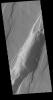
-
PIA22782:
-
Bedforms and Bedrock
Full Resolution:
TIFF
(15.56 MB)
JPEG
(815.1 kB)
|
|
|
2018-10-01 |
Mars
|
2001 Mars Odyssey
|
THEMIS
|
623x2703x3 |
|
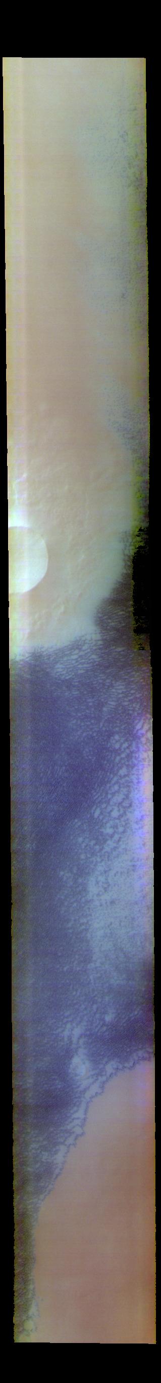
-
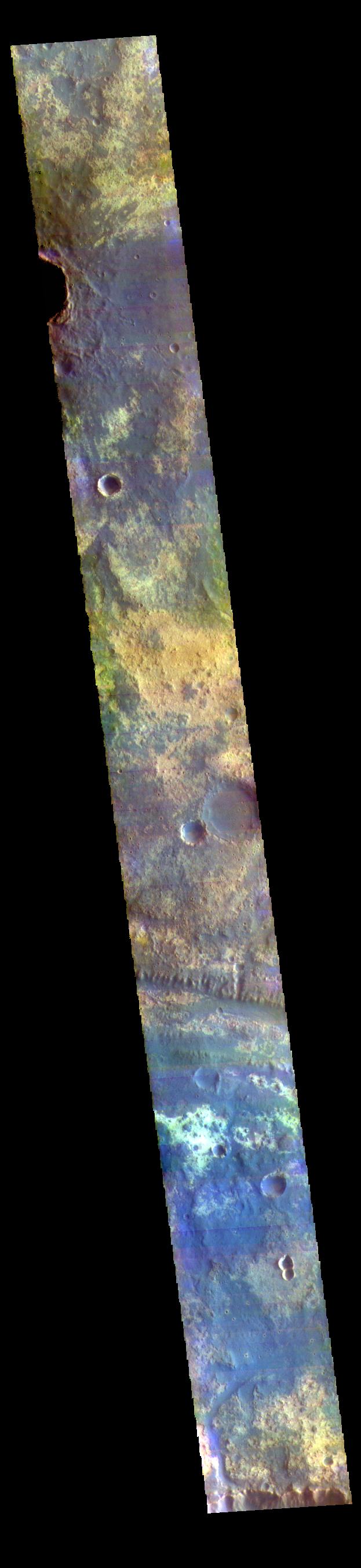
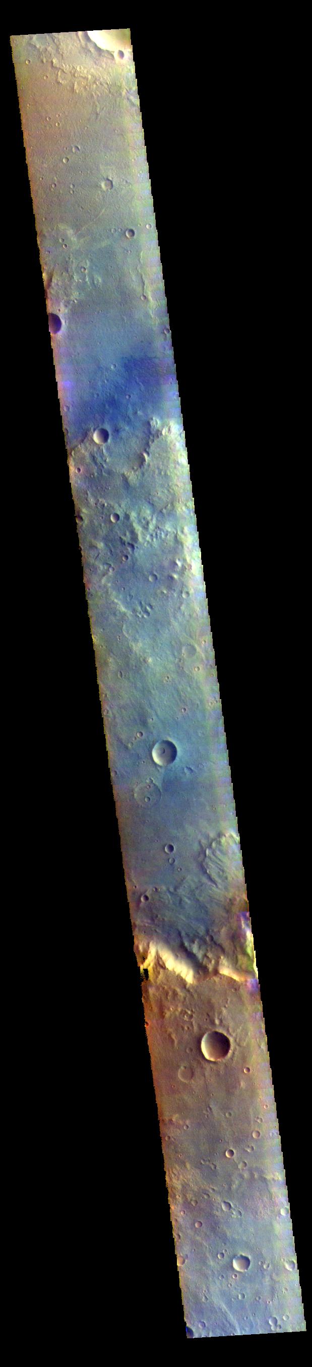
PIA22730:
-
Mawrth Vallis - False Color
Full Resolution:
TIFF
(2.357 MB)
JPEG
(142.8 kB)
|
|
|
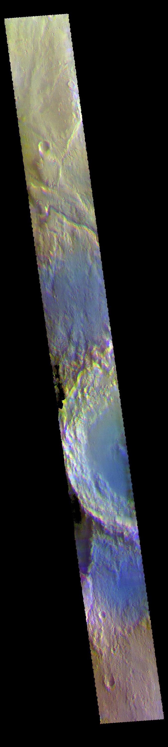
2018-09-28 |
Mars
|
2001 Mars Odyssey
|
THEMIS
|
615x2702x3 |
|
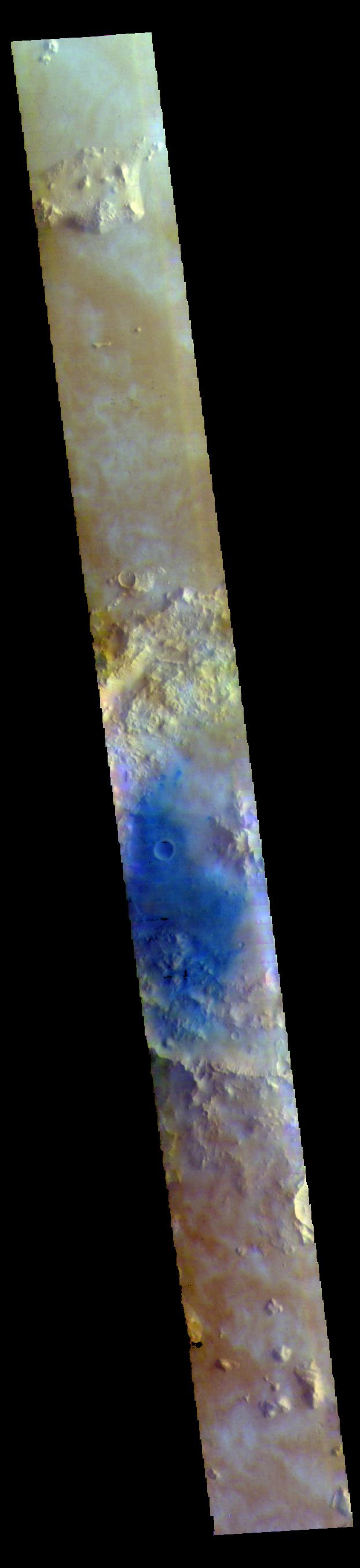
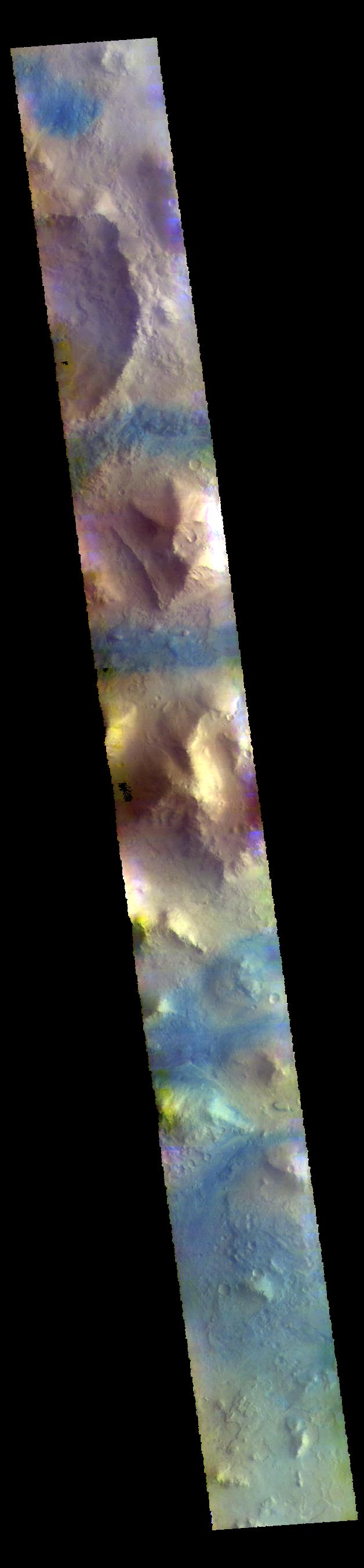
-
PIA22720:
-
Pavonis Mons - False Color
Full Resolution:
TIFF
(2.143 MB)
JPEG
(118.9 kB)
|
|
|
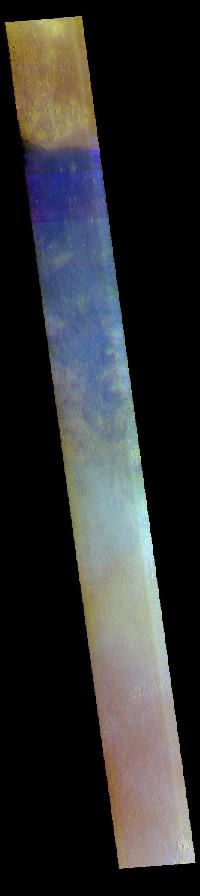
2018-09-27 |
Mars
|
2001 Mars Odyssey
|
THEMIS
|
619x2708x3 |
|
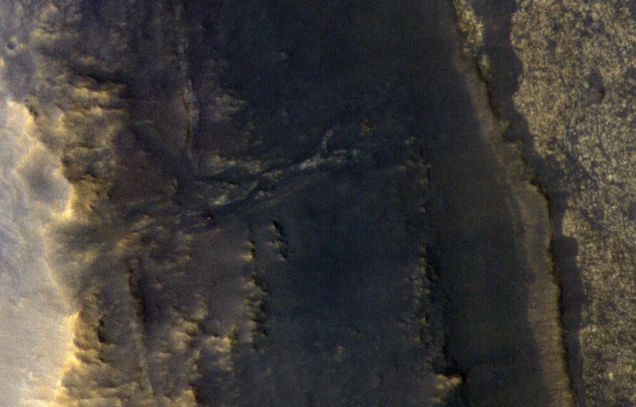
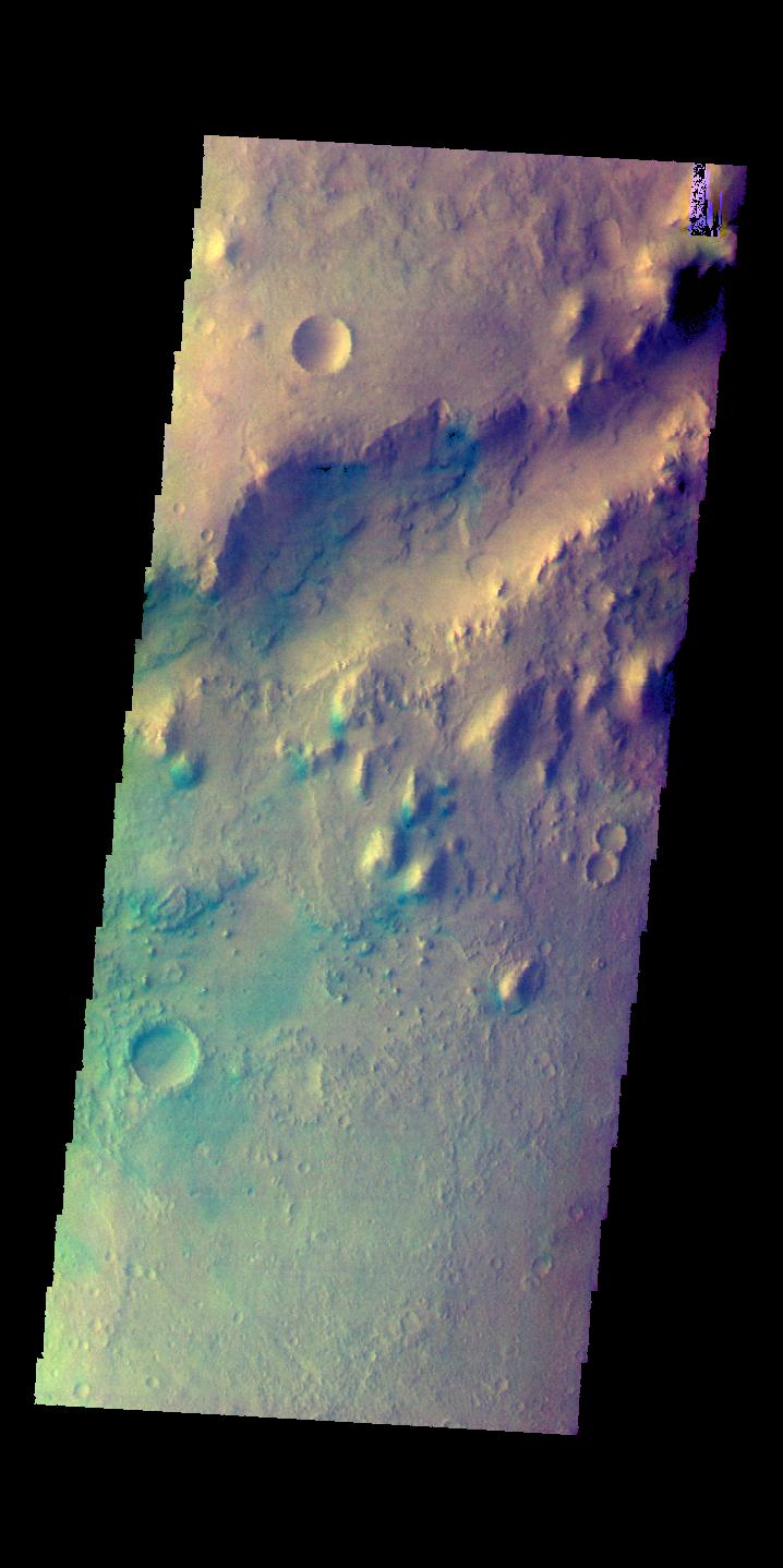
-
PIA22719:
-
Mutch Crater - False Color
Full Resolution:
TIFF
(2.3 MB)
JPEG
(127.2 kB)
|
|
|
2018-09-26 |
Mars
|
2001 Mars Odyssey
|
THEMIS
|
622x2707x3 |
|
-
PIA22718:
-
Tombaugh Crater - False Color
Full Resolution:
TIFF
(2.288 MB)
JPEG
(99.09 kB)
|
|
|
2018-09-25 |
Mars
|
Mars Reconnaissance Orbiter (MRO)
|
HiRISE
|
2170x1390x3 |
|
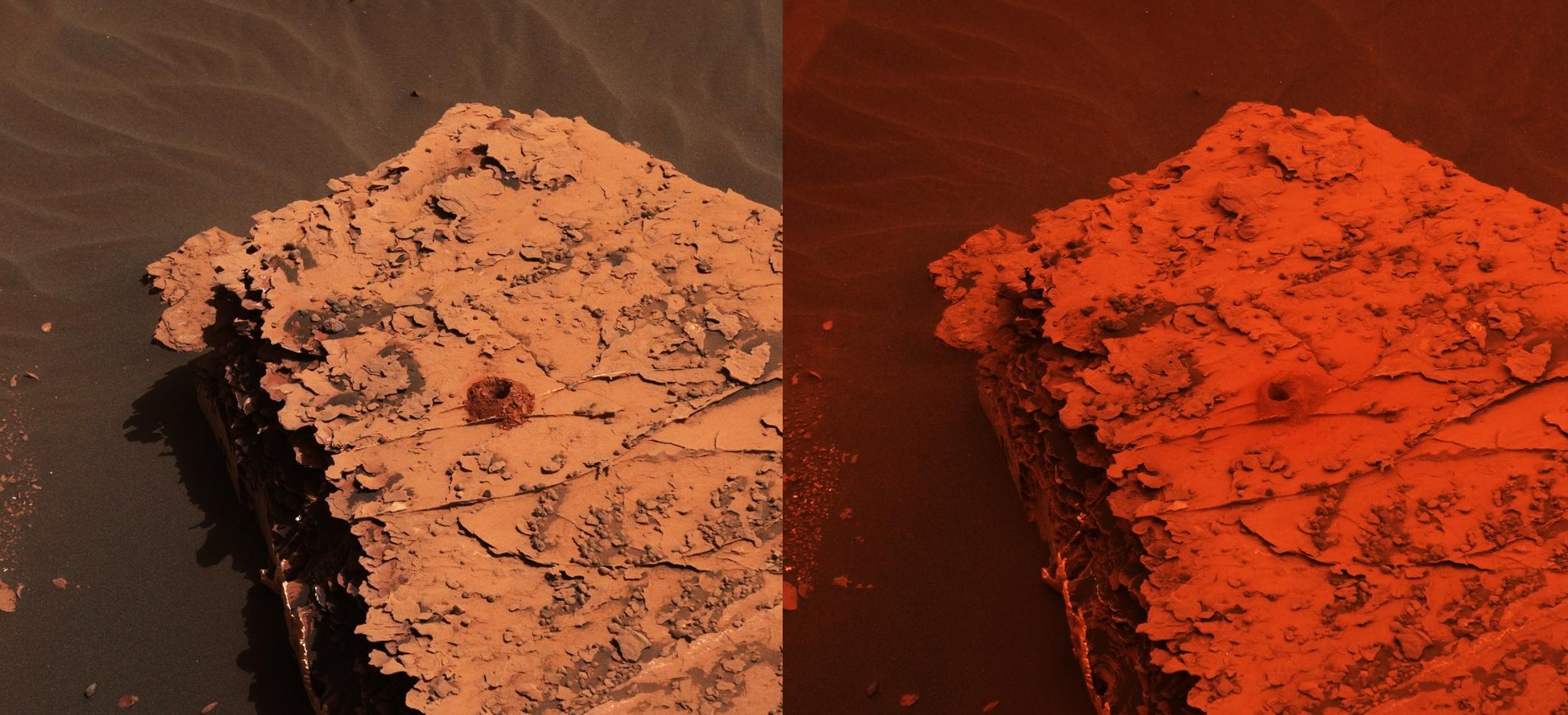
-
PIA22549:
-
Opportunity After the Dust Storm
Full Resolution:
TIFF
(9.053 MB)
JPEG
(492.1 kB)
|
|
|
2018-09-25 |
Mars
|
2001 Mars Odyssey
|
THEMIS
|
315x3030x3 |

|
-
PIA22717:
-
Escorial Crater - False Color
Full Resolution:
TIFF
(2.731 MB)
JPEG
(116.7 kB)
|
|
|
2018-09-24 |
Mars
|
Mars Reconnaissance Orbiter (MRO)
|
HiRISE
|
2880x1800x3 |
|
-
PIA22726:
-
Seeing through the Dusty Air
Full Resolution:
TIFF
(5.191 MB)
JPEG
(1.965 MB)
|
|
|
2018-09-24 |
Mars
|
2001 Mars Odyssey
|
THEMIS
|
676x3008x3 |

|
-
PIA22716:
-
Arabia Terra - False Color
Full Resolution:
TIFF
(2.738 MB)
JPEG
(151.5 kB)
|
|
|
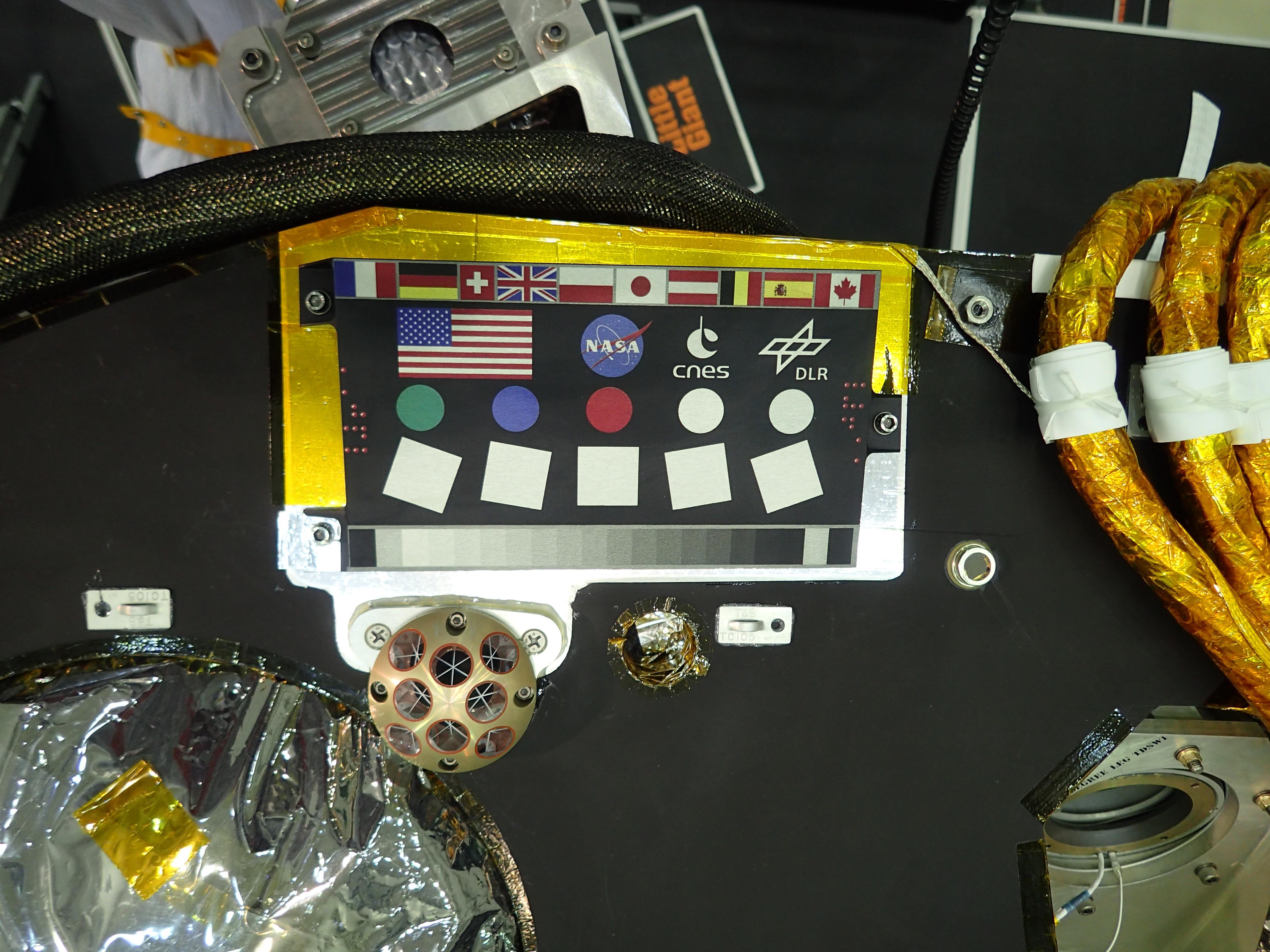
2018-09-21 |
Mars
|
InSight
|
|
4608x3456x3 |
|
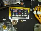
-
PIA22540:
-
InSight Camera Calibration Target, Laser Retroreflector, and Microchip
Full Resolution:
TIFF
(37.57 MB)
JPEG
(1.388 MB)
|
|
|
2018-09-21 |
Mars
|
2001 Mars Odyssey
|
THEMIS
|
673x3010x3 |
|
-
PIA22715:
-
Amazonis Planitia - False Color
Full Resolution:
TIFF
(2.745 MB)
JPEG
(134.6 kB)
|
|
|
2018-09-20 |
Mars
|
2001 Mars Odyssey
|
THEMIS
|
622x2707x3 |
|
-
PIA22714:
-
Nepenthes Mensa - False Color
Full Resolution:
TIFF
(2.257 MB)
JPEG
(111.9 kB)
|
|
|
2018-09-19 |
Mars
|
2001 Mars Odyssey
|
THEMIS
|
608x2702x3 |
|
-
PIA22713:
-
Ice Rich Clouds - False Color
Full Resolution:
TIFF
(2.118 MB)
JPEG
(114.3 kB)
|
|
|
2018-09-18 |
Mars
|
2001 Mars Odyssey
|
THEMIS
|
621x2705x3 |
|
-
PIA22712:
-
Terra Sabaea Crater - False Color
Full Resolution:
TIFF
(2.234 MB)
JPEG
(95.92 kB)
|
|
|
2018-09-17 |
Mars
|
2001 Mars Odyssey
|
THEMIS
|
671x3009x3 |
|
-
PIA22711:
-
Kasei Valles - False Color
Full Resolution:
TIFF
(2.602 MB)
JPEG
(111.5 kB)
|
|
|
2018-09-14 |
Mars
|
2001 Mars Odyssey
|
THEMIS
|
631x2698x3 |
|
-
PIA22710:
-
Terra Sabaea - False Color
Full Resolution:
TIFF
(2.349 MB)
JPEG
(117.9 kB)
|
|
|
2018-09-13 |
Mars
|
2001 Mars Odyssey
|
THEMIS
|
604x1458x3 |
|
-
PIA22709:
-
Escorial Crater - False Color
Full Resolution:
TIFF
(2.048 MB)
JPEG
(70.46 kB)
|
|
|
2018-09-12 |
Mars
|
2001 Mars Odyssey
|
THEMIS
|
319x2731x3 |

|
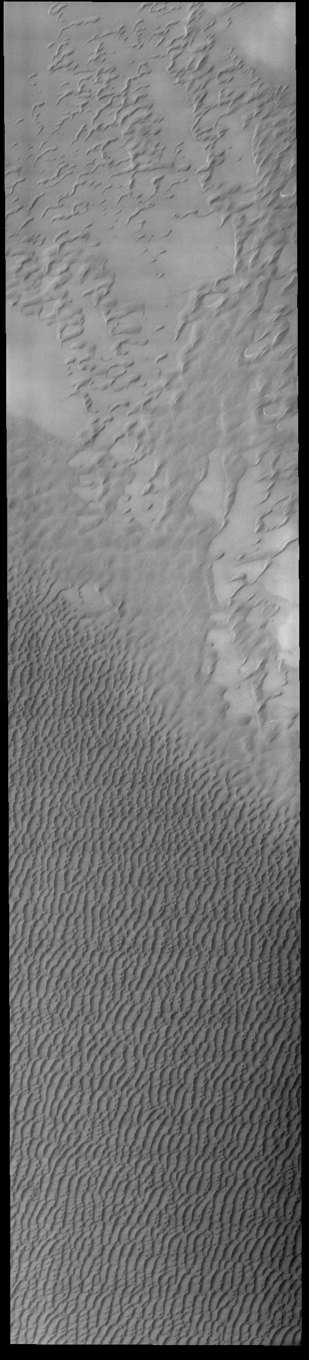
-
PIA22708:
-
Siton Undae - False Color
Full Resolution:
TIFF
(2.401 MB)
JPEG
(76.85 kB)
|
|
|
2018-09-11 |
Mars
|
2001 Mars Odyssey
|
THEMIS
|
628x2703x3 |
|
-
PIA22707:
-
Terra Sabaea - False Color
Full Resolution:
TIFF
(2.341 MB)
JPEG
(108.5 kB)
|
|
|
2018-09-10 |
Mars
|
2001 Mars Odyssey
|
THEMIS
|
718x1438x3 |

|
-
PIA22706:
-
Nili Fossae - False Color
Full Resolution:
TIFF
(2.083 MB)
JPEG
(98.24 kB)
|
|
|
2018-09-07 |
Mars
|
2001 Mars Odyssey
|
THEMIS
|
672x2701x3 |
|
-
PIA22679:
-
Storm Clouds - False Color
Full Resolution:
TIFF
(2.459 MB)
JPEG
(103.1 kB)
|
|
|
2018-09-06 |
Mars
|
Mars Science Laboratory (MSL)
|
Mastcam
|
10000x2886x3 |

|
-
PIA22545:
-
Panorama of Vera Rubin Ridge
Full Resolution:
TIFF
(67.34 MB)
JPEG
(3.445 MB)
|
|
|
2018-09-06 |
Mars
|
2001 Mars Odyssey
|
THEMIS
|
609x2719x3 |

|
-
PIA22678:
-
Thaumasia Planum - False Color
Full Resolution:
TIFF
(2.239 MB)
JPEG
(107.3 kB)
|
|
|
2018-09-05 |
Mars
|
2001 Mars Odyssey
|
THEMIS
|
622x2707x3 |

|
-
PIA22677:
-
Ophir Chasma - False Color
Full Resolution:
TIFF
(2.288 MB)
JPEG
(100.3 kB)
|
|
|
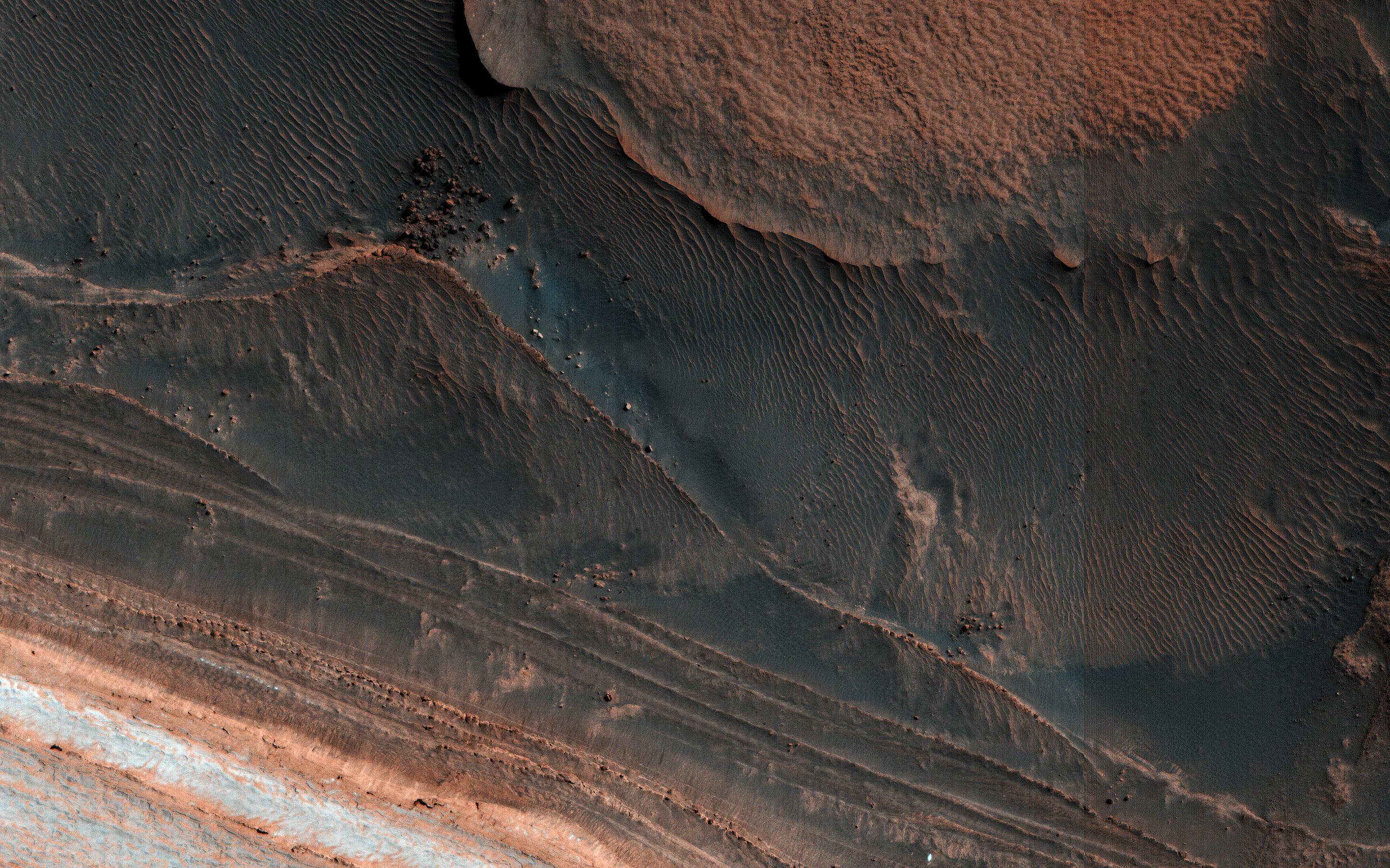
2018-09-04 |
Mars
|
Mars Reconnaissance Orbiter (MRO)
|
HiRISE
|
2880x1800x3 |

|
-
PIA22684:
-
Hanging Sand Dunes within Coprates Chasma
Full Resolution:
TIFF
(15.56 MB)
JPEG
(1.011 MB)
|
|
|
2018-09-04 |
Mars
|
Mars Reconnaissance Orbiter (MRO)
|
HiRISE
|
2880x1800x3 |
|
-
PIA22683:
-
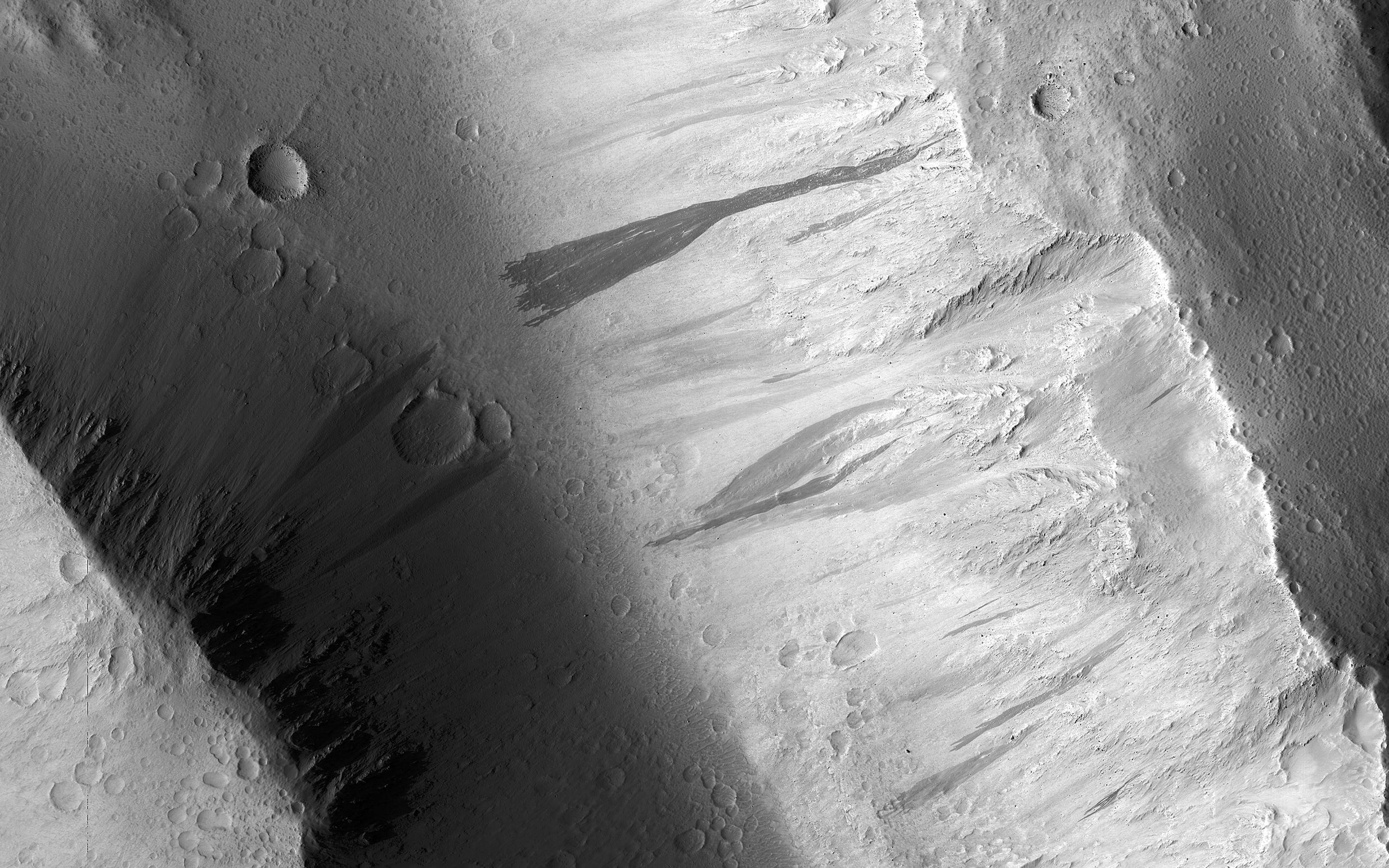
A Fan with Inverted Channels
Full Resolution:
TIFF
(15.56 MB)
JPEG
(1.77 MB)
|
|
|
2018-09-04 |
Mars
|
Mars Reconnaissance Orbiter (MRO)
|
HiRISE
|
2880x1800x3 |

|
-
PIA22682:
-
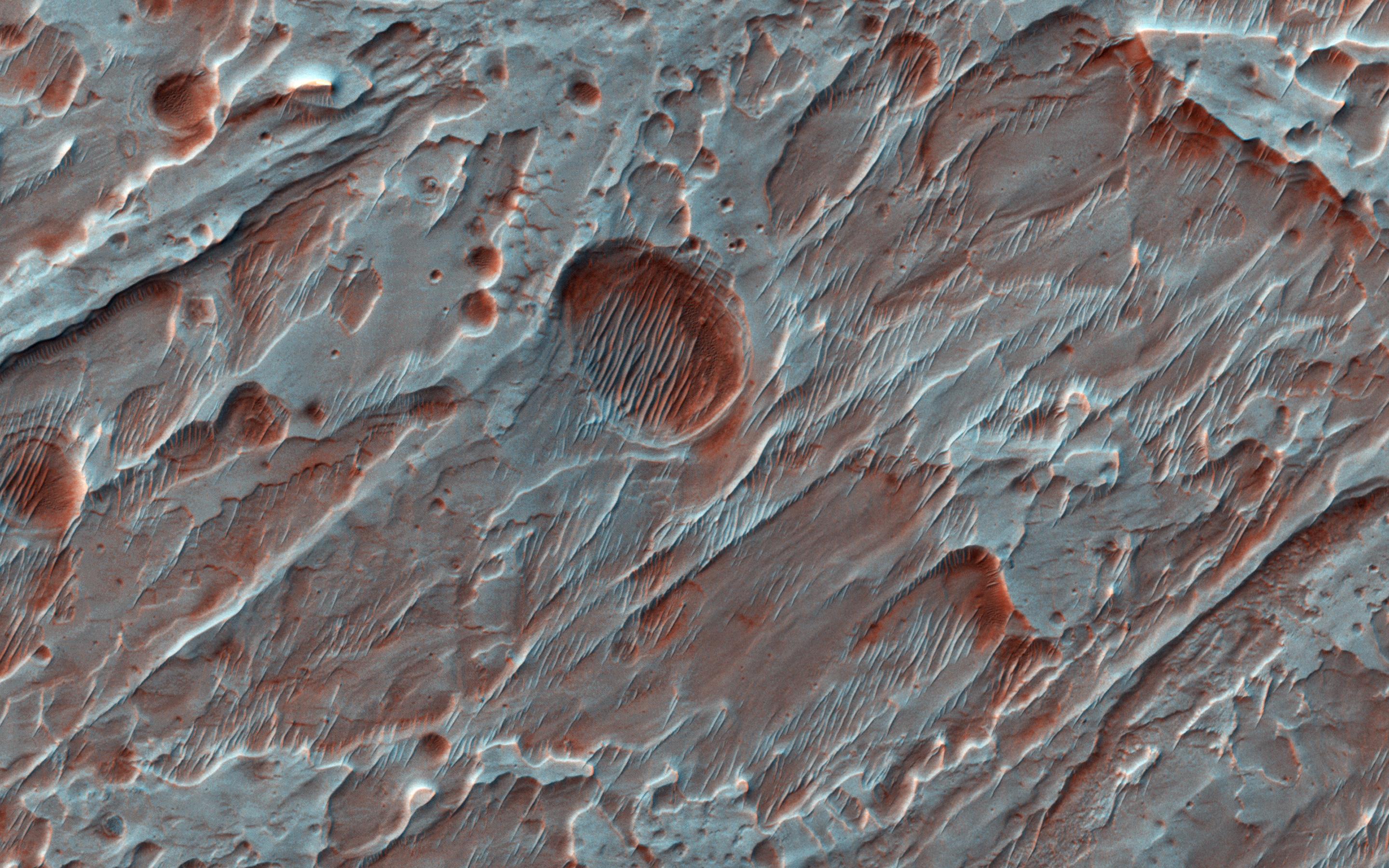
Pitted Cones: Possible Methane Sources?
Full Resolution:
TIFF
(15.56 MB)
JPEG
(938.1 kB)
|
|
|
2018-09-04 |
Mars
|
Mars Reconnaissance Orbiter (MRO)
|
HiRISE
|
2880x1800x3 |
|
-
PIA22681:
-
Crater Gullies and Fractures in Acidalia Planitia
Full Resolution:
TIFF
(15.56 MB)
JPEG
(1.116 MB)
|
|
|
2018-09-04 |
Mars
|
2001 Mars Odyssey
|
THEMIS
|
607x2726x3 |
|
-
PIA22676:
-
Terra Cimmeria - False Color
Full Resolution:
TIFF
(2.231 MB)
JPEG
(115.9 kB)
|
|
|
2018-09-03 |
Mars
|
2001 Mars Odyssey
|
THEMIS
|
607x2726x3 |

|
-
PIA22675:
-
Terra Cimmeria - False Color
Full Resolution:
TIFF
(2.255 MB)
JPEG
(120.3 kB)
|
|
|
2018-08-31 |
Mars
|
2001 Mars Odyssey
|
THEMIS
|
607x2726x3 |

|
-
PIA22671:
-
Terra Cimmeria - False Color
Full Resolution:
TIFF
(2.255 MB)
JPEG
(120.3 kB)
|
|
|
2018-08-30 |
Mars
|
2001 Mars Odyssey
|
THEMIS
|
615x2732x3 |
|
-
PIA22670:
-
Proctor Crater Dunes - False Color
Full Resolution:
TIFF
(2.149 MB)
JPEG
(99.45 kB)
|
|
|
2018-08-29 |
Mars
|
2001 Mars Odyssey
|
THEMIS
|
1373x2638x1 |

|
-
PIA22669:
-
Ascraeus Mons
Full Resolution:
TIFF
(2.574 MB)
JPEG
(363 kB)
|
|
|
2018-08-28 |
Mars
|
2001 Mars Odyssey
|
THEMIS
|
1345x2649x1 |
|
-
PIA22668:
-
Windstreaks
Full Resolution:
TIFF
(2.49 MB)
JPEG
(316.1 kB)
|
|
|
2018-08-27 |
Mars
|
2001 Mars Odyssey
|
THEMIS
|
1388x2640x1 |
|
-
PIA22667:
-
Tharsis Volcanics
Full Resolution:
TIFF
(2.79 MB)
JPEG
(441.2 kB)
|
|
|
2018-08-24 |
Mars
|
2001 Mars Odyssey
|
THEMIS
|
1335x2636x1 |
|
-
PIA22666:
-
Pavonis Mons
Full Resolution:
TIFF
(2.541 MB)
JPEG
(380.9 kB)
|
|
|
2018-08-23 |
Mars
|
2001 Mars Odyssey
|
THEMIS
|
1385x2639x1 |
|
-
PIA22665:
-
Crater in Tharsis
Full Resolution:
TIFF
(2.587 MB)
JPEG
(349.5 kB)
|
|
|
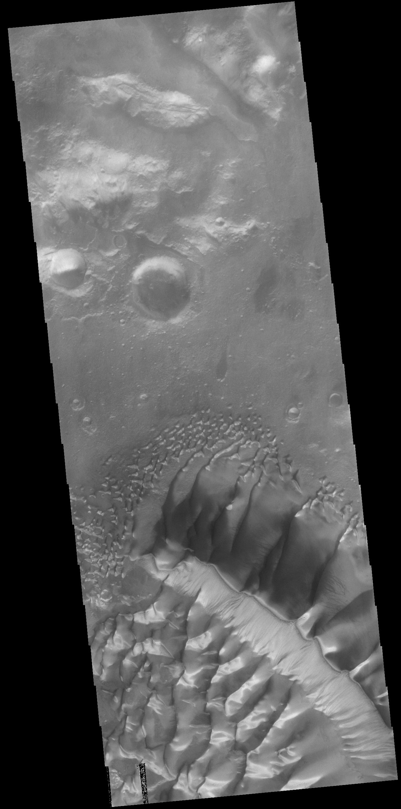
2018-08-22 |
Mars
|
2001 Mars Odyssey
|
THEMIS
|
1334x2654x1 |
|
-
PIA22664:
-
Tyrrhena Fossae
Full Resolution:
TIFF
(2.406 MB)
JPEG
(248.3 kB)
|
|
|
2018-08-21 |
Mars
|
2001 Mars Odyssey
|
THEMIS
|
1338x2697x1 |

|
-
PIA22663:
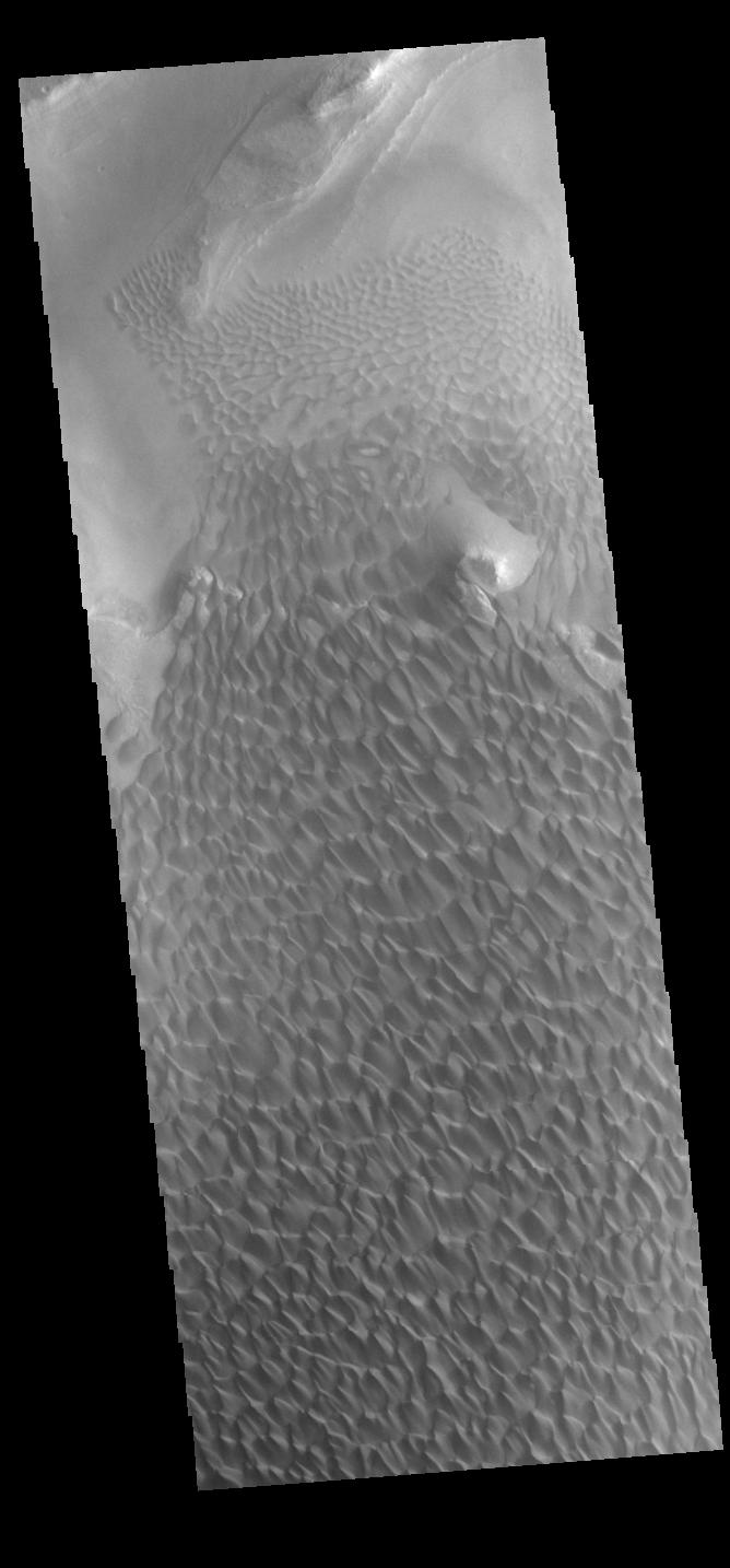
-
Russell Crater Dunes
Full Resolution:
TIFF
(2.452 MB)
JPEG
(255.9 kB)
|
|
|
2018-08-20 |
Mars
|
InSight
|
Instrument Context Camera (ICC)
|
1129x1125x3 |
|
-
PIA22647:
-
InSight's Inner Sanctum Revealed
Full Resolution:
TIFF
(3.284 MB)
JPEG
(245.7 kB)
|
|
|
2018-08-13 |
Mars
|
2001 Mars Odyssey
|
THEMIS
|
1372x2645x1 |
|
-
PIA22624:
-
Aram Chaos
Full Resolution:
TIFF
(2.565 MB)
JPEG
(266 kB)
|
|
|
2018-08-10 |
Mars
|
2001 Mars Odyssey
|
THEMIS
|
1416x2646x1 |
|
-
PIA22623:
-
Buvinda Vallis
Full Resolution:
TIFF
(2.535 MB)
JPEG
(278.1 kB)
|
|
|
2018-08-09 |
Mars
|
2001 Mars Odyssey
|
THEMIS
|
1357x2644x1 |
|
-
PIA22622:
-
Dark Slope Streaks
Full Resolution:
TIFF
(2.452 MB)
JPEG
(234 kB)
|
|
|
2018-08-08 |
Mars
|
2001 Mars Odyssey
|
THEMIS
|
1393x2645x1 |

|
-
PIA22621:
-
Hephaestus Fossae
Full Resolution:
TIFF
(2.383 MB)
JPEG
(282.3 kB)
|
|
|
2018-08-07 |
Mars
|
2001 Mars Odyssey
|
THEMIS
|
1377x2642x1 |
|
-
PIA22620:
-
Dark Slope Streaks
Full Resolution:
TIFF
(2.493 MB)
JPEG
(254 kB)
|
|
|
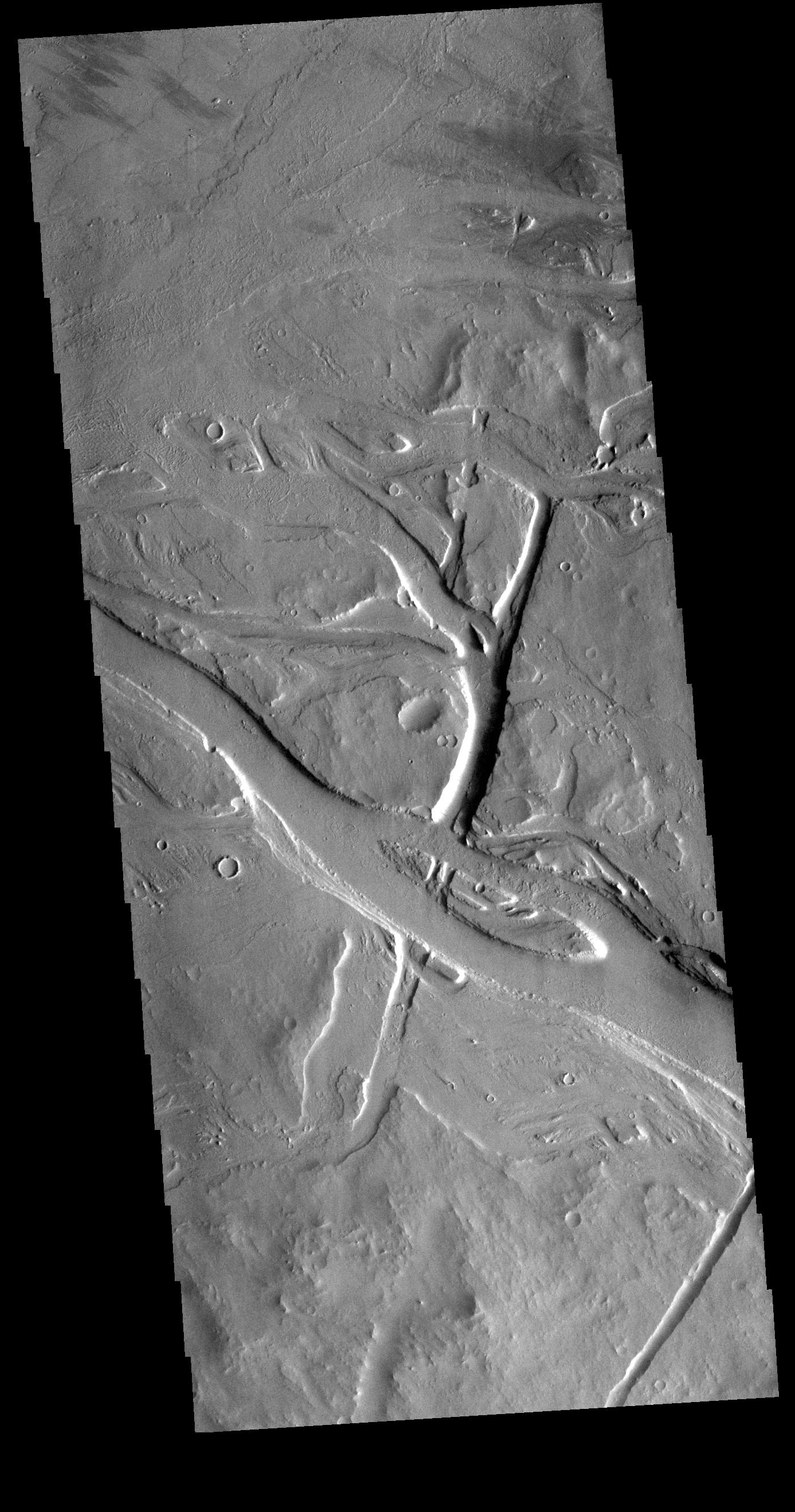
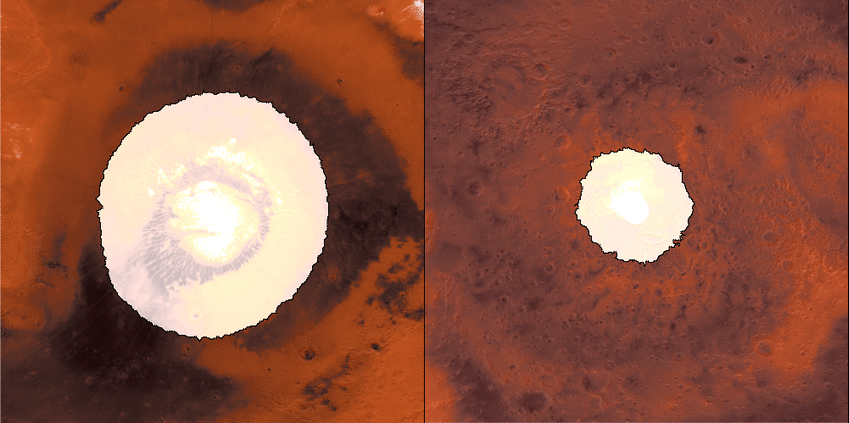
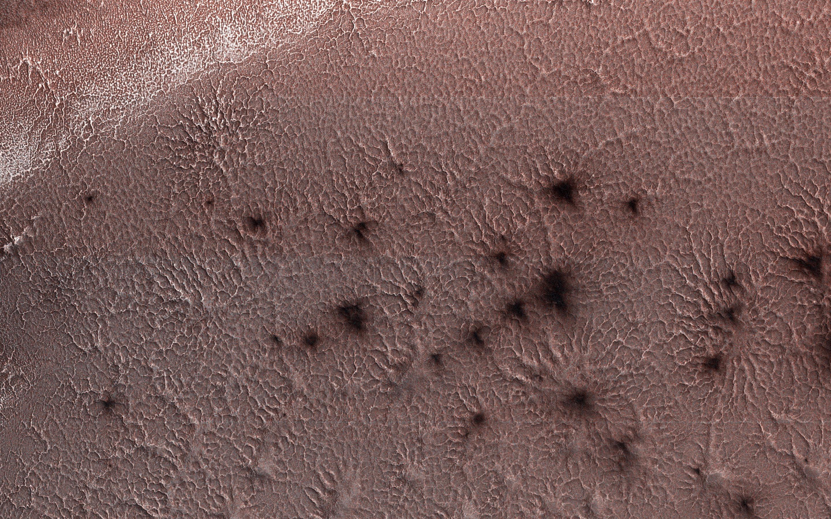
2018-08-06 |
Mars
|
Mars Reconnaissance Orbiter (MRO)
Mars Global Surveyor (MGS)
|
MCS
Thermal Emission Spectrometer
|
849x423x3 |
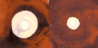
|
-
PIA22546:
-
Growth and Retreat of the CO2 Ice at the Martian Poles

Full Resolution:
TIFF
(562.4 kB)
JPEG
(383.2 kB)
|
|
|
2018-08-06 |
Mars
|
2001 Mars Odyssey
|
THEMIS
|
1405x2646x1 |

|
-
PIA22619:
-
Elysium Fossae
Full Resolution:
TIFF
(2.365 MB)
JPEG
(253.5 kB)
|
|
|
2018-08-03 |
Mars
|
2001 Mars Odyssey
|
THEMIS
|
718x1458x1 |

|
-
PIA22618:
-
Crater Dunes
Full Resolution:
TIFF
(735.7 kB)
JPEG
(80.45 kB)
|
|
|
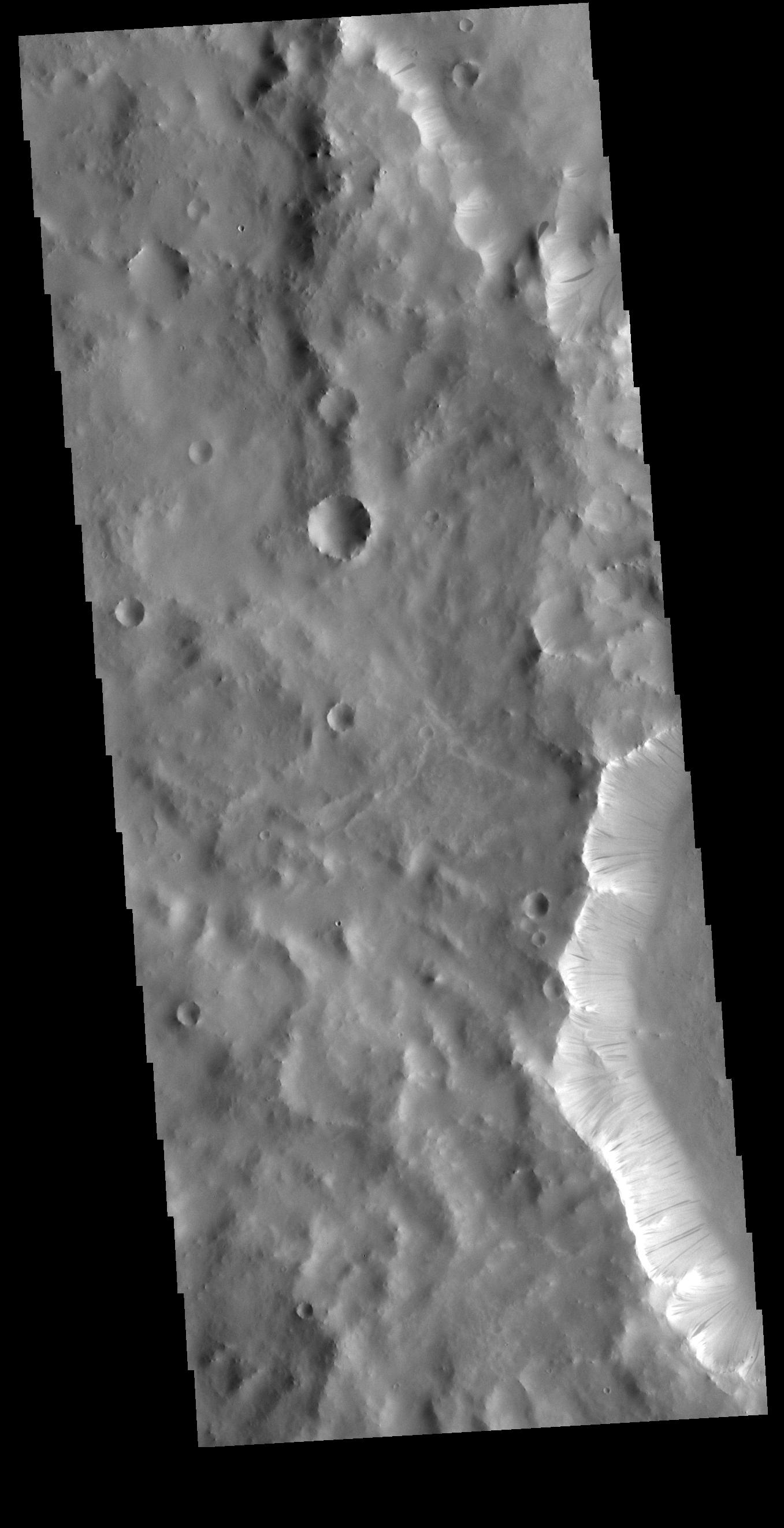
2018-08-02 |
Mars
|
2001 Mars Odyssey
|
THEMIS
|
1381x2643x1 |
|
-
PIA22617:
-
Sacra Fossae
Full Resolution:
TIFF
(2.19 MB)
JPEG
(172.7 kB)
|
|
|
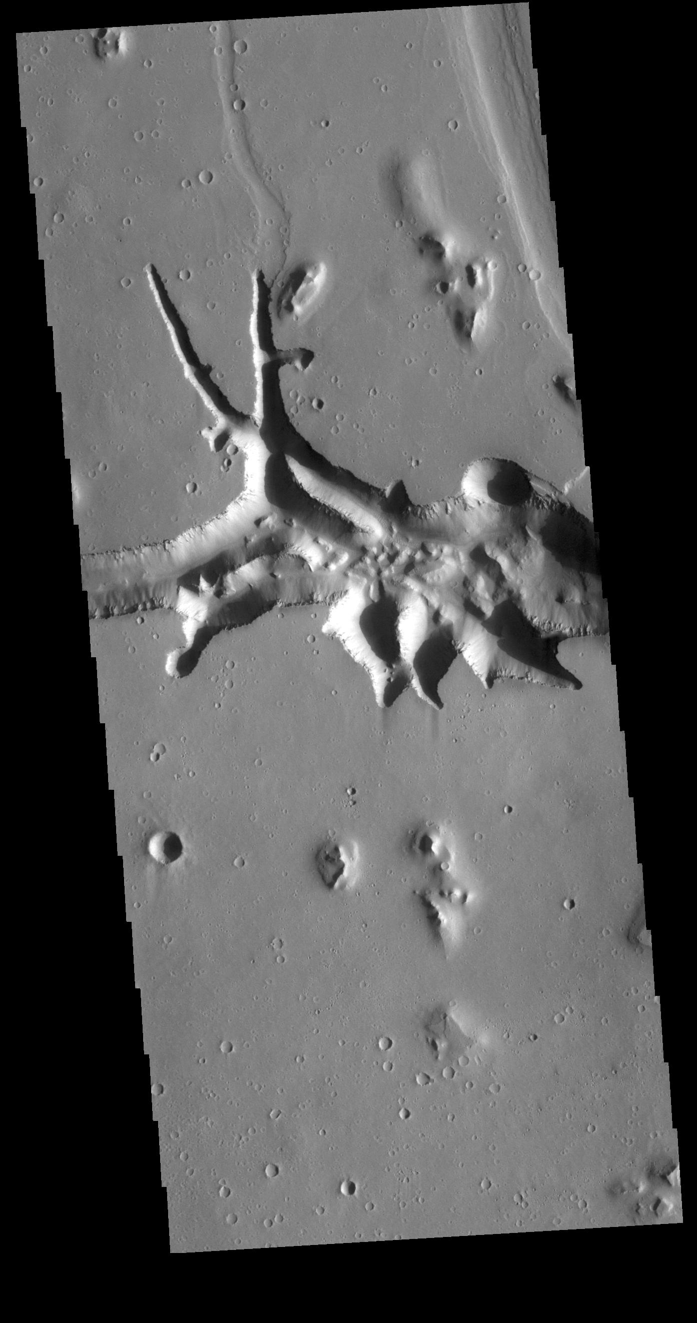
2018-08-01 |
Mars
|
2001 Mars Odyssey
|
THEMIS
|
1362x2651x1 |
|
-
PIA22616:
-
Ganges Chasma Landslide
Full Resolution:
TIFF
(2.56 MB)
JPEG
(294.3 kB)
|
|
|
2018-07-31 |
Mars
|
2001 Mars Odyssey
|
THEMIS
|
721x1461x1 |

|
-
PIA22615:
-
Moreux Crater Dunes
Full Resolution:
TIFF
(640.1 kB)
JPEG
(58.44 kB)
|
|
|
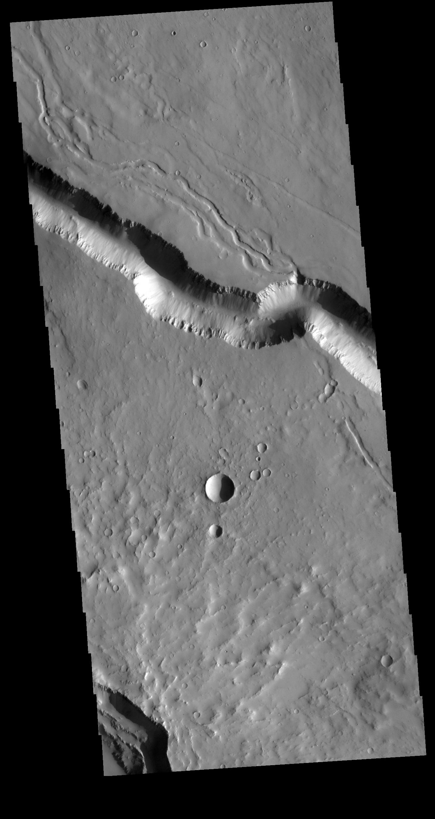
2018-07-30 |
Mars
|
2001 Mars Odyssey
|
THEMIS
|
1353x2645x1 |
|
-
PIA22614:
-
Daedalia Planum Crater
Full Resolution:
TIFF
(2.399 MB)
JPEG
(284.6 kB)
|
|
|
2018-07-27 |
Mars
|
2001 Mars Odyssey
|
THEMIS
|
1359x2647x1 |
|
-
PIA22612:
-
Wind Etching
Full Resolution:
TIFF
(2.802 MB)
JPEG
(478.8 kB)
|
|
|
2018-07-26 |
Mars
|
2001 Mars Odyssey
|
THEMIS
|
1320x2653x1 |
|
-
PIA22611:
-
Daedalia Planum
Full Resolution:
TIFF
(2.575 MB)
JPEG
(406.3 kB)
|
|
|
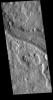
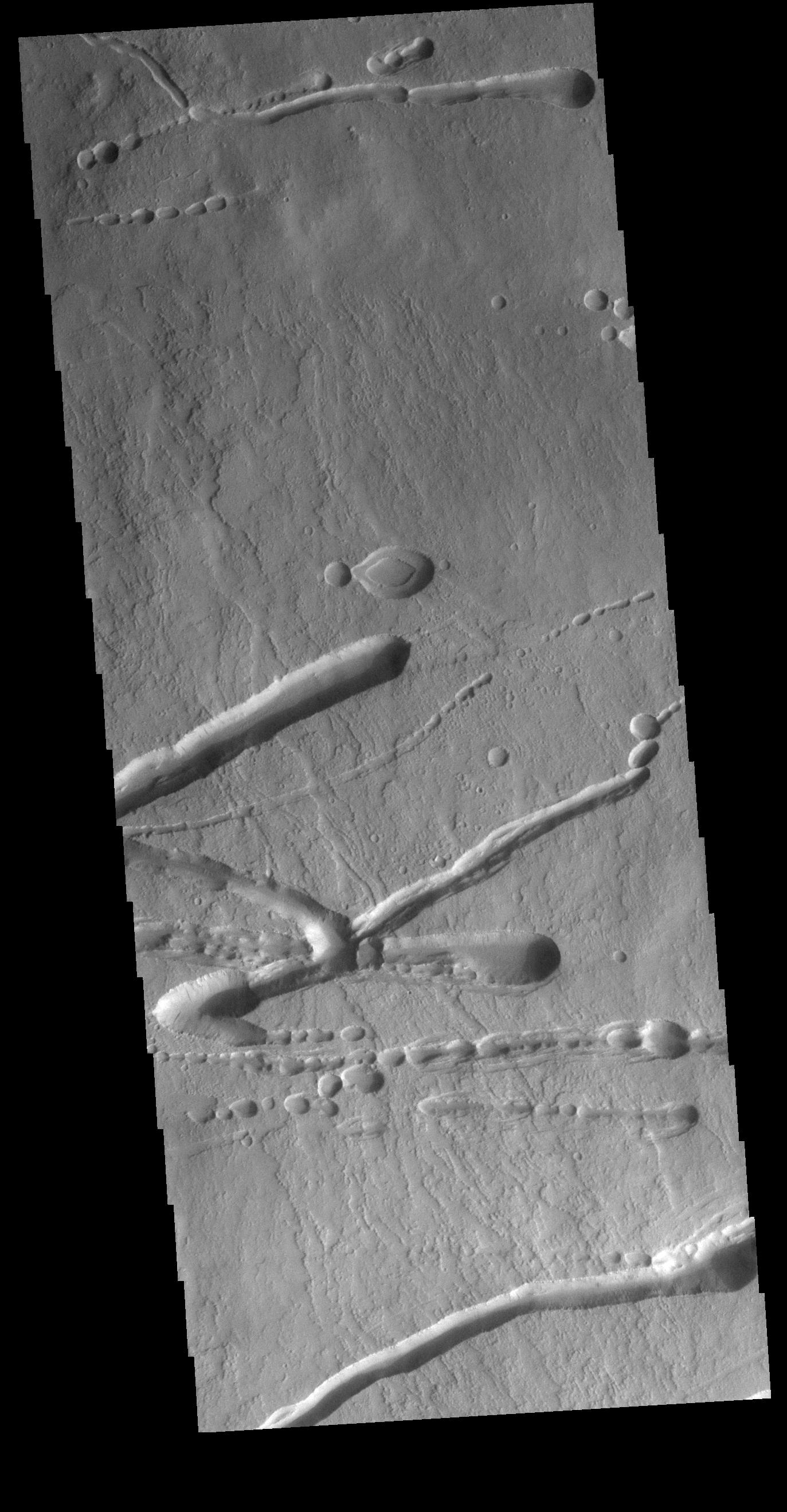
2018-07-25 |
Mars
|
2001 Mars Odyssey
|
THEMIS
|
1212x5306x1 |
|
-
PIA22610:
-
Ares Vallis
Full Resolution:
TIFF
(2.988 MB)
JPEG
(352.8 kB)
|
|
|
2018-07-24 |
Mars
|
2001 Mars Odyssey
|
THEMIS
|
1385x2644x1 |

|
-
PIA22609:
-
Many Textures
Full Resolution:
TIFF
(2.752 MB)
JPEG
(385.3 kB)
|
|
|
2018-07-24 |
Mars
|
Mars Reconnaissance Orbiter (MRO)
|
HiRISE
|
2880x1800x1 |

|
-
PIA22595:
-
The Dark Side of Dust Avalanches
Full Resolution:
TIFF
(5.191 MB)
JPEG
(858.4 kB)
|
|
|
2018-07-24 |
Mars
|
Mars Reconnaissance Orbiter (MRO)
|
HiRISE
|
2880x1800x3 |
|
-
PIA22594:
-
Fans of Roddy Crater
Full Resolution:
TIFF
(15.56 MB)
JPEG
(835.6 kB)
|
|
|
2018-07-24 |
Mars
|
Mars Reconnaissance Orbiter (MRO)
|
HiRISE
|
2880x1800x3 |
|
-
PIA22592:
-
Fans and Valleys
Full Resolution:
TIFF
(15.56 MB)
JPEG
(949.7 kB)
|
|
|
2018-07-23 |
Mars
|
Mars Reconnaissance Orbiter (MRO)
|
HiRISE
|
2880x1800x3 |
|
-
PIA22586:
-
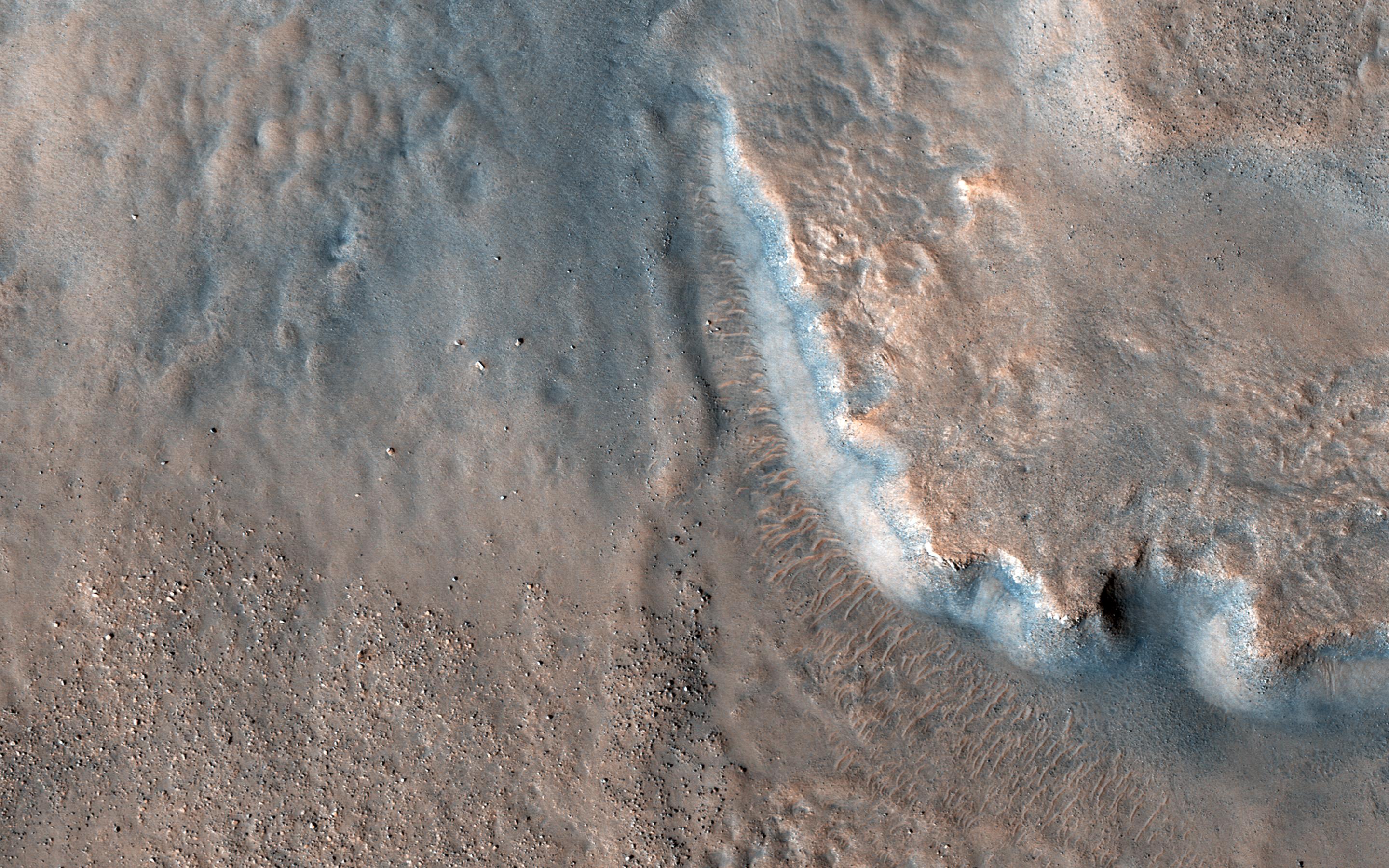
This is Not the Hydrothermal Deposit You're Looking For
Full Resolution:
TIFF
(15.56 MB)
JPEG
(965.6 kB)
|
|
|
2018-07-23 |
Mars
|
2001 Mars Odyssey
|
THEMIS
|
1336x2654x1 |
|
-
PIA22608:
-
Not Quite Round
Full Resolution:
TIFF
(2.518 MB)
JPEG
(302.9 kB)
|
|
|
2018-07-20 |
Mars
|
2001 Mars Odyssey
|
THEMIS
|
1388x2642x1 |
|
-
PIA22607:
-
Indus Vallis
Full Resolution:
TIFF
(2.681 MB)
JPEG
(313 kB)
|
|
|
2018-07-19 |
Mars
|
Mars Reconnaissance Orbiter (MRO)
|
MARCI
|
1816x1024x3 |
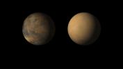
|
-
PIA22487:
-
Mars Before and After Dust Storm
Full Resolution:
TIFF
(1.12 MB)
JPEG
(48.31 kB)
|
|
|
2018-07-19 |
Mars
|
2001 Mars Odyssey
|
THEMIS
|
709x1444x1 |

|
-
PIA22606:
-
Doublet Crater
Full Resolution:
TIFF
(642.6 kB)
JPEG
(71.2 kB)
|
|
|
2018-07-18 |
Mars
|
2001 Mars Odyssey
|
THEMIS
|
1394x2644x1 |
|
-
PIA22605:
-
Hephaestus Fossae Crater
Full Resolution:
TIFF
(2.491 MB)
JPEG
(279.3 kB)
|
|
|
2018-07-17 |
Mars
|
2001 Mars Odyssey
|
THEMIS
|
1358x2649x1 |

|
-
PIA22604:
-
Wind Erosion
Full Resolution:
TIFF
(2.661 MB)
JPEG
(426.8 kB)
|
|
|
2018-07-16 |
Mars
|
2001 Mars Odyssey
|
THEMIS
|
1404x2644x1 |
|
-
PIA22603:
-
Elysium Fossae
Full Resolution:
TIFF
(2.307 MB)
JPEG
(224.2 kB)
|
|
|
2018-07-13 |
Mars
|
2001 Mars Odyssey
|
THEMIS
|
1368x2648x1 |

|
-
PIA22602:
-
Ophir Chasma
Full Resolution:
TIFF
(2.426 MB)
JPEG
(250.2 kB)
|
|
|
2018-07-12 |
Mars
|
2001 Mars Odyssey
|
THEMIS
|
1371x2641x1 |
|
-
PIA22598:
-
Olympus Rupes
Full Resolution:
TIFF
(2.325 MB)
JPEG
(257.7 kB)
|
|
|
2018-07-11 |
Mars
|
2001 Mars Odyssey
|
THEMIS
|
1331x2653x1 |

|
-
PIA22597:
-
Daedalia Planum
Full Resolution:
TIFF
(2.77 MB)
JPEG
(565.7 kB)
|
|
|
2018-07-10 |
Mars
|
2001 Mars Odyssey
|
THEMIS
|
1401x2648x1 |
|
-
PIA22596:
-
Phlegethon Catena
Full Resolution:
TIFF
(2.39 MB)
JPEG
(224.3 kB)
|
|
|
2018-07-09 |
Mars
|
Mars Reconnaissance Orbiter (MRO)
|
HiRISE
|
2880x1800x3 |
|
-
PIA22588:
-
Clays in the Eridania Basin
Full Resolution:
TIFF
(15.56 MB)
JPEG
(671.1 kB)
|
|
|
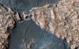
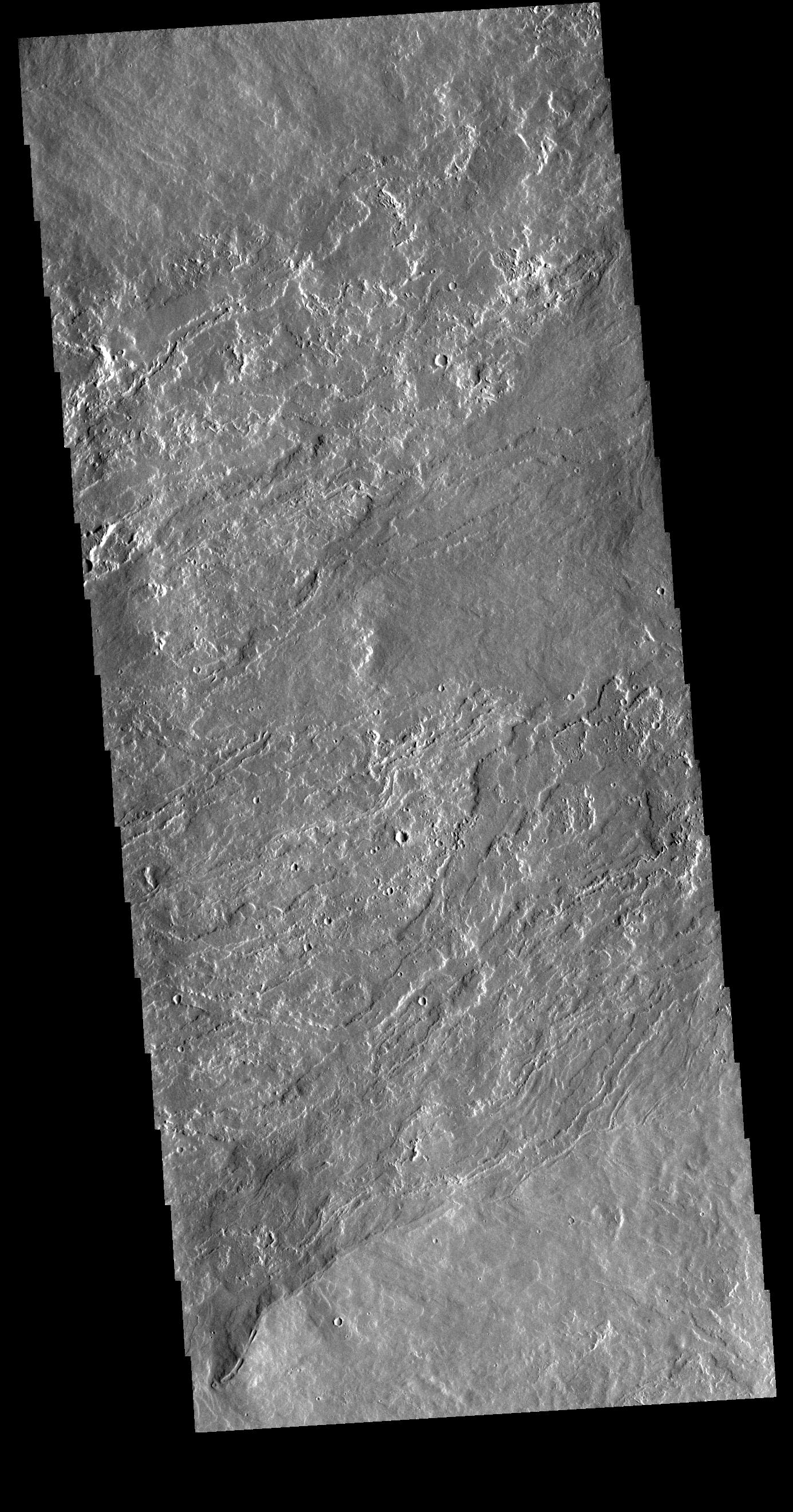
2018-07-09 |
Mars
|
Mars Reconnaissance Orbiter (MRO)
|
HiRISE
|
2880x1800x3 |
|
-
PIA22587:
-
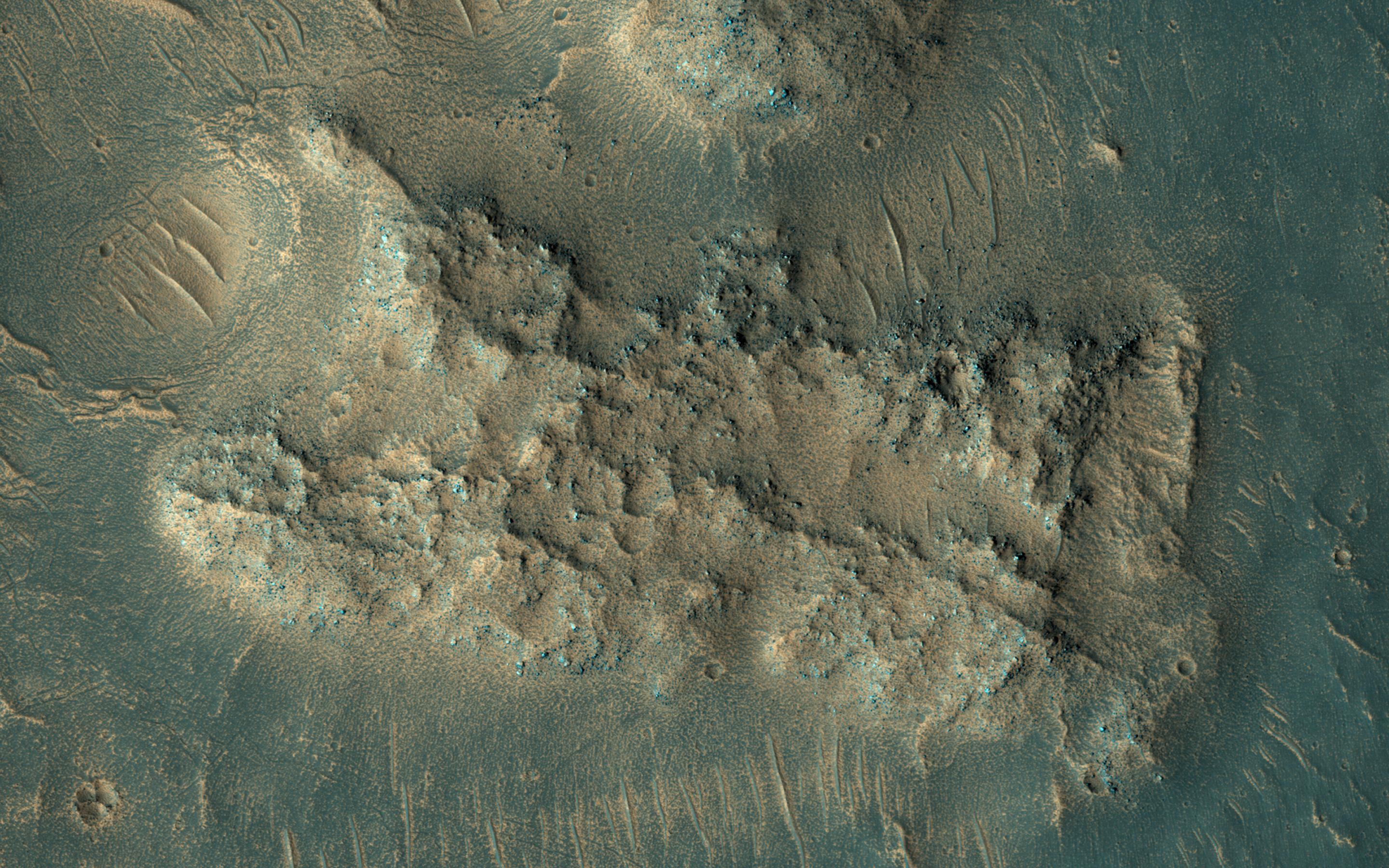
Jamming with the 'Spiders' from Mars
Full Resolution:
TIFF
(15.56 MB)
JPEG
(1.352 MB)
|
|
|
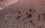
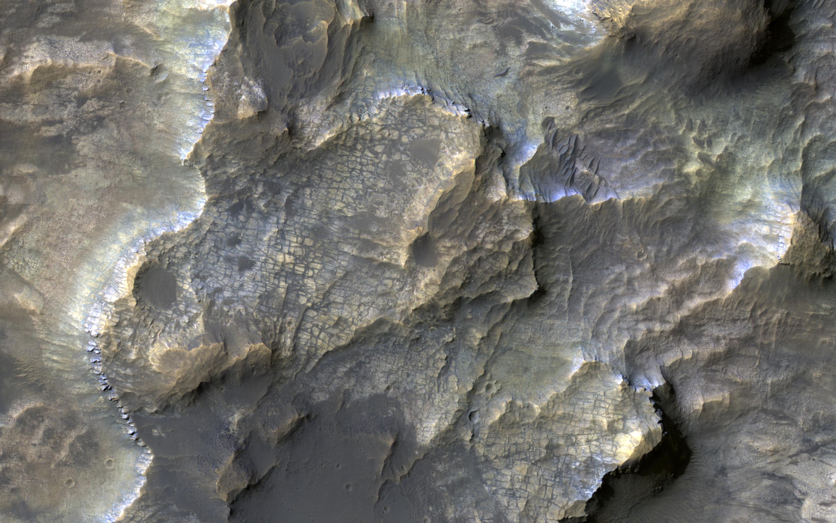
2018-07-09 |
Mars
|
Mars Reconnaissance Orbiter (MRO)
|
HiRISE
|
2880x1800x3 |
|
-
PIA22585:
-
Uplifted Blocks of Light-Toned Layered Deposits
Full Resolution:
TIFF
(15.56 MB)
JPEG
(903.3 kB)
|
|
|
2018-07-09 |
Mars
|
2001 Mars Odyssey
|
THEMIS
|
1390x2643x1 |
|
-
PIA22584:
-
Kasei Valles
Full Resolution:
TIFF
(2.524 MB)
JPEG
(249.8 kB)
|
|
|
2018-07-06 |
Mars
|
2001 Mars Odyssey
|
THEMIS
|
1434x2658x1 |
|
-
PIA22583:
-
Terra Sabaea Crater
Full Resolution:
TIFF
(2.475 MB)
JPEG
(287.9 kB)
|
|
|
2018-07-05 |
Mars
|
2001 Mars Odyssey
|
THEMIS
|
1385x2641x1 |
|
-
PIA22581:
-
Olympus Mons
Full Resolution:
TIFF
(2.899 MB)
JPEG
(573.8 kB)
|
|
|
2018-07-04 |
Mars
|
2001 Mars Odyssey
|
THEMIS
|
1344x2640x1 |

|
-
PIA22580:
-
Pavonis Mons
Full Resolution:
TIFF
(2.638 MB)
JPEG
(382.6 kB)
|
|
|
2018-07-03 |
Mars
|
2001 Mars Odyssey
|
THEMIS
|
1382x2641x1 |

|
-
PIA22579:
-
Terra Sabaea Channel
Full Resolution:
TIFF
(2.612 MB)
JPEG
(307.8 kB)
|
|
|
2018-07-02 |
Mars
|
2001 Mars Odyssey
|
THEMIS
|
1461x2671x1 |
|
-
PIA22578:
-
Dust Devil Tracks
Full Resolution:
TIFF
(2.907 MB)
JPEG
(422 kB)
|
|
|
2018-06-29 |
Mars
|
2001 Mars Odyssey
|
THEMIS
|
1356x2648x1 |
|
-
PIA22577:
-
Wind Etching
Full Resolution:
TIFF
(2.83 MB)
JPEG
(498.3 kB)
|
|
|
2018-06-28 |
Mars
|
2001 Mars Odyssey
|
THEMIS
|
1344x2643x1 |
|
-
PIA22576:
-
Tithonium Chasma
Full Resolution:
TIFF
(1.943 MB)
JPEG
(141.3 kB)
|
|
|
2018-06-27 |
Mars
|
2001 Mars Odyssey
|
THEMIS
|
1372x2644x1 |

|
-
PIA22539:
-
Aram Chaos
Full Resolution:
TIFF
(2.419 MB)
JPEG
(220.7 kB)
|
|
|
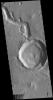
2018-06-26 |
Mars
|
2001 Mars Odyssey
|
THEMIS
|
1362x2647x1 |
|
-
PIA22538:
-
Margaritifer Chaos
Full Resolution:
TIFF
(2.46 MB)
JPEG
(221.5 kB)
|
|
|
2018-06-25 |
Mars
|
Mars Reconnaissance Orbiter (MRO)
|
HiRISE
|
2880x1800x3 |

|
-
PIA22536:
-
The Hills in Ganges Chasma
Full Resolution:
TIFF
(15.56 MB)
JPEG
(681.4 kB)
|
|
|
2018-06-25 |
Mars
|
Mars Reconnaissance Orbiter (MRO)
|
HiRISE
|
2880x1800x3 |
|
-
PIA22535:
-
Ice Block Avalanche
Full Resolution:
TIFF
(15.56 MB)
JPEG
(1.064 MB)
|
|
|
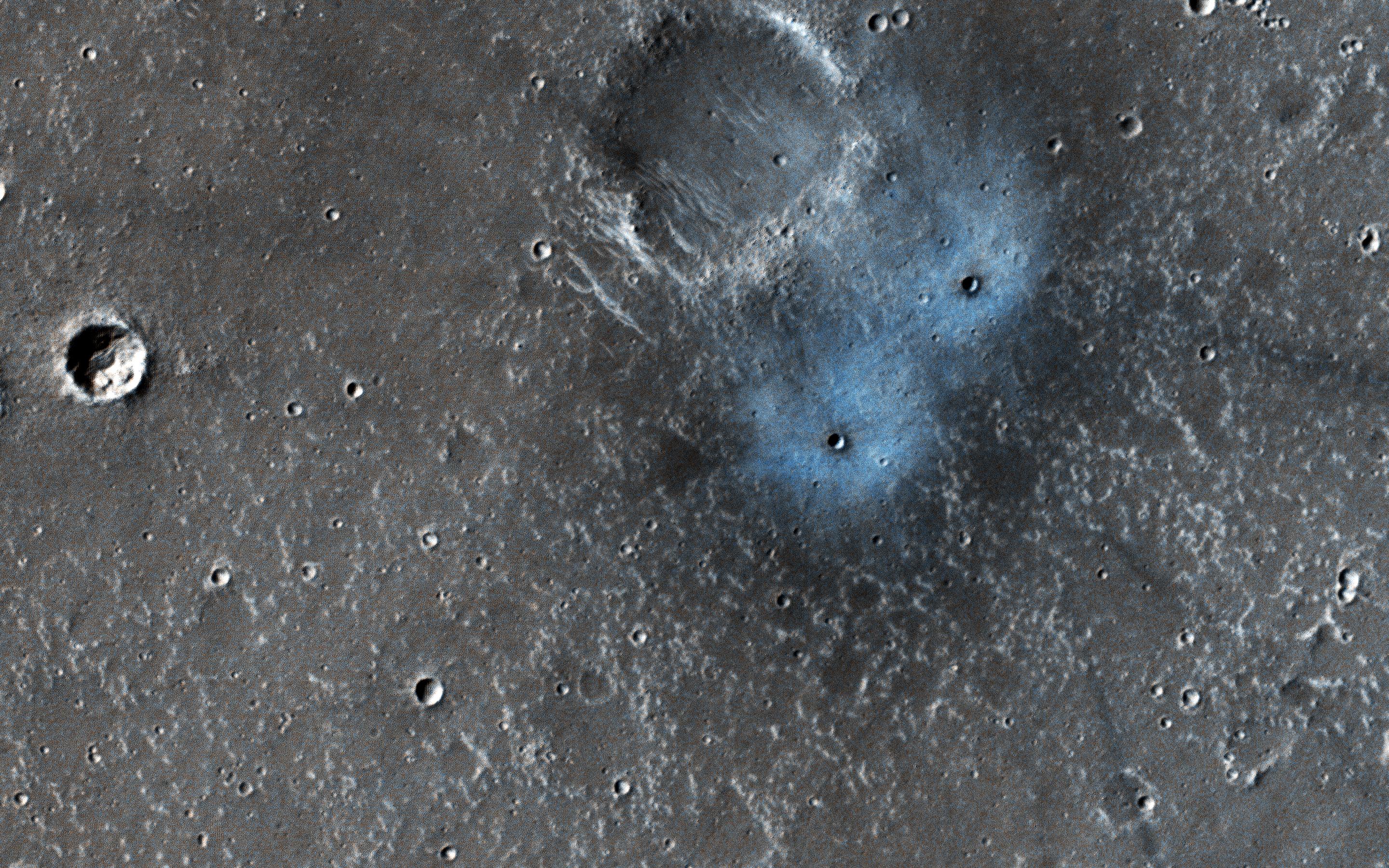
2018-06-25 |
Mars
|
Mars Reconnaissance Orbiter (MRO)
|
HiRISE
|
2880x1800x3 |

|
-
PIA22534:
-
New Crater Blues
Full Resolution:
TIFF
(15.56 MB)
JPEG
(1.491 MB)
|
|
|
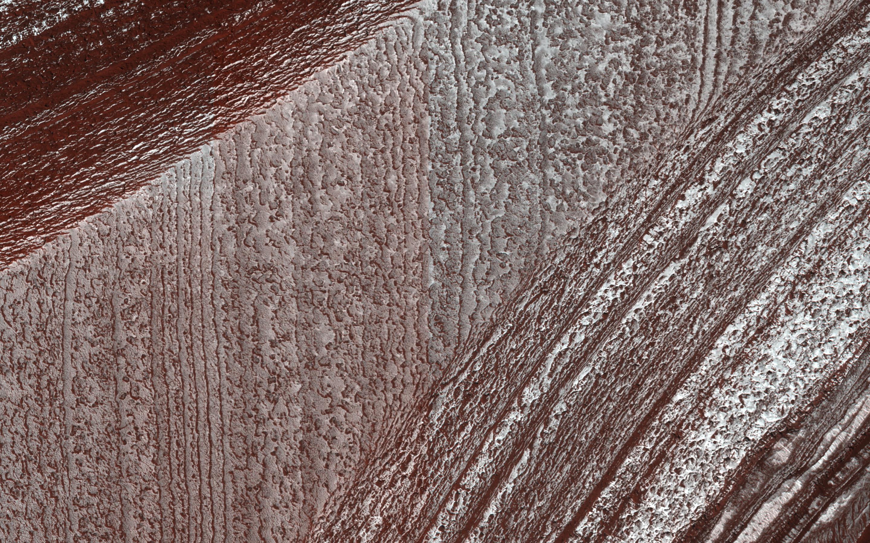
2018-06-25 |
Mars
|
Mars Reconnaissance Orbiter (MRO)
|
HiRISE
|
2880x1800x3 |
|
-
PIA22533:
-
Lingering Frost
Full Resolution:
TIFF
(15.56 MB)
JPEG
(1.219 MB)
|
|
|
2018-06-25 |
Mars
|
2001 Mars Odyssey
|
THEMIS
|
1365x2646x1 |

|
-
PIA22505:
-
Gale Crater
Full Resolution:
TIFF
(2.416 MB)
JPEG
(249.3 kB)
|
|
|
2018-06-22 |
Mars
|
2001 Mars Odyssey
|
THEMIS
|
1368x2642x1 |
|
-
PIA22504:
-
Crater Dark Slope Streaks
Full Resolution:
TIFF
(2.286 MB)
JPEG
(197.4 kB)
|
|
|
2018-06-21 |
Mars
|
2001 Mars Odyssey
|
THEMIS
|
1423x2645x1 |
|
-
PIA22503:
-
Arcadia Plainitia Hills
Full Resolution:
TIFF
(2.712 MB)
JPEG
(295.9 kB)
|
|
|
2018-06-20 |
Mars
|
Mars Science Laboratory (MSL)
|
Mastcam
|
2374x1083x3 |

|
-
PIA22330:
-
Duluth After Dust Storm
Full Resolution:
TIFF
(7.17 MB)
JPEG
(332.7 kB)
|
|
|
2018-06-20 |
Mars
|
Mars Science Laboratory (MSL)
|
MAHLI
|
18033x10144x3 |
|
-
PIA22486:
-
Curiosity's Dusty Selfie
Full Resolution:
TIFF
(400.4 MB)
JPEG
(13.25 MB)
|
|
|
2018-06-20 |
Mars
|
2001 Mars Odyssey
|
THEMIS
|
602x2644x1 |
|
-
PIA22502:
-
Olympia Undae
Full Resolution:
TIFF
(1.548 MB)
JPEG
(202.9 kB)
|
|
|
2018-06-19 |
Mars
|
2001 Mars Odyssey
|
THEMIS
|
668x1434x1 |

|
-
PIA22501:
-
Rabe Crater Dunes
Full Resolution:
TIFF
(679.5 kB)
JPEG
(75.89 kB)
|
|
|
2018-06-18 |
Mars
|
2001 Mars Odyssey
|
THEMIS
|
1358x2643x1 |
|
-
PIA22500:
-
Xanthe Terra Channel
Full Resolution:
TIFF
(2.694 MB)
JPEG
(330.9 kB)
|
 Planetary Data System


