Click on an image for detailed information
Click on a column heading to sort in ascending or descending order

My
List |
Addition Date
|
Target
|
Mission
|
Instrument
|
Size
|

|
2018-10-03 |
Saturn
|
Cassini-Huygens
|
|
2550x3300x3 |
|
-
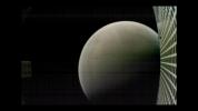
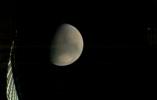
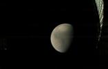
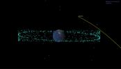
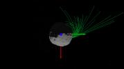
PIA22768:
-
Grand Finale: One of Cassini's Last Dives (Illustration)
Full Resolution:
TIFF
(11.99 MB)
JPEG
(340.5 kB)
|
|
|
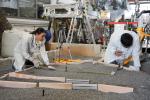
2018-10-09 |
Mars
|
InSight
|
|
8400x5600x3 |
|
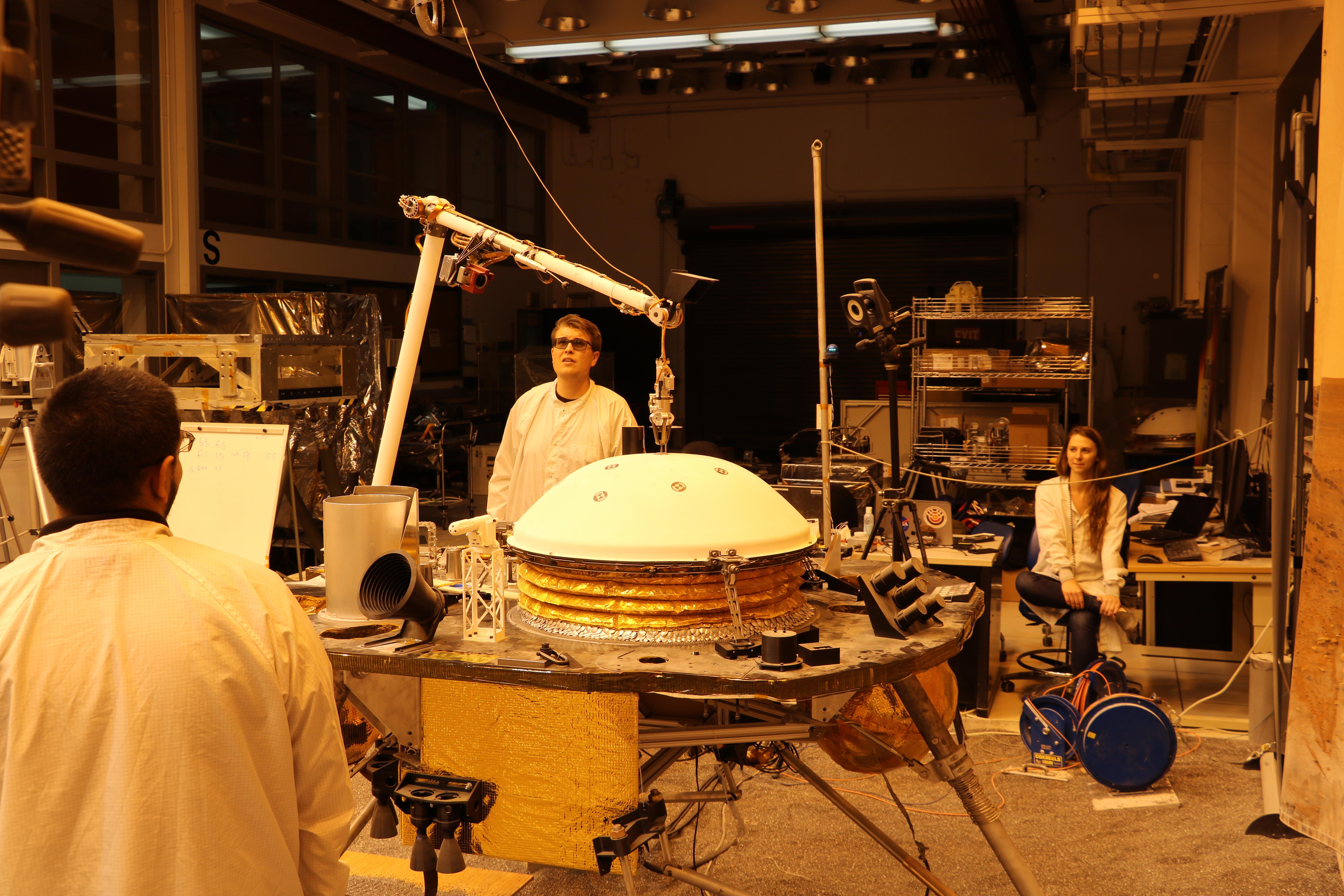
-
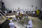
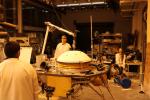
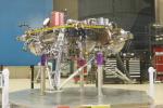
PIA22739:
-
Pre-Launch Testing of InSight's Solar Arrays
Full Resolution:
TIFF
(107.3 MB)
JPEG
(5.003 MB)
|
|
|
2018-10-09 |
Mars
|
InSight
|
|
5760x3840x3 |
|
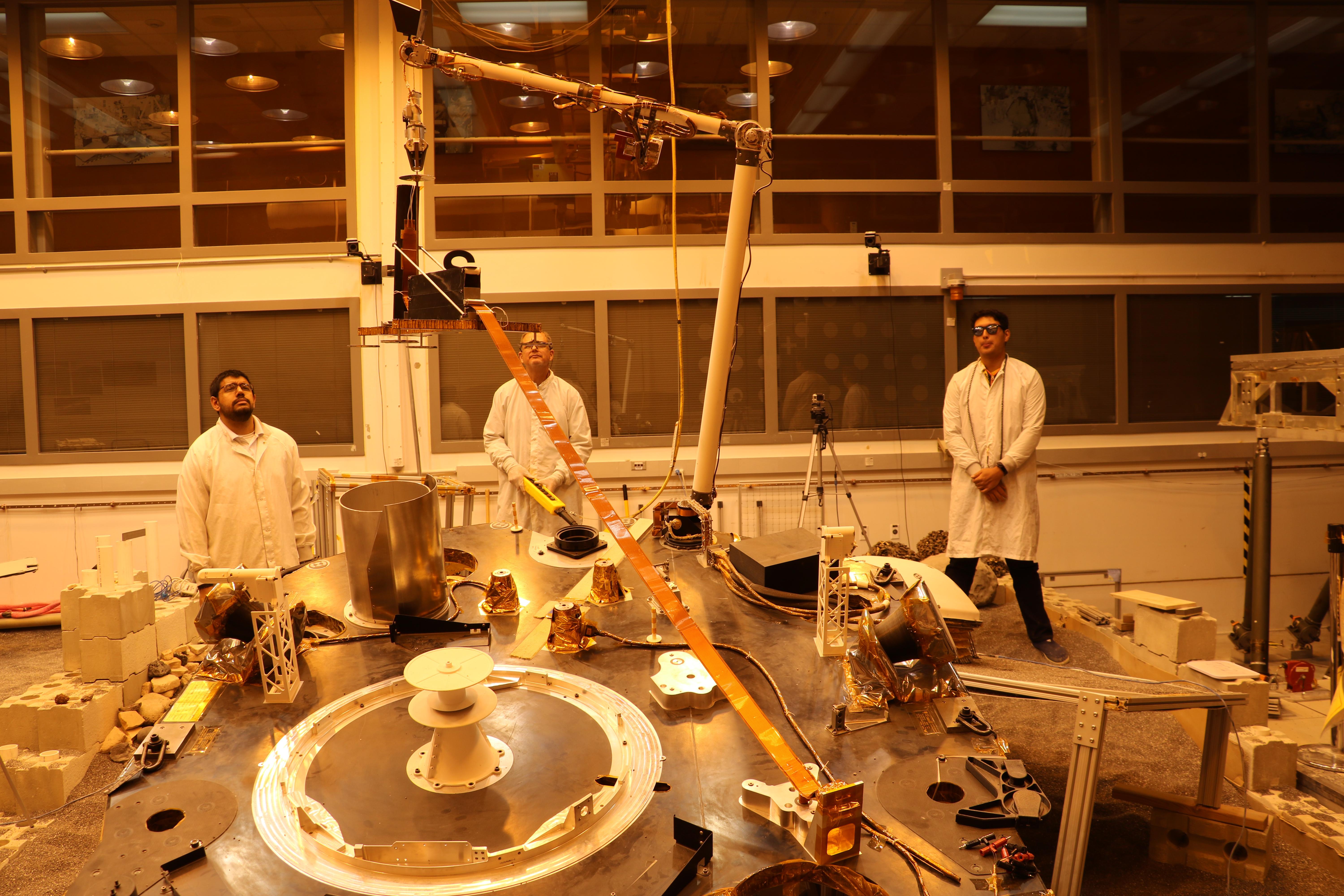
-
PIA22740:
-
Pre-Launch T-VAC Testing on InSight
Full Resolution:
TIFF
(43.71 MB)
JPEG
(1.536 MB)
|
|
|
2018-10-09 |
Mars
|
InSight
|
|
3600x2400x3 |
|
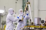
-
PIA22741:
-
Pre-Launch Testing of InSight's Robotic Arm
Full Resolution:
TIFF
(21.3 MB)
JPEG
(1.181 MB)
|
|
|
2018-10-09 |
Earth
|
SMAP
|
|
792x612x3 |
|
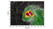
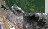
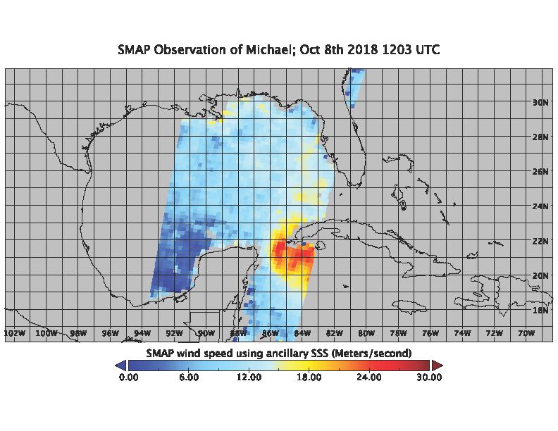
-
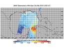
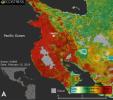
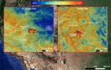
PIA22747:
-
SMAP Captures Hurricane Michael
Full Resolution:
TIFF
(209 kB)
JPEG
(89.97 kB)
|
|
|
2018-10-10 |
Earth
|
SMAP
|
|
792x612x3 |

|
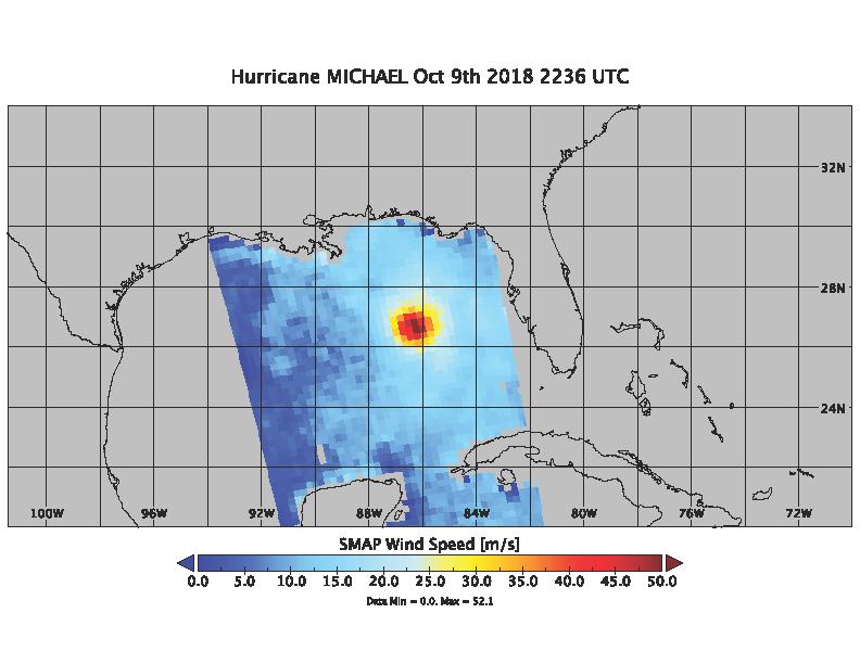
-
PIA22751:
-
Hurricane Michael as seen by SMAP
Full Resolution:
TIFF
(202.1 kB)
JPEG
(62.84 kB)
|
|
|
2018-10-11 |
Mars
|
InSight
|
|
6000x4000x3 |
|
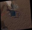
-
PIA22806:
-
InSight Robotic Arm Test Lift of Wind and Thermal Shield
Full Resolution:
TIFF
(60.87 MB)
JPEG
(1.895 MB)
|
|
|
2018-10-11 |
Mars
|
InSight
|
|
6000x4000x3 |

|
-
PIA22807:
-
InSight Robotic Arm Test Lift of Heat Probe
Full Resolution:
TIFF
(60.99 MB)
JPEG
(1.878 MB)
|
|
|
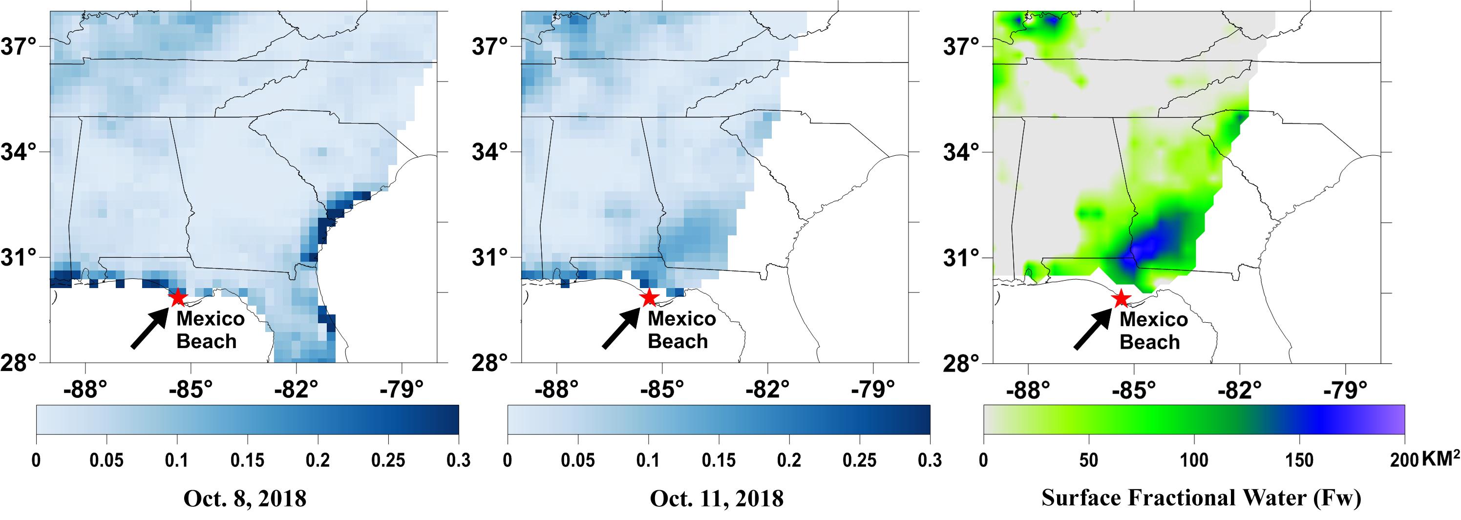
2018-10-11 |
Earth
|
SMAP
|
|
2991x1065x3 |
|
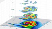
-
PIA22754:
-
NASA's SMAP Detects Flooding from Hurricane Michael
Full Resolution:
TIFF
(1.747 MB)
JPEG
(255.8 kB)
|
|
|
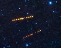
2018-10-22 |
Mars
|
MarCO
|
|
957x609x3 |

|
-
PIA22742:
-
First Image of Mars from a CubeSat
Full Resolution:
TIFF
(709.6 kB)
JPEG
(27.97 kB)
|
|
|
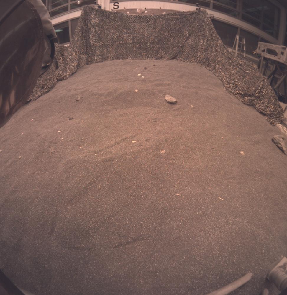
2018-11-21 |
Mars
|
InSight
|
|
973x1000x3 |
|
-
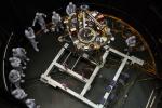
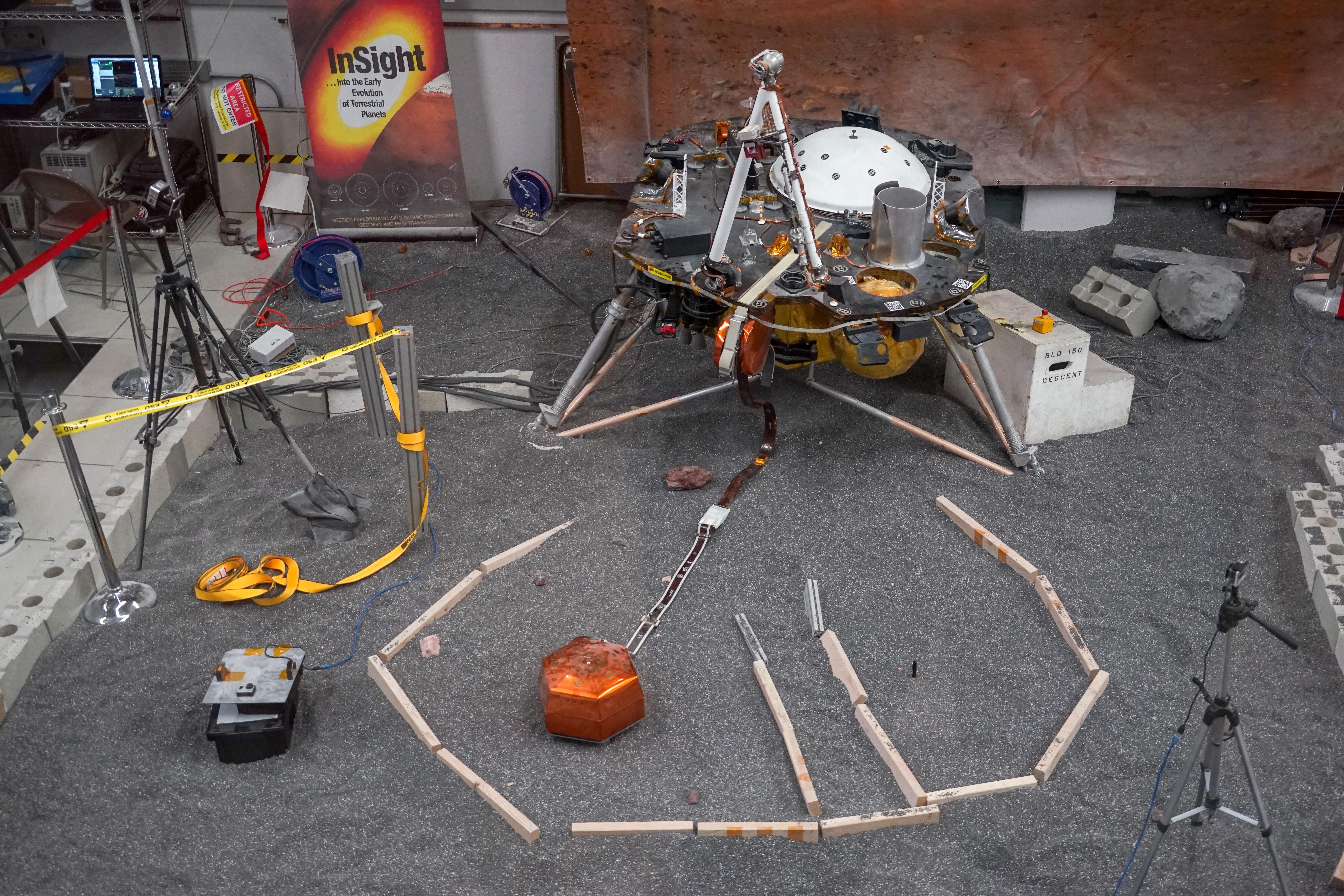
PIA22808:
-
InSight Instrument Deployment Test in JPL Sandbox
Full Resolution:
TIFF
(2.611 MB)
JPEG
(129.3 kB)
|
|
|
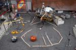
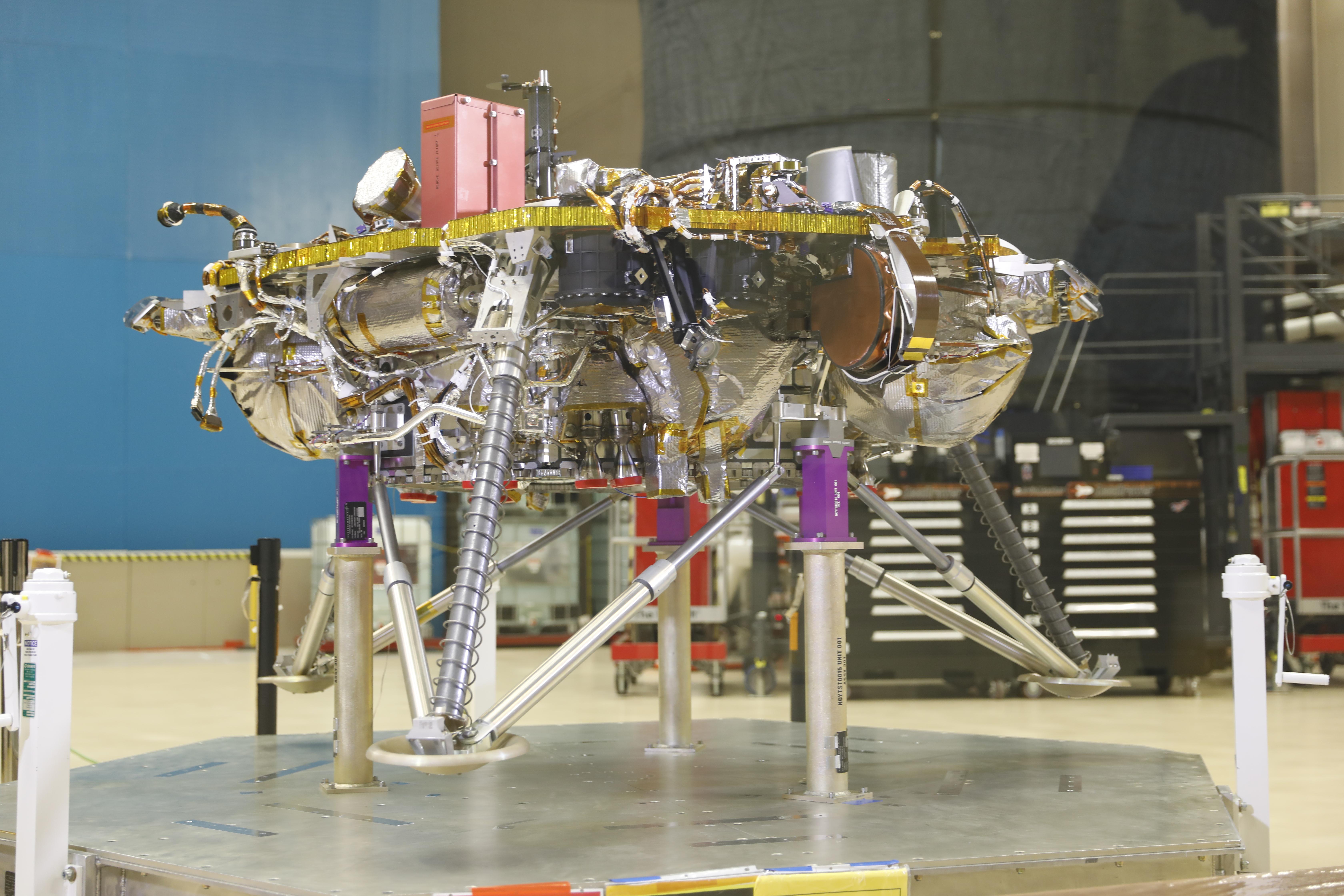
2018-11-21 |
Mars
|
InSight
|
|
6720x4480x3 |
|
-
PIA22572:
-
InSight Landing Systems
Full Resolution:
TIFF
(68.41 MB)
JPEG
(1.904 MB)
|
|
|
2018-11-25 |
Mars
|
MarCO
|
|
1920x1080x3 |

|
-
PIA22830:
-
Two Days Till Mars for MarCO
Full Resolution:
TIFF
(887.7 kB)
JPEG
(55.9 kB)
|
|
|
2018-11-26 |
Mars
|
MarCO
|
|
1920x1080x3 |
|
-
PIA22833:
-
Farewell to Mars
Full Resolution:
TIFF
(2.495 MB)
JPEG
(92 kB)
|
|
|
2018-11-30 |
Mars
|
MarCO
|
|
752x480x3 |
|
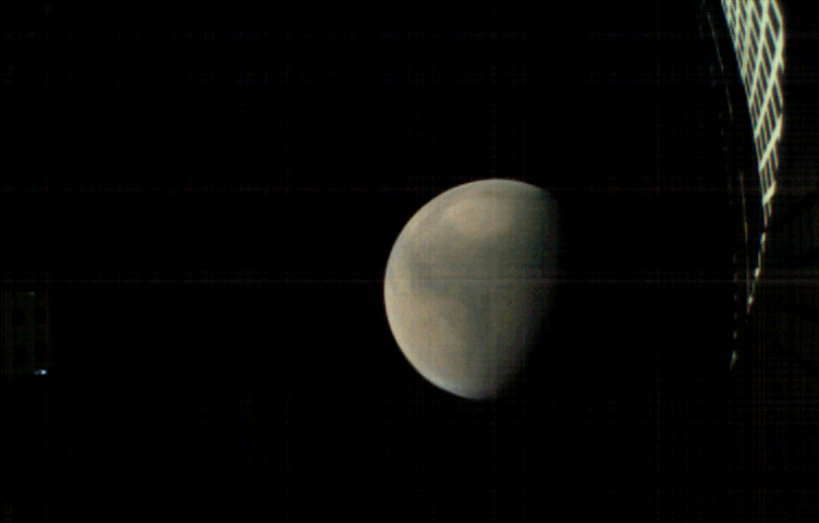
-
PIA22831:
-
Mars, Before InSight's Landing
Full Resolution:
TIFF
(281.5 kB)
JPEG
(14.46 kB)
|
|
|
2018-11-30 |
Mars
|
MarCO
|
|
752x480x3 |

|
-
PIA22832:
-
Away from Mars, With Sunburst
Full Resolution:
TIFF
(678.9 kB)
JPEG
(16.22 kB)
|
|
|
2018-11-30 |
Mars
|
MarCO
|
|
752x480x3 |

|
-
PIA22834:
-
Away from Mars, With Reflection
Full Resolution:
TIFF
(394 kB)
JPEG
(12.75 kB)
|
|
|
2018-12-07 |
Mars
|
MarCO
|
|
752x480x3 |
|
-
PIA22655:
-
MarCO-B (Wall-E) approaches Mars
Full Resolution:
TIFF
(1.088 MB)
JPEG
(190 kB)
|
|
|
2018-12-07 |
Mars
|
InSight
|
|
1500x495x3 |

|
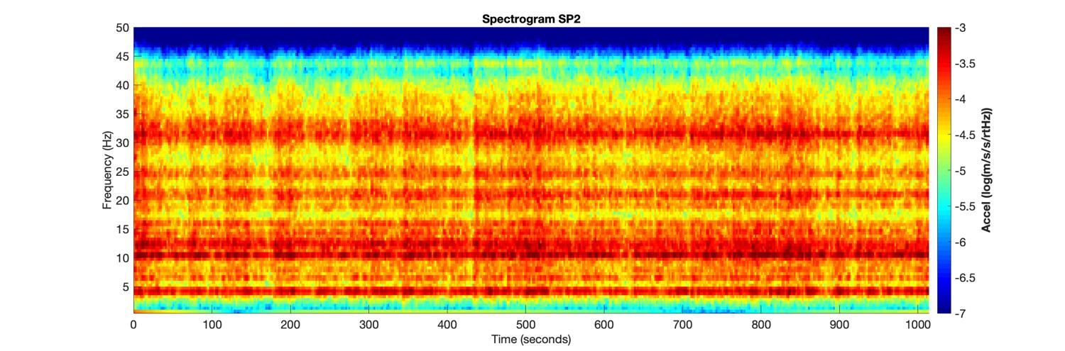
-
PIA22925:
-
Vibrations from InSight's First 20 Minutes on Mars
Full Resolution:
TIFF
(872.1 kB)
JPEG
(129.1 kB)
|
|
|
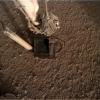
2018-12-07 |
Mars
|
InSight
|
|
457x586x3 |

|
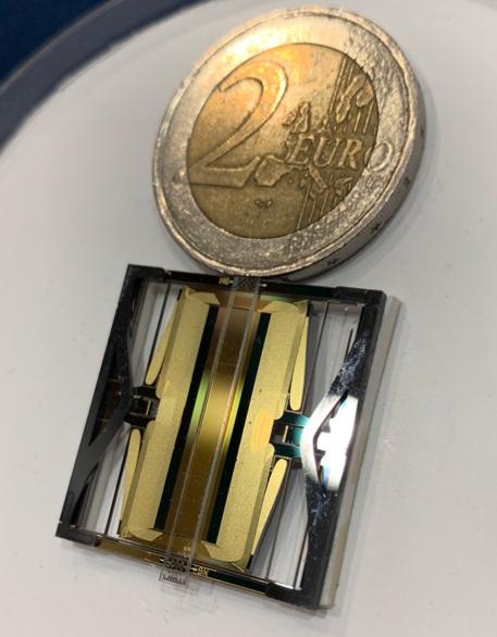
-
PIA22926:
-
Small Seismic Sensor on InSight
Full Resolution:
TIFF
(746.1 kB)
JPEG
(34.64 kB)
|
|
|
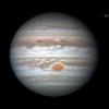
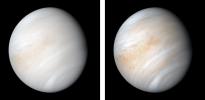
2018-12-12 |
Jupiter
|
|
|
800x800x3 |
|
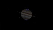
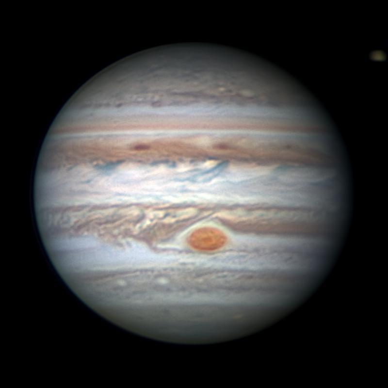
-
PIA22936:
-
Earth-based Observation of Jupiter
Full Resolution:
TIFF
(1.001 MB)
JPEG
(31.7 kB)
|
|
|
2018-12-13 |
Mars
|
Mars 2020
|
|
1920x1080x3 |

|
-
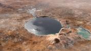
PIA22907:
-
Lake Jezero (Artist's Concept)
Full Resolution:
TIFF
(3.262 MB)
JPEG
(218.2 kB)
|
|
|
2018-12-18 |
Mars
|
InSight
|
|
6000x4000x3 |
|
-
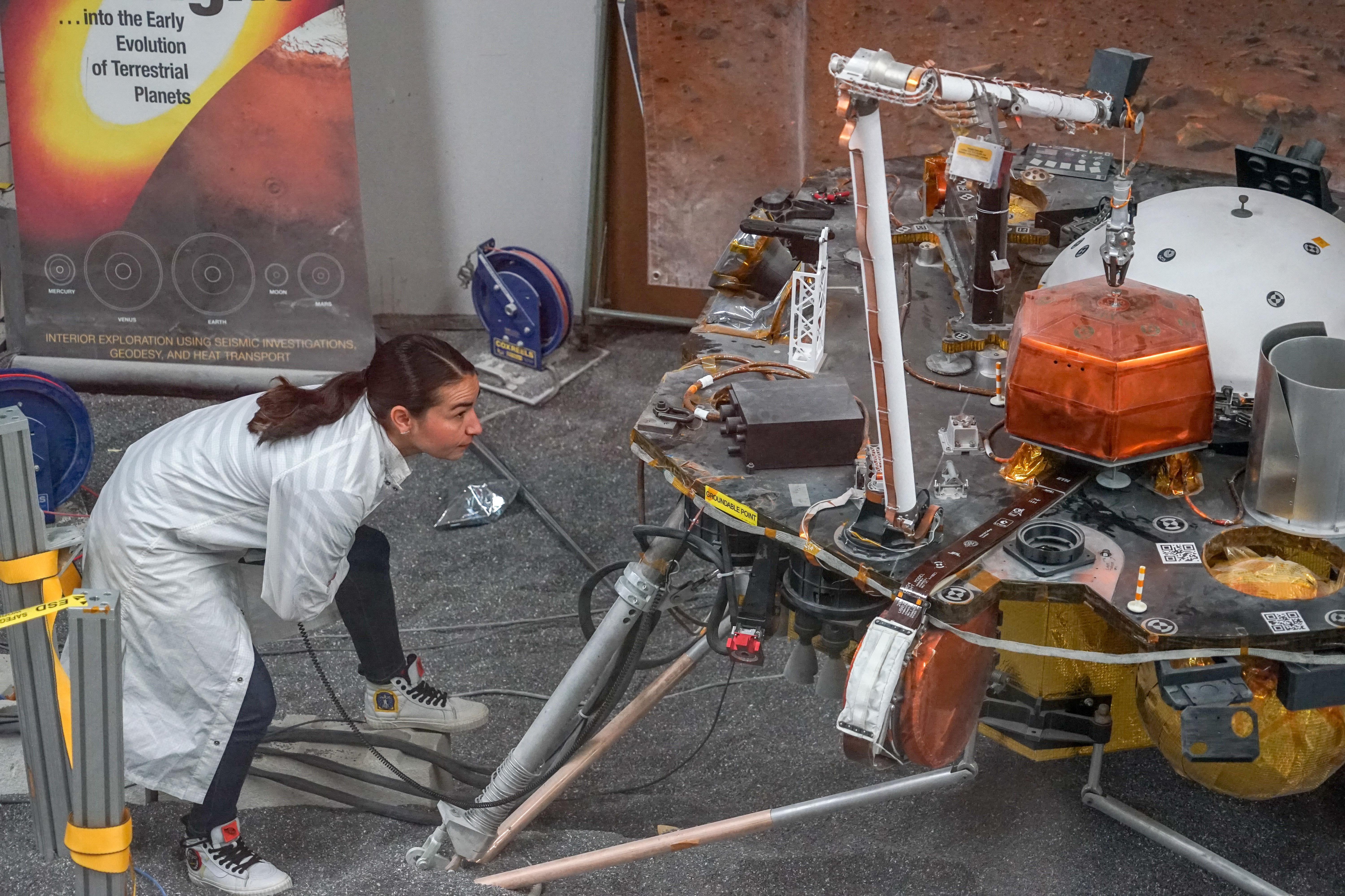
PIA22744:
-
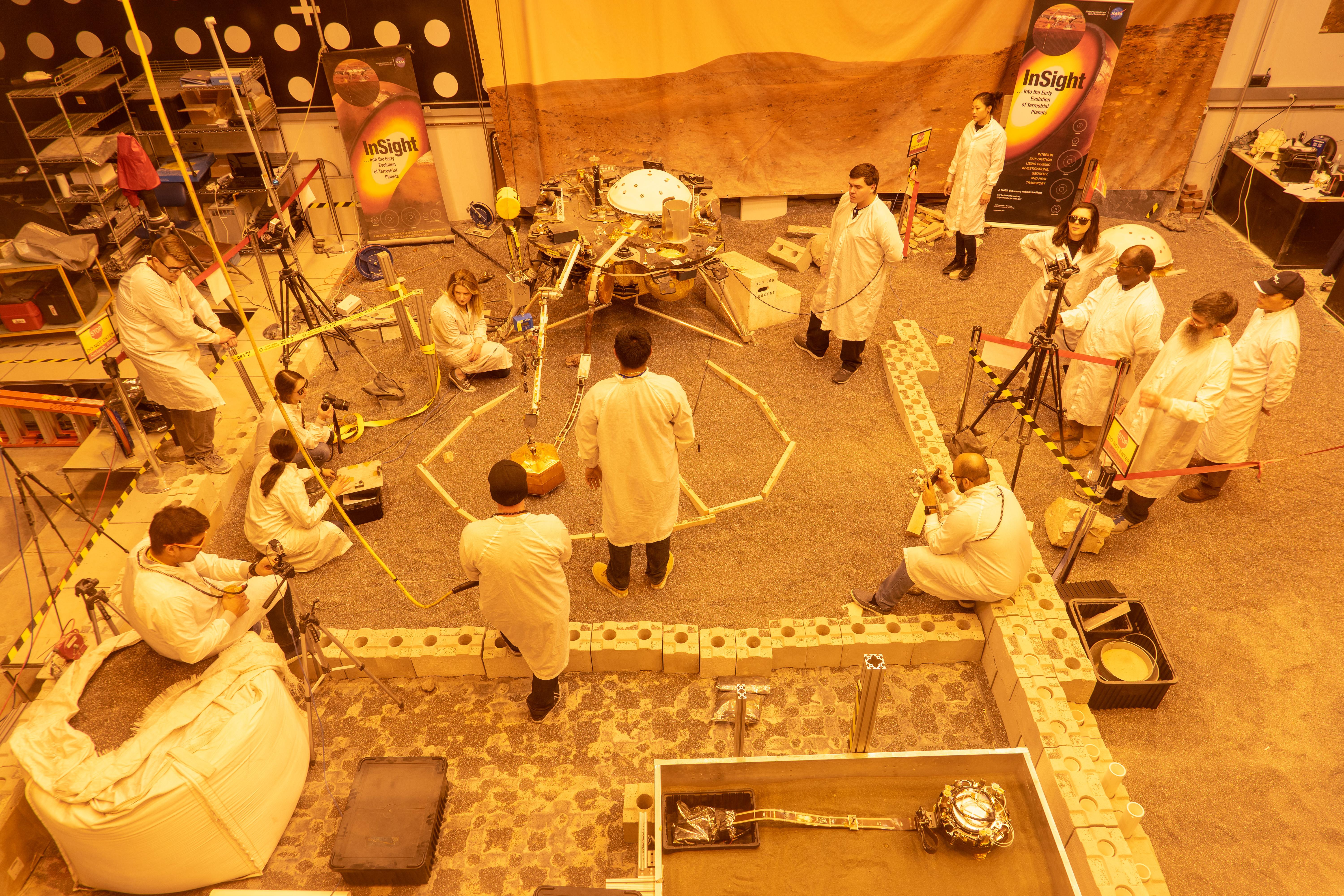
Practicing InSight Instrument Deployment
Full Resolution:
TIFF
(72.03 MB)
JPEG
(3.986 MB)
|
|
|
2018-12-18 |
Mars
|
InSight
|
|
6000x4000x3 |

|
-
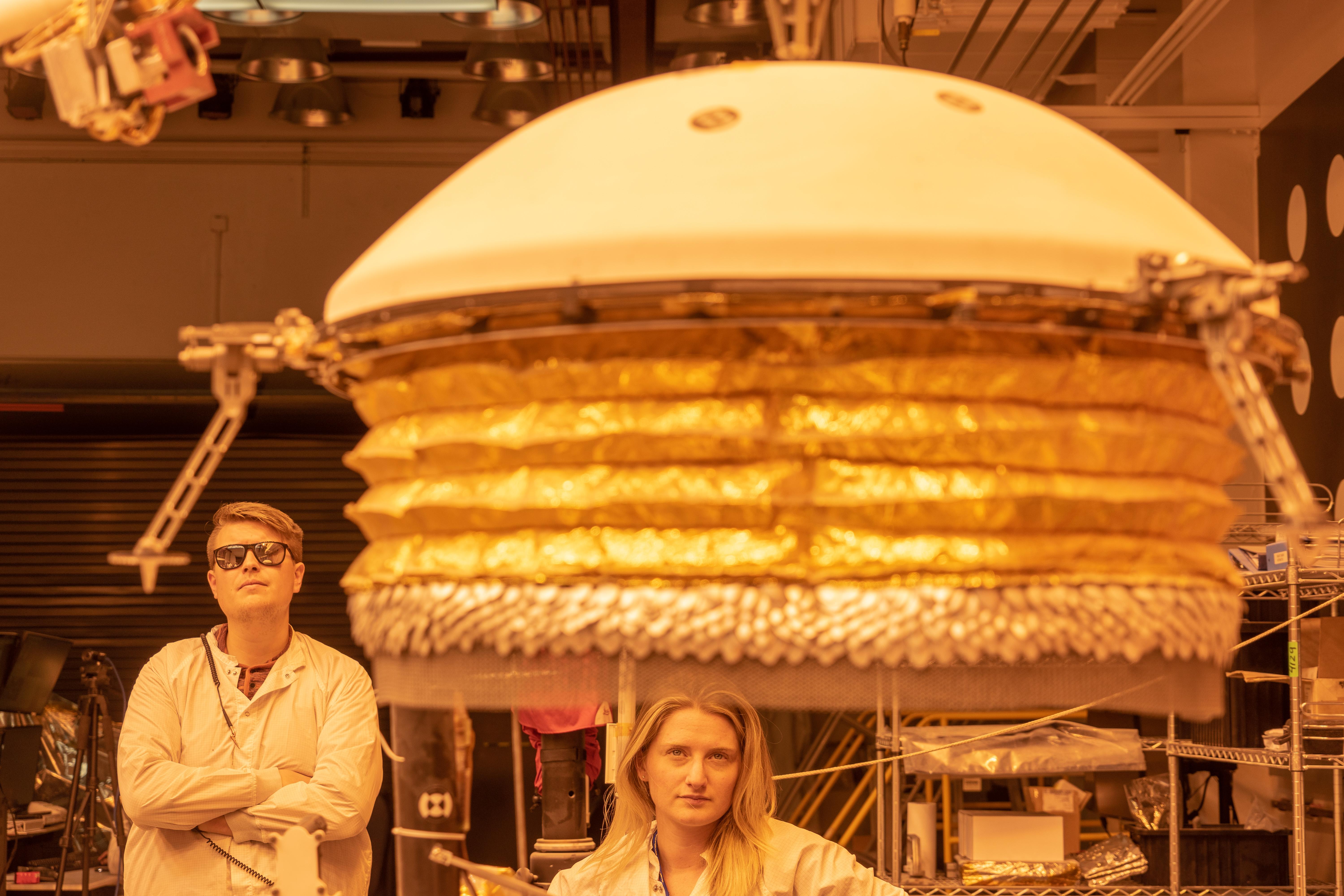
PIA22879:
-
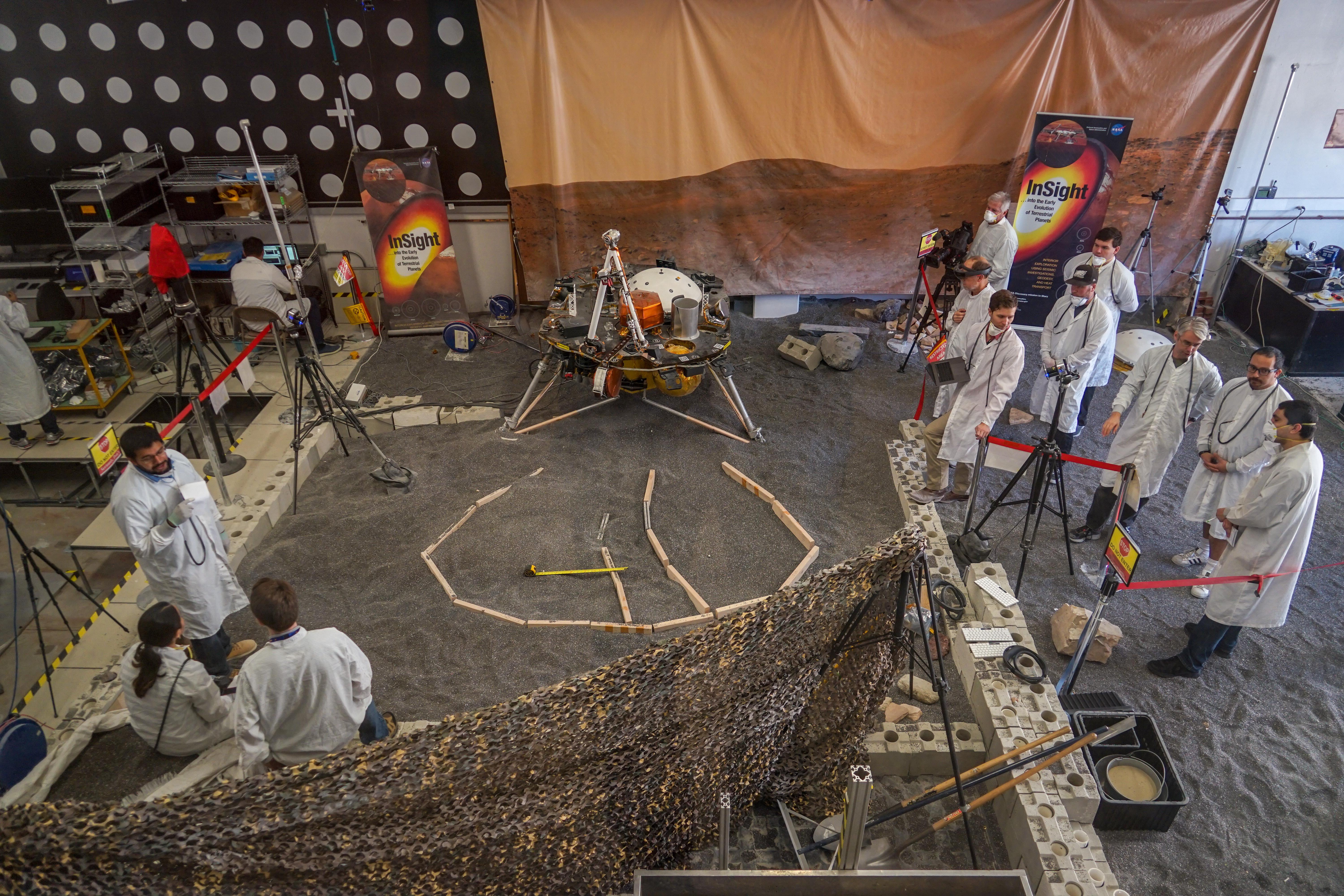
Marsforming for InSight
Full Resolution:
TIFF
(71.97 MB)
JPEG
(3.562 MB)
|
|
|
2018-12-18 |
Mars
|
InSight
|
|
6000x4000x3 |
|
-
PIA22880:
-
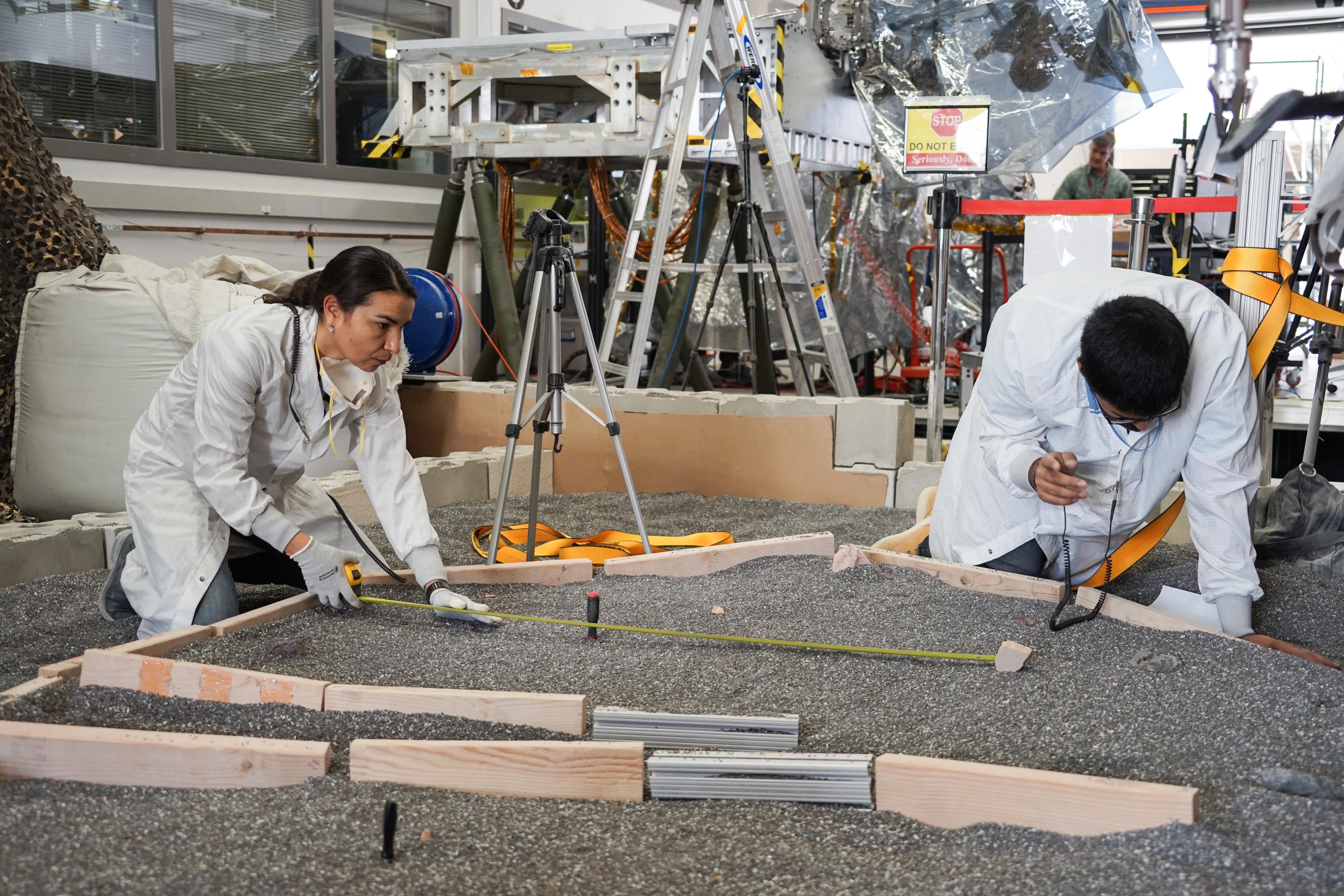
Measuring the Workspace
Full Resolution:
TIFF
(67.29 MB)
JPEG
(3.08 MB)
|
|
|
2018-12-18 |
Mars
|
InSight
|
|
3638x5457x3 |

|
-
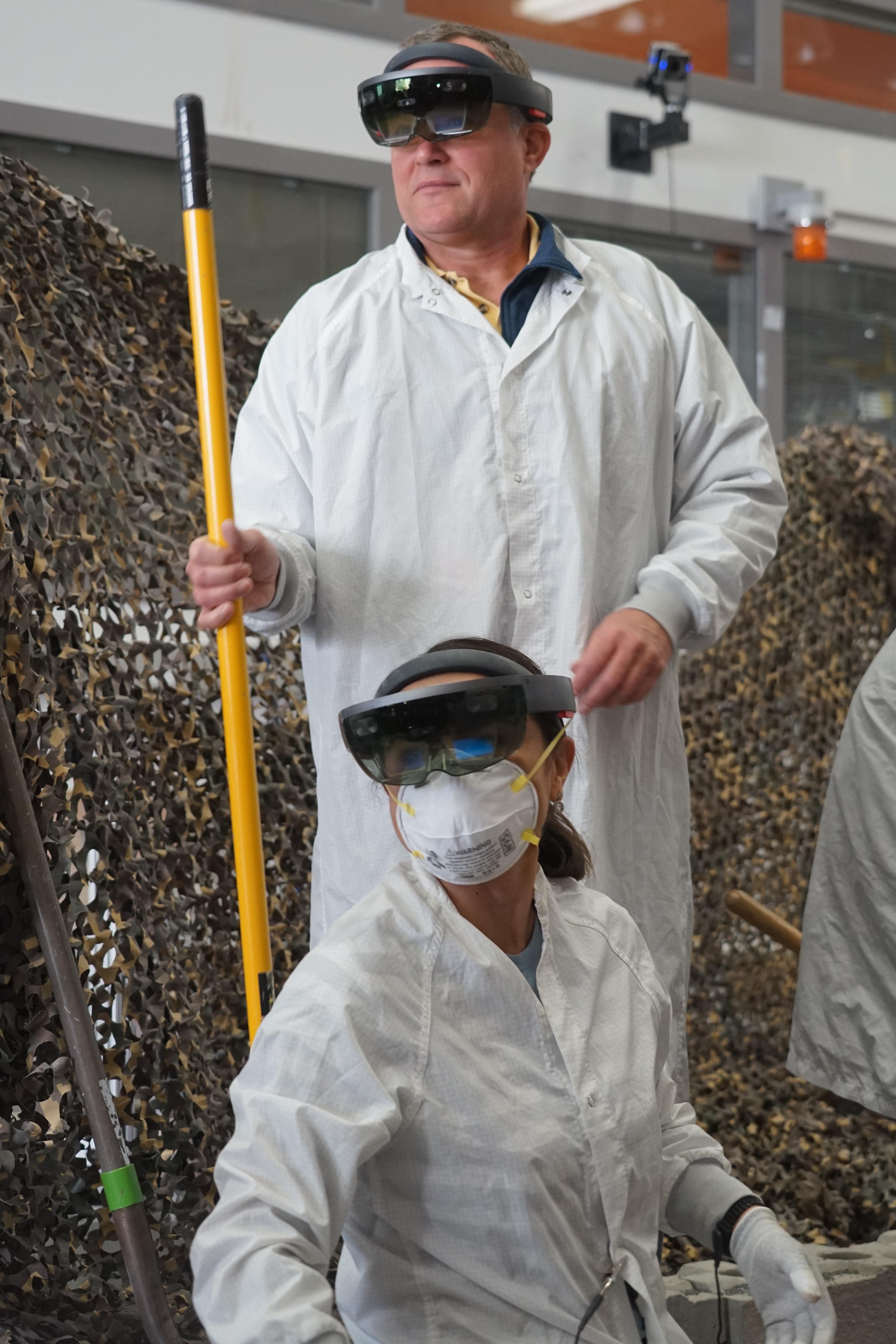
PIA22951:
-
Marsforming With HoloLens
Full Resolution:
TIFF
(50.39 MB)
JPEG
(1.525 MB)
|
|
|
2018-12-18 |
Mars
|
InSight
|
|
6000x4000x3 |

|
-
PIA22952:
-
Inspecting Instrument Deployment
Full Resolution:
TIFF
(67.01 MB)
JPEG
(3.938 MB)
|
|
|
2018-12-18 |
Mars
|
InSight
|
|
6000x4000x3 |
|
-
PIA22953:
-
ForeSight's Workspace
Full Resolution:
TIFF
(59.59 MB)
JPEG
(3.773 MB)
|
|
|
2018-12-18 |
Mars
|
InSight
|
|
4000x6000x3 |

|
-
PIA22954:
-
ForeSight's Grapple
Full Resolution:
TIFF
(54.02 MB)
JPEG
(1.298 MB)
|
|
|
2018-12-18 |
Mars
|
InSight
|
|
6000x4000x3 |

|
-
PIA22955:
-
Setting the Wind and Thermal Shield
Full Resolution:
TIFF
(57.17 MB)
JPEG
(2.024 MB)
|
|
|
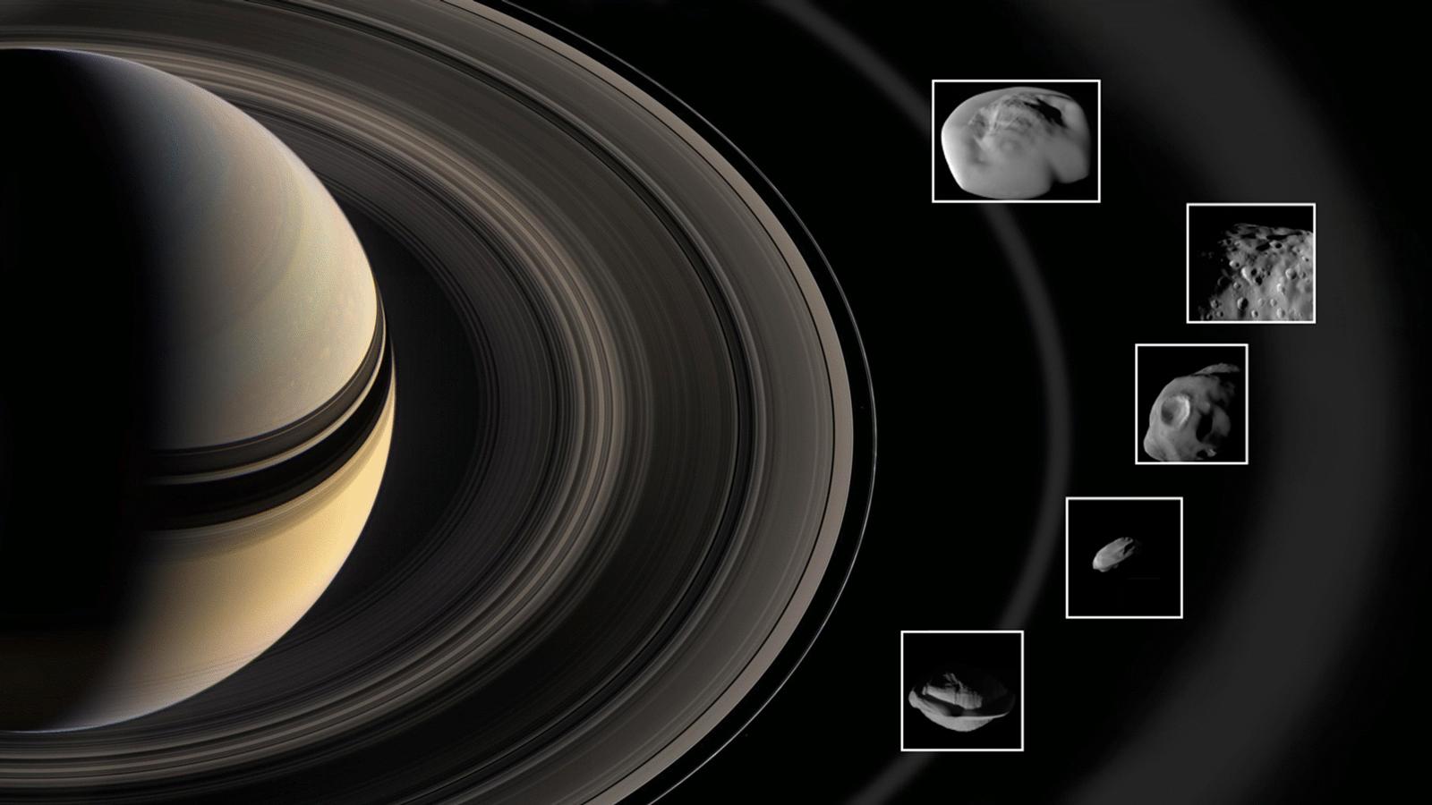
2019-03-28 |
Saturn
|
Cassini-Huygens
|
|
1600x900x3 |

|
-
PIA22772:
-
Cassini Moons Flybys
Full Resolution:
TIFF
(2.732 MB)
JPEG
(102.5 kB)
|
|
|
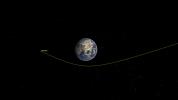
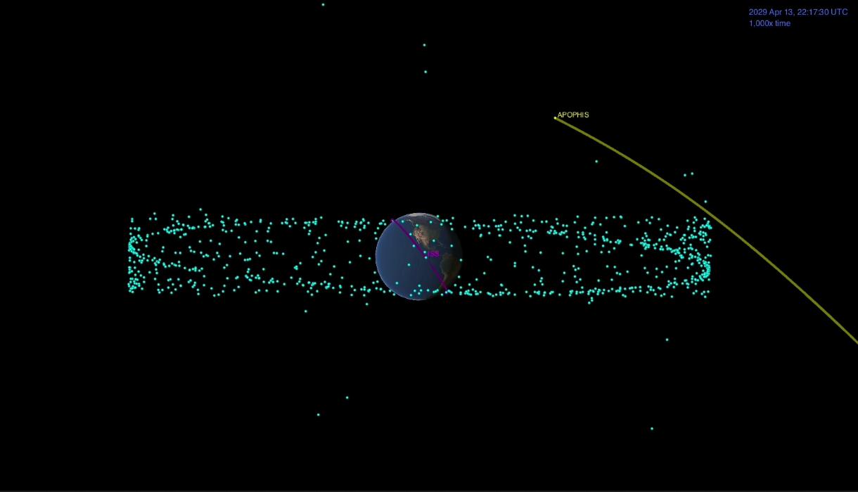
2019-04-29 |
Asteroid
|
|
|
1220x700x3 |
|
-
PIA23195:
-
Asteroid Apophis
Full Resolution:
TIFF
(264.3 kB)
JPEG
(40.1 kB)
|
|
|
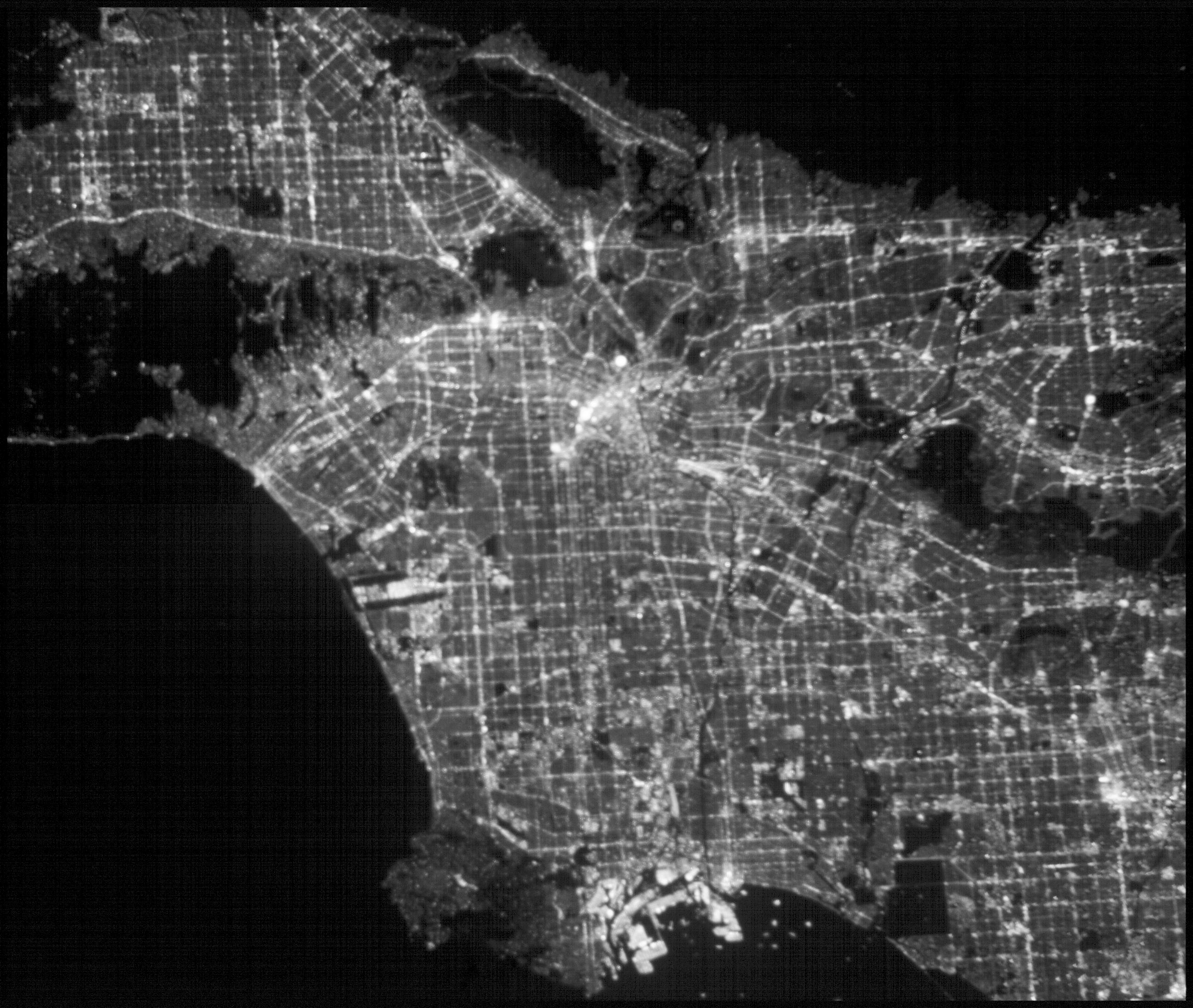
2019-05-16 |
Earth
|
CubeSat
|
|
2592x2192x1 |
|
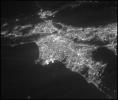
-
PIA23124:
-
ASTERIA Image of Los Angeles 1
Full Resolution:
TIFF
(4.729 MB)
JPEG
(440.4 kB)
|
|
|
2019-05-16 |
Earth
|
CubeSat
|
|
2592x2192x1 |
|
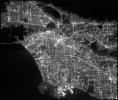
-
PIA23125:
-
ASTERIA Image of Los Angeles 2
Full Resolution:
TIFF
(4.963 MB)
JPEG
(831.4 kB)
|
|
|
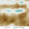
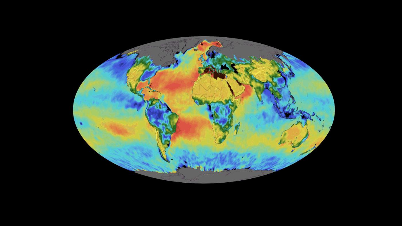
2019-05-17 |
Earth
|
SMAP
|
|
1400x787x3 |
|
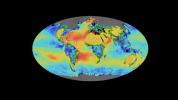
-
PIA23146:
-
SMAP Sea Surface Salinity and Soil Moisture Time Lapse
Full Resolution:
TIFF
(1.025 MB)
JPEG
(82.57 kB)
|
|
|
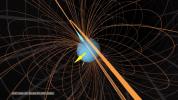
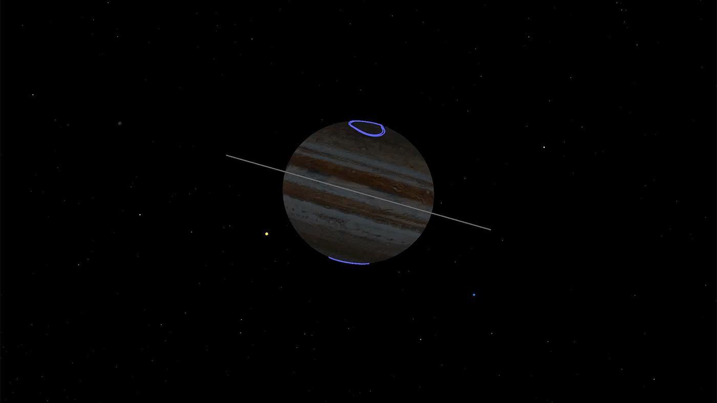
2019-05-20 |
Jupiter
|
Juno
|
|
1280x720x3 |
|
-
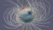
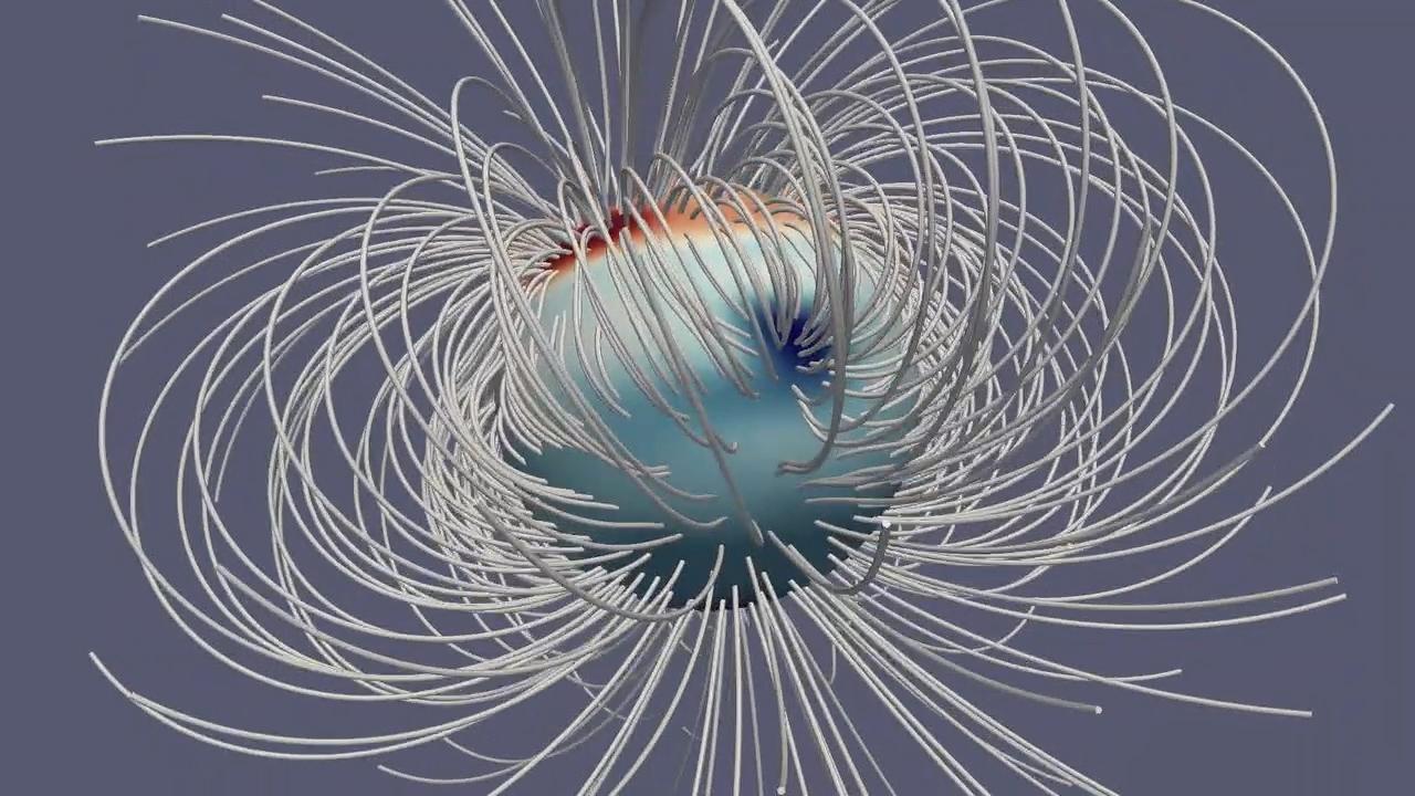
PIA23229:
-
Jupiter's Magnetic Field
Full Resolution:
TIFF
(2.093 MB)
JPEG
(143.8 kB)
|
|
|
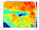
2019-07-02 |
Earth
|
ECOSTRESS
|
|
2258x2190x3 |
|
-
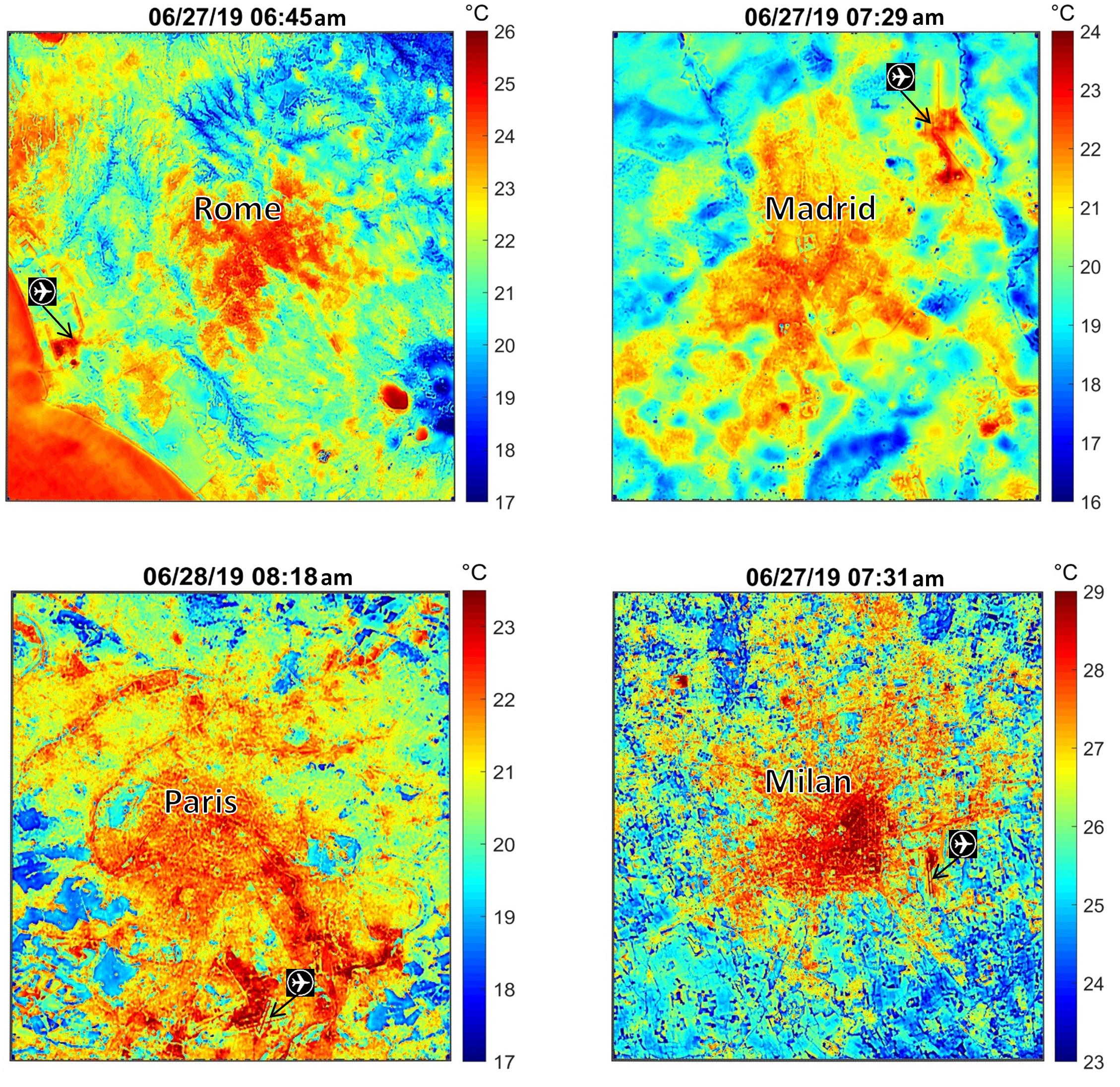
PIA23148:
-
NASA's ECOSTRESS Maps Europe Heat Wave
Full Resolution:
TIFF
(13.41 MB)
JPEG
(928.6 kB)
|
|
|
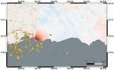
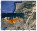
2019-07-11 |
Earth
|
ARIA
|
|
1754x1959x3 |
|
-
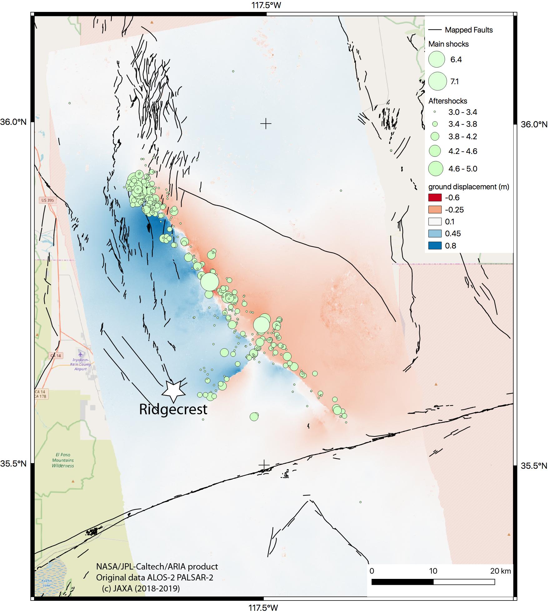
PIA23351:
-
NASA Map Shows Ground Movement from California Quakes
Full Resolution:
TIFF
(4.263 MB)
JPEG
(292.6 kB)
|
|
|
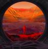
2019-07-22 |
Mars
|
|
|
1400x788x3 |
|
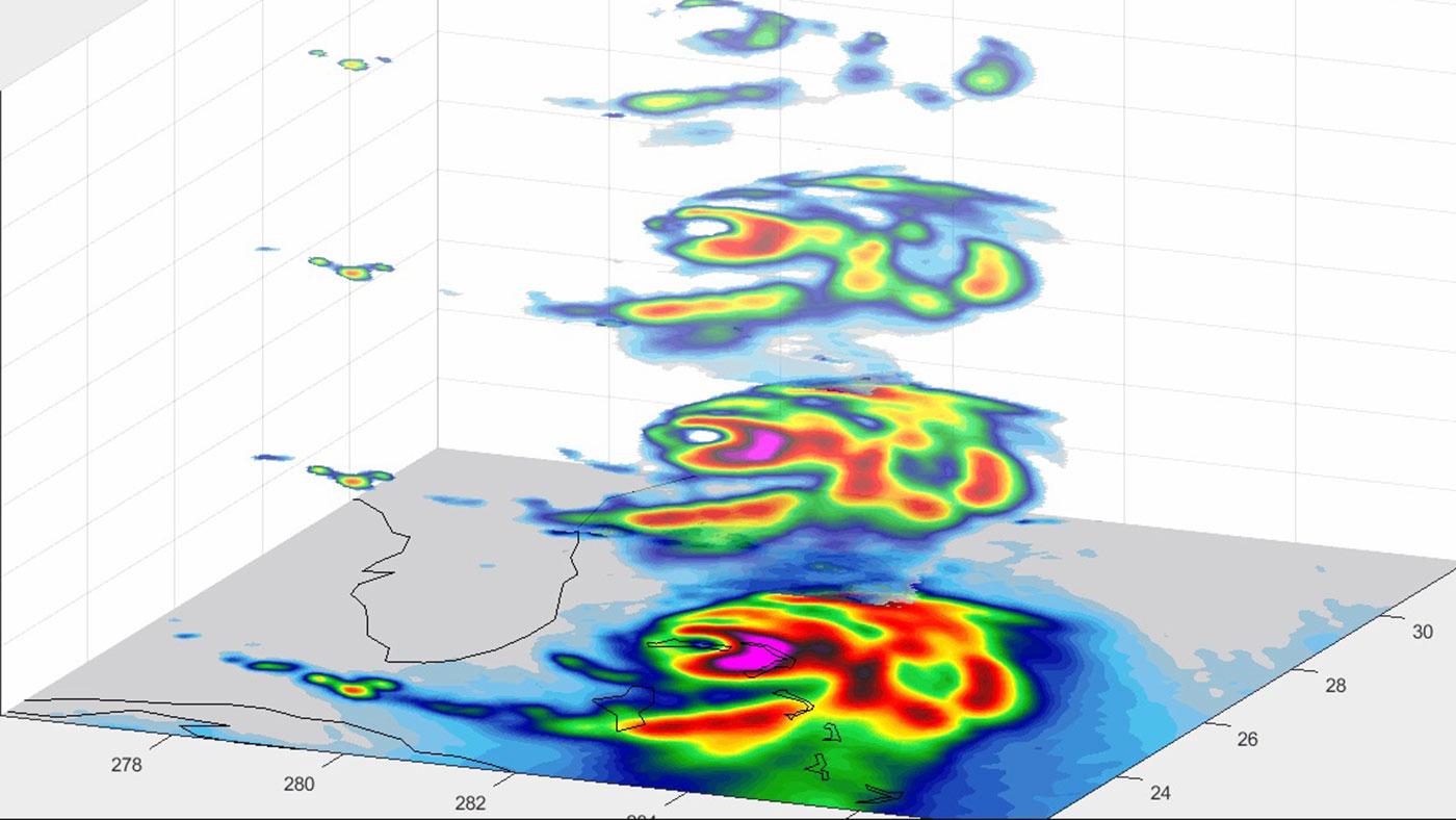
-
PIA23344:
-
Seismic Waves Inside Mars (Artist's Concept)
Full Resolution:
TIFF
(1.043 MB)
JPEG
(66.01 kB)
|
|
|
2019-08-08 |
Earth
|
ECOSTRESS
|
|
974x864x3 |
|
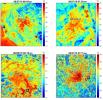
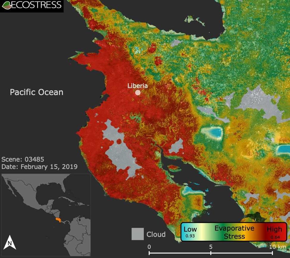
-
PIA22839:
-
ECOSTRESS Focuses on Costa Rican Drought
Full Resolution:
TIFF
(1.922 MB)
JPEG
(129.8 kB)
|
|
|
2019-08-23 |
Mars
|
Mars 2020 Rover
|
|
4032x3024x3 |
|
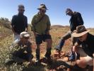
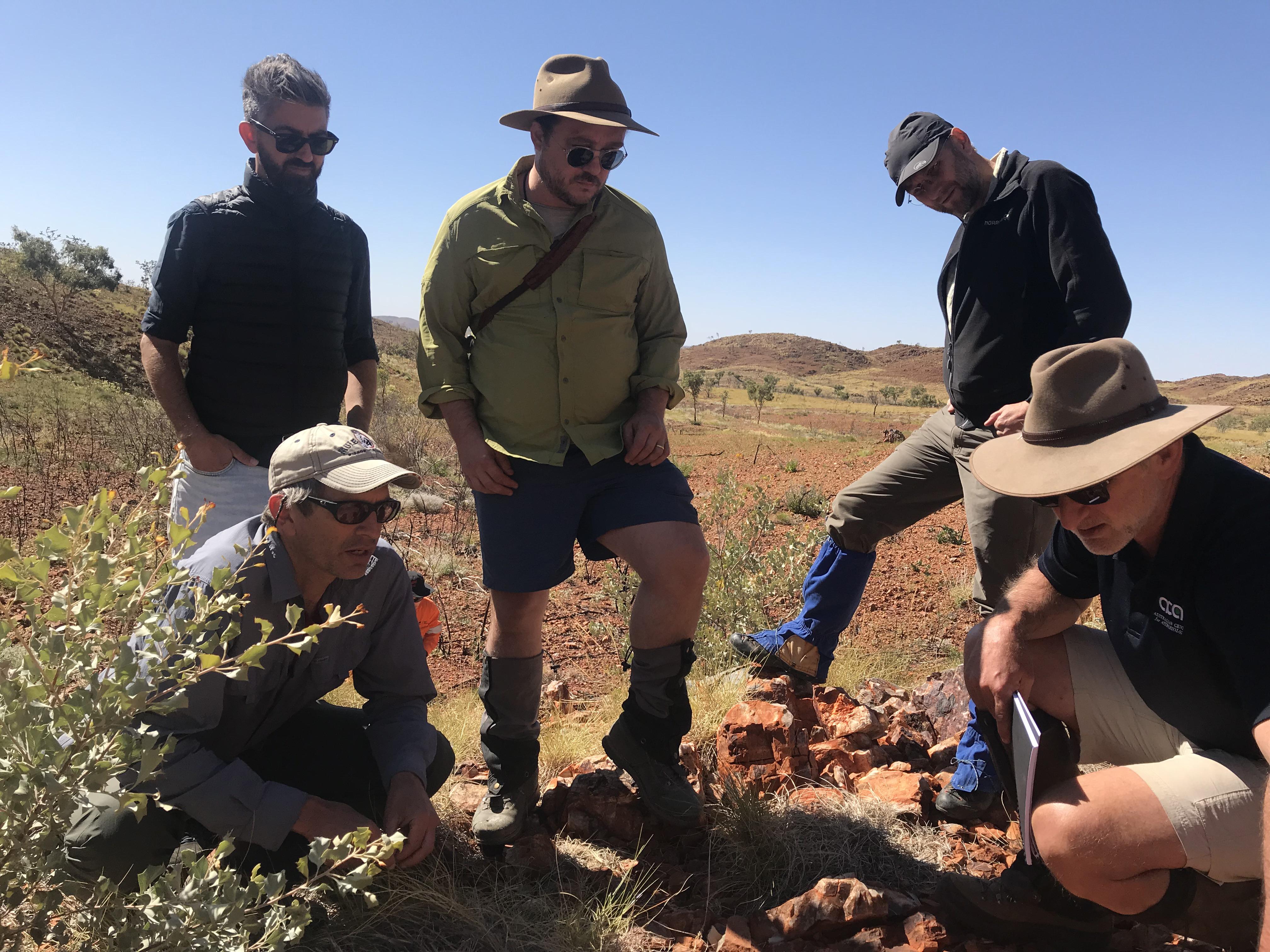
-
PIA23275:
-
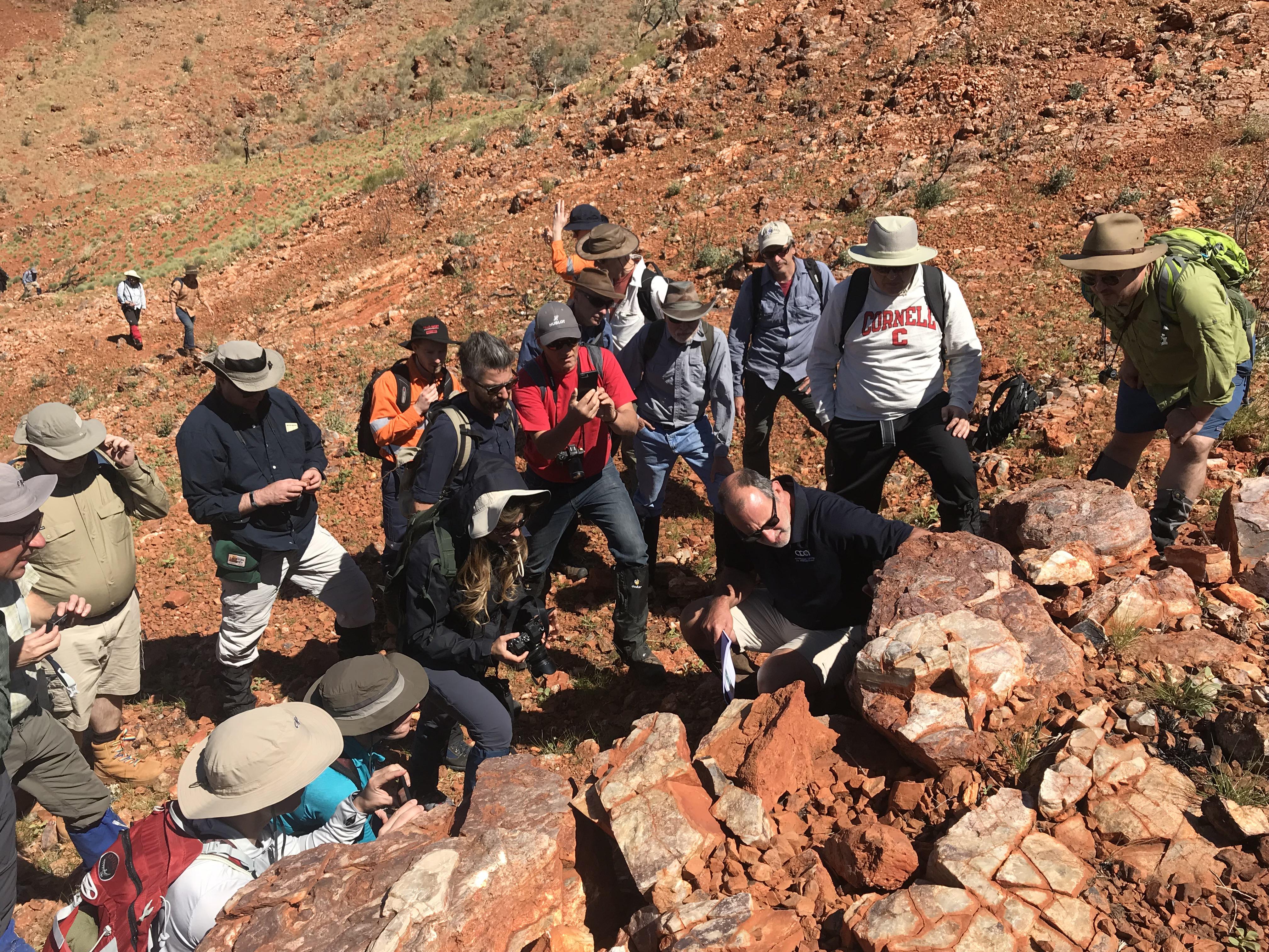
Clues for Mars in the Australian Outback
Full Resolution:
TIFF
(29.11 MB)
JPEG
(1.494 MB)
|
|
|
2019-08-29 |
Earth
|
CubeSat
|
|
1400x778x3 |
|
-
PIA23414:
-
Small Satellite TEMPEST-D Sees Hurricane Dorian off Coast
Full Resolution:
TIFF
(1.738 MB)
JPEG
(121.2 kB)
|
|
|
2019-09-04 |
Earth
|
CubeSat
|
|
1400x788x3 |
|
-
PIA23431:
-
TEMPEST-D CubeSat Sees Hurricane Dorian in 3D
Full Resolution:
TIFF
(1.581 MB)
JPEG
(105.9 kB)
|
|
|
2019-08-28 |
Earth
|
ECOSTRESS
|
|
1867x1132x3 |
|
-
PIA23357:
-
Amazon Fires Seen by NASA's ECOSTRESS
Full Resolution:
TIFF
(6.142 MB)
JPEG
(260.2 kB)
|
|
|
2019-09-18 |
Mars
|
Mars 2020 Rover
|
|
2800x1867x3 |
|
-
PIA23279:
-
Send Your Name to Mars With Brad Pitt
Full Resolution:
TIFF
(15.01 MB)
JPEG
(653.2 kB)
|
|
|
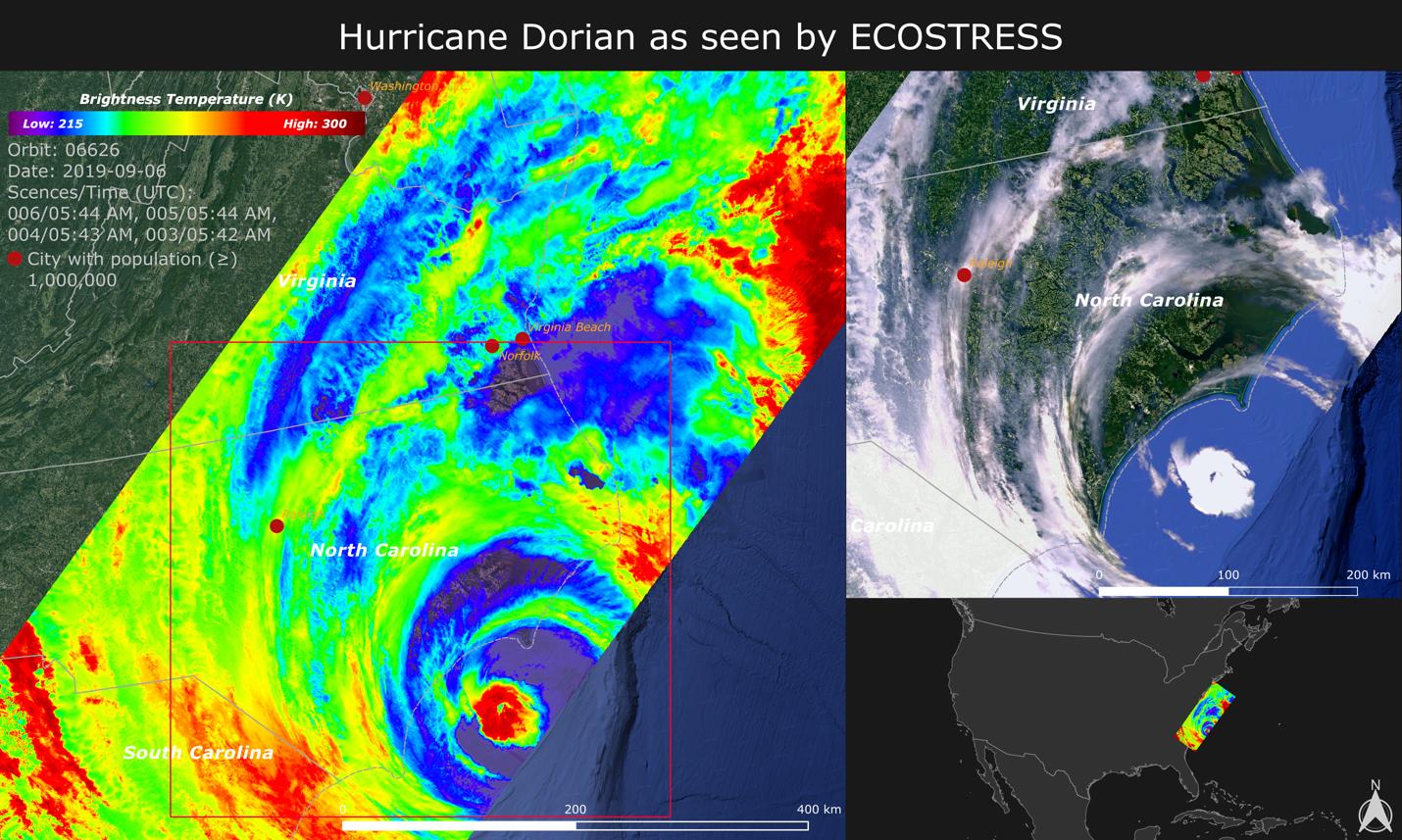
2019-09-18 |
Earth
|
ECOSTRESS
|
|
1430x857x3 |

|
-
PIA23422:
-
NASA Images Hurricane Dorian's Temperature from Space
Full Resolution:
TIFF
(3.196 MB)
JPEG
(252.8 kB)
|
|
|
2019-09-23 |
Mars
|
Mars 2020 Rover
|
|
1600x1200x3 |

|
-
PIA23463:
-
NASA Mars Mission Connects with Bosnian and Herzegovinian Town
Full Resolution:
TIFF
(5.762 MB)
JPEG
(313.6 kB)
|
|
|
2019-09-23 |
Mars
|
Mars 2020 Rover
|
|
1600x1600x3 |

|
-
PIA23464:
-
Jezero Celebrates Jezero
Full Resolution:
TIFF
(6.813 MB)
JPEG
(394.7 kB)
|
|
|
2019-10-01 |
Jupiter
|
Juno
|
|
1400x788x3 |
|
-
PIA23465:
-
Circumlocuting Jupiter's Shadow (Animation)
Full Resolution:
TIFF
(284.5 kB)
JPEG
(30.54 kB)
|
|
|
2019-10-17 |
Mars
|
InSight
|
|
1008x960x3 |
|
-
PIA23379:
-
Pinning Helps the Mole Move
Full Resolution:
TIFF
(2.566 MB)
JPEG
(125.9 kB)
|
|
|
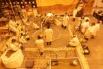
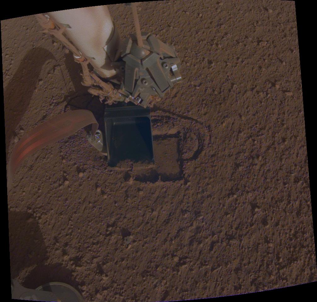
2019-10-28 |
Mars
|
InSight
|
|
1024x1024x3 |
|
-
PIA23213:
-
InSight's Heat Probe Partially Backs Out of Hole
Full Resolution:
TIFF
(3.147 MB)
JPEG
(207.9 kB)
|
|
|
2019-11-05 |
Earth
|
|
|
1440x960x3 |

|
-
PIA23425:
-
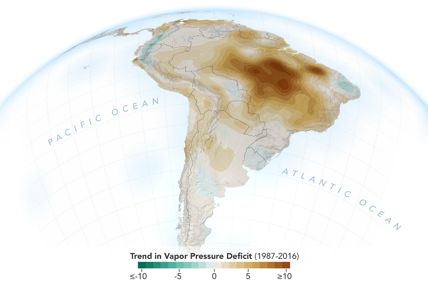
New Study Shows Atmosphere in the Amazon Drying Out
Full Resolution:
TIFF
(1.789 MB)
JPEG
(96.3 kB)
|
|
|
2019-11-05 |
Earth
|
ECOSTRESS
|
|
720x715x3 |
|
-
PIA23432:
-
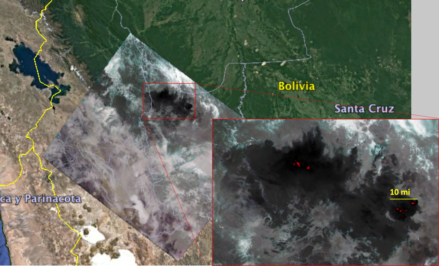
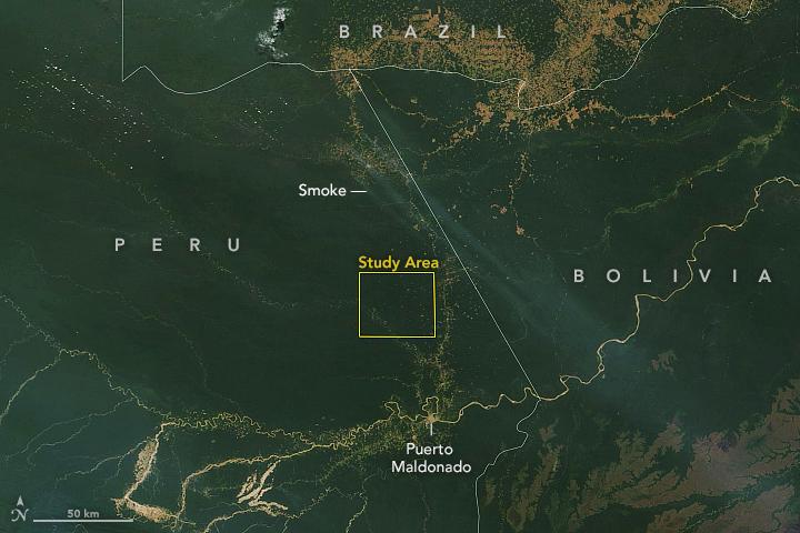
Drought-Stressed Forest Fueled Amazon Fires
Full Resolution:
TIFF
(1.545 MB)
JPEG
(112.1 kB)
|
|
|
2019-11-05 |
Earth
|
Terra
|
|
720x480x3 |
|
-
PIA23546:
-
NASA Terra Satellite Sees Amazon Fires in Peru
Full Resolution:
TIFF
(855.7 kB)
JPEG
(51.57 kB)
|
|
|
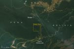
2019-11-15 |
Earth
|
Mars 2020 Rover
|
|
4032x3024x3 |

|
-
PIA23551:
-
Researching Outback Stromatolites
Full Resolution:
TIFF
(36.59 MB)
JPEG
(2.427 MB)
|
|
|
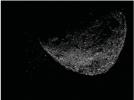
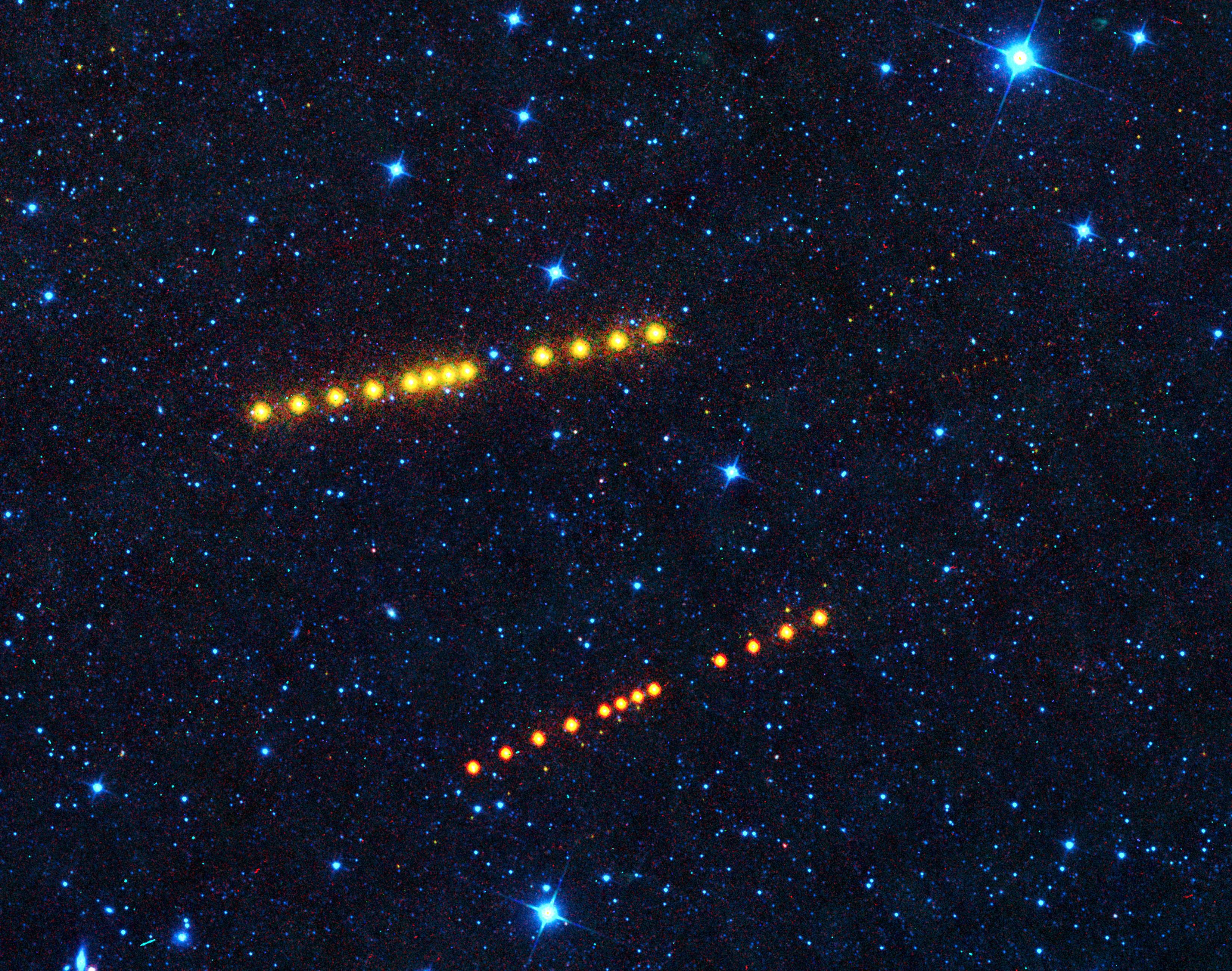
2019-12-05 |
Asteroid
|
|
|
535x398x3 |
|
-
PIA23554:
-
Asteroid Bennu Particles
Full Resolution:
TIFF
(201.2 kB)
JPEG
(24.09 kB)
|
|
|
2019-12-05 |
Asteroid
|
|
|
2532x1417x3 |
|
-
PIA23555:
-
Bennu Particles (Animation)
Full Resolution:
TIFF
(1.12 MB)
JPEG
(116 kB)
|
|
|
2019-12-10 |
Mars
|
|
|
960x540x3 |
|
-
PIA23515:
-
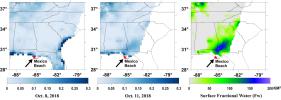
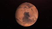
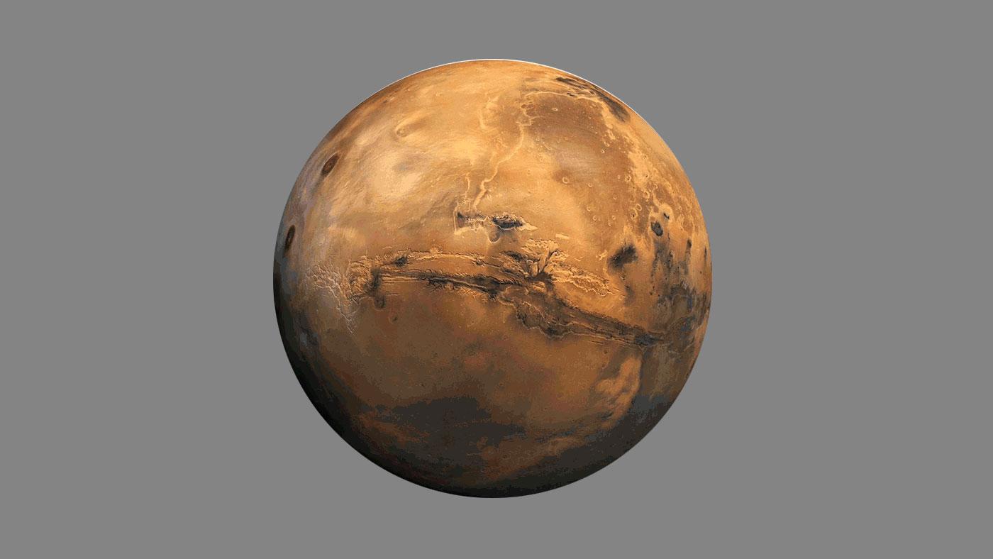
Water Ice Marked on Mars Globe (Illustration)
Full Resolution:
TIFF
(1.004 MB)
JPEG
(35.16 kB)
|
|
|
2019-12-16 |
Earth
|
Mars 2020 Rover
|
|
6417x4437x3 |
|
-
PIA23498:
-
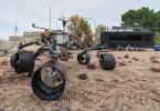
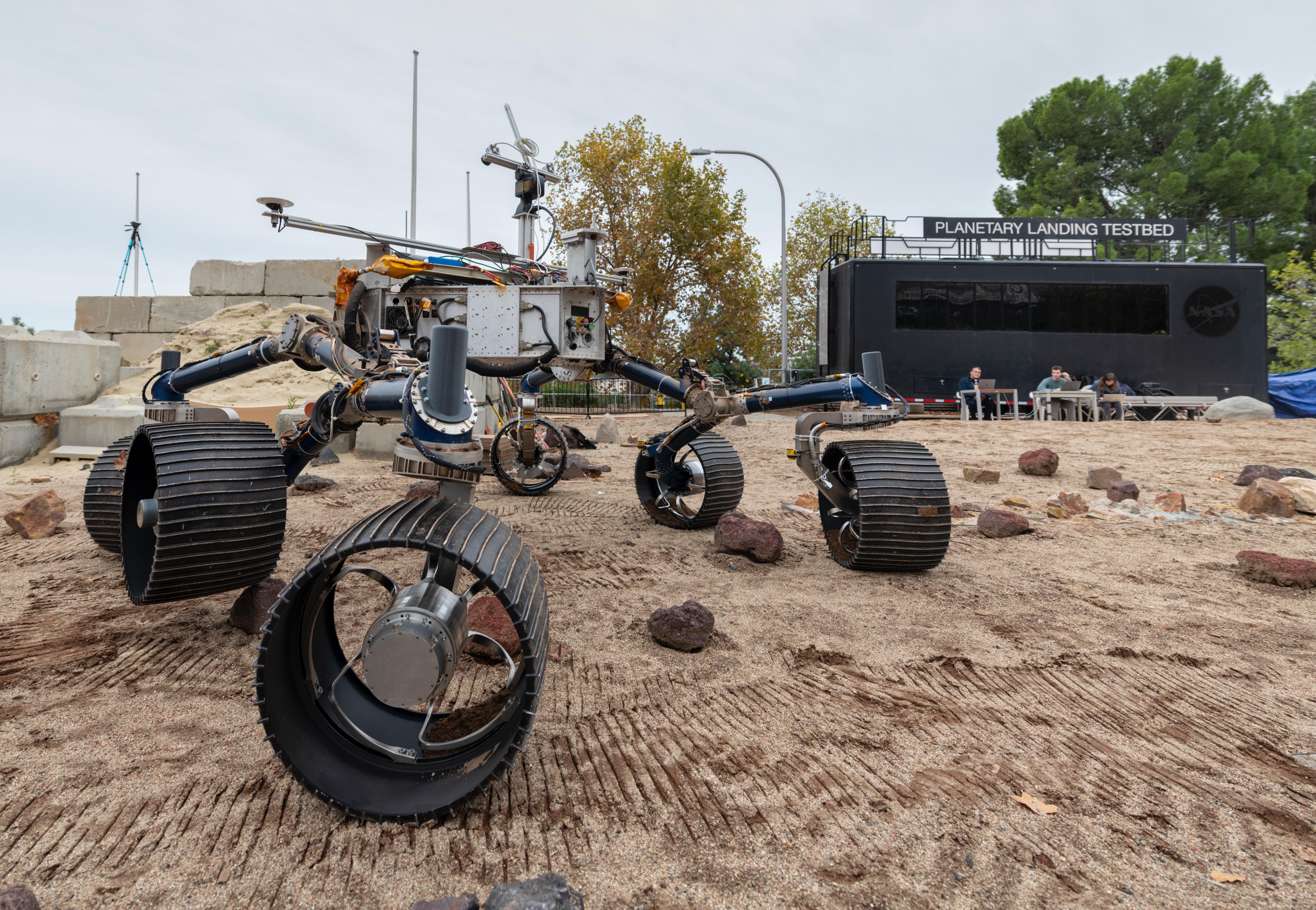
Mars 2020 Makes Tracks for the Red Planet in the Mars Yard
Full Resolution:
TIFF
(73.43 MB)
JPEG
(3.678 MB)
|
|
|
2019-12-17 |
Mars
|
Mars 2020 Rover
|
|
3600x1800x3 |
|
-
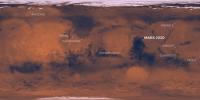
PIA23518:
-
Map of NASA's Mars Landing Sites
Full Resolution:
TIFF
(14.31 MB)
JPEG
(577.3 kB)
|
|
|
2019-12-13 |
Asteroid
|
NEOWISE
|
|
3300x2600x3 |
|
-
PIA23589:
-
Klotho and Lina
Full Resolution:
TIFF
(25.75 MB)
JPEG
(1.71 MB)
|
|
|
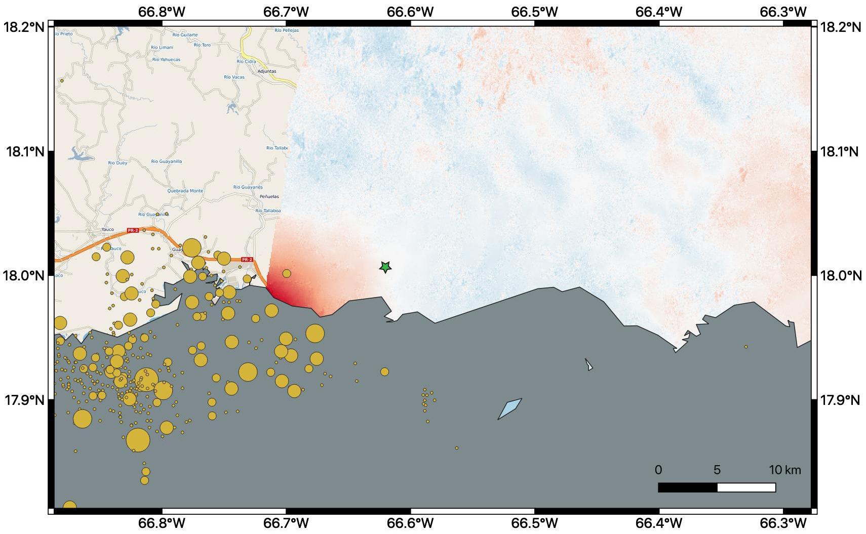
2020-01-10 |
Earth
|
ARIA
|
|
1710x1055x3 |
|
-
PIA23428:
-
Puerto Rico Quake Damage Visible From Space
Full Resolution:
TIFF
(2.476 MB)
JPEG
(189 kB)
|
|
|
2020-02-04 |
Earth
|
ECOSTRESS
|
|
772x440x3 |

|
-
PIA23430:
-
The ECOSTRESS Mission Spots Plants as They Wake Up
Full Resolution:
TIFF
(1.02 MB)
JPEG
(72.92 kB)
|
|
|
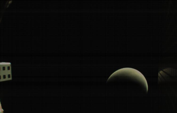
2020-03-25 |
Uranus
|
Voyager
|
|
1040x585x3 |
|
-
PIA23683:
-
GIF of Uranus' Magnetic Field
Full Resolution:
TIFF
(1.104 MB)
JPEG
(152.4 kB)
|
|
|
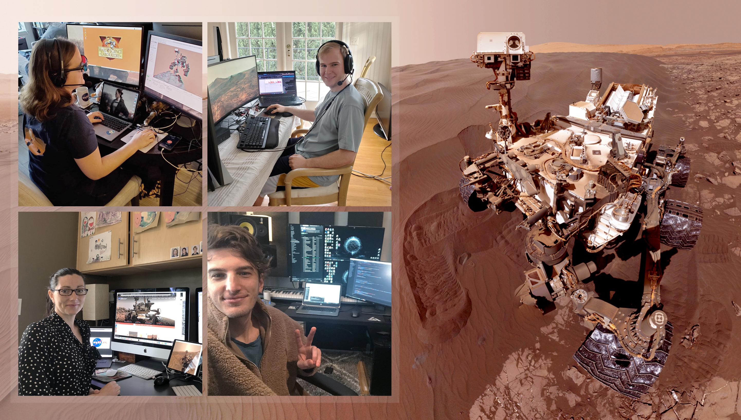
2020-04-14 |
Mars
|
Mars Science Laboratory (MSL)
|
|
2883x1633x3 |

|
-
PIA23773:
-
Curiosity's Team Teleworks
Full Resolution:
TIFF
(14.02 MB)
JPEG
(630.3 kB)
|
|
|
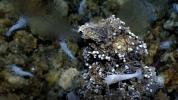
2020-04-15 |
Earth
|
|
|
1920x1080x3 |
|
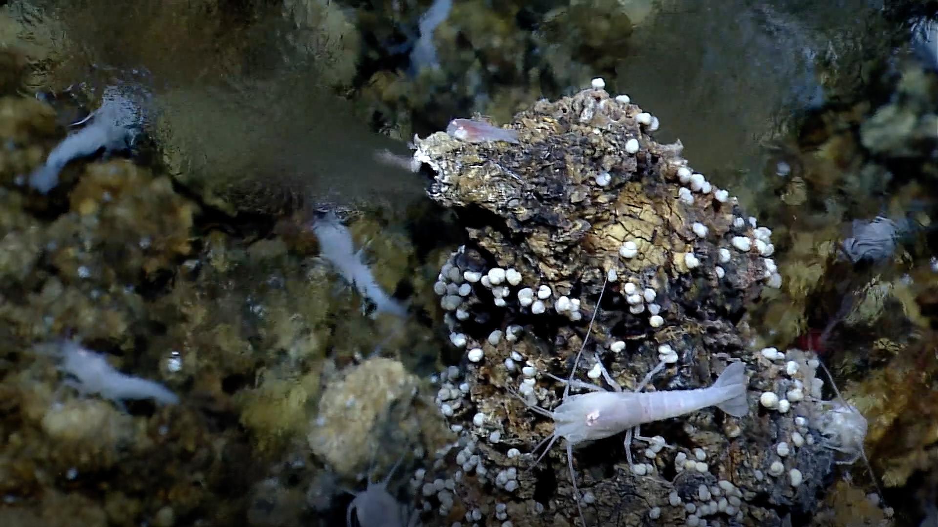
-
PIA23686:
-
White Smoker Ocean Vents
Full Resolution:
TIFF
(6.172 MB)
JPEG
(270.2 kB)
|
|
|
2020-06-08 |
Venus
|
Mariner
|
|
2245x1096x3 |
|
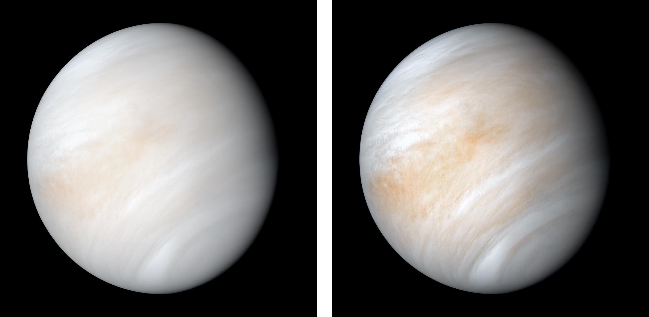
-
PIA23791:
-
Venus from Mariner 10
Full Resolution:
TIFF
(3.457 MB)
JPEG
(94.32 kB)
|
|
|
2020-06-16 |
Mars
|
|
|
2500x2569x3 |
|
-
PIA23900:
-
NASA Astronaut Stands on Mars (Illustration)
Full Resolution:
TIFF
(12.43 MB)
JPEG
(499.2 kB)
|
|
|
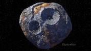
2020-07-07 |
Asteroid
|
Psyche
|
|
4800x2700x3 |
|
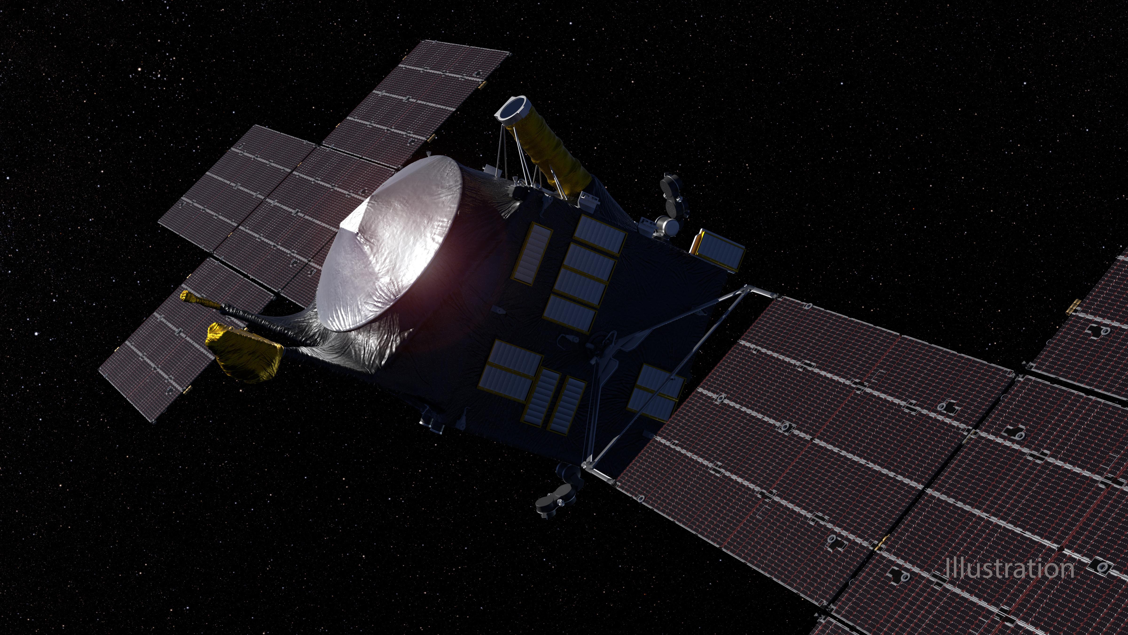
-
PIA23875:
-
Psyche Spacecraft (Artist's Concept)
Full Resolution:
TIFF
(20.14 MB)
JPEG
(1.581 MB)
|
|
|
2020-07-07 |
Asteroid
|
Psyche
|
|
1600x900x3 |
|
-
PIA23876:
-
A Metal-Rich World (Artist's Concept)
Full Resolution:
TIFF
(2.866 MB)
JPEG
(239.1 kB)
|
|
|
2020-07-07 |
Asteroid
|
Psyche
|
|
6520x4489x3 |

|
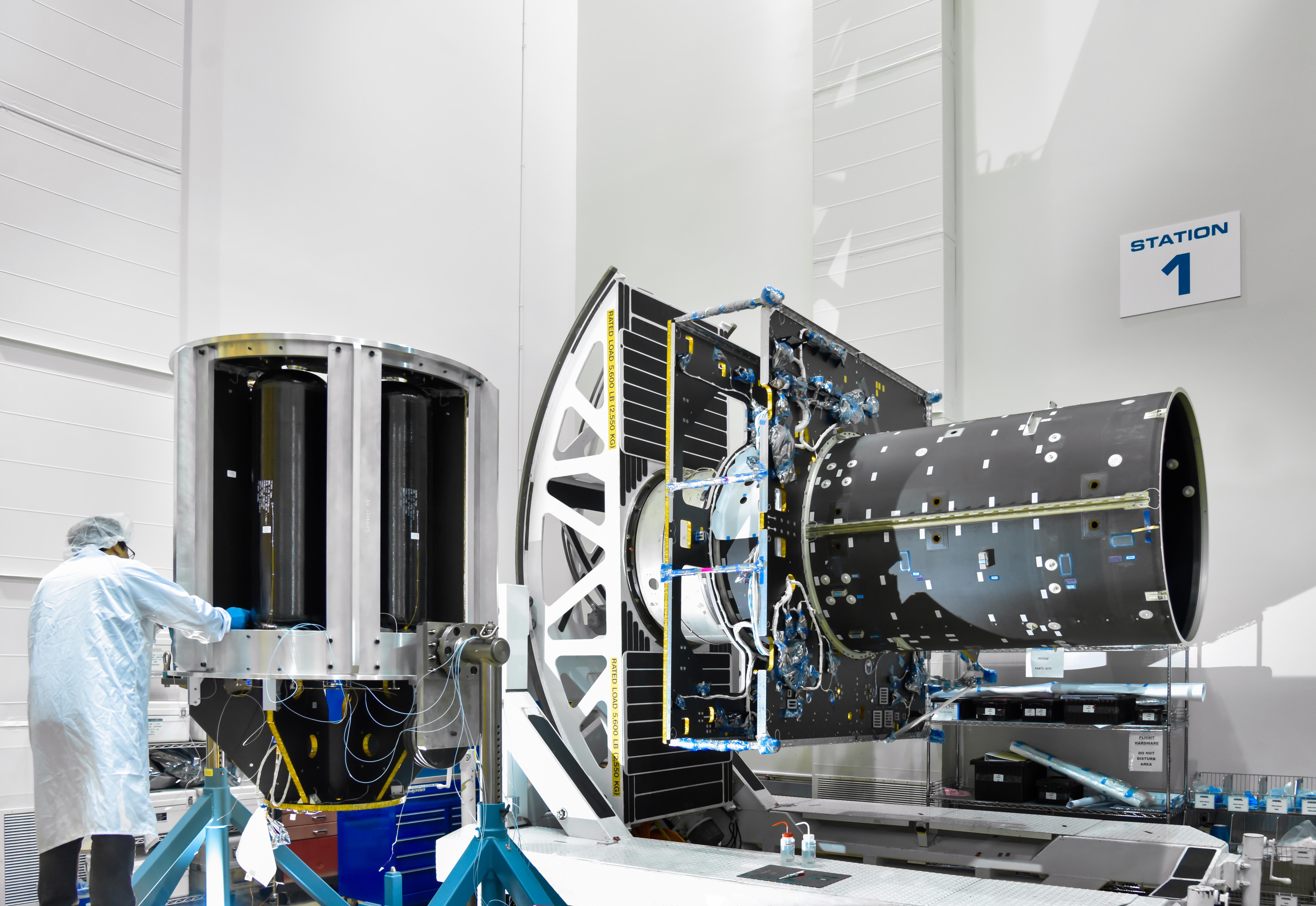
-
PIA23877:
-
Psyche in Progress
Full Resolution:
TIFF
(51.71 MB)
JPEG
(1.669 MB)
|
|
|
2020-07-07 |
Asteroid
|
Psyche
|
|
1600x900x3 |
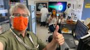
|
-
PIA23878:
-
Thumbs-up for Ion Propulsion
Full Resolution:
TIFF
(4.322 MB)
JPEG
(217.3 kB)
|
|
|
2020-07-07 |
Asteroid
|
Psyche
|
|
3024x4032x3 |

|
-
PIA23879:
-
Ring of Firepower
Full Resolution:
TIFF
(10.22 MB)
JPEG
(260.6 kB)
|
|
|
2020-07-08 |
Comet
|
NEOWISE
|
|
860x651x3 |
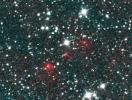
|
-
PIA23792:
-
Comet NEOWISE Discovery Images
Full Resolution:
TIFF
(1.68 MB)
JPEG
(175.1 kB)
|
|
|
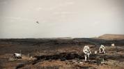
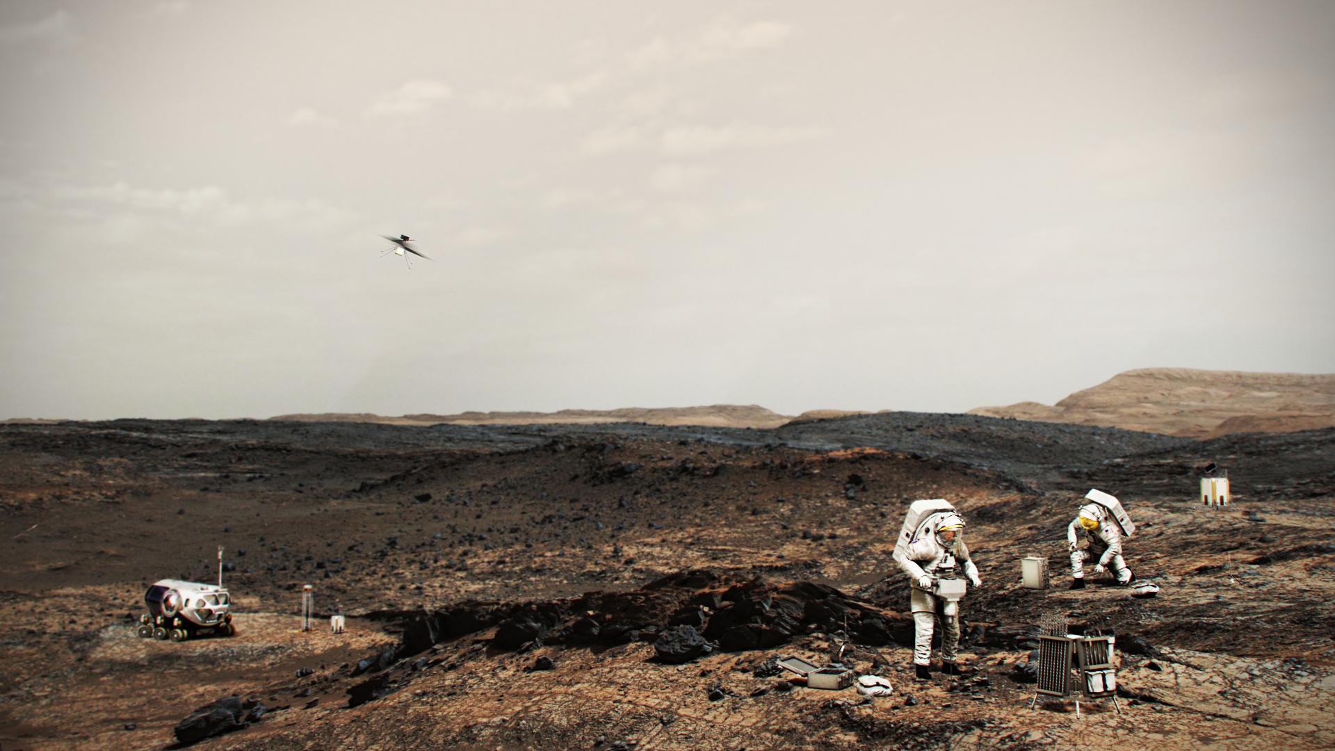
2020-07-28 |
Mars
|
|
|
1600x900x3 |
|
-
PIA24031:
-
NASA Astronauts on Mars (Illustration)
Full Resolution:
TIFF
(3.599 MB)
JPEG
(221.1 kB)
|
|
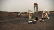
|
2020-07-28 |
Mars
|
|
|
1920x1080x3 |
|
-
PIA24032:
-
NASA Astronauts on Mars With Helicopter (Illustration)
Full Resolution:
TIFF
(4.556 MB)
JPEG
(220 kB)
|
|
|
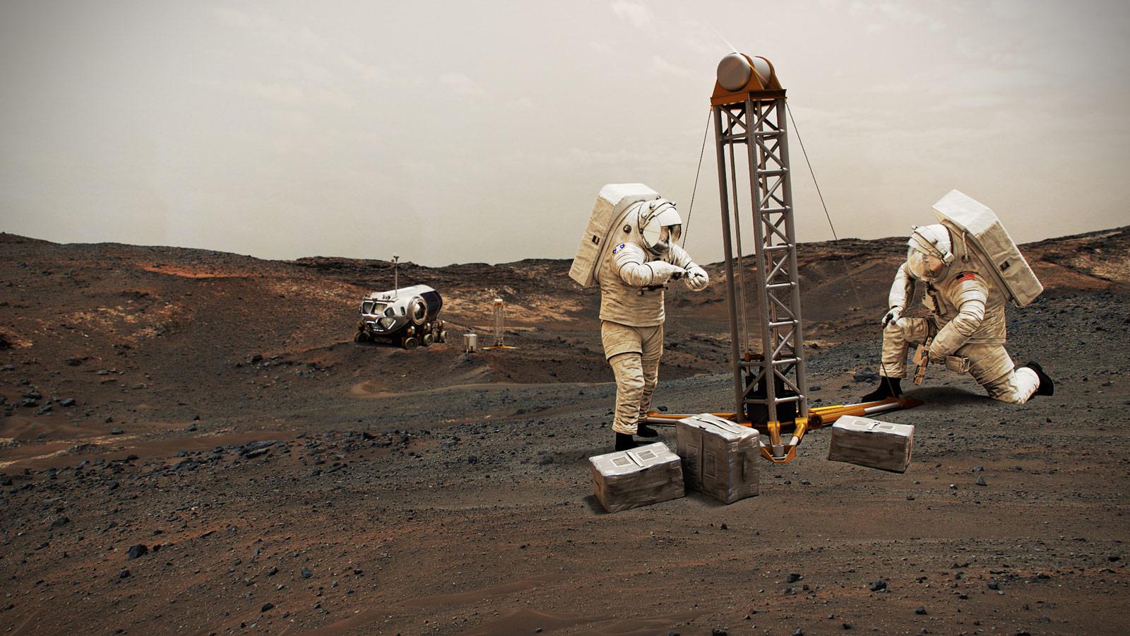
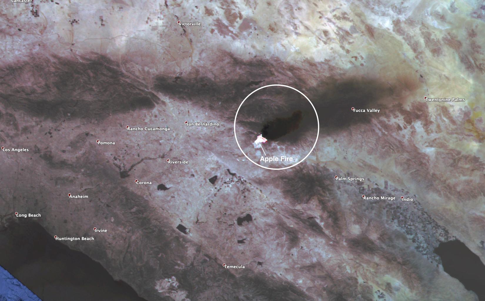
2020-08-03 |
Earth
|
ECOSTRESS
|
|
2908x2224x3 |
|
-
PIA23798:
-
ECOSTRESS Gauges the Apple Fire's Temperature From Space
Full Resolution:
TIFF
(14.41 MB)
JPEG
(620.1 kB)
|
|
|
2020-08-03 |
Earth
|
ECOSTRESS
|
|
1650x1023x3 |

|
-
PIA23799:
-
ECOSTRESS Spies Apple Fire's Smoke Plume
Full Resolution:
TIFF
(4.924 MB)
JPEG
(188.5 kB)
|
|
|
2020-08-05 |
Jupiter
|
Juno
|
|
2539x3373x3 |
|
-
PIA23983:
-
Shallow Lightning on Jupiter (Illustration)
Full Resolution:
TIFF
(20.09 MB)
JPEG
(405.9 kB)
|
|
|
2020-08-05 |
Jupiter
|
Juno
|
|
2264x1962x3 |
|
-
PIA24042:
-
A Mushball and Shallow-Lightning Factory (Illustration)
Full Resolution:
TIFF
(4 MB)
JPEG
(254.8 kB)
|
|
|
2020-08-07 |
Earth
|
ARIA
|
|
2944x2480x3 |
|
-
PIA23692:
-
ARIA Damage Map: Beirut Explosion Aftermath
Full Resolution:
TIFF
(19.6 MB)
JPEG
(1.471 MB)
|
|
|
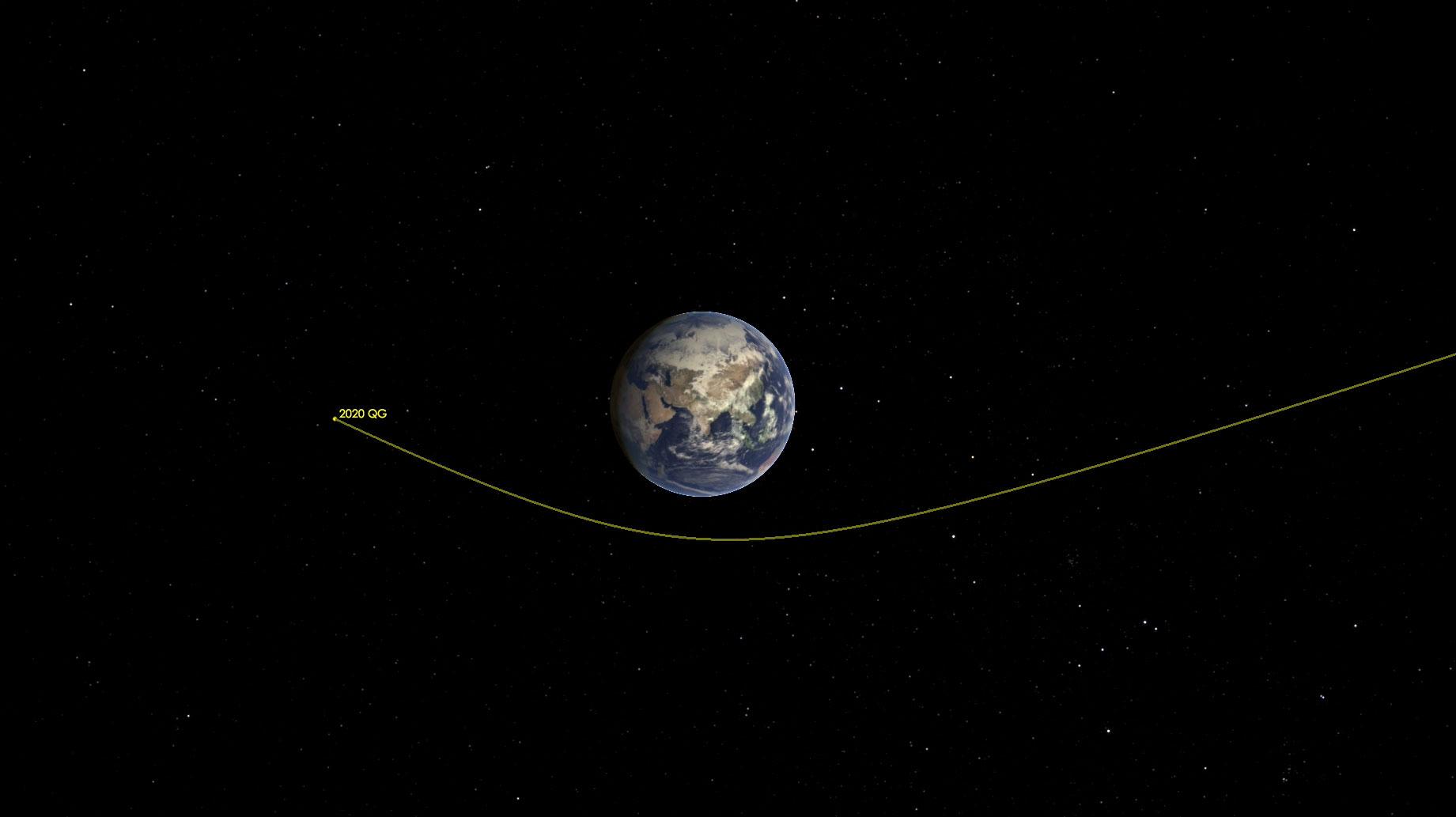
2020-08-18 |
Asteroid
|
|
|
1841x1033x3 |
|
-
PIA24037:
-
Asteroid 2020 QG Zips Around the Earth (Illustration)
Full Resolution:
TIFF
(518.8 kB)
JPEG
(64.57 kB)
|
|
|
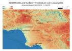
2020-08-19 |
Earth
|
ECOSTRESS
|
|
3507x2480x3 |
|
-
PIA23786:
-
Los Angeles Heat Wave
Full Resolution:
TIFF
(19.81 MB)
JPEG
(1.073 MB)
|
|
|
2020-08-19 |
Earth
|
ECOSTRESS
|
|
3447x2404x3 |
|
-
PIA23787:
-
Death Valley Heats Up
Full Resolution:
TIFF
(23.97 MB)
JPEG
(1.434 MB)
|
|
|
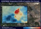
2020-08-27 |
Earth
|
ECOSTRESS
|
|
3507x2480x3 |
|
-
PIA23215:
-
NASA's ECOSTRESS Sees Fire-Induced Tornado From Space
Full Resolution:
TIFF
(21.72 MB)
JPEG
(1.14 MB)
|
|
|
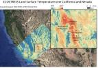
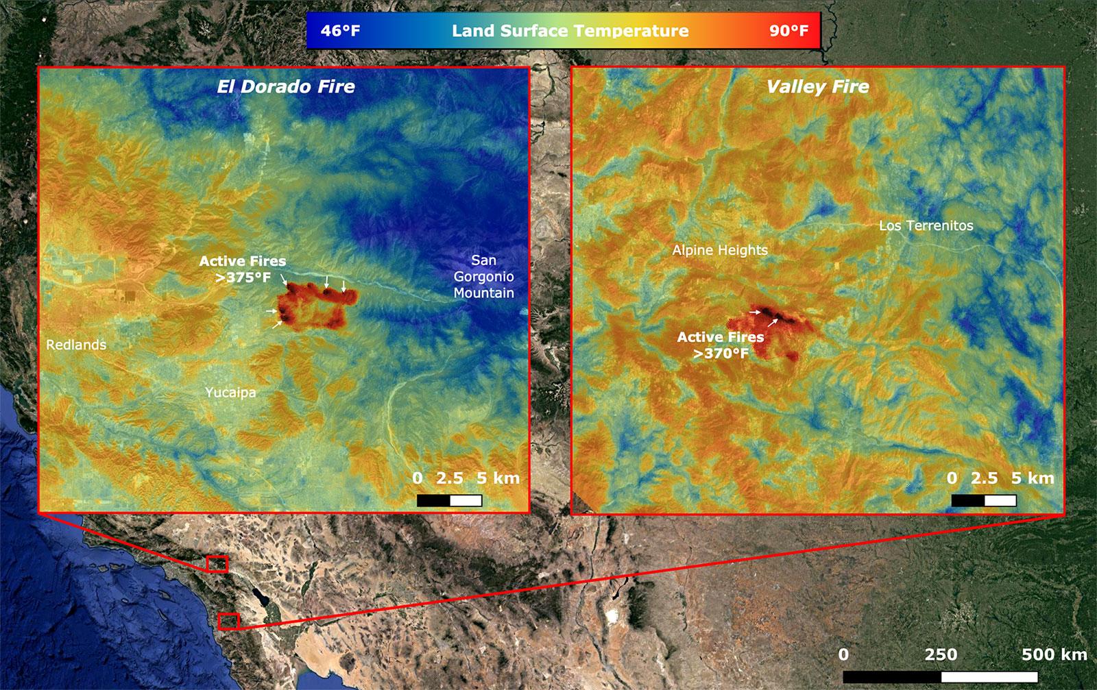
2020-09-08 |
Earth
|
ECOSTRESS
|
|
1600x1007x3 |
|
-
PIA23788:
-
NASA's ECOSTRESS Takes Surface Temperature Around California Fires
Full Resolution:
TIFF
(4.835 MB)
JPEG
(361.7 kB)
|
|
|
2020-09-09 |
Asteroid
|
OSIRIS-REx
|
|
1280x720x3 |
|
-
PIA24101:
-
Asteroid Bennu's Particle Ejection Events (Animation)
Full Resolution:
TIFF
(558 kB)
JPEG
(35.64 kB)
|
|
|
2020-09-23 |
Earth
|
|
|
8000x5955x3 |
|
-
PIA23790:
-
OASIS Study Project (Illustration)
Full Resolution:
TIFF
(104.1 MB)
JPEG
(4.095 MB)
|
|
|
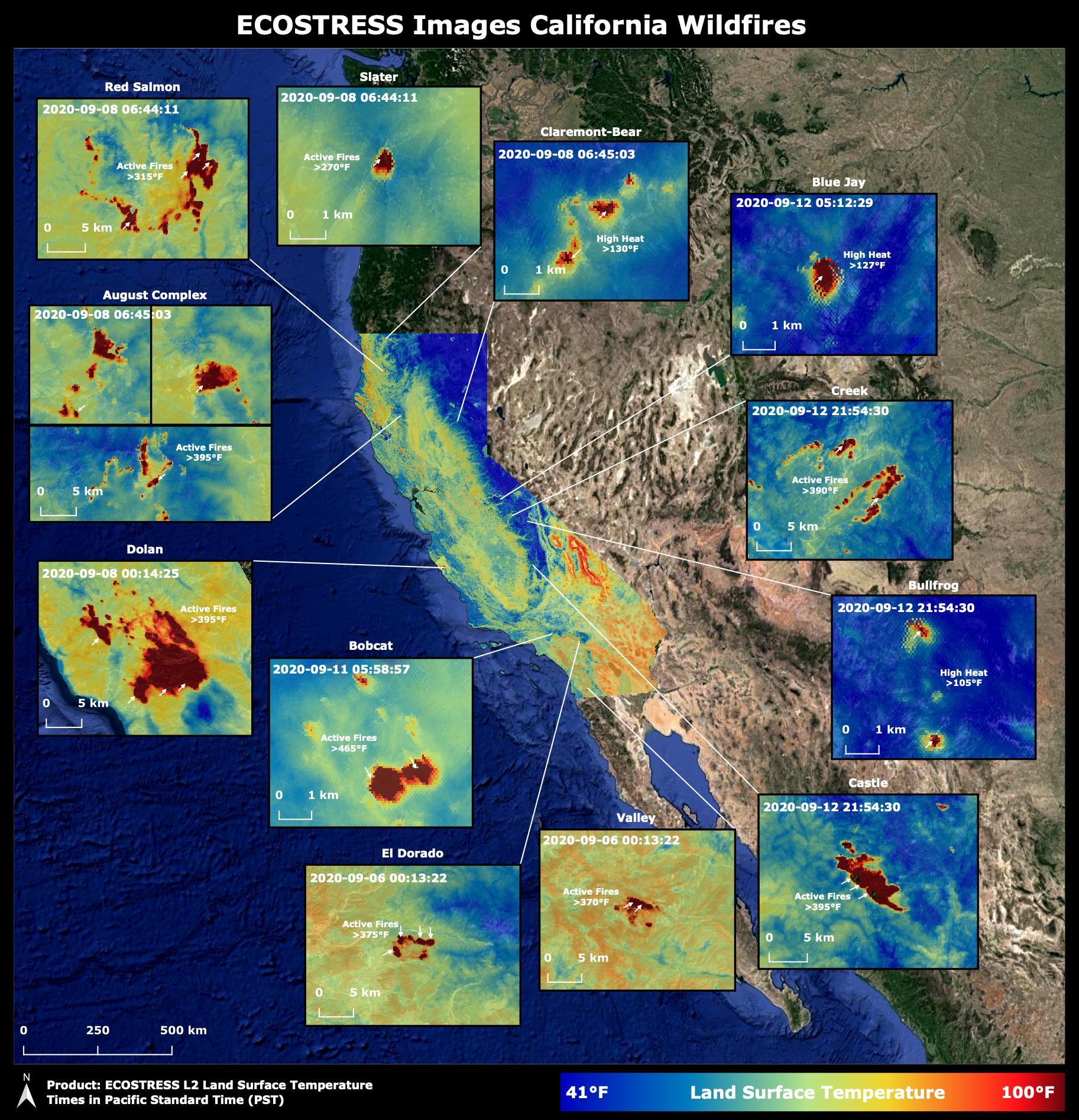
2020-10-02 |
Earth
|
ECOSTRESS
|
|
1825x1894x3 |

|
-
PIA23721:
-
NASA's ECOSTRESS Images California Wildfires From Space
Full Resolution:
TIFF
(10.37 MB)
JPEG
(633.2 kB)
|
|
|
2020-10-20 |
Mars
|
|
|
3840x2160x3 |
|
-
PIA24172:
-
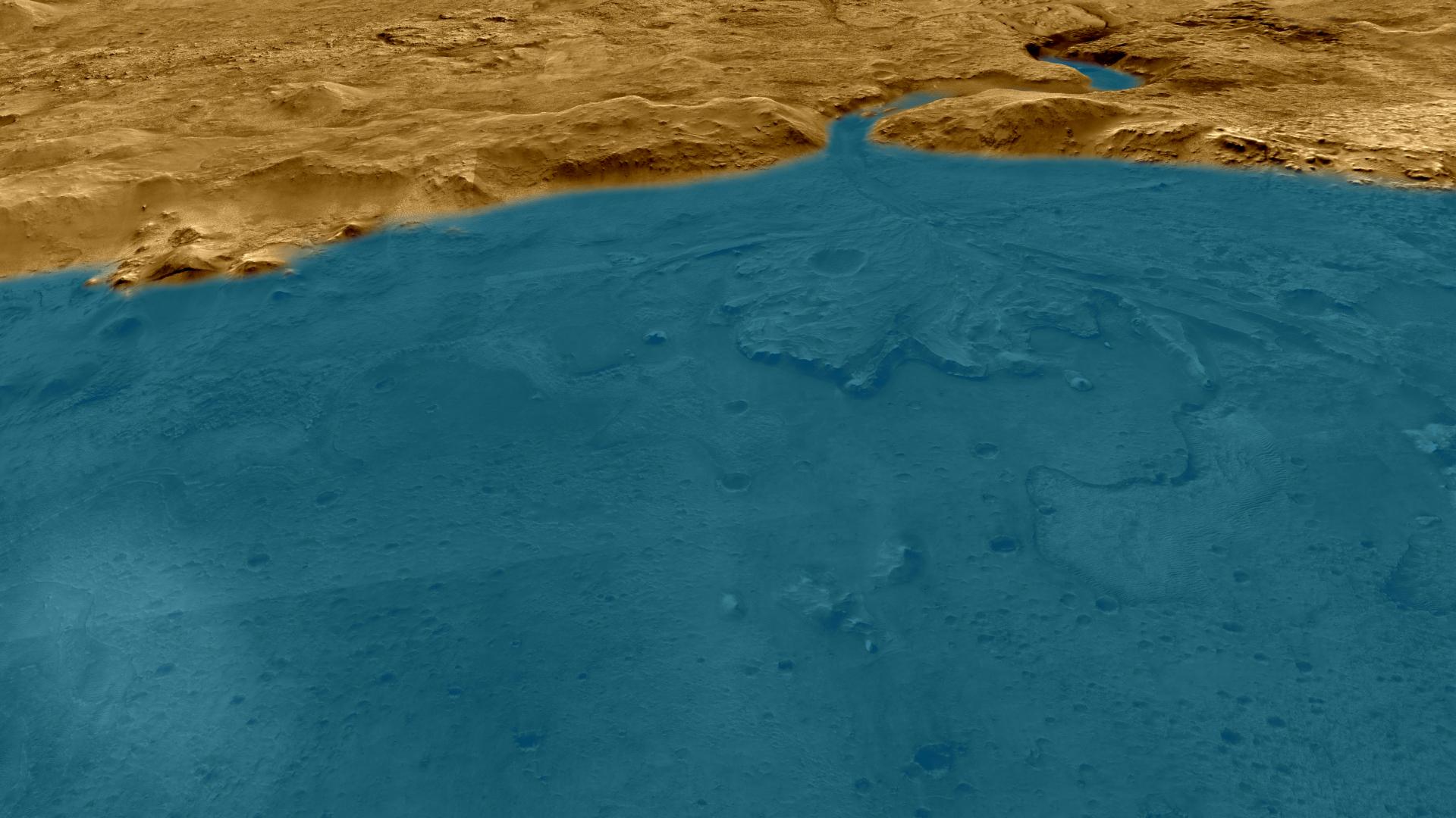
Ancient Jezero Crater (Illustration)
Full Resolution:
TIFF
(23.48 MB)
JPEG
(965 kB)
|
|
|
2020-10-27 |
Jupiter
|
|
|
1185x1973x3 |

|
-
PIA23990:
-
Jovian Sprite (Illustration)
Full Resolution:
TIFF
(4.375 MB)
JPEG
(115.4 kB)
|
|
|
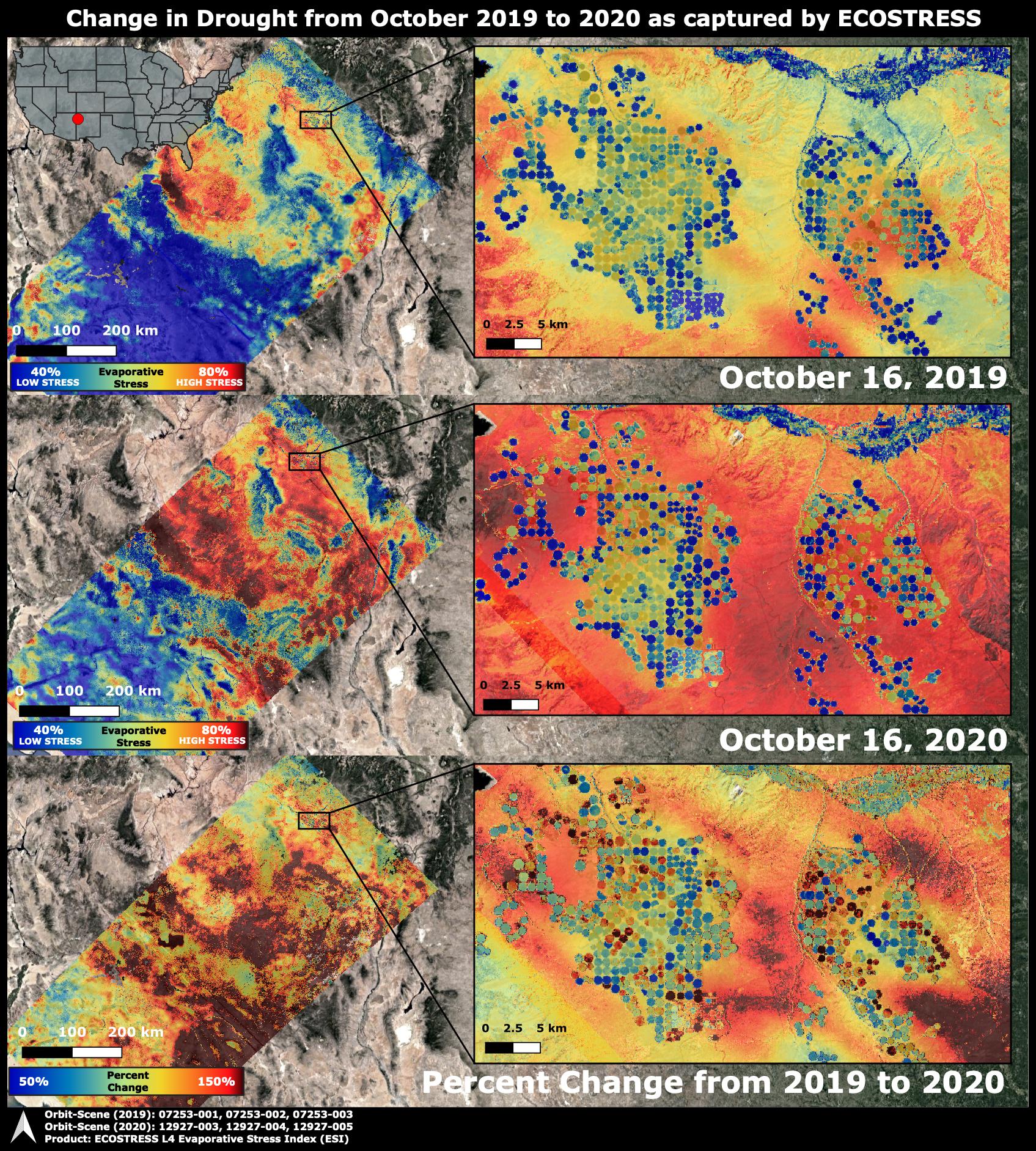
2020-10-28 |
Earth
|
ECOSTRESS
|
|
1695x1883x3 |

|
-
PIA24132:
-
ECOSTRESS Drought Stress Comparison
Full Resolution:
TIFF
(9.579 MB)
JPEG
(930 kB)
|
|
|
2020-12-10 |
Earth
|
Sentinel-6/Jason-CS
|
|
2600x1849x3 |
|
-
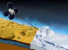
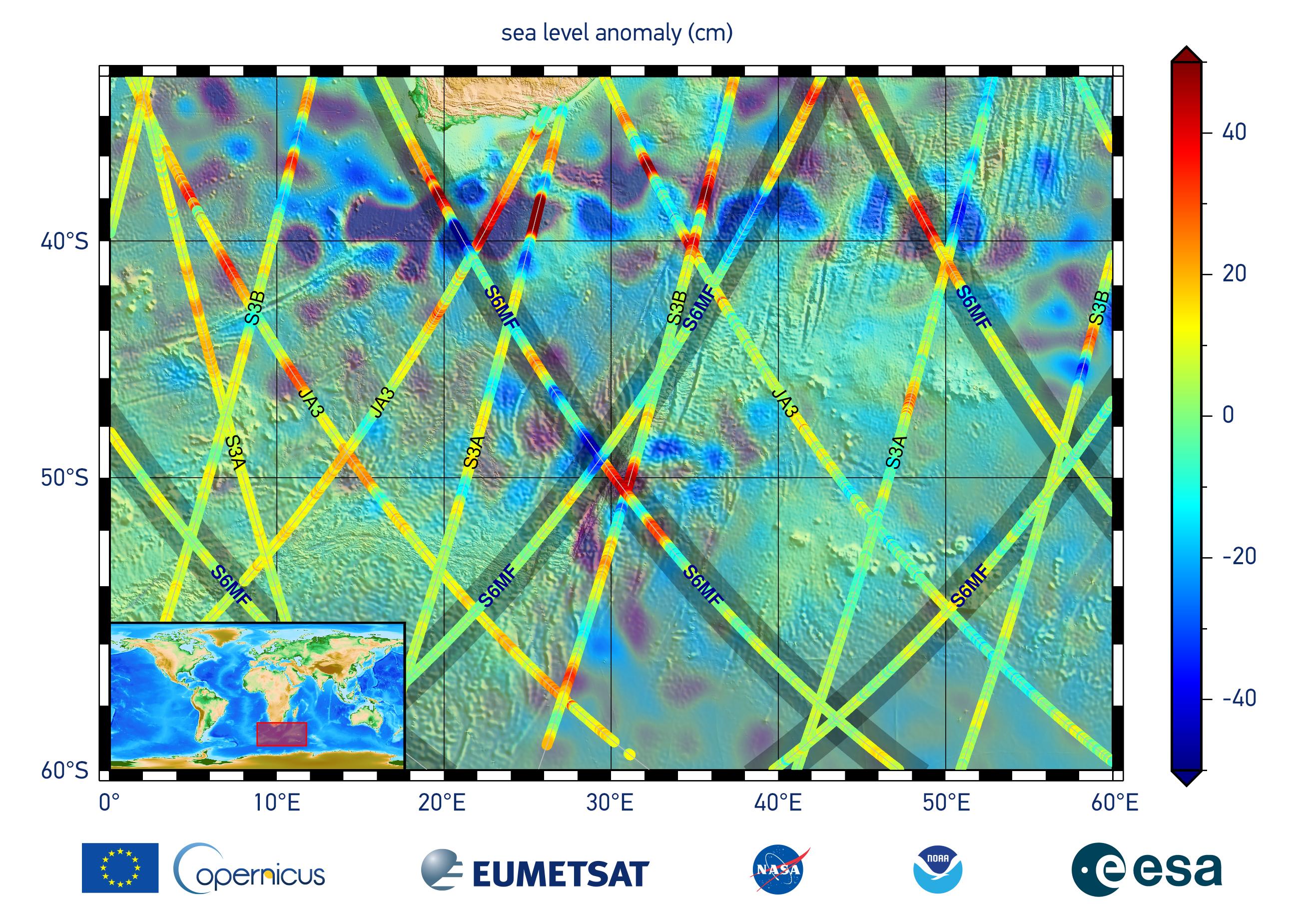
PIA24135:
-
Sentinel-6 Michael Freilich First Light Sea Level
Full Resolution:
TIFF
(10.71 MB)
JPEG
(704.9 kB)
|
|
|
2020-12-10 |
Earth
|
Sentinel-6/Jason-CS
|
|
1216x900x3 |
|
-
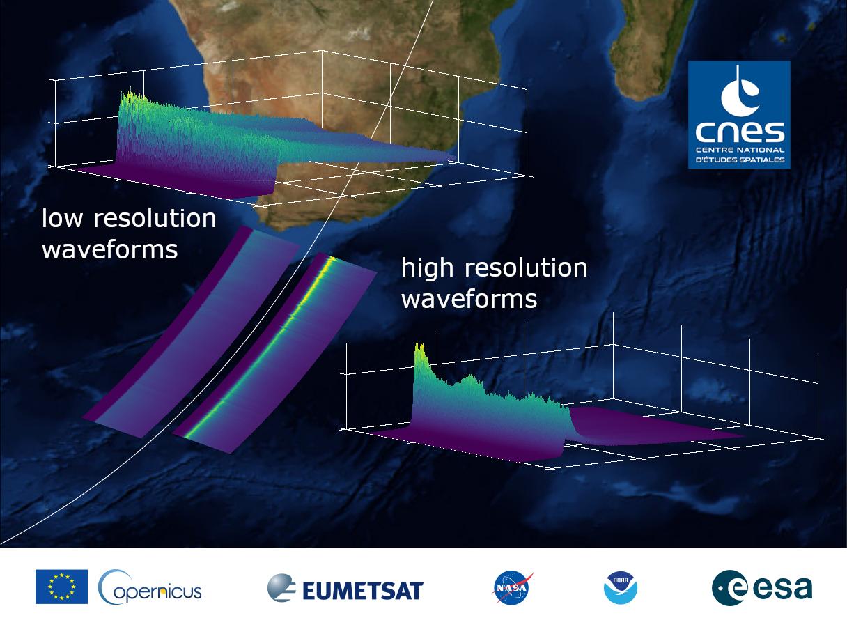
PIA24136:
-
Sentinel-6 Michael Freilich First Light Waveform
Full Resolution:
TIFF
(2.221 MB)
JPEG
(121.2 kB)
|
|
|
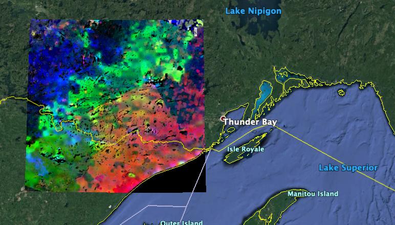
2021-01-25 |
Earth
|
OMG
|
|
3792x2846x3 |
|
-
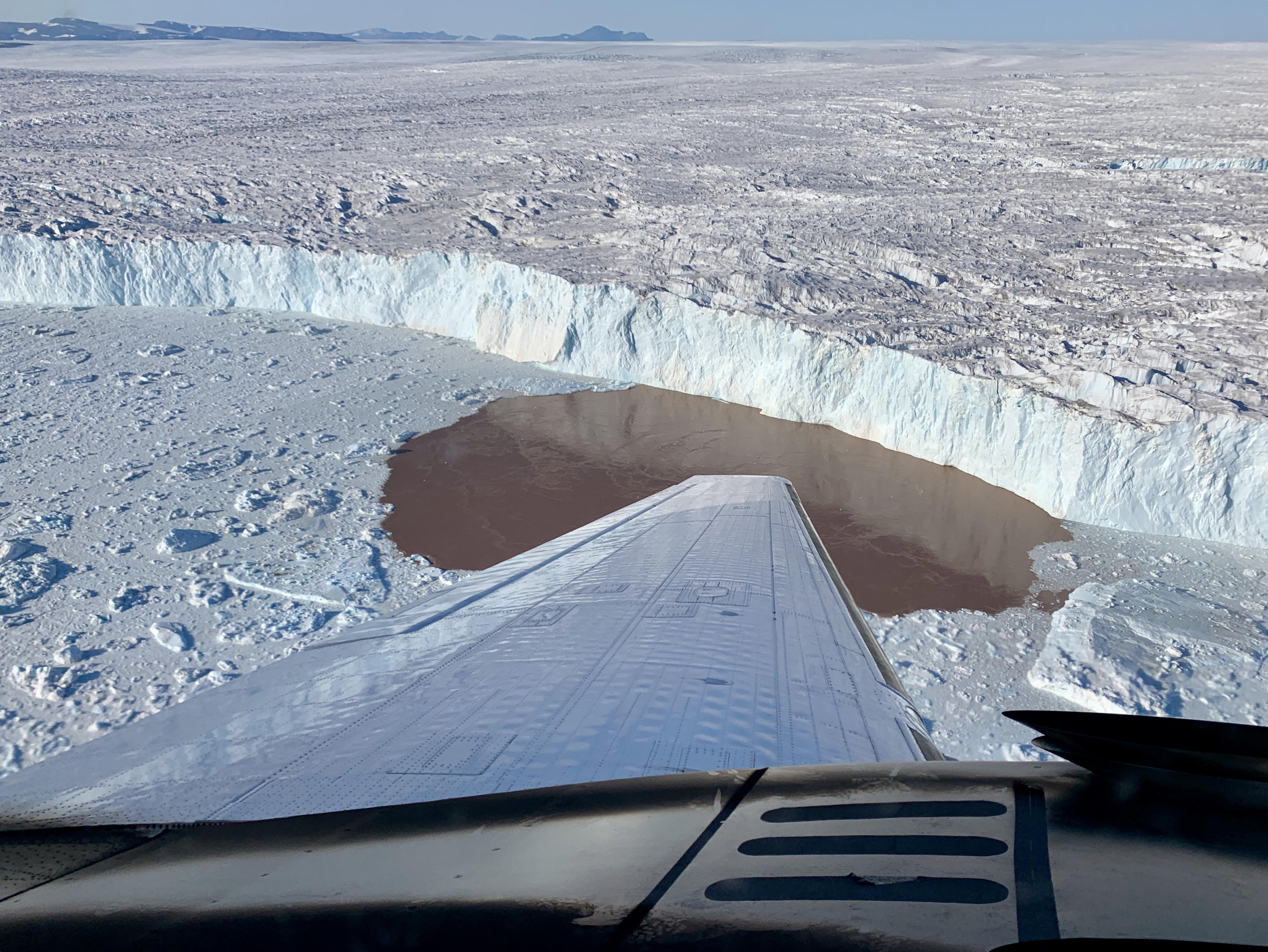
PIA24162:
-
Glacier Undercutting in Action
Full Resolution:
TIFF
(26.91 MB)
JPEG
(1.386 MB)
|
|
|
2021-01-27 |
Mars
|
Mars 2020 Rover
|
|
1920x1080x3 |
|
-
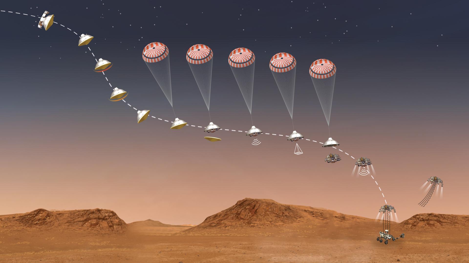
PIA24265:
-
Perseverance's Stages of Descent (Illustration)
Full Resolution:
TIFF
(2.494 MB)
JPEG
(125.1 kB)
|
|
|
2021-01-27 |
Mars
|
Mars 2020 Rover
|
|
3840x2160x3 |
|
-
PIA24309:
-
Exploring Majestic Jezero Crater (Illustration)
Full Resolution:
TIFF
(20.21 MB)
JPEG
(843.7 kB)
|
|
|
2021-01-27 |
Earth
|
|
|
1024x768x3 |

|
-
PIA24374:
-
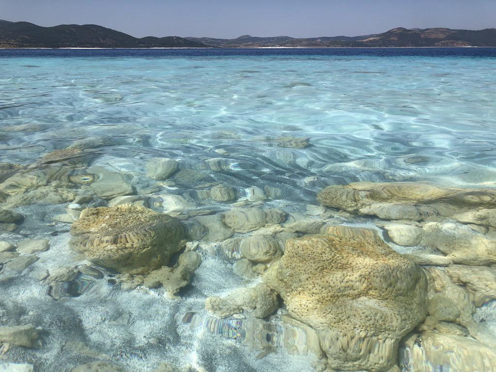
Lake Salda Rocks
Full Resolution:
TIFF
(2.36 MB)
JPEG
(146.1 kB)
|
|
|
2021-01-27 |
Earth
|
|
|
1024x768x3 |

|
-
PIA24375:
-
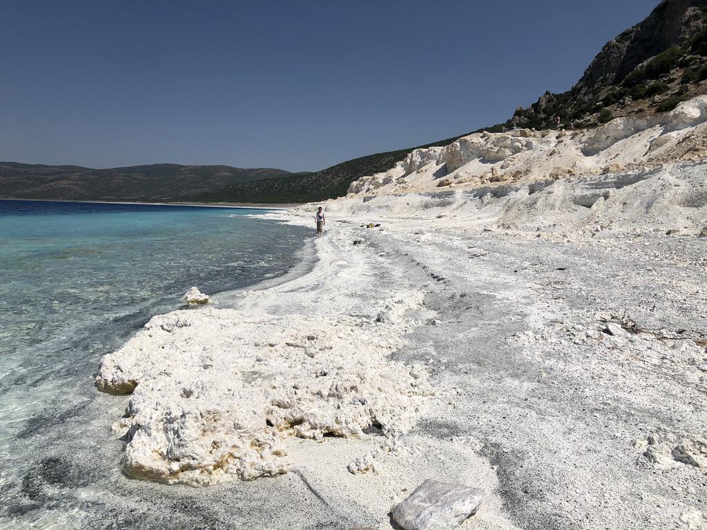
Lake Salda Beach
Full Resolution:
TIFF
(2.112 MB)
JPEG
(189.6 kB)
|
|
|
2021-01-27 |
Mars
|
|
|
4029x3567x3 |
|
-
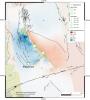
PIA24377:
-
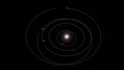
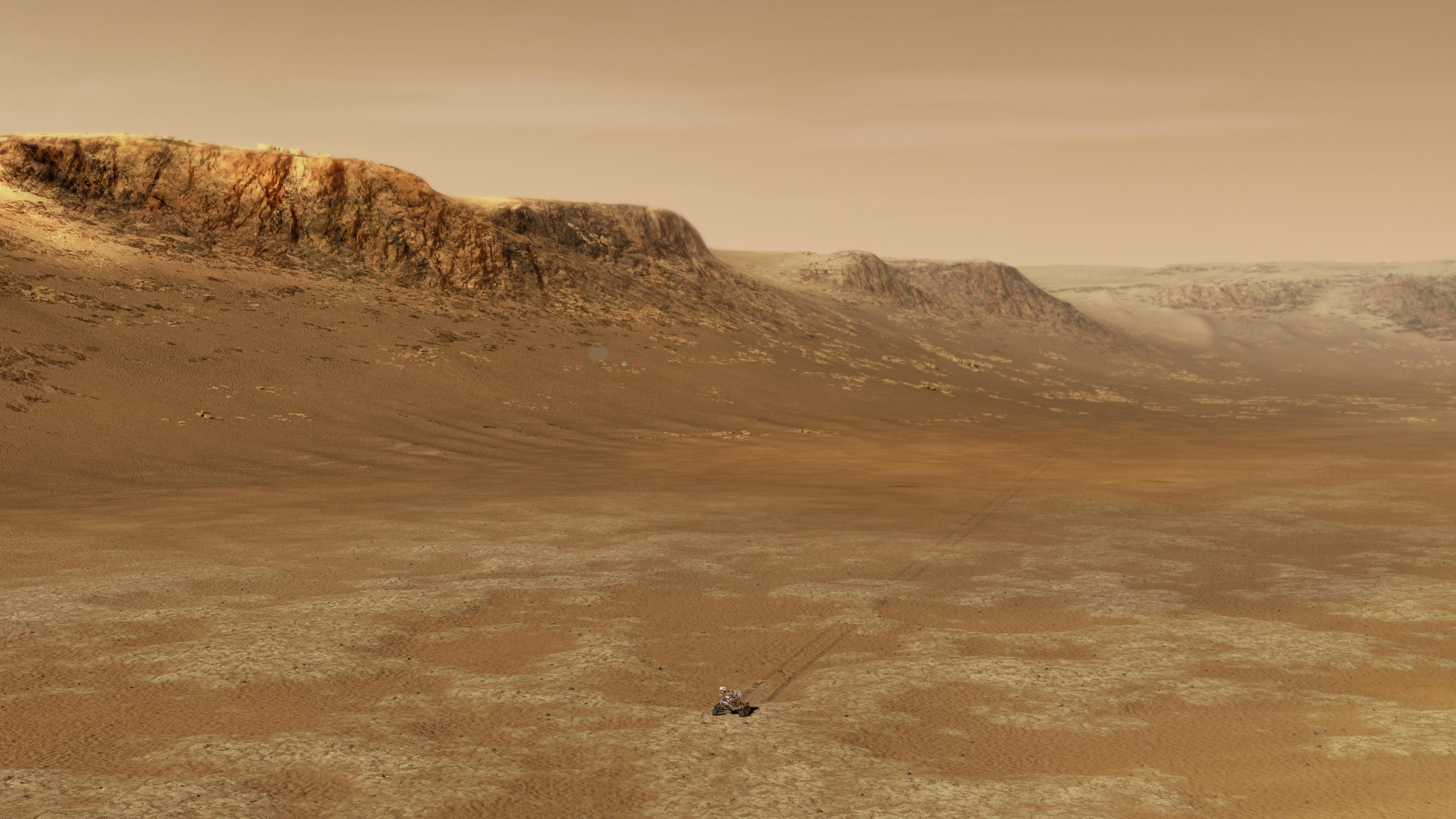
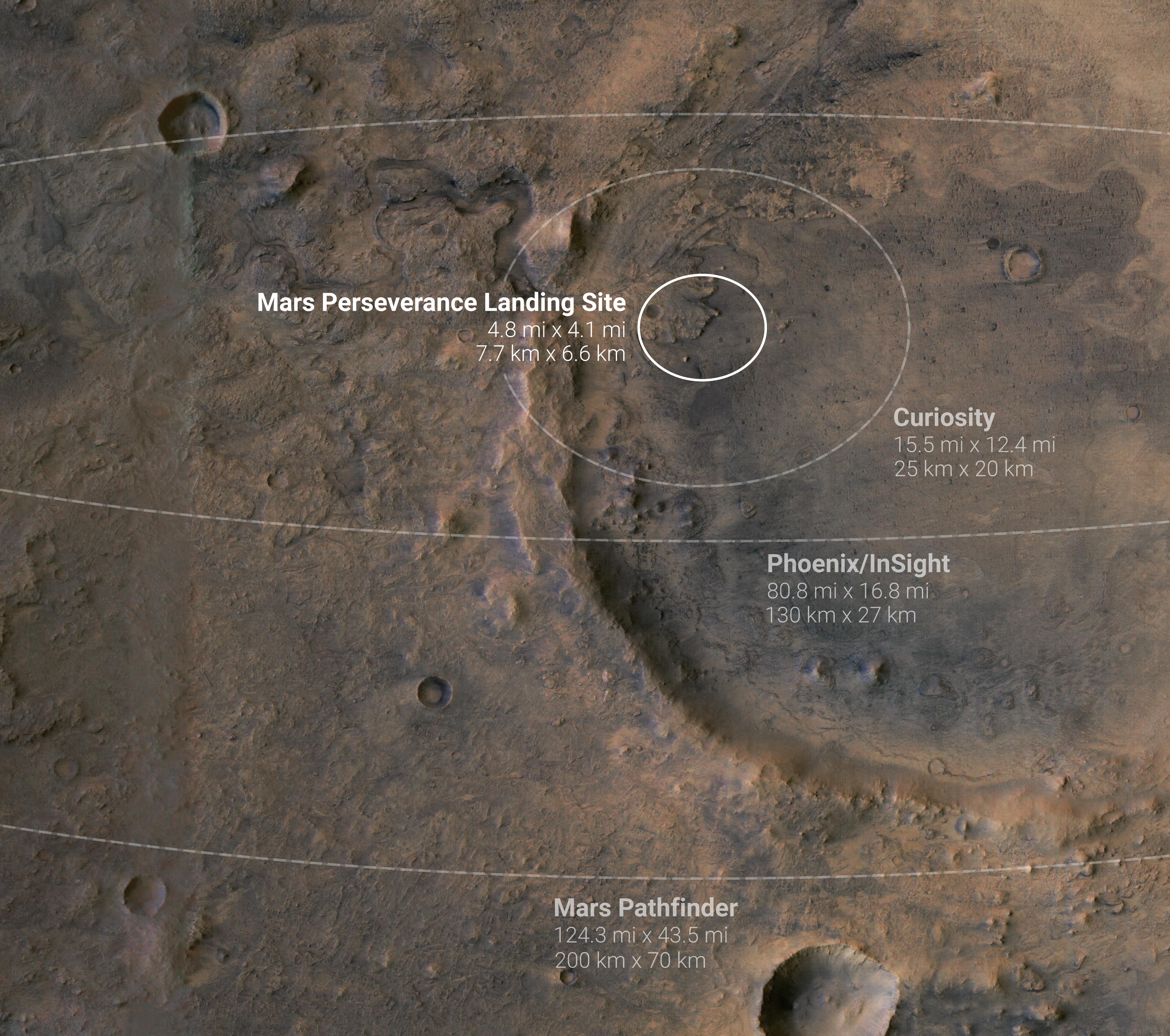
Mars Probe Landing Ellipses
Full Resolution:
TIFF
(37.84 MB)
JPEG
(1.847 MB)
|


