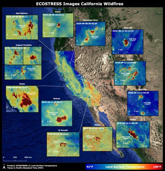
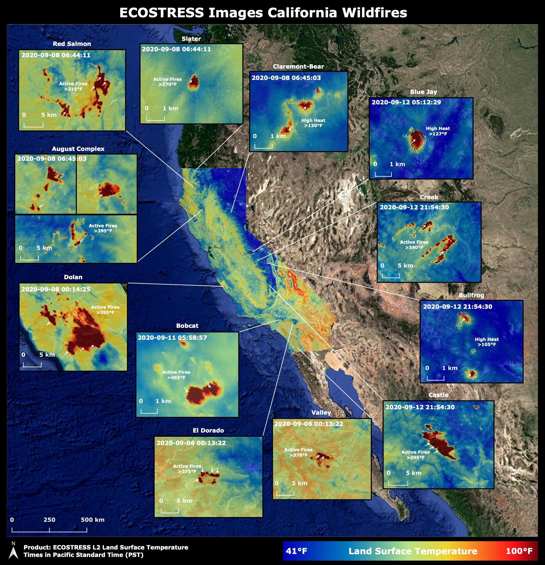
Throughout the month of September 2020, NASA's ECOsystem Spaceborne Thermal Radiometer Experiment on Space Station (ECOSTRESS) imaged multiple wildfires across the state of California.
The image above shows the ECOSTRESS land surface temperature of California. Multiple insets highlight a fraction of the multiple fires that have impacted California, with effects seen throughout the U.S. and beyond. The dark red spots show areas of high heat, with arrows pointing out the active fires. The contiguous California image was stitched together from multiple evening (10 p.m.-6 a.m. PDT) ECOSTRESS images from Sept 6 to 12, 2020, to generate a cloud-free statewide map.
NASA's Jet Propulsion Laboratory in Southern California built and manages the ECOSTRESS mission for the Earth Science Division in the Science Mission Directorate at NASA Headquarters in Washington. ECOSTRESS is an Earth Venture Instrument mission; the program is managed by NASA's Earth System Science Pathfinder program at NASA's Langley Research Center in Hampton, Virginia. Future studies could use ECOSTRESS data products in a similar fashion as LST was used to assess the fires pictured above.
More information about ECOSTRESS is available here: https://ecostress.jpl.nasa.gov/.
For information on Earth science activities aboard the International Space Station, visit: http://www.nasa.gov/issearthscience.