Click on an image for detailed information
Click on a column heading to sort in ascending or descending order

My
List |
Addition Date
|
Target
|
Mission
|
Instrument
|
Size
|

|
2015-10-09 |
Mars
|
2001 Mars Odyssey
|
THEMIS
|
714x1666x3 |
|
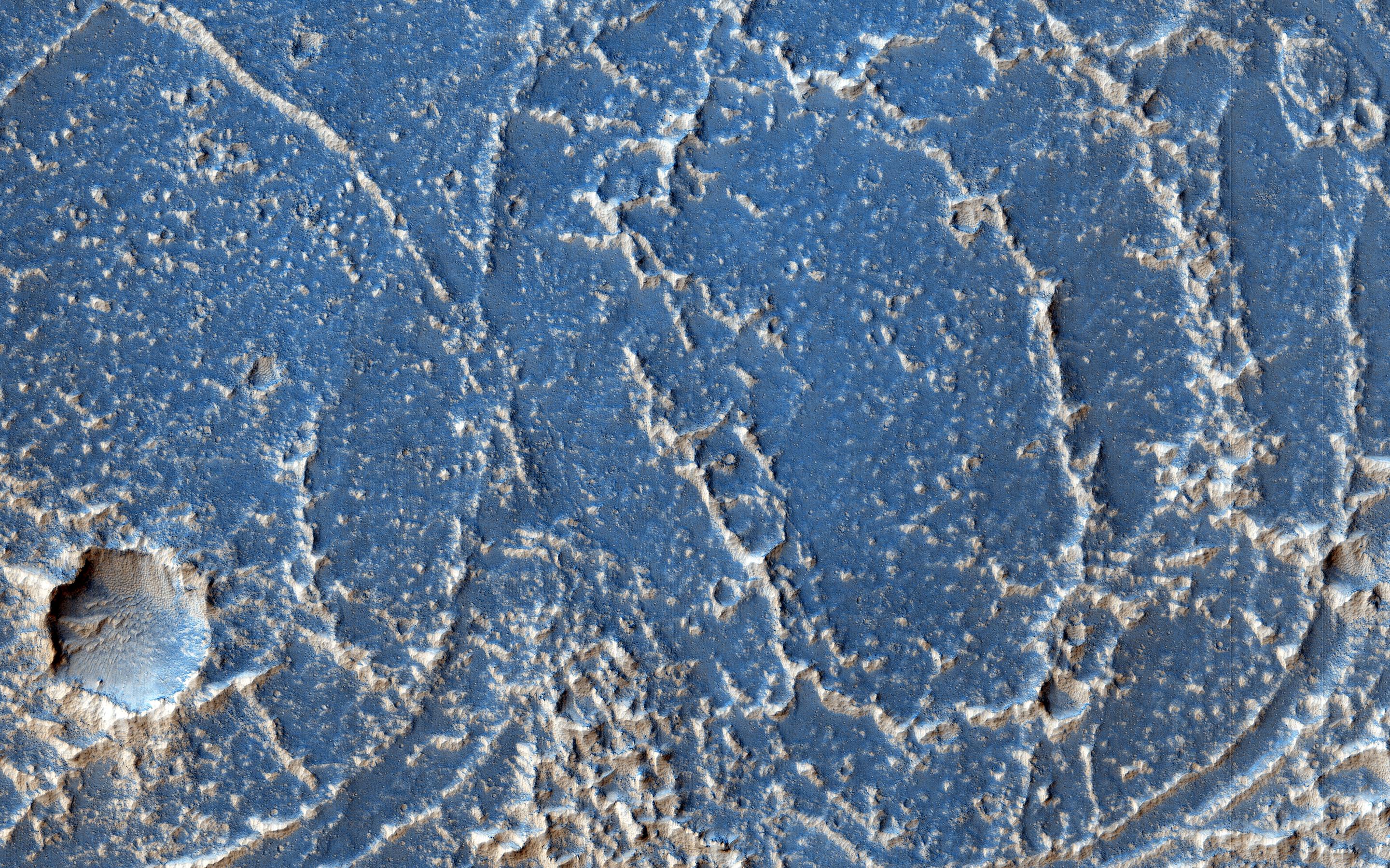
-
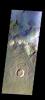
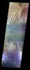
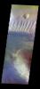
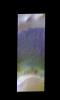
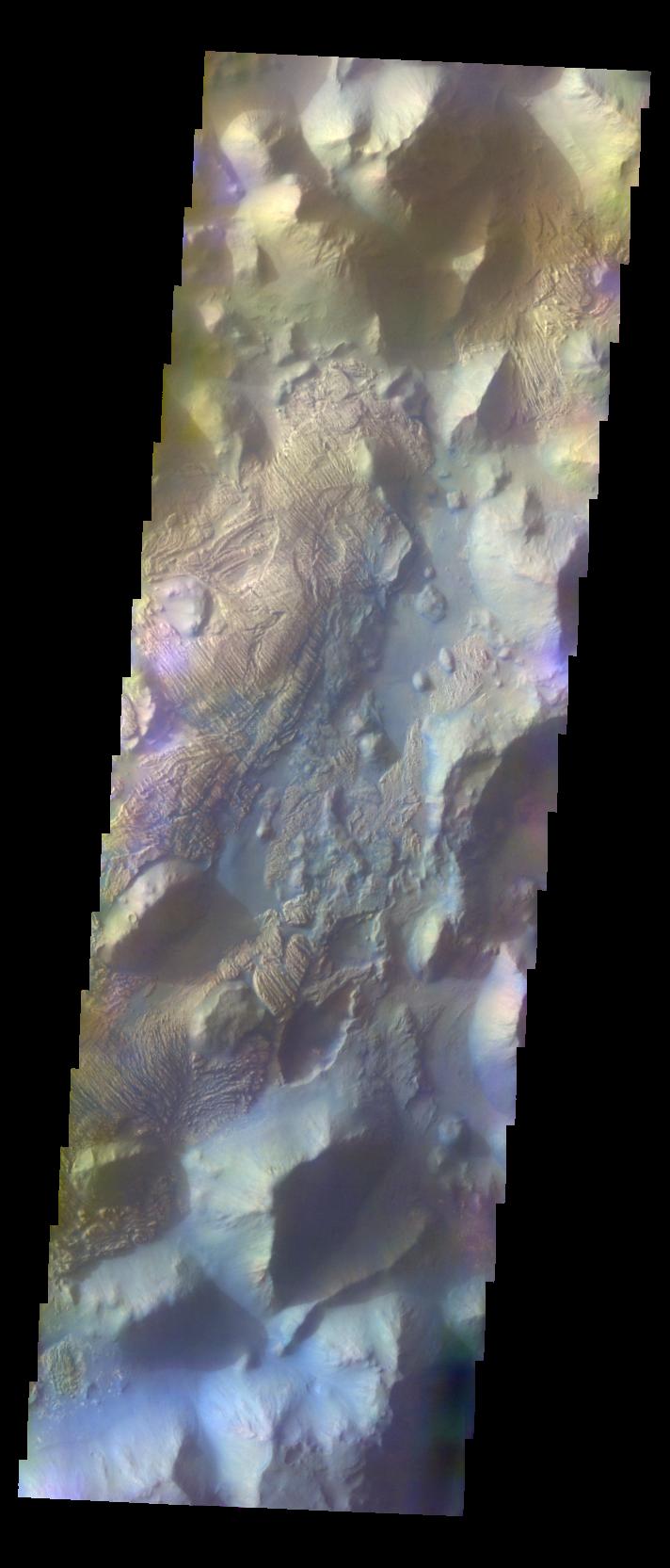
PIA19794:
-
Arabia Terra - False Color
Full Resolution:
TIFF
(2.683 MB)
JPEG
(175 kB)
|
|
|
2015-10-12 |
Mars
|
2001 Mars Odyssey
|
THEMIS
|
1406x2918x1 |
|
-
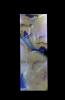
PIA19796:
-
The Martian, Part 1: Acidalia Planitia
Full Resolution:
TIFF
(3.302 MB)
JPEG
(560.8 kB)
|
|
|
2015-10-13 |
Mars
|
2001 Mars Odyssey
|
THEMIS
|
1356x2769x1 |
|
-
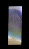
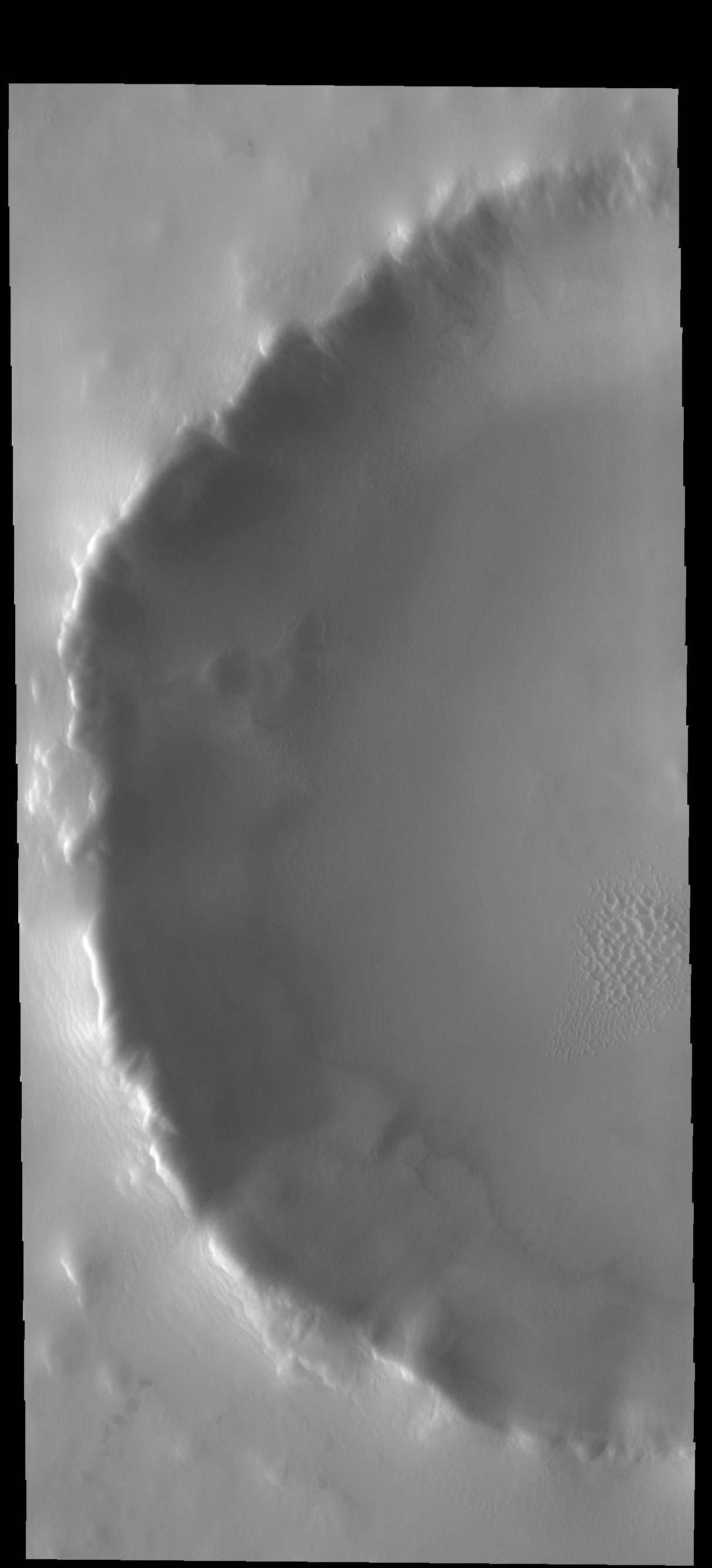
PIA19797:
-
The Martian, Part 2: Mawrth Valles
Full Resolution:
TIFF
(2.974 MB)
JPEG
(366.9 kB)
|
|
|
2015-10-13 |
Mars
|
Mars Science Laboratory (MSL)
|
MAHLI
|
7149x10036x3 |
|
-
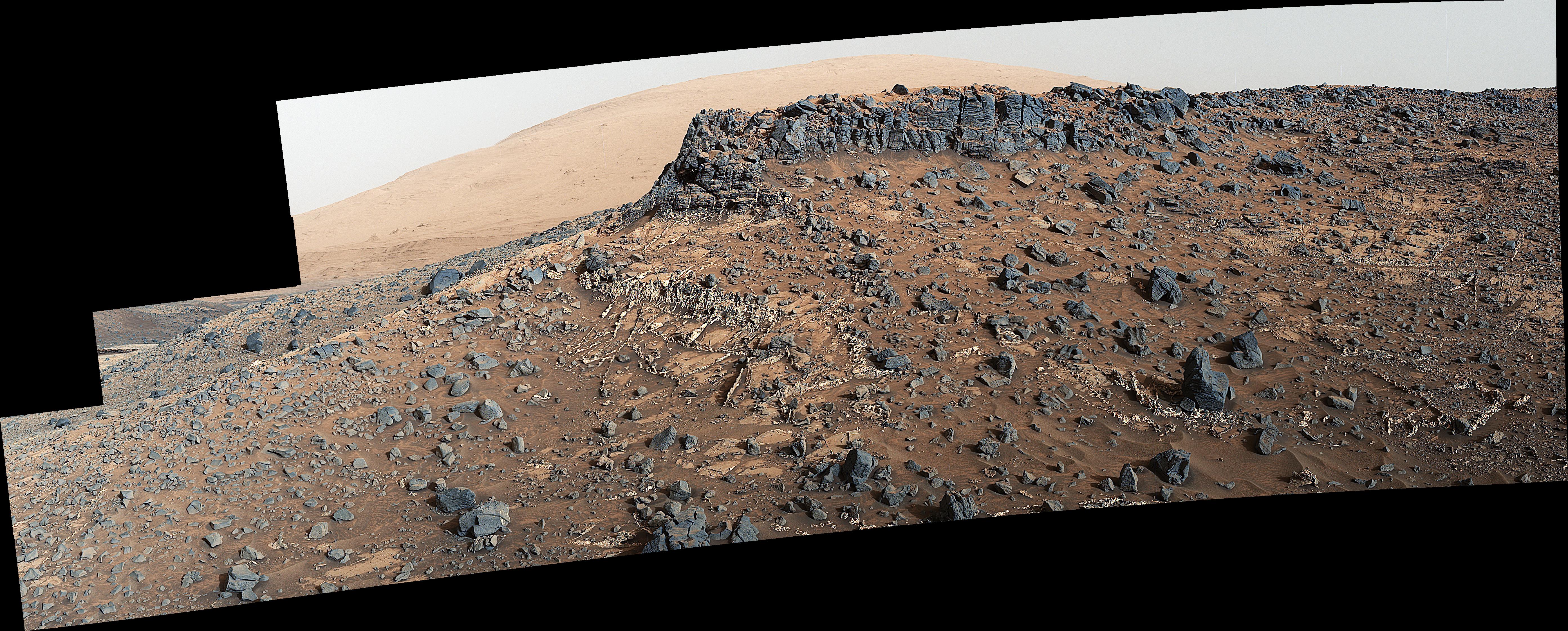
PIA19920:
-
Curiosity Self-Portrait at 'Big Sky' Drilling Site
Full Resolution:
TIFF
(165.6 MB)
JPEG
(5.999 MB)
|
|
|
2015-10-14 |
Mars
|
2001 Mars Odyssey
|
THEMIS
|
1396x3225x1 |
|
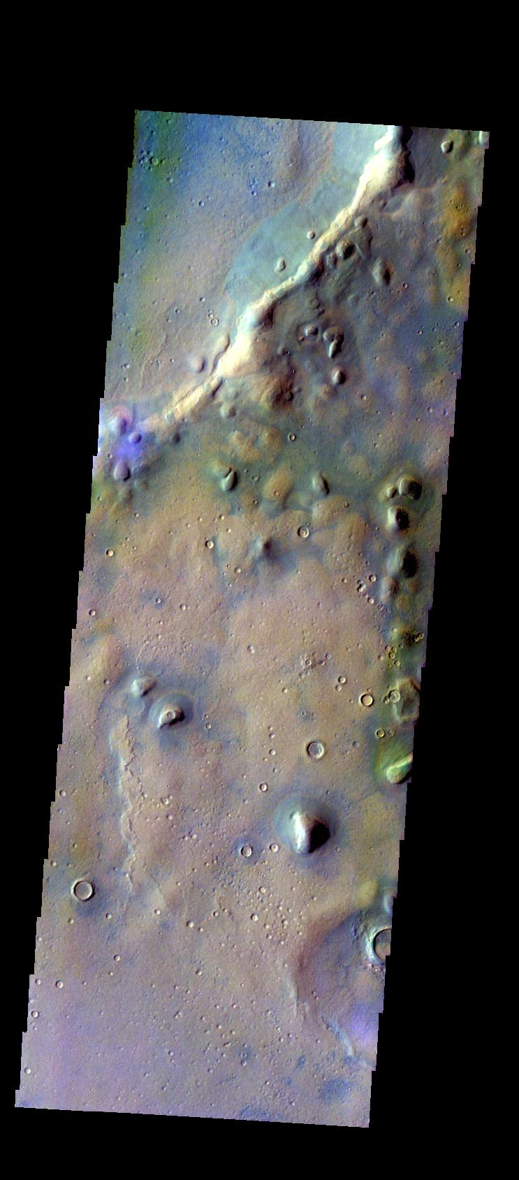
-
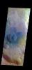
PIA19798:
-
The Martian, Part 3: Meridiani Planum
Full Resolution:
TIFF
(3.553 MB)
JPEG
(525.7 kB)
|
|
|
2015-10-14 |
Mars
|
Mars Reconnaissance Orbiter (MRO)
|
HiRISE
|
2880x1800x3 |
|
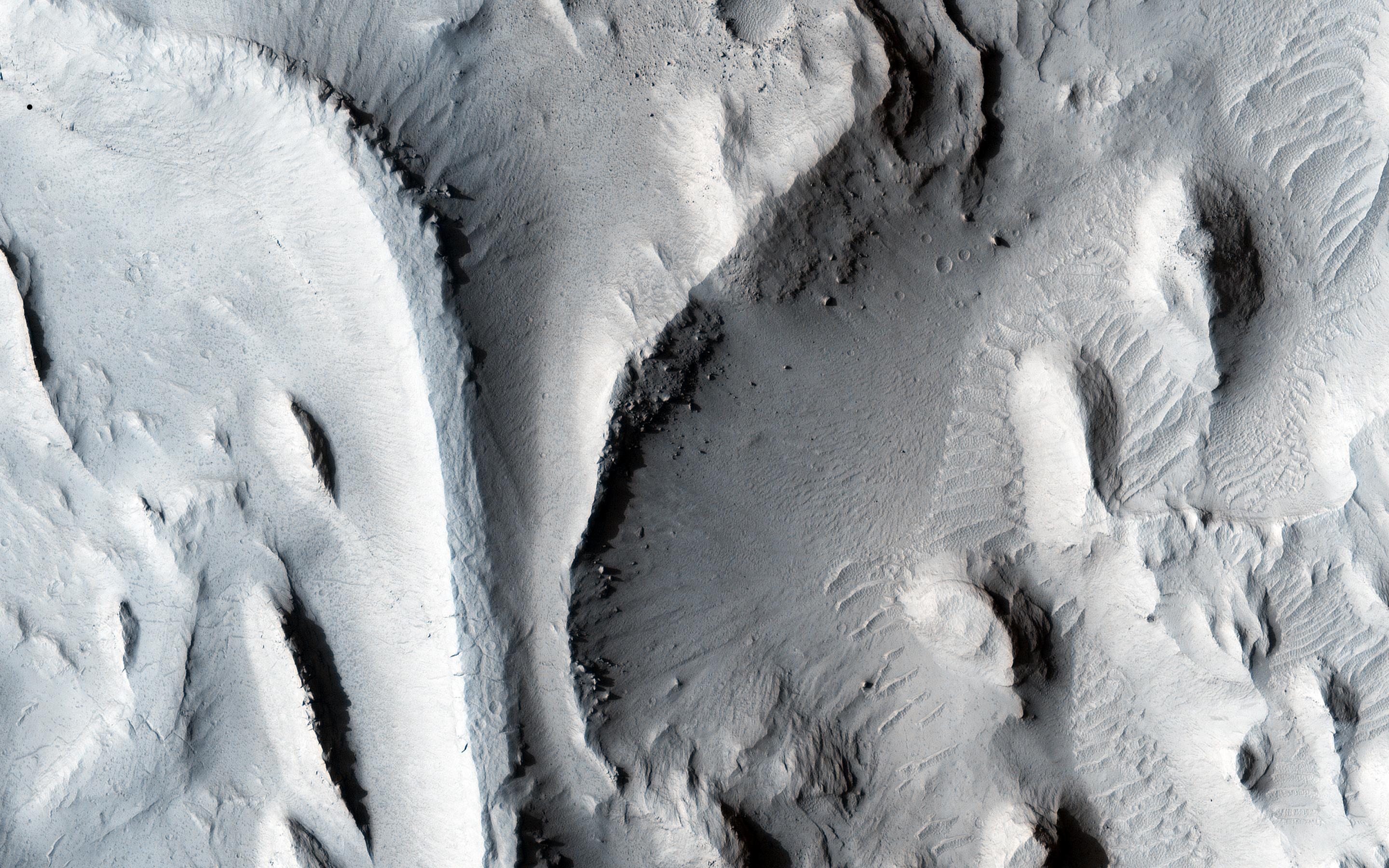
-
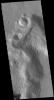
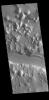
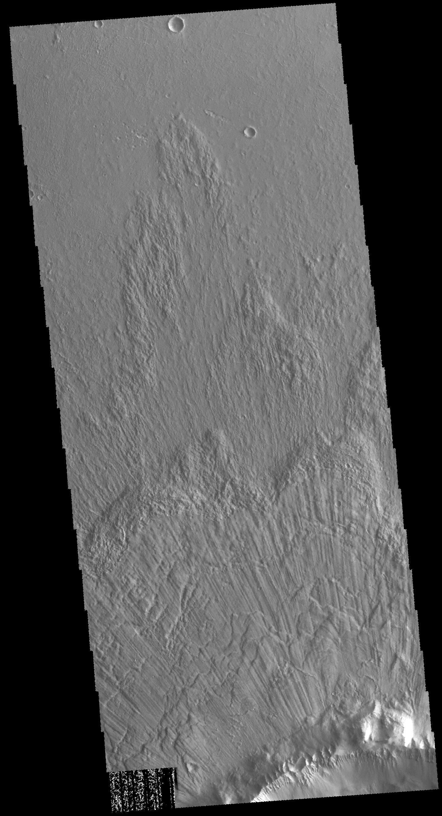
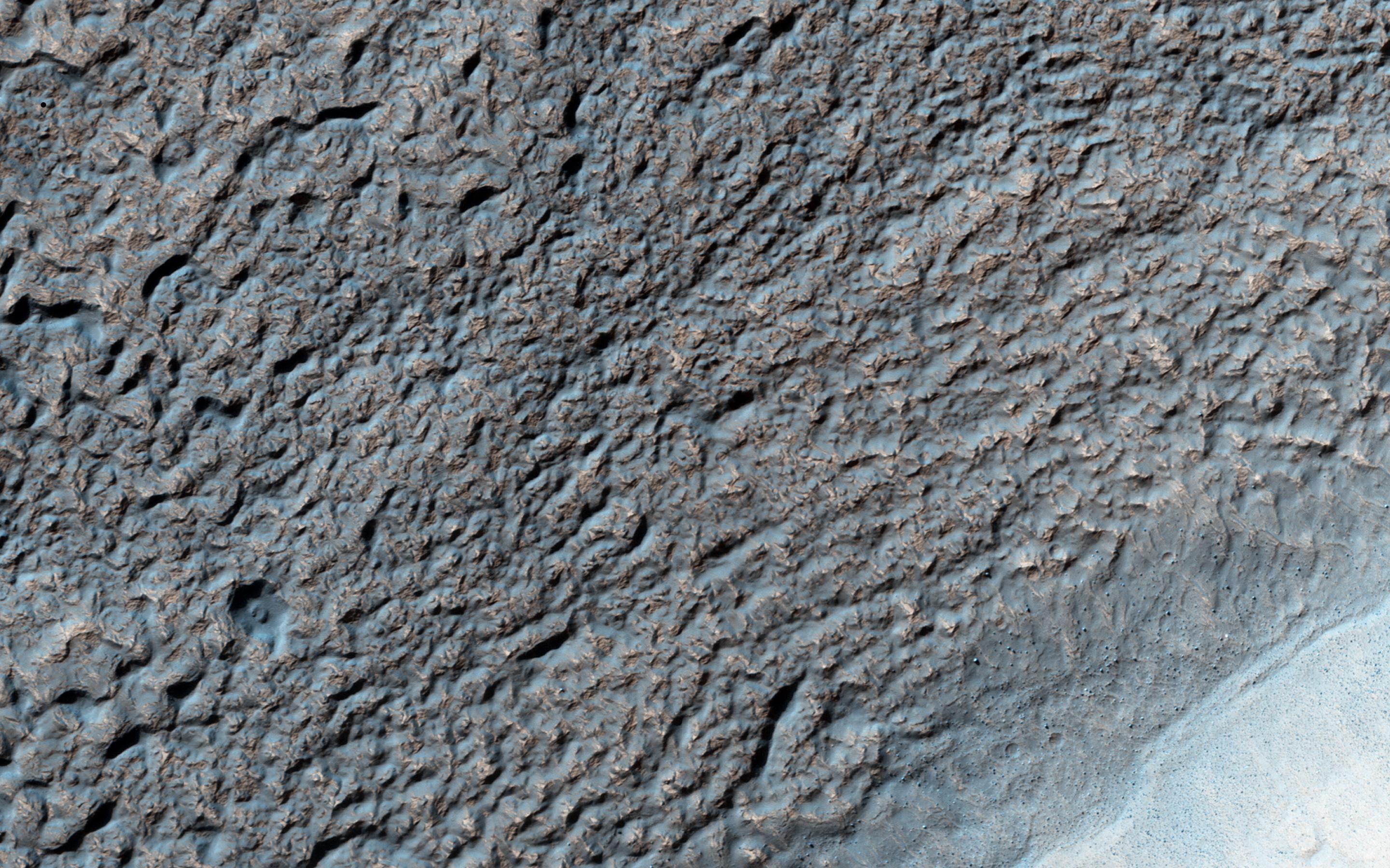
PIA20003:
-
A Cone Shaped Hill
Full Resolution:
TIFF
(14.25 MB)
JPEG
(766.5 kB)
|
|
|
2015-10-14 |
Mars
|
Mars Reconnaissance Orbiter (MRO)
|
HiRISE
|
2880x1800x3 |
|
-
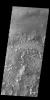
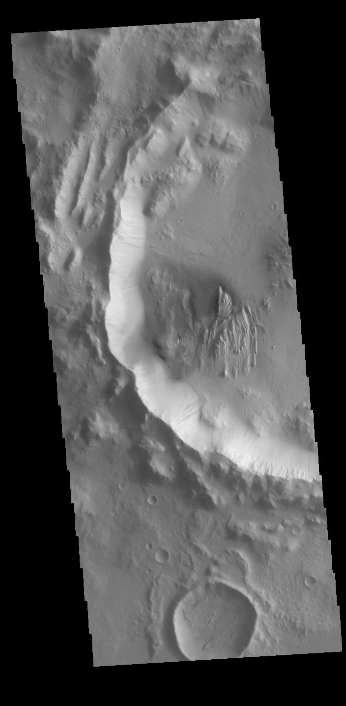
PIA20004:
-
Kasei Valles
Full Resolution:
TIFF
(5.191 MB)
JPEG
(987.8 kB)
|
|
|
2015-10-14 |
Mars
|
Mars Reconnaissance Orbiter (MRO)
|
HiRISE
|
2880x1800x3 |
|
-
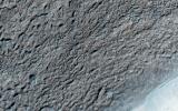
PIA20005:
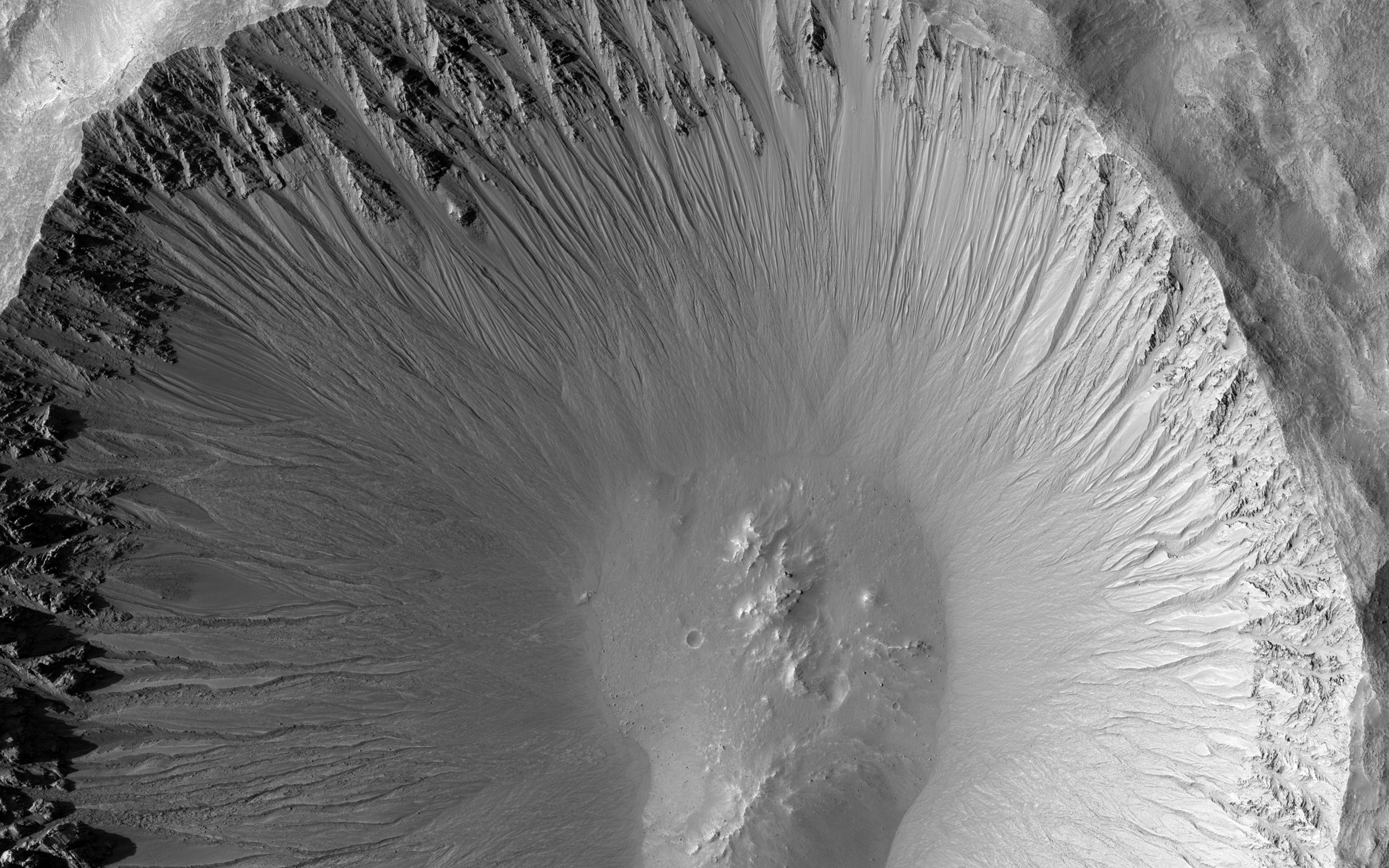
-
Gullies in a Central Pit Crater
Full Resolution:
TIFF
(15.56 MB)
JPEG
(885.4 kB)
|
|
|
2015-10-14 |
Mars
|
Mars Reconnaissance Orbiter (MRO)
|
HiRISE
|
2880x1800x3 |
|
-
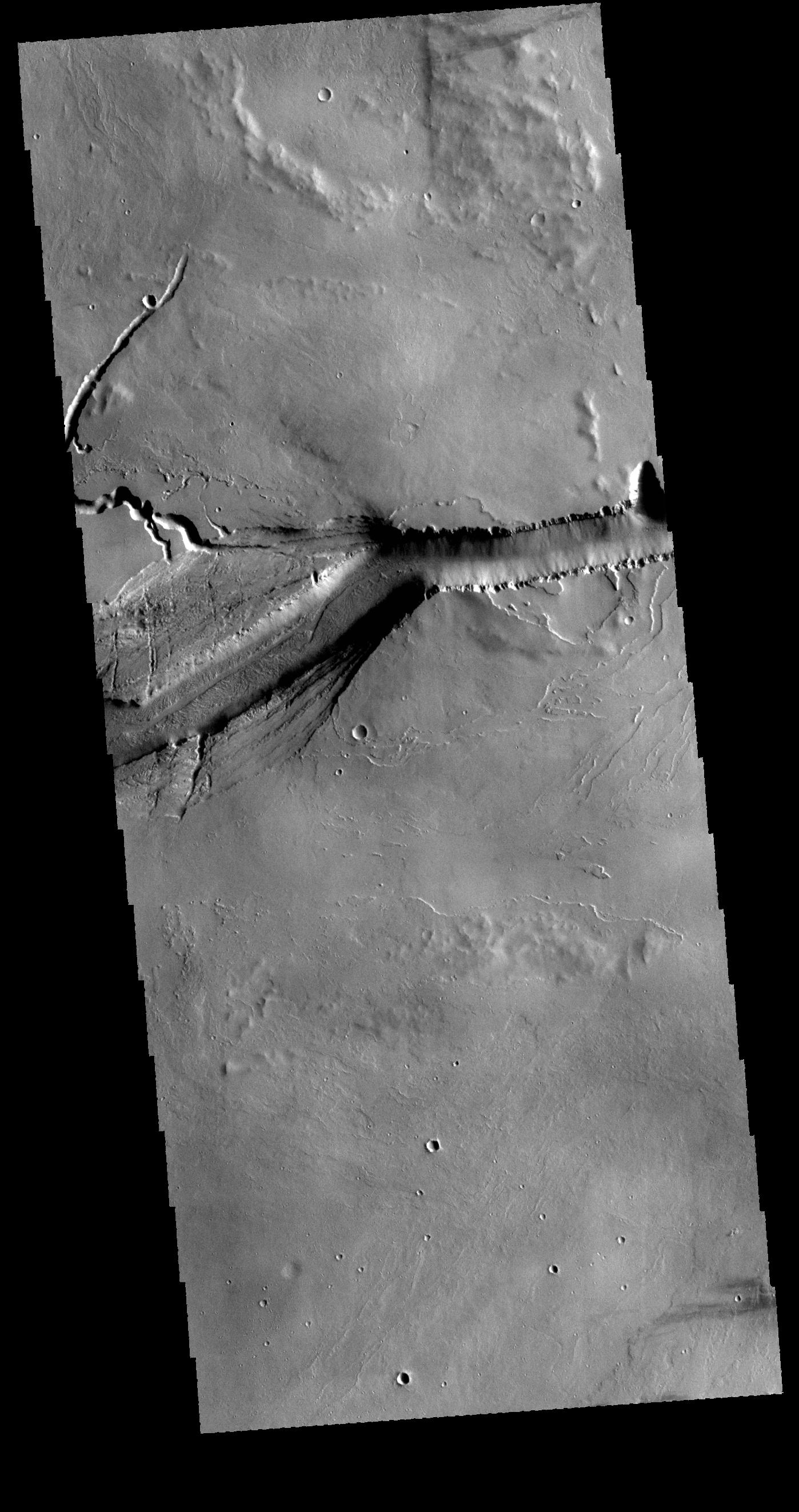
PIA20006:
-
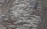
Fine-Branched Ridges
Full Resolution:
TIFF
(15.56 MB)
JPEG
(1.099 MB)
|
|
|
2015-10-15 |
Mars
|
2001 Mars Odyssey
|
THEMIS
|
1388x3222x1 |

|
-
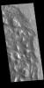
PIA19799:
-
The Martian, Part 4: Schiaparelli Crater Rim
Full Resolution:
TIFF
(3.232 MB)
JPEG
(328.6 kB)
|
|
|
2015-10-16 |
Mars
|
2001 Mars Odyssey
|
THEMIS
|
1325x2774x1 |
|
-
PIA19800:
-
The Martian, Part 5: Schiaparelli Crater Floor
Full Resolution:
TIFF
(3.138 MB)
JPEG
(595.6 kB)
|
|
|
2015-10-19 |
Mars
|
2001 Mars Odyssey
|
THEMIS
|
1400x2645x1 |
|
-
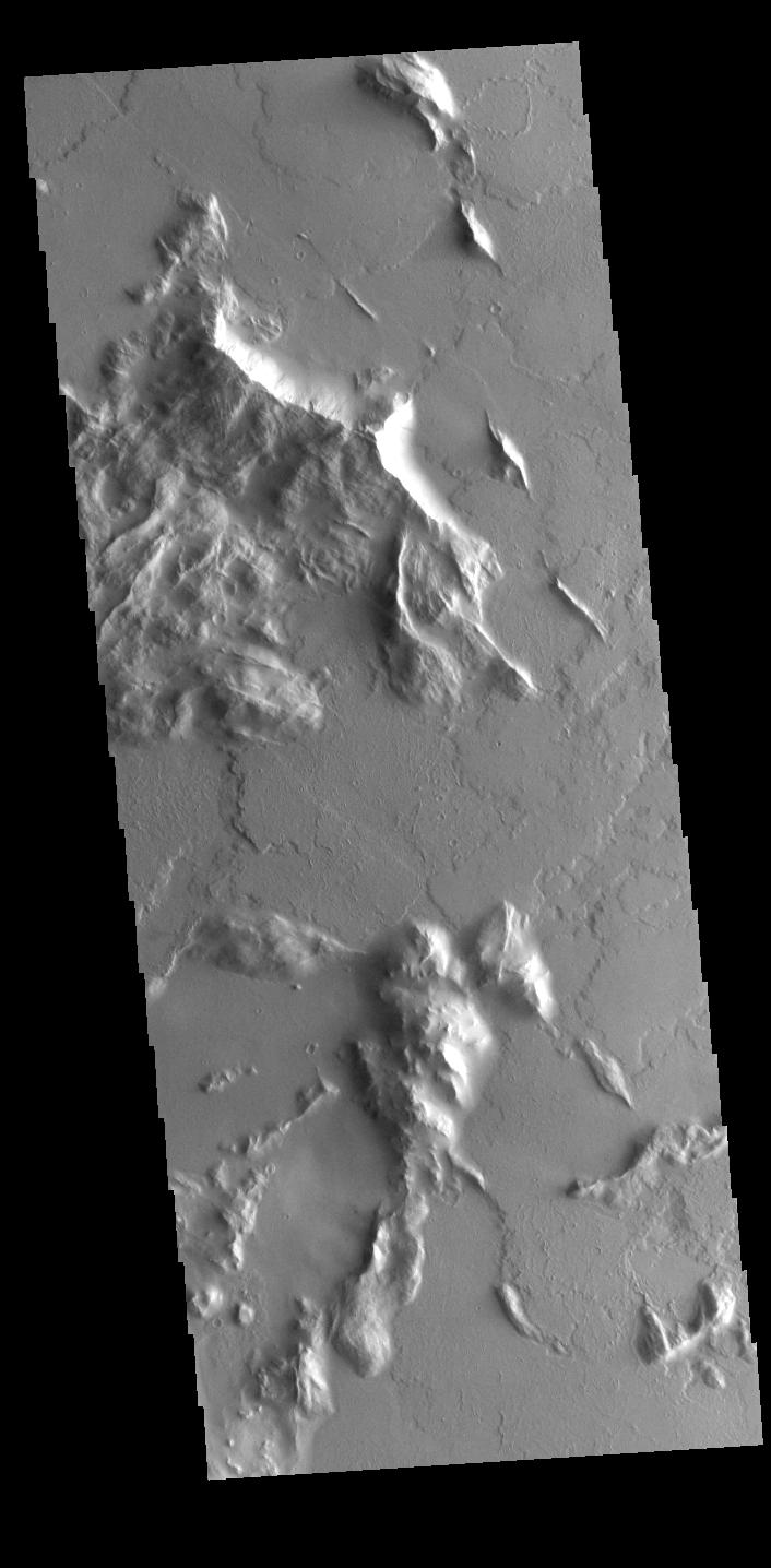
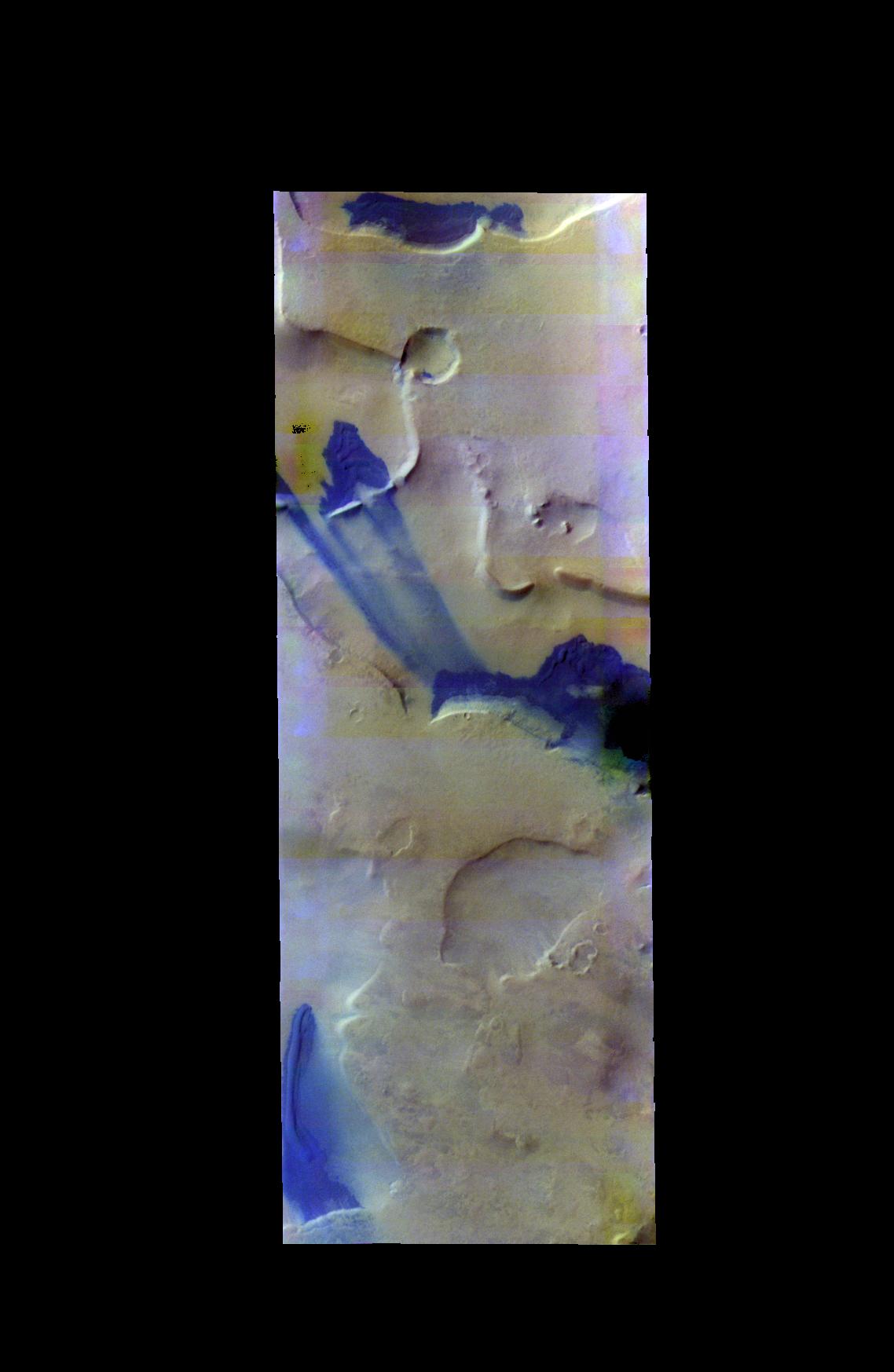
PIA20071:
-
Olympica Fossae
Full Resolution:
TIFF
(2.803 MB)
JPEG
(380.4 kB)
|
|
|
2015-10-20 |
Mars
|
2001 Mars Odyssey
|
THEMIS
|
711x1439x1 |
|
-
PIA20072:
-
Dark Slope Streaks
Full Resolution:
TIFF
(670.8 kB)
JPEG
(59.39 kB)
|
|
|
2015-10-21 |
Mars
|
2001 Mars Odyssey
|
THEMIS
|
1444x2657x1 |
|
-
PIA20073:
-
Channels
Full Resolution:
TIFF
(2.701 MB)
JPEG
(280.7 kB)
|
|
|
2015-10-22 |
Mars
|
2001 Mars Odyssey
|
THEMIS
|
668x1435x3 |
|
-
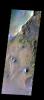
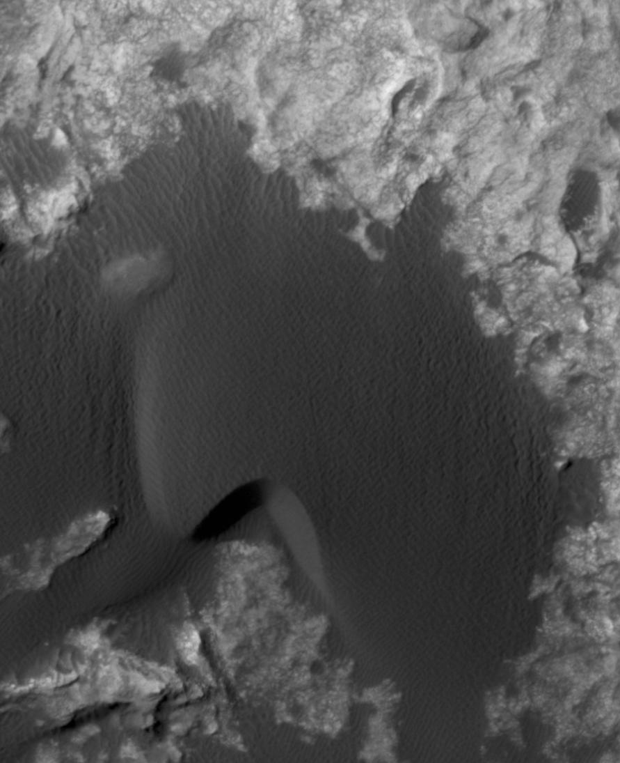
PIA20074:
-
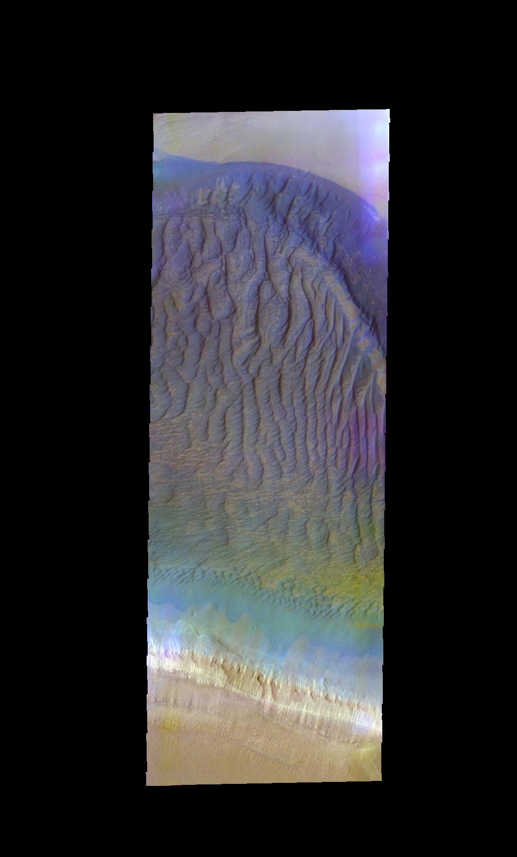
Proctor Crater Dunes - False Color
Full Resolution:
TIFF
(1.98 MB)
JPEG
(108 kB)
|
|
|
2015-10-23 |
Mars
|
2001 Mars Odyssey
|
THEMIS
|
606x2724x3 |
|
-
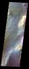
PIA20075:
-
Cloudy Day - False Color
Full Resolution:
TIFF
(2.215 MB)
JPEG
(94.62 kB)
|
|
|
2015-10-26 |
Mars
|
2001 Mars Odyssey
|
THEMIS
|
712x1665x3 |
|
-
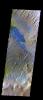
PIA20076:
-
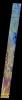
Aureum Chaos - False Color
Full Resolution:
TIFF
(2.557 MB)
JPEG
(99.74 kB)
|
|
|
2015-10-27 |
Mars
|
2001 Mars Odyssey
|
THEMIS
|
756x1690x3 |
|
-
PIA20078:
-
Bamberg Crater Dunes - False Color
Full Resolution:
TIFF
(2.601 MB)
JPEG
(127.3 kB)
|
|
|
2015-10-28 |
Mars
|
2001 Mars Odyssey
|
THEMIS
|
709x1665x3 |
|
-
PIA20079:
-
Capri Mensa - False Color
Full Resolution:
TIFF
(2.451 MB)
JPEG
(90.88 kB)
|
|
|
2015-10-29 |
Mars
|
2001 Mars Odyssey
|
THEMIS
|
712x1665x3 |

|
-
PIA20080:
-
Iani Chaos - False Color
Full Resolution:
TIFF
(2.564 MB)
JPEG
(98.89 kB)
|
|
|
2015-10-30 |
Mars
|
2001 Mars Odyssey
|
THEMIS
|
743x1687x3 |
|
-
PIA20081:
-
Tyndall Crater - False Color
Full Resolution:
TIFF
(2.606 MB)
JPEG
(138.4 kB)
|
|
|
2015-11-02 |
Mars
|
2001 Mars Odyssey
|
THEMIS
|
720x1668x3 |
|
-
PIA20082:
-
Danielson Crater Dunes - False Color
Full Resolution:
TIFF
(2.461 MB)
JPEG
(138.9 kB)
|
|
|
2015-11-03 |
Mars
|
2001 Mars Odyssey
|
THEMIS
|
1357x1951x3 |

|
-
PIA20083:
-
Escorial Crater- False Color
Full Resolution:
TIFF
(2.952 MB)
JPEG
(121 kB)
|
|
|
2015-11-04 |
Mars
|
2001 Mars Odyssey
|
THEMIS
|
711x1665x3 |
|
-
PIA20084:
-
Hebes Chasma - False Color
Full Resolution:
TIFF
(2.418 MB)
JPEG
(99.01 kB)
|
|
|
2015-11-05 |
Mars
|
Mars Reconnaissance Orbiter (MRO)
|
HiRISE
|
2880x1800x3 |
|
-
PIA20044:
-
Layers and Fractures in Ophir Chasma
Full Resolution:
TIFF
(15.56 MB)
JPEG
(815.3 kB)
|
|
|
2015-11-05 |
Mars
|
Mars Reconnaissance Orbiter (MRO)
|
HiRISE
|
2880x1800x1 |

|
-
PIA20045:
-
Marching Dust Devils
Full Resolution:
TIFF
(5.191 MB)
JPEG
(1.254 MB)
|
|
|
2015-11-05 |
Mars
|
Mars Reconnaissance Orbiter (MRO)
|
HiRISE
|
2880x1800x3 |

|
-
PIA20046:
-
Small Channels and a Rocky Patch in the Cydonia Region
Full Resolution:
TIFF
(15.56 MB)
JPEG
(1.167 MB)
|
|
|
2015-11-05 |
Mars
|
Mars Reconnaissance Orbiter (MRO)
|
HiRISE
|
2880x1800x3 |
|
-
PIA20047:
-
Meanders in Ridge Form in the Zephyria Region
Full Resolution:
TIFF
(13.52 MB)
JPEG
(673.1 kB)
|
|
|
2015-11-05 |
Mars
|
2001 Mars Odyssey
|
THEMIS
|
733x1674x3 |
|
-
PIA20085:
-
Becquerel Crater - False Color
Full Resolution:
TIFF
(2.544 MB)
JPEG
(123.7 kB)
|
|
|
2015-11-06 |
Mars
|
2001 Mars Odyssey
|
THEMIS
|
712x1665x3 |
|
-
PIA20087:
-
Candor Chasma - False Color
Full Resolution:
TIFF
(2.59 MB)
JPEG
(108.4 kB)
|
|
|
2015-11-09 |
Mars
|
2001 Mars Odyssey
|
THEMIS
|
1437x2654x1 |

|
-
PIA20088:
-
Bacolor Crater Ejecta
Full Resolution:
TIFF
(2.789 MB)
JPEG
(408.4 kB)
|
|
|
2015-11-10 |
Mars
|
2001 Mars Odyssey
|
THEMIS
|
1423x2651x1 |
|
-
PIA20089:
-
Auqakuh Vallis
Full Resolution:
TIFF
(2.683 MB)
JPEG
(289.1 kB)
|
|
|
2015-11-11 |
Mars
|
2001 Mars Odyssey
|
THEMIS
|
723x1459x1 |
|
-
PIA20090:
-
Crater Chaos
Full Resolution:
TIFF
(775.6 kB)
JPEG
(96.58 kB)
|
|
|
2015-11-11 |
Mars
|
Mars Science Laboratory (MSL)
|
Mastcam
|
5572x2246x3 |
|
-
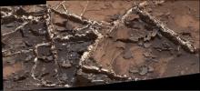
PIA19921:
-
Veiny 'Garden City' Site and Surroundings on Mount Sharp, Mars
Full Resolution:
TIFF
(30.62 MB)
JPEG
(2.718 MB)
|
|
|
2015-11-11 |
Mars
|
Mars Science Laboratory (MSL)
|
Mastcam
|
1505x685x3 |
|
-
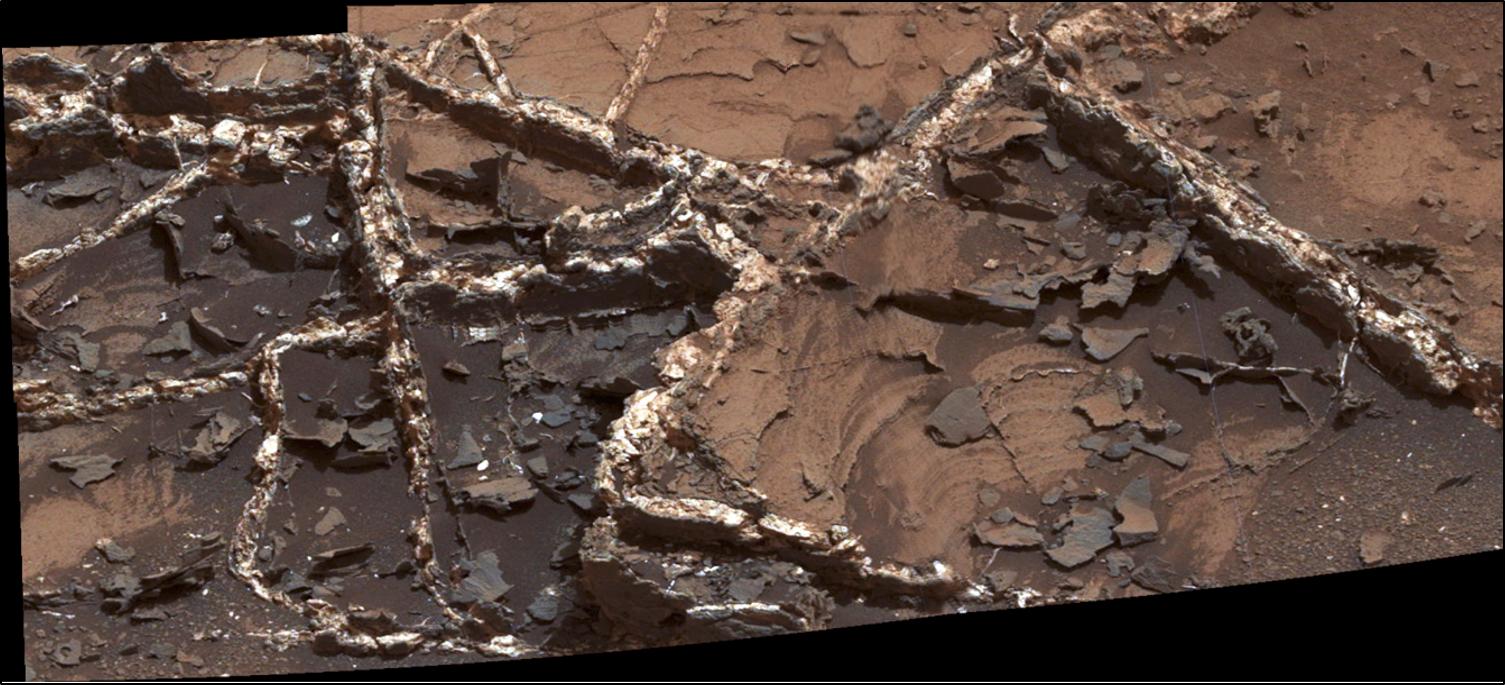
PIA19922:
-
'Garden City' Vein Complex on Lower Mount Sharp, Mars
Full Resolution:
TIFF
(3.093 MB)
JPEG
(179.7 kB)
|
|
|
2015-11-11 |
Mars
|
Mars Science Laboratory (MSL)
|
ChemCam
|
949x396x3 |
|
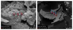
-
PIA19923:
-
Dark, Thin Fracture-Filling Material
Full Resolution:
TIFF
(554.9 kB)
JPEG
(50.57 kB)
|
|
|
2015-11-11 |
Mars
|
Mars Science Laboratory (MSL)
|
ChemCam
|
847x388x1 |
|
-
PIA19924:
-
Thick, Dark Veins at 'Garden City,' Mars
Full Resolution:
TIFF
(311.2 kB)
JPEG
(49.1 kB)
|
|
|
2015-11-11 |
Mars
|
Mars Science Laboratory (MSL)
|
MAHLI
|
628x446x3 |
|
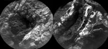
-
PIA19925:
-
Crystal Growth Texture in Light Vein at 'Garden City'
Full Resolution:
TIFF
(840.8 kB)
JPEG
(60.26 kB)
|
|
|
2015-11-11 |
Mars
|
Mars Science Laboratory (MSL)
|
MAHLI
|
573x438x3 |
|
-
PIA19926:
-
Injection of Light Material into an Older Dark Vein
Full Resolution:
TIFF
(753.4 kB)
JPEG
(40.18 kB)
|
|
|
2015-11-11 |
Mars
|
Mars Science Laboratory (MSL)
|
MAHLI
|
570x451x3 |
|
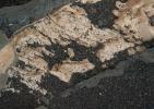
-
PIA19927:
-
Light Material Ripped Up Older Dark Vein Material
Full Resolution:
TIFF
(771.7 kB)
JPEG
(55.89 kB)
|
|
|
2015-11-12 |
Mars
|
2001 Mars Odyssey
|
THEMIS
|
1174x2595x1 |
|
-
PIA20091:
-
Olympia Undae
Full Resolution:
TIFF
(3.05 MB)
JPEG
(519.1 kB)
|
|
|
2015-11-13 |
Mars
|
2001 Mars Odyssey
|
THEMIS
|
714x1439x1 |
|
-
PIA20092:
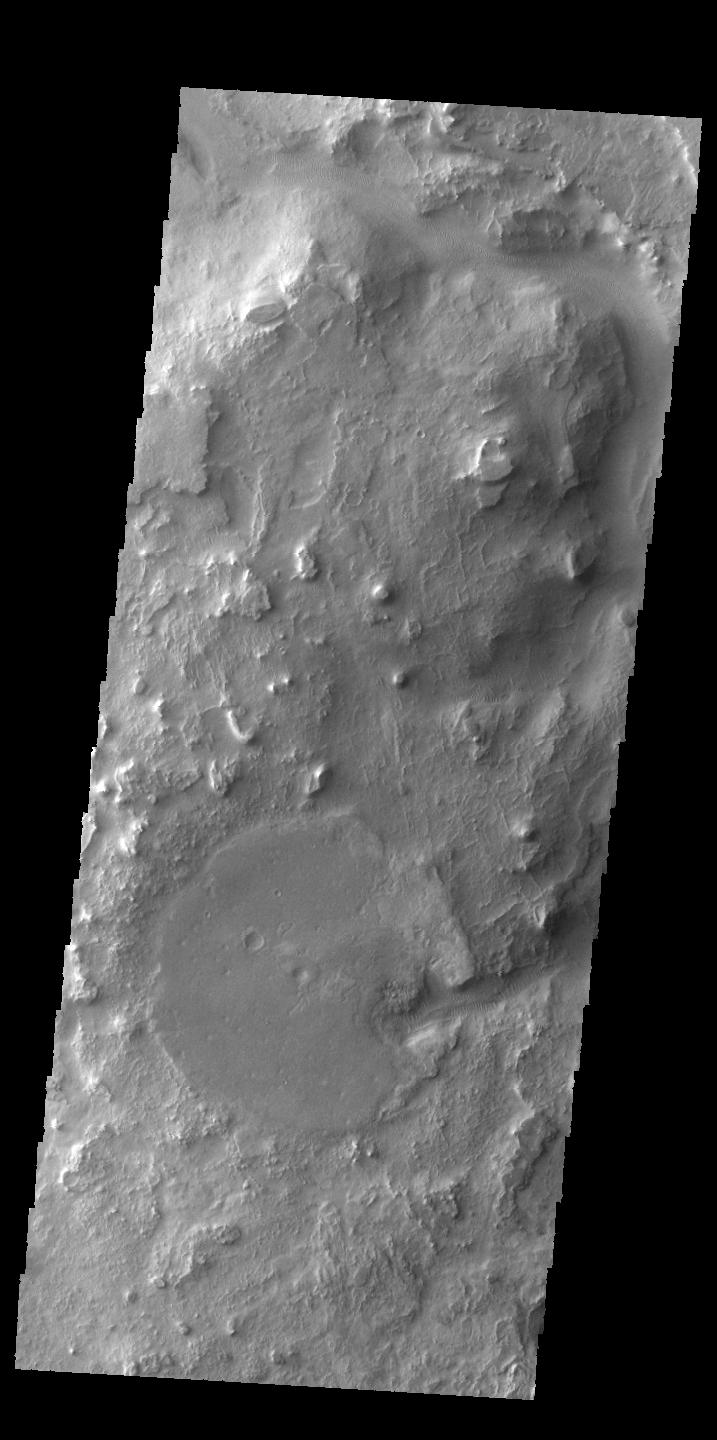
-
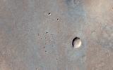
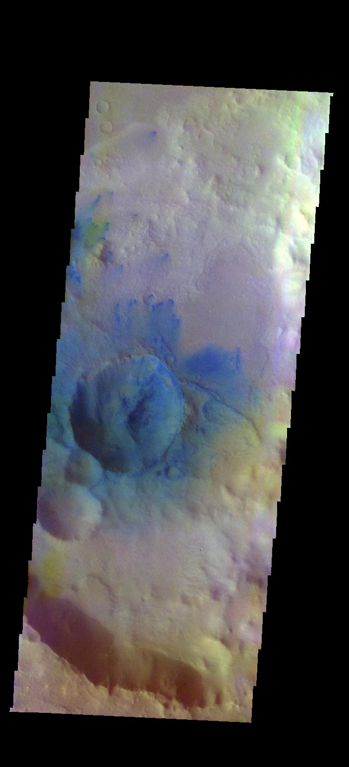
Central Pit Crater
Full Resolution:
TIFF
(706.8 kB)
JPEG
(77.56 kB)
|
|
|
2015-11-16 |
Mars
|
2001 Mars Odyssey
|
THEMIS
|
706x1436x1 |
|
-
PIA20093:
-
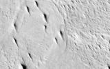
Ridges and Flows
Full Resolution:
TIFF
(728.2 kB)
JPEG
(89.67 kB)
|
|
|
2015-11-16 |
Mars
|
Mars Science Laboratory (MSL)
|
Mastcam
|
5288x1703x3 |

|
-
PIA19928:
-
Curiosity Rover Will Study Dunes on Route up Mountain
Full Resolution:
TIFF
(16.7 MB)
JPEG
(1.074 MB)
|
|
|
2015-11-16 |
Mars
|
Mars Science Laboratory (MSL)
|
Mastcam
|
2391x1265x3 |

|
-
PIA19929:
-
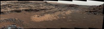
Glimpse of 'Bagnold Dunes' Edging Mount Sharp
Full Resolution:
TIFF
(8.223 MB)
JPEG
(521.4 kB)
|
|
|
2015-11-16 |
Mars
|
Mars Science Laboratory (MSL)
|
HiRISE
|
1804x1368x3 |

|
-
PIA19930:
-
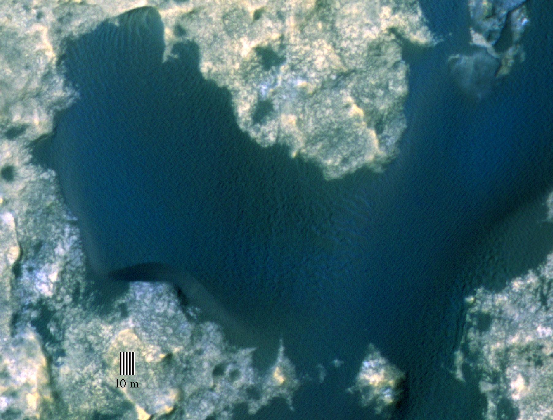
Orbital View of Dune That Curiosity Will Visit
Full Resolution:
TIFF
(7.407 MB)
JPEG
(306 kB)
|
|
|
2015-11-16 |
Mars
|
Mars Science Laboratory (MSL)
|
HiRISE
|
891x1095x1 |

|
-
PIA20161:
-
Change Observed in Martian Sand Dune
Full Resolution:
TIFF
(875.3 kB)
JPEG
(87.75 kB)
|
|
|
2015-11-16 |
Mars
|
Mars Science Laboratory (MSL)
|
HiRISE
|
3300x2550x3 |
|
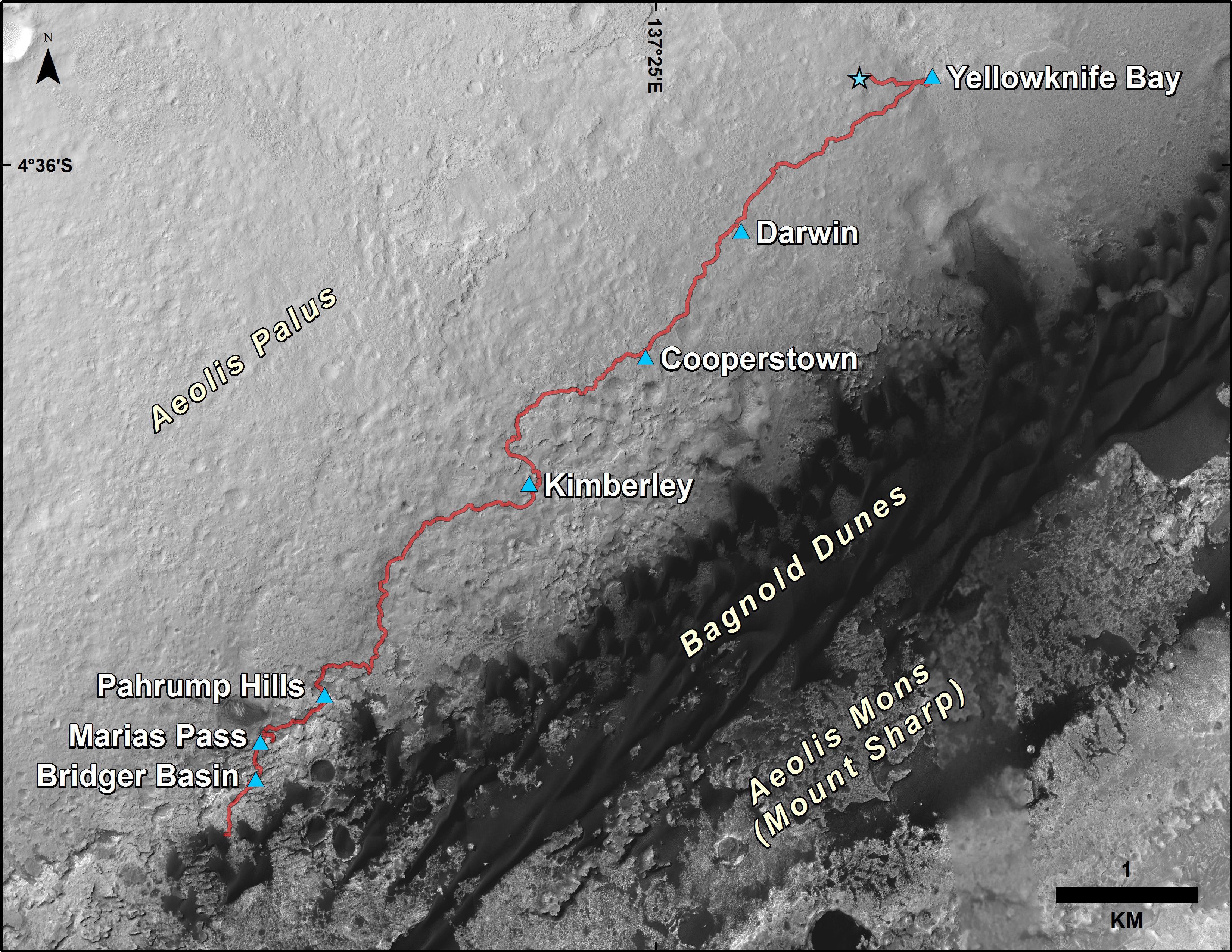
-
PIA20162:
-
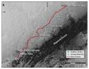
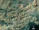
Curiosity Rover's Traverse, First 1,163 Sols on Mars
Full Resolution:
TIFF
(12.23 MB)
JPEG
(1.431 MB)
|
|
|
2015-11-17 |
Mars
|
2001 Mars Odyssey
|
THEMIS
|
1396x2646x1 |

|
-
PIA20094:
-
Sacra Fossae
Full Resolution:
TIFF
(2.452 MB)
JPEG
(246.8 kB)
|
|
|
2015-11-18 |
Mars
|
2001 Mars Odyssey
|
THEMIS
|
1158x2583x1 |
|
-
PIA20095:
-
Olympia Rupes
Full Resolution:
TIFF
(2.187 MB)
JPEG
(123 kB)
|
|
|
2015-11-19 |
Mars
|
2001 Mars Odyssey
|
THEMIS
|
1167x2584x1 |
|
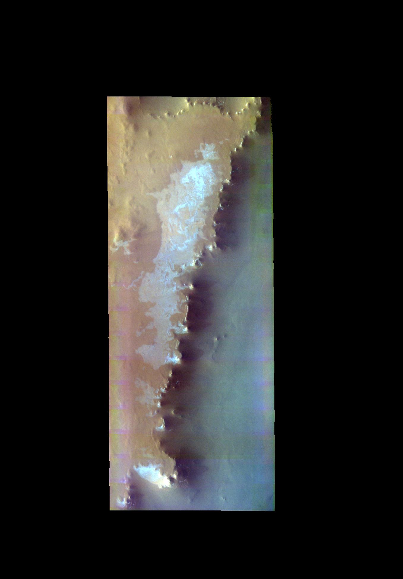
-
PIA20096:
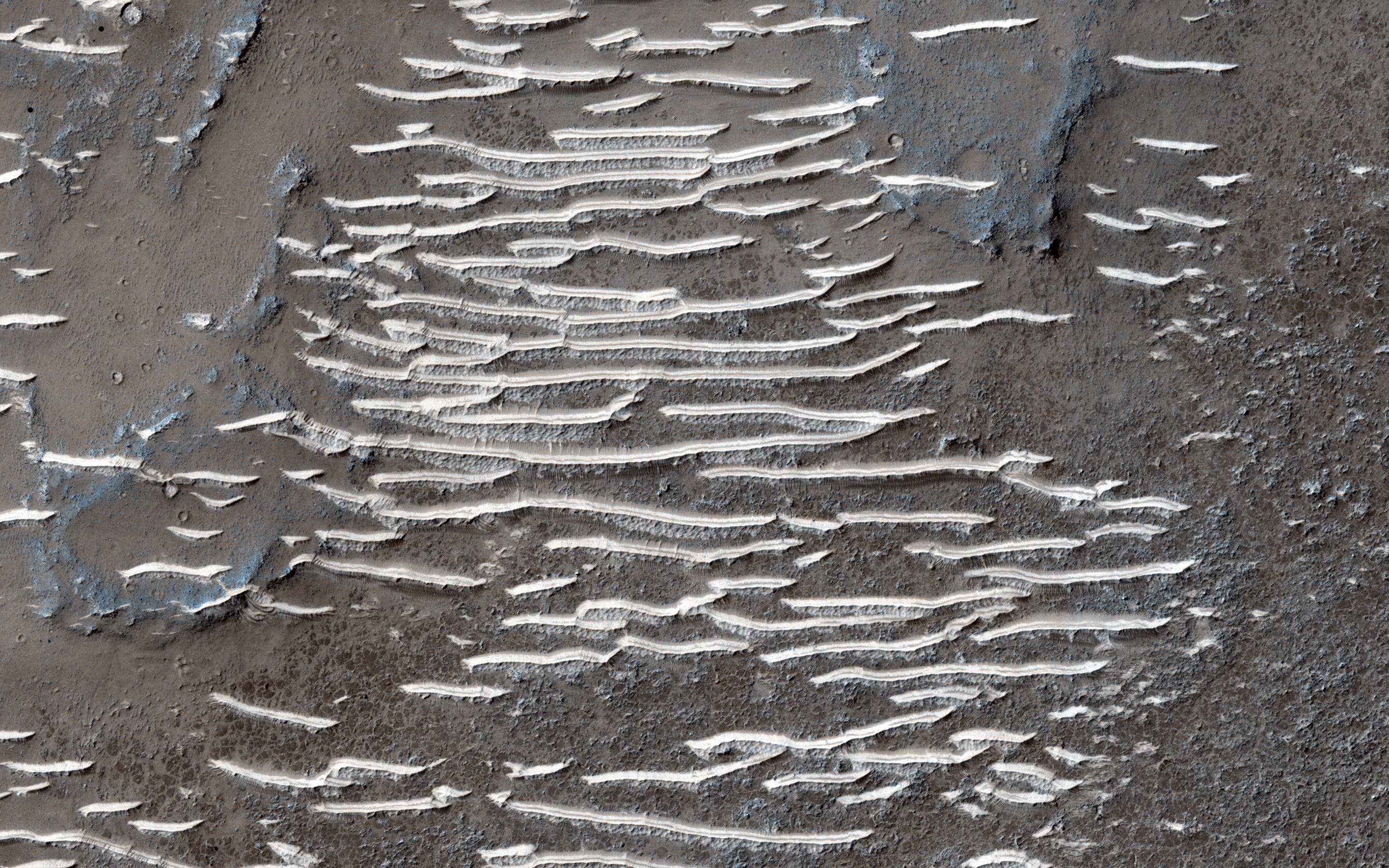
-
Polar Cap Layers
Full Resolution:
TIFF
(2.608 MB)
JPEG
(227.7 kB)
|
|
|
2015-11-20 |
Mars
|
2001 Mars Odyssey
|
THEMIS
|
712x1448x1 |

|
-
PIA20097:
-
Channels
Full Resolution:
TIFF
(705.9 kB)
JPEG
(75.31 kB)
|
|
|
2015-11-23 |
Mars
|
2001 Mars Odyssey
|
THEMIS
|
714x1448x1 |
|
-
PIA20098:
-
Granicus Valles
Full Resolution:
TIFF
(775.6 kB)
JPEG
(125 kB)
|
|
|
2015-11-24 |
Mars
|
2001 Mars Odyssey
|
THEMIS
|
716x1453x1 |
|
-
PIA20099:
-
Tanaica Montes
Full Resolution:
TIFF
(722.8 kB)
JPEG
(79.18 kB)
|
|
|
2015-11-24 |
Mars
|
Mars Science Laboratory (MSL)
|
|
1000x1650x3 |
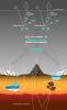
|
-
PIA20163:
-
Carbon Exchange and Loss Processes on Mars
Full Resolution:
TIFF
(387.2 kB)
JPEG
(116.4 kB)
|
|
|
2015-11-25 |
Mars
|
2001 Mars Odyssey
|
THEMIS
|
697x1431x1 |

|
-
PIA20100:
-
Shalbatana Vallis
Full Resolution:
TIFF
(683.5 kB)
JPEG
(72.42 kB)
|
|
|
2015-11-26 |
Mars
|
2001 Mars Odyssey
|
THEMIS
|
1212x2667x1 |
|
-
PIA20101:
-
Frosty Crater
Full Resolution:
TIFF
(2.243 MB)
JPEG
(119.7 kB)
|
|
|
2015-11-27 |
Mars
|
2001 Mars Odyssey
|
THEMIS
|
605x2729x3 |
|
-
PIA20102:
-
Sirenum Fossae - False Color
Full Resolution:
TIFF
(2.263 MB)
JPEG
(161.3 kB)
|
|
|
2015-11-27 |
Mars
|
Mars Reconnaissance Orbiter (MRO)
|
HiRISE
|
2880x1800x3 |
|
-
PIA20157:
-
Down in the Paleochannels
Full Resolution:
TIFF
(15.56 MB)
JPEG
(1.072 MB)
|
|
|
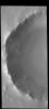
2015-11-27 |
Mars
|
Mars Reconnaissance Orbiter (MRO)
|
HiRISE
|
2880x1800x1 |

|
-
PIA20158:
-
A Youthful Crater in the Cydonia Colles Region
Full Resolution:
TIFF
(5.191 MB)
JPEG
(819.4 kB)
|
|
|
2015-11-27 |
Mars
|
Mars Reconnaissance Orbiter (MRO)
|
HiRISE
|
2880x1800x3 |
|
-
PIA20159:
-
A Landing Site for ExoMars 2016
Full Resolution:
TIFF
(15.56 MB)
JPEG
(1.932 MB)
|
|
|
2015-11-27 |
Mars
|
Mars Reconnaissance Orbiter (MRO)
|
HiRISE
|
2880x1800x1 |
|
-
PIA20160:
-
Inverted Meandering Rivers at a Possible Future Mars Landing Site
Full Resolution:
TIFF
(5.055 MB)
JPEG
(832.6 kB)
|
|
|
2015-11-30 |
Mars
|
2001 Mars Odyssey
|
THEMIS
|
690x1539x3 |
|
-
PIA20103:
-
Candor Chasma - False Color
Full Resolution:
TIFF
(2.162 MB)
JPEG
(82.09 kB)
|
|
|
2015-12-01 |
Mars
|
2001 Mars Odyssey
|
THEMIS
|
1138x1747x3 |
|
-
PIA20105:
-
Dunes - False Color
Full Resolution:
TIFF
(2.328 MB)
JPEG
(102 kB)
|
|
|
2015-12-02 |
Mars
|
2001 Mars Odyssey
|
THEMIS
|
1040x1723x3 |
|
-
PIA20106:
-
Southern Dunes - False Color
Full Resolution:
TIFF
(2.239 MB)
JPEG
(105 kB)
|
|
|
2015-12-03 |
Mars
|
2001 Mars Odyssey
|
THEMIS
|
704x1545x3 |
|
-
PIA20107:
-
Sand Dunes - False Color
Full Resolution:
TIFF
(2.21 MB)
JPEG
(79.37 kB)
|
|
|
2015-12-04 |
Mars
|
2001 Mars Odyssey
|
THEMIS
|
1036x1721x3 |
|
-
PIA20108:
-
Southern Dunes - False Color
Full Resolution:
TIFF
(2.149 MB)
JPEG
(83.74 kB)
|
|
|
2015-12-07 |
Mars
|
2001 Mars Odyssey
|
THEMIS
|
716x1449x1 |
|
-
PIA20109:
-
A Hill Divided
Full Resolution:
TIFF
(742.5 kB)
JPEG
(90.83 kB)
|
|
|
2015-12-08 |
Mars
|
2001 Mars Odyssey
|
THEMIS
|
717x1440x1 |

|
-
PIA20110:
-
Huo-Hsing Vallis
Full Resolution:
TIFF
(768.7 kB)
JPEG
(102.8 kB)
|
|
|
2015-12-09 |
Mars
|
2001 Mars Odyssey
|
THEMIS
|
724x1447x1 |
|
-
PIA20111:
-
Textures
Full Resolution:
TIFF
(802.6 kB)
JPEG
(128.6 kB)
|
|
|
2015-12-10 |
Mars
|
Mars Reconnaissance Orbiter (MRO)
|
HiRISE
|
2880x1800x3 |
|
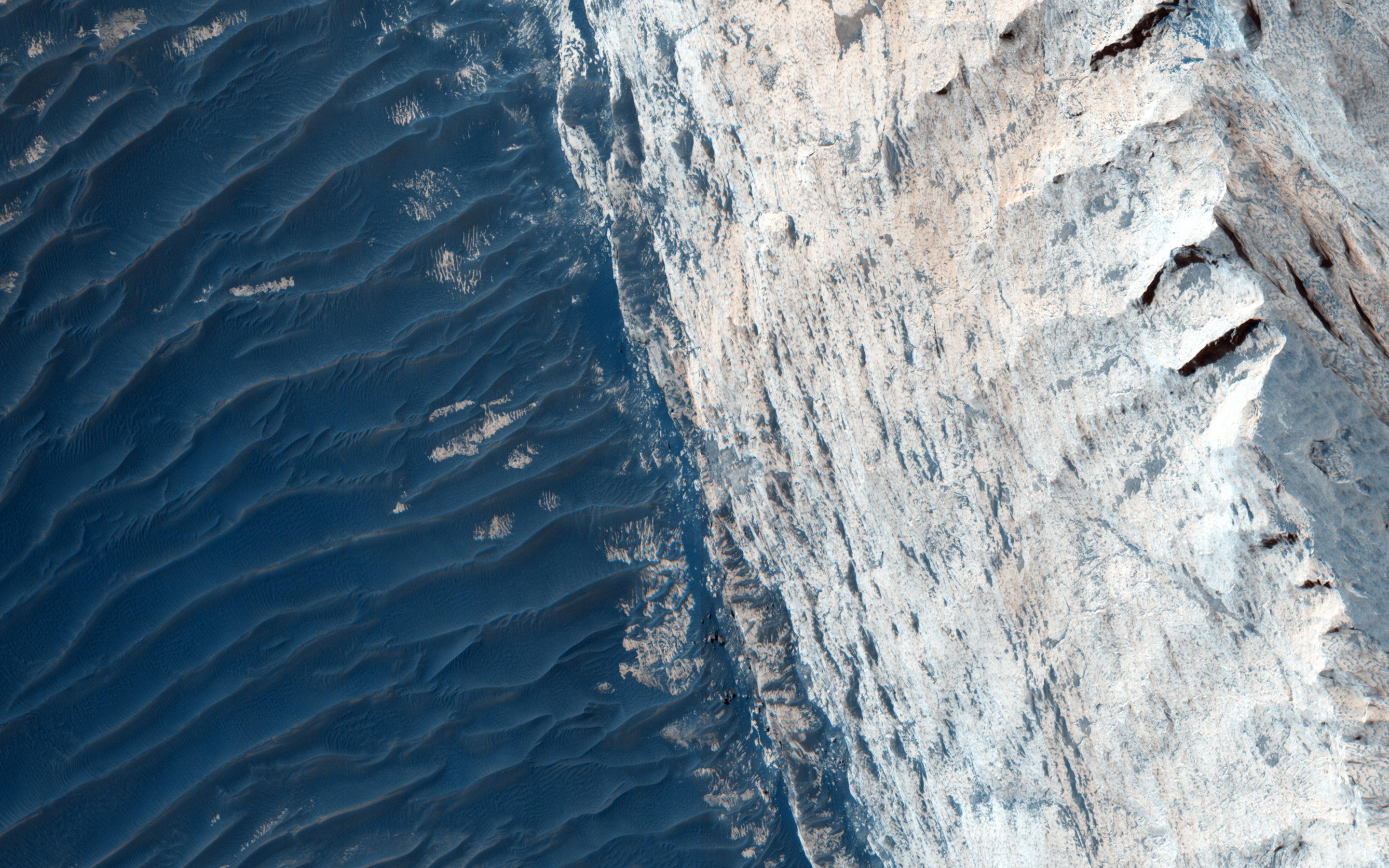
-
PIA20208:
-
The Coming and Going of Ice
Full Resolution:
TIFF
(15.56 MB)
JPEG
(898.6 kB)
|
|
|
2015-12-10 |
Mars
|
Mars Reconnaissance Orbiter (MRO)
|
HiRISE
|
2880x1800x3 |
|
-
PIA20209:
-
Strange Patterns in Echus Chasma
Full Resolution:
TIFF
(15.56 MB)
JPEG
(1.477 MB)
|
|
|
2015-12-10 |
Mars
|
Mars Reconnaissance Orbiter (MRO)
|
HiRISE
|
2880x1800x3 |
|
-
PIA20210:
-
Inverted Streams in the Aeolis Region
Full Resolution:
TIFF
(15.56 MB)
JPEG
(902.3 kB)
|
|
|
2015-12-10 |
Mars
|
Mars Reconnaissance Orbiter (MRO)
|
HiRISE
|
2880x1800x3 |
|
-
PIA20211:
-
Curiosity Trek
Full Resolution:
TIFF
(15.56 MB)
JPEG
(873.1 kB)
|
|
|
2015-12-10 |
Mars
|
2001 Mars Odyssey
|
THEMIS
|
1175x2585x1 |
|
-
PIA20112:
-
Tenuis Cavus
Full Resolution:
TIFF
(2.291 MB)
JPEG
(212.1 kB)
|
|
|
2015-12-10 |
Mars
|
Mars Science Laboratory (MSL)
|
Mastcam
|
1492x4046x3 |
|
-
PIA20168:
-
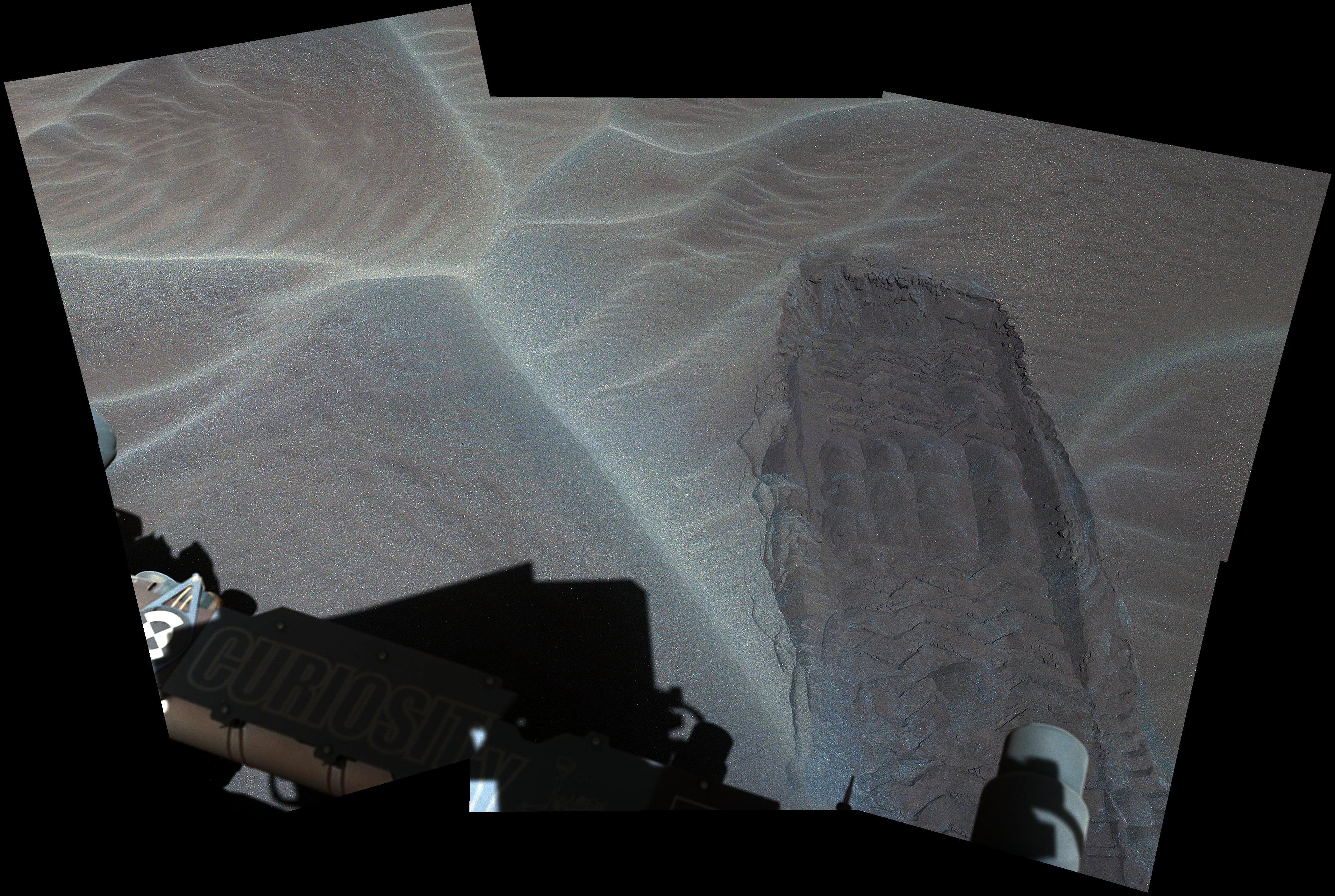
'High Dune' is First Martian Dune Studied up Close
Full Resolution:
TIFF
(14.24 MB)
JPEG
(1.086 MB)
|
|
|
2015-12-10 |
Mars
|
Mars Science Laboratory (MSL)
|
Mastcam
|
4192x2813x3 |
|
-
PIA20169:
-
Rover Track in Sand Sheet Near Martian Sand Dune
Full Resolution:
TIFF
(24.15 MB)
JPEG
(1.761 MB)
|
|
|
2015-12-10 |
Mars
|
Mars Science Laboratory (MSL)
|
MAHLI
|
1584x1184x3 |
|
-
PIA20170:
-
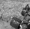
Martian Sand Disturbed by Rover Wheel
Full Resolution:
TIFF
(5.628 MB)
JPEG
(553.3 kB)
|
|
|
2015-12-10 |
Mars
|
Mars Science Laboratory (MSL)
|
MAHLI
|
1609x1198x3 |
|
-
PIA20171:
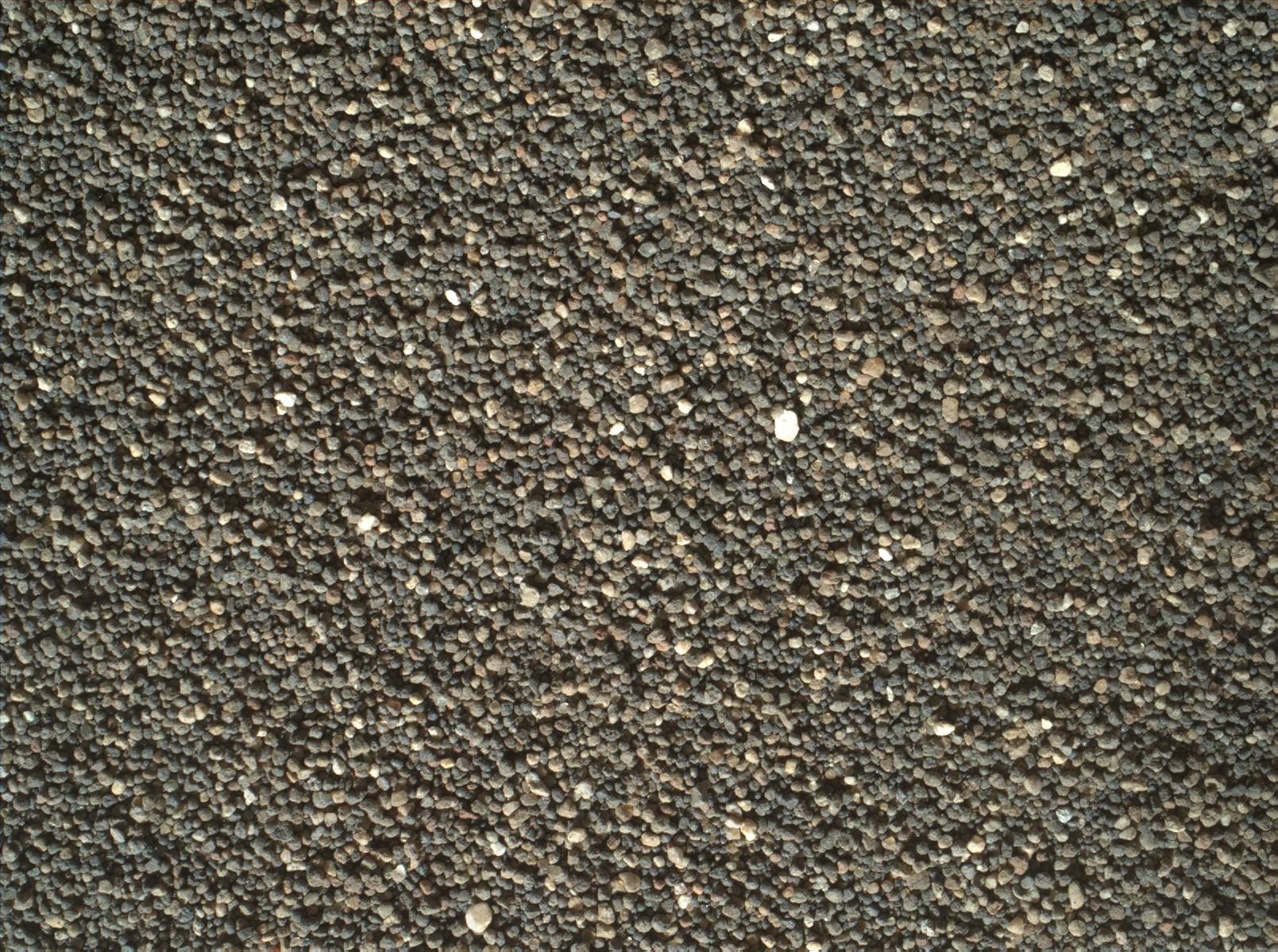
-
Surface Close-up of a Martian Sand Dune
Full Resolution:
TIFF
(5.785 MB)
JPEG
(515 kB)
|
|
|
2015-12-11 |
Mars
|
2001 Mars Odyssey
|
THEMIS
|
1396x2646x1 |
|
-
PIA20113:
-
Olympica Fossae
Full Resolution:
TIFF
(2.544 MB)
JPEG
(313.6 kB)
|
|
|
2015-12-14 |
Mars
|
2001 Mars Odyssey
|
THEMIS
|
1398x2645x1 |

|
-
PIA20114:
-
More Olympica Fossae
Full Resolution:
TIFF
(2.702 MB)
JPEG
(392.7 kB)
|
|
|
2015-12-15 |
Mars
|
2001 Mars Odyssey
|
THEMIS
|
1412x2644x1 |
|
-
PIA20115:
-
Elysium Fossae
Full Resolution:
TIFF
(2.283 MB)
JPEG
(271.6 kB)
|
|
|
2015-12-16 |
Mars
|
2001 Mars Odyssey
|
THEMIS
|
1409x2646x1 |
|
-
PIA20116:
-
Hephaestus Fossae
Full Resolution:
TIFF
(2.428 MB)
JPEG
(318.7 kB)
|
|
|
2015-12-17 |
Mars
|
2001 Mars Odyssey
|
THEMIS
|
704x1435x1 |

|
-
PIA20117:
-
Dark Slope Streaks
Full Resolution:
TIFF
(700.4 kB)
JPEG
(70.45 kB)
|
|
|
2015-12-17 |
Mars
|
Mars Reconnaissance Orbiter (MRO)
Mars Science Laboratory (MSL)
|
HiRISE
|
3300x2550x3 |
|
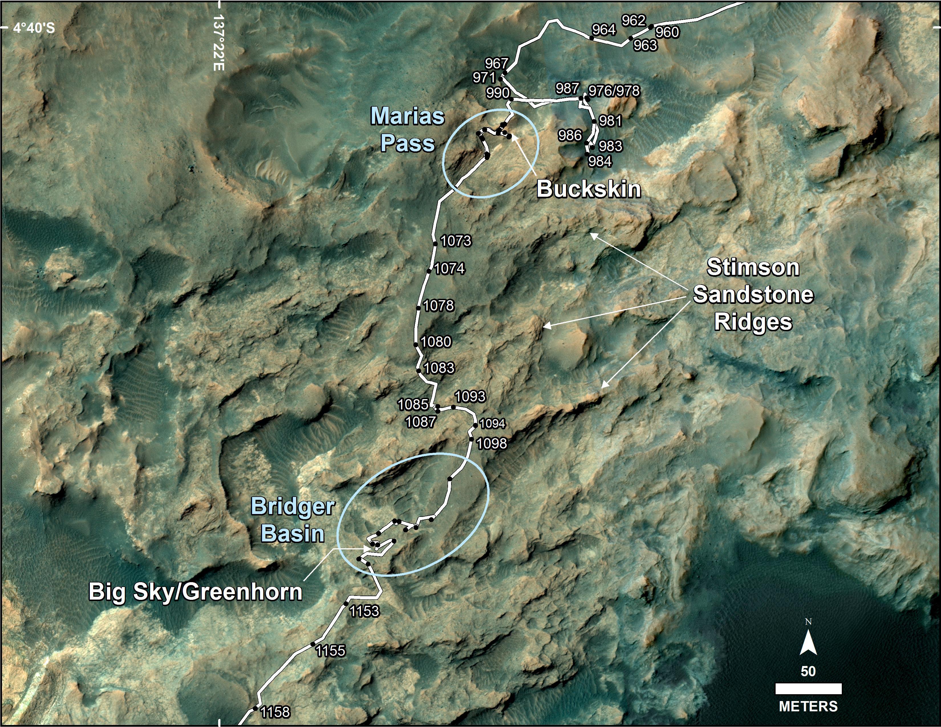
-
PIA20172:
-
Curiosity Rover's Traverse, First 1,185 Sols on Mars
Full Resolution:
TIFF
(13.35 MB)
JPEG
(1.533 MB)
|
|
|
2015-12-17 |
Mars
|
Mars Reconnaissance Orbiter (MRO)
Mars Science Laboratory (MSL)
|
HiRISE
|
3300x2550x3 |
|
-
PIA20173:
-
Curiosity's Path During 2015 Studies of Silica-Rich Rocks
Full Resolution:
TIFF
(25.26 MB)
JPEG
(1.372 MB)
|
|
|
2015-12-17 |
Mars
|
Mars Science Laboratory (MSL)
|
Mastcam
|
7949x2273x3 |
|
-
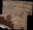
PIA20174:
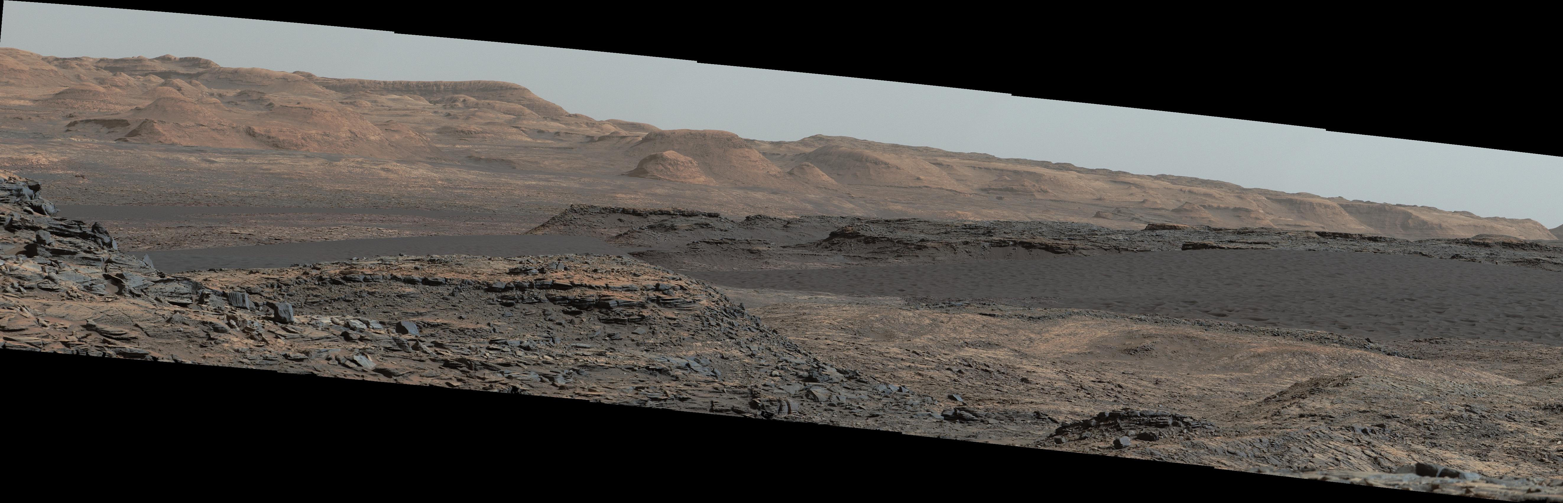
-
'Marias Pass,' Contact Zone of Two Martian Rock Units
Full Resolution:
TIFF
(50.21 MB)
JPEG
(4.009 MB)
|
|
|
2015-12-17 |
Mars
|
Mars Science Laboratory (MSL)
|
Navcam (MSL)
|
1024x998x1 |
|
-
PIA20175:
-
Area with Silica-Rich Target Near 'Marias Pass' on Mars
Full Resolution:
TIFF
(1.023 MB)
JPEG
(219.6 kB)
|
|
|
2015-12-17 |
Mars
|
Mars Science Laboratory (MSL)
|
Navcam (MSL)
|
7696x2268x1 |
|
-
PIA20266:
-
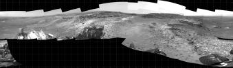
Full-Circle View Near 'Marias Pass' on Mars
Full Resolution:
TIFF
(10.75 MB)
JPEG
(1.919 MB)
|
|
|
2015-12-17 |
Mars
|
Mars Science Laboratory (MSL)
|
ChemCam
|
1218x1110x3 |
|
-
PIA20267:
-
Details on Silica-Rich 'Elk' Target near 'Marias Pass'
Full Resolution:
TIFF
(3.033 MB)
JPEG
(142.2 kB)
|
|
|
2015-12-17 |
Mars
|
Mars Science Laboratory (MSL)
|
Navcam (MSL)
|
874x508x1 |

|
-
PIA20268:
-
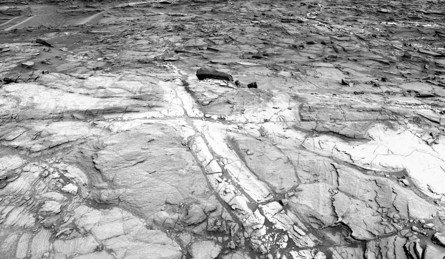
Discolored Fracture Zones in Martian Sandstone
Full Resolution:
TIFF
(444.7 kB)
JPEG
(117.2 kB)
|
|
|
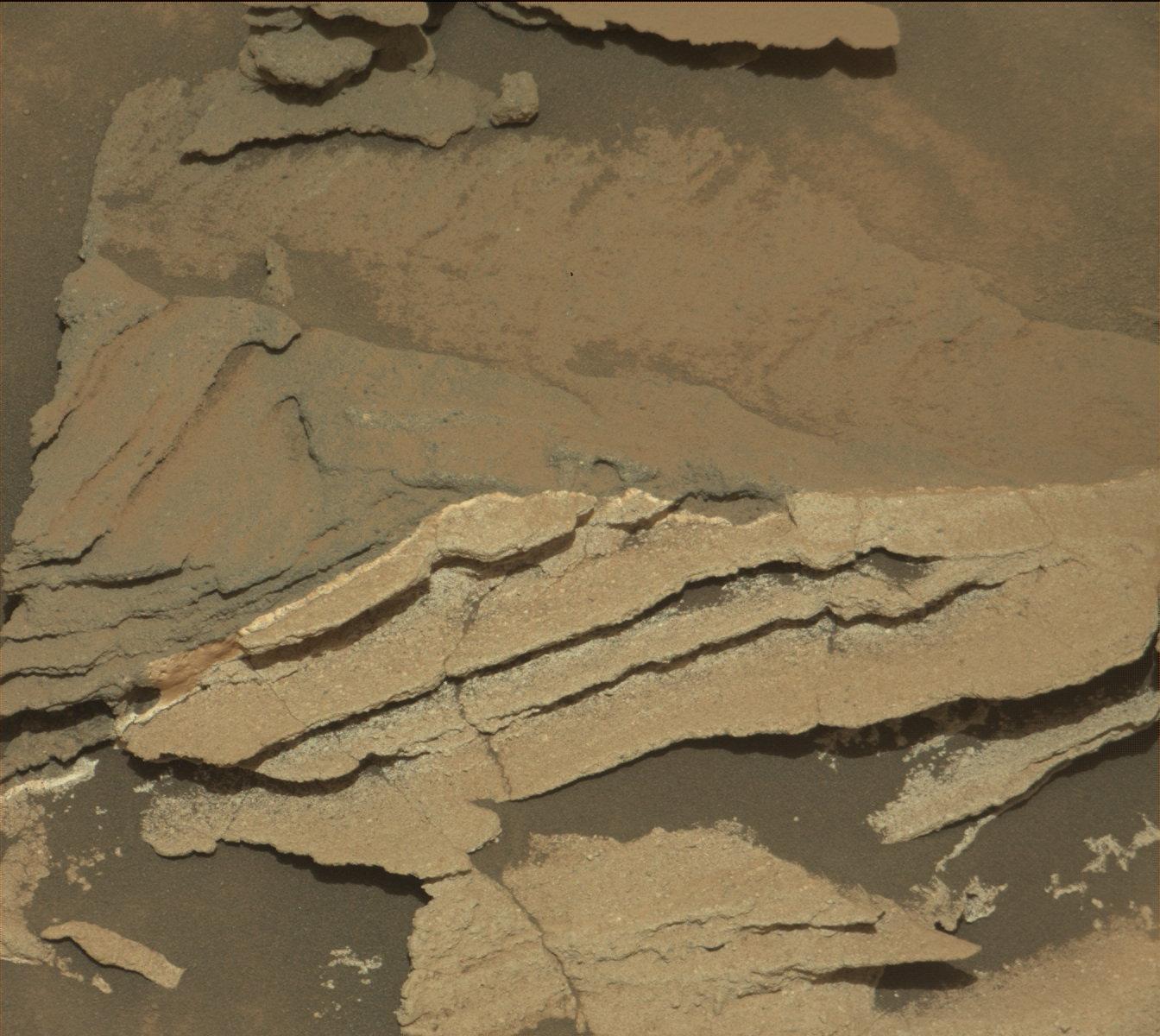
2015-12-17 |
Mars
|
Mars Science Laboratory (MSL)
|
Mastcam
|
1344x1200x3 |
|
-
PIA20269:
-
Detail of Discoloration Pattern Seen by Curiosity
Full Resolution:
TIFF
(4.1 MB)
JPEG
(223.5 kB)
|
|
|
2015-12-17 |
Mars
|
Mars Science Laboratory (MSL)
|
Mastcam
|
4532x4171x3 |
|
-
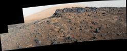
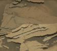
PIA20270:
-
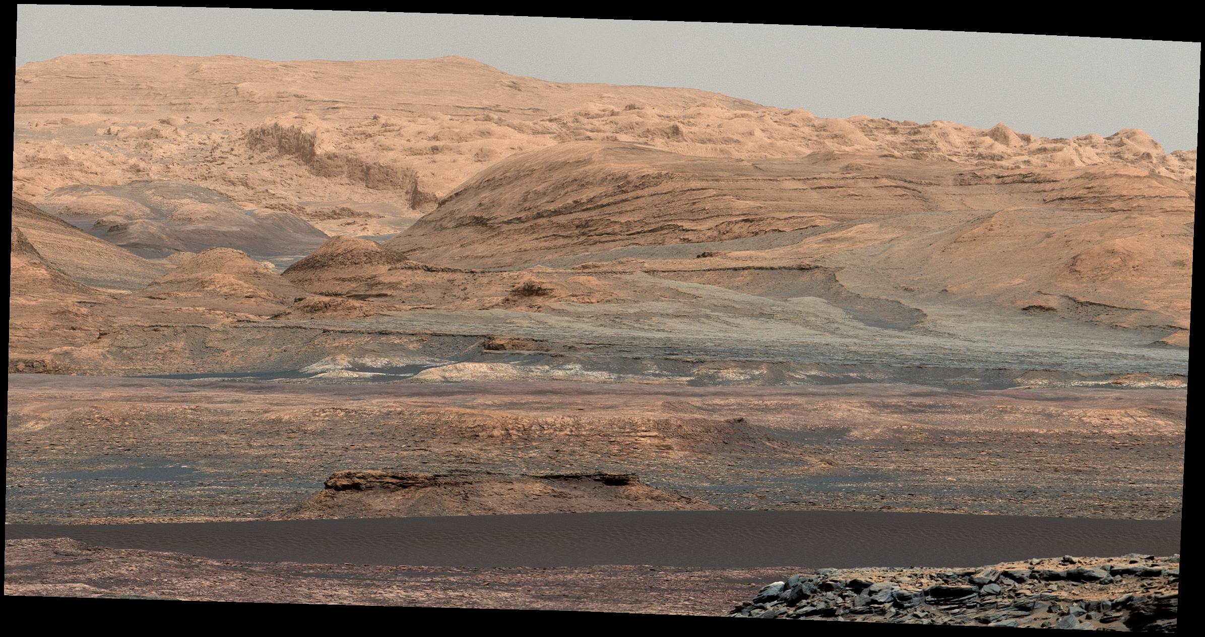
'Big Sky' and 'Greenhorn' Drilling Area on Mount Sharp
Full Resolution:
TIFF
(46.14 MB)
JPEG
(2.171 MB)
|
|
|
2015-12-17 |
Mars
|
Mars Science Laboratory (MSL)
|
CheMin
MAHLI
|
1260x671x3 |
|
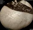
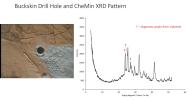
-
PIA20271:
-
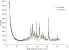
'Buckskin' Drill Hole and CheMin X-ray Diffraction
Full Resolution:
TIFF
(706.4 kB)
JPEG
(82.16 kB)
|
|
|
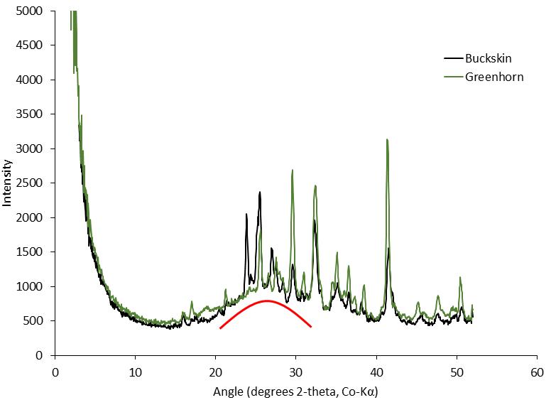
2015-12-17 |
Mars
|
Mars Science Laboratory (MSL)
|
CheMin
MAHLI
|
1236x672x3 |
|
-
PIA20272:
-
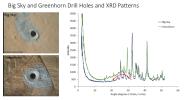
'Big Sky' and 'Greenhorn' Drill Holes and CheMin X-ray Diffraction
Full Resolution:
TIFF
(819.4 kB)
JPEG
(99.92 kB)
|
|
|
2015-12-17 |
Mars
|
Mars Science Laboratory (MSL)
|
CheMin
|
776x563x3 |
|
-
PIA20273:
-
Silica in Opal at 'Buckskin' and 'Greenhorn' on Mount Sharp
Full Resolution:
TIFF
(91.21 kB)
JPEG
(34.65 kB)
|
|
|
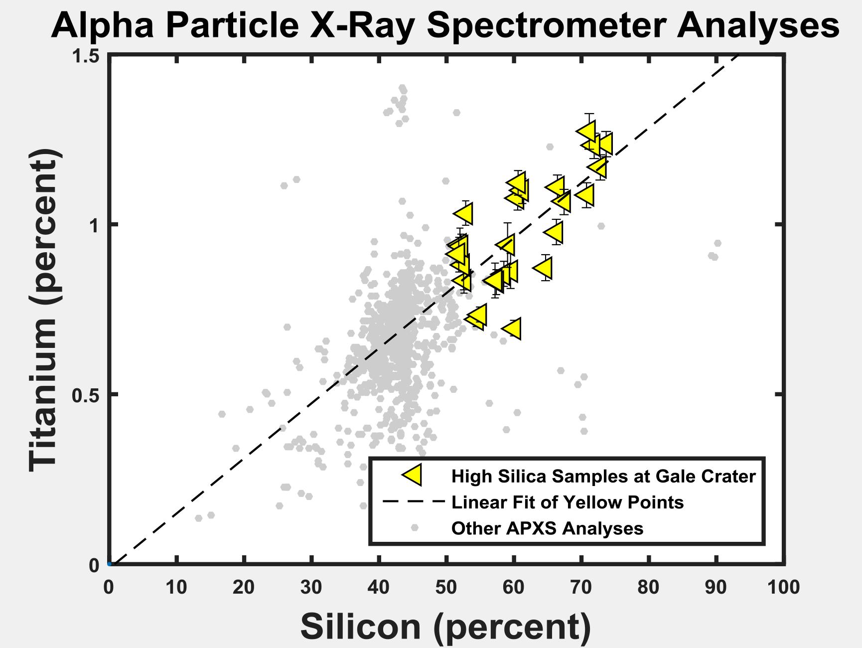
2015-12-17 |
Mars
|
Mars Science Laboratory (MSL)
|
Alpha Particle X-ray Spectrometer
|
1730x1300x3 |
|
-
PIA20274:
-
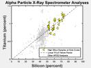
Silicon and Titanium Correlation in Selected Rocks at Gale Crater, Mars
Full Resolution:
TIFF
(384 kB)
JPEG
(163.3 kB)
|
|
|
2015-12-17 |
Mars
|
Mars Science Laboratory (MSL)
|
Alpha Particle X-ray Spectrometer
|
3000x1320x1 |

|
-
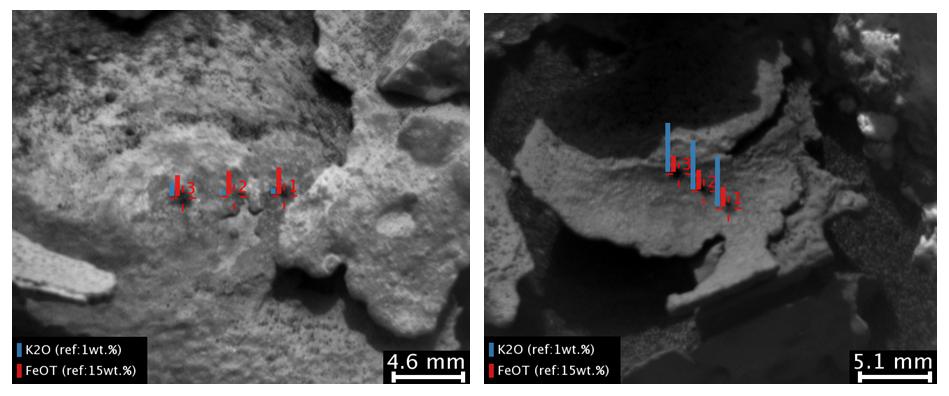
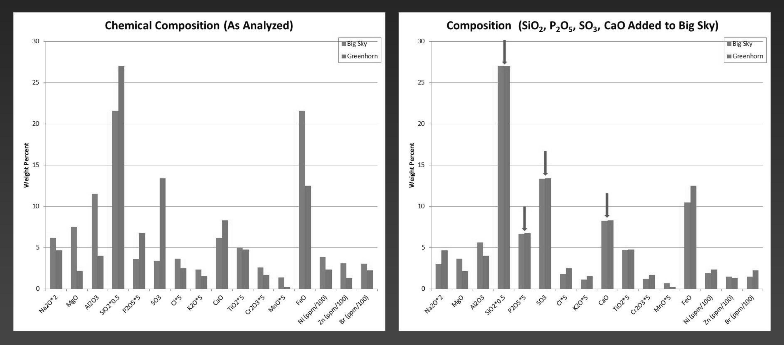
PIA20275:
-
'Big Sky' and 'Greenhorn' Elemental Comparison
Full Resolution:
TIFF
(675.1 kB)
JPEG
(193.7 kB)
|
|
|
2015-12-17 |
Mars
|
Mars Science Laboratory (MSL)
|
Alpha Particle X-ray Spectrometer
|
1744x1312x3 |
|
-
PIA20276:
-
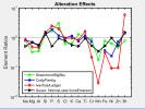
Alteration Effects at Gale and Gusev Craters
Full Resolution:
TIFF
(402.1 kB)
JPEG
(187 kB)
|
|
|
2015-12-18 |
Mars
|
2001 Mars Odyssey
|
THEMIS
|
706x1436x1 |
|
-
PIA20217:
-
Athabasca Valles
Full Resolution:
TIFF
(697.6 kB)
JPEG
(83.44 kB)
|


