Your search criteria found
12760
images
Target is Mars (and available satellites)
Go to PIAxxxxx:
Refine this list of images by:
Target:
Deimos
Mars
Phobos
Mission:
2001 Mars Odyssey
Antarctic Meteorite Location and Mapping Project (AMLAMP)
Dawn
ExoMars
Hubble Space Telescope
InSight
MAVEN
Mariner Mars 1964 (Mariner 4)
Mariner Mars 1969 (Mariner 7)
Mariner Mars 1971 (Mariner 9)
Mars 2020
Mars 2020 Rover
Mars Atmosphere and Volatile Evolution MissioN (MAVEN)
Mars Climate Orbiter
Mars Cube One (MarCO)
Mars Exploration Rover (MER)
Mars Express (MEX)
Mars Global Surveyor (MGS)
Mars Helicopter
Mars Pathfinder (MPF)
Mars Reconnaissance Orbiter (MRO)
Mars Sample Return
Mars Sample Return (MSR)
Mars Science Laboratory (MSL)
Phoenix
Rosetta
Viking
Spacecraft:
2001 Mars Odyssey
Curiosity
Dawn
InSight Mars Lander
Ingenuity
MAVEN
MarCO-B
Mariner 4
Mariner 7
Mariner 9
Mars Climate Orbiter
Mars Express (MEX)
Mars Express (MEX) Orbiter
Mars Global Surveyor Orbiter
Mars Pathfinder Lander
Mars Pathfinder Rover
Mars Reconnaissance Orbiter (MRO)
Mars Sample Return
Mars Science Laboratory (MSL)
NASA's Mars Pathfinder Lander
Opportunity
Perseverance
Philae Lander
Phoenix Lander
Phoenix Mars Lander
Spirit
Viking Lander 1
Viking Lander 2
Viking Orbiter 1
Viking Orbiter 2
Instrument:
Alpha Particle X-ray Spectrometer
Alpha Particle X-ray Spectrometer (MSL)
Atmospheric Structure / Meteorology Instrument
CHIMRA
Camera 1
Camera 2
Chemistry & Mineralogy (CheMin)
Chemistry and Camera (ChemCam)
Comet Infrared and Visible Analyser (CIVA
Compact Reconnaissance Imaging Spectrometer for Mars (CRISM)
Context Camera (CTX)
Deep Space Network
Descent Image Motion Estimation System (DIMES)
Dynamic Albedo of Neutrons
Dynamic Albedo of Neutrons (DAN)
Gamma Ray Spectrometer - Neutron Spectrometer
Gamma Ray Spectrometer Suite
Hazard Avoidance Camera
Hazard Avoidance Camera (M2020)
Hazard Avoidance Camera (MSL)
Heat and Physical Properties Package (HP3)
High Resolution Imaging Science Experiment (HiRISE)
High Resolution Instrument (HRI)
High Resolution Stereo Camera
Imager for Mars Pathfinder
Imaging Ultraviolet Spectrograph
Imaging Ultraviolet Spectrograph (IUVS)
Instrument Context Camera (ICC)
Instrument Deployment Camera (IDC)
Lander Vision System Camera (LCAM)
Magnetometer
Mars Advanced Radar for Subsurface and Ionosphere Sounding (MARSIS)
Mars Advanced Radar for Subsurface and Ionospheric Sounding (MARSIS)
Mars Climate Sounder (MCS)
Mars Color Imager (MARCI)
Mars Descent Imager
Mars Environmental Dynamics Analyzer (MEDA)
Mars Hand Lens Imager (MAHLI)
Mars Horizon Sensor Assembly
Mars Orbiter Camera (MOC)
Mars Orbiter Laser Altimeter
Mars Radiation Experiment
Mastcam
Mastcam-Z
Microscopic Imager
Microscopy Electrochemistry and Conductivity Analyzer (MECA)
Miniature Thermal Emission Spectrometer
Moessbauer Spectrometer
Navigation Camera
Navigation Camera (M2020)
Navigation Camera (MSL)
Neutral Gas and Ion Mass Spectrometer
Neutron Spectrometer
Optical Microscope
Optical Navigation Camera
Panoramic Camera
Planetary Instrument for X-ray Lithochemistry (PIXL)
Radar System
Radiation Assessment Detector (RAD)
Radio Science Subsystem
Robotic Arm
Robotic Arm (MSL)
Robotic Arm Camera (RAC)
Rock Abrasion Tool (RAT)
Rover Cameras
Rover Environmental Monitoring Station (REMS)
Sample Analysis at Mars (SAM)
Scanning Habitable Environments with Raman & Luminescence for Organics and Chemicals (SHERLOC)
Seismic Experiment for Interior Structure (SEIS)
Shallow Subsurface Radar (SHARAD)
Stereo Imager (SSI)
SuperCam
Surface Stereo Imager (SSI)
Thermal Emission Imaging System
Thermal Emission Spectrometer
Thermal and Electrical Conductivity Probe
Thermal and Evolved Gas Analyzer
Trace Gas Orbiter
Visual Imaging Subsystem
Visual Imaging Subsystem - Camera A
Visual Imaging Subsystem - Camera B
Wide Field Planetary Camera 2
Click on an image for detailed information
Click on a column heading to sort in ascending or descending order
My
List
Addition Date
Target
Mission
Instrument
Size
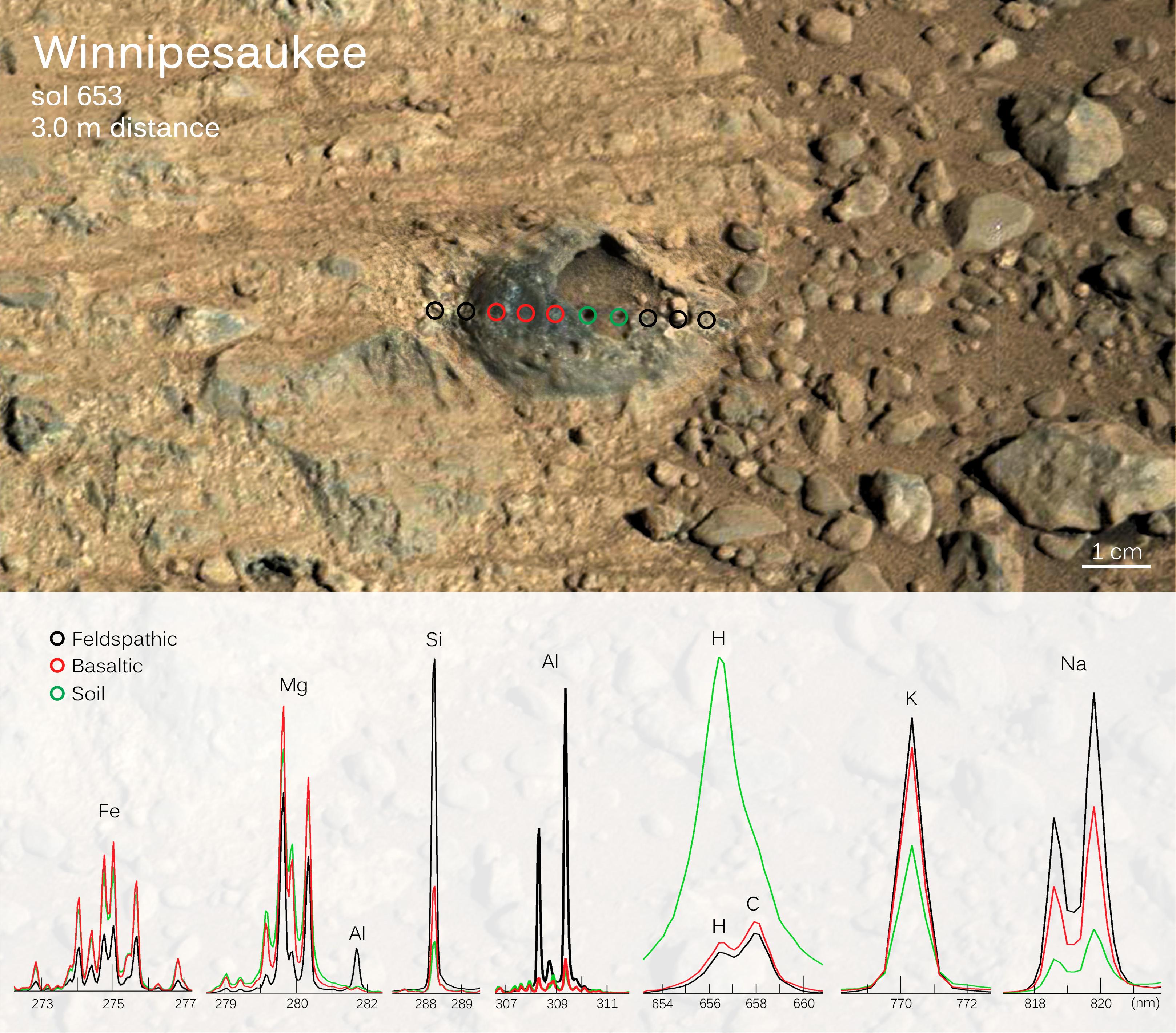
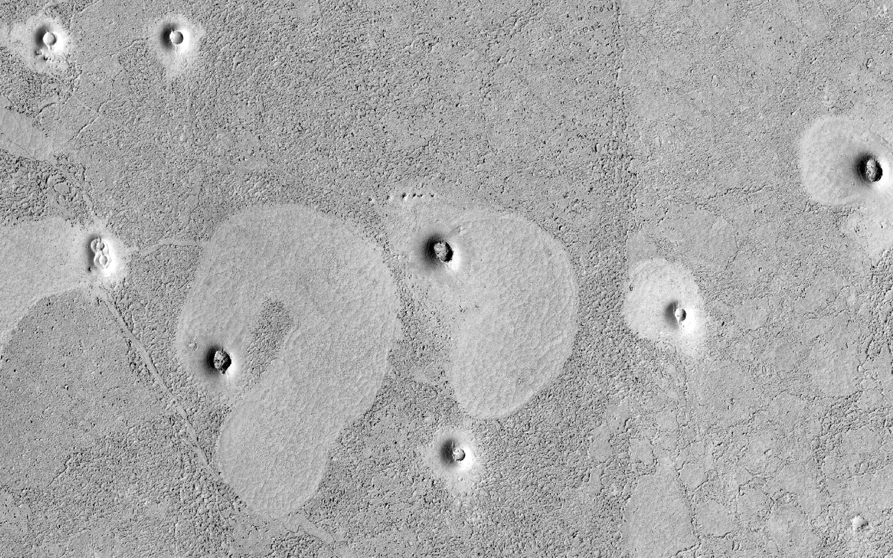
2014-06-03
Mars
2001 Mars Odyssey
THEMIS
320x1808x1
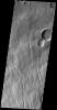
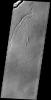
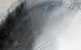
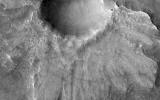
PIA18266:
"Butterfly" Crater
Full Resolution:
TIFF
(579.4 kB)
JPEG
(139.8 kB)
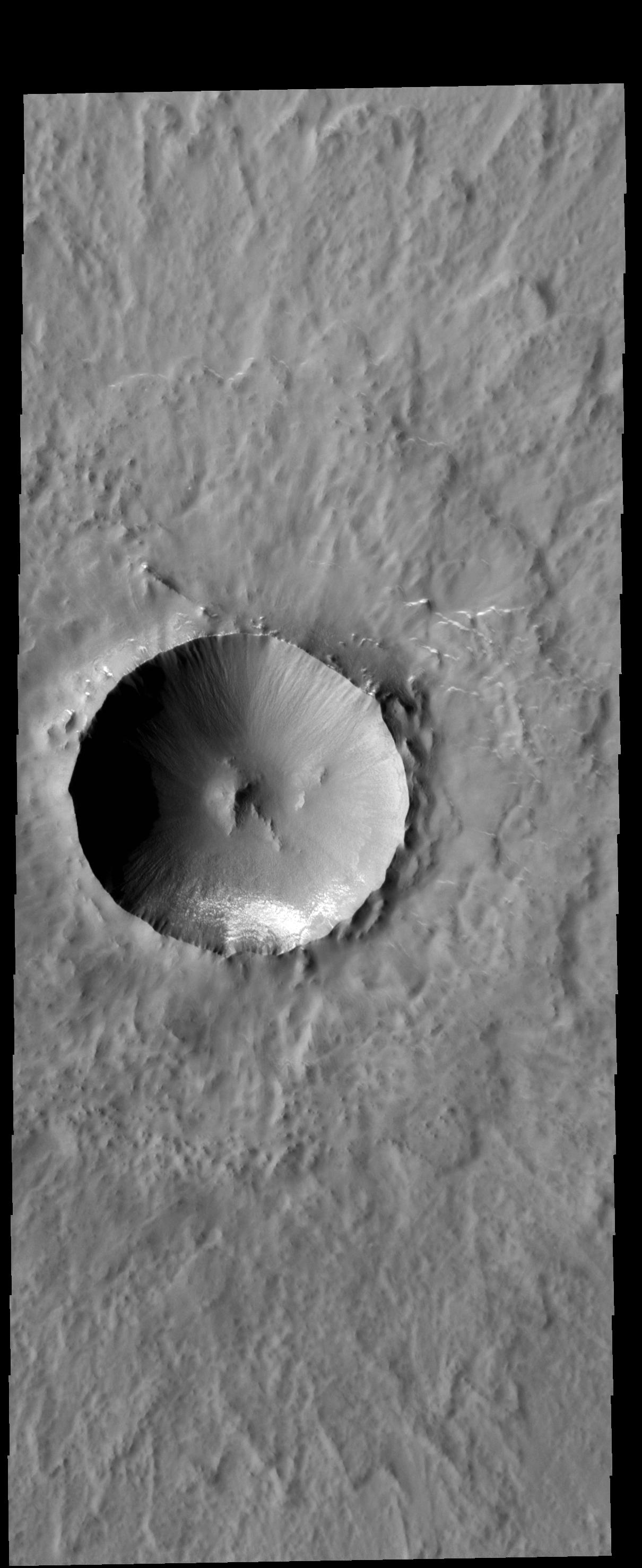
2014-06-04
Mars
2001 Mars Odyssey
THEMIS
1147x2939x1
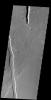
PIA18267:
"Butterfly" Crater
Full Resolution:
TIFF
(3.375 MB)
JPEG
(571 kB)
2014-06-04
Mars
Mars Reconnaissance Orbiter (MRO)
HiRISE
840x333x1
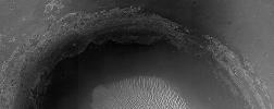
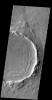
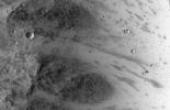
PIA18511:
A Large Crater in Meridiani Planum
Full Resolution:
TIFF
(280.2 kB)
JPEG
(73.14 kB)
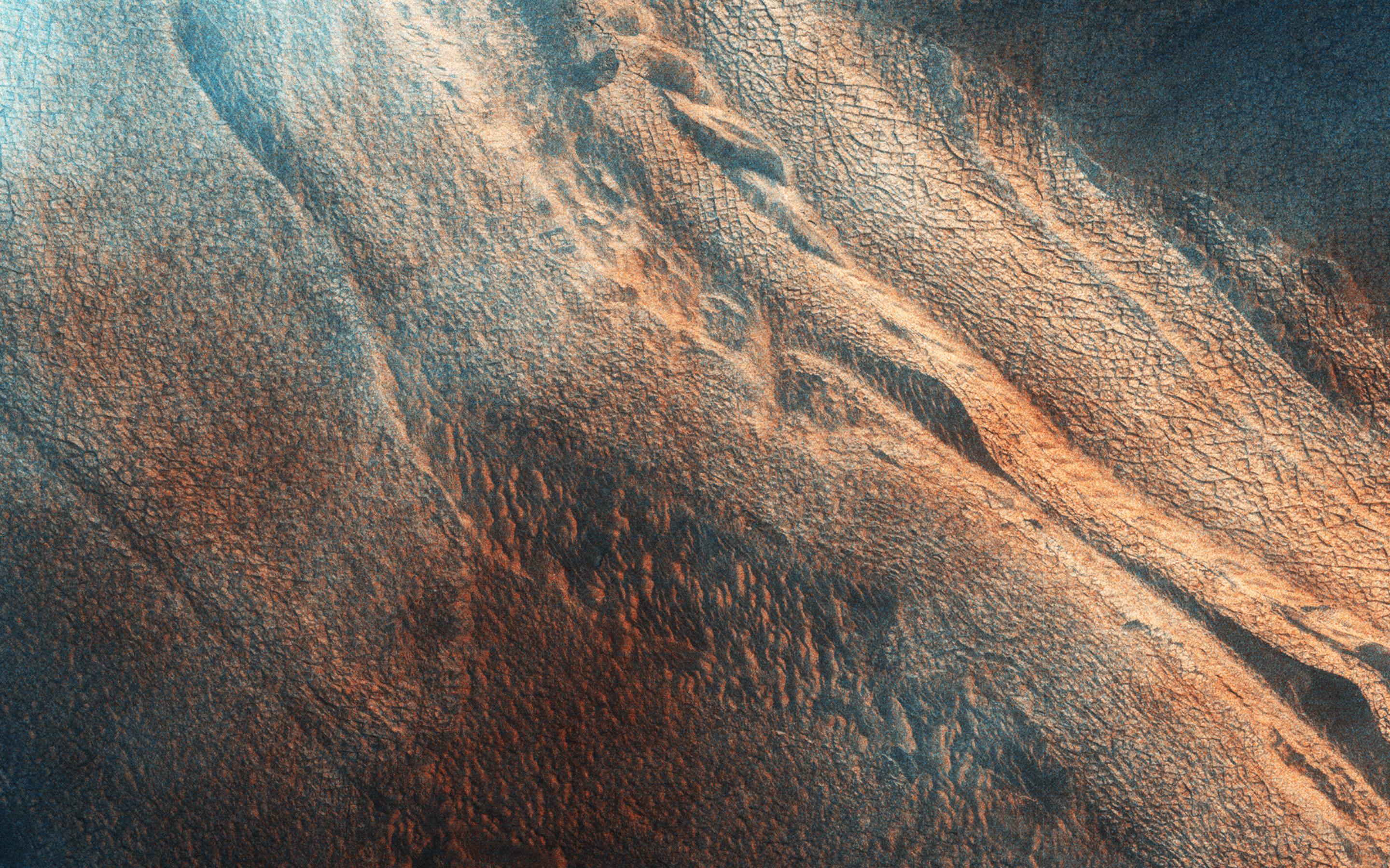
2014-06-04
Mars
Mars Reconnaissance Orbiter (MRO)
HiRISE
2880x1800x3
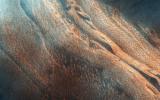
PIA18512:
Touring a Dusty Region
Full Resolution:
TIFF
(15.56 MB)
JPEG
(623.1 kB)
2014-06-04
Mars
Mars Reconnaissance Orbiter (MRO)
HiRISE
2880x1800x1
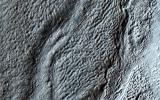
PIA18513:
An Alluvial Fan in a Low-Latitude Crater
Full Resolution:
TIFF
(5.191 MB)
JPEG
(646.5 kB)
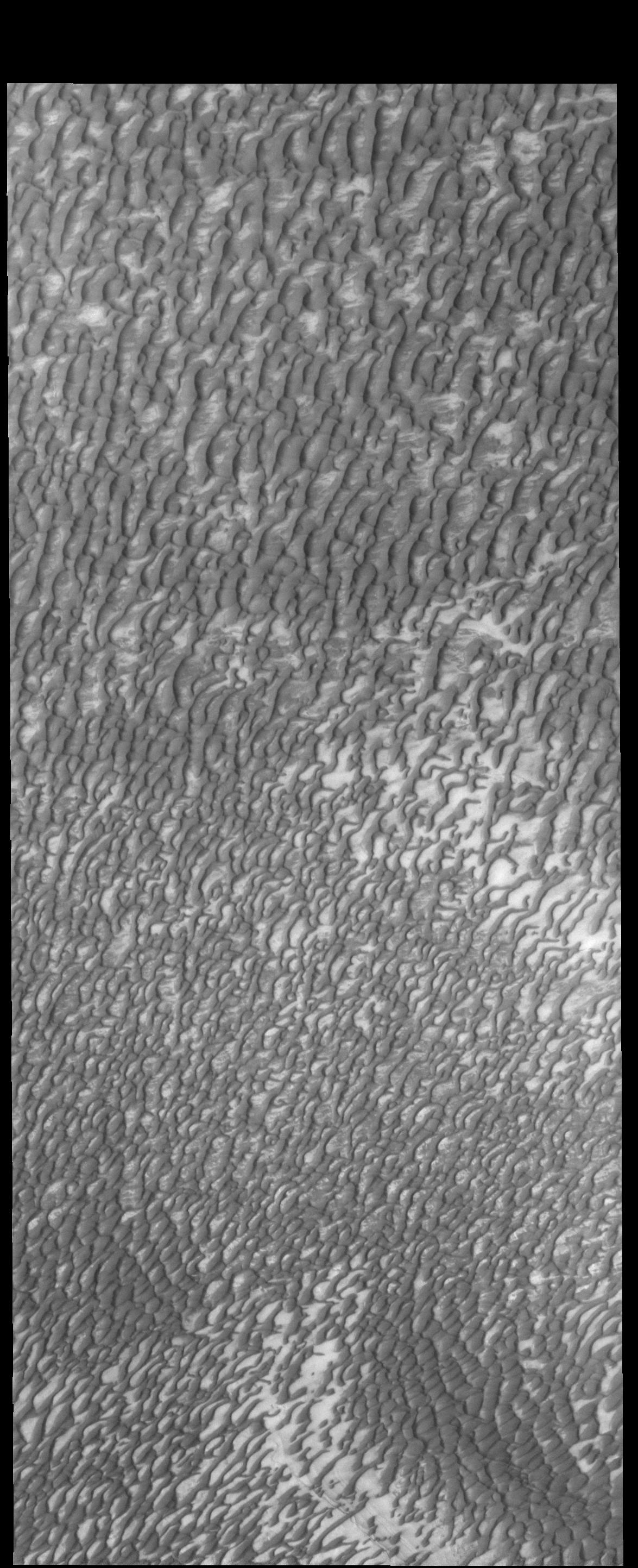
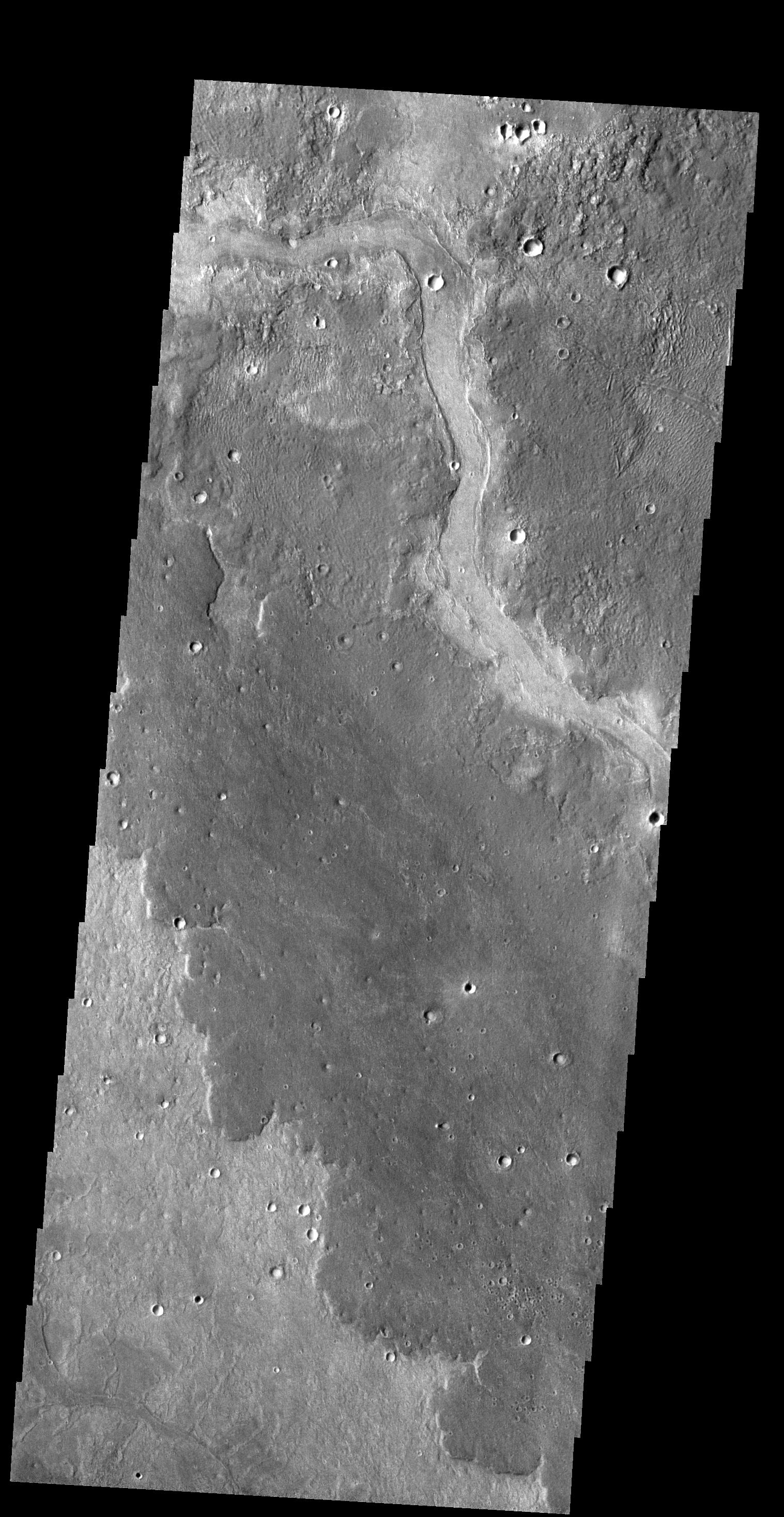
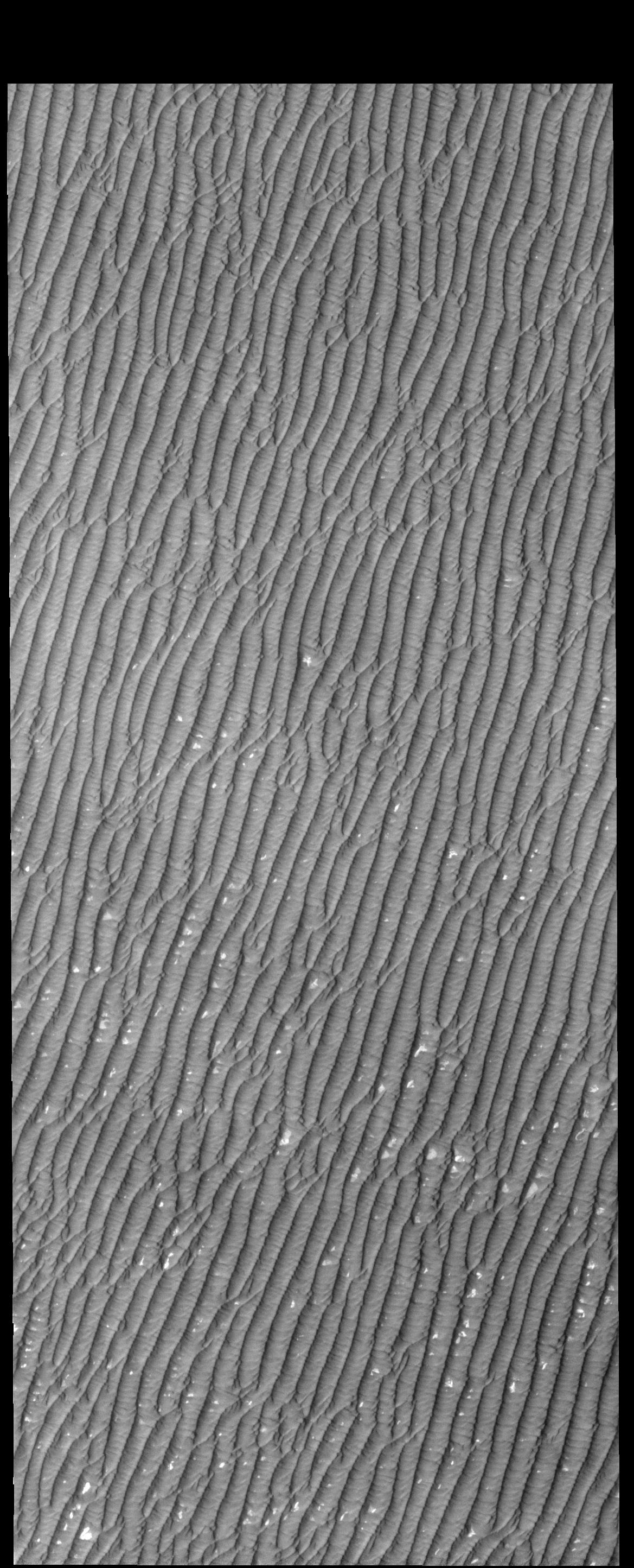
2014-06-05
Mars
2001 Mars Odyssey
THEMIS
1175x2886x1
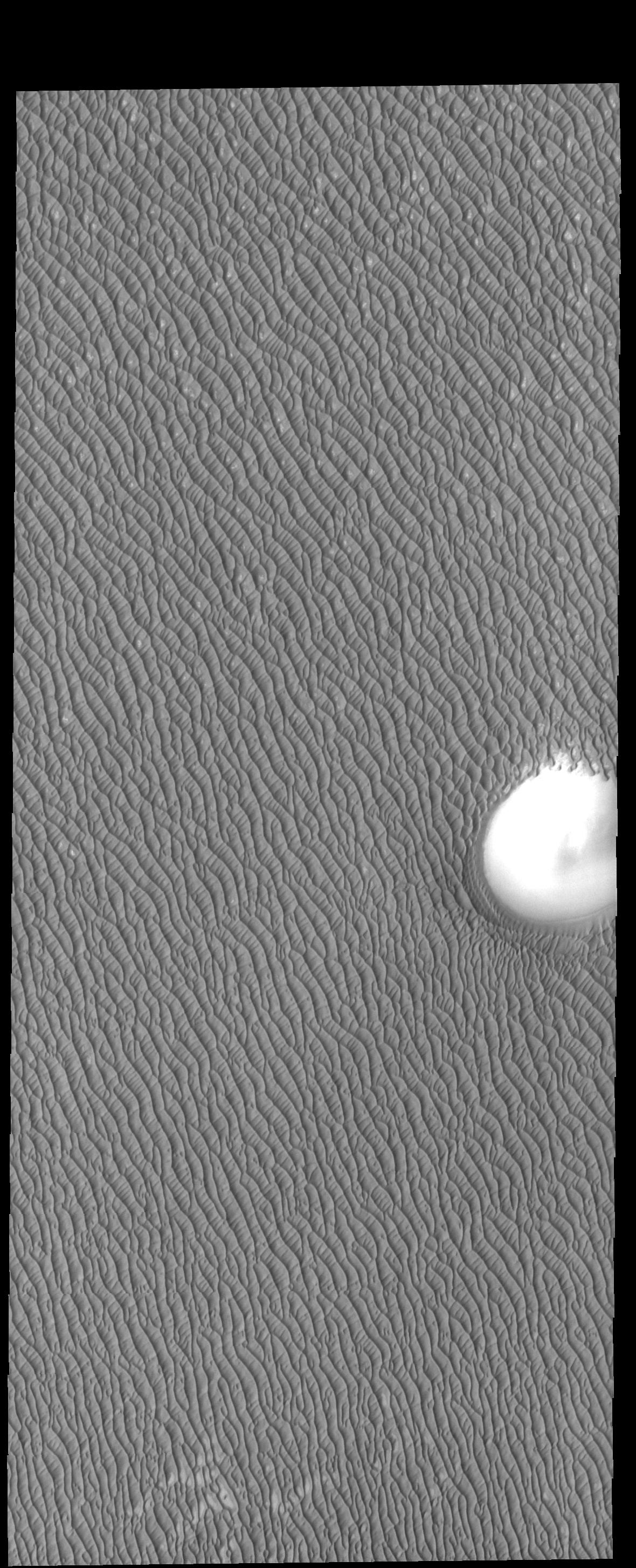
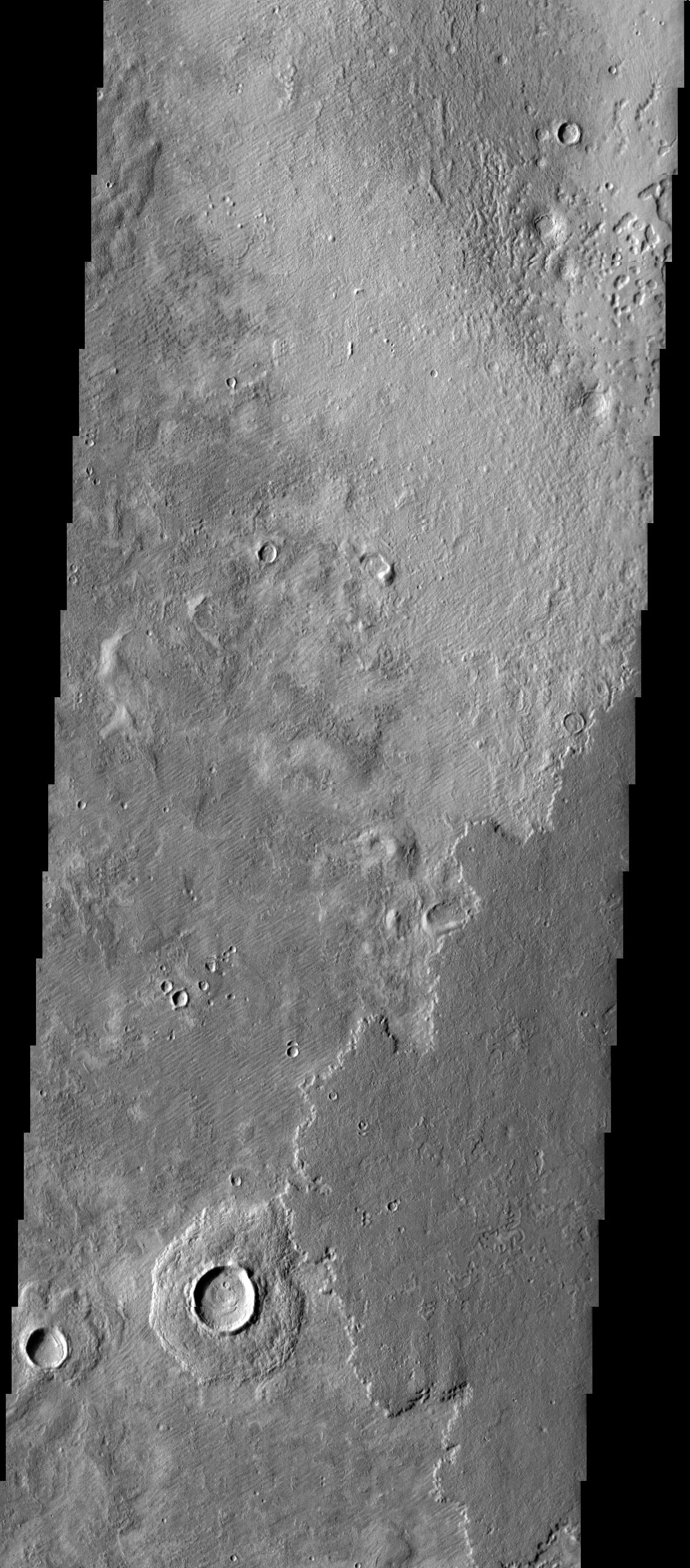
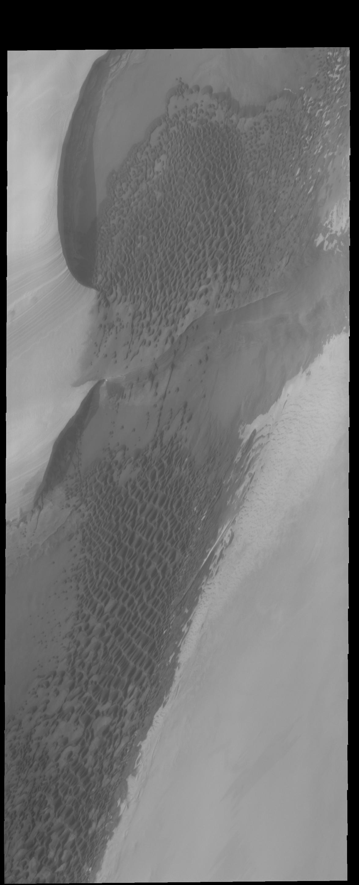
PIA18268:
North Polar Dunes
Full Resolution:
TIFF
(3.395 MB)
JPEG
(425.4 kB)
2014-06-06
Mars
2001 Mars Odyssey
THEMIS
835x2283x1
PIA18269:
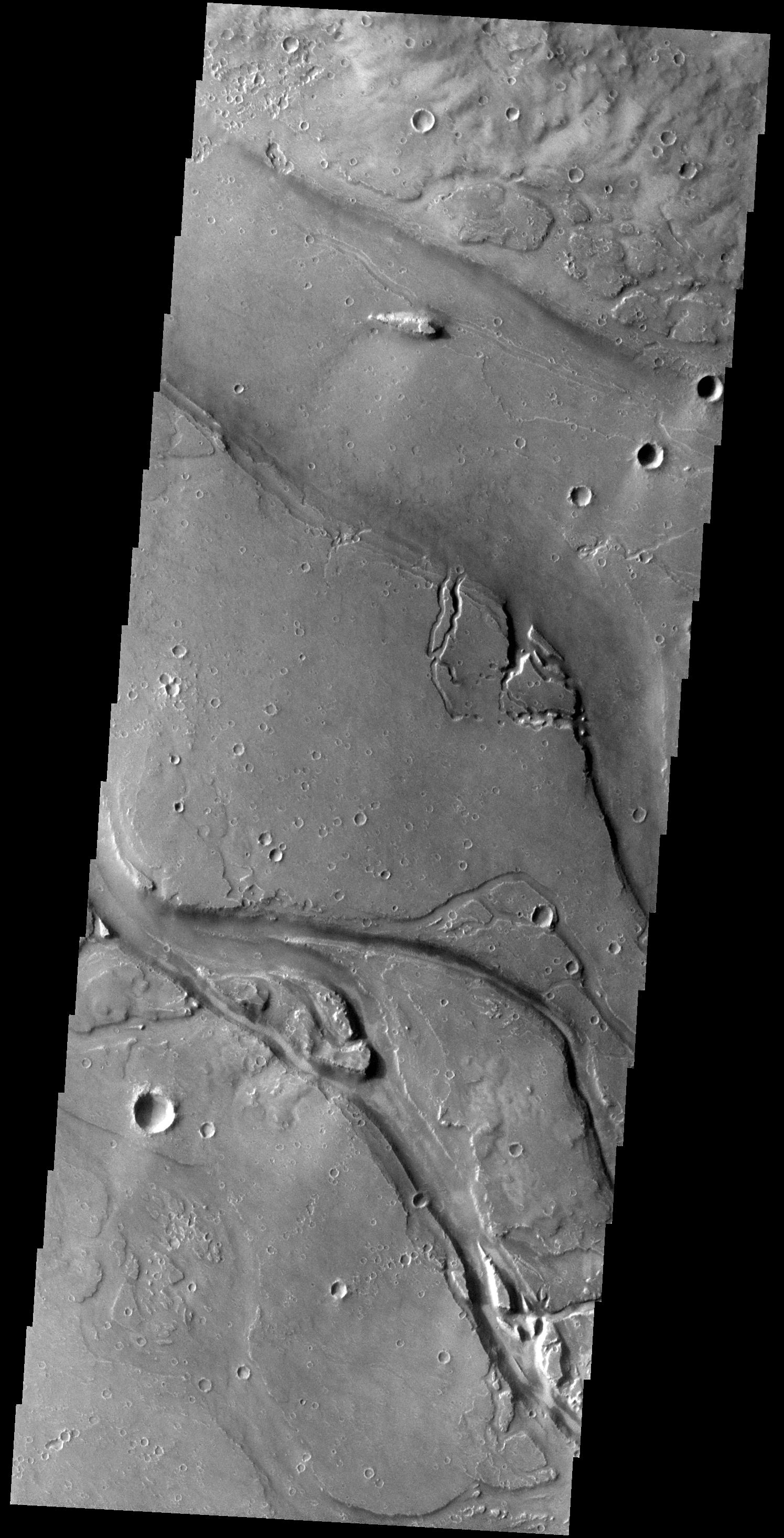
Kasei Valles Islands
Full Resolution:
TIFF
(1.909 MB)
JPEG
(201.6 kB)
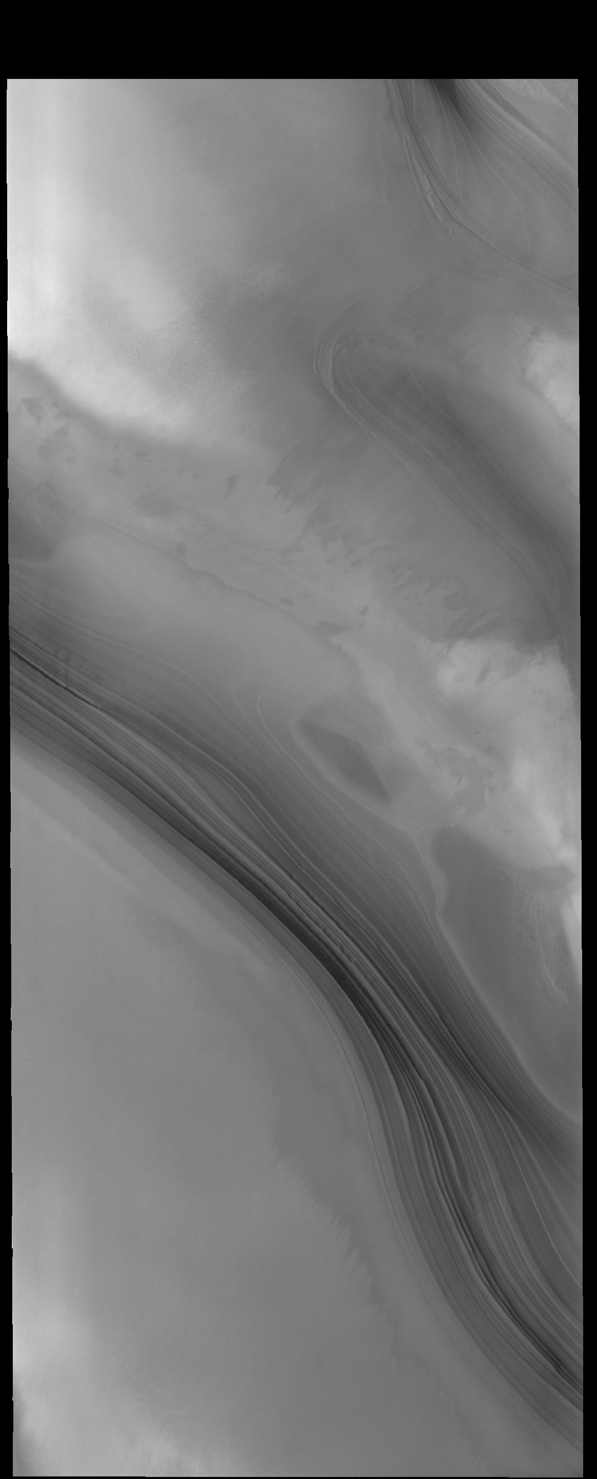
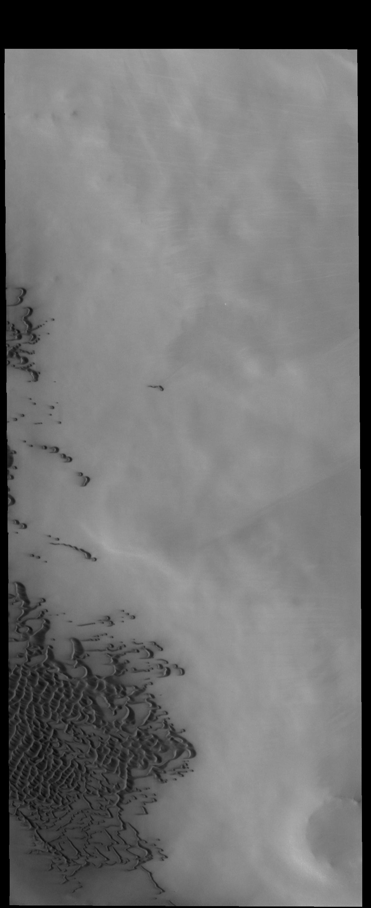
2014-06-09
Mars
2001 Mars Odyssey
THEMIS
1165x2886x1
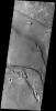
PIA18480:
North Polar Layers
Full Resolution:
TIFF
(3.366 MB)
JPEG
(148.9 kB)
2014-06-10
Mars
2001 Mars Odyssey
THEMIS
1469x2931x1
PIA18481:
Tharsis Volcanics
Full Resolution:
TIFF
(4.311 MB)
JPEG
(373.1 kB)
2014-06-11
Mars
2001 Mars Odyssey
THEMIS
1495x2932x1
PIA18482:
Granicus Valles
Full Resolution:
TIFF
(4.388 MB)
JPEG
(475.7 kB)
2014-06-12
Mars
2001 Mars Odyssey
THEMIS
1509x2927x1
PIA18483:
Hecates Tholus
Full Resolution:
TIFF
(4.422 MB)
JPEG
(394.3 kB)
2014-06-13
Mars
2001 Mars Odyssey
THEMIS
1554x2935x1
PIA18484:
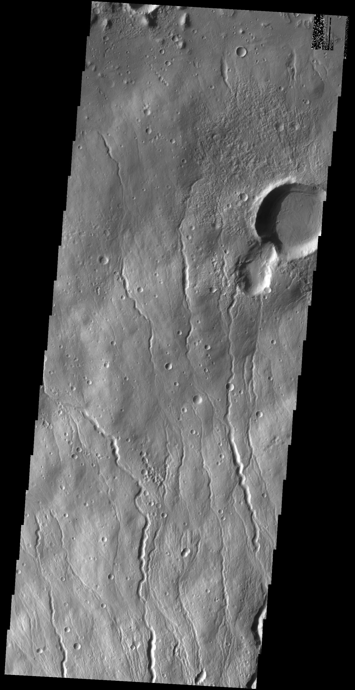
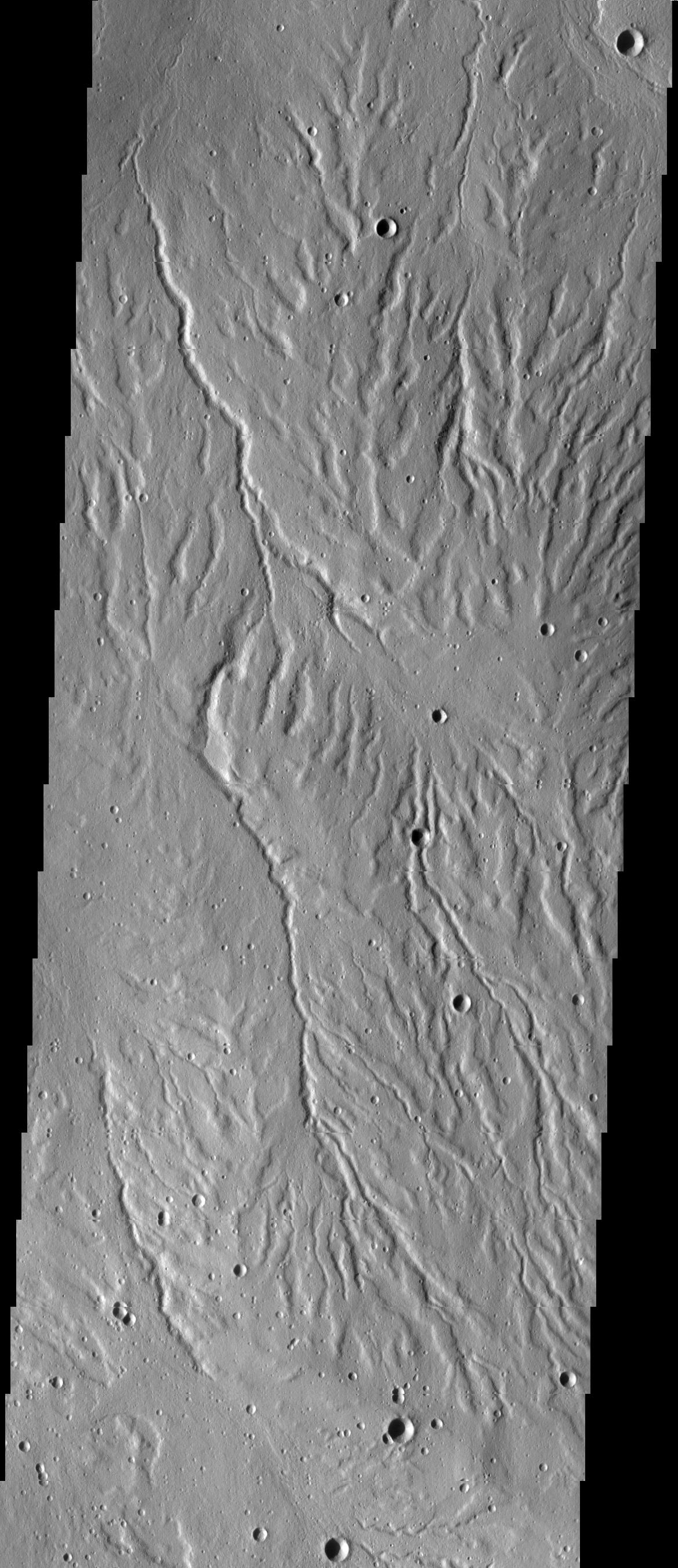
Arabia Terra Channels
Full Resolution:
TIFF
(4.566 MB)
JPEG
(506.4 kB)
2014-06-16
Mars
2001 Mars Odyssey
THEMIS
1510x2931x1
PIA18485:
Arabia Terra Channels
Full Resolution:
TIFF
(4.431 MB)
JPEG
(351.9 kB)
2014-06-17
Mars
2001 Mars Odyssey
THEMIS
1202x2944x1
PIA18486:
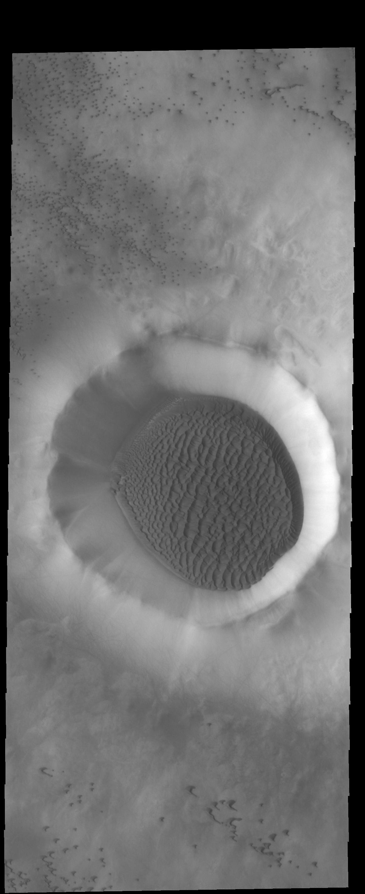
Crater Dunes
Full Resolution:
TIFF
(3.543 MB)
JPEG
(186.1 kB)
2014-06-18
Mars
2001 Mars Odyssey
THEMIS
1517x2933x1
PIA18487:
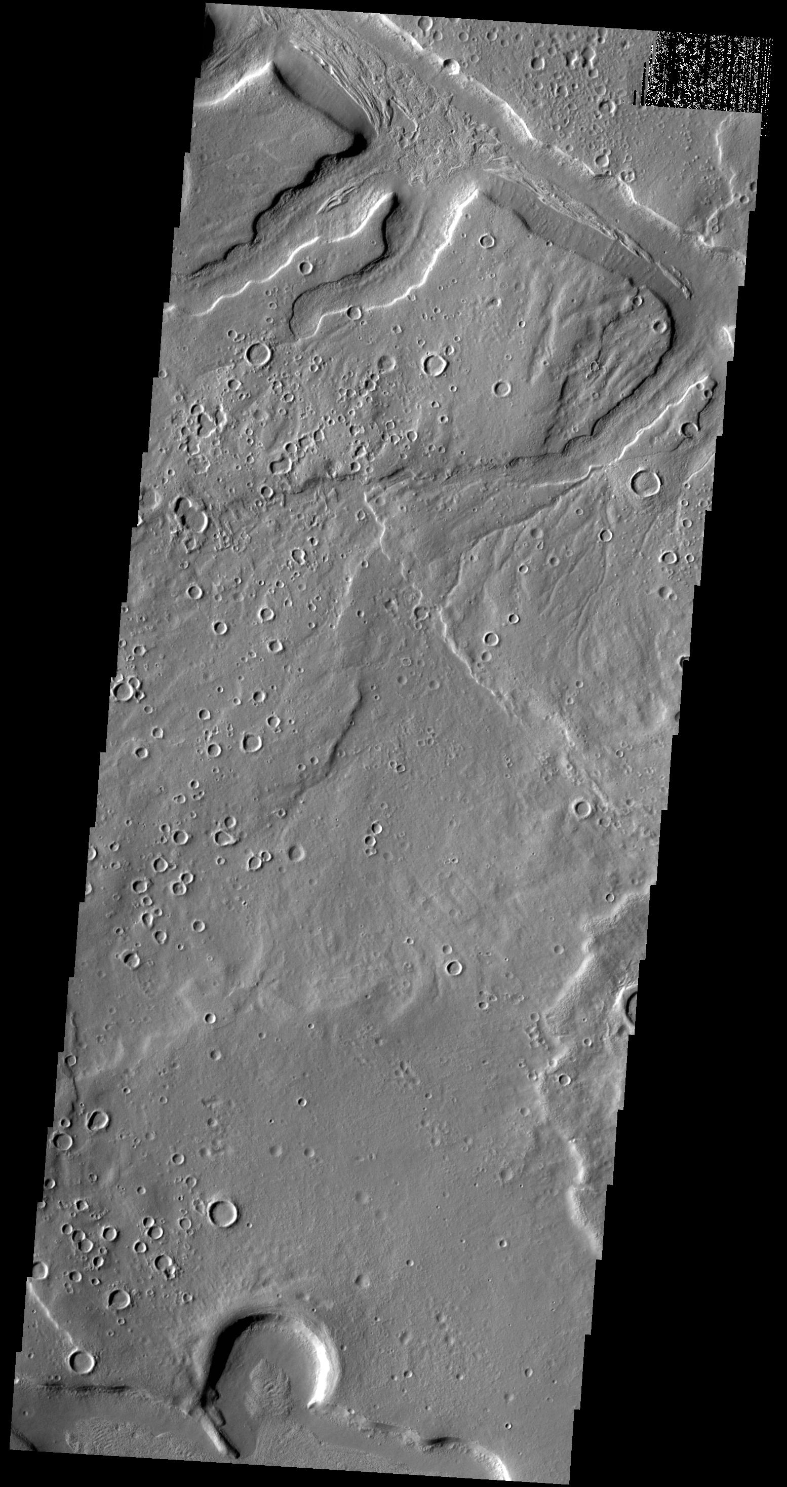
Lava Channel
Full Resolution:
TIFF
(4.454 MB)
JPEG
(582.1 kB)
2014-06-18
Mars
Mars Reconnaissance Orbiter (MRO)
HiRISE
2880x1800x3
PIA18585:
Sand Dune Catch and Release
Full Resolution:
TIFF
(15.56 MB)
JPEG
(743.6 kB)
2014-06-18
Mars
Mars Reconnaissance Orbiter (MRO)
HiRISE
2880x1800x3
PIA18586:
Blockfall on the North Polar Layered Deposits
Full Resolution:
TIFF
(15.56 MB)
JPEG
(790.1 kB)
2014-06-18
Mars
Mars Reconnaissance Orbiter (MRO)
HiRISE
2880x1800x3
PIA18587:
Waiting for Dust Devils
Full Resolution:
TIFF
(5.191 MB)
JPEG
(1.172 MB)
2014-06-18
Mars
Mars Reconnaissance Orbiter (MRO)
HiRISE
2880x1800x3
PIA18588:
Moving Mass Material on a Mesa
Full Resolution:
TIFF
(15.56 MB)
JPEG
(650.1 kB)
2014-06-19
Mars
2001 Mars Odyssey
THEMIS
1505x2931x1
PIA18488:
Mamers Valles
Full Resolution:
TIFF
(4.416 MB)
JPEG
(367.7 kB)
2014-06-20
Mars
2001 Mars Odyssey
THEMIS
1166x2879x1
PIA18489:
Polar Dunes
Full Resolution:
TIFF
(3.36 MB)
JPEG
(164.7 kB)
2014-06-23
Mars
2001 Mars Odyssey
THEMIS
1277x3085x1
PIA18490:
Crater Dunes
Full Resolution:
TIFF
(3.944 MB)
JPEG
(197.8 kB)
2014-06-23
Mars
Mars Science Laboratory (MSL)
MAHLI
7072x9424x3
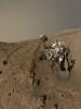
PIA18390:
Curiosity Self-Portrait at 'Windjana' Drilling Site
Full Resolution:
TIFF
(200 MB)
JPEG
(5.43 MB)
2014-06-23
Mars
Mars Science Laboratory (MSL)
HiRISE
3300x2550x3
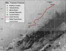
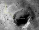
PIA18391:
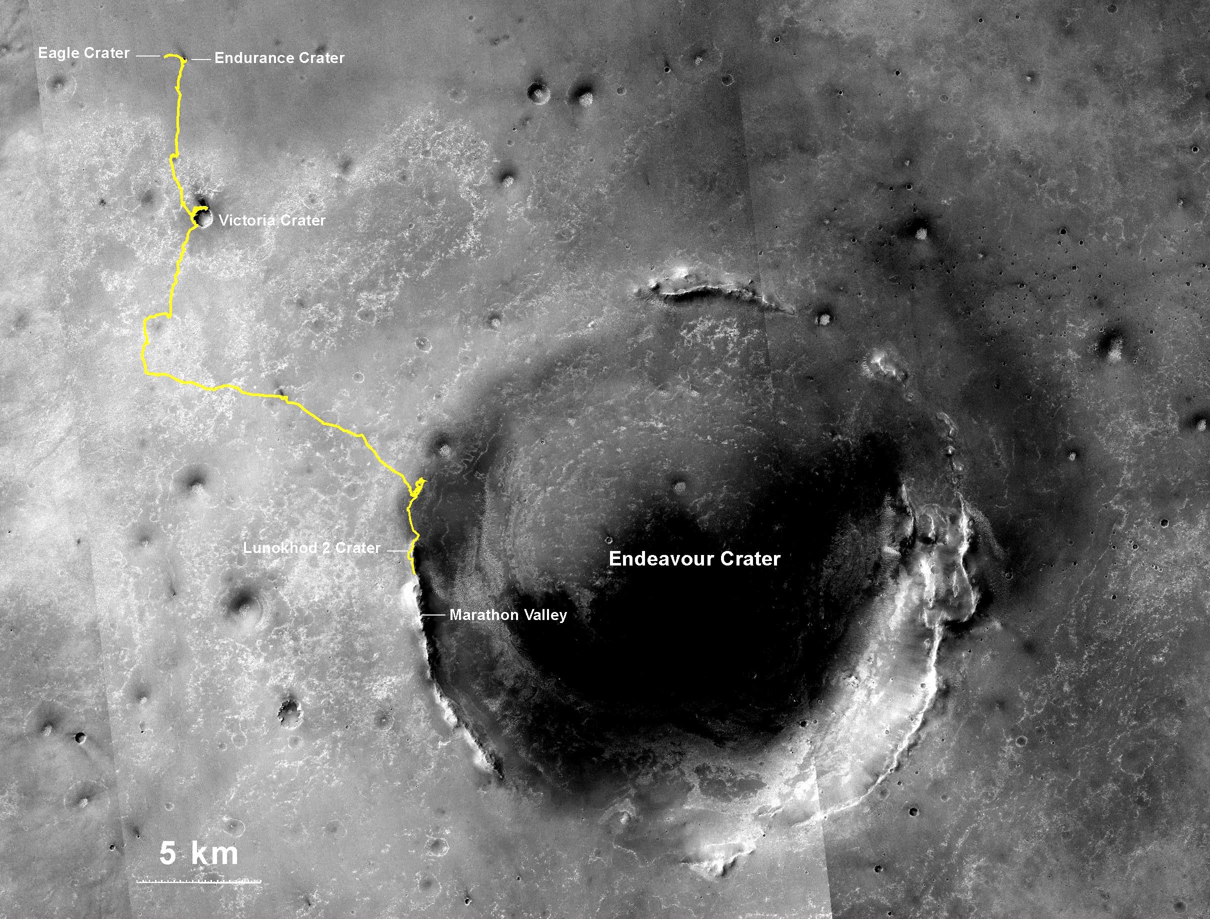
Curiosity's Progress on Route to Mount Sharp
Full Resolution:
TIFF
(25.26 MB)
JPEG
(1.565 MB)
2014-06-23
Mars
Mars Science Laboratory (MSL)
HiRISE
3300x2550x3
PIA18392:
Curiosity Rover's Traverse, First 663 Sols on Mars
Full Resolution:
TIFF
(25.26 MB)
JPEG
(1.455 MB)
2014-06-23
Mars
Mars Exploration Rover (MER)
Panoramic Camera
7843x2000x3
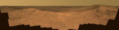
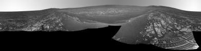
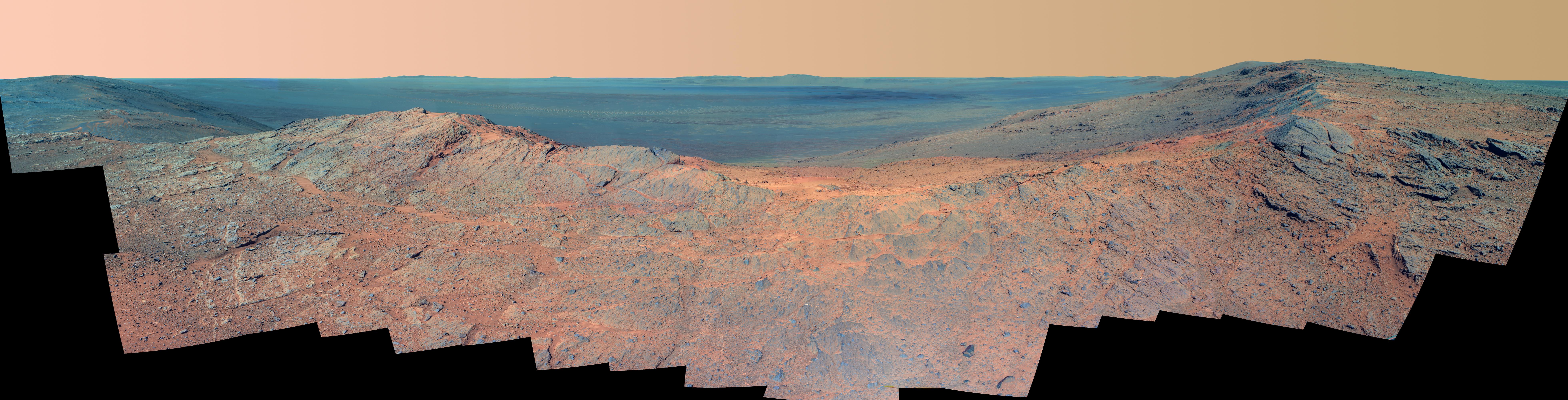
PIA18393:
'Pillinger Point' Overlooking Endeavour Crater on Mars
Full Resolution:
TIFF
(47.07 MB)
JPEG
(1.723 MB)
2014-06-23
Mars
Mars Exploration Rover (MER)
Panoramic Camera
7843x2000x3
PIA18394:
'Pillinger Point' Overlooking Endeavour Crater on Mars (False Color)
Full Resolution:
TIFF
(47.07 MB)
JPEG
(2.293 MB)
2014-06-23
Mars
Mars Exploration Rover (MER)
Panoramic Camera
7793x2000x3
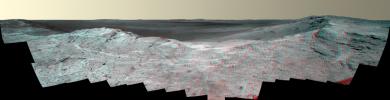
PIA18395:
'Pillinger Point' Overlooking Endeavour Crater on Mars (Stereo)
Full Resolution:
TIFF
(46.77 MB)
JPEG
(2.275 MB)
2014-06-24
Mars
2001 Mars Odyssey
THEMIS
1480x2929x1
PIA18491:
Lava Channels
Full Resolution:
TIFF
(4.34 MB)
JPEG
(564 kB)
2014-06-25
Mars
2001 Mars Odyssey
THEMIS
1529x2936x1
PIA18492:
Crater Fill
Full Resolution:
TIFF
(4.494 MB)
JPEG
(348.8 kB)
2014-06-26
Mars
2001 Mars Odyssey
THEMIS
1270x3069x1
PIA18493:
Dust Devil Tracks
Full Resolution:
TIFF
(3.902 MB)
JPEG
(495.6 kB)
2014-06-27
Mars
2001 Mars Odyssey
THEMIS
1445x2932x1
PIA18495:
Dark Slope Streaks
Full Resolution:
TIFF
(4.242 MB)
JPEG
(218.2 kB)
2014-06-30
Mars
2001 Mars Odyssey
THEMIS
1180x2900x1
PIA18496:
North Polar Dunes
Full Resolution:
TIFF
(3.426 MB)
JPEG
(154 kB)
2014-07-01
Mars
2001 Mars Odyssey
THEMIS
1178x2906x1
PIA18497:
Hyperborei Cavi
Full Resolution:
TIFF
(3.427 MB)
JPEG
(192.4 kB)
2014-07-02
Mars
2001 Mars Odyssey
THEMIS
1175x2896x1
PIA18498:
Polar Layers
Full Resolution:
TIFF
(3.407 MB)
JPEG
(180.2 kB)
2014-07-02
Mars
Mars Reconnaissance Orbiter (MRO)
HiRISE
2880x1800x3
PIA18589:
A Giant Cave on a Giant Volcano
Full Resolution:
TIFF
(15.56 MB)
JPEG
(824.1 kB)
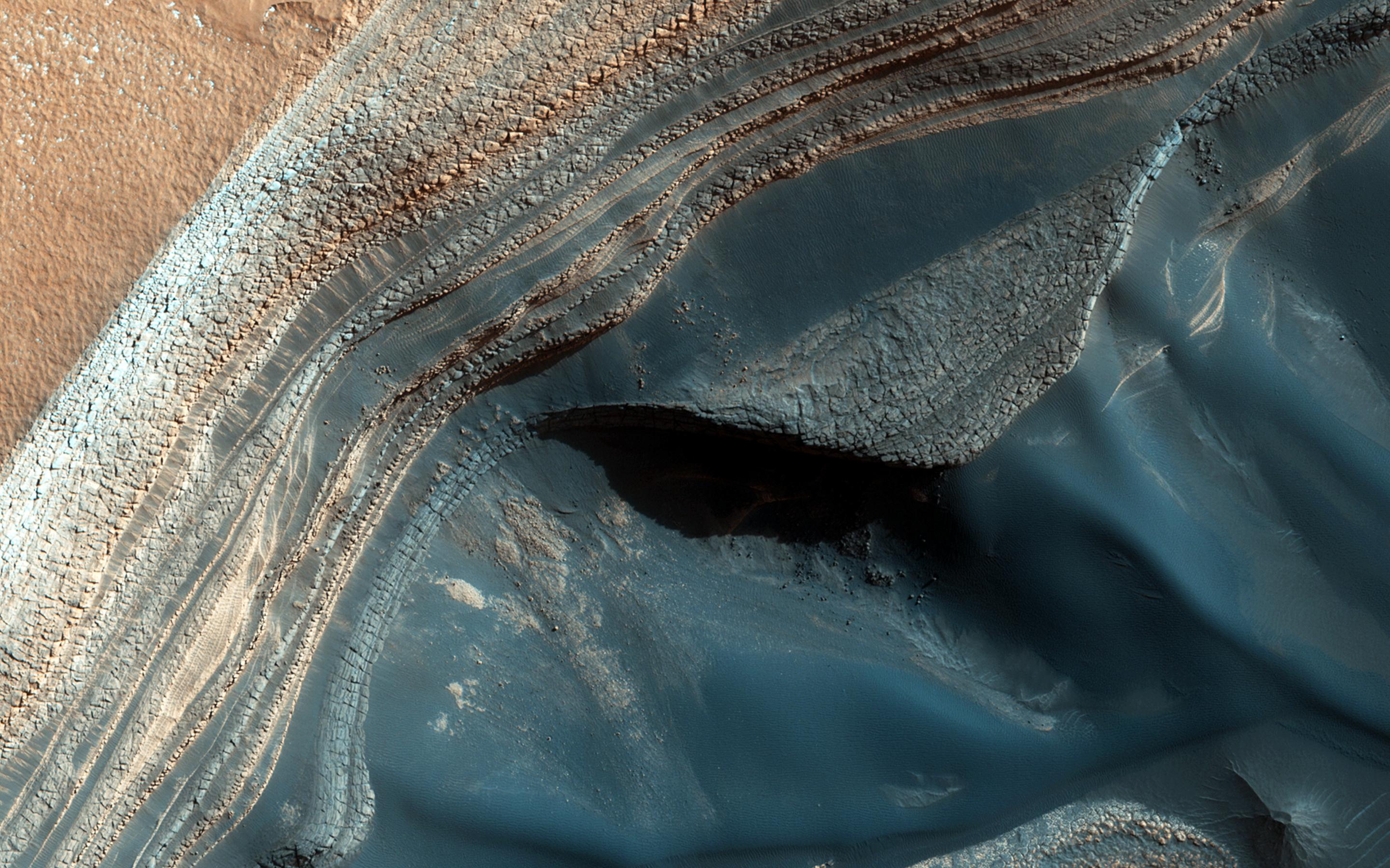
2014-07-02
Mars
Mars Reconnaissance Orbiter (MRO)
HiRISE
2880x1800x3
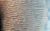
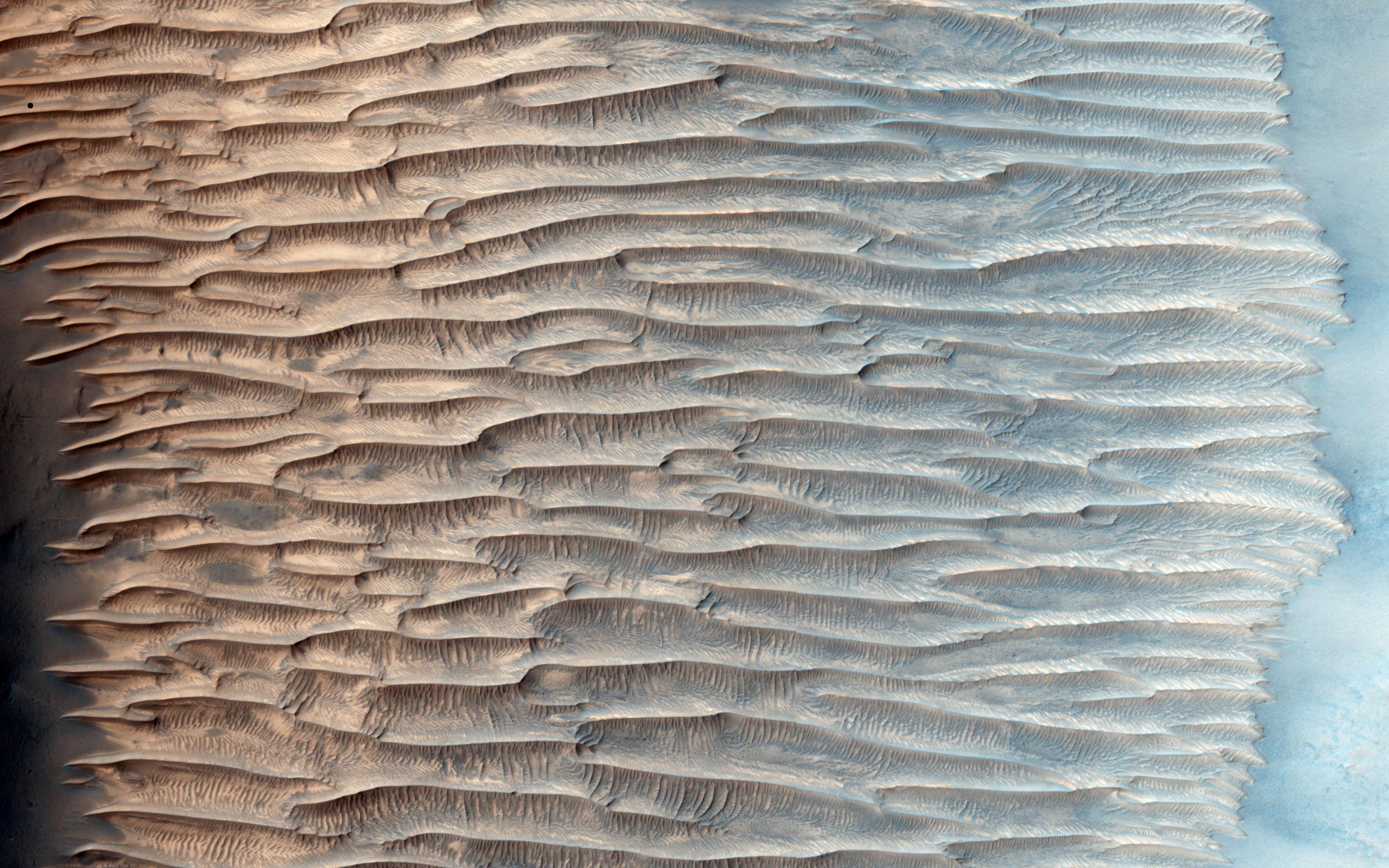
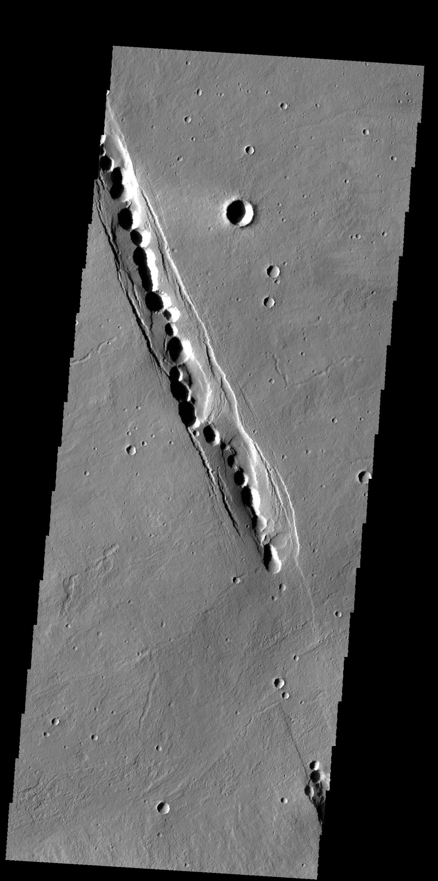
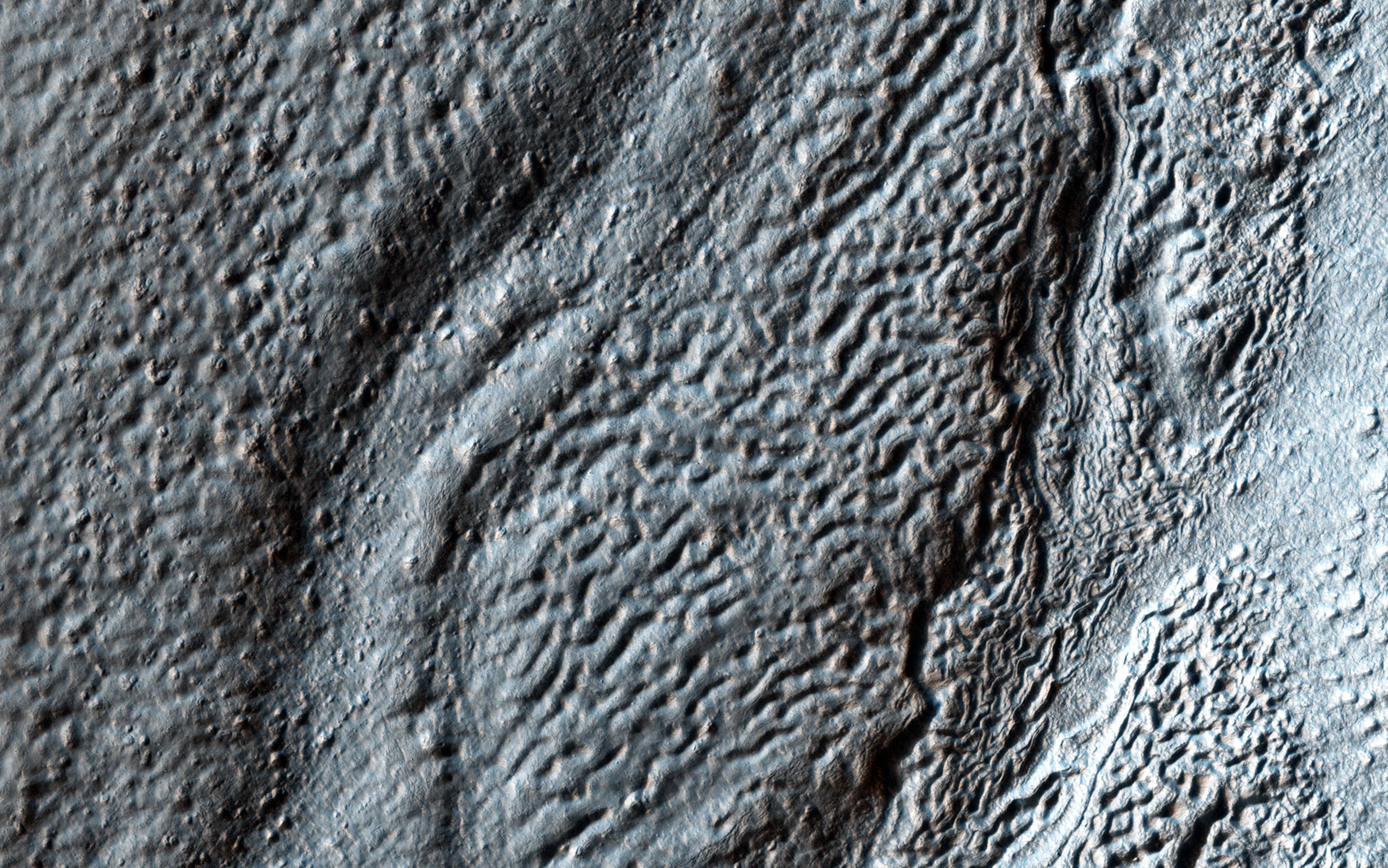
PIA18620:
Feathery Ridges
Full Resolution:
TIFF
(15.56 MB)
JPEG
(822.4 kB)
2014-07-02
Mars
Mars Reconnaissance Orbiter (MRO)
HiRISE
2880x1800x3
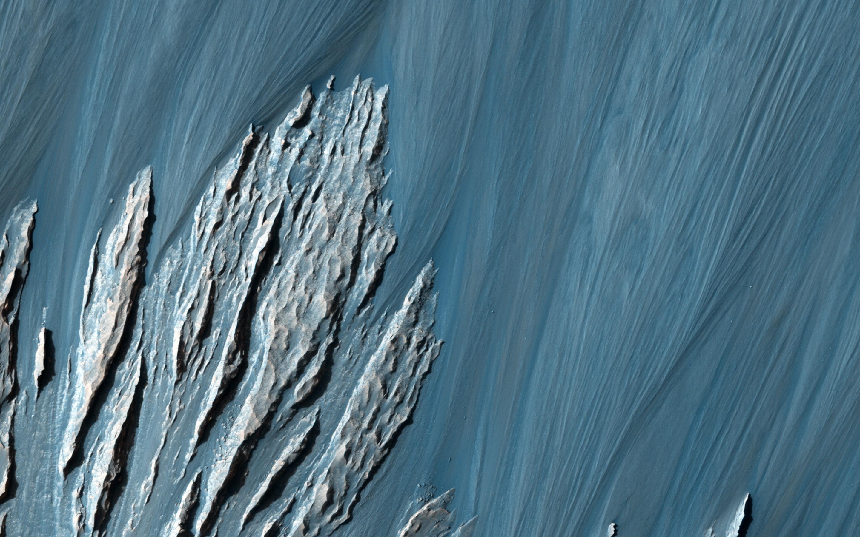
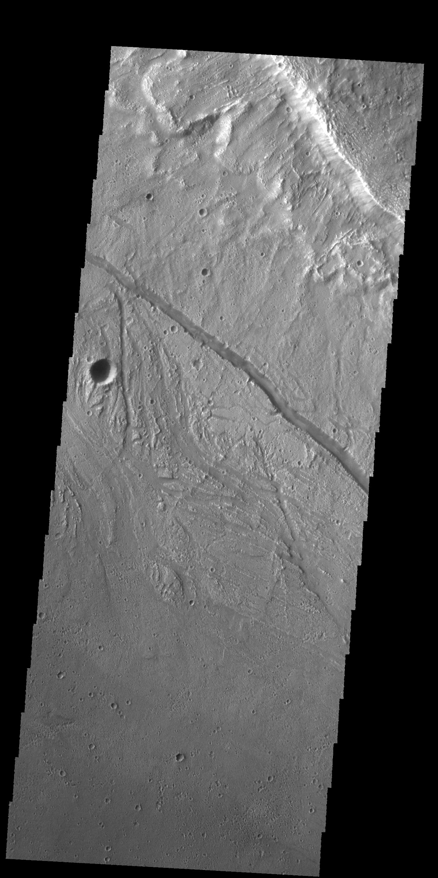
PIA18621:
A Revealing Landslide in Hebes Chasma
Full Resolution:
TIFF
(15.56 MB)
JPEG
(599 kB)
2014-07-02
Mars
Mars Reconnaissance Orbiter (MRO)
HiRISE
2880x1800x3
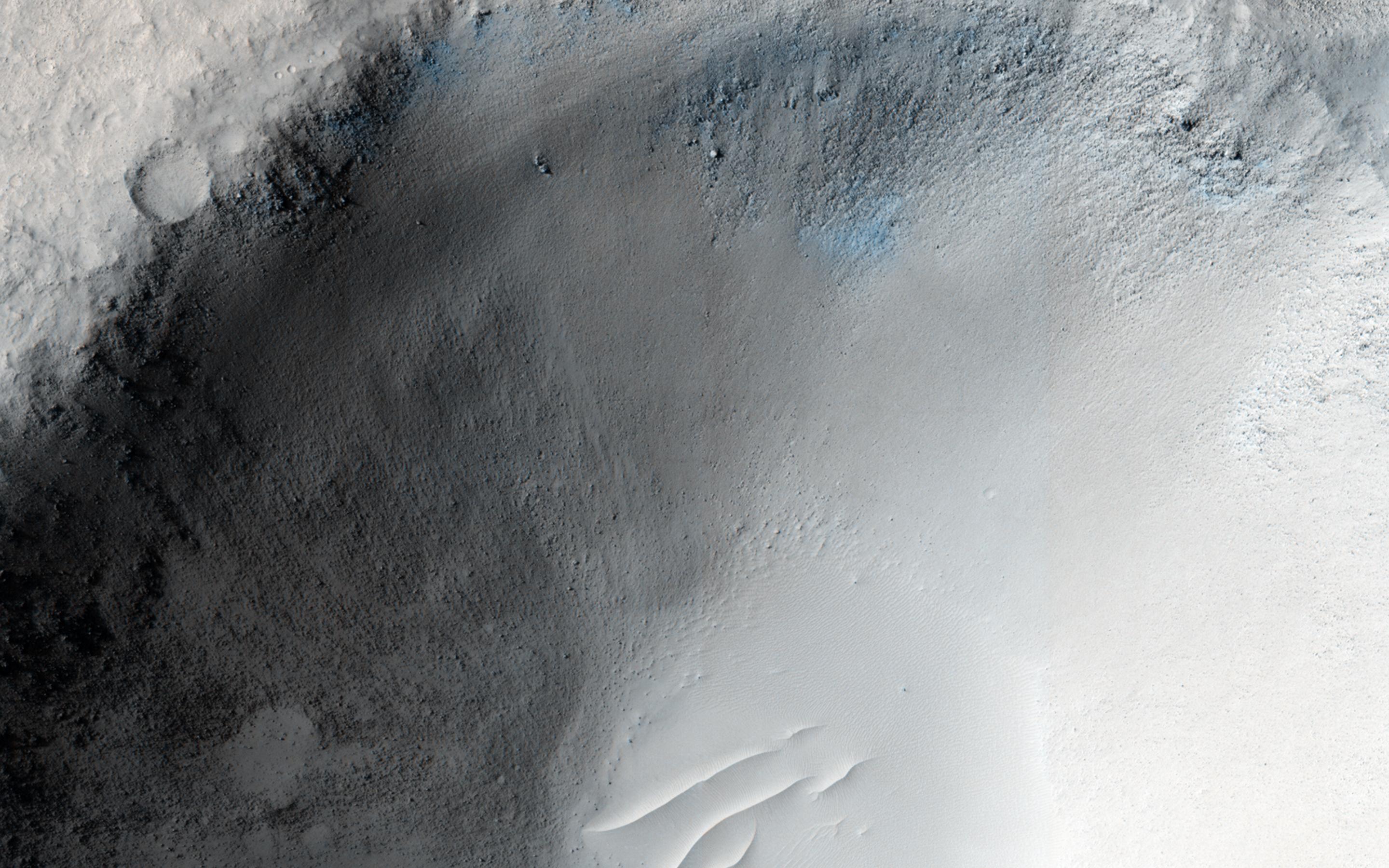
PIA18622:
An Impact Crater in Isidis Planitia
Full Resolution:
TIFF
(15.56 MB)
JPEG
(682.5 kB)
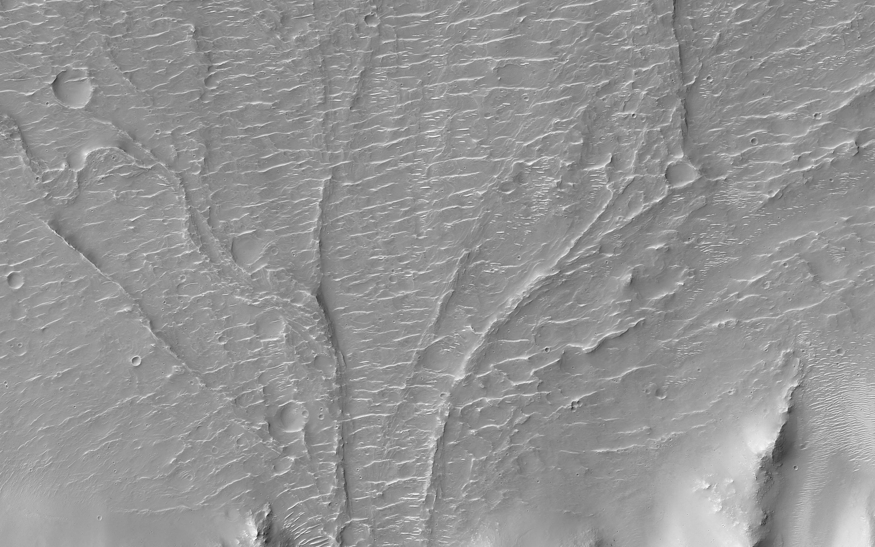
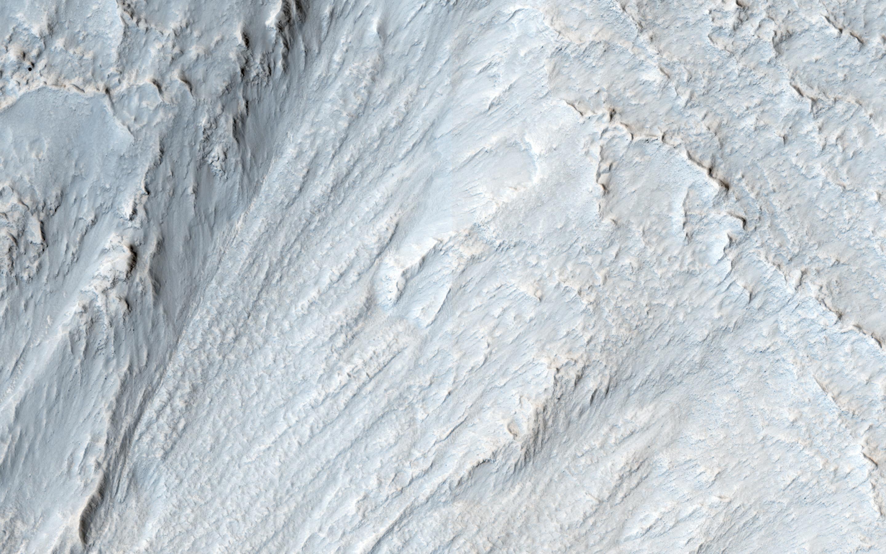
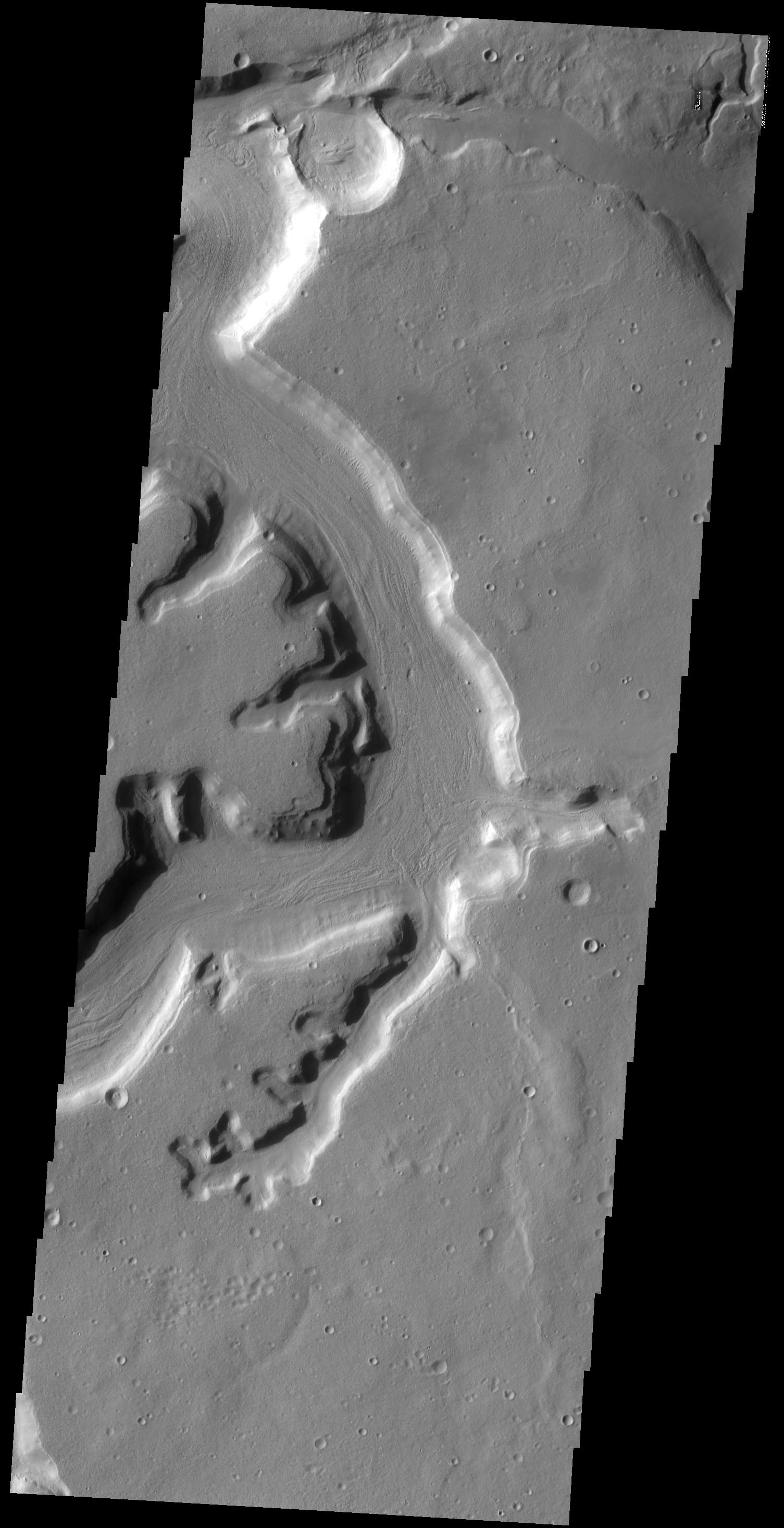
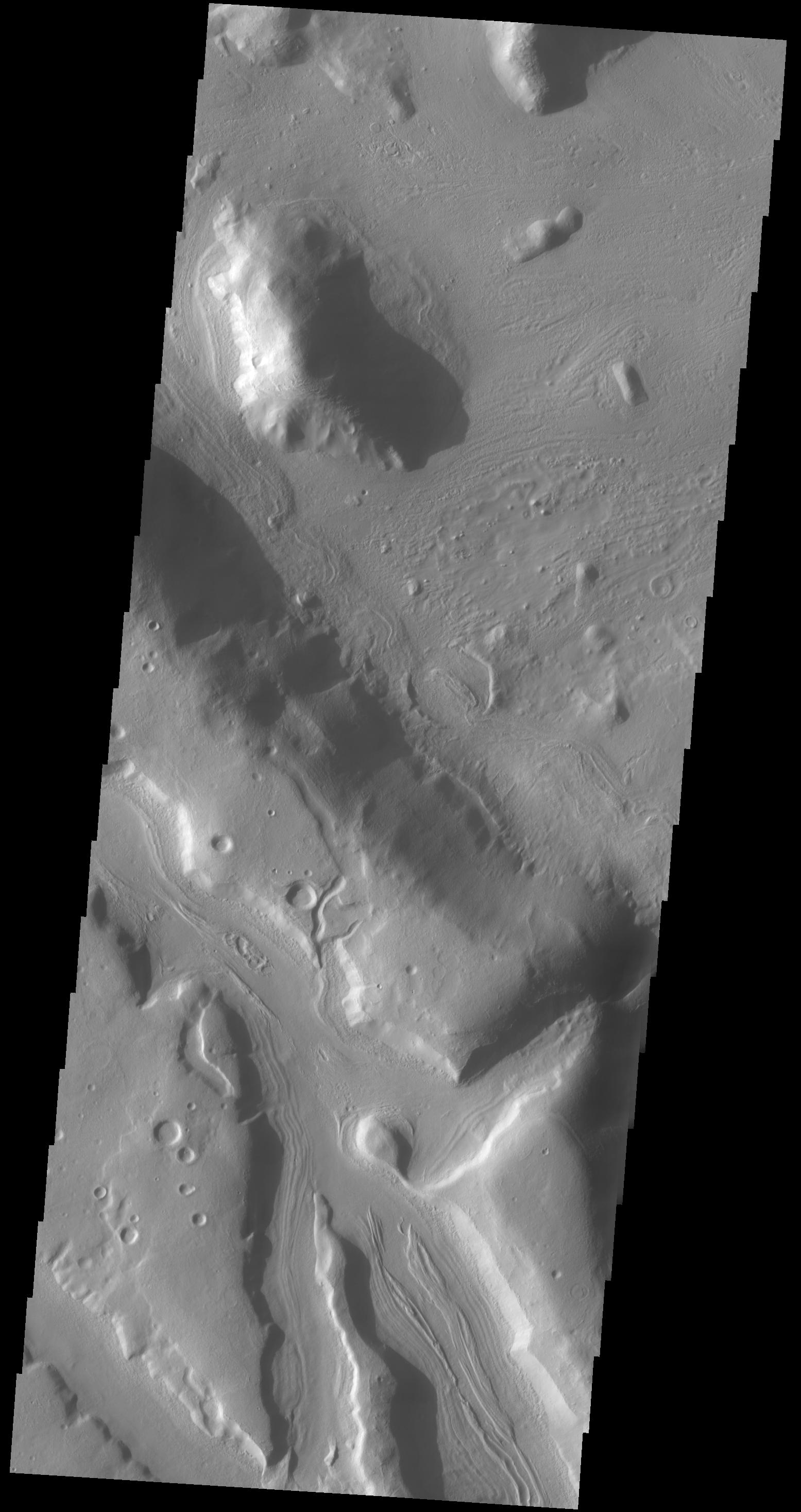
2014-07-03
Mars
2001 Mars Odyssey
THEMIS
1493x2929x1
PIA18499:
Cyane Fossae
Full Resolution:
TIFF
(4.378 MB)
JPEG
(504.6 kB)
2014-07-04
Mars
2001 Mars Odyssey
THEMIS
1505x2953x1
PIA18500:
Protonilus Mensae
Full Resolution:
TIFF
(4.449 MB)
JPEG
(357.2 kB)
2014-07-07
Mars
2001 Mars Odyssey
THEMIS
1180x2906x1
PIA18501:
Olympia Undae
Full Resolution:
TIFF
(3.433 MB)
JPEG
(470.1 kB)
2014-07-08
Mars
2001 Mars Odyssey
THEMIS
1185x2908x1
PIA18502:
North Polar Dunes
Full Resolution:
TIFF
(3.45 MB)
JPEG
(255.4 kB)
2014-07-08
Mars
Mars Reconnaissance Orbiter (MRO)
HiRISE
2312x1497x3
PIA18399:
Curiosity Mars Rover Reaching Edge of Its Landing Ellipse
Full Resolution:
TIFF
(3.467 MB)
JPEG
(504.4 kB)
2014-07-08
Mars
Mars Reconnaissance Orbiter (MRO)
HiRISE
2880x1800x3
PIA18581:
Curiosity Offside!
Full Resolution:
TIFF
(15.56 MB)
JPEG
(689.5 kB)
2014-07-09
Mars
2001 Mars Odyssey
THEMIS
1172x2888x1
PIA18503:
Rupes Tenuis
Full Resolution:
TIFF
(3.389 MB)
JPEG
(189.9 kB)
2014-07-09
Mars
Mars Science Laboratory (MSL)
ChemCam
3235x2842x3
PIA18396:
Martian Rock and Dust Filling Studied with Laser and Camera
Full Resolution:
TIFF
(27.59 MB)
JPEG
(821.6 kB)
2014-07-10
Mars
2001 Mars Odyssey
THEMIS
1184x2898x1
PIA18504:
More Polar Dunes
Full Resolution:
TIFF
(3.435 MB)
JPEG
(145.1 kB)
2014-07-10
Mars
Mars Reconnaissance Orbiter (MRO)
HiRISE
2880x1800x3
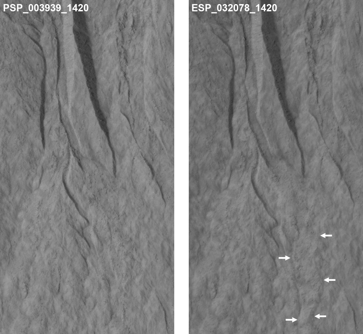
PIA18538:
Activity in Martian Gully
Full Resolution:
TIFF
(15.56 MB)
JPEG
(1.044 MB)
2014-07-10
Mars
Mars Reconnaissance Orbiter (MRO)
HiRISE
1250x1150x1
PIA18400:
Changes Near Downhill End of a Martian Gully
Full Resolution:
TIFF
(1.439 MB)
JPEG
(144.3 kB)
2014-07-11
Mars
2001 Mars Odyssey
THEMIS
1182x2905x1
PIA18505:
More Polar Dunes
Full Resolution:
TIFF
(3.438 MB)
JPEG
(249.2 kB)
2014-07-14
Mars
2001 Mars Odyssey
THEMIS
1216x2961x1
PIA18506:
Aspledon Undae
Full Resolution:
TIFF
(3.605 MB)
JPEG
(612.9 kB)
2014-07-15
Mars
2001 Mars Odyssey
THEMIS
1496x2933x1
PIA18508:
Hills
Full Resolution:
TIFF
(4.393 MB)
JPEG
(343.6 kB)
2014-07-15
Mars
Mars Science Laboratory (MSL)
ChemCam
Mastcam
8830x4230x3
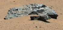
PIA18387:
Curiosity Finds Iron Meteorite on Mars
Full Resolution:
TIFF
(112.1 MB)
JPEG
(3.279 MB)
2014-07-16
Mars
2001 Mars Odyssey
THEMIS
1178x2888x1
PIA18509:
Polar Dunes
Full Resolution:
TIFF
(3.406 MB)
JPEG
(242.1 kB)
2014-07-16
Mars
Mars Science Laboratory (MSL)
ChemCam
MAHLI
1590x1060x3
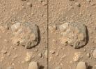
PIA18388:
Curiosity's ChemCam Examines Mars Rock Target 'Nova'
Full Resolution:
TIFF
(5.058 MB)
JPEG
(162.9 kB)
2014-07-16
Mars
Mars Science Laboratory (MSL)
MAHLI
744x540x3
PIA18401:
First Imaging of Laser-Induced Spark on Mars
Full Resolution:
TIFF
(1.206 MB)
JPEG
(114.6 kB)
2014-07-16
Mars
Mars Reconnaissance Orbiter (MRO)
HiRISE
2880x1800x3
PIA18623:
Ridges in Eridania Basin
Full Resolution:
TIFF
(15.56 MB)
JPEG
(768.2 kB)
2014-07-16
Mars
Mars Reconnaissance Orbiter (MRO)
HiRISE
2880x1800x3
PIA18624:
The Icy Surface of the North Polar Cap
Full Resolution:
TIFF
(15.56 MB)
JPEG
(1.095 MB)
2014-07-16
Mars
Mars Reconnaissance Orbiter (MRO)
HiRISE
2880x1800x3
PIA18625:
Ancient Lake Sediments in a Crater
Full Resolution:
TIFF
(15.56 MB)
JPEG
(768 kB)
2014-07-17
Mars
2001 Mars Odyssey
THEMIS
1169x2889x1
PIA18540:
Olympia Undae
Full Resolution:
TIFF
(3.381 MB)
JPEG
(475.5 kB)
2014-07-18
Mars
2001 Mars Odyssey
THEMIS
1210x2954x1
PIA18541:
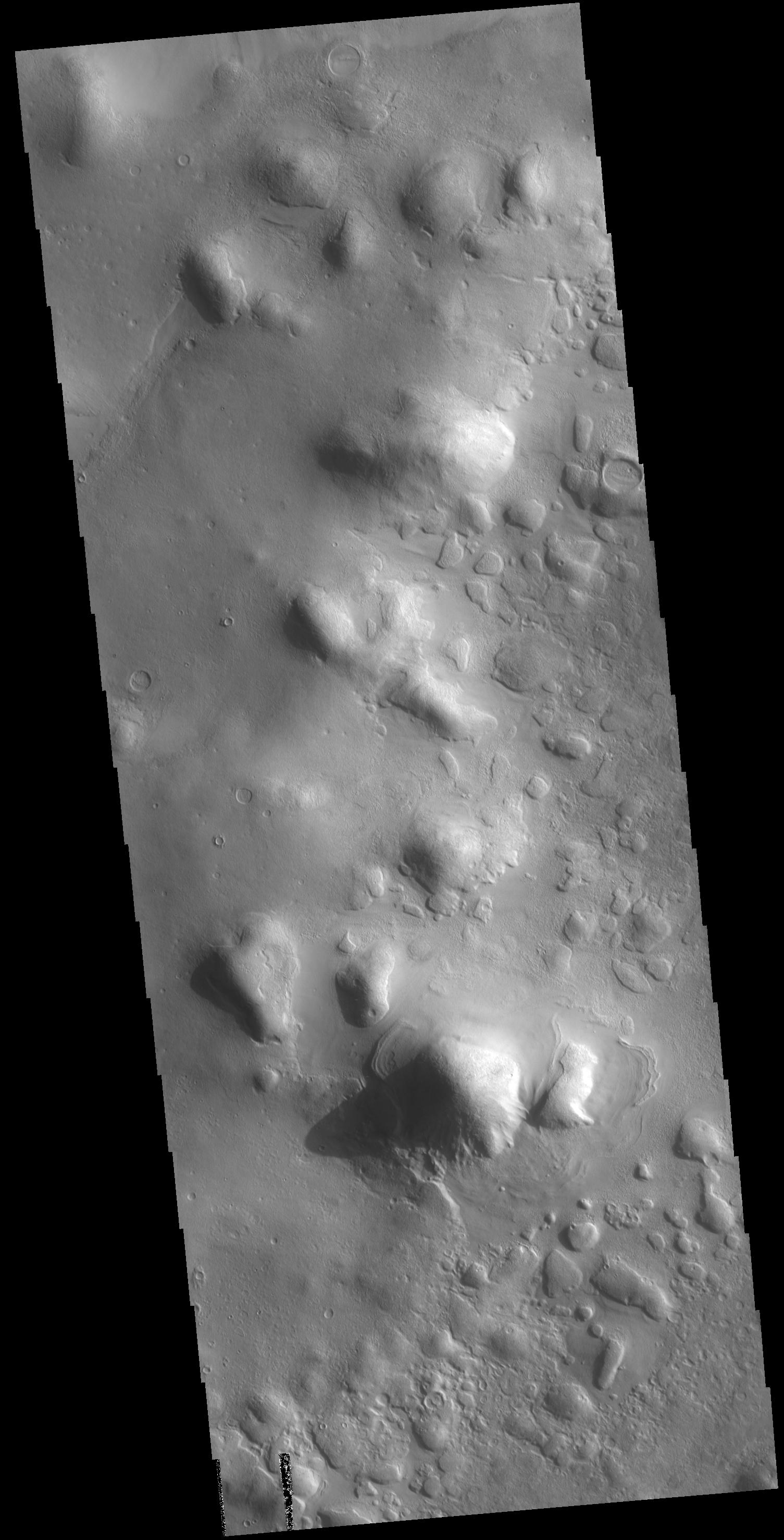
Lonar Crater
Full Resolution:
TIFF
(3.579 MB)
JPEG
(260.4 kB)
2014-07-21
Mars
2001 Mars Odyssey
THEMIS
1185x2908x1
PIA18542:
More Polar Dunes
Full Resolution:
TIFF
(3.45 MB)
JPEG
(238.7 kB)
2014-07-22
Mars
2001 Mars Odyssey
THEMIS
1555x2935x1
PIA18543:
Coloe Fossae
Full Resolution:
TIFF
(4.569 MB)
JPEG
(320.8 kB)
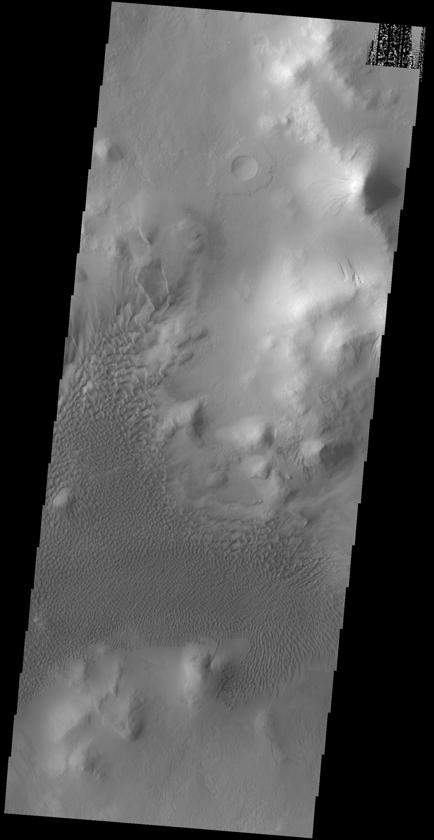
2014-07-23
Mars
2001 Mars Odyssey
THEMIS
1522x2945x1
PIA18544:
Lyot Crater Dunes
Full Resolution:
TIFF
(4.487 MB)
JPEG
(275.7 kB)
2014-07-24
Mars
2001 Mars Odyssey
THEMIS
1188x2701x1
PIA18545:
Plains Layers
Full Resolution:
TIFF
(3.213 MB)
JPEG
(575.5 kB)
2014-07-25
Mars
2001 Mars Odyssey
THEMIS
1169x2701x1
PIA18546:
Rubicon Valles
Full Resolution:
TIFF
(3.161 MB)
JPEG
(453.6 kB)
2014-07-28
Mars
2001 Mars Odyssey
THEMIS
1517x2936x1
PIA18547:
Colles
Full Resolution:
TIFF
(4.459 MB)
JPEG
(482.6 kB)
2014-07-28
Mars
Mars Exploration Rover (MER)
Mars Reconnaissance Orbiter (MRO)
CTX
2420x1838x3
PIA18404:
Opportunity's Journey Exceeds 25 Miles
Full Resolution:
TIFF
(13.35 MB)
JPEG
(943.2 kB)
2014-07-28
Mars
Mars Exploration Rover (MER)
Panoramic Camera
3609x3130x3
PIA18414:
'Lunokhod 2 Crater' on Mars (False Color)
Full Resolution:
TIFF
(33.9 MB)
JPEG
(1.349 MB)
2014-07-28
Mars
Mars Exploration Rover (MER)
Panoramic Camera
2817x3040x3
PIA18415:
'Lunokhod 2' Crater on Mars (Stereo)
Full Resolution:
TIFF
(25.7 MB)
JPEG
(1.707 MB)
2014-07-28
Mars
Mars Exploration Rover (MER)
Panoramic Camera
3609x3130x3
PIA18416:
'Lunokhod 2' Crater on Mars
Full Resolution:
TIFF
(33.9 MB)
JPEG
(1.068 MB)
2014-07-29
Mars
2001 Mars Odyssey
THEMIS
756x1570x1
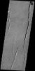
PIA18549:
Hrad Vallis
Full Resolution:
TIFF
(1.188 MB)
JPEG
(158.5 kB)
2014-07-30
Mars
2001 Mars Odyssey
THEMIS
1169x2884x1
PIA18550:
Hyperboreae Undae
Full Resolution:
TIFF
(3.375 MB)
JPEG
(126.5 kB)
2014-07-30
Mars
Mars Reconnaissance Orbiter (MRO)
HiRISE
2880x1800x3
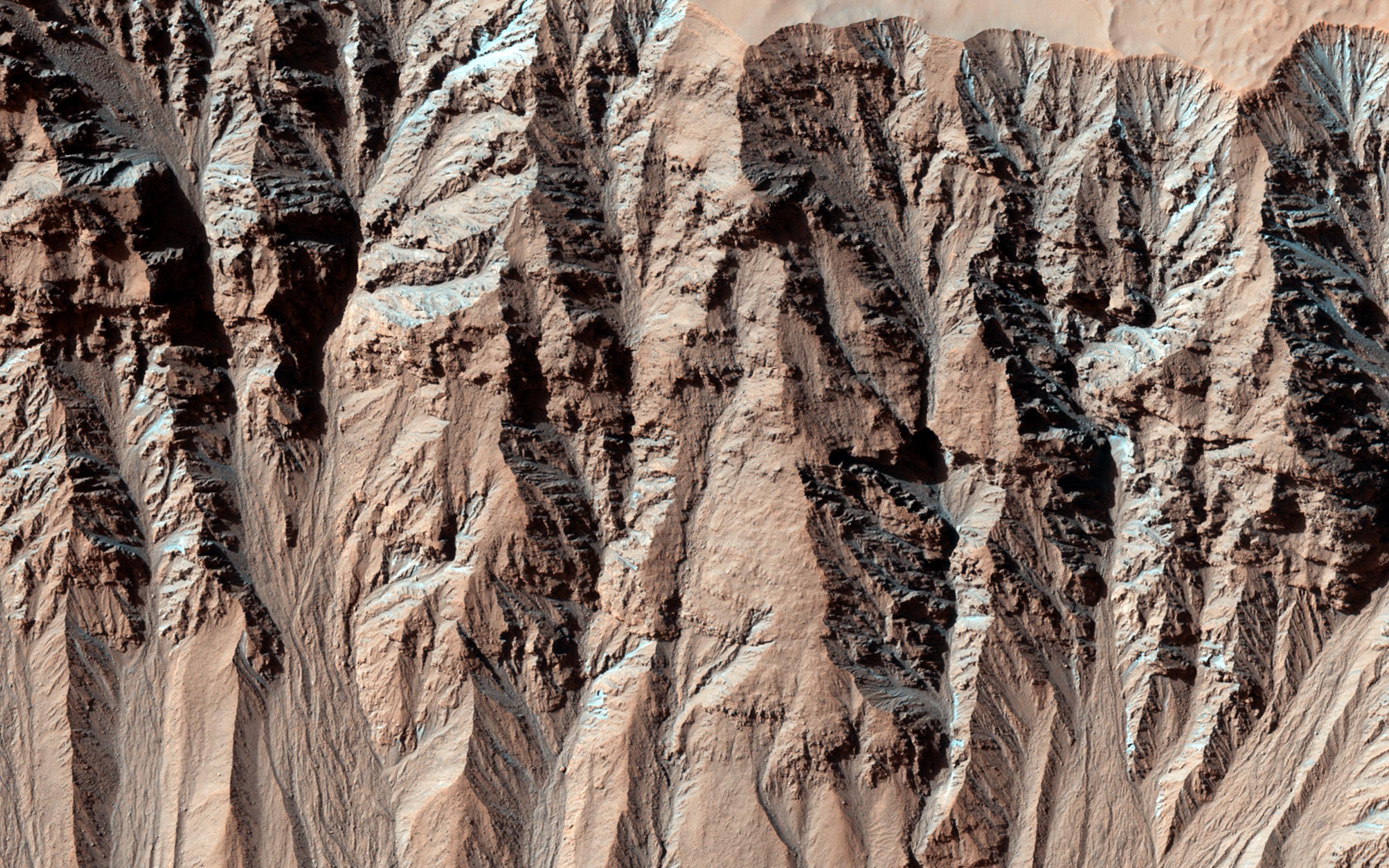
PIA18632:
Water-Bearing Rocks in Noctis Labyrinthus
Full Resolution:
TIFF
(15.56 MB)
JPEG
(986.8 kB)
2014-07-30
Mars
Mars Reconnaissance Orbiter (MRO)
HiRISE
2880x1800x1
PIA18633:
Preserving Ice from a Vanished Terrain
Full Resolution:
TIFF
(5.191 MB)
JPEG
(798.5 kB)
2014-07-30
Mars
Mars Reconnaissance Orbiter (MRO)
HiRISE
2880x1800x3
PIA18634:
Frosty Gullies
Full Resolution:
TIFF
(15.56 MB)
JPEG
(1.386 MB)
2014-07-30
Mars
Mars Reconnaissance Orbiter (MRO)
HiRISE
2880x1800x3
PIA18635:
Layers and Sand on the Floor of Schiaparelli Crater
Full Resolution:
TIFF
(15.56 MB)
JPEG
(1.025 MB)
2014-07-31
Mars
2001 Mars Odyssey
THEMIS
1459x2933x1
PIA18548:
Cyane Fossae
Full Resolution:
TIFF
(4.284 MB)
JPEG
(439.1 kB)
2014-08-01
Mars
2001 Mars Odyssey
THEMIS
1463x2933x1
PIA18551:
Kasei Valles
Full Resolution:
TIFF
(4.296 MB)
JPEG
(468.5 kB)
2014-08-01
Mars
Mars Reconnaissance Orbiter (MRO)
Mars Science Laboratory (MSL)
HiRISE
3300x2550x3
PIA18408:
Sandy Martian Valleys in Curiosity's Near Future
Full Resolution:
TIFF
(25.26 MB)
JPEG
(1.213 MB)
2014-08-01
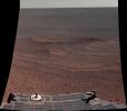
Mars
Mars Science Laboratory (MSL)
Panoramic Camera
7696x1750x1
PIA18409:
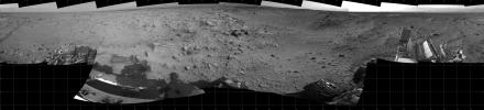
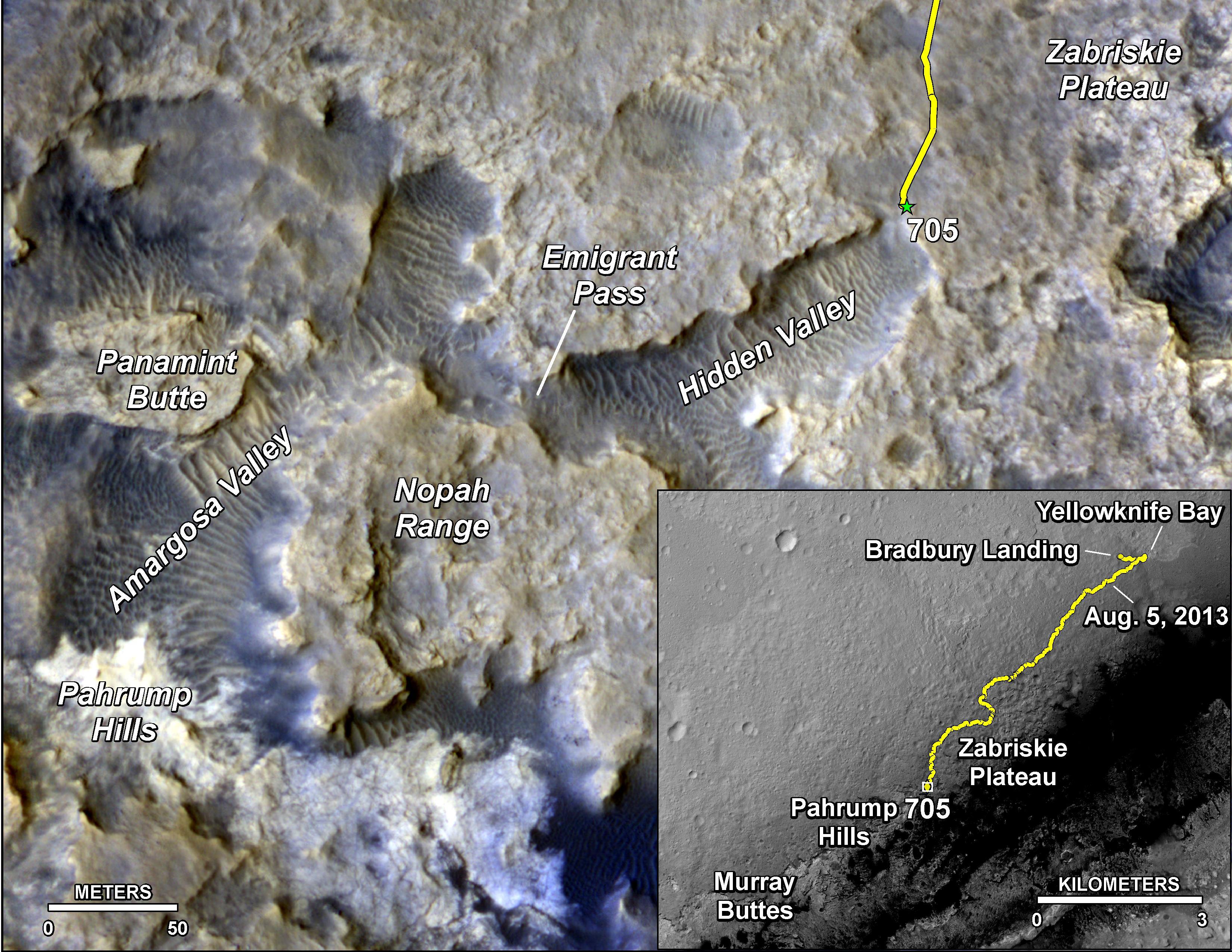
Curiosity's 360-Degree View Before Entering 'Hidden Valley'
Full Resolution:
TIFF
(13.48 MB)
JPEG
(1.506 MB)
2014-08-04
Mars
2001 Mars Odyssey
THEMIS
1190x2924x1
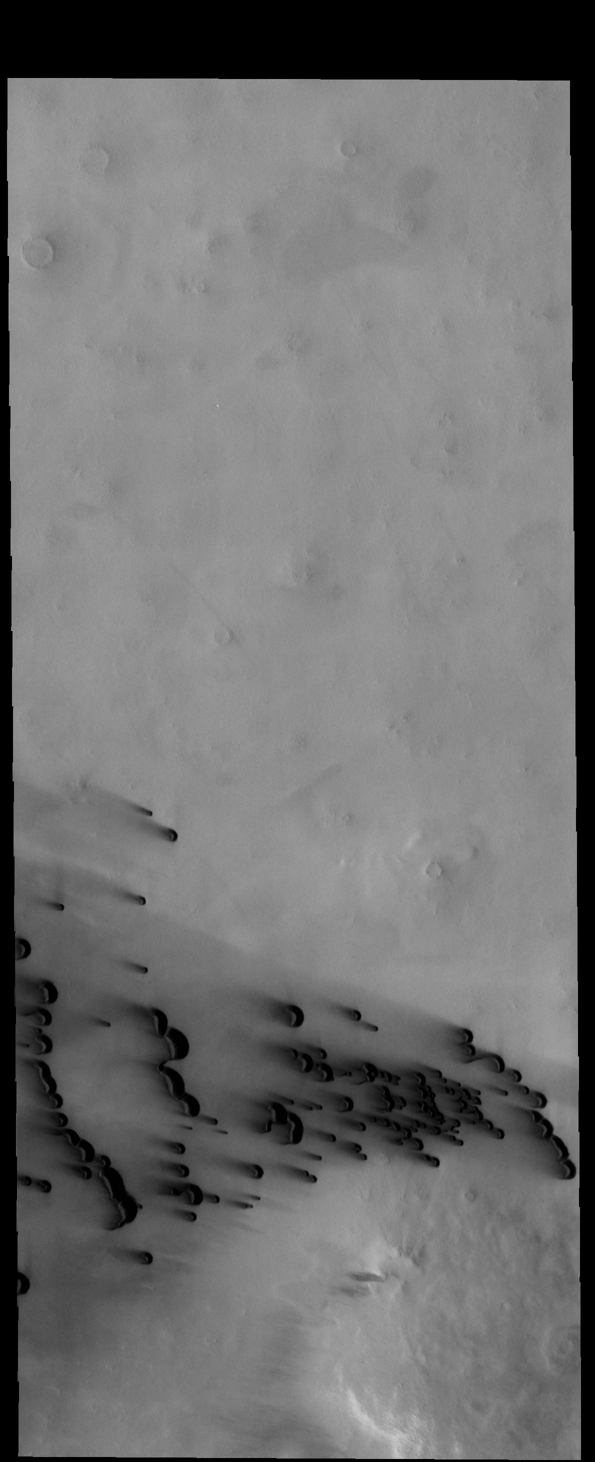
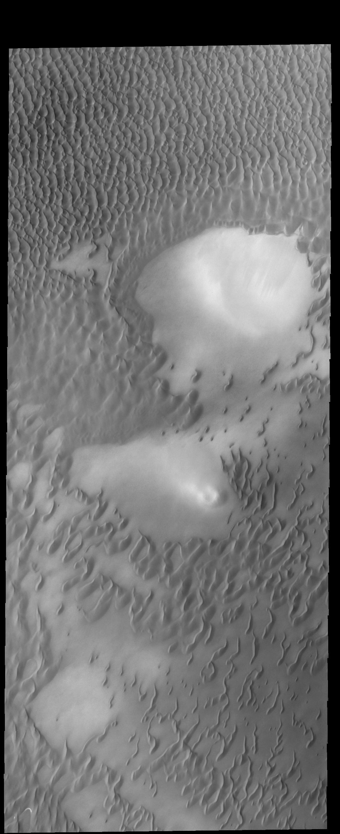
PIA18671:
Dark Dunes
Full Resolution:
TIFF
(3.484 MB)
JPEG
(211.8 kB)
2014-08-05
Mars
2001 Mars Odyssey
THEMIS
1327x5924x1
PIA18552:
Ceraunius Tholus
Full Resolution:
TIFF
(7.869 MB)
JPEG
(326.9 kB)
2014-08-05
Mars
Mars Science Laboratory (MSL)
Navcam (MSL)
1024x1024x1
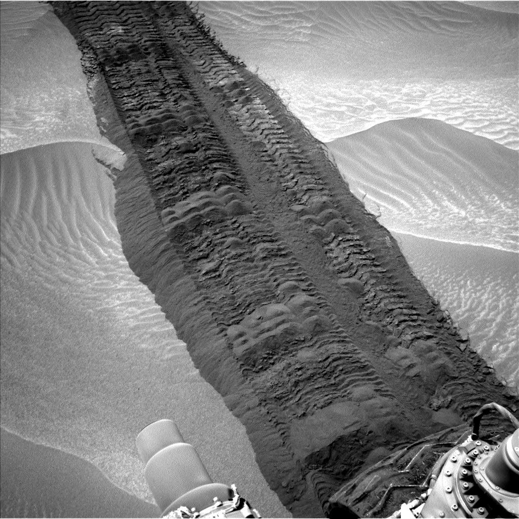
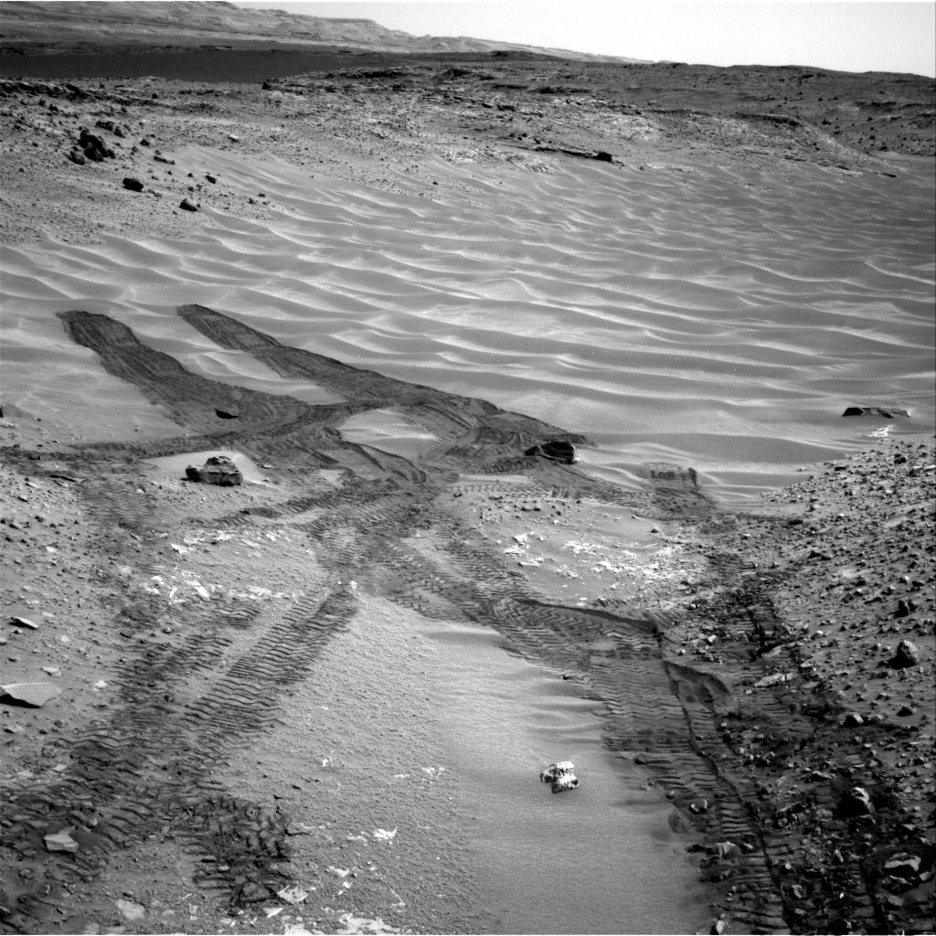
PIA18590:
Curiosity Tracks in 'Hidden Valley' on Mars
Full Resolution:
TIFF
(1.05 MB)
JPEG
(233 kB)
2014-08-06
Mars
2001 Mars Odyssey
THEMIS
1185x2907x1
PIA18554:
Polar Dunes
Full Resolution:
TIFF
(3.449 MB)
JPEG
(255.5 kB)
2014-08-07
Mars
2001 Mars Odyssey
THEMIS
1327x5924x1
PIA18555:
Uranius Tholus
Full Resolution:
TIFF
(7.869 MB)
JPEG
(379.4 kB)
2014-08-08
Mars
2001 Mars Odyssey
THEMIS
1188x2897x1
PIA18557:
Polar Dunes
Full Resolution:
TIFF
(3.446 MB)
JPEG
(123 kB)
2014-08-11
Mars
2001 Mars Odyssey
THEMIS
771x1910x1
PIA18558:
Ascraeus Mons
Full Resolution:
TIFF
(1.474 MB)
JPEG
(158.2 kB)
2014-08-12
Mars
2001 Mars Odyssey
THEMIS
1174x2888x1
PIA18672:
Polar Dunes
Full Resolution:
TIFF
(3.395 MB)
JPEG
(178.5 kB)
2014-08-13
Mars
2001 Mars Odyssey
THEMIS
1186x2902x1
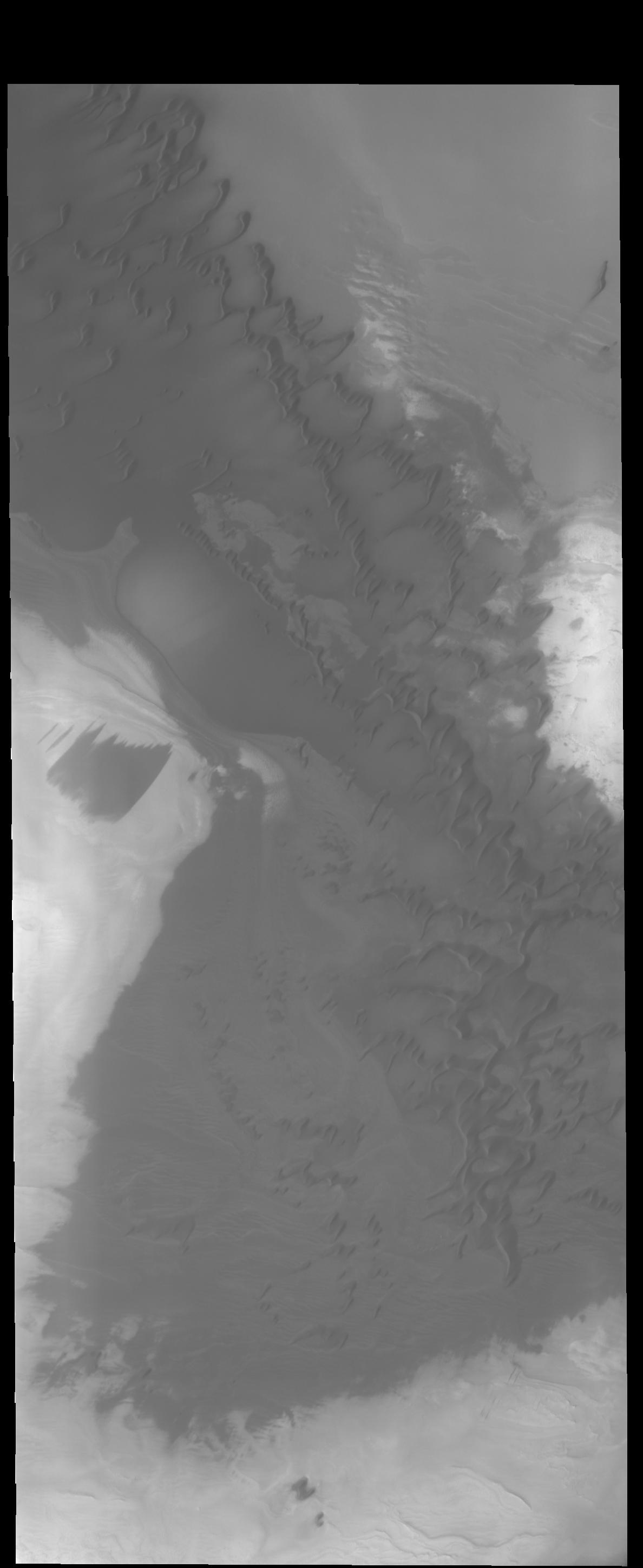
PIA18674:
Olympia Undae
Full Resolution:
TIFF
(3.446 MB)
JPEG
(170.1 kB)
2014-08-13
Mars
Mars Reconnaissance Orbiter (MRO)
HiRISE
2880x1800x1
PIA18645:
Strange Cones and Flows
Full Resolution:
TIFF
(5.191 MB)
JPEG
(1.315 MB)
2014-08-13
Mars
Mars Reconnaissance Orbiter (MRO)
HiRISE
2880x1800x3
PIA18646:
The Side of Chasma Boreale
Full Resolution:
TIFF
(15.56 MB)
JPEG
(1.215 MB)
2014-08-13
Mars
Mars Reconnaissance Orbiter (MRO)
HiRISE
2880x1800x3
PIA18647:
Glaciation at the Eastern Hellas Margin
Full Resolution:
TIFF
(15.56 MB)
JPEG
(1.016 MB)
2014-08-13
Mars
Mars Reconnaissance Orbiter (MRO)
HiRISE
2311x1486x1
PIA18594:
An Irregular, Upright Boulder on Mars
Full Resolution:
TIFF
(3.438 MB)
JPEG
(414 kB)
2014-08-14
Mars
2001 Mars Odyssey
THEMIS
1183x2888x1
PIA18676:
More Polar Dunes
Full Resolution:
TIFF
(3.421 MB)
JPEG
(385.8 kB)
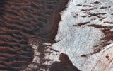
2014-08-14
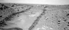
Mars
Mars Exploration Rover (MER)
Navigation Camera
7688x1962x1
PIA18595:
Opportunity's Surroundings After 25 Miles on Mars
Full Resolution:
TIFF
(15.1 MB)
JPEG
(1.245 MB)
2014-08-15
Mars
2001 Mars Odyssey
THEMIS
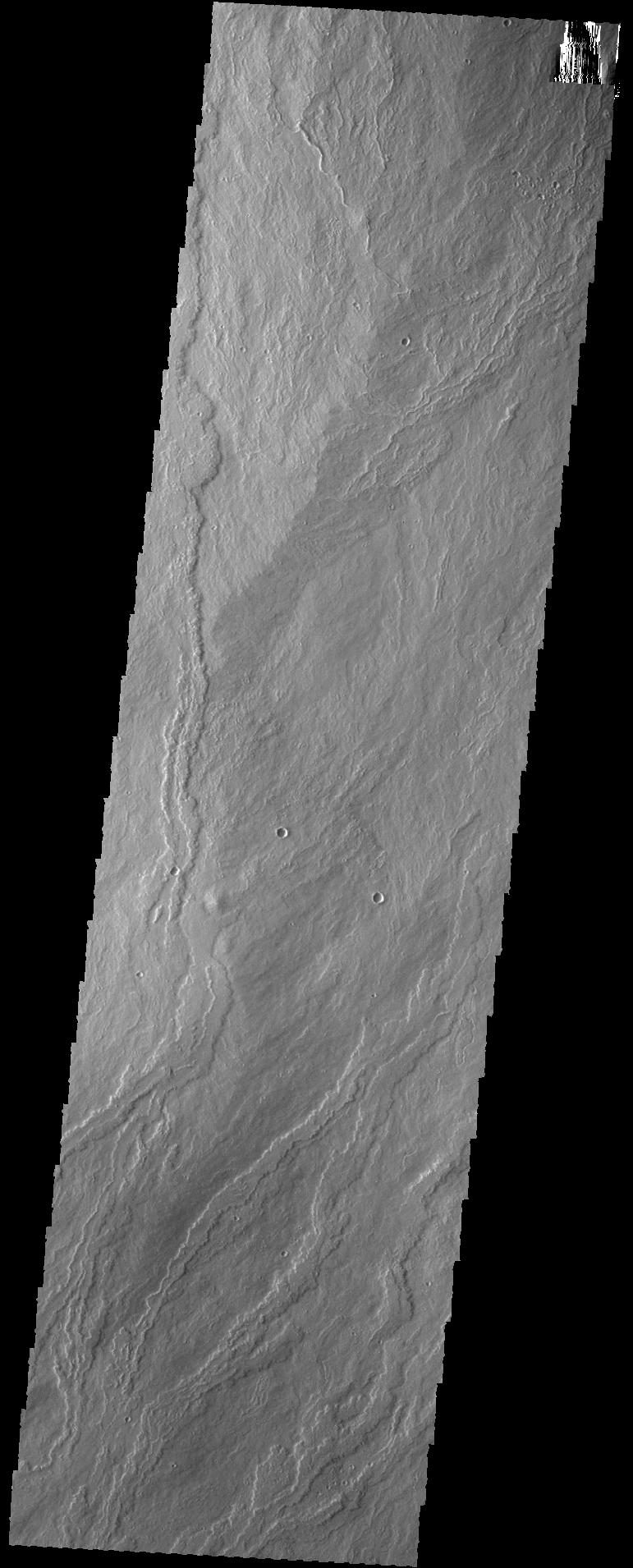
1173x2880x1
PIA18677:
Polar Layers
Full Resolution:
TIFF
(3.382 MB)
JPEG
(229.4 kB)
2014-08-15
Mars
Mars Science Laboratory (MSL)
Navcam (MSL)
1024x448x1
PIA18597:
Looking Up the Ramp Holding 'Bonanza King' on Mars
Full Resolution:
TIFF
(459.4 kB)
JPEG
(112 kB)
2014-08-15
Mars
Mars Science Laboratory (MSL)
Navcam (MSL)
1024x1024x1
PIA18599:
Down Northeastern Ramp into 'Hidden Valley' on Mars
Full Resolution:
TIFF
(1.05 MB)
JPEG
(210.8 kB)
1-100
101-200
201-300
301-400
401-500
501-600
601-700
701-800
801-900
901-1000
Currently displaying images:
8501 - 8600
of 12760


