My
List |
Addition Date
|
Target
|
Mission
|
Instrument
|
Size
|

|
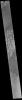
2023-01-12 |
Mars
|
2001 Mars Odyssey
|
THEMIS
|
590x2729x1 |
|
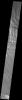
-
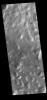
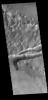
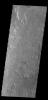
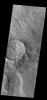
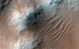
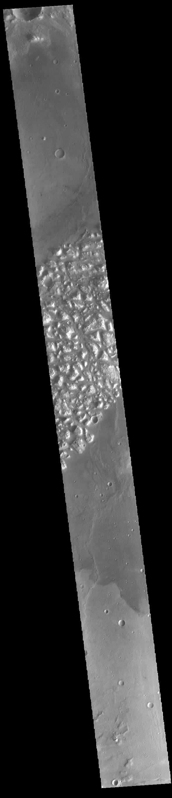
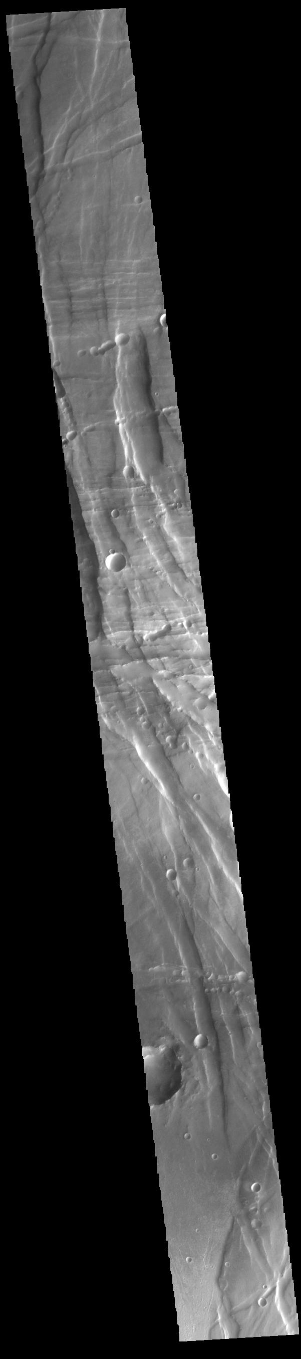
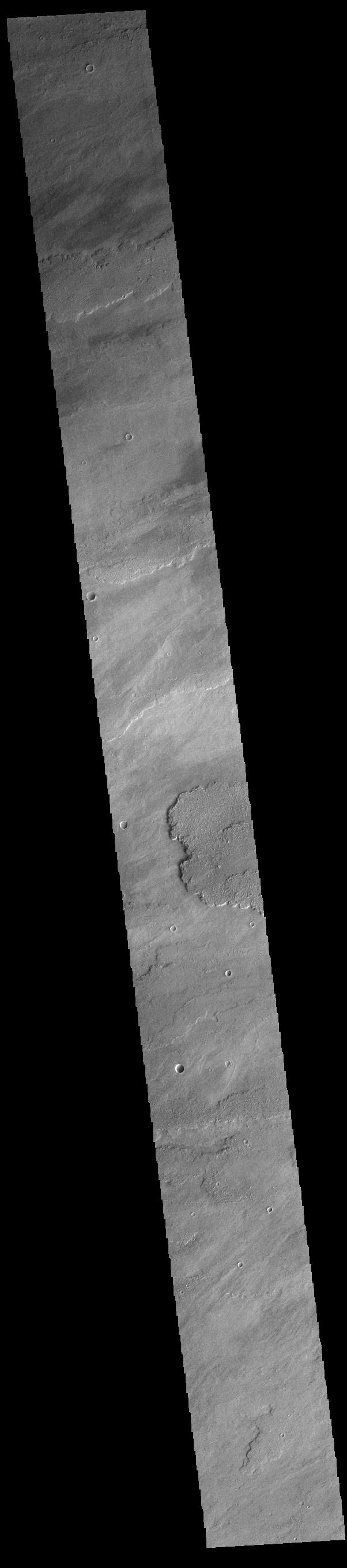
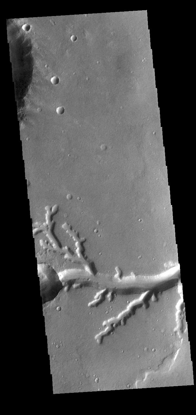
PIA25749:
-
Atlantis Chaos
Full Resolution:
TIFF
(753.5 kB)
JPEG
(101.8 kB)
|
|
|
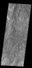
2023-01-11 |
Mars
|
2001 Mars Odyssey
|
THEMIS
|
670x1408x1 |
|
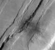
-
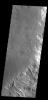
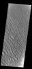
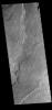
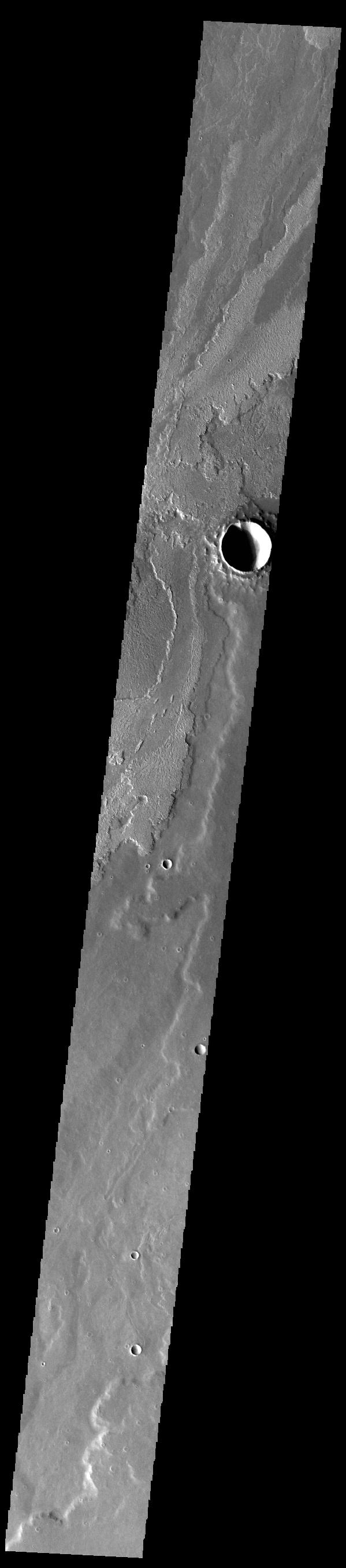
PIA25748:
-
Daedalia Planum
Full Resolution:
TIFF
(746.1 kB)
JPEG
(163.2 kB)
|
|
|
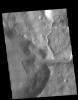
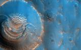
2023-01-10 |
Mars
|
2001 Mars Odyssey
|
THEMIS
|
1136x1448x1 |
|
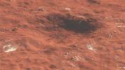
-
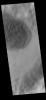
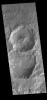
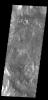
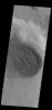
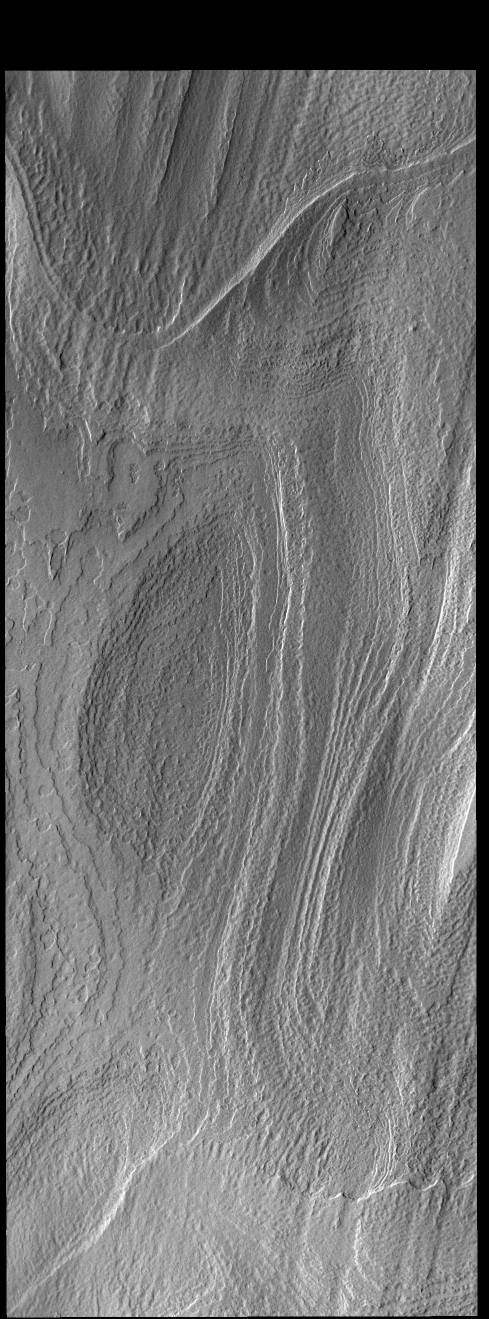
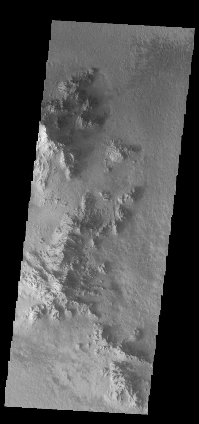
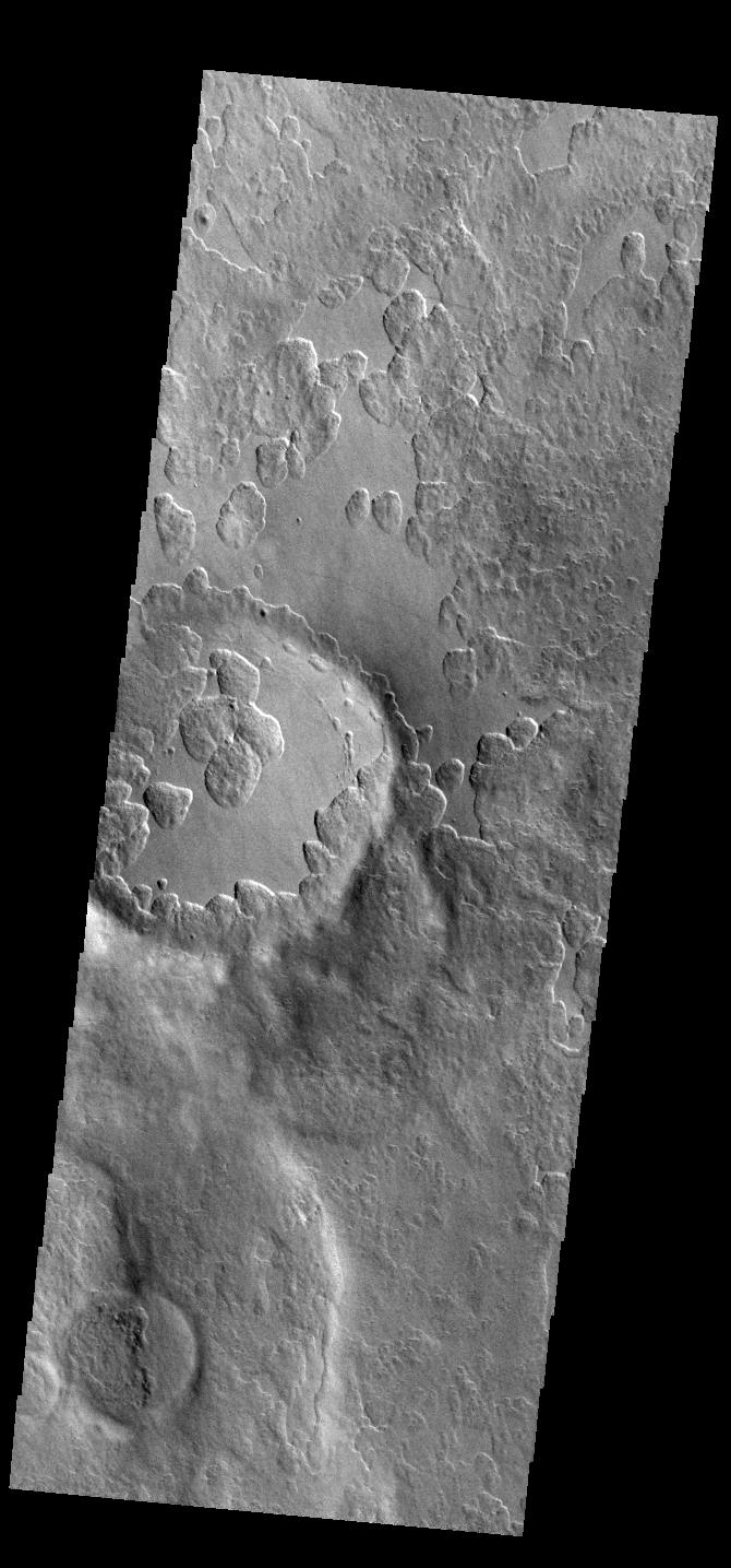
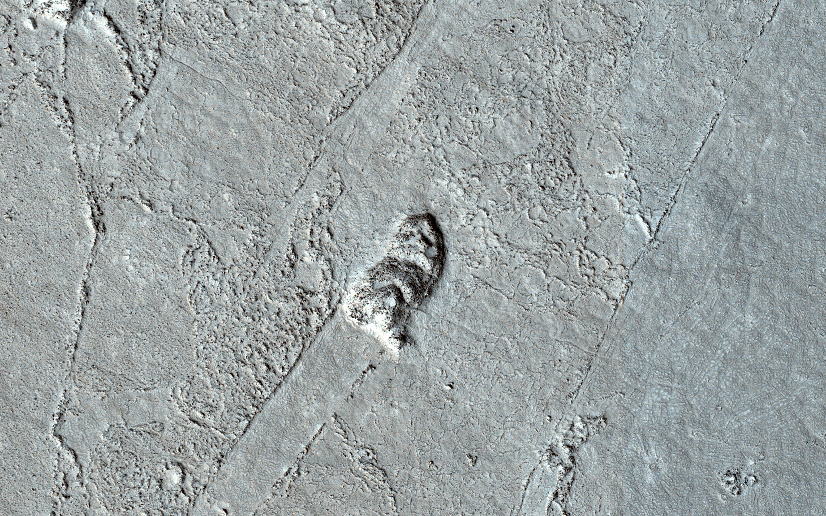
PIA25747:
-
Crater Delta
Full Resolution:
TIFF
(1.288 MB)
JPEG
(157.1 kB)
|
|
|
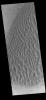
2023-01-09 |
Mars
|
2001 Mars Odyssey
|
THEMIS
|
660x1433x1 |
|
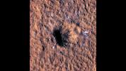
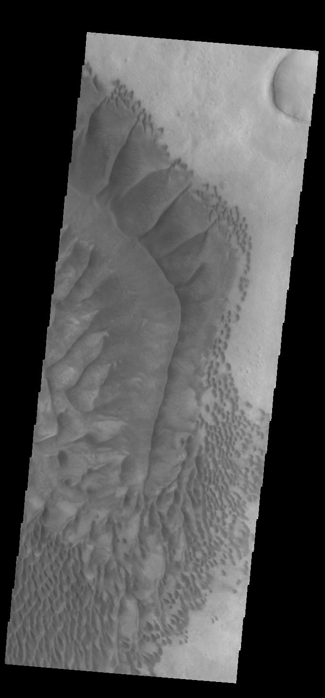
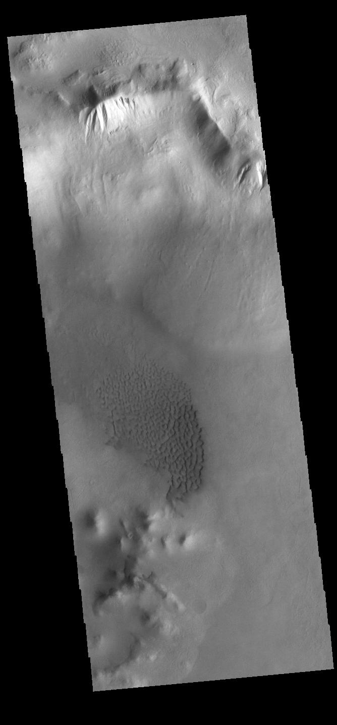
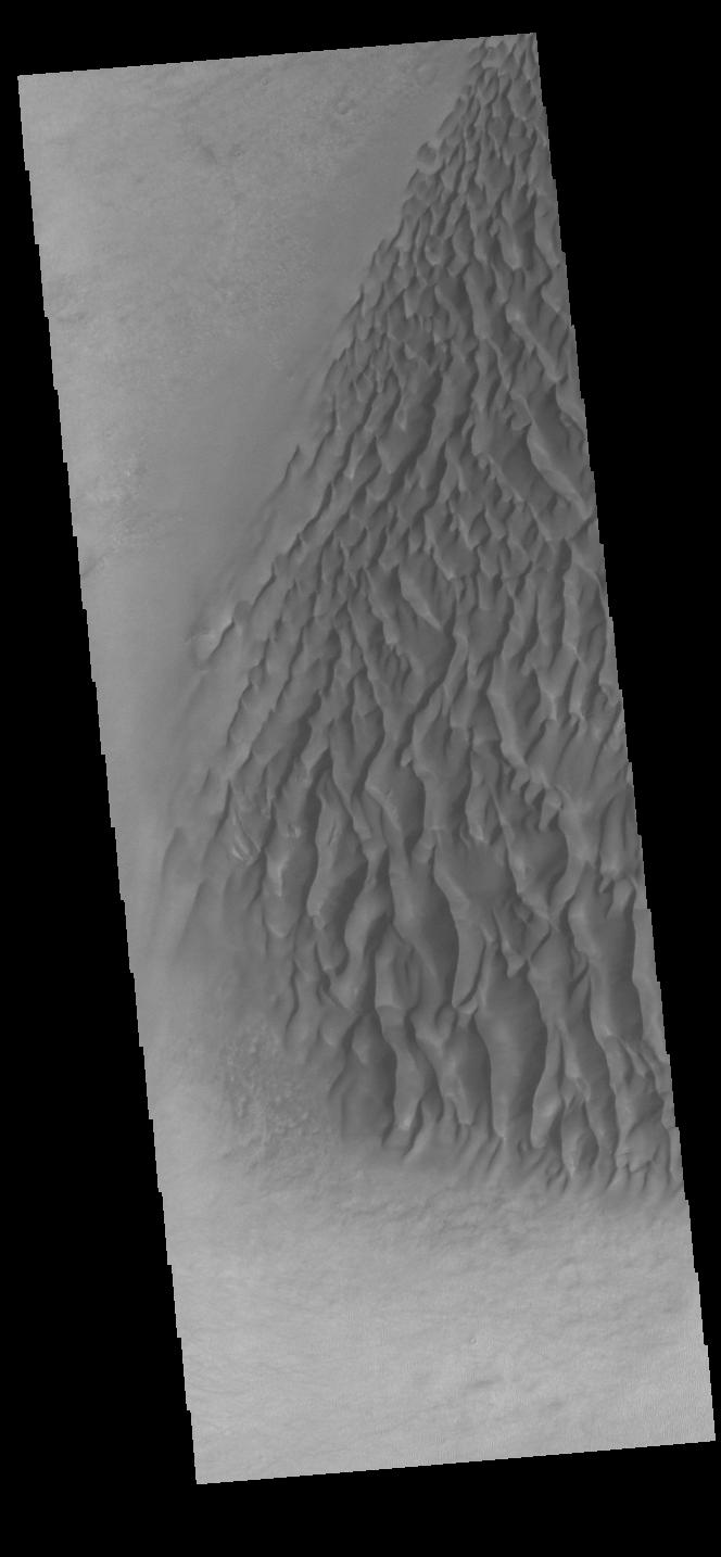
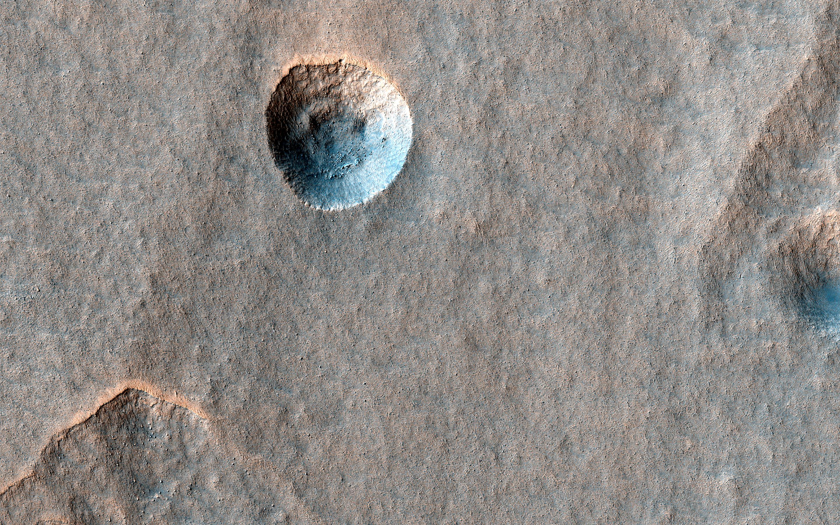
-
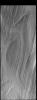
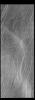
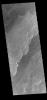
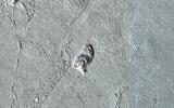
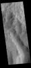
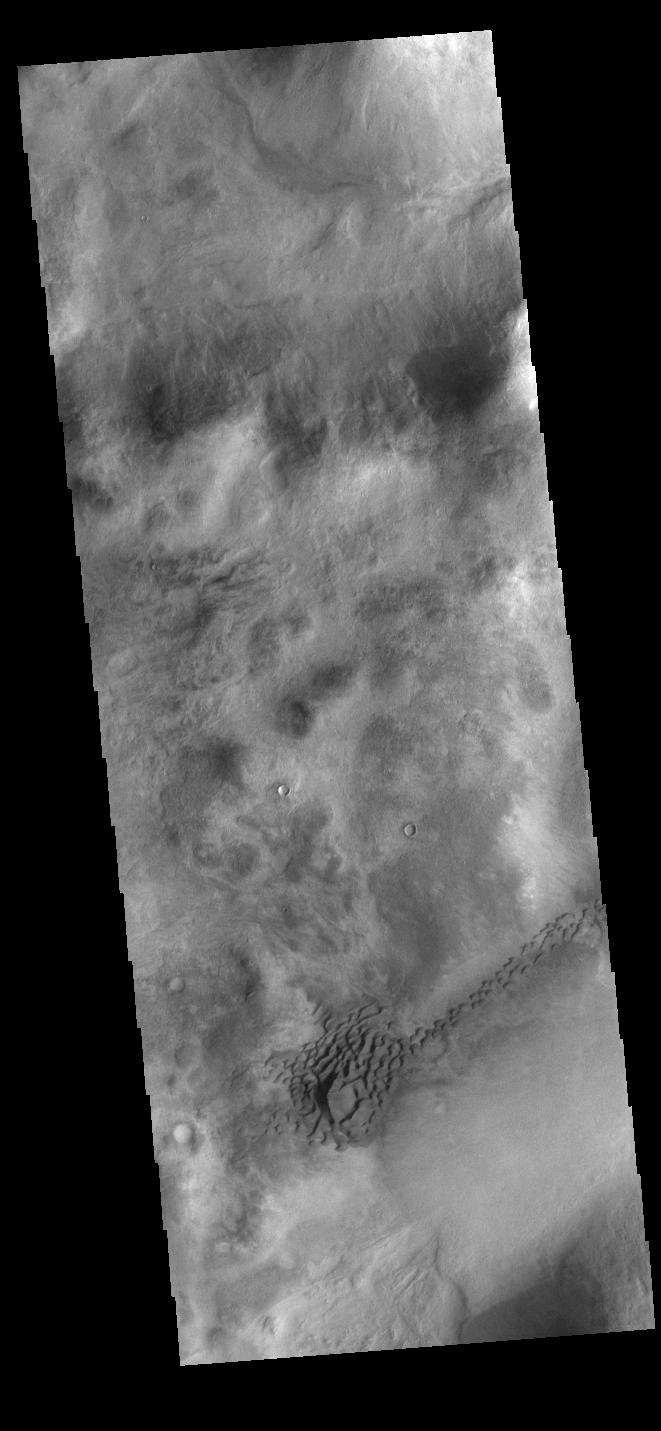
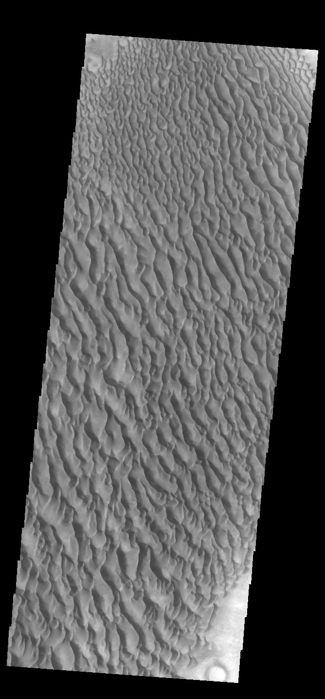
PIA25746:
-
Proctor Crater Dunes
Full Resolution:
TIFF
(676.2 kB)
JPEG
(73.77 kB)
|
|
|
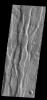
2023-01-06 |
Mars
|
2001 Mars Odyssey
|
THEMIS
|
599x2712x1 |

|
-
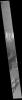
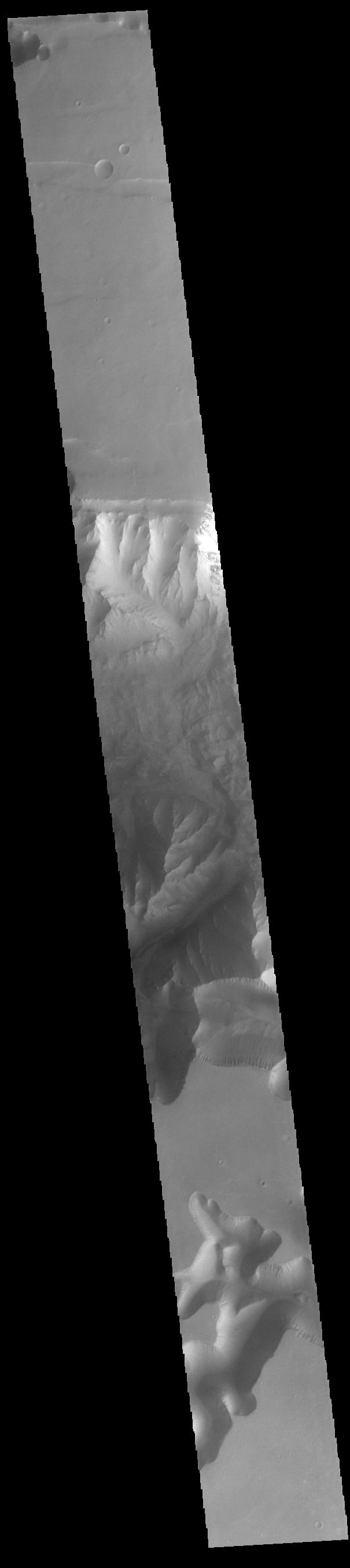
PIA25745:
-
Daedalia Planum
Full Resolution:
TIFF
(760 kB)
JPEG
(118.7 kB)
|
|
|
2023-01-05 |
Mars
|
2001 Mars Odyssey
|
THEMIS
|
664x1424x1 |
|
-
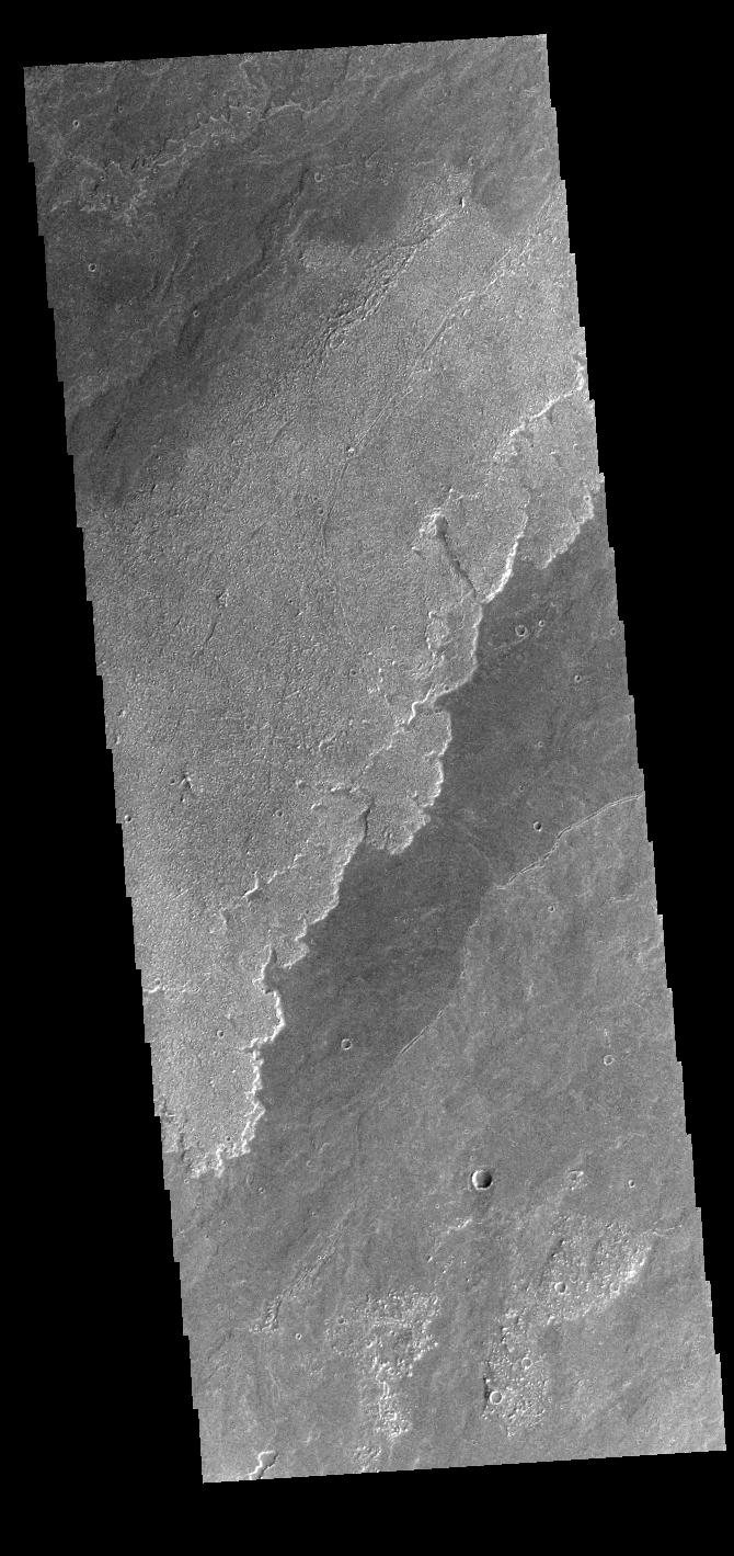
PIA25744:
-
Ariadnes Colles
Full Resolution:
TIFF
(696.9 kB)
JPEG
(85.54 kB)
|
|
|
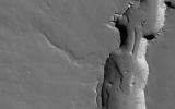
2023-01-04 |
Mars
|
2001 Mars Odyssey
|
THEMIS
|
677x1418x1 |
|
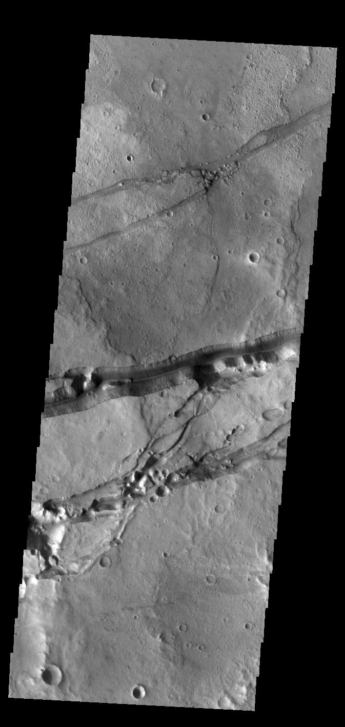
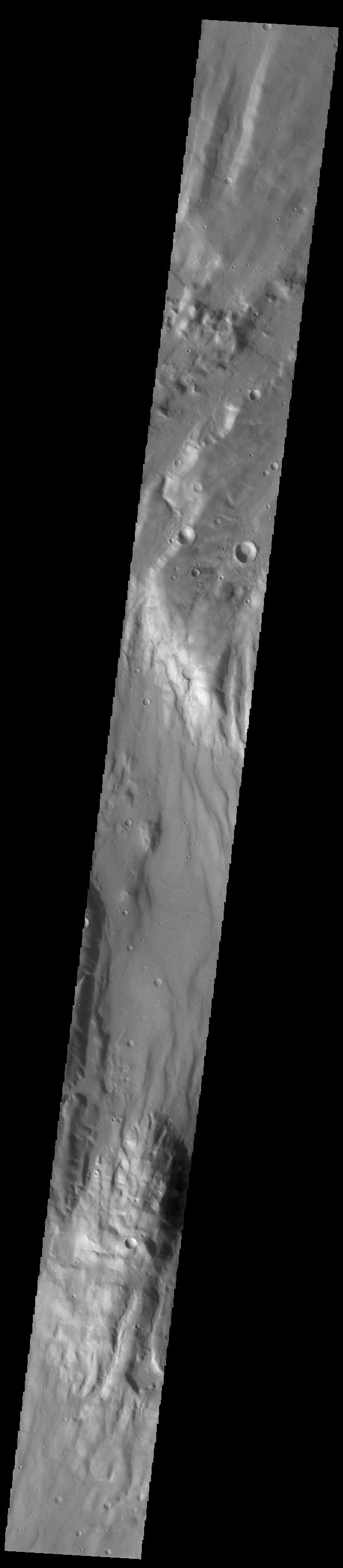
-
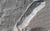
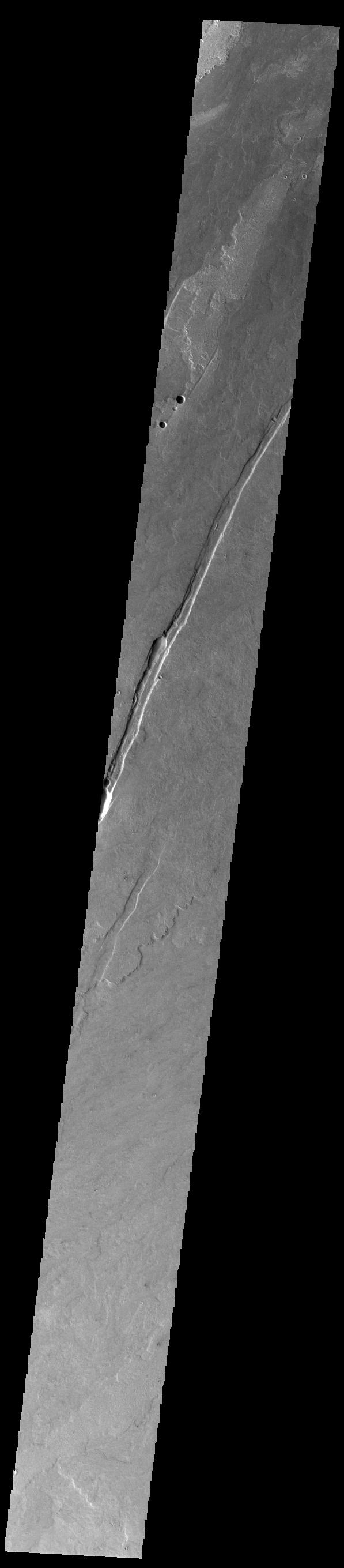
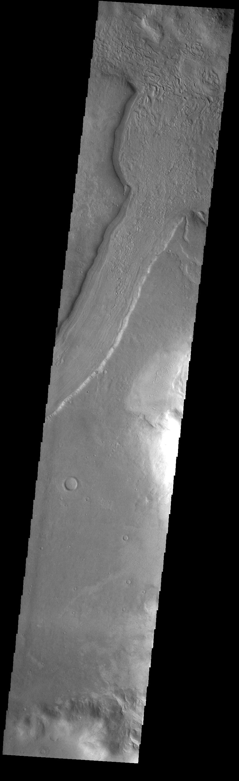
PIA25743:
-
Crater Rim Channels
Full Resolution:
TIFF
(726.7 kB)
JPEG
(102 kB)
|
|
|
2023-01-03 |
Mars
|
2001 Mars Odyssey
|
THEMIS
|
660x1432x1 |
|
-
PIA25742:
-
Crater Dunes
Full Resolution:
TIFF
(628.4 kB)
JPEG
(57.74 kB)
|
|
|
2023-01-02 |
Mars
|
2001 Mars Odyssey
|
THEMIS
|
977x2635x1 |
|
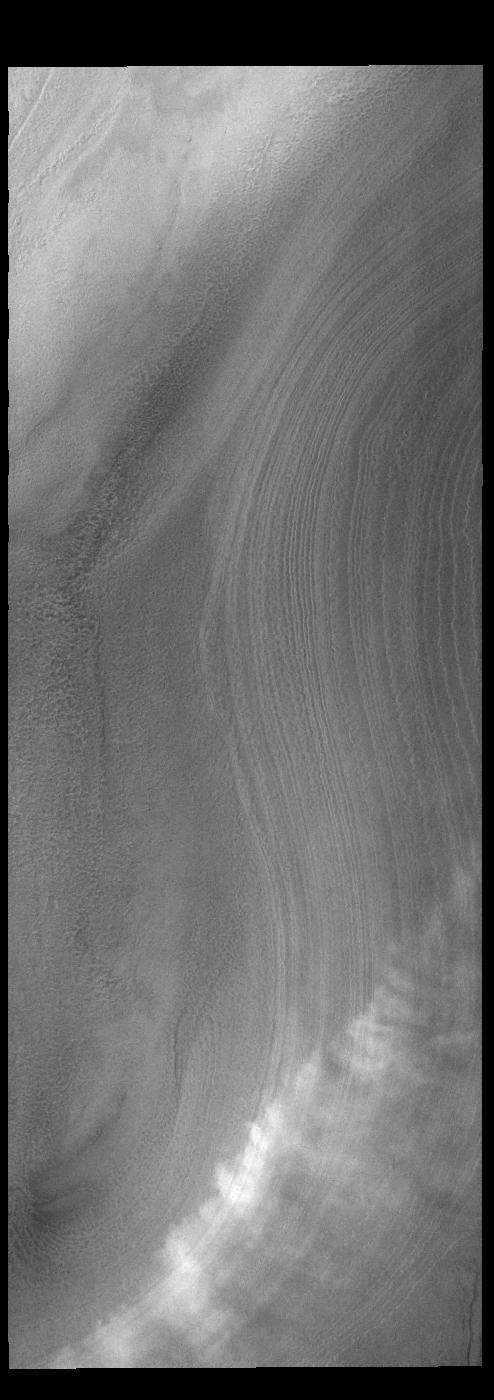
-
PIA25741:
-
South Polar Layers
Full Resolution:
TIFF
(2.577 MB)
JPEG
(447.4 kB)
|
|
|
2022-12-30 |
Mars
|
2001 Mars Odyssey
|
THEMIS
|
979x2631x1 |
|
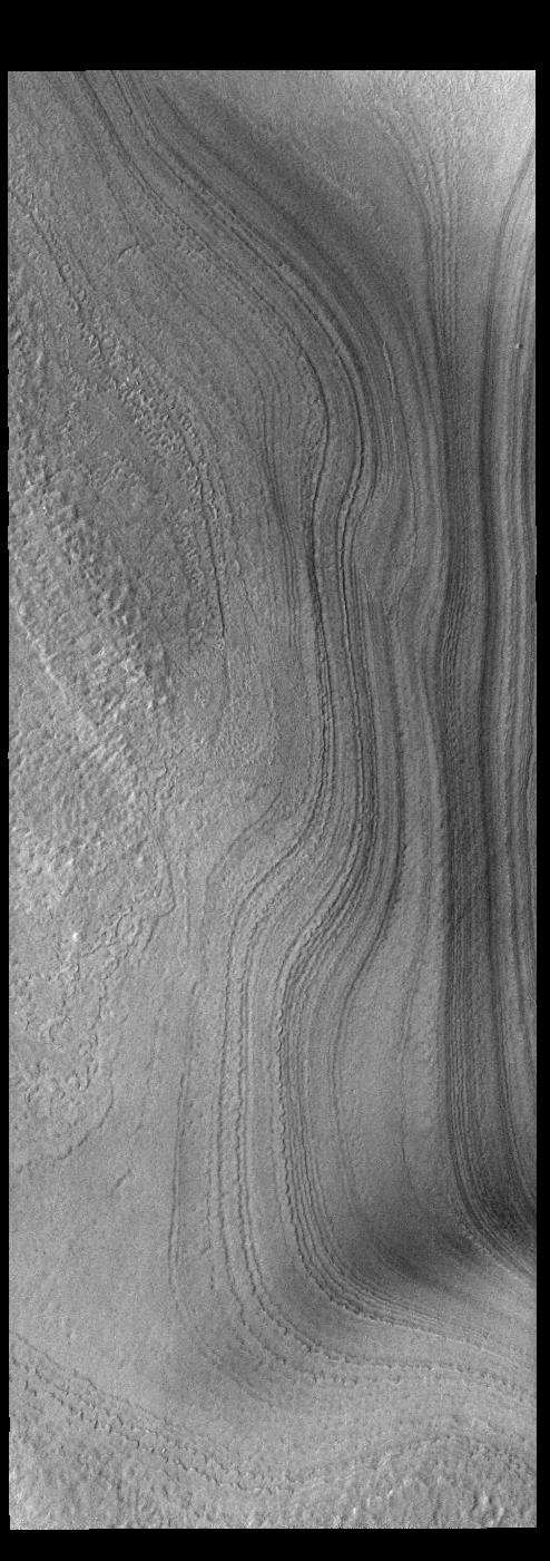
-
PIA25720:
-
South Polar Layers
Full Resolution:
TIFF
(2.557 MB)
JPEG
(409.9 kB)
|
|
|
2022-12-29 |
Mars
|
2001 Mars Odyssey
|
THEMIS
|
660x1432x1 |
|
-
PIA25719:
-
Kaiser Crater Dunes
Full Resolution:
TIFF
(644.6 kB)
JPEG
(58.24 kB)
|
|
|
2022-12-28 |
Mars
|
2001 Mars Odyssey
|
THEMIS
|
661x1431x1 |

|
-
PIA25718:
-
Nereidum Montes Dunes
Full Resolution:
TIFF
(701.2 kB)
JPEG
(82.6 kB)
|
|
|
2022-12-27 |
Mars
|
2001 Mars Odyssey
|
THEMIS
|
605x2708x1 |
|
-
PIA25717:
-
Coprates Chasma
Full Resolution:
TIFF
(696.2 kB)
JPEG
(72.2 kB)
|
|
|
2022-12-26 |
Mars
|
2001 Mars Odyssey
|
THEMIS
|
670x1436x1 |

|
-
PIA25716:
-
Russell Crater Dunes
Full Resolution:
TIFF
(642.9 kB)
JPEG
(60.06 kB)
|
|
|
2022-12-23 |
Mars
|
2001 Mars Odyssey
|
THEMIS
|
681x1419x1 |
|
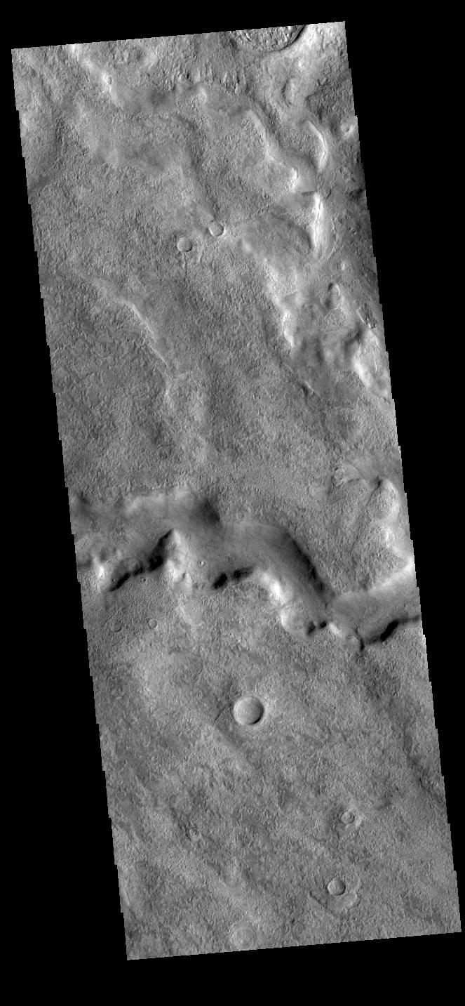
-
PIA25715:
-
Eberswalde Crater
Full Resolution:
TIFF
(743.6 kB)
JPEG
(114.5 kB)
|
|
|
2022-12-22 |
Mars
|
Mars Reconnaissance Orbiter (MRO)
|
HiRISE
|
2880x1800x3 |
|
-
PIA25704:
-
Dunes in Hellas
Full Resolution:
TIFF
(15.56 MB)
JPEG
(1.105 MB)
|
|
|
2022-12-22 |
Mars
|
Mars Reconnaissance Orbiter (MRO)
|
HiRISE
|
2880x1800x3 |
|
-
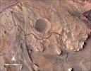
PIA25703:
-
Mysterious Crater Deposits
Full Resolution:
TIFF
(15.56 MB)
JPEG
(1.316 MB)
|
|
|
2022-12-22 |
Mars
|
Mars Reconnaissance Orbiter (MRO)
|
HiRISE
|
2880x1800x3 |

|
-
PIA25702:
-
Channels on a Streamlined Island of Kasei Vallis
Full Resolution:
TIFF
(8.258 MB)
JPEG
(1.326 MB)
|
|
|
2022-12-22 |
Mars
|
Mars Reconnaissance Orbiter (MRO)
|
HiRISE
|
2880x1800x3 |
|
-
PIA25701:
-
Tectonic, Volcanic and Fluvial Activity?
Full Resolution:
TIFF
(7.58 MB)
JPEG
(893.2 kB)
|
|
|
2022-12-22 |
Mars
|
2001 Mars Odyssey
|
THEMIS
|
670x1422x1 |

|
-
PIA25714:
-
Sirenum Fossae
Full Resolution:
TIFF
(671.9 kB)
JPEG
(83.5 kB)
|
|
|
2022-12-21 |
Mars
|
Mars 2020 Rover
|
Scanning Habitable Environments with Raman & Luminescence for Organics and Chemicals (SHERLOC)
|
4784x1666x3 |
|
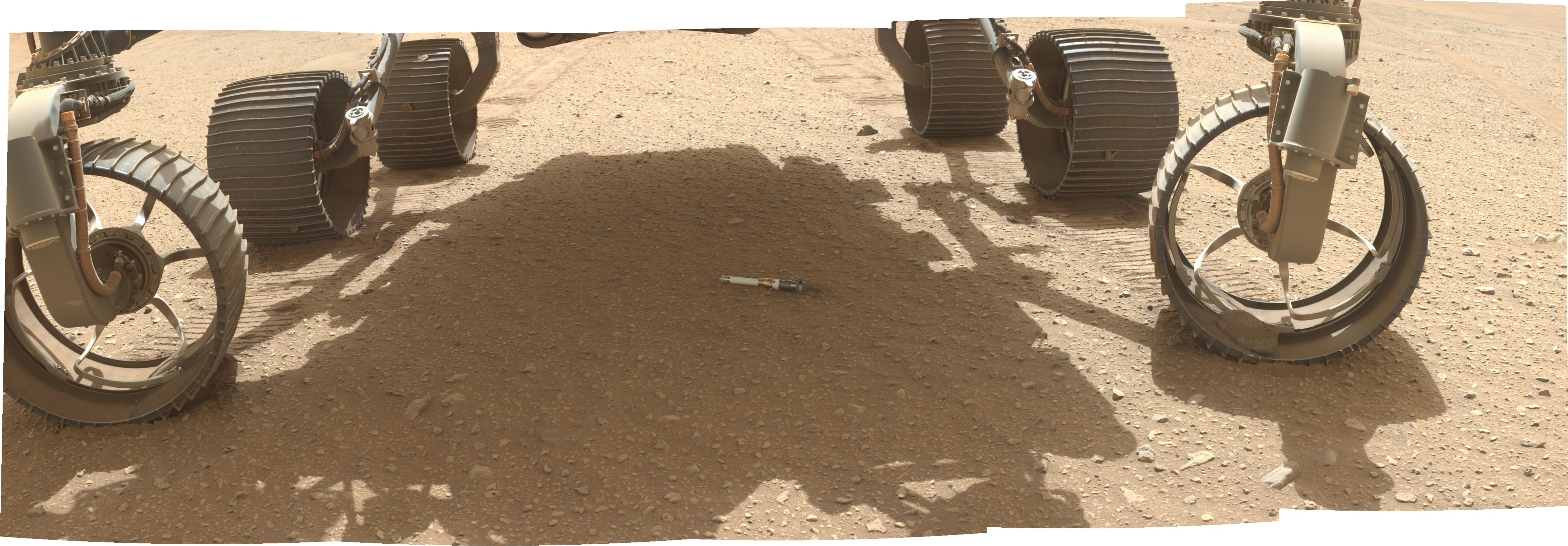
-
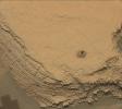
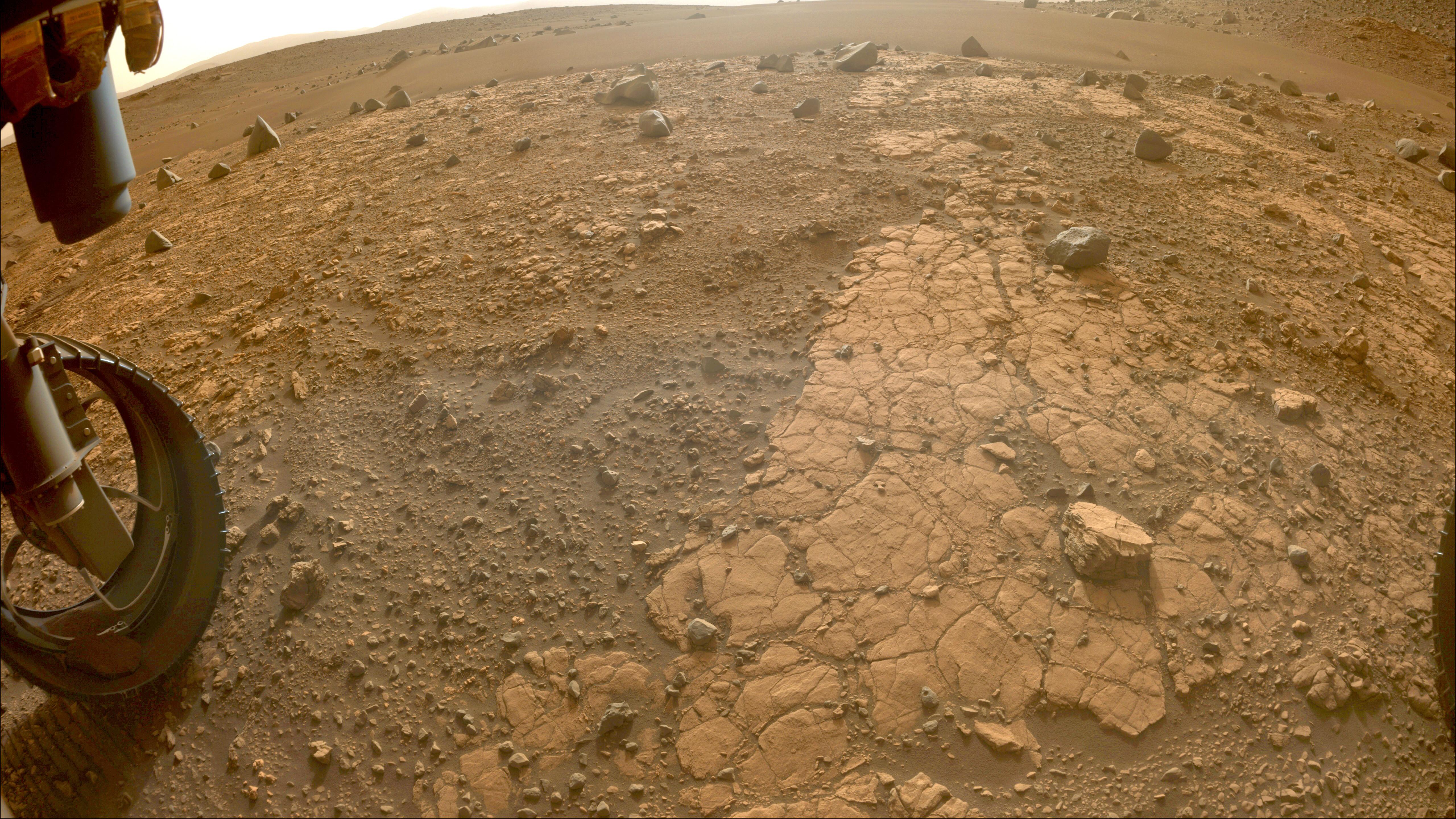
PIA25663:
-
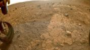
WATSON Documents First Sample on the Martian Surface
Full Resolution:
TIFF
(22.19 MB)
JPEG
(1.087 MB)
|
|
|
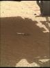
2022-12-21 |
Mars
|
Mars 2020 Rover
|
|
1200x1648x3 |
|
-
PIA25652:
-
Perseverance Deposits Its First Sample on the Martian Surface
Full Resolution:
TIFF
(5.583 MB)
JPEG
(308.9 kB)
|
|
|
2022-12-21 |
Mars
|
2001 Mars Odyssey
|
THEMIS
|
668x1418x1 |
|
-
PIA25713:
-
Claritas Fossae
Full Resolution:
TIFF
(708 kB)
JPEG
(88.27 kB)
|
|
|
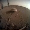
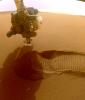
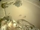
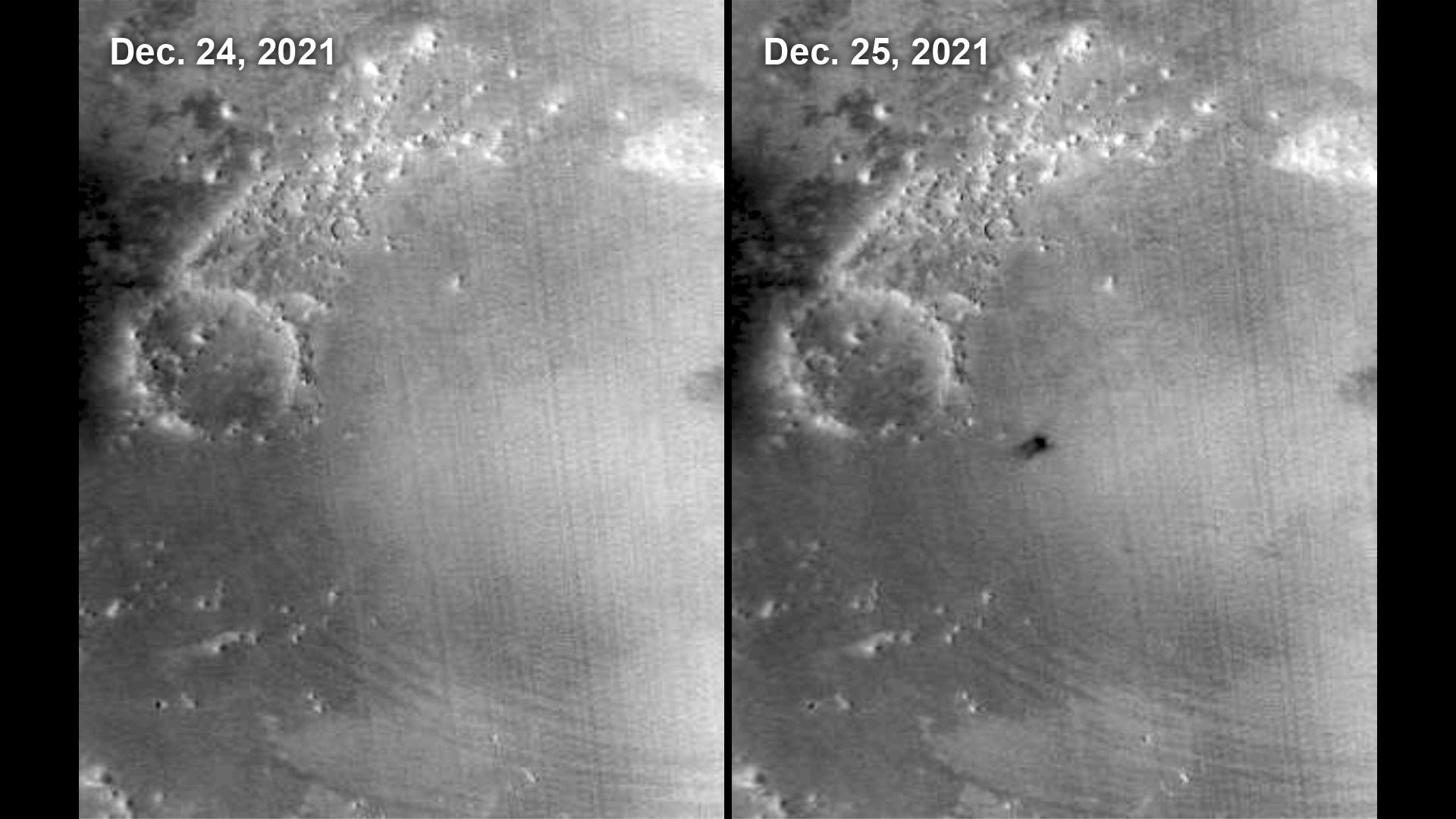
2022-12-21 |
Mars
|
InSight
|
|
1024x1024x3 |
|
-
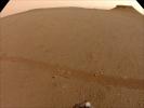
PIA25680:
-
One of InSight's Last Images
Full Resolution:
TIFF
(2.775 MB)
JPEG
(107.5 kB)
|
|
|
2022-12-20 |
Mars
|
2001 Mars Odyssey
|
THEMIS
|
608x2703x1 |
|
-
PIA25712:
-
Ius Chasma
Full Resolution:
TIFF
(707.7 kB)
JPEG
(74.44 kB)
|
|
|
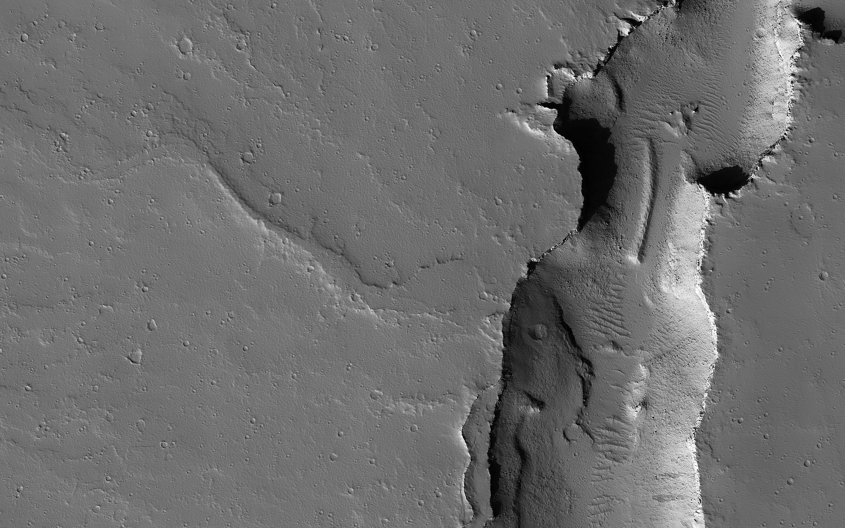
2022-12-19 |
Mars
|
2001 Mars Odyssey
|
THEMIS
|
660x1424x1 |

|
-
PIA25711:
-
Claritas Fossae Channel
Full Resolution:
TIFF
(701.4 kB)
JPEG
(90.24 kB)
|
|
|
2022-12-16 |
Mars
|
2001 Mars Odyssey
|
THEMIS
|
599x2716x1 |

|
-
PIA25650:
-
Mangala Fossae
Full Resolution:
TIFF
(773.9 kB)
JPEG
(98.44 kB)
|
|
|
2022-12-15 |
Mars
|
Mars 2020 Rover
|
Navigation Camera (M2020)
|
5120x3840x3 |
|
-
PIA25679:
-
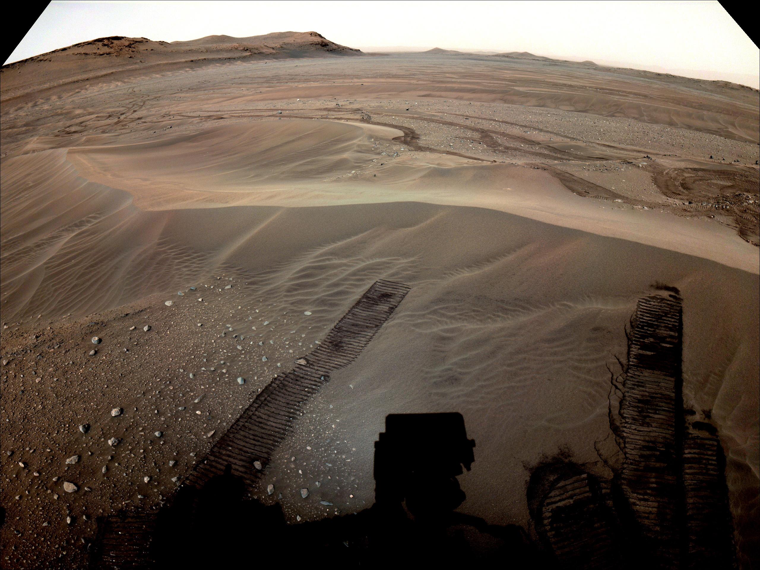
Three of Perseverance's Depot Locations
Full Resolution:
TIFF
(56.23 MB)
JPEG
(2.874 MB)
|
|
|
2022-12-15 |
Mars
|
Mars 2020 Rover
|
|
1906x1072x3 |
|
-
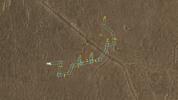
PIA25678:
-
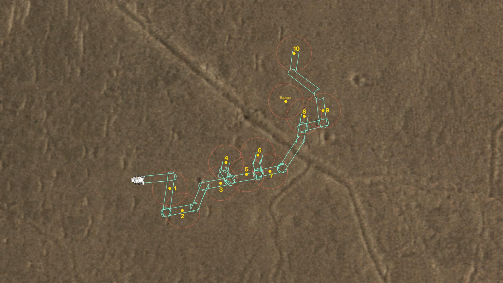
A Map of Perseverance's Depot Samples
Full Resolution:
TIFF
(3.896 MB)
JPEG
(189.6 kB)
|
|
|
2022-12-15 |
Mars
|
Mars 2020 Rover
|
Navigation Camera (M2020)
|
2560x1920x3 |

|
-
PIA25675:
-
Perseverance Views Depot in the Distance
Full Resolution:
TIFF
(12.68 MB)
JPEG
(744.2 kB)
|
|
|
2022-12-15 |
Mars
|
Mars 2020 Rover
|
|
1336x751x3 |
|
-
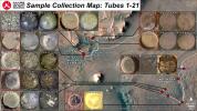
PIA25674:
-
A Map of Perseverance's Samples
Full Resolution:
TIFF
(3.011 MB)
JPEG
(268.7 kB)
|
|
|
2022-12-15 |
Mars
|
Mars 2020 Rover
|
|
3300x2550x3 |
|
-
PIA25673:
-
Map of Perseverance's Delta Top Campaign
Full Resolution:
TIFF
(25.26 MB)
JPEG
(2.209 MB)
|
|
|
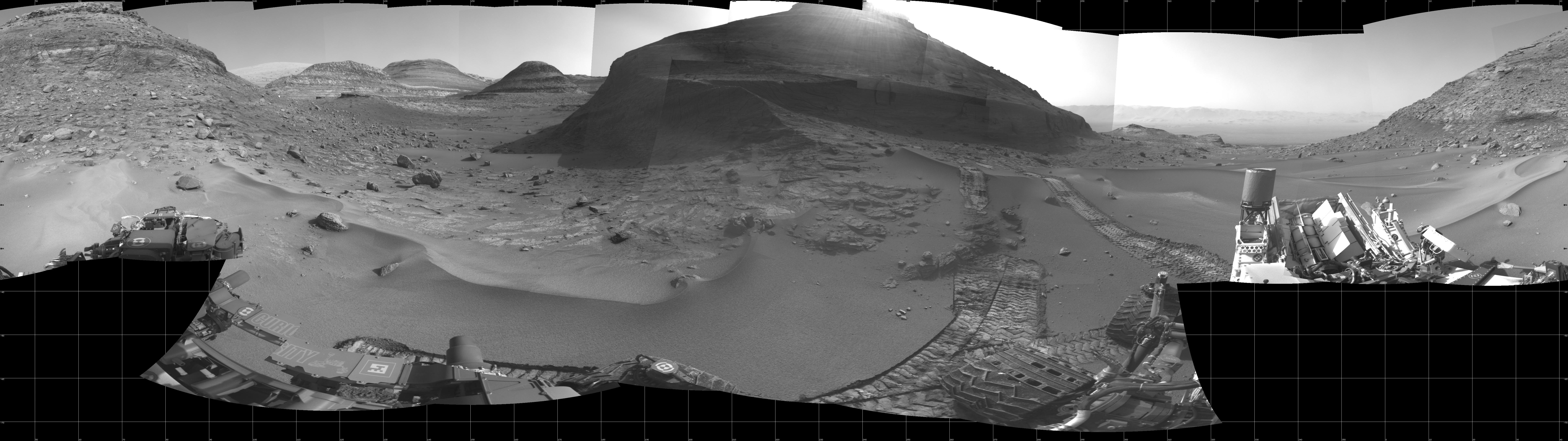
2022-12-15 |
Mars
|
Mars 2020 Rover
|
Mastcam-Z
|
40562x5548x3 |
|
-
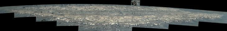
PIA25672:
Perseverance's Mastcam-Z Views Hogwallow Flats
Full Resolution:
TIFF
(449.4 MB)
JPEG
(30.87 MB)
|
|
|
2022-12-15 |
Mars
|
Mars 2020 Rover
|
Mastcam-Z
|
24625x2981x3 |
|
-
PIA25671:
Mastcam-Z Views the Eastern Edge of Jezero's Delta
Full Resolution:
TIFF
(137.1 MB)
JPEG
(7.829 MB)
|
|
|
2022-12-15 |
Mars
|
Mars 2020 Rover
|
Mastcam-Z
|
14578x3201x3 |
|
-
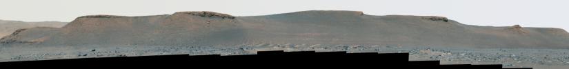
PIA25660:
Perseverance's Mastcam-Z Views Rockytop
Full Resolution:
TIFF
(78.22 MB)
JPEG
(3.97 MB)
|
|
|
2022-12-15 |
Mars
|
Mars 2020 Rover
|
Mastcam-Z
|
16426x13191x3 |
|
-
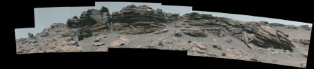
PIA25656:
-
Perseverance's Mastcam-Z Views Bettys Rock
Full Resolution:
TIFF
(342 MB)
JPEG
(20.82 MB)
|
|
|
2022-12-15 |
Mars
|
Mars 2020 Rover
|
Scanning Habitable Environments with Raman & Luminescence for Organics and Chemicals (SHERLOC)
|
964x720x3 |
|
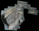
-
PIA25659:
-
Perseverance's WATSON Views Bettys Rock
Full Resolution:
TIFF
(2.083 MB)
JPEG
(133.3 kB)
|
|
|
2022-12-15 |
Mars
|
Mars 2020 Rover
|
Navigation Camera (M2020)
|
2560x1920x3 |
|
-
PIA25658:
-
Perseverance's Navcam Views Bettys Rock
Full Resolution:
TIFF
(14.75 MB)
JPEG
(673.6 kB)
|
|
|
2022-12-15 |
Mars
|
Mars 2020 Rover
|
Hazard Avoidance Camera (M2020)
|
5120x2880x3 |
|
-
PIA25655:
-
Perseverance Views Bettys Rock
Full Resolution:
TIFF
(41.58 MB)
JPEG
(1.612 MB)
|
|
|
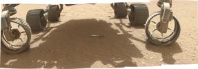
2022-12-15 |
Mars
|
Mars 2020 Rover
|
Hazard Avoidance Camera (M2020)
|
1401x1648x3 |
|
-
PIA25654:
-
NASA's Perseverance Rover Collects Regolith
Full Resolution:
TIFF
(5.951 MB)
JPEG
(427.9 kB)
|
|
|
2022-12-15 |
Mars
|
2001 Mars Odyssey
|
THEMIS
|
597x2707x1 |
|
-
PIA25649:
-
Arsia Mons
Full Resolution:
TIFF
(655.2 kB)
JPEG
(73.29 kB)
|
|
|
2022-12-14 |
Mars
|
2001 Mars Odyssey
|
THEMIS
|
668x1437x1 |

|
-
PIA25648:
-
Crater Gullies
Full Resolution:
TIFF
(653.7 kB)
JPEG
(64.9 kB)
|
|
|
2022-12-13 |
Mars
|
Mars 2020 Rover
|
SuperCam
|
2370x1840x3 |
|
-
PIA25657:
-
NASA's Perseverance Records a Martian Dust Devil
Full Resolution:
TIFF
(3.839 MB)
JPEG
(248.7 kB)
|
|
|
2022-12-13 |
Mars
|
2001 Mars Odyssey
|
THEMIS
|
501x1407x1 |
|
-
PIA25647:
-
Angustus Labyrinthus
Full Resolution:
TIFF
(669.3 kB)
JPEG
(62.4 kB)
|
|
|
2022-12-12 |
Mars
|
Mars Helicopter
|
|
636x476x3 |
|
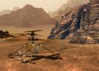
-
PIA25662:
-
Ingenuity's Hazard Avoidance Capability
Full Resolution:
TIFF
(754.7 kB)
JPEG
(25.7 kB)
|
|
|
2022-12-12 |
Mars
|
2001 Mars Odyssey
|
THEMIS
|
664x1434x1 |

|
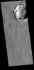
-
PIA25646:
-
Proctor Crater Dunes
Full Resolution:
TIFF
(636.7 kB)
JPEG
(58.69 kB)
|
|
|
2022-12-09 |
Mars
|
2001 Mars Odyssey
|
THEMIS
|
673x1418x1 |

|
-
PIA25645:
-
Sirenum Fossae
Full Resolution:
TIFF
(722.9 kB)
JPEG
(105.5 kB)
|
|
|
2022-12-08 |
Mars
|
2001 Mars Odyssey
|
THEMIS
|
296x2829x1 |

|
-
PIA25644:
-
Charlier Crater Dunes
Full Resolution:
TIFF
(687.2 kB)
JPEG
(54.03 kB)
|
|
|
2022-12-07 |
Mars
|
Mars 2020 Rover
|
Navigation Camera (M2020)
|
5120x3840x3 |
|
-
PIA25589:
-
Perseverance's First 2 Regolith Samples
Full Resolution:
TIFF
(52.98 MB)
JPEG
(2.498 MB)
|
|
|
2022-12-07 |
Mars
|
Mars 2020 Rover
|
|
1280x960x3 |
|
-
PIA25588:
-
Perseverance's CacheCam Views a Regolith Sample
Full Resolution:
TIFF
(2.169 MB)
JPEG
(49.21 kB)
|
|
|
2022-12-07 |
Mars
|
2001 Mars Odyssey
|
THEMIS
|
614x2733x1 |
|
-
PIA25643:
-
Charitum Montes Gullies
Full Resolution:
TIFF
(732.2 kB)
JPEG
(70.01 kB)
|
|
|
2022-12-06 |
Mars
|
2001 Mars Odyssey
|
THEMIS
|
671x1425x1 |

|
-
PIA25642:
-
Sirenum Fossae
Full Resolution:
TIFF
(696.9 kB)
JPEG
(79.04 kB)
|
|
|
2022-12-05 |
Mars
|
2001 Mars Odyssey
|
THEMIS
|
666x1437x1 |
|
-
PIA25641:
-
Crater Dunes
Full Resolution:
TIFF
(584.2 kB)
JPEG
(53.65 kB)
|
|
|
2022-12-02 |
Mars
|
2001 Mars Odyssey
|
THEMIS
|
595x2722x1 |

|
-
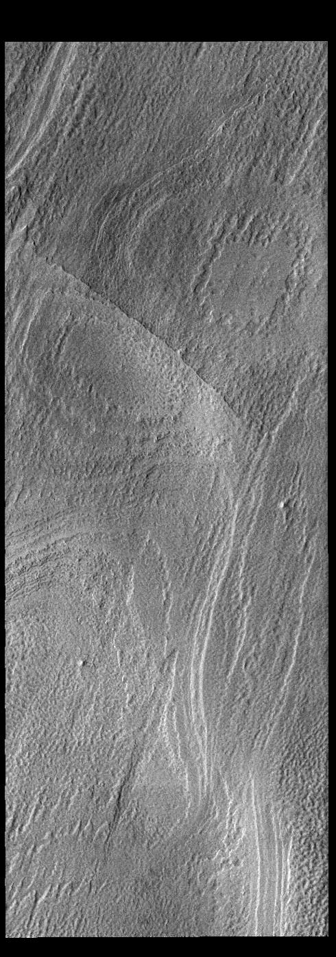
PIA25635:
-
Fossae
Full Resolution:
TIFF
(750.7 kB)
JPEG
(83.3 kB)
|
|
|
2022-12-01 |
Mars
|
2001 Mars Odyssey
|
THEMIS
|
494x1400x1 |
|
-
PIA25634:
-
South Polar Clouds
Full Resolution:
TIFF
(670.8 kB)
JPEG
(78.4 kB)
|
|
|
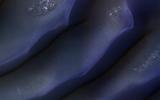
2022-11-30 |
Mars
|
2001 Mars Odyssey
|
THEMIS
|
494x1401x1 |
|
-
PIA25633:
-
Polar Layers
Full Resolution:
TIFF
(693 kB)
JPEG
(119 kB)
|
|
|
2022-11-29 |
Mars
|
2001 Mars Odyssey
|
THEMIS
|
598x2735x1 |
|
-
PIA25632:
-
Crater Dunes
Full Resolution:
TIFF
(750.6 kB)
JPEG
(85.02 kB)
|
|
|
2022-11-28 |
Mars
|
2001 Mars Odyssey
|
THEMIS
|
663x1433x1 |

|
-
PIA25631:
-
Tader Valles
Full Resolution:
TIFF
(756.5 kB)
JPEG
(145.2 kB)
|
|
|
2022-11-25 |
Mars
|
2001 Mars Odyssey
|
THEMIS
|
594x2732x1 |
|
-
PIA25620:
-
Claritas Fossae
Full Resolution:
TIFF
(769.9 kB)
JPEG
(103 kB)
|
|
|
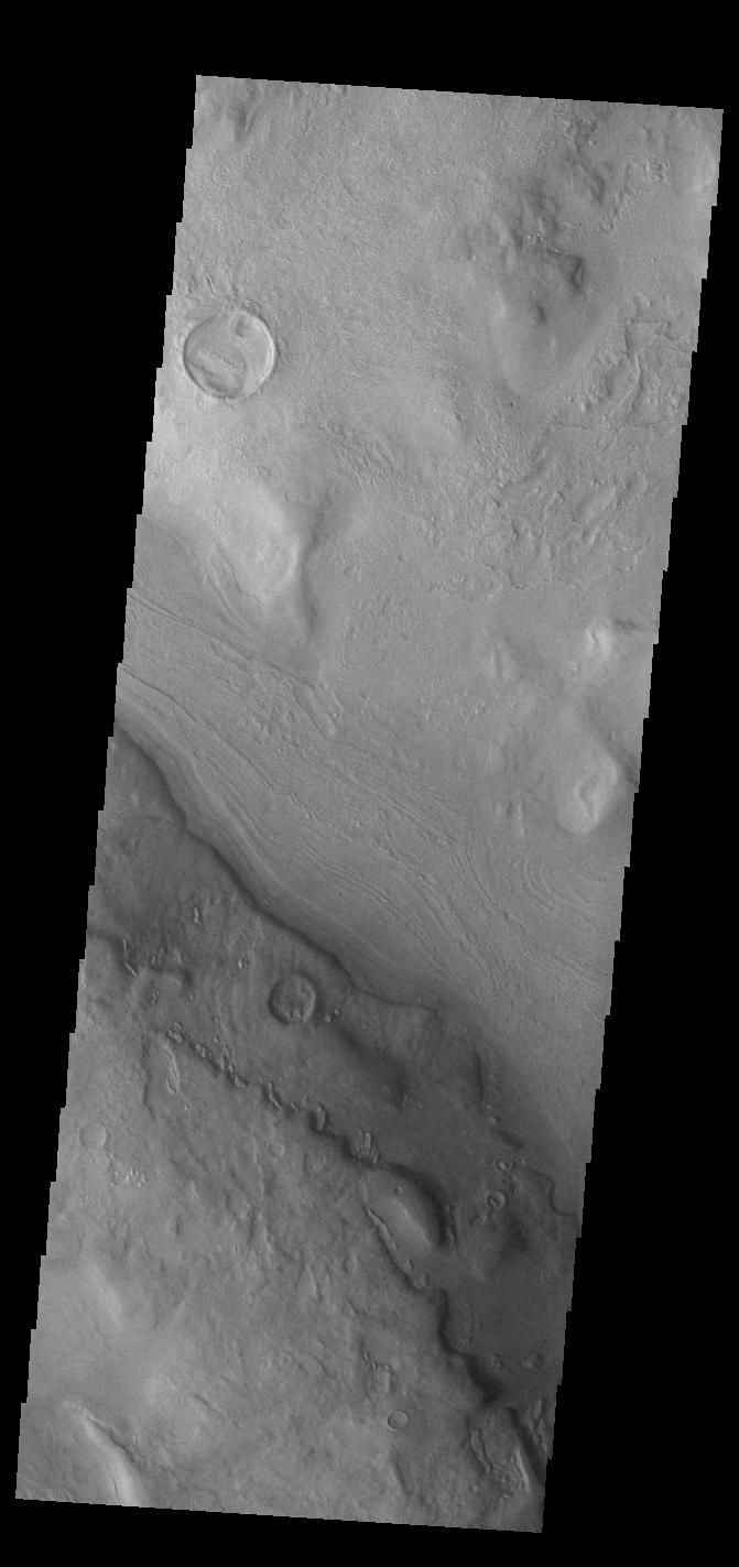
2022-11-24 |
Mars
|
2001 Mars Odyssey
|
THEMIS
|
678x1422x1 |
|
-
PIA25619:
-
Mangala Fossae
Full Resolution:
TIFF
(718.8 kB)
JPEG
(97.28 kB)
|
|
|
2022-11-23 |
Mars
|
2001 Mars Odyssey
|
THEMIS
|
271x2775x1 |

|
-
PIA25618:
-
Cavi Angusti
Full Resolution:
TIFF
(700.9 kB)
JPEG
(68.58 kB)
|
|
|
2022-11-22 |
Mars
|
2001 Mars Odyssey
|
THEMIS
|
671x1423x1 |

|
-
PIA25617:
-
Reull Vallis
Full Resolution:
TIFF
(683.5 kB)
JPEG
(80.14 kB)
|
|
|
2022-11-21 |
Mars
|
2001 Mars Odyssey
|
THEMIS
|
668x1433x1 |
|
-
PIA25616:
-
Proctor Crater Dunes
Full Resolution:
TIFF
(724.9 kB)
JPEG
(98.68 kB)
|
|
|
2022-11-18 |
Mars
|
2001 Mars Odyssey
|
THEMIS
|
597x2719x1 |

|
-
PIA25615:
-
Daedalia Planum
Full Resolution:
TIFF
(739 kB)
JPEG
(101.5 kB)
|
|
|
2022-11-17 |
Mars
|
Mars 2020 Rover
|
Hazard Avoidance Camera (M2020)
|
5120x2880x3 |
|
-
PIA25339:
-
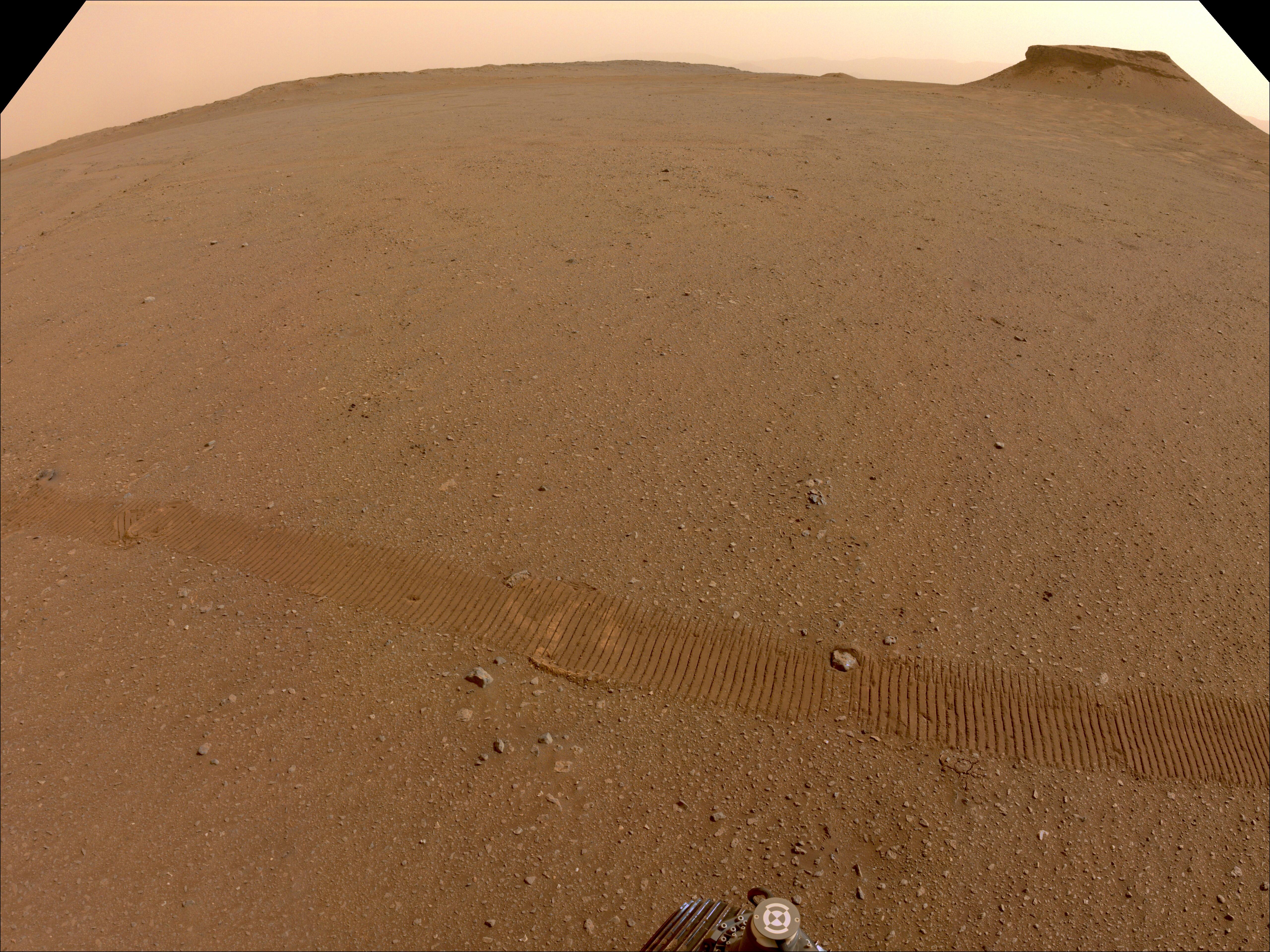
Jezero Crater's Yori Pass
Full Resolution:
TIFF
(44.26 MB)
JPEG
(2.148 MB)
|
|
|
2022-11-17 |
Mars
|
2001 Mars Odyssey
|
THEMIS
|
490x1397x1 |
|
-
PIA25614:
-
South Polar Cap
Full Resolution:
TIFF
(685.5 kB)
JPEG
(158 kB)
|
|
|
2022-11-16 |
Mars
|
2001 Mars Odyssey
|
THEMIS
|
668x1425x1 |
|
-
PIA25613:
-
Landslides
Full Resolution:
TIFF
(687 kB)
JPEG
(78.1 kB)
|
|
|
2022-11-15 |
Mars
|
2001 Mars Odyssey
|
THEMIS
|
601x2711x1 |
|
-
PIA25612:
-
Claritas Fossae
Full Resolution:
TIFF
(749.1 kB)
JPEG
(88.9 kB)
|
|
|
2022-11-14 |
Mars
|
Mars Helicopter
|
|
6000x4326x3 |
|
-
PIA25338:
-
NASA's Mars Helicopters: Present, Future, and Proposed
Full Resolution:
TIFF
(67.09 MB)
JPEG
(2.575 MB)
|
|
|
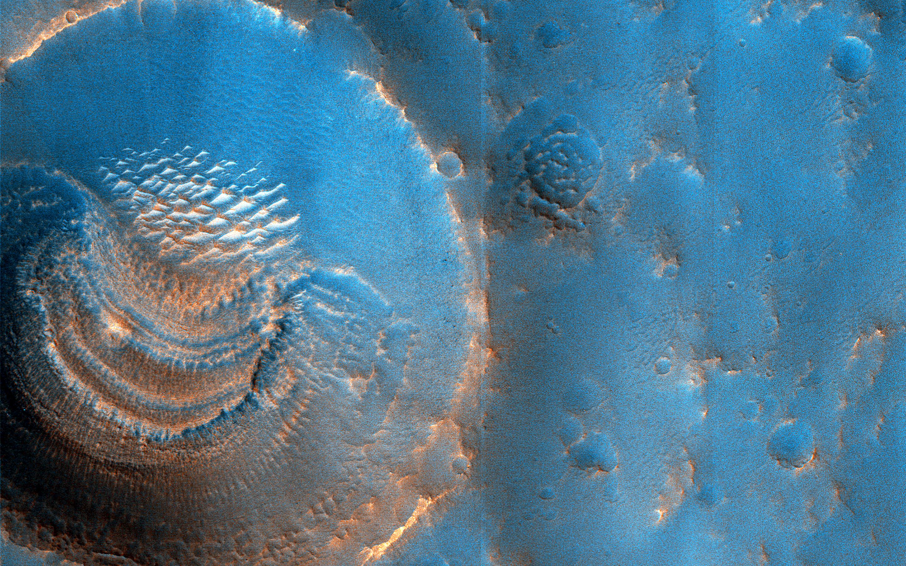
2022-11-14 |
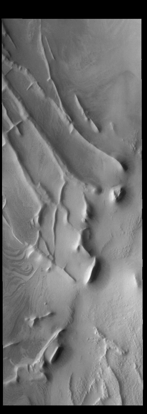
Mars
|
2001 Mars Odyssey
|
THEMIS
|
1319x2683x1 |
|
-
PIA25611:
-
Out of Round
Full Resolution:
TIFF
(2.552 MB)
JPEG
(383.4 kB)
|
|
|
2022-11-11 |
Mars
|
2001 Mars Odyssey
|
THEMIS
|
666x1397x1 |
|
-
PIA25610:
-
Daedalia Planum
Full Resolution:
TIFF
(746.3 kB)
JPEG
(179.1 kB)
|
|
|
2022-11-10 |
Mars
|
2001 Mars Odyssey
|
THEMIS
|
670x1427x1 |

|
-
PIA25609:
-
Hale Crater
Full Resolution:
TIFF
(693.8 kB)
JPEG
(85.73 kB)
|
|
|
2022-11-09 |
Mars
|
2001 Mars Odyssey
|
THEMIS
|
669x1417x1 |
|
-
PIA25608:
-
Daedalia Planum
Full Resolution:
TIFF
(750.7 kB)
JPEG
(160 kB)
|
|
|
2022-11-08 |
Mars
|
2001 Mars Odyssey
|
THEMIS
|
675x1420x1 |
|
-
PIA25607:
-
Eberswalde Crater
Full Resolution:
TIFF
(734.5 kB)
JPEG
(112.7 kB)
|
|
|
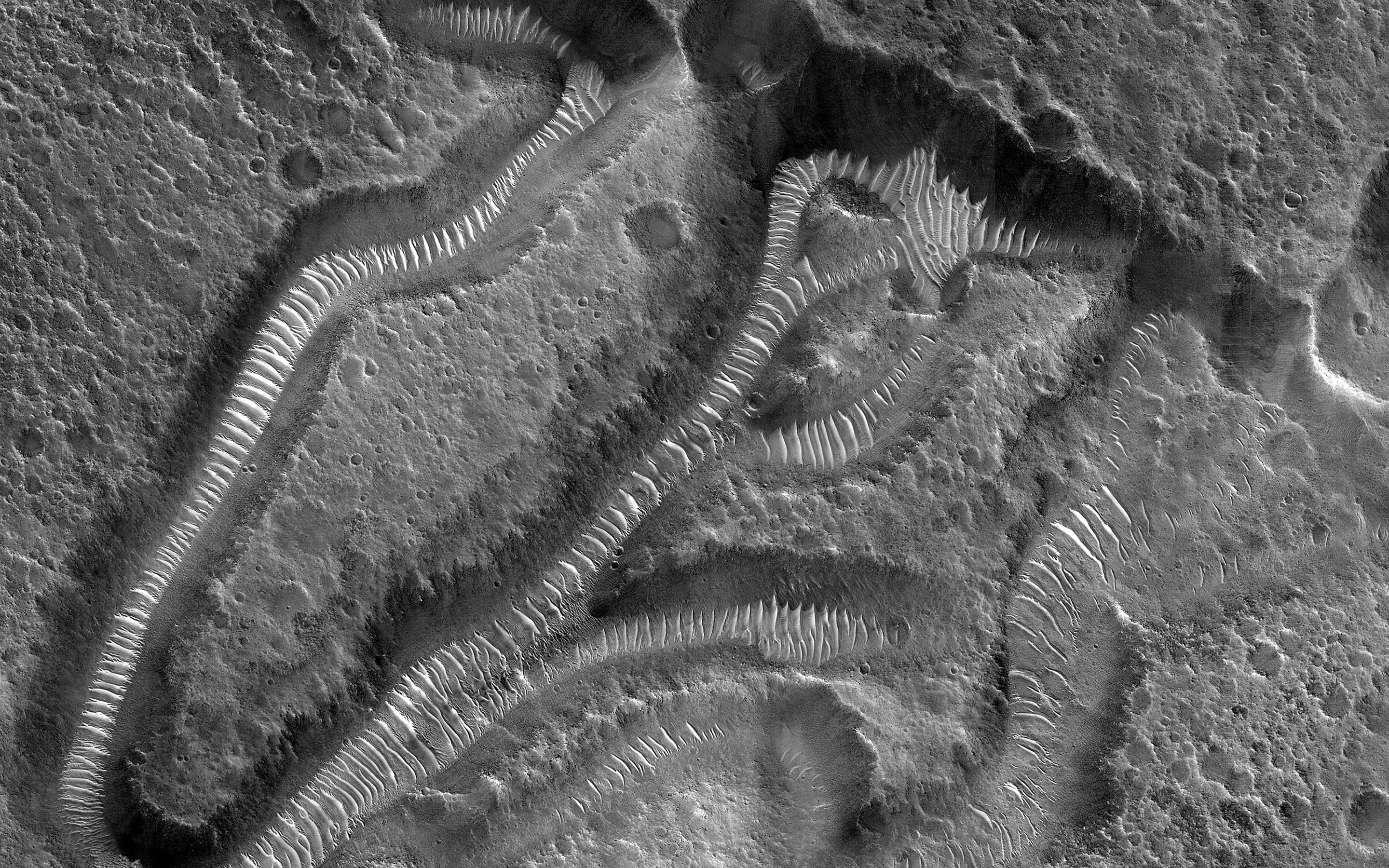
2022-11-07 |
Mars
|
2001 Mars Odyssey
|
THEMIS
|
839x2736x1 |

|
-
PIA25606:
-
Reull Vallis
Full Resolution:
TIFF
(1.392 MB)
JPEG
(165 kB)
|
|
|
2022-11-04 |
Mars
|
2001 Mars Odyssey
|
THEMIS
|
670x1419x1 |
|
-
PIA25605:
-
Daedalia Planum
Full Resolution:
TIFF
(743.6 kB)
JPEG
(146 kB)
|
|
|
2022-11-03 |
Mars
|
Mars 2020 Rover
|
|
1630x1557x3 |
|
-
PIA25337:
-
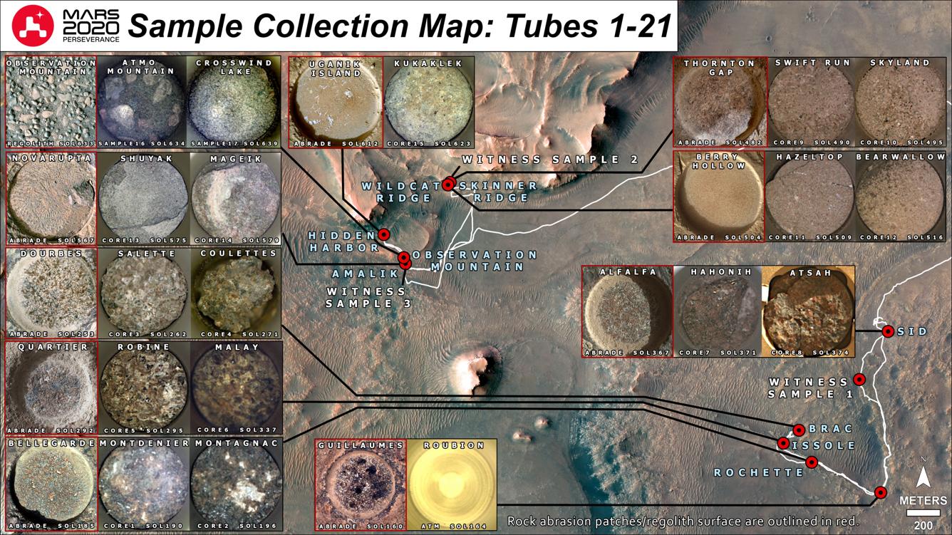
CacheCam Image of Perseverance's 14th Sample of Martian Rock
Full Resolution:
TIFF
(6.384 MB)
JPEG
(312 kB)
|
|
|
2022-11-03 |
Mars
|
2001 Mars Odyssey
|
THEMIS
|
601x2714x1 |
|
-
PIA25604:
-
Daedalia Planum
Full Resolution:
TIFF
(801.7 kB)
JPEG
(151.3 kB)
|
|
|
2022-11-02 |
Mars
|
2001 Mars Odyssey
|
THEMIS
|
598x2704x1 |

|
-
PIA25603:
-
Arsia Mons
Full Resolution:
TIFF
(715 kB)
JPEG
(91.93 kB)
|
|
|
2022-11-01 |
Mars
|
2001 Mars Odyssey
|
THEMIS
|
677x1428x1 |
|
-
PIA25602:
-
Ladon Valles
Full Resolution:
TIFF
(731.4 kB)
JPEG
(97.36 kB)
|
|
|
2022-10-31 |
Mars
|
2001 Mars Odyssey
|
THEMIS
|
597x2732x1 |
|
-
PIA25601:
-
Dao and Niger Valles
Full Resolution:
TIFF
(771.3 kB)
JPEG
(95.12 kB)
|
|
|
2022-10-28 |
Mars
|
2001 Mars Odyssey
|
THEMIS
|
593x2730x1 |
|
-
PIA25580:
-
Claritas Fossae
Full Resolution:
TIFF
(742.3 kB)
JPEG
(96.72 kB)
|
|
|
2022-10-27 |
Mars
|
Mars Reconnaissance Orbiter (MRO)
|
CTX
|
3351x3083x1 |
|
-
PIA25587:
-
Context Camera Views a Mars Impact Crater in Tempe Terra
Full Resolution:
TIFF
(8.751 MB)
JPEG
(1.998 MB)
|
|
|
2022-10-27 |
Mars
|
Mars Reconnaissance Orbiter (MRO)
|
HiRISE
|
1200x674x3 |
|
-
PIA25586:
-
Flyover of Mars Impact Using HiRISE Data (Animation)
Full Resolution:
TIFF
(2.057 MB)
JPEG
(69.31 kB)
|
|
|
2022-10-27 |
Mars
|
Mars Reconnaissance Orbiter (MRO)
|
MARCI
|
1920x1080x1 |

|
-
PIA25585:
-
MARCI Views a Mars Impact Crater in Amazonis Planitia
Full Resolution:
TIFF
(1.693 MB)
JPEG
(156.5 kB)
|
|
|
2022-10-27 |
Mars
|
Mars Reconnaissance Orbiter (MRO)
|
CTX
|
5448x3523x1 |

|
-
PIA25584:
-
Context Camera Views an Impact Crater in Amazonis Planitia
Full Resolution:
TIFF
(19.22 MB)
JPEG
(5.28 MB)
|
|
|
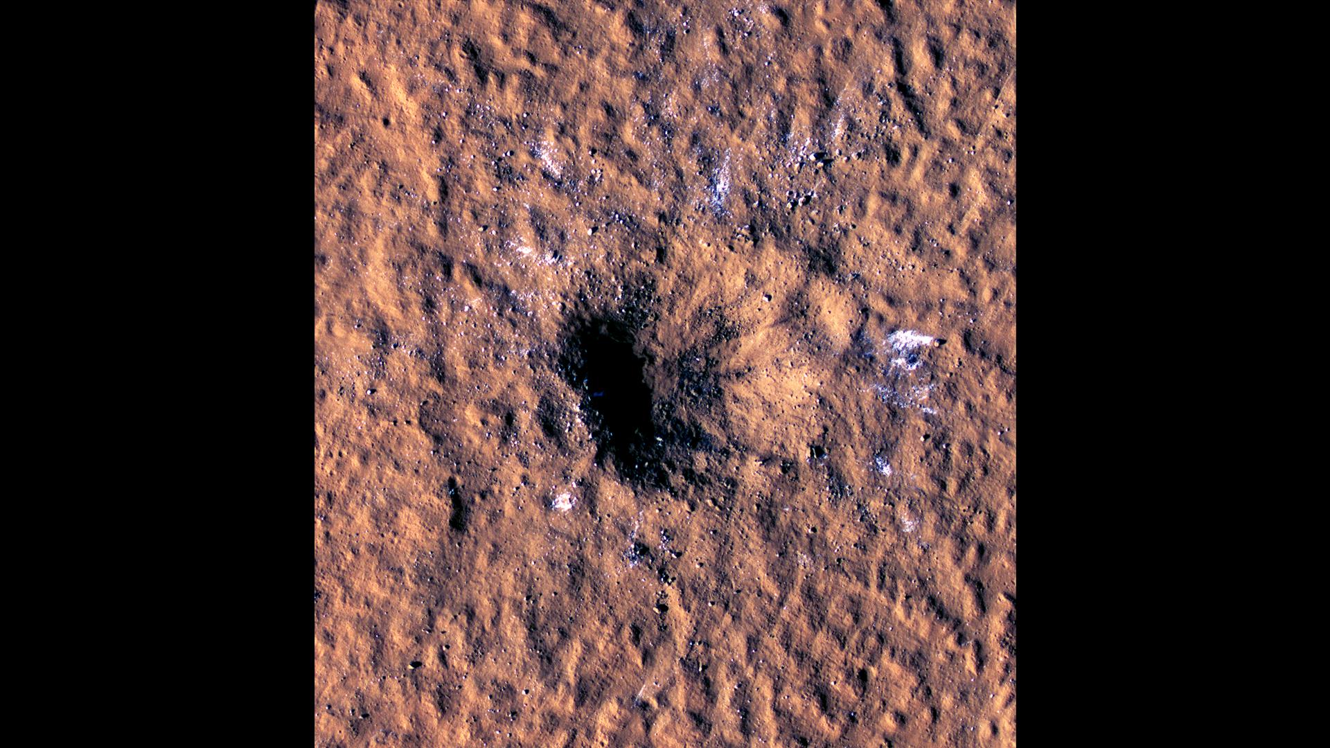
2022-10-27 |
Mars
|
Mars Reconnaissance Orbiter (MRO)
|
HiRISE
|
1920x1080x3 |
|
-
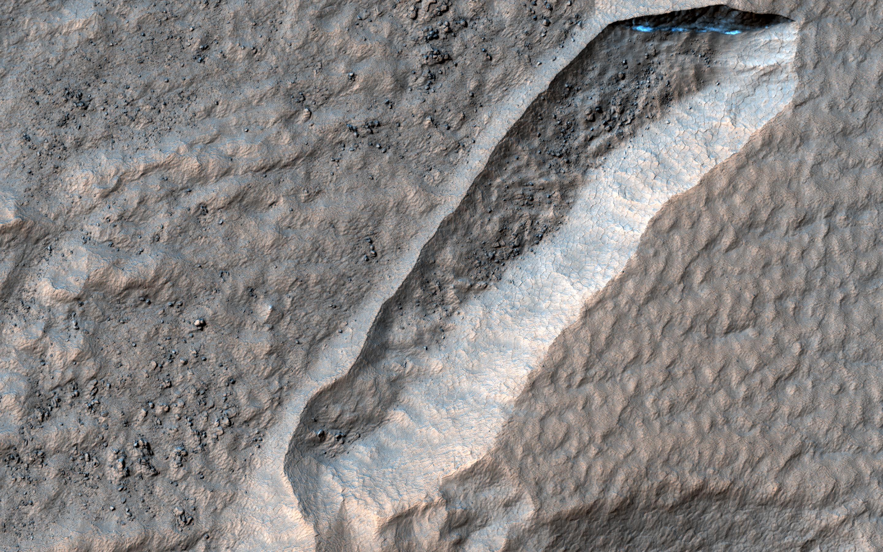
PIA25583:
-
HiRISE Views a Mars Impact Crater Surrounded by Water Ice
Full Resolution:
TIFF
(4.226 MB)
JPEG
(341.2 kB)
|
|
|
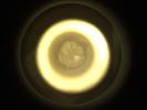
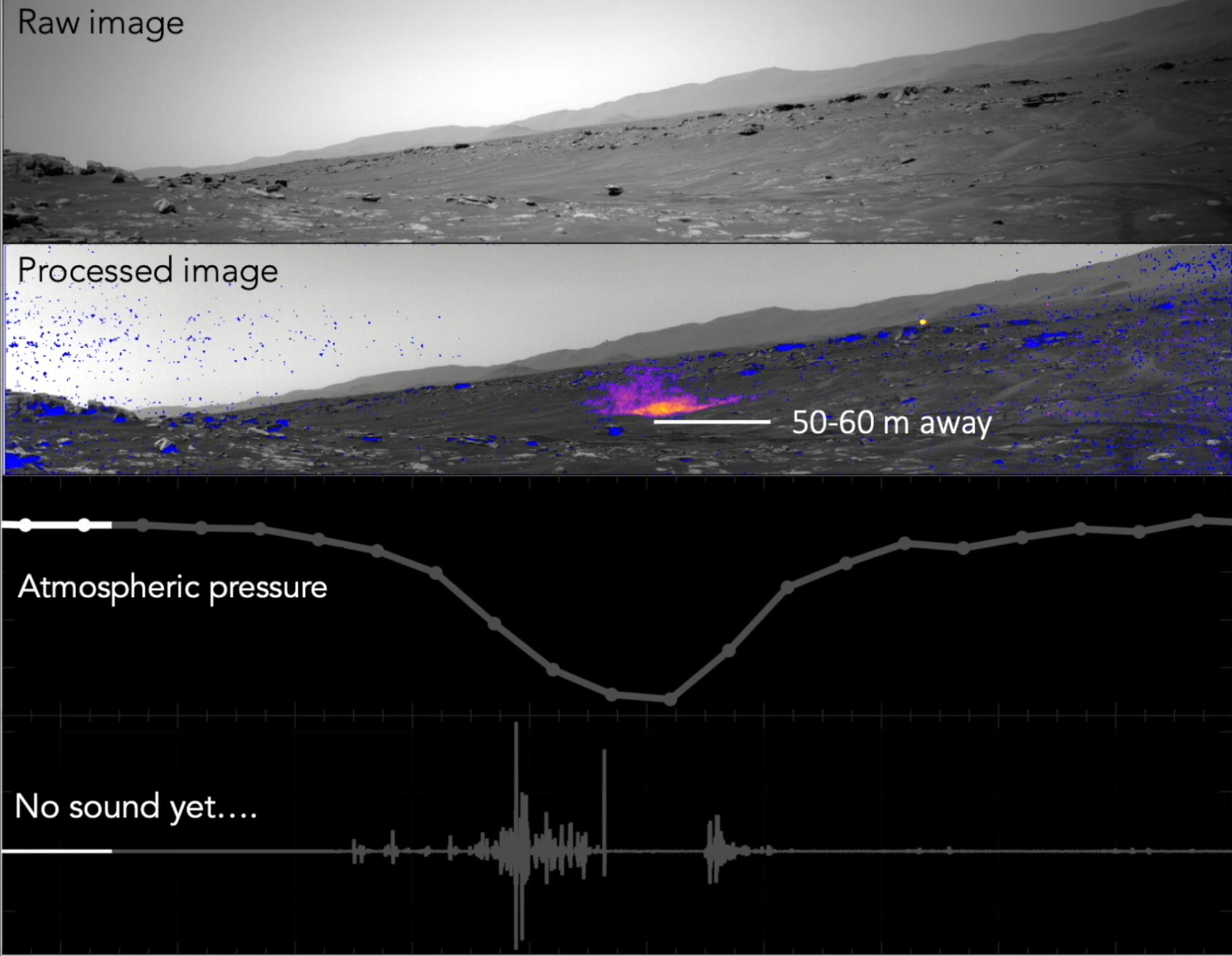
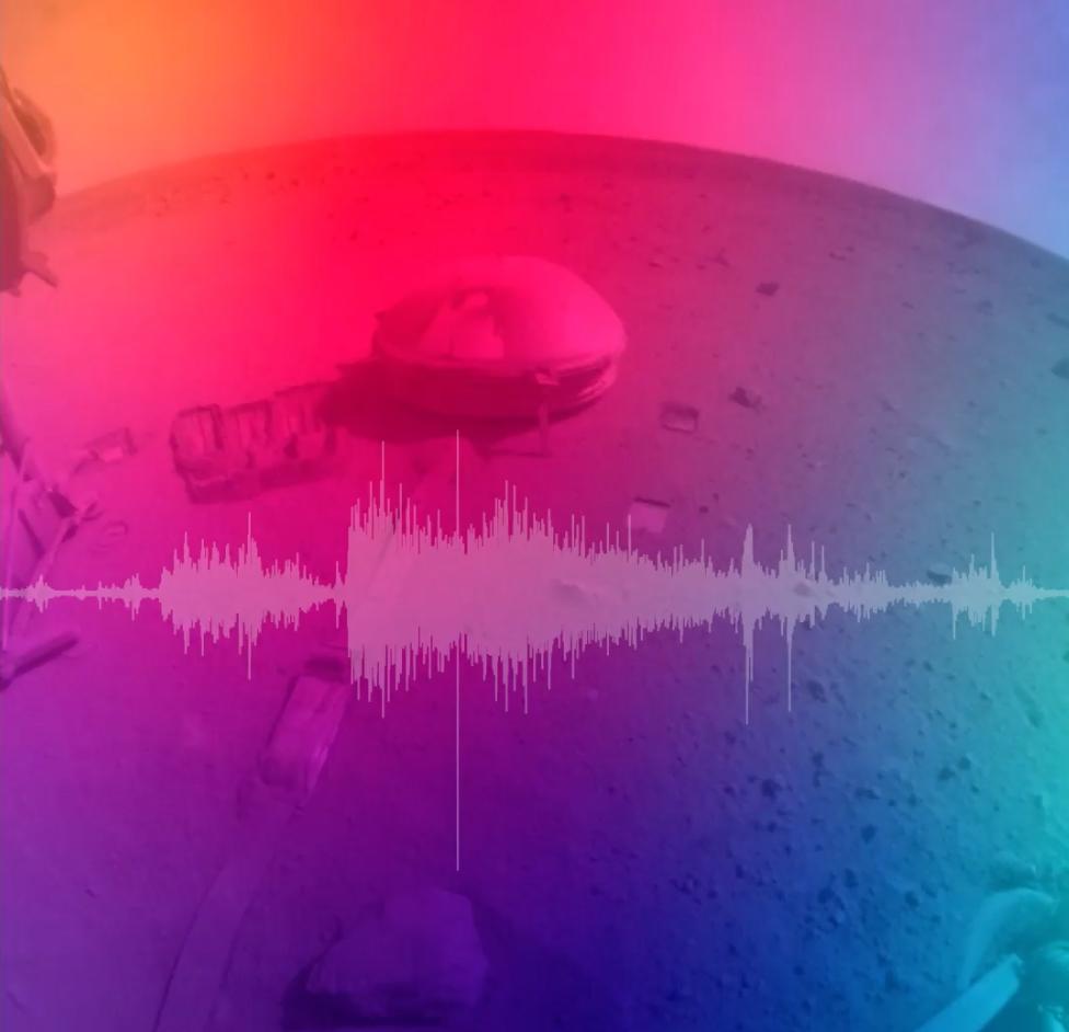
2022-10-27 |
Mars
|
InSight
|
|
976x942x3 |

|
-
PIA25582:
-
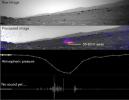
NASA's InSight Records the Sound of a Martian Impact
Full Resolution:
TIFF
(2.466 MB)
JPEG
(47.12 kB)
|
|
|
2022-10-27 |
Mars
|
2001 Mars Odyssey
|
THEMIS
|
602x2716x1 |

|
-
PIA25579:
-
Daedalia Planum
Full Resolution:
TIFF
(776.6 kB)
JPEG
(119.2 kB)
|
|
|
2022-10-26 |
Mars
|
2001 Mars Odyssey
|
THEMIS
|
670x1435x1 |
|
-
PIA25578:
-
Peneus Patera
Full Resolution:
TIFF
(740.4 kB)
JPEG
(127.9 kB)
|
|
|
2022-10-25 |
Mars
|
2001 Mars Odyssey
|
THEMIS
|
605x2709x1 |
|
-
PIA25577:
-
Ius Chasma
Full Resolution:
TIFF
(690.6 kB)
JPEG
(65.92 kB)
|
|
|
2022-10-24 |
Mars
|
Mars Reconnaissance Orbiter (MRO)
|
HiRISE
|
2880x1800x3 |
|
-
PIA25559:
-
The Tale of a Retreating Scarp
Full Resolution:
TIFF
(15.56 MB)
JPEG
(1.087 MB)
|
|
|
2022-10-24 |
Mars
|
Mars Reconnaissance Orbiter (MRO)
|
HiRISE
|
2880x1800x3 |
|
-
PIA25558:
-
In the Wake of Ancient Lava Flows
Full Resolution:
TIFF
(15.56 MB)
JPEG
(1.204 MB)
|
|
|
2022-10-24 |
Mars
|
Mars Reconnaissance Orbiter (MRO)
|
HiRISE
|
2880x1800x3 |

|
-
PIA25557:
-
A Crater in Scalloped Terrain
Full Resolution:
TIFF
(15.56 MB)
JPEG
(1.619 MB)
|
|
|
2022-10-24 |
Mars
|
Mars Reconnaissance Orbiter (MRO)
|
HiRISE
|
2880x1800x3 |
|
-
PIA25556:
-
Slipping and Sliding in Echus Chaos
Full Resolution:
TIFF
(15.56 MB)
JPEG
(757.9 kB)
|
|
|
2022-10-24 |
Mars
|
2001 Mars Odyssey
|
THEMIS
|
666x1432x1 |
|
-
PIA25576:
-
Crater Dunes
Full Resolution:
TIFF
(605 kB)
JPEG
(52.71 kB)
|
|
|
2022-10-21 |
Mars
|
2001 Mars Odyssey
|
THEMIS
|
664x1434x1 |
|
-
PIA25575:
-
Maunder Crater
Full Resolution:
TIFF
(679.2 kB)
JPEG
(61.77 kB)
|
|
|
2022-10-20 |
Mars
|
2001 Mars Odyssey
|
THEMIS
|
672x1425x1 |

|
-
PIA25574:
-
Nirgal Vallis
Full Resolution:
TIFF
(699.7 kB)
JPEG
(91.86 kB)
|
|
|
2022-10-19 |
Mars
|
Mars Science Laboratory (MSL)
|
Mastcam
|
1328x1184x3 |
|
-
PIA25418:
-
Curiosity's 36th Drill Hole at Canaima
Full Resolution:
TIFF
(4.172 MB)
JPEG
(254.5 kB)
|
|
|
2022-10-19 |
Mars
|
Mars Science Laboratory (MSL)
|
Navigation Camera (M2020)
|
7696x2165x1 |

|
-
PIA25417:
Curiosity's Navcams View Paraitepuy Pass
Full Resolution:
TIFF
(11.31 MB)
JPEG
(1.471 MB)
|
 Planetary Data System


