Click on an image for detailed information
Click on a column heading to sort in ascending or descending order

My
List |
Addition Date
|
Target
|
Mission
|
Instrument
|
Size
|

|
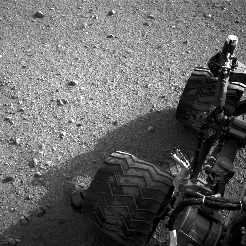
2023-09-18 |
Mars
|
Mars Science Laboratory (MSL)
|
Mastcam
|
9000x2394x3 |
|
-
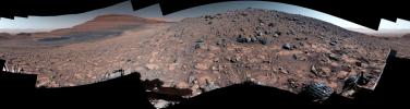
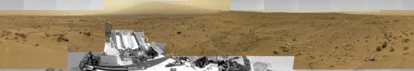
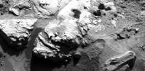
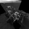
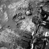
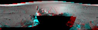
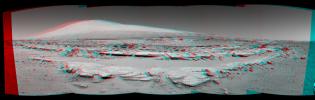
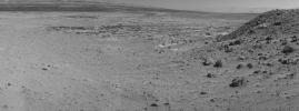
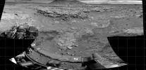
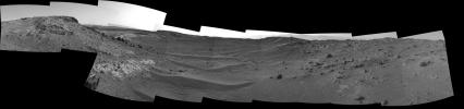
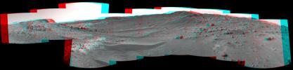
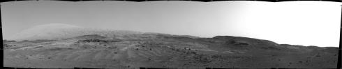
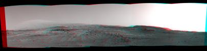
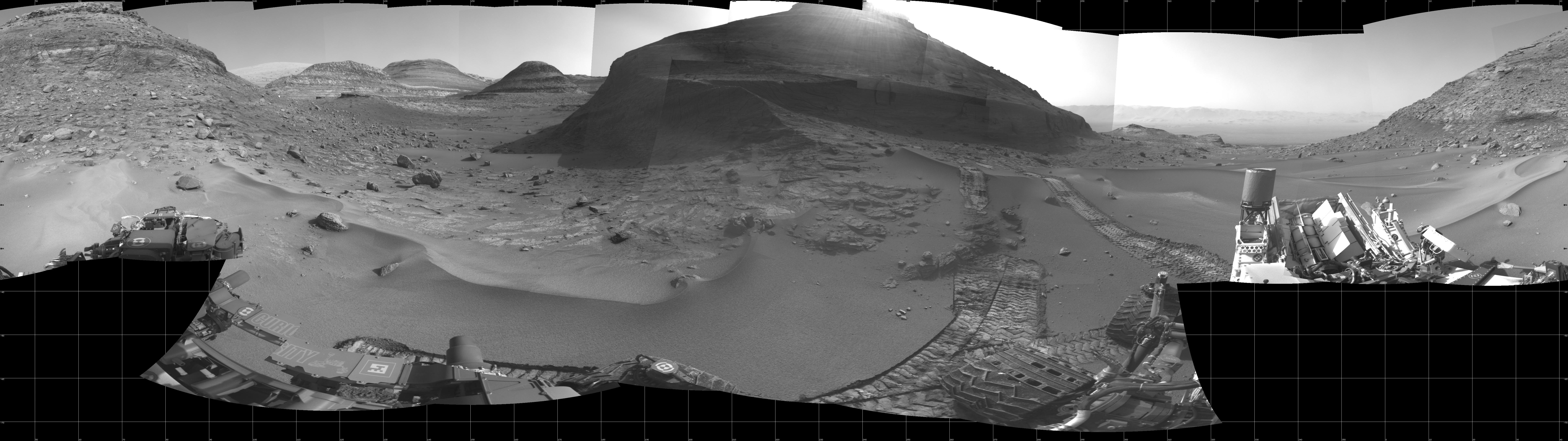
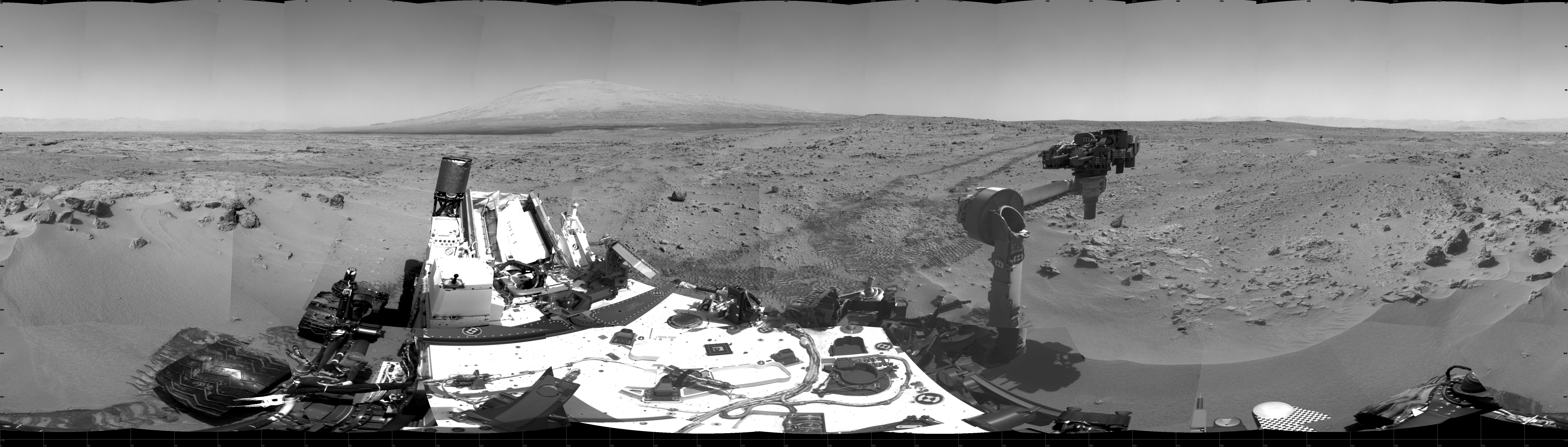
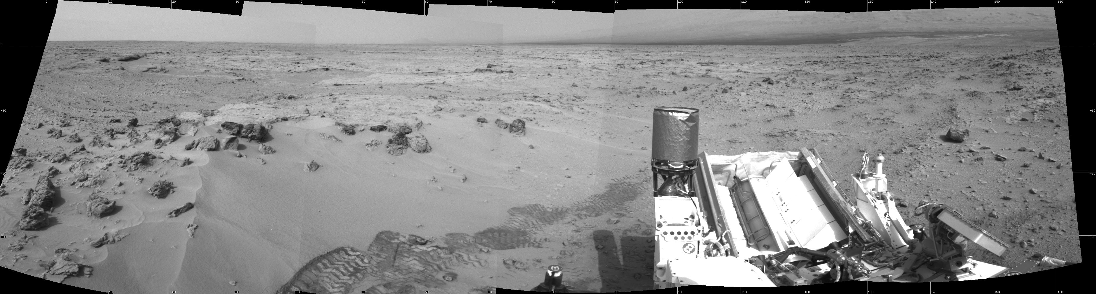
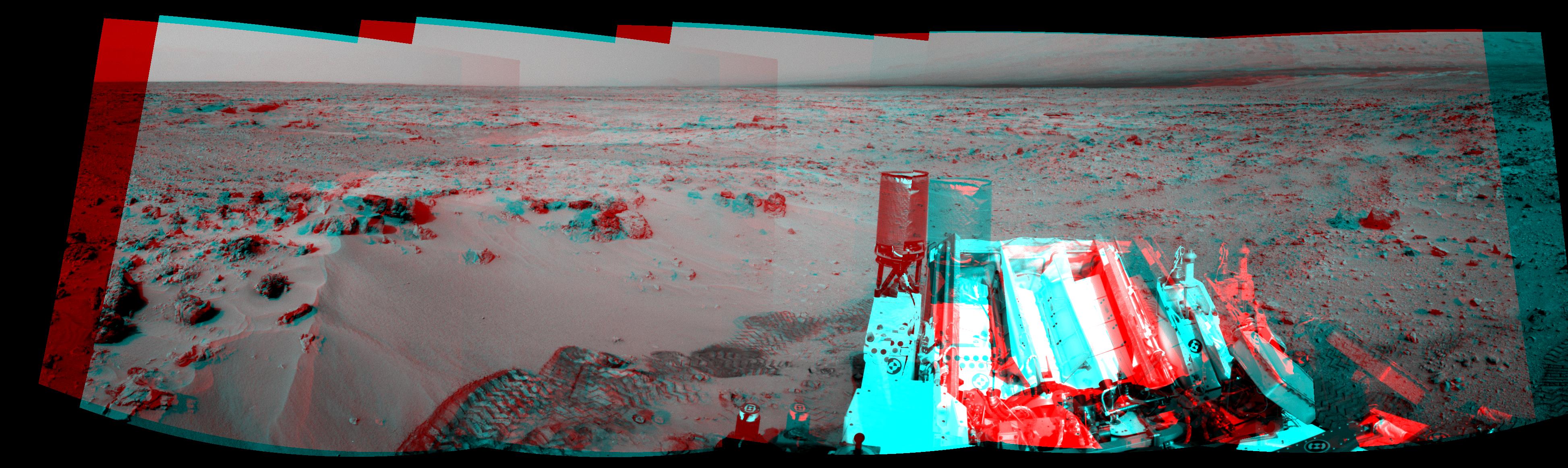
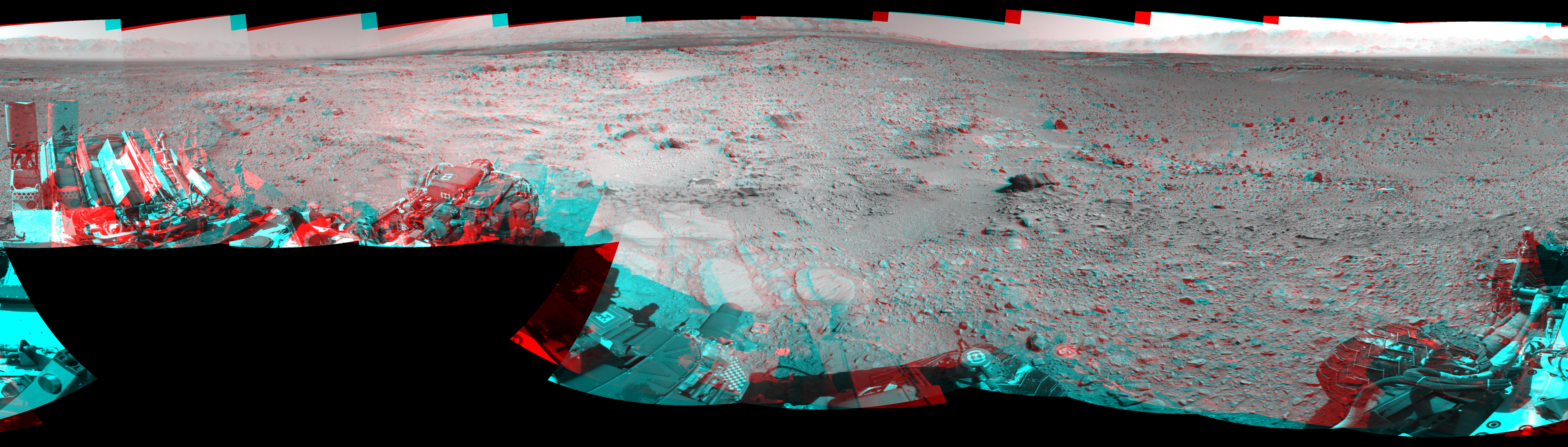
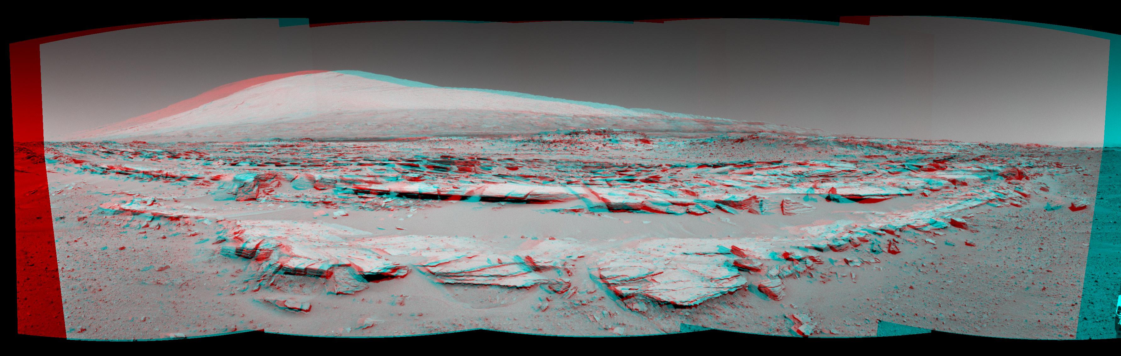
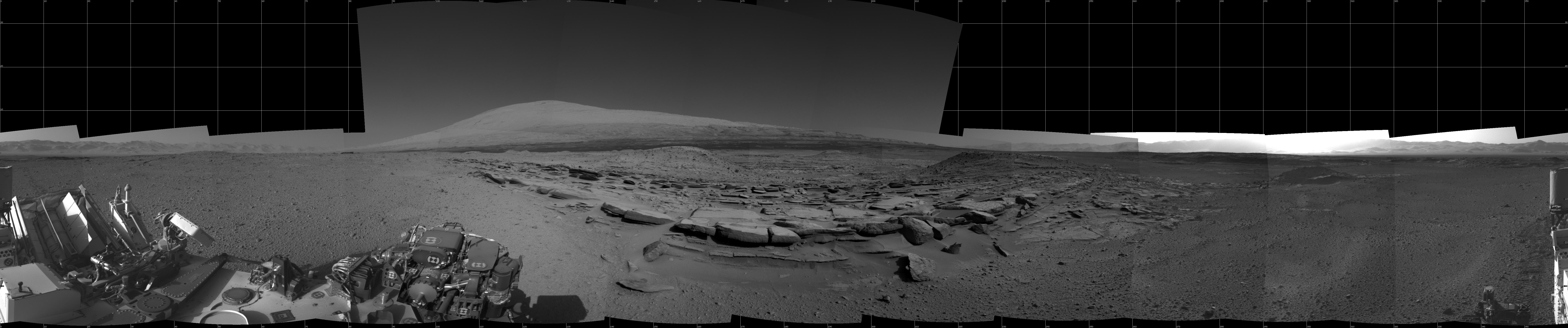
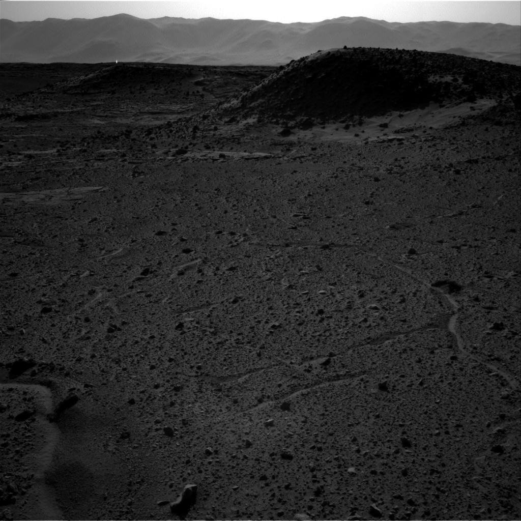
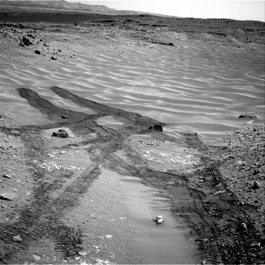
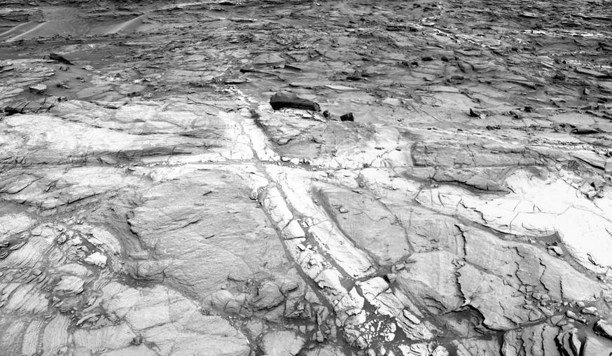
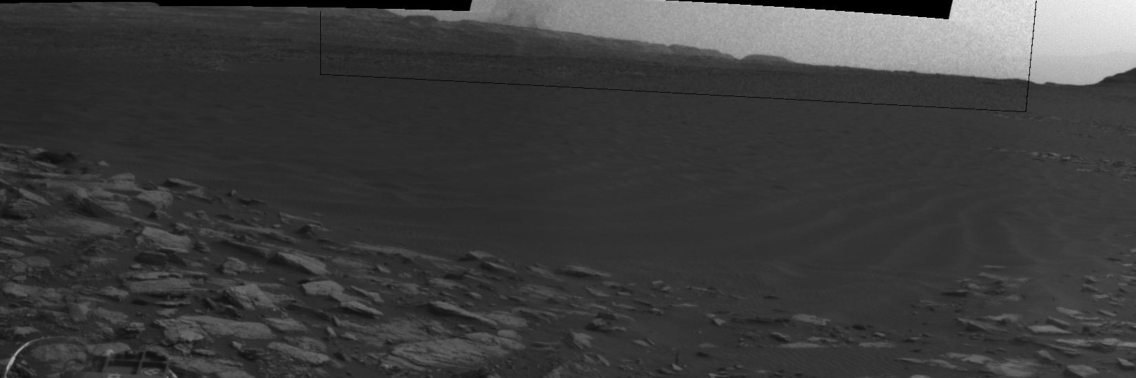
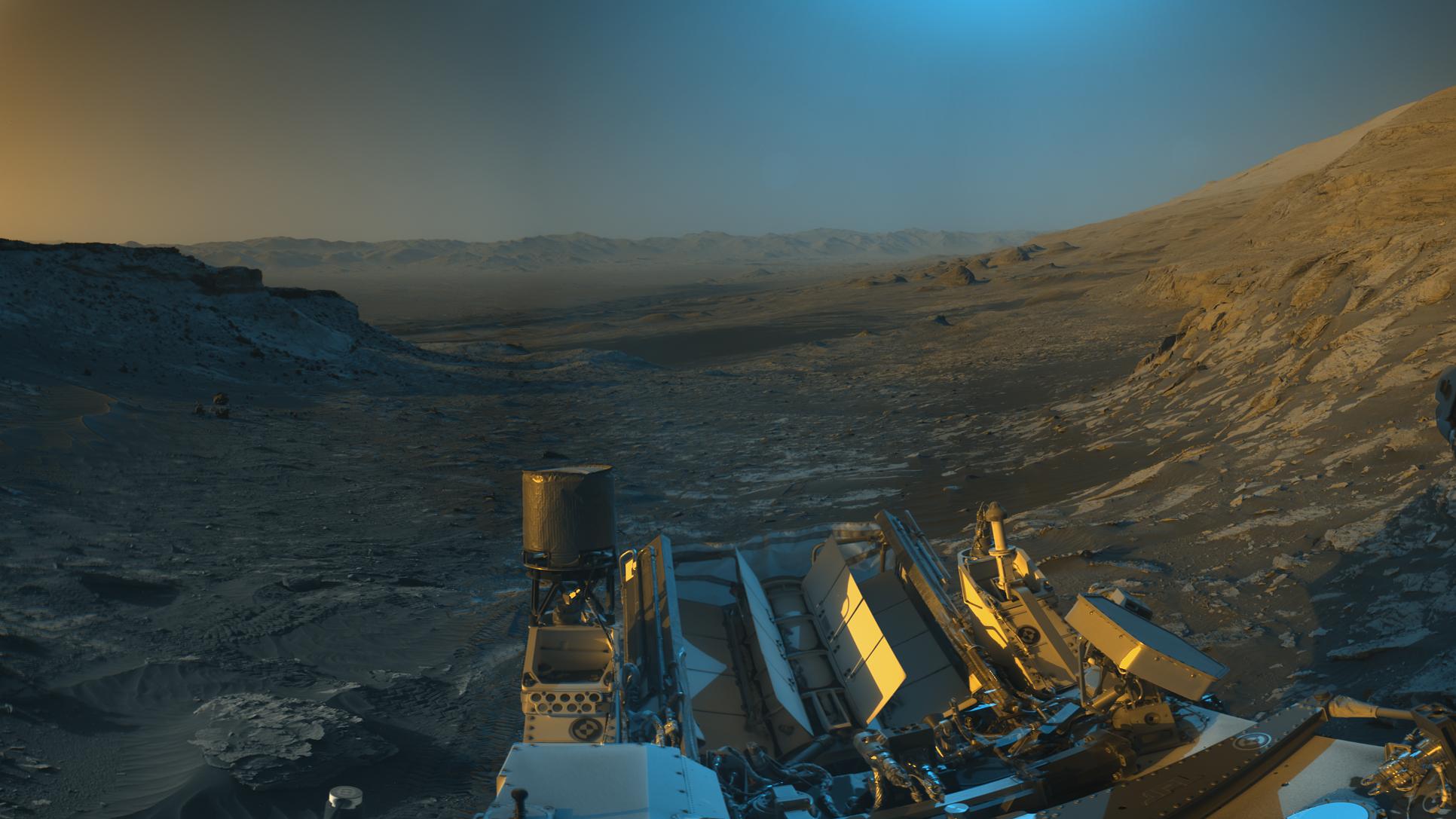
PIA26019:
Curiosity Views Gediz Vallis Ridge
Full Resolution:
TIFF
(48.14 MB)
JPEG
(4.548 MB)
|
|
|
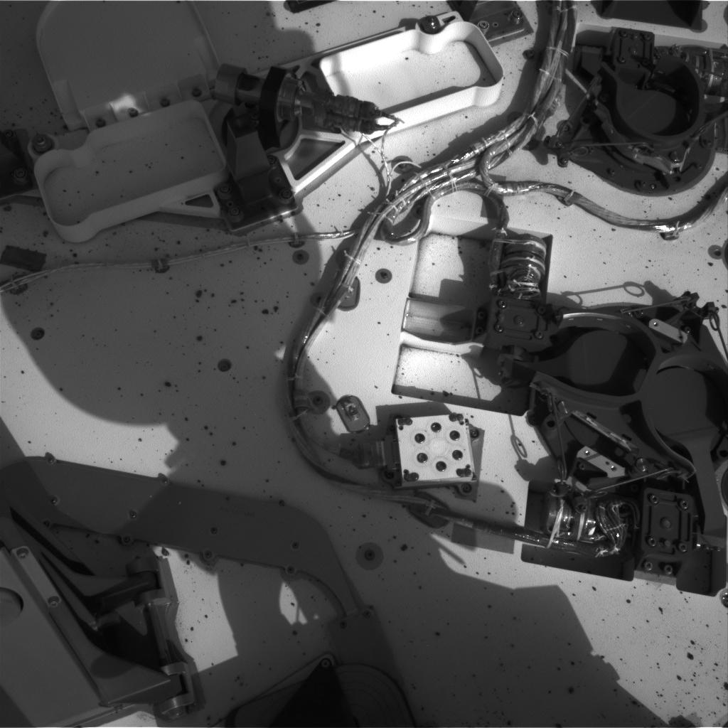
2023-11-06 |
Mars
|
Mars Science Laboratory (MSL)
|
Mastcam
|
1504x1000x3 |
|
-
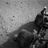
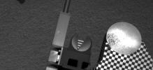
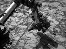
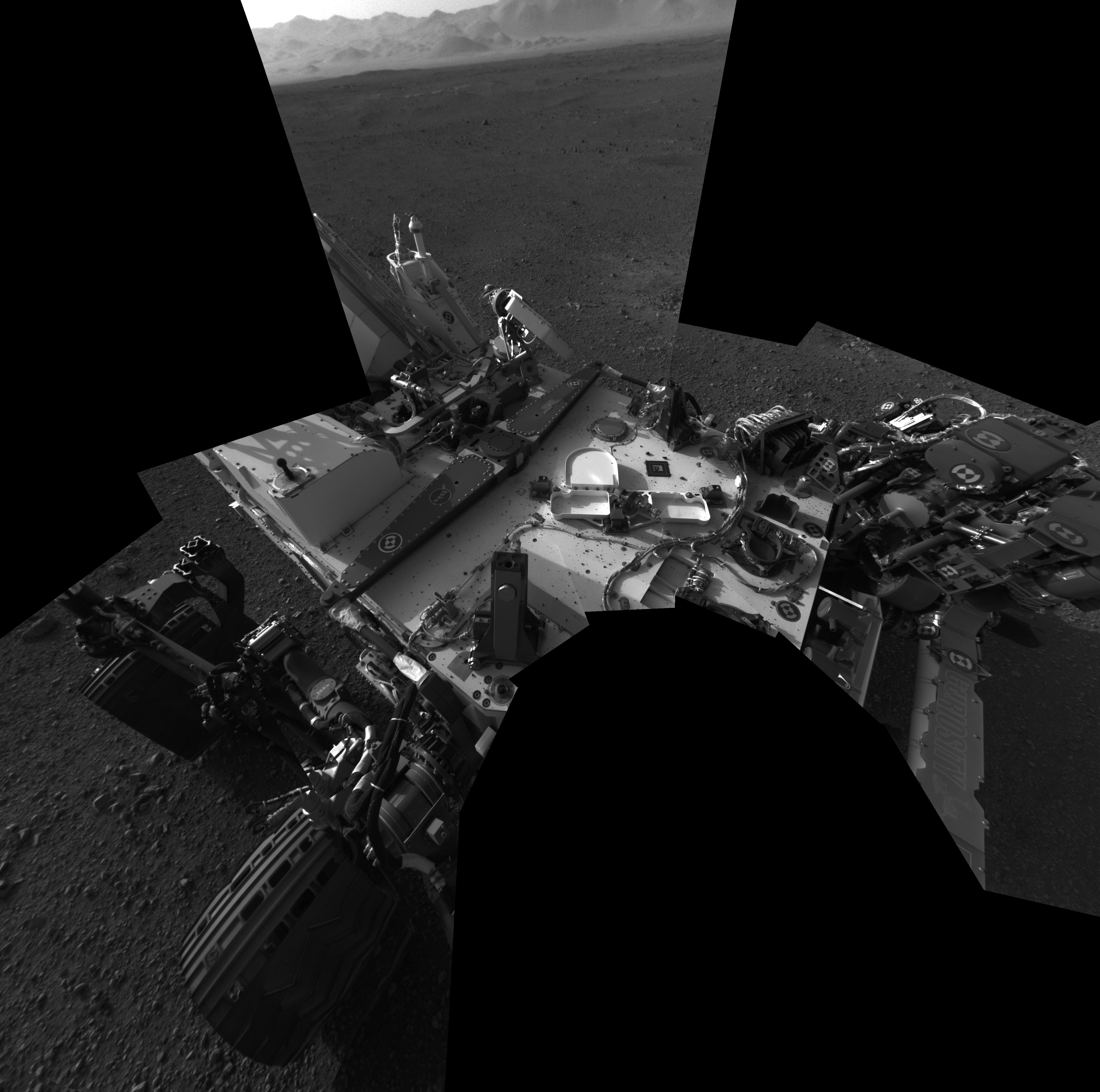
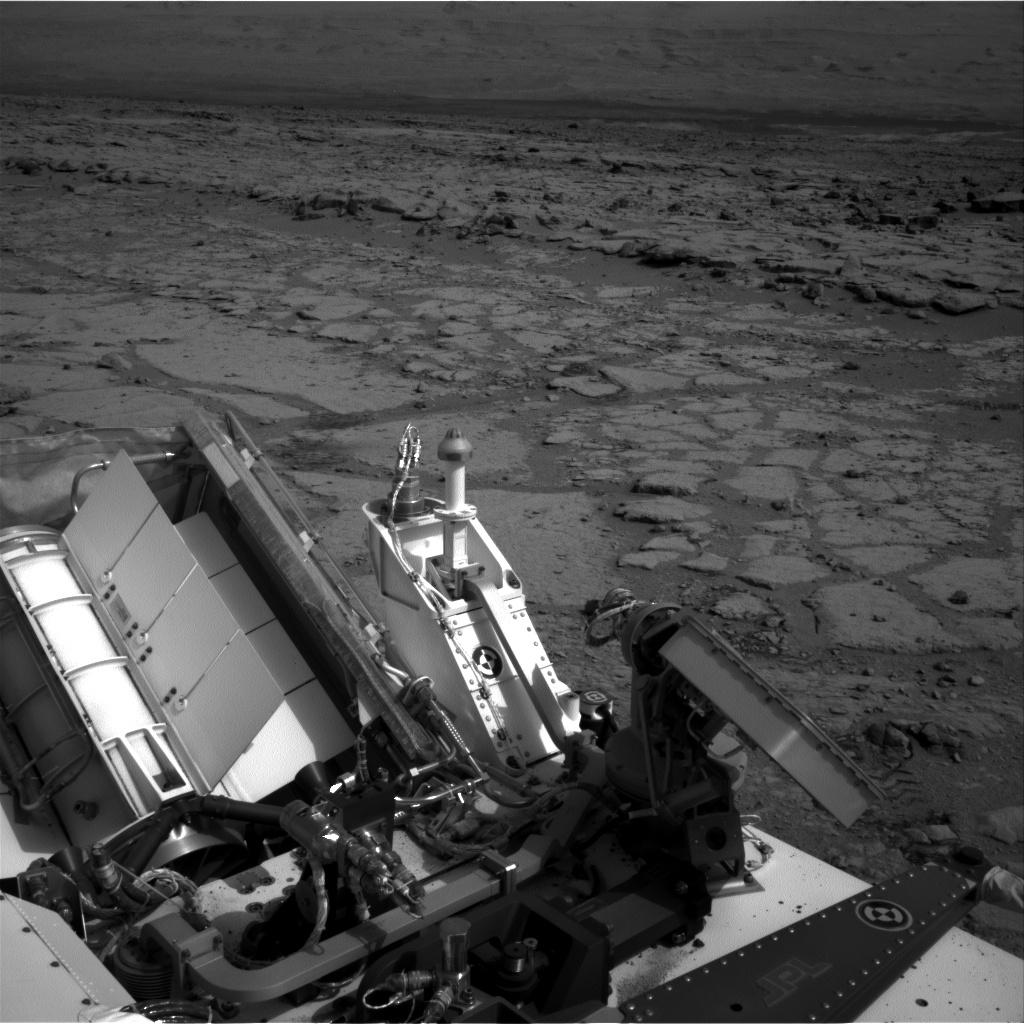
PIA26043:
-
Curiosity Mastcam Filter Wheel
Full Resolution:
TIFF
(3.852 MB)
JPEG
(134.8 kB)
|
|
|
2023-11-06 |
Mars
|
Mars Science Laboratory (MSL)
|
Mastcam
|
1583x1482x3 |
|
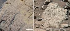
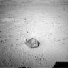
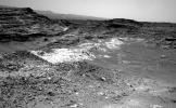
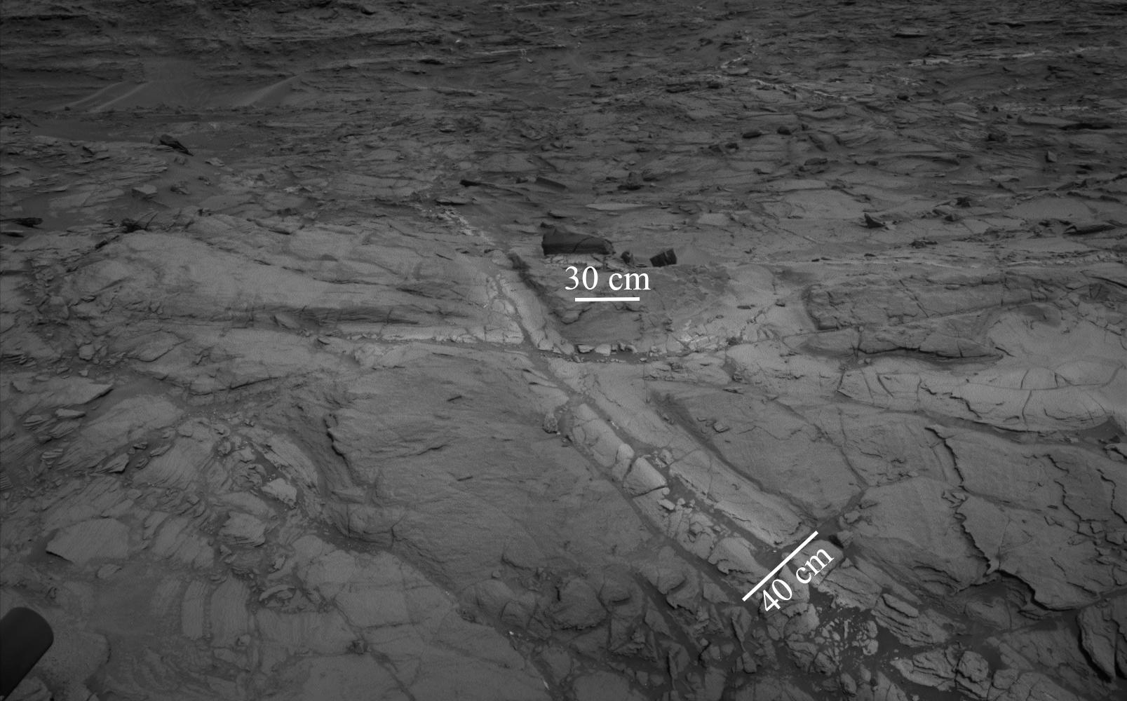
-
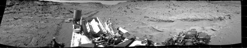
PIA26048:
-
Curiosity Views 'Sequoia' Using Its Mastcam
Full Resolution:
TIFF
(5.387 MB)
JPEG
(433.2 kB)
|
|
|
2013-06-19 |
Mars
|
Mars Science Laboratory (MSL)
|
Mastcam
Navcam (MSL)
|
17548x3022x3 |
|
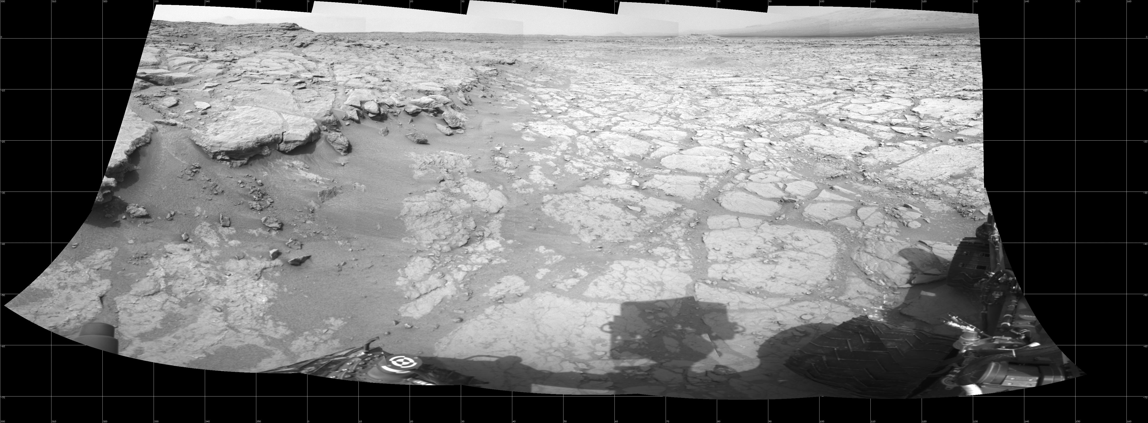
-
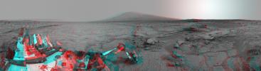
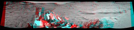
PIA16918:
Billion-Pixel View From Curiosity at Rock Nest, White-Balanced
Full Resolution:
TIFF
(159.1 MB)
JPEG
(7.72 MB)
|
|
|
2013-06-19 |
Mars
|
Mars Science Laboratory (MSL)
|
Mastcam
Navcam (MSL)
|
17548x3022x3 |
|
-
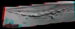
PIA16919:
Billion-Pixel View From Curiosity at Rock Nest, Raw Color
Full Resolution:
TIFF
(159.1 MB)
JPEG
(7.4 MB)
|
|
|
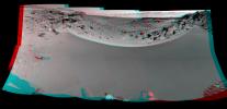
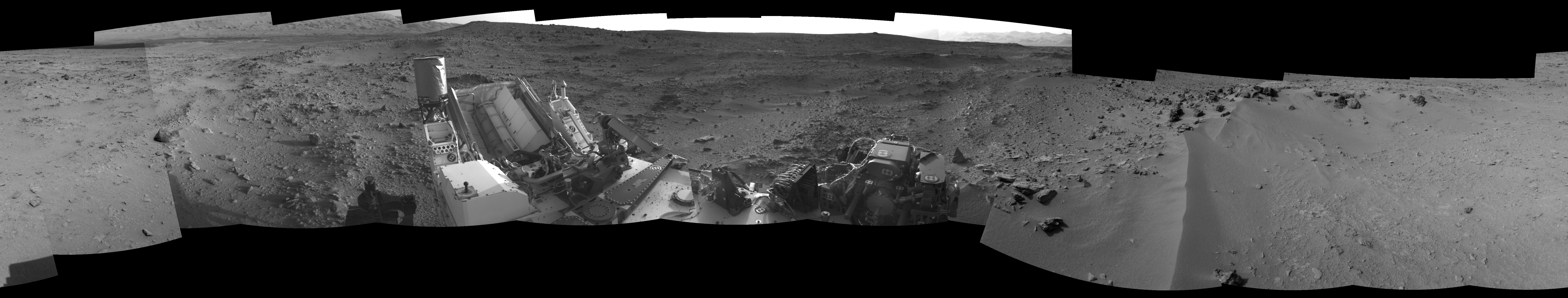
2013-03-12 |
Mars
|
Mars Exploration Rover (MER)
Mars Science Laboratory (MSL)
|
Mastcam
Panoramic Camera
|
2660x1179x3 |
|
-
PIA16833:
-
Two Different Aqueous Environments
Full Resolution:
TIFF
(9.412 MB)
JPEG
(605.8 kB)
|
|
|
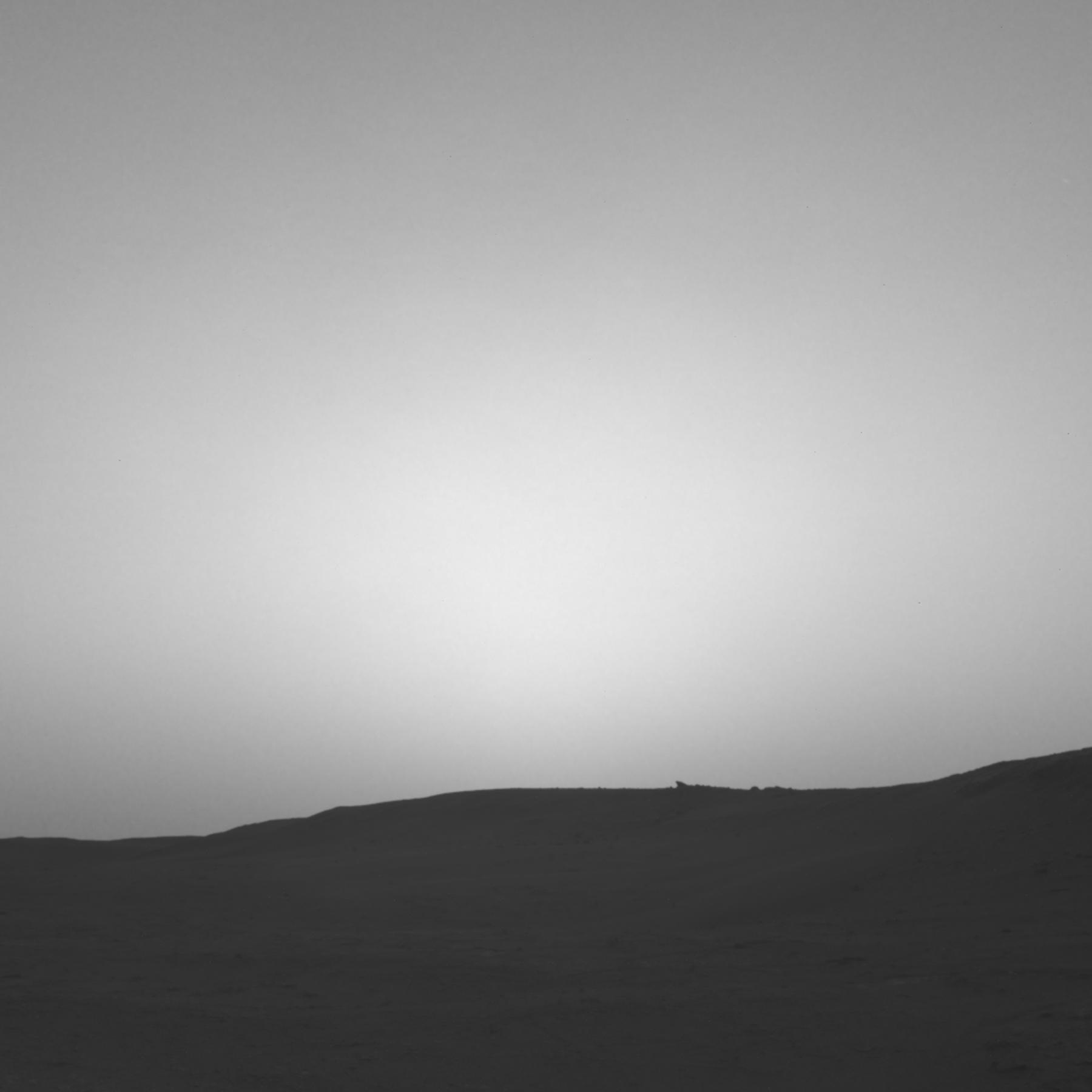
2023-11-22 |
Mars
|
Mars 2020 Rover
Mars Helicopter
|
Mastcam-Z
|
1920x1079x3 |
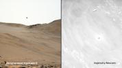
|
-
PIA26078:
-
Two Views of Ingenuity's 59th Flight
Full Resolution:
TIFF
(3.377 MB)
JPEG
(124.2 kB)
|
|
|
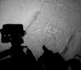
2013-08-02 |
Mars
|
Mars Science Laboratory (MSL)
|
Navigation Camera
|
1000x462x1 |
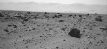
|
-
PIA17082:
-
Westward View from Curiosity on Sol 347
Full Resolution:
TIFF
(462.7 kB)
JPEG
(74.03 kB)
|
|
|
2014-05-06 |
Mars
|
Mars Science Laboratory (MSL)
|
Navigation Camera
|
598x293x1 |
|
-
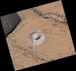
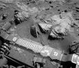
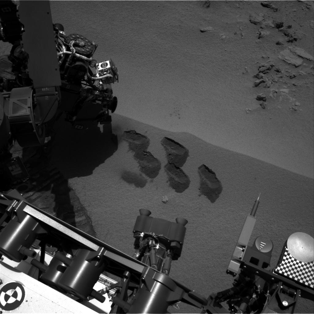
PIA18090:
-
Sample-Collection Drill Hole on Martian Sandstone Target 'Windjana'
Full Resolution:
TIFF
(175.6 kB)
JPEG
(42.97 kB)
|
|
|
2014-11-10 |
Mars
|
Mars Exploration Rover (MER)
MAVEN
|
Navigation Camera
|
1024x1024x1 |

|
-
PIA18866:
-
Image Relayed by MAVEN Mars Orbiter from Curiosity Mars Rover
Full Resolution:
TIFF
(1.05 MB)
JPEG
(255.2 kB)
|
|
|
2015-04-16 |
Mars
|
Mars Science Laboratory (MSL)
|
Navigation Camera
|
3345x777x1 |

|
-
PIA19391:
Ten Kilometers and Counting, on Mars
Full Resolution:
TIFF
(2.602 MB)
JPEG
(261.5 kB)
|
|
|
2020-06-12 |
Mars
|
Mars Science Laboratory (MSL)
|
Navigation Camera
|
1600x900x3 |
|
-
PIA23897:
-
Martian Terrain as Viewed in AI4Mars
Full Resolution:
TIFF
(1.408 MB)
JPEG
(168.6 kB)
|
|
|
2022-10-19 |
Mars
|
Mars Science Laboratory (MSL)
|
Navigation Camera (M2020)
|
7696x2165x1 |

|
-
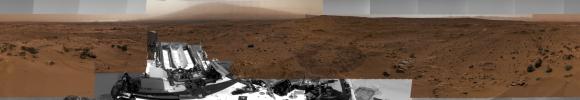
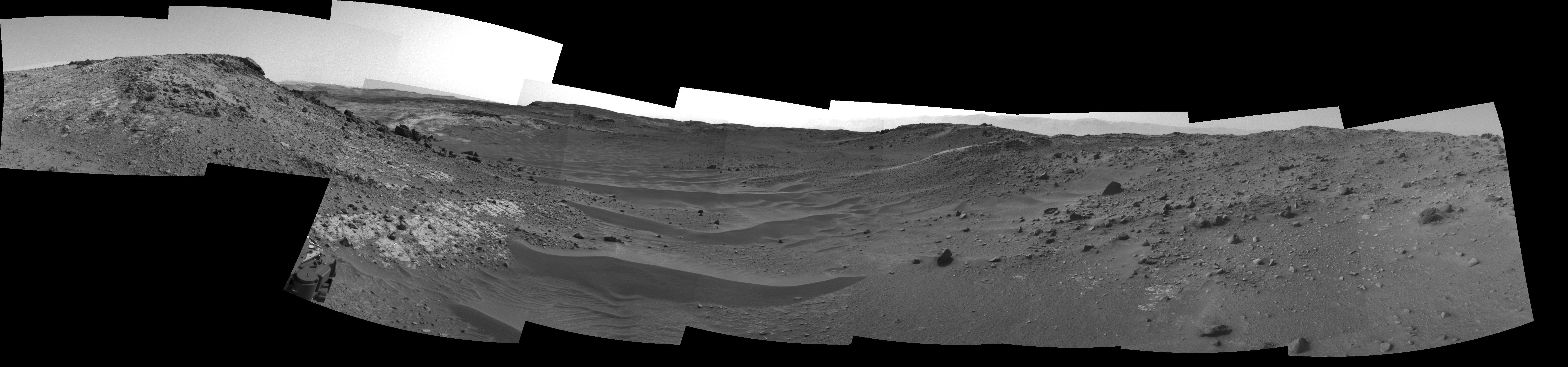
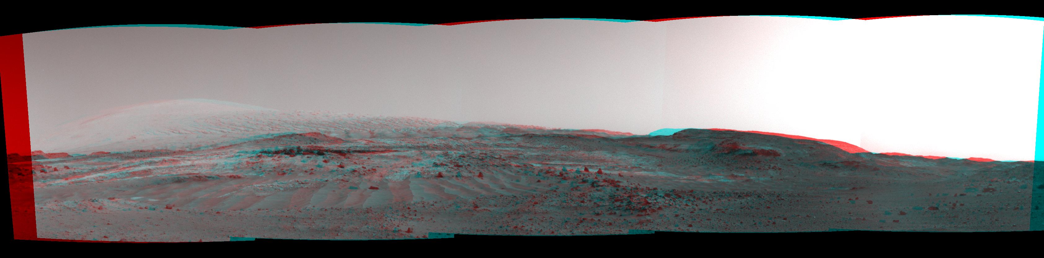
PIA25417:
Curiosity's Navcams View Paraitepuy Pass
Full Resolution:
TIFF
(11.31 MB)
JPEG
(1.471 MB)
|
|
|
2023-06-13 |
Mars
|
Mars Science Laboratory (MSL)
|
Navigation Camera (M2020)
|
3840x2160x3 |
|
-
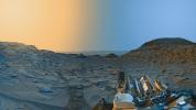
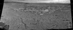
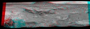
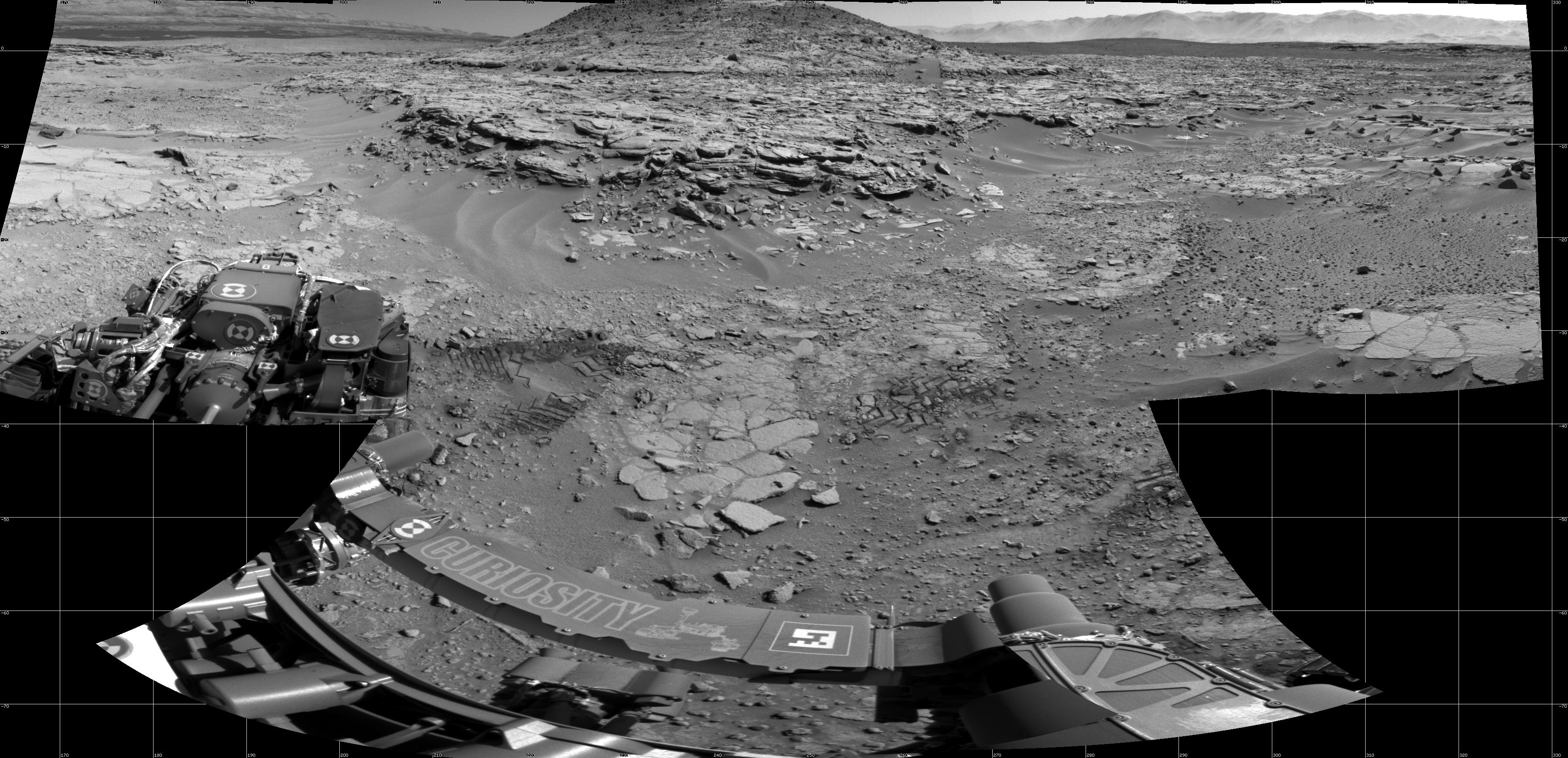
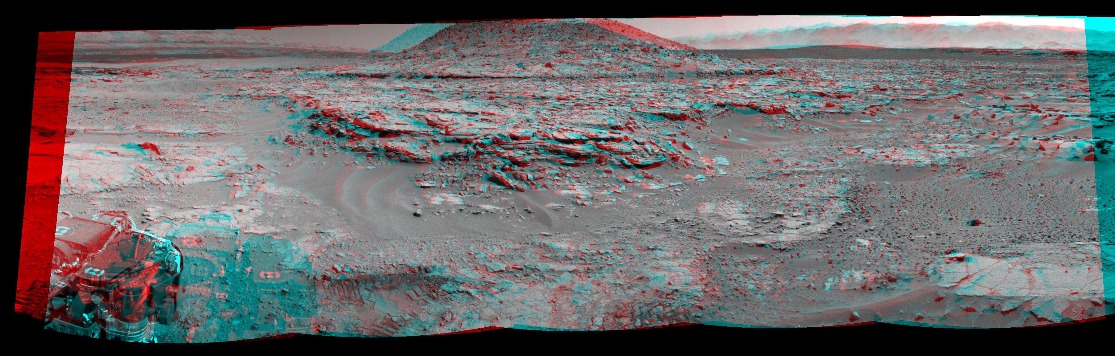
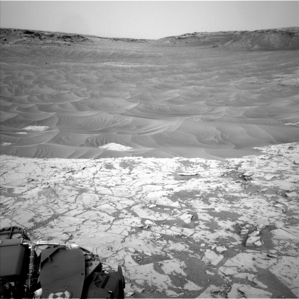
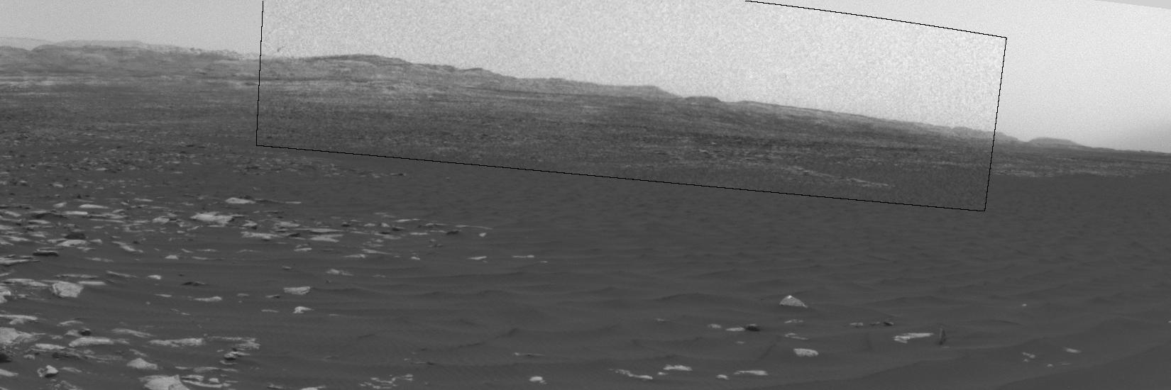
PIA25912:
-
Curiosity's 'Postcard' of 'Marker Band Valley'
Full Resolution:
TIFF
(19.22 MB)
JPEG
(666.5 kB)
|
|
|
2012-08-09 |
Mars
|
Mars Science Laboratory (MSL)
|
Navcam (MSL)
|
4313x4281x1 |
|
-
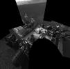
PIA16027:
-
Checking out the Rover Deck in Full Resolution
Full Resolution:
TIFF
(18.5 MB)
JPEG
(935.7 kB)
|
|
|
2012-08-17 |
Mars
|
Mars Science Laboratory (MSL)
|
Navcam (MSL)
|
5341x5301x1 |
|
-
PIA16063:
-
Still Life with Rover
Full Resolution:
TIFF
(28.36 MB)
JPEG
(1.591 MB)
|
|
|
2012-08-20 |
Mars
|
Mars Science Laboratory (MSL)
|
Navcam (MSL)
|
7703x2253x1 |

|
-
PIA16077:
-
The Heights of Mount Sharp
Full Resolution:
TIFF
(17.37 MB)
JPEG
(1.363 MB)
|
|
|
2012-08-29 |
Mars
|
Mars Science Laboratory (MSL)
|
Navcam (MSL)
|
1024x1024x1 |
|
-
PIA15693:
-
Martian Soil on Curiosity's Wheels After Sol 22 Drive
Full Resolution:
TIFF
(1.05 MB)
JPEG
(247.4 kB)
|
|
|
2012-09-06 |
Mars
|
Mars Science Laboratory (MSL)
|
Navcam (MSL)
|
7703x1749x1 |

|
-
PIA15698:
Curiosity's Location During Arm Checkouts
Full Resolution:
TIFF
(13.49 MB)
JPEG
(1.578 MB)
|
|
|
2012-09-12 |
Mars
|
Mars Science Laboratory (MSL)
|
Navcam (MSL)
|
1024x1024x1 |

|
-
PIA16164:
-
Opening and Closing SAM

Full Resolution:
TIFF
(1.05 MB)
JPEG
(101.4 kB)
|
|
|
2012-09-19 |
Mars
|
Mars Science Laboratory (MSL)
|
Navcam (MSL)
|
1024x1024x1 |
|
-
PIA16155:
-
'Jake Matijevic' Contact Target for Curiosity
Full Resolution:
TIFF
(1.05 MB)
JPEG
(254.6 kB)
|
|
|
2012-10-04 |
Mars
|
Mars Science Laboratory (MSL)
|
Navcam (MSL)
|
7824x1488x1 |

|
-
PIA16202:
View on the Way to 'Glenelg'
Full Resolution:
TIFF
(11.65 MB)
JPEG
(1.1 MB)
|
|
|
2012-10-04 |
Mars
|
Mars Science Laboratory (MSL)
|
Navcam (MSL)
|
1024x1024x1 |
|
-
PIA16205:
-
Wheel Scuff Mark at 'Rocknest'
Full Resolution:
TIFF
(1.05 MB)
JPEG
(281.5 kB)
|
|
|
2012-10-12 |
Mars
|
Mars Science Laboratory (MSL)
|
Navcam (MSL)
|
7703x2198x1 |

|
-
PIA16227:
Curiosity's Location During First Scooping
Full Resolution:
TIFF
(16.95 MB)
JPEG
(1.911 MB)
|
|
|
2012-10-18 |
Mars
|
Mars Science Laboratory (MSL)
|
Navcam (MSL)
|
1024x1024x1 |
|
-
PIA16231:
-
Curiosity's First Three Bites Into Martian Ground
Full Resolution:
TIFF
(1.05 MB)
JPEG
(161.7 kB)
|
|
|
2012-10-25 |
Mars
|
Mars Science Laboratory (MSL)
|
Navcam (MSL)
|
438x200x1 |
|
-
PIA16235:
-
Scooped Material on Rover's Observation Tray
Full Resolution:
TIFF
(87.91 kB)
JPEG
(14.34 kB)
|
|
|
2012-11-15 |
Mars
|
Mars Science Laboratory (MSL)
|
Navcam (MSL)
|
1024x1024x1 |

|
-
PIA16199:
-
Five Bites Into Mars
Full Resolution:
TIFF
(1.05 MB)
JPEG
(120.5 kB)
|
|
|
2012-11-20 |
Mars
|
Mars Science Laboratory (MSL)
|
Navcam (MSL)
|
1024x1024x1 |

|
-
PIA16447:
-
Post-Drive View on Curiosity's Sol 102
Full Resolution:
TIFF
(1.05 MB)
JPEG
(179.7 kB)
|
|
|
2012-11-20 |
Mars
|
Mars Science Laboratory (MSL)
|
Navcam (MSL)
|
3707x996x1 |

|
-
PIA16448:
Curiosity's Eastward View After Sol 100 Drive
Full Resolution:
TIFF
(3.696 MB)
JPEG
(460.2 kB)
|
|
|
2012-11-20 |
Mars
|
Mars Science Laboratory (MSL)
|
Navcam (MSL)
|
3893x1162x3 |
|
-
PIA16449:
-
Curiosity's Eastward View After Sol 100 Drive, Stereo
Full Resolution:
TIFF
(13.58 MB)
JPEG
(640.8 kB)
|
|
|
2012-12-18 |
Mars
|
Mars Science Laboratory (MSL)
|
Navcam (MSL)
|
1024x1024x1 |

|
-
PIA16553:
-
Looking Back at Entry Into 'Yellowknife Bay'
Full Resolution:
TIFF
(1.05 MB)
JPEG
(138.6 kB)
|
|
|
2012-12-21 |
Mars
|
Mars Science Laboratory (MSL)
|
Navcam (MSL)
|
4798x1769x1 |

|
-
PIA16562:
-
At Edge of 'Yellowknife Bay,' Sol 130
Full Resolution:
TIFF
(8.502 MB)
JPEG
(863 kB)
|
|
|
2013-01-04 |
Mars
|
Mars Science Laboratory (MSL)
|
Navcam (MSL)
|
1371x667x1 |

|
-
PIA16564:
-
'Snake River' Rock Feature Viewed by Curiosity Mars Rover
Full Resolution:
TIFF
(915.7 kB)
JPEG
(179.5 kB)
|
|
|
2013-04-23 |
Mars
|
Mars Science Laboratory (MSL)
|
Navcam (MSL)
|
7824x3328x3 |
|
-
PIA16847:
-
Mars Stereo View from "John Klein" to Mount Sharp (Raw)
Full Resolution:
TIFF
(78.14 MB)
JPEG
(2.325 MB)
|
|
|
2013-03-25 |
Mars
|
Mars Science Laboratory (MSL)
|
Navcam (MSL)
|
1024x1024x1 |
|
-
PIA16812:
-
View From Camera Not Used During Curiosity's First Six Months on Mars
Full Resolution:
TIFF
(1.05 MB)
JPEG
(241.9 kB)
|
|
|
2013-04-23 |
Mars
|
Mars Science Laboratory (MSL)
|
Navcam (MSL)
|
7824x2131x3 |
|
-
PIA16925:
Mars Stereo View from "John Klein" to Mount Sharp
Full Resolution:
TIFF
(50.04 MB)
JPEG
(1.804 MB)
|
|
|
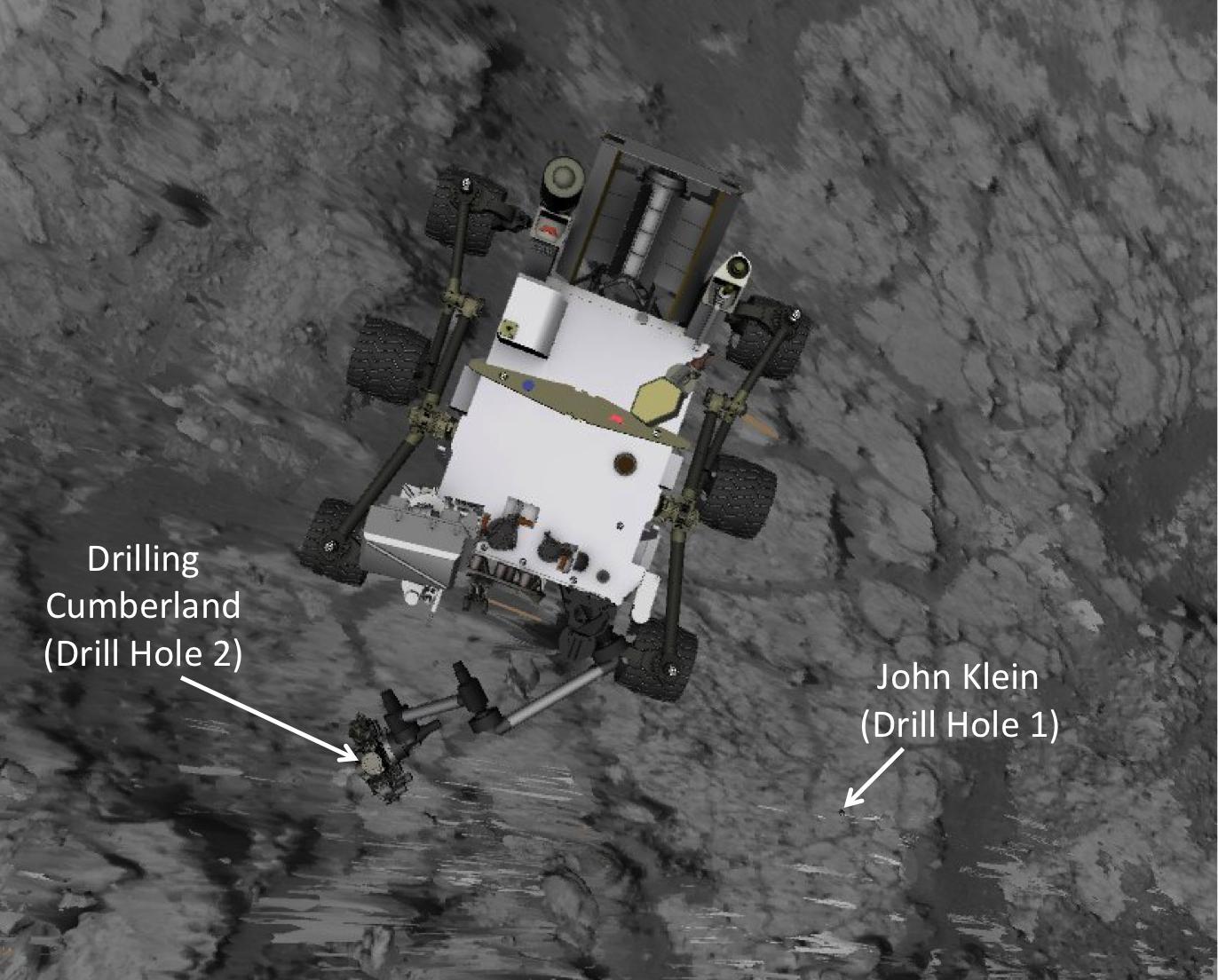
2013-06-05 |
Mars
|
Mars Science Laboratory (MSL)
|
Navcam (MSL)
|
1372x1104x3 |
|
-
PIA17065:
-
Position of Curiosity for Drilling at 'Cumberland'
Full Resolution:
TIFF
(4.546 MB)
JPEG
(185.5 kB)
|
|
|
2013-07-02 |
Phobos
|
Mars Science Laboratory (MSL)
|
Navcam (MSL)
|
511x511x1 |
|
-
PIA17270:
-
Phobos Passing Overhead
Full Resolution:
TIFF
(261.6 kB)
JPEG
(15.82 kB)
|
|
|
2013-07-08 |
Mars
|
Mars Science Laboratory (MSL)
|
Navcam (MSL)
|
1024x1024x1 |
|
-
PIA17272:
-
First Leg of Long Trek Toward Mount Sharp
Full Resolution:
TIFF
(1.05 MB)
JPEG
(298.1 kB)
|
|
|
2013-07-11 |
Mars
|
Mars Science Laboratory (MSL)
|
Navcam (MSL)
|
1024x1024x1 |
|
-
PIA17269:
-
Heading for Mount Sharp, Sol 329
Full Resolution:
TIFF
(1.05 MB)
JPEG
(248.8 kB)
|
|
|
2013-08-27 |
Mars
|
Mars Science Laboratory (MSL)
|
Navcam (MSL)
|
6124x987x1 |

|
-
PIA17354:
View Ahead After Curiosity's Sol 376 Drive Using Autonomous Navigation
Full Resolution:
TIFF
(6.053 MB)
JPEG
(873.6 kB)
|
|
|
2013-09-10 |
Mars
|
Mars Science Laboratory (MSL)
|
Navcam (MSL)
|
1840x718x1 |
|
-
PIA17359:
-
Curiosity's View from 'Panorama Point' to 'Waypoint 1' and Outcrop 'Darwin'
Full Resolution:
TIFF
(1.323 MB)
JPEG
(210.5 kB)
|
|
|
2013-10-29 |
Mars
|
Mars Science Laboratory (MSL)
|
Navcam (MSL)
|
1323x456x1 |

|
-
PIA17580:
-
Curiosity's View of "Cooperstown" Outcrop on Route to Mount Sharp
Full Resolution:
TIFF
(604.1 kB)
JPEG
(97.89 kB)
|
|
|
2013-12-20 |
Mars
|
Mars Science Laboratory (MSL)
|
Navcam (MSL)
|
7696x1739x1 |

|
-
PIA17581:
Rocky Mars Ground Where Curiosity Has Been Driving
Full Resolution:
TIFF
(13.4 MB)
JPEG
(1.933 MB)
|
|
|
2013-12-20 |
Mars
|
Mars Science Laboratory (MSL)
|
Navcam (MSL)
|
7733x2206x3 |

|
-
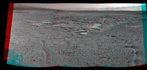
PIA17584:
Rocky Mars Ground Where Curiosity Has Been Driving (Stereo)
Full Resolution:
TIFF
(51.19 MB)
JPEG
(2.437 MB)
|
|
|
2014-01-29 |
Mars
|
Mars Science Laboratory (MSL)
|
Navcam (MSL)
|
7696x1717x1 |
|
-
PIA17763:
Full-Circle Vista During Curiosity's Approach to 'Dingo Gap'
Full Resolution:
TIFF
(13.23 MB)
JPEG
(1.852 MB)
|
|
|
2014-01-29 |
Mars
|
Mars Science Laboratory (MSL)
|
Navcam (MSL)
|
7733x2357x3 |
|
-
PIA17764:
-
Full-Circle Vista During Curiosity's Approach to 'Dingo Gap' (Stereo)
Full Resolution:
TIFF
(54.7 MB)
JPEG
(2.399 MB)
|
|
|
2014-01-31 |
Mars
|
Mars Science Laboratory (MSL)
|
Navcam (MSL)
|
4127x1993x3 |
|
-
PIA17769:
-
Curiosity's View Past Dune at 'Dingo Gap' (Stereo)
Full Resolution:
TIFF
(24.69 MB)
JPEG
(1.066 MB)
|
|
|
2014-01-31 |
Mars
|
Mars Science Laboratory (MSL)
|
Navcam (MSL)
|
4075x1439x1 |

|
-
PIA17930:
-
Curiosity's View Past Dune at 'Dingo Gap'
Full Resolution:
TIFF
(5.87 MB)
JPEG
(876.4 kB)
|
|
|
2014-02-19 |
Mars
|
Mars Science Laboratory (MSL)
|
Navcam (MSL)
|
1011x868x1 |
|
-
PIA17945:
-
Curiosity Mars Rover's Shadow After Long Backward Drive
Full Resolution:
TIFF
(878.6 kB)
JPEG
(175 kB)
|
|
|
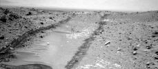
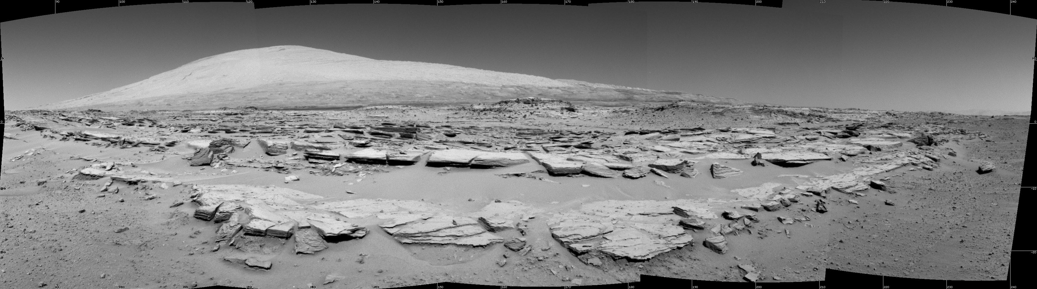
2014-02-27 |
Mars
|
Mars Science Laboratory (MSL)
|
Navcam (MSL)
|
3482x972x1 |
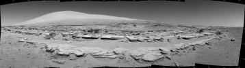
|
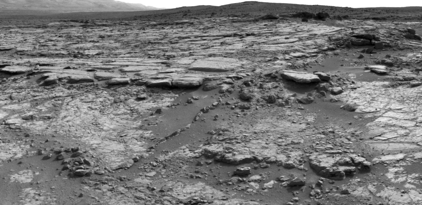
-
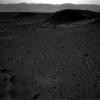
PIA17947:
Martian Landscape with Rock Rows and Mount Sharp
Full Resolution:
TIFF
(3.389 MB)
JPEG
(476.3 kB)
|
|
|
2014-02-27 |
Mars
|
Mars Science Laboratory (MSL)
|
Navcam (MSL)
|
3563x1131x3 |
|
-
PIA17948:
-
Martian Landscape With Rock Rows and Mount Sharp (Stereo)
Full Resolution:
TIFF
(12.09 MB)
JPEG
(503.8 kB)
|
|
|
2014-02-27 |
Mars
|
Mars Science Laboratory (MSL)
|
Navcam (MSL)
|
1024x1024x1 |

|
-
PIA17949:
-
Curiosity's View Back After Passing 'Junda' Striations
Full Resolution:
TIFF
(1.05 MB)
JPEG
(240.6 kB)
|
|
|
2014-02-27 |
Mars
|
Mars Science Laboratory (MSL)
|
Navcam (MSL)
|
4945x973x1 |
|
-
PIA17950:
Panoramic View From West of 'Dingo Gap'
Full Resolution:
TIFF
(4.819 MB)
JPEG
(818.6 kB)
|
|
|
2014-02-27 |
Mars
|
Mars Science Laboratory (MSL)
|
Navcam (MSL)
|
5015x1132x3 |
|
-
PIA17951:
Panoramic View From West of 'Dingo Gap' (Stereo)
Full Resolution:
TIFF
(17.04 MB)
JPEG
(954 kB)
|
|
|
2014-03-24 |
Mars
|
Mars Science Laboratory (MSL)
|
Navcam (MSL)
|
7696x1609x1 |

|
-
PIA18069:
Panorama With Sandstone Outcrop Near 'The Kimberley' Waypoint
Full Resolution:
TIFF
(12.4 MB)
JPEG
(1.052 MB)
|
|
|
2014-03-24 |
Mars
|
Mars Science Laboratory (MSL)
|
Navcam (MSL)
|
3657x1414x3 |
|
-
PIA18070:
-
Panorama With Sandstone Outcrop Near 'The Kimberley' Waypoint (Stereo)
Full Resolution:
TIFF
(15.52 MB)
JPEG
(573.6 kB)
|
|
|
2014-04-03 |
Mars
|
Mars Science Laboratory (MSL)
|
Navcam (MSL)
|
2043x759x1 |
|
-
PIA18072:
-
Curiosity's View From Before Final Approach to 'The Kimberley' Waypoint
Full Resolution:
TIFF
(1.552 MB)
JPEG
(258.1 kB)
|
|
|
2014-04-03 |
Mars
|
Mars Science Laboratory (MSL)
|
Navcam (MSL)
|
2307x956x1 |
|
-
PIA18073:
-
Curiosity's View From Arrival Point at 'The Kimberley' Waypoint
Full Resolution:
TIFF
(2.208 MB)
JPEG
(393.1 kB)
|
|
|
2014-04-03 |
Mars
|
Mars Science Laboratory (MSL)
|
Navcam (MSL)
|
2338x1111x3 |
|
-
PIA18074:
-
Curiosity's View From Arrival Point at 'The Kimberley' Waypoint (Stereo)
Full Resolution:
TIFF
(7.796 MB)
JPEG
(446.6 kB)
|
|
|
2014-04-08 |
Mars
|
Mars Science Laboratory (MSL)
|
Navcam (MSL)
|
1024x1024x1 |
|
-
PIA18077:
-
Bright Spot Toward Sun in Image from NASA's Curiosity Mars Rover
Full Resolution:
TIFF
(1.05 MB)
JPEG
(152.5 kB)
|
|
|
2014-04-16 |
Mars
|
Mars Science Laboratory (MSL)
|
Navcam (MSL)
|
3595x1737x1 |
|
-
PIA18083:
-
'Mount Remarkable' and Surrounding Outcrops at Mars Rover's Waypoint
Full Resolution:
TIFF
(6.252 MB)
JPEG
(882.7 kB)
|
|
|
2014-04-16 |
Mars
|
Mars Science Laboratory (MSL)
|
Navcam (MSL)
|
3612x1155x3 |
|
-
PIA18084:
-
Stereo View of 'Mount Remarkable' and Surrounding Outcrops at Mars Rover's Waypoint
Full Resolution:
TIFF
(12.52 MB)
JPEG
(697.9 kB)
|
|
|
2014-04-25 |
Mars
|
Mars Science Laboratory (MSL)
|
Navcam (MSL)
|
1024x892x1 |
|
-
PIA18086:
-
Curiosity Mars Rover Beside Sandstone Target 'Windjana'
Full Resolution:
TIFF
(914.5 kB)
JPEG
(171.2 kB)
|
|
|
2014-08-05 |
Mars
|
Mars Science Laboratory (MSL)
|
Navcam (MSL)
|
1024x1024x1 |

|
-
PIA18590:
-
Curiosity Tracks in 'Hidden Valley' on Mars
Full Resolution:
TIFF
(1.05 MB)
JPEG
(233 kB)
|
|
|
2014-08-15 |
Mars
|
Mars Science Laboratory (MSL)
|
Navcam (MSL)
|
1024x448x1 |
|
-
PIA18597:
-
Looking Up the Ramp Holding 'Bonanza King' on Mars
Full Resolution:
TIFF
(459.4 kB)
JPEG
(112 kB)
|
|
|
2014-08-15 |
Mars
|
Mars Science Laboratory (MSL)
|
Navcam (MSL)
|
1024x1024x1 |

|
-
PIA18599:
-
Down Northeastern Ramp into 'Hidden Valley' on Mars
Full Resolution:
TIFF
(1.05 MB)
JPEG
(210.8 kB)
|
|
|
2014-08-15 |
Mars
|
Mars Science Laboratory (MSL)
|
Navcam (MSL)
|
1024x1024x1 |
|
-
PIA18600:
-
View Down 'Hidden Valley' Ramp at 'Bonanza King' on Mars
Full Resolution:
TIFF
(1.05 MB)
JPEG
(151.1 kB)
|
|
|
2014-11-18 |
Mars
|
Mars Science Laboratory (MSL)
|
Navcam (MSL)
|
1024x1024x1 |

|
-
PIA18883:
-
Ripples Beside 'Pahrump Hills' Outcrop at Base of Mount Sharp
Full Resolution:
TIFF
(1.05 MB)
JPEG
(179.2 kB)
|
|
|
2015-03-06 |
Mars
|
Mars Science Laboratory (MSL)
|
Navcam (MSL)
|
1024x830x1 |
|
-
PIA19147:
-
Curiosity's Arm Holding Steady, Sol 915
Full Resolution:
TIFF
(851 kB)
JPEG
(152.4 kB)
|
|
|
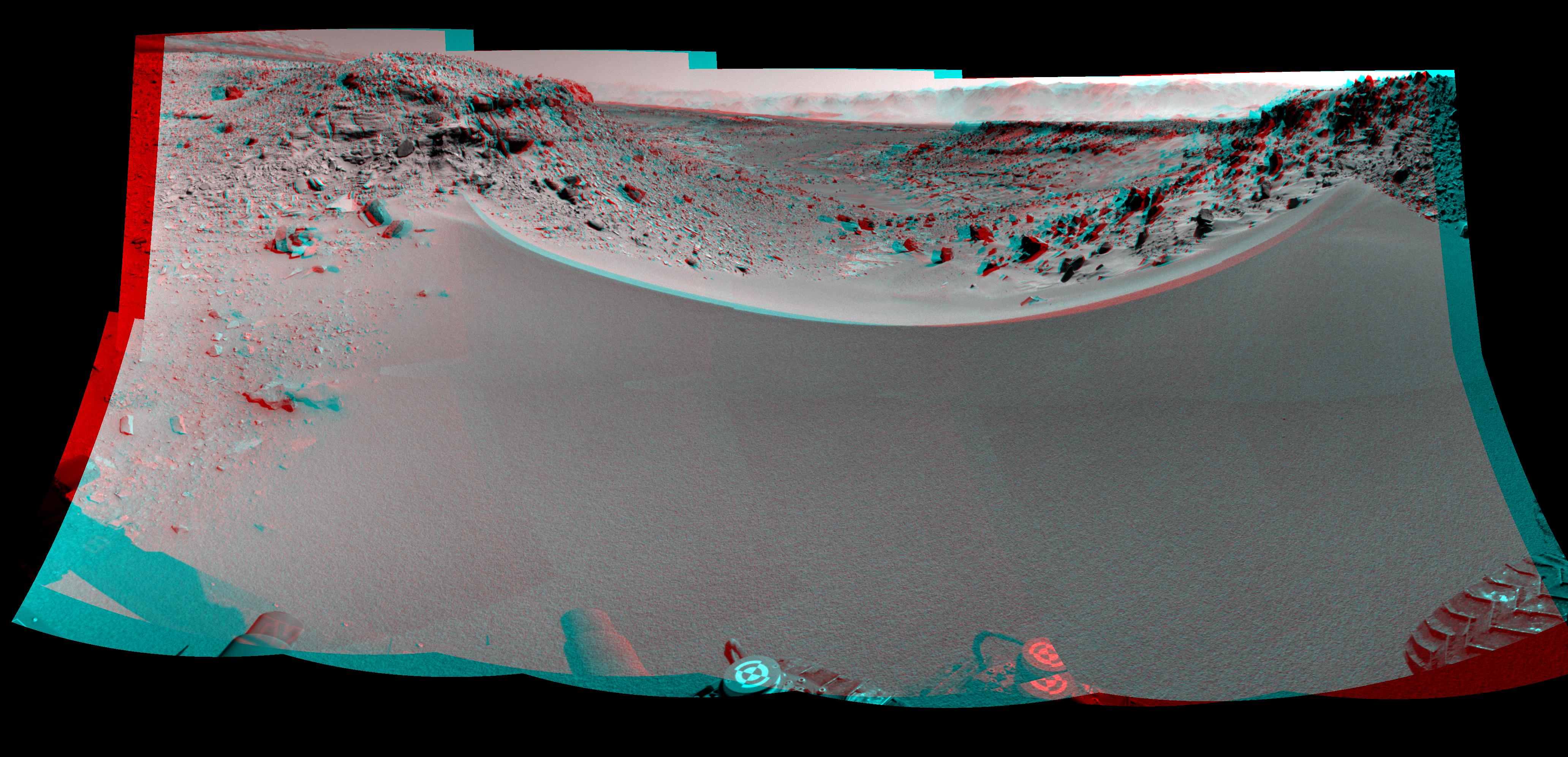
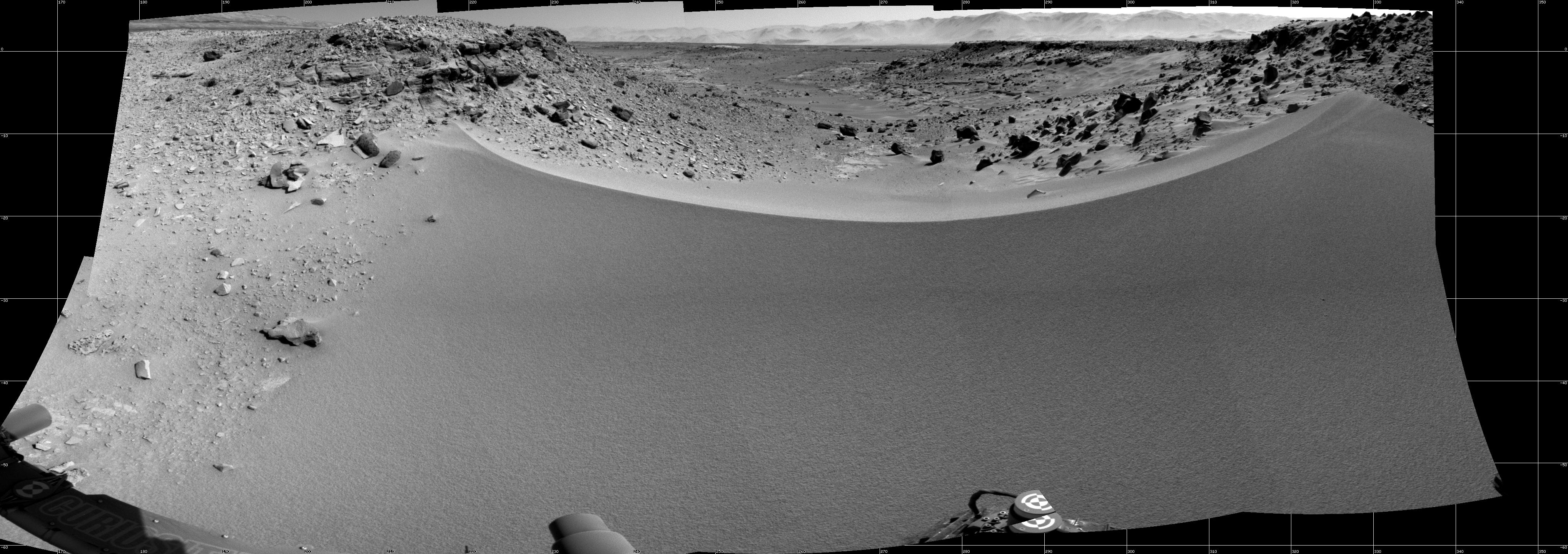
2015-04-13 |
Mars
|
Mars Science Laboratory (MSL)
|
Navcam (MSL)
|
6225x1460x1 |
|
-
PIA19163:
Curiosity View Ahead Through 'Artist's Drive'
Full Resolution:
TIFF
(9.1 MB)
JPEG
(796.2 kB)
|
|
|
2015-04-13 |
Mars
|
Mars Science Laboratory (MSL)
|
Navcam (MSL)
|
6246x1497x3 |
|
-
PIA19165:
Curiosity View Ahead Through 'Artist's Drive' (Stereo)
Full Resolution:
TIFF
(28.06 MB)
JPEG
(1.019 MB)
|
|
|
2015-04-13 |
Mars
|
Mars Science Laboratory (MSL)
|
Navcam (MSL)
|
3356x685x1 |
|
-
PIA19386:
Scene From 'Artist's Drive' on Mars
Full Resolution:
TIFF
(2.302 MB)
JPEG
(234.8 kB)
|
|
|
2015-04-13 |
Mars
|
Mars Science Laboratory (MSL)
|
Navcam (MSL)
|
3368x832x3 |
|
-
PIA19387:
Scene From 'Artist's Drive' on Mars (Stereo)
Full Resolution:
TIFF
(8.41 MB)
JPEG
(231.6 kB)
|
|
|
2016-08-04 |
Mars
|
Mars Science Laboratory (MSL)
|
Navcam (MSL)
|
982x726x1 |
|
-
PIA20764:
-
Curiosity's Arm Over 'Marimba' Target on Mount Sharp
Full Resolution:
TIFF
(713.9 kB)
JPEG
(138.6 kB)
|
|
|
2015-05-22 |
Mars
|
Mars Science Laboratory (MSL)
|
Navcam (MSL)
|
954x588x1 |
|
-
PIA19663:
-
Rover's Reward for Climbing: Exposed Geological Contact
Full Resolution:
TIFF
(561.8 kB)
JPEG
(132.5 kB)
|
|
|
2015-12-17 |
Mars
|
Mars Science Laboratory (MSL)
|
Navcam (MSL)
|
1024x998x1 |
|
-
PIA20175:
-
Area with Silica-Rich Target Near 'Marias Pass' on Mars
Full Resolution:
TIFF
(1.023 MB)
JPEG
(219.6 kB)
|
|
|
2015-12-17 |
Mars
|
Mars Science Laboratory (MSL)
|
Navcam (MSL)
|
7696x2268x1 |
|
-
PIA20266:
-
Full-Circle View Near 'Marias Pass' on Mars
Full Resolution:
TIFF
(10.75 MB)
JPEG
(1.919 MB)
|
|
|
2015-12-17 |
Mars
|
Mars Science Laboratory (MSL)
|
Navcam (MSL)
|
874x508x1 |

|
-
PIA20268:
-
Discolored Fracture Zones in Martian Sandstone
Full Resolution:
TIFF
(444.7 kB)
JPEG
(117.2 kB)
|
|
|
2016-01-04 |
Mars
|
Mars Science Laboratory (MSL)
|
Navcam (MSL)
|
4937x1190x1 |
|
-
PIA20281:
Slip Face on Downwind Side of 'Namib' Sand Dune on Mars
Full Resolution:
TIFF
(4.713 MB)
JPEG
(512.6 kB)
|
|
|
2016-01-04 |
Mars
|
Mars Science Laboratory (MSL)
|
Navcam (MSL)
|
4937x1190x3 |

|
-
PIA20282:
Downwind Side of 'Namib' Sand Dune on Mars, Stereo
Full Resolution:
TIFF
(13 MB)
JPEG
(596.7 kB)
|
|
|
2016-12-05 |
Mars
|
Mars Science Laboratory (MSL)
|
Navcam (MSL)
|
1024x1024x1 |
|
-
PIA21140:
-
Martian Terrain Near Curiosity's 'Precipice' Target
Full Resolution:
TIFF
(1.019 MB)
JPEG
(167.9 kB)
|
|
|
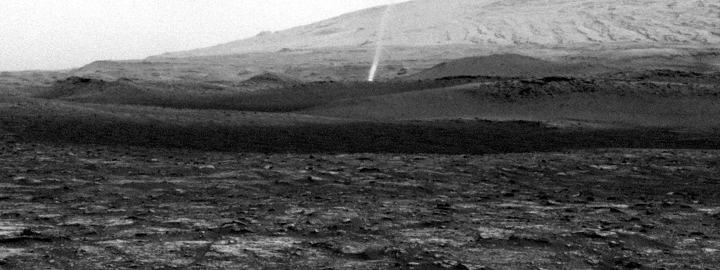
2017-02-27 |
Mars
|
Mars Science Laboratory (MSL)
|
Navcam (MSL)
|
7696x1669x1 |

|
-
PIA21268:
Full-Circle Vista With a Linear Shaped Martian Sand Dune
Full Resolution:
TIFF
(6.643 MB)
JPEG
(788.3 kB)
|
|
|
2017-02-27 |
Mars
|
Mars Science Laboratory (MSL)
|
Navcam (MSL)
|
1650x550x1 |

|
-
PIA21270:
-
Martian Dust Devil Action in Gale Crater, Sol 1597
Full Resolution:
TIFF
(809.6 kB)
JPEG
(114.5 kB)
|
|
|
2017-02-27 |
Mars
|
Mars Science Laboratory (MSL)
|
Navcam (MSL)
|
1650x550x1 |
|
-
PIA21481:
-
Dust Devil Passes Near Martian Sand Dune
Full Resolution:
TIFF
(664.3 kB)
JPEG
(66.26 kB)
|
|
|
2017-02-27 |
Mars
|
Mars Science Laboratory (MSL)
|
Navcam (MSL)
|
1650x550x1 |
|
-
PIA21482:
-
Curiosity Observes Whirlwinds Carrying Martian Dust
Full Resolution:
TIFF
(691 kB)
JPEG
(105.6 kB)
|
|
|
2017-02-27 |
Mars
|
Mars Science Laboratory (MSL)
|
Navcam (MSL)
|
1650x550x1 |

|
-
PIA21483:
-
Swirling Dust in Gale Crater, Mars, Sol 1613
Full Resolution:
TIFF
(673.4 kB)
JPEG
(80.89 kB)
|
|
|
2017-05-30 |
Mars
|
Mars Science Laboratory (MSL)
|
Navcam (MSL)
|
1607x1000x1 |
|
-
PIA21649:
-
Halos in Martian Sandstone
Full Resolution:
TIFF
(1.532 MB)
JPEG
(199.6 kB)
|
|
|
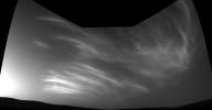
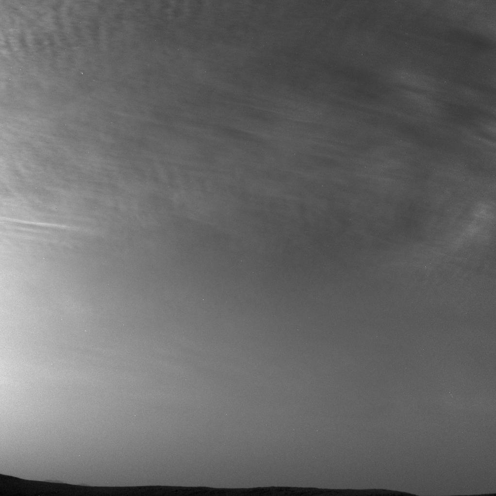
2017-08-09 |
Mars
|
Mars Science Laboratory (MSL)
|
Navcam (MSL)
|
511x511x1 |
|
-
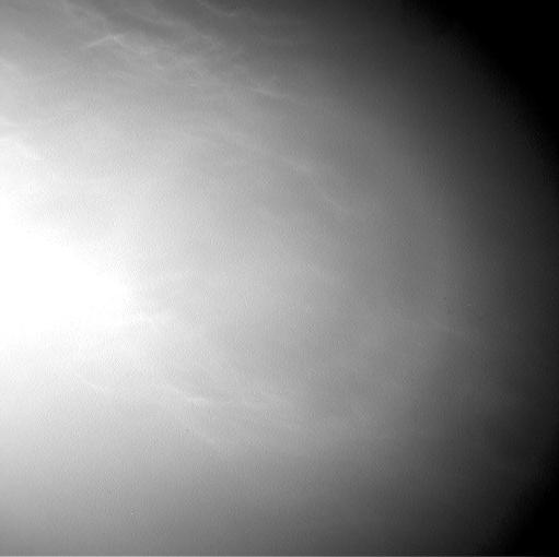
PIA21840:
-
Clouds Sailing Above Martian Horizon, Enhanced
Full Resolution:
TIFF
(261.6 kB)
JPEG
(89.02 kB)
|
|
|
2017-08-09 |
Mars
|
Mars Science Laboratory (MSL)
|
Navcam (MSL)
|
511x511x1 |
|
-
PIA21841:
-
Clouds Sailing Overhead on Mars, Enhanced
Full Resolution:
TIFF
(261.6 kB)
JPEG
(91.08 kB)
|
|
|
2017-08-09 |
Mars
|
Mars Science Laboratory (MSL)
|
Navcam (MSL)
|
511x510x1 |
|
-
PIA21842:
-
Clouds Sailing Overhead on Mars, Unenhanced
Full Resolution:
TIFF
(261.1 kB)
JPEG
(15.55 kB)
|
|
|
2019-04-04 |
Phobos
|
Mars Science Laboratory (MSL)
|
Navcam (MSL)
|
1800x1800x1 |

|
-
PIA23135:
-
Curiosity Observes Sunset Eclipse: Sol 2358
Full Resolution:
TIFF
(1.554 MB)
JPEG
(67.65 kB)
|
|
|
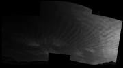
2019-05-29 |
Mars
|
Mars Science Laboratory (MSL)
|
Navcam (MSL)
|
1022x1022x1 |
|
-
PIA23241:
-
Curiosity Sees Drifting Clouds Over Gale Crater
Full Resolution:
TIFF
(894.7 kB)
JPEG
(33.78 kB)
|
|
|
2019-05-29 |
Mars
|
Mars Science Laboratory (MSL)
|
Navcam (MSL)
|
1022x1022x1 |
|
-
PIA23242:
-
Curiosity Sees More Clouds Over Gale Crater
Full Resolution:
TIFF
(1.004 MB)
JPEG
(73.52 kB)
|
|
|
2019-05-29 |
Mars
|
Mars Science Laboratory (MSL)
|
Navcam (MSL)
|
2300x1200x1 |
|
-
PIA23243:
-
Curiosity's Three-Frame Mosaic of Clouds
Full Resolution:
TIFF
(1.896 MB)
JPEG
(105.3 kB)
|
|
|
2020-03-20 |
Mars
|
Mars Science Laboratory (MSL)
|
Navcam (MSL)
|
860x858x1 |
|
-
PIA23625:
-
Navcam Movie of How Curiosity Takes a Selfie
Full Resolution:
TIFF
(630.2 kB)
JPEG
(79.92 kB)
|
|
|
2020-09-01 |
Mars
|
Mars Science Laboratory (MSL)
|
Navcam (MSL)
|
1024x384x1 |
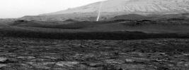
|
-
PIA24039:
-
Curiosity Spots a Dust Devil in the Hills
Full Resolution:
TIFF
(393.8 kB)
JPEG
(84.83 kB)
|
|
|
2021-05-28 |
Mars
|
Mars Science Laboratory (MSL)
|
Navcam (MSL)
|
2526x1401x3 |
|
-
PIA24645:
-
Curiosity Navigation Cameras Spot Twilight Clouds on Sol 3075
Full Resolution:
TIFF
(1.471 MB)
JPEG
(90.56 kB)
|
|
|
2021-05-28 |
Mars
|
Mars Science Laboratory (MSL)
|
Navcam (MSL)
|
2514x1448x3 |
|
-
PIA24646:
-
Curiosity Navigation Cameras Spot Twilight Clouds on Sol 3072
Full Resolution:
TIFF
(1.252 MB)
JPEG
(79.95 kB)
|
|
|
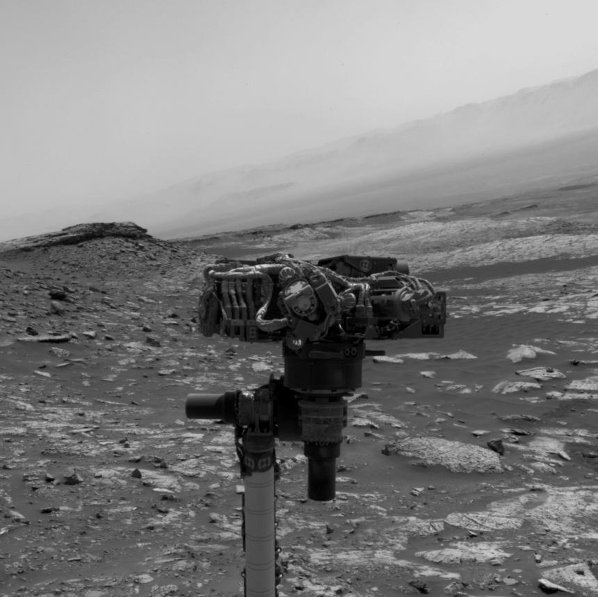
2021-11-23 |
Mars
|
Mars Science Laboratory (MSL)
|
Navcam (MSL)
|
1932x1087x3 |

|
-
PIA24937:
-
A Picture Postcard From Curiosity's Navcams
Full Resolution:
TIFF
(5.197 MB)
JPEG
(198.6 kB)
|


