My
List |
Addition Date
|
Target
|
Mission
|
Instrument
|
Size
|

|
2000-05-11 |
Earth
|
Landsat
Shuttle Radar Topography Mission (SRTM)
|
C-Band Interferometric Radar
Thematic Mapper
|
1840x2320x3 |
|
-
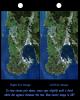
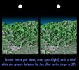
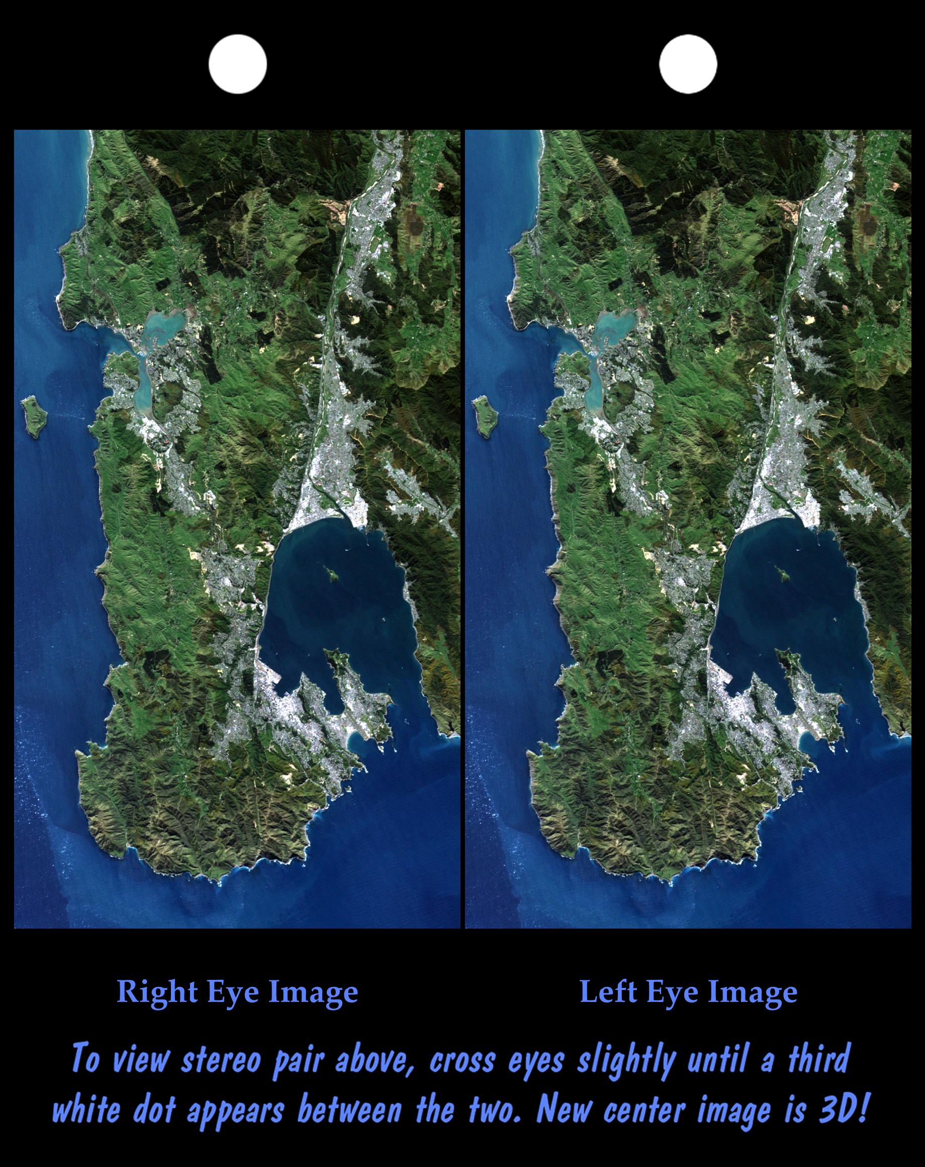
PIA02749:
-
Stereo Pair: Wellington, New Zealand
Full Resolution:
TIFF
(9.859 MB)
JPEG
(619.5 kB)
|
|
|
2000-04-27 |
Earth
|
Landsat
Shuttle Radar Topography Mission (SRTM)
|
C-Band Interferometric Radar
Thematic Mapper
|
1362x900x3 |

|
-
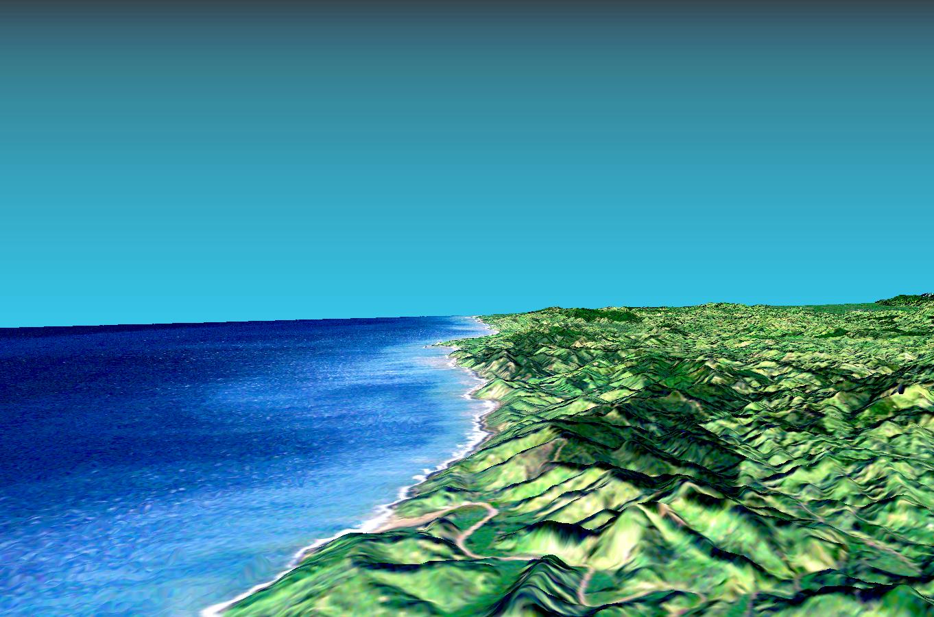
PIA02748:
-
Perspective View with Landsat Overlaid Owahanga, New Zealand
Full Resolution:
TIFF
(2.168 MB)
JPEG
(177.3 kB)
|
|
|
2000-04-20 |
Earth
|
Landsat
Shuttle Radar Topography Mission (SRTM)
|
C-Band Interferometric Radar
Thematic Mapper
|
4000x3000x3 |
|
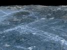
-
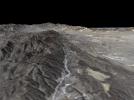
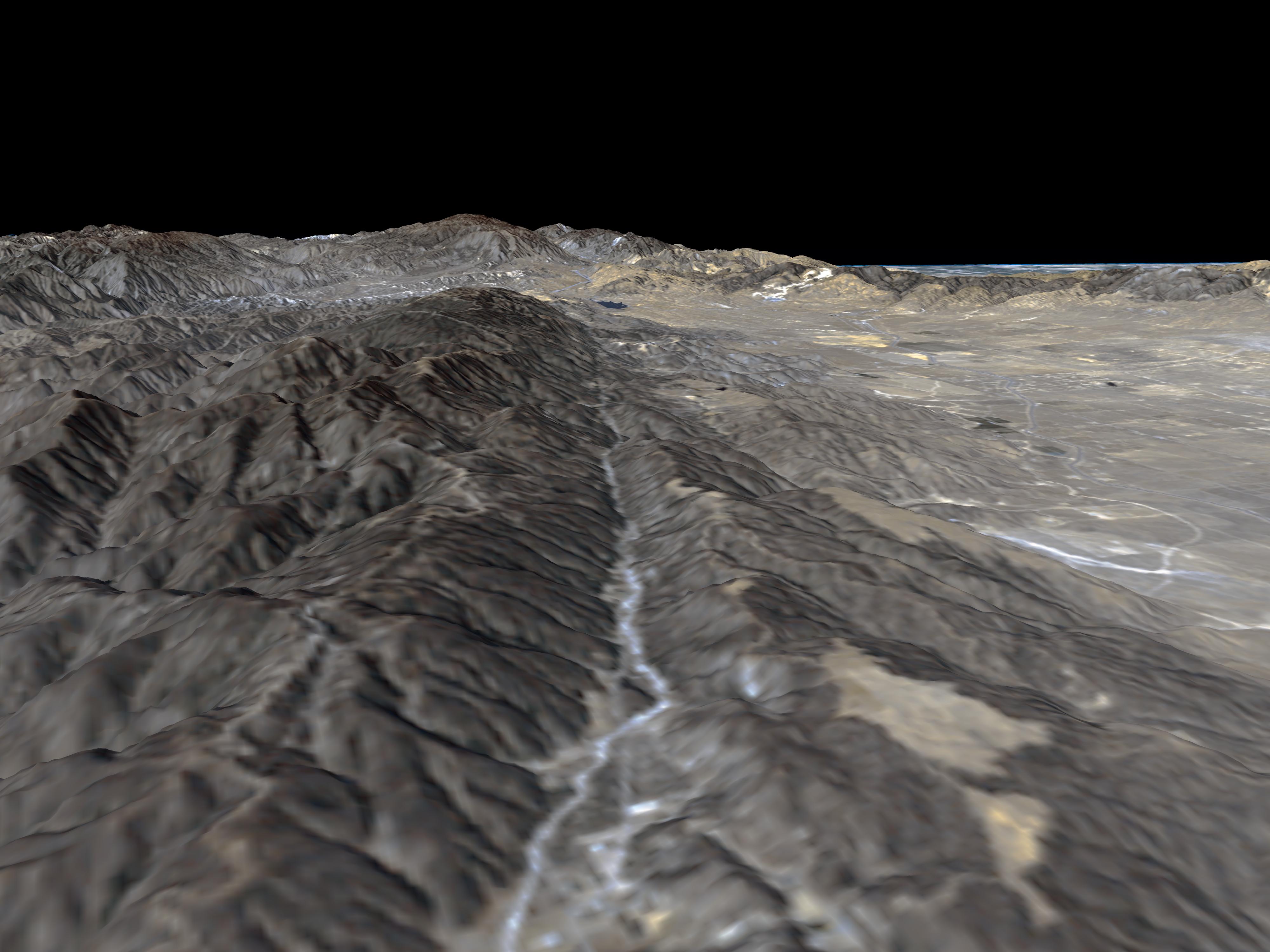
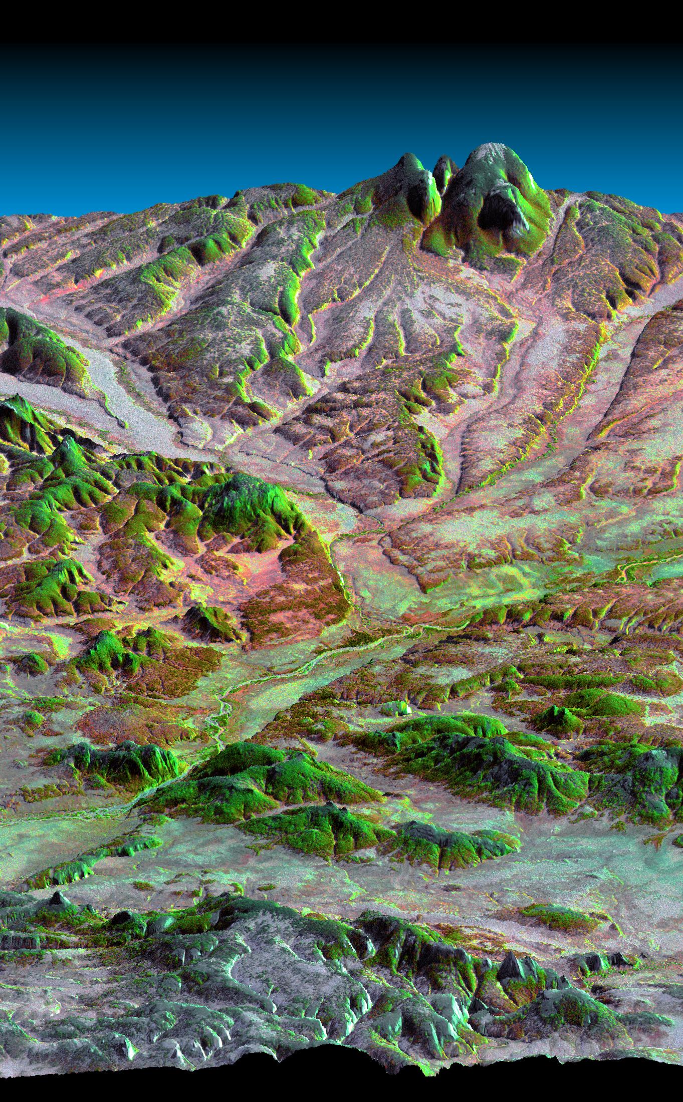
PIA02745:
-
Perspective View, San Andreas Fault
Full Resolution:
TIFF
(7.318 MB)
JPEG
(703.5 kB)
|
|
|
2000-04-20 |
Earth
|
Landsat
Shuttle Radar Topography Mission (SRTM)
|
C-Band Interferometric Radar
Thematic Mapper
|
4000x3000x3 |
|
-
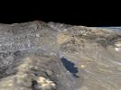
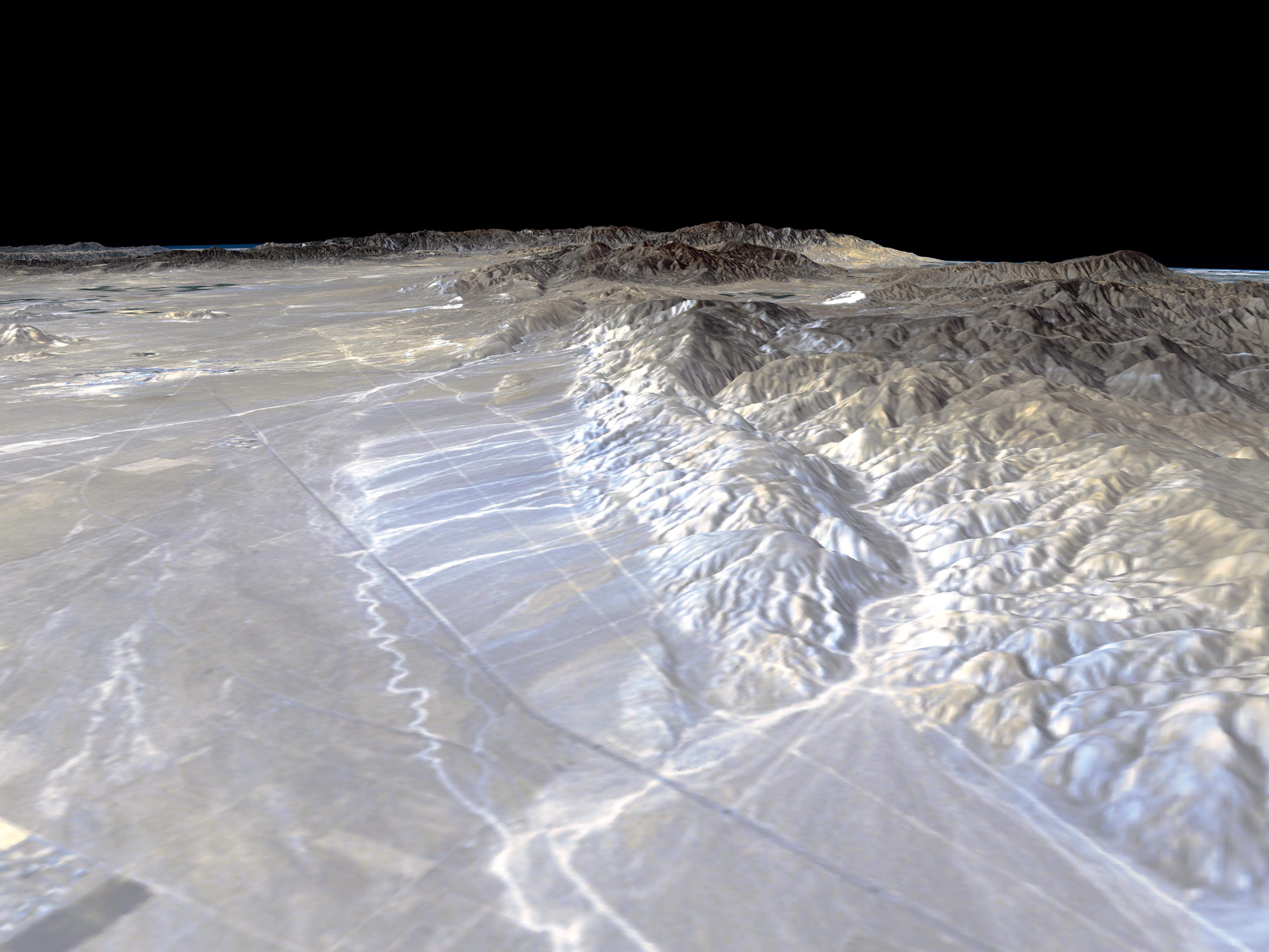
PIA02747:
-
Perspective View, Garlock Fault
Full Resolution:
TIFF
(8.213 MB)
JPEG
(756.2 kB)
|
|
|
2000-04-20 |
Earth
|
Landsat
Shuttle Radar Topography Mission (SRTM)
|
C-Band Interferometric Radar
Thematic Mapper
|
4000x3000x3 |
|
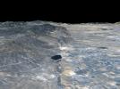
-
PIA02746:
-
Perspective View, San Andreas Fault
Full Resolution:
TIFF
(6.834 MB)
JPEG
(666.4 kB)
|
|
|
2000-04-13 |
Earth
|
Landsat
Shuttle Radar Topography Mission (SRTM)
|
C-Band Interferometric Radar
Thematic Mapper
|
839x651x3 |
|
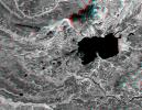
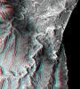
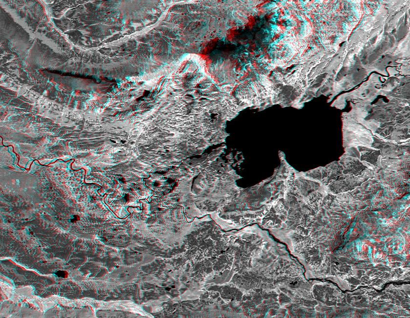
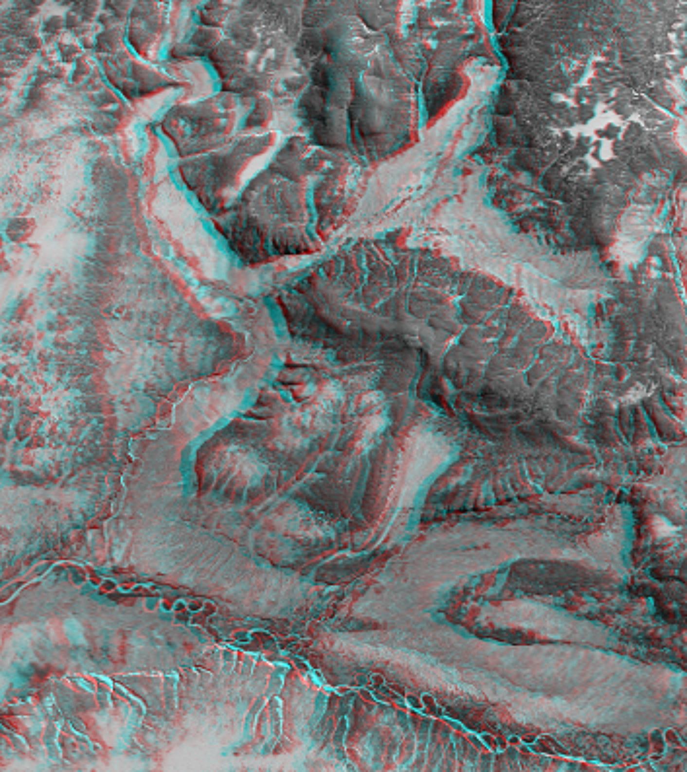
-
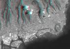
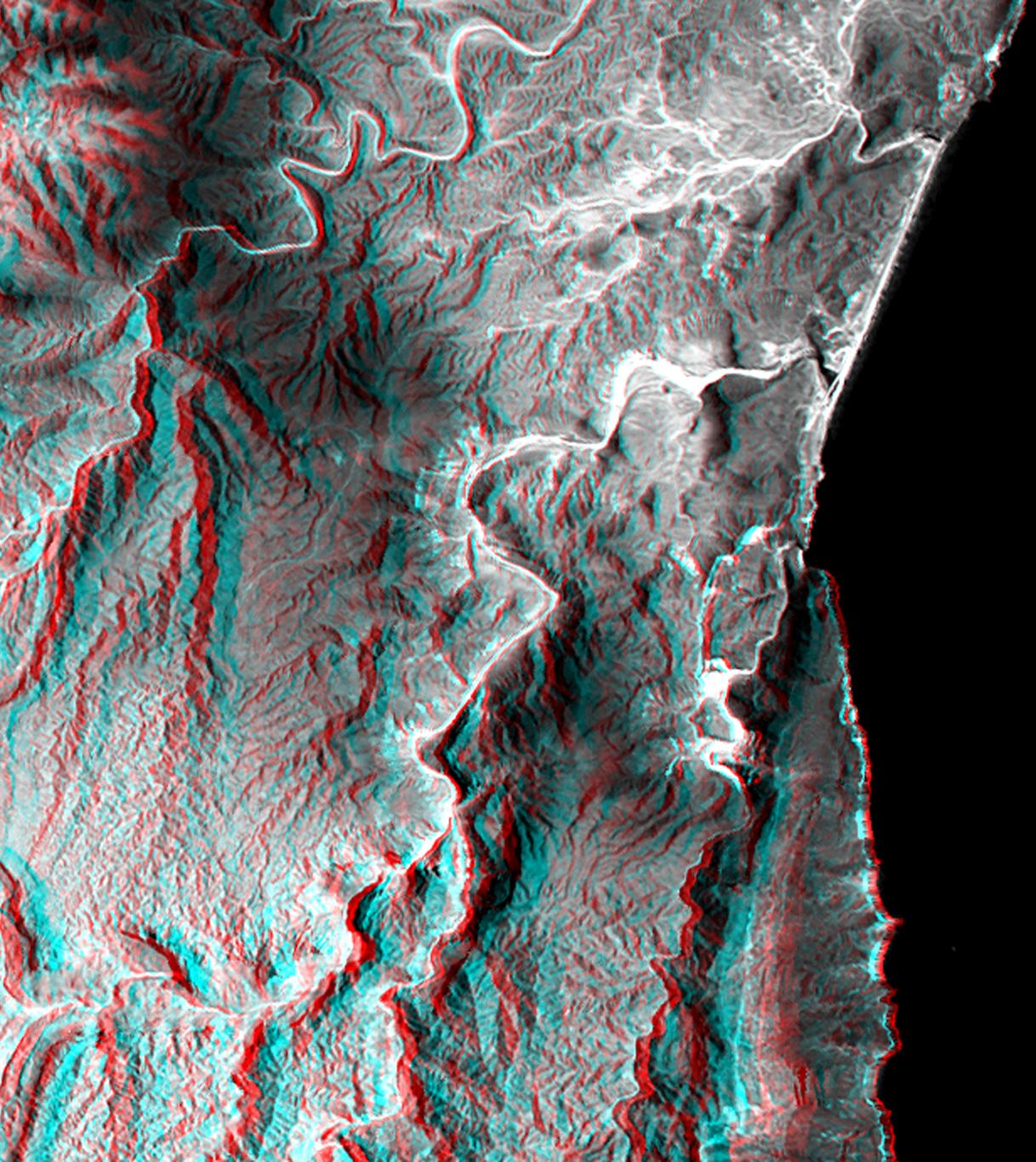
PIA02744:
-
Anaglyph, Lake Palanskoye Landslide, Kamchatka Peninsula, Russia
Full Resolution:
TIFF
(1.501 MB)
JPEG
(180.1 kB)
|
|
|
2000-04-13 |
Earth
|
Landsat
Shuttle Radar Topography Mission (SRTM)
|
C-Band Interferometric Radar
Thematic Mapper
|
1428x2200x3 |
|
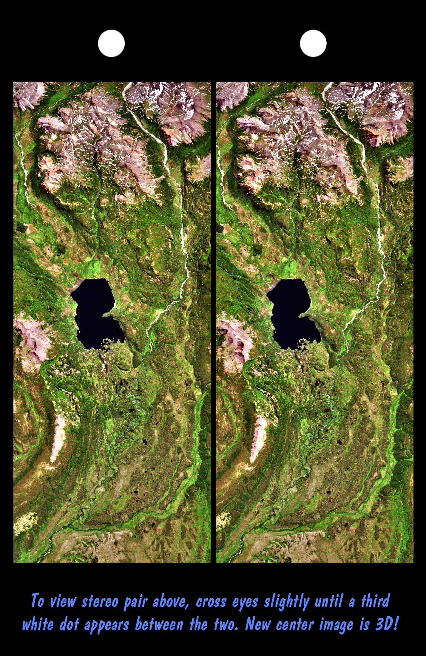
-
PIA02743:
-
Stereo Pair, Lake Palanskoye Landslide, Kamchatka Peninsula, Russia
Full Resolution:
TIFF
(7.223 MB)
JPEG
(689.6 kB)
|
|
|
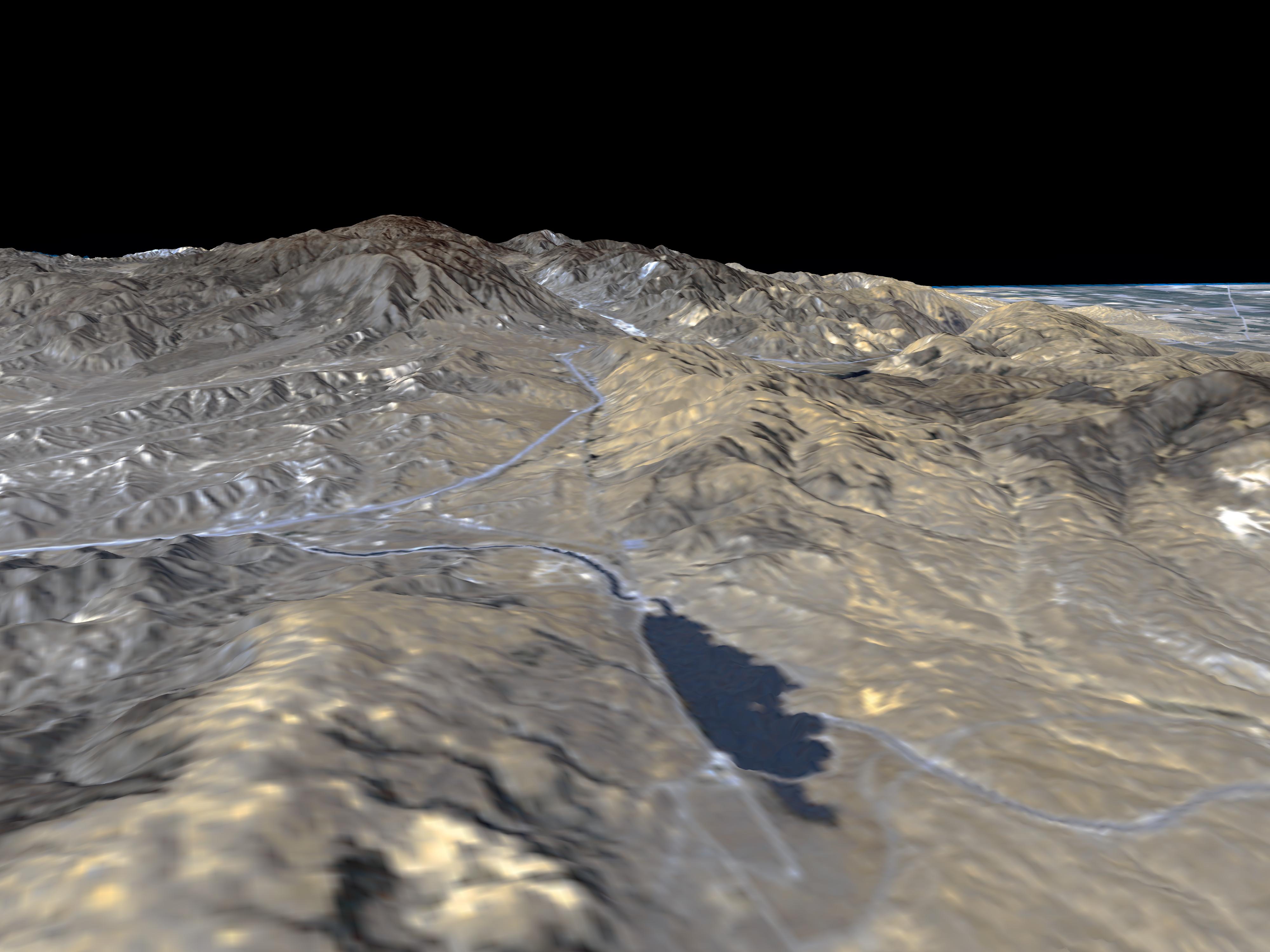
2000-03-23 |
Earth
|
Landsat
Shuttle Radar Topography Mission (SRTM)
|
C-Band Interferometric Radar
Thematic Mapper
|
2220x994x3 |

|
-
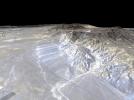
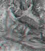
PIA02740:
-
3-D Perspective View, Kamchatka Peninsula, Russia
Full Resolution:
TIFF
(4.091 MB)
JPEG
(304.8 kB)
|
|
|
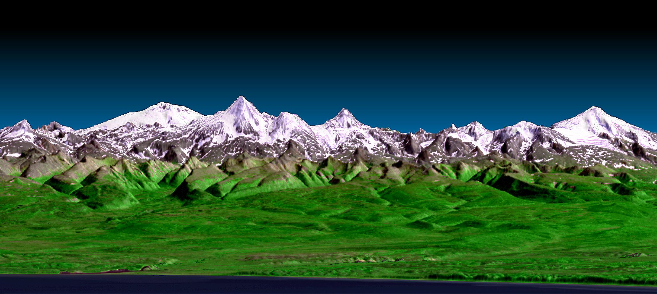
2000-03-16 |
Earth
|
Landsat
Shuttle Radar Topography Mission (SRTM)
|
C-Band Interferometric Radar
Thematic Mapper
|
4000x3000x3 |
|
-
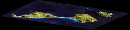
PIA02739:
-
3-D Perspective View, Miquelon and Saint Pierre Islands
Full Resolution:
TIFF
(34.1 MB)
JPEG
(1.338 MB)
|
|
|
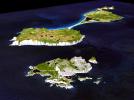
2000-03-10 |
Earth
|
Landsat
Shuttle Radar Topography Mission (SRTM)
|
C-Band Interferometric Radar
Thematic Mapper
|
1591x2005x3 |
|
-
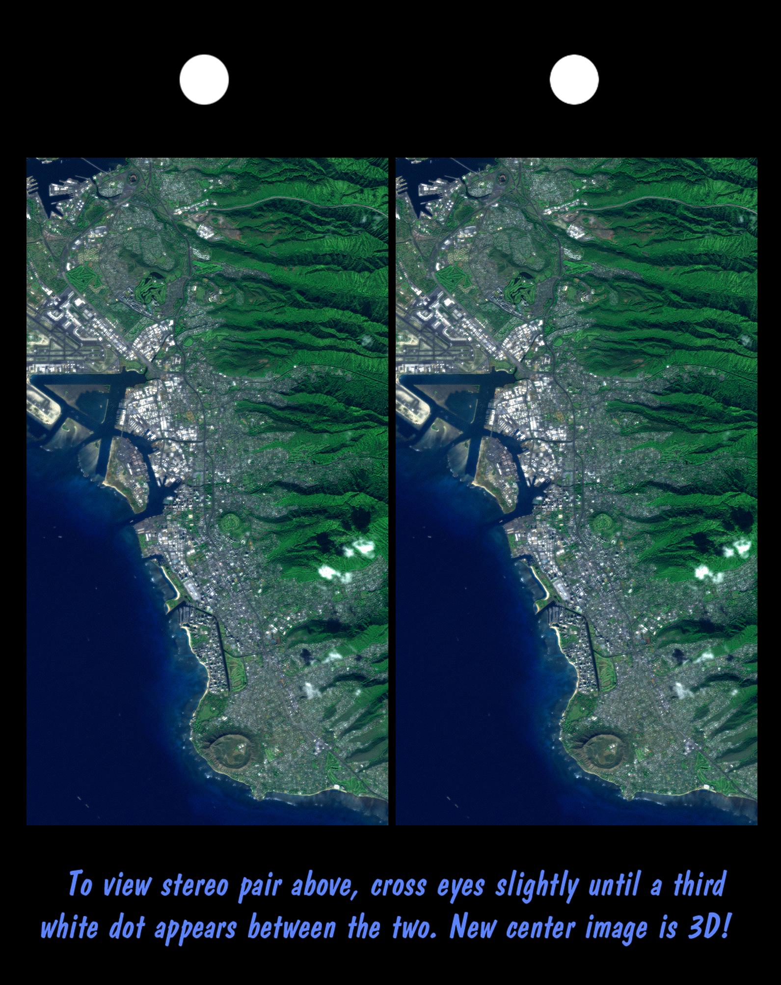
PIA02738:
-
Stereo Pair, Honolulu, Oahu
Full Resolution:
TIFF
(6.849 MB)
JPEG
(439.6 kB)
|
|
|
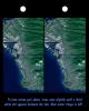
2000-03-10 |
Earth
|
Landsat
Shuttle Radar Topography Mission (SRTM)
|
C-Band Interferometric Radar
Thematic Mapper
|
2340x2069x3 |
|
-
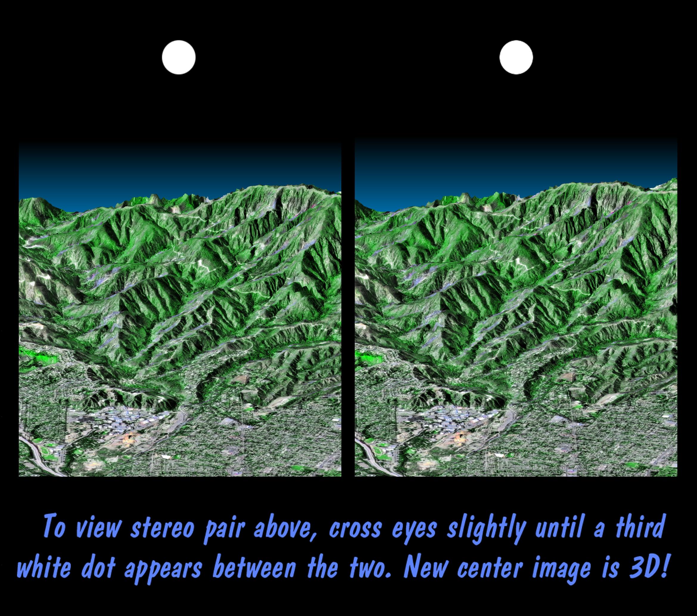
PIA02737:
-
Stereo Pair, Pasadena, California
Full Resolution:
TIFF
(8.309 MB)
JPEG
(704.7 kB)
|
|
|
2000-03-10 |
Earth
|
Landsat
Shuttle Radar Topography Mission (SRTM)
|
C-Band Interferometric Radar
Thematic Mapper
|
1218x1366x3 |
|
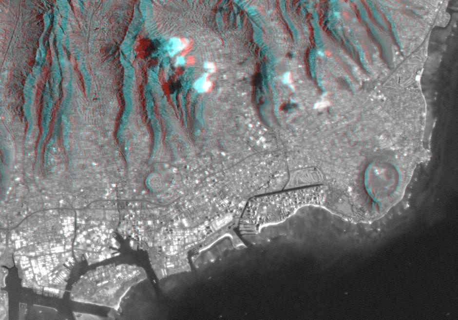
-
PIA02736:
-
Anaglyph, Landsat overlay, Southernmost Coastal Oman
Full Resolution:
TIFF
(4.27 MB)
JPEG
(312.1 kB)
|
|
|
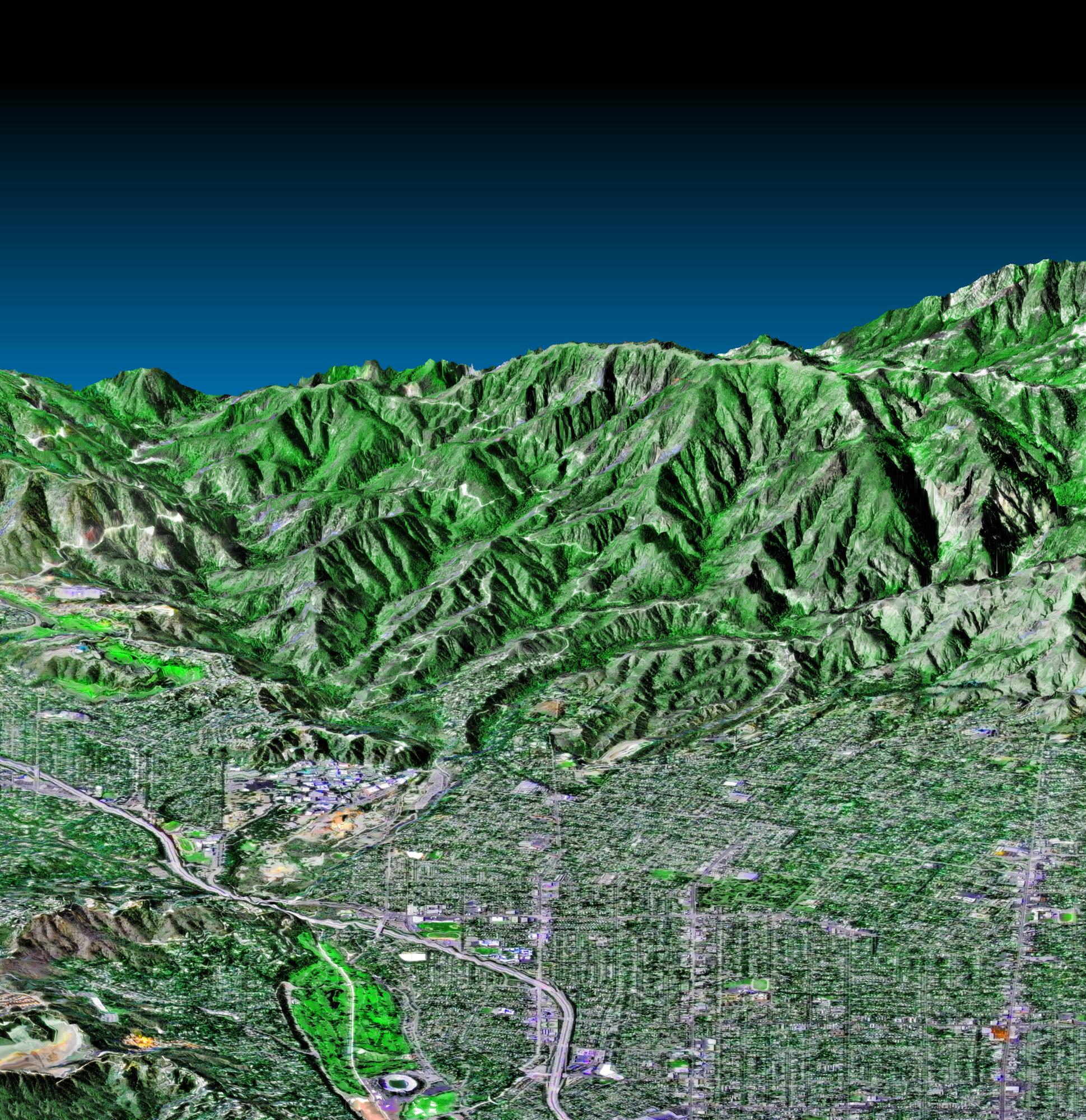
2000-02-21 |
Earth
|
Landsat
Shuttle Radar Topography Mission (SRTM)
|
C-Band Interferometric Radar
Thematic Mapper
|
4000x3000x3 |
|
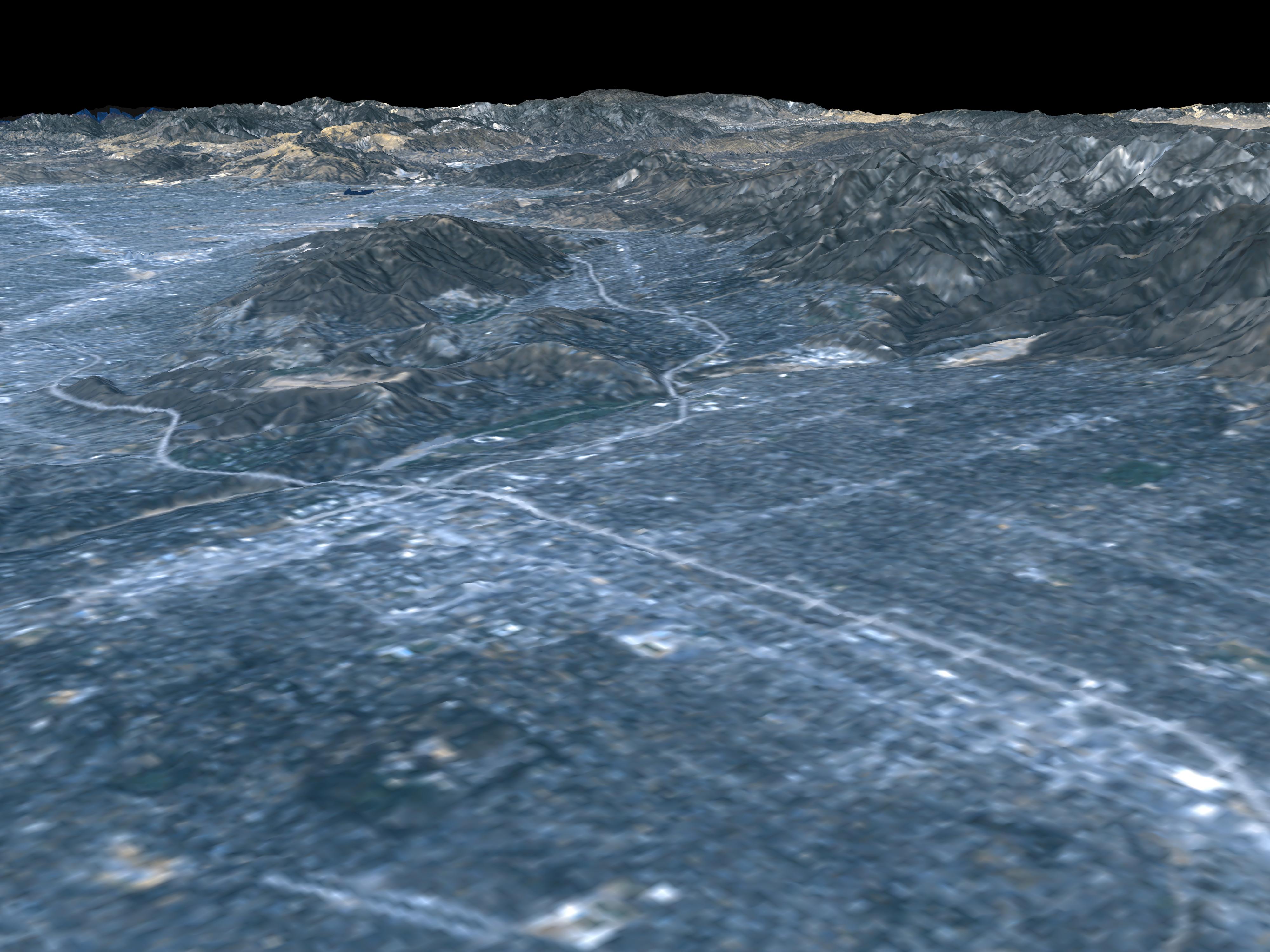
-
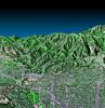
PIA02734:
-
Perspective View, Landsat Overlay Pasadena, California
Full Resolution:
TIFF
(27.95 MB)
JPEG
(930 kB)
|
|
|
2000-02-21 |
Earth
|
Landsat
Shuttle Radar Topography Mission (SRTM)
|
C-Band Interferometric Radar
Thematic Mapper
|
4000x3000x3 |
|
-
PIA02733:
-
Perspective view, Landsat overlay San Andreas Fault, Palmdale, California
Full Resolution:
TIFF
(24.12 MB)
JPEG
(879.1 kB)
|
|
|
2000-02-20 |
Earth
|
Landsat
Shuttle Radar Topography Mission (SRTM)
|
C-Band Interferometric Radar
Thematic Mapper
|
940x658x3 |
|
-
PIA02728:
-
Anaglyph, Landsat overlay Honolulu, Hawaii
Full Resolution:
TIFF
(1.436 MB)
JPEG
(112.3 kB)
|
|
|
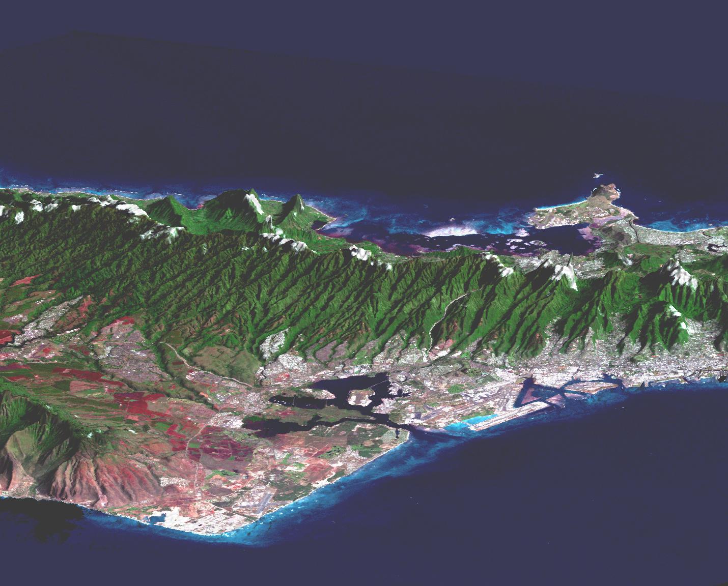
2000-02-20 |
Earth
|
Landsat
Shuttle Radar Topography Mission (SRTM)
|
C-Band Interferometric Radar
Thematic Mapper
|
1430x1152x3 |

|
-
PIA02727:
-
Perspective view, Landsat Overlay Oahu, Hawaii
Full Resolution:
TIFF
(2.192 MB)
JPEG
(217.2 kB)
|
|
|
2000-02-18 |
Earth
|
Landsat
Shuttle Radar Topography Mission (SRTM)
|
C-Band Interferometric Radar
Thematic Mapper
|
1939x1999x3 |
|
-
PIA02718:
-
Pasadena, California Perspective View with Aerial Photo and Landsat Overlay
Full Resolution:
TIFF
(10.26 MB)
JPEG
(872.3 kB)
|
|
|
2000-02-18 |
Earth
|
Landsat
Shuttle Radar Topography Mission (SRTM)
|
C-Band Interferometric Radar
Thematic Mapper
|
1363x2200x3 |

|
-
PIA02717:
-
Kamchatka Peninsula, Russia 3-D Perspective with Landsat Overlay
Full Resolution:
TIFF
(8.536 MB)
JPEG
(860.9 kB)
|
|
|
2000-02-16 |
Earth
|
Landsat
Shuttle Radar Topography Mission (SRTM)
|
C-Band Interferometric Radar
Thematic Mapper
|
1412x1588x3 |
|
-
PIA02709:
-
Anaglyph with Landsat Overlay, Kamchatka Peninsula, Russia
Full Resolution:
TIFF
(6.288 MB)
JPEG
(309.4 kB)
|
|
|
2000-02-14 |
Earth
|
Landsat
Shuttle Radar Topography Mission (SRTM)
|
C-Band Interferometric Radar
Thematic Mapper
|
3835x904x3 |
|
-
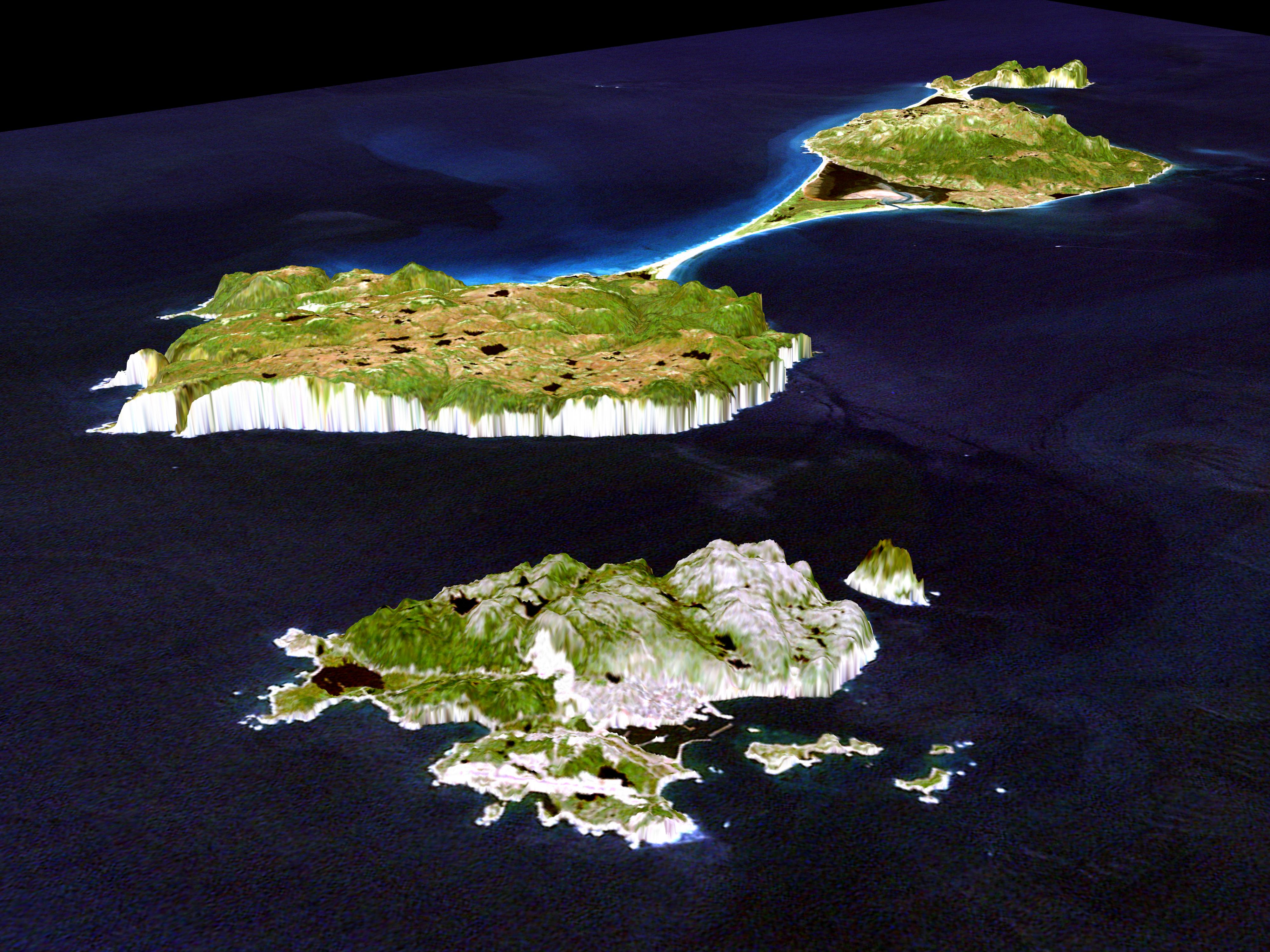
PIA02702:
3-D perspective of Saint Pierre and Miquelon Islands
Full Resolution:
TIFF
(5.571 MB)
JPEG
(258.4 kB)
|
 Planetary Data System


