|
Your search criteria found 2605 images Target is Earth (and available satellites) |
| My List |
Addition Date |
Target
|
Mission | Instrument | Size |

|
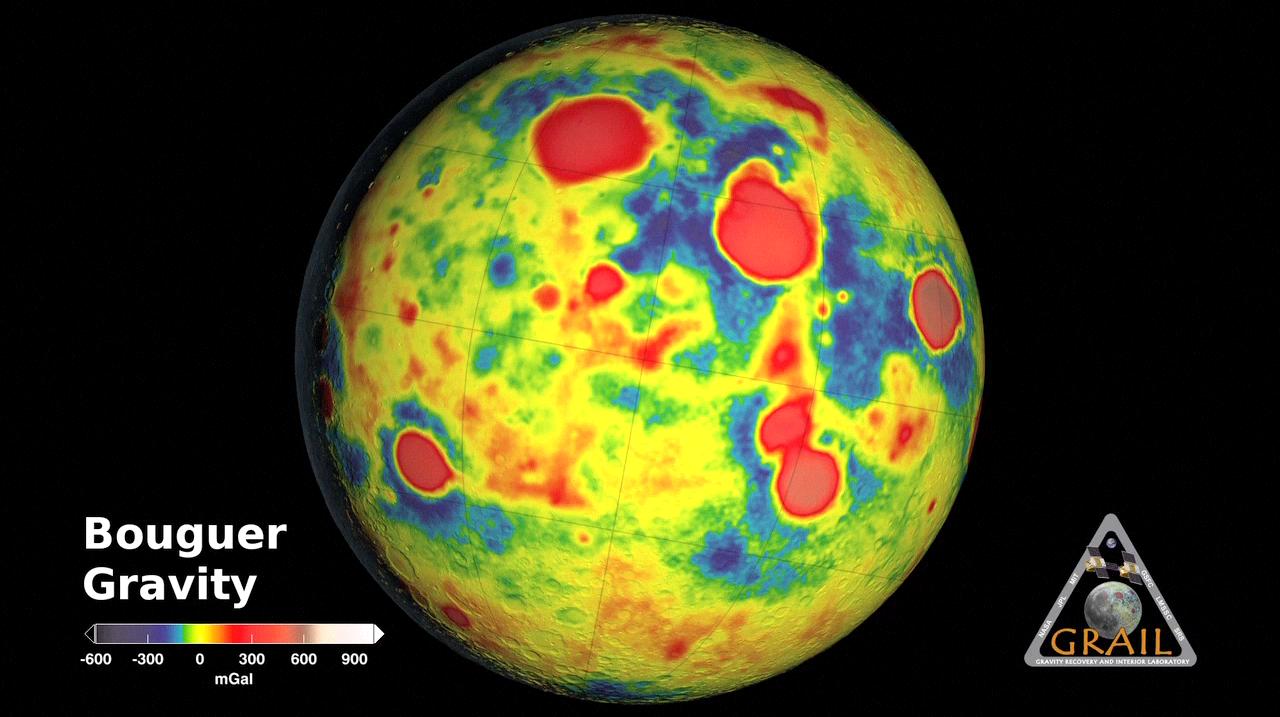
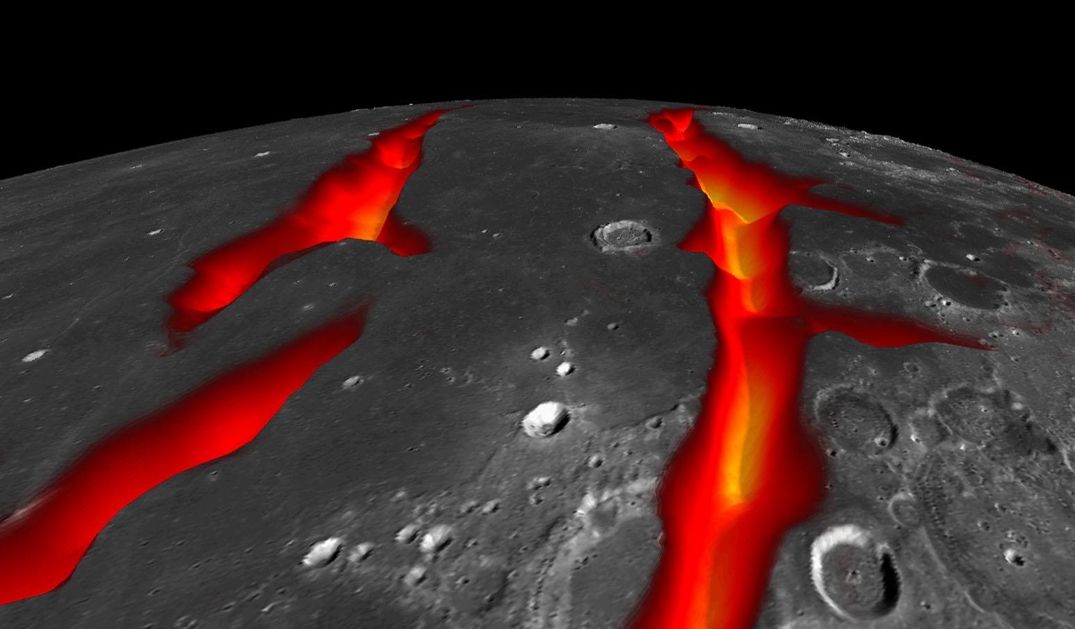
2012-12-05 | Moon |
GRAIL |
1280x717x3 | |

|
|||||
|
|
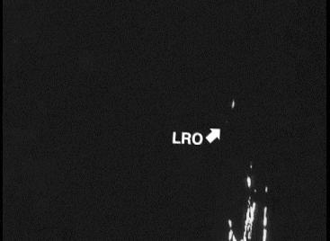
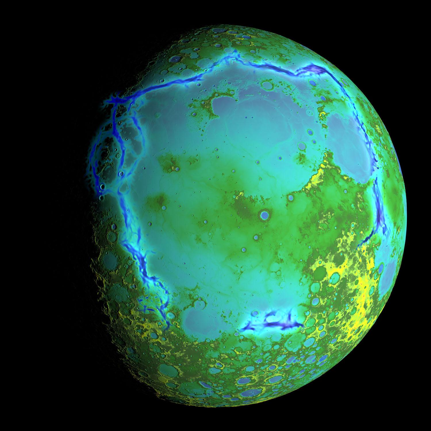
2012-12-05 | Moon |
GRAIL Lunar Reconnaissance Orbiter (LRO) |
1038x658x3 | |
|
|||||
|
|
2012-12-13 | Moon |
GRAIL Lunar Reconnaissance Orbiter (LRO) |
1280x720x1 | |
|
|||||
|
|
2012-12-13 | Moon |
GRAIL Lunar Reconnaissance Orbiter (LRO) |
1636x671x3 | |
|
|||||
|
|
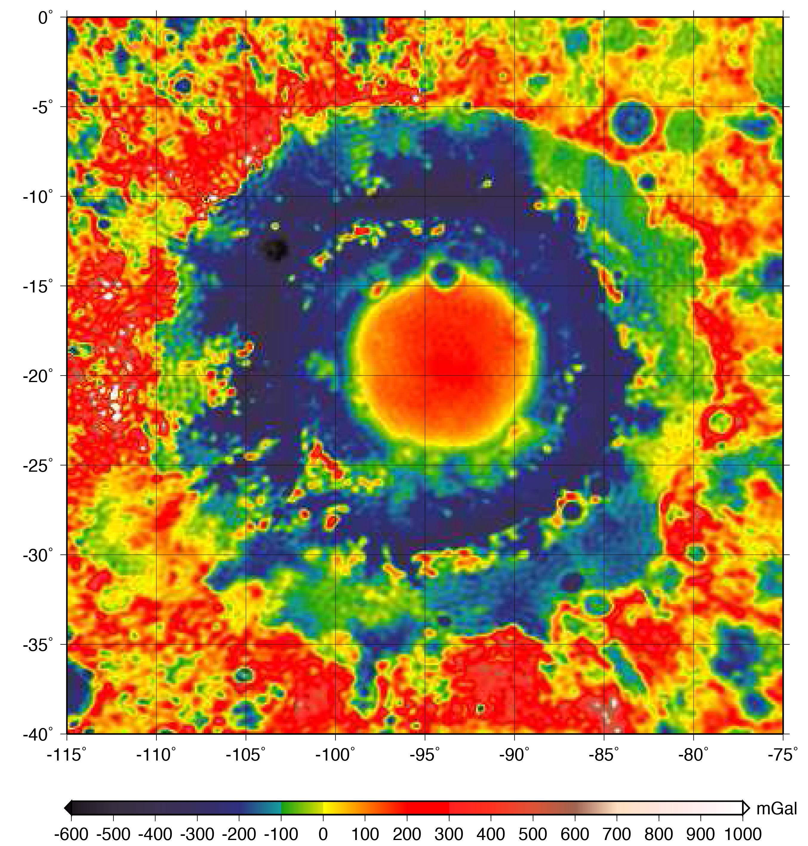
2012-12-13 | Moon |
GRAIL |
1230x1242x3 | |
|
|||||
|
|
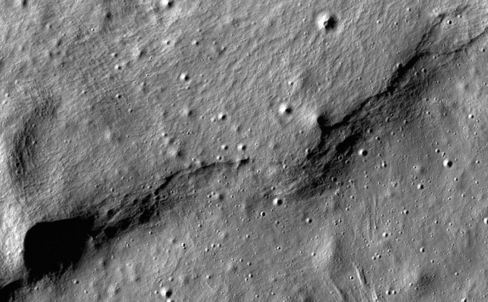
2012-12-13 | Moon |
GRAIL Lunar Reconnaissance Orbiter (LRO) |
367x268x1 | |
|
|||||
|
|
2012-12-13 | Moon |
GRAIL Lunar Reconnaissance Orbiter (LRO) |
1702x998x3 | |
|
|||||
|
|
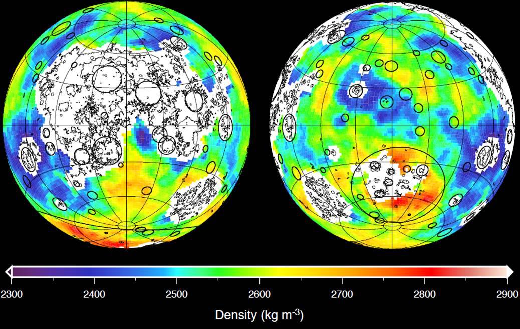
2013-03-19 | Moon |
GRAIL |
2022x2040x3 | |
|
|||||
|
|
2013-11-08 | Moon |
GRAIL |
1557x1001x3 | |
|
|||||
|
|
2014-03-18 | Moon |
Lunar Reconnaissance Orbiter (LRO) |
Lunar Reconnaissance Orbiter Camera (NAC) Lunar Reconnaissance Orbiter Camera (WAC) |
1819x1819x1 |
|
|||||
|
|
2014-10-01 | Moon |
GRAIL Lunar Reconnaissance Orbiter (LRO) |
Lunar Reconnaissance Orbiter Camera (WAC) Lunar Orbit Laser Altimeter |
1546x905x3 |
|
|||||
|
|
2014-10-01 | Moon |
GRAIL Lunar Reconnaissance Orbiter (LRO) |
Lunar Orbit Laser Altimeter |
1500x1500x3 |
|
|||||
|
|
2016-10-27 | Moon |
GRAIL |
2707x2832x3 | |

|
|||||
|
|
2017-08-17 | Moon |
Terra |
MISR |
600x675x1 |
|
|||||
|
|
2019-05-13 | Moon |
Lunar Reconnaissance Orbiter (LRO) |
1100x1100x3 | |
|
|||||
|
|
2019-05-13 | Moon |
Lunar Reconnaissance Orbiter (LRO) |
1407x1009x1 | |
|
|||||
|
|
2019-05-13 | Moon |
Lunar Reconnaissance Orbiter (LRO) |
1631x1010x1 | |

|
|||||
|
|
2019-05-13 | Moon |
Lunar Reconnaissance Orbiter (LRO) |
1222x988x1 | |

|
|||||
|
|
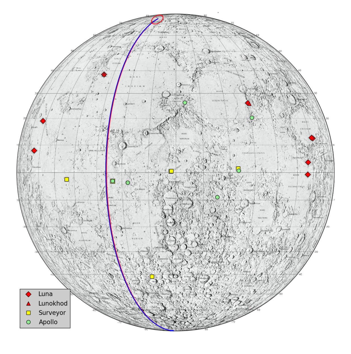
2019-11-20 | Moon |
Apollo 12 |
711x1113x3 | |
|
|||||
|
|
2021-04-21 | Moon |
Apollo |
3294x3226x3 | |
|
|||||
|
|
2022-02-01 | Moon |
Cold Operable Lunar Deployable Arm (COLDArm) |
4032x3024x3 | |
|
|||||
|
|
2022-12-05 | Moon |
Cold Operable Lunar Deployable Arm (COLDArm) |
8256x5504x3 | |

|
|||||
|
|
2022-12-05 | Moon |
Cold Operable Lunar Deployable Arm (COLDArm) |
5504x8256x3 | |
|
|||||
|
|
2022-12-05 | Moon |
Cold Operable Lunar Deployable Arm (COLDArm) |
8256x5504x3 | |

|
|||||
|
|
2022-12-12 | Moon |
Lunar Flashlight |
2947x1661x3 | |

|
|||||
|
|
2022-12-23 | Moon |
Lunar Flashlight |
4096x1773x3 | |
|
|||||
|
|
2023-01-12 | Moon |
Lunar Flashlight |
2012x1134x3 | |
|
|||||
|
|
2023-12-20 | Moon |
Cold Operable Lunar Deployable Arm (COLDArm) |
8272x6200x3 | |

|
|||||
|
|
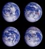
1996-08-29 | Earth |
Voyager |
565x790x3 | |

|
|||||
|
|
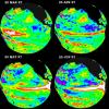
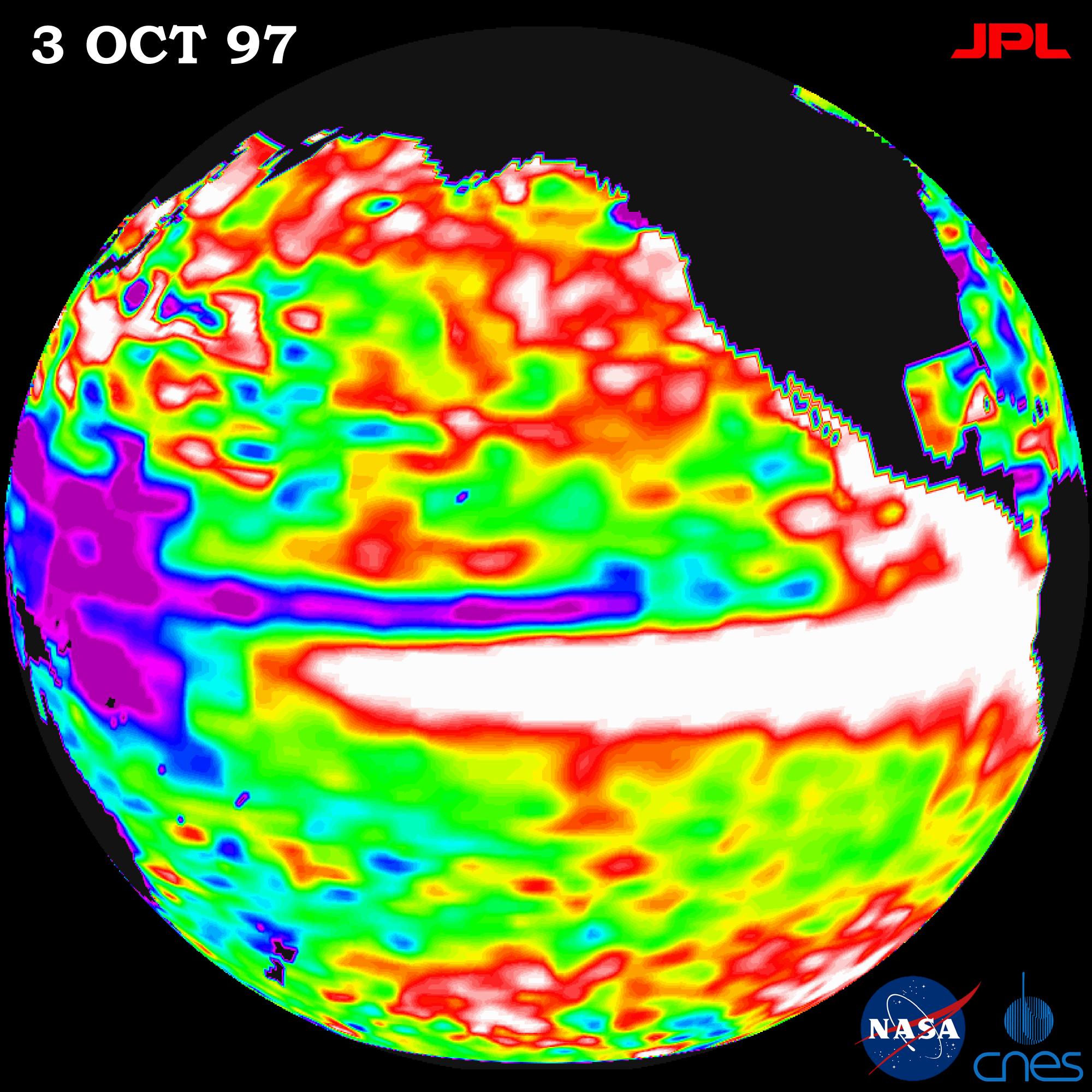
1999-06-21 | Earth |
TOPEX/Poseidon |
Altimeter |
901x900x3 |
|
|||||
|
|
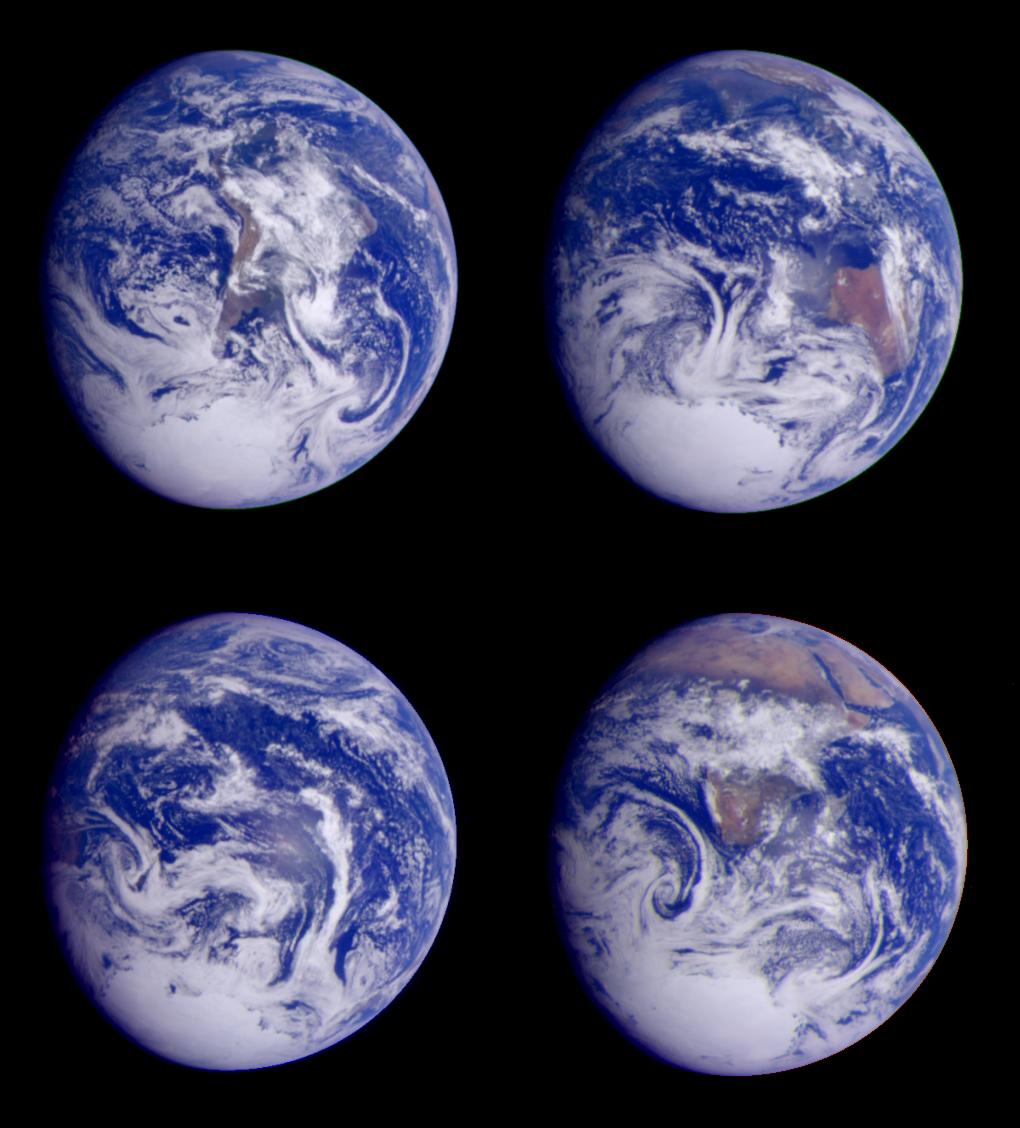
1996-01-29 | Earth |
Galileo |
Solid-State Imaging |
427x754x3 |
|
|||||
|
|
1996-01-29 | Earth |
Galileo |
Solid-State Imaging |
800x800x3 |

|
|||||
|
|
1996-01-29 | Earth |
Galileo |
Solid-State Imaging |
800x800x3 |

|
|||||
|
|
2001-02-28 | Earth |
Galileo |
Solid-State Imaging |
538x758x3 |

|
|||||
|
|
1996-02-01 | Earth |
Galileo |
Solid-State Imaging |
1378x458x3 |

|
|||||
|
|
1996-02-09 | Earth |
Galileo |
Solid-State Imaging |
2450x2200x3 |
|
|||||
|
|
2001-02-28 | Earth |
Galileo |
Solid-State Imaging |
452x746x3 |
|
|||||
|
|
1996-02-08 | Earth |
Galileo |
Solid-State Imaging |
800x800x3 |

|
|||||
|
|
1996-01-29 | Earth |
Galileo |
Solid-State Imaging |
800x800x3 |

|
|||||
|
|
1996-01-29 | Earth |
Galileo |
Solid-State Imaging |
987x987x3 |
|
|||||
|
|
1996-08-05 | Earth |
Galileo |
Solid-State Imaging |
3670x6735x3 |
|
|||||
|
|
1996-01-29 | Earth |
Galileo |
Solid-State Imaging |
1572x1580x3 |
|
|||||
|
|
1996-02-08 | Earth |
Galileo |
Solid-State Imaging |
650x650x1 |

|
|||||
|
|
1996-02-08 | Earth |
Galileo |
Near Infrared Mapping Spectrometer |
460x328x3 |
|
|||||
|
|
1996-02-08 | Earth |
Galileo |
Solid-State Imaging |
888x894x1 |
|
|||||
|
|
1996-02-08 | Earth |
Galileo |
Solid-State Imaging |
1083x1314x3 |

|
|||||
|
|
1998-06-04 | Earth |
Galileo |
Solid-State Imaging |
1700x2164x3 |

|
|||||
|
|
1999-06-12 | Earth |
DSPSE |
Ultraviolet/Visible Camera |
969x1385x3 |
|
|||||
|
|
1996-09-12 | Earth |
Voyager |
VG ISS - Narrow Angle |
453x614x3 |

|
|||||
|
|
1996-09-13 | Earth |
Voyager |
VG ISS - Narrow Angle |
620x500x3 |
|
|||||
|
|
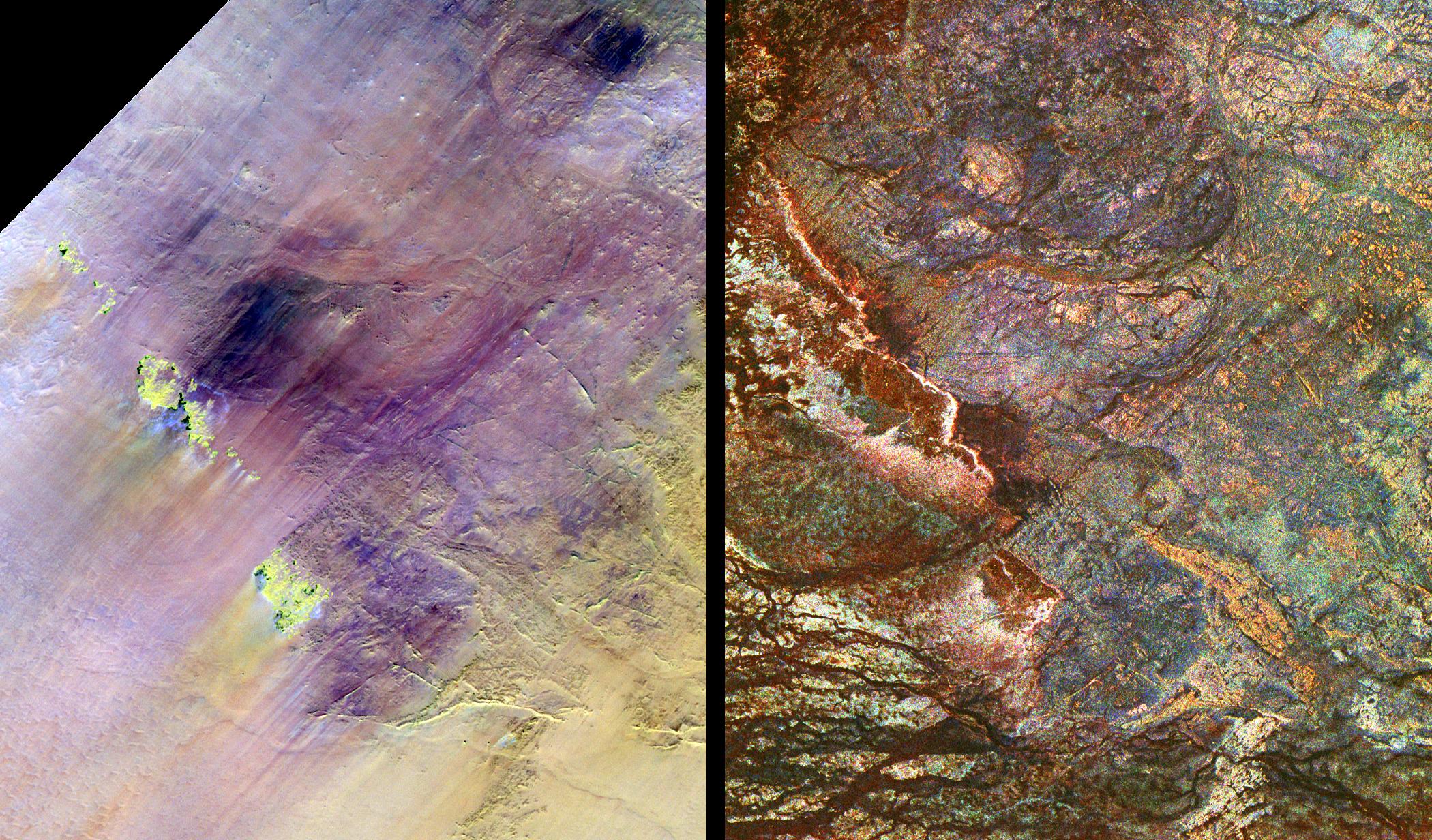
1996-10-23 | Earth |
Spaceborne Imaging Radar-C/X-Band Synthetic Aperture Radar |
L-Band Imaging Radar |
1427x976x1 |
|
|||||
|
|
1996-11-13 | Earth |
Spaceborne Imaging Radar-C/X-Band Synthetic Aperture Radar |
Imaging Radar |
2910x2040x3 |
|
|||||
|
|
1996-11-13 | Earth |
Spaceborne Imaging Radar-C/X-Band Synthetic Aperture Radar |
Imaging Radar |
2620x3320x3 |

|
|||||
|
|
1996-11-13 | Earth |
Spaceborne Imaging Radar-C/X-Band Synthetic Aperture Radar |
Imaging Radar |
2732x4000x3 |
|
|||||
|
|
1997-01-22 | Earth |
KidSat |
Electronic Still Camera |
3060x2036x3 |
|
|||||
|
|
1997-01-22 | Earth |
KidSat |
Electronic Still Camera |
3060x2036x3 |
|
|||||
|
|
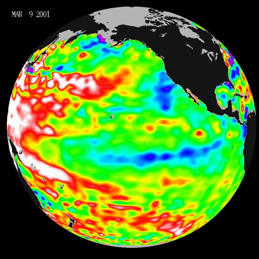
2001-03-28 | Earth |
TOPEX/Poseidon |
Altimeter |
900x900x3 |
|
|||||
|
|
2001-03-30 | Earth | 1352x1390x3 | ||
|
|||||
|
|
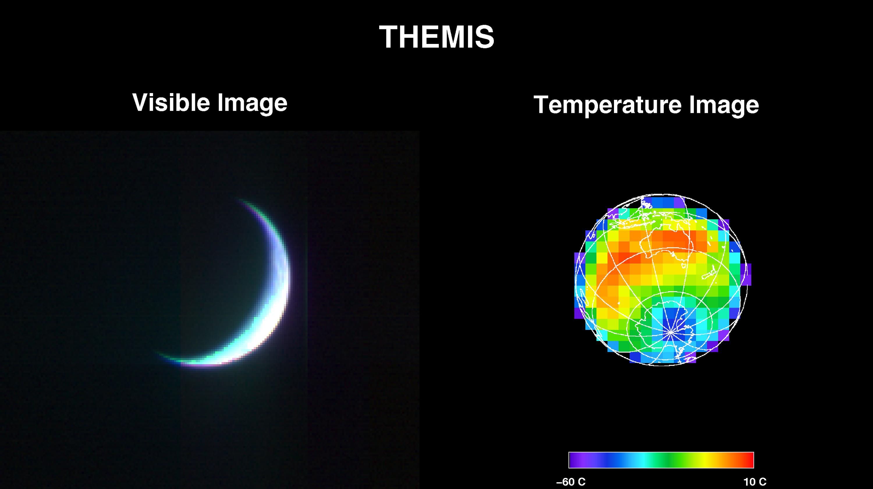
2001-04-26 | Earth |
2001 Mars Odyssey |
THEMIS |
3000x1681x3 |
|
|||||
|
|
2001-05-01 | Earth |
2001 Mars Odyssey |
THEMIS |
3124x1342x1 |
|
|||||
|
|
1997-09-10 | Earth |
Galileo |
420x480x3 | |

|
|||||
|
|
1997-09-10 | Earth |
Galileo |
620x480x3 | |

|
|||||
|
|
1997-09-10 | Earth |
Galileo |
Solid-State Imaging |
1020x1128x3 |
|
|||||
|
|
1997-09-10 | Earth |
Galileo |
Solid-State Imaging |
452x439x3 |

|
|||||
|
|
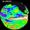
1997-10-14 | Earth |
TOPEX/Poseidon |
Altimeter |
900x900x3 |
|
|||||
|
|
1997-10-14 | Earth |
TOPEX/Poseidon |
Altimeter |
900x900x3 |
|
|||||
|
|
1997-10-14 | Earth |
TOPEX/Poseidon |
Altimeter |
900x900x3 |
|
|||||
|
|
1998-04-06 | Earth |
Spaceborne Imaging Radar-C/X-Band Synthetic Aperture Radar |
L-Band Imaging Radar |
2100x1232x3 |
|
|||||
|
|
1997-10-14 | Earth |
TOPEX/Poseidon |
Altimeter |
2000x2000x3 |
|
|||||
|
|
1997-10-14 | Earth |
TOPEX/Poseidon |
Altimeter |
2154x1036x3 |
|
|||||
|
|
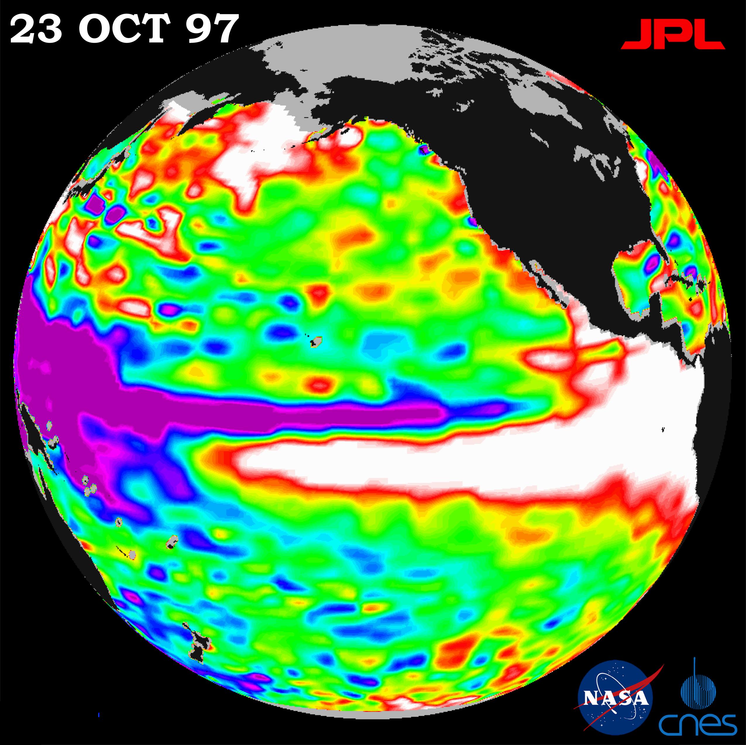
1997-10-23 | Earth |
Cassini-Huygens |
1520x2280x3 | |
|
|||||
|
|
1997-10-23 | Earth |
Cassini-Huygens |
1536x2304x3 | |
|
|||||
|
|
1997-10-23 | Earth |
Cassini-Huygens |
2280x1800x3 | |
|
|||||
|
|
1998-03-16 | Earth |
Spaceborne Imaging Radar-C/X-Band Synthetic Aperture Radar |
L-Band Imaging Radar |
2282x2375x3 |

|
|||||
|
|
1998-03-16 | Earth |
Spaceborne Imaging Radar-C/X-Band Synthetic Aperture Radar |
L-Band Imaging Radar |
1571x1135x3 |
|
|||||
|
|
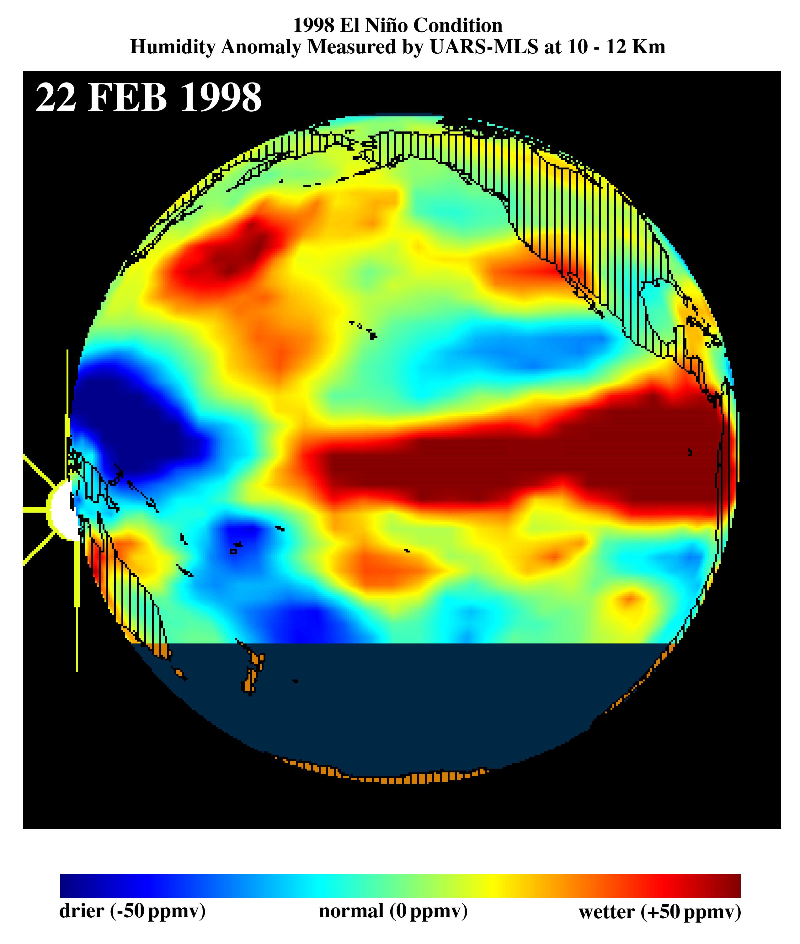
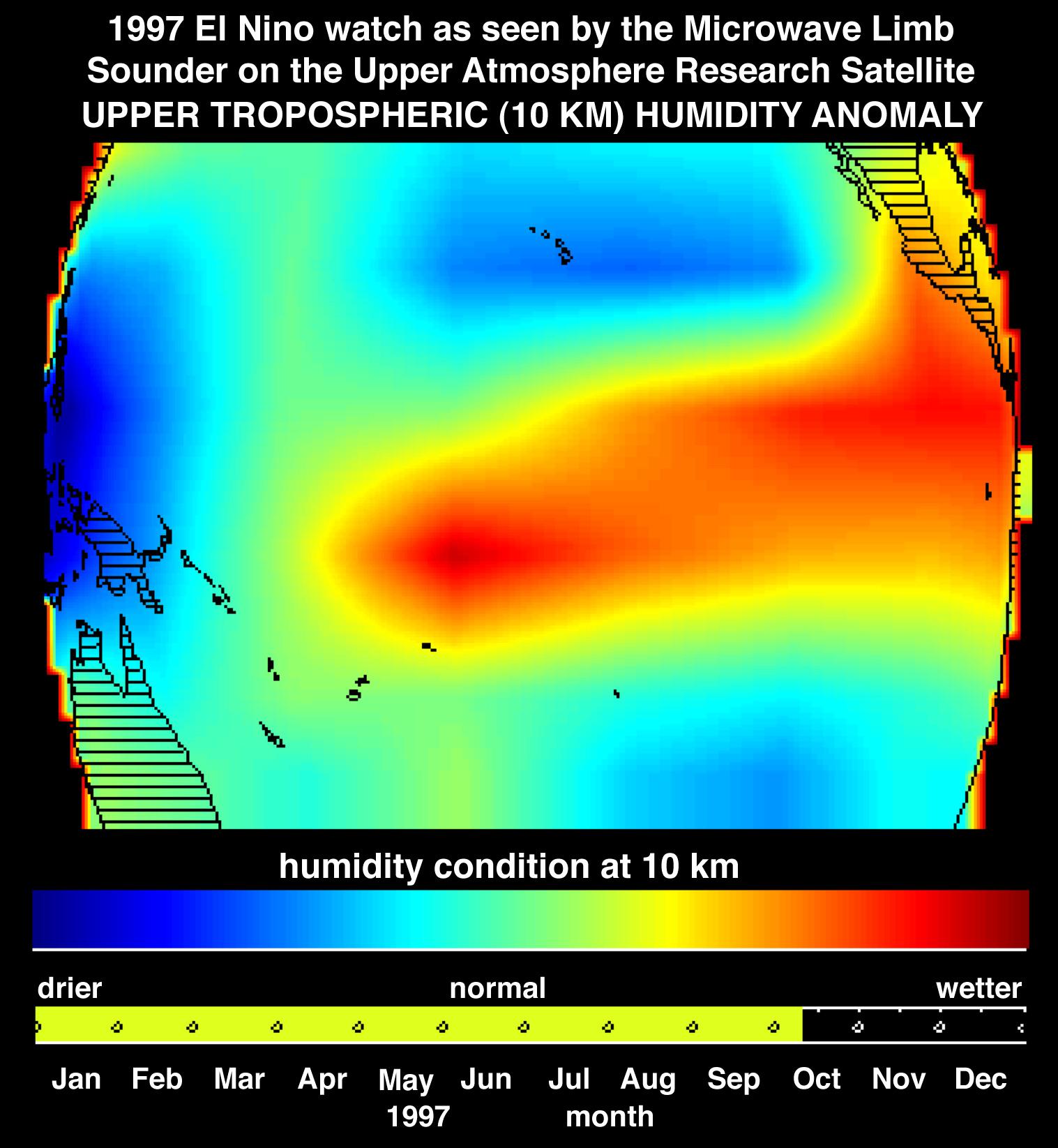
1998-03-16 | Earth |
Terra |
MLS |
2550x3009x3 |
|
|||||
|
|
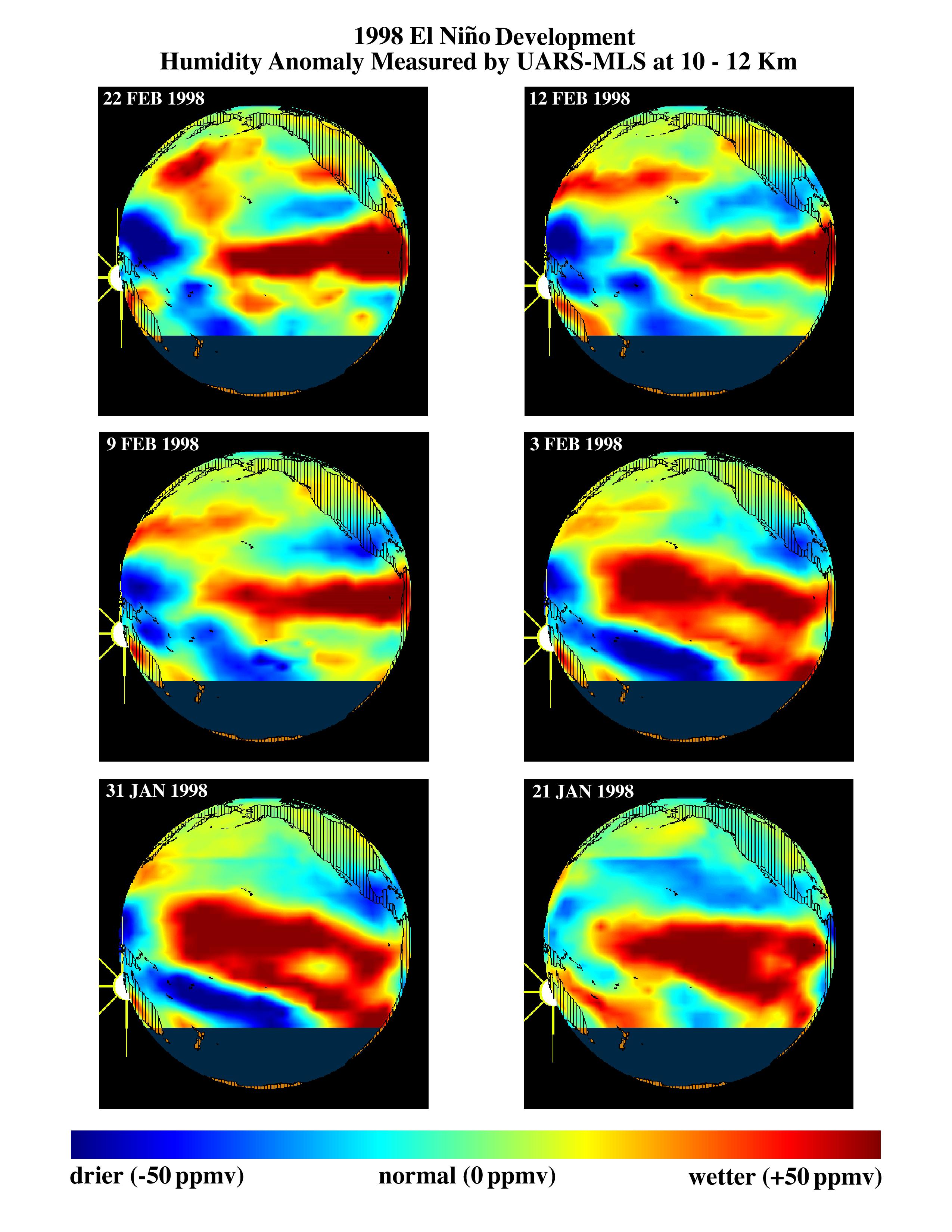
1998-03-26 | Earth |
Terra |
MLS |
2550x3300x3 |
|
|||||
|
|
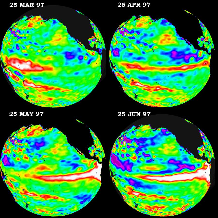
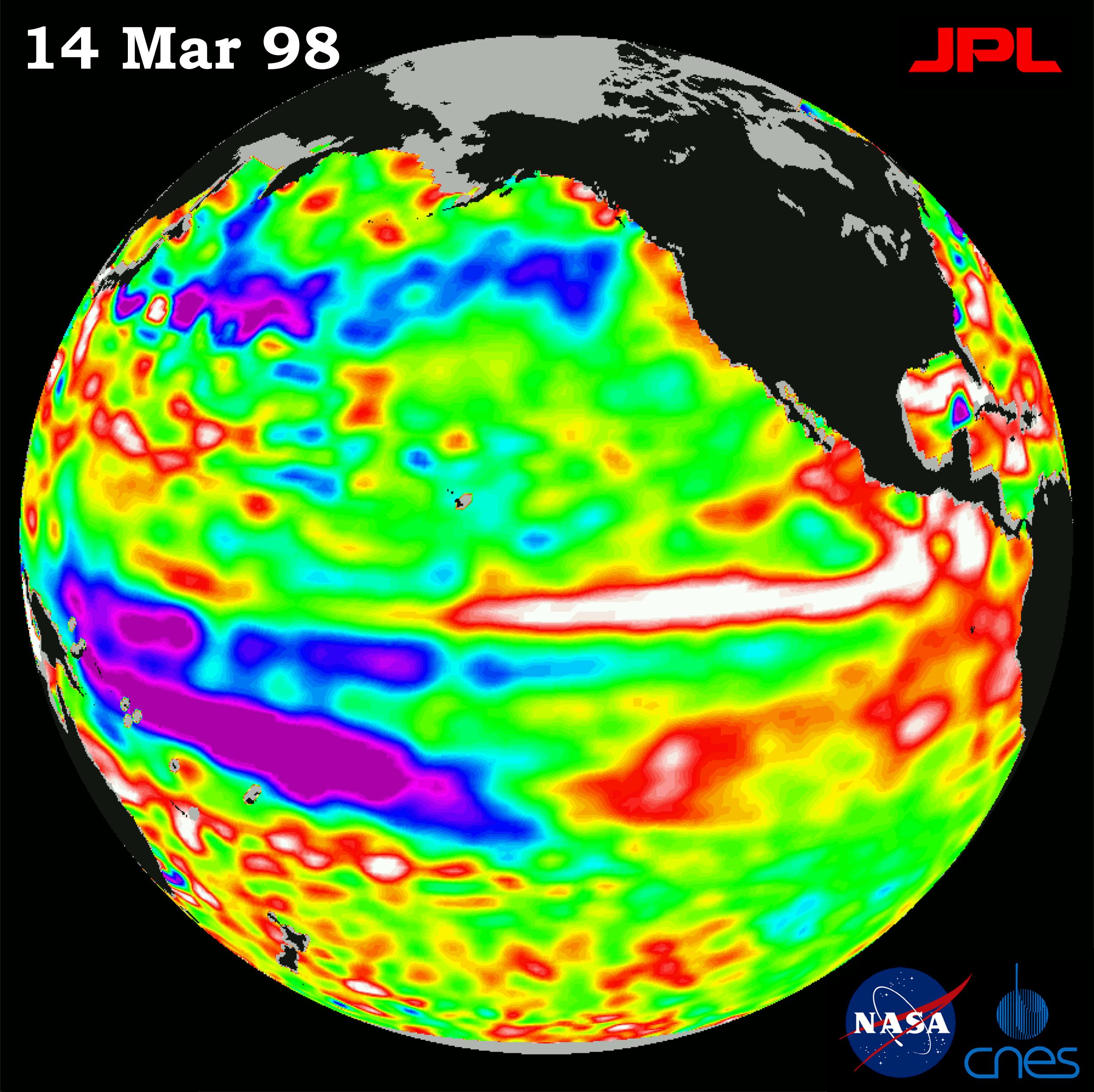
1998-04-02 | Earth |
TOPEX/Poseidon |
Altimeter |
2550x2545x3 |
|
|||||
|
|
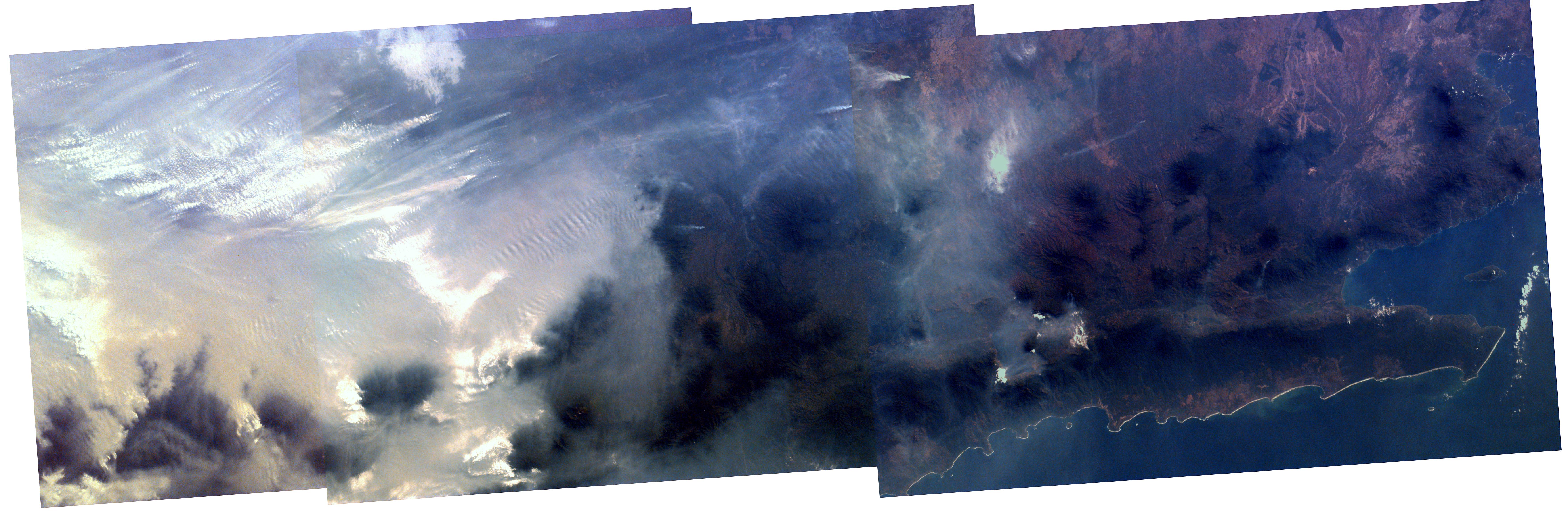
1997-10-03 | Earth |
KidSat |
Electronic Still Camera |
7019x2290x3 |
|
|||||
|
|
1997-10-03 | Earth |
KidSat |
Electronic Still Camera |
3060x2036x3 |
|
|||||
|
|
1997-10-03 | Earth |
KidSat |
Electronic Still Camera |
1024x1024x3 |
|
|||||
|
|
1997-10-03 | Earth |
KidSat |
Electronic Still Camera |
3060x2036x3 |

|
|||||
|
|
1997-10-03 | Earth |
KidSat |
Electronic Still Camera |
3060x2036x3 |

|
|||||
|
|
1997-10-03 | Earth |
KidSat |
Electronic Still Camera |
3060x2036x3 |
|
|||||
|
|
1997-10-03 | Earth |
KidSat |
Electronic Still Camera |
1024x1024x3 |
|
|||||
|
|
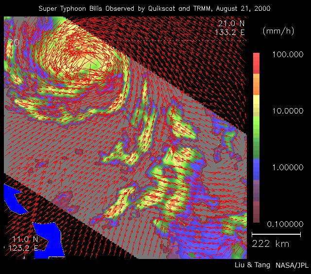
2000-08-23 | Earth |
QuikScat |
SeaWinds Scatterometer |
640x565x3 |
|
|||||
|
|
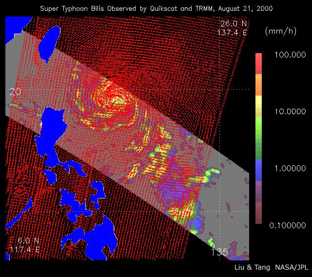
2002-07-05 | Earth |
QuikScat |
SeaWinds Scatterometer |
640x568x3 |
|
|||||
|
|
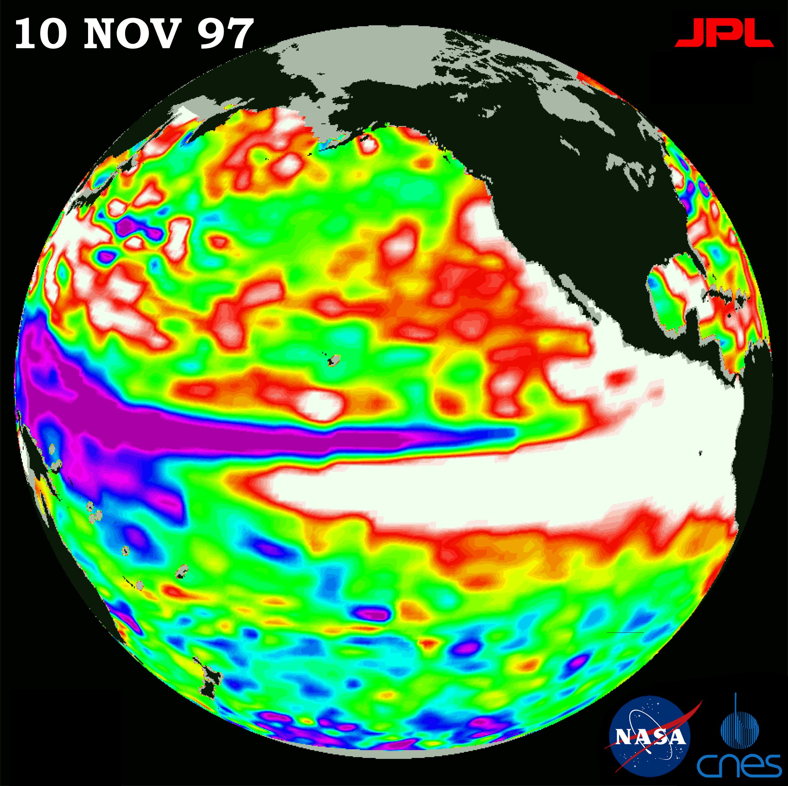
1997-10-23 | Earth |
Cassini-Huygens |
1901x2850x3 | |
|
|||||
|
|
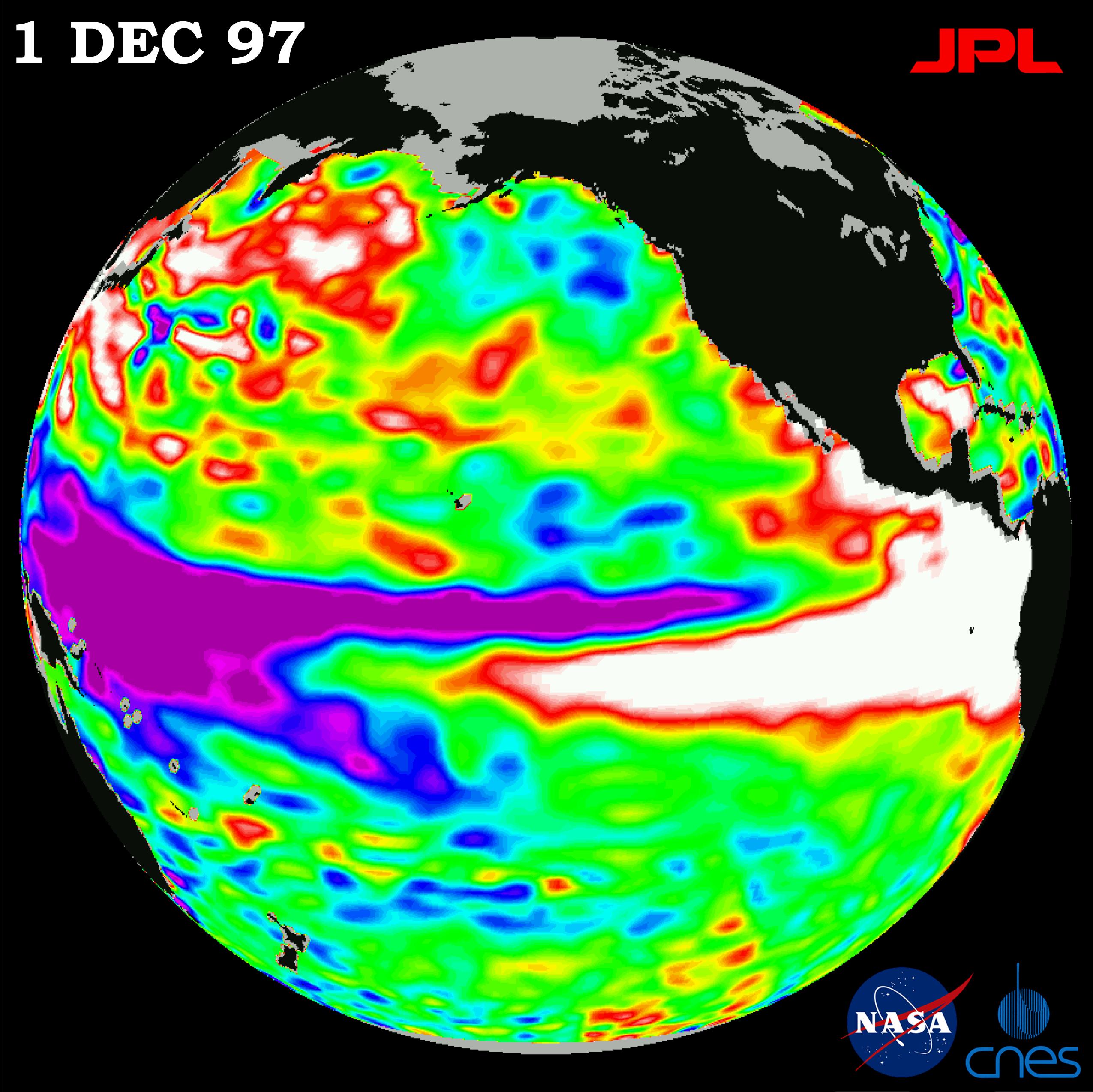
1997-10-23 | Earth |
Cassini-Huygens |
1800x2280x3 | |
|
|||||
|
|
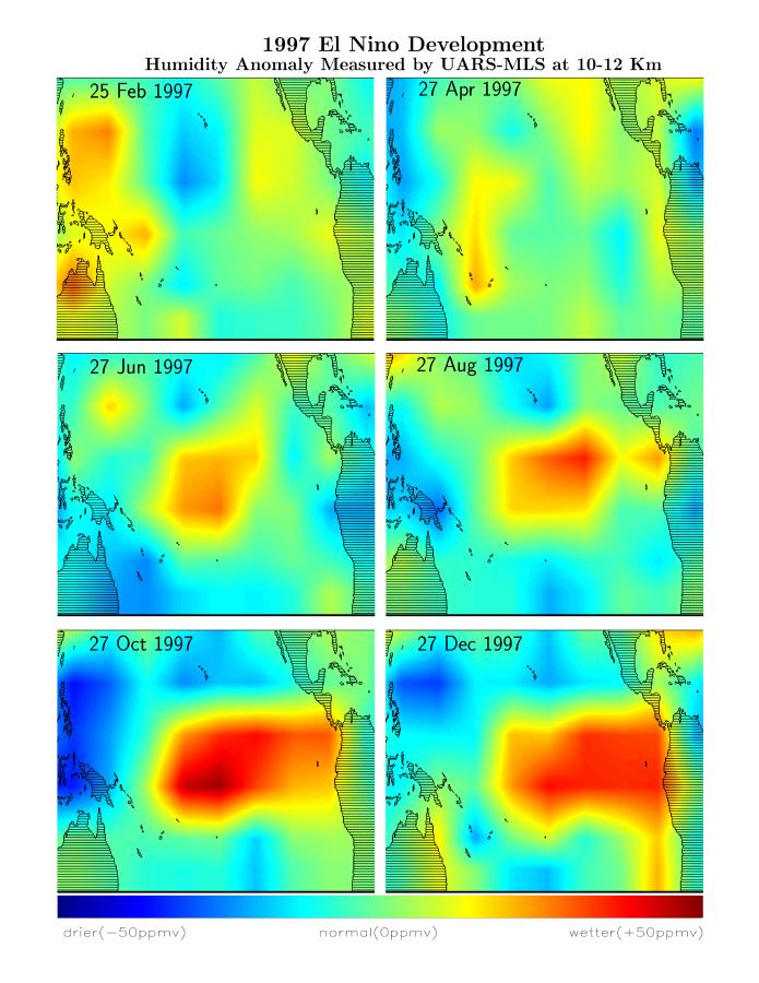
1997-10-30 | Earth |
Terra |
MLS |
1517x1645x3 |
|
|||||
|
|
1997-10-30 | Earth |
TOPEX/Poseidon |
Altimeter |
2550x2545x3 |
|
|||||
|
|
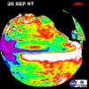
1997-11-20 | Earth |
TOPEX/Poseidon |
Altimeter |
2550x2544x3 |
|
|||||
|
|
1997-12-08 | Earth |
TOPEX/Poseidon |
Altimeter |
2550x2548x3 |
|
|||||
|
|
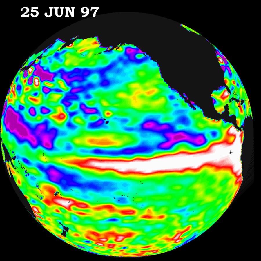
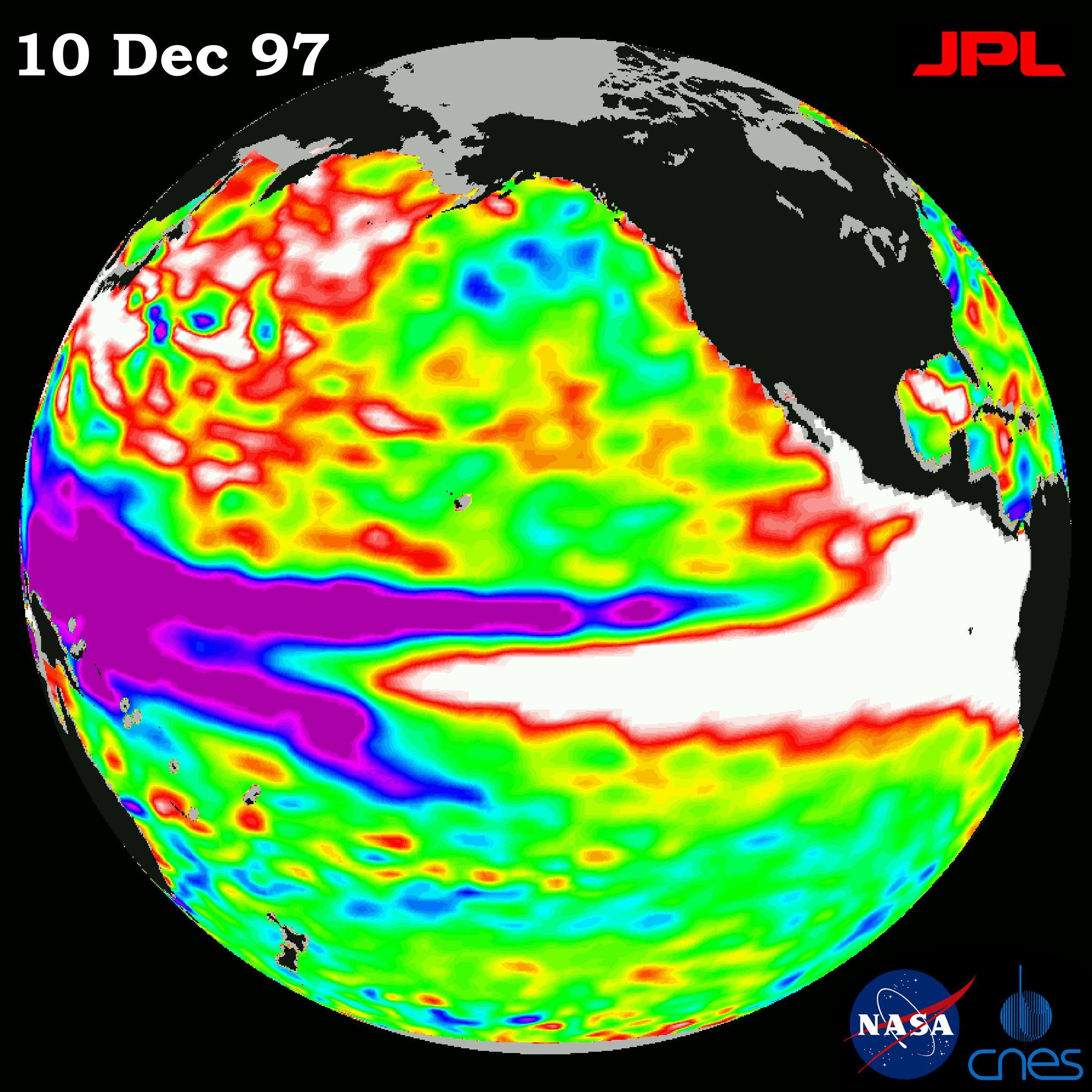
1997-12-19 | Earth |
TOPEX/Poseidon |
Altimeter |
2550x2550x3 |

|
|||||
|
|
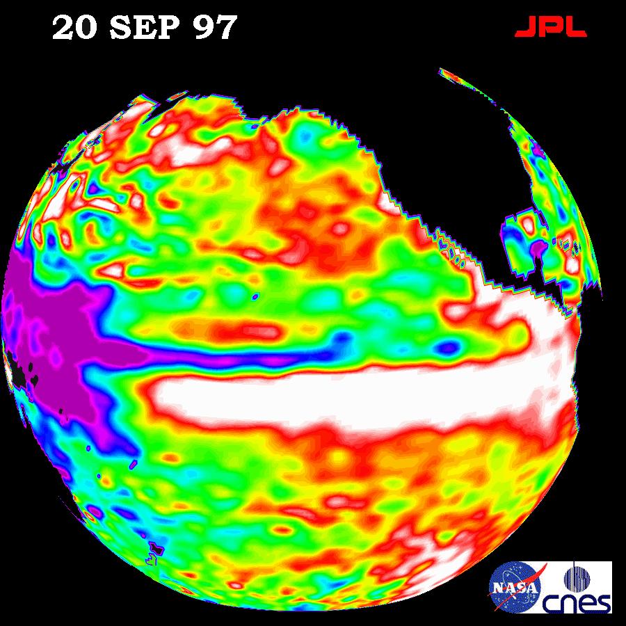
1998-11-04 | Earth |
TOPEX/Poseidon |
Altimeter |
1908x1908x3 |
|
|||||
|
|
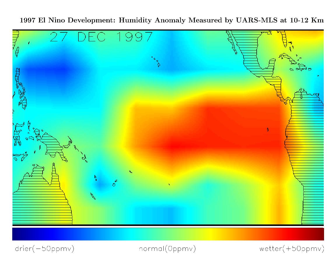
1998-03-14 | Earth |
Terra |
MLS |
1152x900x3 |
|
|||||
|
|
1998-03-14 | Earth |
Terra |
MLS |
695x900x3 |
|
|||||
|
|
1998-04-06 | Earth |
Spaceborne Imaging Radar-C/X-Band Synthetic Aperture Radar |
L-Band Imaging Radar |
4001x3032x3 |
|
|||||
|
|
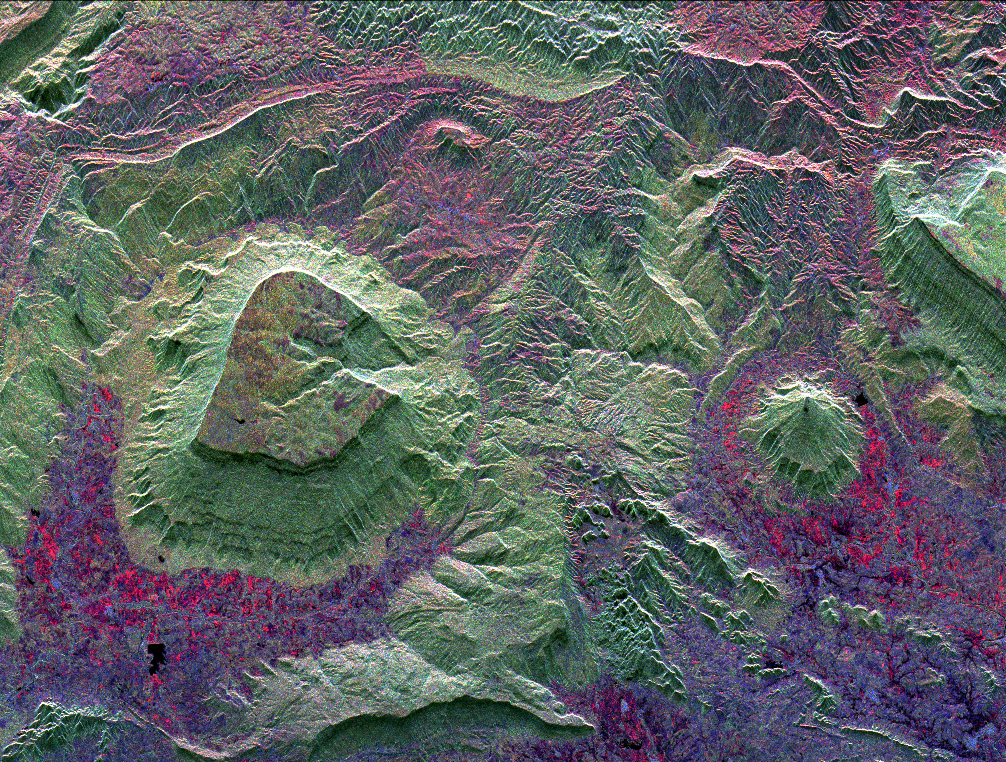
1998-04-14 | Earth |
Spaceborne Imaging Radar-C/X-Band Synthetic Aperture Radar |
Imaging Radar |
1943x4000x3 |
|
|
|||||
|
|
1998-04-09 | Earth |
Spaceborne Imaging Radar-C/X-Band Synthetic Aperture Radar |
Imaging Radar |
1409x1567x3 |
|
|||||

|
 |
|
|
 |
 |
|
|
|
|
|

|
| 1-100 | 101-200 | 201-300 | 301-400 | 401-500 | 501-600 | 601-700 | 701-800 | 801-900 | 901-1000 |
| Currently displaying images: 301 - 400 of 2605 |