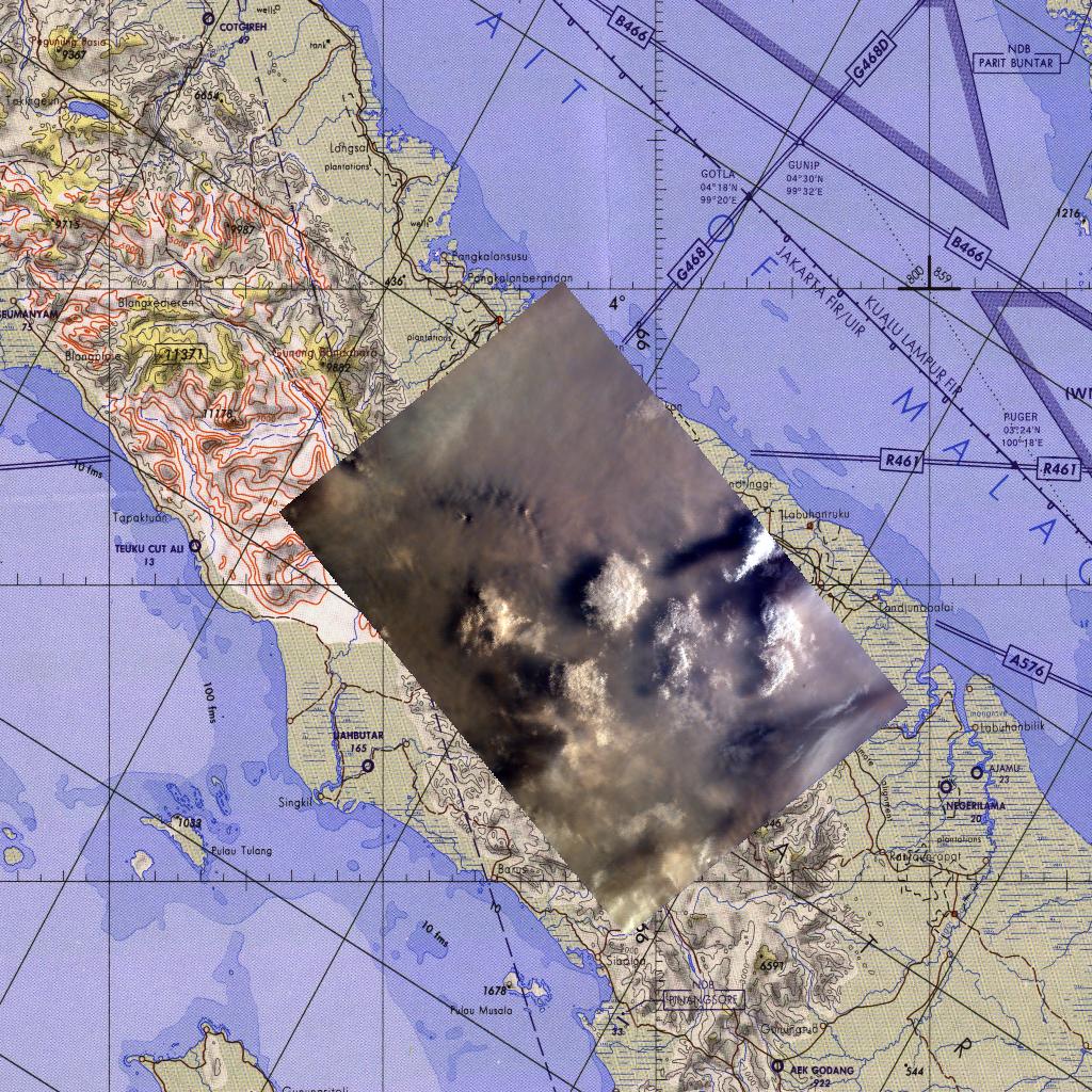
This map corresponds to KidSat image MET 00215424 of the northern regions of Sumatra that was captured on September 27, 1997 during the Shuttle flight STS-86. It is centered at 3.1 degrees S 98.6 degrees E.
As the Space Shuttle Atlantis flew over the Indonesian archipelago last Friday, middle school students across the country photographed the fires and smoke that blanket Sumatra. A joint effort between 23 of the 52 schools participating in this mission, the KidSat camera was used to image a 140 km wide, 1950 km long strip that starts in the northwest (5.24 degrees N, 97.11 degrees E), and follows the Pegunungan Barisan range across the equator to the southern tip of Sumatra (7.44S, 106.1E).
Smoldering underground fires have raged uncontrolled for the past few weeks in Southeast Asia. Originally set to clear land for agriculture, the fires are usually extinguished by the annual monsoon rains. However, this year, the rains had not come due to El Niño which produces dry conditions in the Indonesia region.
The KidSat camera that photographed these fires is mounted in the overhead starboard window of the Shuttle Atlantis and operates before and after docking with Mir when the Shuttle's windows face the Earth. Students on the ground are linked to the camera through the Internet and a series of satellites. Commands are sent from middle schools through a Mission Operations Gateway at the University of California, San Diego, to a Thinkpad on the Shuttle flight deck. Images are transmitted back to the Jet Propulsion Laboratory where they are immediately placed on the Internet for the KidSat students and the rest of the world to view and use. High school and undergraduate students work in collaboration with scientists and engineers to develop and operate the KidSat systems. Curriculum developed by The Johns Hopkins University Institute for the Academic Advancement of Youth is used in the middle school classrooms to encourage scientific inquiry based on the images.
The photographs from the three missions of the KidSat pilot program can be accessed at the following URL: http://www.jpl.nasa.gov/kidsat
The KidSat program was developed by the Jet Propulsion Laboratory, The Johns Hopkins University Institute for the Academic Advancement of Youth, and The University of California, San Diego, with support from NASA's Johnson Space Center. The project is supported by NASA's Office of Human Resources and Education with support from NASA's Offices of Mission to Planet Earth, Space Flight, and Space Science. JPL is a division of the California Institute of Technology (Caltech).
Photojournal note:
The website formerly known as KidSat was renamed EarthKAM in 1998: http://www.earthkam.ucsd.edu/.
 Planetary Data System


