Your search criteria found 162 images
Target is Titan
Go to PIAxxxxx:
Refine this list of images by:
Target:
Click on an image for detailed information
Click on a column heading to sort in ascending or descending order
My
List
Addition DateSort Ascending Target Mission Instrument Size
Add Image to Favorite List 2007-02-16 Titan Cassini-Huygens
Radar Mapper
1500x1008x1
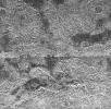
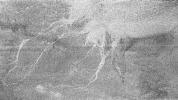
This radar image NASA's Cassini spacecraft of Titan shows Ganesa Macula, interpreted as a cryovolcano (ice volcano), and its surroundings. Cryovolcanism is thought to have been an important process on Titan and may still be happening today.
PIA09176:
Ganesa Macula
Full Resolution:     TIFF (1.514 MB)     JPEG (487.3 kB)
Add Image to Favorite List 2007-02-16 Titan Cassini-Huygens
Radar Mapper
725x416x1
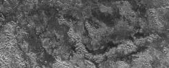
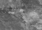
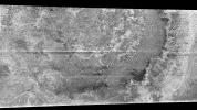
This radar image from NASA's Cassini spacecraft of Titan shows a semi-circular feature that may be part of an impact crater. Very few impact craters have been seen on Titan so far, implying that the surface is young.
PIA09175:
A New Crater on Titan?
Full Resolution:     TIFF (302.1 kB)     JPEG (134.5 kB)
Add Image to Favorite List 2007-02-07 Titan Cassini-Huygens
Radar Mapper
9000x1176x1
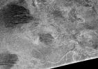
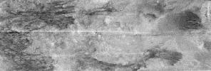
This image of Titan's surface shows the entire scene obtained by NASA's Cassini radar instrument on Sept. 7, 2006. It includes clear examples of the longitudinal dunes, as well as one of only three positively-identified impact craters (on the far left).
PIA09172:
Titan (T17) Viewed by Cassini's Radar - Sept. 7, 2006
Full Resolution:     TIFF (10.58 MB)     JPEG (2.876 MB)
Add Image to Favorite List 2007-01-24 Titan Cassini-Huygens
Radar Mapper
569x502x1
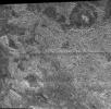
This radar image from NASA's Cassini spacecraft of Titan's well-known dunes is distinctive because it may show an age relationship between different classes of features on the surface of this frigid world.
PIA09115:
Titan Dunes over Possible Craters (T23)
Full Resolution:     TIFF (286.2 kB)     JPEG (75.78 kB)
Add Image to Favorite List 2007-01-13 Titan Cassini-Huygens
Radar Mapper
19200x1920x1
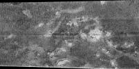
This image was obtained by NASA's Cassini radar instrument during a flyby on Jan. 13, 2007. Northern mid-latitudes to equator (Ganesa Macula, Aaru, western Senkyo, Tsegihi).
PIA00928:
Titan Radar Swath (T-23 Flyby - Jan. 13, 2007)
Full Resolution:     TIFF (17.2 MB)     JPEG (4.487 MB)
Add Image to Favorite List 2007-01-11 Titan Cassini-Huygens
Radar Mapper
18991x1920x1
This radar image from NASA's Cassini spacecraft shows the entire scene in which hydrocarbon lakes were first discovered on Titan, near its north pole.
PIA09112:
Titan (T16) Viewed by Cassini's Radar - July 22, 2006
Full Resolution:     TIFF (36.46 MB)     JPEG (5.132 MB)
Add Image to Favorite List 2007-01-11 Titan Cassini-Huygens
Radar Mapper
1542x562x1
This pair of images, taken by NASA's Cassini spacecraft radar mapper on two different Titan passes on Dec. 11, 2006 (T21 left), and Oct. 29, 2005 (T8 right), represent two different views of a field of dunes.
PIA09111:
Two Sides of Dunes
Full Resolution:     TIFF (867.7 kB)     JPEG (289.7 kB)
Add Image to Favorite List 2007-01-03 Titan Cassini-Huygens
Radar Mapper
2600x3400x3
The existence of oceans or lakes of liquid methane on Saturn's moon Titan was predicted more than 20 years ago. But with a dense haze preventing a closer look it has not been possible to confirm their presence until NASA's Cassini flyby of July 22, 2006.
PIA09102:
Liquid Lakes on Titan
Full Resolution:     TIFF (26.55 MB)     JPEG (1.177 MB)
Add Image to Favorite List 2006-12-12 Titan Cassini-Huygens
Radar Mapper
15971x1676x1
This image was obtained by NASA's Cassini radar instrument during a flyby on Dec. 12, 2006. North Polar Pass (Northern Lakes Region, Aaru).
PIA04308:
Titan Radar Swath (T-21 Flyby - Dec. 12, 2006)
Full Resolution:     TIFF (12.45 MB)     JPEG (3.269 MB)
Add Image to Favorite List 2006-12-12 Titan Cassini-Huygens
Radar Mapper
Visual and Infrared Mapping Spectrometer
1600x1200x3
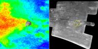
This image composite from NASA's Cassini spacecraft contains a radar image taken during a February 2005 (T3) flyby. A faint fan of material seems to originate at the crater.
PIA09036:
Infrared and Radar Views of Titan #2
Full Resolution:     TIFF (5.77 MB)     JPEG (247 kB)
Add Image to Favorite List 2006-12-12 Titan Cassini-Huygens
Radar Mapper
Visual and Infrared Mapping Spectrometer
1260x942x3
This set of composite images was constructed from the best NASA Cassini radar data and visual and infrared mapping spectrometer data obtained from all the Titan flybys up to the most recent flyby on Oct 25 (T20).
PIA09035:
Infrared and Radar Views of Titan
Full Resolution:     TIFF (3.565 MB)     JPEG (111.3 kB)
Add Image to Favorite List 2006-10-12 Titan Cassini-Huygens
Radar Mapper
1790x649x1
In this image taken by NASA's Cassini radar system, a previously unseen style of lakes is revealed. The lakes here assume complex shapes and are among the darkest seen so far on Titan.
PIA01943:
Lakes and More Lakes
Full Resolution:     TIFF (1.163 MB)     JPEG (419.7 kB)
Add Image to Favorite List 2006-10-12 Titan Cassini-Huygens
Radar Mapper
1675x815x1
The large dark patch seen on this image at high latitudes surrounding Titan's north pole, is from NASA's Cassini spacecraft's radar system, and most likely a hydrocarbon lake.
PIA01942:
Titan's Great Lakes?
Full Resolution:     TIFF (1.367 MB)     JPEG (514.8 kB)
Add Image to Favorite List 2006-10-09 Titan Cassini-Huygens
Radar Mapper
19620x1774x1
This image was obtained by NASA's Cassini radar instrument during a flyby on Oct. 9, 2006. North Polar Pass (Northern Lakes Region, Aaru).
PIA03187:
Titan Radar Swath (T-19 Flyby - Oct. 9, 2006)
Full Resolution:     TIFF (19.03 MB)     JPEG (5.221 MB)
Add Image to Favorite List 2006-09-26 Titan Cassini-Huygens
Radar Mapper
460x276x1
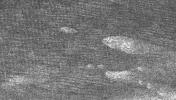
This image from NASA's Cassini spacecraft of Titan shows clear shorelines that are reminiscent of terrestrial lakes. With Titan's colder
temperatures and hydrocarbon-rich atmosphere the lakes likely contain a combination of methane and ethane, not water.
PIA08741:
Shorefront Property, Anyone?
Full Resolution:     TIFF (127.3 kB)     JPEG (41.61 kB)
Add Image to Favorite List 2006-09-26 Titan Cassini-Huygens
Radar Mapper
484x326x1
NASA's Cassini radar image shows two lakes 'kissing' each other on the surface of Saturn's moon Titan. The image from a flyby on Sept. 23, 2006, covers an area about 60 kilometers (37 miles) wide by 40 kilometers (25 miles) high.
PIA08740:
Titan's "Kissing Lakes"
Full Resolution:     TIFF (158.2 kB)     JPEG (52.3 kB)
Add Image to Favorite List 2006-09-12 Titan Cassini-Huygens
Radar Mapper
1864x1024x1
This image from NASA's Cassini radar instrument was acquired by the Cassini radar instrument in synthetic aperture mode during a Sept. 7, 2006, flyby of Titan.
PIA08738:
Swimming in Dunes
Full Resolution:     TIFF (1.911 MB)     JPEG (623.9 kB)
Add Image to Favorite List 2006-09-12 Titan Cassini-Huygens
Radar Mapper
1068x888x1
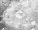
This image from NASA's Cassini radar instrument shows an impact crater with a diameter of 30 kilometers (19 miles) on the surface of Saturn's moon Titan.
PIA08737:
Crater Studies on Titan
Full Resolution:     TIFF (949.6 kB)     JPEG (424.8 kB)
Add Image to Favorite List 2006-07-24 Titan Cassini-Huygens
Radar Mapper
2540x1800x1
NASA's Cassini spacecraft, using its radar system, has discovered very strong evidence for hydrocarbon lakes on Titan. Dark patches, which resemble terrestrial lakes, seem to be sprinkled all over the high latitudes surrounding Titan's north pole.
PIA08630:
Lakes on Titan
Full Resolution:     TIFF (4.577 MB)     JPEG (1.333 MB)
Add Image to Favorite List 2006-07-19 Titan Cassini-Huygens
Radar Mapper
320x240x3
Cassini's powerful radar eyes have uncovered a geologic goldmine in a region called Xanadu on Saturn's moon Titan. Panning west to east, the geologic features include river channels, mountains and hills, a crater and possible lakes.
PIA08605:
Titan's Geological Goldmine - Radar Movie Animation Icon
Full Resolution:     TIFF (223.5 kB)     JPEG (4.451 kB)
Add Image to Favorite List 2006-07-19 Titan Cassini-Huygens
Radar Mapper
845x574x1
A network of river channels is located atop Xanadu, the continent-sized region on Saturn's moon Titan. This radar image was captured by NASA's Cassini Radar Mapper on April 30, 2006.
PIA08604:
Xanadu's Meandering Rivers
Full Resolution:     TIFF (485.8 kB)     JPEG (129.1 kB)
Add Image to Favorite List 2006-07-19 Titan Cassini-Huygens
Radar Mapper
20833x2890x1
This image of Titan was acquired on April 30, 2006, NASA's Cassini's radar instrument in synthetic-aperture mode over the continent-sized region called Xanadu.
PIA08552:
Titan (T13) Viewed by Cassini's Radar - April 30, 2006
Full Resolution:     TIFF (60.21 MB)     JPEG (5.791 MB)
Add Image to Favorite List 2006-05-12 Titan Cassini-Huygens
Radar Mapper
7218x766x1
This image was taken with NASA's Cassini Synthetic Aperture Radar instrument on Oct. 28, 2005. This was the fourth flyby of Titan during which radar images were obtained. The most ubiquitous features in this swath are
PIA08454:
Dunes and more Dunes
Full Resolution:     TIFF (5.535 MB)     JPEG (1.68 MB)
Add Image to Favorite List 2006-05-09 Titan Cassini-Huygens
Radar Mapper
1191x1163x1
This complex area of hilly terrain and erosional channels is located atop Xanadu, the continent-sized region on Saturn's moon Titan. This image was captured by NASA's Cassini Titan Radar Mapper on April 30, 2006.
PIA08449:
Complex Terrain
Full Resolution:     TIFF (1.387 MB)     JPEG (518 kB)
Add Image to Favorite List 2006-05-09 Titan Cassini-Huygens
Radar Mapper
2098x851x1
NASA's Cassini spacecraft's Titan Radar Mapper instrument imaged this area atop Xanadu, the bright area of Titan, on April 30, 2006.
PIA08448:
Titan's Land-o-Lakes
Full Resolution:     TIFF (1.788 MB)     JPEG (614.8 kB)
Add Image to Favorite List 2006-05-05 Titan Cassini-Huygens
Radar Mapper
1051x972x3
This map of Saturn's moon Titan shows the location mapped with NASA's Cassini radar mapper using its synthetic aperture radar imaging mode on April 30, 2006.
PIA08430:
Radar Flyby of Titan - April 30, 2006
Full Resolution:     TIFF (3.069 MB)     JPEG (85.88 kB)
Add Image to Favorite List 2006-05-05 Titan Cassini-Huygens
Radar Mapper
1477x1448x1
This image from the Synthetic Aperture Radar instrument on NASA's Cassini spacecraft shows the radar-bright region Xanadu and two circular features interpreted to be degraded impact craters.
PIA08429:
Impact Craters on Xanadu
Full Resolution:     TIFF (2.141 MB)     JPEG (786.5 kB)
Add Image to Favorite List 2006-05-05 Titan Cassini-Huygens
Radar Mapper
3289x1767x1
This image from the Synthetic Aperture Radar instrument on NASA's Cassini spacecraft shows the radar-bright western margin of Xanadu, one of the most prominent features on Titan.
PIA08428:
Xanadu: Rivers Flowed onto a Sunless Sea
Full Resolution:     TIFF (5.819 MB)     JPEG (1.394 MB)
Add Image to Favorite List 2006-05-03 Titan Cassini-Huygens
Radar Mapper
850x1107x1
This image of Saturn's moon Titan from the Synthetic Aperture Radar instrument on NASA's Cassini spacecraft shows Shikoku Facula, a region that is bright in both radar and visible wavelengths.
PIA08426:
Radar Images Shikoku - "Great Britain"
Full Resolution:     TIFF (942.2 kB)     JPEG (331.6 kB)
Add Image to Favorite List 2006-05-03 Titan Cassini-Huygens
Radar Mapper
2070x1244x1
This image of Saturn's moon Titan from the Synthetic Aperture Radar instrument on NASA's Cassini spacecraft shows the southwestern area of a feature called Xanadu (bottom right of the image).
PIA08425:
Radar Images the Margin of Xanadu
Full Resolution:     TIFF (2.579 MB)     JPEG (571.4 kB)
Add Image to Favorite List 2006-05-03 Titan Cassini-Huygens
Imaging Science Subsystem
Radar Mapper
800x422x1
This frame from a movie shows how data from two different instruments on NASA's Cassini spacecraft can be combined to give an integrated view of Titan's surface.
PIA07785:
Comparing Notes on Titan -- Radar & Imaging Science Subsystem Animation Icon
Full Resolution:     TIFF (338.2 kB)     JPEG (20.4 kB)
Add Image to Favorite List 2006-04-27 Titan Cassini-Huygens
Radar Mapper
6777x3390x3
This map of Saturn's moon Titan by NASA's Cassini radar mapper using its synthetic aperture radar imaging mode. Shown are a variety of geologic features, including impact craters, wind-blown deposits, channels and cryovolcanic features.
PIA08100:
Titan (T13) Viewed by Cassini's Radar - Flat Map
Full Resolution:     TIFF (68.92 MB)     JPEG (996.8 kB)
Add Image to Favorite List 2006-04-27 Titan Cassini-Huygens
Radar Mapper
1051x972x3
Seen here are areas mapped on Saturn's moon Titan by NASA's Cassini radar mapper using its synthetic aperture radar imaging mode. Shown are a variety of geologic features, including impact craters, wind-blown deposits, channels and cryovolcanic features.
PIA08099:
Titan (T13) Viewed by Cassini's Radar
Full Resolution:     TIFF (3.069 MB)     JPEG (81.07 kB)
Add Image to Favorite List 2005-11-30 Titan Cassini-Huygens
Descent Imager/Spectral Radiometer
Radar Mapper
488x732x3
This composite image shows a mosaic of the European Space Agency's Huygens probe landing site, as seen by the descent imager/spectral radiometer on the Huygens probe. The mosaic is overlaid on a NASA Cassini orbiter radar image.
PIA06437:
Huygens Landing Site
Full Resolution:     TIFF (1.073 MB)     JPEG (49.99 kB)
Add Image to Favorite List 2005-11-30 Titan Cassini-Huygens
Imaging Science Subsystem
Radar Mapper
Visual and Infrared Mapping Spectrometer
668x415x3
This frame from a movie shows a quick succession of multiple products of Titan's surface from NASA's Cassini orbiter and the European Space Agency's Huygens probe.
PIA06435:
Huygens Landing Site (Animation) Animation Icon
Full Resolution:     TIFF (832.7 kB)     JPEG (26.32 kB)
Add Image to Favorite List 2005-11-16 Titan Cassini-Huygens
Radar Mapper
2538x1900x3
This set of images shows the areas mapped so far on Saturn's moon Titan by NASA's Cassini radar mapper using its synthetic aperture radar imaging mode.
PIA03571:
Titan Viewed by Cassini's Radar
Full Resolution:     TIFF (14.48 MB)     JPEG (225.8 kB)
Add Image to Favorite List 2005-11-16 Titan Cassini-Huygens
Radar Mapper
1051x972x3
This map of Saturn's moon Titan shows the location mapped with NASA's Cassini radar mapper using its synthetic aperture radar imaging mode during the Oct. 28, 2005, flyby.
PIA03570:
Radar Swath of Oct. 28, 2005, Titan Flyby
Full Resolution:     TIFF (3.069 MB)     JPEG (65.05 kB)
Add Image to Favorite List 2005-11-01 Titan Cassini-Huygens
Radar Mapper
Visual and Infrared Mapping Spectrometer
6144x3072x3
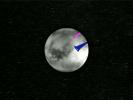
NASA's Cassini spacecraft carried the European Space Agency's Huygens probe to Saturn and released it in December 2004. The magenta cross in both images shows the best estimate of the actual Huygens landing site.
PIA03569:
Pinpointing Huygens Landing Site
Full Resolution:     TIFF (56.62 MB)     JPEG (1.875 MB)
Add Image to Favorite List 2005-11-01 Titan Cassini-Huygens
Radar Mapper
829x598x1
The geologic diversity of Titan's surface is well illustrated by this synthetic aperture radar image, obtained on Oct. 28, 2005, during NASA's Cassini spacecraft's ninth Titan fly-by and fourth radar pass.
PIA03568:
Diverse Geology
Full Resolution:     TIFF (496.5 kB)     JPEG (142.4 kB)
Add Image to Favorite List 2005-11-01 Titan Cassini-Huygens
Radar Mapper
510x289x1
Large areas of this Cassini synthetic aperture radar image of Titan from NASA's Cassini spacecraft are covered by long, dark ridges.
PIA03567:
Dunes Galore
Full Resolution:     TIFF (147.8 kB)     JPEG (42.52 kB)
Add Image to Favorite List 2005-11-01 Titan Cassini-Huygens
Radar Mapper
1138x649x1
This synthetic aperture radar image of Titan was taken on Oct. 28, 2005, as NASA's Cassini spacecraft flew by at a distance of 1,350 kilometers (840 miles).
PIA03566:
Tectonic Features
Full Resolution:     TIFF (739.5 kB)     JPEG (235.7 kB)
Add Image to Favorite List 2005-10-28 Titan Cassini-Huygens
Radar Mapper
17610x3153x1
This image was obtained by NASA's Cassini radar instrument during a flyby on Oct. 28, 2005. Equatorial Pass (Trailing hemisphere, Central Adiri, Central Belet, Huygens Landing Site, Antillia Faculae).
PIA03068:
Titan Radar Swath (T-8 Flyby, Oct. 28, 2005)
Full Resolution:     TIFF (17.59 MB)     JPEG (4.557 MB)
Add Image to Favorite List 2005-10-25 Titan Cassini-Huygens
Radar Mapper
2538x1900x3
These three radar passes from NASA's Cassini spacecraft taken on Sept. 7, 2005 reveal a variety of geologic features, including impact craters, wind-blown deposits, channels, and cryovolcanic features.
PIA08110:
Titan Viewed by Cassini's Radar
Full Resolution:     TIFF (14.48 MB)     JPEG (222.9 kB)
Add Image to Favorite List 2005-10-25 Titan Cassini-Huygens
Radar Mapper
2261x1131x3
This map of Saturn's moon Titan shows the location of the upcoming Oct. 28, 2005, Titan flyby and the areas mapped so far by NASA's Cassini Radar Mapper using its Synthetic Aperture Radar imaging mode.
PIA08111:
Titan Viewed by Cassini's Radar - Flat Map
Full Resolution:     TIFF (7.681 MB)     JPEG (166.3 kB)
Add Image to Favorite List 2005-09-16 Titan Cassini-Huygens
Radar Mapper
1287x1516x1
This image from NASA's Cassini spacecraft shows that this bright terrain is cut by channels that are variable in width; they form both radial and branching networks. Such patterns are reminiscent of networks formed by rainfall on Earth.
PIA03565:
Titan's Rain Drains to the Plains
Full Resolution:     TIFF (1.953 MB)     JPEG (609.6 kB)
Add Image to Favorite List 2005-09-16 Titan Cassini-Huygens
Radar Mapper
1715x1400x1
Fluids have flowed and cut these deeply-incised channels into the icy surface of Titan as seen in this Synthetic Aperture Radar image obtained by NASA's Cassini spacecraft.
PIA03564:
Canyonlands of Titan
Full Resolution:     TIFF (2.404 MB)     JPEG (709.1 kB)
Add Image to Favorite List 2005-09-16 Titan Cassini-Huygens
Radar Mapper
1909x1385x1
This Synthetic Aperture Radar image of the surface of Saturn's moon Titan was obtained by NASA's Cassini spacecraft on Sept. 7, 2005.
PIA03563:
Shoreline on Titan?
Full Resolution:     TIFF (2.647 MB)     JPEG (746.7 kB)
Add Image to Favorite List 2005-09-07 Titan Cassini-Huygens
Radar Mapper
6162x1222x1
This image was obtained by NASA's Cassini radar instrument during a flyby on Sept. 7, 2005. Southern Mid-latitudes (Central Tsegihi, Mezzoramia).
PIA01855:
Titan Radar Swath (T-7 Flyby - Sept. 7, 2005)
Full Resolution:     TIFF (5.025 MB)     JPEG (1.32 MB)
Add Image to Favorite List 2005-09-05 Titan Cassini-Huygens
Radar Mapper
1591x1124x1
Synthetic aperture radar images obtained from NASA's Cassini spacecraft in February 2005 show that Titan's surface is modified by fluid flows and wind-driven deposits.
PIA03555:
Titan, a Geologically Dynamic World
Full Resolution:     TIFF (1.79 MB)     JPEG (569.1 kB)
Add Image to Favorite List 2005-04-27 Titan Cassini-Huygens
Visual and Infrared Mapping Spectrometer
Radar Mapper
750x196x3
This three-panel image shows one of Titan's most prominent impact craters in an infrared-wavelength image, radar image and in the false-color image. The Cassini radar imaged this crater during NASA's Cassini spacecraft's third flyby of Titan.
PIA07868:
Titan Crater in Three Views
Full Resolution:     TIFF (441.8 kB)     JPEG (21.34 kB)
Add Image to Favorite List 2005-02-18 Titan Cassini-Huygens
Radar Mapper
640x481x3
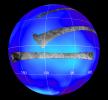
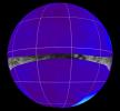
This frame from an animation shows NASA's Cassini spacecraft approaching Titan. The strips of data on the globe represent areas observed with NASA's Cassini radar instrument.
PIA07369:
Cassini Radar Titan Movie Animation Icon
Full Resolution:     TIFF (445.1 kB)     JPEG (30.5 kB)
Add Image to Favorite List 2005-02-18 Titan Cassini-Huygens
Radar Mapper
1000x800x1
This image from NASA's Cassini spacecraft shows a crater, approximately 60 kilometers (37 miles) in diameter, on the very eastern end of the radar image strip taken by the Cassini orbiter on its third close flyby of Titan.
PIA07368:
Impact Crater with Ejecta Blanket
Full Resolution:     TIFF (801 kB)     JPEG (210.1 kB)
Add Image to Favorite List 2005-02-18 Titan Cassini-Huygens
Radar Mapper
1304x648x1
Although most of the region observed by NASA's Cassini radar instrument in the February close flyby of Titan is very different from the regions imaged in October, this image shows a complex of bright hills and ridges surrounded by a dark plain.
PIA07367:
Dark Terrain
Full Resolution:     TIFF (846.1 kB)     JPEG (330.8 kB)
Add Image to Favorite List 2005-02-18 Titan Cassini-Huygens
Radar Mapper
1020x574x1
This area imaged by NASA's Cassini radar system during the spacecraft's third close flyby of Titan on Feb. 15, 2005, is just to the east of the Circus Maximus impact feature.
PIA07366:
Huygens Landing Site Similarities
Full Resolution:     TIFF (586.3 kB)     JPEG (225.6 kB)
Add Image to Favorite List 2005-02-16 Titan Cassini-Huygens
Radar Mapper
1287x724x1
A huge annular feature with an outer diameter of approximately 440 kilometers (273 miles) appears in this image taken with NASA's Cassini Titan radar mapper. It resembles a large crater or part of a ringed basin.
PIA07365:
Circus Maximus
Full Resolution:     TIFF (933 kB)     JPEG (322.1 kB)
Add Image to Favorite List 2005-02-16 Titan Cassini-Huygens
Radar Mapper
2000x675x1
This image is a portion of the swath acquired by NASA's Cassini Titan radar mapper on Feb. 15, 2005, on the mission's second opportunity to image the surface with radar. The optically bright region is named Xanadu.
PIA07009:
Cat Scratches
Full Resolution:     TIFF (1.352 MB)     JPEG (480.5 kB)
Add Image to Favorite List 2005-02-15 Titan Cassini-Huygens
Radar Mapper
16768x2688x1
This image was obtained by NASA's Cassini radar instrument during a flyby on Feb. 15, 2005. The radar antenna was pointing toward Titan at an altitude of 1,577 kilometers (890 miles) during the closest approach.
PIA04389:
Titan Radar Swath (T-3 Flyby - Feb. 15, 2005)
Full Resolution:     TIFF (18.88 MB)     JPEG (5.264 MB)
Add Image to Favorite List 2004-12-01 Titan Cassini-Huygens
Radar Mapper
844x998x1
As Cassini scientists work to understand the newly-exposed surface of Saturn's largest moon, Titan, they have found an interesting arrowhead-shaped feature, shown in the center of this synthetic aperture radar image from NASA's Cassini spacecraft.
PIA06995:
Follow the Arrow
Full Resolution:     TIFF (843.4 kB)     JPEG (225.1 kB)
Add Image to Favorite List 2004-11-08 Titan Cassini-Huygens
Radar Mapper
504x424x1
This synthetic aperture radar image of the surface of Saturn's moon Titan was acquired on Oct. 26, 2004, when NASA's Cassini spacecraft flew over. Dark regions may represent areas that are smooth, made of radar-absorbing materials.
PIA06993:
Oozing Across Titan
Full Resolution:     TIFF (214.1 kB)     JPEG (59.3 kB)
Add Image to Favorite List 2004-11-05 Titan Cassini-Huygens
Radar Mapper
1846x1882x3
Saturn's moon Titan shows a sharp contrast between its smooth and rough edges in a new false-color radar image from NASA's Cassini spacecraft.
PIA06992:
Radar Shows Titan Live and in Color
Full Resolution:     TIFF (8.428 MB)     JPEG (1.142 MB)
Add Image to Favorite List 2004-10-28 Titan Cassini-Huygens
Radar Mapper
720x540x1
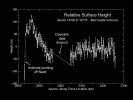
This graph, produced using preliminary altimetry data from NASA's Cassini radar instrument, shows relative surface heights on Titan. This region of Titan is remarkably flat.
PIA06989:
Topography on Titan
Full Resolution:     TIFF (154.4 kB)     JPEG (39.7 kB)
Add Image to Favorite List 2004-10-28 Titan Cassini-Huygens
Radar Mapper
2774x2048x3
This radar image of the surface of Saturn's moon Titan was acquired on October 26, 2004, when NASA's Cassini spacecraft flew over. Brighter areas may correspond to rougher terrains and darker areas are thought to be smoother.
PIA06988:
Diversity on Titan
Full Resolution:     TIFF (4.557 MB)     JPEG (970.7 kB)
Retrieve Previous Set  Jump to a Previous Set   Current Set 
 1-100   101-200 
Currently displaying images: 101 - 162 of 162