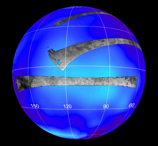
This map of Saturn's moon Titan shows the location mapped with the Cassini radar mapper using its synthetic aperture radar imaging mode on April 30, 2006.
The global map shows the areas mapped so far by radar. The top radar swath was mapped during a flyby on Oct. 26, 2004. The middle swath was taken during the Feb. 15, 2005, flyby.
Labels represent the approximate longitude. The radar swaths are superimposed on a false-color image made from observations by NASA's Hubble Space Telescope.
Cassini's radar has revealed a variety of geologic features, including impact craters, wind-blown deposits, channels and cryovolcanic features.
The Cassini-Huygens mission is a cooperative project of NASA, the European Space Agency and the Italian Space Agency. The Jet Propulsion Laboratory, a division of the California Institute of Technology in Pasadena, manages the mission for NASA's Science Mission Directorate, Washington, D.C. The Cassini orbiter was designed, developed and assembled at JPL. The radar instrument was built by JPL and the Italian Space Agency, working with team members from the United States and several European countries.
For more information about the Cassini-Huygens mission visit http://saturn.jpl.nasa.gov/home/index.cfm.