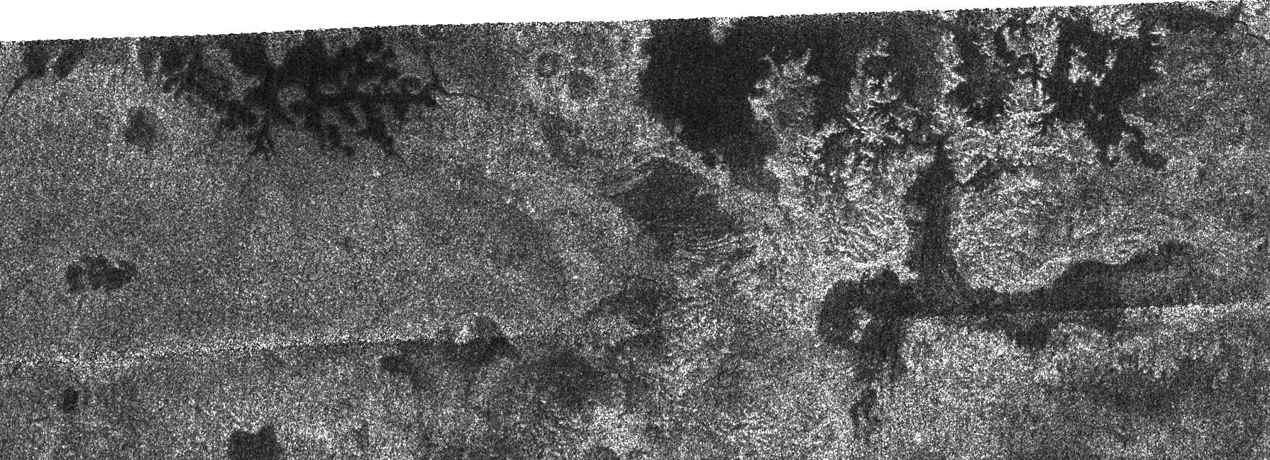
In this image taken by the Cassini radar system, a previously unseen style of lakes is revealed. The lakes here assume complex shapes and are among the darkest seen so far on Titan.
The lake at the left is reminiscent both in form and scale of the flooded drainage system, Lake Powell in Utah and Arizona. However, the Titan lake has been filled with liquid methane and ethane rather than water. In the lake at right, older terrain may have been deeply cut by river valleys before it was flooded by the embaying lake. For a different radar view from the same flyby see PIA01942.
This radar image was acquired Oct. 9, 2006, and is centered near 80 degrees north latitude, 357 degrees west longitude. It measures about 310 kilometers by 100 kilometers (190 miles by 62 miles). Smallest details in this image are about 500 meters (1,640 feet) across.
The Cassini-Huygens mission is a cooperative project of NASA, the European Space Agency and the Italian Space Agency. The Jet Propulsion Laboratory, a division of the California Institute of Technology in Pasadena, manages the mission for NASA's Science Mission Directorate, Washington, D.C. The Cassini orbiter and its two onboard cameras were designed, developed and assembled at JPL. The radar instrument team is based at JPL, working with team members from the United States and several European countries.
For more information about the Cassini-Huygens mission visit http://saturn.jpl.nasa.gov/home/index.cfm.
