Synthetic aperture radar images obtained in February 2005 show that Titan's surface is modified by fluid flows and wind-driven deposits. Previous synthetic aperture radar images have shown features that may be cryovolcanic in origin, such as long flows (see PIA06993) and linear features that may have formed by tectonic processes (see PIA06995).
The latest data argue that Titan has a young and dynamic surface that is modified by all four major geologic processes: volcanism, tectonism, erosion, and impact cratering. All surfaces of solid bodies are shaped by these four processes, and Cassini-Huygens is revealing how each has contributed to the Titan we see today.
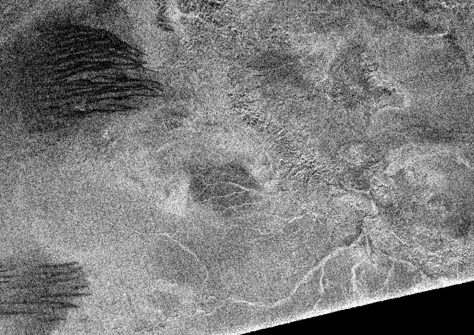
The data show a variety of surface drainage patterns that include twisting channels 1 to 2 kilometers-wide (0.6 to 1.2 miles) and up to 200-kilometers-long (124 miles). There is a well-developed drainage pattern associated with a large (450-kilometer, or 280 mile-diameter) basin that has eroded part of the basin's rim on the lower right of the image. These patters are in much larger scales than those imaged by the Huygens probe.
The most surprising new features revealed in the synthetic aperture images are dark lineated streaks, dubbed "cat scratches," which are seen in patches throughout the whole radar swath image (see PIA07009). The "scratches" are interpreted as linear/longitudinal dunes formed by wind transport. Radar images of terrestrial dunes, such as snow dunes in Antarctica, show remarkably similar patterns. Individual "scratches" are 500 meters to 1 kilometer (1,640 feet to 0.6 miles) across and spaced by 1 to 2 kilometer intervals (0.6 to 1.2-mile), straight or undulated, and oriented roughly east-west, suggesting a direction of prevalent winds.
The Cassini-Huygens mission is a cooperative project of NASA, the European Space Agency and the Italian Space Agency. The Jet Propulsion Laboratory, a division of the California Institute of Technology in Pasadena, manages the mission for NASA's Science Mission Directorate, Washington, D.C. The Cassini orbiter was designed, developed and assembled at JPL. The radar instrument team is based at JPL, working with team members from the United States and several European countries.
For more information about the Cassini-Huygens mission visit http://saturn.jpl.nasa.gov.
 Planetary Data System


