Click on an image for detailed information
Click on a column heading to sort in ascending or descending order

My
List |
Addition Date
|
Target
|
Mission
|
Instrument
|
Size
|

|
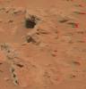
2012-08-29 |
Mars
|
Mars Science Laboratory (MSL)
|
|
1024x1024x1 |
|
-
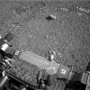
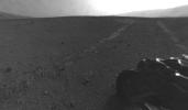
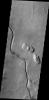
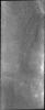
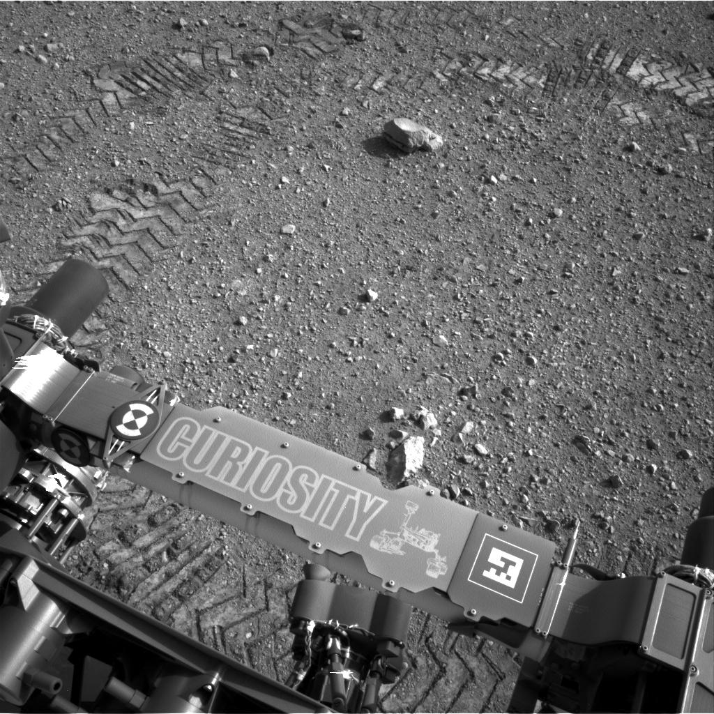
PIA16093:
-
Curiosity Leaves Its Mark
Full Resolution:
TIFF
(1.05 MB)
JPEG
(245.6 kB)
|
|
|
2012-08-29 |
Mars
|
Mars Science Laboratory (MSL)
|
|
1024x1024x1 |
|
-
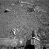
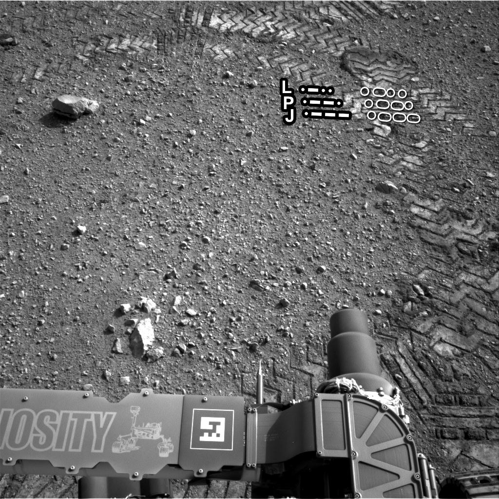
PIA16111:
-
Reading the Rover's Tracks
Full Resolution:
TIFF
(1.05 MB)
JPEG
(274.3 kB)
|
|
|
2012-08-29 |
Mars
|
Mars Science Laboratory (MSL)
|
|
1024x1024x1 |
|
-
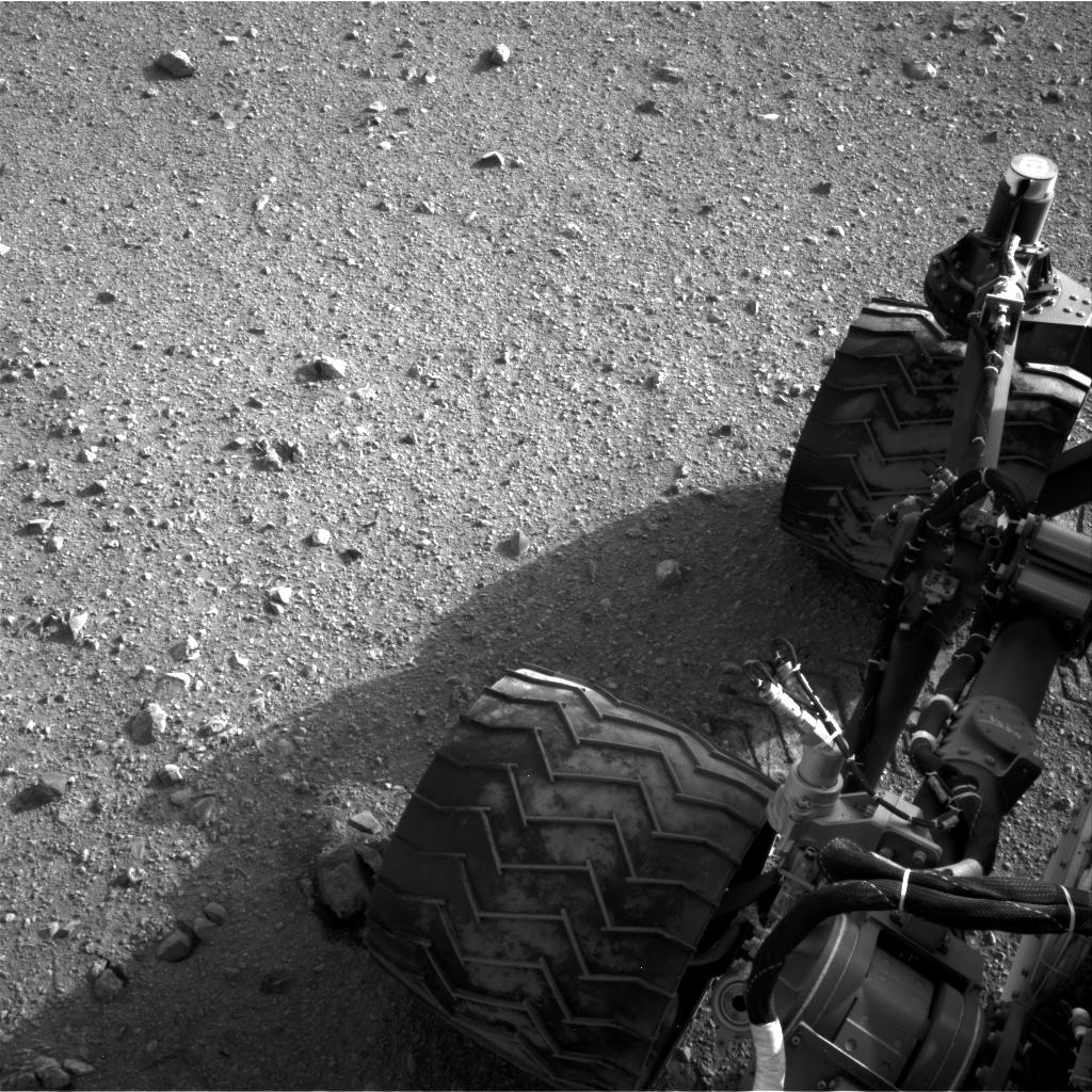
PIA16112:
-
Curiosity Tracks Its Tracks
Full Resolution:
TIFF
(1.05 MB)
JPEG
(174.8 kB)
|
|
|
2012-08-29 |
Mars
|
Mars Science Laboratory (MSL)
|
Navcam (MSL)
|
1024x1024x1 |
|
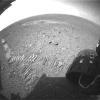
-
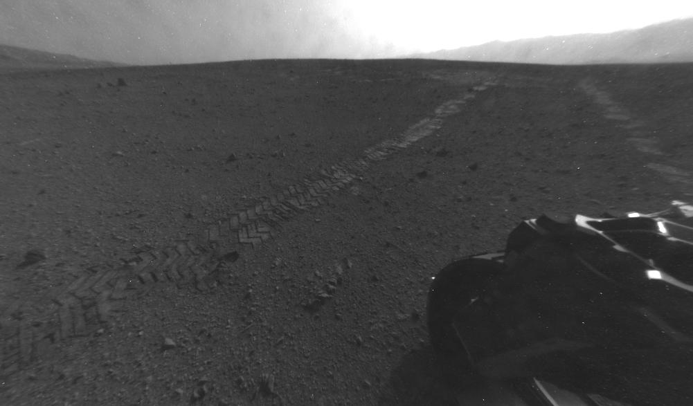
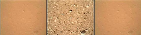
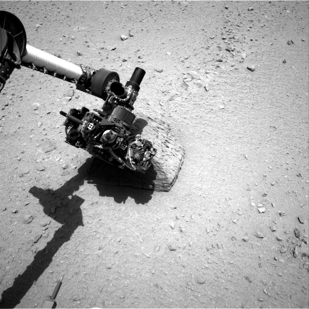
PIA15693:
-
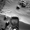
Martian Soil on Curiosity's Wheels After Sol 22 Drive
Full Resolution:
TIFF
(1.05 MB)
JPEG
(247.4 kB)
|
|
|
2012-08-29 |
Mars
|
Mars Science Laboratory (MSL)
|
Hazcam (MSL)
|
1001x587x1 |
|
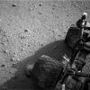
-
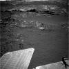
PIA15694:
-
Tracks from Eastbound Drive on Curiosity's Sol 22
Full Resolution:
TIFF
(588.4 kB)
JPEG
(49.86 kB)
|
|
|
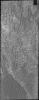
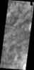
2012-08-30 |
Mars
|
2001 Mars Odyssey
|
THEMIS
|
1308x2764x1 |
|
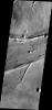
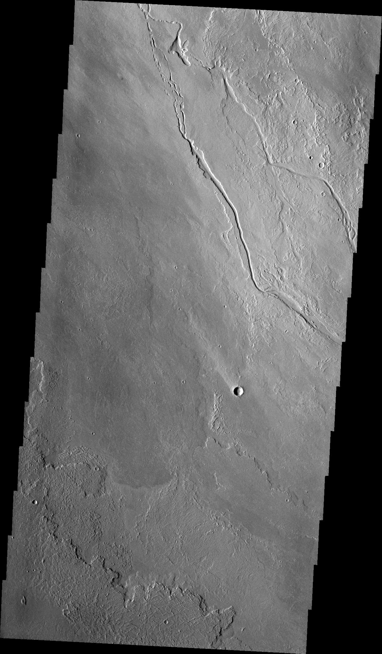
-
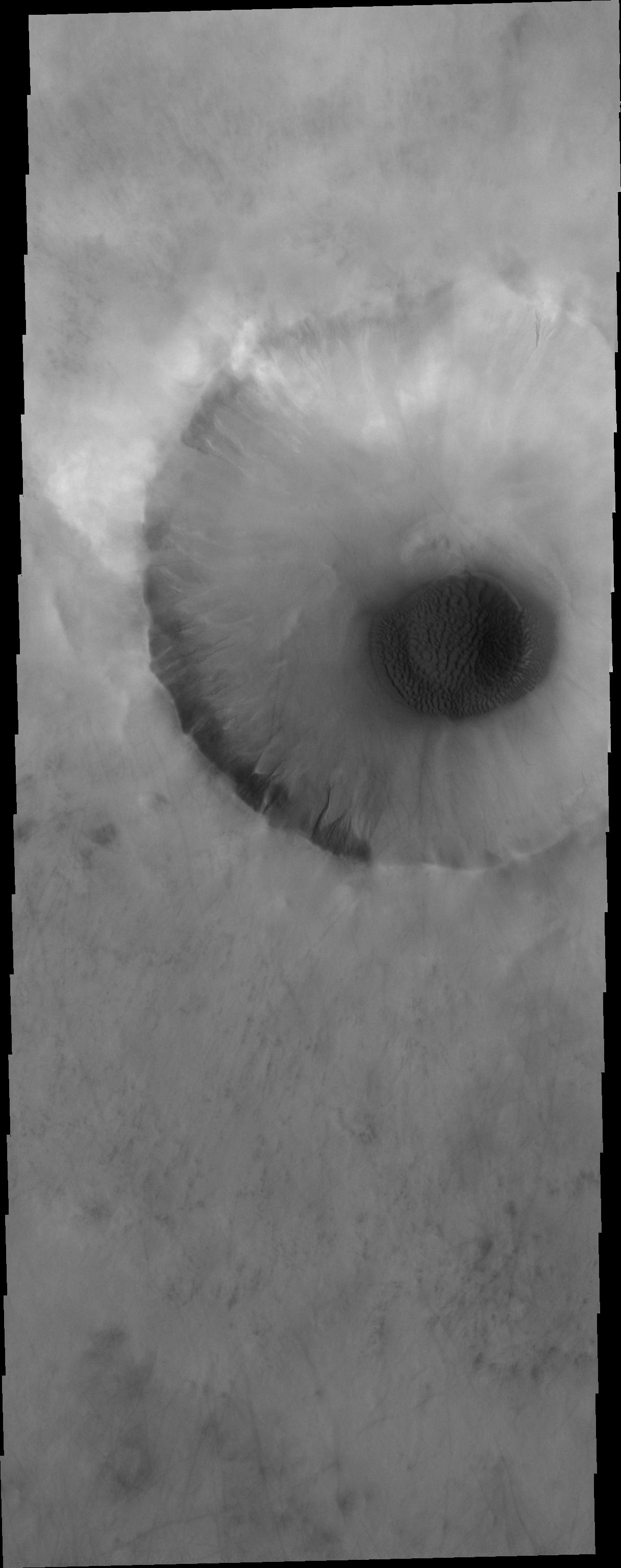
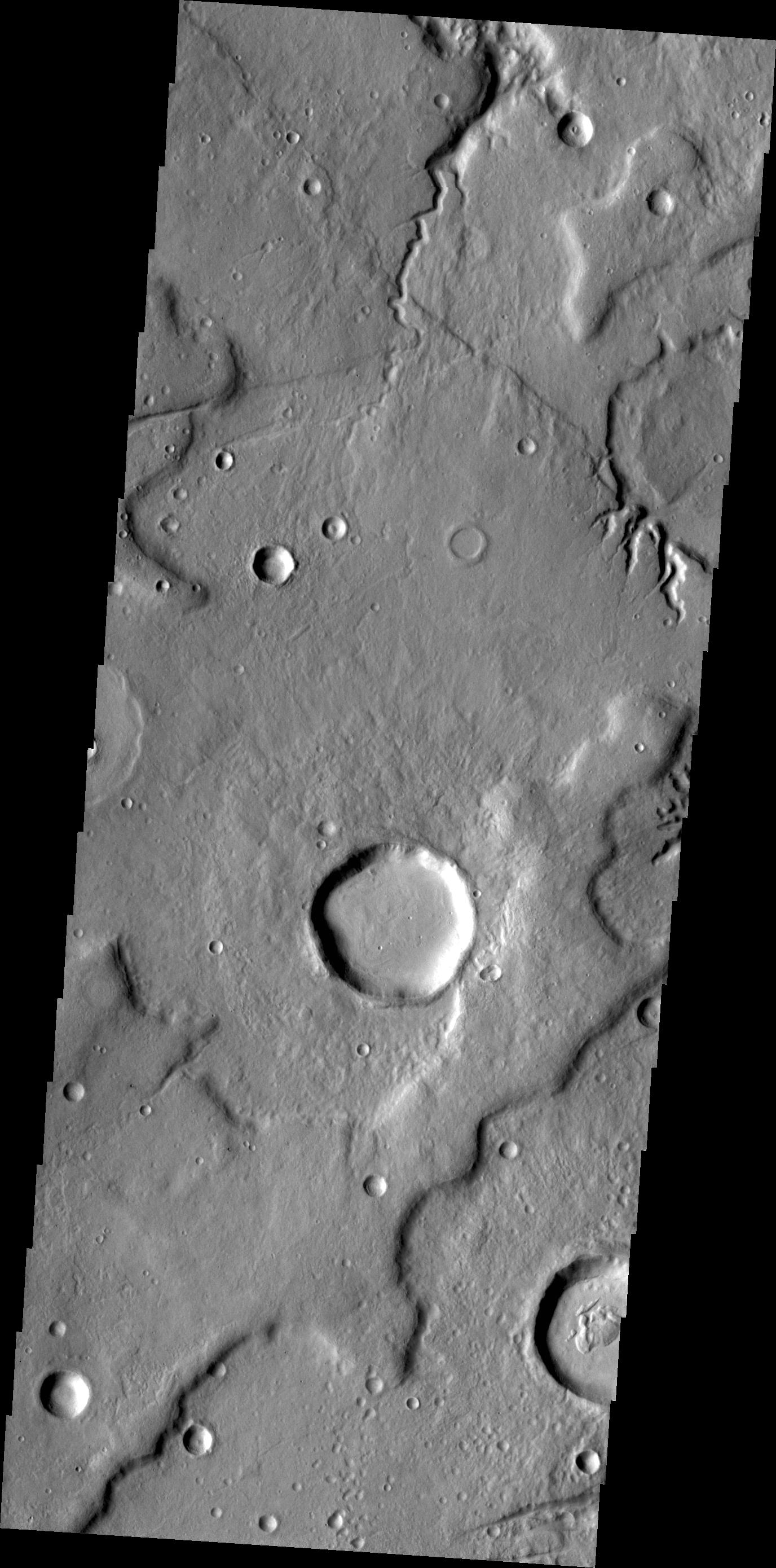
PIA15933:
-
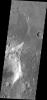
Ascraeus Mons
Full Resolution:
TIFF
(3.619 MB)
JPEG
(421.9 kB)
|
|
|
2012-08-30 |
Mars
|
Mars Science Laboratory (MSL)
|
ChemCam
|
1512x720x1 |
|
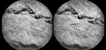
-
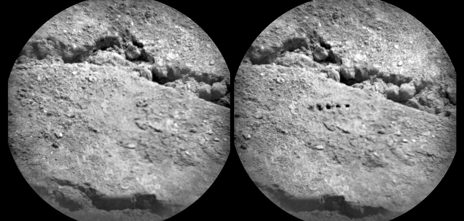
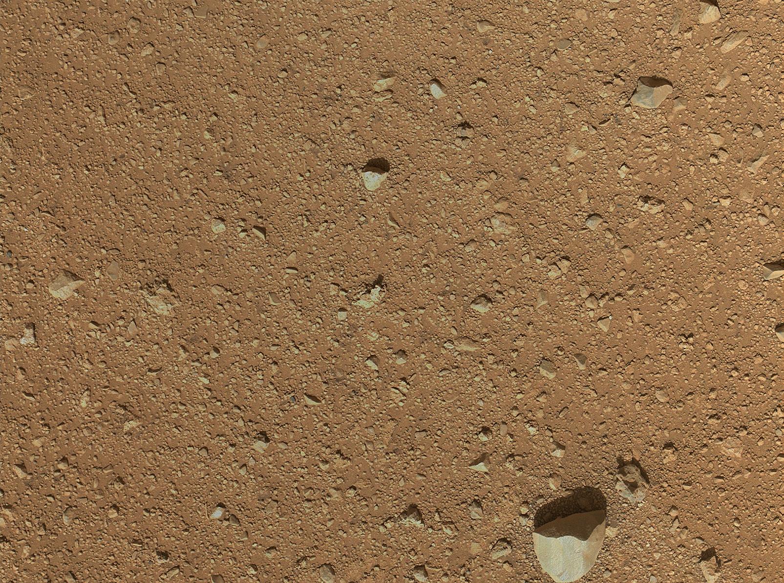
PIA15695:
-
Marks of Laser Exam on Martian Soil
Full Resolution:
TIFF
(1.09 MB)
JPEG
(156 kB)
|
|
|
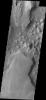
2012-08-31 |
Mars
|
2001 Mars Odyssey
|
THEMIS
|
1217x3072x1 |

|
-
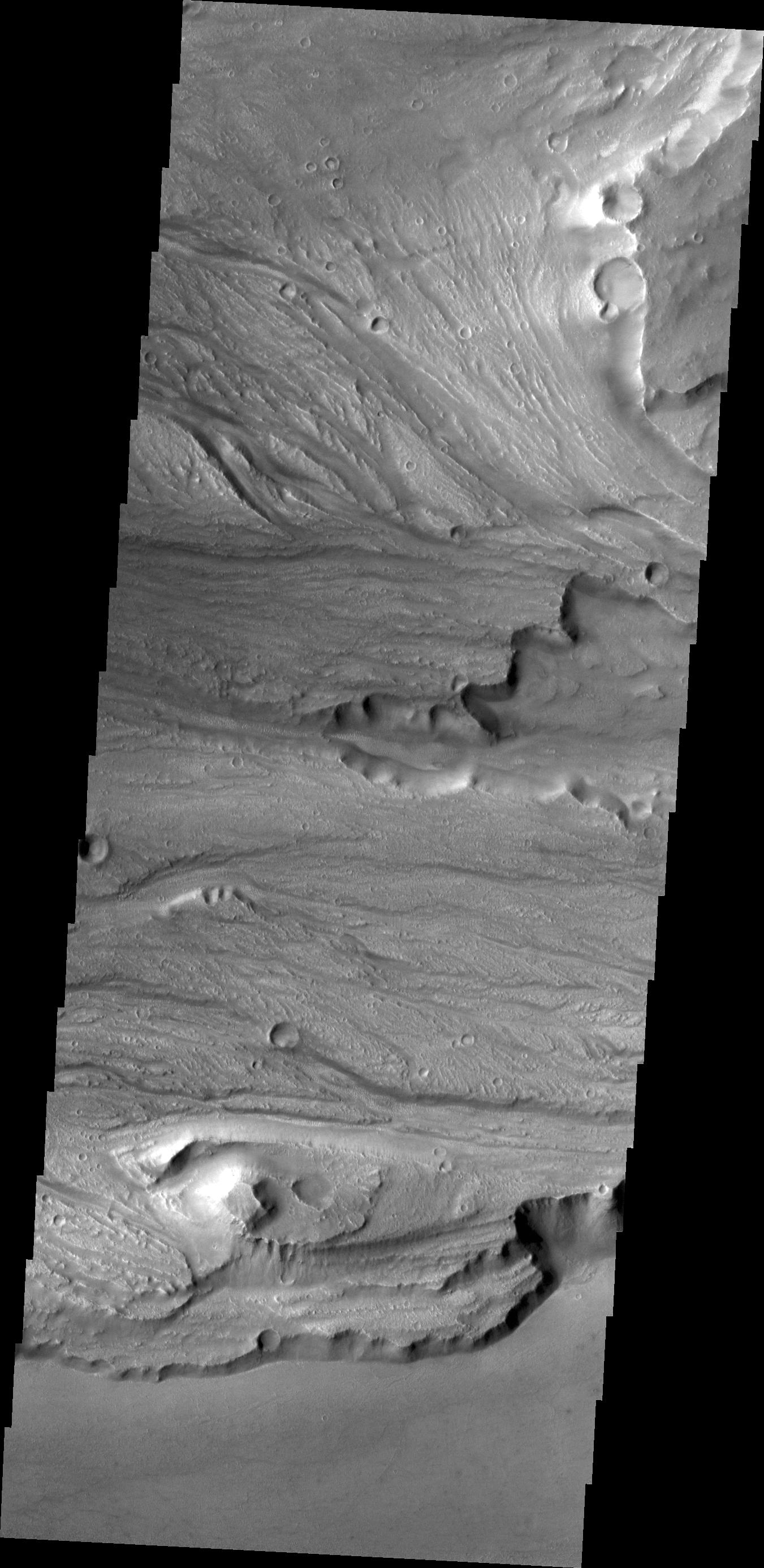
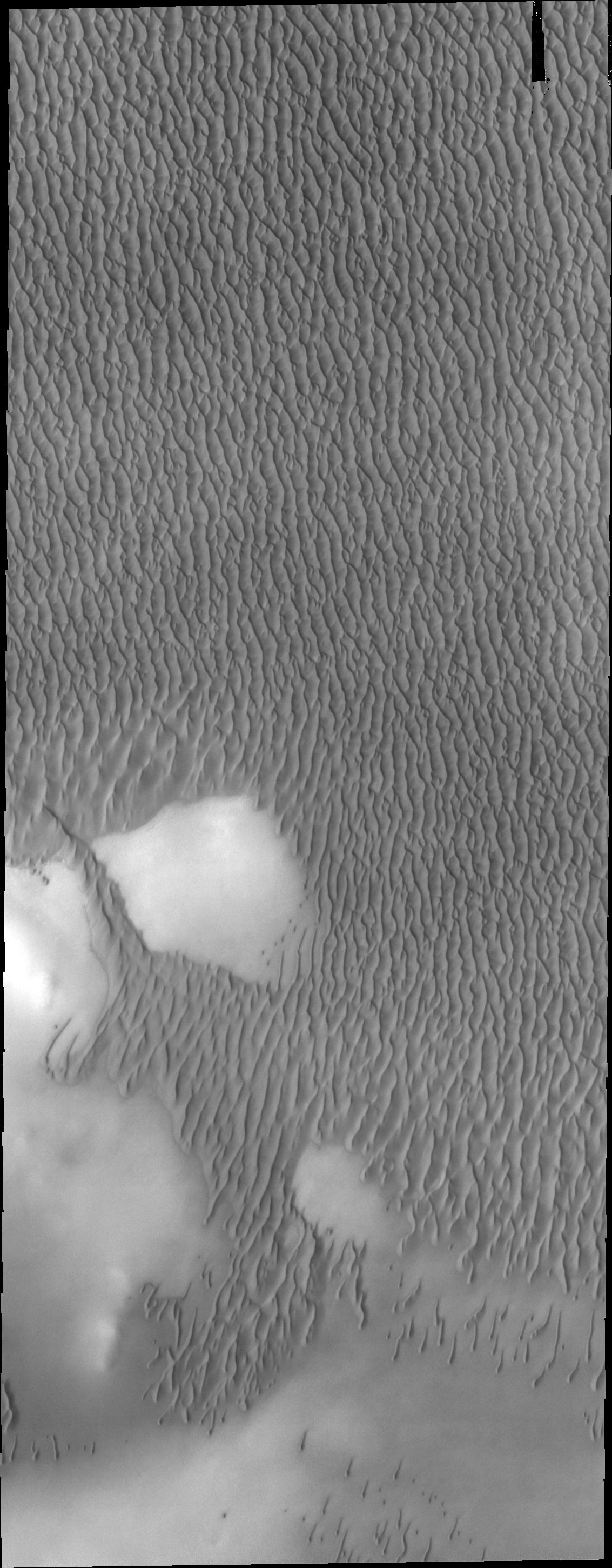
PIA15934:
-
Sand Sheet
Full Resolution:
TIFF
(3.743 MB)
JPEG
(207.8 kB)
|
|
|
2012-08-31 |
Mars
|
Mars Reconnaissance Orbiter (MRO)
Mars Science Laboratory (MSL)
|
HiRISE
|
2800x1800x1 |
|
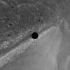
-
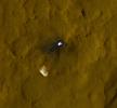
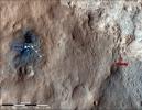
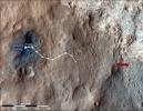
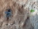
PIA15696:
-
Orbiter View of Curiosity From Nearly Straight Overhead
Full Resolution:
TIFF
(5.047 MB)
JPEG
(578.1 kB)
|
|
|
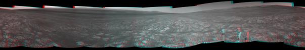
2012-08-31 |
Mars
|
Mars Science Laboratory (MSL)
|
Hazcam (MSL)
|
7703x977x1 |

|
-
PIA15697:
Looking Back at Tracks from Sol 24 Drive
Full Resolution:
TIFF
(7.534 MB)
JPEG
(1.005 MB)
|
|
|
2012-09-03 |
Mars
|
2001 Mars Odyssey
|
THEMIS
|
1347x2768x1 |
|
-
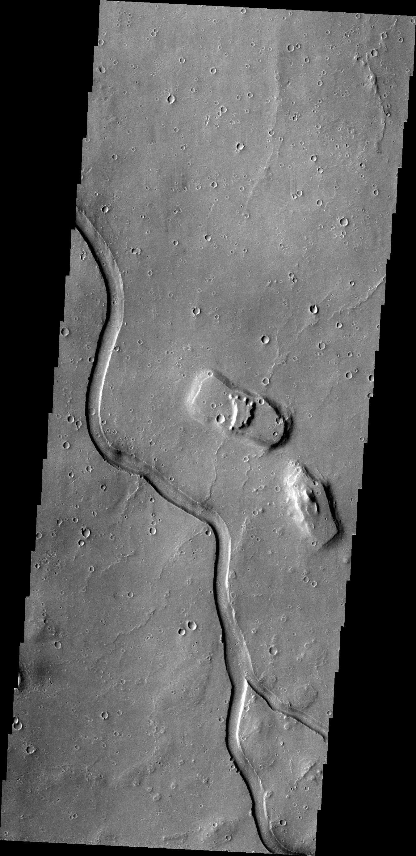
PIA15935:
-
Hebrus Valles
Full Resolution:
TIFF
(3.732 MB)
JPEG
(517 kB)
|
|
|
2012-09-04 |
Mars
|
2001 Mars Odyssey
|
THEMIS
|
1376x2779x1 |

|
-
PIA15936:
-
Channels
Full Resolution:
TIFF
(3.829 MB)
JPEG
(391.9 kB)
|
|
|
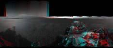
2012-09-04 |
Mars
|
Mars Science Laboratory (MSL)
|
|
7824x3337x3 |
|
-
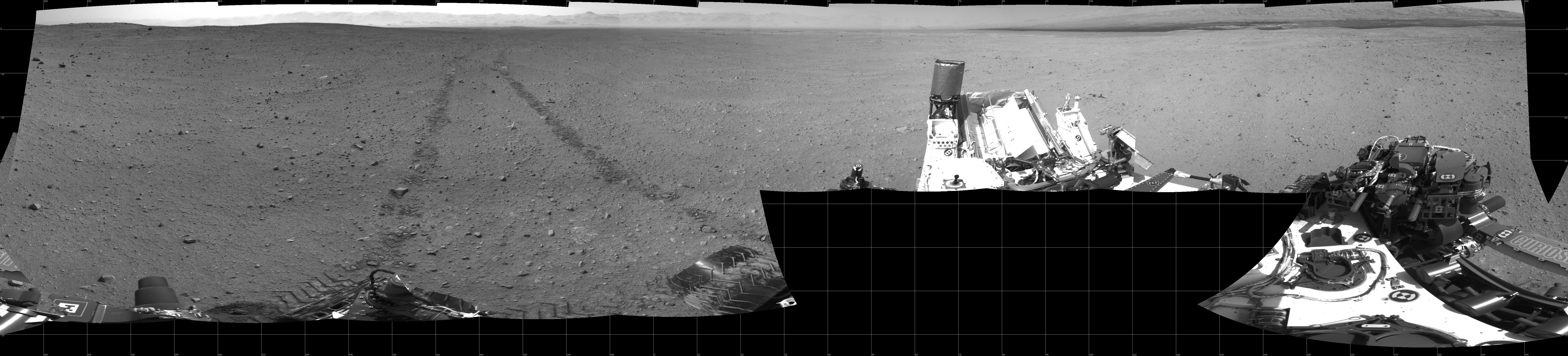
PIA16140:
-
3-D View from Bradbury Landing Site
Full Resolution:
TIFF
(78.35 MB)
JPEG
(1.916 MB)
|
|
|
2012-09-05 |
Mars
|
2001 Mars Odyssey
|
THEMIS
|
1351x2772x1 |

|
-
PIA15937:
-
Kasei Valles
Full Resolution:
TIFF
(3.749 MB)
JPEG
(373.8 kB)
|
|
|
2012-09-06 |
Mars
|
2001 Mars Odyssey
|
THEMIS
|
1140x2920x1 |

|
-
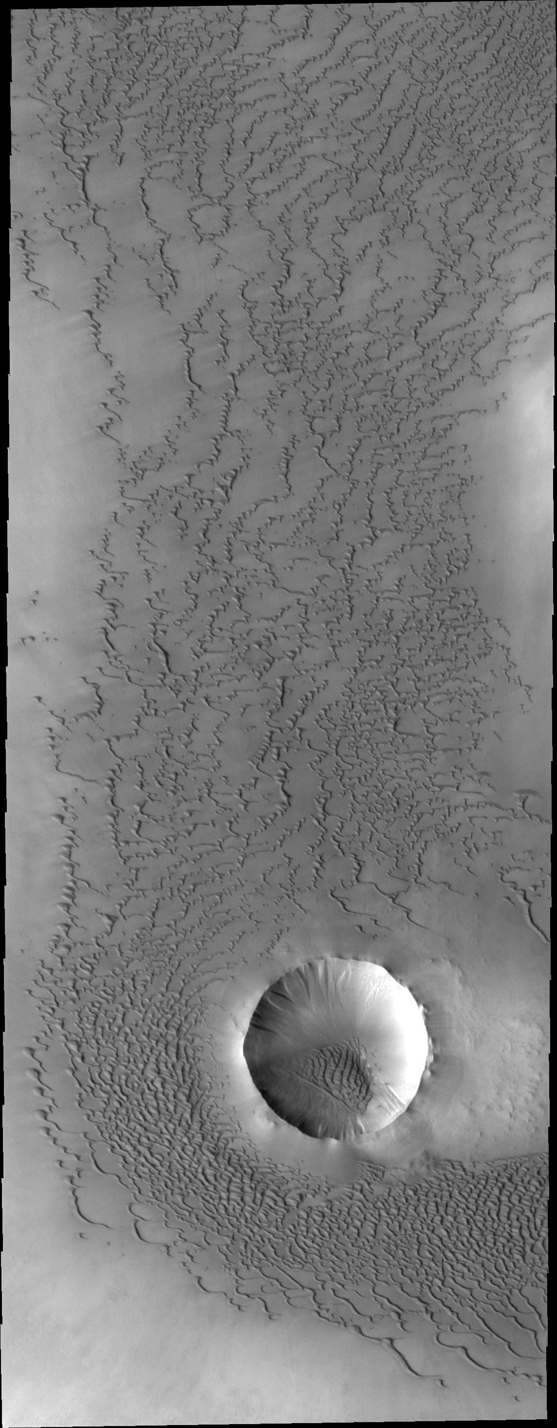
PIA15938:
-
Abalos Undae
Full Resolution:
TIFF
(3.332 MB)
JPEG
(371.2 kB)
|
|
|
2012-09-06 |
Mars
|
Mars Science Laboratory (MSL)
|
Navcam (MSL)
|
7703x1749x1 |

|
-
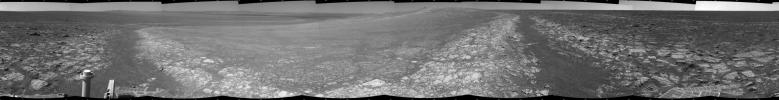
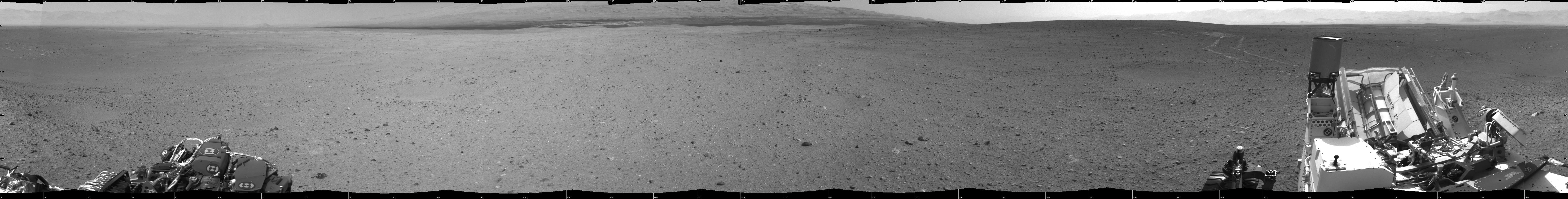
PIA15698:
Curiosity's Location During Arm Checkouts
Full Resolution:
TIFF
(13.49 MB)
JPEG
(1.578 MB)
|
|
|
2012-09-06 |
Mars
|
Mars Science Laboratory (MSL)
|
MAHLI
Mastcam
|
1347x1200x3 |
|
-
PIA15699:
-
Camera on Curiosity's Arm as Seen by Camera on Mast
Full Resolution:
TIFF
(4.851 MB)
JPEG
(136.8 kB)
|
|
|
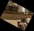
2012-09-06 |
Mars
|
Mars Science Laboratory (MSL)
|
HiRISE
|
574x643x3 |
|
-
PIA16141:
-
A Rover's Journey Begins
Full Resolution:
TIFF
(1.108 MB)
JPEG
(51.17 kB)
|
|
|
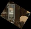
2012-09-06 |
Mars
|
Mars Science Laboratory (MSL)
|
HiRISE
|
579x538x3 |
|
-
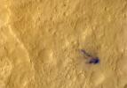
PIA16142:
-
Relics of Rover's Landing
Full Resolution:
TIFF
(935 kB)
JPEG
(34.81 kB)
|
|
|
2012-09-06 |
Mars
|
Mars Science Laboratory (MSL)
|
HiRISE
|
2055x1437x3 |
|
-
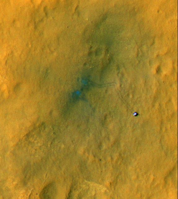
PIA16143:
-
Dissecting the Scene of Sky Crane Crash
Full Resolution:
TIFF
(8.863 MB)
JPEG
(454.9 kB)
|
|
|
2012-09-06 |
Mars
|
Mars Science Laboratory (MSL)
|
|
1438x933x3 |
|
-
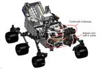
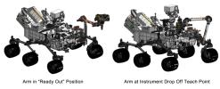
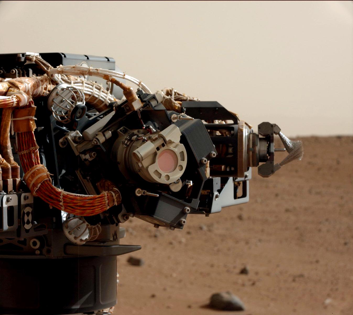
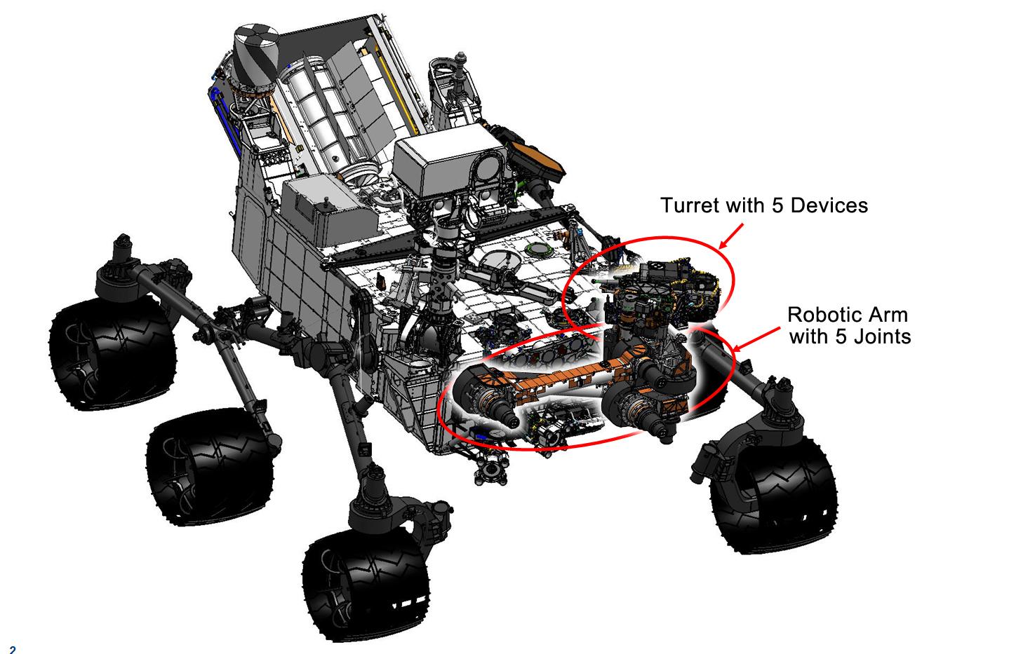
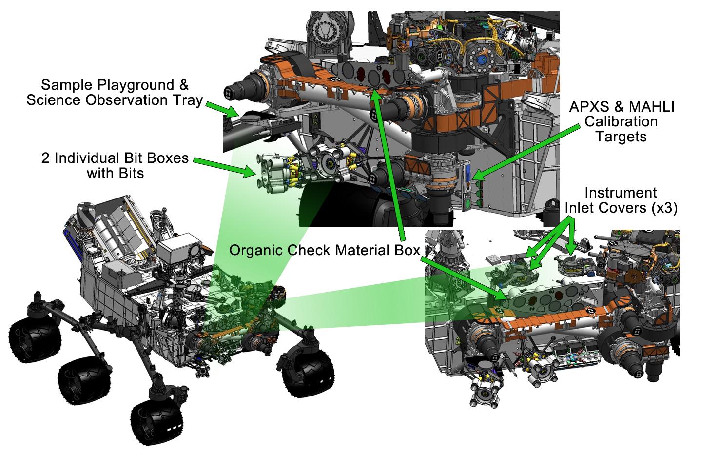
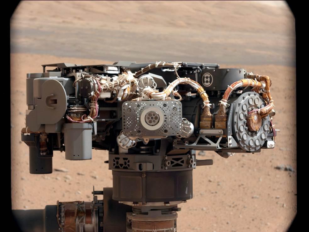
PIA16144:
-
Curiosity's Robotic Arm
Full Resolution:
TIFF
(4.027 MB)
JPEG
(169 kB)
|
|
|
2012-09-06 |
Mars
|
Mars Science Laboratory (MSL)
|
|
1438x933x3 |

|
-
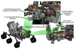
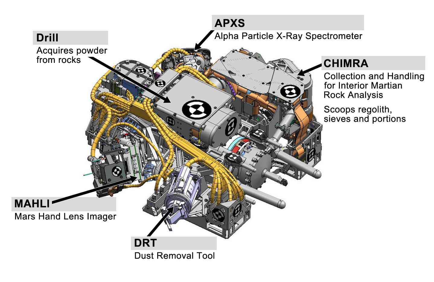
PIA16145:
-
Tools at Curiosity's 'Fingertips'
Full Resolution:
TIFF
(4.027 MB)
JPEG
(192.1 kB)
|
|
|
2012-09-06 |
Mars
|
Mars Science Laboratory (MSL)
|
|
1438x933x3 |
|
-
PIA16146:
-
Curiosity's Work Bench
Full Resolution:
TIFF
(4.027 MB)
JPEG
(223.4 kB)
|
|
|
2012-09-06 |
Mars
|
Mars Science Laboratory (MSL)
|
|
1427x578x3 |
|
-
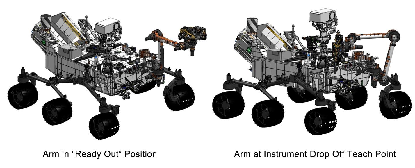
PIA16147:
-
Flexing Curiosity's Arm
Full Resolution:
TIFF
(2.476 MB)
JPEG
(116.9 kB)
|
|
|
2012-09-06 |
Mars
|
Mars Science Laboratory (MSL)
|
HiRISE
|
3300x2550x3 |
|
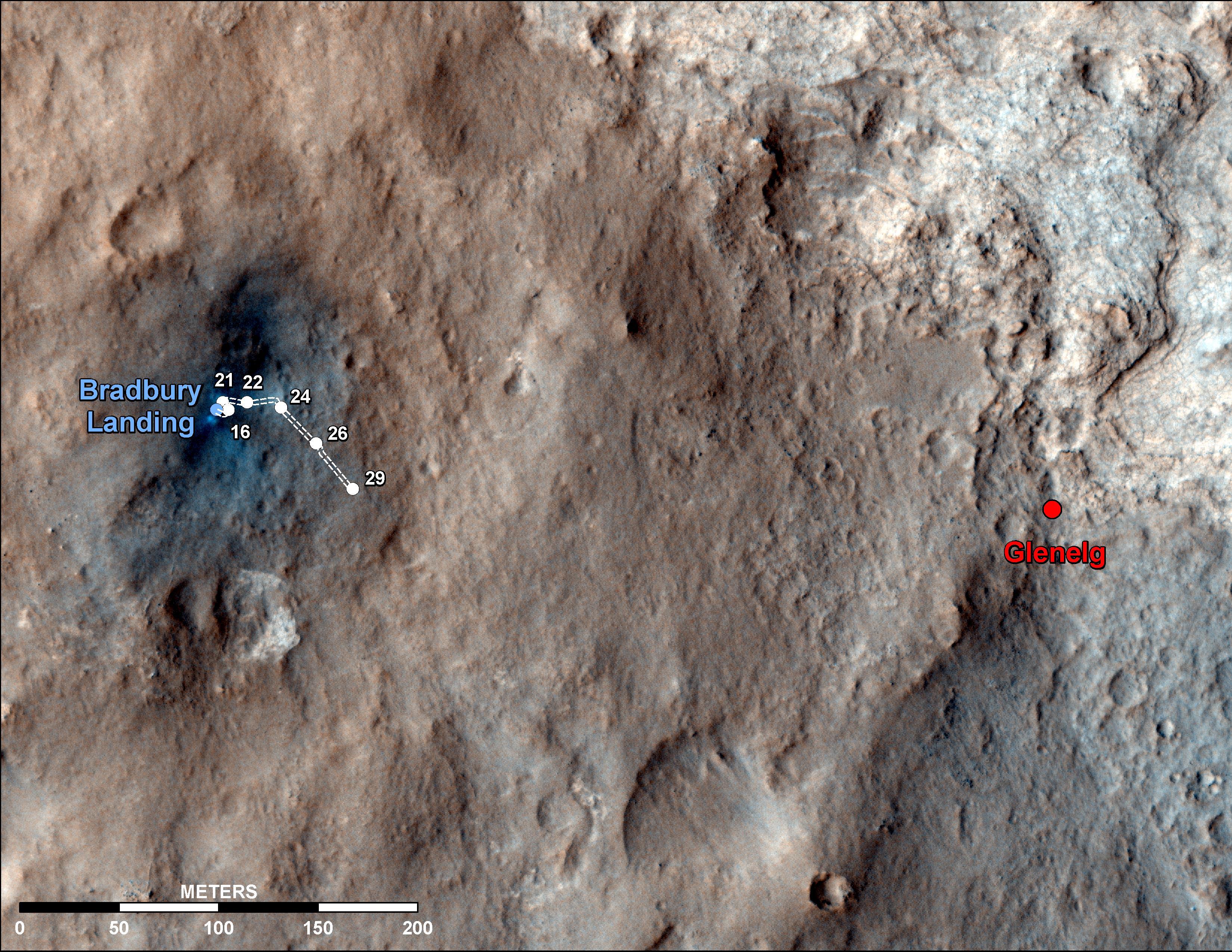
-
PIA16148:
-
Curiosity Traverse Map Through Sol 29
Full Resolution:
TIFF
(25.26 MB)
JPEG
(1.558 MB)
|
|
|
2012-09-07 |
Mars
|
2001 Mars Odyssey
|
THEMIS
|
1380x2776x1 |
|
-
PIA15939:
-
Hrad Vallis
Full Resolution:
TIFF
(3.836 MB)
JPEG
(494.1 kB)
|
|
|
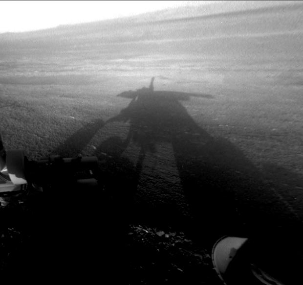
2012-09-07 |
Mars
|
Mars Exploration Rover (MER)
|
Hazcam
|
620x582x1 |
|
-
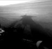
PIA16120:
-
Shadow Self-Portrait by Opportunity at Endeavour Crater
Full Resolution:
TIFF
(361.4 kB)
JPEG
(27.52 kB)
|
|
|
2012-09-07 |
Mars
|
Mars Exploration Rover (MER)
|
Navigation Camera
|
1024x1024x1 |
|
-
PIA16121:
-
Outcrop Beckoning Opportunity, Sol 3057
Full Resolution:
TIFF
(1.05 MB)
JPEG
(218.8 kB)
|
|
|
2012-09-07 |
Mars
|
Mars Exploration Rover (MER)
|
Navigation Camera
|
7688x987x1 |
|
-
PIA16122:
Opportunity's Surroundings on 3,000th Sol
Full Resolution:
TIFF
(7.596 MB)
JPEG
(1.148 MB)
|
|
|
2012-09-07 |
Mars
|
Mars Exploration Rover (MER)
|
Navigation Camera
|
7753x1152x3 |

|
-
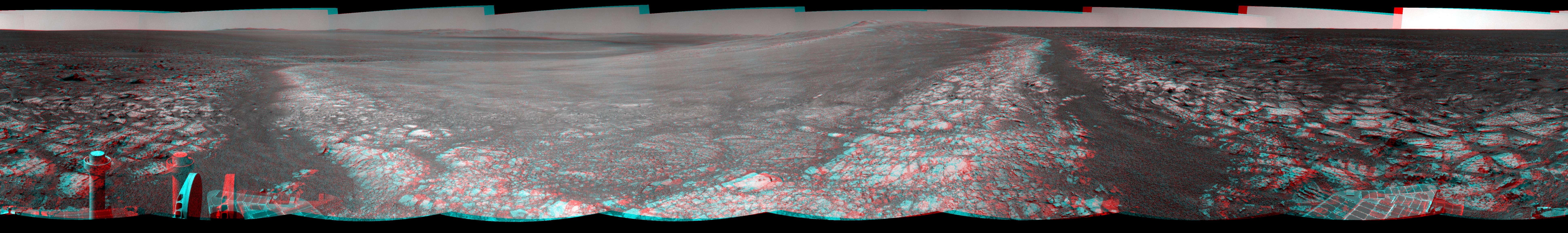
PIA16123:
Opportunity's Surroundings on 3,000th Sol, in 3-D
Full Resolution:
TIFF
(26.8 MB)
JPEG
(1.421 MB)
|
|
|
2012-09-07 |
Mars
|
Mars Exploration Rover (MER)
|
Navigation Camera
|
4111x4111x1 |

|
-
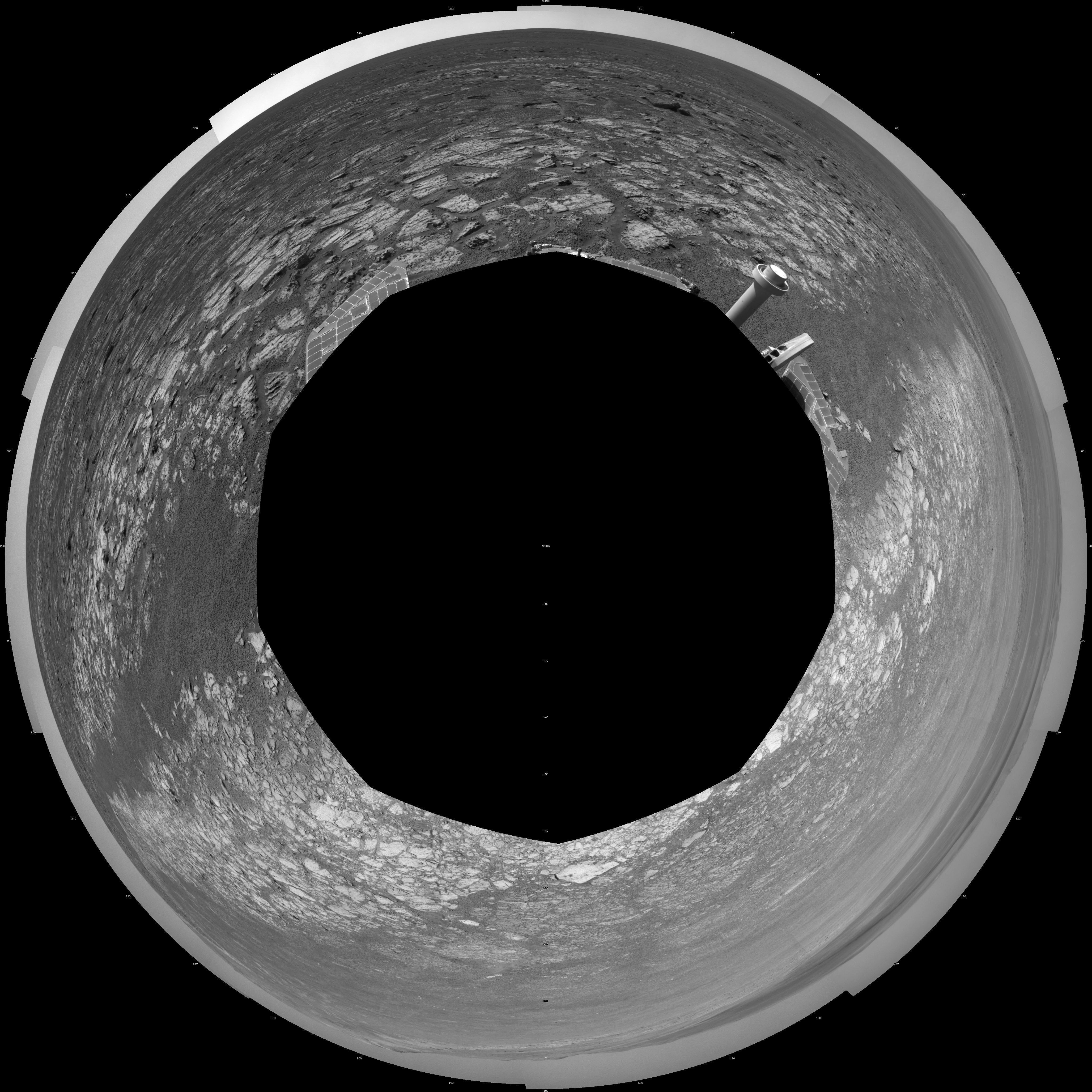
PIA16124:
-
Opportunity's Surroundings on 3,000th Sol, Polar Projection
Full Resolution:
TIFF
(16.93 MB)
JPEG
(1.518 MB)
|
|
|
2012-09-07 |
Mars
|
Mars Exploration Rover (MER)
|
Navigation Camera
|
4000x4000x1 |
|
-
PIA16125:
-
Opportunity's Surroundings on 3,000th Sol, Vertical Projection
Full Resolution:
TIFF
(16.02 MB)
JPEG
(1.55 MB)
|
|
|
2012-09-07 |
Mars
|
Mars Exploration Rover (MER)
|
Panoramic Camera
|
2979x624x3 |
|
-
PIA16126:
Opportunity Eyes Rock Fins on Cape York, Sol 3058 (Stereo)
Full Resolution:
TIFF
(5.579 MB)
JPEG
(297.1 kB)
|
|
|
2012-09-07 |
Mars
|
Mars Exploration Rover (MER)
|
Panoramic Camera
|
2979x624x3 |
|
-
PIA16127:
Opportunity Eyes Rock Fins on Cape York, Sol 3058 (False Color)
Full Resolution:
TIFF
(5.579 MB)
JPEG
(302.9 kB)
|
|
|
2012-09-07 |
Mars
|
Mars Exploration Rover (MER)
|
Panoramic Camera
|
2979x624x3 |

|
-
PIA16128:
Opportunity Eyes Rock Fins on Cape York, Sol 3058
Full Resolution:
TIFF
(5.579 MB)
JPEG
(233.9 kB)
|
|
|
2012-09-08 |
Mars
|
Mars Science Laboratory (MSL)
|
MAHLI
|
2025x1877x3 |
|
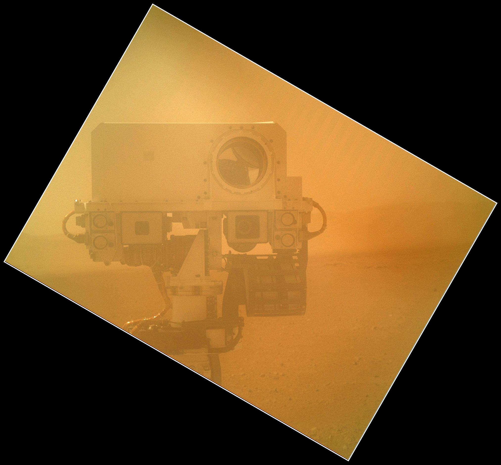
-
PIA16149:
-
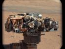
Rover Takes Self Portrait
Full Resolution:
TIFF
(11.41 MB)
JPEG
(268.4 kB)
|
|
|
2012-09-09 |
Mars
|
Mars Science Laboratory (MSL)
|
MAHLI
|
573x144x3 |
|
-
PIA16129:
Martian Ground Seen by Arm Camera With and Without Dust Cover (Thumbnails)
Full Resolution:
TIFF
(247.8 kB)
JPEG
(13.73 kB)
|
|
|
2012-09-09 |
Mars
|
Mars Science Laboratory (MSL)
|
MAHLI
|
1605x1193x3 |
|
-
PIA16130:
-
First Image From Curiosity's Arm Camera With Dust Cover Open
Full Resolution:
TIFF
(5.746 MB)
JPEG
(624.3 kB)
|
|
|
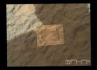
2012-09-10 |
Mars
|
Mars Science Laboratory (MSL)
|
MAHLI
|
1987x1839x3 |
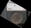
|
-
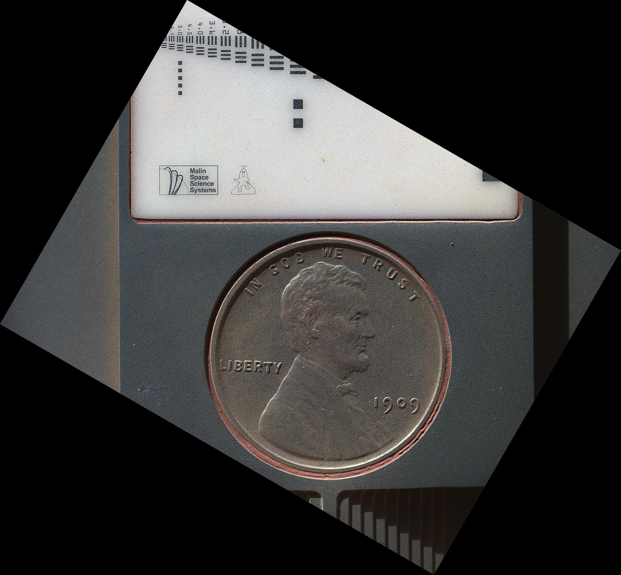
PIA16131:
-
Lincoln Penny on Mars in Camera's Calibration Target
Full Resolution:
TIFF
(10.97 MB)
JPEG
(430.3 kB)
|
|
|
2012-09-10 |
Mars
|
Mars Science Laboratory (MSL)
|
MAHLI
|
1991x1852x3 |
|
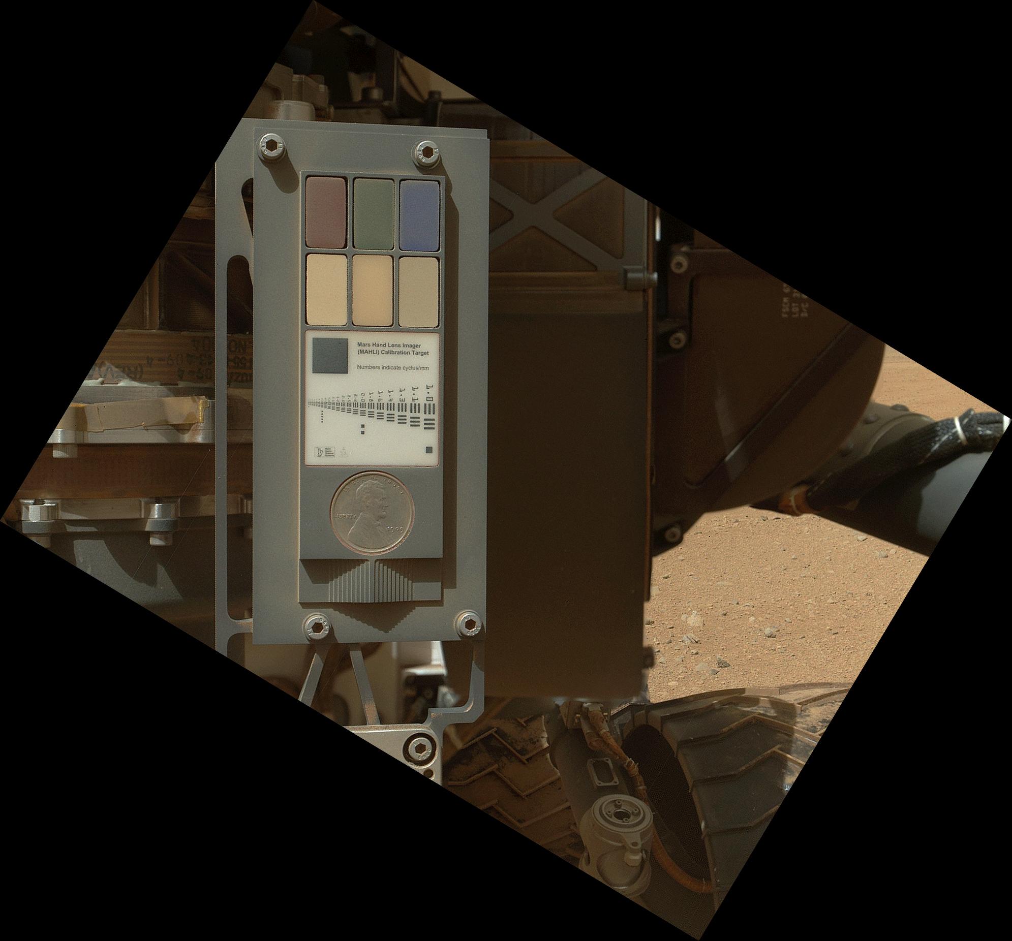
-
PIA16132:
-
Calibration Target for Curiosity's Arm Camera
Full Resolution:
TIFF
(11.07 MB)
JPEG
(266.1 kB)
|
|
|
2012-09-10 |
Mars
|
Mars Science Laboratory (MSL)
|
Hazcam (MSL)
MAHLI
|
-1x-1x3 |
|
-
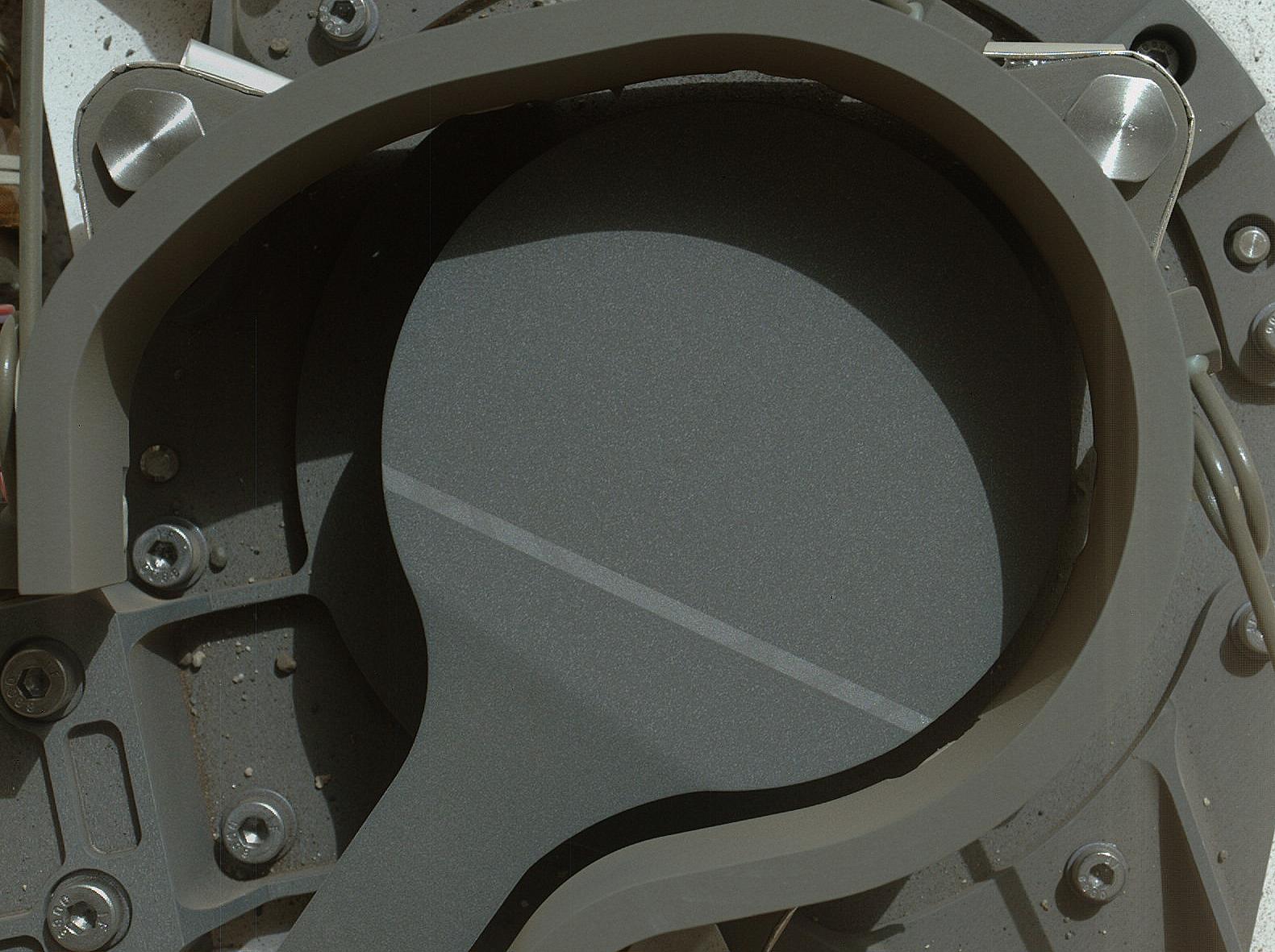
PIA16133:
-
Belly Check for Curiosity
Full Resolution:
TIFF
(10.76 MB)
JPEG
(237.4 kB)
|
|
|
2012-09-10 |
Mars
|
Mars Science Laboratory (MSL)
|
MAHLI
|
2949x1981x3 |
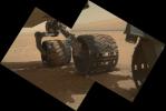
|
-
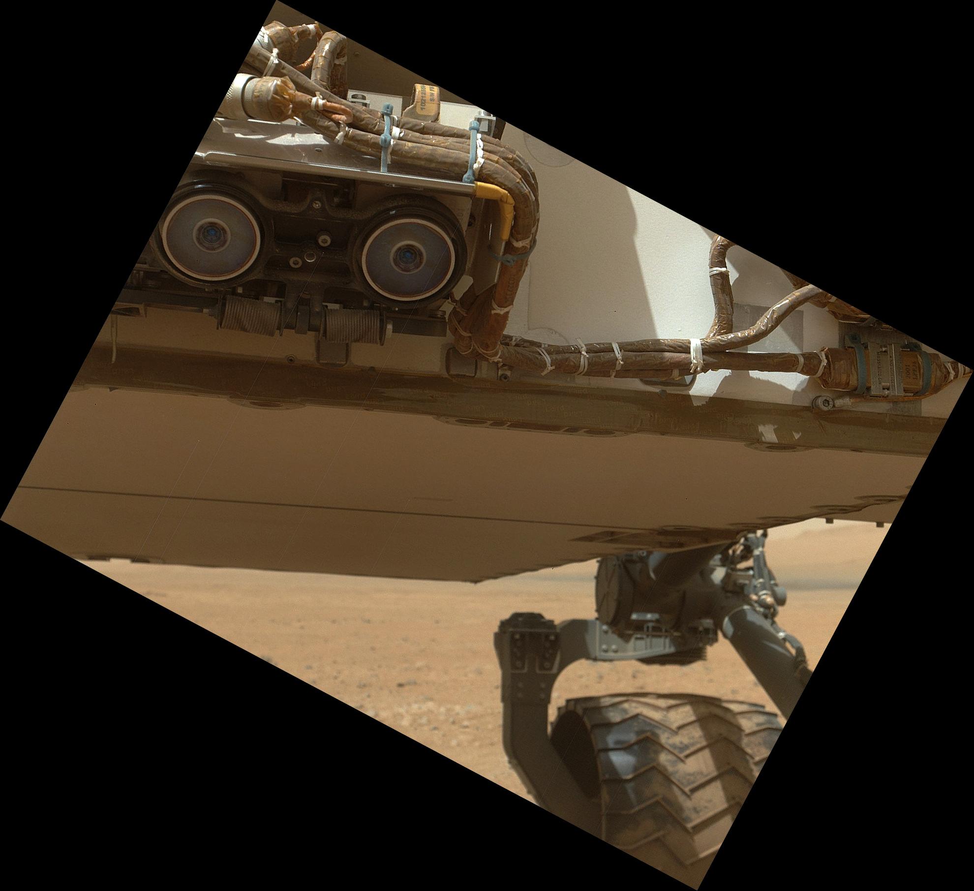
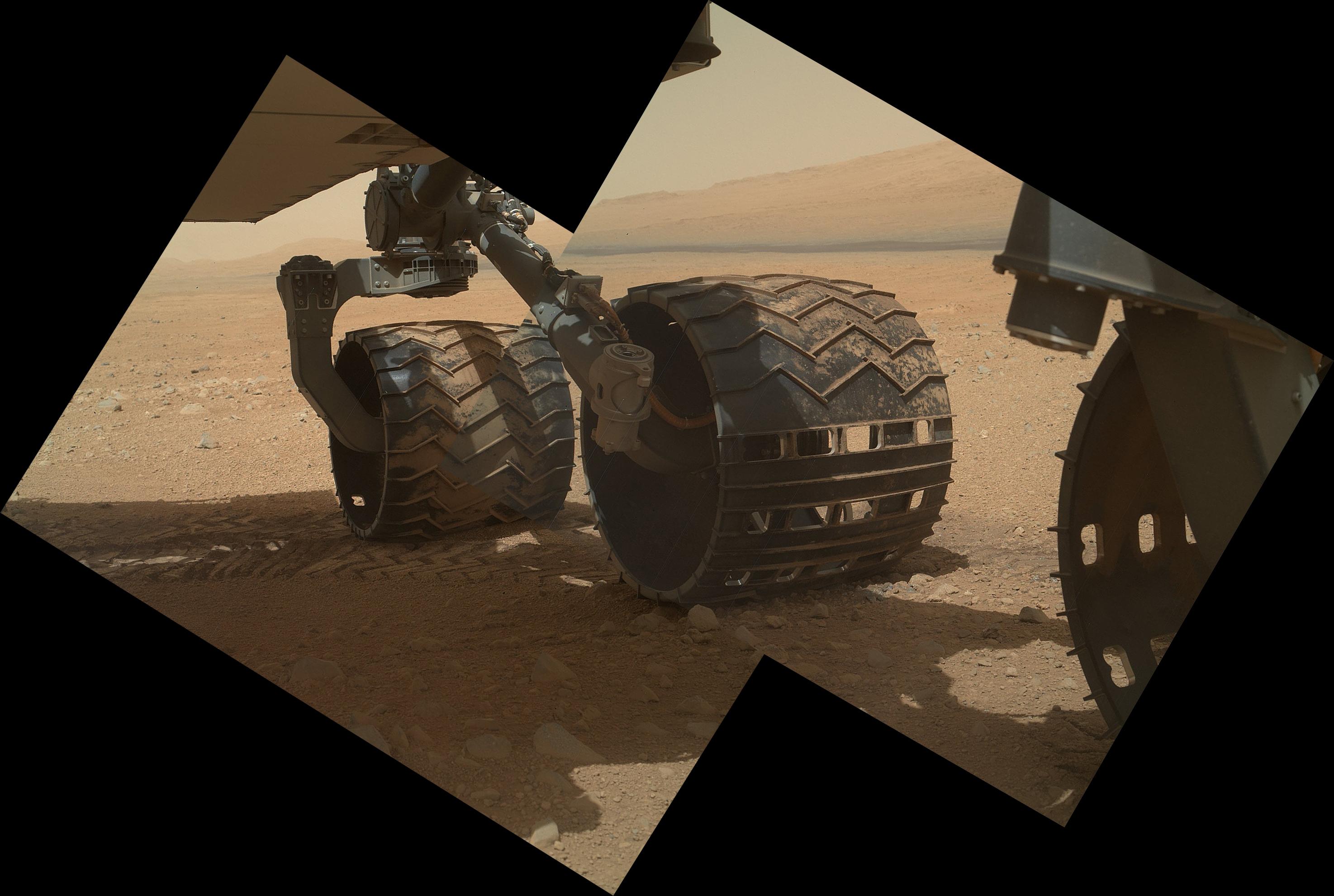
PIA16134:
-
Wheels and a Destination
Full Resolution:
TIFF
(17.53 MB)
JPEG
(453.3 kB)
|
|
|
2012-09-10 |
Mars
|
2001 Mars Odyssey
|
THEMIS
|
1449x2950x1 |
|
-
PIA15940:
-
Dust Devil Tracks
Full Resolution:
TIFF
(4.279 MB)
JPEG
(315.7 kB)
|
|
|
2012-09-10 |
Mars
|
Mars Science Laboratory (MSL)
|
MAHLI
|
1988x1839x3 |
|
-
PIA16135:
-
Sealed Organic Check Material on Curiosity
Full Resolution:
TIFF
(10.97 MB)
JPEG
(235.8 kB)
|
|
|
2012-09-10 |
Mars
|
Mars Science Laboratory (MSL)
|
MAHLI
|
2023x1876x3 |
|
-
PIA16136:
-
A Piece of New Mexico on Mars
Full Resolution:
TIFF
(11.39 MB)
JPEG
(408.7 kB)
|
|
|
2012-09-10 |
Mars
|
Mars Science Laboratory (MSL)
|
MAHLI
|
5768x2624x3 |
|
-
PIA16137:
-
Panorama of Curiosity's Belly Check
Full Resolution:
TIFF
(45.43 MB)
JPEG
(934.1 kB)
|
|
|
2012-09-11 |
Mars
|
2001 Mars Odyssey
|
THEMIS
|
1382x2920x1 |
|
-
PIA15941:
-
Channels
Full Resolution:
TIFF
(4.04 MB)
JPEG
(274.7 kB)
|
|
|
2012-09-11 |
Mars
|
Mars Reconnaissance Orbiter (MRO)
|
MCS
|
1095x1018x3 |

|
-
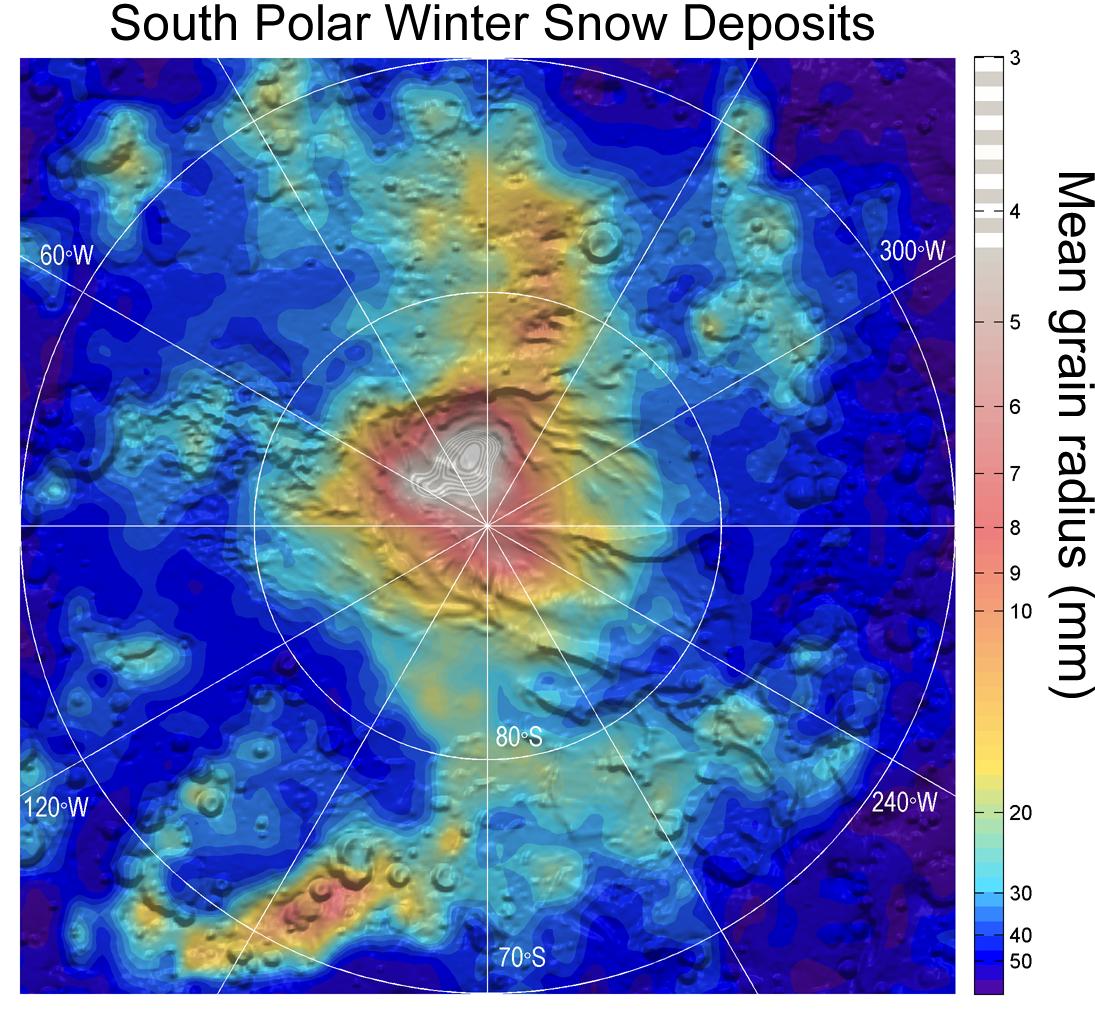
PIA16138:
-
Carbon-Dioxide Snowfall on Mars
Full Resolution:
TIFF
(3.346 MB)
JPEG
(184.6 kB)
|
|
|
2012-09-12 |
Mars
|
2001 Mars Odyssey
|
THEMIS
|
1387x2923x1 |

|
-
PIA15942:
-
Channels
Full Resolution:
TIFF
(4.059 MB)
JPEG
(569.8 kB)
|
|
|
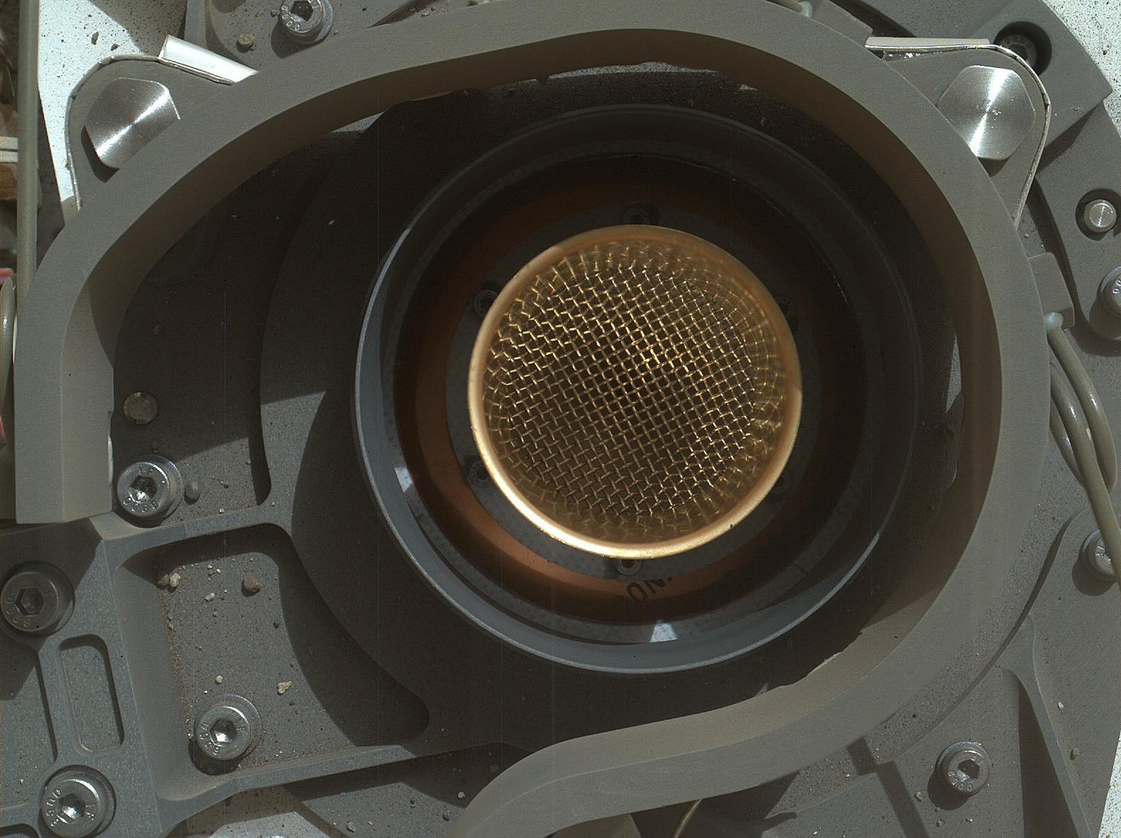
2012-09-12 |
Mars
|
Mars Science Laboratory (MSL)
|
Alpha Particle X-ray Spectrometer (MSL)
Mastcam
|
983x738x3 |

|
-
PIA16160:
-
Portrait of APXS on Mars
Full Resolution:
TIFF
(2.177 MB)
JPEG
(82.27 kB)
|
|
|
2012-09-12 |
Mars
|
Mars Science Laboratory (MSL)
|
MAHLI
Mastcam
|
917x688x3 |
|
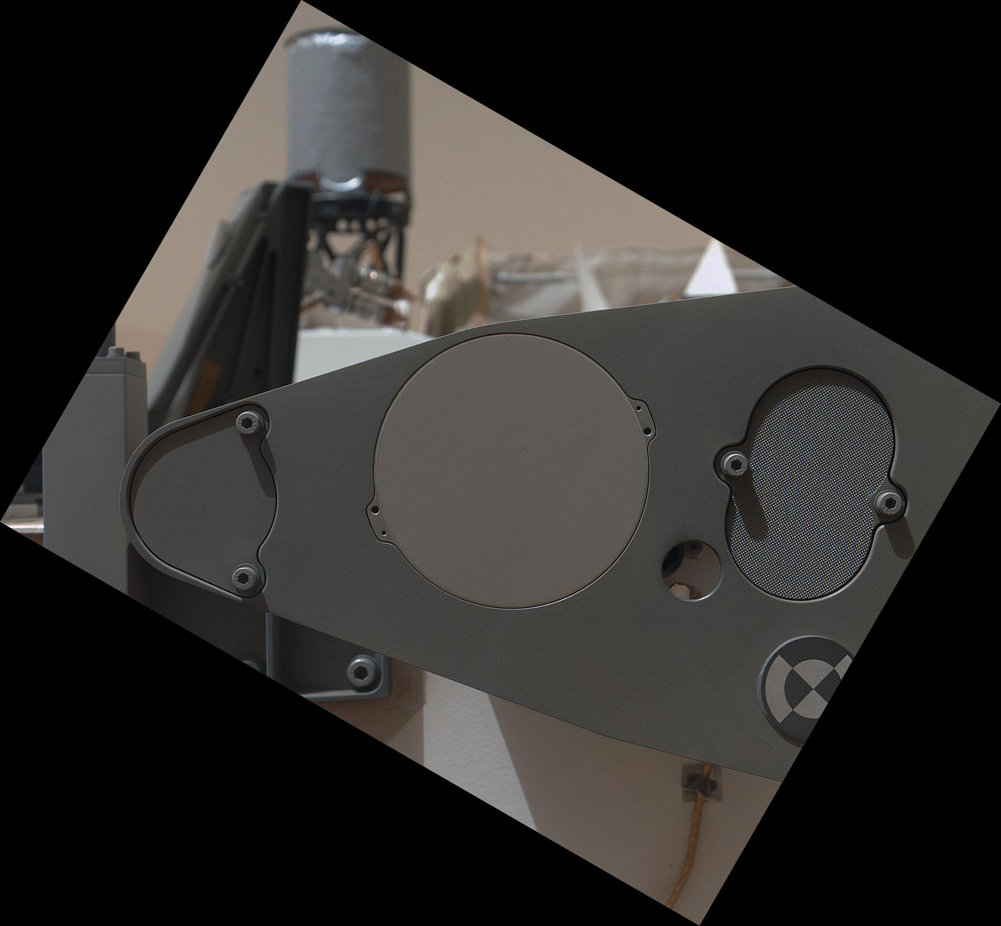
-
PIA16161:
-
Hello, MAHLI
Full Resolution:
TIFF
(1.894 MB)
JPEG
(70.73 kB)
|
|
|
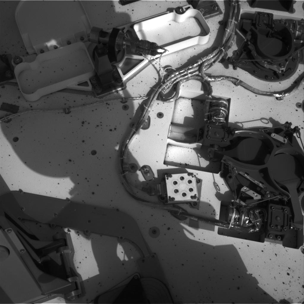
2012-09-12 |
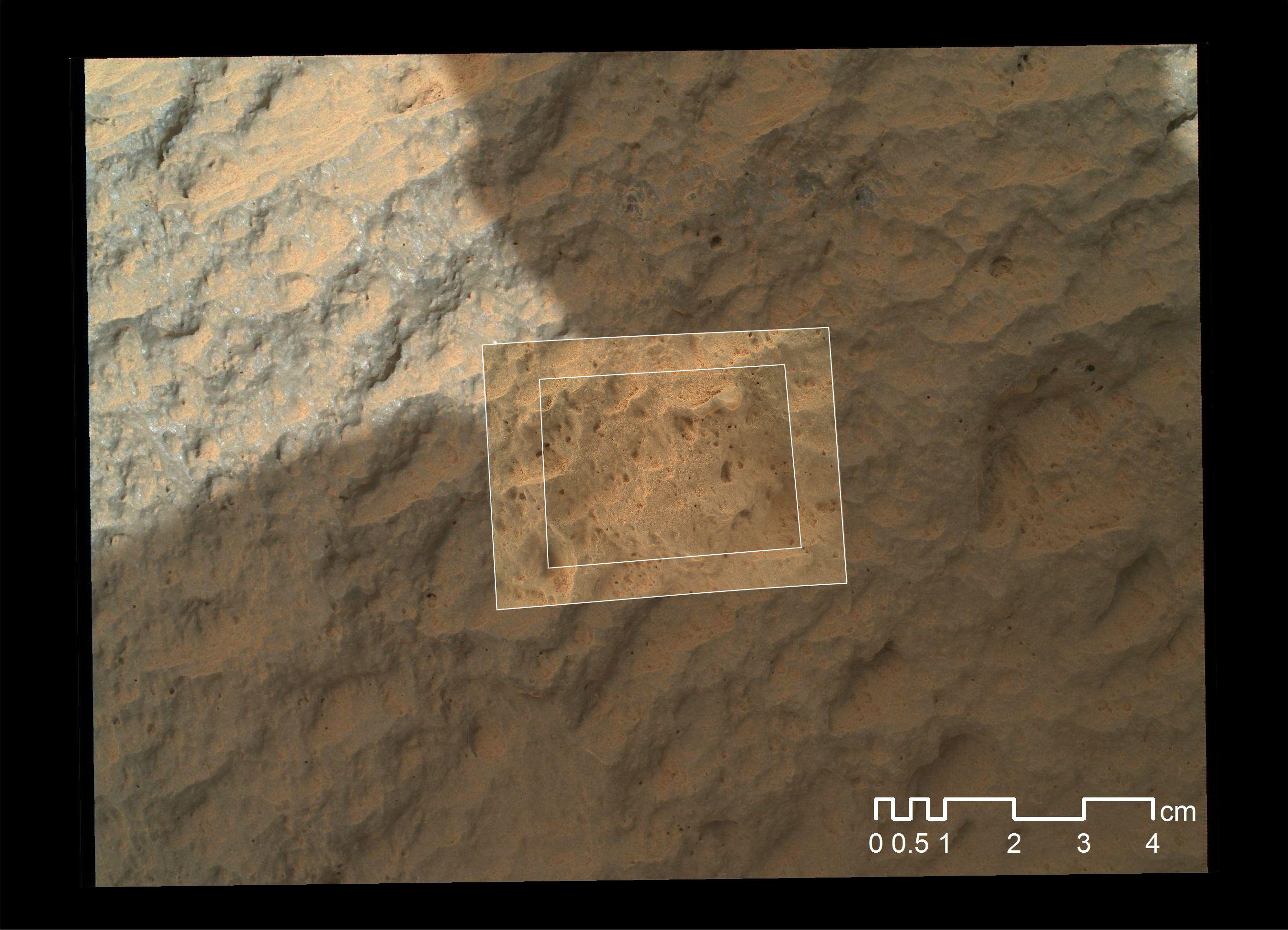
Mars
|
Mars Science Laboratory (MSL)
|
CheMin
MAHLI
|
1581x1181x3 |
|
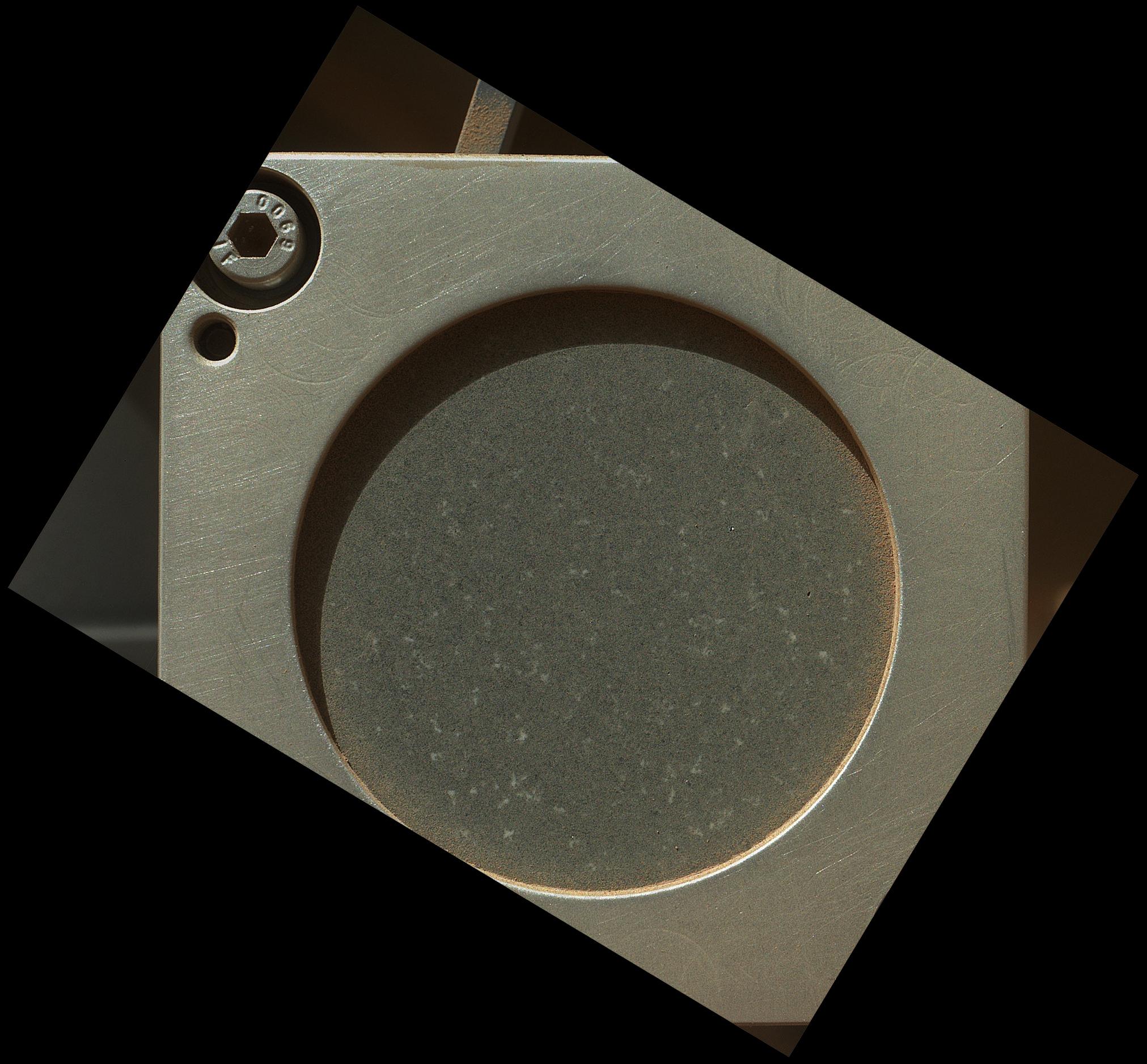
-
PIA16162:
-
Getting Ready for Sampling on Mars
Full Resolution:
TIFF
(5.604 MB)
JPEG
(228.8 kB)
|
|
|
2012-09-12 |
Mars
|
Mars Science Laboratory (MSL)
|
CheMin
MAHLI
|
1581x1181x3 |
|
-
PIA16163:
-
Say 'Ahh' on Mars
Full Resolution:
TIFF
(5.604 MB)
JPEG
(242.9 kB)
|
|
|
2012-09-12 |
Mars
|
Mars Science Laboratory (MSL)
|
Navcam (MSL)
|
1024x1024x1 |

|
-
PIA16164:
-
Opening and Closing SAM

Full Resolution:
TIFF
(1.05 MB)
JPEG
(101.4 kB)
|
|
|
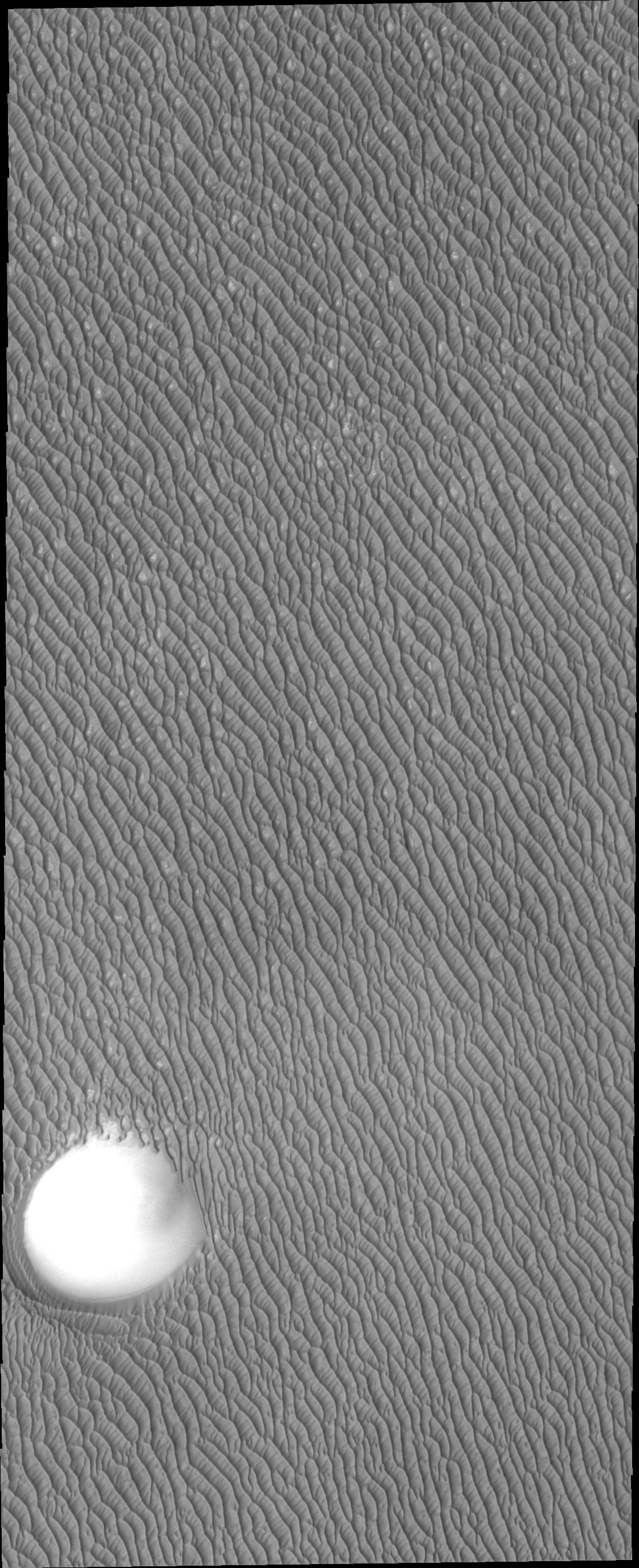
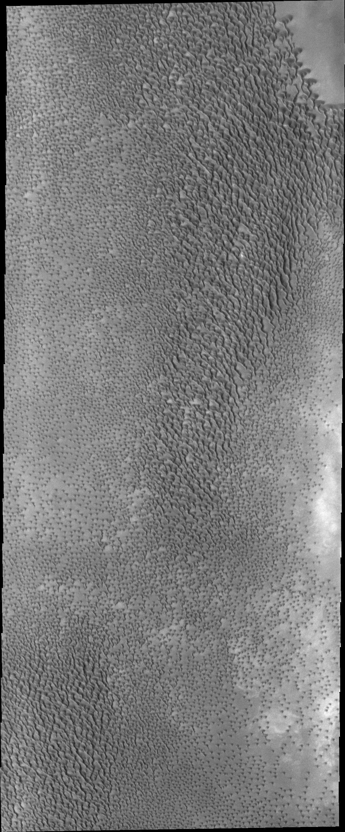
2012-09-13 |
Mars
|
2001 Mars Odyssey
|
THEMIS
|
1121x2749x1 |
|
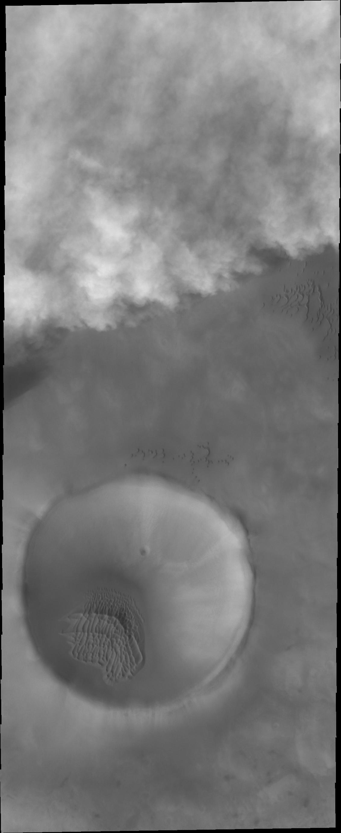
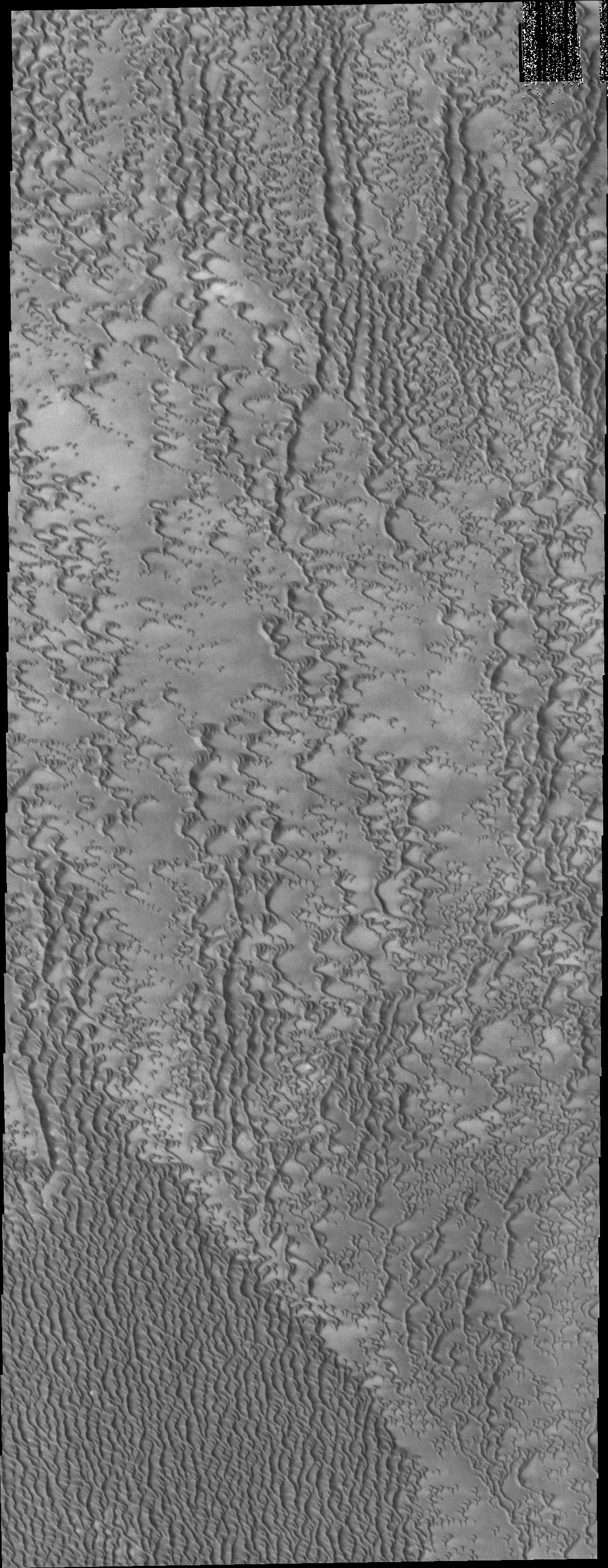
-
PIA15943:
-
North Polar Dunes
Full Resolution:
TIFF
(3.085 MB)
JPEG
(428.3 kB)
|
|
|
2012-09-13 |
Mars
|
Mars Science Laboratory (MSL)
|
MAHLI
|
1096x1200x3 |
|
-
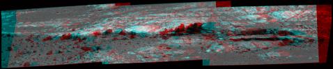
PIA15879:
-
3-D View of MAHLI Calibration Target
Full Resolution:
TIFF
(3.947 MB)
JPEG
(191.8 kB)
|
|
|
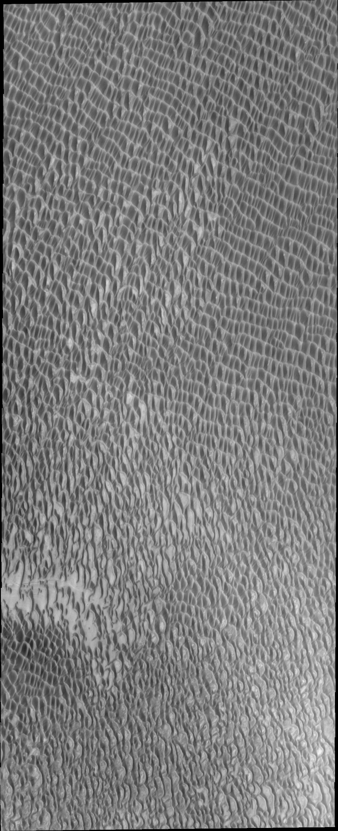
2012-09-14 |
Mars
|
2001 Mars Odyssey
|
THEMIS
|
1117x2741x1 |
|
-
PIA15944:
-
More Polar Dunes
Full Resolution:
TIFF
(3.065 MB)
JPEG
(424.3 kB)
|
|
|
2012-09-14 |
Mars
|
Mars Exploration Rover (MER)
|
Microscopic Imager
|
1809x1856x1 |
|
-
PIA16139:
-
Puzzling Little Martian Spheres That Don't Taste Like 'Blueberries'
Full Resolution:
TIFF
(3.361 MB)
JPEG
(607 kB)
|
|
|
2012-09-17 |
Mars
|
2001 Mars Odyssey
|
THEMIS
|
1128x2759x1 |
|
-
PIA15945:
-
North Polar Dunes
Full Resolution:
TIFF
(3.116 MB)
JPEG
(244.1 kB)
|
|
|
2012-09-18 |
Mars
|
2001 Mars Odyssey
|
THEMIS
|
1352x2776x1 |
|
-
PIA15946:
-
Channels
Full Resolution:
TIFF
(3.757 MB)
JPEG
(392.9 kB)
|
|
|
2012-09-19 |
Mars
|
2001 Mars Odyssey
|
THEMIS
|
1347x2920x1 |

|
-
PIA15947:
-
Landslide
Full Resolution:
TIFF
(3.937 MB)
JPEG
(224 kB)
|
|
|
2012-09-19 |
Mars
|
Mars Science Laboratory (MSL)
|
Mastcam
|
3823x2333x3 |
|
-
PIA16150:
-
Dark Bands Run Through Light Layers
Full Resolution:
TIFF
(26.77 MB)
JPEG
(613.9 kB)
|
|
|
2012-09-19 |
Mars
|
Mars Science Laboratory (MSL)
|
Mastcam
|
570x570x1 |
|
-
PIA16151:
-
Phobos in Transit
Full Resolution:
TIFF
(325.4 kB)
JPEG
(6.434 kB)
|
|
|
2012-09-19 |
Mars
|
Mars Science Laboratory (MSL)
|
Mastcam
|
1090x545x1 |

|
-
PIA16152:
-
Comparing Phobos Views
Full Resolution:
TIFF
(594.9 kB)
JPEG
(16.81 kB)
|
|
|
2012-09-19 |
Mars
|
Mars Reconnaissance Orbiter (MRO)
Mars Science Laboratory (MSL)
|
HiRISE
|
3300x2550x3 |
|
-
PIA16153:
-
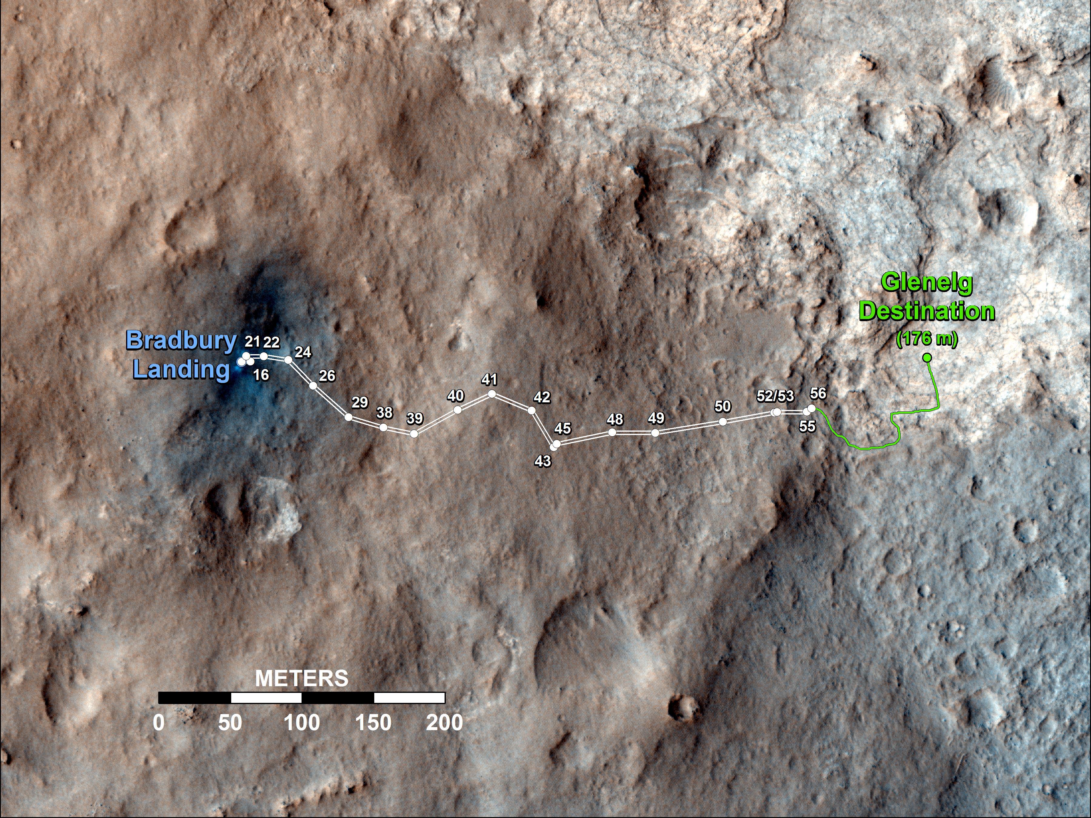
Curiosity Traverse Map Through Sol 43
Full Resolution:
TIFF
(25.26 MB)
JPEG
(1.57 MB)
|
|
|
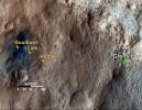
2012-09-19 |
Mars
|
Mars Science Laboratory (MSL)
|
Mastcam
|
11909x3375x3 |
|
-
PIA16154:
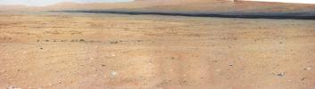
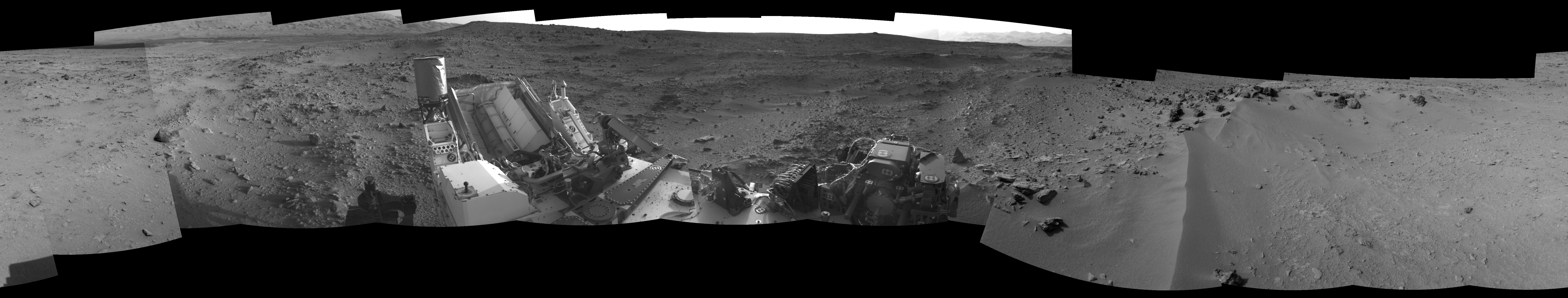
On the Road to Glenelg
Full Resolution:
TIFF
(120.6 MB)
JPEG
(5.589 MB)
|
|
|
2012-09-19 |
Mars
|
Mars Science Laboratory (MSL)
|
Navcam (MSL)
|
1024x1024x1 |
|
-
PIA16155:
-
'Jake Matijevic' Contact Target for Curiosity
Full Resolution:
TIFF
(1.05 MB)
JPEG
(254.6 kB)
|
|
|
2012-09-20 |
Mars
|
2001 Mars Odyssey
|
THEMIS
|
1321x2917x1 |
|
-
PIA15948:
-
Lava Channels
Full Resolution:
TIFF
(3.857 MB)
JPEG
(532.8 kB)
|
|
|
2012-09-20 |
Vesta
|
Dawn
Mars Reconnaissance Orbiter (MRO)
|
Framing Camera
HiRISE
|
2535x840x1 |
|
-
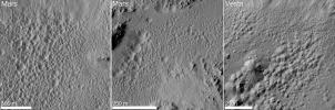
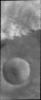
PIA16185:
-
Pitted Terrain on Mars and Vesta
Full Resolution:
TIFF
(2.132 MB)
JPEG
(388.1 kB)
|
|
|
2012-09-21 |
Mars
|
2001 Mars Odyssey
|
THEMIS
|
1133x2767x1 |
|
-
PIA15949:
-
Storm Front
Full Resolution:
TIFF
(3.138 MB)
JPEG
(125.2 kB)
|
|
|
2012-09-21 |
Mars
|
Mars Science Laboratory (MSL)
|
MAHLI
|
1584x1184x3 |
|
-
PIA15882:
-
Curiosity's Stars and Stripes
Full Resolution:
TIFF
(5.628 MB)
JPEG
(223.5 kB)
|
|
|
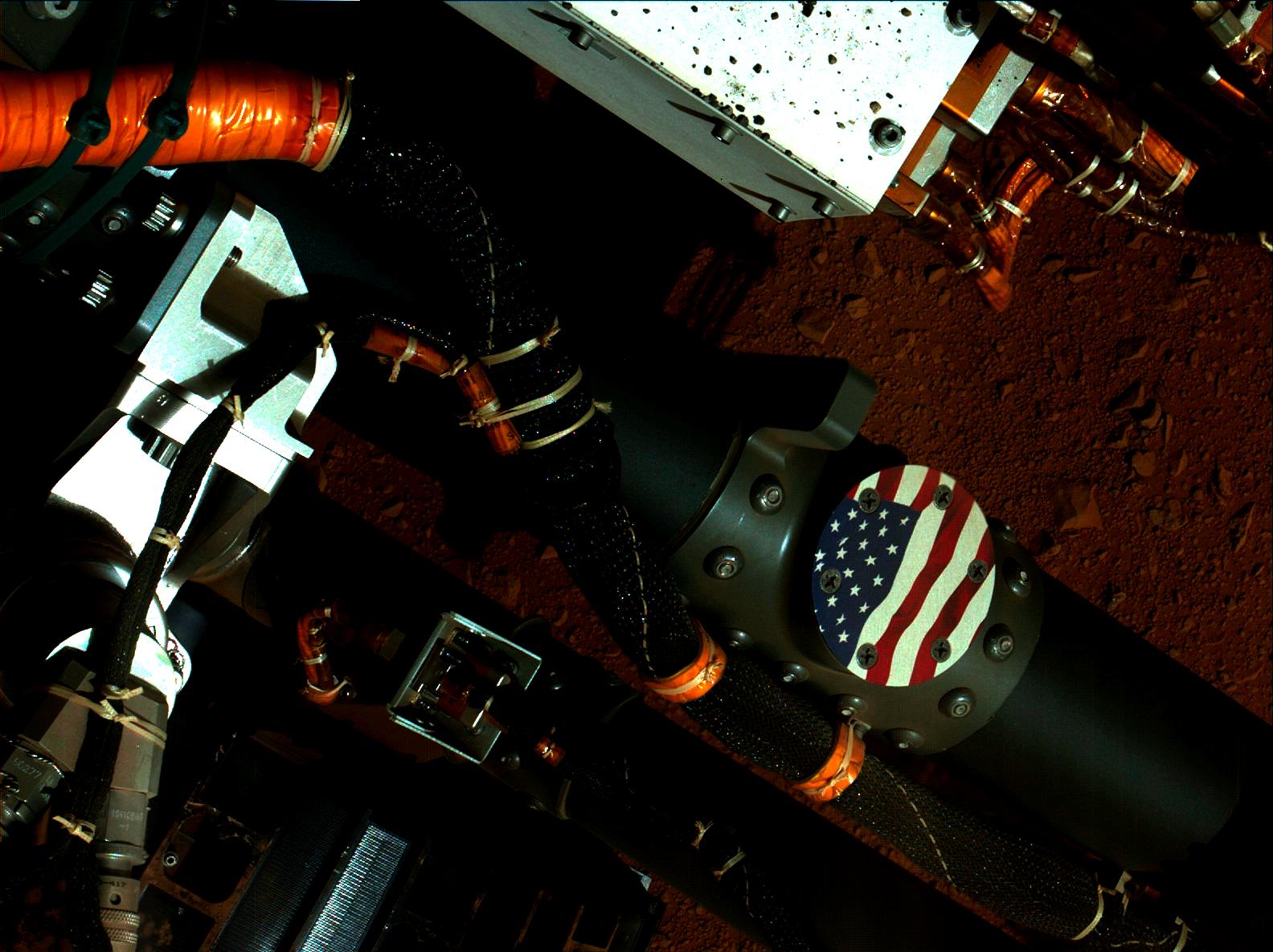
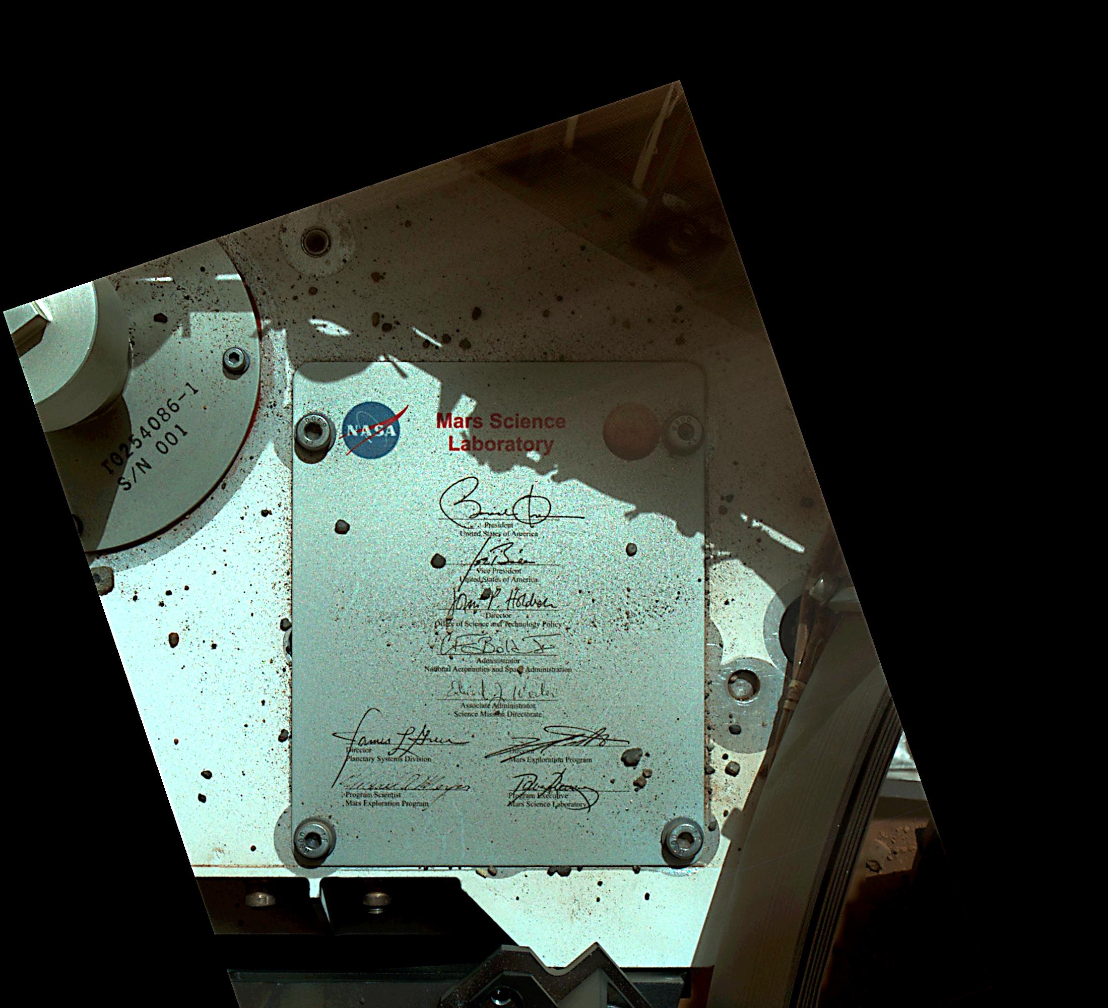
2012-09-21 |
Mars
|
Mars Science Laboratory (MSL)
|
MAHLI
|
2199x2000x3 |
|
-
PIA15883:
-
President's Signature Onboard Curiosity
Full Resolution:
TIFF
(13.2 MB)
JPEG
(434.6 kB)
|
|
|
2012-09-24 |
Mars
|
2001 Mars Odyssey
|
THEMIS
|
1134x2924x1 |
|
-
PIA16309:
-
More Polar Dunes
Full Resolution:
TIFF
(3.319 MB)
JPEG
(498.1 kB)
|
|
|
2012-09-24 |
Mars
|
Mars Science Laboratory (MSL)
|
Navcam (MSL)
Robotic Arm (MSL)
|
1024x1024x1 |

|
-
PIA16220:
-
Curiosity's Rock-Contact Science Begins
Full Resolution:
TIFF
(1.05 MB)
JPEG
(226.7 kB)
|
|
|
2012-09-24 |
Mars
|
Mars Science Laboratory (MSL)
|
MAHLI
|
2700x1950x3 |
|
-
PIA16221:
-
Mars Hand Lens Imager Nested Close-Ups of Rock 'Jake Matijevic'
Full Resolution:
TIFF
(15.8 MB)
JPEG
(525.3 kB)
|
|
|
2012-09-25 |
Mars
|
2001 Mars Odyssey
|
THEMIS
|
1369x2773x1 |
|
-
PIA16310:
-
Elysium Channels
Full Resolution:
TIFF
(3.801 MB)
JPEG
(313.2 kB)
|
|
|
2012-09-26 |
Mars
|
2001 Mars Odyssey
|
THEMIS
|
1340x2770x1 |
|
-
PIA16311:
-
Mega Gully
Full Resolution:
TIFF
(3.716 MB)
JPEG
(212.2 kB)
|
|
|
2012-09-27 |
Mars
|
2001 Mars Odyssey
|
THEMIS
|
1151x2776x1 |
|
-
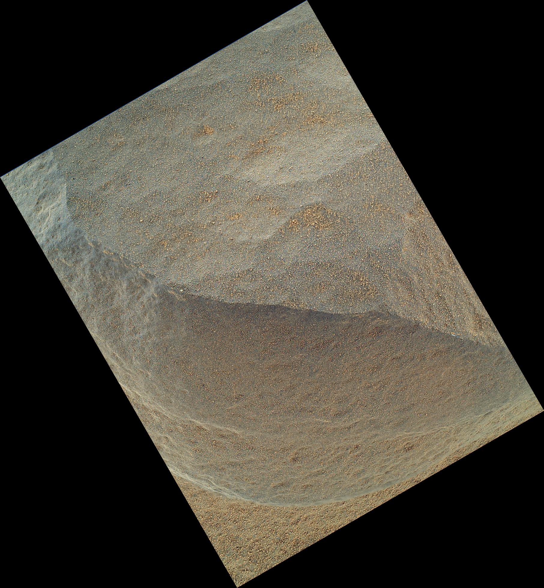
PIA16312:
-
Polar Dunes
Full Resolution:
TIFF
(3.199 MB)
JPEG
(513 kB)
|
|
|
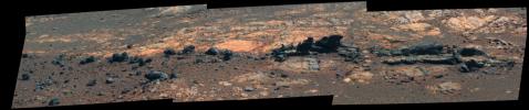
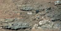
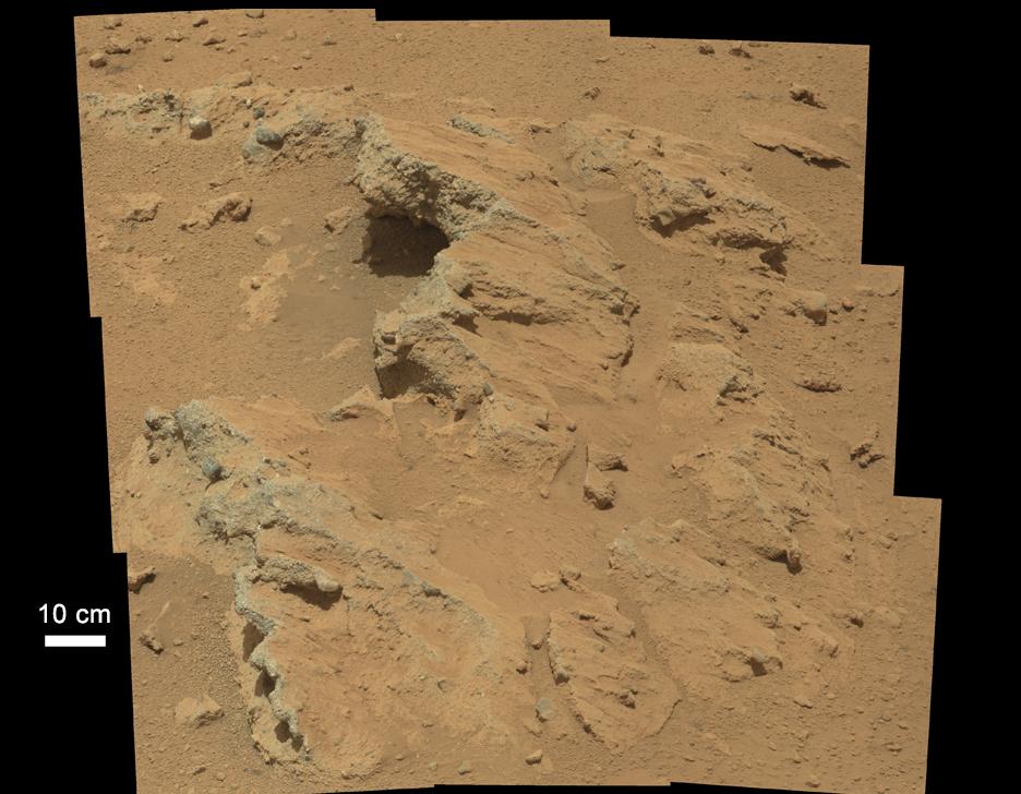
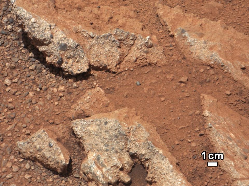
2012-09-27 |
Mars
|
Mars Science Laboratory (MSL)
|
Mastcam
|
936x728x3 |

|
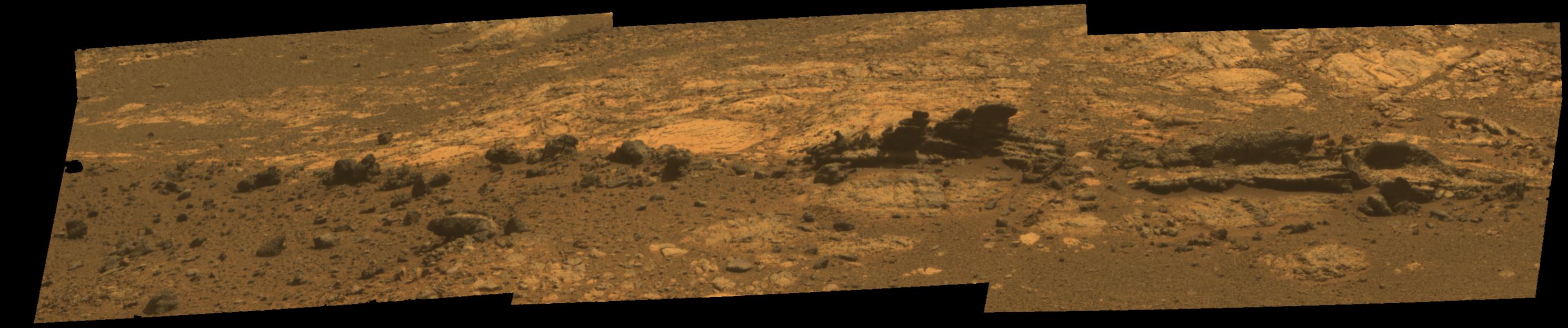
-
PIA16156:
-
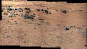
Remnants of Ancient Streambed on Mars
Full Resolution:
TIFF
(2.045 MB)
JPEG
(96.69 kB)
|
|
|
2012-09-27 |
Mars
|
Mars Reconnaissance Orbiter (MRO)
Mars Science Laboratory (MSL)
|
HiRISE
|
932x720x3 |
|
-
PIA16157:
-
Curiosity's Roadside Discoveries
Full Resolution:
TIFF
(2.014 MB)
JPEG
(132.4 kB)
|
|
|
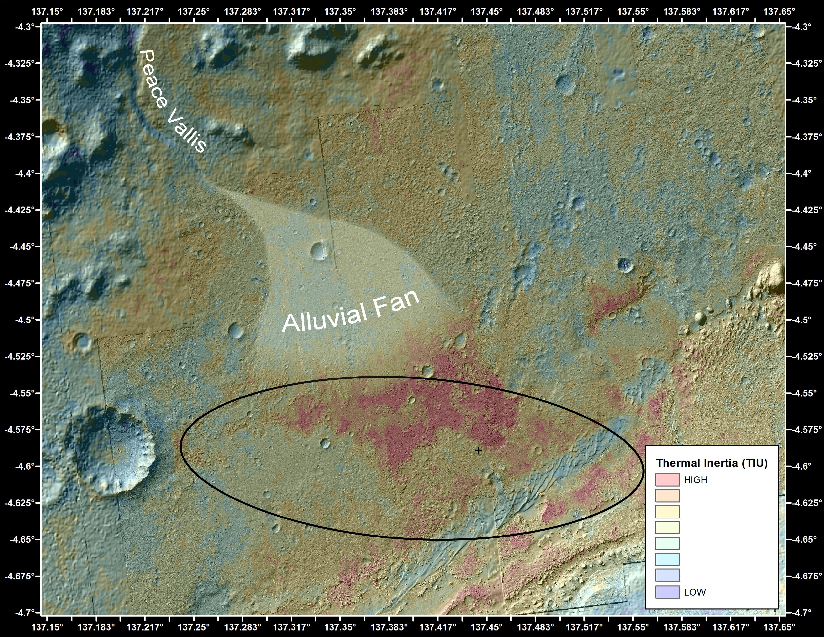
2012-09-27 |
Mars
|
Mars Reconnaissance Orbiter (MRO)
Mars Science Laboratory (MSL)
|
HiRISE
|
3339x2580x3 |

|
-
PIA16158:
-
Where Water Flowed Downslope
Full Resolution:
TIFF
(25.85 MB)
JPEG
(1.87 MB)
|
|
|
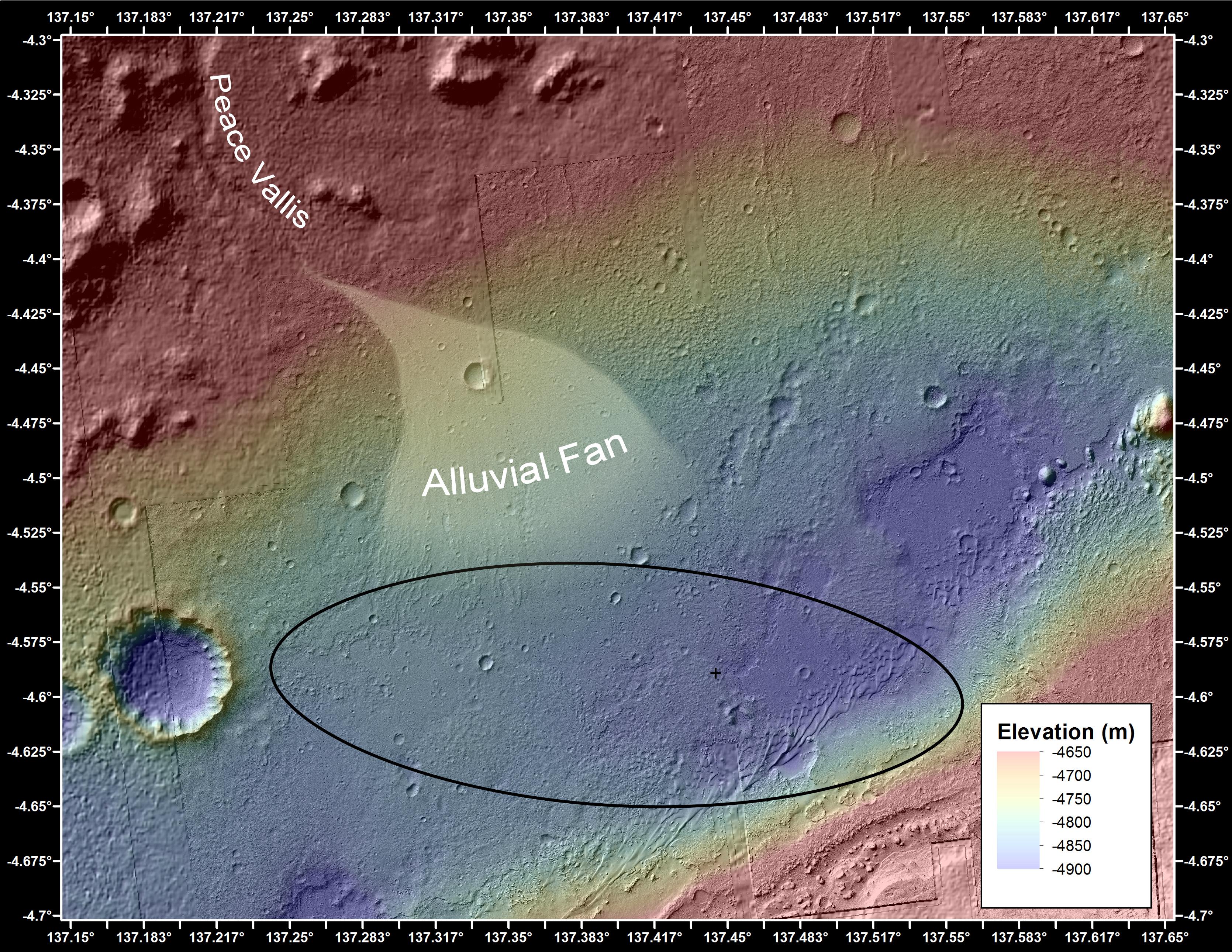
2012-09-27 |
Mars
|
2001 Mars Odyssey
Mars Science Laboratory (MSL)
|
THEMIS
|
3338x2580x3 |

|
-
PIA16159:
-
Downslope of the Fan
Full Resolution:
TIFF
(25.85 MB)
JPEG
(1.89 MB)
|
|
|
2012-09-27 |
Mars
|
Mars Science Laboratory (MSL)
|
Mastcam
|
1280x646x3 |
|
-
PIA16187:
-
Best View of Goulburn Scour
Full Resolution:
TIFF
(2.482 MB)
JPEG
(227.5 kB)
|
|
|
2012-09-27 |
Mars
|
Mars Science Laboratory (MSL)
|
Mastcam
|
960x719x3 |
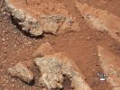
|
-
PIA16188:
-
Link to a Watery Past
Full Resolution:
TIFF
(2.072 MB)
JPEG
(143.4 kB)
|
|
|
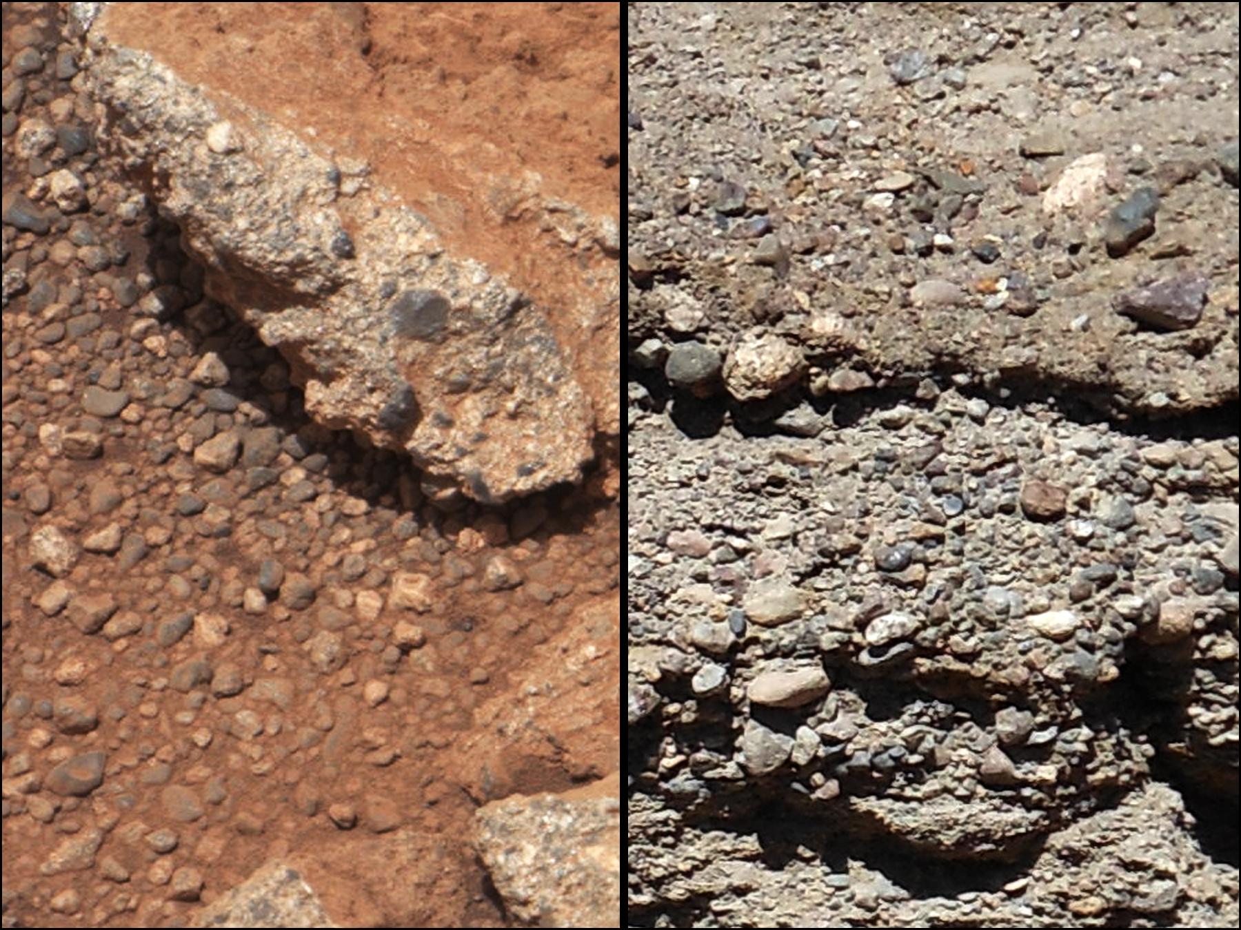
2012-09-27 |
Mars
|
Mars Science Laboratory (MSL)
|
Mastcam
|
1800x1350x3 |

|
-
PIA16189:
-
Rock Outcrops on Mars and Earth
Full Resolution:
TIFF
(7.293 MB)
JPEG
(399.8 kB)
|
|
|
2012-09-28 |
Mars
|
2001 Mars Odyssey
|
THEMIS
|
1133x2901x1 |

|
-
PIA16313:
-
Olympia Undae
Full Resolution:
TIFF
(3.29 MB)
JPEG
(339.7 kB)
|
|
|
2012-10-01 |
Mars
|
2001 Mars Odyssey
|
THEMIS
|
1271x2175x1 |
|
-
PIA16314:
-
Lava Channels
Full Resolution:
TIFF
(2.768 MB)
JPEG
(389.7 kB)
|
|
|
2012-10-01 |
Mars
|
Mars Science Laboratory (MSL)
|
MAHLI
|
1812x1958x3 |
|
-
PIA14762:
-
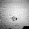
'Bathurst Inlet' Rock on Curiosity's Sol 54, Context View
Full Resolution:
TIFF
(10.65 MB)
JPEG
(311.4 kB)
|
|
|
2012-10-01 |
Mars
|
Mars Science Laboratory (MSL)
|
MAHLI
|
1812x1959x3 |
|
-
PIA14763:
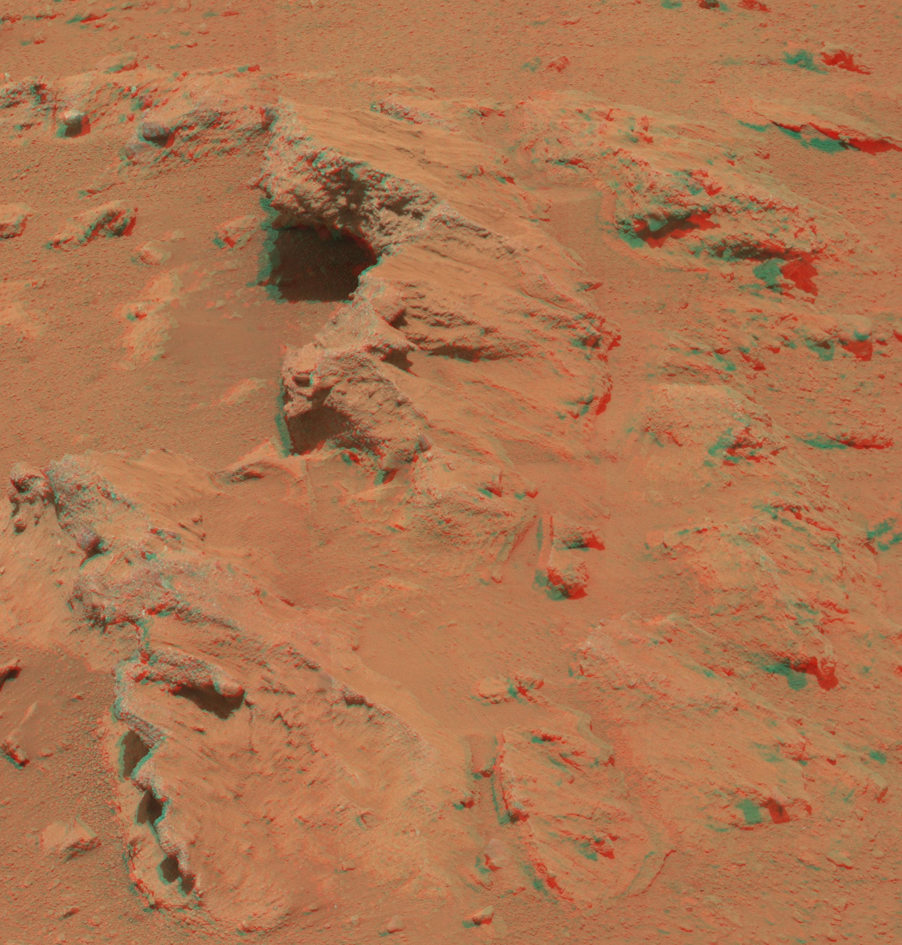
-
'Bathurst Inlet' Rock on Curiosity's Sol 54, Close-Up View
Full Resolution:
TIFF
(10.65 MB)
JPEG
(618.9 kB)
|
|
|
2012-10-02 |
Mars
|
2001 Mars Odyssey
|
THEMIS
|
1131x2747x1 |
|
-
PIA16315:
-
Polar Dunes
Full Resolution:
TIFF
(3.11 MB)
JPEG
(249.9 kB)
|
|
|
2012-10-03 |
Mars
|
2001 Mars Odyssey
|
THEMIS
|
1425x2941x1 |
|
-
PIA16316:
-
Utopia Planitia
Full Resolution:
TIFF
(4.196 MB)
JPEG
(486.4 kB)
|
|
|
2012-10-03 |
Mars
|
Mars Exploration Rover (MER)
|
Navigation Camera
|
7753x1287x3 |
|
-
PIA16222:
'Matijevic Hill' on Rim of Mars' Endeavour Crater, Stereo View
Full Resolution:
TIFF
(29.94 MB)
JPEG
(1.162 MB)
|
|
|
2012-10-03 |
Mars
|
Mars Science Laboratory (MSL)
|
Mastcam
|
2901x3036x3 |
|
-
PIA16223:
-
Martian Streambed Evidence Rock in 3-D
Full Resolution:
TIFF
(26.43 MB)
JPEG
(977.2 kB)
|
|
|
2012-10-04 |
Mars
|
2001 Mars Odyssey
|
THEMIS
|
1334x2919x1 |
|
-
PIA16317:
-
Chaos
Full Resolution:
TIFF
(3.898 MB)
JPEG
(278.6 kB)
|
|
|
2012-10-04 |
Mars
|
Mars Science Laboratory (MSL)
|
HiRISE
|
3600x2700x3 |
|
-
PIA16200:
-
Curiosity's Travels Through Sol 56
Full Resolution:
TIFF
(29.17 MB)
JPEG
(1.87 MB)
|
|
|
2012-10-04 |
Mars
|
Mars Science Laboratory (MSL)
|
Navcam (MSL)
|
7824x1488x1 |

|
-
PIA16202:
View on the Way to 'Glenelg'
Full Resolution:
TIFF
(11.65 MB)
JPEG
(1.1 MB)
|
|
|
2012-10-04 |
Mars
|
Mars Science Laboratory (MSL)
|
Mastcam
|
3926x2218x3 |
|
-
PIA16204:
-
'Rocknest' From Sol 52 Location
Full Resolution:
TIFF
(26.13 MB)
JPEG
(1.876 MB)
|
|
|
2012-10-04 |
Mars
|
Mars Science Laboratory (MSL)
|
Navcam (MSL)
|
1024x1024x1 |
|
-
PIA16205:
-
Wheel Scuff Mark at 'Rocknest'
Full Resolution:
TIFF
(1.05 MB)
JPEG
(281.5 kB)
|
|
|
2012-10-05 |
Mars
|
2001 Mars Odyssey
|
THEMIS
|
1339x2921x1 |
|
-
PIA16318:
-
Landslide
Full Resolution:
TIFF
(3.915 MB)
JPEG
(272 kB)
|
|
|
2012-10-08 |
Mars
|
2001 Mars Odyssey
|
THEMIS
|
1295x2917x1 |

|
-
PIA16319:
-
Arsia Mons
Full Resolution:
TIFF
(3.782 MB)
JPEG
(320.9 kB)
|


