My
List |
Addition Date
|
Target
|
Mission
|
Instrument
|
Size
|

|
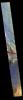
2019-04-03 |
Mars
|
Mars Reconnaissance Orbiter (MRO)
|
HiRISE
|
2880x1800x3 |
|
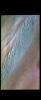
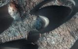
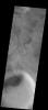
-
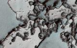
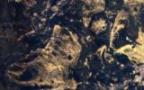
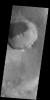
PIA23103:
-
Dramatic Changes over the South Polar Cap
Full Resolution:
TIFF
(15.56 MB)
JPEG
(1.161 MB)
|
|
|
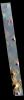
2019-04-03 |
Mars
|
2001 Mars Odyssey
|
THEMIS
|
606x2716x3 |
|
-
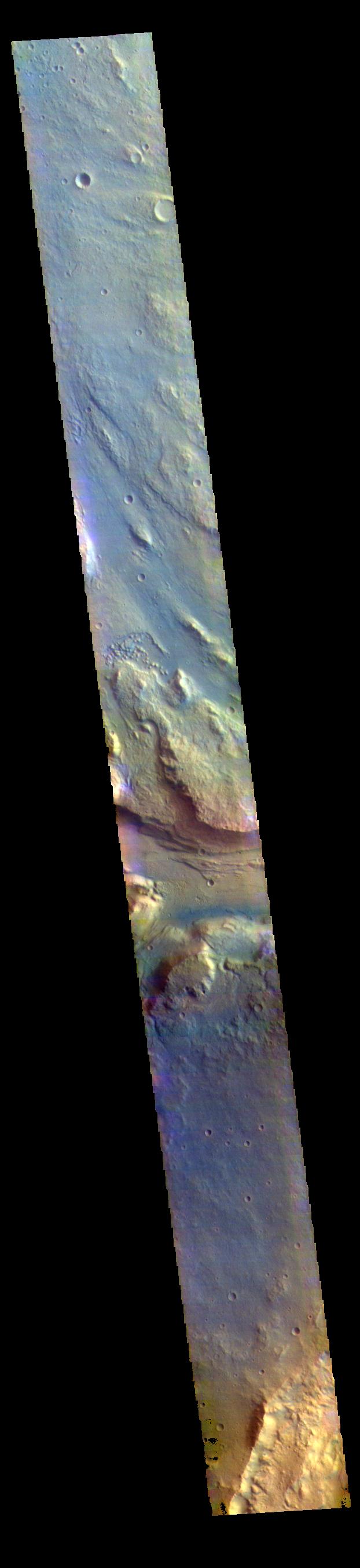
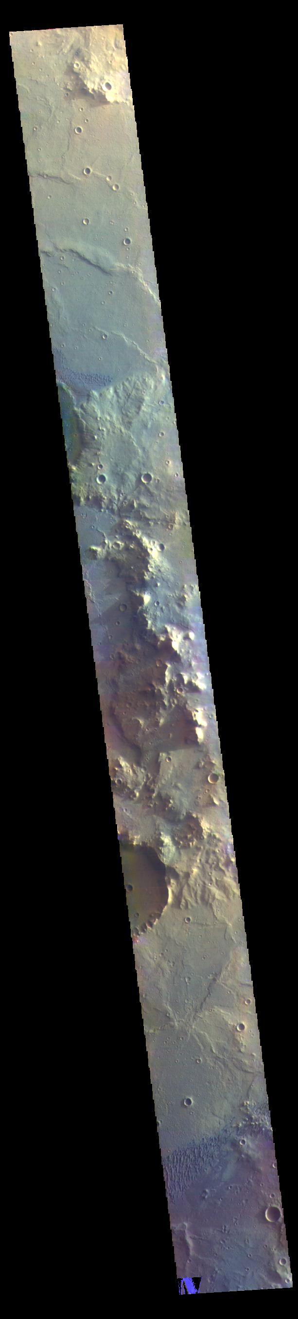
PIA23093:
-
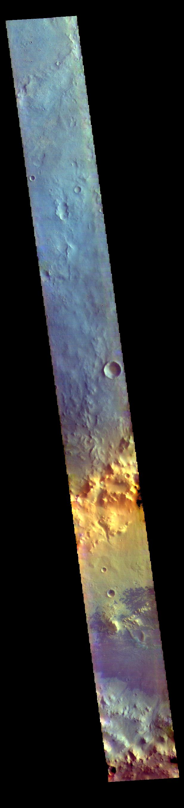
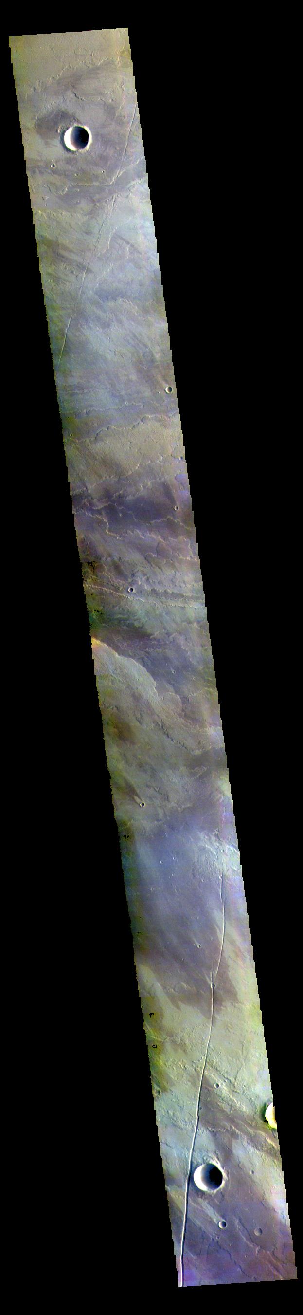
Melas Chasma - False Color
Full Resolution:
TIFF
(2.166 MB)
JPEG
(97.21 kB)
|
|
|
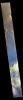
2019-04-02 |
Mars
|
2001 Mars Odyssey
|
THEMIS
|
610x2709x3 |
|
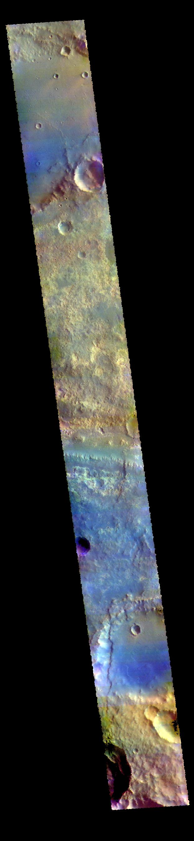
-
PIA23092:
-
Goodbye Opportunity
Full Resolution:
TIFF
(2.249 MB)
JPEG
(140.3 kB)
|
|
|
2019-04-01 |
Mars
|
2001 Mars Odyssey
|
THEMIS
|
611x2704x3 |
|
-
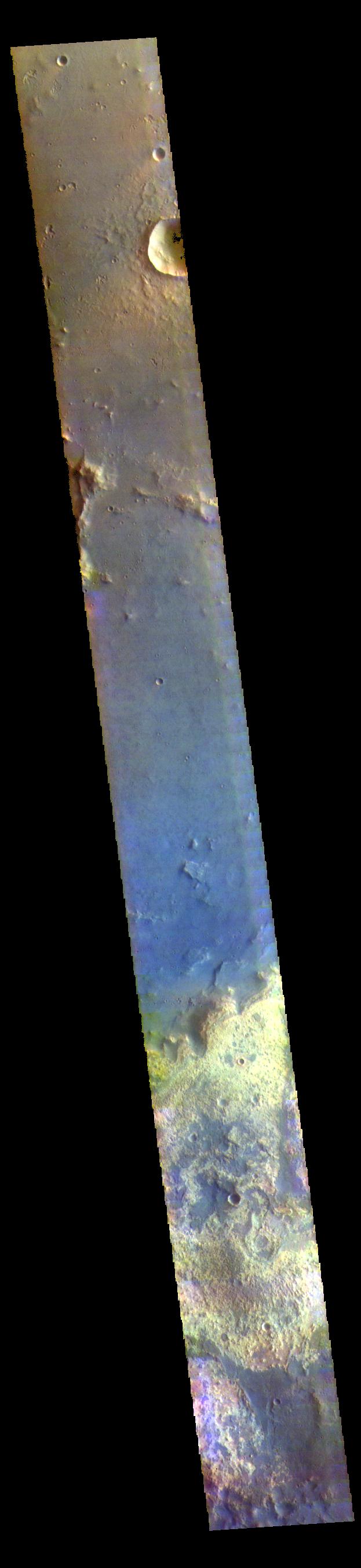
PIA23091:
-
Rutherford Crater - False Color
Full Resolution:
TIFF
(2.258 MB)
JPEG
(108.9 kB)
|
|
|
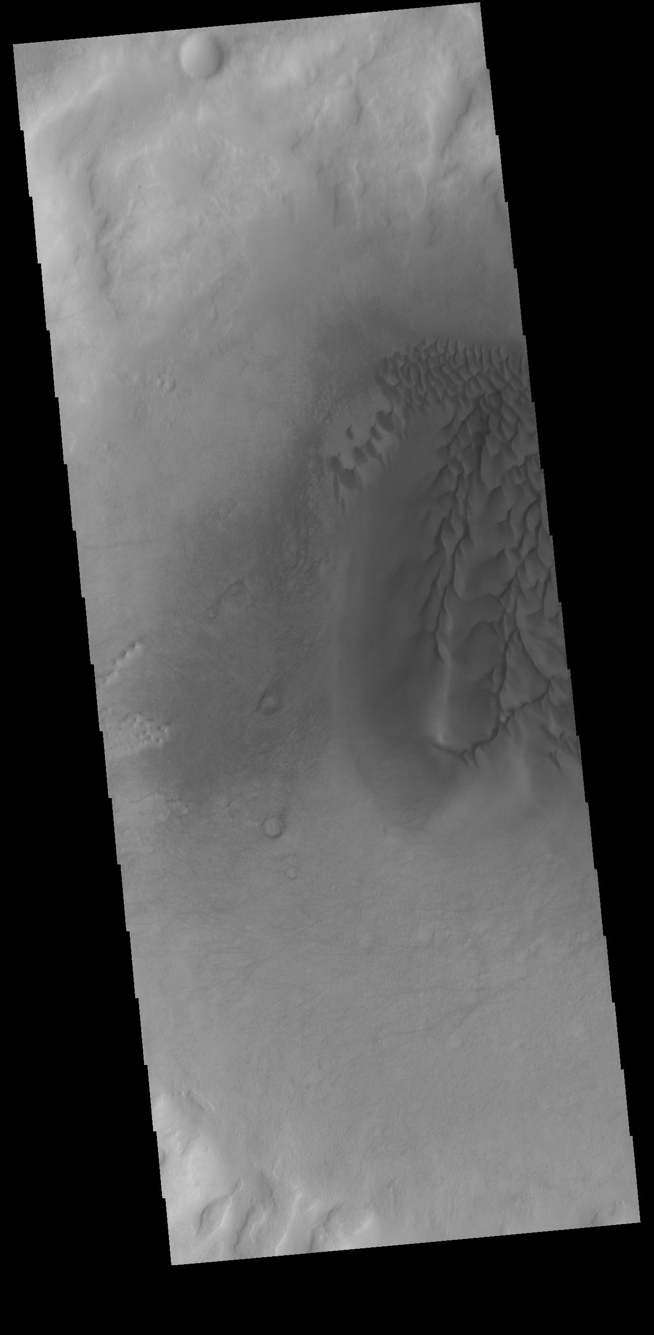
2019-03-29 |
Mars
|
2001 Mars Odyssey
|
THEMIS
|
611x2706x3 |
|
-
PIA23090:
-
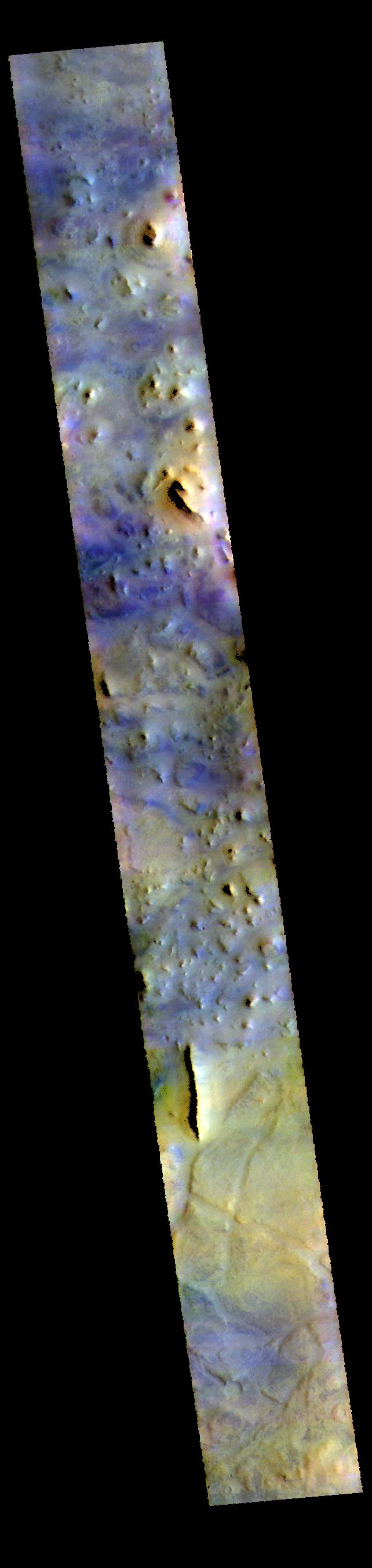
Arabia Terra Craters - False Color
Full Resolution:
TIFF
(2.225 MB)
JPEG
(118.4 kB)
|
|
|
2019-03-28 |
Mars
|
2001 Mars Odyssey
|
THEMIS
|
606x2713x3 |

|
-
PIA23089:
-
Arabia Terra - False Color
Full Resolution:
TIFF
(2.18 MB)
JPEG
(113.2 kB)
|
|
|
2019-03-27 |
Mars
|
2001 Mars Odyssey
|
THEMIS
|
616x2704x3 |
|
-
PIA23088:
-
Acidalia Planitia - False Color
Full Resolution:
TIFF
(2.357 MB)
JPEG
(135.4 kB)
|
|
|
2019-03-26 |
Mars
|
2001 Mars Odyssey
|
THEMIS
|
612x2705x3 |

|
-
PIA23087:
-
Elysium Planitia - False Color
Full Resolution:
TIFF
(2.127 MB)
JPEG
(100.5 kB)
|
|
|
2019-03-25 |
Mars
|
2001 Mars Odyssey
|
THEMIS
|
712x1452x3 |
|
-
PIA23086:
-
Terra Sabaea - False Color
Full Resolution:
TIFF
(2.137 MB)
JPEG
(84.42 kB)
|
|
|
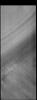
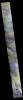
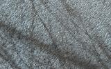
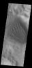
2019-03-22 |
Mars
|
2001 Mars Odyssey
|
THEMIS
|
672x1411x1 |
|
-
PIA23085:
-
Daedalia Planum
Full Resolution:
TIFF
(749.9 kB)
JPEG
(154.4 kB)
|
|
|
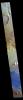
2019-03-21 |
Mars
|
2001 Mars Odyssey
|
THEMIS
|
975x2625x1 |
|
-
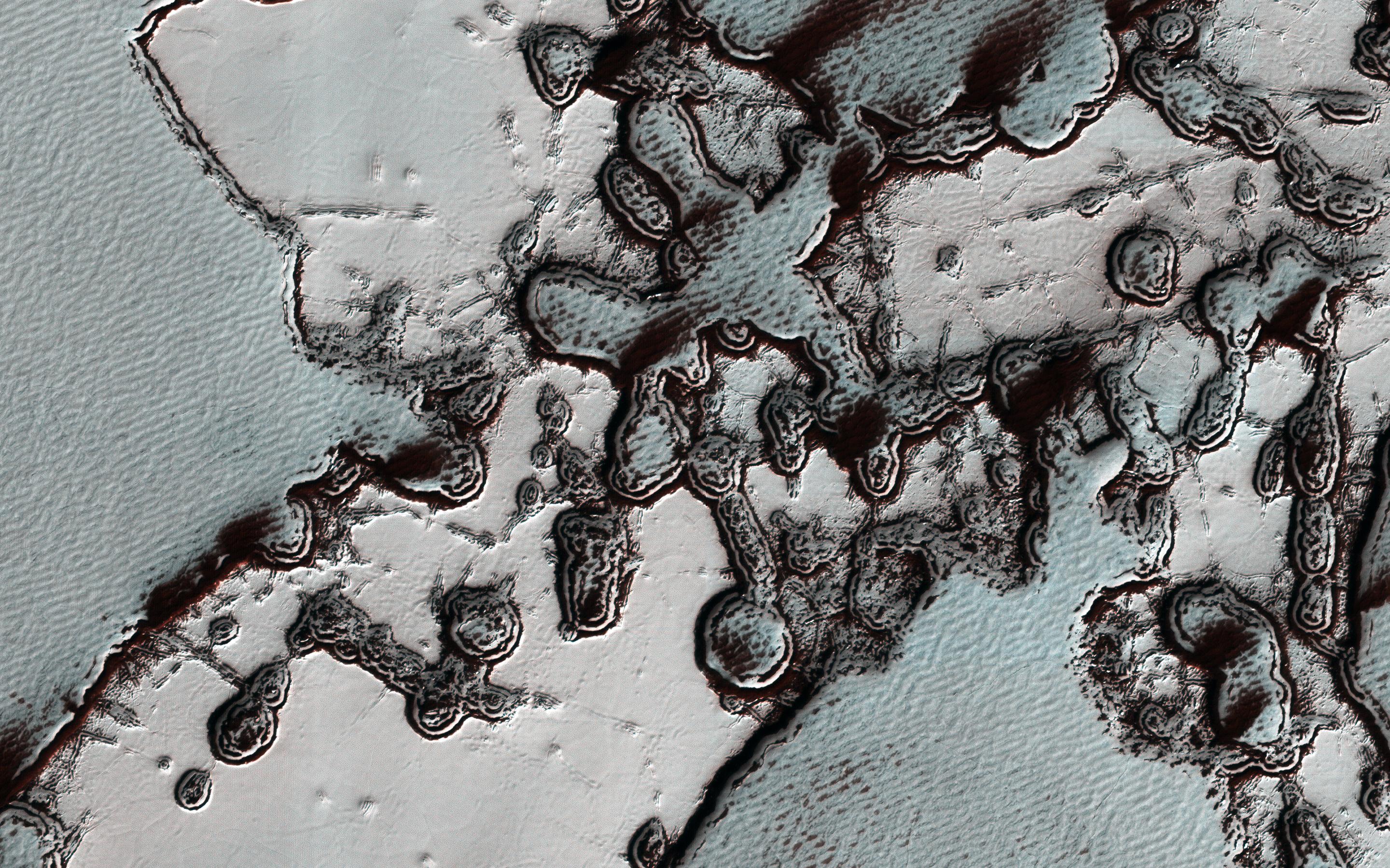
PIA23084:
-
Polar Layers
Full Resolution:
TIFF
(2.562 MB)
JPEG
(376.1 kB)
|
|
|
2019-03-20 |
Mars
|
2001 Mars Odyssey
|
THEMIS
|
976x2625x1 |
|
-
PIA23083:
-
Polar Layers
Full Resolution:
TIFF
(2.494 MB)
JPEG
(309.2 kB)
|
|
|
2019-03-19 |
Mars
|
2001 Mars Odyssey
|
THEMIS
|
1321x2695x1 |

|
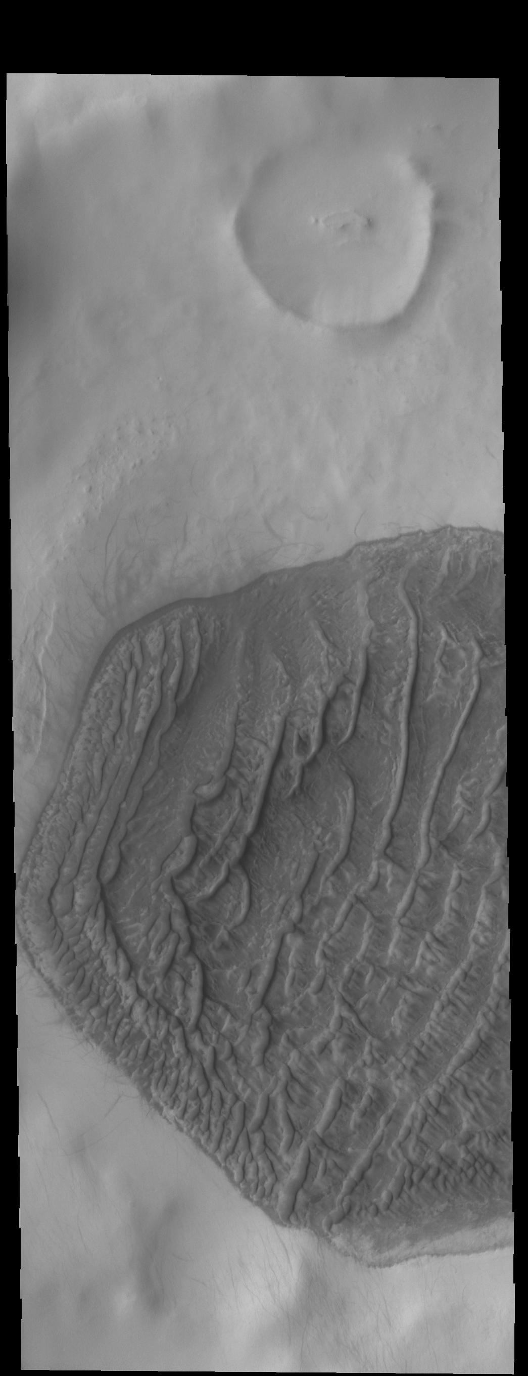
-
PIA23082:
-
Crater Dunes
Full Resolution:
TIFF
(2.023 MB)
JPEG
(159.2 kB)
|
|
|
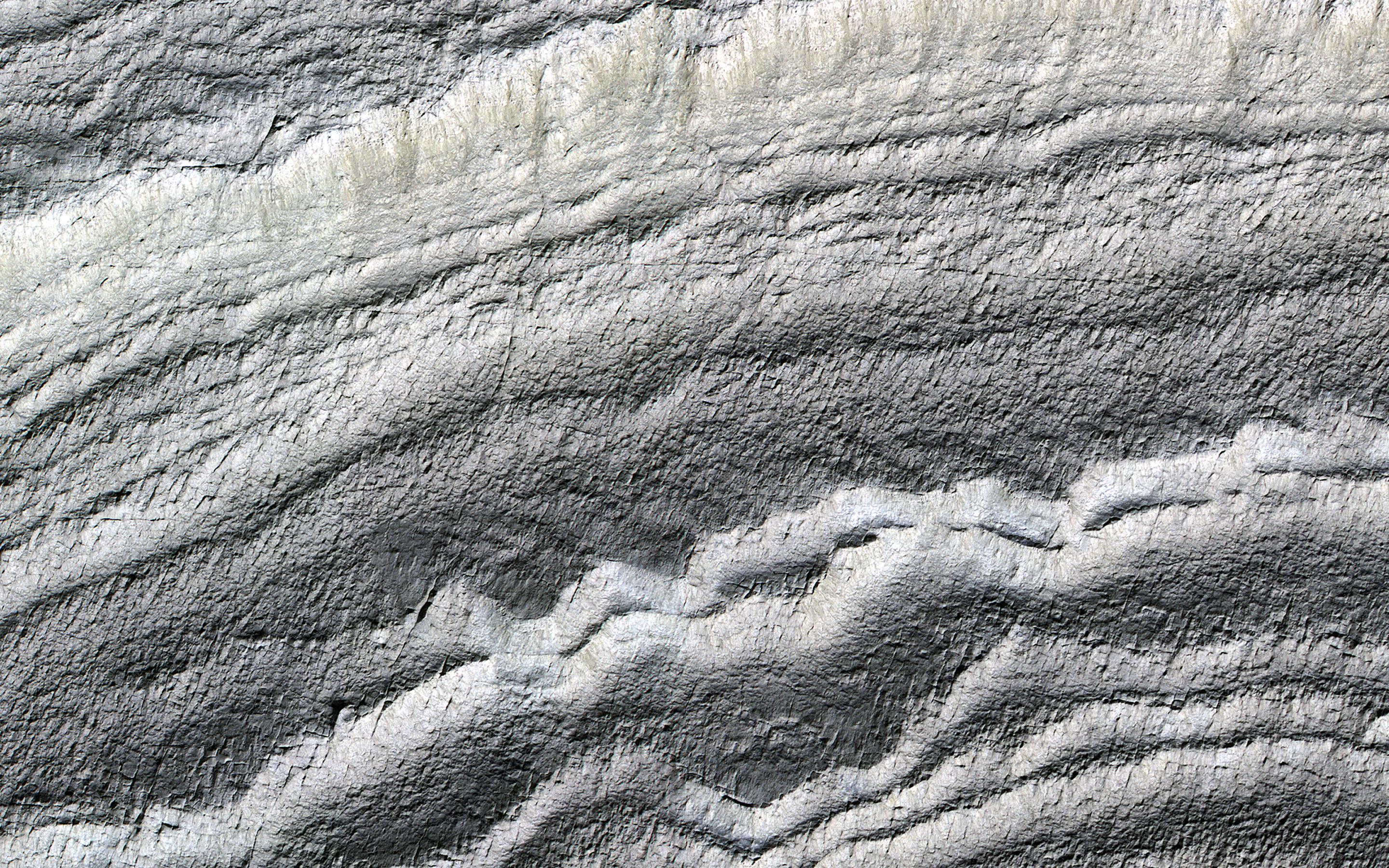
2019-03-18 |
Mars
|
Mars Reconnaissance Orbiter (MRO)
|
HiRISE
|
2880x1800x3 |
|
-
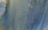
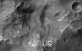
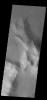
PIA23101:
-
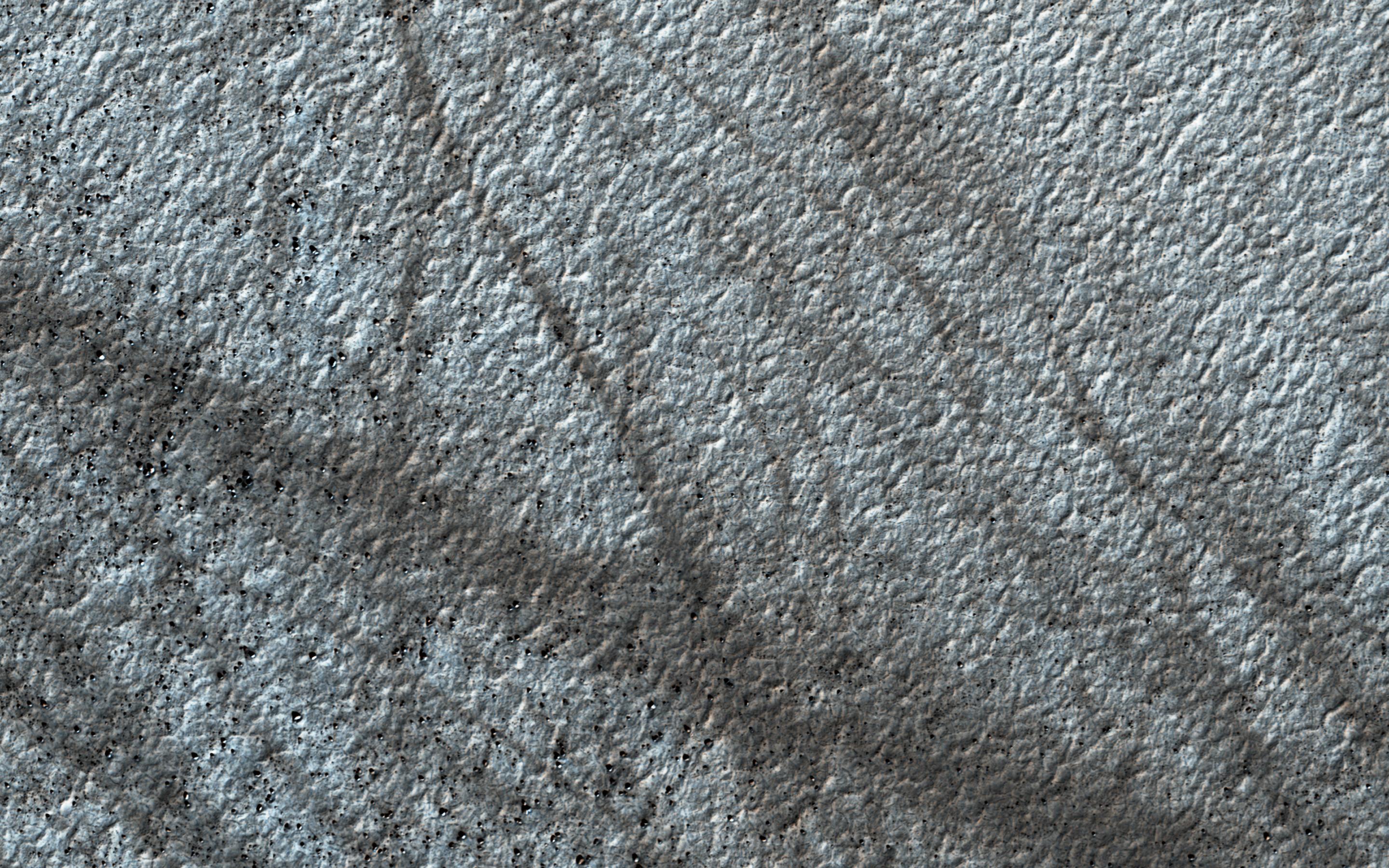
Bedrock in the Central Peaks of Hale Crater
Full Resolution:
TIFF
(15.56 MB)
JPEG
(734.3 kB)
|
|
|
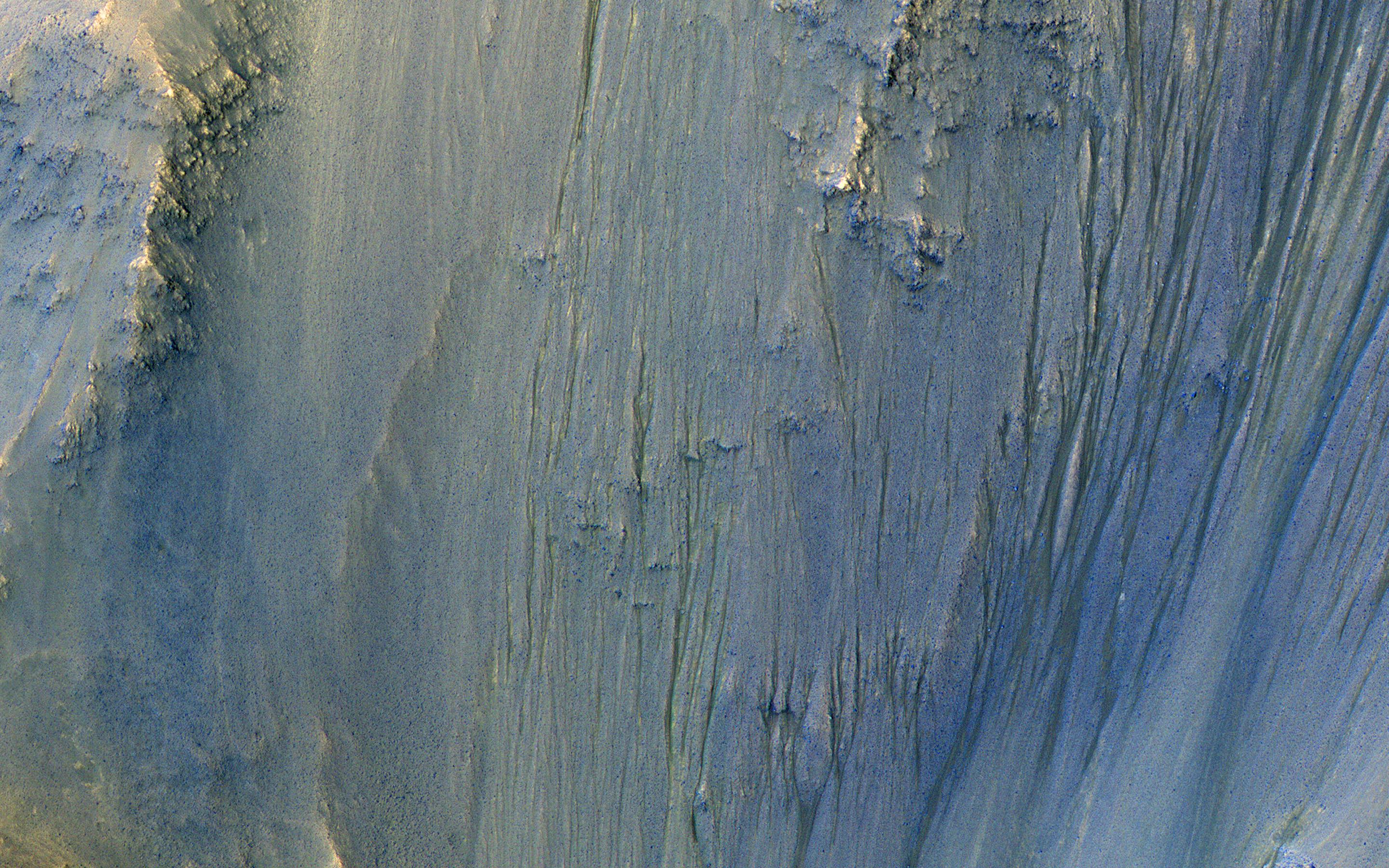
2019-03-18 |
Mars
|
Mars Reconnaissance Orbiter (MRO)
|
HiRISE
|
2880x1800x3 |
|
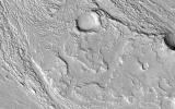
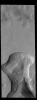
-
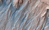
PIA23100:
-
Complex Gullies in a Crater
Full Resolution:
TIFF
(15.56 MB)
JPEG
(1.584 MB)
|
|
|
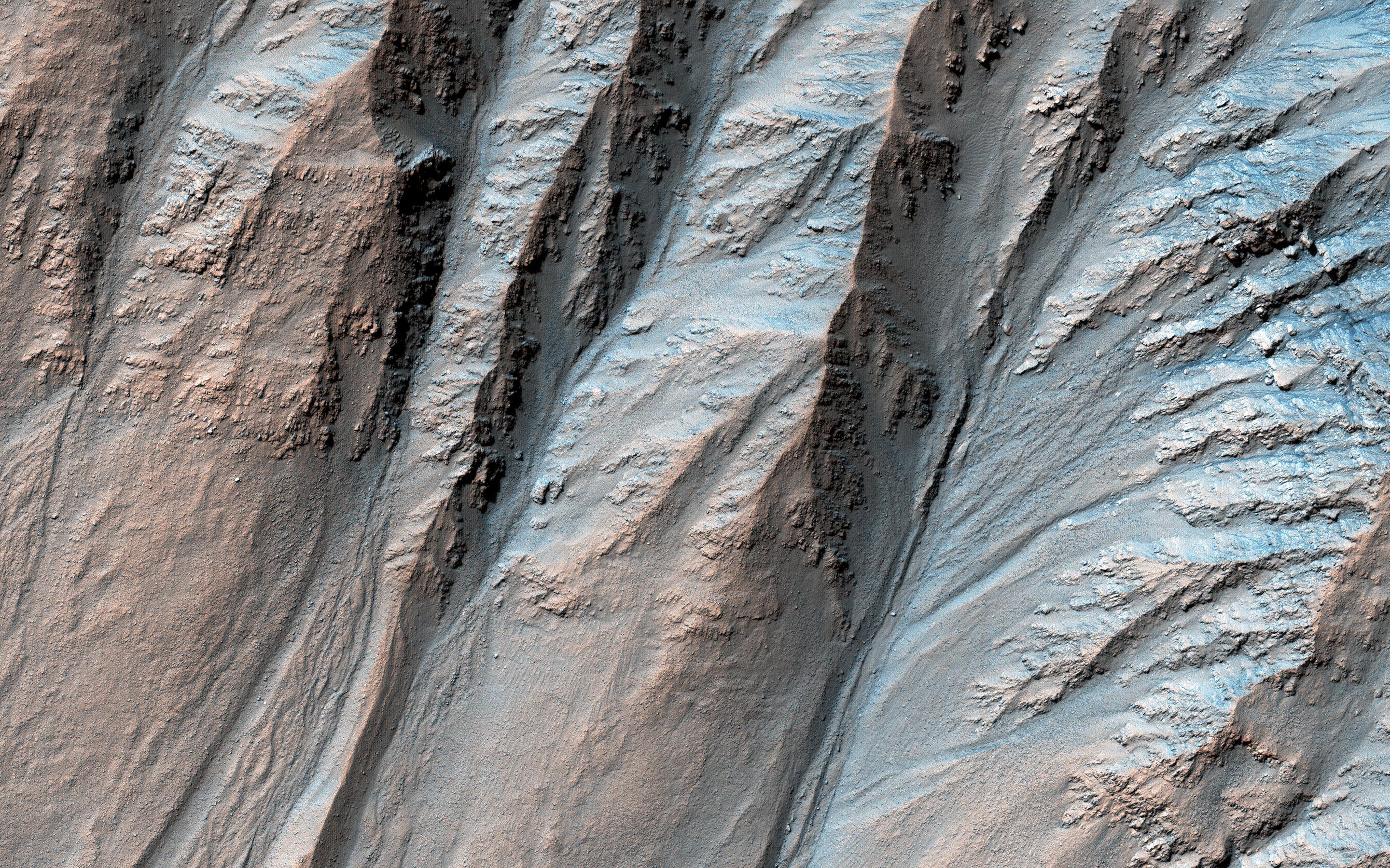
2019-03-18 |
Mars
|
Mars Reconnaissance Orbiter (MRO)
|
HiRISE
|
2880x1800x3 |
|
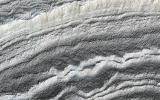
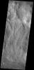
-
PIA23099:
-
In the Gullies and Bedrock of Ius Chasma
Full Resolution:
TIFF
(15.56 MB)
JPEG
(1.063 MB)
|
|
|
2019-03-18 |
Mars
|
Mars Reconnaissance Orbiter (MRO)
|
HiRISE
|
2880x1800x3 |
|
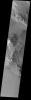
-
PIA23098:
-
Everything is (Well) Illuminated
Full Resolution:
TIFF
(15.56 MB)
JPEG
(1.461 MB)
|
|
|
2019-03-18 |
Mars
|
2001 Mars Odyssey
|
THEMIS
|
674x1424x1 |
|
-
PIA23081:
-
Ariadnes Colles
Full Resolution:
TIFF
(705.5 kB)
JPEG
(91.8 kB)
|
|
|
2019-03-15 |
Mars
|
2001 Mars Odyssey
|
THEMIS
|
981x2628x1 |
|
-
PIA23076:
-
Polar Ice
Full Resolution:
TIFF
(2.581 MB)
JPEG
(472.6 kB)
|
|
|
2019-03-14 |
Mars
|
2001 Mars Odyssey
|
THEMIS
|
1314x2662x1 |

|
-
PIA23075:
-
Claritas Fossae Channel
Full Resolution:
TIFF
(2.462 MB)
JPEG
(277.7 kB)
|
|
|
2019-03-13 |
Mars
|
2001 Mars Odyssey
|
THEMIS
|
671x1423x1 |
|
-
PIA23074:
-
Craters
Full Resolution:
TIFF
(705.1 kB)
JPEG
(84.14 kB)
|
|
|
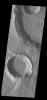
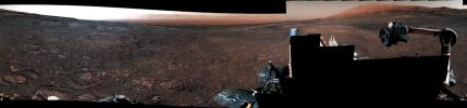
2019-03-12 |
Mars
|
Mars Exploration Rover (MER)
|
Panoramic Camera
|
900x201x3 |
|
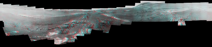
-
PIA22910:
Opportunity Legacy Pan (Anaglyph)
Full Resolution:
TIFF
(316.2 kB)
JPEG
(23.12 kB)
|
|
|
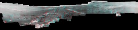
2019-03-12 |
Mars
|
Mars Exploration Rover (MER)
|
Panoramic Camera
|
900x201x3 |
|
-
PIA22909:
Opportunity Legacy Pan (True Color)
Full Resolution:
TIFF
(310.9 kB)
JPEG
(24.82 kB)
|
|
|
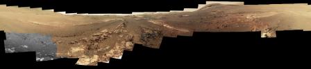
2019-03-12 |
Mars
|
Mars Exploration Rover (MER)
|
Panoramic Camera
|
900x201x3 |
|
-
PIA22908:
Opportunity Legacy Pan (False Color)
Full Resolution:
TIFF
(333.7 kB)
JPEG
(24.36 kB)
|
|
|
2019-03-12 |
Mars
|
Mars Exploration Rover (MER)
|
Panoramic Camera
|
224x96x1 |

|
-
PIA22930:
-
Last Images Opportunity Took
Full Resolution:
TIFF
(8.102 kB)
JPEG
(1.527 kB)
|
|
|
2019-03-12 |
Mars
|
Mars Exploration Rover (MER)
|
Panoramic Camera
|
1024x1024x3 |
|
-
PIA22929:
-
Opportunity's Last Message
Full Resolution:
TIFF
(904.4 kB)
JPEG
(314.2 kB)
|
|
|
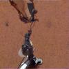
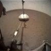
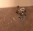
2019-03-12 |
Mars
|
InSight
|
Instrument Deployment Camera (IDC)
|
1024x1024x3 |
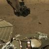
|
-
PIA23049:
-
InSight's Arm Camera Observes Phobos Eclipse
Full Resolution:
TIFF
(3.147 MB)
JPEG
(156.5 kB)
|
|
|
2019-03-12 |
Mars
|
InSight
|
Instrument Context Camera (ICC)
|
1024x1024x3 |
|
-
PIA23048:
-
InSight's Deck Camera Observes Phobos Eclipse
Full Resolution:
TIFF
(2.662 MB)
JPEG
(78.13 kB)
|
|
|
2019-03-12 |
Mars
|
2001 Mars Odyssey
|
THEMIS
|
670x1420x1 |
|
-
PIA23073:
-
Daedalia Planum
Full Resolution:
TIFF
(754.9 kB)
JPEG
(177.9 kB)
|
|
|
2019-03-11 |
Mars
|
2001 Mars Odyssey
|
THEMIS
|
834x2746x1 |

|
-
PIA23072:
-
Rabe Crater Dunes
Full Resolution:
TIFF
(1.245 MB)
JPEG
(104 kB)
|
|
|
2019-03-08 |
Mars
|
2001 Mars Odyssey
|
THEMIS
|
614x2704x3 |
|
-
PIA23071:
-
Nili Patera - False Color
Full Resolution:
TIFF
(2.302 MB)
JPEG
(130.5 kB)
|
|
|
2019-03-07 |
Mars
|
2001 Mars Odyssey
|
THEMIS
|
683x1423x3 |
|
-
PIA23070:
-
Ius Chasma - False Color
Full Resolution:
TIFF
(1.946 MB)
JPEG
(65.87 kB)
|
|
|
2019-03-06 |
Mars
|
2001 Mars Odyssey
|
THEMIS
|
618x2710x3 |
|
-
PIA23069:
-
Crater Dunes - False Color
Full Resolution:
TIFF
(2.245 MB)
JPEG
(111.2 kB)
|
|
|
2019-03-05 |
Mars
|
2001 Mars Odyssey
|
THEMIS
|
628x2703x3 |
|
-
PIA23068:
-
Terra Sabaea - False Color
Full Resolution:
TIFF
(2.338 MB)
JPEG
(133.1 kB)
|
|
|
2019-03-04 |
Mars
|
Mars Reconnaissance Orbiter (MRO)
|
HiRISE
|
2880x1800x3 |
|
-
PIA23080:
-
Colorful Mawrth Vallis
Full Resolution:
TIFF
(15.56 MB)
JPEG
(910.7 kB)
|
|
|
2019-03-04 |
Mars
|
Mars Reconnaissance Orbiter (MRO)
|
HiRISE
|
2880x1800x3 |
|
-
PIA23079:
-
Colorful Impact Ejecta in Ladon Valles
Full Resolution:
TIFF
(15.56 MB)
JPEG
(1.111 MB)
|
|
|
2019-03-04 |
Mars
|
Mars Reconnaissance Orbiter (MRO)
|
HiRISE
|
2880x1800x3 |
|
-
PIA23078:
-
Gullies in Galle
Full Resolution:
TIFF
(5.191 MB)
JPEG
(1.533 MB)
|
|
|
2019-03-04 |
Mars
|
Mars Reconnaissance Orbiter (MRO)
|
HiRISE
|
2880x1800x3 |
|
-
PIA23077:
-
The Slow Charm of Brain Terrain
Full Resolution:
TIFF
(15.56 MB)
JPEG
(1.528 MB)
|
|
|
2019-03-04 |
Mars
|
2001 Mars Odyssey
|
THEMIS
|
642x2702x3 |

|
-
PIA23067:
-
Acidalia Colles - False Color
Full Resolution:
TIFF
(2.48 MB)
JPEG
(124.7 kB)
|
|
|
2019-03-01 |
Mars
|
2001 Mars Odyssey
|
THEMIS
|
622x2706x3 |
|
-
PIA23066:
-
Near the River - False Color
Full Resolution:
TIFF
(2.27 MB)
JPEG
(118.8 kB)
|
|
|
2019-02-28 |
Mars
|
2001 Mars Odyssey
|
THEMIS
|
637x2703x3 |
|
-
PIA23055:
-
Protonilus Mensae - False Color
Full Resolution:
TIFF
(2.272 MB)
JPEG
(107.9 kB)
|
|
|
2019-02-27 |
Mars
|
2001 Mars Odyssey
|
THEMIS
|
703x1432x3 |
|
-
PIA23054:
-
Crater Dunes - False Color
Full Resolution:
TIFF
(1.971 MB)
JPEG
(75.32 kB)
|
|
|
2019-02-26 |
Mars
|
2001 Mars Odyssey
|
THEMIS
|
623x2703x3 |
|
-
PIA23053:
-
Chryse Planitia - False Color
Full Resolution:
TIFF
(2.335 MB)
JPEG
(125 kB)
|
|
|
2019-02-25 |
Mars
|
2001 Mars Odyssey
|
THEMIS
|
587x1441x3 |
|
-
PIA23052:
-
Chasma Boreale - False Color
Full Resolution:
TIFF
(2.187 MB)
JPEG
(157.2 kB)
|
|
|
2019-02-22 |
Mars
|
Mars Science Laboratory (MSL)
|
Mastcam
|
1328x1184x3 |
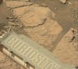
|
-
PIA23047:
-
Curiosity on the Clay Unit
Full Resolution:
TIFF
(4.41 MB)
JPEG
(175 kB)
|
|
|
2019-02-22 |
Mars
|
2001 Mars Odyssey
|
THEMIS
|
623x2701x3 |
|
-
PIA23051:
-
Volcanic Plains - False Color
Full Resolution:
TIFF
(2.31 MB)
JPEG
(122.9 kB)
|
|
|
2019-02-21 |
Mars
|
2001 Mars Odyssey
|
THEMIS
|
622x2704x3 |
|
-
PIA23040:
-
Marth Crater - False Color
Full Resolution:
TIFF
(2.246 MB)
JPEG
(104.8 kB)
|
|
|
2019-02-20 |
Mars
|
Mars Reconnaissance Orbiter (MRO)
|
HiRISE
|
2880x1800x3 |
|
-
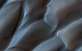
PIA23064:
-
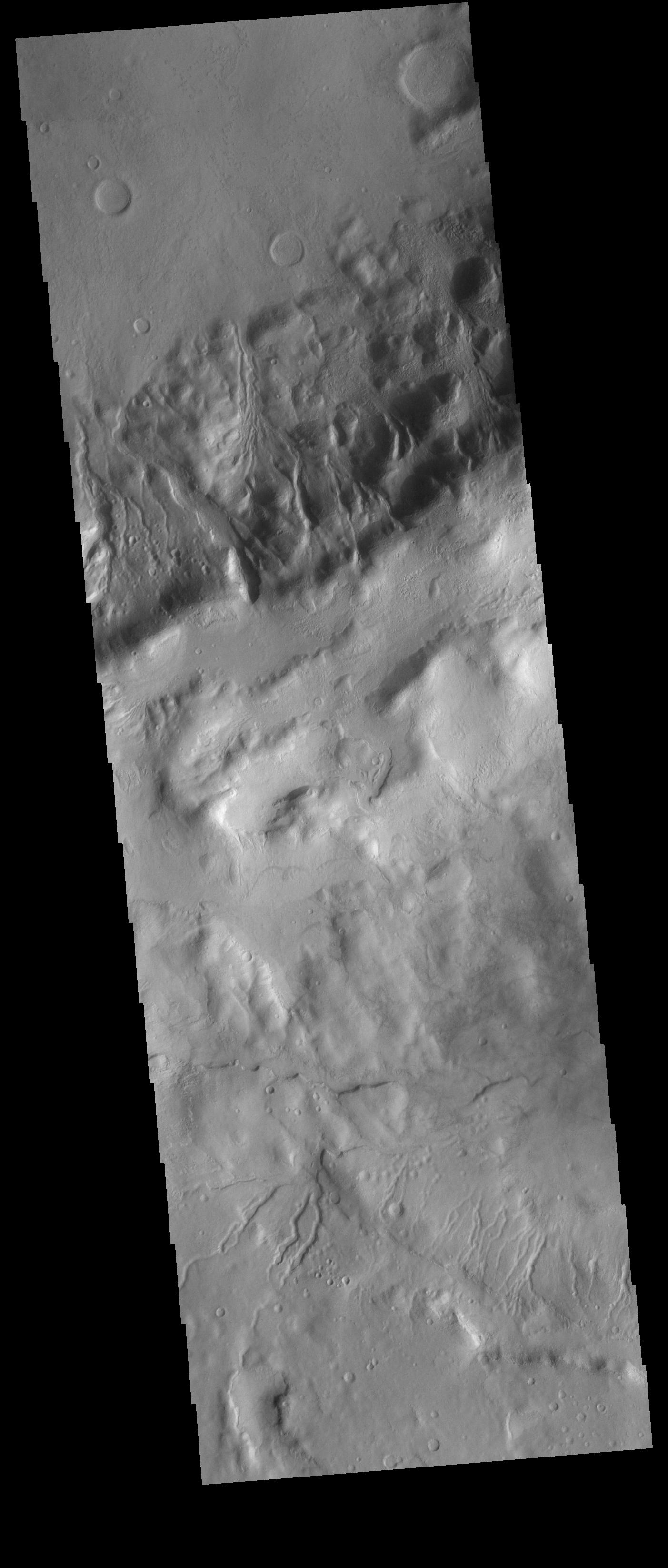
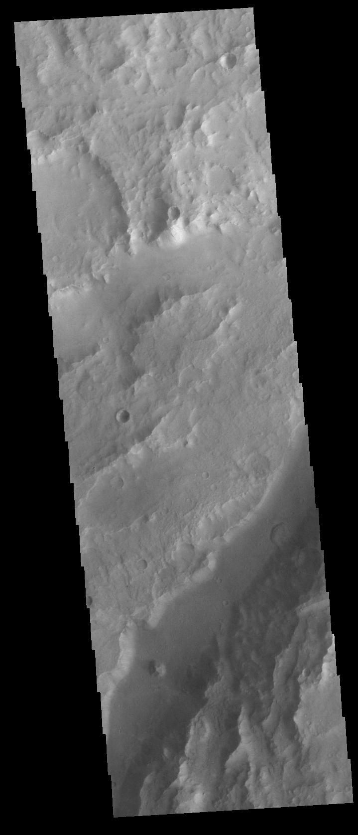
Following the Tracks
Full Resolution:
TIFF
(15.56 MB)
JPEG
(1.071 MB)
|
|
|
2019-02-20 |
Mars
|
Mars Reconnaissance Orbiter (MRO)
|
HiRISE
|
2880x1800x3 |
|
-
PIA23063:
-
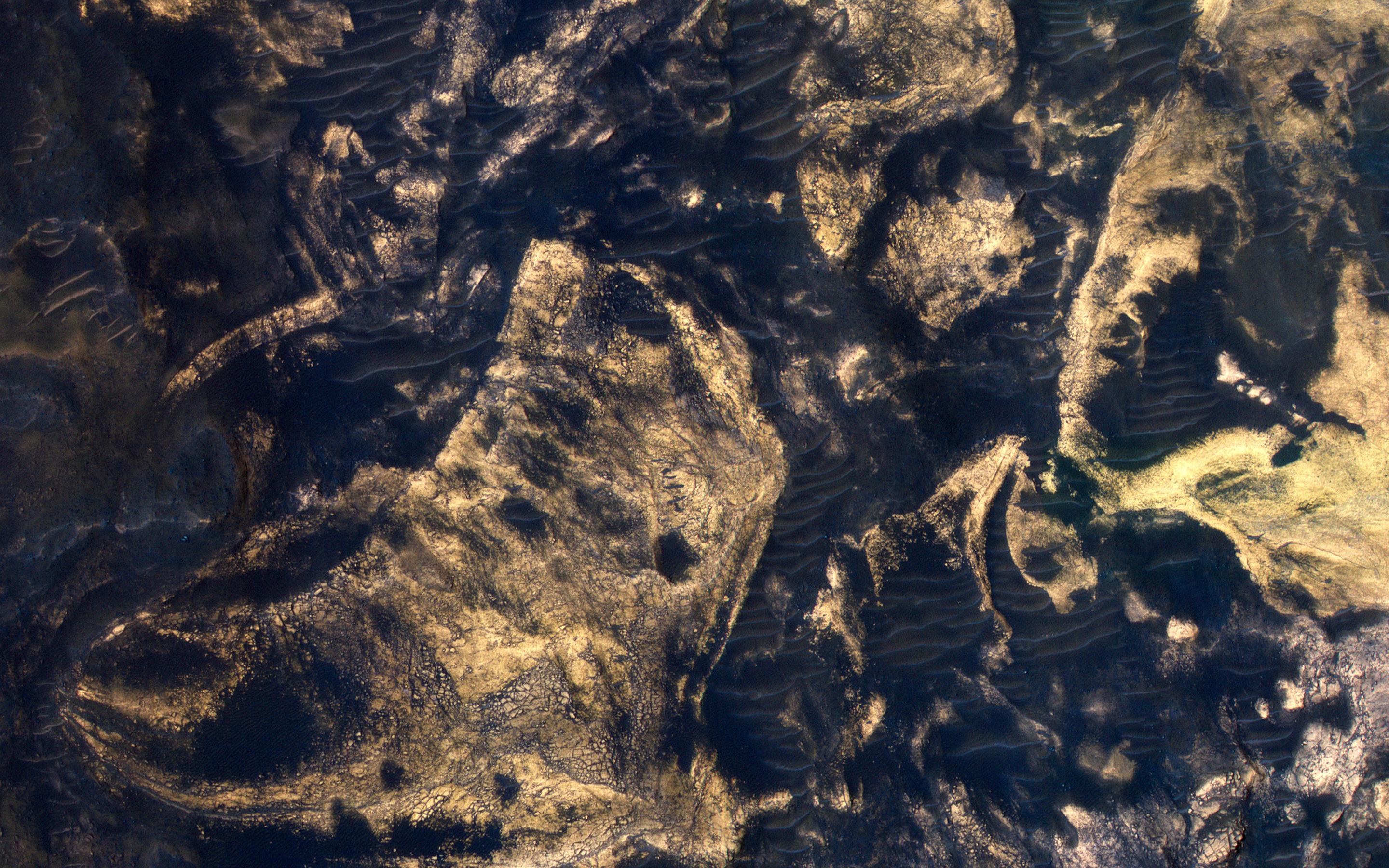
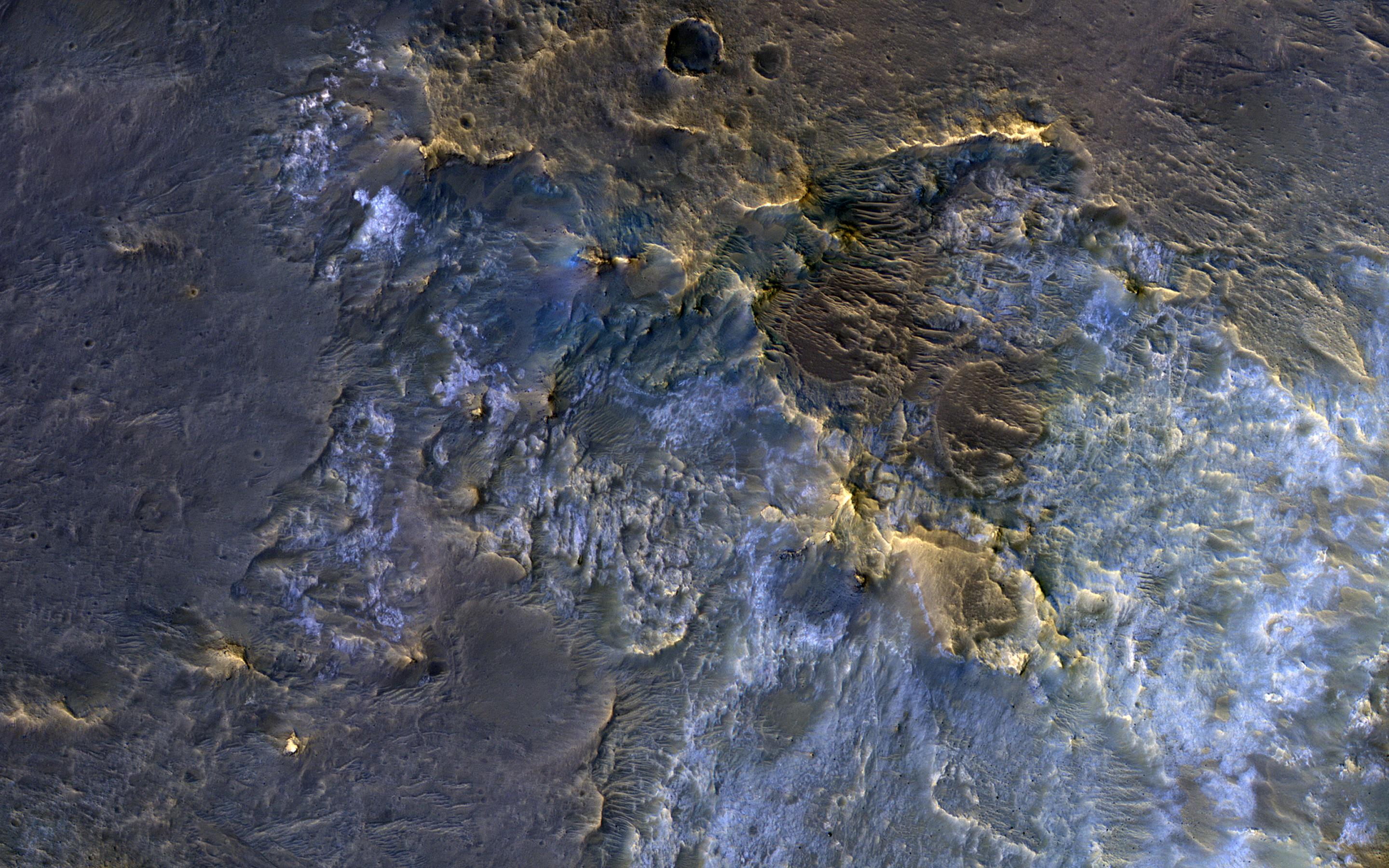
Jumbled Blocks on the Floor of Melas Chasma
Full Resolution:
TIFF
(15.56 MB)
JPEG
(941.4 kB)
|
|
|
2019-02-20 |
Mars
|
Mars Reconnaissance Orbiter (MRO)
|
HiRISE
|
2880x1800x3 |
|
-
PIA23062:
-
Almost Like Water
Full Resolution:
TIFF
(5.191 MB)
JPEG
(1.563 MB)
|
|
|
2019-02-20 |
Mars
|
Mars Reconnaissance Orbiter (MRO)
|
HiRISE
|
2880x1800x3 |
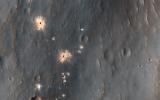
|
-
PIA23061:
-
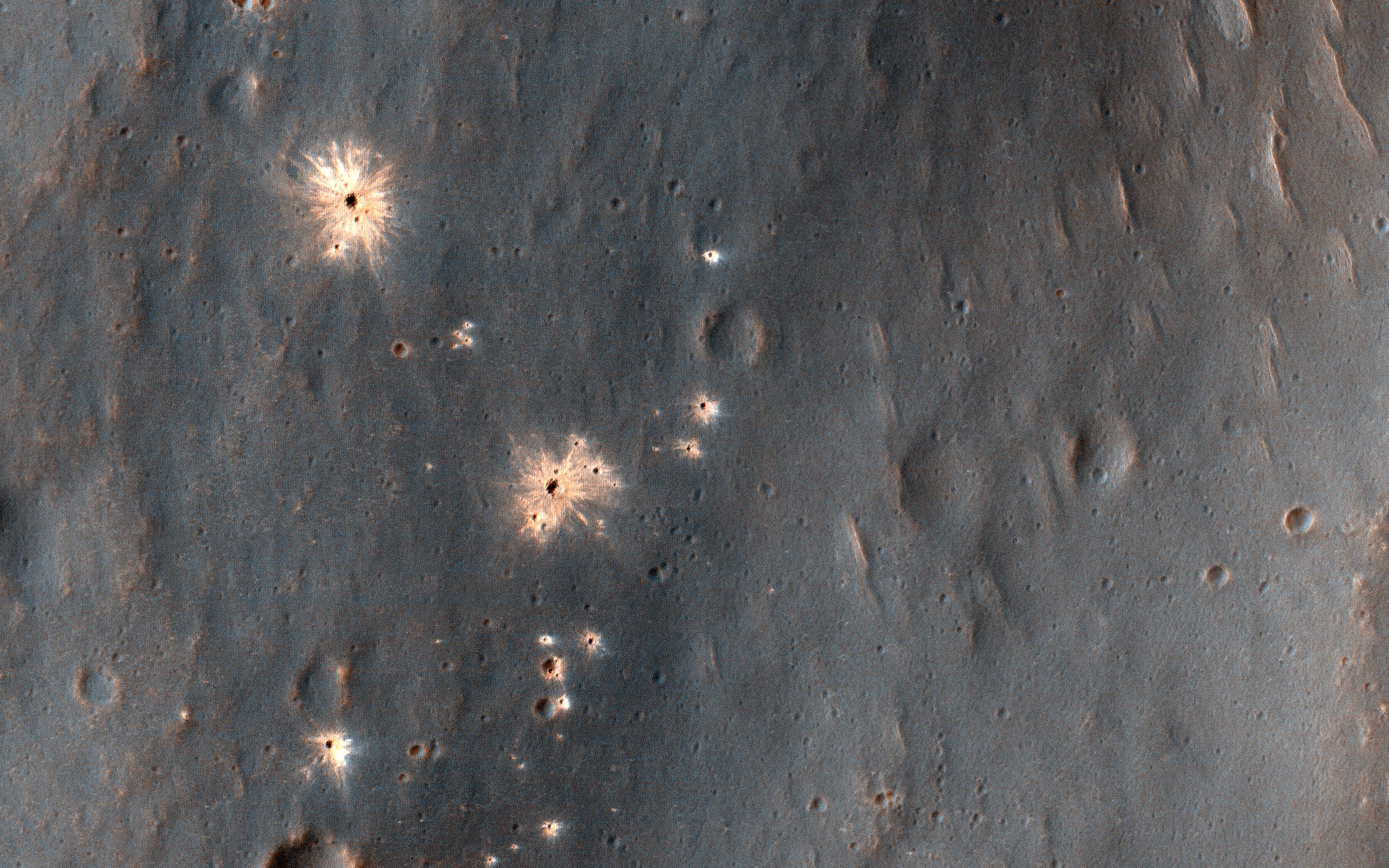
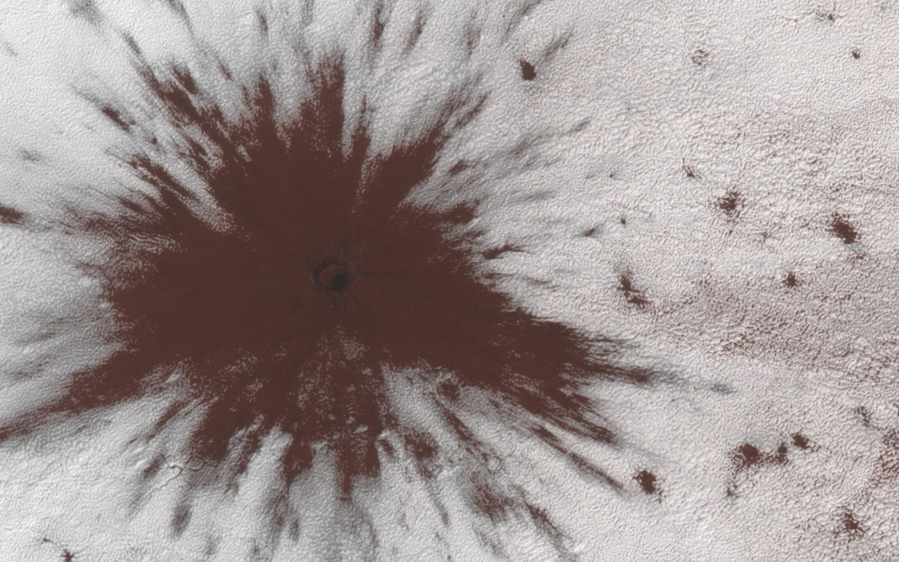
A Recent Impact Site in Noachis Terra
Full Resolution:
TIFF
(15.56 MB)
JPEG
(1.279 MB)
|
|
|
2019-02-20 |
Mars
|
2001 Mars Odyssey
|
THEMIS
|
623x2702x3 |
|
-
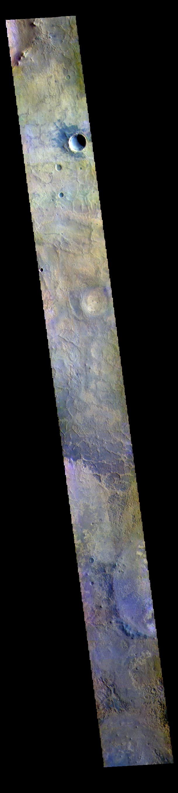
PIA23039:
-
Pasteur Crater - False Color
Full Resolution:
TIFF
(2.321 MB)
JPEG
(137.4 kB)
|
|
|
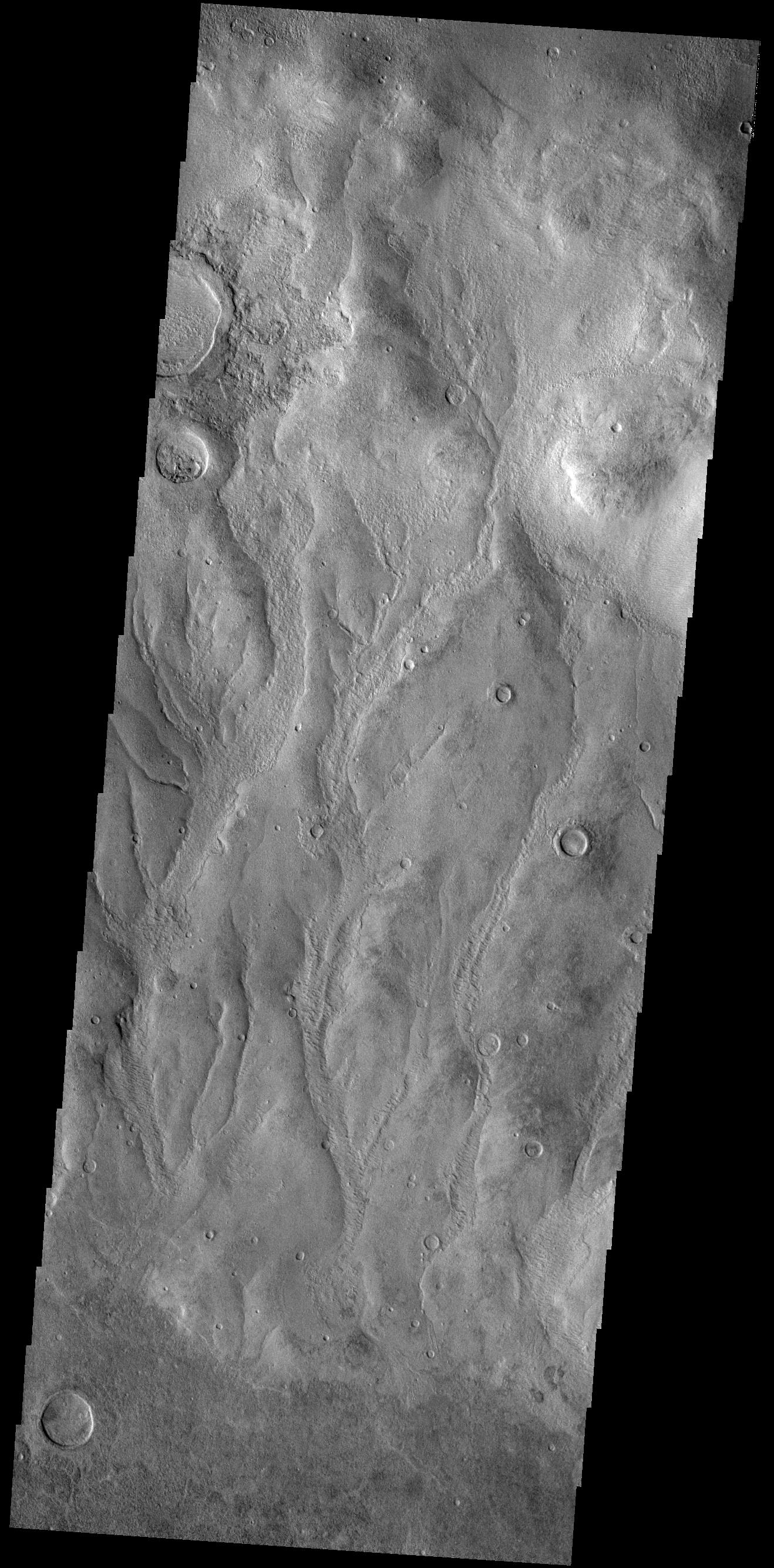
2019-02-19 |
Mars
|
2001 Mars Odyssey
|
THEMIS
|
613x2714x3 |
|
-
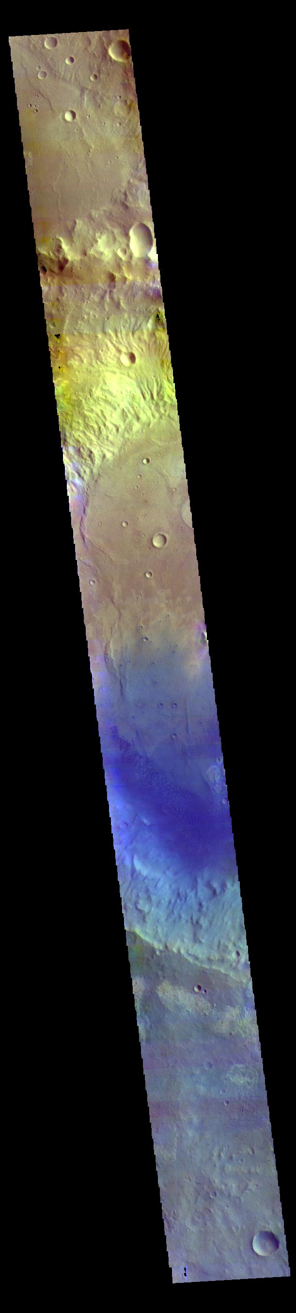
PIA23038:
-
Herschel Crater - False Color
Full Resolution:
TIFF
(2.144 MB)
JPEG
(111.7 kB)
|
|
|
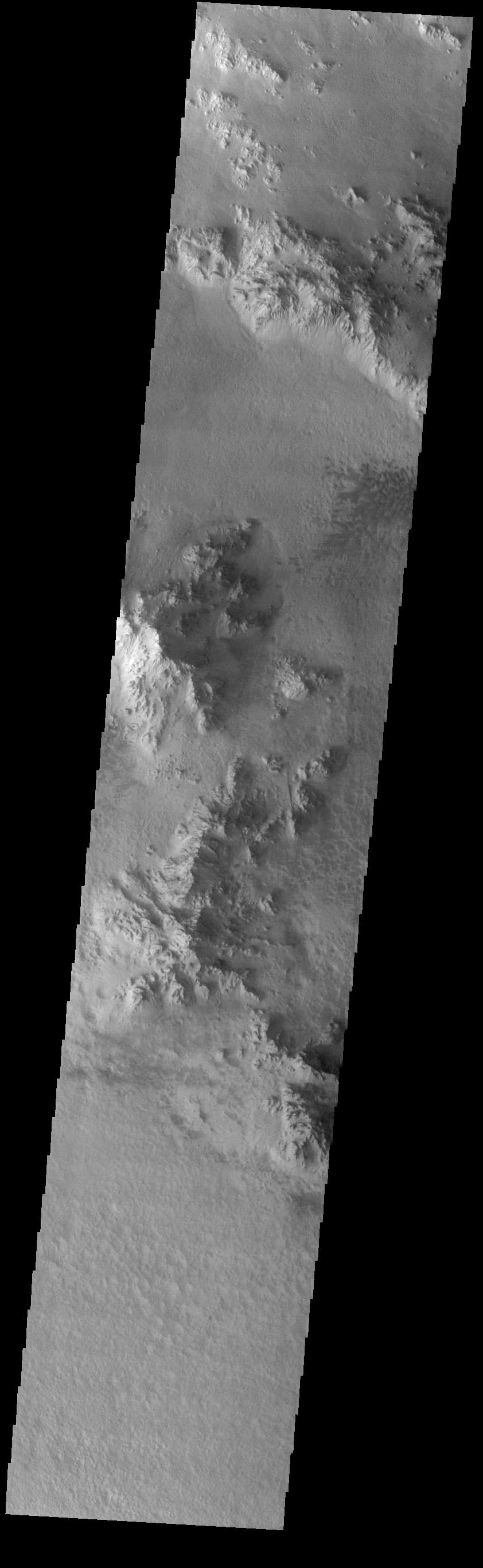
2019-02-18 |
Mars
|
2001 Mars Odyssey
|
THEMIS
|
623x2702x3 |
|
-
PIA23037:
-
Mawrth Vallis - False Color
Full Resolution:
TIFF
(2.335 MB)
JPEG
(135.7 kB)
|
|
|
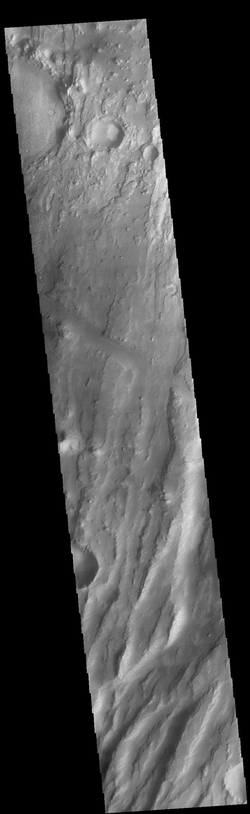
2019-02-15 |
Mars
|
2001 Mars Odyssey
|
THEMIS
|
1319x2675x1 |
|
-
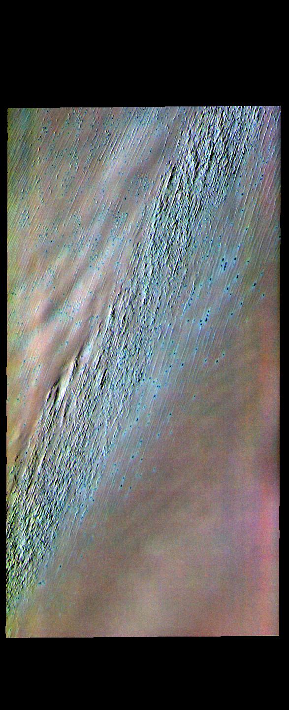
PIA23036:
-
Kaiser Crater Dunes
Full Resolution:
TIFF
(2.215 MB)
JPEG
(195.7 kB)
|
|
|
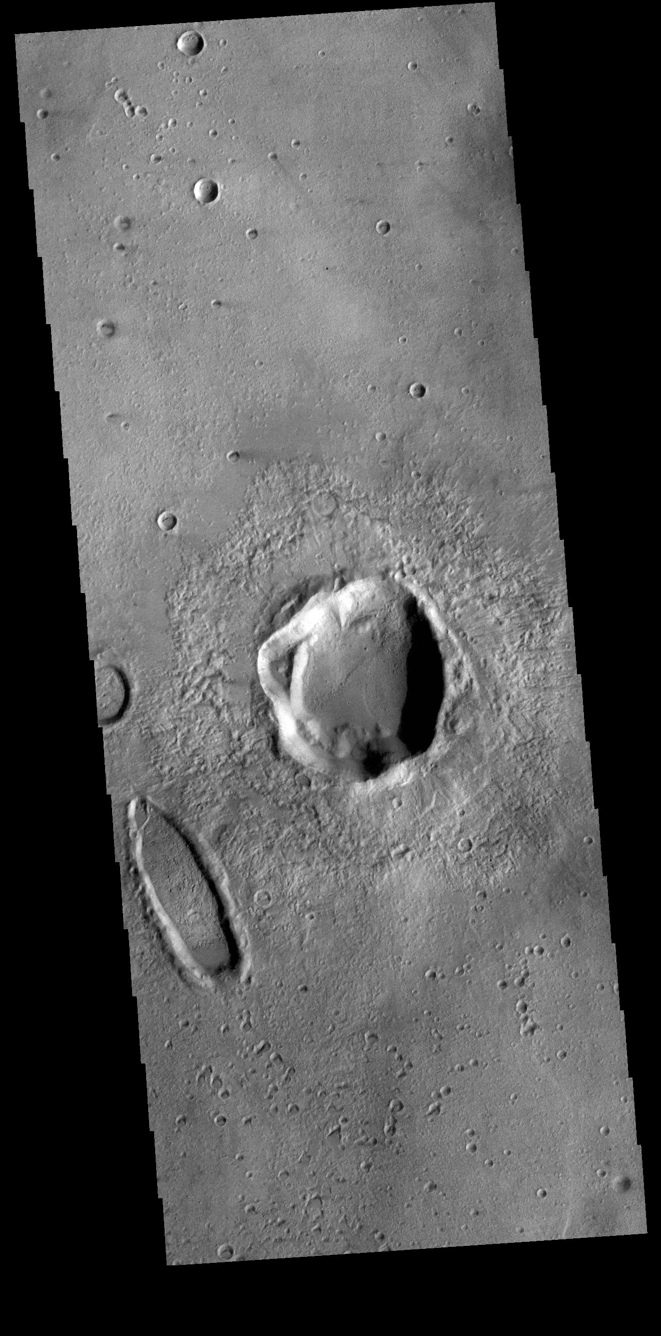
2019-02-14 |
Mars
|
2001 Mars Odyssey
|
THEMIS
|
1045x2722x1 |

|
-
PIA23035:
-
High Latitude Dunes
Full Resolution:
TIFF
(2.14 MB)
JPEG
(167.5 kB)
|
|
|
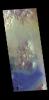
2019-02-13 |
Mars
|
Mars Exploration Rover (MER)
|
Navigation Camera
|
1024x1024x1 |

|
-
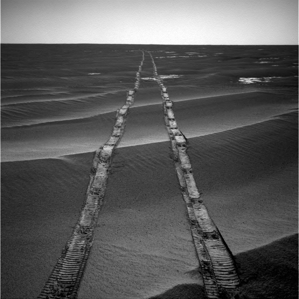
PIA22928:
-
Looking Back on a Golden Opportunity
Full Resolution:
TIFF
(1.022 MB)
JPEG
(159.8 kB)
|
|
|
2019-02-13 |
Mars
|
2001 Mars Odyssey
|
THEMIS
|
668x1430x1 |
|
-
PIA23034:
-
Matara Crater Dunes
Full Resolution:
TIFF
(645.6 kB)
JPEG
(62.36 kB)
|
|
|
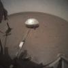
2019-02-13 |
Mars
|
InSight
|
Heat and Physical Properties Package (HP3)
|
1024x1024x3 |
|
-
PIA23046:
-
HP3 on the Martian Surface
Full Resolution:
TIFF
(3.147 MB)
JPEG
(189.3 kB)
|
|
|
2019-02-12 |
Mars
|
2001 Mars Odyssey
|
THEMIS
|
538x1459x1 |
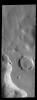
|
-
PIA23033:
-
Crater Gullies
Full Resolution:
TIFF
(663.2 kB)
JPEG
(61.56 kB)
|
|
|
2019-02-11 |
Mars
|
Mars Reconnaissance Orbiter (MRO)
|
HiRISE
|
969x777x3 |
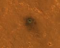
|
-
PIA23043:
-
InSight Seismometer's Wind and Thermal Shield Seen from Space
Full Resolution:
TIFF
(2.26 MB)
JPEG
(190.4 kB)
|
|
|
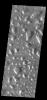
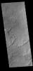
2019-02-11 |
Mars
|
2001 Mars Odyssey
|
THEMIS
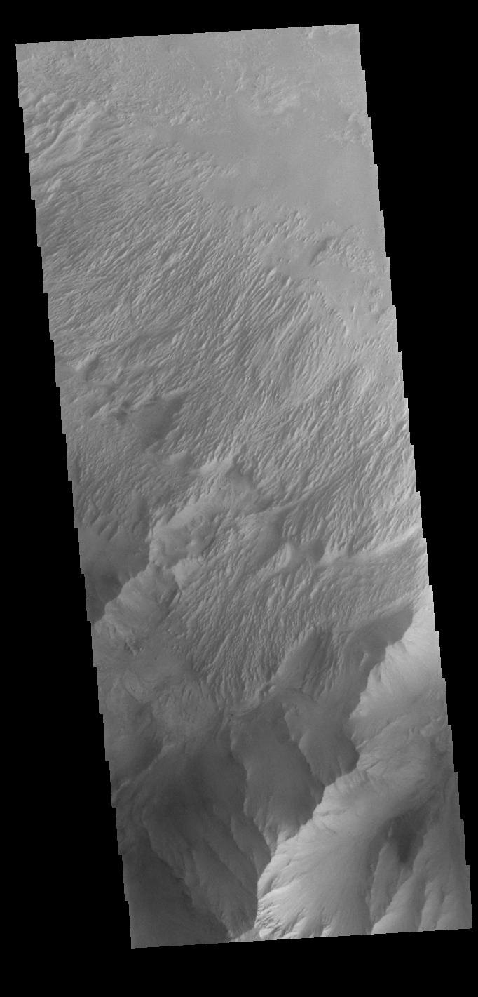
|
672x1411x1 |

|
-
PIA23032:
-
Daedalia Planum
Full Resolution:
TIFF
(749.7 kB)
JPEG
(154.4 kB)
|
|
|
2019-02-08 |
Mars
|
Mars Science Laboratory (MSL)
|
Mastcam
|
2000x466x3 |
|
-
PIA23042:
Curiosity's 360 Panorama of Rock Hall
Full Resolution:
TIFF
(1.967 MB)
JPEG
(163.3 kB)
|
|
|
2019-02-08 |
Mars
|
2001 Mars Odyssey
|
THEMIS
|
1321x2695x1 |

|
-
PIA23031:
-
Crater Dunes
Full Resolution:
TIFF
(2.022 MB)
JPEG
(159.3 kB)
|
|
|
2019-02-07 |
Mars
|
2001 Mars Odyssey
|
THEMIS
|
1314x2662x1 |

|
-
PIA23030:
-
Claritas Fossae Channel
Full Resolution:
TIFF
(2.463 MB)
JPEG
(277.8 kB)
|
|
|
2019-02-06 |
Mars
|
2001 Mars Odyssey
|
THEMIS
|
1346x2693x1 |
|
-
PIA23029:
-
Crater Dunes
Full Resolution:
TIFF
(2.126 MB)
JPEG
(179.5 kB)
|
|
|
2019-02-05 |
Mars
|
Mars Reconnaissance Orbiter (MRO)
|
HiRISE
|
2880x1800x3 |
|
-
PIA23059:
-
Layered History
Full Resolution:
TIFF
(15.56 MB)
JPEG
(2.159 MB)
|
|
|
2019-02-05 |
Mars
|
Mars Reconnaissance Orbiter (MRO)
|
HiRISE
|
2880x1800x3 |
|
-
PIA23058:
-
Wind Flow
Full Resolution:
TIFF
(15.56 MB)
JPEG
(1.055 MB)
|
|
|
2019-02-05 |
Mars
|
Mars Reconnaissance Orbiter (MRO)
|
HiRISE
|
2880x1800x3 |

|
-
PIA23057:
-
Exposing the Rock in Impact Craters
Full Resolution:
TIFF
(15.56 MB)
JPEG
(873.6 kB)
|
|
|
2019-02-05 |
Mars
|
Mars Reconnaissance Orbiter (MRO)
|
HiRISE
|
2880x1800x3 |
|
-
PIA23056:
-
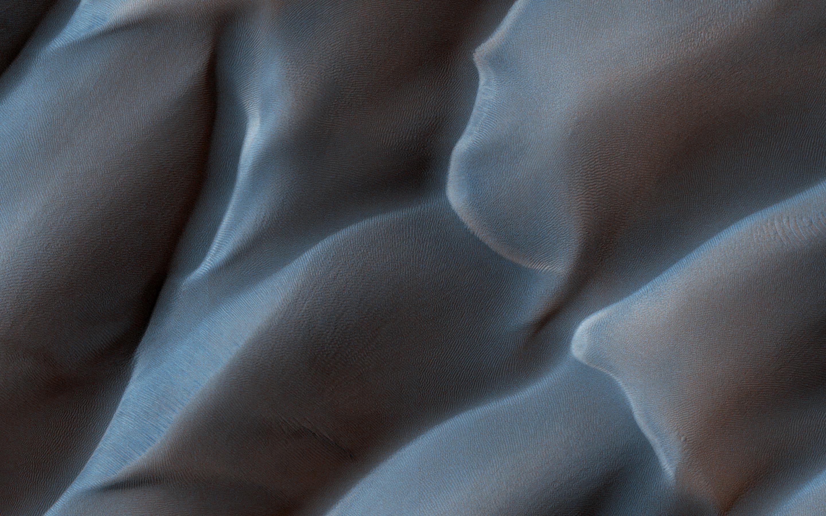
A Dune Field Near Nili Patera
Full Resolution:
TIFF
(15.56 MB)
JPEG
(1.162 MB)
|
|
|
2019-02-05 |
Mars
|
2001 Mars Odyssey
|
THEMIS
|
834x2746x1 |

|
-
PIA23028:
-
Rabe Crater
Full Resolution:
TIFF
(1.245 MB)
JPEG
(104.1 kB)
|
|
|
2019-02-04 |
Mars
|
InSight
|
Instrument Deployment Camera (IDC)
|
1024x1024x3 |
|
-
PIA22959:
-
InSight Deploys its Wind and Thermal Shield
Full Resolution:
TIFF
(2.248 MB)
JPEG
(101.4 kB)
|
|
|
2019-02-04 |
Mars
|
2001 Mars Odyssey
|
THEMIS
|
1013x3278x1 |
|
-
PIA23027:
-
Polar Layers
Full Resolution:
TIFF
(3.281 MB)
JPEG
(563.1 kB)
|
|
|
2019-02-01 |
Mars
|
2001 Mars Odyssey
|
THEMIS
|
718x1665x1 |

|
-
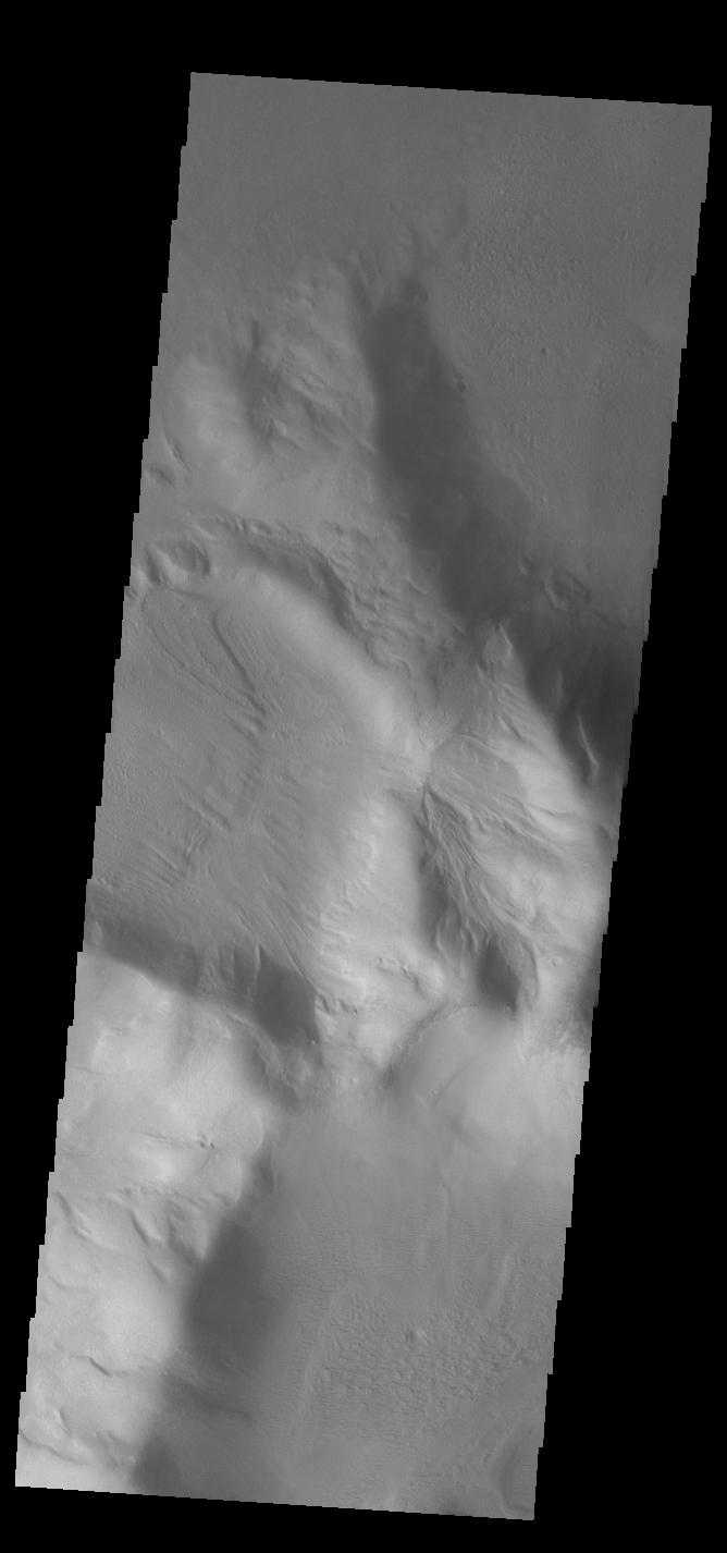
PIA23026:
-
Daedalia Planum
Full Resolution:
TIFF
(901.6 kB)
JPEG
(173.6 kB)
|
|
|
2019-01-31 |
Mars
|
2001 Mars Odyssey
|
THEMIS
|
1444x3304x1 |
|
-
PIA23025:
-
Spallanzani Crater
Full Resolution:
TIFF
(3.02 MB)
JPEG
(349.4 kB)
|
|
|
2019-01-30 |
Mars
|
2001 Mars Odyssey
|
THEMIS
|
1440x3300x1 |
|
-
PIA23024:
-
Dunes and Dust Devils
Full Resolution:
TIFF
(2.692 MB)
JPEG
(249.5 kB)
|
|
|
2019-01-29 |
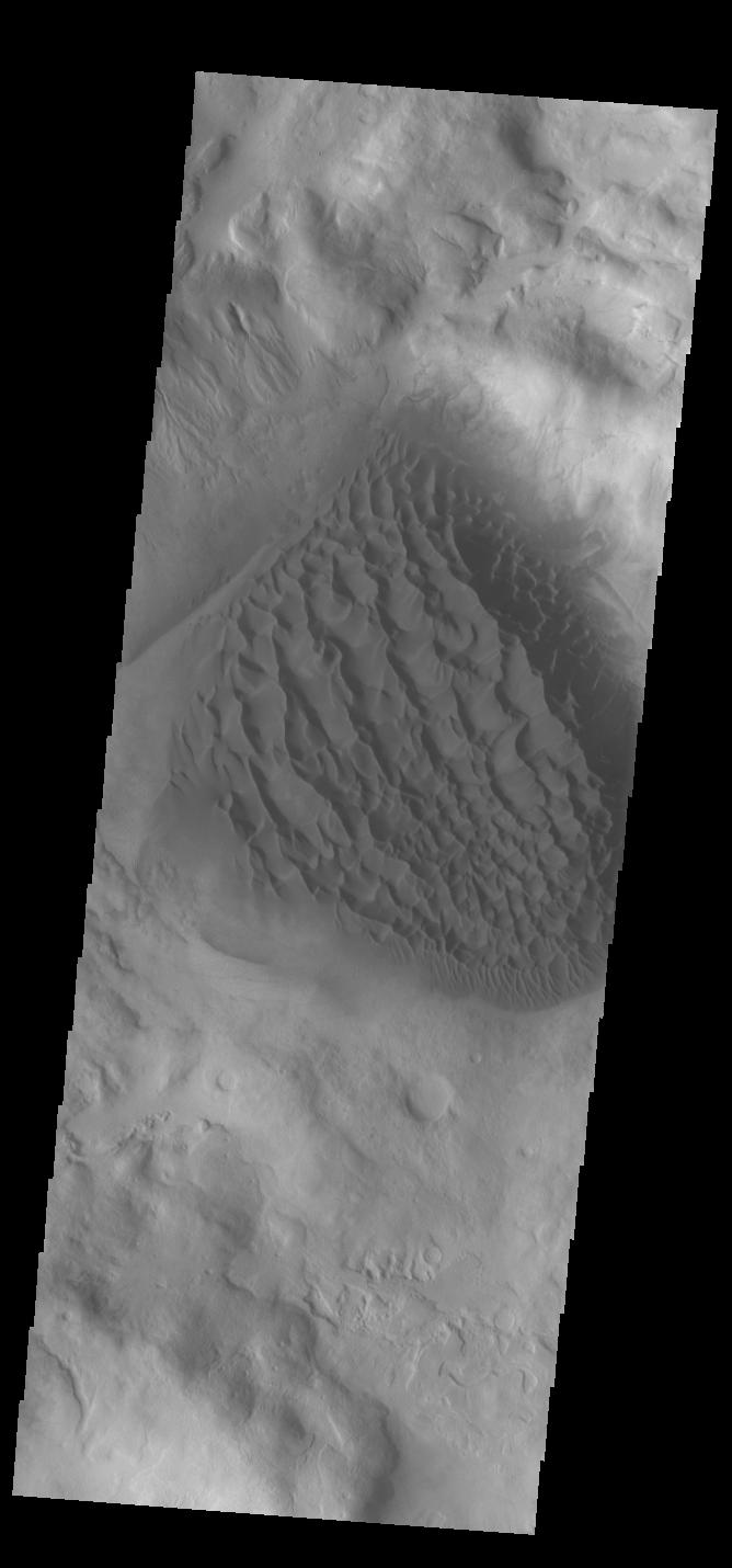
Mars
|
2001 Mars Odyssey
|
THEMIS
|
1399x3291x1 |

|
-
PIA23023:
-
Crater Dunes
Full Resolution:
TIFF
(2.972 MB)
JPEG
(332 kB)
|
|
|
2019-01-28 |
Mars
|
Mars Science Laboratory (MSL)
|
MAHLI
|
10758x10008x3 |
|
-
PIA22960:
-
Curiosity's Selfie at Rock Hall
Full Resolution:
TIFF
(268.3 MB)
JPEG
(11.55 MB)
|
|
|
2019-01-28 |
Mars
|
2001 Mars Odyssey
|
THEMIS
|
1410x3258x1 |
|
-
PIA23016:
-
Daedalia Planum
Full Resolution:
TIFF
(3.353 MB)
JPEG
(598.1 kB)
|
|
|
2019-01-25 |
Mars
|
2001 Mars Odyssey
|
THEMIS
|
1403x3291x1 |

|
-
PIA23015:
-
Gullies
Full Resolution:
TIFF
(2.931 MB)
JPEG
(319.4 kB)
|
|
|
2019-01-24 |
Mars
|
2001 Mars Odyssey
|
THEMIS
|
988x3236x1 |
|
-
PIA23014:
-
Summer at the Pole
Full Resolution:
TIFF
(3.008 MB)
JPEG
(422.6 kB)
|
|
|
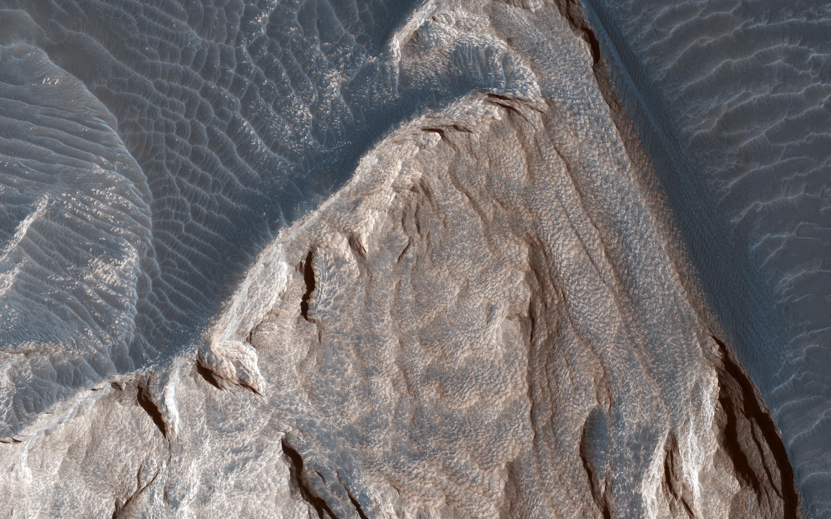
2019-01-23 |
Mars
|
Mars Reconnaissance Orbiter (MRO)
|
HiRISE
|
2880x1800x3 |
|
-
PIA23022:
-
Cross-Section of a Complex Crater
Full Resolution:
TIFF
(5.191 MB)
JPEG
(801.2 kB)
|
|
|
2019-01-23 |
Mars
|
Mars Reconnaissance Orbiter (MRO)
|
HiRISE
|
2880x1800x3 |
|
-
PIA23021:
-
A First Look at Dunes
Full Resolution:
TIFF
(15.56 MB)
JPEG
(750 kB)
|
|
|
2019-01-23 |
Mars
|
Mars Reconnaissance Orbiter (MRO)
|
HiRISE
|
2880x1800x3 |
|
-
PIA23020:
-
Multi-Elevation Gullies
Full Resolution:
TIFF
(15.56 MB)
JPEG
(1.298 MB)
|
|
|
2019-01-23 |
Mars
|
Mars Reconnaissance Orbiter (MRO)
|
HiRISE
|
2880x1800x3 |

|
-
PIA23019:
-
Impact Near the South Pole
Full Resolution:
TIFF
(14.66 MB)
JPEG
(795 kB)
|
|
|
2019-01-23 |
Mars
|
2001 Mars Odyssey
|
THEMIS
|
719x1676x1 |

|
-
PIA23013:
-
Ma'adim Vallis
Full Resolution:
TIFF
(805.6 kB)
JPEG
(81 kB)
|
|
|
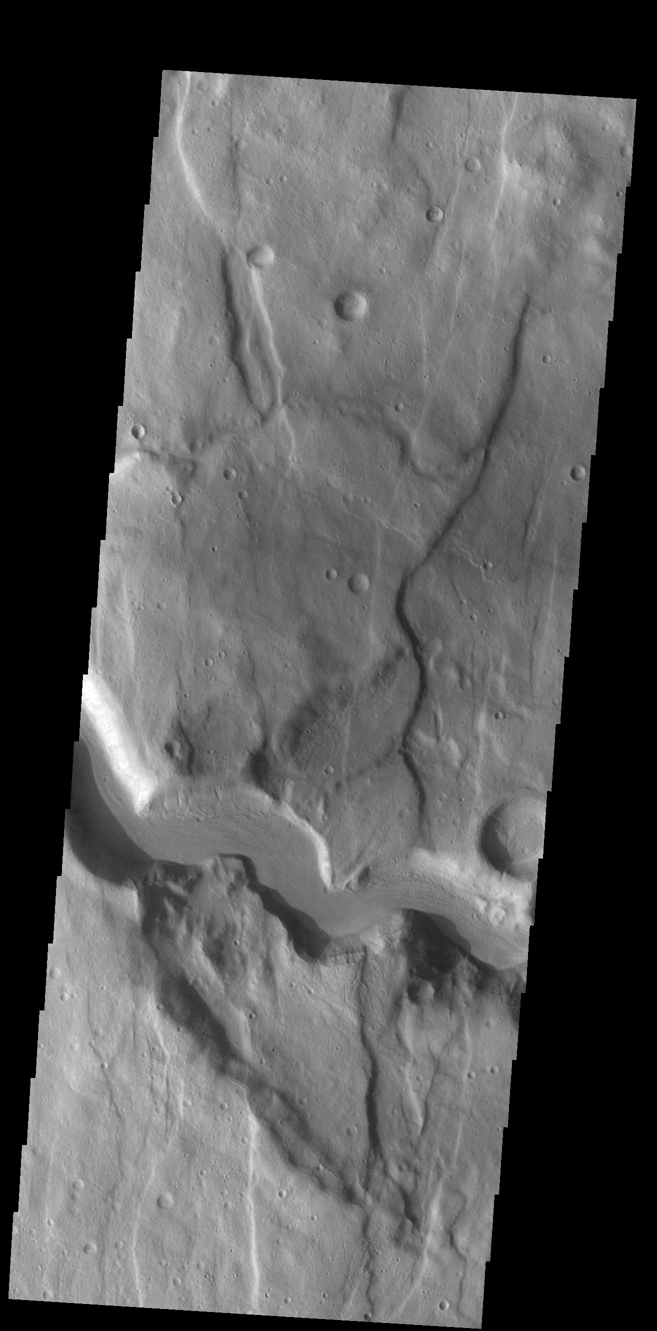
2019-01-22 |
Mars
|
2001 Mars Odyssey
|
THEMIS
|
682x1421x1 |

|
-
PIA23012:
-
Candor Chasma
Full Resolution:
TIFF
(688.5 kB)
JPEG
(82.69 kB)
|
|
|
2019-01-21 |
Mars
|
2001 Mars Odyssey
|
THEMIS
|
674x1421x1 |
|
-
PIA23011:
-
Out of Round
Full Resolution:
TIFF
(727.3 kB)
JPEG
(106.6 kB)
|
|
|
2019-01-18 |
Mars
|
2001 Mars Odyssey
|
THEMIS
|
668x1426x1 |
|
-
PIA22999:
-
Moving Downhill
Full Resolution:
TIFF
(622.4 kB)
JPEG
(53.15 kB)
|
|
|
2019-01-17 |
Mars
|
2001 Mars Odyssey
|
THEMIS
|
1324x2675x1 |

|
-
PIA22998:
-
More Gullies
Full Resolution:
TIFF
(2.458 MB)
JPEG
(267.5 kB)
|
|
|
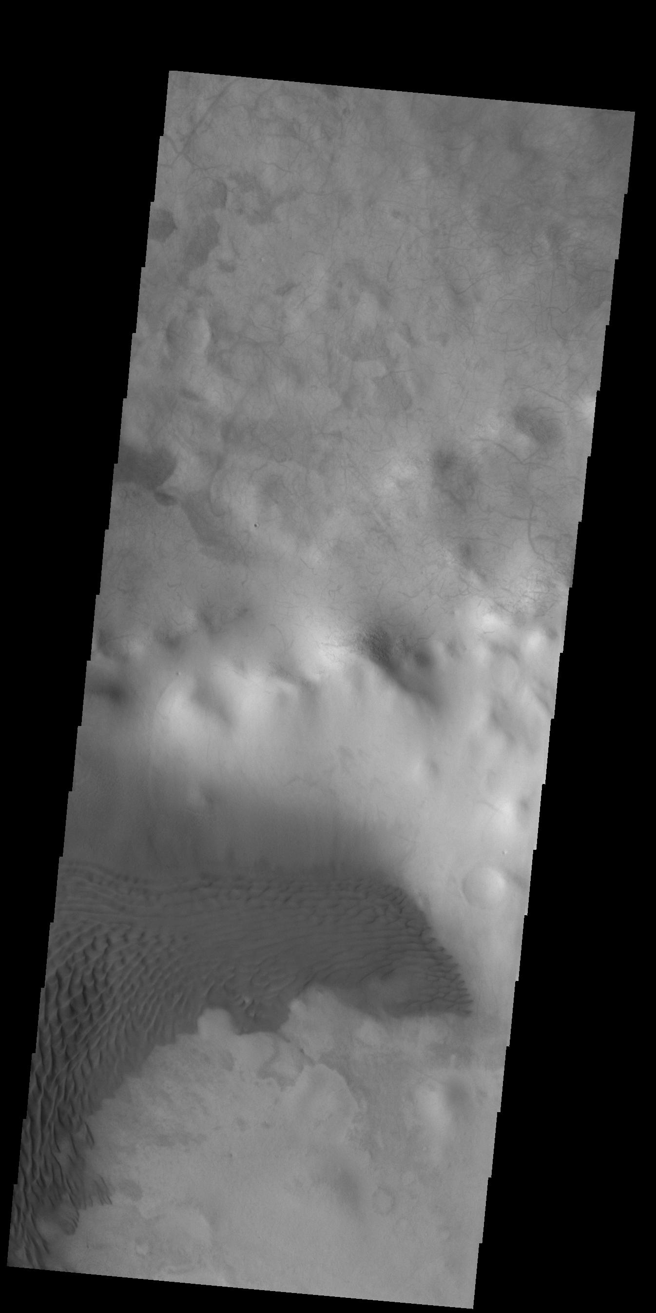
2019-01-16 |
Mars
|
2001 Mars Odyssey
|
THEMIS
|
1320x2682x1 |

|
-
PIA22997:
-
Gullies
Full Resolution:
TIFF
(2.581 MB)
JPEG
(356.6 kB)
|
|
|
2019-01-15 |
Mars
|
2001 Mars Odyssey
|
THEMIS
|
537x1453x1 |
|
-
PIA22996:
-
Southern Crater
Full Resolution:
TIFF
(661.5 kB)
JPEG
(65.48 kB)
|
|
|
2019-01-14 |
Mars
|
2001 Mars Odyssey
|
THEMIS
|
1318x2669x1 |
|
-
PIA22995:
-
Kaiser Crater Gullies
Full Resolution:
TIFF
(2.895 MB)
JPEG
(516.2 kB)
|
|
|
2019-01-11 |
Mars
|
2001 Mars Odyssey
|
THEMIS
|
842x2736x1 |
|
-
PIA22994:
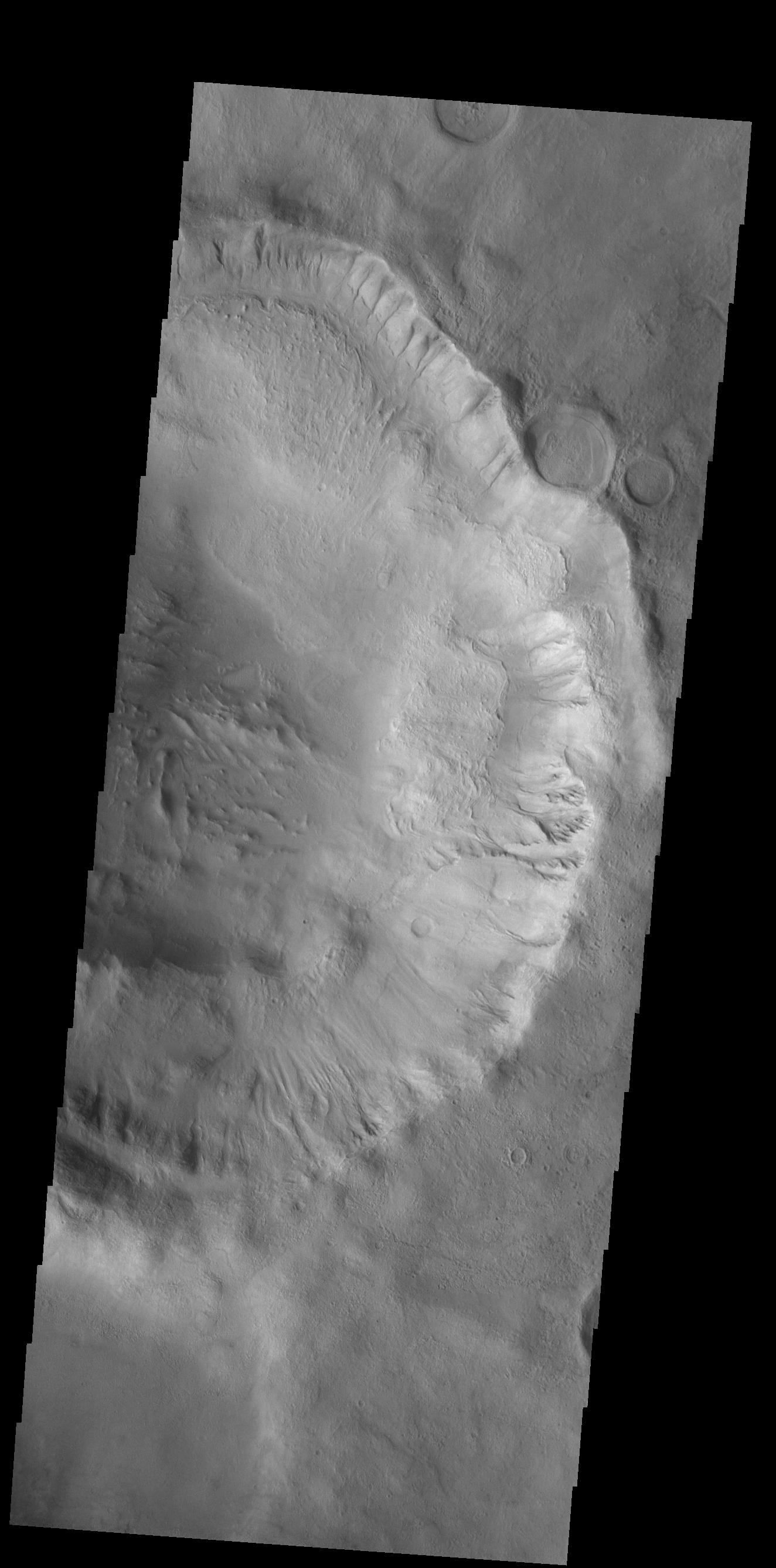
-
Hale Crater
Full Resolution:
TIFF
(1.438 MB)
JPEG
(182.7 kB)
|
|
|
2019-01-10 |
Mars
|
2001 Mars Odyssey
|
THEMIS
|
841x2730x1 |

|
-
PIA22993:
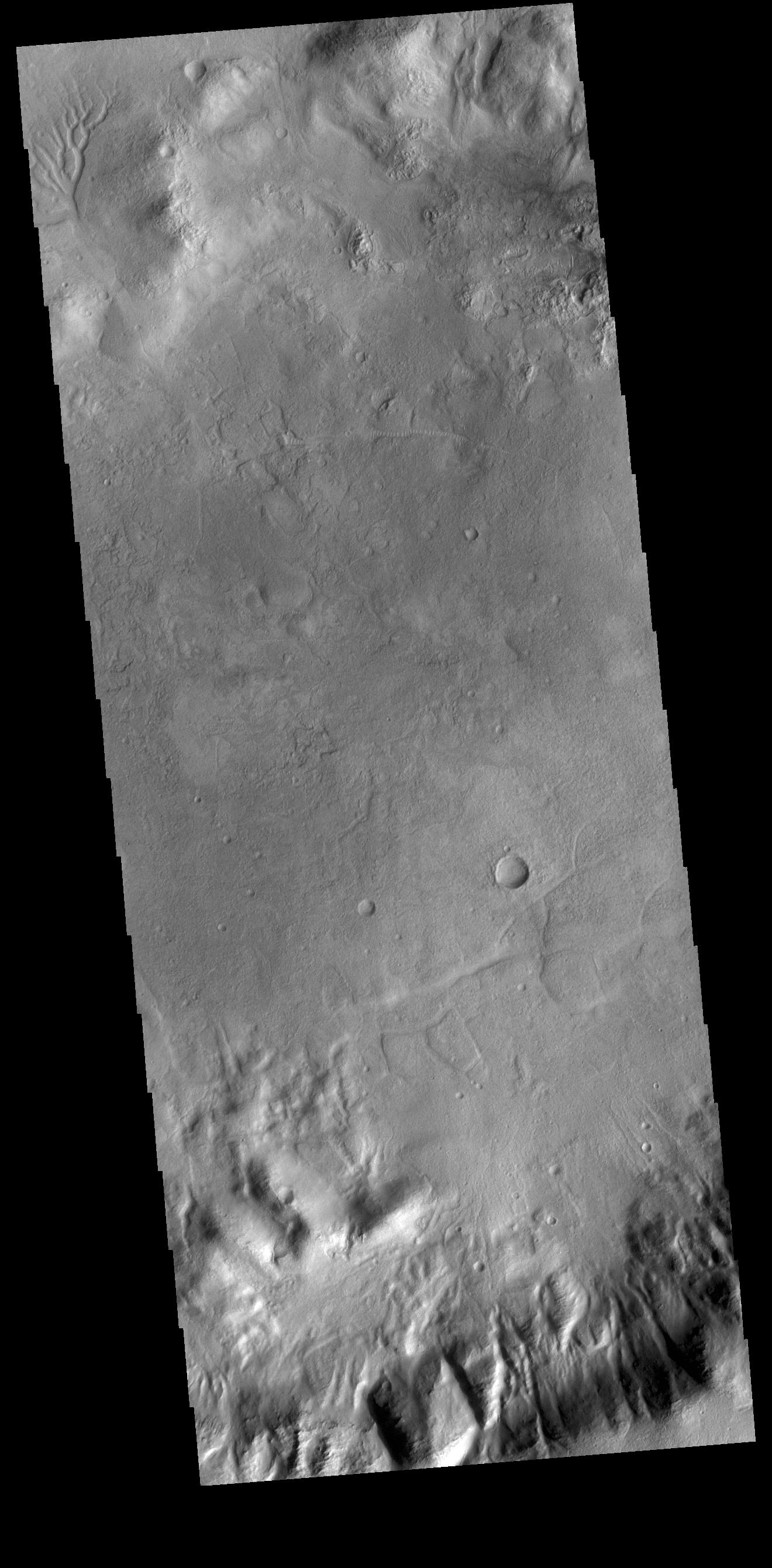
-
Claritas Fossae
Full Resolution:
TIFF
(1.449 MB)
JPEG
(165.9 kB)
|
|
|
2019-01-09 |
Mars
|
2001 Mars Odyssey
|
THEMIS
|
1321x2667x1 |
|
-
PIA22992:
-
There's Something Odd Here
Full Resolution:
TIFF
(2.691 MB)
JPEG
(452.4 kB)
|
|
|
2019-01-08 |
Mars
|
2001 Mars Odyssey
|
THEMIS
|
837x2751x1 |
|
-
PIA22991:
-
Maunder Crater Gullies
Full Resolution:
TIFF
(1.4 MB)
JPEG
(128.9 kB)
|
|
|
2019-01-07 |
Mars
|
2001 Mars Odyssey
|
THEMIS
|
986x2623x1 |
|
-
PIA22990:
-
Polar Ice
Full Resolution:
TIFF
(2.589 MB)
JPEG
(440.3 kB)
|
|
|
2019-01-04 |
Mars
|
2001 Mars Odyssey
|
THEMIS
|
1410x3256x1 |
|
-
PIA22989:
-
Sirenum Fossae
Full Resolution:
TIFF
(3.425 MB)
JPEG
(460.9 kB)
|
|
|
2019-01-03 |
Mars
|
2001 Mars Odyssey
|
THEMIS
|
1330x2685x1 |
|
-
PIA22988:
-
Crater Dunes
Full Resolution:
TIFF
(2.324 MB)
JPEG
(224.2 kB)
|
 Planetary Data System


