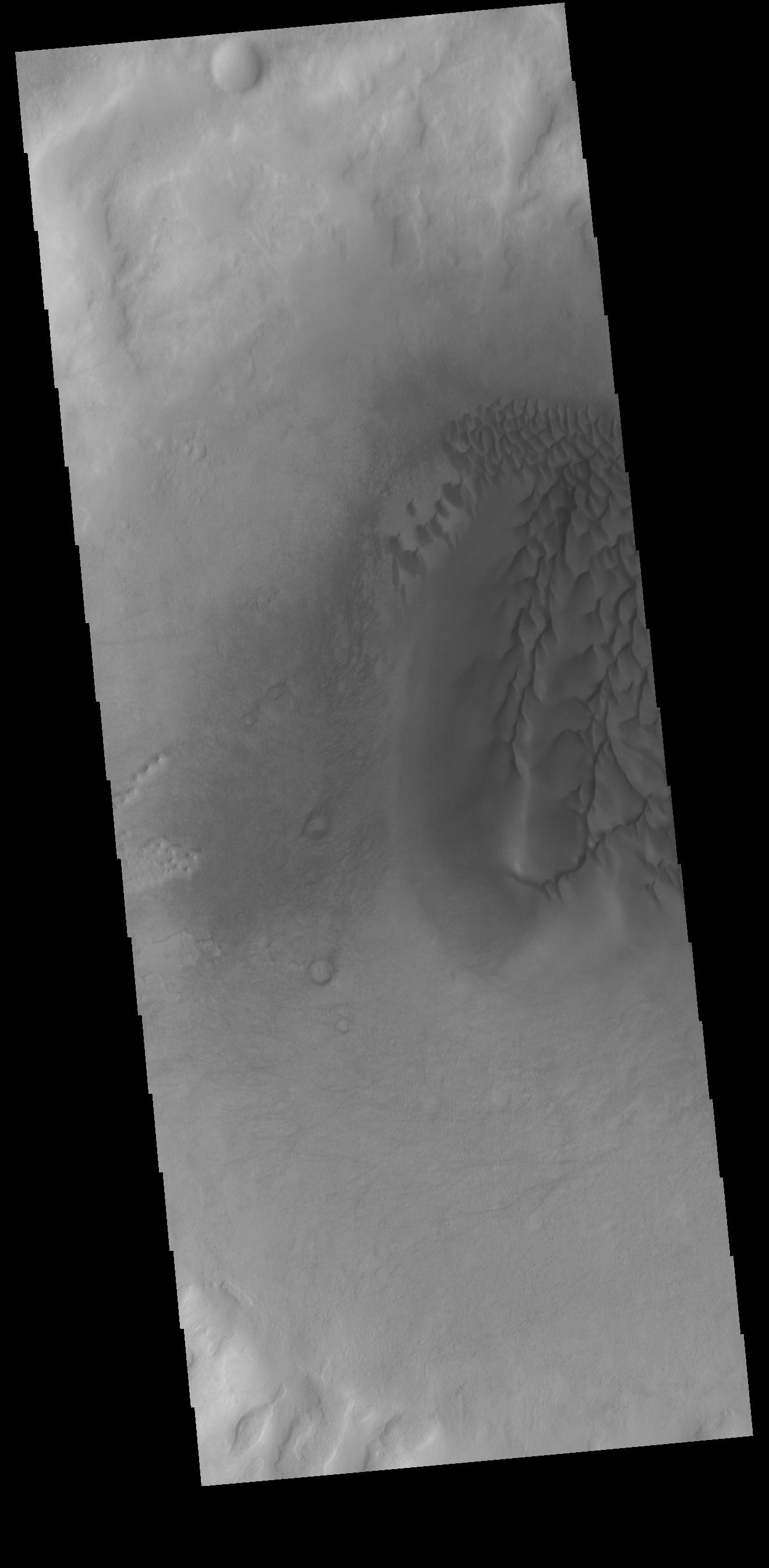
Context imageThis VIS image shows part of the floor of an unnamed crater in Noachis Terra. Individual dunes and a large sand sheet with surface dune morphology fill a large area of the crater floor. The amount of sand controls the formation of dunes. Regions with only a limited amount of sand will contain small individual dunes. As more sand enters a region the dunes will grow larger. When large amounts of sand fill a region, individual dunes will coalesce into larger and larger dunes, eventually completely covering the surface as a sand sheet with dune crest features on the top. Dunes often occur in craters on Mars.
Orbit Number: 75357 Latitude: -52.1099 Longitude: 33.1768 Instrument: VIS Captured: 2018-12-10 03:58
Please see the THEMIS Data Citation Note for details on crediting THEMIS images.
NASA's Jet Propulsion Laboratory manages the 2001 Mars Odyssey mission for NASA's Science Mission Directorate, Washington, D.C. The Thermal Emission Imaging System (THEMIS) was developed by Arizona State University, Tempe, in collaboration with Raytheon Santa Barbara Remote Sensing. The THEMIS investigation is led by Dr. Philip Christensen at Arizona State University. Lockheed Martin Astronautics, Denver, is the prime contractor for the Odyssey project, and developed and built the orbiter. Mission operations are conducted jointly from Lockheed Martin and from JPL, a division of the California Institute of Technology in Pasadena.
