My
List |
Addition Date
|
Target
|
Mission
|
Instrument
|
Size
|

|
2000-02-18 |
Earth
|
Shuttle Radar Topography Mission (SRTM)
|
C-Band Interferometric Radar
|
1856x1852x3 |
|
-
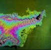
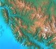
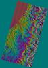
PIA02720:
-
Honolulu, Hawaii Radar Image, Wrapped Color as Height
Full Resolution:
TIFF
(2.443 MB)
JPEG
(1.319 MB)
|
|
|
2000-02-18 |
Earth
|
Landsat
Shuttle Radar Topography Mission (SRTM)
|
C-Band Interferometric Radar
Thematic Mapper
|
1939x1999x3 |
|
-
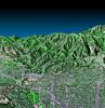
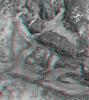
PIA02718:
-
Pasadena, California Perspective View with Aerial Photo and Landsat Overlay
Full Resolution:
TIFF
(10.26 MB)
JPEG
(872.3 kB)
|
|
|
2000-02-18 |
Earth
|
Landsat
Shuttle Radar Topography Mission (SRTM)
|
C-Band Interferometric Radar
Thematic Mapper
|
1363x2200x3 |
|
-
PIA02717:
-
Kamchatka Peninsula, Russia 3-D Perspective with Landsat Overlay
Full Resolution:
TIFF
(8.536 MB)
JPEG
(860.9 kB)
|
|
|
2000-02-17 |
Earth
|
Shuttle Radar Topography Mission (SRTM)
|
C-Band Interferometric Radar
|
1059x722x3 |
|
-
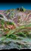
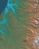
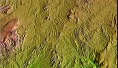
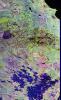
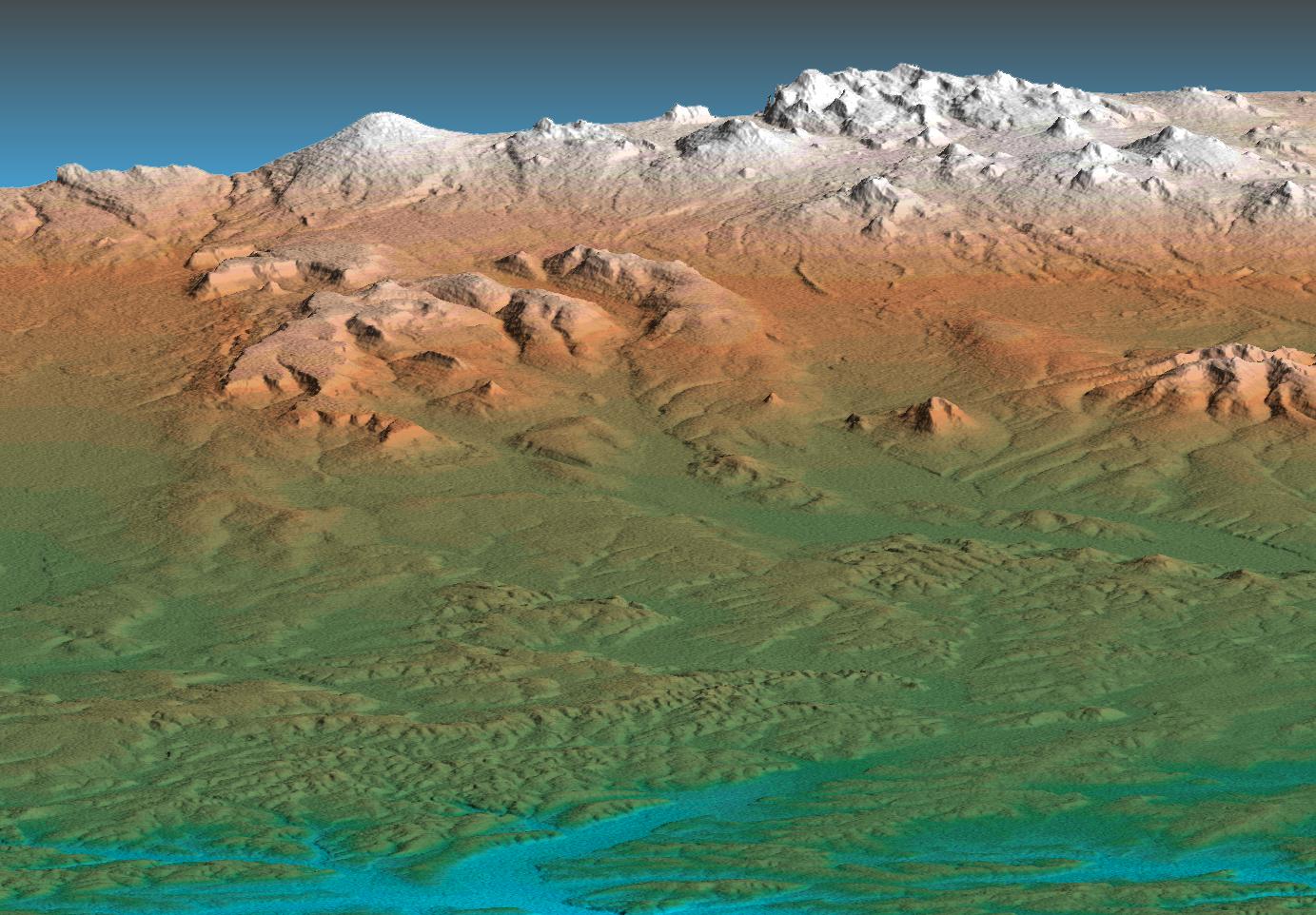
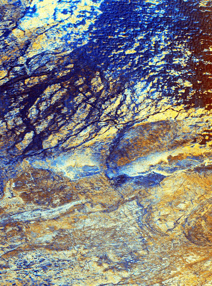
PIA02711:
-
Simi Valley, California, Perspective View of Shaded Relief, Color as Height
Full Resolution:
TIFF
(2.166 MB)
JPEG
(207.8 kB)
|
|
|
2000-02-17 |
Earth
|
Shuttle Radar Topography Mission (SRTM)
|
C-Band Interferometric Radar
|
1228x1093x3 |
|
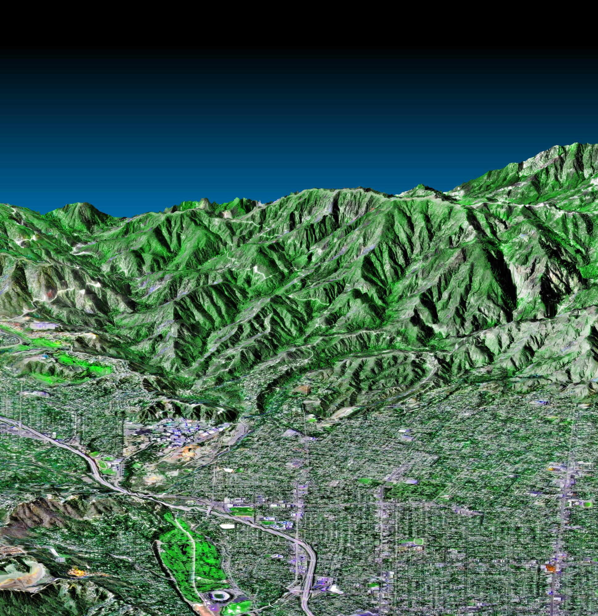
-
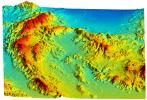
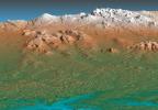
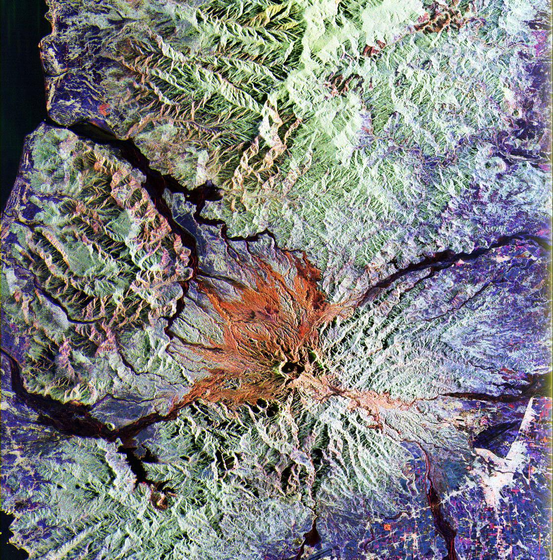
PIA02716:
-
San Gabriel Mountains, California, Shaded relief, Color as Height
Full Resolution:
TIFF
(4.009 MB)
JPEG
(232.8 kB)
|
|
|
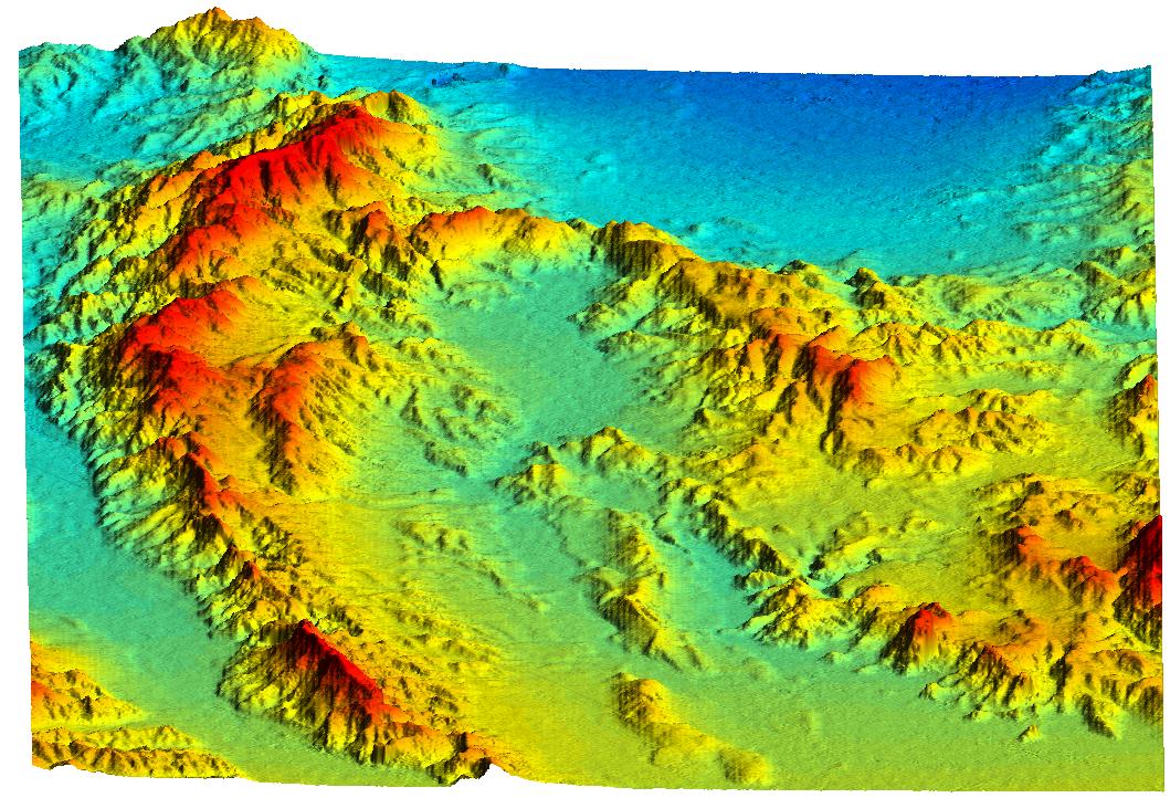
2000-02-17 |
Earth
|
Shuttle Radar Topography Mission (SRTM)
|
C-Band Interferometric Radar
|
1228x1093x3 |

|
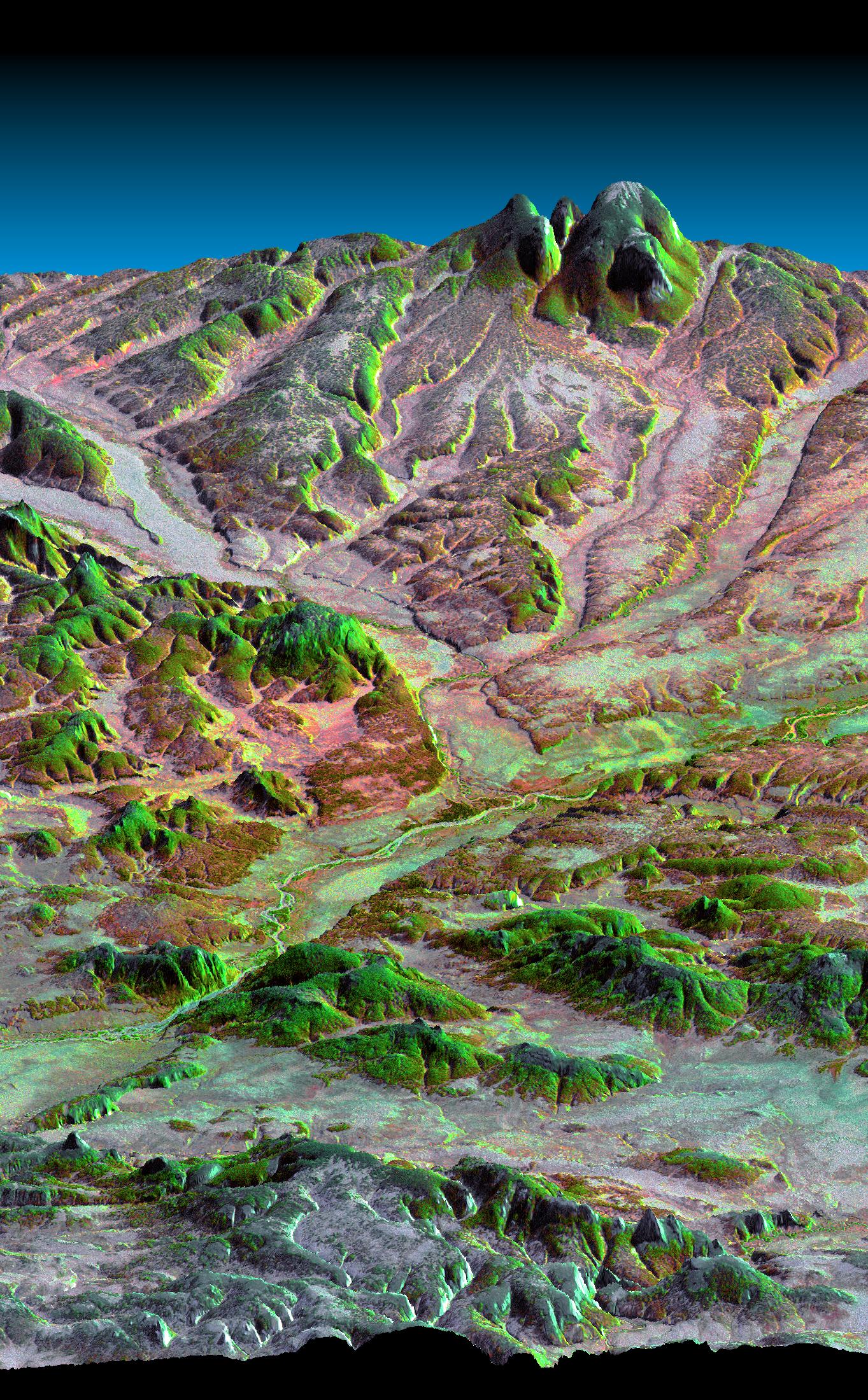
-
PIA02715:
-
San Gabriel Mountains, California, Radar Image, Color as Height
Full Resolution:
TIFF
(3.906 MB)
JPEG
(326.9 kB)
|
|
|
2000-02-17 |
Earth
|
Shuttle Radar Topography Mission (SRTM)
|
C-Band Interferometric Radar
|
1357x982x3 |
|
-
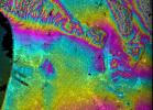
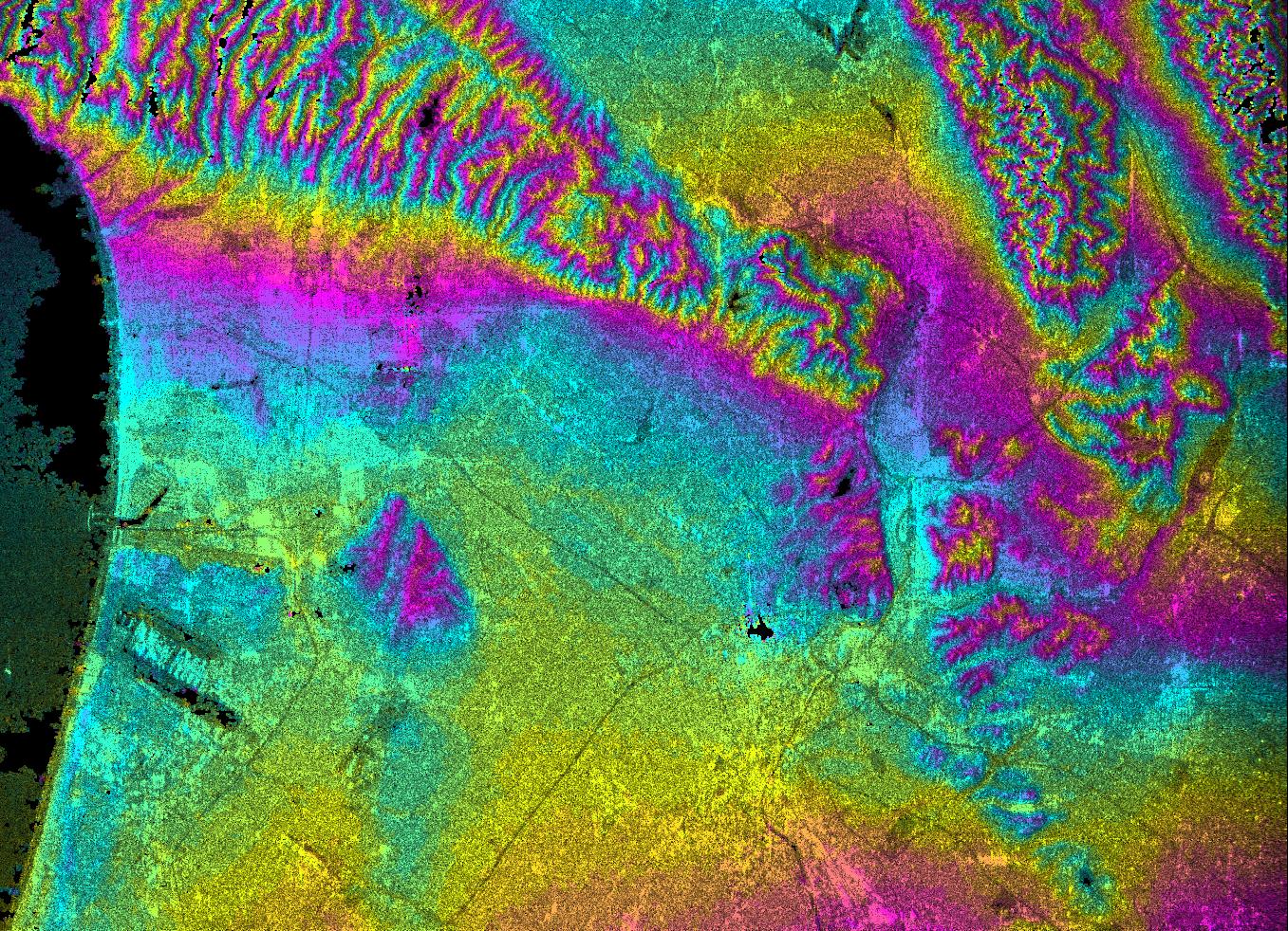
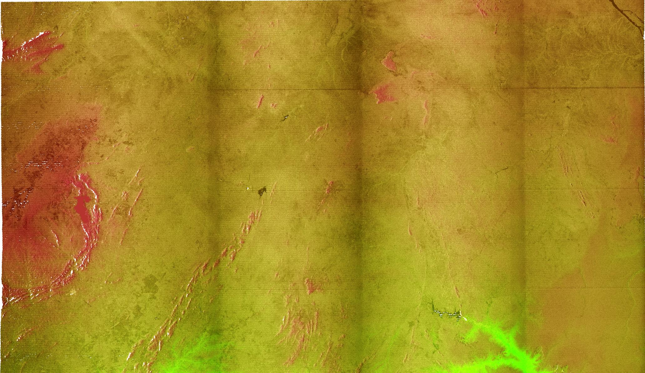
PIA02713:
-
Los Angeles, California, Radar Image, Wrapped Color as Height
Full Resolution:
TIFF
(1.232 MB)
JPEG
(587.3 kB)
|
|
|
2000-02-17 |
Earth
|
Shuttle Radar Topography Mission (SRTM)
|
C-Band Interferometric Radar
|
1749x4787x3 |
|
-
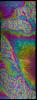
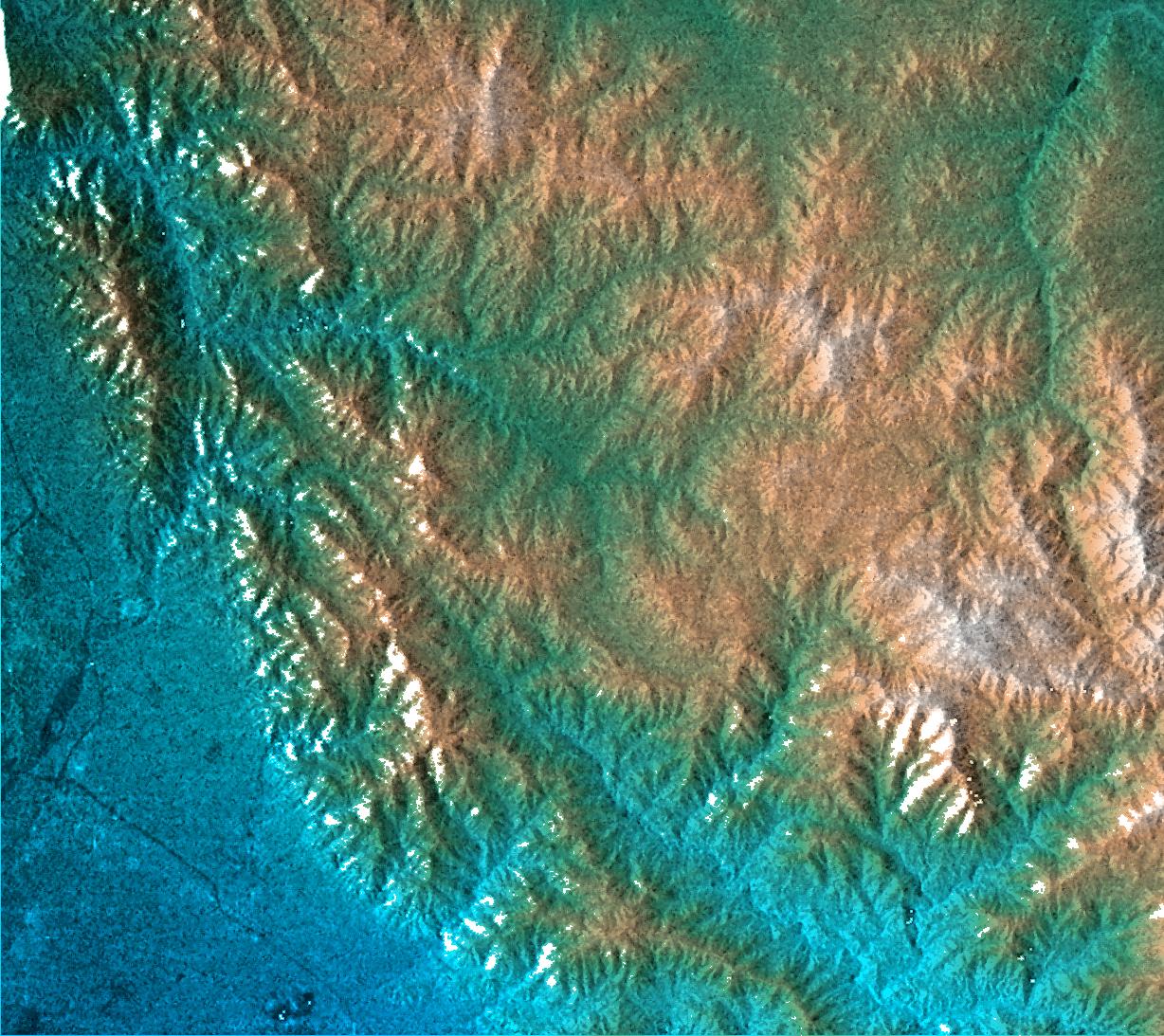
PIA02714:
-
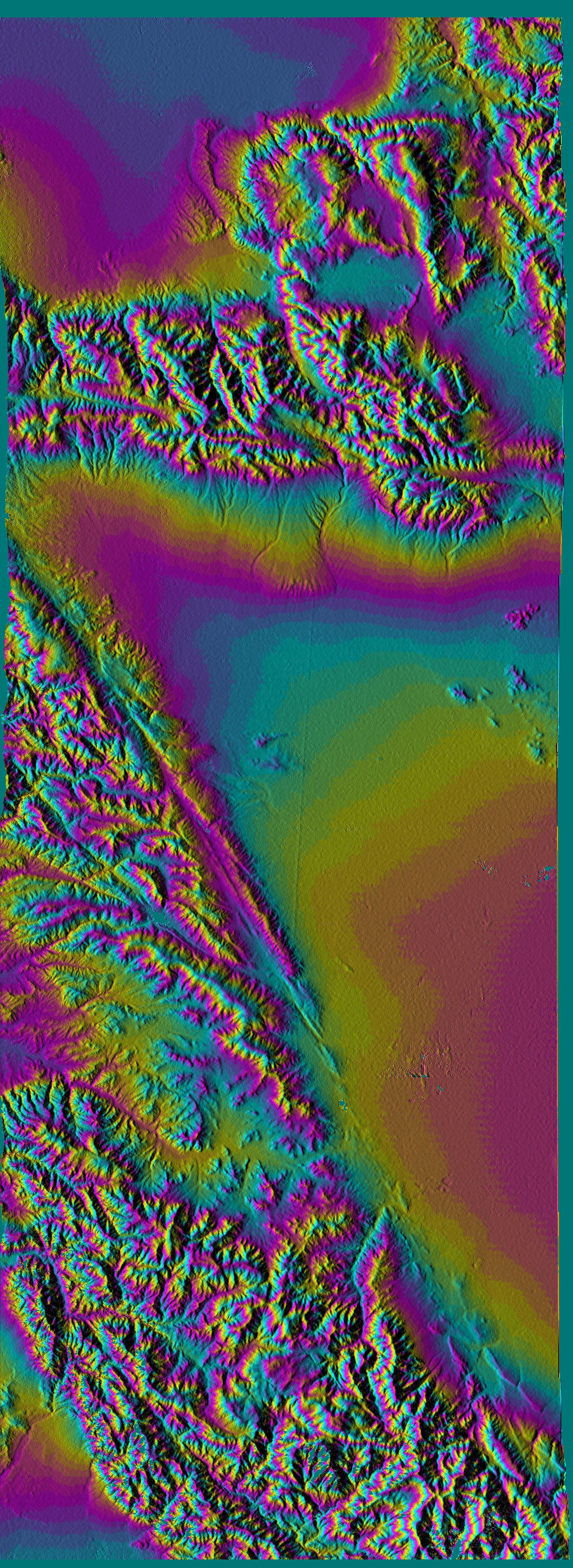
San Andreas Fault, Southern California , Radar Image, Wrapped Color as Height
Full Resolution:
TIFF
(7.228 MB)
JPEG
(3.292 MB)
|
|
|
2000-02-17 |
Earth
|
Shuttle Radar Topography Mission (SRTM)
|
C-Band Interferometric Radar
|
1749x4787x3 |
|
-
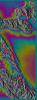
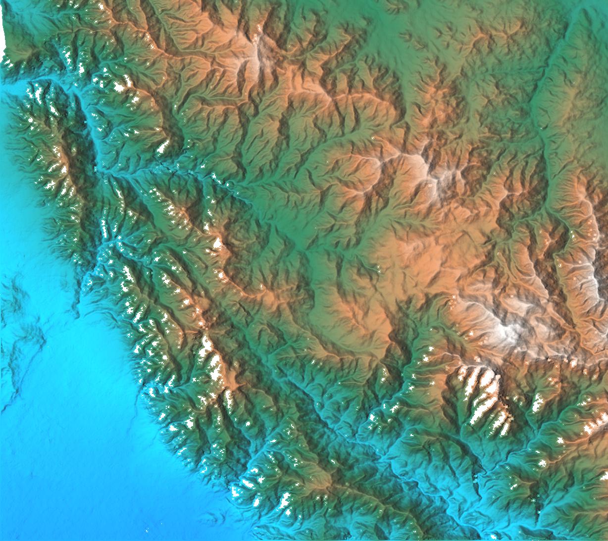
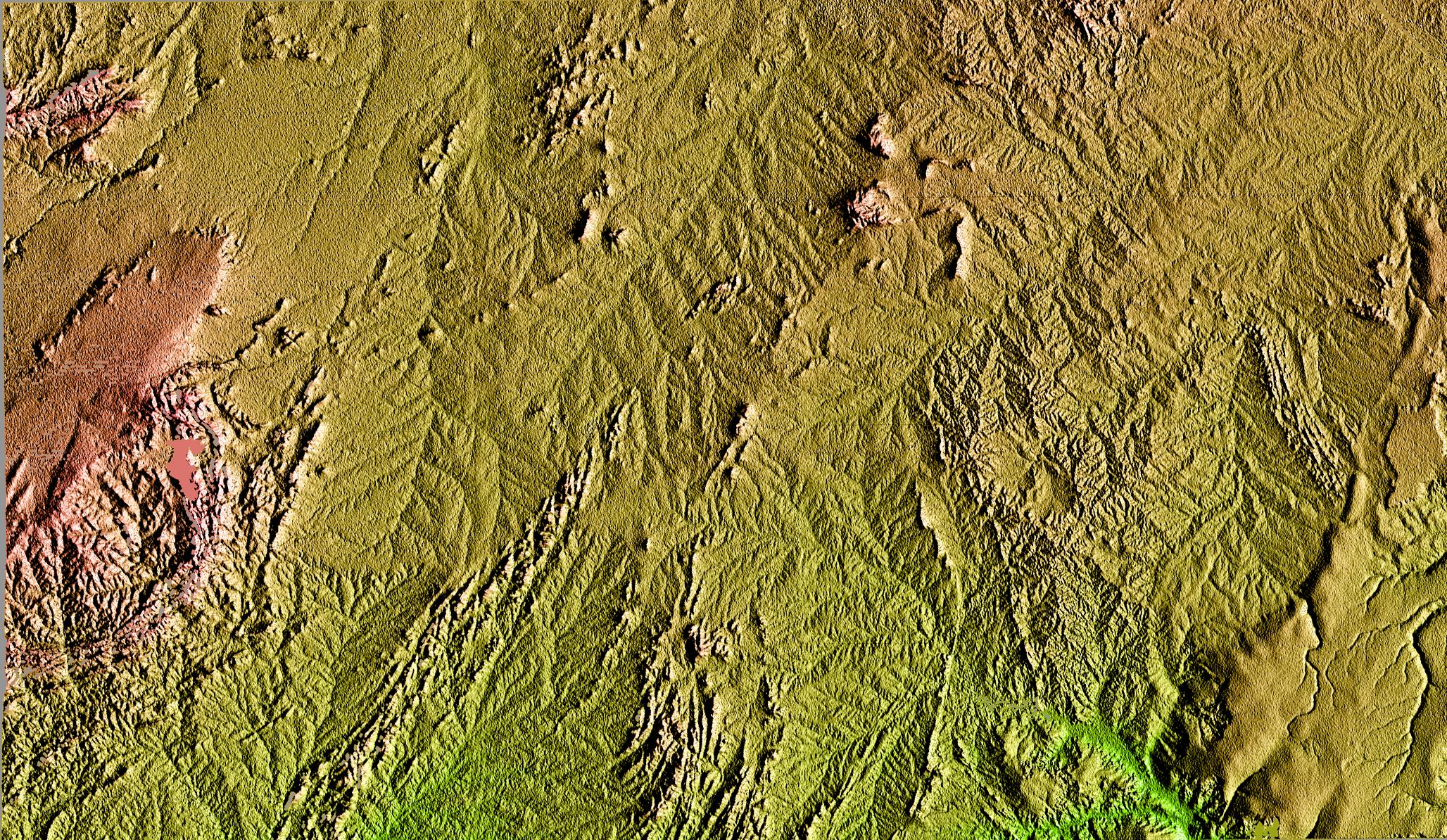
PIA02712:
-
San Andreas Fault, Southern California, Shaded Relief, Wrapped Color as Height
Full Resolution:
TIFF
(6.467 MB)
JPEG
(2.572 MB)
|
|
|
2000-02-16 |
Earth
|
Shuttle Radar Topography Mission (SRTM)
|
C-Band Interferometric Radar
|
1881x2650x3 |
|
-
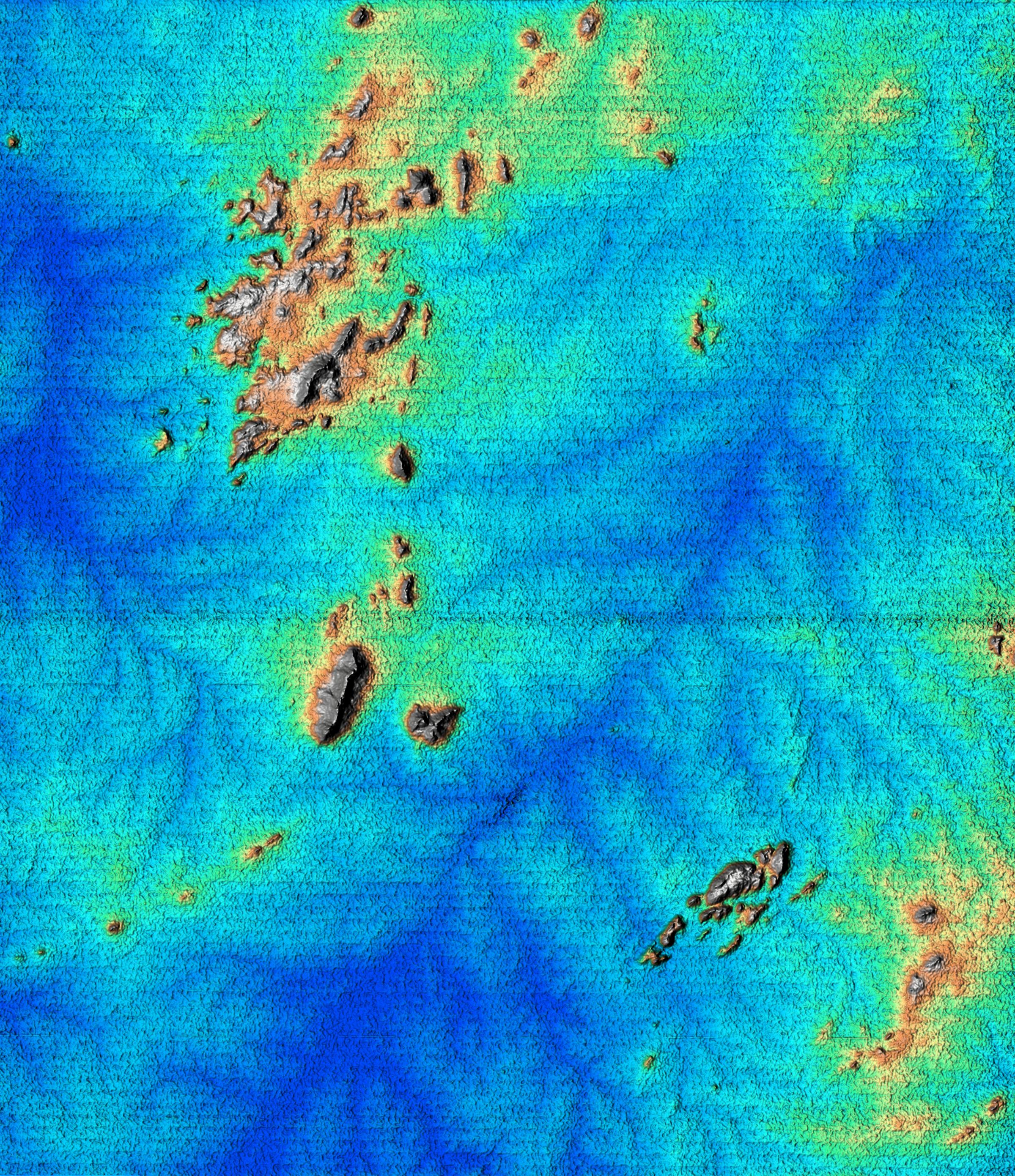
PIA02710:
-
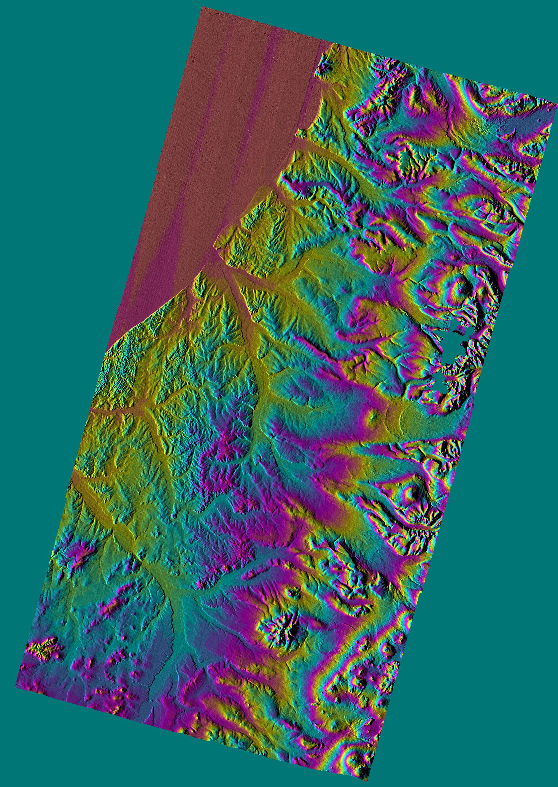
Shaded Relief Color Wrapped, Kamchatka Peninsula, Russia
Full Resolution:
TIFF
(2.271 MB)
JPEG
(868.8 kB)
|
|
|
2000-02-16 |
Earth
|
Landsat
Shuttle Radar Topography Mission (SRTM)
|
C-Band Interferometric Radar
Thematic Mapper
|
1412x1588x3 |
|
-
PIA02709:
-
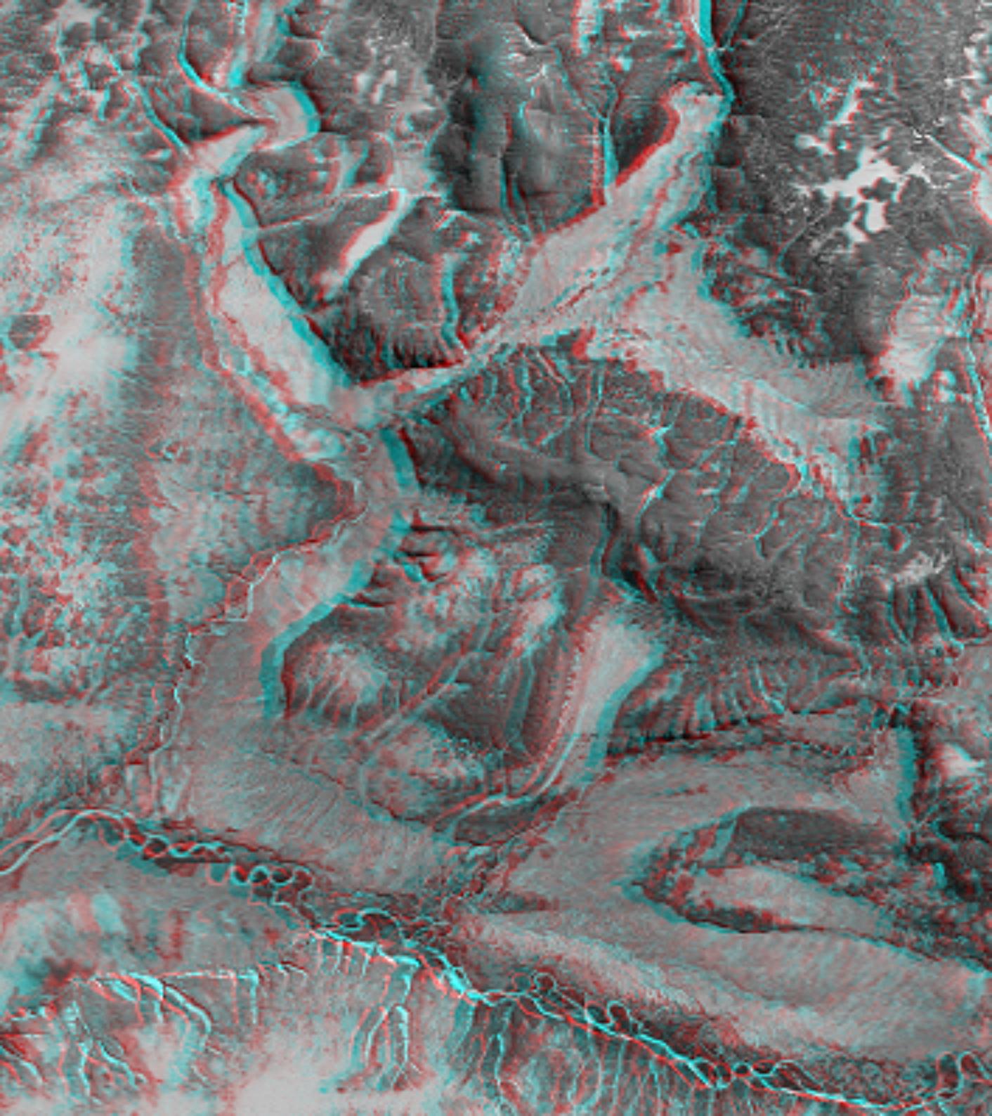
Anaglyph with Landsat Overlay, Kamchatka Peninsula, Russia
Full Resolution:
TIFF
(6.288 MB)
JPEG
(309.4 kB)
|
|
|
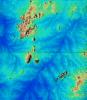
2000-02-16 |
Earth
|
Shuttle Radar Topography Mission (SRTM)
|
C-Band Interferometric Radar
|
2384x3021x3 |
|
-
PIA02708:
-
Shaded Relief, Kamchatka Peninsula, Russia
Full Resolution:
TIFF
(20.34 MB)
JPEG
(1.485 MB)
|
|
|
2000-02-16 |
Earth
|
Shuttle Radar Topography Mission (SRTM)
|
C-Band Interferometric Radar
|
1383x962x3 |
|
-
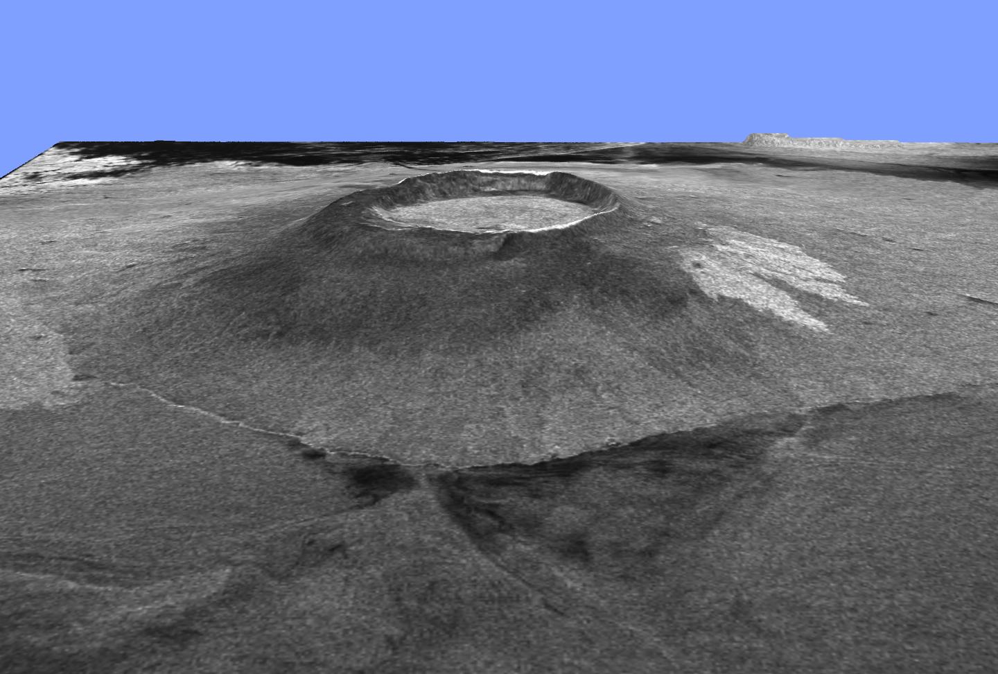
PIA02707:
-
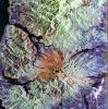
Perspective View, Kamchatka Peninsula, Russia
Full Resolution:
TIFF
(2.612 MB)
JPEG
(219.9 kB)
|
|
|
2000-02-15 |
Earth
|
Shuttle Radar Topography Mission (SRTM)
|
C-Band Interferometric Radar
|
2400x2938x3 |

|
-
PIA02706:
-
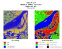
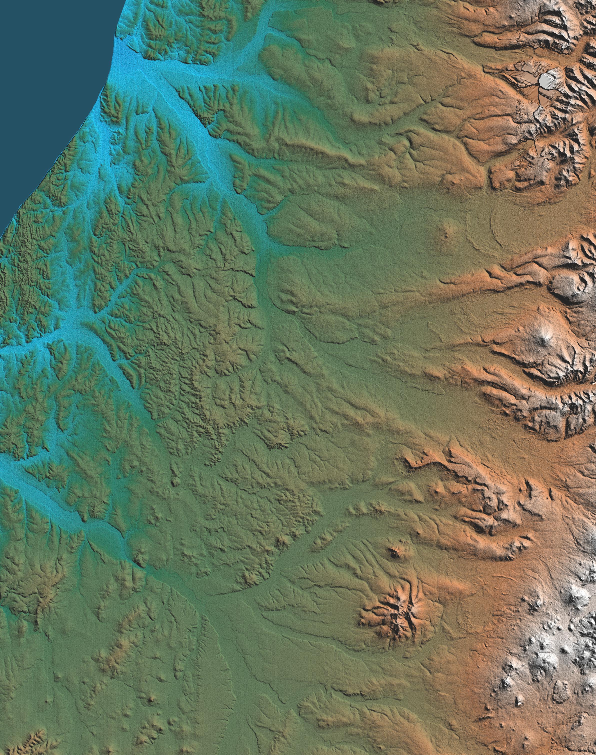
Shaded Relief of South Africa, Northern Cape Province
Full Resolution:
TIFF
(24.95 MB)
JPEG
(2.451 MB)
|
|
|
2000-02-15 |
Earth
|
Shuttle Radar Topography Mission (SRTM)
|
C-Band Interferometric Radar
|
2062x1194x3 |

|
-
PIA02705:
-
Radar Image with Color as Height, Bahia State, Brazil
Full Resolution:
TIFF
(7.958 MB)
JPEG
(497.6 kB)
|
|
|
2000-02-15 |
Earth
|
Shuttle Radar Topography Mission (SRTM)
|
C-Band Interferometric Radar
|
2056x1194x3 |
|
-
PIA02704:
-
Shaded Relief of Bahia State, Brazil
Full Resolution:
TIFF
(8.391 MB)
JPEG
(1.179 MB)
|
|
|
2000-02-14 |
Earth
|
Shuttle Radar Topography Mission (SRTM)
|
C-Band Interferometric Radar
|
2257x2887x1 |

|
-
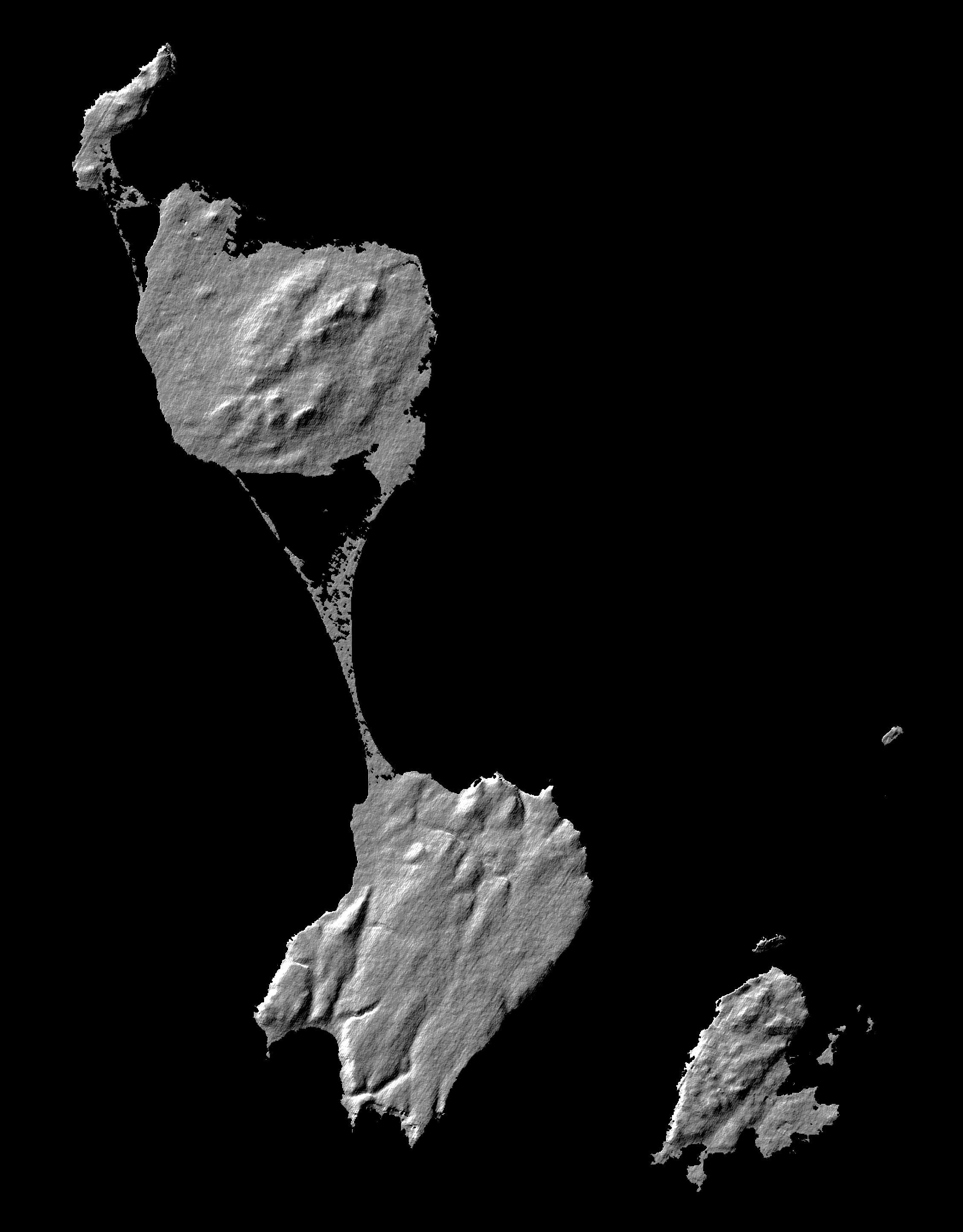
PIA02703:
-
Shaded Relief Image of Saint Pierre and Miquelon
Full Resolution:
TIFF
(633 kB)
JPEG
(328.2 kB)
|
|
|
2000-02-14 |
Earth
|
Landsat
Shuttle Radar Topography Mission (SRTM)
|
C-Band Interferometric Radar
Thematic Mapper
|
3835x904x3 |
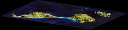
|
-
PIA02702:
3-D perspective of Saint Pierre and Miquelon Islands
Full Resolution:
TIFF
(5.571 MB)
JPEG
(258.4 kB)
|
|
|
2000-02-14 |
Earth
|
Shuttle Radar Topography Mission (SRTM)
|
C-Band Interferometric Radar
|
1890x2270x1 |
|
-
PIA02701:
-
Radar Image of Rio Sao Francisco, Brazil
Full Resolution:
TIFF
(4.91 MB)
JPEG
(828.3 kB)
|
|
|
2000-02-14 |
Earth
|
Shuttle Radar Topography Mission (SRTM)
|
C-Band Interferometric Radar
|
2400x2781x3 |
|
-
PIA02700:
-
Shaded Relief of Rio Sao Francisco, Brazil
Full Resolution:
TIFF
(22.27 MB)
JPEG
(1.606 MB)
|
|
|
1999-01-27 |
Earth
|
Spaceborne Imaging Radar-C/X-Band Synthetic Aperture Radar
|
|
1700x2200x3 |
|
-
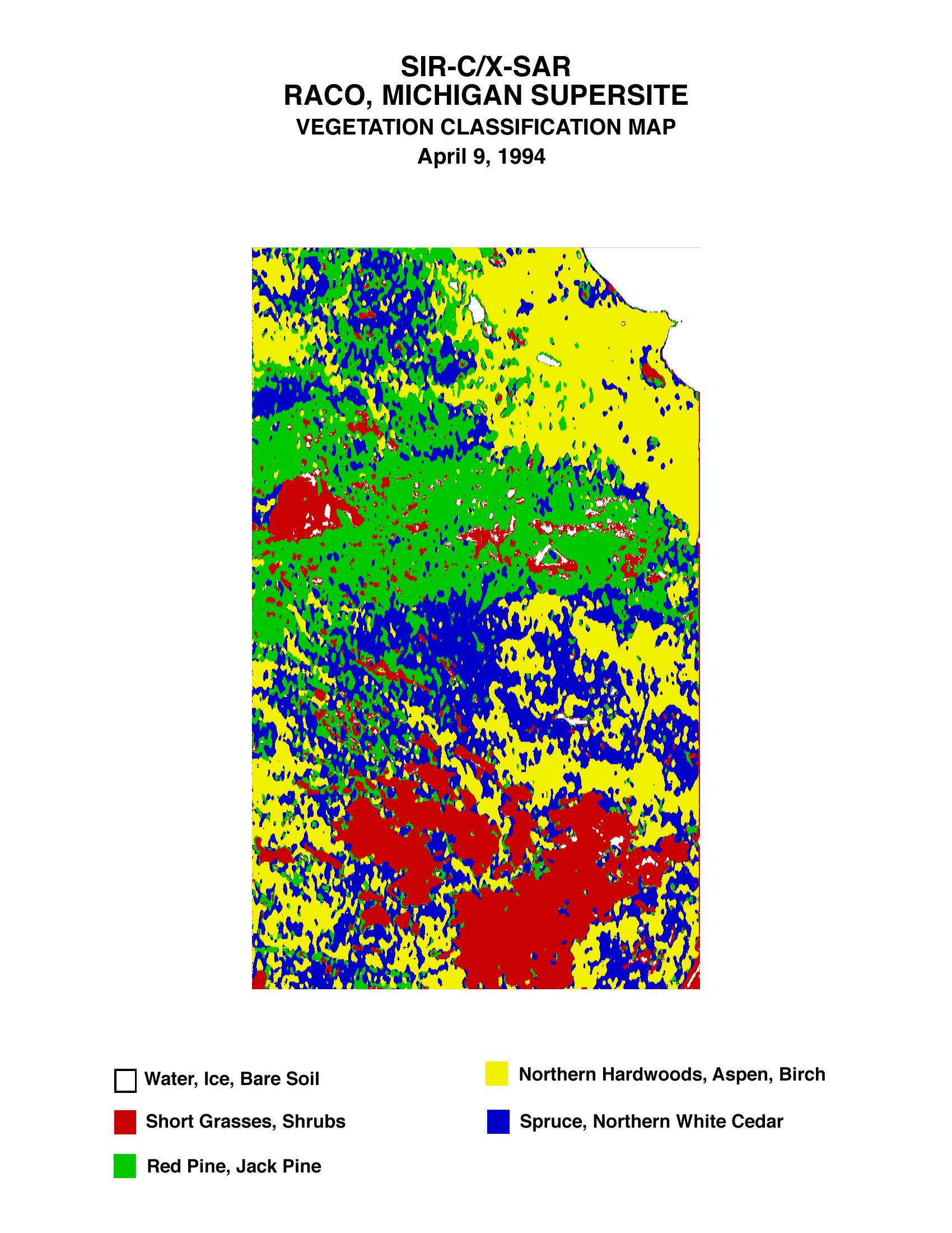
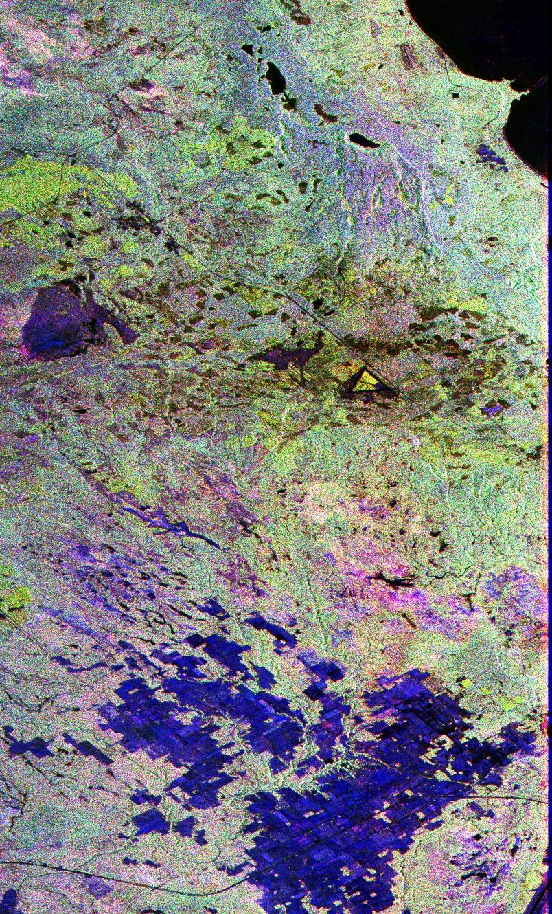
PIA01713:
-
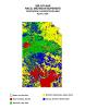
Space Radar Image of Raco Vegetation Map
Full Resolution:
TIFF
(511.3 kB)
JPEG
(447.6 kB)
|
|
|
1999-01-27 |
Earth
|
Spaceborne Imaging Radar-C/X-Band Synthetic Aperture Radar
|
|
1280x1024x3 |
|
-
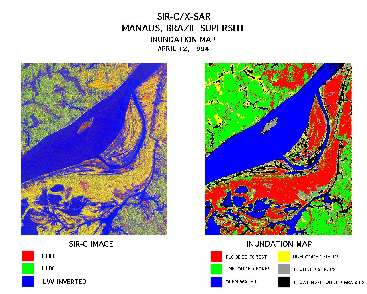
PIA01712:
-
Space Radar Image of Manaus, Brazil
Full Resolution:
TIFF
(1.531 MB)
JPEG
(300.6 kB)
|
|
|
1999-01-27 |
Earth
|
Spaceborne Imaging Radar-C/X-Band Synthetic Aperture Radar
|
|
736x994x3 |
|
-
PIA01711:
-
Space Radar Image of Safsaf, North Africa
Full Resolution:
TIFF
(2.76 MB)
JPEG
(328.7 kB)
|
|
|
1999-01-27 |
Earth
|
Spaceborne Imaging Radar-C/X-Band Synthetic Aperture Radar
|
|
1042x1433x3 |

|
-
PIA01710:
-
Space Radar Image of Kilauea, Hawaii
Full Resolution:
TIFF
(5.636 MB)
JPEG
(549.3 kB)
|
|
|
1999-01-27 |
Earth
|
Spaceborne Imaging Radar-C/X-Band Synthetic Aperture Radar
|
|
1116x1130x3 |
|
-
PIA01709:
-
SPace Radar Image of Mt. Pinatubo, Philippines
Full Resolution:
TIFF
(4.975 MB)
JPEG
(576.1 kB)
|
|
|
1999-01-27 |
Earth
|
Spaceborne Imaging Radar-C/X-Band Synthetic Aperture Radar
|
|
1440x972x3 |

|
-
PIA01708:
-
Space Radar Image Isla Isabela in 3-D
Full Resolution:
TIFF
(1.477 MB)
JPEG
(173.6 kB)
|
|
|
1999-01-27 |
Earth
|
Spaceborne Imaging Radar-C/X-Band Synthetic Aperture Radar
|
|
804x1330x3 |
|
-
PIA01700:
-
Space Radar Image of Raco, Michigan
Full Resolution:
TIFF
(4.208 MB)
JPEG
(489.4 kB)
|
 Planetary Data System


