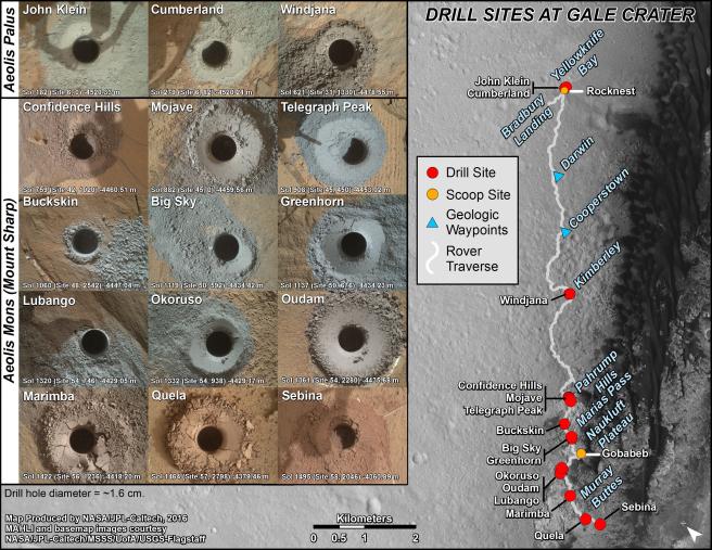
This graphic maps locations of the sites where NASA's Curiosity Mars rover collected its first 19 rock or soil samples for analysis by laboratory instruments inside the vehicle. It also presents images of the drilled holes where 15 rock-powder samples were acquired. Curiosity scooped two soil samples at each of the other two sites: Rocknest and Gobabeb.
The diameter of each drill hole is about 0.6 inch (1.6 centimeters), slightly smaller than a U.S. dime. The images used here are raw color, as recorded by the rover's Mars Hand Lens Imager (MAHLI) camera. Notice the differences in color of the material at different drilling sites.
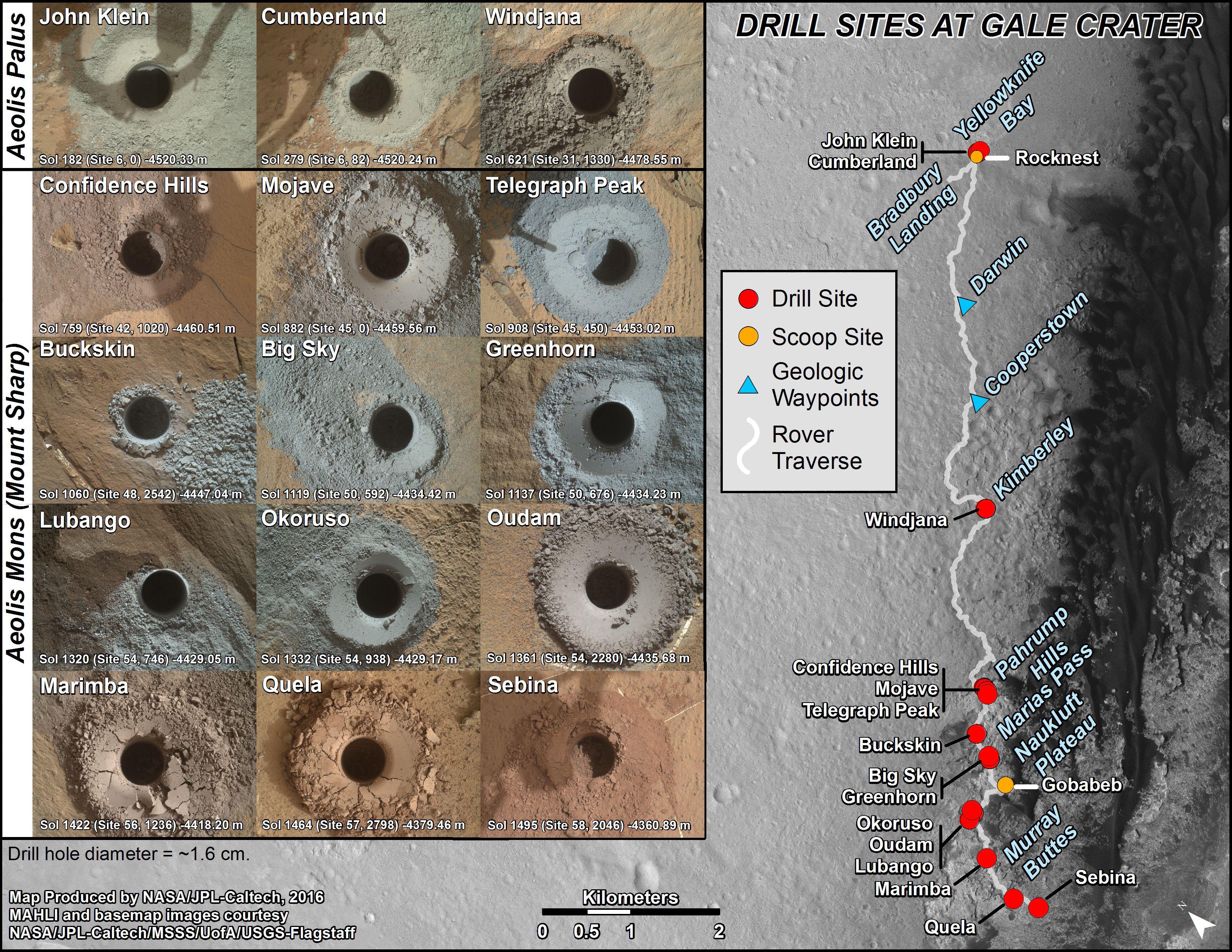
For the map, north is toward the upper left corner. The scale bar represents 2 kilometers (1.2 miles). The base map is from the High Resolution Imaging Science Experiment (HiRISE) camera on NASA's Mars Reconnaissance Orbiter.
The latest sample site included is "Sebina,"where Curiosity drilled into bedrock of the Murray formation on Oct. 20, 2016, during the 1,495th Martian day, or sol, of the mission.
Curiosity landed in August 2012 on the plain (named Aeolis Palus) near Mount Sharp (or Aeolis Mons).
The drilling dates for the first 13 rock samples collected are, by location: "John Klein" on Feb. 8, 2013 (Sol 182); "Cumberland" on May 19, 2013 (Sol 279); "Windjana" on May 5, 2014 (Sol 621); "Confidence Hills" on Sept. 24, 2014 (Sol 759); "Mojave" on Jan. 29, 2015 (Sol 882); "Telegraph Peak" on Feb. 24, 2015 (Sol 908); "Buckskin" on July 30, 2015 (Sol 1060); "Big Sky" on Sept. 29, 2015 (Sol 1119); "Greenhorn" on Oct. 18, 2015 (Sol 1137); "Lubango" on April 23, 2016 (Sol 1320); "Okoruso" on May 5, 2016 (Sol 1332); "Oudam" on June 4, 2016 (Sol 1361); "Quela" on Sept. 18, 2016 (Sol 1464).
MAHLI was built by Malin Space Science Systems, San Diego. NASA's Jet Propulsion Laboratory, a division of Caltech Pasadena, California, manages the Mars Science Laboratory Project for the NASA Science Mission Directorate, Washington. JPL designed and built the project's Curiosity rover.
NASA's Jet Propulsion Laboratory, a division of Caltech in Pasadena, California, manages the Mars Science Laboratory Project and Mars Reconnaissance Orbiter Project for NASA's Science Mission Directorate, Washington.
For more information about Curiosity, visit http://www.nasa.gov/msl and http://mars.jpl.nasa.gov/msl.
 Planetary Data System


