My
List |
Addition Date
|
Target
|
Mission
|
Instrument
|
Size
|

|
2025-06-06 |
Earth
|
|
SAR
|
1920x985x3 |

|
-
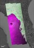
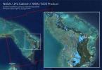
PIA26494:
-
NASA Portal Details Land Motion Across North America
Full Resolution:
TIFF
(2.941 MB)
JPEG
(184.7 kB)
|
|
|
2024-10-02 |
Earth
|
|
SAR
|
2480x3507x3 |
|
-
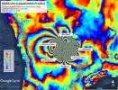
PIA26414:
-
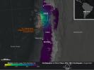
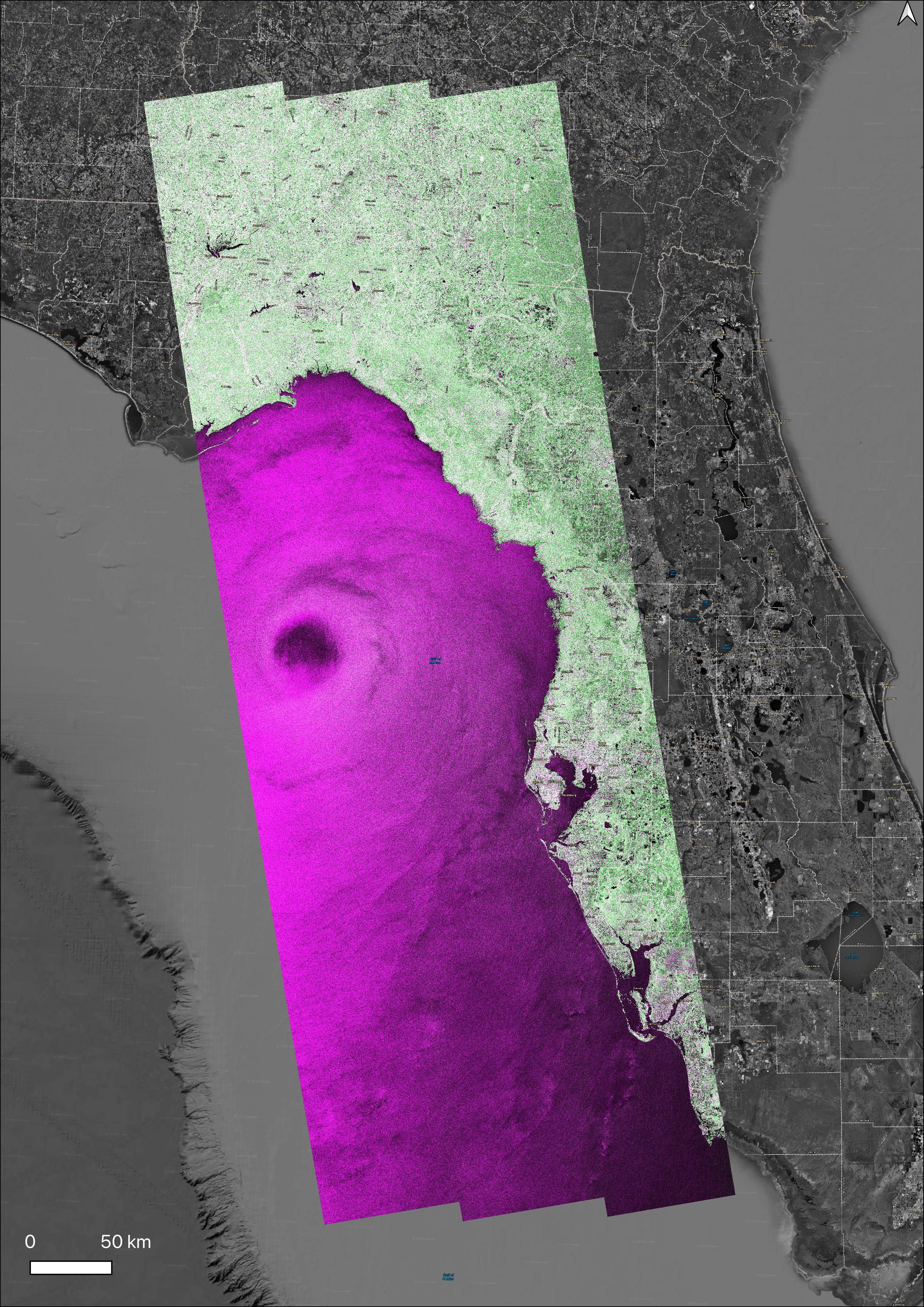
NASA's OPERA Project Generates Radar Image of Hurricane Helene
Full Resolution:
TIFF
(18.81 MB)
JPEG
(2.337 MB)
|
|
|
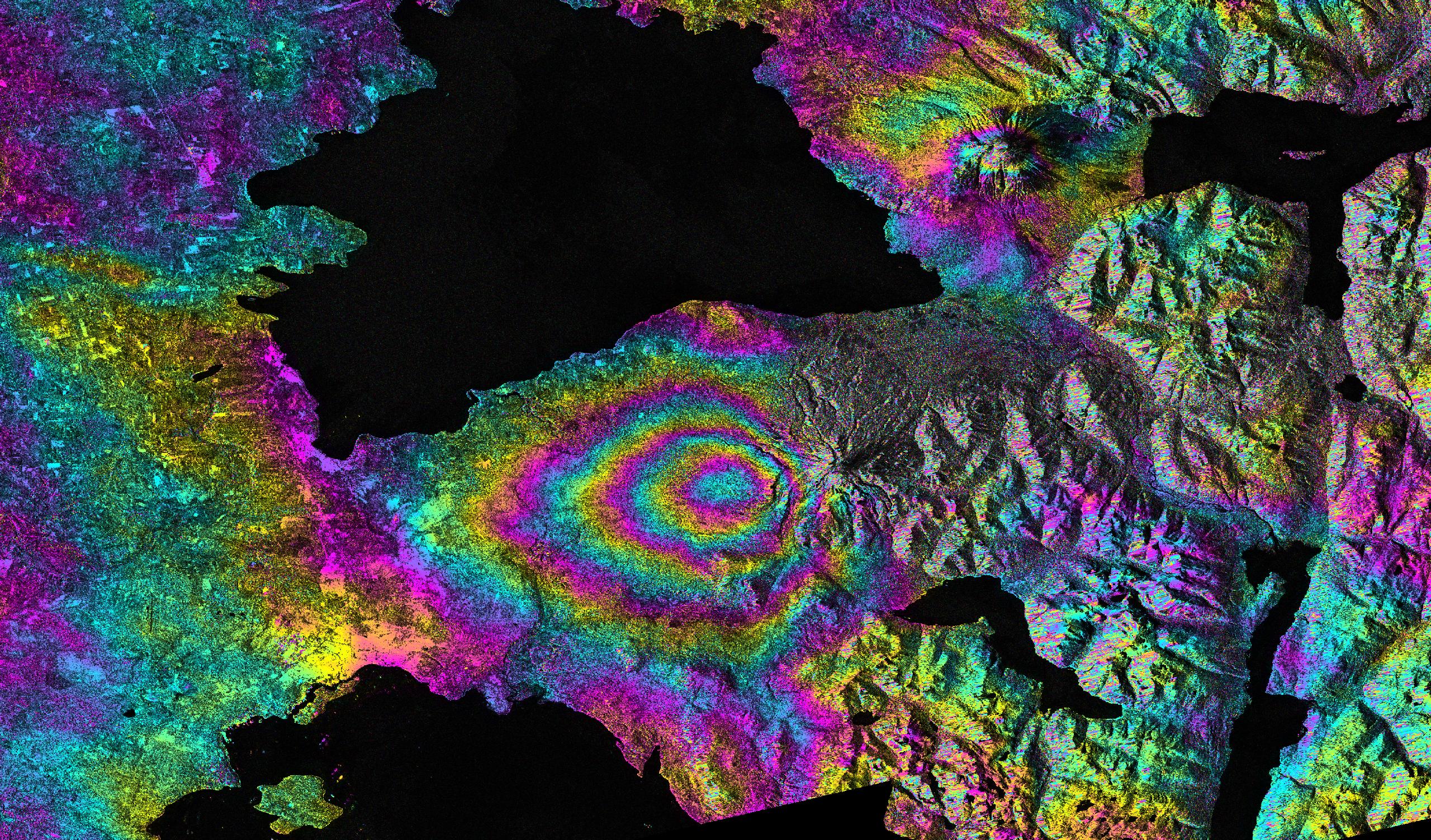
2022-12-09 |
Earth
|
ARIA
|
SAR
|
3203x2451x3 |
|
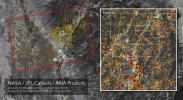
-
PIA25525:
-
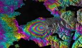
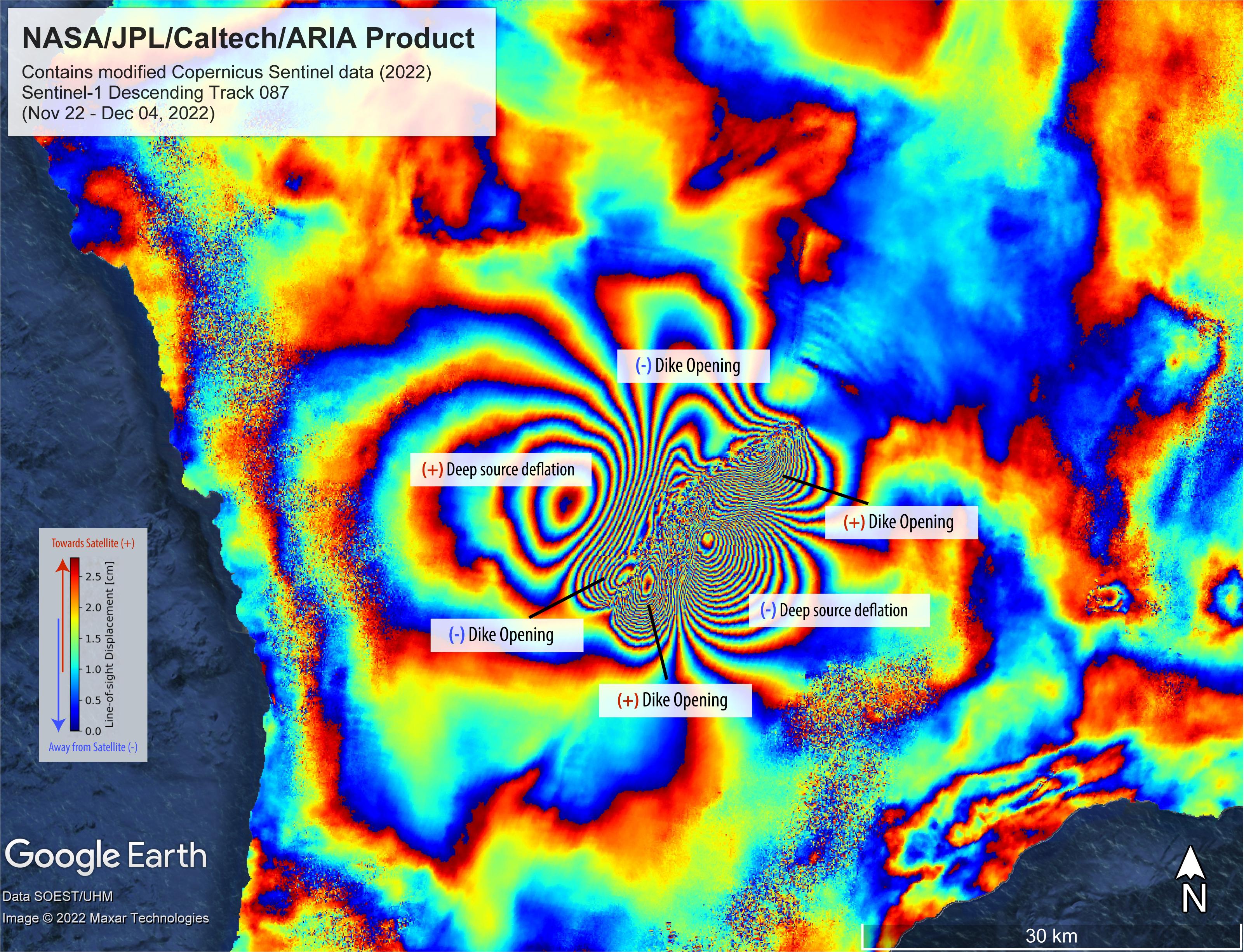
Satellite Data Shows Ground Motion From Mauna Loa Volcano Eruption
Full Resolution:
TIFF
(23.12 MB)
JPEG
(1.331 MB)
|
|
|
2020-01-15 |
Earth
|
ARIA
|
SAR
|
2437x1918x3 |
|
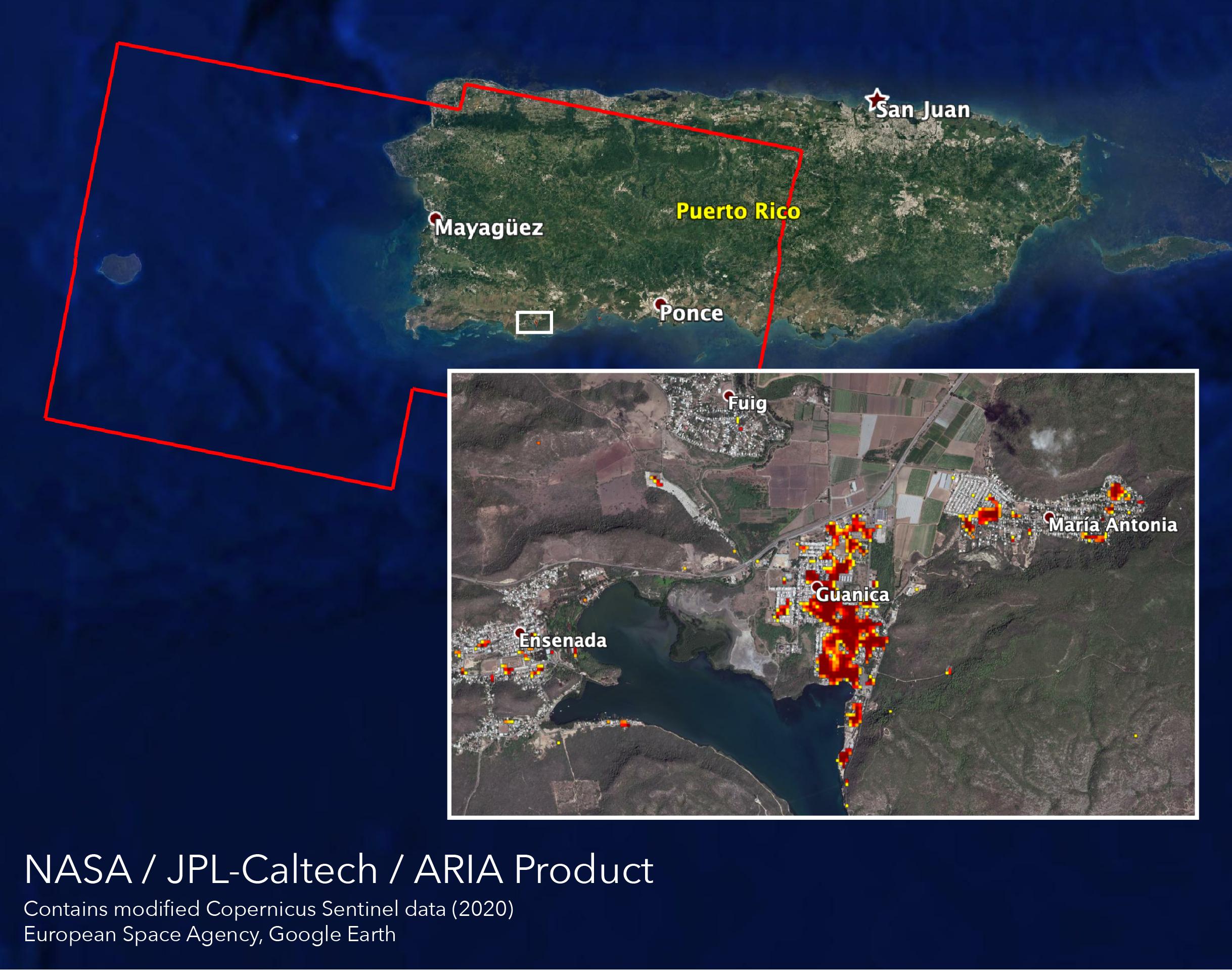
-
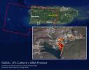
PIA23429:
-
ARIA Maps Damage of Western Puerto Rico After Quakes
Full Resolution:
TIFF
(8.865 MB)
JPEG
(483.7 kB)
|
|
|
2019-10-15 |
Earth
|
ARIA
|
SAR
|
3063x2249x3 |
|
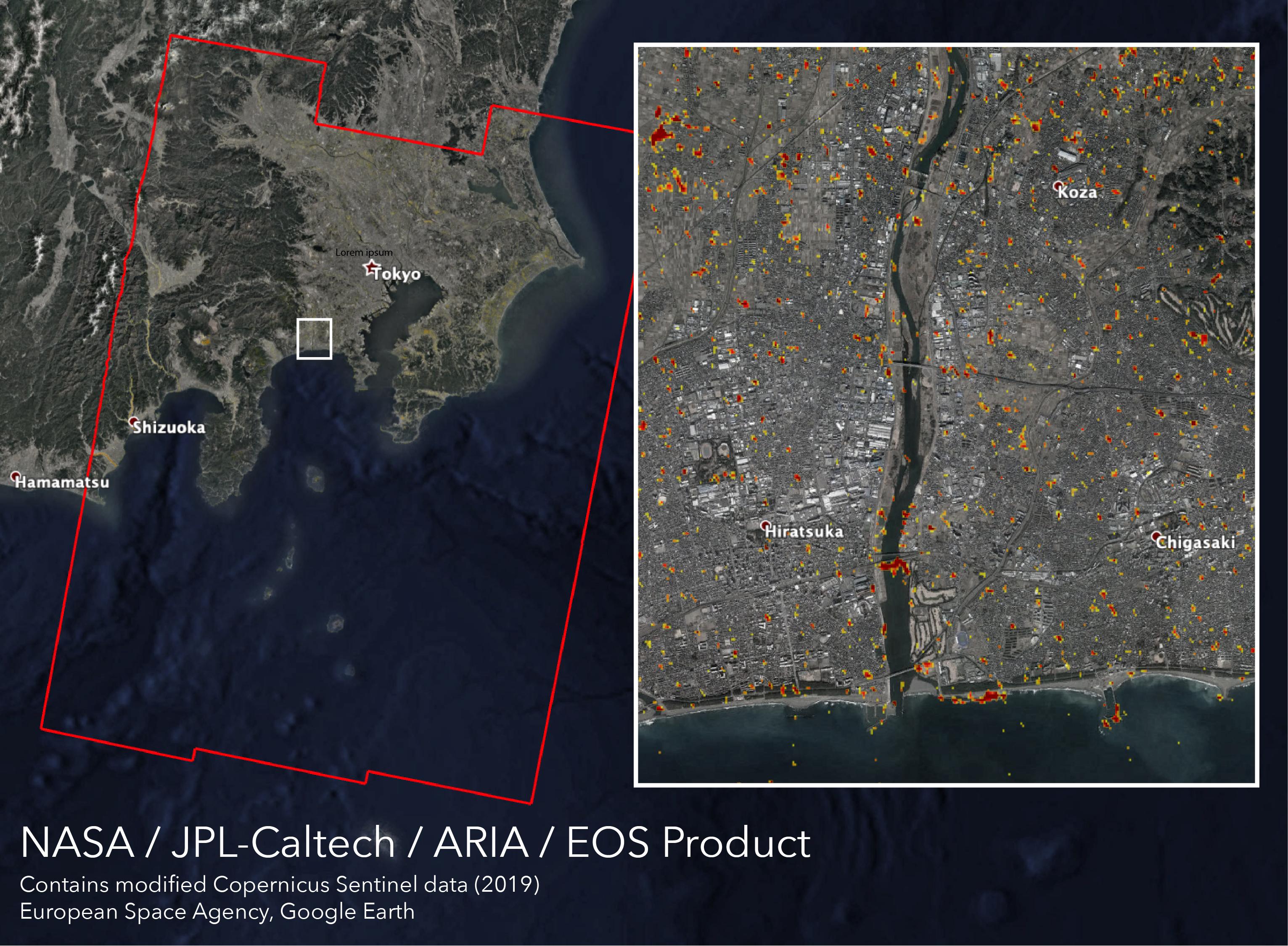
-
PIA23424:
-
New ARIA Map Shows Damage from Typhoon Hagibis
Full Resolution:
TIFF
(13.95 MB)
JPEG
(960.9 kB)
|
|
|
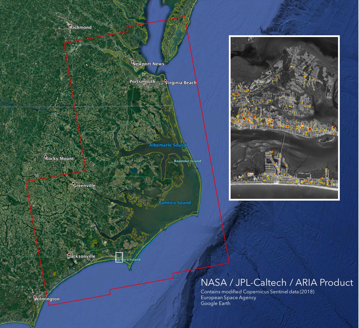
2019-09-03 |
Earth
|
ARIA
|
SAR
|
6900x4772x3 |
|
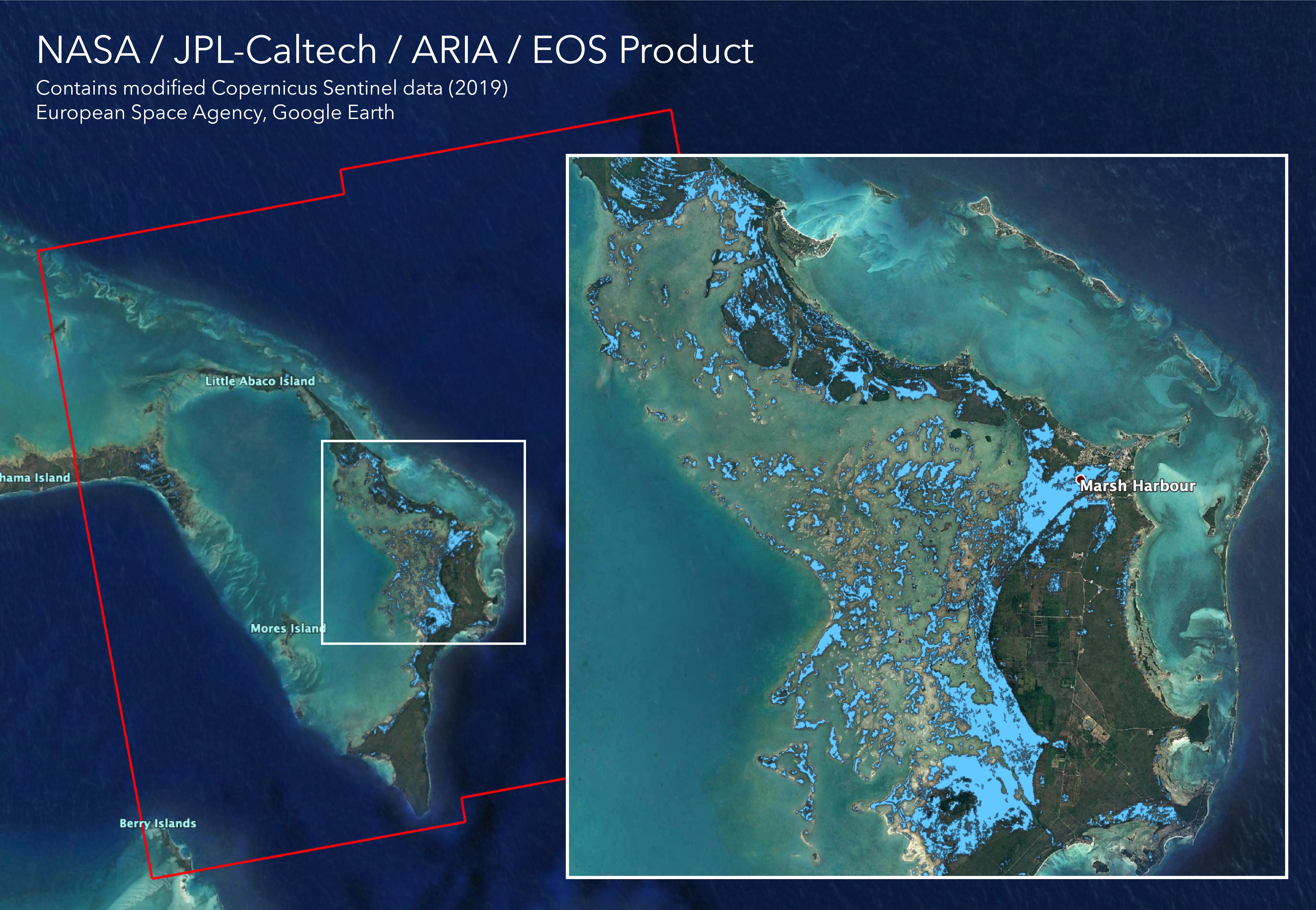
-
PIA23360:
-
Flooding from Dorian Seen from Space
Full Resolution:
TIFF
(71.04 MB)
JPEG
(2.466 MB)
|
|
|
2019-07-12 |
Earth
|
ARIA
|
SAR
|
2754x1965x3 |

|
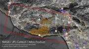
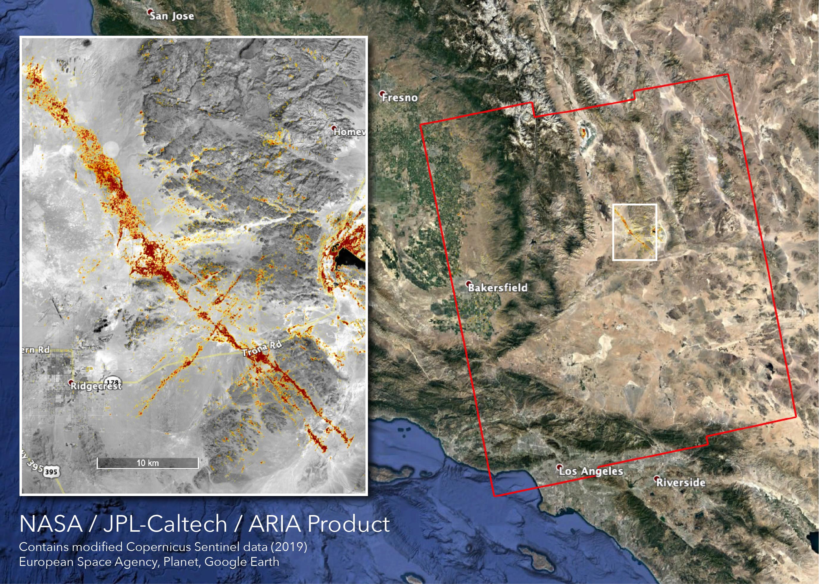
-
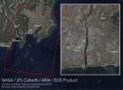
PIA23354:
-
NASA's ARIA Team Maps California Quake Damage
Full Resolution:
TIFF
(15.93 MB)
JPEG
(1.011 MB)
|
|
|
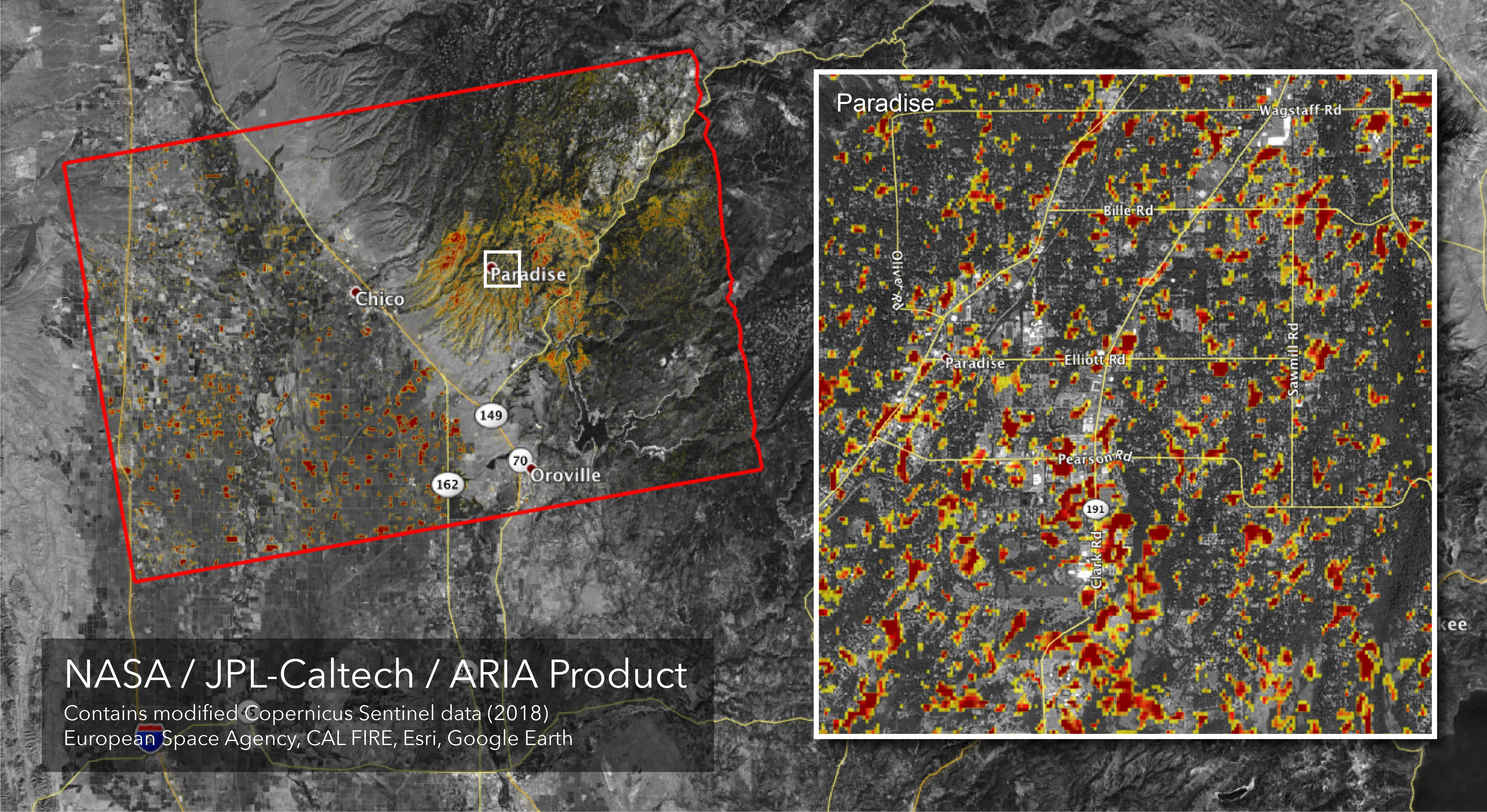
2018-11-19 |
Earth
|
ARIA
|
SAR
|
5949x3249x3 |
|
-
PIA22819:
-
Updated ARIA Map of CA Camp Fire Damage
Full Resolution:
TIFF
(21.68 MB)
JPEG
(3.068 MB)
|
|
|
2018-11-12 |
Earth
|
ARIA
|
SAR
|
5176x2873x3 |
|
-
PIA22816:
-
NASA's ARIA Maps California Fire Damage
Full Resolution:
TIFF
(16.43 MB)
JPEG
(2.572 MB)
|
|
|
2018-09-18 |
Earth
|
ARIA
|
SAR
|
1231x1077x3 |
|
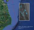
-
PIA22704:
-
NASA's ARIA Maps Aftermath from Florence
Full Resolution:
TIFF
(3.318 MB)
JPEG
(194.2 kB)
|
|
|
2018-09-17 |
Earth
|
ARIA
|
SAR
|
1233x1125x3 |

|
-
PIA22702:
-
NASA's ARIA Maps Damage from Florence
Full Resolution:
TIFF
(3.944 MB)
JPEG
(269.1 kB)
|
|
|
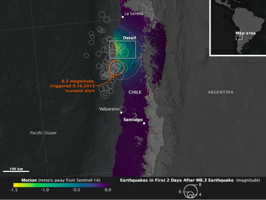
2015-10-12 |
Earth
|
Earth Observatory
|
C-Band SAR
|
898x676x3 |
|
-
PIA20002:
-
NASA Looks at Land Surface Changes Following Chilean Quake
Full Resolution:
TIFF
(888.9 kB)
JPEG
(51.91 kB)
|
|
|
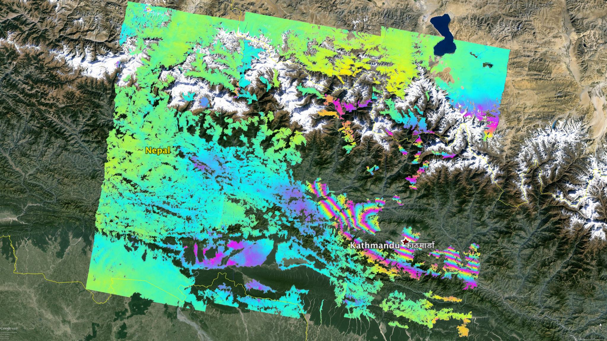
2015-05-02 |
Earth
|
ARIA
|
C-SAR Sensor
|
2048x1152x3 |

|
-
PIA19535:
-
NASA's ARIA Project Maps Deformation of Earth's Surface from Nepal Quake
Full Resolution:
TIFF
(7.08 MB)
JPEG
(600.1 kB)
|
|
|
2015-04-29 |
Earth
|
|
C-SAR Sensor
|
2560x1504x3 |
|
-
PIA11434:
-
Ground Deformation from Chilean Volcanic Eruption Shown by Satellite Radar Image
Full Resolution:
TIFF
(11.55 MB)
JPEG
(1.664 MB)
|
 Planetary Data System


