My
List |
Addition Date
|
Target
|
Mission
|
Instrument
|
Size
|

|
2014-09-25 |
Mars
|
Mars Science Laboratory (MSL)
|
MAHLI
|
1584x1184x3 |
|
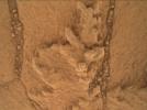
-
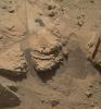
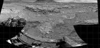
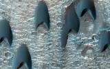
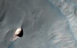
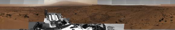
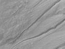
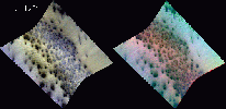
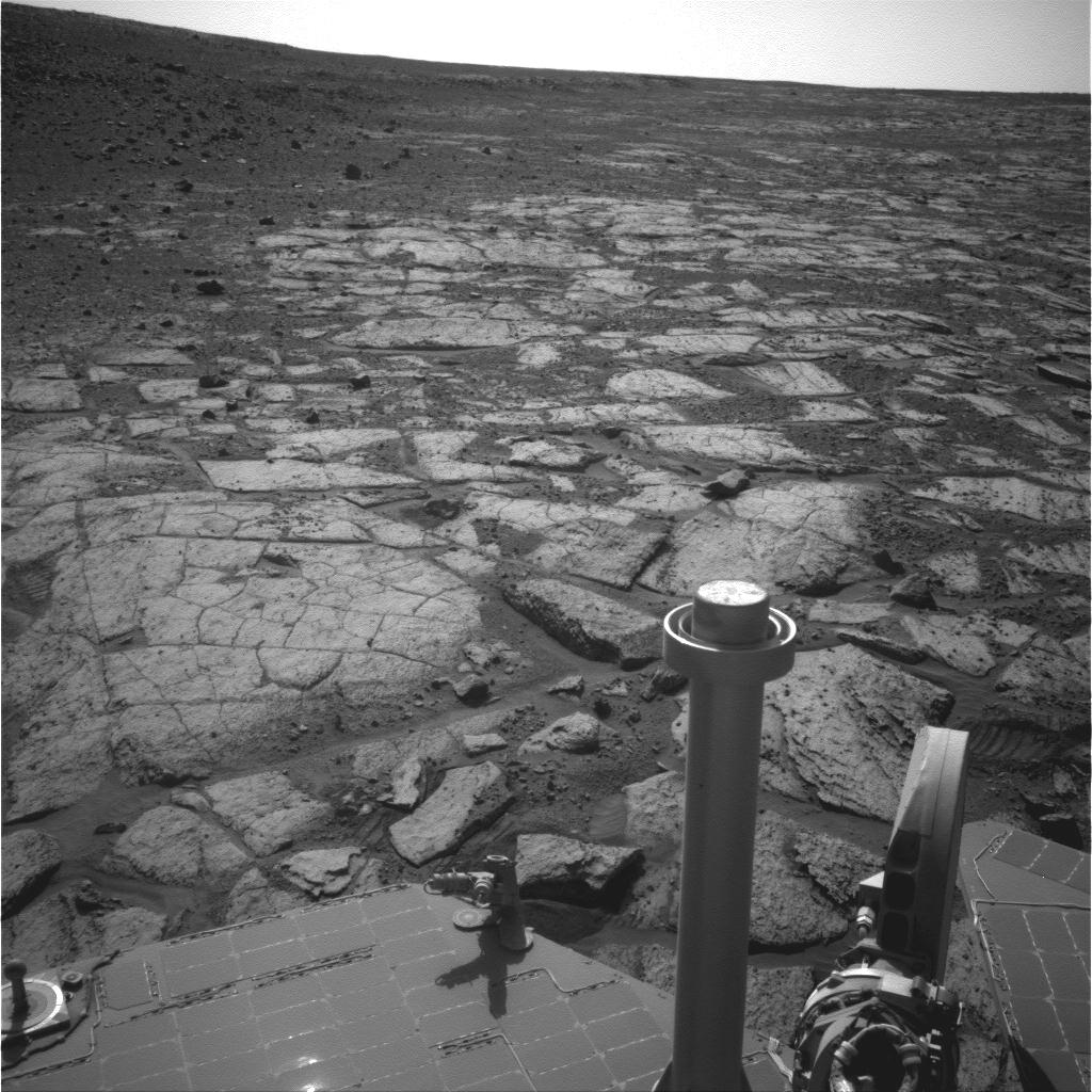
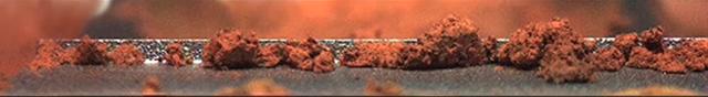
PIA18610:
-
Resistant Features in 'Pahrump Hills' Outcrop
Full Resolution:
TIFF
(5.628 MB)
JPEG
(345.3 kB)
|
|
|
2014-09-25 |
Mars
|
Mars Science Laboratory (MSL)
|
MAHLI
|
1569x1170x3 |
|
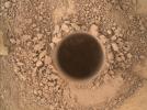
-
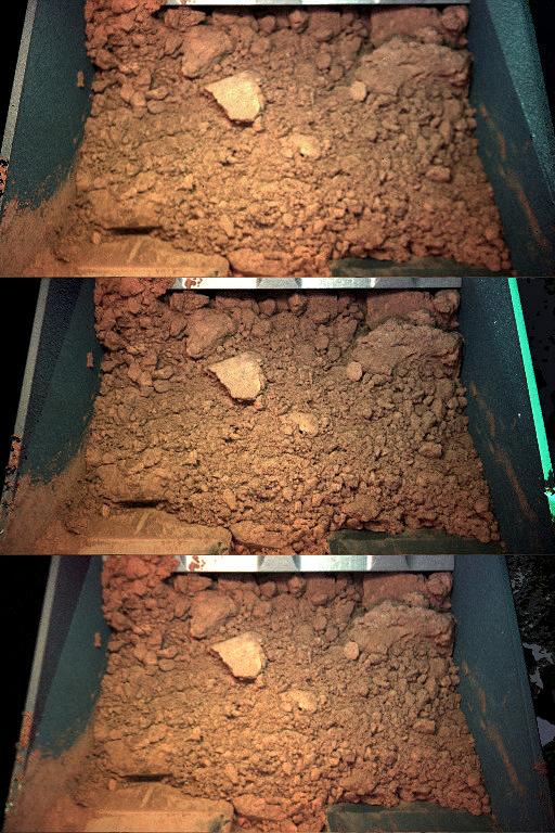
PIA18609:
-
First Sampling Hole in Mount Sharp
Full Resolution:
TIFF
(5.509 MB)
JPEG
(530.7 kB)
|
|
|
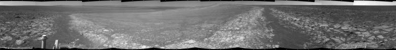
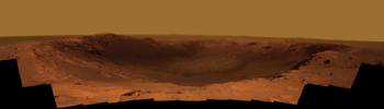
2014-09-09 |
Mars
|
Mars Exploration Rover (MER)
|
Panoramic Camera
|
2285x1168x3 |
|
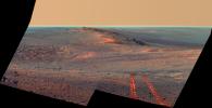
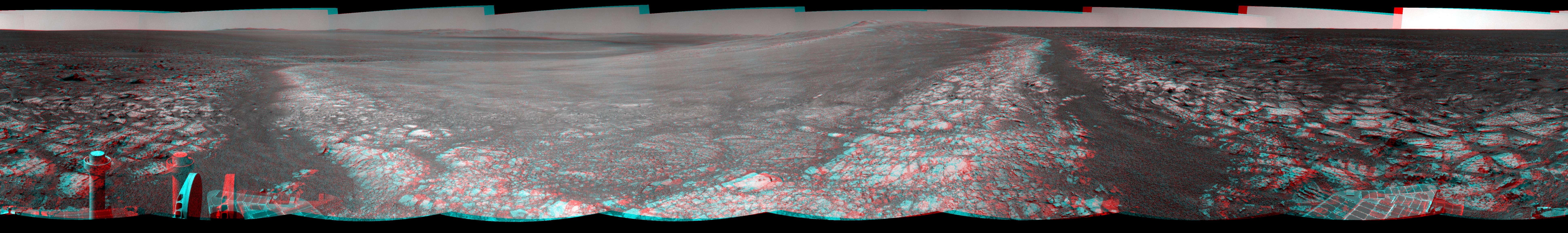
-
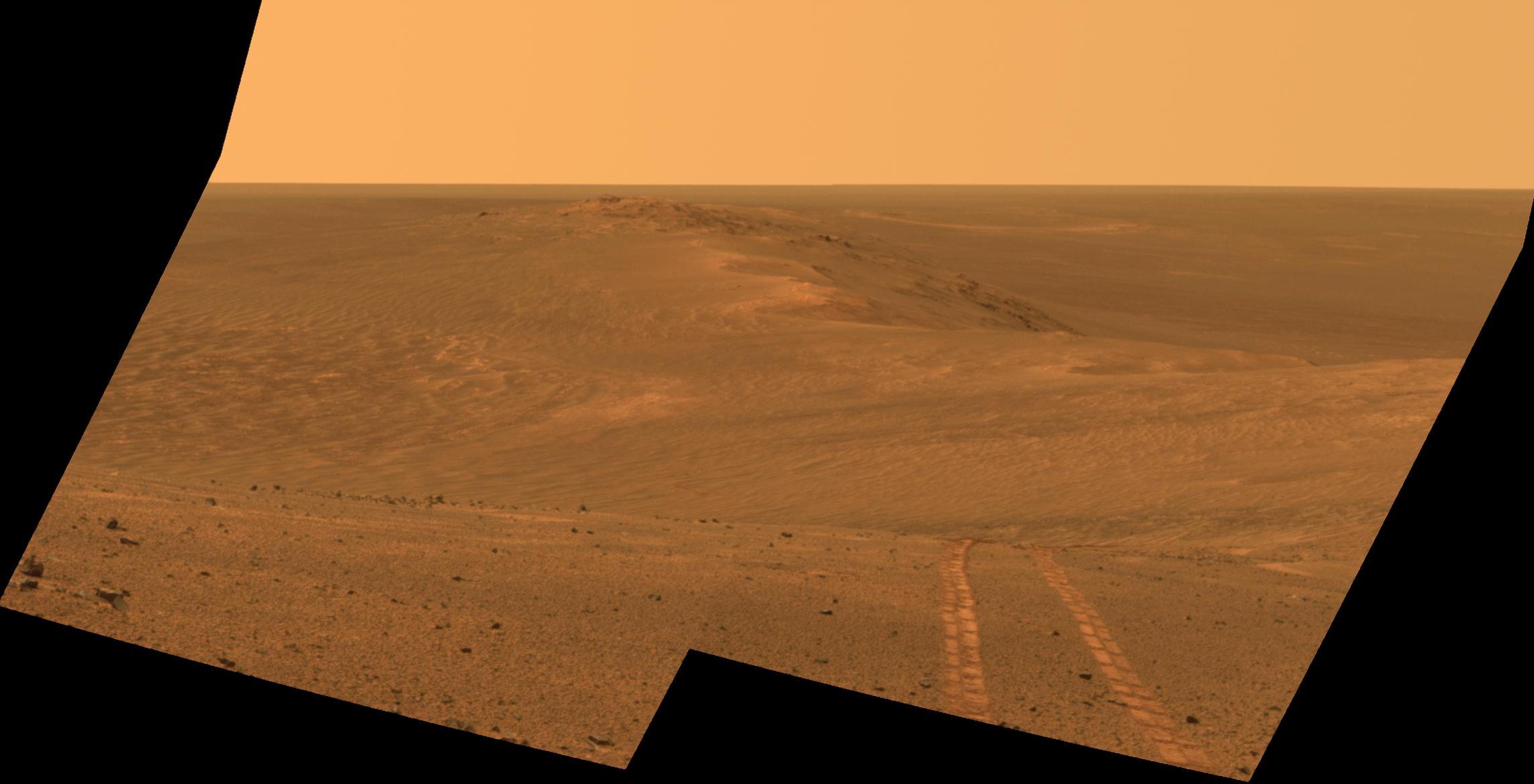
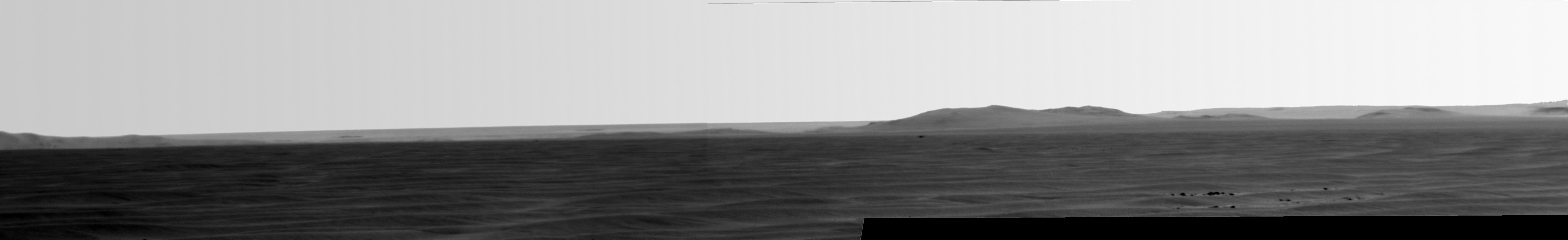
PIA18605:
-
Rover Tracks in Northward View Along West Rim of Endeavour, False Color
Full Resolution:
TIFF
(8.01 MB)
JPEG
(284.7 kB)
|
|
|
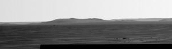
2014-09-09 |
Mars
|
Mars Exploration Rover (MER)
|
Panoramic Camera
|
2285x1168x3 |
|
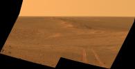
-
PIA18604:
-
Rover Tracks in Northward View Along West Rim of Endeavour
Full Resolution:
TIFF
(8.01 MB)
JPEG
(164.9 kB)
|
|
|
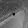
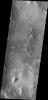
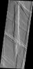
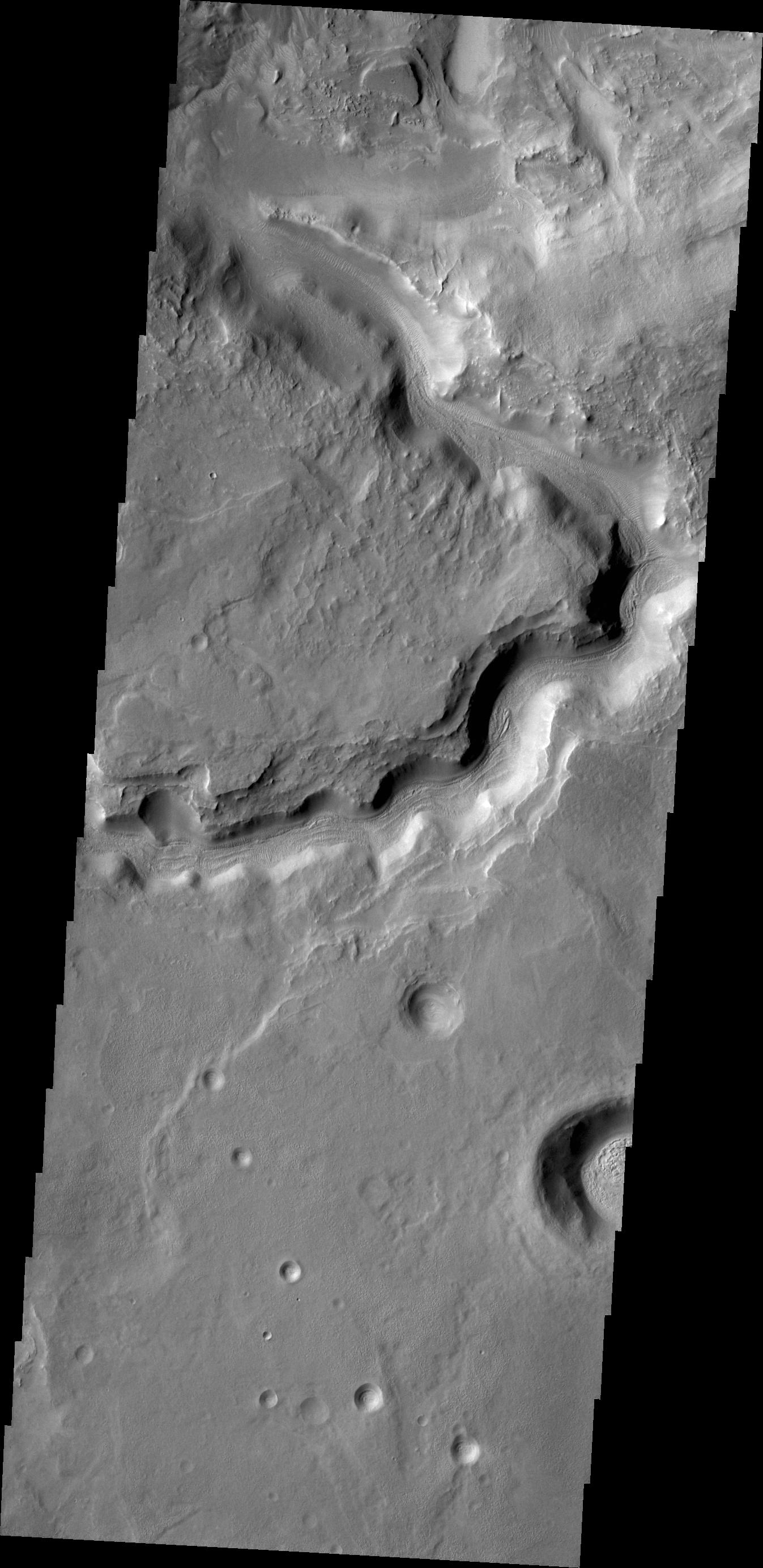
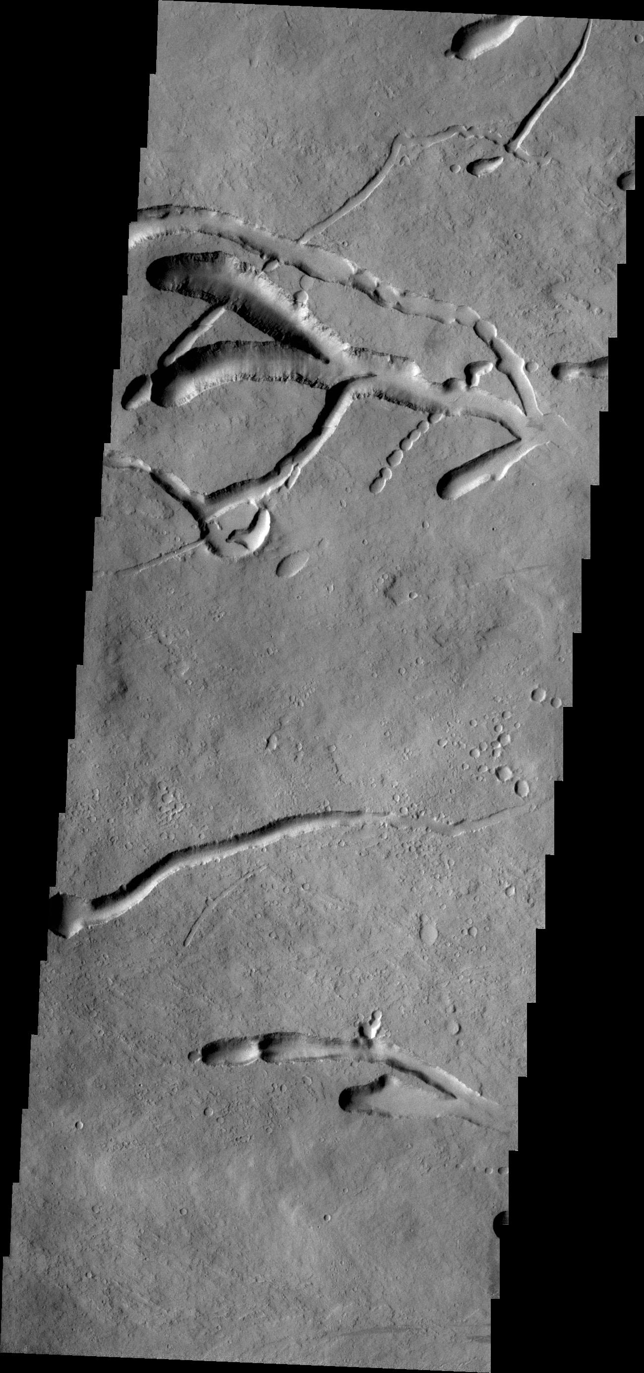
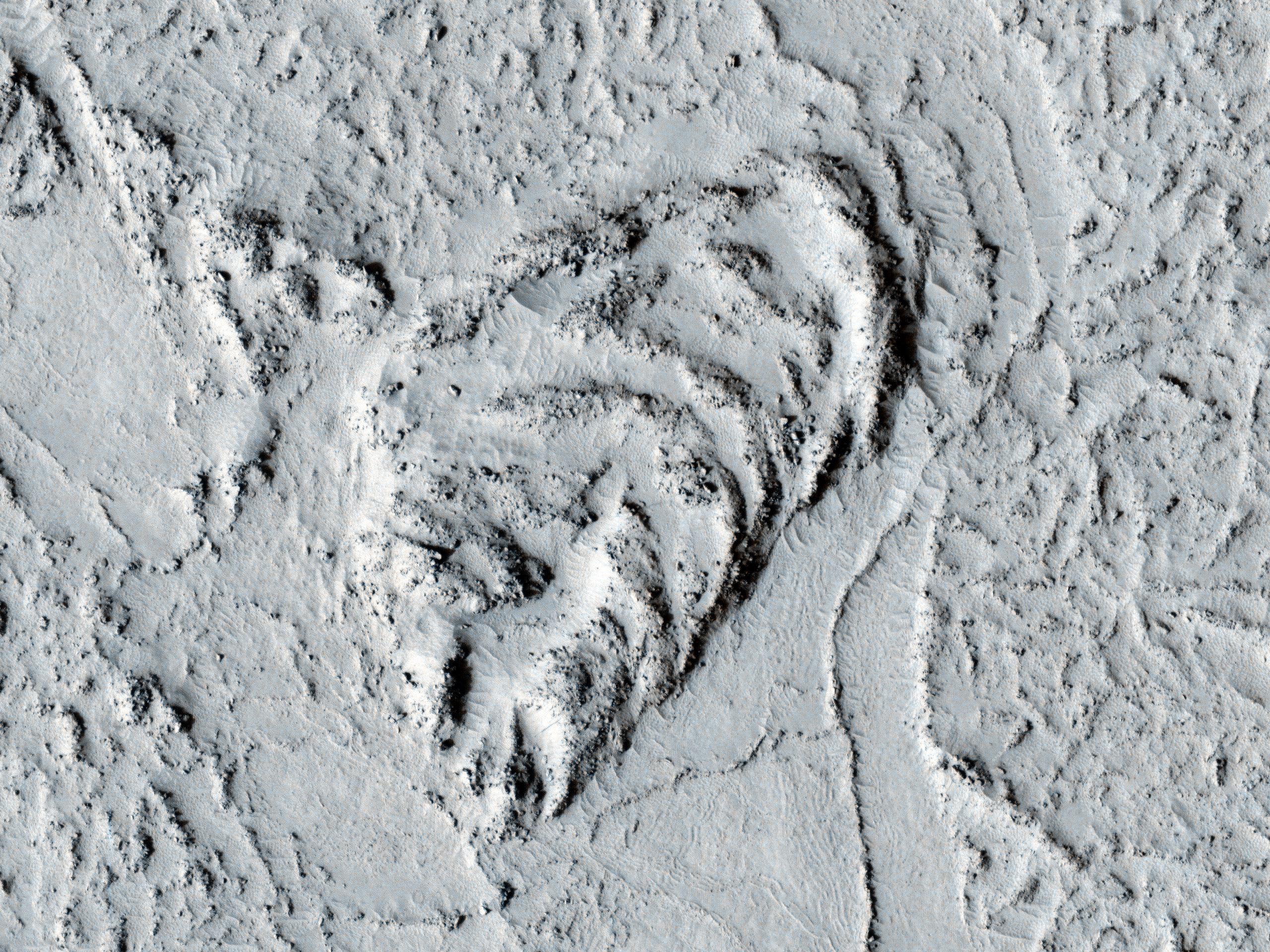
2014-08-26 |
Mars
|
2001 Mars Odyssey
|
THEMIS
|
1376x2959x1 |

|
-
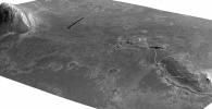
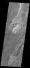
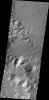
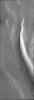
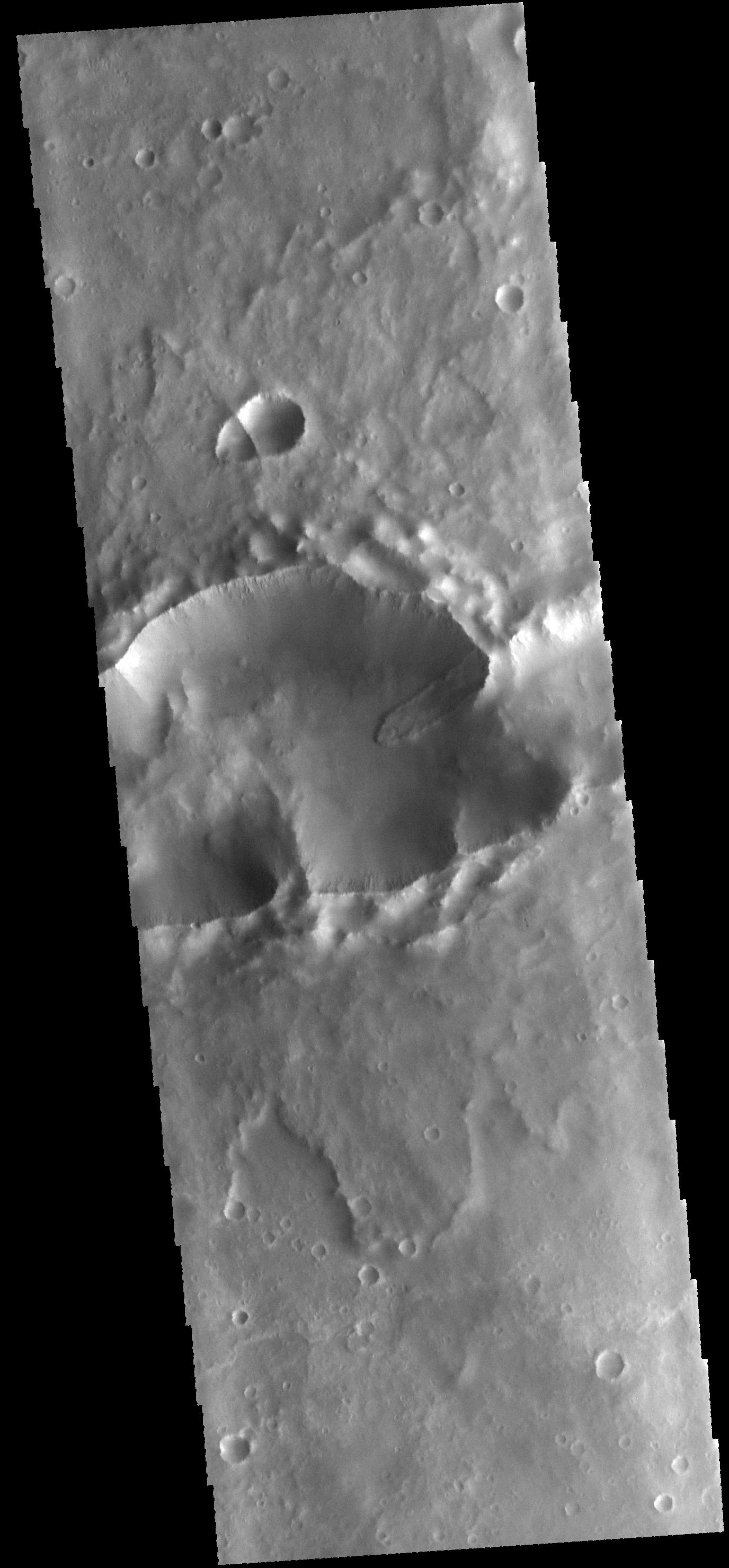
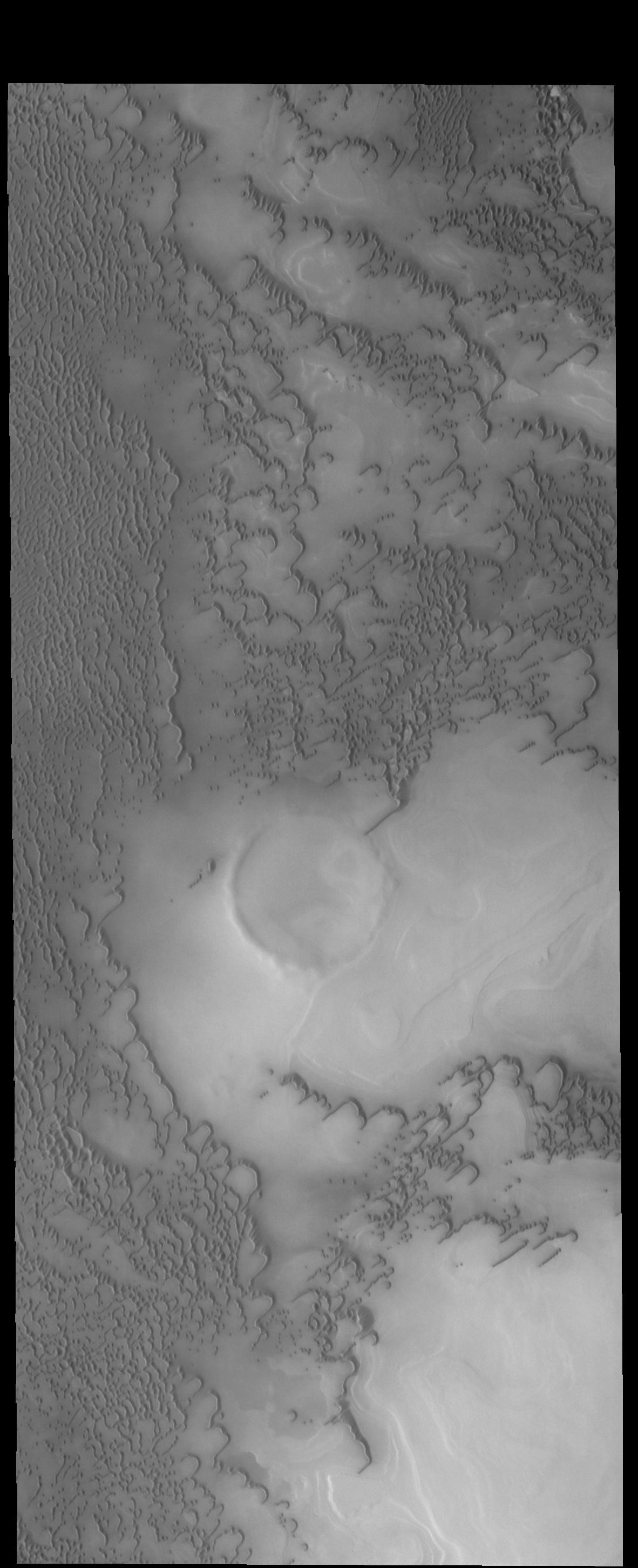
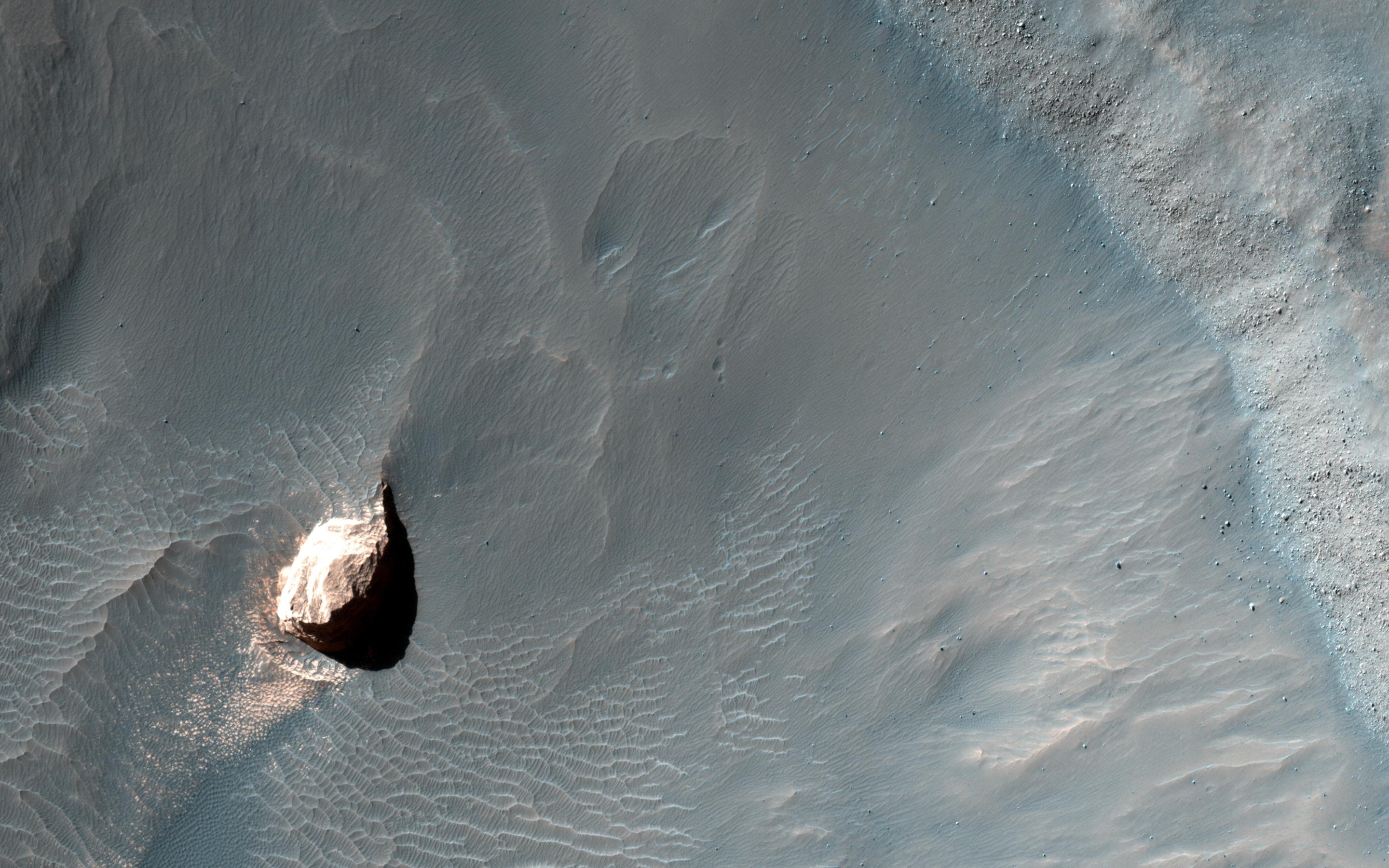
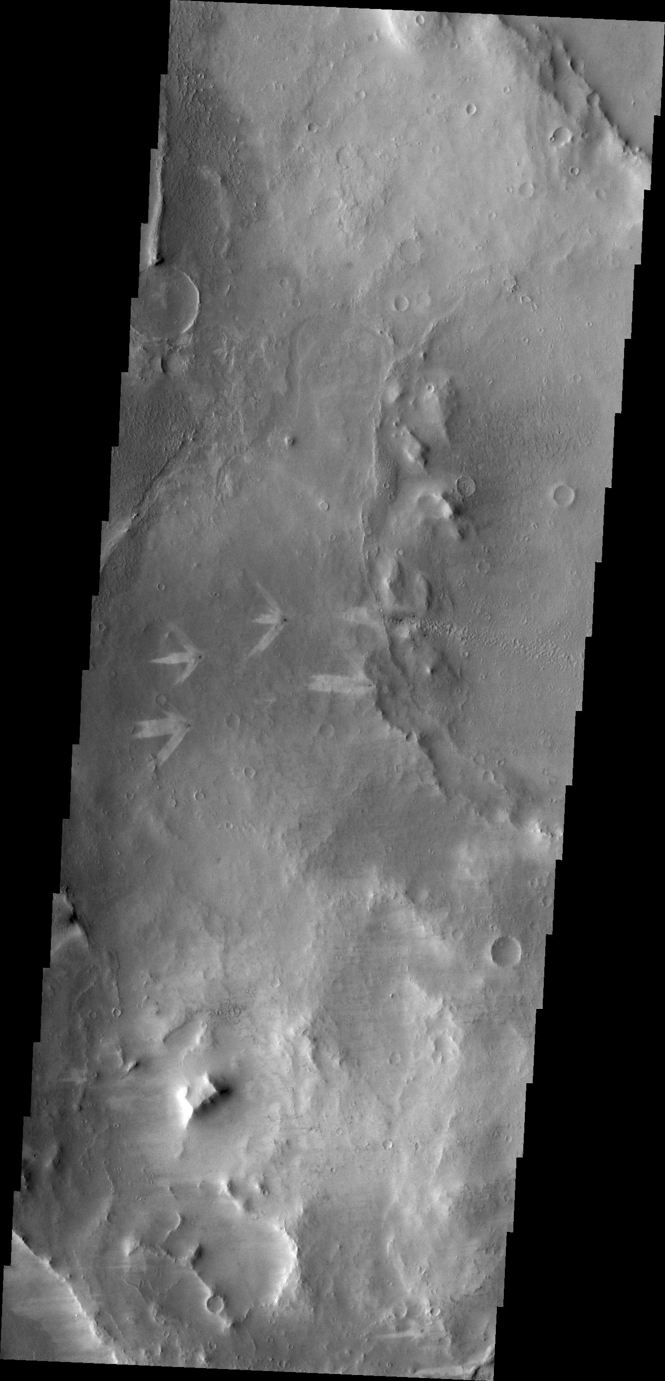
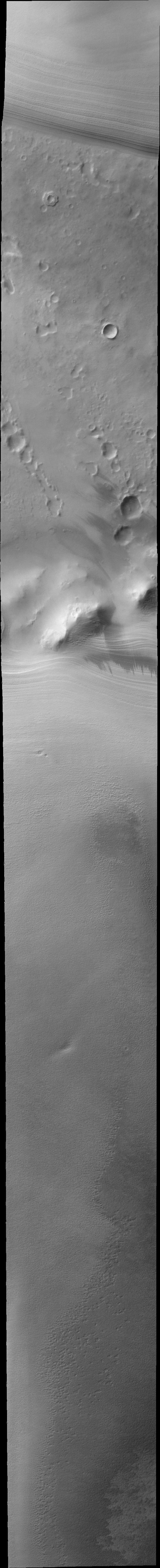
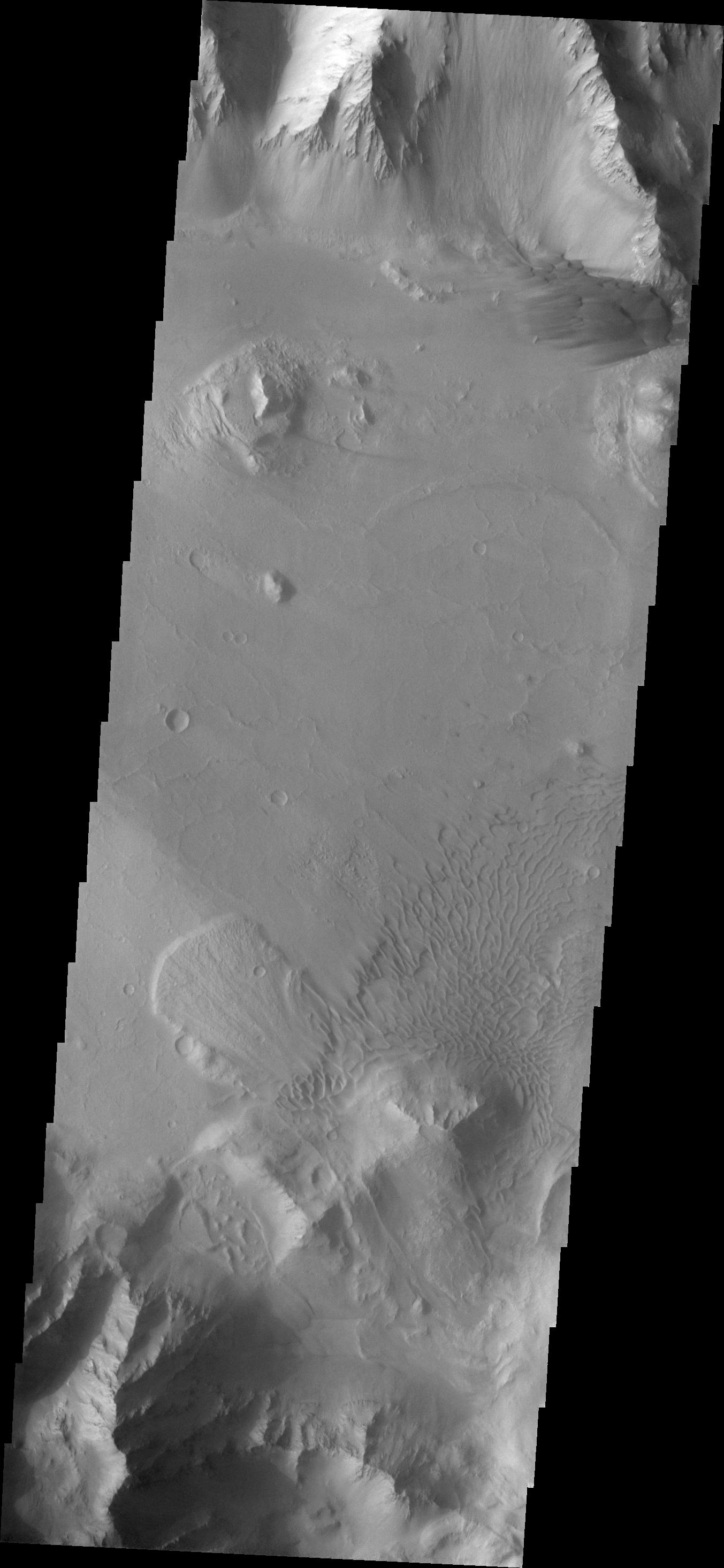
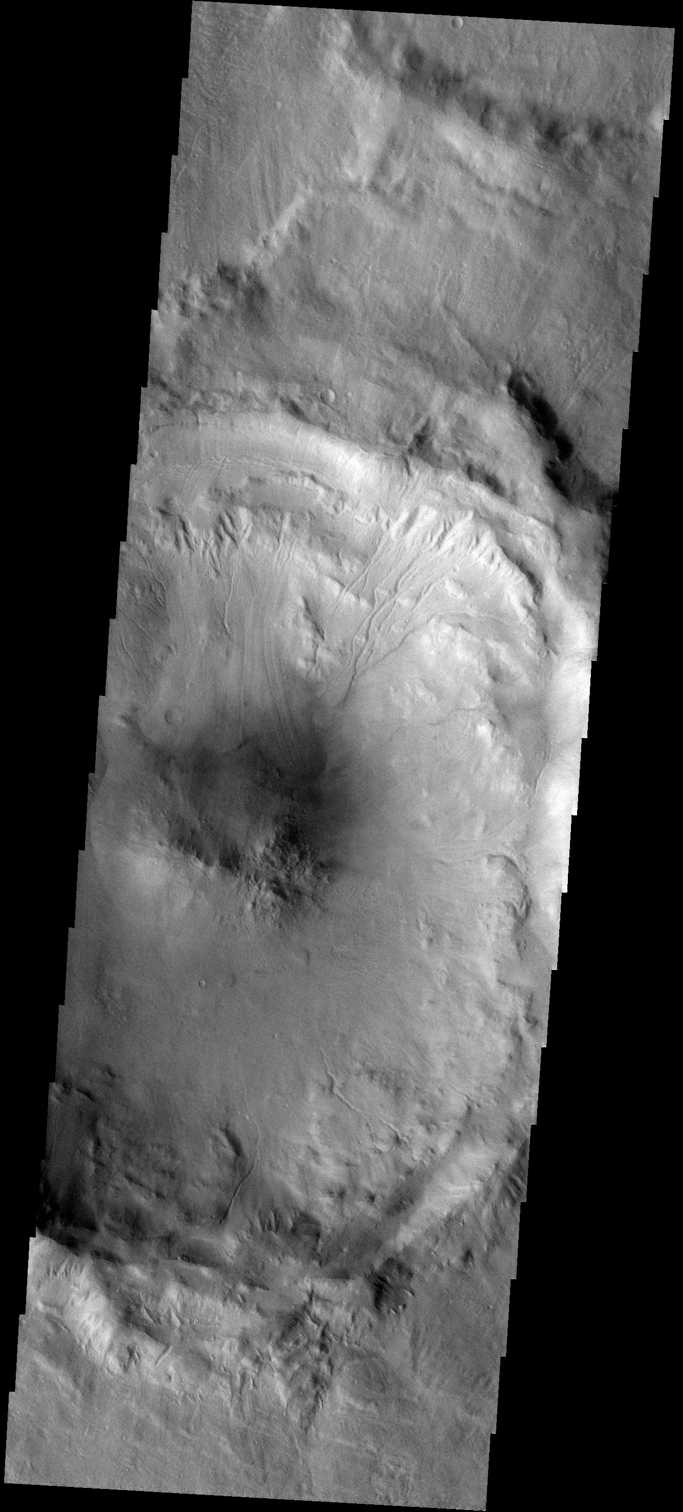
PIA18690:
-
Landslide
Full Resolution:
TIFF
(4.077 MB)
JPEG
(321 kB)
|
|
|
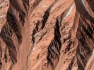
2014-07-16 |
Mars
|
Mars Science Laboratory (MSL)
|
ChemCam
MAHLI
|
1590x1060x3 |
|
-
PIA18388:
-
Curiosity's ChemCam Examines Mars Rock Target 'Nova'
Full Resolution:
TIFF
(5.058 MB)
JPEG
(162.9 kB)
|
|
|
2014-07-11 |
Mars
|
2001 Mars Odyssey
|
THEMIS
|
1182x2905x1 |
|
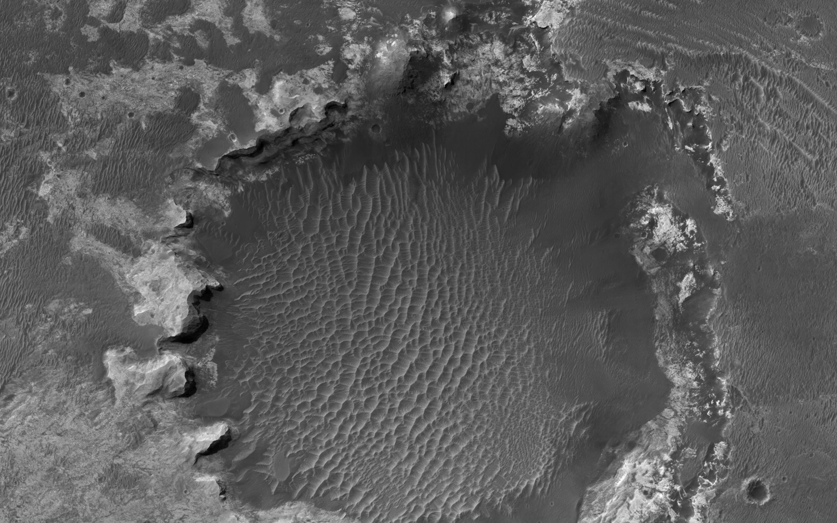
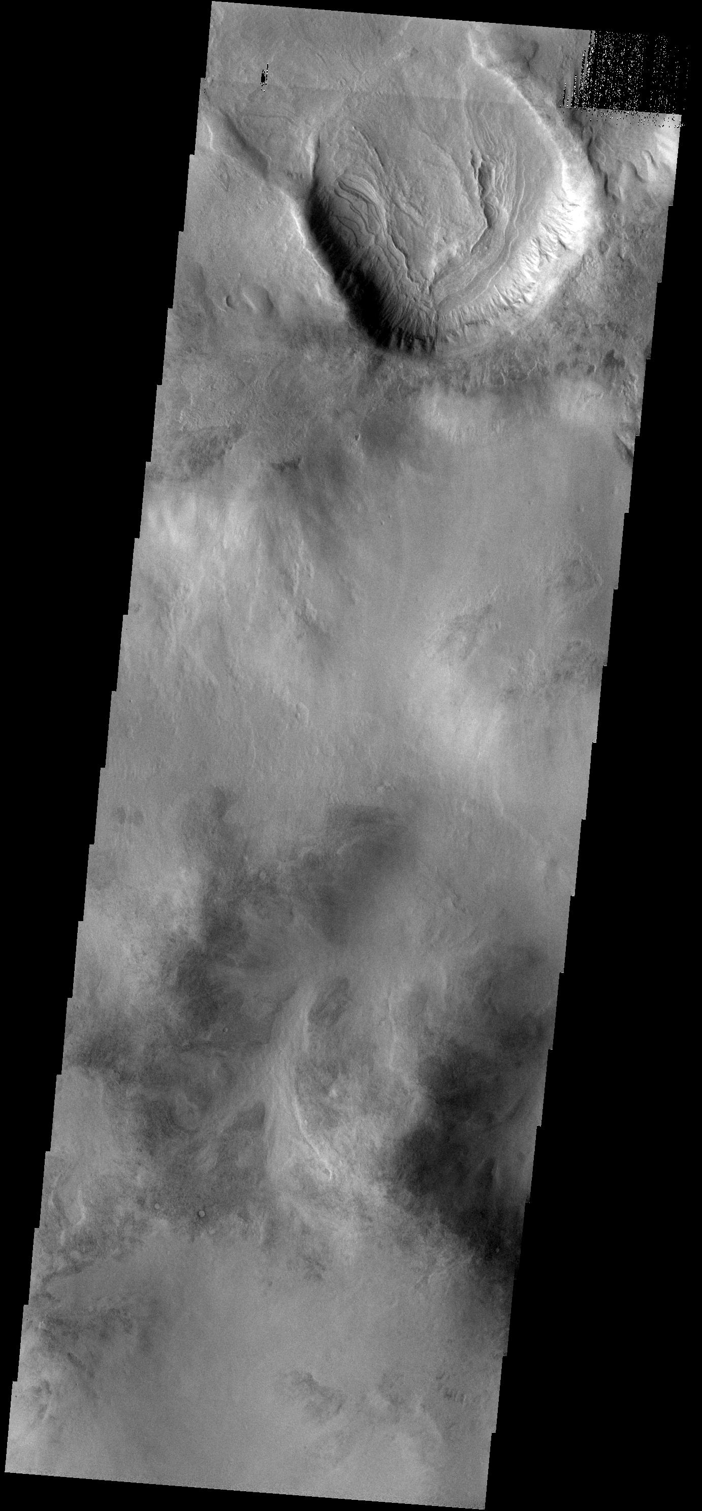
-
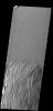
PIA18505:
-
More Polar Dunes
Full Resolution:
TIFF
(3.438 MB)
JPEG
(249.2 kB)
|
|
|
2014-07-09 |
Mars
|
Mars Science Laboratory (MSL)
|
ChemCam
|
3235x2842x3 |
|
-
PIA18396:
-
Martian Rock and Dust Filling Studied with Laser and Camera
Full Resolution:
TIFF
(27.59 MB)
JPEG
(821.6 kB)
|
|
|
2014-05-22 |
Mars
|
Mars Reconnaissance Orbiter (MRO)
|
HiRISE
|
1413x951x3 |
|
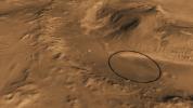
-
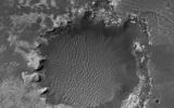
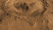
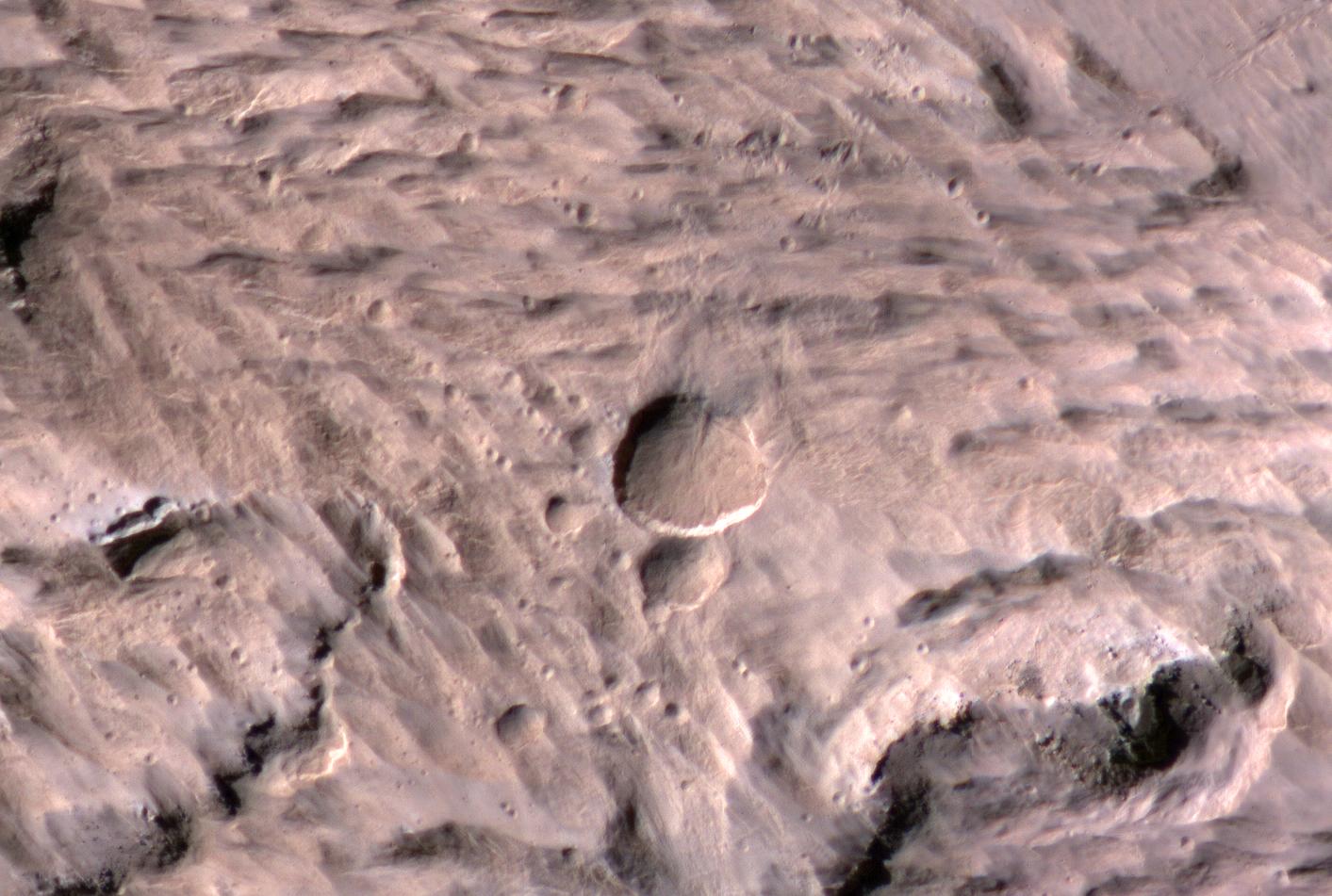
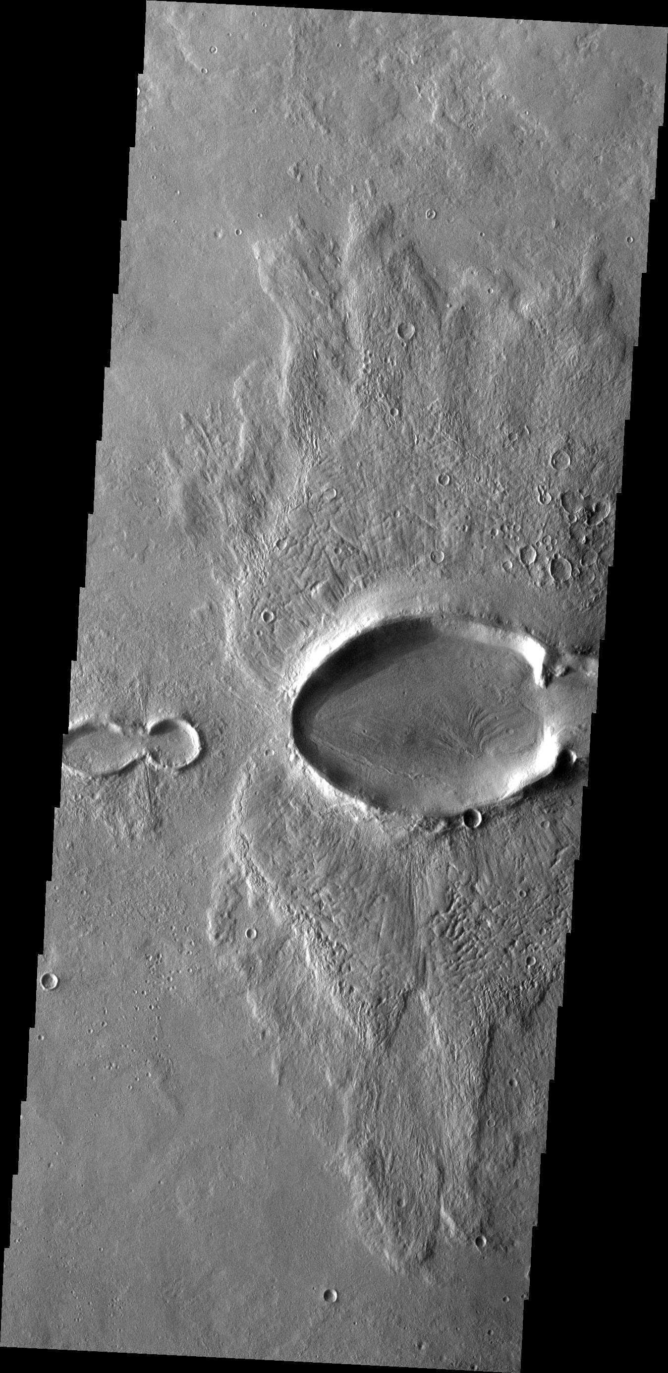
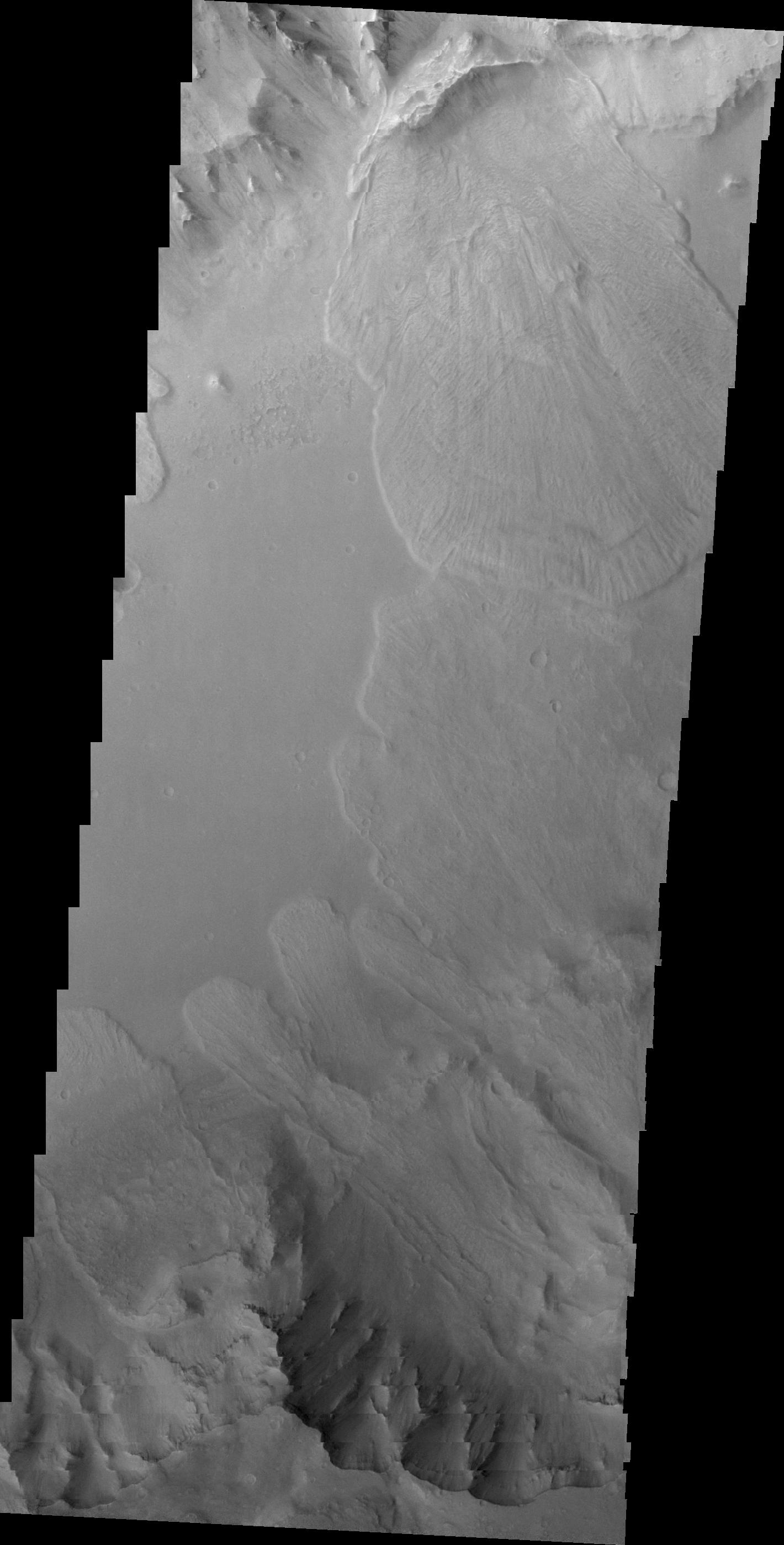
PIA18384:
-
Large, Fresh Crater Surrounded by Smaller Craters
Full Resolution:
TIFF
(4.033 MB)
JPEG
(174.3 kB)
|
|
|
2014-05-15 |
Mars
|
Mars Science Laboratory (MSL)
|
MAHLI
|
1184x1272x3 |
|
-
PIA18092:
-
Mars Rock 'Windjana' After Examination
Full Resolution:
TIFF
(4.52 MB)
JPEG
(331 kB)
|
|
|
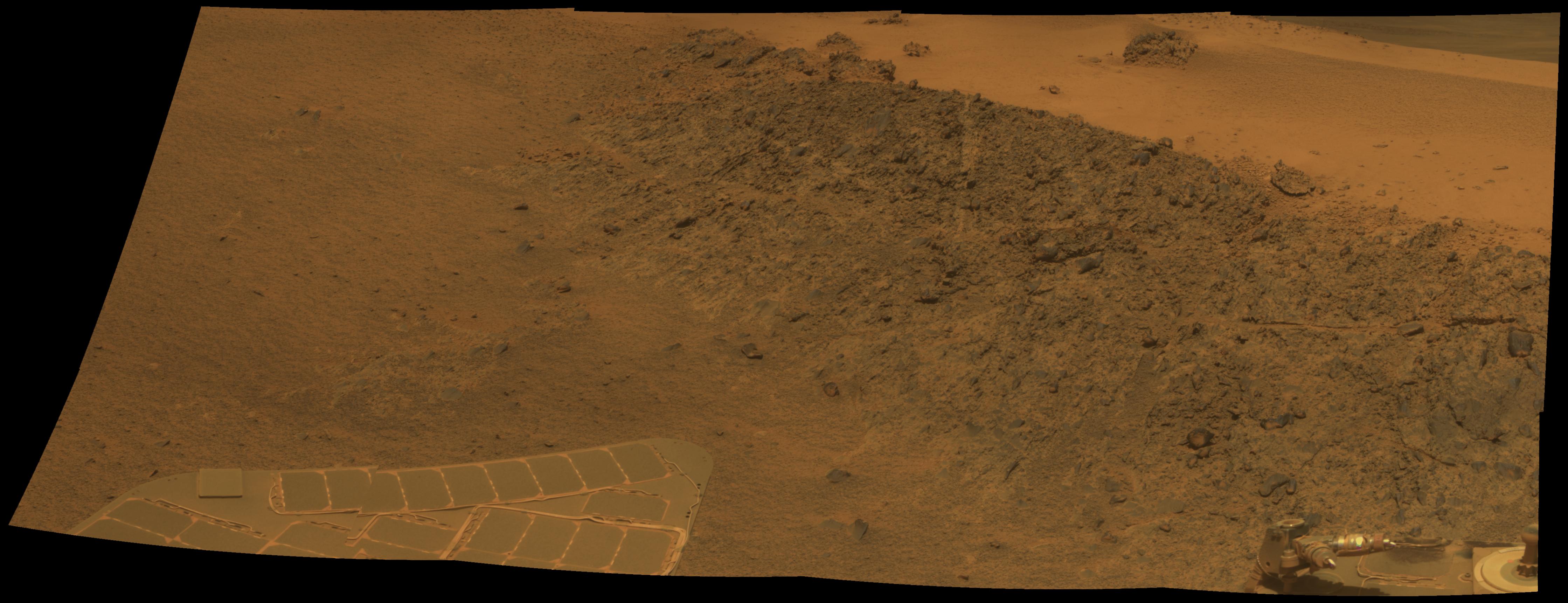
2014-04-17 |
Mars
|
Mars Exploration Rover (MER)
|
Panoramic Camera
|
7694x6016x3 |
|
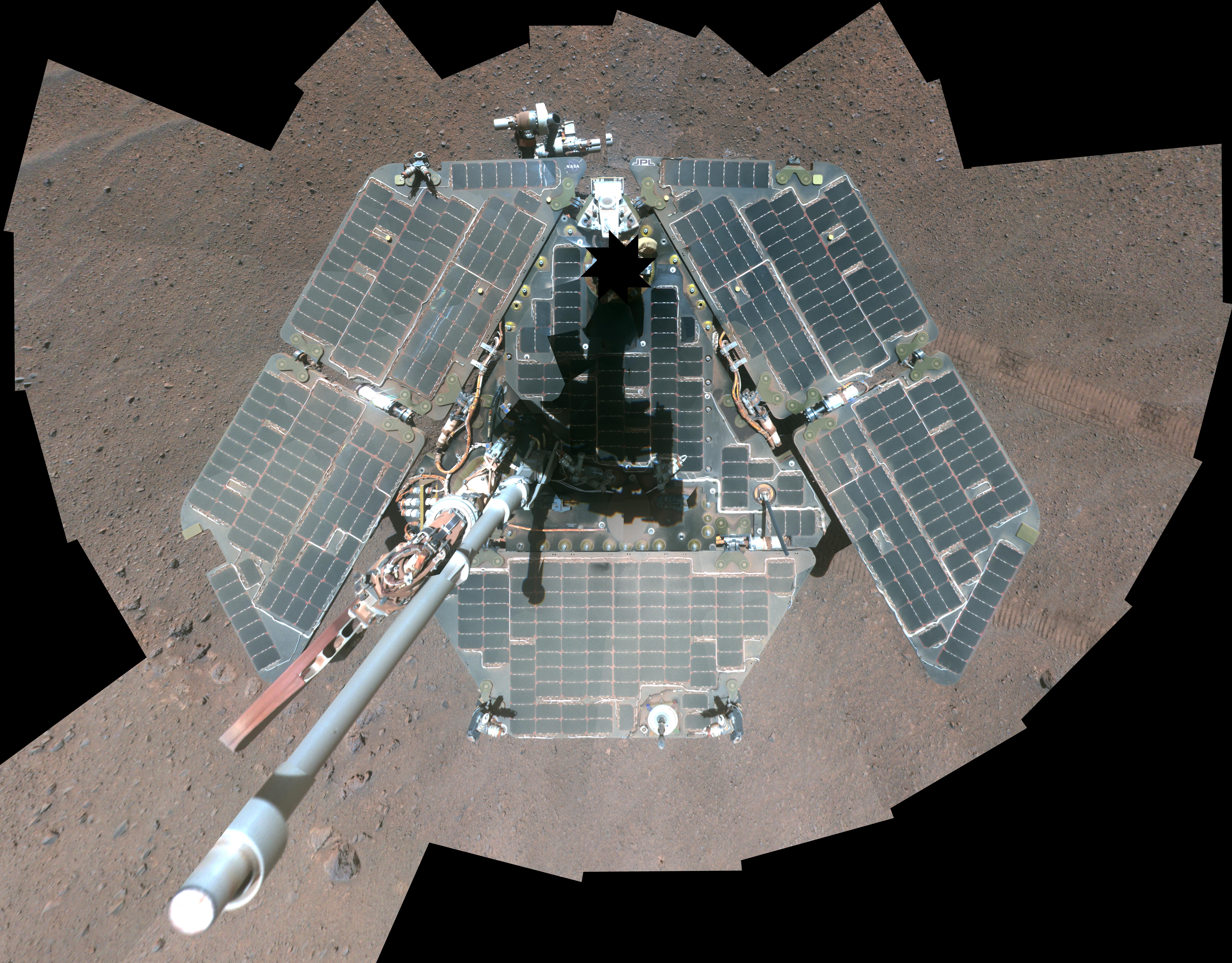
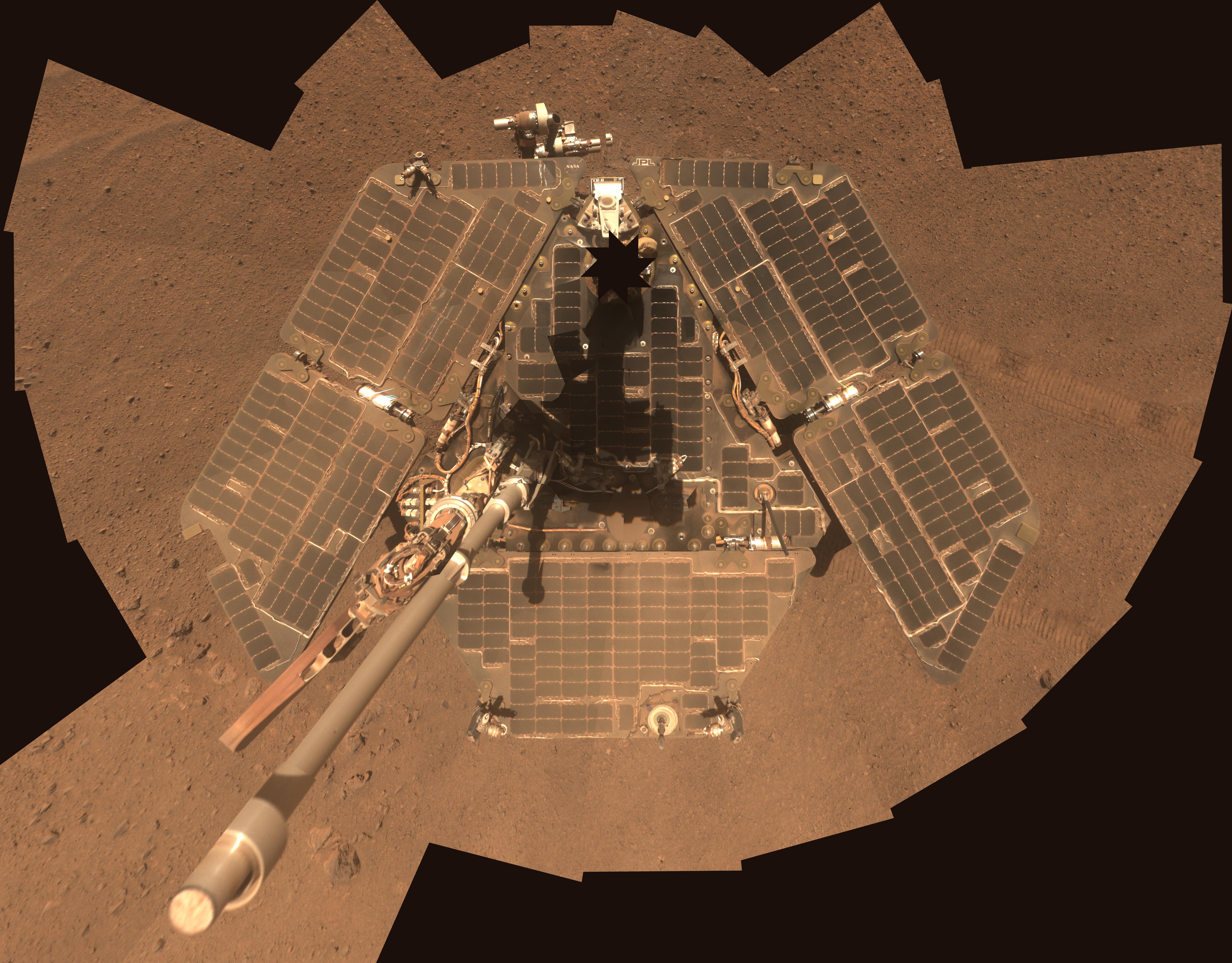
-
PIA18080:
-
Self-Portrait by Freshly Cleaned Opportunity Mars Rover, False Color
Full Resolution:
TIFF
(138.9 MB)
JPEG
(4.265 MB)
|
|
|
2014-04-17 |
Mars
|
Mars Exploration Rover (MER)
|
Panoramic Camera
|
7694x6016x3 |
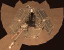
|
-
PIA18079:
-
Self-Portrait by Freshly Cleaned Opportunity Mars Rover in March 2014
Full Resolution:
TIFF
(138.9 MB)
JPEG
(3.583 MB)
|
|
|
2014-04-16 |
Mars
|
Mars Science Laboratory (MSL)
|
Navcam (MSL)
|
3612x1155x3 |
|
-
PIA18084:
-
Stereo View of 'Mount Remarkable' and Surrounding Outcrops at Mars Rover's Waypoint
Full Resolution:
TIFF
(12.52 MB)
JPEG
(697.9 kB)
|
|
|
2014-04-16 |
Mars
|
Mars Science Laboratory (MSL)
|
Navcam (MSL)
|
3595x1737x1 |
|
-
PIA18083:
-
'Mount Remarkable' and Surrounding Outcrops at Mars Rover's Waypoint
Full Resolution:
TIFF
(6.252 MB)
JPEG
(882.7 kB)
|
|
|
2014-03-10 |
Mars
|
2001 Mars Odyssey
|
THEMIS
|
1447x2927x1 |

|
-
PIA18101:
-
Hecates Tholus
Full Resolution:
TIFF
(4.24 MB)
JPEG
(272.2 kB)
|
|
|
2014-03-06 |
Mars
|
2001 Mars Odyssey
|
THEMIS
|
1407x2928x1 |
|
-
PIA18066:
-
Ceraunius Tholus
Full Resolution:
TIFF
(4.125 MB)
JPEG
(368.8 kB)
|
|
|
2014-03-05 |
Mars
|
Mars Reconnaissance Orbiter (MRO)
|
HiRISE
|
2880x1800x1 |
|
-
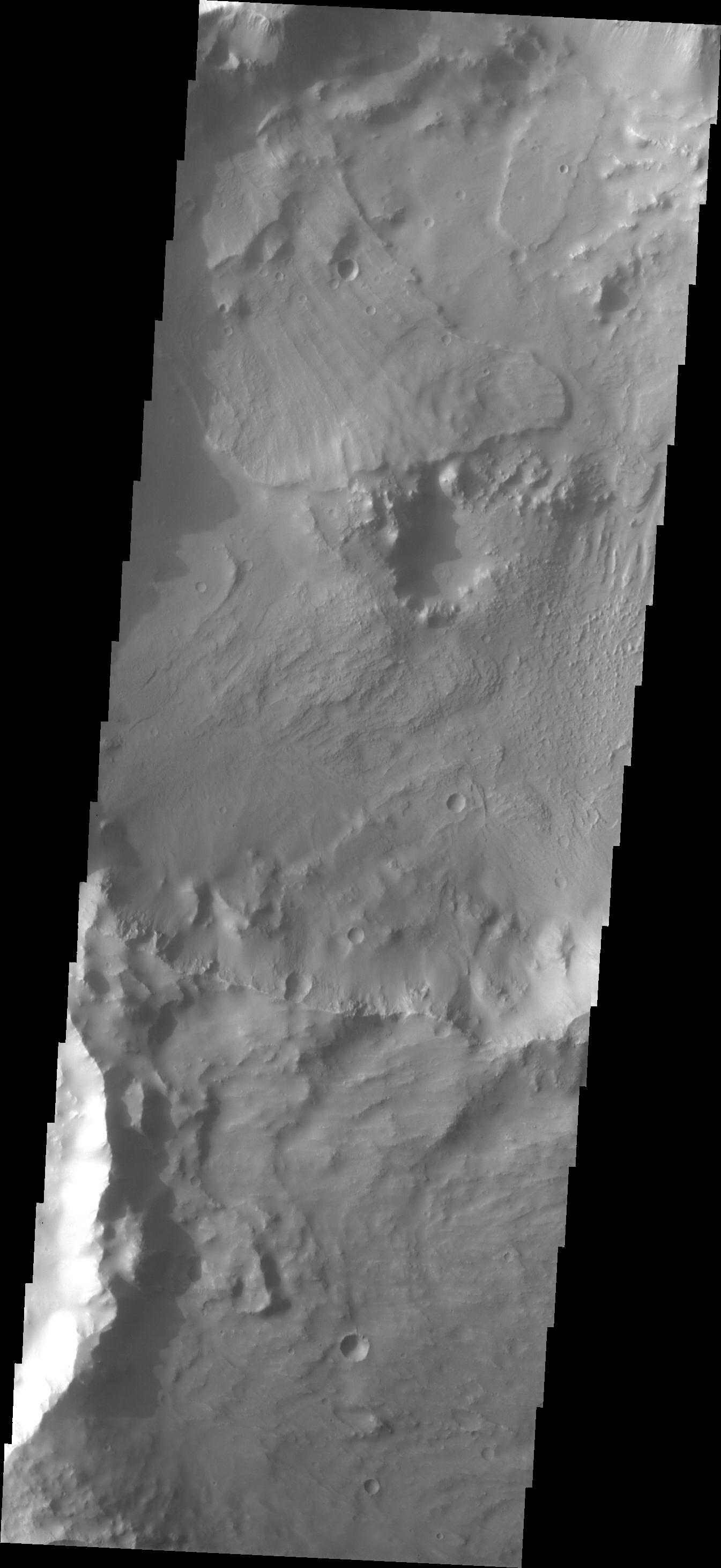
PIA18110:
-
A Crater Straddling Two Terrain Units
Full Resolution:
TIFF
(5.191 MB)
JPEG
(612.7 kB)
|
|
|
2014-03-05 |
Mars
|
2001 Mars Odyssey
|
THEMIS
|
1449x2932x1 |

|
-
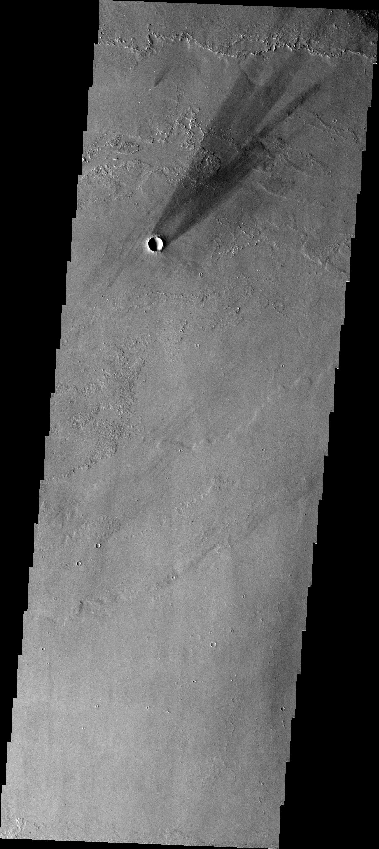
PIA18065:
-
Crater Ejecta
Full Resolution:
TIFF
(4.253 MB)
JPEG
(332.3 kB)
|
|
|
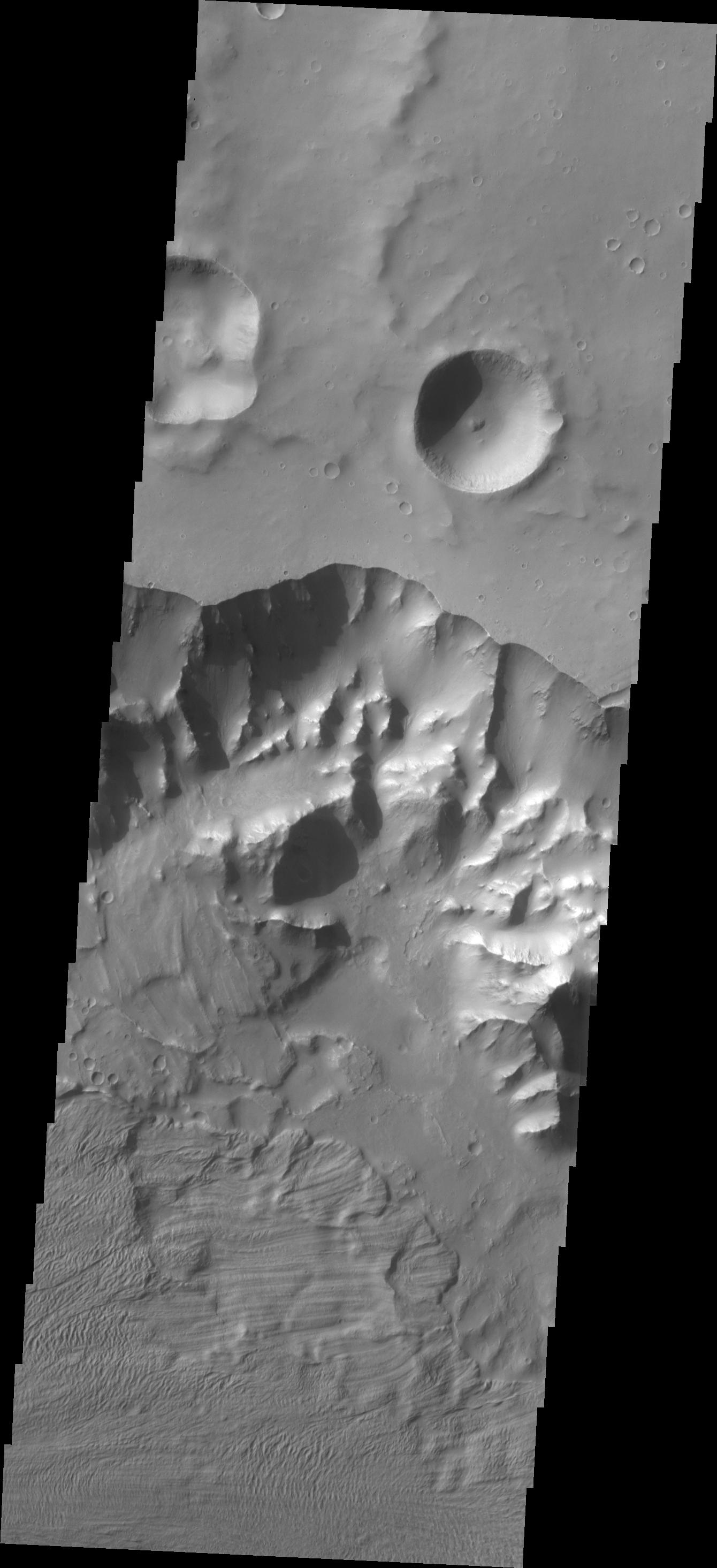
2014-02-25 |
Mars
|
2001 Mars Odyssey
|
THEMIS
|
1483x2937x1 |
|
-
PIA18025:
-
Rubicon Valles
Full Resolution:
TIFF
(4.36 MB)
JPEG
(478 kB)
|
|
|
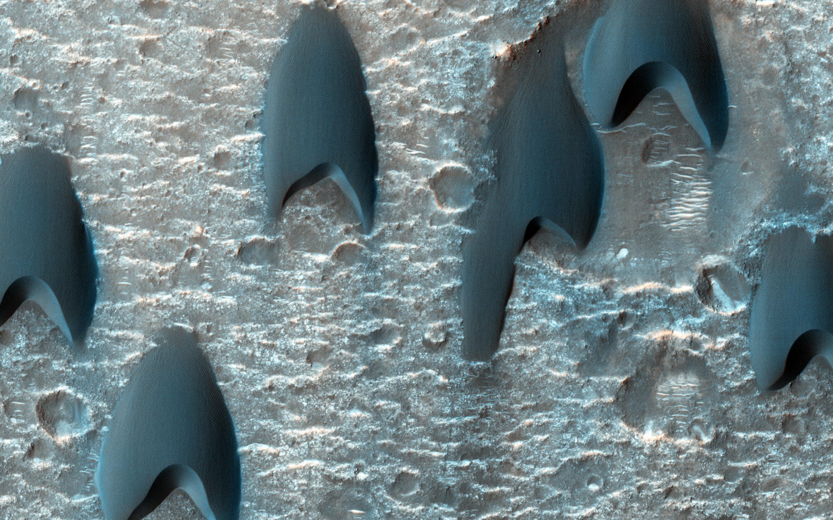
2014-02-13 |
Mars
|
Mars Reconnaissance Orbiter (MRO)
|
HiRISE
|
2880x1800x3 |
|
-
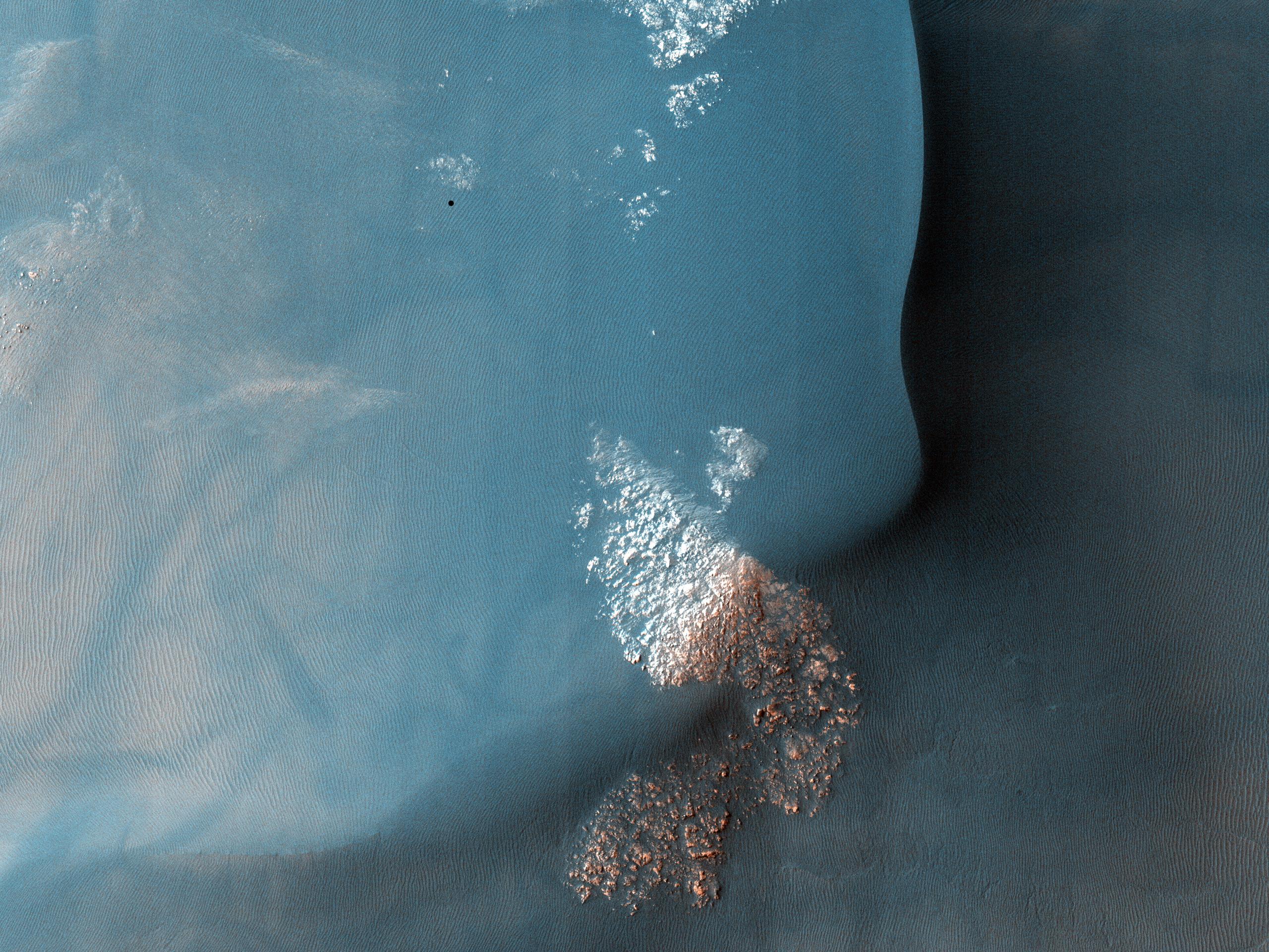
PIA17981:
-
Dunes Flying in Formation
Full Resolution:
TIFF
(15.56 MB)
JPEG
(797.8 kB)
|
|
|
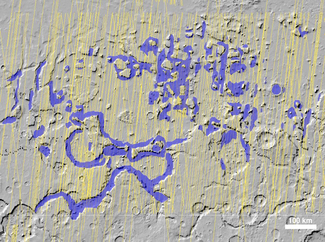
2013-12-09 |
Mars
|
Mars Reconnaissance Orbiter (MRO)
Mars Science Laboratory (MSL)
|
CTX
|
3300x2550x3 |
|
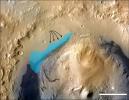
-
PIA17596:
-
Possible Extent of Ancient Lake in Gale Crater, Mars
Full Resolution:
TIFF
(25.26 MB)
JPEG
(1.34 MB)
|
|
|
2013-12-05 |
Mars
|
Mars Science Laboratory (MSL)
|
ChemCam
|
960x720x3 |
|
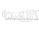
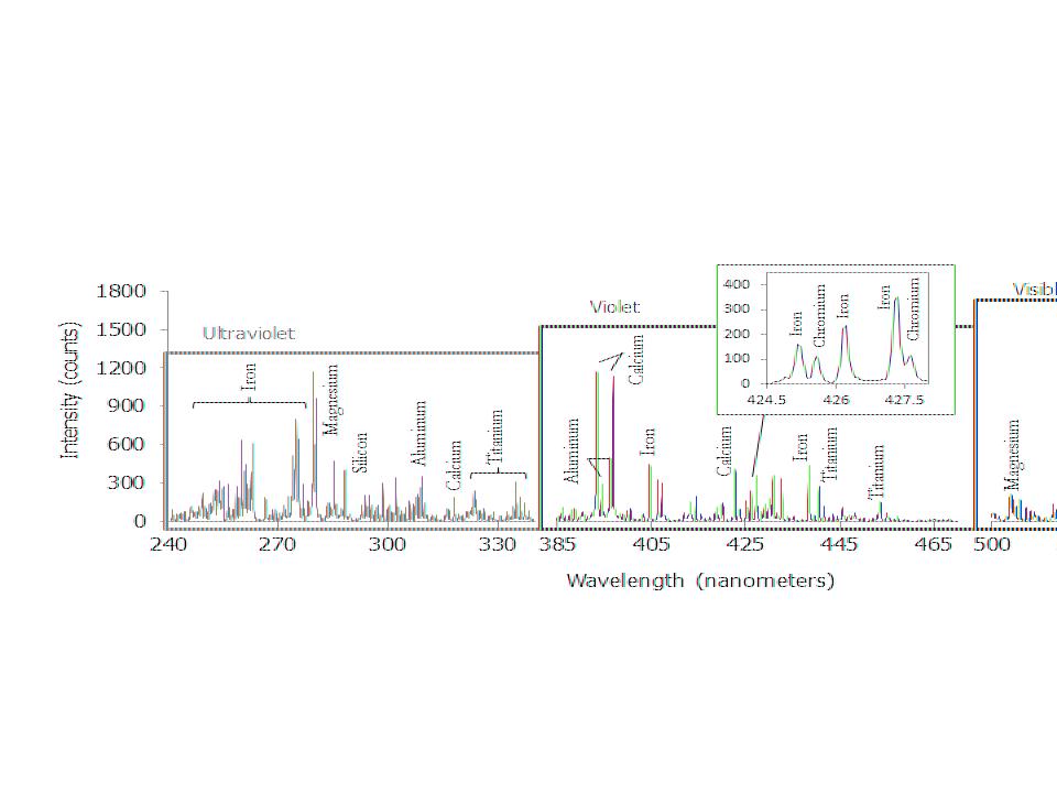
-
PIA17593:
-
ChemCam Spectrum from Martian Rock Target 'Ithaca'
Full Resolution:
TIFF
(2.075 MB)
JPEG
(56.65 kB)
|
|
|
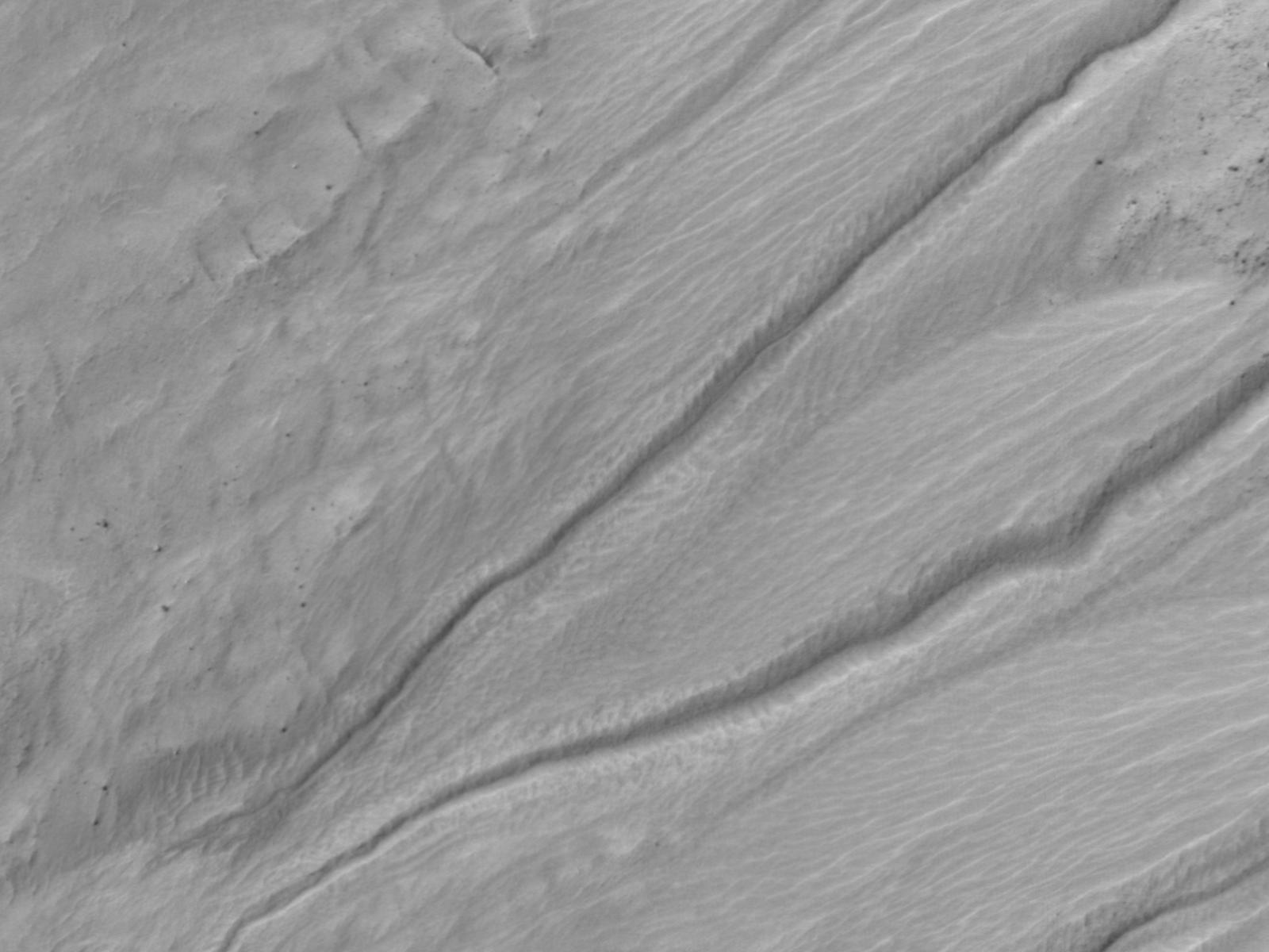
2013-09-12 |
Mars
|
2001 Mars Odyssey
|
THEMIS
|
1364x2950x1 |
|
-
PIA17425:
-
Rim Channels
Full Resolution:
TIFF
(4.028 MB)
JPEG
(285.9 kB)
|
|
|
2013-08-21 |
Mars
|
Mars Reconnaissance Orbiter (MRO)
|
HiRISE
|
2880x1800x3 |
|
-
PIA17639:
-
Small Crater within Pollack Crater Containing Light-Toned Material
Full Resolution:
TIFF
(15.56 MB)
JPEG
(665.2 kB)
|
|
|
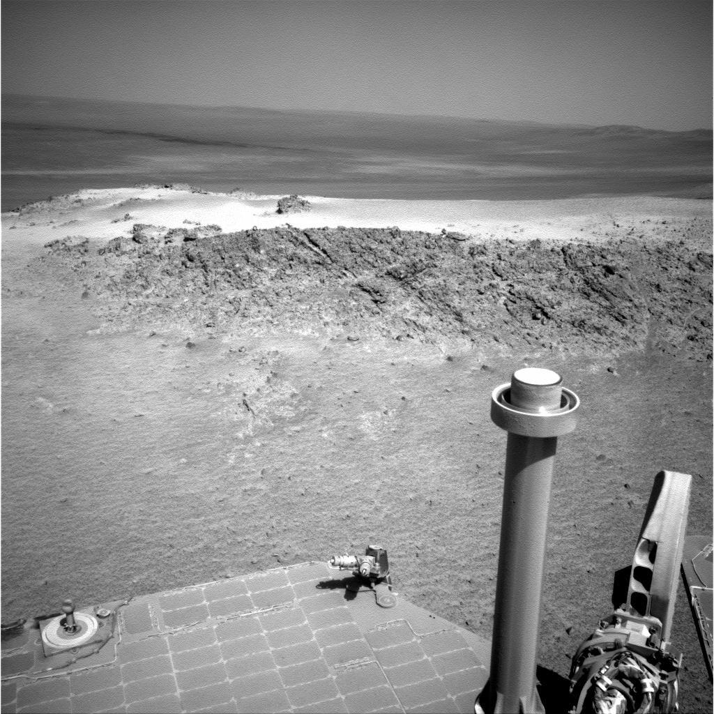
2013-08-14 |
Mars
|
Mars Exploration Rover (MER)
|
Navigation Camera
|
1024x1024x1 |
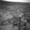
|
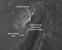
-
PIA17088:
-
Northern Tip of 'Solander Point' on Endeavour Crater Rim
Full Resolution:
TIFF
(1.05 MB)
JPEG
(180.7 kB)
|
|
|
2013-07-04 |
Mars
|
2001 Mars Odyssey
|
THEMIS
|
1348x2769x1 |
|
-
PIA17310:
-
THEMIS Art #109
Full Resolution:
TIFF
(3.737 MB)
JPEG
(513.8 kB)
|
|
|
2013-06-19 |
Mars
|
Mars Science Laboratory (MSL)
|
Mastcam
Navcam (MSL)
|
17548x3022x3 |
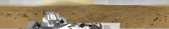
|
-
PIA16919:
Billion-Pixel View From Curiosity at Rock Nest, Raw Color
Full Resolution:
TIFF
(159.1 MB)
JPEG
(7.4 MB)
|
|
|
2013-06-19 |
Mars
|
Mars Science Laboratory (MSL)
|
Mastcam
Navcam (MSL)
|
17548x3022x3 |
|
-
PIA16918:
Billion-Pixel View From Curiosity at Rock Nest, White-Balanced
Full Resolution:
TIFF
(159.1 MB)
JPEG
(7.72 MB)
|
|
|
2013-06-12 |
Mars
|
Mars Reconnaissance Orbiter (MRO)
|
MCS
|
1883x2437x3 |
|
-
PIA17263:
-
Scanning Martian Atmospheric Temperatures (Graphic)
Full Resolution:
TIFF
(13.77 MB)
JPEG
(337.9 kB)
|
|
|
2013-06-07 |
Mars
|
Mars Exploration Rover (MER)
|
HiRISE
|
8192x4206x1 |
|
-
PIA17076:
-
Perspective View of 'Botany Bay' and Surroundings, With Vertical Exaggeration
Full Resolution:
TIFF
(34.49 MB)
JPEG
(3.985 MB)
|
|
|
2013-05-01 |
Mars
|
Mars Reconnaissance Orbiter (MRO)
|
HiRISE
|
2880x1800x1 |

|
-
PIA17870:
-
Watch for Falling Rocks!
Full Resolution:
TIFF
(5.191 MB)
JPEG
(428.7 kB)
|
|
|
2013-03-07 |
Mars
|
Mars Reconnaissance Orbiter (MRO)
|
Shallow Subsurface Radar (SHARAD)
|
1000x692x3 |
|
-
PIA16767:
-
Visualization of Buried Marte Vallis Channels
Full Resolution:
TIFF
(2.077 MB)
JPEG
(74.88 kB)
|
|
|
2013-02-04 |
Mars
|
Mars Science Laboratory (MSL)
|
ChemCam
|
750x750x1 |
|
-
PIA16719:
-
Drill Bit Tip on Mars Rover Curiosity, Head-on View
Full Resolution:
TIFF
(563.3 kB)
JPEG
(34.13 kB)
|
|
|
2013-02-04 |
Mars
|
Mars Science Laboratory (MSL)
|
ChemCam
|
750x750x1 |
|
-
PIA16718:
-
Drill Bit Tip on Mars Rover Curiosity, Side View
Full Resolution:
TIFF
(563.3 kB)
JPEG
(32.42 kB)
|
|
|
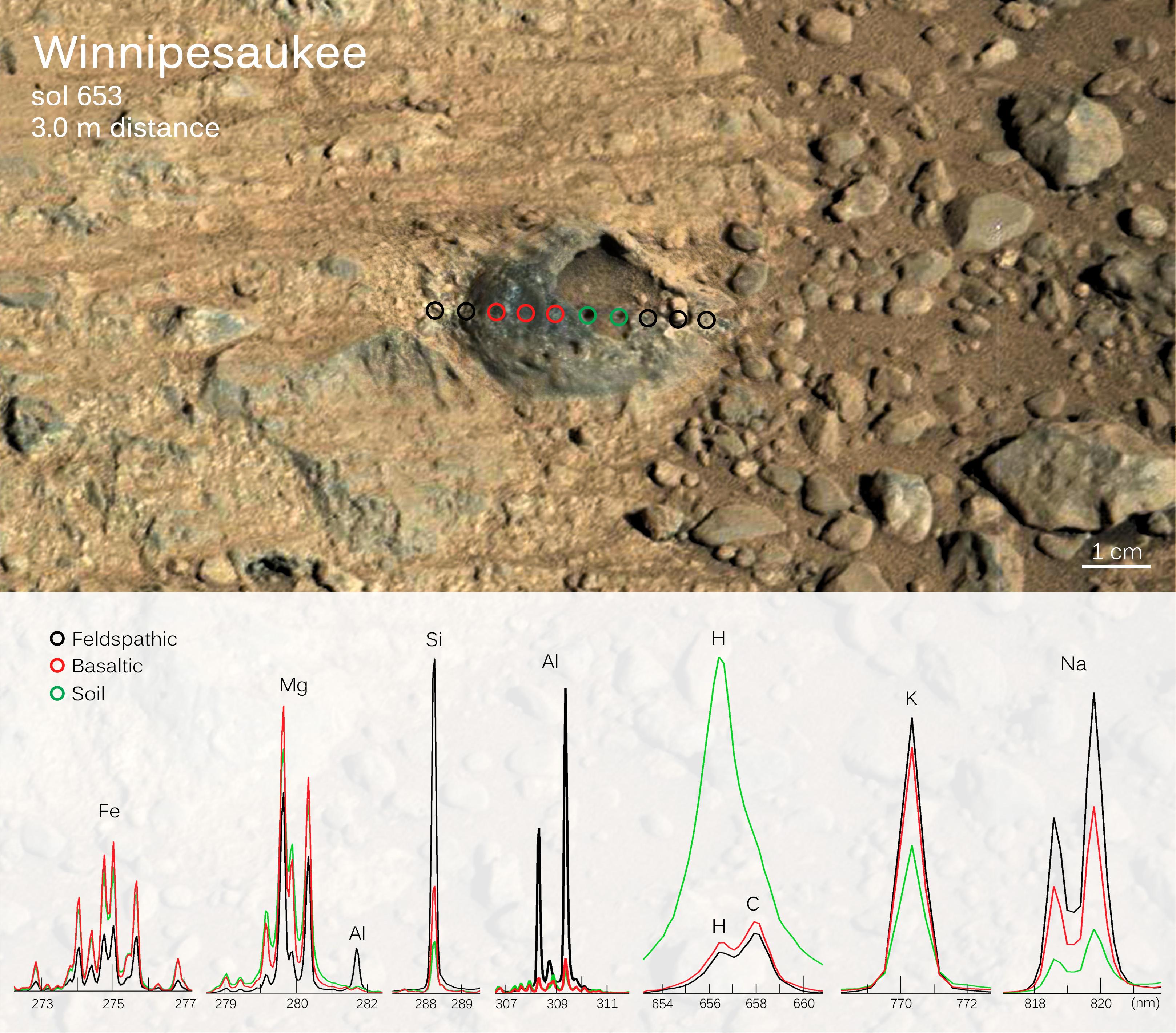
2012-12-03 |
Mars
|
Mars Science Laboratory (MSL)
|
Alpha Particle X-ray Spectrometer (MSL)
|
1600x1200x3 |
|
-
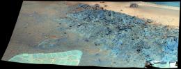
PIA16572:
-
Inspecting Soils Across Mars
Full Resolution:
TIFF
(5.762 MB)
JPEG
(141.9 kB)
|
|
|
2012-09-18 |
Mars
|
2001 Mars Odyssey
|
THEMIS
|
1352x2776x1 |
|
-
PIA15946:
-
Channels
Full Resolution:
TIFF
(3.757 MB)
JPEG
(392.9 kB)
|
|
|
2012-09-07 |
Mars
|
Mars Exploration Rover (MER)
|
Navigation Camera
|
4000x4000x1 |
|
-
PIA16125:
-
Opportunity's Surroundings on 3,000th Sol, Vertical Projection
Full Resolution:
TIFF
(16.02 MB)
JPEG
(1.55 MB)
|
|
|
2012-09-07 |
Mars
|
Mars Exploration Rover (MER)
|
Navigation Camera
|
4111x4111x1 |

|
-
PIA16124:
-
Opportunity's Surroundings on 3,000th Sol, Polar Projection
Full Resolution:
TIFF
(16.93 MB)
JPEG
(1.518 MB)
|
|
|
2012-09-07 |
Mars
|
Mars Exploration Rover (MER)
|
Navigation Camera
|
7753x1152x3 |

|
-
PIA16123:
Opportunity's Surroundings on 3,000th Sol, in 3-D
Full Resolution:
TIFF
(26.8 MB)
JPEG
(1.421 MB)
|
|
|
2012-09-07 |
Mars
|
Mars Exploration Rover (MER)
|
Navigation Camera
|
7688x987x1 |
|
-
PIA16122:
Opportunity's Surroundings on 3,000th Sol
Full Resolution:
TIFF
(7.596 MB)
JPEG
(1.148 MB)
|
|
|
2012-09-06 |
Mars
|
Mars Science Laboratory (MSL)
|
|
1438x933x3 |

|
-
PIA16145:
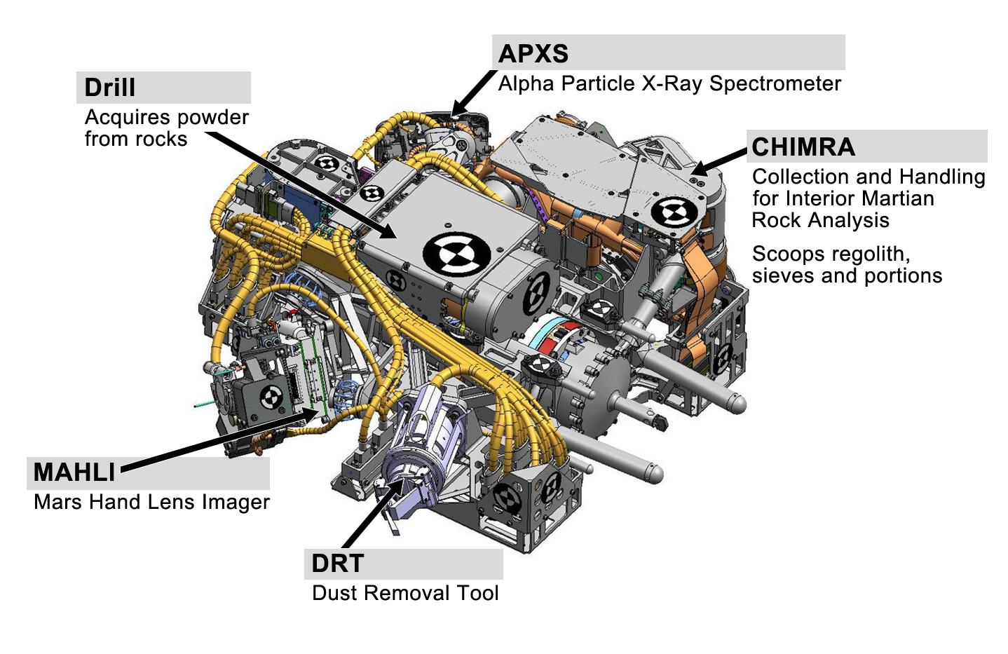
-
Tools at Curiosity's 'Fingertips'
Full Resolution:
TIFF
(4.027 MB)
JPEG
(192.1 kB)
|
|
|
2012-09-06 |
Mars
|
Mars Science Laboratory (MSL)
|
HiRISE
|
2055x1437x3 |
|
-
PIA16143:
-
Dissecting the Scene of Sky Crane Crash
Full Resolution:
TIFF
(8.863 MB)
JPEG
(454.9 kB)
|
|
|
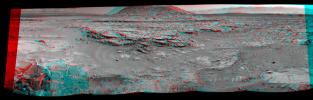
2012-07-05 |
Mars
|
Mars Exploration Rover (MER)
|
Panoramic Camera
|
5788x2000x3 |
|
-
PIA15689:
-
'Greeley Panorama' from Opportunity's Fifth Martian Winter (False Color)
Full Resolution:
TIFF
(34.74 MB)
JPEG
(1.065 MB)
|
|
|
2012-06-14 |
Mars
|
2001 Mars Odyssey
|
THEMIS
|
682x1537x1 |
|
-
PIA15725:
-
Daedalia Planum
Full Resolution:
TIFF
(1.049 MB)
JPEG
(158 kB)
|
|
|
2012-06-06 |
Mars
|
2001 Mars Odyssey
|
THEMIS
|
1347x2766x1 |

|
-
PIA15719:
-
Channel
Full Resolution:
TIFF
(3.73 MB)
JPEG
(363 kB)
|
|
|
2012-05-25 |
Mars
|
2001 Mars Odyssey
|
THEMIS
|
1340x2930x1 |

|
-
PIA15711:
-
Ganges Chasma
Full Resolution:
TIFF
(3.93 MB)
JPEG
(255.3 kB)
|
|
|
2012-01-05 |
Mars
|
Mars Exploration Rover (MER)
Mars Reconnaissance Orbiter (MRO)
|
HiRISE
|
700x560x1 |
|
-
PIA15276:
-
Locator Map for 'Greeley Haven' on Endeavour Rim
Full Resolution:
TIFF
(392.6 kB)
JPEG
(56.54 kB)
|
|
|
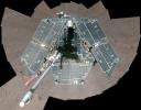
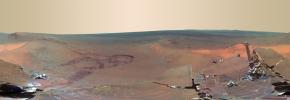
2012-01-05 |
Mars
|
Mars Exploration Rover (MER)
|
Panoramic Camera
|
4478x1722x3 |
|
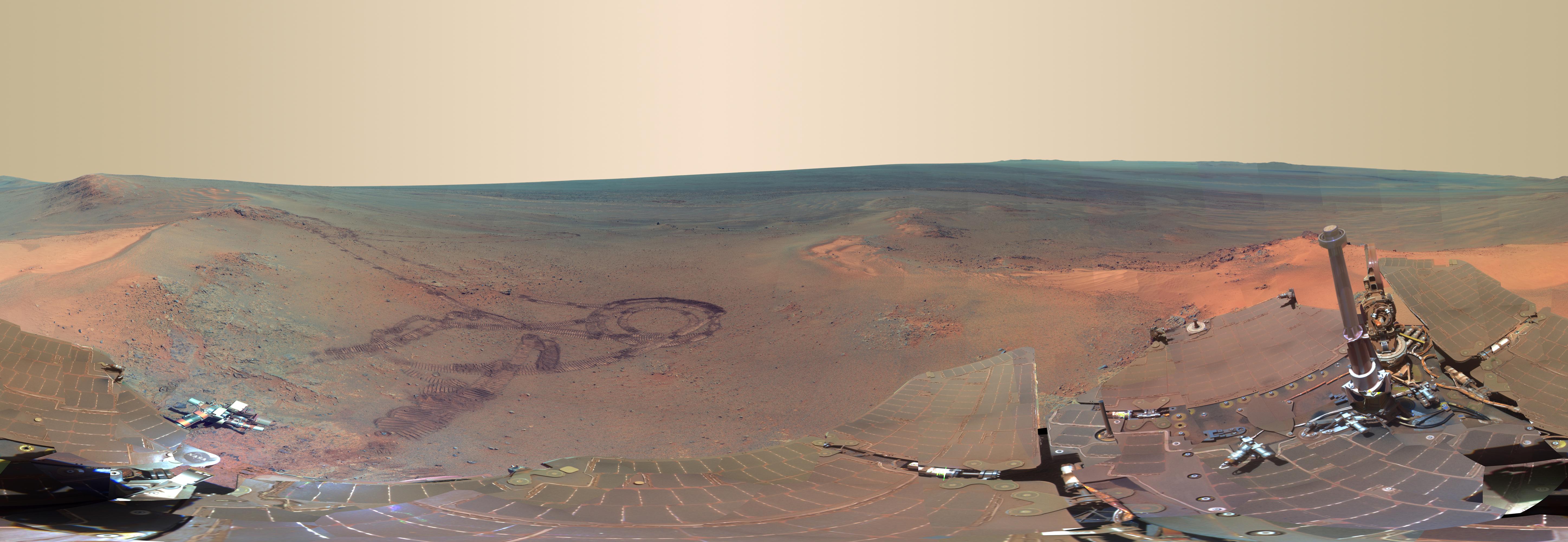
-
PIA15275:
-
'Greeley Haven' Site for Opportunity's Fifth Martian Winter (False Color)
Full Resolution:
TIFF
(23.13 MB)
JPEG
(1.402 MB)
|
|
|
2012-01-05 |
Mars
|
Mars Exploration Rover (MER)
|
Panoramic Camera
|
4478x1722x3 |

|
-
PIA15119:
-
'Greeley Haven' Site for Opportunity's Fifth Martian Winter
Full Resolution:
TIFF
(23.13 MB)
JPEG
(694.1 kB)
|
|
|
2012-01-05 |
Mars
|
Mars Exploration Rover (MER)
|
Navigation Camera
|
1024x1024x1 |

|
-
PIA15118:
-
Approaching 'Greeley Haven' on Endeavour Rim
Full Resolution:
TIFF
(1.05 MB)
JPEG
(212.1 kB)
|
|
|
2011-12-21 |
Mars
|
2001 Mars Odyssey
|
THEMIS
|
1299x2770x1 |
|
-
PIA15208:
-
Ascraeus Mons
Full Resolution:
TIFF
(3.602 MB)
JPEG
(442.6 kB)
|
|
|
2011-10-25 |
Mars
|
2001 Mars Odyssey
|
THEMIS
|
1388x2812x1 |
|
-
PIA14971:
-
Crater Rim Channels
Full Resolution:
TIFF
(3.908 MB)
JPEG
(320 kB)
|
|
|
2011-08-04 |
Mars
|
Mars Reconnaissance Orbiter (MRO)
|
HiRISE
|
1600x1200x1 |
|
-
PIA14503:
-
Changes in a Gully in a Mars Crater (Two-Image Comparison)
Full Resolution:
TIFF
(1.922 MB)
JPEG
(136.2 kB)
|
|
|
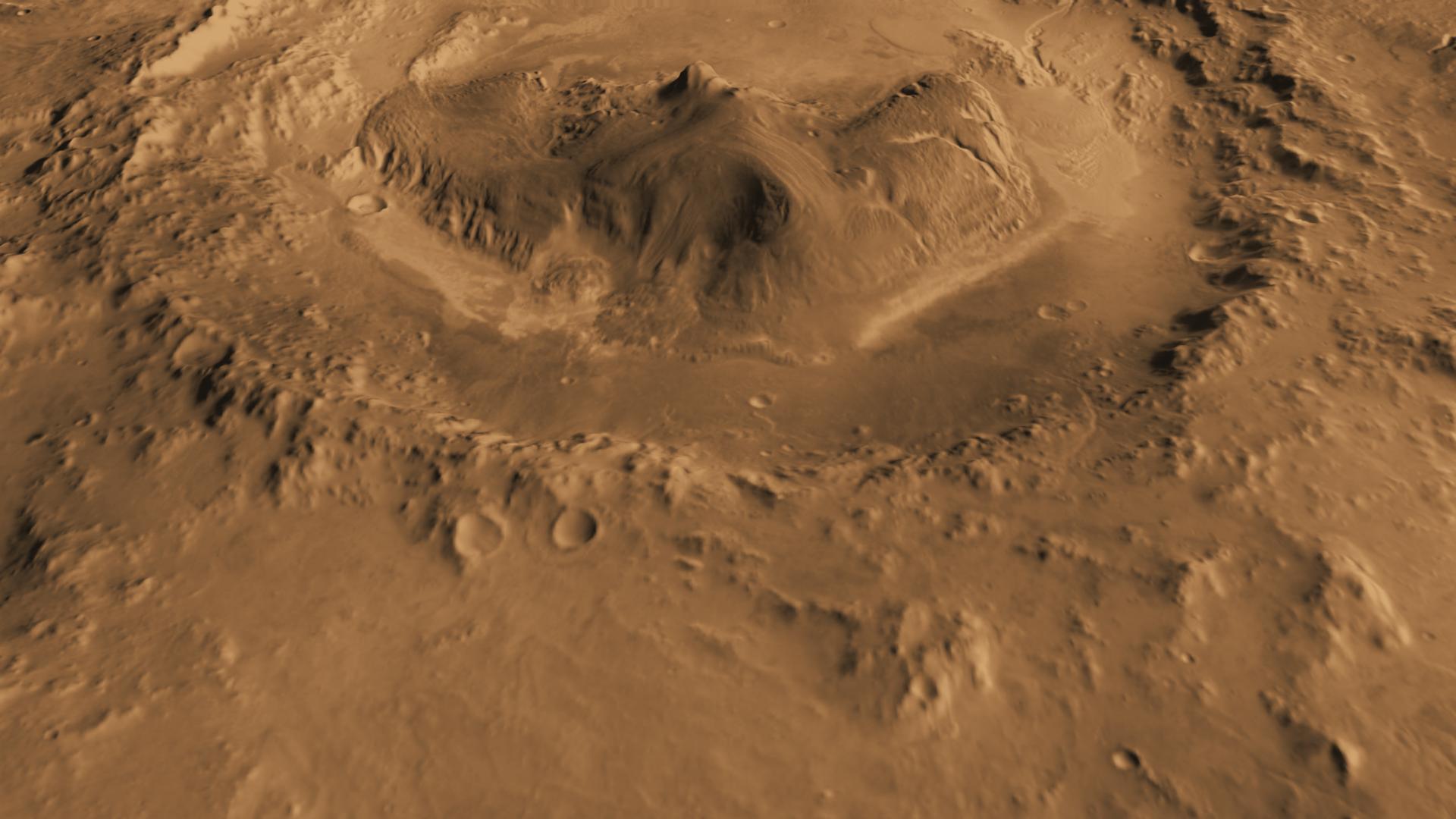
2011-07-22 |
Mars
|
Mars Science Laboratory (MSL)
|
MOLA
THEMIS
|
1920x1080x3 |
|
-
PIA14292:
-
Oblique view of Gale Crater from the Northwest
Full Resolution:
TIFF
(6.23 MB)
JPEG
(141.6 kB)
|
|
|
2011-07-06 |
Mars
|
2001 Mars Odyssey
Mars Global Surveyor (MGS)
Mars Science Laboratory (MSL)
|
MOLA
THEMIS
|
1920x1080x3 |
|
-
PIA14291:
-
Oblique view of Gale Crater from the North
Full Resolution:
TIFF
(6.23 MB)
JPEG
(170.8 kB)
|
|
|
2011-03-24 |
Mars
|
2001 Mars Odyssey
|
THEMIS
|
940x2772x1 |
|
-
PIA13944:
-
V40448004
Full Resolution:
TIFF
(2.609 MB)
JPEG
(475.7 kB)
|
|
|
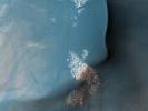
2011-02-14 |
Mars
|
Mars Reconnaissance Orbiter (MRO)
|
CTX
|
420x487x3 |

|
-
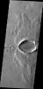
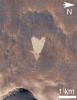
PIA13799:
-
Heart-Shaped Feature in Arabia Terra (Wide View)
Full Resolution:
TIFF
(206.5 kB)
JPEG
(25.93 kB)
|
|
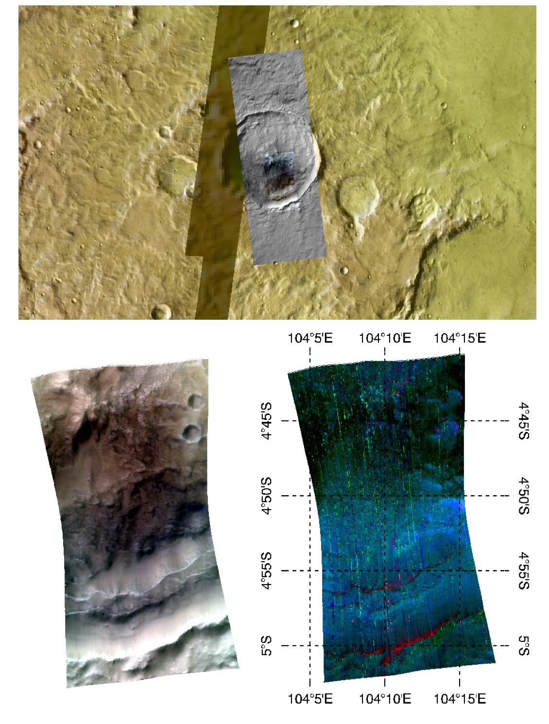
|
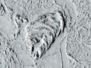
2011-02-14 |
Mars
|
Mars Reconnaissance Orbiter (MRO)
|
CTX
|
377x487x3 |
|
-
PIA13798:
-
Heart-Shaped Feature in Arabia Terra
Full Resolution:
TIFF
(185.6 kB)
JPEG
(41.39 kB)
|
|
|
2011-01-20 |
Mars
|
Mars Exploration Rover (MER)
|
Panoramic Camera
|
14745x4000x3 |
|
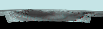
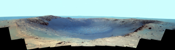
-
PIA13796:
-
Stereo Panorama of 'Santa Maria' Crater for Opportunity's Anniversary
Full Resolution:
TIFF
(176.9 MB)
JPEG
(3.45 MB)
|
|
|
2011-01-20 |
Mars
|
Mars Exploration Rover (MER)
|
Panoramic Camera
|
14745x4000x3 |
|
-
PIA13795:
-
Panorama of 'Santa Maria' Crater for Opportunity's Anniversary (False Color)
Full Resolution:
TIFF
(176.9 MB)
JPEG
(5.587 MB)
|
|
|
2011-01-20 |
Mars
|
Mars Exploration Rover (MER)
|
Panoramic Camera
|
14745x4000x3 |
|
-
PIA13794:
-
Color Panorama of 'Santa Maria' Crater for Opportunity's Anniversary
Full Resolution:
TIFF
(176.9 MB)
JPEG
(4.196 MB)
|
|
|
2010-12-16 |
Mars
|
Mars Exploration Rover (MER)
|
Panoramic Camera
|
7892x1206x1 |
|
-
PIA13709:
-
Super-Resolution View of Cape Tribulation, Sol 2298
Full Resolution:
TIFF
(9.528 MB)
JPEG
(278.7 kB)
|
|
|
2010-12-13 |
Mars
|
2001 Mars Odyssey
|
THEMIS
|
1333x2768x1 |
|
-
PIA13711:
-
Triple Tails of Windstreaks
Full Resolution:
TIFF
(3.694 MB)
JPEG
(320.9 kB)
|
|
|
2010-11-12 |
Mars
|
Mars Reconnaissance Orbiter (MRO)
|
HiRISE
|
2560x1920x3 |
|
-
PIA13611:
-
Fresh Crater with Gullies
Full Resolution:
TIFF
(14.76 MB)
JPEG
(768.3 kB)
|
|
|
2010-11-03 |
Mars
|
2001 Mars Odyssey
|
THEMIS
|
1331x2768x1 |
|
-
PIA13232:
-
Ulysses Fossae
Full Resolution:
TIFF
(3.688 MB)
JPEG
(351.9 kB)
|
|
|
2010-10-25 |
Mars
|
Mars Reconnaissance Orbiter (MRO)
|
HiRISE
|
2560x1920x3 |
|
-
PIA13538:
-
Southern Hemisphere Crater with Dune Field
Full Resolution:
TIFF
(14.76 MB)
JPEG
(1.1 MB)
|
|
|
2010-10-19 |
Mars
|
Mars Reconnaissance Orbiter (MRO)
|
HiRISE
|
2560x1920x3 |
|
-
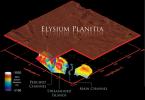
PIA13484:
-
Flow Obstructions and Wakes Southeast of Elysium Planitia
Full Resolution:
TIFF
(14.76 MB)
JPEG
(1.413 MB)
|
|
|
2010-09-16 |
Mars
|
2001 Mars Odyssey
|
THEMIS
|
1353x2771x1 |
|
-
PIA13392:
-
Chaos
Full Resolution:
TIFF
(3.753 MB)
JPEG
(217.3 kB)
|
|
|
2010-08-10 |
Mars
|
2001 Mars Odyssey
|
THEMIS
|
1324x2777x1 |

|
-
PIA13326:
-
Ganges Chasma
Full Resolution:
TIFF
(3.681 MB)
JPEG
(219.9 kB)
|
|
|
2010-06-29 |
Mars
|
Mars Exploration Rover (MER)
|
Panoramic Camera
|
4096x1366x1 |

|
-
PIA13197:
-
Super-Resolution View of Endeavour Rim, Sol 2239
Full Resolution:
TIFF
(5.601 MB)
JPEG
(245.7 kB)
|
|
|
2010-03-02 |
Mars
|
Mars Reconnaissance Orbiter (MRO)
|
Shallow Subsurface Radar (SHARAD)
|
1098x818x3 |

|
-
PIA12861:
-
Glacial Ice Deposits in Mid-Latitudes of Mars
Full Resolution:
TIFF
(2.698 MB)
JPEG
(237.4 kB)
|
|
|
2009-12-30 |
Mars
|
2001 Mars Odyssey
|
THEMIS
|
1461x2783x1 |

|
-
PIA12415:
-
Windstreaks
Full Resolution:
TIFF
(4.071 MB)
JPEG
(400.6 kB)
|
|
|
2009-10-02 |
Mars
|
2001 Mars Odyssey
|
THEMIS
|
613x5993x1 |

|
-
PIA12247:
-
Polar Layers
Full Resolution:
TIFF
(3.678 MB)
JPEG
(400 kB)
|
|
|
2009-08-31 |
Mars
|
2001 Mars Odyssey
|
THEMIS
|
1420x2798x1 |

|
-
PIA11940:
-
Capri Chasma
Full Resolution:
TIFF
(3.978 MB)
JPEG
(275.4 kB)
|
|
|
2009-08-28 |
Mars
|
2001 Mars Odyssey
|
THEMIS
|
320x3600x1 |

|
-
PIA11939:
-
Capri Chasma
Full Resolution:
TIFF
(1.153 MB)
JPEG
(172.6 kB)
|
|
|
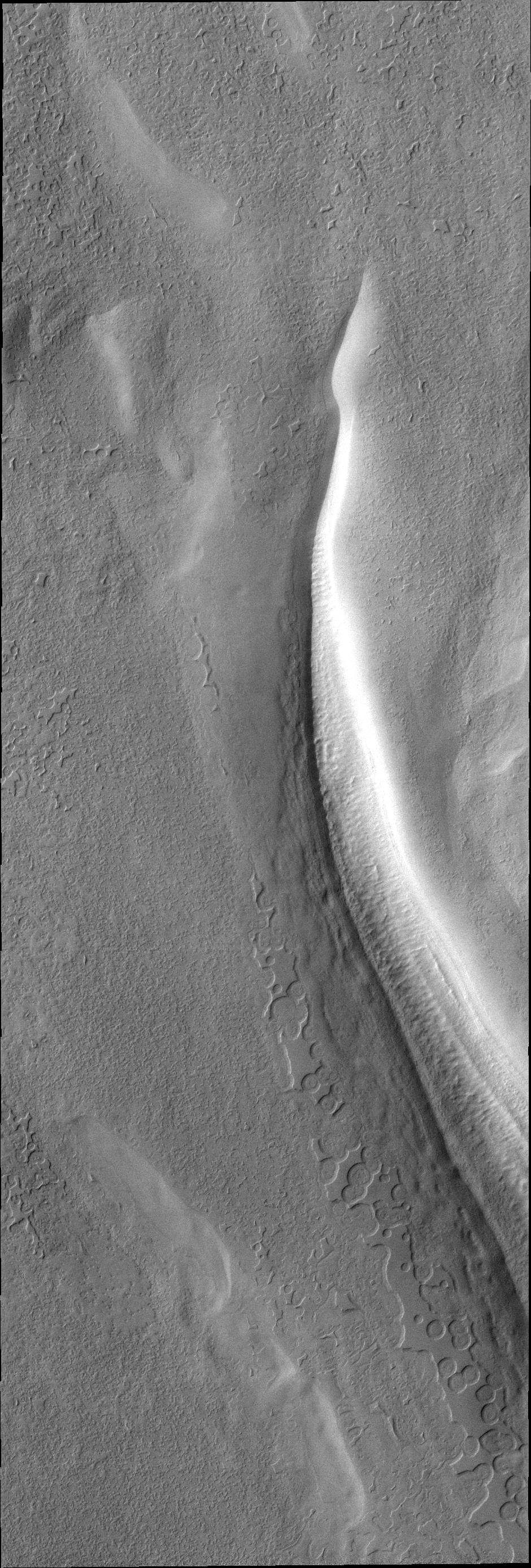
2009-03-06 |
Mars
|
2001 Mars Odyssey
|
THEMIS
|
1300x2913x1 |

|
-
PIA11337:
-
Windstreak
Full Resolution:
TIFF
(3.791 MB)
JPEG
(492.3 kB)
|
|
|
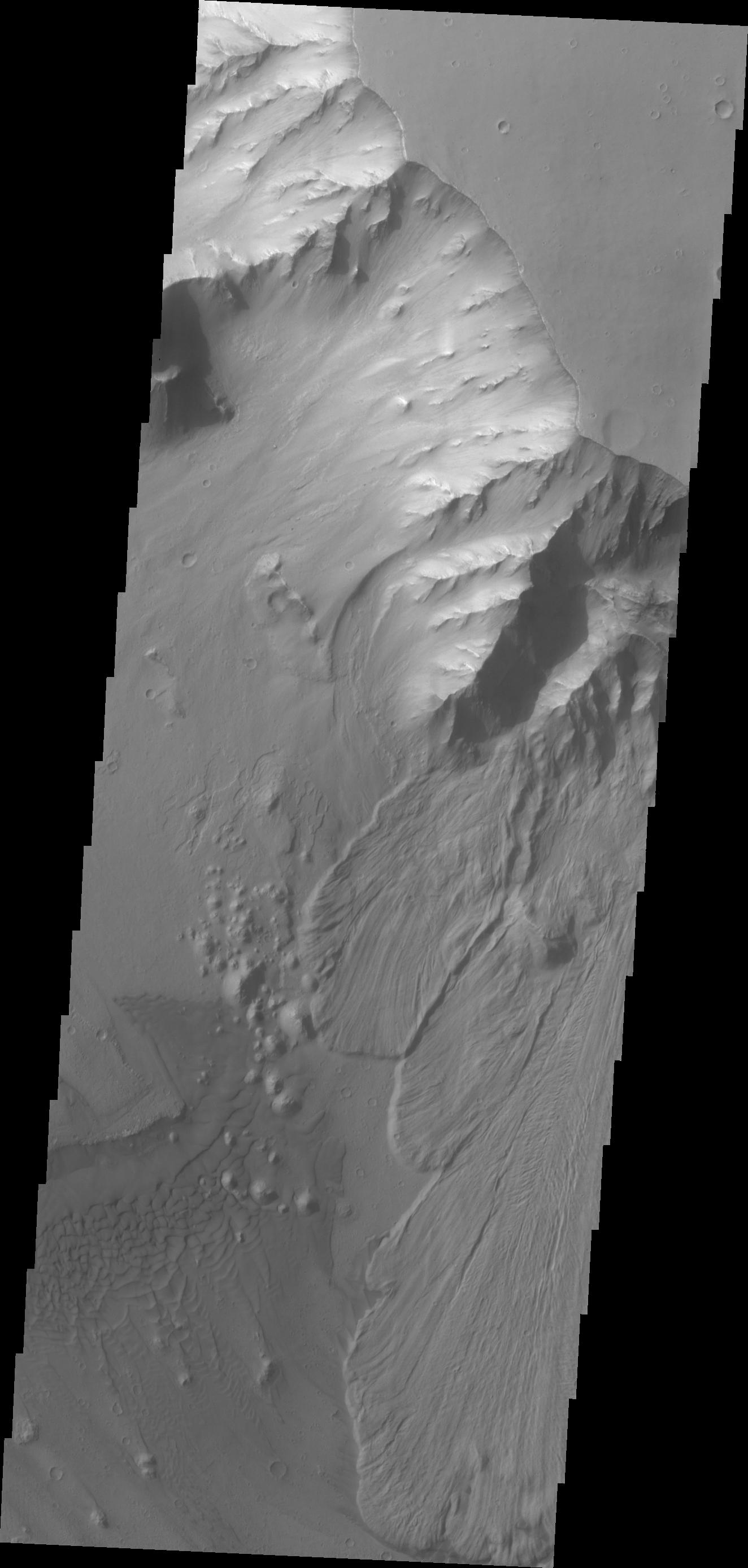
2009-01-27 |
Mars
|
2001 Mars Odyssey
|
THEMIS
|
1345x2923x1 |

|
-
PIA11310:
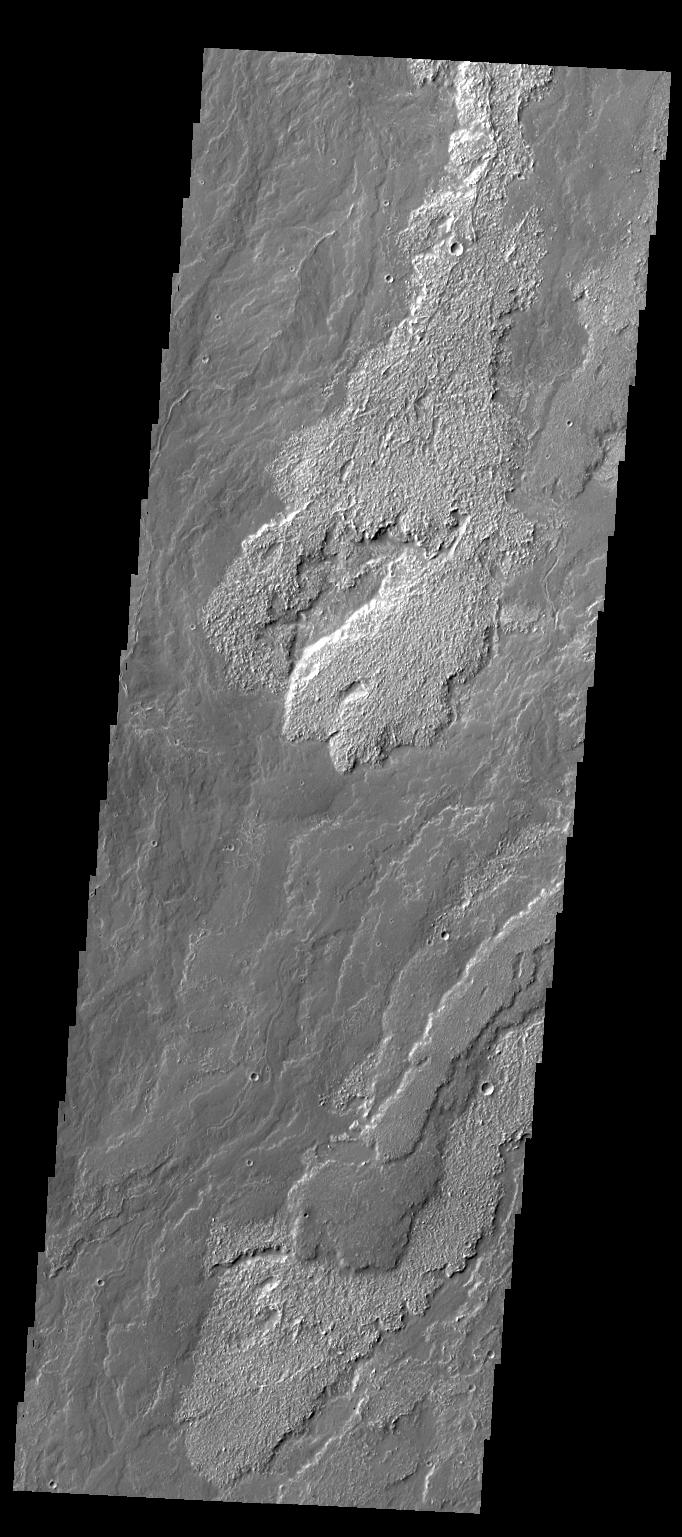
-
Landslides
Full Resolution:
TIFF
(3.936 MB)
JPEG
(215.5 kB)
|
|
|
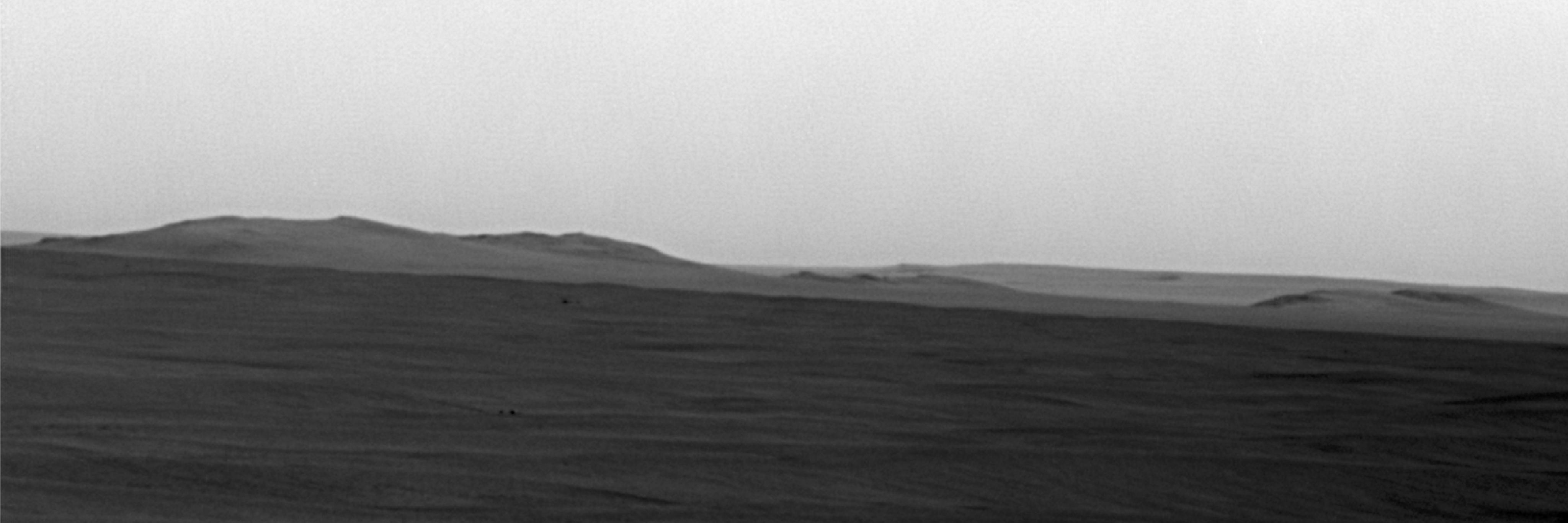
2009-01-12 |
Mars
|
Mars Exploration Rover (MER)
|
Panoramic Camera
|
7214x2818x3 |
|
-
PIA11755:
-
Rover's Wheel Churns Up Bright Martian Soil (Stereo)
Full Resolution:
TIFF
(60.99 MB)
JPEG
(1.725 MB)
|
|
|
2008-12-18 |
Mars
|
Mars Reconnaissance Orbiter (MRO)
|
CRISM
|
2718x1936x3 |
|
-
PIA11732:
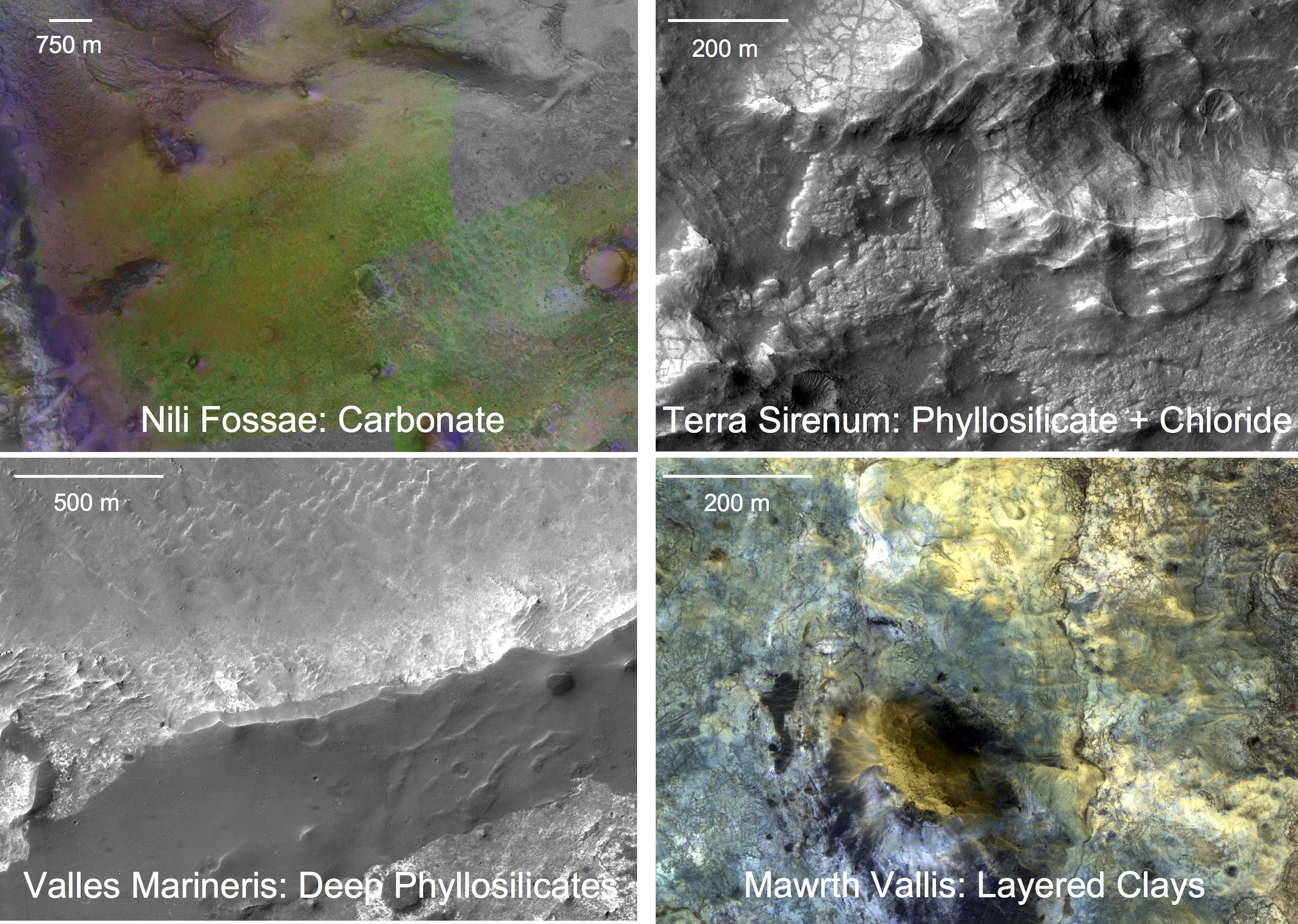
-
Four Types of Deposits From Wet Conditions on Early Mars
Full Resolution:
TIFF
(15.8 MB)
JPEG
(886.6 kB)
|
|
|
2008-08-14 |
Mars
|
Phoenix
|
MECA
|
3172x2157x1 |
|
-
PIA11041:
-
Sharp Tips on the Atomic Force Microscope
Full Resolution:
TIFF
(6.851 MB)
JPEG
(515.7 kB)
|
|
|
2008-08-14 |
Mars
|
Phoenix
|
MECA
|
1279x720x3 |
|
-
PIA11040:
-
Atomic Force Microscope Operation

Full Resolution:
TIFF
(2.766 MB)
JPEG
(80.77 kB)
|
|
|
2008-06-27 |
Mars
|
2001 Mars Odyssey
|
THEMIS
|
1390x2922x1 |

|
-
PIA10823:
-
Cerulli Channels
Full Resolution:
TIFF
(4.066 MB)
JPEG
(353.2 kB)
|
|
|
2008-06-26 |
Mars
|
Phoenix
|
Robotic Arm Camera (RAC)
Surface Stereo Imager (SSI)
|
1000x693x3 |
|
-
PIA10921:
-
'Rosy Red' Soil in Scoop
Full Resolution:
TIFF
(2.082 MB)
JPEG
(111.4 kB)
|
|
|
2008-06-26 |
Mars
|
Phoenix
|
Robotic Arm Camera (RAC)
Surface Stereo Imager (SSI)
|
640x88x3 |

|
-
PIA10918:
Pan and Zoom of 'Rosy Red' Soil in Scoop
Full Resolution:
TIFF
(169.4 kB)
JPEG
(11.97 kB)
|
|
|
2008-06-04 |
Mars
|
Phoenix
|
Robotic Arm Camera (RAC)
|
512x768x3 |
|
-
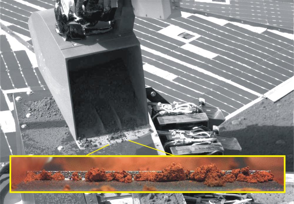
PIA10758:
-
Color Views of Soil Scooped on Sol 9
Full Resolution:
TIFF
(1.181 MB)
JPEG
(102.7 kB)
|
|
|
2008-05-09 |
Mars
|
Mars Reconnaissance Orbiter (MRO)
|
CRISM
|
1592x2208x3 |
|
-
PIA10943:
-
The Minerals of Aureum Chaos
Full Resolution:
TIFF
(10.56 MB)
JPEG
(449.5 kB)
|
|
|
2008-04-28 |
Mars
|
2001 Mars Odyssey
|
THEMIS
|
1335x2925x1 |

|
-
PIA10329:
-
Triplet Crater
Full Resolution:
TIFF
(3.909 MB)
JPEG
(355.5 kB)
|
|
|
2008-04-21 |
Mars
|
2001 Mars Odyssey
|
THEMIS
|
1353x2931x1 |

|
-
PIA10324:
-
Coprates Chasma
Full Resolution:
TIFF
(3.97 MB)
JPEG
(289 kB)
|
|
|
2008-04-03 |
Mars
|
Mars Reconnaissance Orbiter (MRO)
|
CRISM
|
1242x2055x3 |
|
-
PIA10643:
-
Complex Sulfate Deposits in Coprates Chasma
Full Resolution:
TIFF
(7.665 MB)
JPEG
(320.6 kB)
|
|
|
2008-03-28 |
Mars
|
Mars Reconnaissance Orbiter (MRO)
|
CRISM
|
1130x1490x3 |
|
-
PIA10641:
-
Livonia, New York, Students Study Past Martian Water
Full Resolution:
TIFF
(5.057 MB)
JPEG
(227.9 kB)
|
|
|
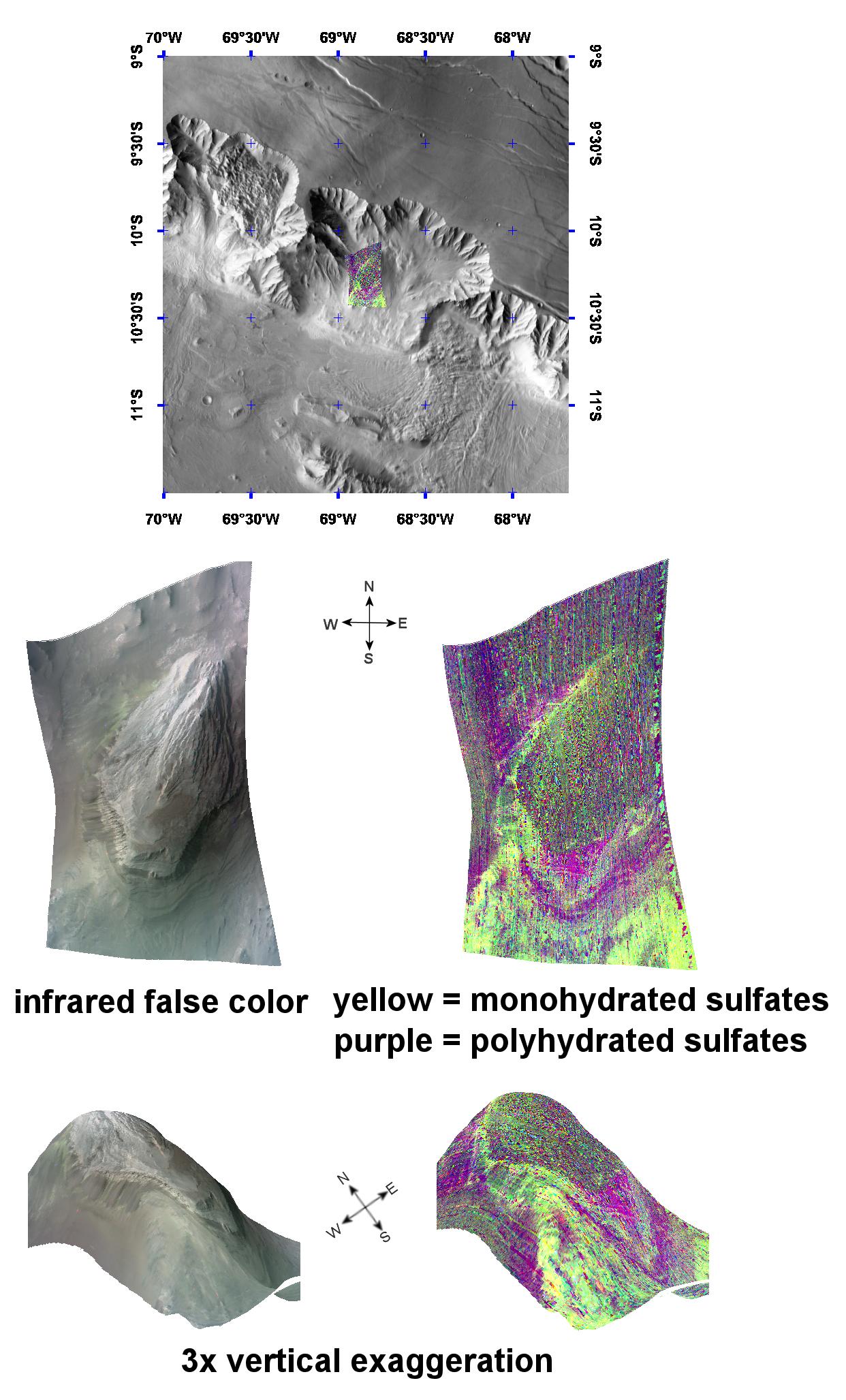
2008-03-06 |
Mars
|
Mars Reconnaissance Orbiter (MRO)
|
CRISM
|
988x2046x3 |
|
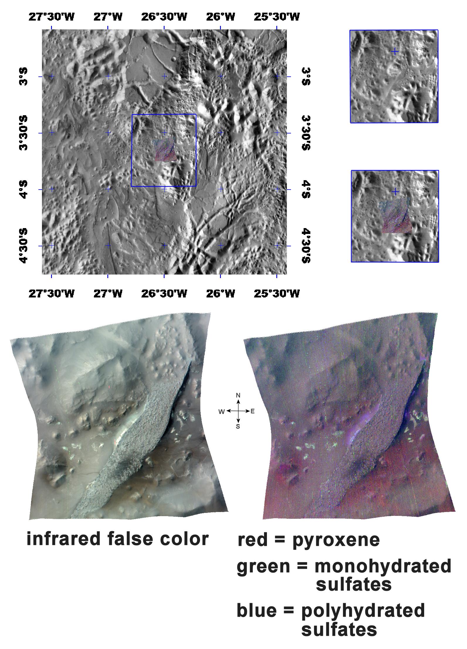
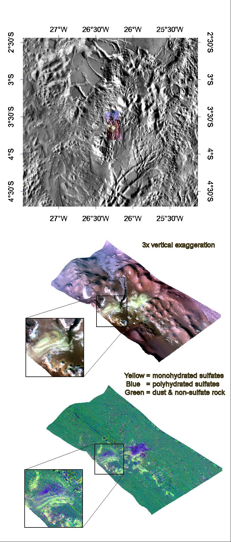
-
PIA10638:
-
Mono- and Polyhydrated Sulfates in Tithonium Chasma
Full Resolution:
TIFF
(6.073 MB)
JPEG
(312.3 kB)
|
|
|
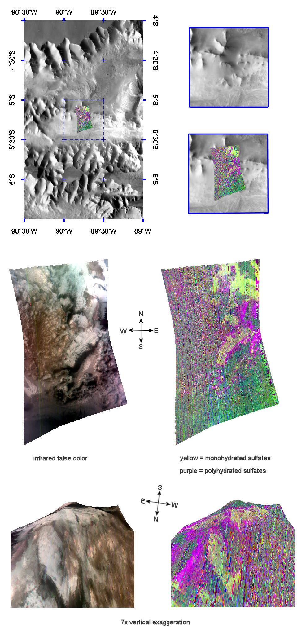
2008-02-14 |
Mars
|
Mars Reconnaissance Orbiter (MRO)
|
CRISM
|
797x1863x3 |
|
-
PIA10636:
-
Mono- & Polyhydrated Sulfates in Aureum Chaos
Full Resolution:
TIFF
(4.46 MB)
JPEG
(251.4 kB)
|
|
|
2008-02-14 |
Mars
|
2001 Mars Odyssey
|
THEMIS
|
1327x2771x1 |

|
-
PIA10277:
-
Dark Slope Streaks
Full Resolution:
TIFF
(3.681 MB)
JPEG
(275.5 kB)
|
|
|
2008-01-25 |
Mars
|
2001 Mars Odyssey
|
THEMIS
|
1301x2803x1 |

|
-
PIA10264:
-
Gullies
Full Resolution:
TIFF
(3.651 MB)
JPEG
(289.2 kB)
|
|
|
2007-12-23 |
Mars
|
Mars Exploration Rover (MER)
|
Panoramic Camera
|
11473x4000x1 |
|
-
PIA10209:
-
Cape Verde
Full Resolution:
TIFF
(45.89 MB)
JPEG
(4.018 MB)
|
|
|
2007-12-11 |
Mars
|
Mars Reconnaissance Orbiter (MRO)
|
CRISM
|
720x486x3 |
|
-
PIA10137:
-
Carbon-Dioxide Frost Settling from Seasonal Outbursts on Mars (Movie)
Full Resolution:
TIFF
(1.051 MB)
JPEG
(28.16 kB)
|
|
|
2007-11-07 |
Mars
|
2001 Mars Odyssey
|
THEMIS
|
320x10768x1 |

|
-
PIA10044:
-
Ejecta Blanket
Full Resolution:
TIFF
(3.449 MB)
JPEG
(601.3 kB)
|
|
|
2007-08-21 |
Mars
|
2001 Mars Odyssey
|
THEMIS
|
1087x2864x1 |

|
-
PIA09463:
-
Polar Textures
Full Resolution:
TIFF
(3.117 MB)
JPEG
(839.6 kB)
|
|
|
2007-08-20 |
Mars
|
2001 Mars Odyssey
|
THEMIS
|
1335x2954x1 |

|
-
PIA09462:
-
Crater Modification
Full Resolution:
TIFF
(3.948 MB)
JPEG
(429.1 kB)
|
|
|
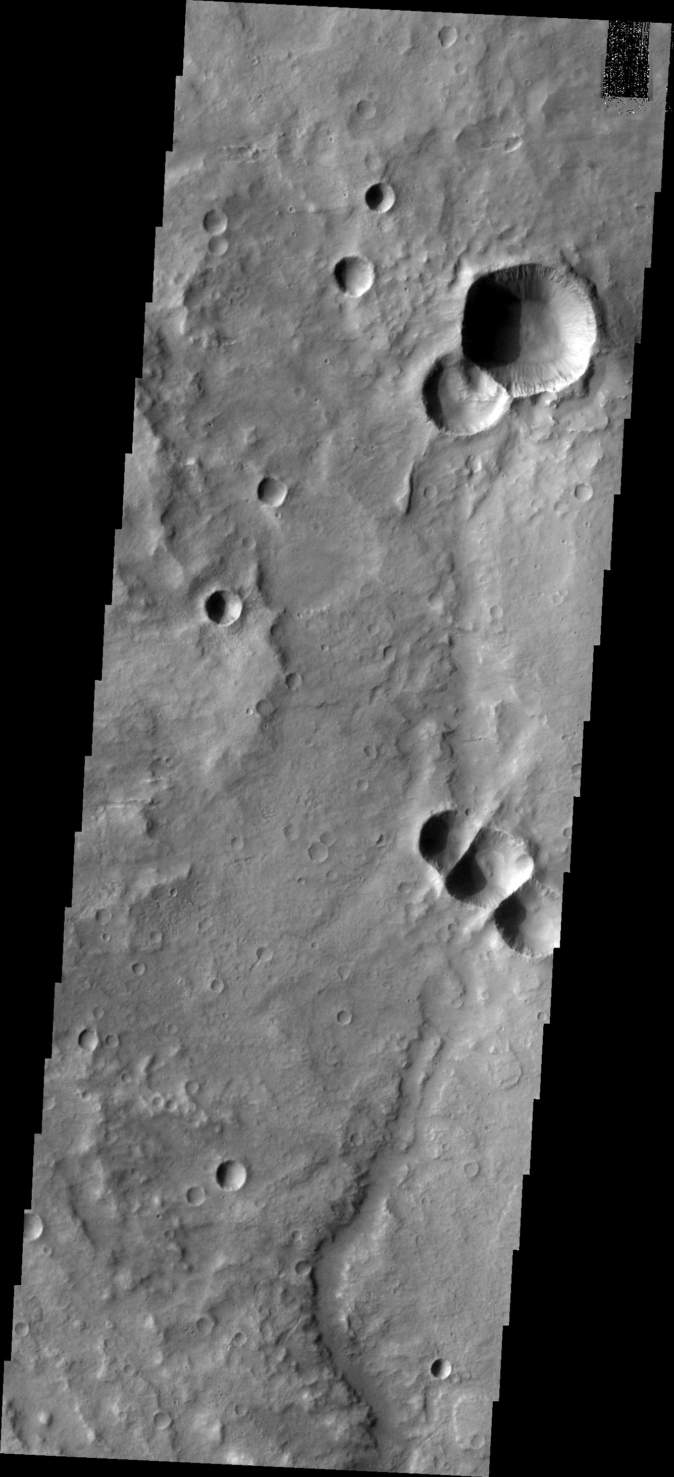
2007-06-25 |
Mars
|
2001 Mars Odyssey
|
|
1382x2974x1 |

|
-
PIA09422:
-
Layered Fill
Full Resolution:
TIFF
(4.115 MB)
JPEG
(413.7 kB)
|
 Planetary Data System


