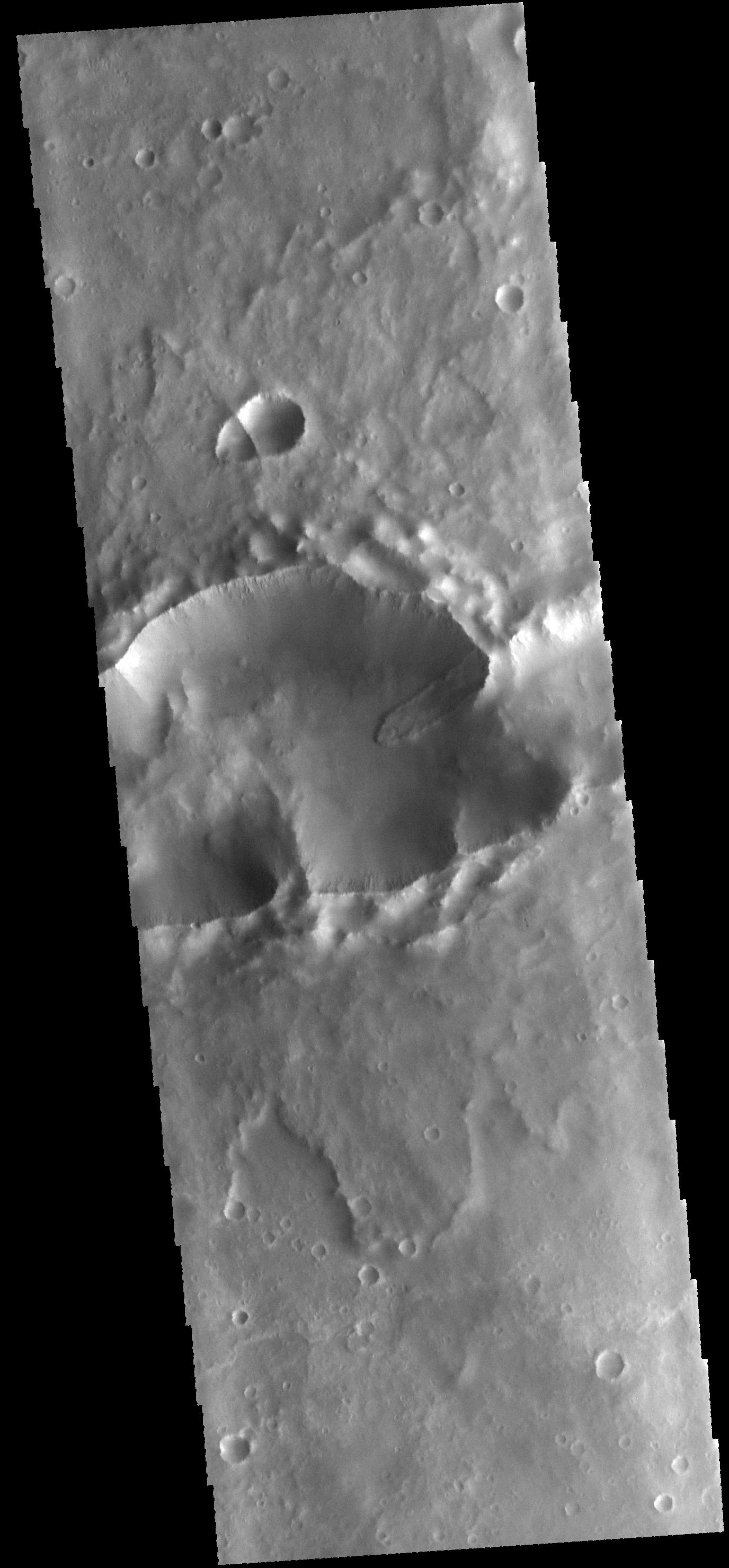
Context imageToday's VIS image shows a landslide deposit within a complex crater (note the ejecta to the top and bottom of the image). There is a smaller complex crater on the ejecta to the north of the larger crater. This "doublet" crater with the linear interior rim is formed when two impactors hit the surface simultaneously. The impactors are initially all part of the same meteor. The larger crater may have formed from multiple impactors.
Orbit Number: 56056 Latitude: -19.0844 Longitude: 93.6361 Instrument: VIS Captured: 2014-08-03 09:43
Please see the THEMIS Data Citation Note for details on crediting THEMIS images.
NASA's Jet Propulsion Laboratory manages the 2001 Mars Odyssey mission for NASA's Science Mission Directorate, Washington, D.C. The Thermal Emission Imaging System (THEMIS) was developed by Arizona State University, Tempe, in collaboration with Raytheon Santa Barbara Remote Sensing. The THEMIS investigation is led by Dr. Philip Christensen at Arizona State University. Lockheed Martin Astronautics, Denver, is the prime contractor for the Odyssey project, and developed and built the orbiter. Mission operations are conducted jointly from Lockheed Martin and from JPL, a division of the California Institute of Technology in Pasadena.
