Your search criteria found 20 images
Feature Name
Go to PIAxxxxx:
Refine this list of images by:
Target:
Mission:
Spacecraft:
Instrument:
Click on an image for detailed information
Click on a column heading to sort in ascending or descending order
My
List
Addition DateSort Ascending Target Mission Instrument Size
Add Image to Favorite List 2023-01-10 Earth Terra
ASTER
1657x1335x3
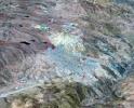
NASA's Terra spacecraft shows Potosi, the capital city of the Department of Potosi in Bolivia, and one of the highest cities in the world at 4090 m.
PIA25705:
Potosi, Bolivia
Full Resolution:     TIFF (6.639 MB)     JPEG (453 kB)
Add Image to Favorite List 2019-08-28 Earth ECOSTRESS
1867x1132x3
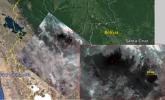
NASA's Ecosystem Spaceborne Thermal Radiometer Experiment on Space Station (ECOSTRESS) captured new imagery of fires in the Amazon regions of Brazil and Bolivia on Aug. 23, 2019.
PIA23357:
Amazon Fires Seen by NASA's ECOSTRESS
Full Resolution:     TIFF (6.142 MB)     JPEG (260.2 kB)
Add Image to Favorite List 2018-08-08 Terra
ASTER
2200x1800x3
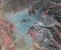
NASA's Terra spacecraft obtained this image of La Paz, Bolivia, the highest capital in the world, located on the Andes' Altiplano plateau at more than 3500 meters above sea level.
PIA21220:
La Paz, Bolivia
Full Resolution:     TIFF (11.89 MB)     JPEG (986.6 kB)
Add Image to Favorite List 2017-07-06 Ceres Dawn
Framing Camera
1024x1024x1
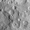
NASA's Dawn spacecraft took this image of Hakumyi Crater on Ceres, visible left of center. Evidence for organics was also found at the 4-mile (6.5 kilometer) wide fresh crater on the southern rim of Hakumyi.
PIA21413:
Hakumyi Crater
Full Resolution:     TIFF (1.05 MB)     JPEG (250.3 kB)
Add Image to Favorite List 2017-04-28 Earth Terra
ASTER
3262x3671x3
In the high plains of the Andes in Bolivia, Lake Poopo has virtually vanished, as shown in this image from NASA's Terra spacecraft. Once covering over 3,000 square kilometers, the lake essentially dried up in 2015.
PIA21546:
Lake Poopo, Bolivia
Full Resolution:     TIFF (31.94 MB)     JPEG (1.333 MB)
Add Image to Favorite List 2014-02-26 Earth Terra
ASTER
2244x2334x3
NASA's Terra spacecraft shows that extremely heavy seasonal rains have fallen on northern Bolivia since October 2013. The worst affected province is Beni in the northeastern part of the country.
PIA18031:
NASA Spacecraft Eyes Bolivian Flooding
Full Resolution:     TIFF (15.72 MB)     JPEG (1.011 MB)
Add Image to Favorite List 2013-04-16 Earth Terra
ASTER
2832x2982x3
This image of the river-delineated border between western Brazil's Acre province, and northwestern Bolivia's Pando Department, demarcates a remarkable difference in land use and development practices as seen by NASA's Terra spacecraft.
PIA16991:
Brazil-Bolivia Border
Full Resolution:     TIFF (25.35 MB)     JPEG (2.142 MB)
Add Image to Favorite List 2011-06-14 Earth Terra
ASTER
2745x1842x3
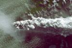
Southern Chile's Puyehue volcano came to life on June 4, 2011, after decades of dormancy. Winds spread the ash column eastward over neighboring Argentina, leading to the evacuation of thousands of residents. This image is from NASA's Terra spacecraft.
PIA14272:
NASA Spacecraft Spots Fury of Disruptive Chilean Volcano
Full Resolution:     TIFF (15.17 MB)     JPEG (521 kB)
Add Image to Favorite List 2003-06-19 Earth Shuttle Radar Topography Mission (SRTM)
C-Band Interferometric Radar
960x725x3
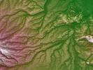
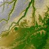
Pando Province, Bolivia, and adjacent parts of Brazil and Peru are seen in this visualization of NASA's Shuttle Radar Topography Mission elevation data covering part of the Amazon Basin.
PIA03390:
Pando Province, Northern Bolivia, Shaded Relief and Colored Height
Full Resolution:     TIFF (2.091 MB)     JPEG (172.2 kB)
Add Image to Favorite List 2003-01-08 Earth Terra
MISR
1559x1368x3
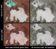
In the high plateau of southwestern Bolivia, two large salt deserts, or playas, are located between the eastern and western Andes. NASA's Terra spacecraft depicted the playas on January 16, 2002 and January 3, 2003.
PIA03749:
Salt Playas of the Bolivian Altiplano
Full Resolution:     TIFF (5.821 MB)     JPEG (270.9 kB)
Add Image to Favorite List 2002-10-02 Earth Terra
MISR
2400x1086x3
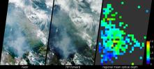
These images acquired in 2002 from NASA's Terra satellite show smoke over Rondonia, Brazil.
PIA03727:
Smoke over Rondonia, Brazil
Full Resolution:     TIFF (5.422 MB)     JPEG (282.9 kB)
Add Image to Favorite List 2002-09-26 Earth Shuttle Radar Topography Mission (SRTM)
C-Band Interferometric Radar
1016x865x3
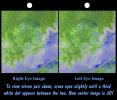
An 8-kilometer (5-mile) wide crater of possible impact origin is shown in this stereoscopic view of an isolated part of the Bolivian Amazon from NASA's Shuttle Radar Topography Mission.
PIA03363:
Stereo Pair with ASTER Image, Iturralde Structure, Bolivia
Full Resolution:     TIFF (2.168 MB)     JPEG (186.8 kB)
Add Image to Favorite List 2002-09-26 Earth Shuttle Radar Topography Mission (SRTM)
C-Band Interferometric Radar
1200x1200x3
This anaglyph, from NASA's Shuttle Radar Topography Mission, is of the Iturralde Structure, Bolivia, a possible impact crater. 3D glasses are necessary to view this image.
PIA03362:
Anaglyph: Shaded Relief and Height as Brightness, Iturralde Structure, Bolivia
Full Resolution:     TIFF (3.729 MB)     JPEG (366.1 kB)
Add Image to Favorite List 2002-09-17 Earth Terra
ASTER
1192x998x3
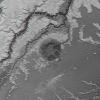
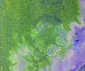
This image of Iturralde Crater, Bolivia was acquired on June 29, 2001 by NASA's Terra satellite.
PIA03859:
Iturralde Crater, Bolivia
Full Resolution:     TIFF (3.573 MB)     JPEG (482.4 kB)
Add Image to Favorite List 2002-09-13 Earth Shuttle Radar Topography Mission (SRTM)
C-Band Interferometric Radar
3601x3601x3
An 8-kilometer (5-mile) wide crater of possible impact origin is shown in this view of an isolated part of the Bolivian Amazon from NASA's Shuttle Radar Topography Mission.
PIA03359:
Shaded Relief with Height as Color, Iturralde Structure, Bolivia
Full Resolution:     TIFF (38.9 MB)     JPEG (3.517 MB)
Add Image to Favorite List 2001-10-17 Earth Terra
MISR
846x606x3
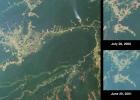
Rio Brancois the capital of the Brazilian state of Acre and is situated near the border with northeastern Bolivia. This image from NASA's Terra satellite was acquired on July 28, 2000.
PIA03427:
Deforestation near Rio Branco, Brazil
Full Resolution:     TIFF (1.479 MB)     JPEG (85.05 kB)
Add Image to Favorite List 2001-01-24 Earth Terra
MISR
1567x1354x3
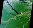
Close to the city of Manaus, Brazil the Rio Solimoes and the Rio Negro converge to form the Amazon River. This image from NASA's Terra satellite was acquired on July 23, 2000 during Terra orbit 3178.
PIA02642:
A Merging of Pale and Dark
Full Resolution:     TIFF (6.731 MB)     JPEG (556.3 kB)
Add Image to Favorite List 2000-10-06 Earth Terra
ASTER
4980x4200x3
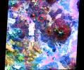
This image NASA's Terra satellite is of the Andes along the Chile-Bolivia border. This image is from NASA's Terra satellite.
PIA02654:
ASTER Andes
Full Resolution:     TIFF (47.55 MB)     JPEG (4.841 MB)
Add Image to Favorite List 1999-04-15 Earth Spaceborne Imaging Radar-C/X-Band Synthetic Aperture Radar
2840x1243x3
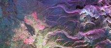
This is an image from NASA's Spaceborne Imaging Radar-C/X-band Synthetic Aperture of the Bolivian capital city of La Paz that was created using three radar frequencies.
PIA01813:
Space Radar Image of La Paz, Bolivia
Full Resolution:     TIFF (13.04 MB)     JPEG (1.023 MB)
Add Image to Favorite List 1996-08-05 Earth Galileo
Solid-State Imaging
3670x6735x3
This false-color mosaic of the central part of the Andes mountains of South America (70 degrees w. longitude, 19 degrees s. latitude) is made up of 42 images acquired by NASA's Galileo spacecraft from an altitude of about 25,000 kilometers (15,000 miles).
PIA00133:
Earth - False Color Mosaic of the Andes
Full Resolution:     TIFF (49.61 MB)     JPEG (2.406 MB)
Currently displaying images: 1 - 20 of 20