Click on an image for detailed information
Click on a column heading to sort in ascending or descending order

My
List |
Addition Date
|
Target
|
Mission
|
Instrument
|
Size
|

|
2009-08-21 |
Mars
|
Mars Exploration Rover (MER)
|
Microscopic Imager
|
735x1014x3 |
|
-
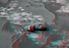
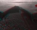
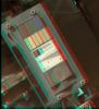
PIA12180:
-
Spirit's View of Own Underbelly, (Sol 1925 Stereo)
Full Resolution:
TIFF
(2.239 MB)
JPEG
(74.14 kB)
|
|
|
2009-08-21 |
Mars
|
Mars Exploration Rover (MER)
|
Microscopic Imager
|
947x1000x3 |
|
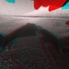
-
PIA12181:
-
Spirit's View of Own Underbelly, (Stereo from Two Sols)
Full Resolution:
TIFF
(2.845 MB)
JPEG
(69.71 kB)
|
|
|
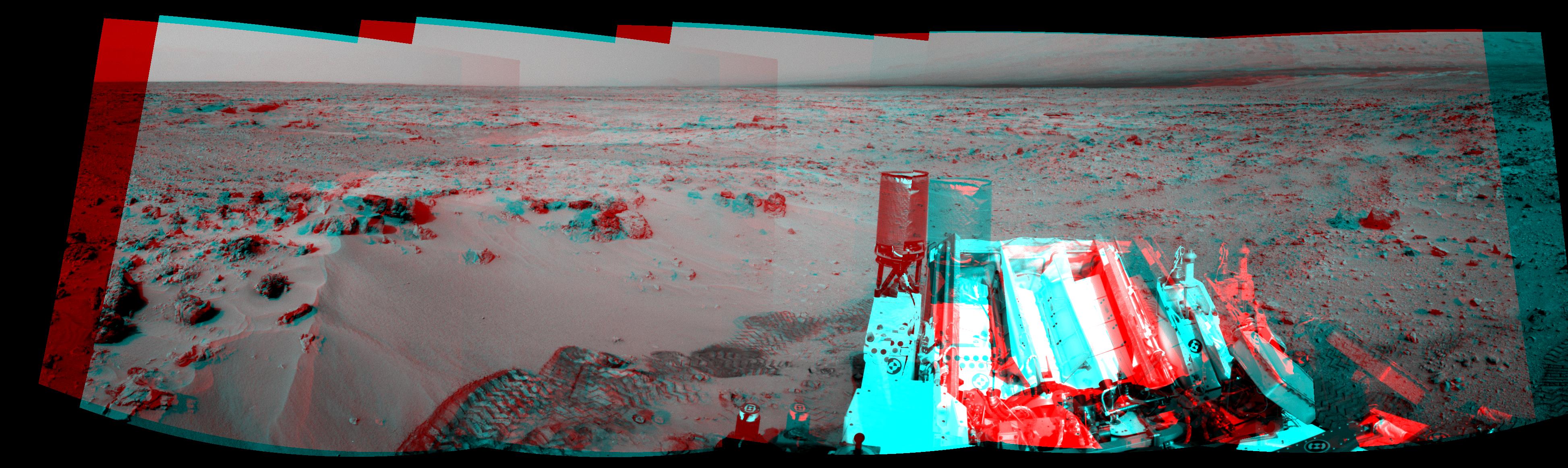
2009-08-26 |
Mars
|
Mars Exploration Rover (MER)
|
Panoramic Camera
|
23123x5093x3 |
|
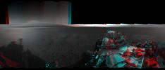
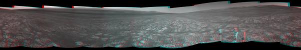
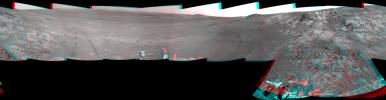
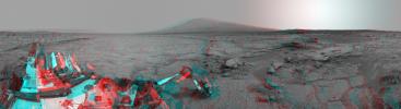
-
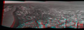
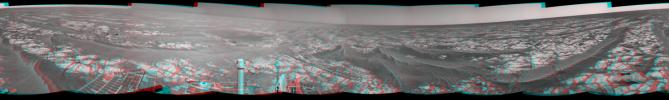
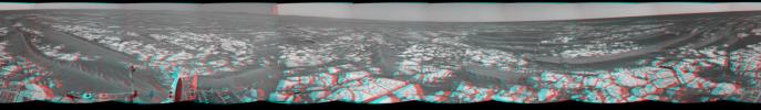
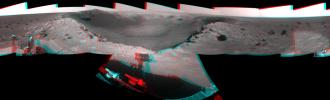
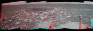
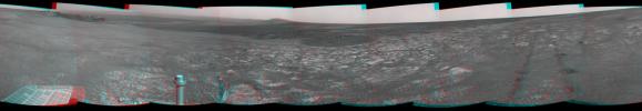
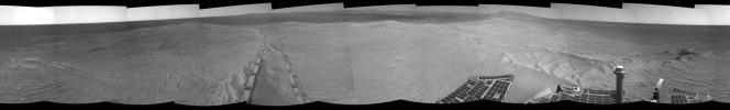
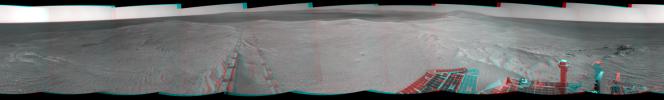
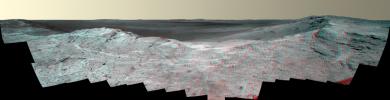
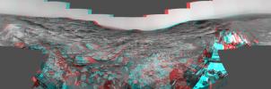
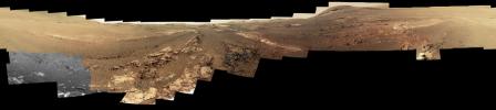
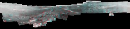
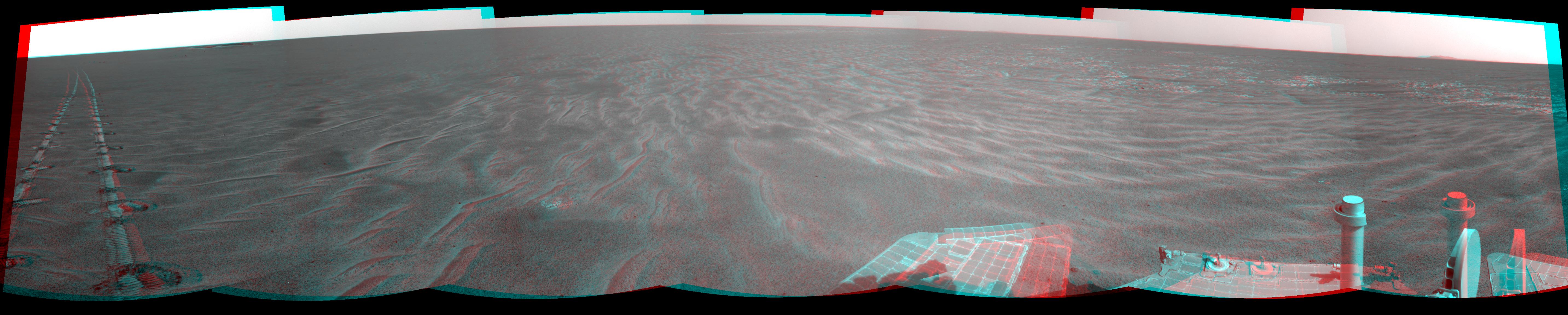
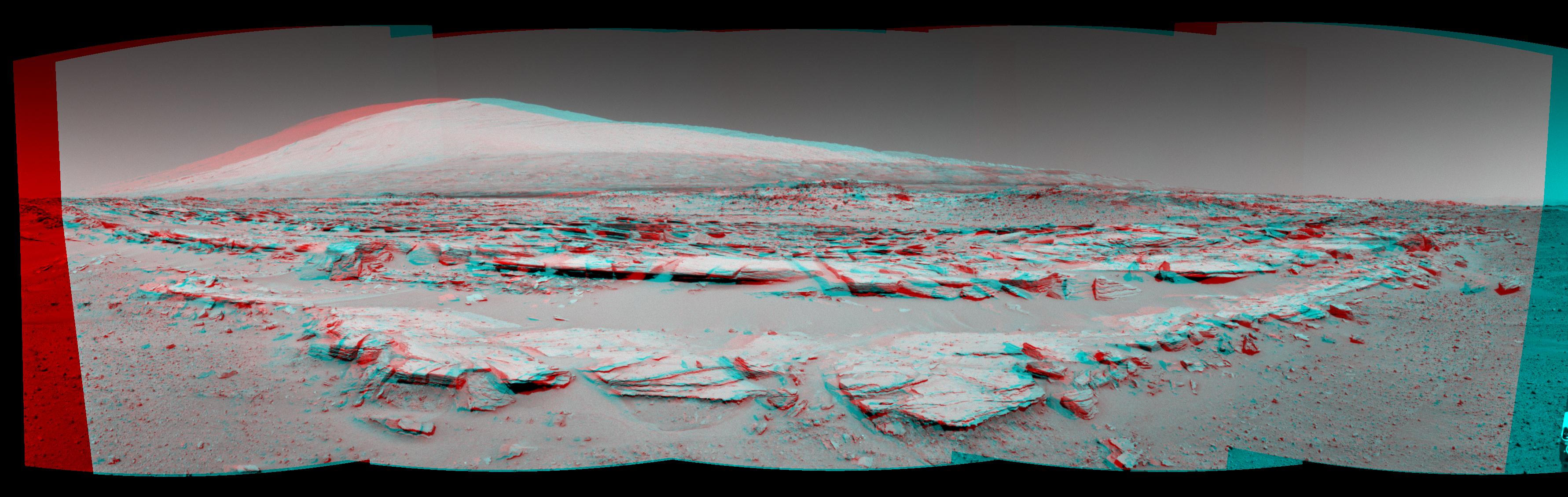
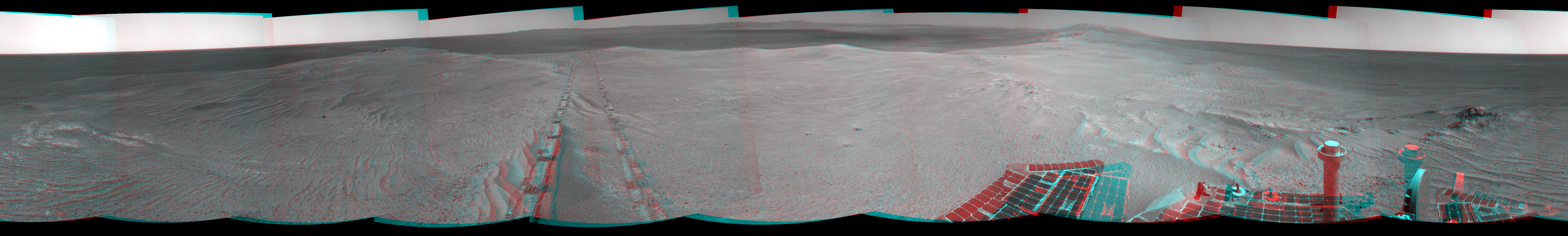
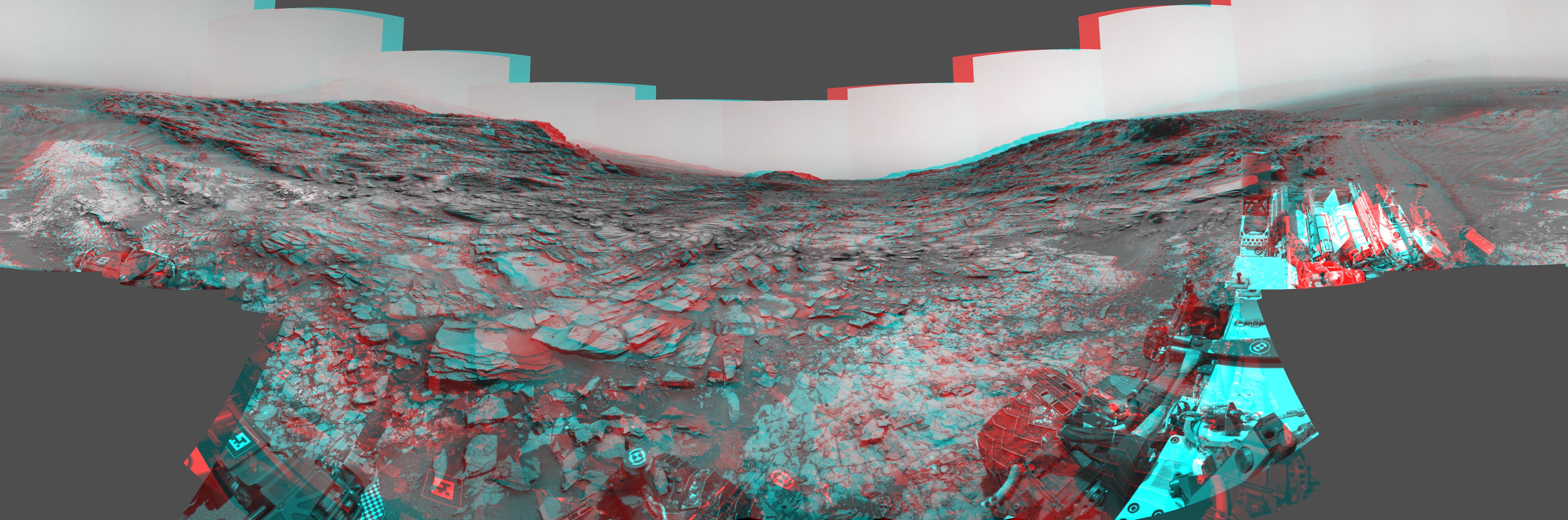
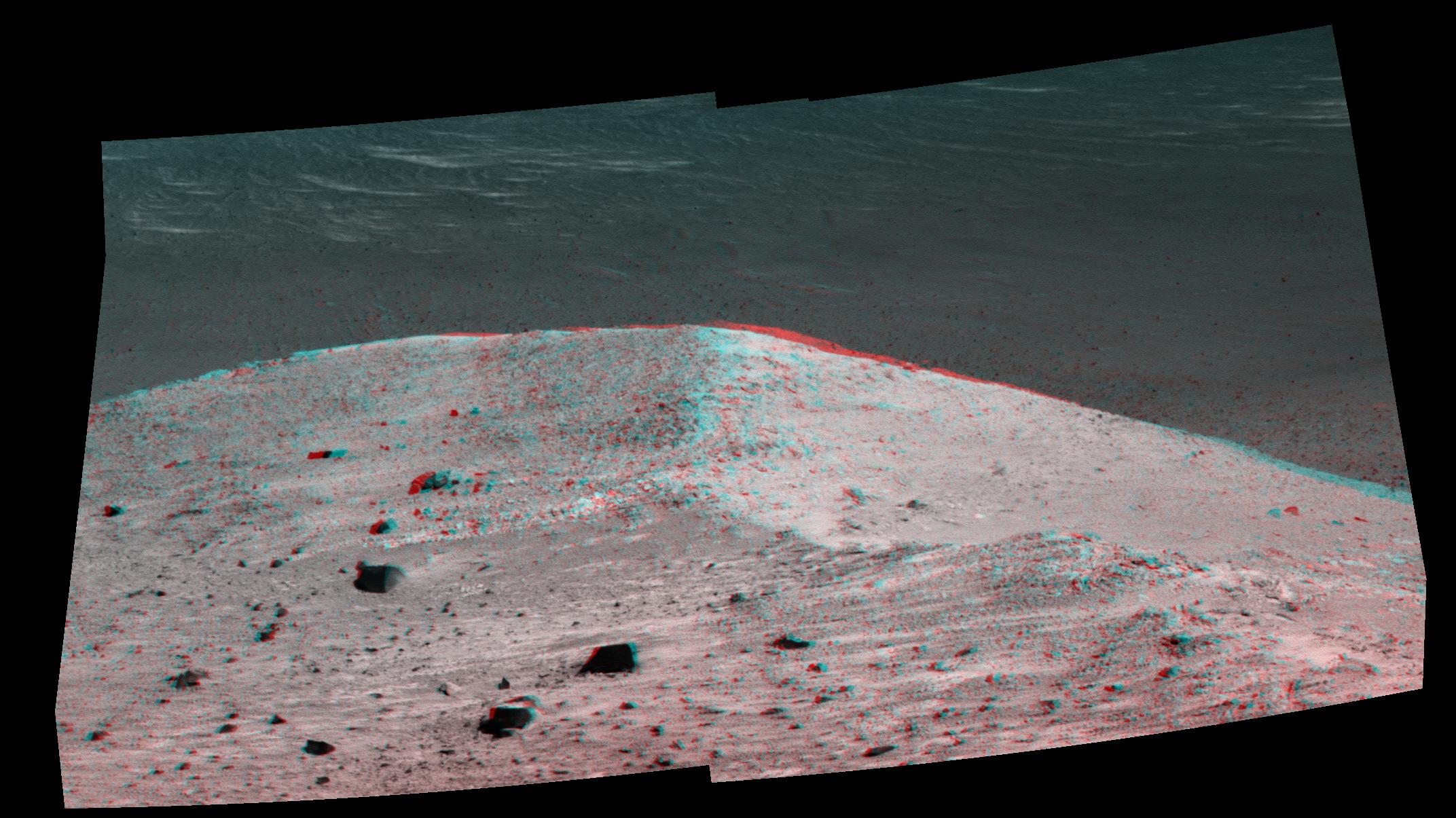
PIA12202:
'Calypso' Panorama of Spirit's View from 'Troy' (Stereo)
Full Resolution:
TIFF
(353.3 MB)
JPEG
(9.053 MB)
|
|
|
2010-06-25 |
Mars
|
Mars Exploration Rover (MER)
|
Navigation Camera
|
7753x2513x3 |
|
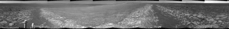
-
PIA13221:
-
Opportunity's Surroundings After Sol 2220 Drive (Stereo)
Full Resolution:
TIFF
(58.45 MB)
JPEG
(1.074 MB)
|
|
|
2010-09-07 |
Mars
|
Mars Exploration Rover (MER)
|
Navigation Camera
|
4278x1143x3 |
|
-
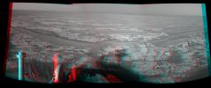
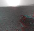
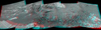
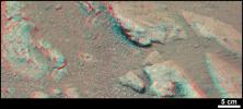
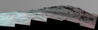
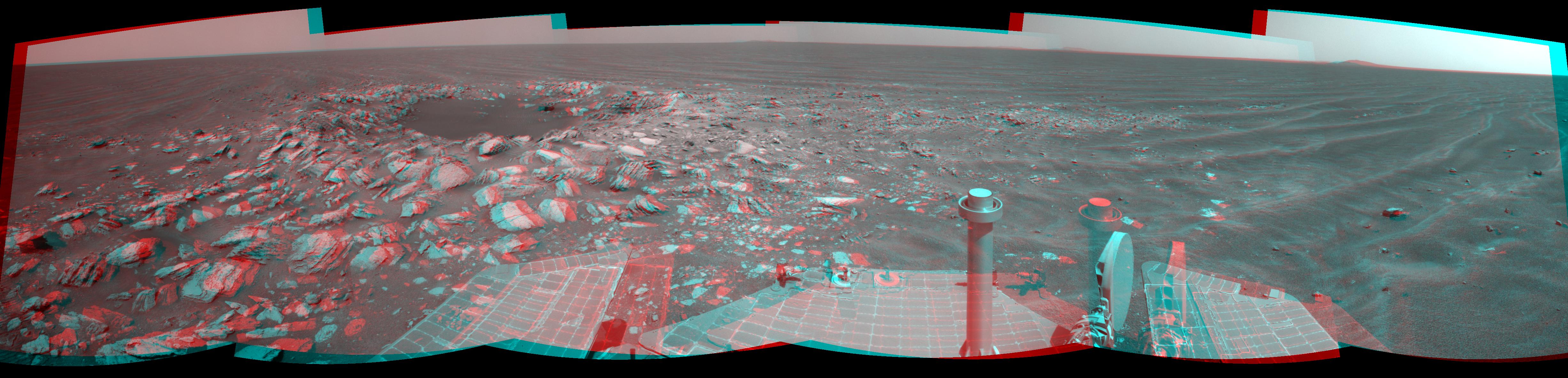
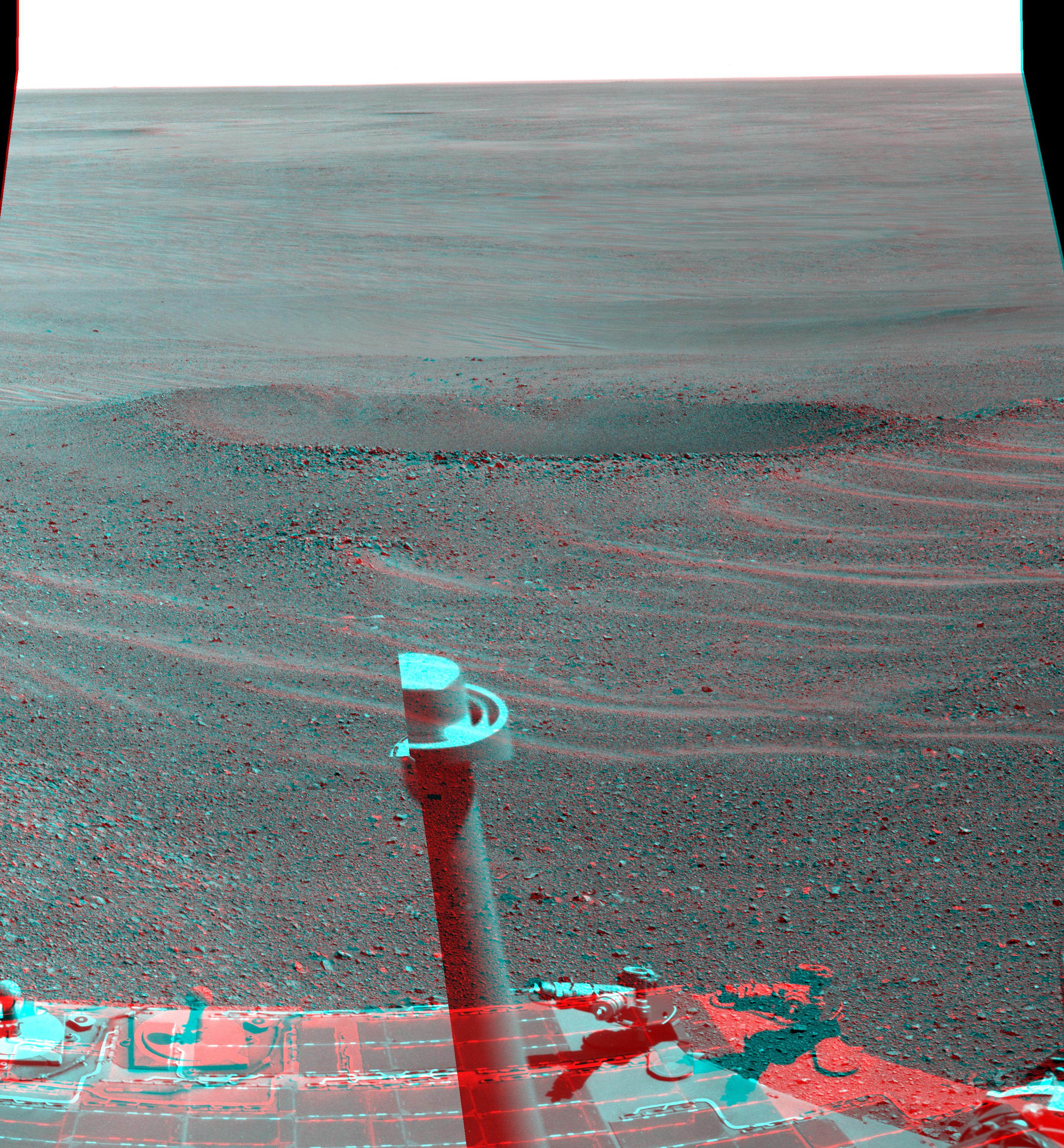
PIA13371:
-
'Cambridge Bay' Outcrop Examined by Opportunity (Stereo)
Full Resolution:
TIFF
(14.67 MB)
JPEG
(549.4 kB)
|
|
|
2010-09-29 |
Mars
|
Mars Exploration Rover (MER)
|
Navigation Camera
|
7753x1161x3 |
|
-
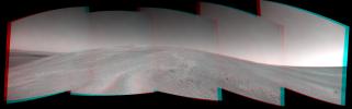
PIA13415:
Opportunity's Surroundings After Sol 2363 Drive (Stereo)
Full Resolution:
TIFF
(27 MB)
JPEG
(1.221 MB)
|
|
|
2010-09-29 |
Mars
|
Mars Exploration Rover (MER)
|
Navigation Camera
|
912x639x3 |
|
-
PIA13417:
-
Opportunity's Close-up of 'Oileán Ruaidh' (Stereo)
Full Resolution:
TIFF
(1.751 MB)
JPEG
(91.42 kB)
|
|
|
2010-10-19 |
Mars
|
Mars Exploration Rover (MER)
|
Navigation Camera
|
2719x1145x3 |
|
-
PIA13491:
-
Opportunity's Eastward View After Sol 2382 Drive (Stereo)
Full Resolution:
TIFF
(9.349 MB)
JPEG
(332.7 kB)
|
|
|
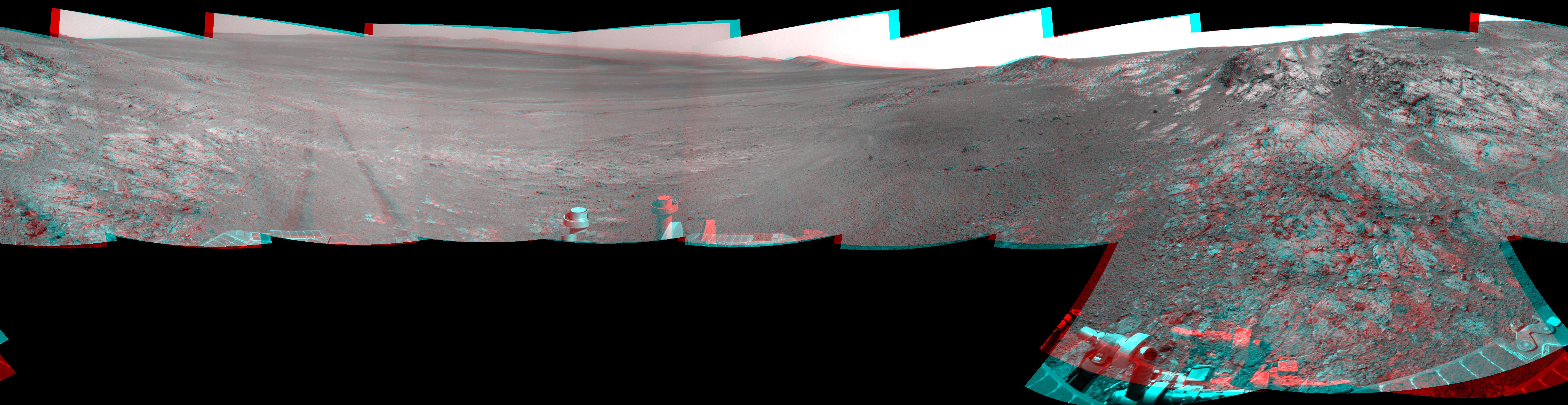
2010-11-12 |
Mars
|
Mars Exploration Rover (MER)
|
Navigation Camera
|
7753x1131x3 |
|
-
PIA13589:
Opportunity's Surroundings After Sol 2393 Drive (Stereo)
Full Resolution:
TIFF
(26.31 MB)
JPEG
(1.238 MB)
|
|
|
2010-11-12 |
Mars
|
Mars Exploration Rover (MER)
|
Navigation Camera
|
2681x1133x3 |

|
-
PIA13587:
-
Opportunity's Eastward View After Sol 2401 Drive (Stereo)
Full Resolution:
TIFF
(9.122 MB)
JPEG
(390.4 kB)
|
|
|
2010-11-18 |
Mars
|
Mars Exploration Rover (MER)
|
Panoramic Camera
|
6876x1055x3 |
|
-
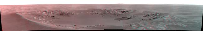
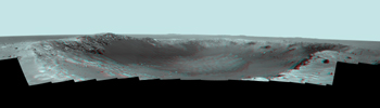
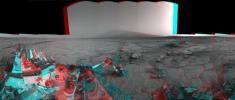
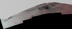
PIA13595:
'Intrepid' Crater on Mars (Stereo)
Full Resolution:
TIFF
(21.76 MB)
JPEG
(873.7 kB)
|
|
|
2010-11-18 |
Mars
|
Mars Exploration Rover (MER)
|
Navigation Camera
|
2777x1055x3 |
|
-
PIA13597:
-
'Yankee Clipper' Crater on Mars (Stereo)
Full Resolution:
TIFF
(8.789 MB)
JPEG
(184.1 kB)
|
|
|
2010-12-28 |
Mars
|
Mars Exploration Rover (MER)
|
Hazcam
|
1004x1024x3 |
|
-
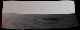
PIA13710:
-
Fisheye Stereo from Edge of 'Santa Maria' Crater, Sol 2459
Full Resolution:
TIFF
(3.089 MB)
JPEG
(111.5 kB)
|
|
|
2011-01-13 |
Mars
|
Mars Exploration Rover (MER)
|
Navigation Camera
|
7753x2352x3 |
|
-
PIA13757:
-
View of 'Santa Maria' Crater from Western Rim, Sol 2454 (Stereo)
Full Resolution:
TIFF
(54.71 MB)
JPEG
(1.487 MB)
|
|
|
2011-01-20 |
Mars
|
Mars Exploration Rover (MER)
|
Panoramic Camera
|
14745x4000x3 |
|
-
PIA13796:
-
Stereo Panorama of 'Santa Maria' Crater for Opportunity's Anniversary
Full Resolution:
TIFF
(176.9 MB)
JPEG
(3.45 MB)
|
|
|
2011-05-04 |
Mars
|
Mars Exploration Rover (MER)
|
Navigation Camera
|
1747x1093x3 |
|
-
PIA13989:
-
Martian 'Freedom 7' Crater 50 Years After Freedom 7 Flight (Stereo)
Full Resolution:
TIFF
(5.737 MB)
JPEG
(245.7 kB)
|
|
|
2011-05-18 |
Mars
|
Mars Exploration Rover (MER)
|
Navigation Camera
|
5733x1153x3 |
|
-
PIA14130:
Autonomous Hazard Checks Leave Patterned Rover Tracks on Mars (Stereo)
Full Resolution:
TIFF
(19.83 MB)
JPEG
(736.2 kB)
|
|
|
2011-06-02 |
Mars
|
Mars Exploration Rover (MER)
|
Navigation Camera
|
4905x1182x3 |
|
-
PIA14133:
-
Opportunity Beside a Small, Young Crater (Stereo)
Full Resolution:
TIFF
(17.39 MB)
JPEG
(702.3 kB)
|
|
|
2011-07-15 |
Mars
|
Mars Reconnaissance Orbiter (MRO)
|
HiRISE
|
2560x1920x3 |
|
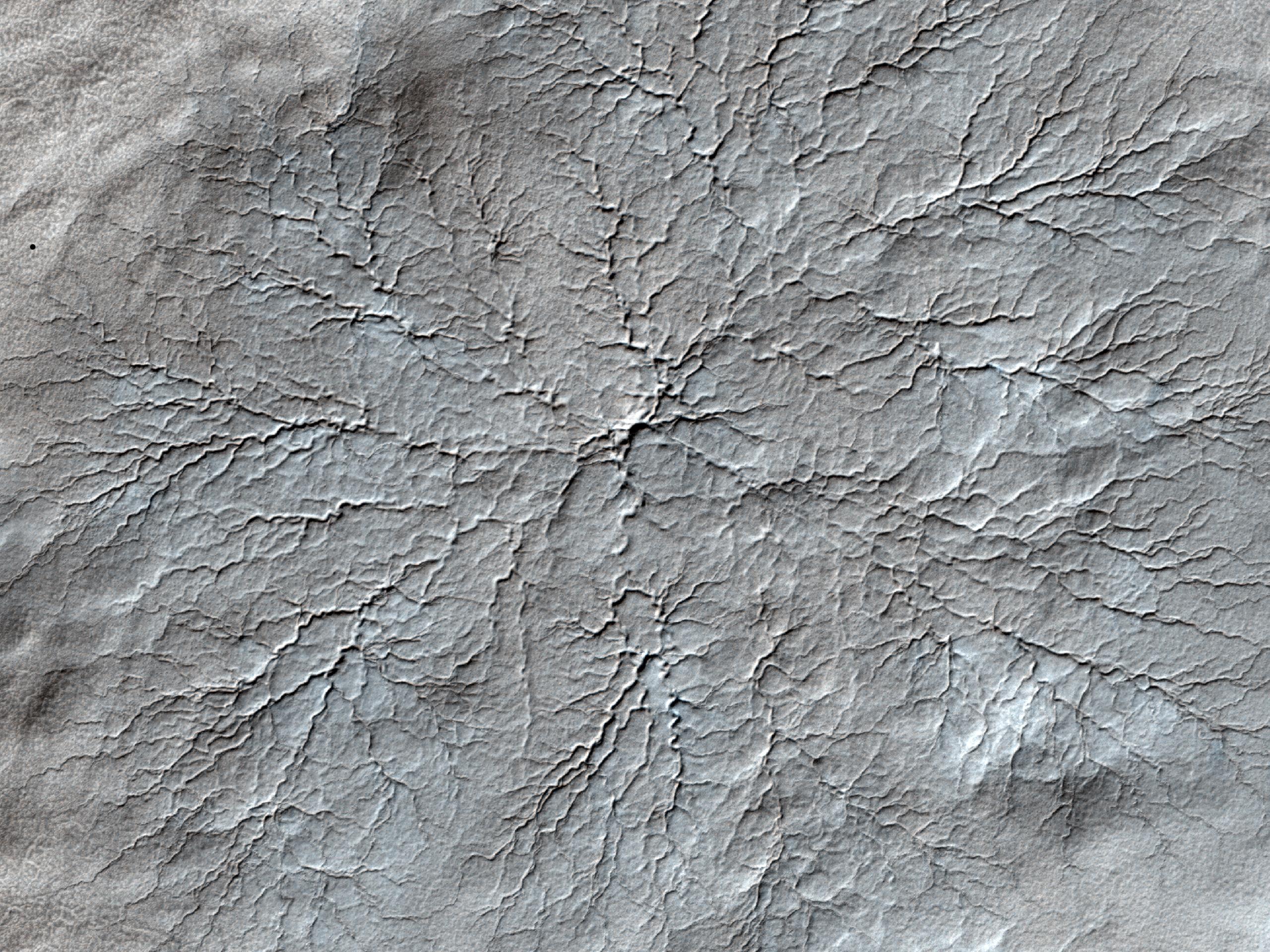
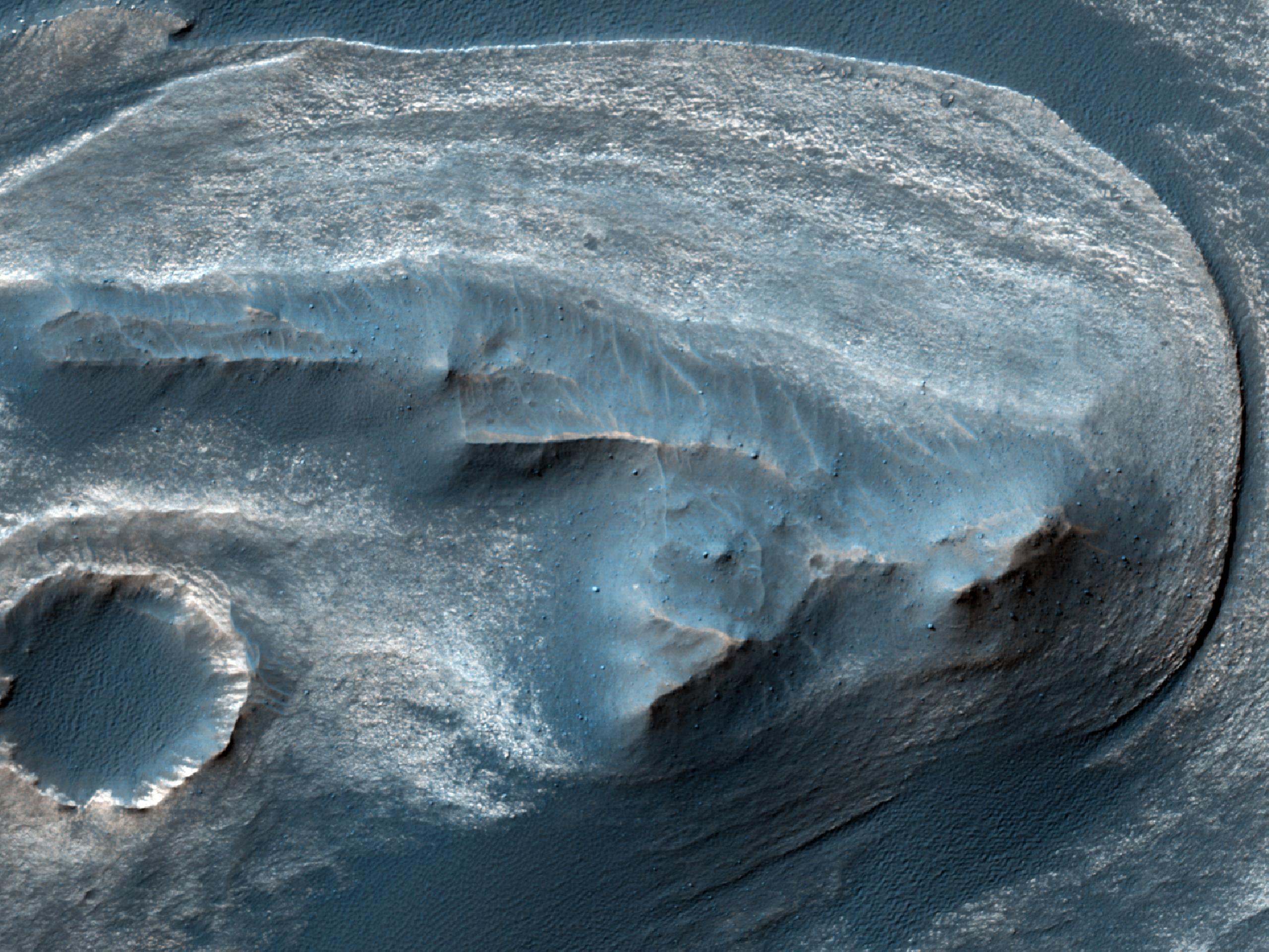
-
PIA14459:
-
Erosion Features near the South Pole of Mars
Full Resolution:
TIFF
(14.76 MB)
JPEG
(1.003 MB)
|
|
|
2011-07-15 |
Mars
|
Mars Reconnaissance Orbiter (MRO)
|
HiRISE
|
840x333x3 |
|
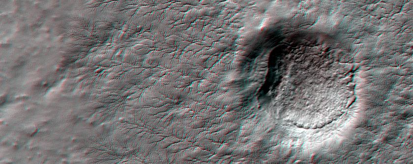
-
PIA14460:
-
Erosion Features near the South Pole of Mars (Anaglyph)
Full Resolution:
TIFF
(840.3 kB)
JPEG
(78.15 kB)
|
|
|
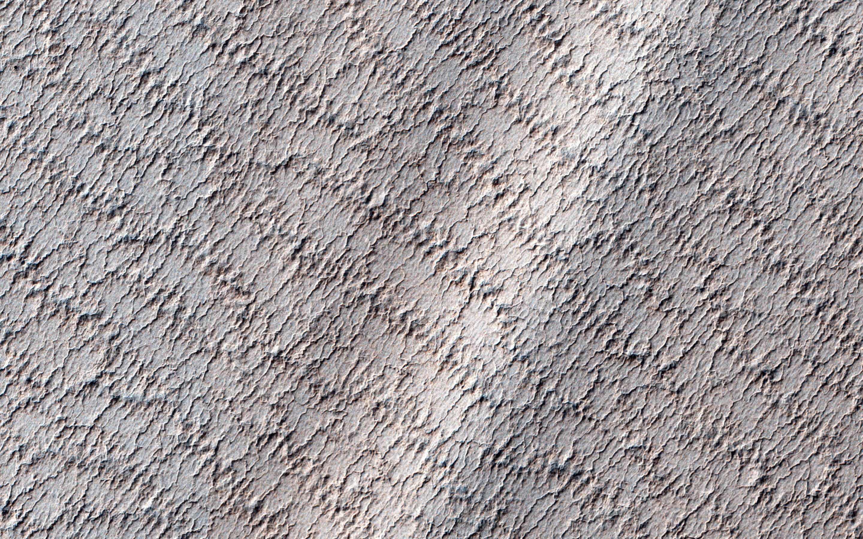
2012-03-29 |
Mars
|
Mars Reconnaissance Orbiter (MRO)
|
HiRISE
|
2560x1920x3 |
|
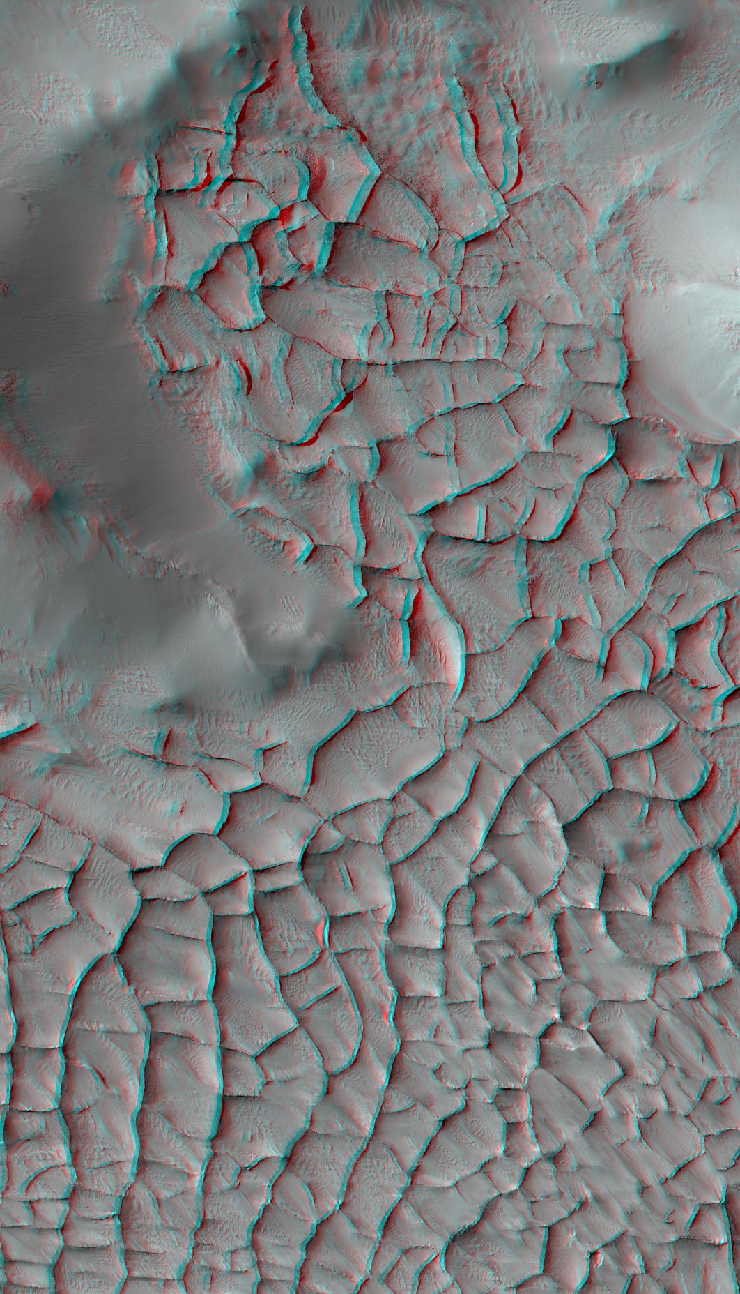
-
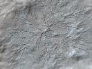
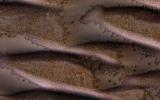
PIA14432:
-
Cratered Dune Forms
Full Resolution:
TIFF
(14.76 MB)
JPEG
(645.6 kB)
|
|
|
2011-08-15 |
Mars
|
Mars Exploration Rover (MER)
|
Navigation Camera
|
6767x1169x3 |
|
-
PIA14531:
'Spirit Point' Vista from Opportunity, in Stereo
Full Resolution:
TIFF
(23.73 MB)
JPEG
(1.008 MB)
|
|
|
2012-06-11 |
Mars
|
Mars Science Laboratory (MSL)
|
|
2560x1600x3 |
|
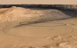
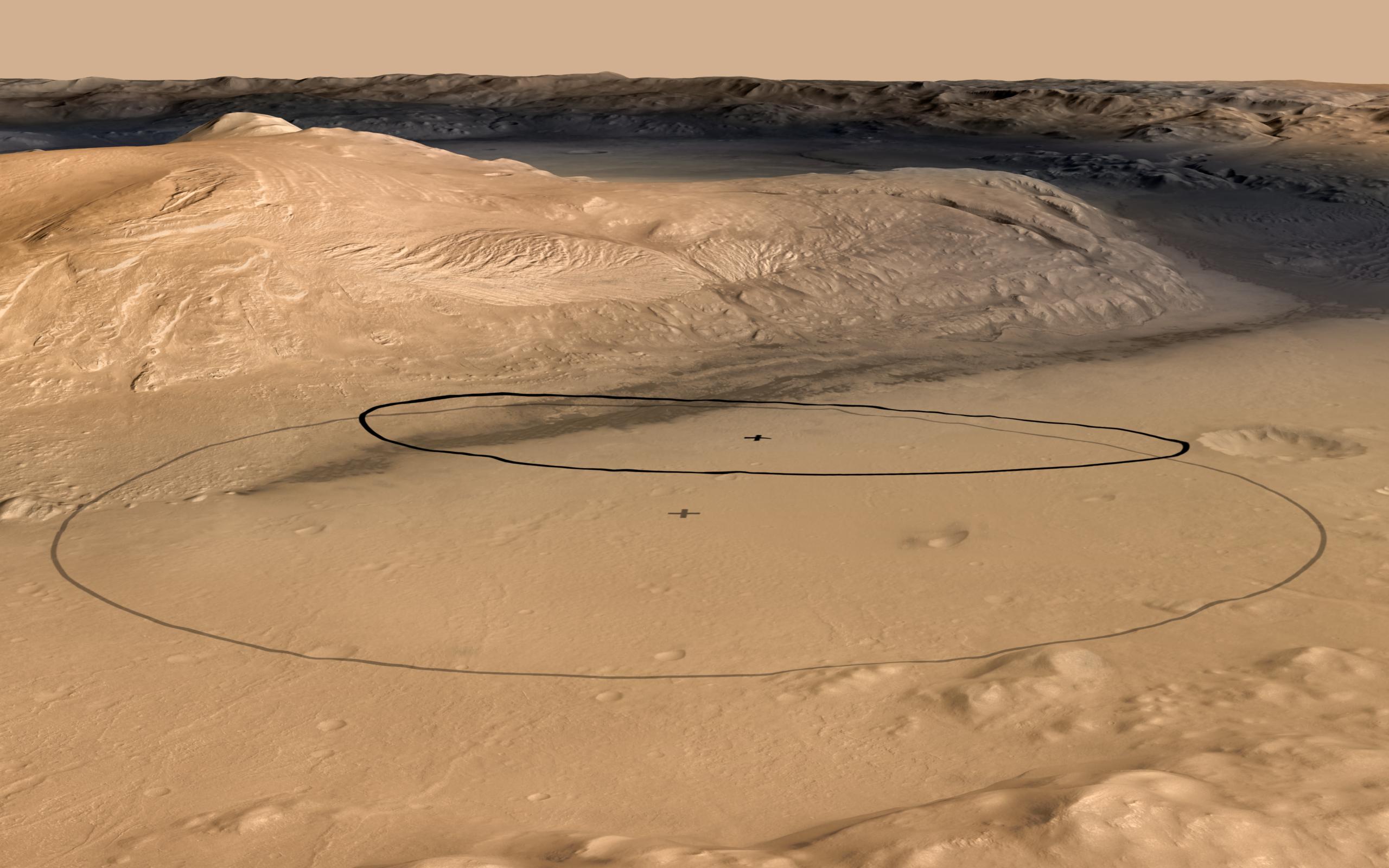
-
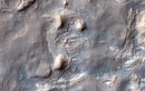
PIA15685:
-
Revised Landing Target for Mars Rover Curiosity
Full Resolution:
TIFF
(12.3 MB)
JPEG
(356.8 kB)
|
|
|
2012-06-11 |
Mars
|
Mars Science Laboratory (MSL)
|
|
2560x1600x3 |
|
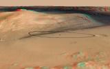
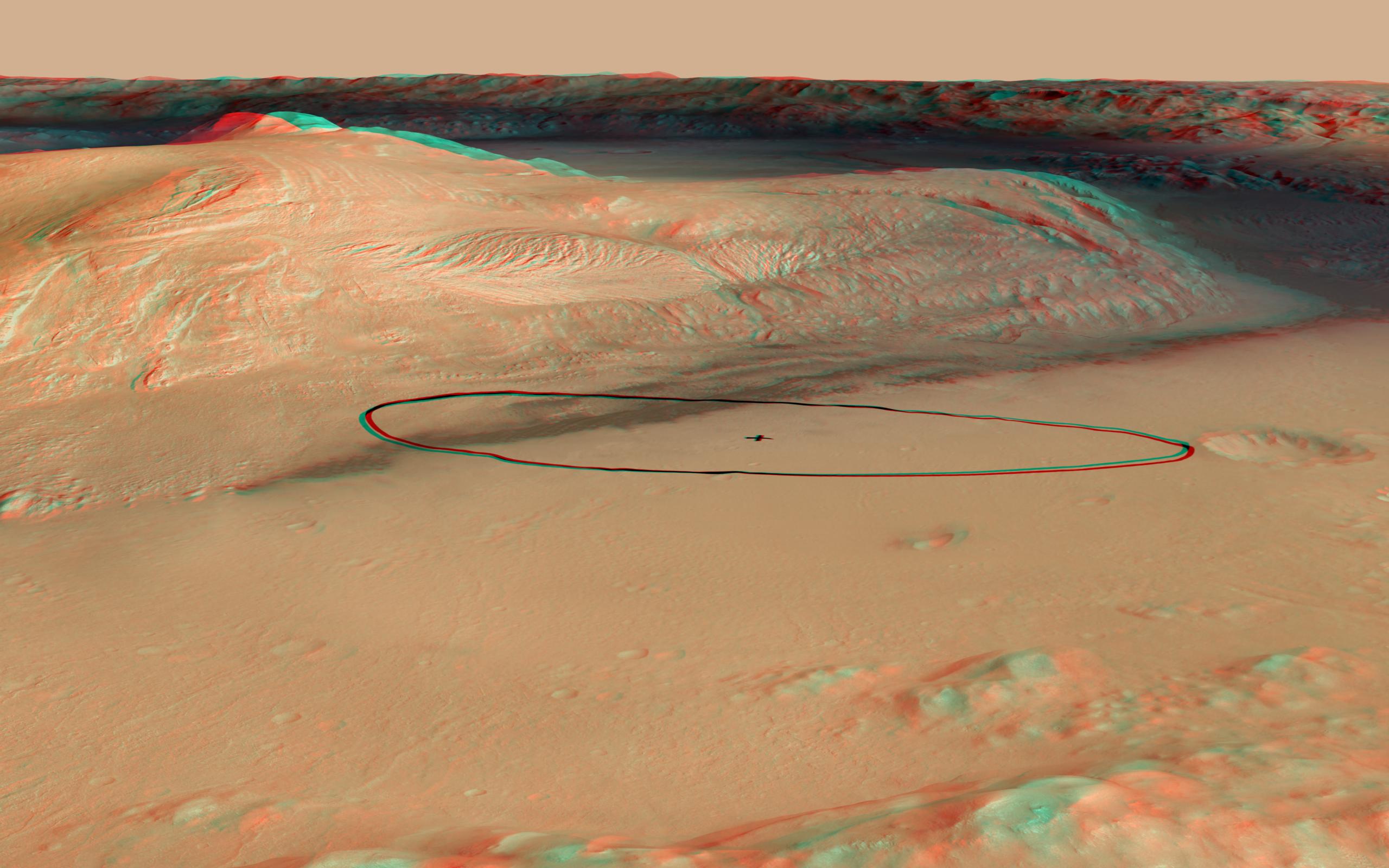
-
PIA15688:
-
Landing Target for Mars Rover Curiosity, in Stereo
Full Resolution:
TIFF
(12.3 MB)
JPEG
(341.3 kB)
|
|
|
2012-08-07 |
Mars
|
Mars Science Laboratory (MSL)
|
|
1024x925x3 |
|
-
PIA16002:
-
3-D View from Behind Curiosity
Full Resolution:
TIFF
(2.843 MB)
JPEG
(94.86 kB)
|
|
|
2012-08-07 |
Mars
|
Mars Science Laboratory (MSL)
|
|
1024x847x3 |
|
-
PIA16003:
-
3-D View from the Front of Curiosity
Full Resolution:
TIFF
(2.603 MB)
JPEG
(97.37 kB)
|
|
|
2012-08-07 |
Mars
|
Mars Science Laboratory (MSL)
|
|
1024x1024x3 |
|
-
PIA16004:
-
3-D View from the Front of Curiosity
Full Resolution:
TIFF
(3.147 MB)
JPEG
(109.6 kB)
|
|
|
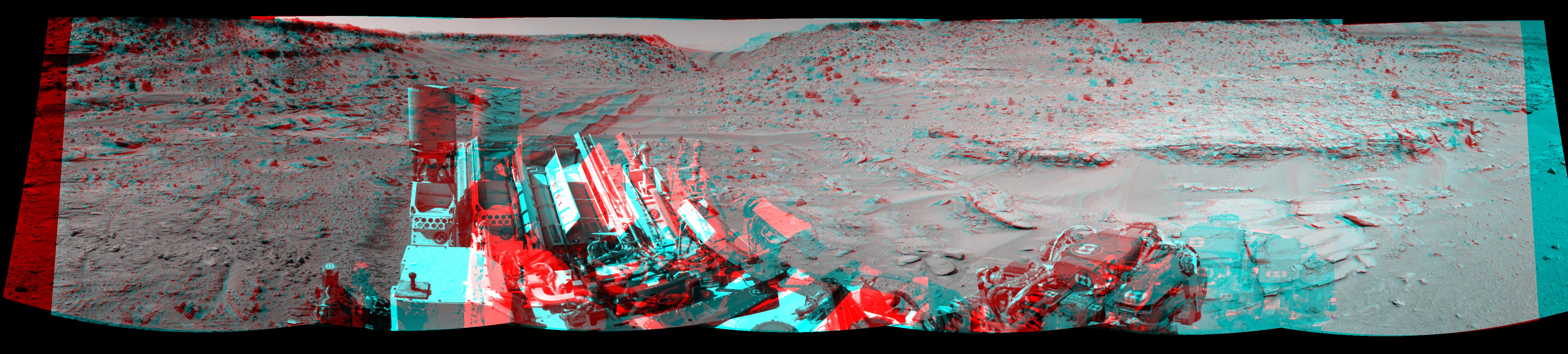
2012-09-04 |
Mars
|
Mars Science Laboratory (MSL)
|
|
7824x3337x3 |
|
-
PIA16140:
-
3-D View from Bradbury Landing Site
Full Resolution:
TIFF
(78.35 MB)
JPEG
(1.916 MB)
|
|
|
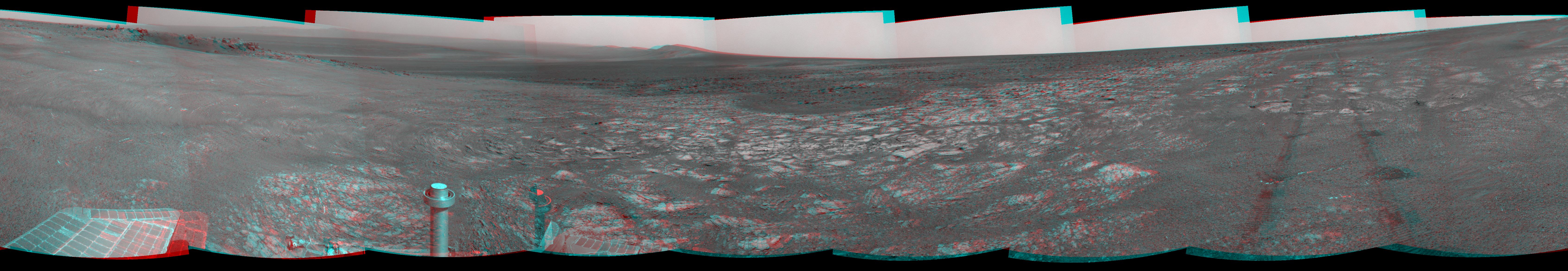
2012-09-07 |
Mars
|
Mars Exploration Rover (MER)
|
Navigation Camera
|
7688x987x1 |
|
-
PIA16122:
Opportunity's Surroundings on 3,000th Sol
Full Resolution:
TIFF
(7.596 MB)
JPEG
(1.148 MB)
|
|
|
2012-09-07 |
Mars
|
Mars Exploration Rover (MER)
|
Navigation Camera
|
7753x1152x3 |

|
-
PIA16123:
Opportunity's Surroundings on 3,000th Sol, in 3-D
Full Resolution:
TIFF
(26.8 MB)
JPEG
(1.421 MB)
|
|
|
2012-09-13 |
Mars
|
Mars Science Laboratory (MSL)
|
MAHLI
|
1096x1200x3 |
|
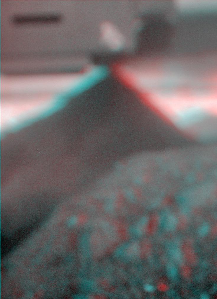
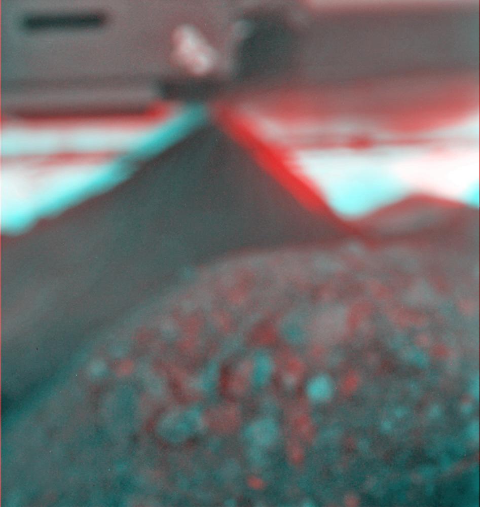
-
PIA15879:
-
3-D View of MAHLI Calibration Target
Full Resolution:
TIFF
(3.947 MB)
JPEG
(191.8 kB)
|
|
|
2012-10-03 |
Mars
|
Mars Exploration Rover (MER)
|
Navigation Camera
|
7753x1287x3 |
|
-
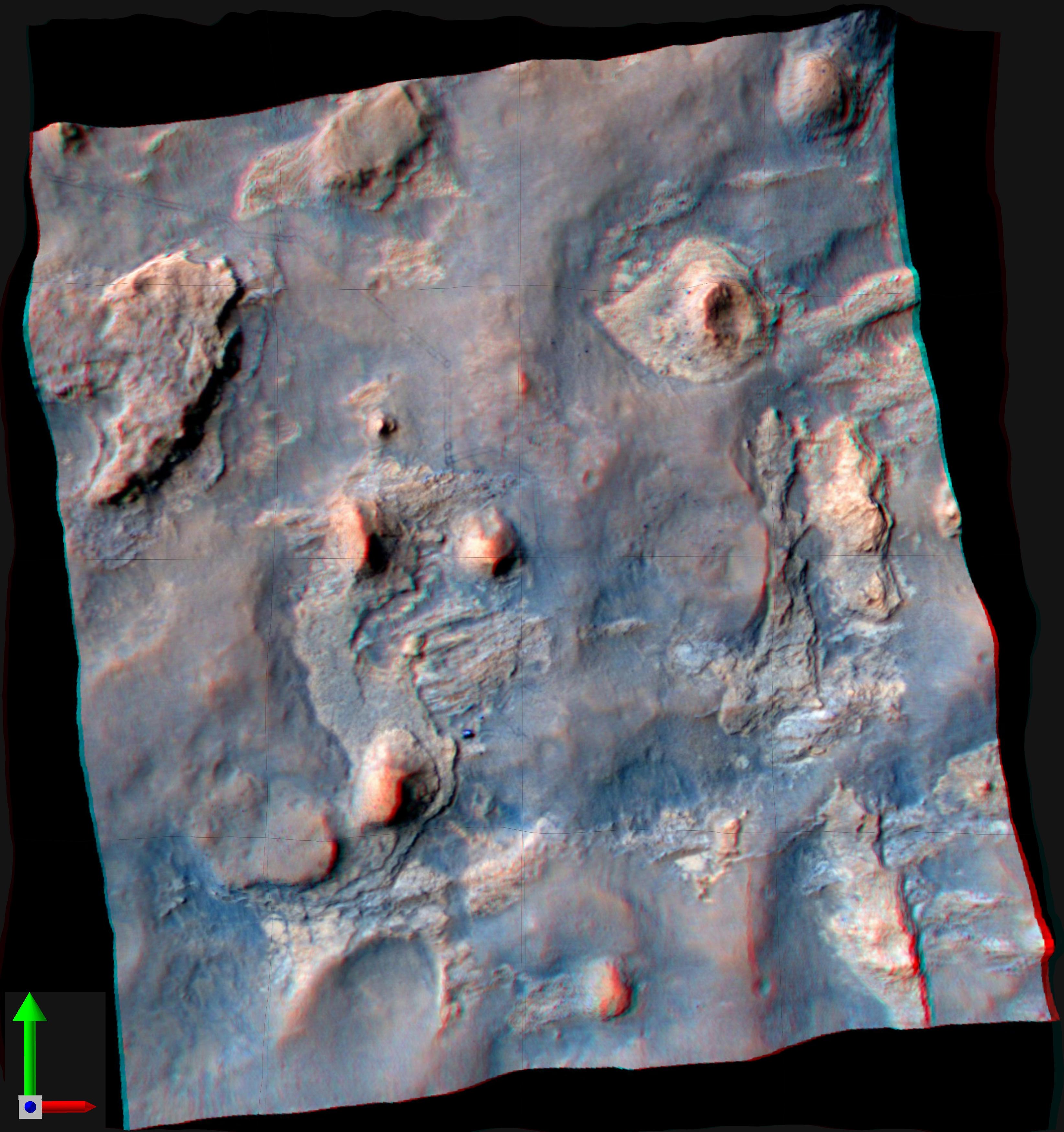
PIA16222:
'Matijevic Hill' on Rim of Mars' Endeavour Crater, Stereo View
Full Resolution:
TIFF
(29.94 MB)
JPEG
(1.162 MB)
|
|
|
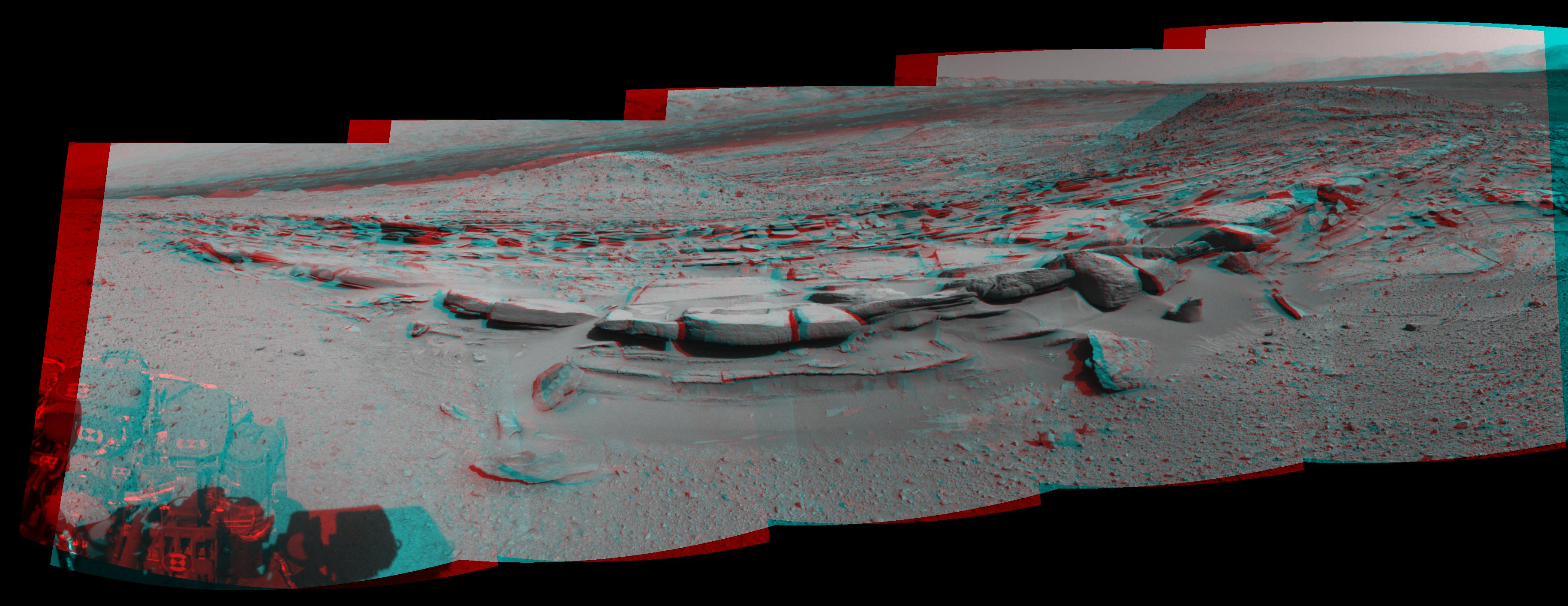
2012-10-03 |
Mars
|
Mars Science Laboratory (MSL)
|
Mastcam
|
2901x3036x3 |
|
-
PIA16223:
-
Martian Streambed Evidence Rock in 3-D
Full Resolution:
TIFF
(26.43 MB)
JPEG
(977.2 kB)
|
|
|
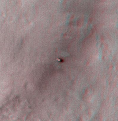
2012-10-10 |
Mars
|
Mars Reconnaissance Orbiter (MRO)
Mars Science Laboratory (MSL)
|
HiRISE
|
398x408x3 |
|
-
PIA16208:
-
Curiosity at Bradbury Landing Site in 3-D
Full Resolution:
TIFF
(487.5 kB)
JPEG
(17.84 kB)
|
|
|
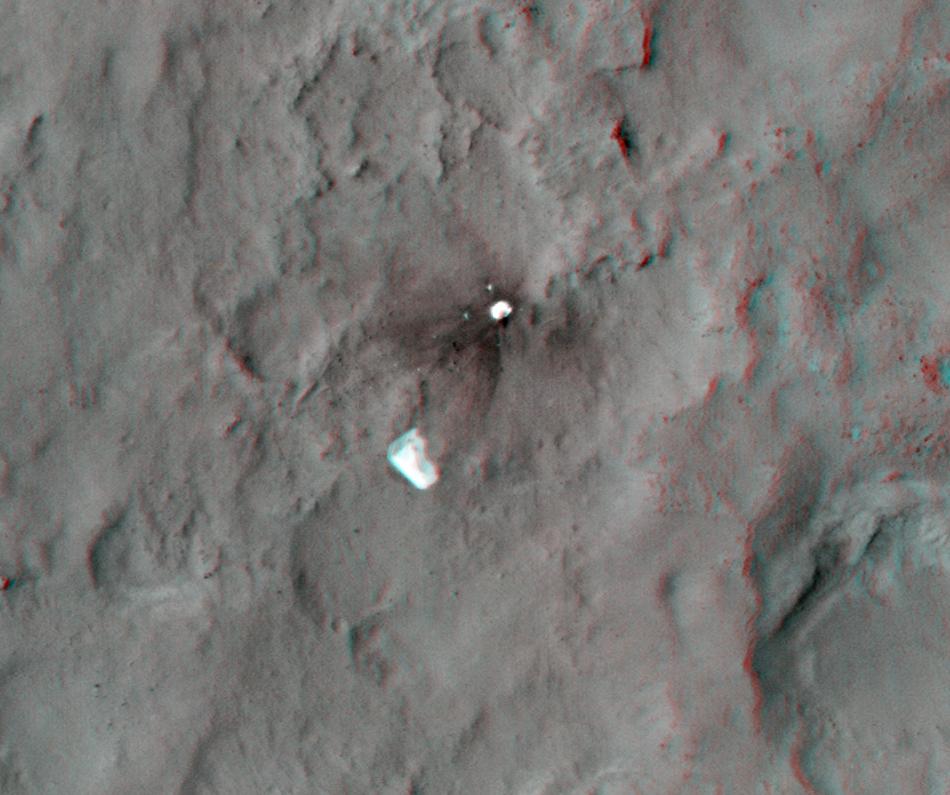
2012-10-10 |
Mars
|
Mars Reconnaissance Orbiter (MRO)
Mars Science Laboratory (MSL)
|
HiRISE
|
950x795x3 |
|
-
PIA16209:
-
Parachute and Back Shell in 3-D
Full Resolution:
TIFF
(2.267 MB)
JPEG
(87.85 kB)
|
|
|
2012-10-10 |
Mars
|
Mars Reconnaissance Orbiter (MRO)
Mars Science Laboratory (MSL)
|
HiRISE
|
2414x1387x3 |
|
-
PIA16210:
-
'Glenelg' in 3-D
Full Resolution:
TIFF
(10.05 MB)
JPEG
(554.1 kB)
|
|
|
2012-11-20 |
Mars
|
Mars Science Laboratory (MSL)
|
Navcam (MSL)
|
3893x1162x3 |
|
-
PIA16449:
-
Curiosity's Eastward View After Sol 100 Drive, Stereo
Full Resolution:
TIFF
(13.58 MB)
JPEG
(640.8 kB)
|
|
|
2012-12-19 |
Mars
|
Mars Exploration Rover (MER)
|
Navigation Camera
|
7753x1255x3 |
|
-
PIA16557:
Opportunity's Surroundings on Sol 3071, Stereo View
Full Resolution:
TIFF
(29.2 MB)
JPEG
(1.296 MB)
|
|
|
2012-12-19 |
Mars
|
Mars Exploration Rover (MER)
|
Navigation Camera
|
7753x2005x3 |
|
-
PIA16559:
Opportunity's Surroundings on Sol 3105, Stereo View
Full Resolution:
TIFF
(46.65 MB)
JPEG
(1.802 MB)
|
|
|
2012-12-19 |
Mars
|
Mars Exploration Rover (MER)
|
Navigation Camera
|
4285x1289x3 |
|
-
PIA16561:
-
Opportunity at 'Copper Cliff,' Sol 3153
Full Resolution:
TIFF
(16.58 MB)
JPEG
(862.8 kB)
|
|
|
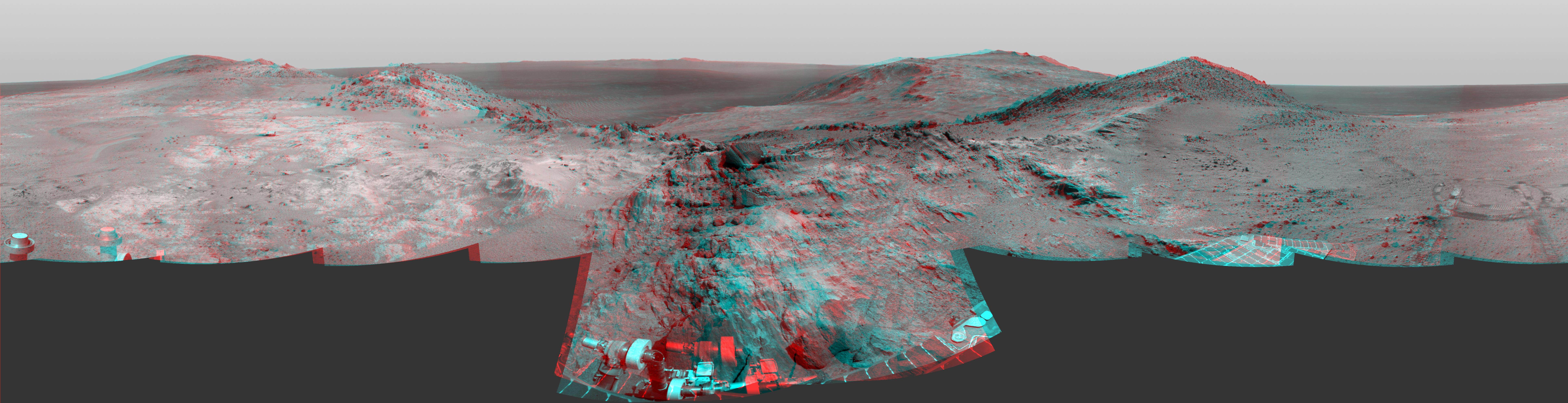
2013-01-22 |
Mars
|
Mars Exploration Rover (MER)
|
Panoramic Camera
|
14669x5000x3 |

|
-
PIA16709:
-
'Matijevic Hill' Panorama for Rover's Ninth Anniversary (Stereo)
Full Resolution:
TIFF
(220.1 MB)
JPEG
(7.268 MB)
|
|
|
2013-04-23 |
Mars
|
Mars Science Laboratory (MSL)
|
Navcam (MSL)
|
7824x3328x3 |
|
-
PIA16847:
-
Mars Stereo View from "John Klein" to Mount Sharp (Raw)
Full Resolution:
TIFF
(78.14 MB)
JPEG
(2.325 MB)
|
|
|
2013-04-16 |
Mars
|
Mars Exploration Rover (MER)
|
Navigation Camera
|
5076x1157x3 |
|
-
PIA16924:
Opportunity Overlooking Endeavour Crater, Stereo View
Full Resolution:
TIFF
(17.63 MB)
JPEG
(764.1 kB)
|
|
|
2013-04-23 |
Mars
|
Mars Science Laboratory (MSL)
|
Navcam (MSL)
|
7824x2131x3 |
|
-
PIA16925:
Mars Stereo View from "John Klein" to Mount Sharp
Full Resolution:
TIFF
(50.04 MB)
JPEG
(1.804 MB)
|
|
|
2013-05-30 |
Mars
|
Mars Science Laboratory (MSL)
|
Mastcam
|
2498x1126x3 |
|
-
PIA17063:
-
Evidence About a Martian Streambed (Stereo)
Full Resolution:
TIFF
(8.441 MB)
JPEG
(394.8 kB)
|
|
|
2013-10-23 |
Mars
|
Mars Exploration Rover (MER)
|
Navigation Camera
|
4278x1333x3 |
|
-
PIA17367:
-
Mars Hill-Climbing Opportunity at 'Solander Point,' in Stereo
Full Resolution:
TIFF
(17.12 MB)
JPEG
(474 kB)
|
|
|
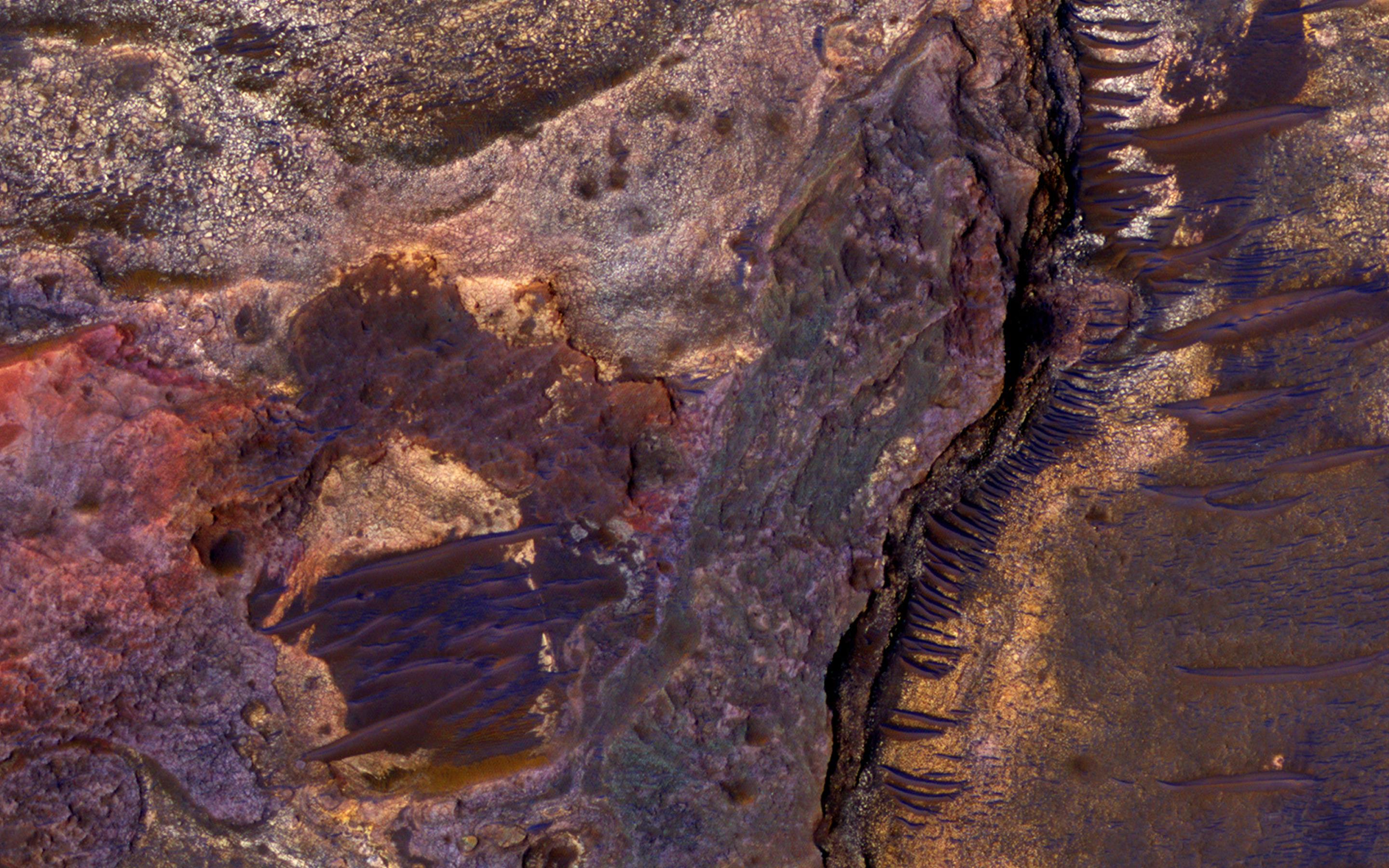
2013-09-03 |
Mars
|
Mars Reconnaissance Orbiter (MRO)
|
HiRISE
|
2880x1800x3 |
|
-
PIA17648:
-
Slope Lineae along Coprates Chasma Ridge
Full Resolution:
TIFF
(15.56 MB)
JPEG
(862.3 kB)
|
|
|
2013-12-20 |
Mars
|
Mars Science Laboratory (MSL)
|
Navcam (MSL)
|
7733x2206x3 |

|
-
PIA17584:
Rocky Mars Ground Where Curiosity Has Been Driving (Stereo)
Full Resolution:
TIFF
(51.19 MB)
JPEG
(2.437 MB)
|
|
|
2014-01-15 |
Mars
|
Mars Reconnaissance Orbiter (MRO)
|
HiRISE
|
2560x1920x3 |
|
-
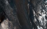
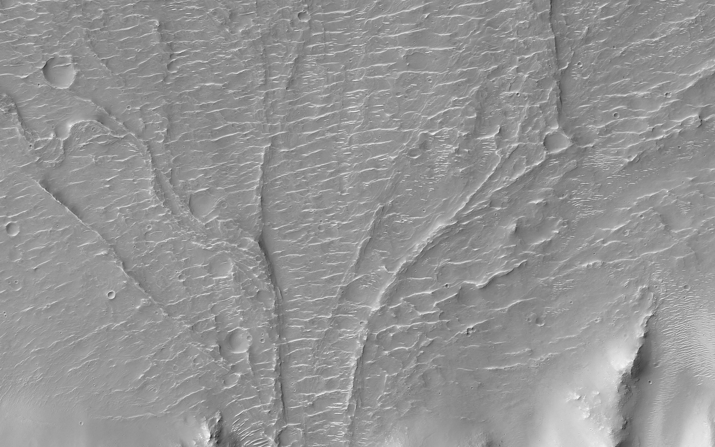
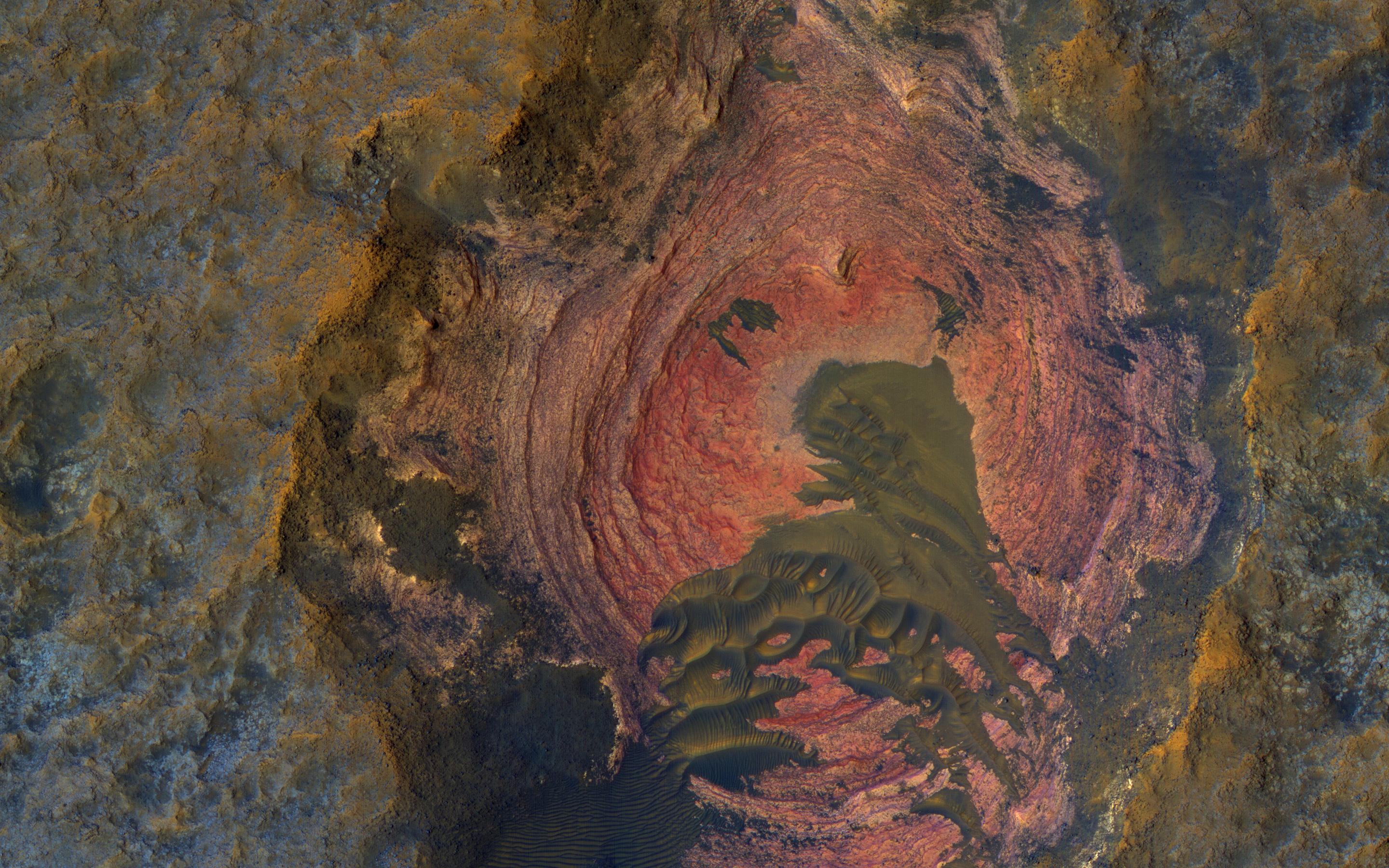
PIA17874:
-
Recent Volcanism in Valles Marineris
Full Resolution:
TIFF
(14.75 MB)
JPEG
(836.7 kB)
|
|
|
2014-01-31 |
Mars
|
Mars Science Laboratory (MSL)
|
Navcam (MSL)
|
4127x1993x3 |
|
-
PIA17769:
-
Curiosity's View Past Dune at 'Dingo Gap' (Stereo)
Full Resolution:
TIFF
(24.69 MB)
JPEG
(1.066 MB)
|
|
|
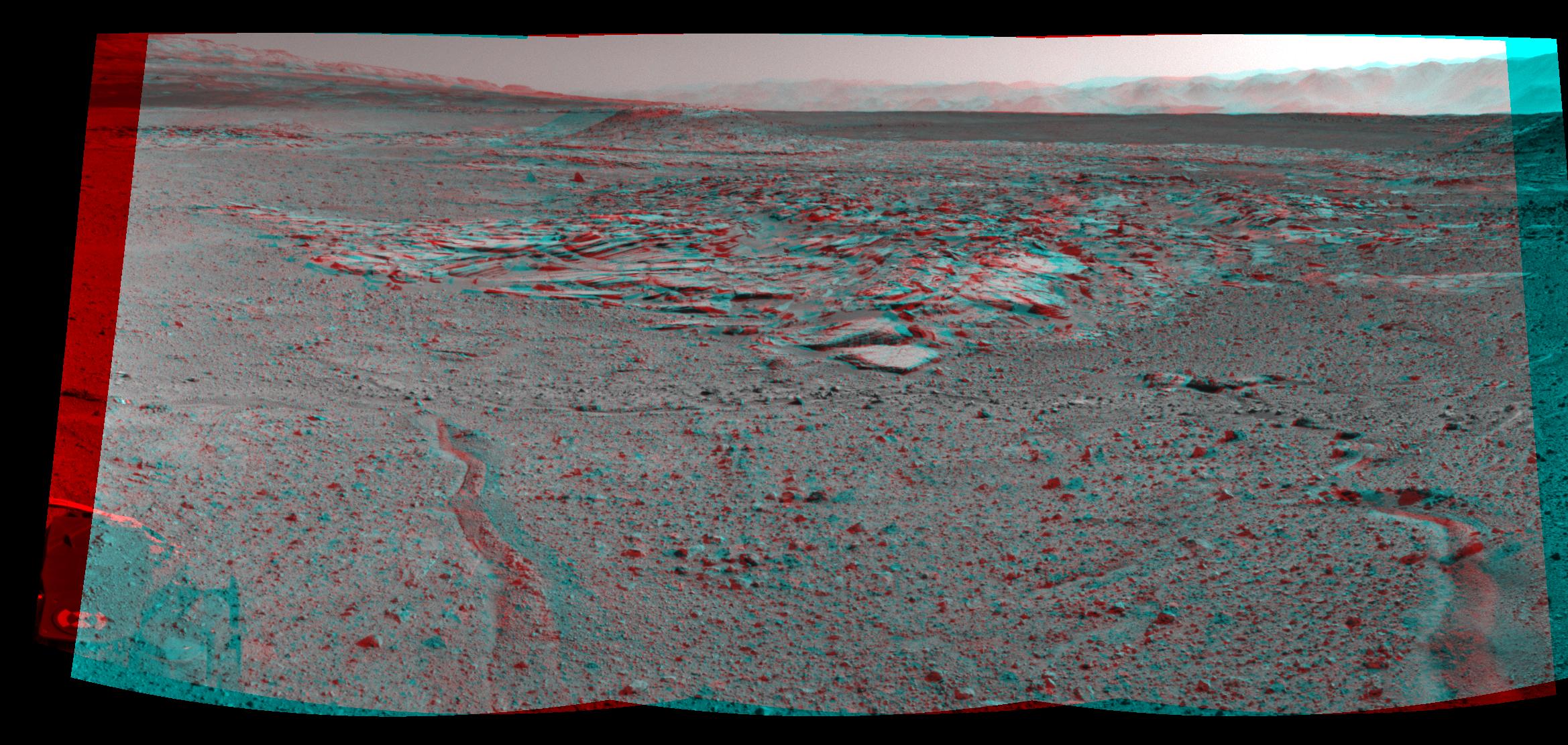
2014-02-27 |
Mars
|
Mars Science Laboratory (MSL)
|
Navcam (MSL)
|
3563x1131x3 |
|
-
PIA17948:
-
Martian Landscape With Rock Rows and Mount Sharp (Stereo)
Full Resolution:
TIFF
(12.09 MB)
JPEG
(503.8 kB)
|
|
|
2014-02-27 |
Mars
|
Mars Science Laboratory (MSL)
|
Navcam (MSL)
|
5015x1132x3 |
|
-
PIA17951:
Panoramic View From West of 'Dingo Gap' (Stereo)
Full Resolution:
TIFF
(17.04 MB)
JPEG
(954 kB)
|
|
|
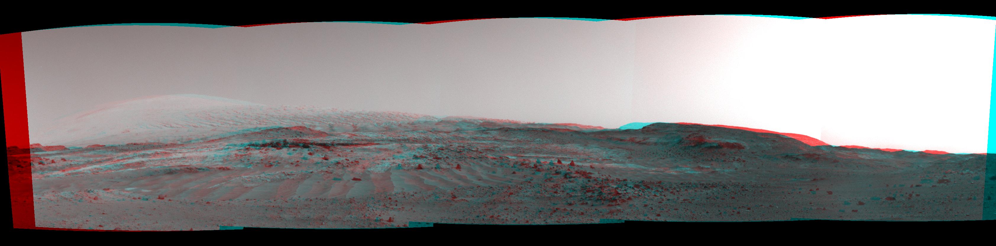
2014-03-24 |
Mars
|
Mars Science Laboratory (MSL)
|
Navcam (MSL)
|
3657x1414x3 |
|
-
PIA18070:
-
Panorama With Sandstone Outcrop Near 'The Kimberley' Waypoint (Stereo)
Full Resolution:
TIFF
(15.52 MB)
JPEG
(573.6 kB)
|
|
|
2014-04-03 |
Mars
|
Mars Science Laboratory (MSL)
|
Navcam (MSL)
|
2338x1111x3 |
|
-
PIA18074:
-
Curiosity's View From Arrival Point at 'The Kimberley' Waypoint (Stereo)
Full Resolution:
TIFF
(7.796 MB)
JPEG
(446.6 kB)
|
|
|
2014-04-16 |
Mars
|
Mars Reconnaissance Orbiter (MRO)
Mars Science Laboratory (MSL)
|
HiRISE
|
3287x3497x3 |
|
-
PIA18082:
-
Stereo View of Curiosity and Rover Tracks at 'the Kimberley,' April 2014
Full Resolution:
TIFF
(34.5 MB)
JPEG
(791.9 kB)
|
|
|
2014-04-16 |
Mars
|
Mars Science Laboratory (MSL)
|
Navcam (MSL)
|
3612x1155x3 |
|
-
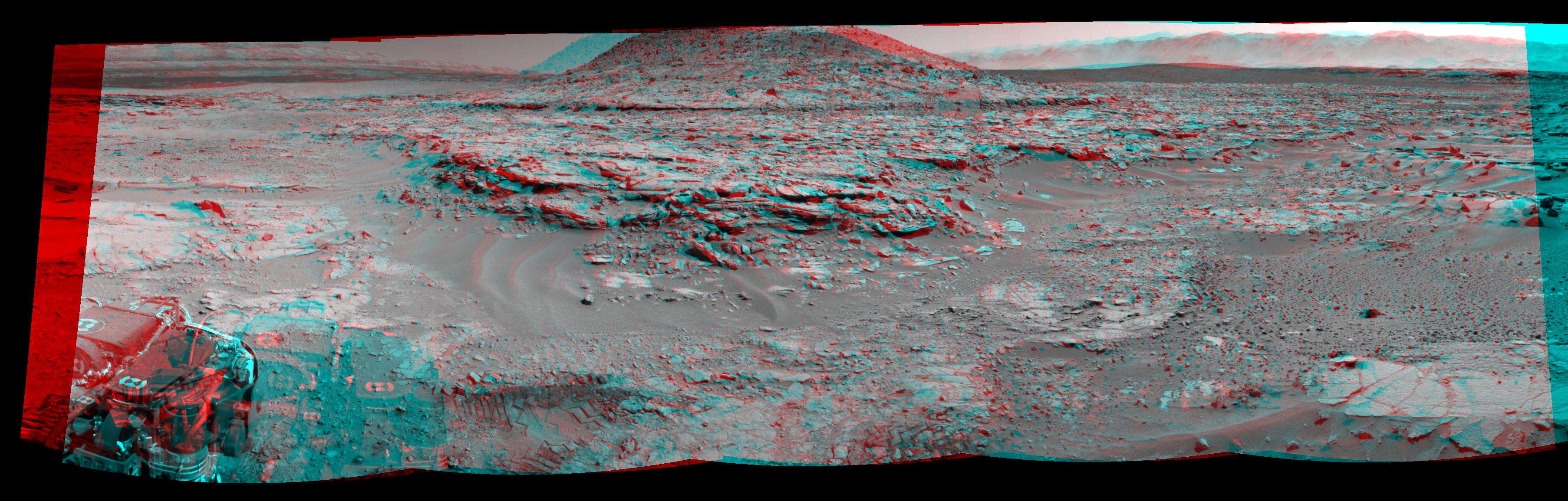
PIA18084:
-
Stereo View of 'Mount Remarkable' and Surrounding Outcrops at Mars Rover's Waypoint
Full Resolution:
TIFF
(12.52 MB)
JPEG
(697.9 kB)
|
|
|
2014-04-16 |
Mars
|
Mars Reconnaissance Orbiter (MRO)
|
HiRISE
|
2880x1800x3 |
|
-
PIA18227:
-
Curiosity Ready to Drill for Gold at the Kimberley
Full Resolution:
TIFF
(15.56 MB)
JPEG
(735.3 kB)
|
|
|
2014-05-19 |
Mars
|
Mars Exploration Rover (MER)
|
Panoramic Camera
|
5454x1264x3 |
|
-
PIA18093:
Endeavour Crater Rim From 'Murray Ridge' on Mars
Full Resolution:
TIFF
(20.69 MB)
JPEG
(398 kB)
|
|
|
2014-05-19 |
Mars
|
Mars Exploration Rover (MER)
|
Navigation Camera
|
7753x1217x1 |
|
-
PIA18095:
Approaching a Target Deposit on Mars Crater Rim
Full Resolution:
TIFF
(9.445 MB)
JPEG
(1.222 MB)
|
|
|
2014-05-19 |
Mars
|
Mars Exploration Rover (MER)
|
Navigation Camera
|
7753x1217x3 |
|
-
PIA18096:
Approaching a Target Deposit on Mars Crater Rim (Stereo)
Full Resolution:
TIFF
(28.32 MB)
JPEG
(1.311 MB)
|
|
|
2014-05-19 |
Mars
|
Mars Exploration Rover (MER)
|
Navigation Camera
|
7753x1168x1 |
|
-
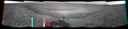
PIA18098:
Opportunity's Tracks Near Crater Rim Ridgeline
Full Resolution:
TIFF
(9.065 MB)
JPEG
(993.8 kB)
|
|
|
2014-05-19 |
Mars
|
Mars Exploration Rover (MER)
|
Navigation Camera
|
7753x1168x3 |
|
-
PIA18099:
Opportunity's Tracks Near Crater Rim Ridgeline (Stereo)
Full Resolution:
TIFF
(27.18 MB)
JPEG
(1.024 MB)
|
|
|
2014-06-23 |
Mars
|
Mars Exploration Rover (MER)
|
Panoramic Camera
|
7793x2000x3 |
|
-
PIA18395:
'Pillinger Point' Overlooking Endeavour Crater on Mars (Stereo)
Full Resolution:
TIFF
(46.77 MB)
JPEG
(2.275 MB)
|
|
|
2014-06-04 |
Mars
|
Mars Reconnaissance Orbiter (MRO)
|
HiRISE
|
2880x1800x1 |

|
-
PIA18513:
-
An Alluvial Fan in a Low-Latitude Crater
Full Resolution:
TIFF
(5.191 MB)
JPEG
(646.5 kB)
|
|
|
2014-07-28 |
Mars
|
Mars Exploration Rover (MER)
|
Panoramic Camera
|
2817x3040x3 |
|
-
PIA18415:
-
'Lunokhod 2' Crater on Mars (Stereo)
Full Resolution:
TIFF
(25.7 MB)
JPEG
(1.707 MB)
|
|
|
2014-09-09 |
Mars
|
Mars Exploration Rover (MER)
|
Panoramic Camera
|
2134x1148x3 |
|
-
PIA18606:
-
Rover's Tracks in Stereo View Along Rim of Endeavour Crater
Full Resolution:
TIFF
(7.353 MB)
JPEG
(323 kB)
|
|
|
2014-05-22 |
Mars
|
Mars Reconnaissance Orbiter (MRO)
|
HiRISE
|
2880x1800x1 |

|
-
PIA18772:
-
Global Eyes on an Impact Prize
Full Resolution:
TIFF
(5.191 MB)
JPEG
(700.7 kB)
|
|
|
2014-10-16 |
Mars
|
Mars Exploration Rover (MER)
|
Panoramic Camera
|
4430x2488x3 |
|
-
PIA18616:
-
Opportunity's Northward View of 'Wdowiak Ridge' (Stereo)
Full Resolution:
TIFF
(33.09 MB)
JPEG
(1.566 MB)
|
|
|
2014-10-29 |
Mars
|
Mars Reconnaissance Orbiter (MRO)
|
HiRISE
|
2880x1800x1 |
|
-
PIA18887:
-
Which Way is Up?
Full Resolution:
TIFF
(5.191 MB)
JPEG
(506.4 kB)
|
|
|
2015-01-08 |
Mars
|
Mars Exploration Rover (MER)
|
Navigation Camera
|
4136x1278x3 |
|
-
PIA19100:
-
Approach to 'Cape Tribulation' Summit (Stereo)
Full Resolution:
TIFF
(15.87 MB)
JPEG
(779.7 kB)
|
|
|
2015-01-22 |
Mars
|
Mars Exploration Rover (MER)
|
Panoramic Camera
|
4109x1024x3 |
|
-
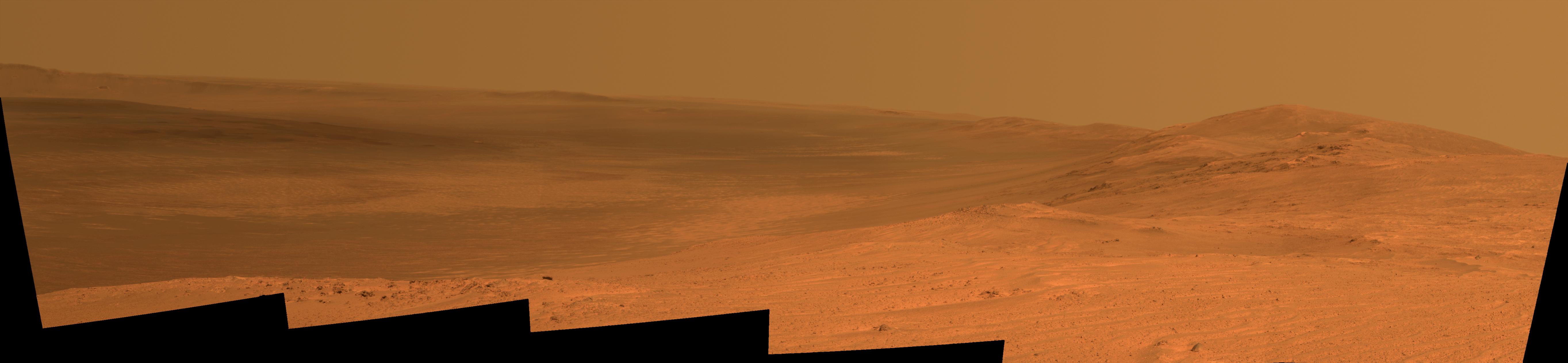
PIA19111:
High Viewpoint for 11-Year-Old Rover Mission on Mars (Stereo)
Full Resolution:
TIFF
(12.63 MB)
JPEG
(475.3 kB)
|
|
|
2015-03-23 |
Mars
|
Mars Exploration Rover (MER)
|
Panoramic Camera
|
3511x994x3 |
|
-
PIA19153:
Mars 'Marathon Valley' Overlook, in Stereo
Full Resolution:
TIFF
(10.47 MB)
JPEG
(431.7 kB)
|
|
|
2015-03-24 |
Mars
|
Mars Exploration Rover (MER)
|
Navigation Camera
|
7719x1982x3 |
|
-
PIA19156:
Opportunity's Approach to 'Marathon Valley' (Stereo)
Full Resolution:
TIFF
(45.91 MB)
JPEG
(1.493 MB)
|
|
|
2015-04-13 |
Mars
|
Mars Science Laboratory (MSL)
|
Navcam (MSL)
|
6246x1497x3 |
|
-
PIA19165:
Curiosity View Ahead Through 'Artist's Drive' (Stereo)
Full Resolution:
TIFF
(28.06 MB)
JPEG
(1.019 MB)
|
|
|
2015-04-13 |
Mars
|
Mars Science Laboratory (MSL)
|
Navcam (MSL)
|
3368x832x3 |
|
-
PIA19387:
Scene From 'Artist's Drive' on Mars (Stereo)
Full Resolution:
TIFF
(8.41 MB)
JPEG
(231.6 kB)
|
|
|
2015-05-20 |
Mars
|
Mars Reconnaissance Orbiter (MRO)
|
HiRISE
|
2880x1800x3 |
|
-
PIA18562:
-
Sedimentary Rock Layers on a Crater Floor
Full Resolution:
TIFF
(15.56 MB)
JPEG
(773.6 kB)
|
|
|
2015-05-20 |
Mars
|
Mars Reconnaissance Orbiter (MRO)
|
HiRISE
|
2880x1800x3 |
|
-
PIA18563:
-
Alluvial Fans in Mojave Crater
Full Resolution:
TIFF
(15.56 MB)
JPEG
(898.5 kB)
|
|
|
2015-06-03 |
Mars
|
Mars Reconnaissance Orbiter (MRO)
|
HiRISE
|
2880x1800x3 |
|
-
PIA11776:
-
A Mysterious Bright Streak on the South Polar Layered Deposits
Full Resolution:
TIFF
(15.56 MB)
JPEG
(1.307 MB)
|
|
|
2015-07-01 |
Mars
|
Mars Science Laboratory (MSL)
|
Navcam (MSL)
|
7729x2563x3 |
|
-
PIA19678:
-
Panorama from Curiosity's Sol 1000 Location (Stereo)
Full Resolution:
TIFF
(59.45 MB)
JPEG
(2.315 MB)
|
|
|
2015-09-25 |
Mars
|
Mars Exploration Rover (MER)
|
Panoramic Camera
|
5595x1758x3 |
|
-
PIA19911:
-
'Hinners Point' Above Floor of 'Marathon Valley' on Mars (Stereo)
Full Resolution:
TIFF
(15.79 MB)
JPEG
(1.128 MB)
|
|
|
2015-11-27 |
Mars
|
Mars Reconnaissance Orbiter (MRO)
|
HiRISE
|
2880x1800x1 |

|
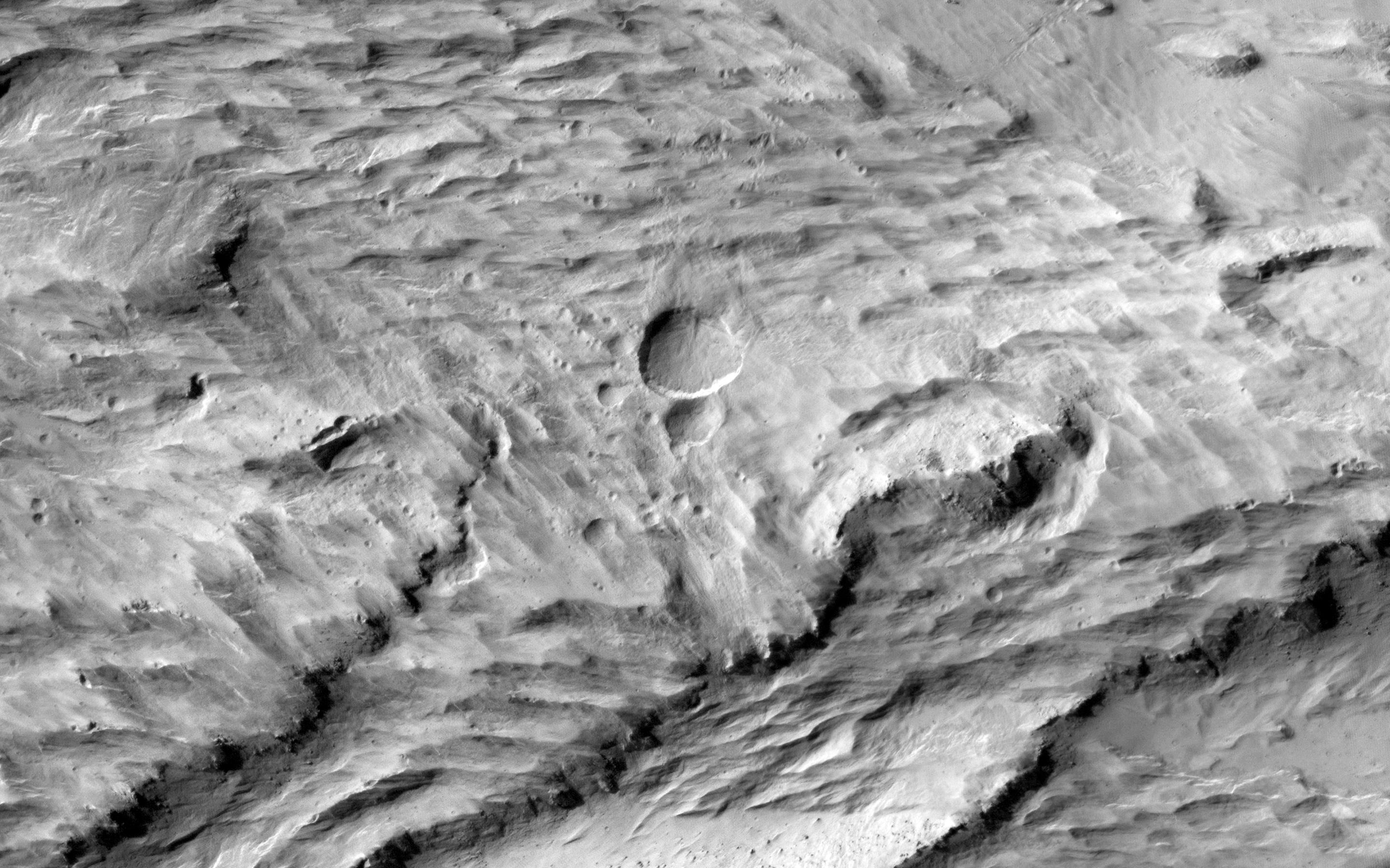
-
PIA20158:
-
A Youthful Crater in the Cydonia Colles Region
Full Resolution:
TIFF
(5.191 MB)
JPEG
(819.4 kB)
|
|
|
2015-12-23 |
Mars
|
Mars Reconnaissance Orbiter (MRO)
|
HiRISE
|
2880x1800x1 |

|
-
PIA20290:
-
Boulders on a Landslide
Full Resolution:
TIFF
(5.191 MB)
JPEG
(1.134 MB)
|
|
|
2016-01-04 |
Mars
|
Mars Science Laboratory (MSL)
|
Navcam (MSL)
|
4937x1190x3 |

|
-
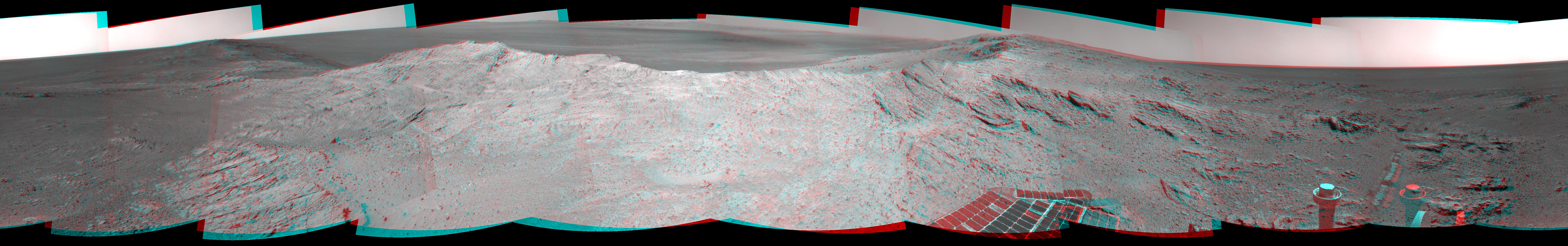
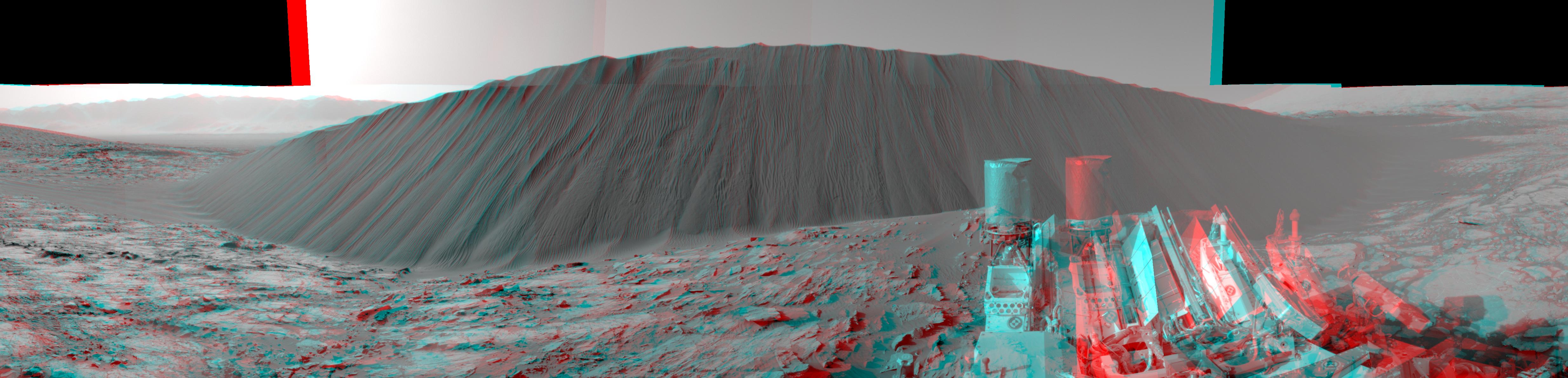
PIA20282:
Downwind Side of 'Namib' Sand Dune on Mars, Stereo
Full Resolution:
TIFF
(13 MB)
JPEG
(596.7 kB)
|
|
|
2016-02-25 |
Mars
|
Mars Exploration Rover (MER)
|
Panoramic Camera
|
6015x2459x3 |
|
-
PIA20320:
-
Steep 'Knudsen Ridge' Along 'Marathon Valley' on Mars (Stereo)
Full Resolution:
TIFF
(17.97 MB)
JPEG
(1.276 MB)
|
|
|
2016-05-18 |
Mars
|
Mars Reconnaissance Orbiter (MRO)
|
HiRISE
|
2880x1800x3 |
|
-
PIA15881:
-
Frosted Dunes
Full Resolution:
TIFF
(15.56 MB)
JPEG
(950.9 kB)
|
|
|
2016-08-19 |
Mars
|
Mars Science Laboratory (MSL)
|
Mastcam
|
4893x2642x3 |

|
-
PIA20836:
-
Breccia-Conglomerate Rocks on Lower Mount Sharp, Mars (Stereo)
Full Resolution:
TIFF
(18.52 MB)
JPEG
(976.6 kB)
|
|
|
2016-10-07 |
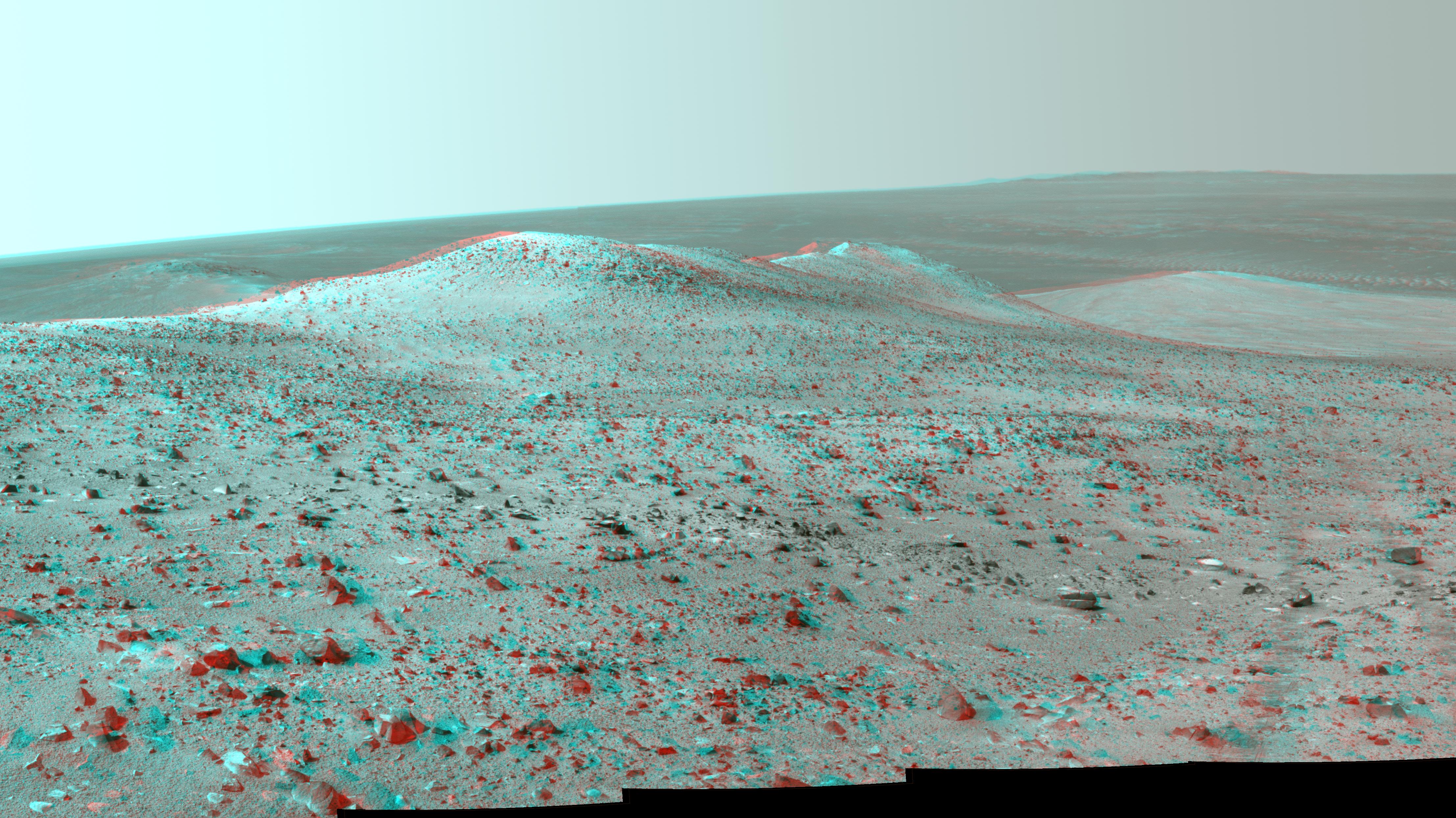
Mars
|
Mars Exploration Rover (MER)
|
Panoramic Camera
|
2144x1205x3 |
|
-
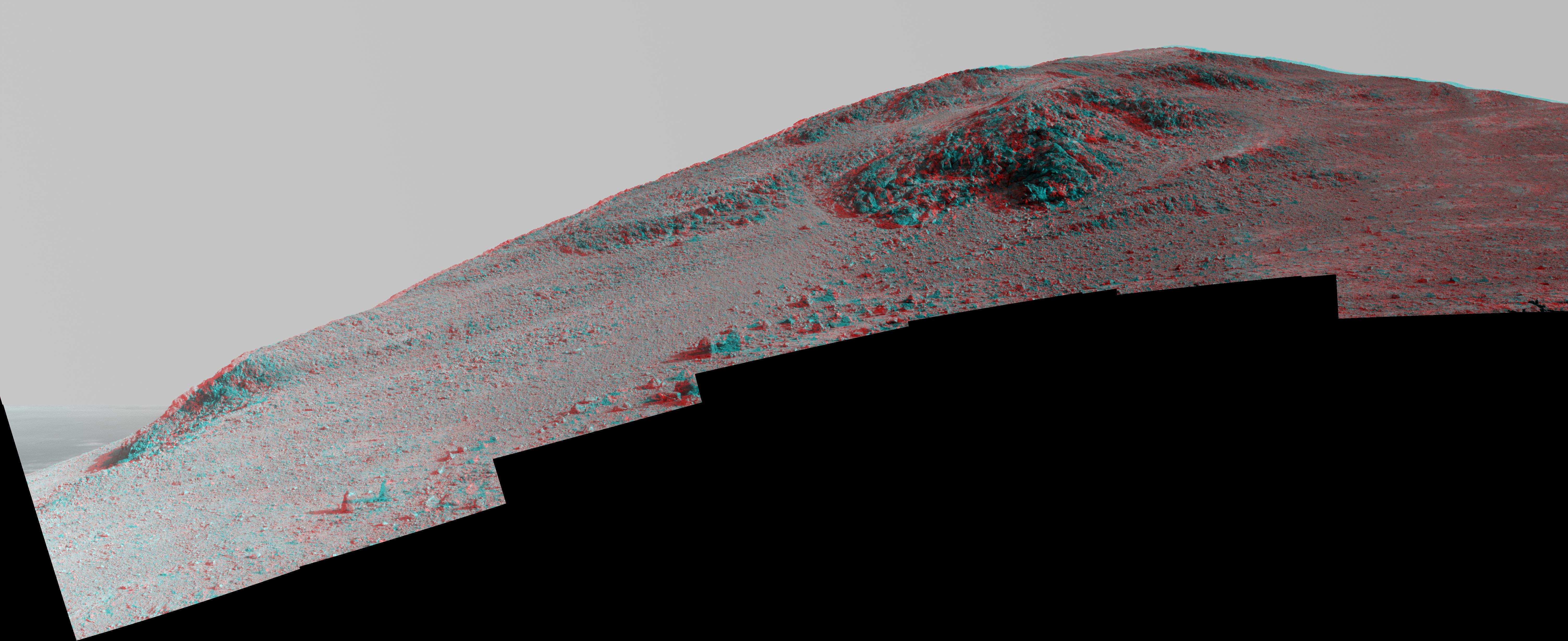
PIA20853:
-
'Spirit Mound' at Edge of Endeavour Crater, Mars (Anaglyph)
Full Resolution:
TIFF
(4.643 MB)
JPEG
(320.8 kB)
|
|
|
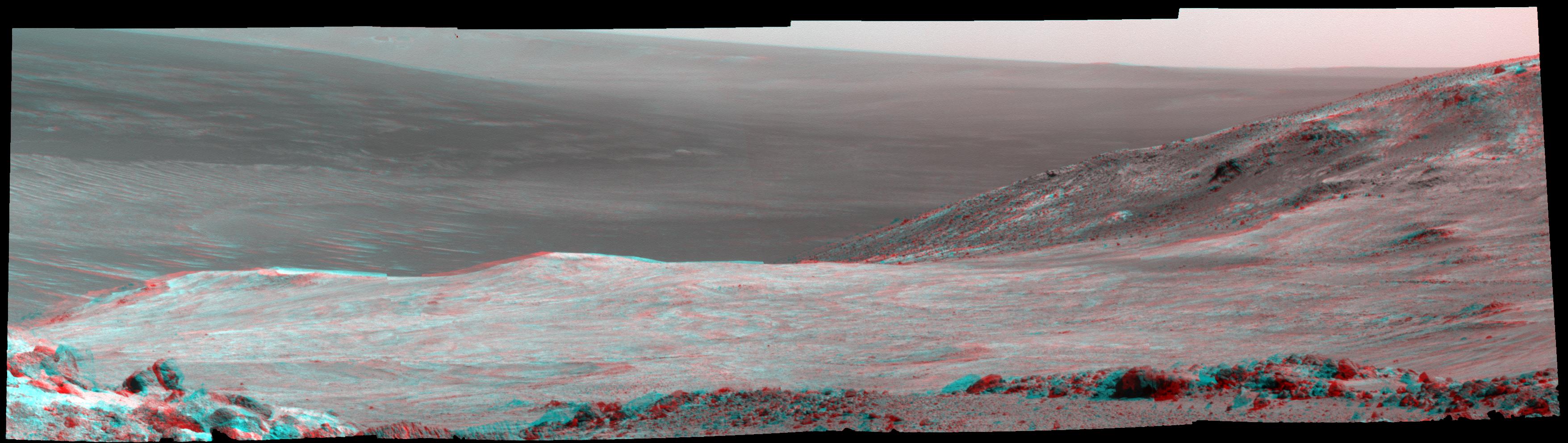
2017-01-25 |
Mars
|
Mars Reconnaissance Orbiter (MRO)
|
HiRISE
|
1062x1855x3 |
|
-
PIA21265:
-
Blade-Like Martian Walls Outline Polygons (Stereo)
Full Resolution:
TIFF
(5.31 MB)
JPEG
(331.2 kB)
|
|
|
2017-02-23 |
Mars
|
Mars Reconnaissance Orbiter (MRO)
|
HiRISE
|
2880x1800x3 |
|
-
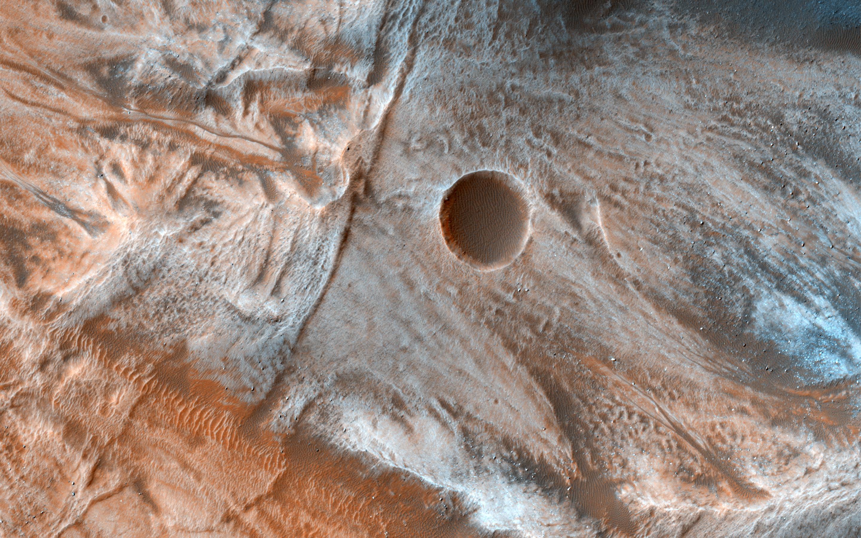
PIA21463:
-
Layers and Dark Dunes
Full Resolution:
TIFF
(15.56 MB)
JPEG
(931.6 kB)
|
|
|
2017-03-06 |
Mars
|
Mars Reconnaissance Orbiter (MRO)
|
HiRISE
|
2880x1800x3 |
|
-
PIA21554:
-
A Mass of Viscous Flow Features
Full Resolution:
TIFF
(15.56 MB)
JPEG
(924.8 kB)
|
|
|
2017-03-07 |
Mars
|
Mars Reconnaissance Orbiter (MRO)
|
HiRISE
|
2880x1800x3 |
|
-
PIA21555:
-
The Entrance to Mawrth Vallis
Full Resolution:
TIFF
(15.56 MB)
JPEG
(597.1 kB)
|
|
|
2017-05-12 |
Mars
|
Mars Reconnaissance Orbiter (MRO)
|
HiRISE
|
2880x1800x3 |

|
-
PIA21633:
-
Landslide!
Full Resolution:
TIFF
(15.56 MB)
JPEG
(1.122 MB)
|
|
|
2017-06-01 |
Mars
|
Mars Reconnaissance Orbiter (MRO)
|
HiRISE
|
2880x1800x1 |

|
-
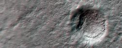
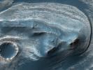
PIA21652:
-
A Triple Crater
Full Resolution:
TIFF
(5.191 MB)
JPEG
(768.3 kB)
|
|
|
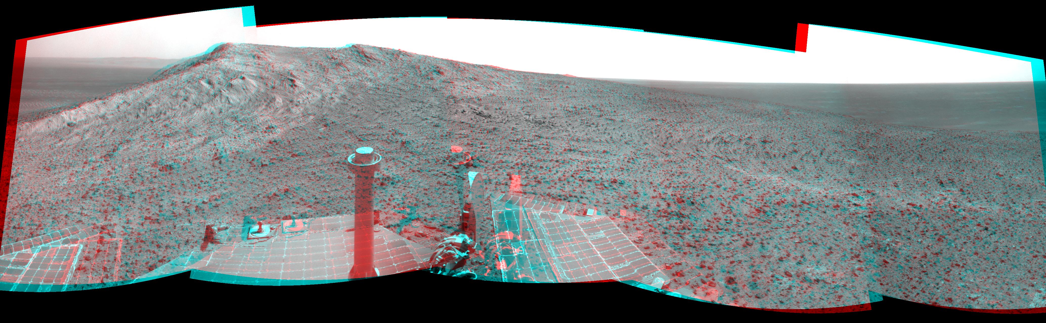
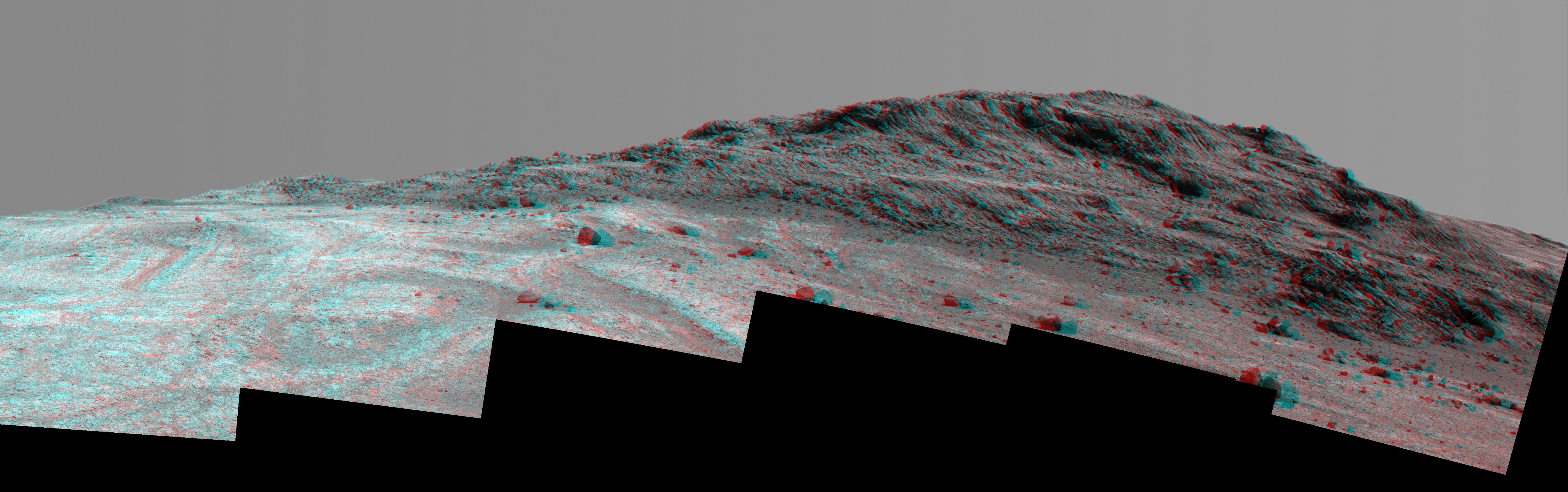
2017-06-16 |
Mars
|
Mars Exploration Rover (MER)
|
Panoramic Camera
|
9222x1452x3 |
|
-
PIA21706:
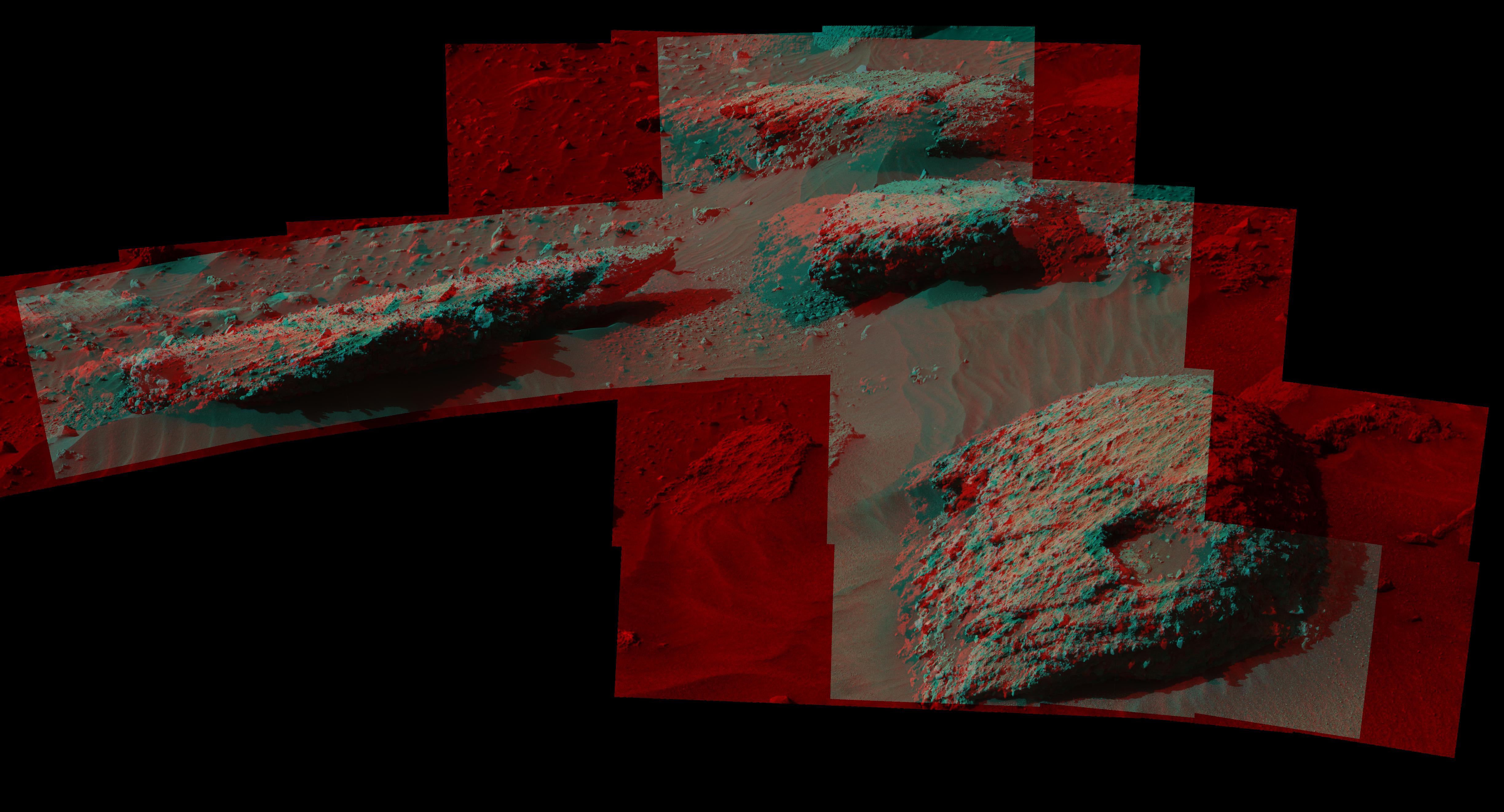
Mars Rover Opportunity's View of 'Orion Crater' (Stereo)
Full Resolution:
TIFF
(26.06 MB)
JPEG
(2.533 MB)
|
|
|
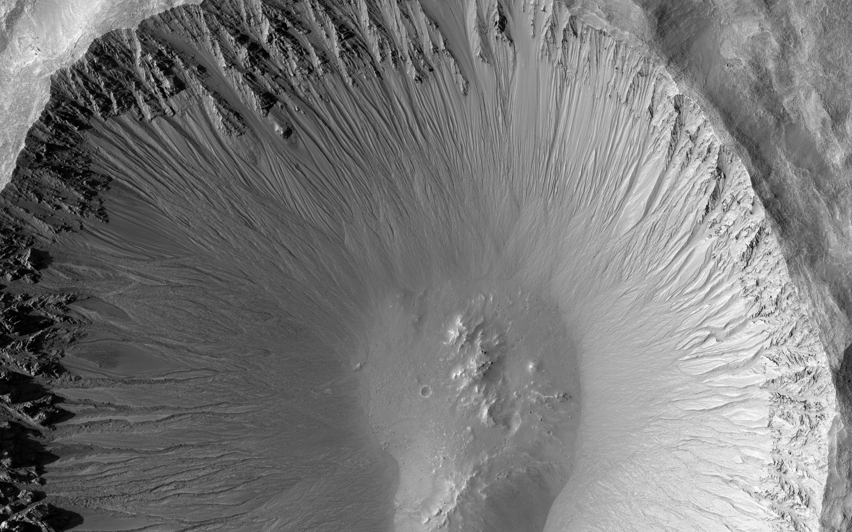
2017-06-26 |
Mars
|
Mars Reconnaissance Orbiter (MRO)
|
HiRISE
|
12000x7500x1 |
|
-
PIA21763:
-
The Niagara Falls of Mars
Full Resolution:
TIFF
(65.87 MB)
JPEG
(6.103 MB)
|
|
|
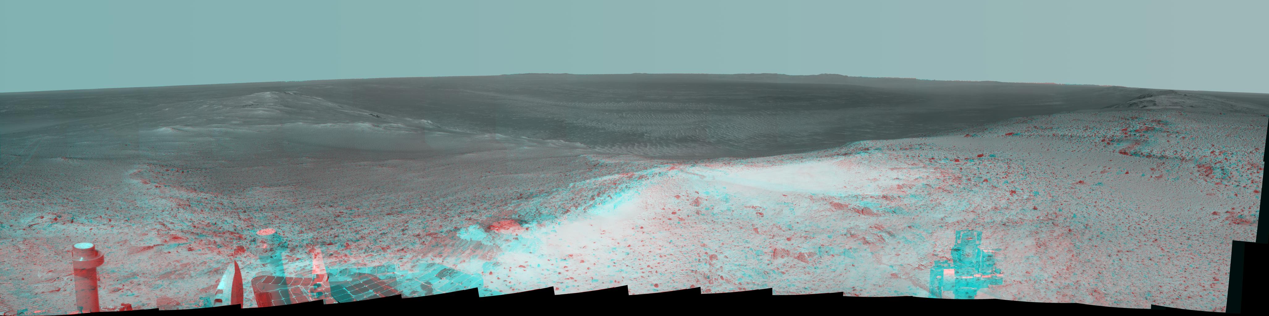
2017-07-20 |
Mars
|
Mars Exploration Rover (MER)
|
Panoramic Camera
|
7000x1070x3 |

|
-
PIA21721:
Panorama Above 'Perseverance Valley' on Mars (Stereo)
Full Resolution:
TIFF
(15.32 MB)
JPEG
(1.169 MB)
|
|
|
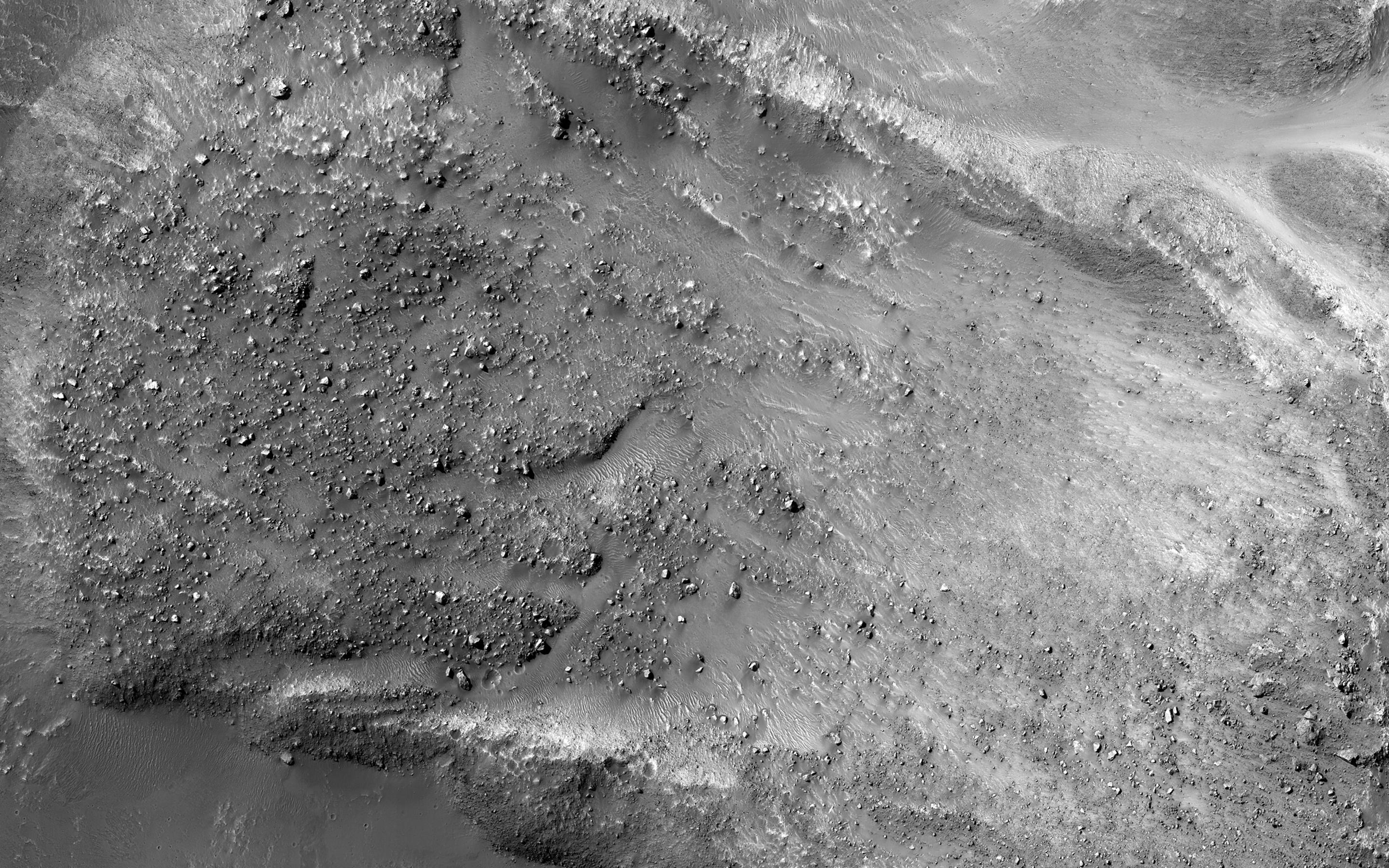
2018-04-02 |
Mars
|
Mars Reconnaissance Orbiter (MRO)
|
HiRISE
|
4500x3000x1 |

|
-
PIA22347:
-
Three Channels Exiting a Crater Lake
Full Resolution:
TIFF
(13.52 MB)
JPEG
(3.068 MB)
|
|
|
2019-03-04 |
Mars
|
Mars Reconnaissance Orbiter (MRO)
|
HiRISE
|
2880x1800x3 |
|
-
PIA23079:
-
Colorful Impact Ejecta in Ladon Valles
Full Resolution:
TIFF
(15.56 MB)
JPEG
(1.111 MB)
|
|
|
2019-03-12 |
Mars
|
Mars Exploration Rover (MER)
|
Panoramic Camera
|
900x201x3 |
|
-
PIA22909:
Opportunity Legacy Pan (True Color)
Full Resolution:
TIFF
(310.9 kB)
JPEG
(24.82 kB)
|
|
|
2019-03-12 |
Mars
|
Mars Exploration Rover (MER)
|
Panoramic Camera
|
900x201x3 |
|
-
PIA22910:
Opportunity Legacy Pan (Anaglyph)
Full Resolution:
TIFF
(316.2 kB)
JPEG
(23.12 kB)
|


