My
List |
Addition Date
|
Target
|
Mission
|
Instrument
|
Size
|

|
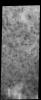
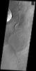
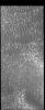
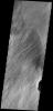
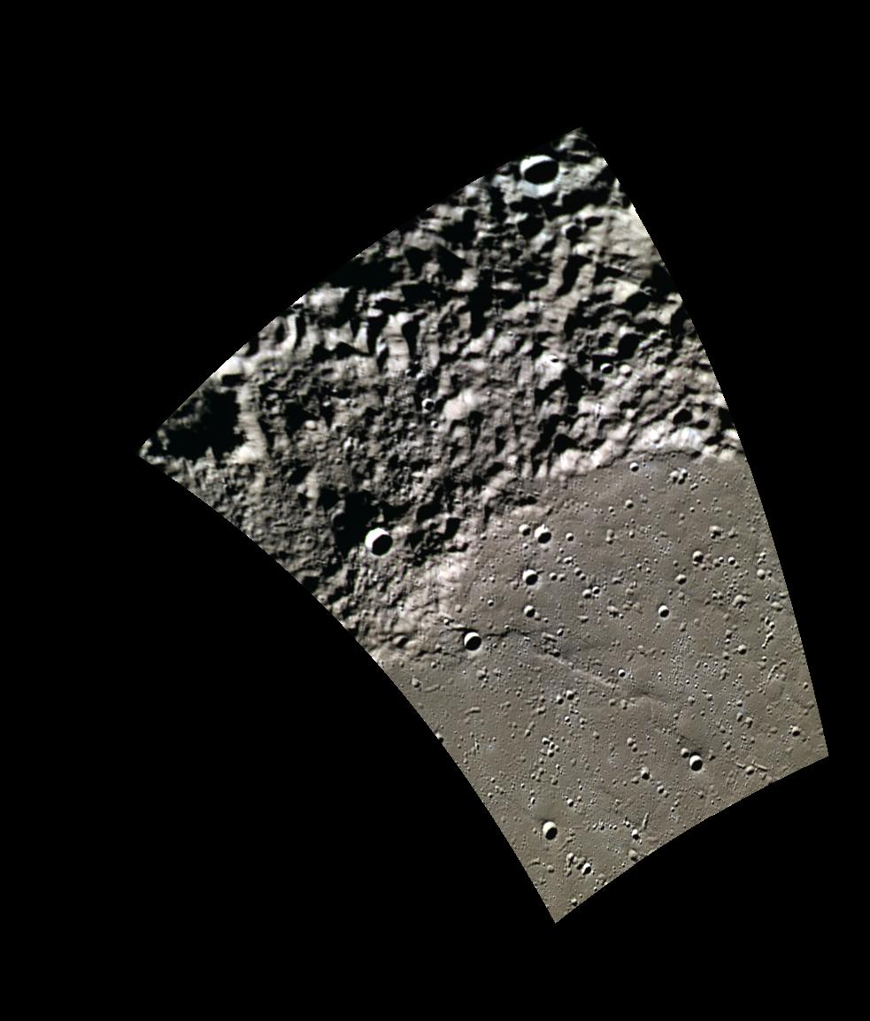
2014-06-26 |
Mars
|
2001 Mars Odyssey
|
THEMIS
|
1270x3069x1 |
|
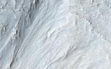
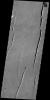
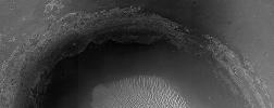
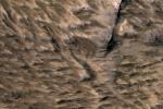
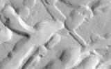
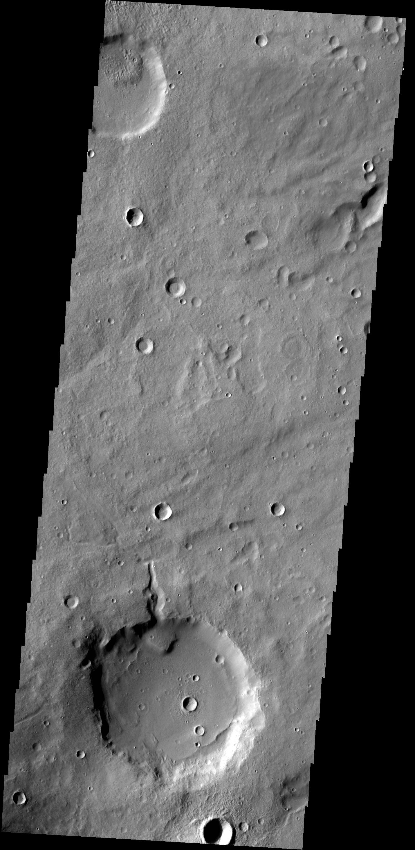
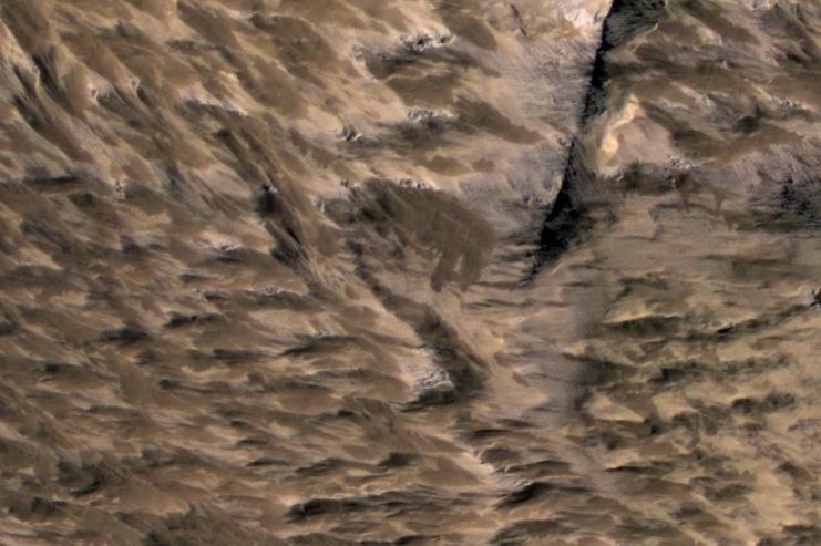
-
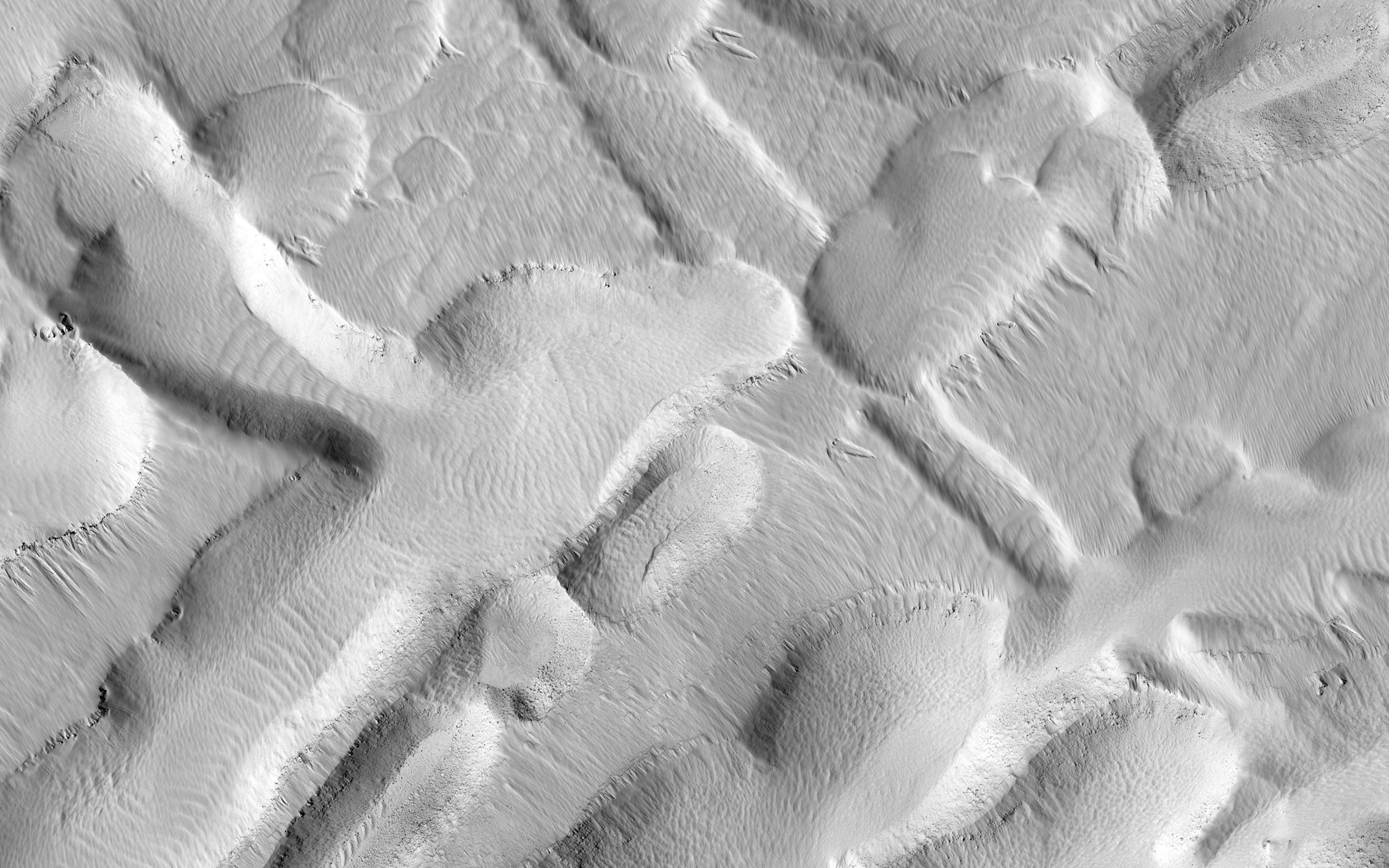
PIA18493:
-
Dust Devil Tracks
Full Resolution:
TIFF
(3.902 MB)
JPEG
(495.6 kB)
|
|
|
2014-06-25 |
Mercury
|
MESSENGER
|
MDIS - Wide Angle
|
723x723x1 |
|
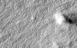
-
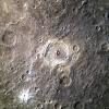
PIA18528:
-
Goal!!
Full Resolution:
TIFF
(523.5 kB)
JPEG
(85.41 kB)
|
|
|
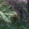
2014-06-25 |
Earth
|
Terra
|
ASTER
|
2049x1824x3 |

|
-
PIA18494:
-
Palouse, WA
Full Resolution:
TIFF
(11.22 MB)
JPEG
(793.4 kB)
|
|
|
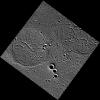
2014-06-25 |
Mars
|
2001 Mars Odyssey
|
THEMIS
|
1529x2936x1 |
|
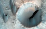
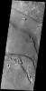
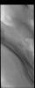
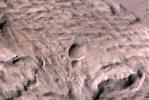
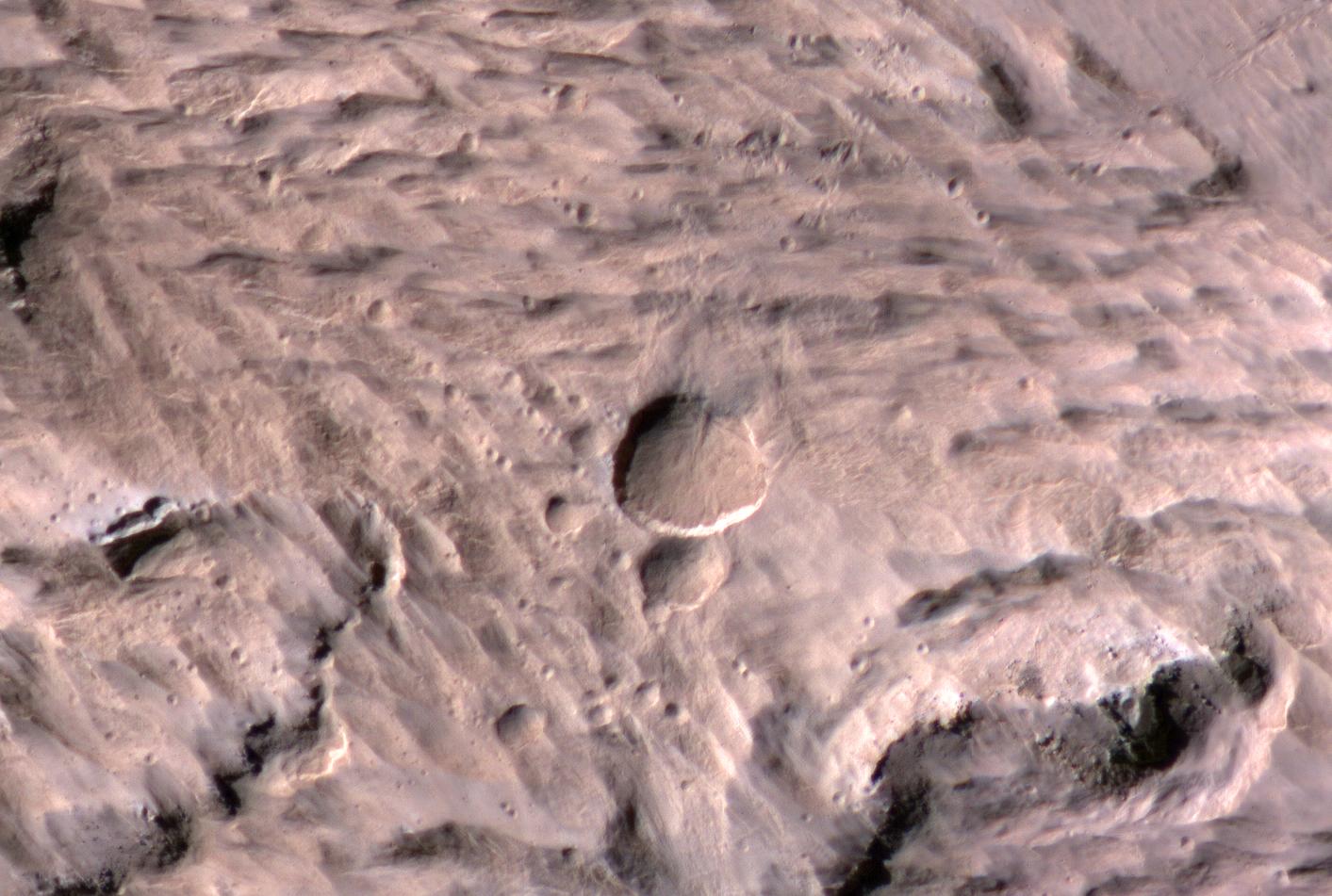
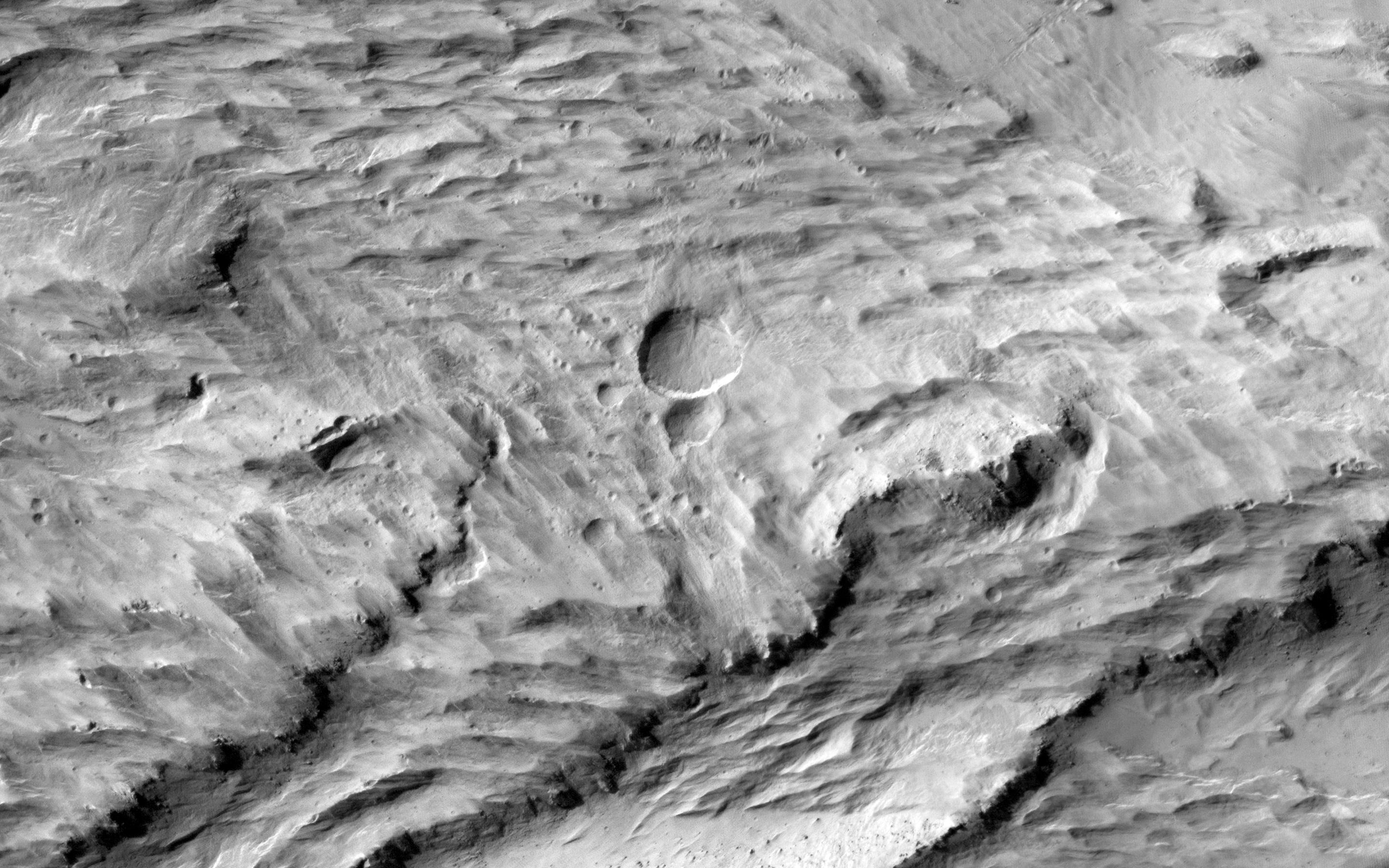
-
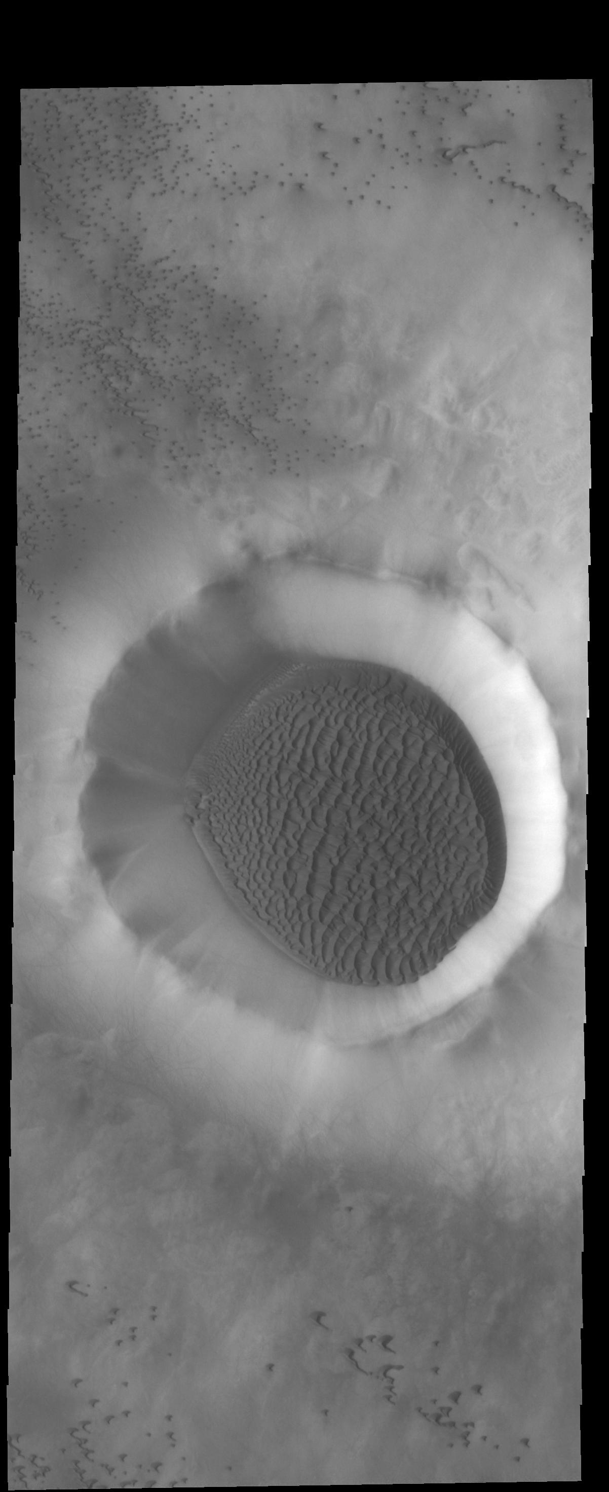
PIA18492:
-
Crater Fill
Full Resolution:
TIFF
(4.494 MB)
JPEG
(348.8 kB)
|
|
|
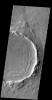
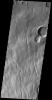
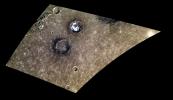
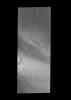
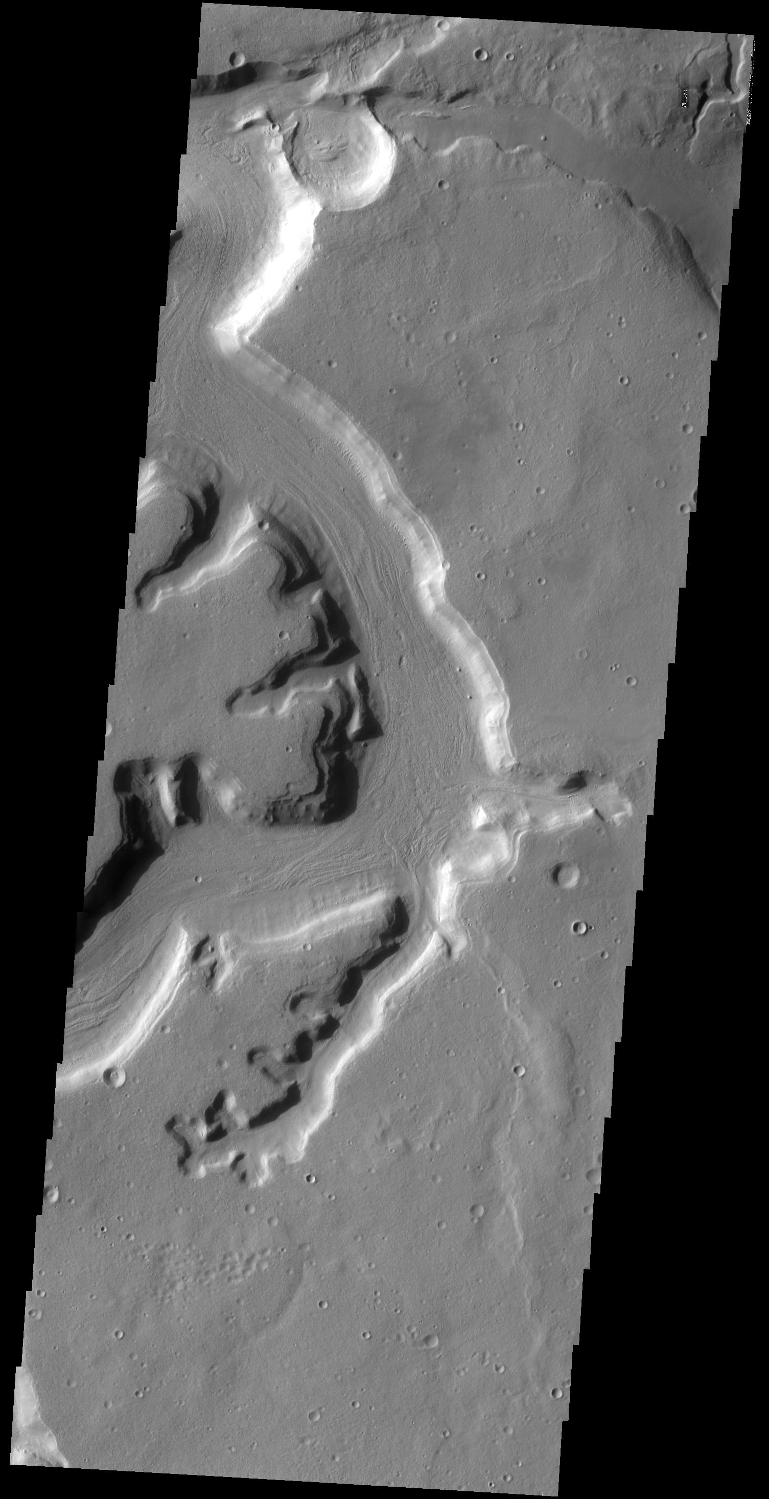
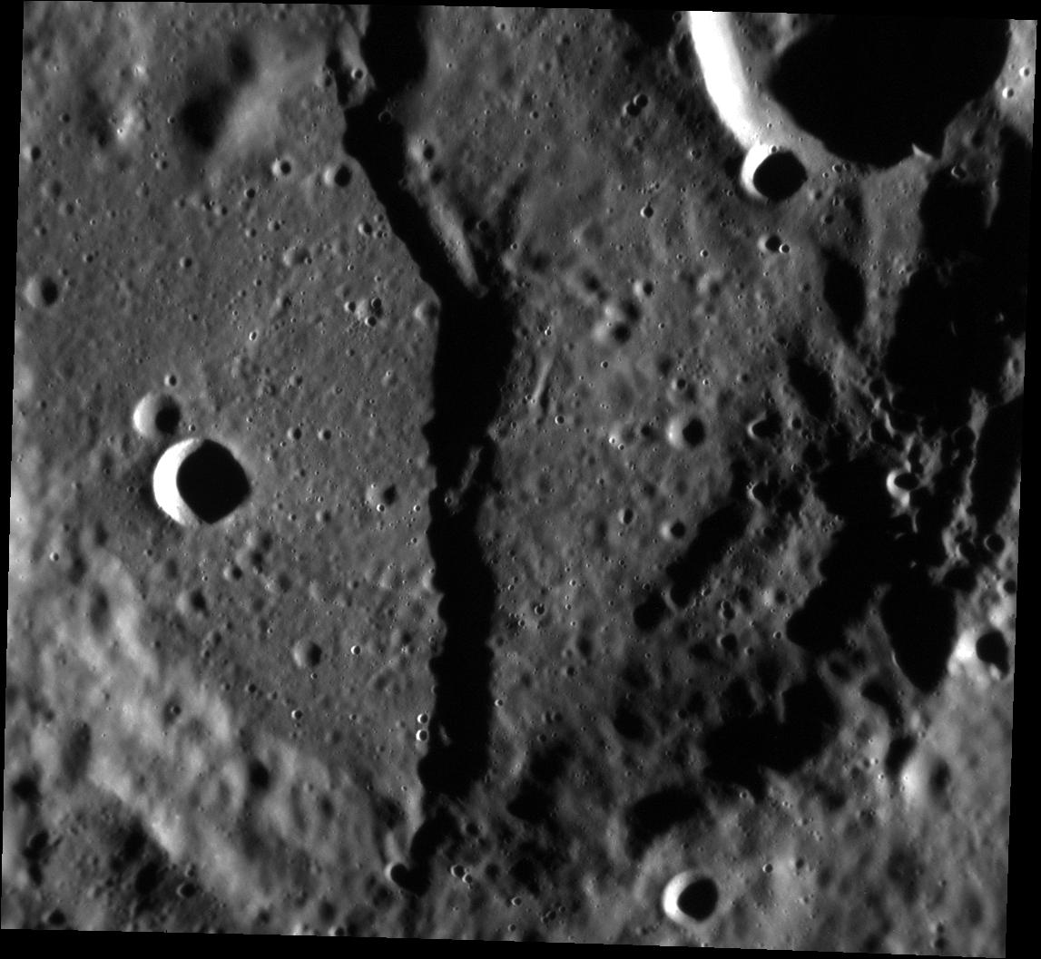
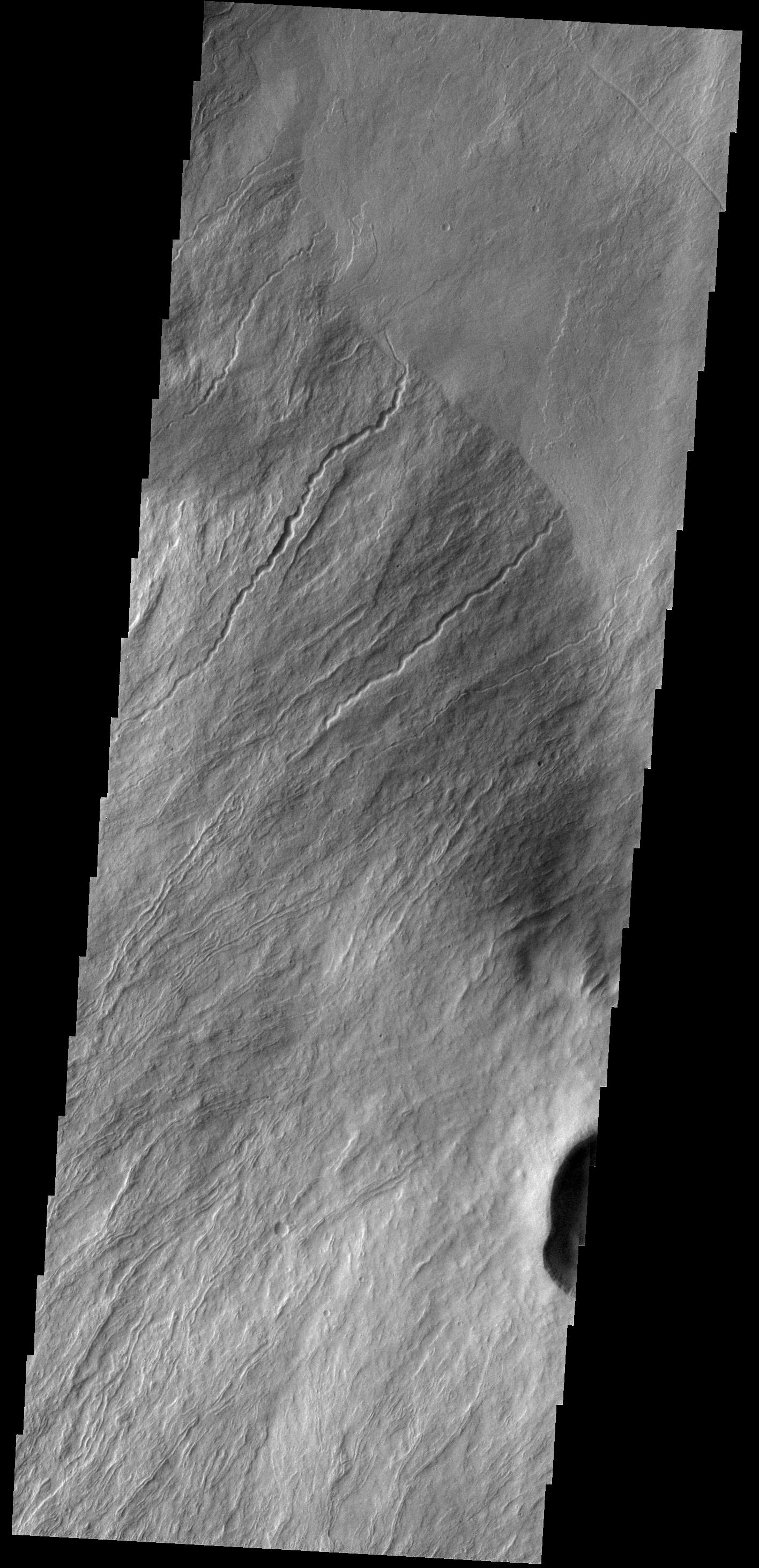
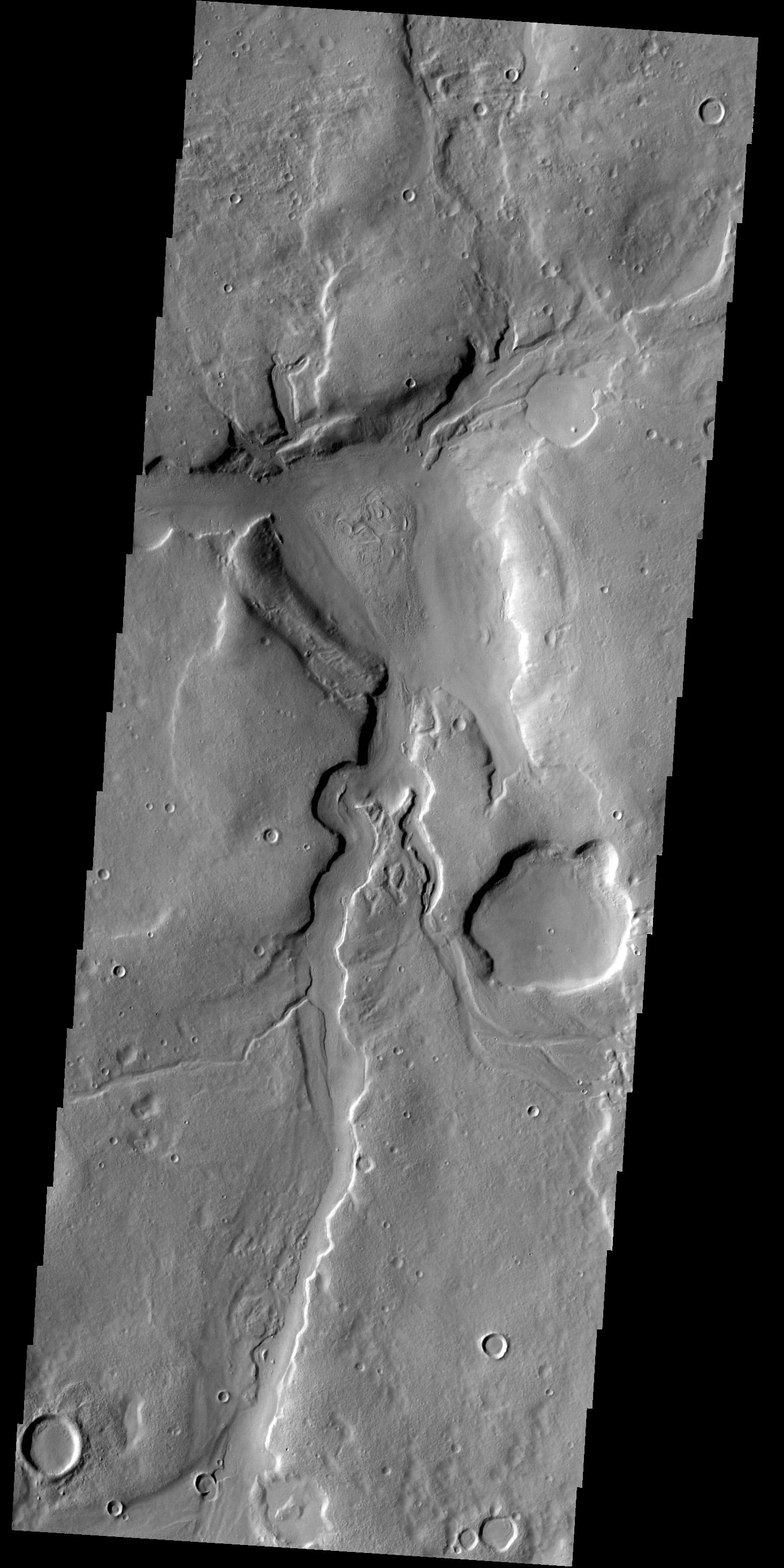
2014-06-24 |
Mars
|
2001 Mars Odyssey
|
THEMIS
|
1480x2929x1 |
|
-
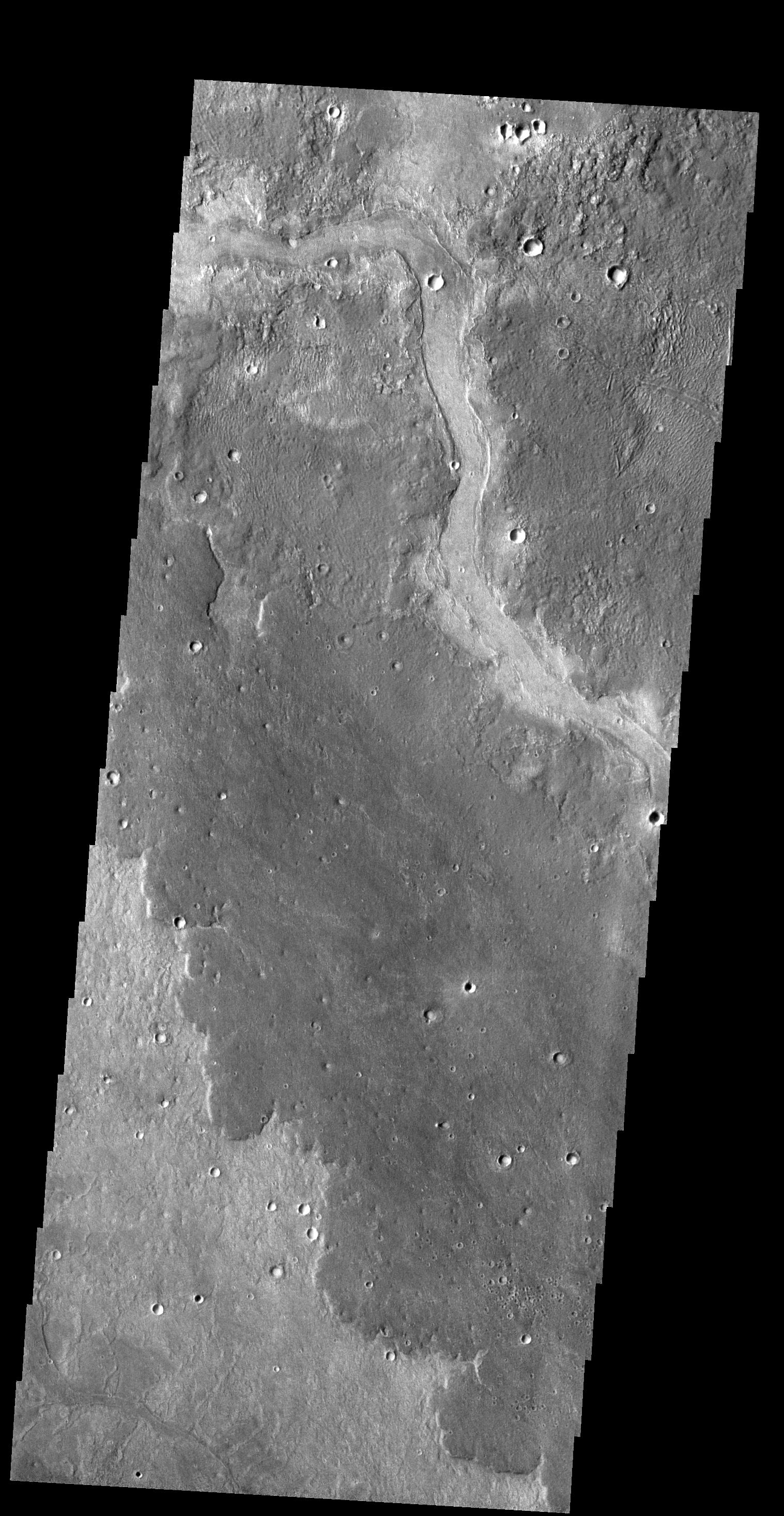
PIA18491:
-
Lava Channels
Full Resolution:
TIFF
(4.34 MB)
JPEG
(564 kB)
|
|
|
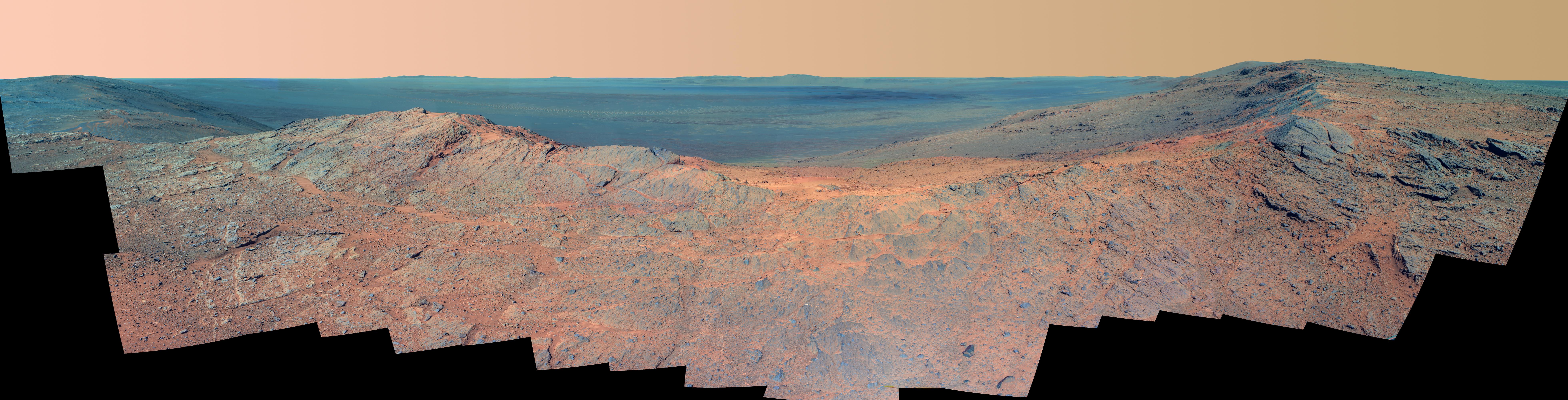
2014-06-23 |
Mars
|
Mars Exploration Rover (MER)
|
Panoramic Camera
|
7843x2000x3 |

|
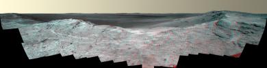
-
PIA18394:
'Pillinger Point' Overlooking Endeavour Crater on Mars (False Color)
Full Resolution:
TIFF
(47.07 MB)
JPEG
(2.293 MB)
|
|
|
2014-06-23 |
Mars
|
Mars Exploration Rover (MER)
|
Panoramic Camera
|
7793x2000x3 |
|
-
PIA18395:
'Pillinger Point' Overlooking Endeavour Crater on Mars (Stereo)
Full Resolution:
TIFF
(46.77 MB)
JPEG
(2.275 MB)
|
|
|
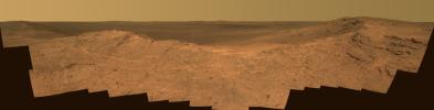
2014-06-23 |
Mars
|
Mars Exploration Rover (MER)
|
Panoramic Camera
|
7843x2000x3 |
|
-
PIA18393:
'Pillinger Point' Overlooking Endeavour Crater on Mars
Full Resolution:
TIFF
(47.07 MB)
JPEG
(1.723 MB)
|
|
|
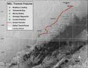
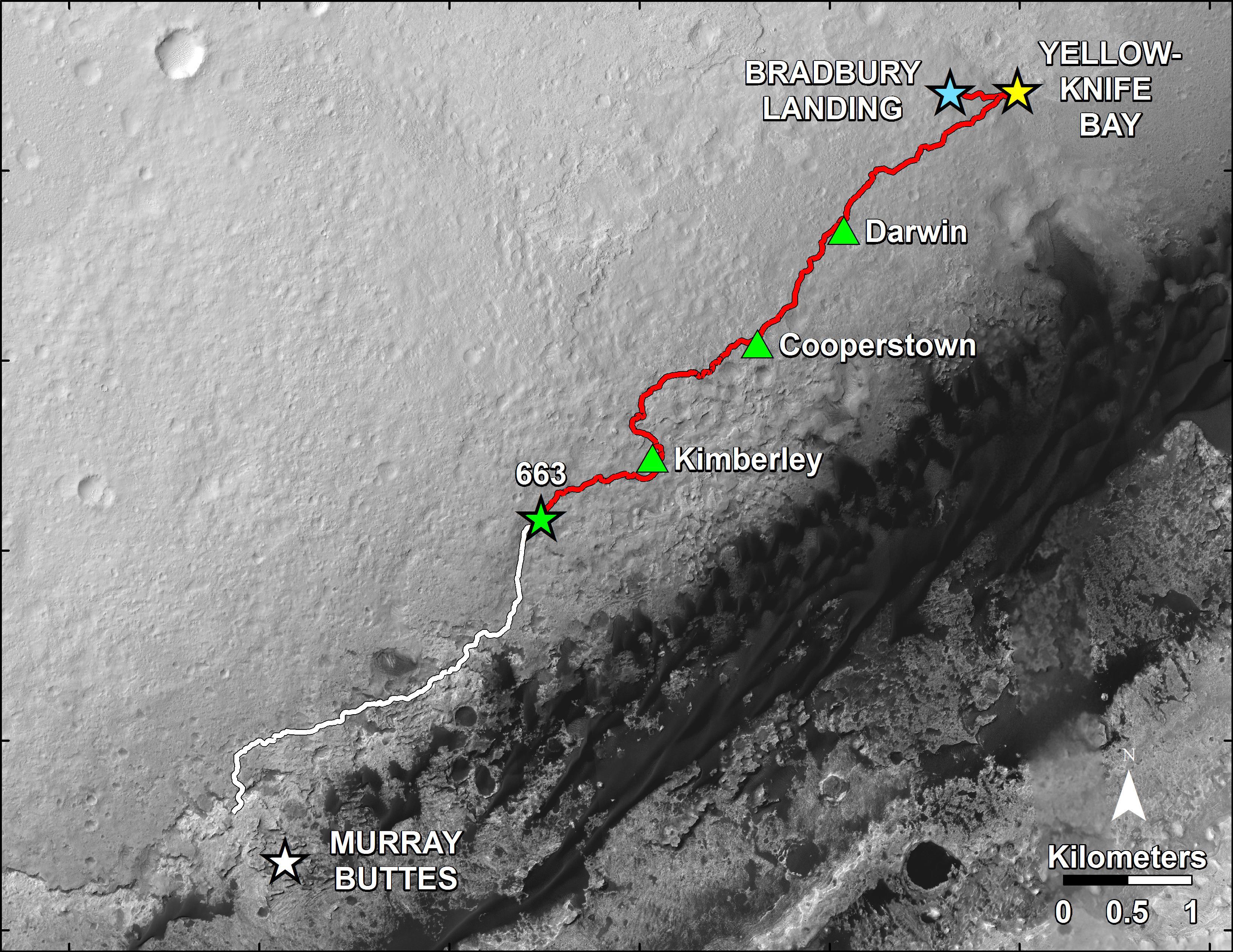
2014-06-23 |
Mars
|
Mars Science Laboratory (MSL)
|
HiRISE
|
3300x2550x3 |
|
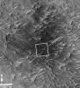
-
PIA18392:
-
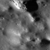
Curiosity Rover's Traverse, First 663 Sols on Mars
Full Resolution:
TIFF
(25.26 MB)
JPEG
(1.455 MB)
|
|
|
2014-06-23 |
Mars
|
Mars Science Laboratory (MSL)
|
HiRISE
|
3300x2550x3 |

|
-
PIA18391:
-
Curiosity's Progress on Route to Mount Sharp
Full Resolution:
TIFF
(25.26 MB)
JPEG
(1.565 MB)
|
|
|
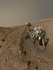
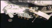
2014-06-23 |
Mars
|
Mars Science Laboratory (MSL)
|
MAHLI
|
7072x9424x3 |
|
-
PIA18390:
-
Curiosity Self-Portrait at 'Windjana' Drilling Site
Full Resolution:
TIFF
(200 MB)
JPEG
(5.43 MB)
|
|
|
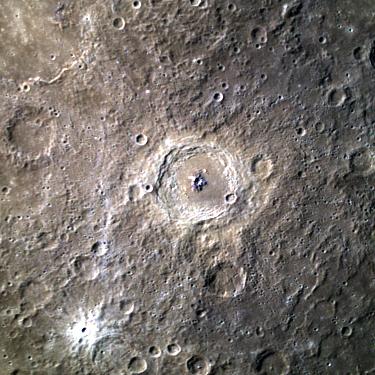
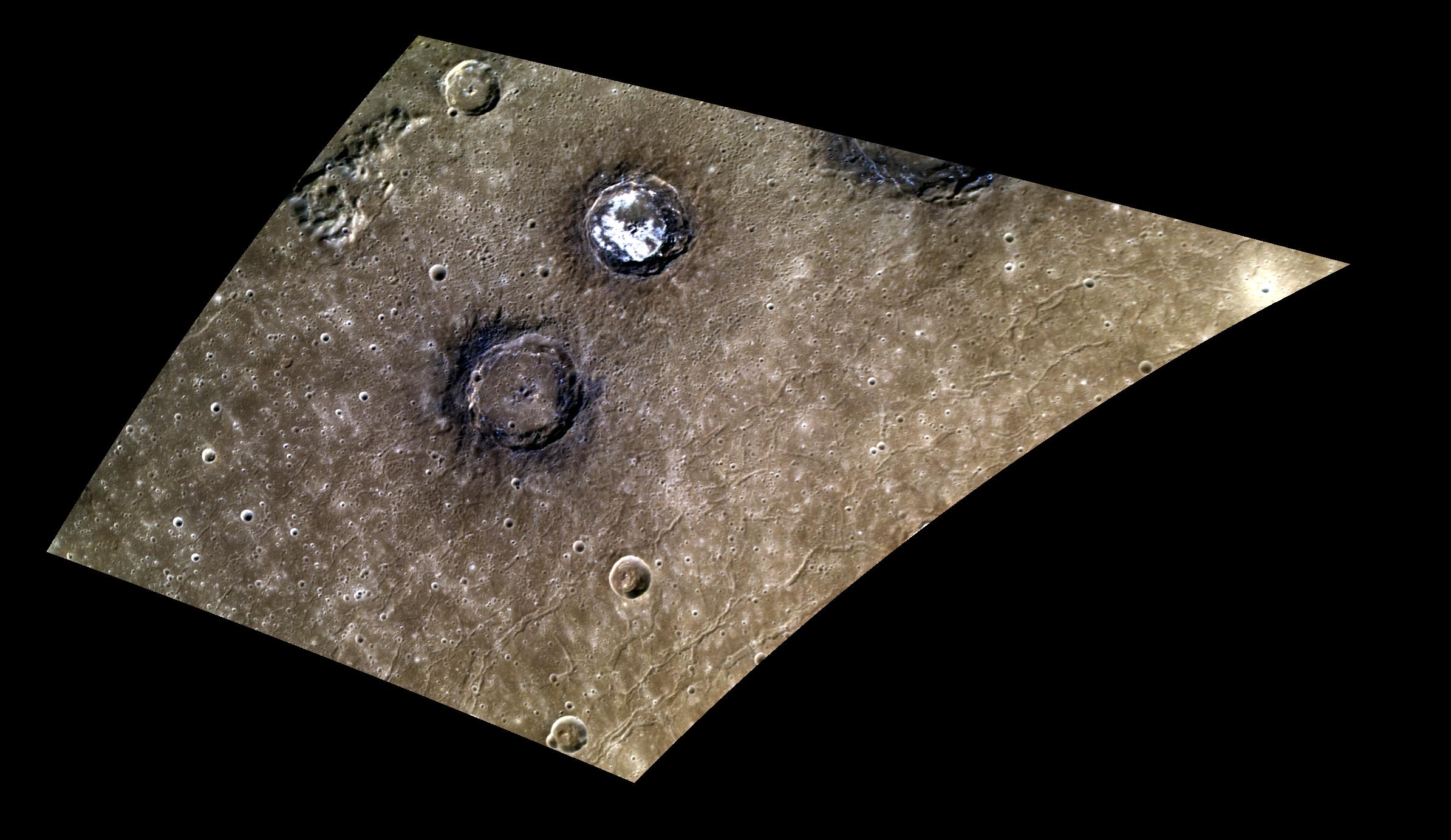
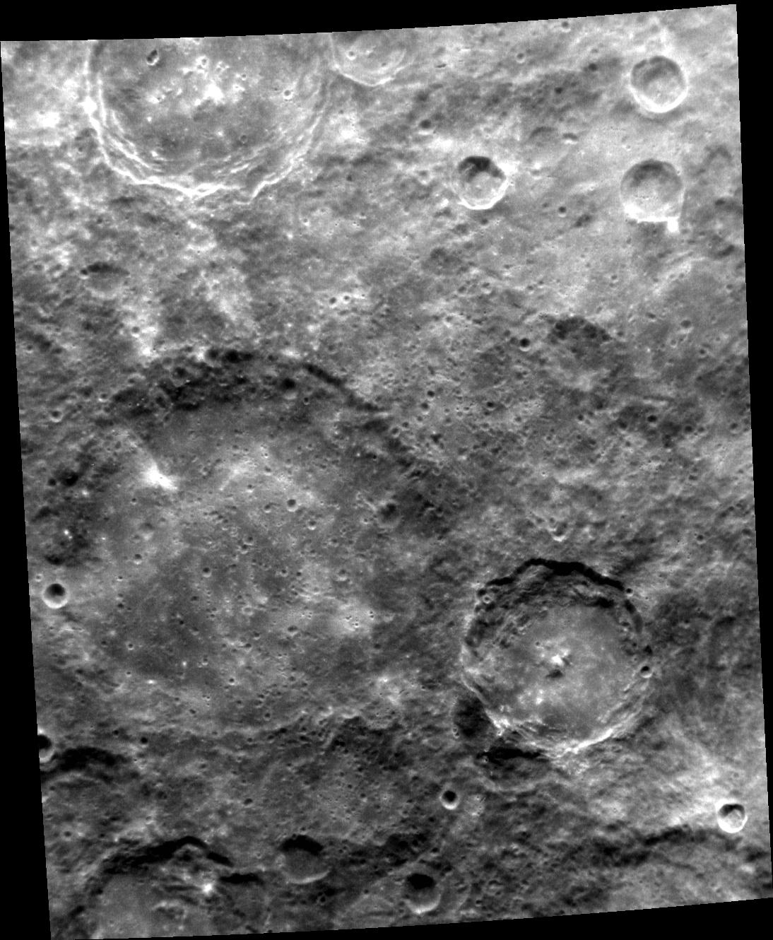
2014-06-23 |
Mercury
|
MESSENGER
|
MASCS
Mercury Dual Imaging System (MDIS)
|
1826x2500x3 |
|
-
PIA18527:
-
Bright and Dark
Full Resolution:
TIFF
(13.7 MB)
JPEG
(586 kB)
|
|
|
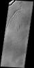
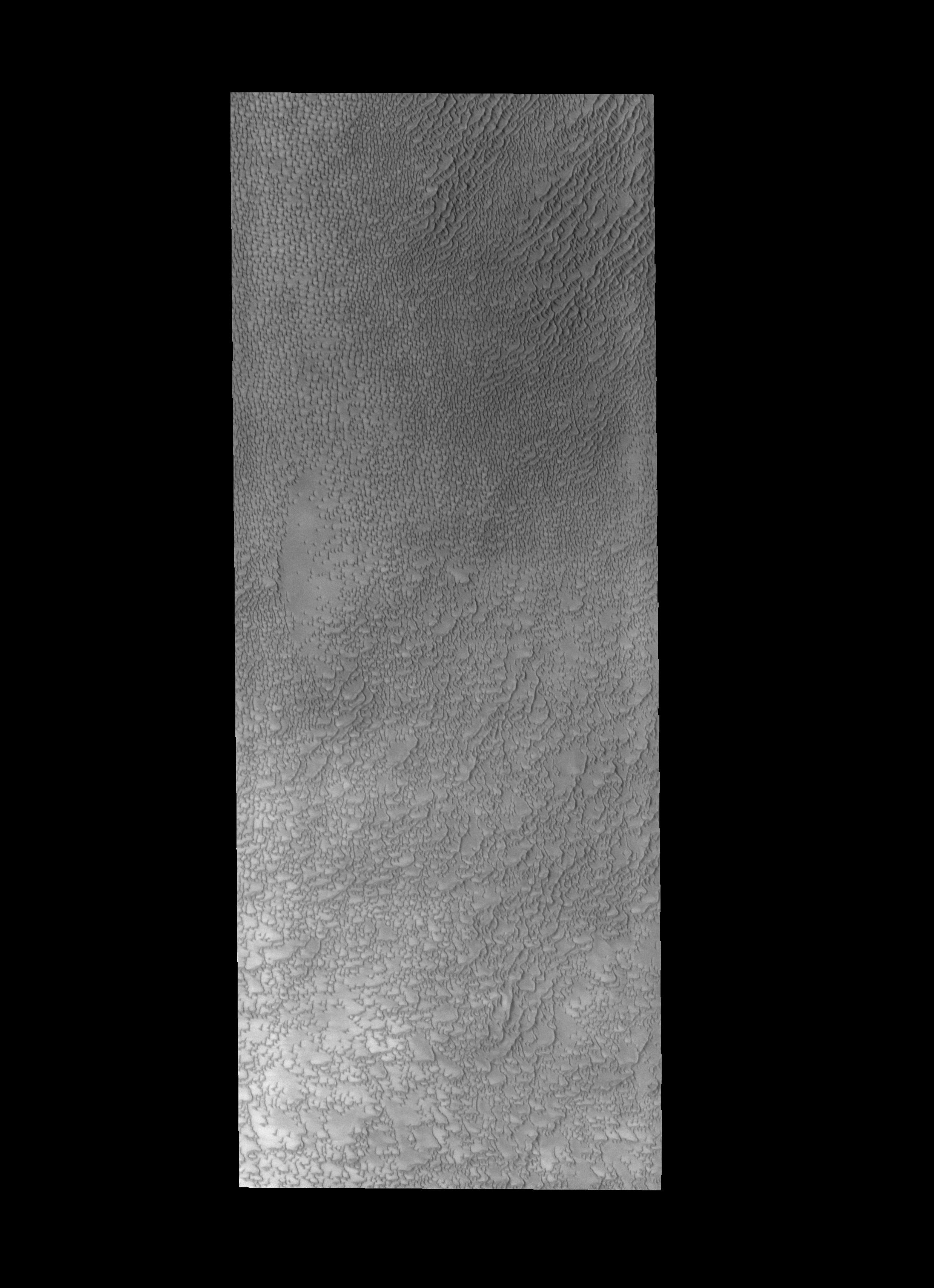
2014-06-23 |
Mars
|
2001 Mars Odyssey
|
THEMIS
|
1277x3085x1 |

|
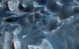
-
PIA18490:
-
Crater Dunes
Full Resolution:
TIFF
(3.944 MB)
JPEG
(197.8 kB)
|
|
|
2014-06-23 |
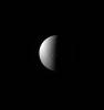
Titan
|
Cassini-Huygens
|
ISS - Narrow Angle
|
768x711x1 |
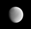
|
-
PIA17168:
-
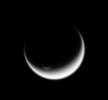
Subtle Titan
Full Resolution:
TIFF
(546.8 kB)
JPEG
(11.52 kB)
|
|
|
2014-06-20 |
Mercury
|
MESSENGER
|
MDIS - Narrow Angle
|
1410x1480x1 |
|
-
PIA18526:
-
Halo of Hollows
Full Resolution:
TIFF
(2.089 MB)
JPEG
(277.5 kB)
|
|
|
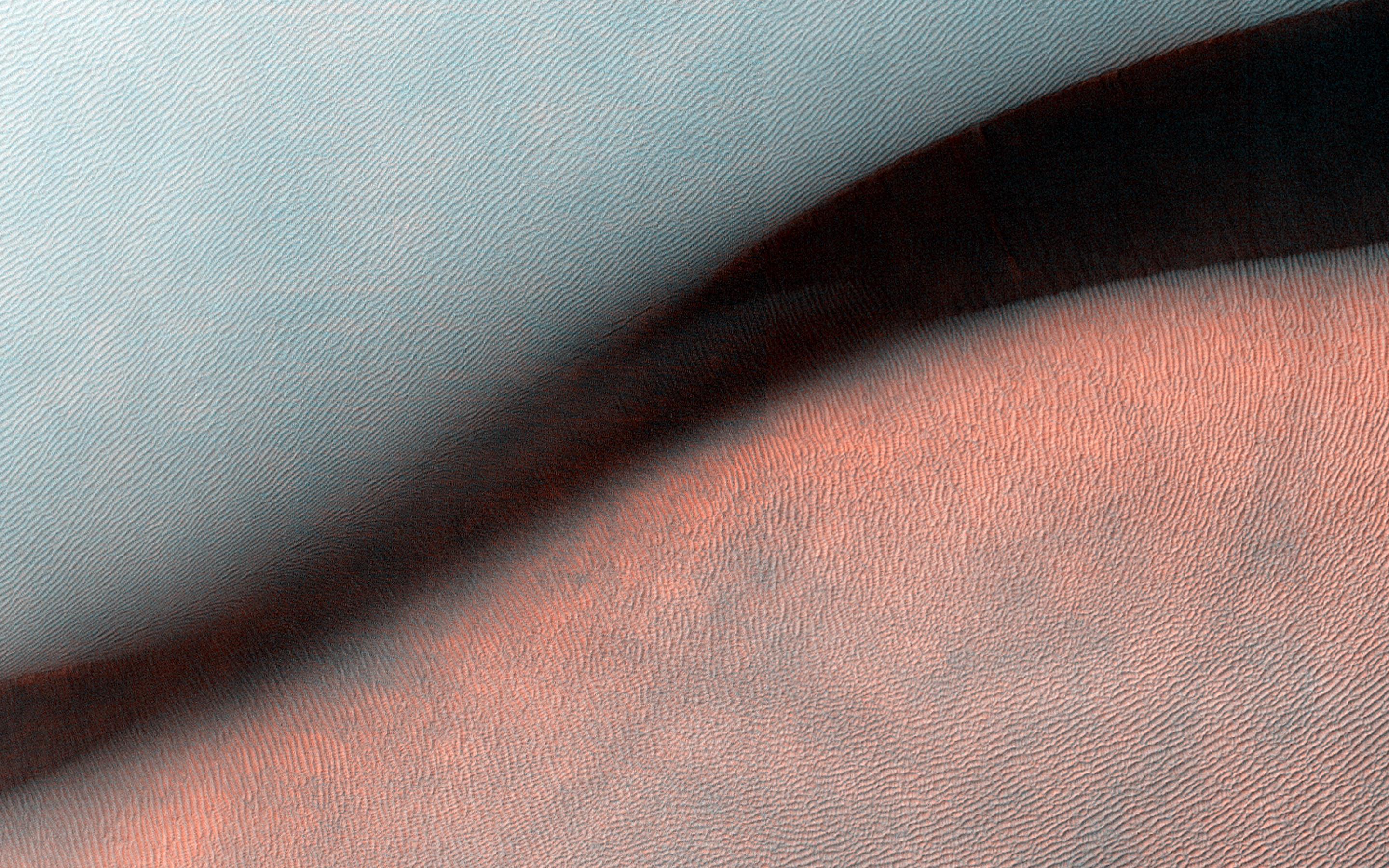
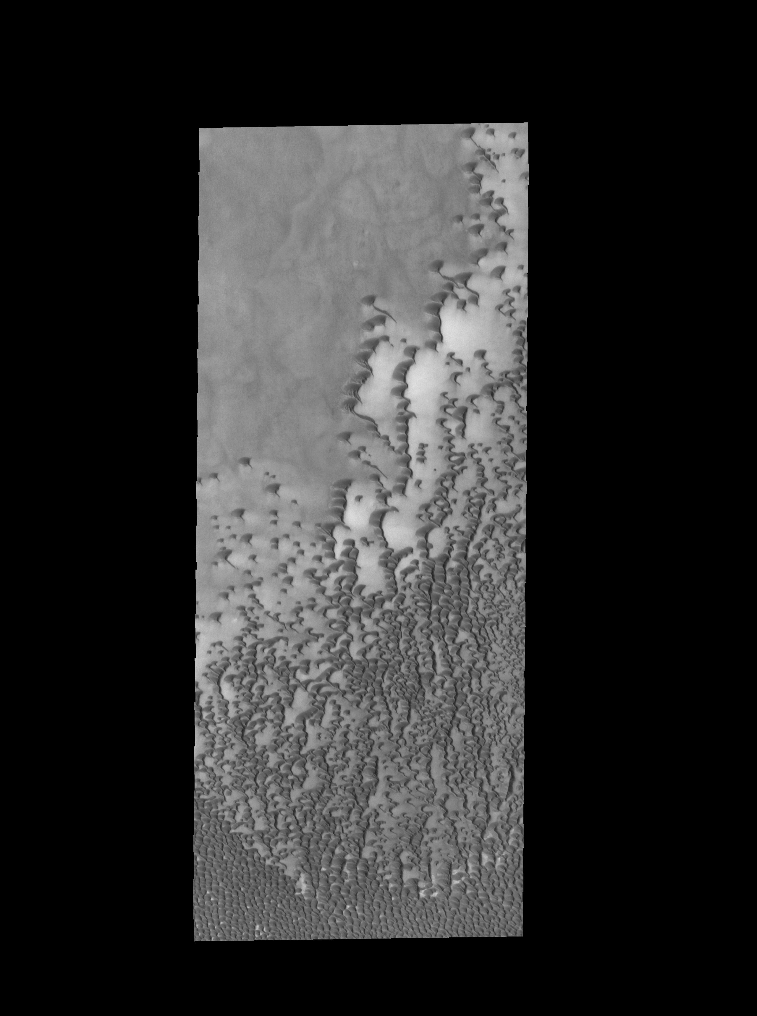
2014-06-20 |
Mars
|
2001 Mars Odyssey
|
THEMIS
|
1166x2879x1 |

|
-
PIA18489:
-
Polar Dunes
Full Resolution:
TIFF
(3.36 MB)
JPEG
(164.7 kB)
|
|
|
2014-06-19 |
Comet
|
Rosetta
|
OSIRIS
|
1025x1025x3 |
|
-
PIA18516:
-
Rosetta Closing In
Full Resolution:
TIFF
(1.054 MB)
JPEG
(36.24 kB)
|
|
|
2014-06-19 |
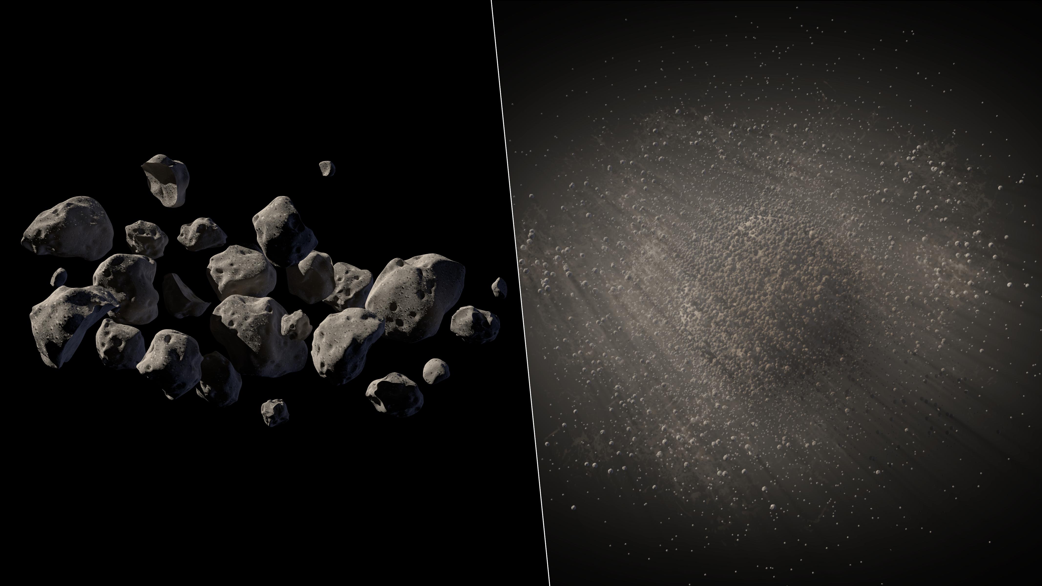
Asteroid
|
Spitzer Space Telescope
|
|
4267x2400x3 |
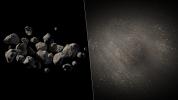
|
-
PIA18456:
-
The Spacious Structure of Asteroid 2011 MD (Artist's Concept)
Full Resolution:
TIFF
(30.74 MB)
JPEG
(529.5 kB)
|
|
|
2014-06-19 |
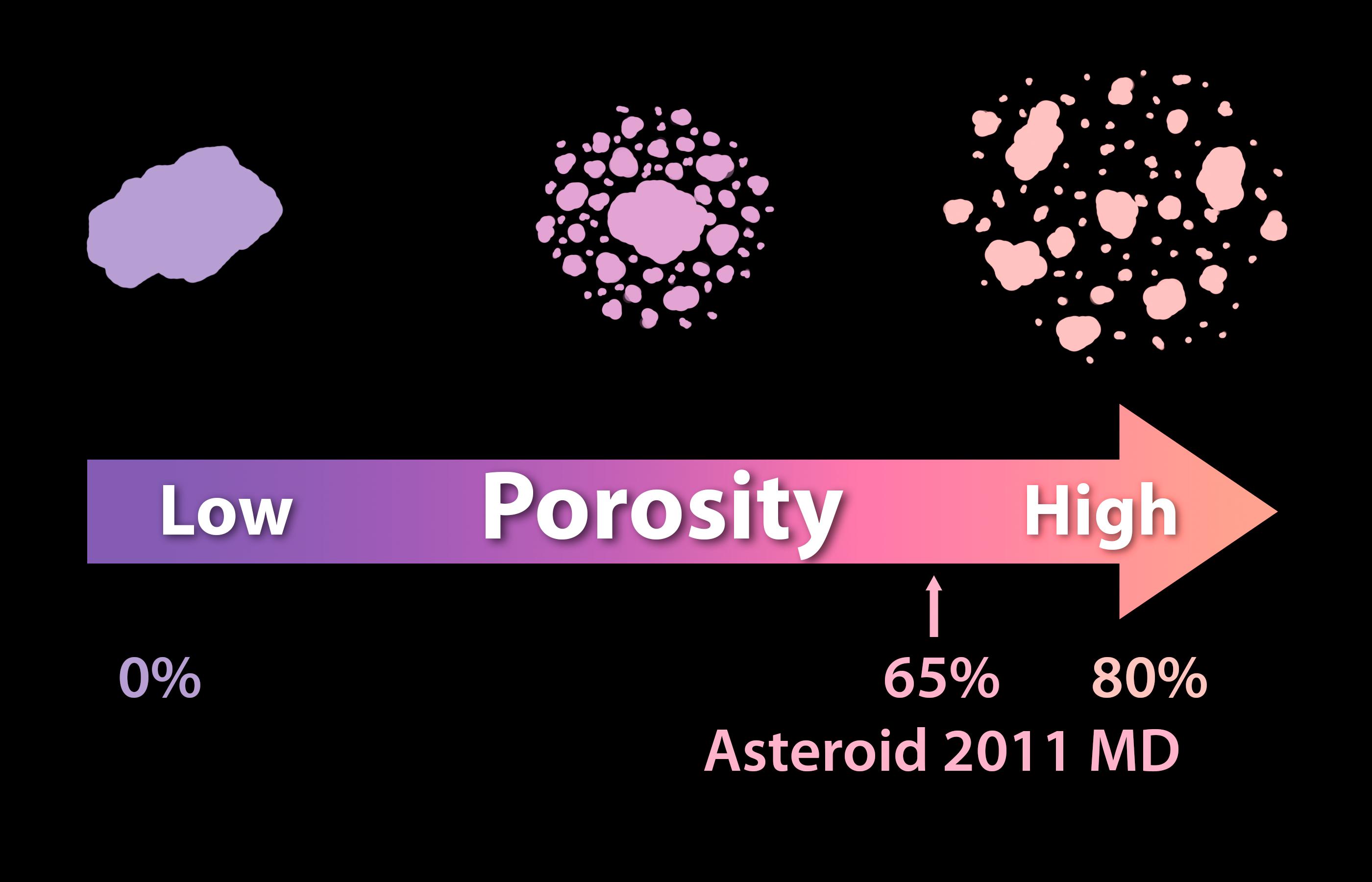
Asteroid
|
Spitzer Space Telescope
|
|
2800x1800x3 |

|
-
PIA18455:
-
Solid as a Rock? Porosity of Asteroids
Full Resolution:
TIFF
(15.13 MB)
JPEG
(196.5 kB)
|
|
|
2014-06-19 |
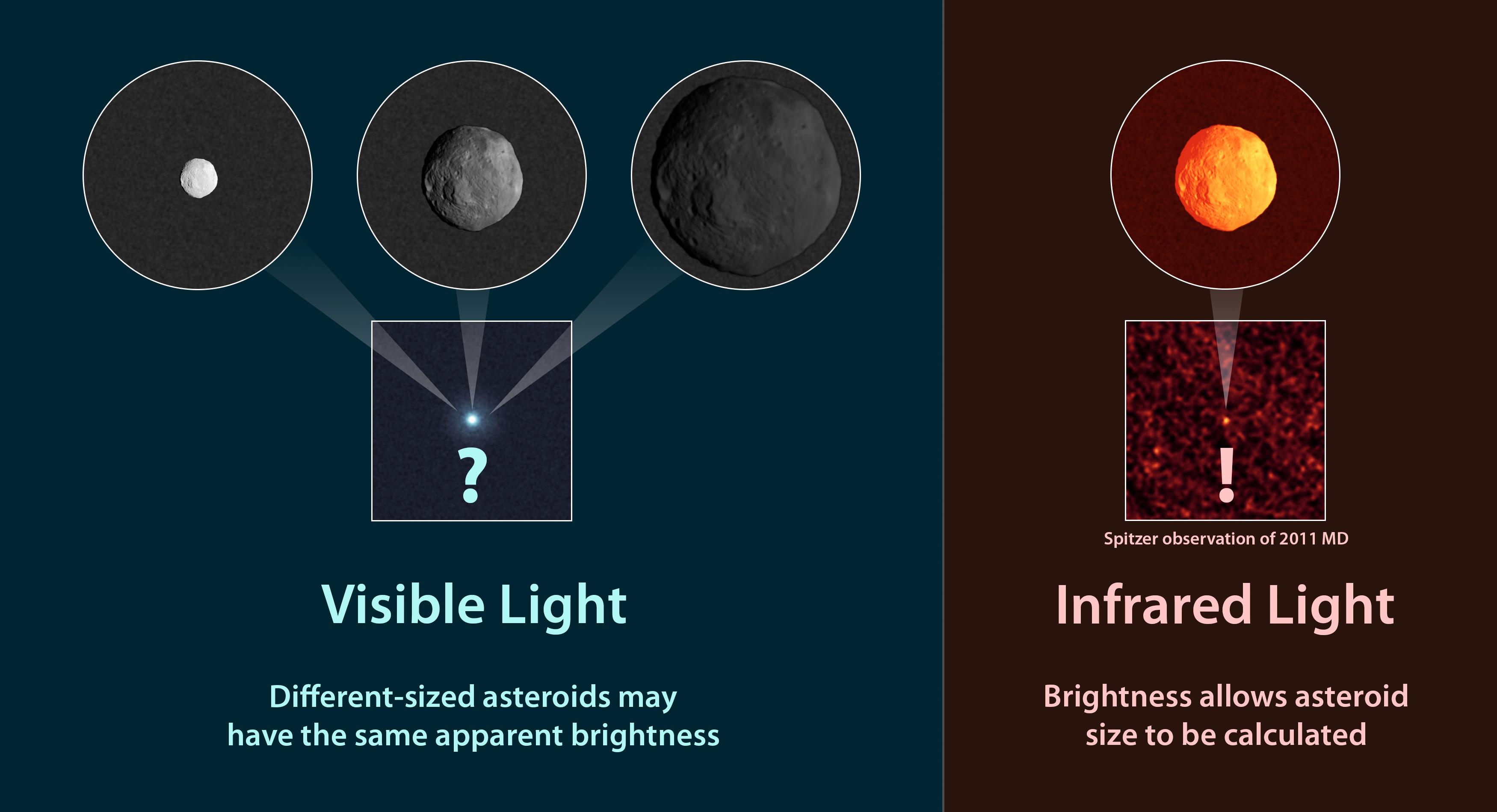
Asteroid
|
Spitzer Space Telescope
|
|
3500x1900x3 |
|
-
PIA18454:
-
How to Measure the Size of an Asteroid
Full Resolution:
TIFF
(19.96 MB)
JPEG
(305.5 kB)
|
|
|
2014-06-19 |
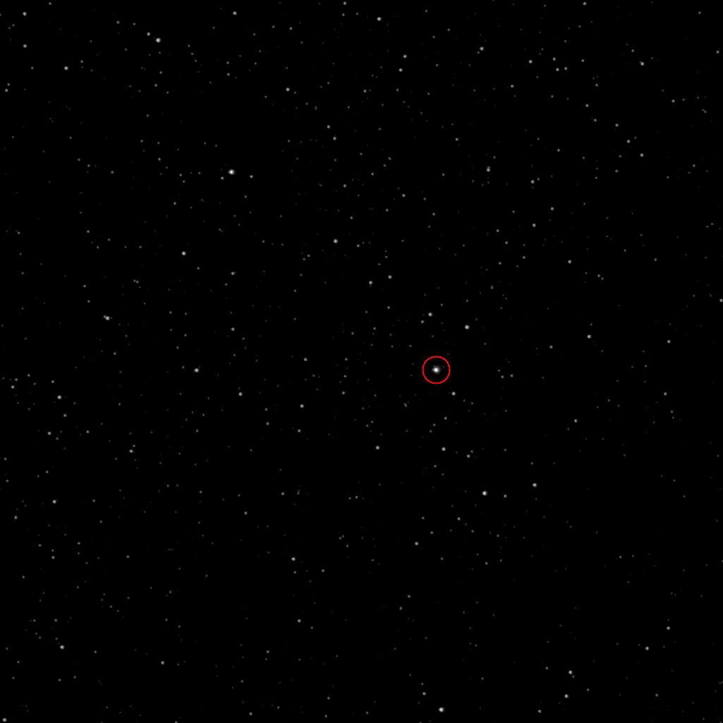
Asteroid
|
Spitzer Space Telescope
|
IRAC
|
1120x1120x3 |
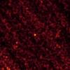
|
-
PIA18453:
-
I Spy a Little Asteroid With My Infrared Eye
Full Resolution:
TIFF
(3.765 MB)
JPEG
(42.88 kB)
|
|
|
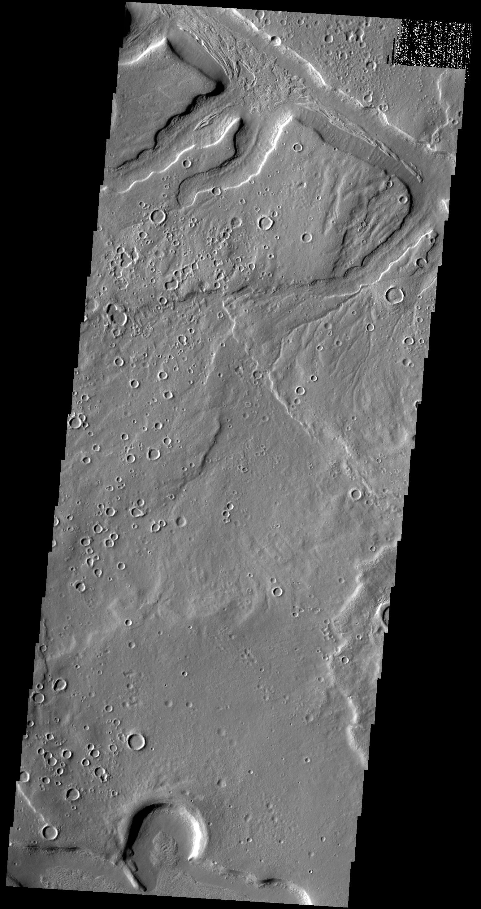
2014-06-19 |
Mars
|
2001 Mars Odyssey
|
THEMIS
|
1505x2931x1 |

|
-
PIA18488:
-
Mamers Valles
Full Resolution:
TIFF
(4.416 MB)
JPEG
(367.7 kB)
|
|
|
2014-06-18 |
Mercury
|
MESSENGER
|
MDIS - Wide Angle
|
781x882x3 |
|
-
PIA18525:
-
Craters, Peaks, and Chains
Full Resolution:
TIFF
(2.067 MB)
JPEG
(74.17 kB)
|
|
|
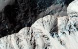
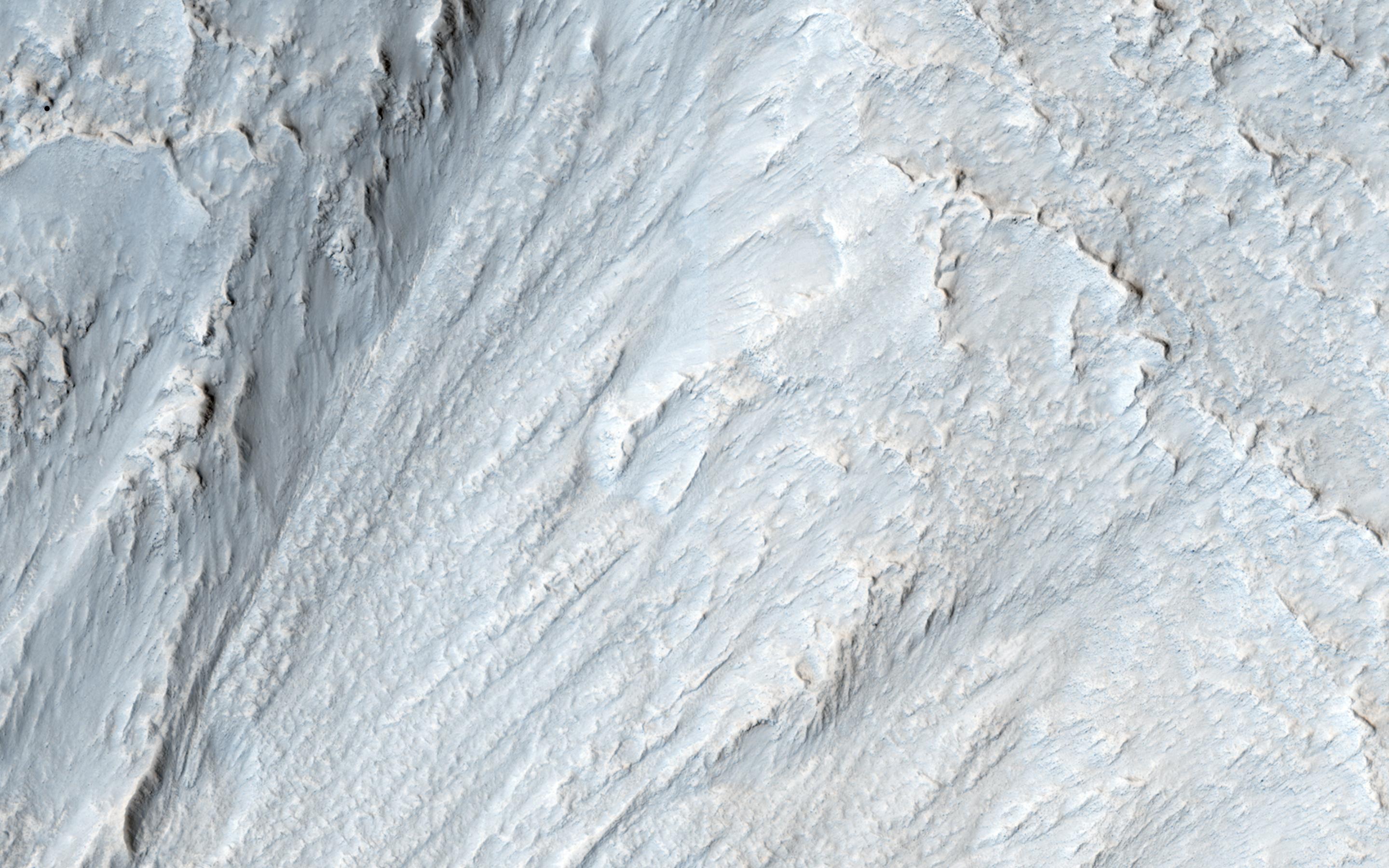
2014-06-18 |
Mars
|
Mars Reconnaissance Orbiter (MRO)
|
HiRISE
|
2880x1800x3 |
|
-
PIA18588:
-
Moving Mass Material on a Mesa
Full Resolution:
TIFF
(15.56 MB)
JPEG
(650.1 kB)
|
|
|
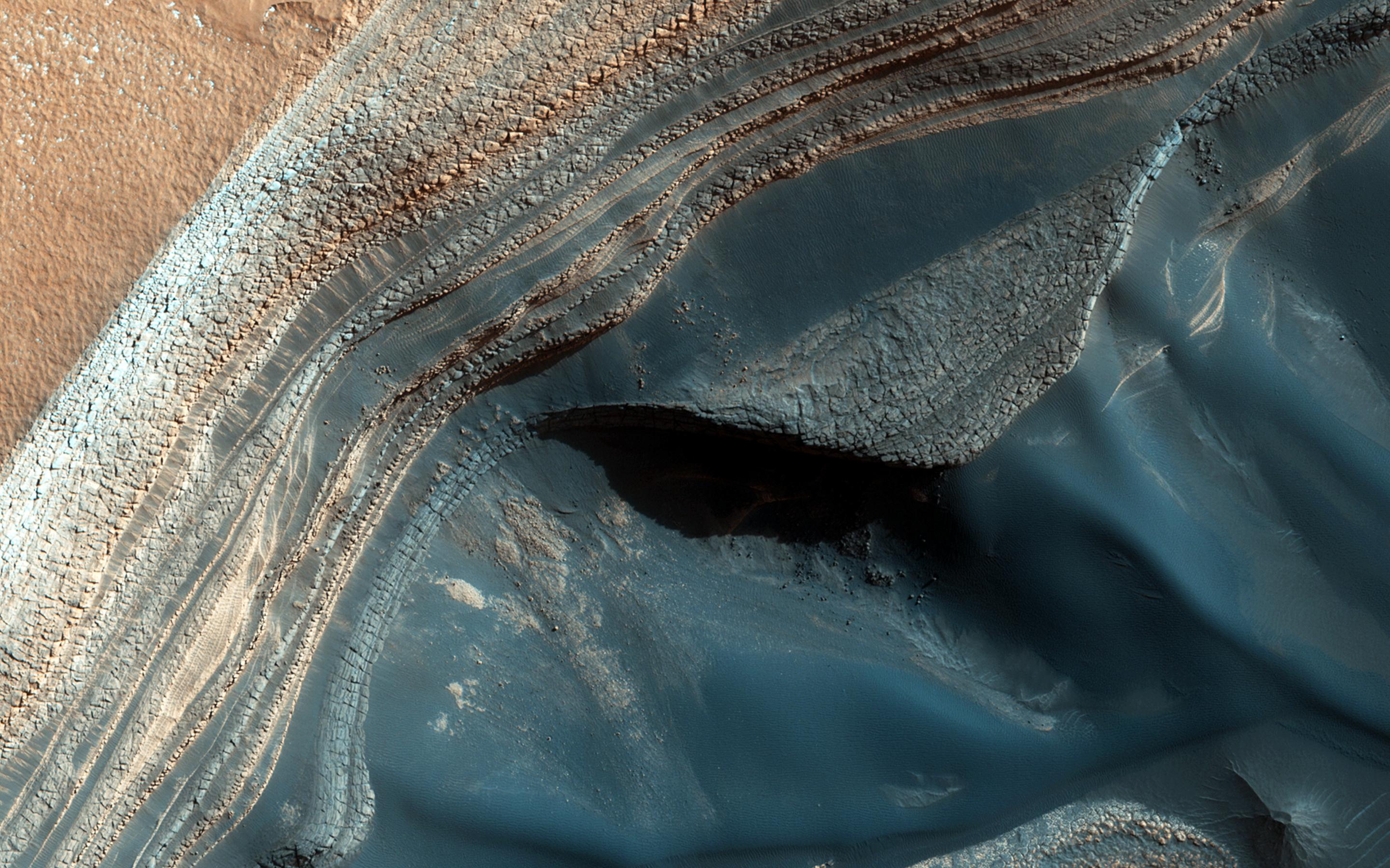
2014-06-18 |
Mars
|
Mars Reconnaissance Orbiter (MRO)
|
HiRISE
|
2880x1800x3 |
|
-
PIA18587:
-
Waiting for Dust Devils
Full Resolution:
TIFF
(5.191 MB)
JPEG
(1.172 MB)
|
|
|
2014-06-18 |
Mars
|
Mars Reconnaissance Orbiter (MRO)
|
HiRISE
|
2880x1800x3 |

|
-
PIA18586:
-
Blockfall on the North Polar Layered Deposits
Full Resolution:
TIFF
(15.56 MB)
JPEG
(790.1 kB)
|
|
|
2014-06-18 |
Mars
|
Mars Reconnaissance Orbiter (MRO)
|
HiRISE
|
2880x1800x3 |
|
-
PIA18585:
-
Sand Dune Catch and Release
Full Resolution:
TIFF
(15.56 MB)
JPEG
(743.6 kB)
|
|
|
2014-06-18 |
Mars
|
2001 Mars Odyssey
|
THEMIS
|
1517x2933x1 |

|
-
PIA18487:
-
Lava Channel
Full Resolution:
TIFF
(4.454 MB)
JPEG
(582.1 kB)
|
|
|
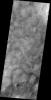
2014-06-17 |
Mars
|
2001 Mars Odyssey
|
THEMIS
|
1202x2944x1 |

|
-
PIA18486:
-
Crater Dunes
Full Resolution:
TIFF
(3.543 MB)
JPEG
(186.1 kB)
|
|
|
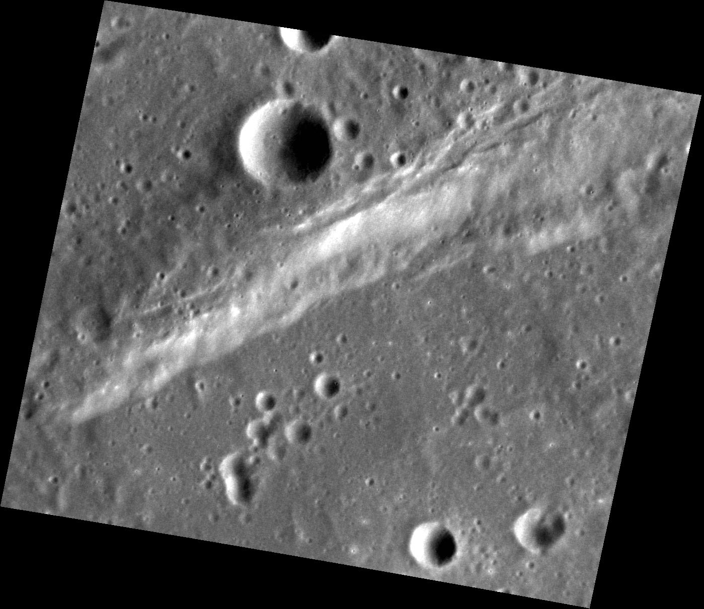
2014-06-16 |
Mercury
|
MESSENGER
|
MDIS - Narrow Angle
|
1081x1074x1 |
|
-
PIA18524:
-
Rim and Hollows
Full Resolution:
TIFF
(1.162 MB)
JPEG
(150.4 kB)
|
|
|
2014-06-16 |
Mars
|
2001 Mars Odyssey
|
THEMIS
|
1510x2931x1 |
|
-
PIA18485:
-
Arabia Terra Channels
Full Resolution:
TIFF
(4.431 MB)
JPEG
(351.9 kB)
|
|
|
2014-06-16 |
Atlas
|
Cassini-Huygens
|
ISS - Narrow Angle
|
853x741x1 |

|
-
PIA17167:
-
Emerging from Darkness
Full Resolution:
TIFF
(633 kB)
JPEG
(42.18 kB)
|
|
|
2014-06-13 |
Mercury
|
MESSENGER
|
MDIS - Narrow Angle
|
1147x1057x1 |

|
-
PIA18523:
-
Split Down the Middle
Full Resolution:
TIFF
(1.214 MB)
JPEG
(127.6 kB)
|
|
|
2014-06-13 |
Mars
|
2001 Mars Odyssey
|
THEMIS
|
1554x2935x1 |

|
-
PIA18484:
-
Arabia Terra Channels
Full Resolution:
TIFF
(4.566 MB)
JPEG
(506.4 kB)
|
|
|
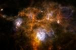
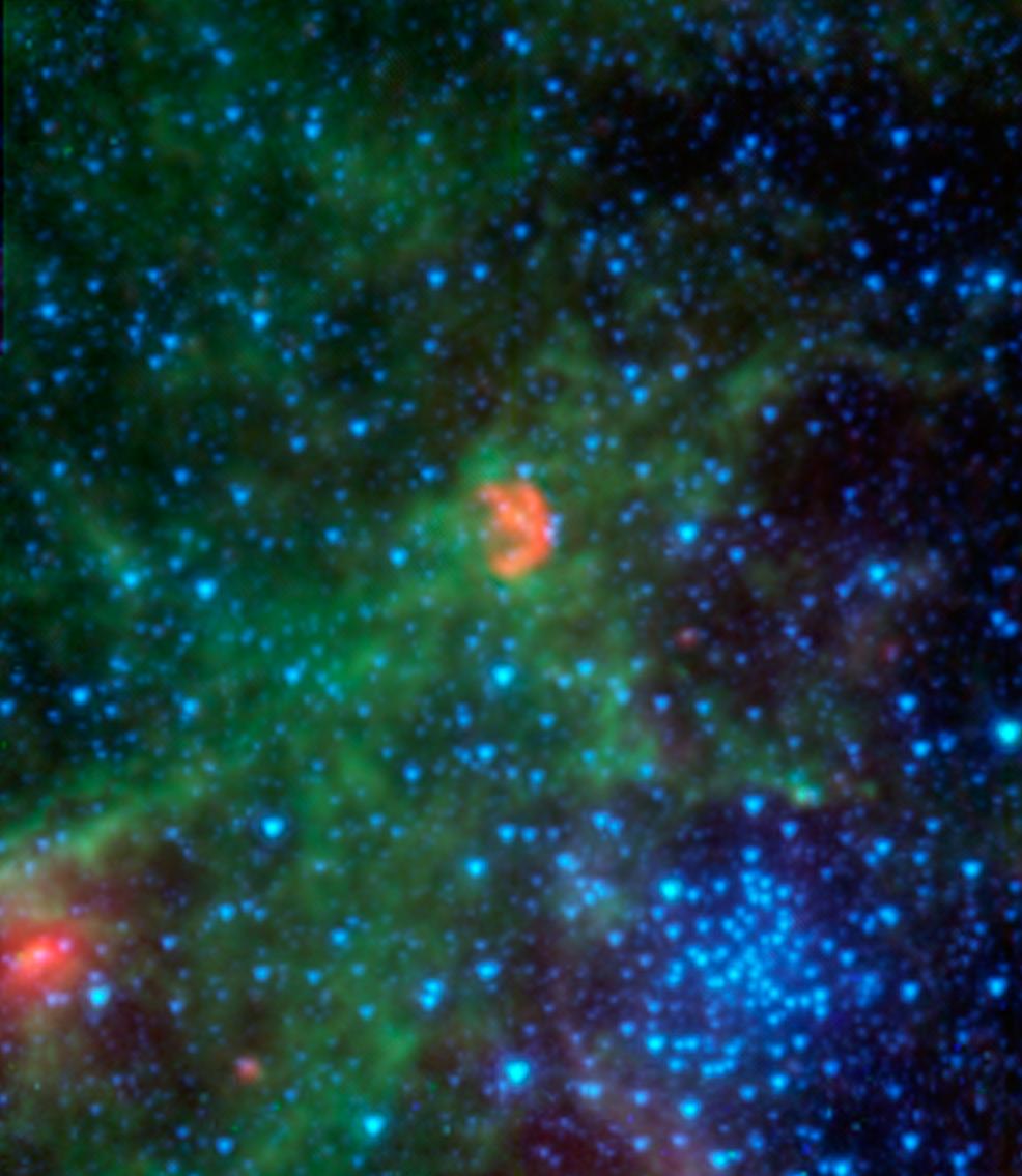
2014-06-12 |
NGC 7538
|
Herschel Space Observatory
|
PACS
SPIRE
|
2305x1540x3 |
|
-
PIA18452:
-
A Puzzling Cosmic Ring
Full Resolution:
TIFF
(10.65 MB)
JPEG
(170.6 kB)
|
|
|
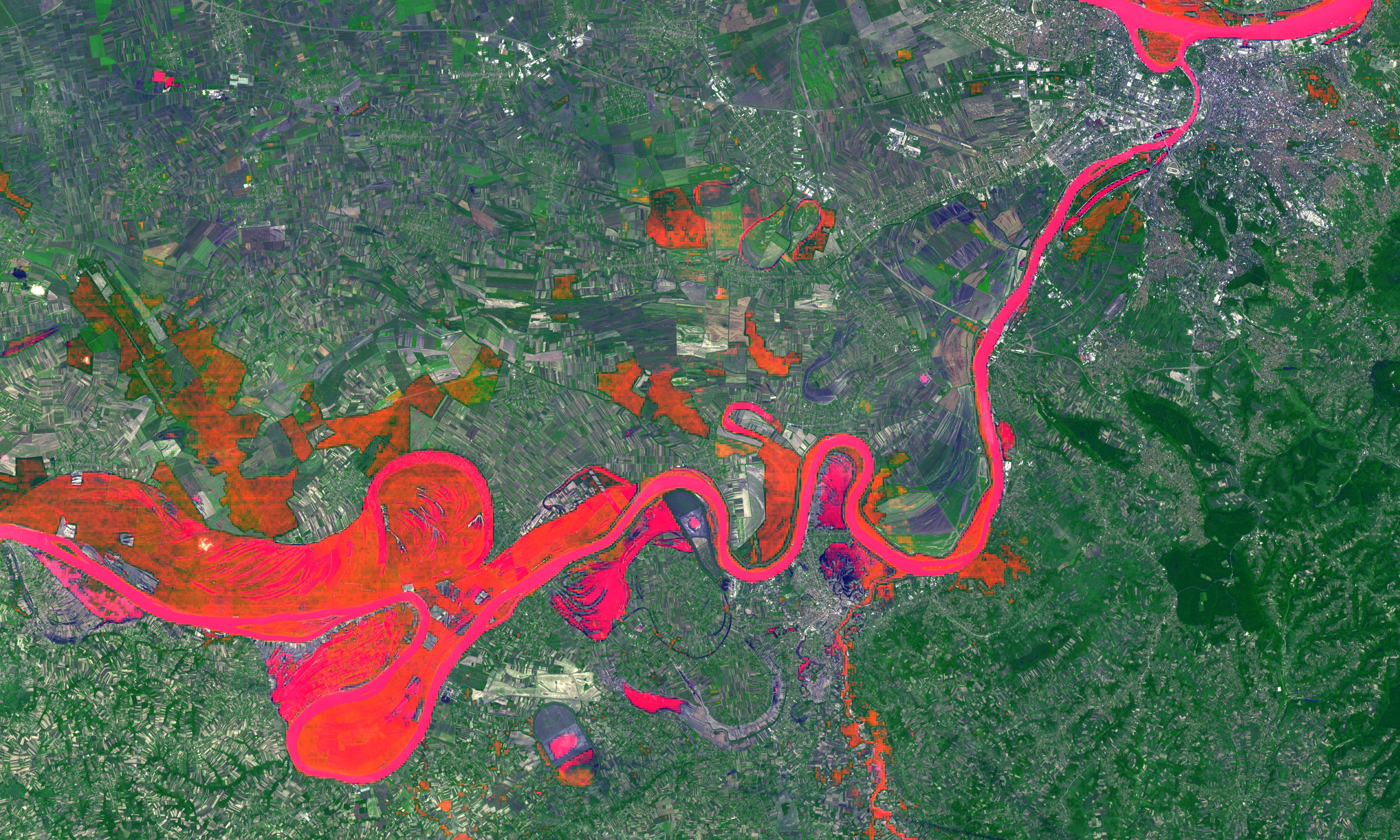
2014-06-12 |
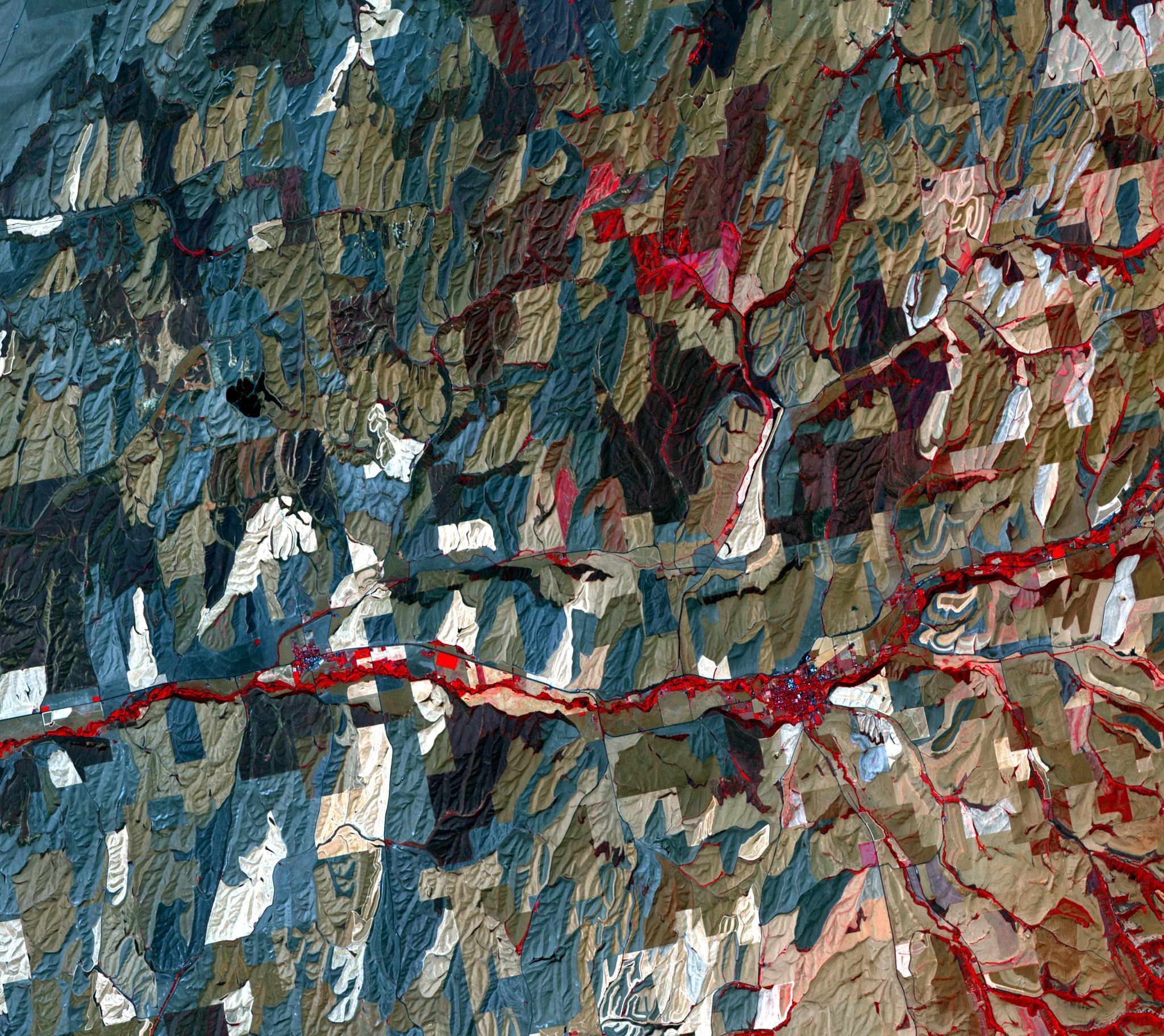
Earth
|
Terra
|
ASTER
|
3816x2292x3 |

|
-
PIA18051:
-
Historic Serbian Floods Eyed by NASA Spacecraft
Full Resolution:
TIFF
(26.25 MB)
JPEG
(1.819 MB)
|
|
|
2014-06-12 |
Mars
|
2001 Mars Odyssey
|
THEMIS
|
1509x2927x1 |
|
-
PIA18483:
-
Hecates Tholus
Full Resolution:
TIFF
(4.422 MB)
JPEG
(394.3 kB)
|
|
|
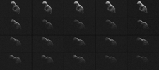
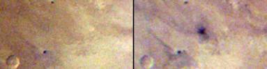
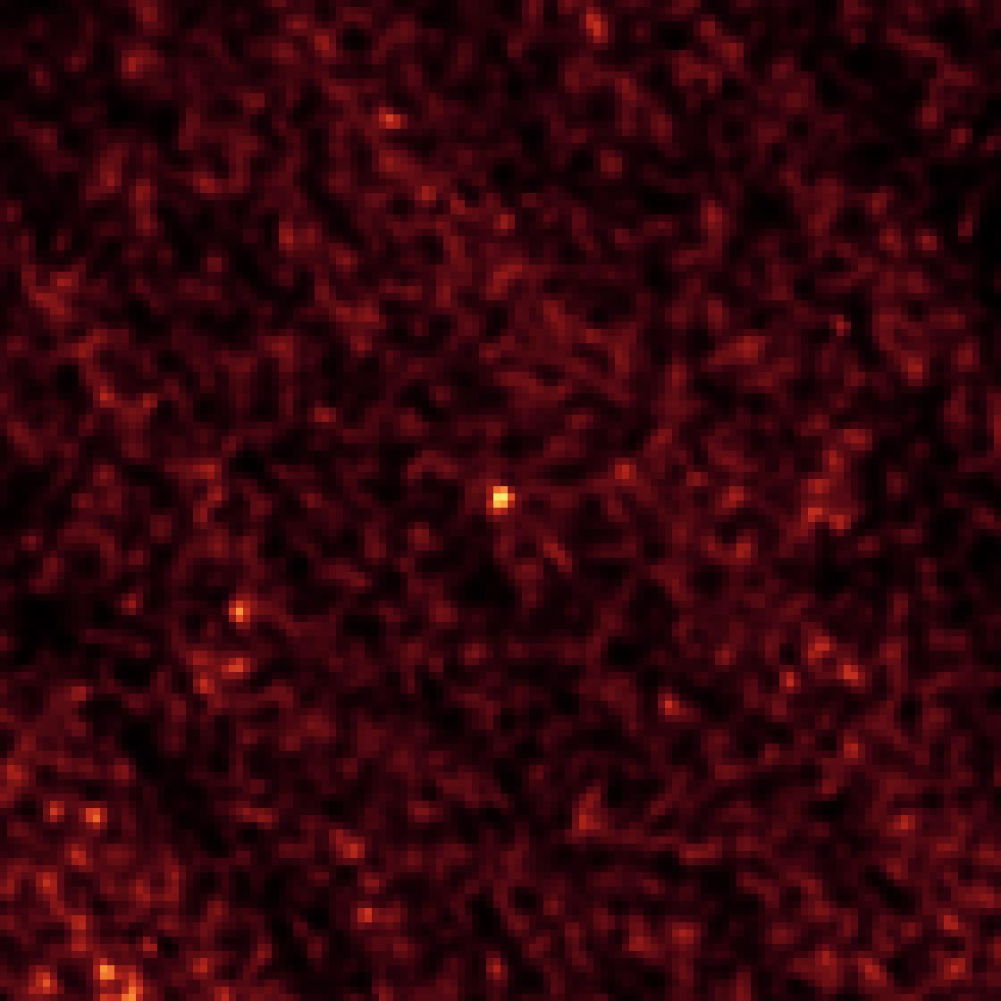
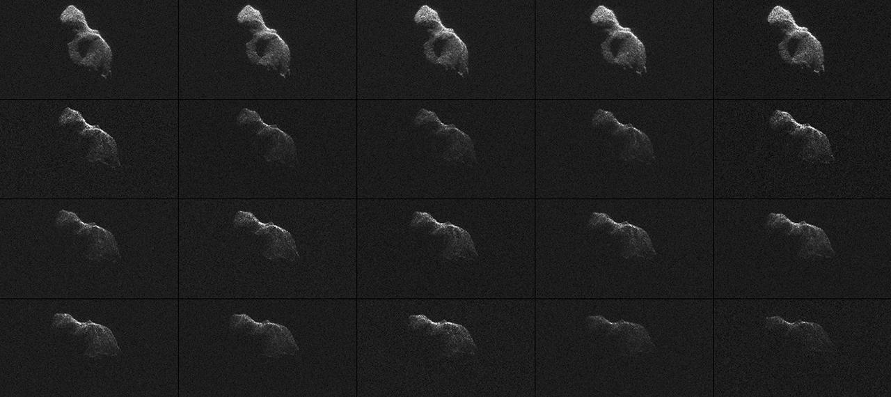
2014-06-12 |
Asteroid
|
Goldstone Deep Space Network (DSN)
|
Goldstone Solar System Radar
|
1280x570x1 |
|
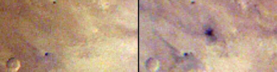
-
PIA18412:
-
Radar Images of Asteroid 2014 HQ124

Full Resolution:
TIFF
(730.6 kB)
JPEG
(93.79 kB)
|
|
|
2014-06-11 |
Mercury
|
MESSENGER
|
MDIS - Wide Angle
|
375x375x3 |
|
-
PIA18514:
-
Bartok's Blues
Full Resolution:
TIFF
(422.2 kB)
JPEG
(40.88 kB)
|
|
|
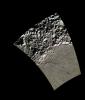
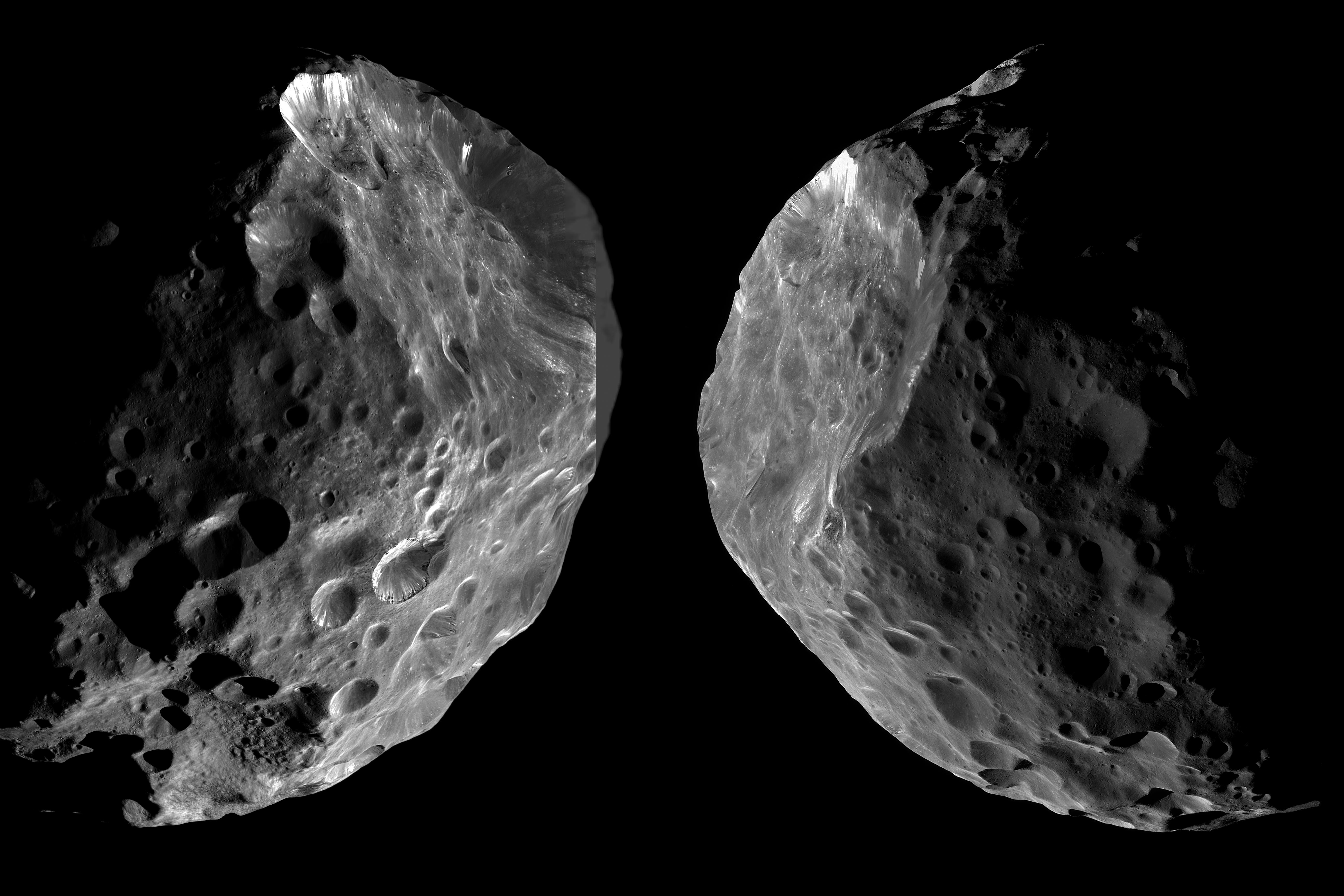
2014-06-11 |
Phoebe
|
Cassini-Huygens
|
ISS - Narrow Angle
ISS - Wide Angle
|
5182x3455x1 |

|
-
PIA18411:
-
Arrival and Departure at Phoebe
Full Resolution:
TIFF
(17.93 MB)
JPEG
(1.192 MB)
|
|
|
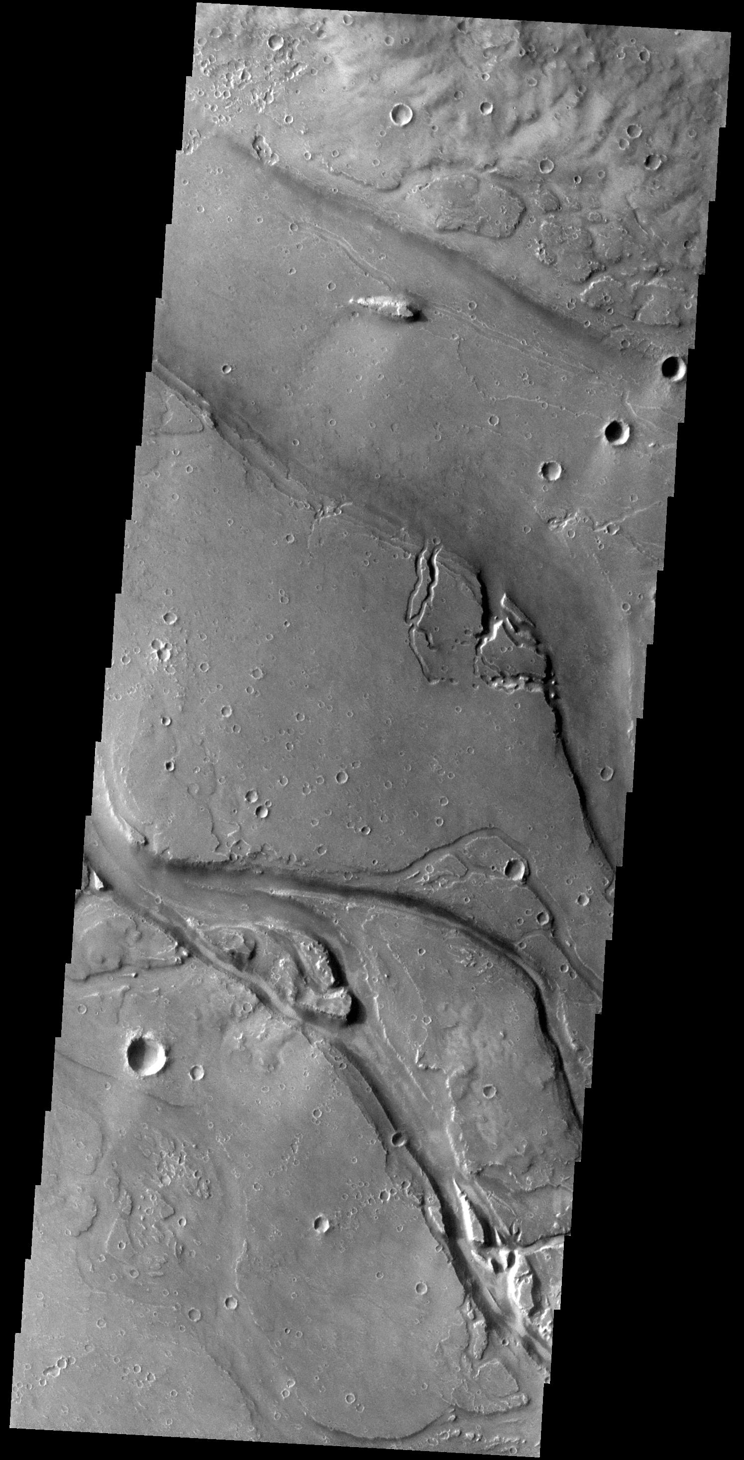
2014-06-11 |
Mars
|
2001 Mars Odyssey
|
THEMIS
|
1495x2932x1 |
|
-
PIA18482:
-
Granicus Valles
Full Resolution:
TIFF
(4.388 MB)
JPEG
(475.7 kB)
|
|
|
2014-06-10 |
Mercury
|
Mars Science Laboratory (MSL)
|
Mastcam
|
1280x256x1 |
|
-
PIA18389:
Mercury Transit of the Sun, Seen From Mars
Full Resolution:
TIFF
(328.2 kB)
JPEG
(21.61 kB)
|
|
|
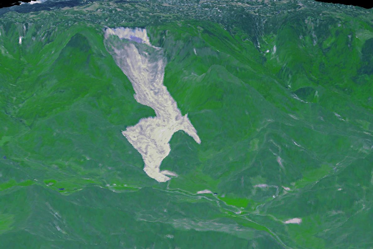
2014-06-10 |
Earth
|
Terra
|
ASTER
|
1188x793x3 |
|
-
PIA18050:
-
Giant Arizona Landslide Spotted by NASA Spacecraft
Full Resolution:
TIFF
(2.828 MB)
JPEG
(108.6 kB)
|
|
|
2014-06-10 |
Mars
|
2001 Mars Odyssey
|
THEMIS
|
1469x2931x1 |
|
-
PIA18481:
-
Tharsis Volcanics
Full Resolution:
TIFF
(4.311 MB)
JPEG
(373.1 kB)
|
|
|
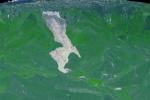
2014-06-09 |
Earth
|
Terra
|
ASTER
|
1336x2153x3 |
|
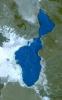
-
PIA18515:
-
Lake Afrera, Ethiopia
Full Resolution:
TIFF
(8.632 MB)
JPEG
(416.1 kB)
|
|
|
2014-06-09 |
Mercury
|
MESSENGER
|
MDIS - Narrow Angle
|
1399x1211x1 |

|
-
PIA18449:
-
Along a Scarp
Full Resolution:
TIFF
(1.696 MB)
JPEG
(188.5 kB)
|
|
|
2014-06-09 |
Mars
|
2001 Mars Odyssey
|
THEMIS
|
1165x2886x1 |
|
-
PIA18480:
-
North Polar Layers
Full Resolution:
TIFF
(3.366 MB)
JPEG
(148.9 kB)
|
|
|
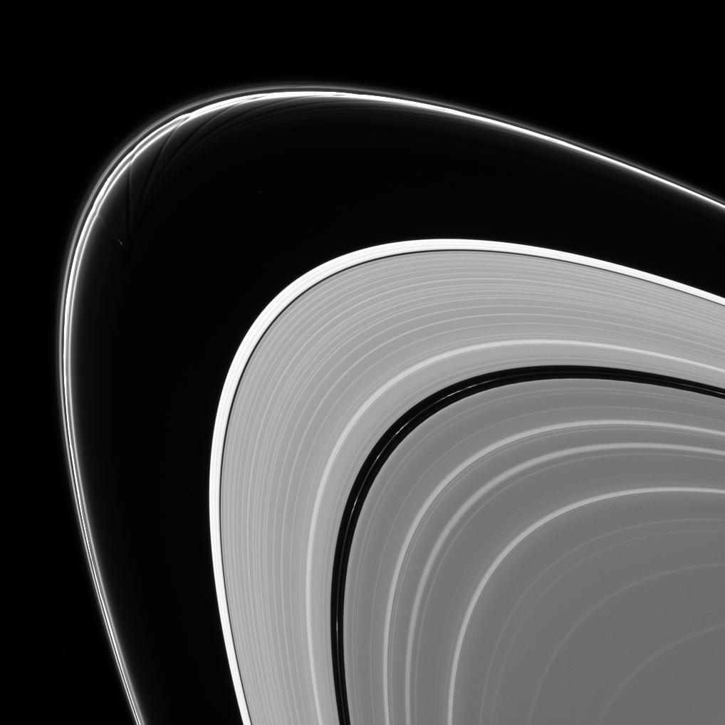
2014-06-09 |
Prometheus
|
Cassini-Huygens
|
ISS - Narrow Angle
|
1018x1018x1 |
|
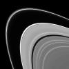
-
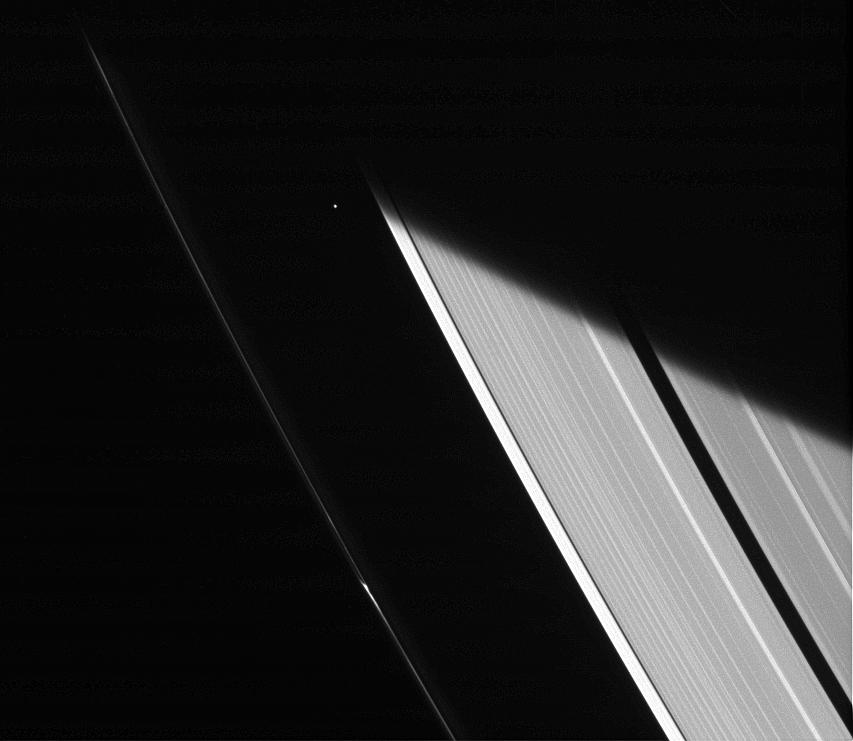
PIA18270:
-
Gored of the Rings
Full Resolution:
TIFF
(1.038 MB)
JPEG
(62.96 kB)
|
|
|
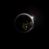
2014-06-06 |
Mercury
|
MESSENGER
|
MDIS - Wide Angle
|
2389x1384x3 |
|
-
PIA18448:
-
The Contrasting Colors of Sander and Munch
Full Resolution:
TIFF
(9.923 MB)
JPEG
(315.4 kB)
|
|
|
2014-06-06 |
|
ISS
|
OPALS
|
872x480x3 |
|
-
PIA18386:
-
OPALS and the Moon
Full Resolution:
TIFF
(420.8 kB)
JPEG
(44.49 kB)
|
|
|
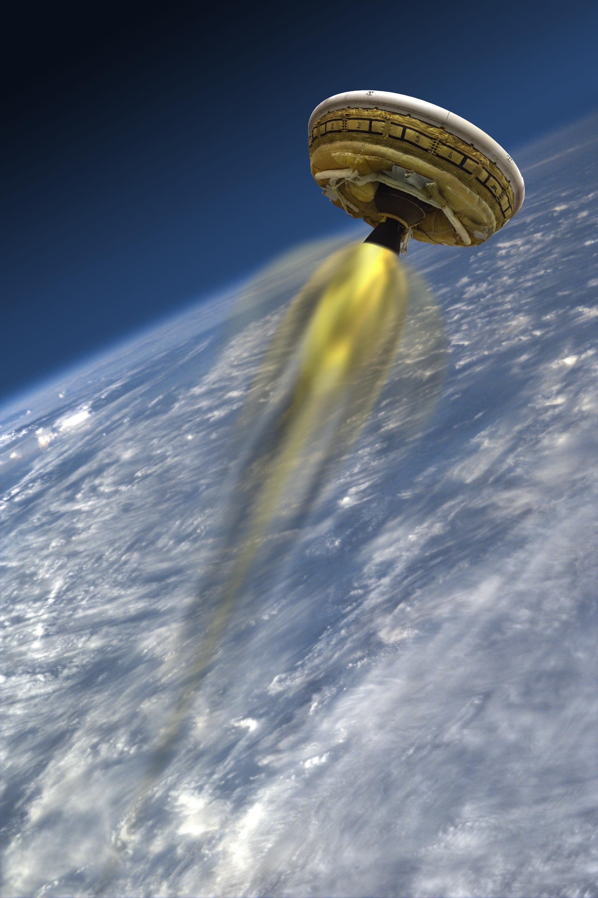
2014-06-06 |
Earth
|
LDSD
|
|
1280x720x3 |
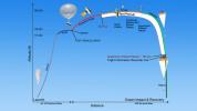
|
-
PIA18451:
-
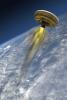
Timeline of Events for Planetary Landing Test
Full Resolution:
TIFF
(2.766 MB)
JPEG
(63.51 kB)
|
|
|
2014-06-06 |
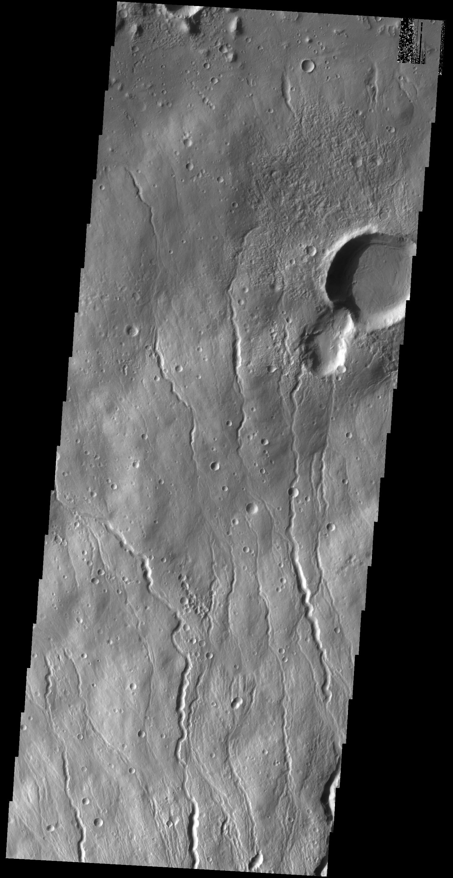
Mars
|
2001 Mars Odyssey
|
THEMIS
|
835x2283x1 |
|
-
PIA18269:
-
Kasei Valles Islands
Full Resolution:
TIFF
(1.909 MB)
JPEG
(201.6 kB)
|
|
|
2014-06-05 |
Mars
|
2001 Mars Odyssey
|
THEMIS
|
1175x2886x1 |
|
-
PIA18268:
-
North Polar Dunes
Full Resolution:
TIFF
(3.395 MB)
JPEG
(425.4 kB)
|
|
|
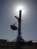
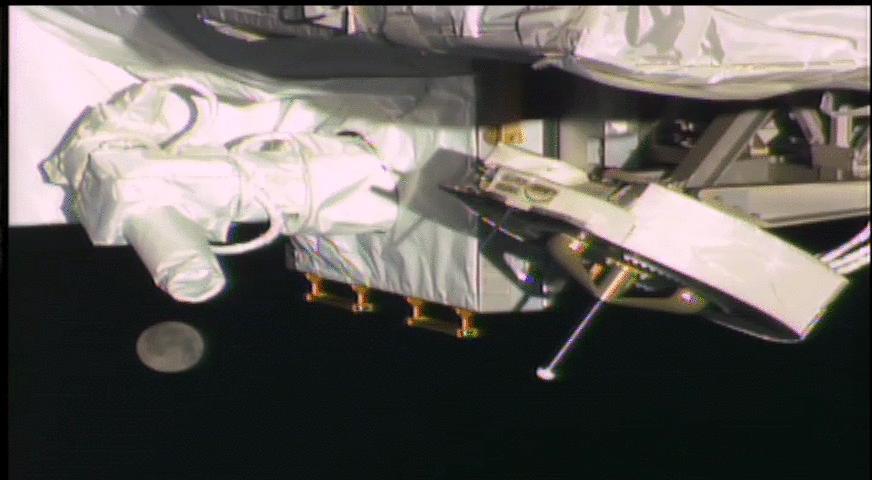
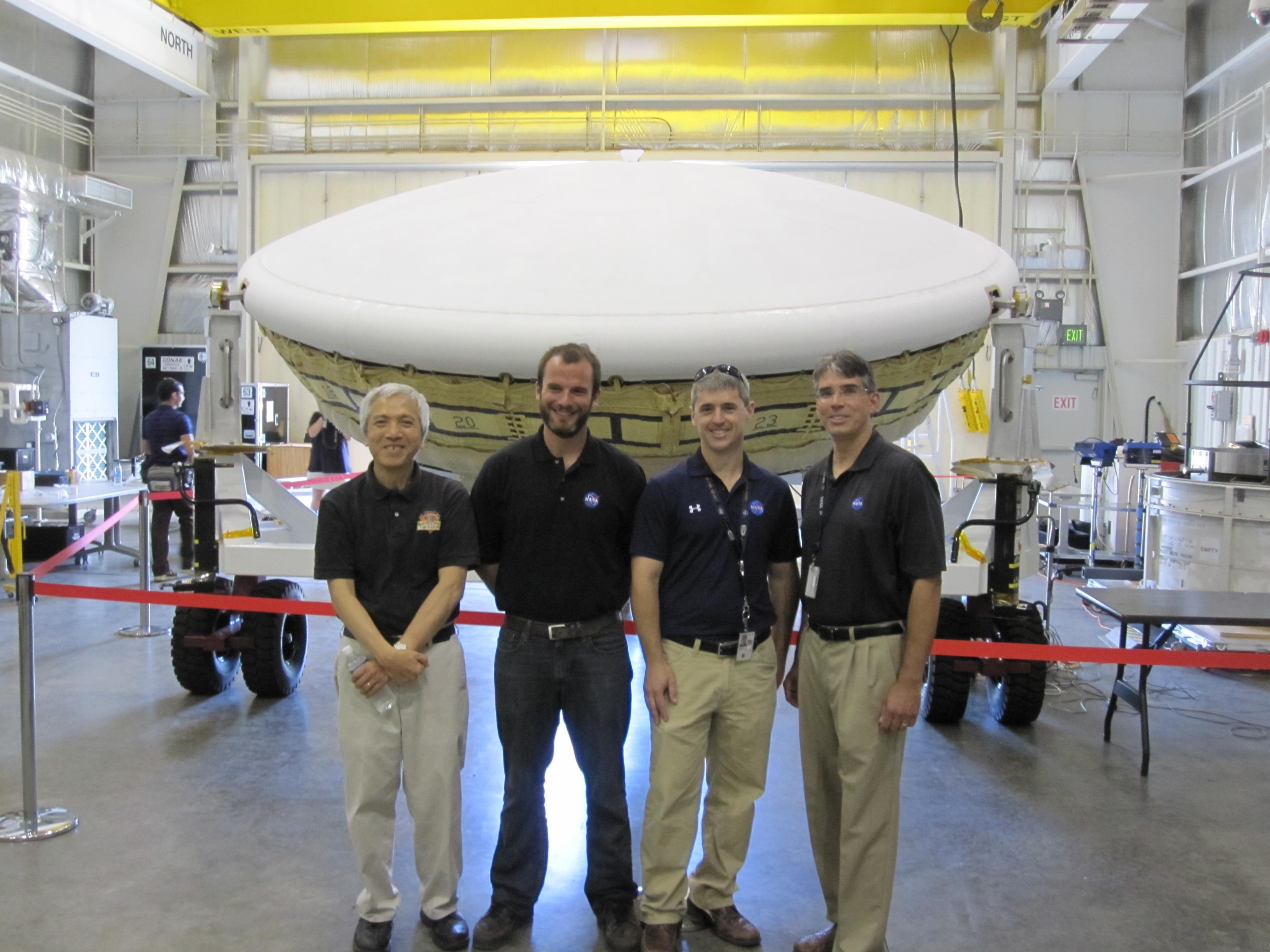
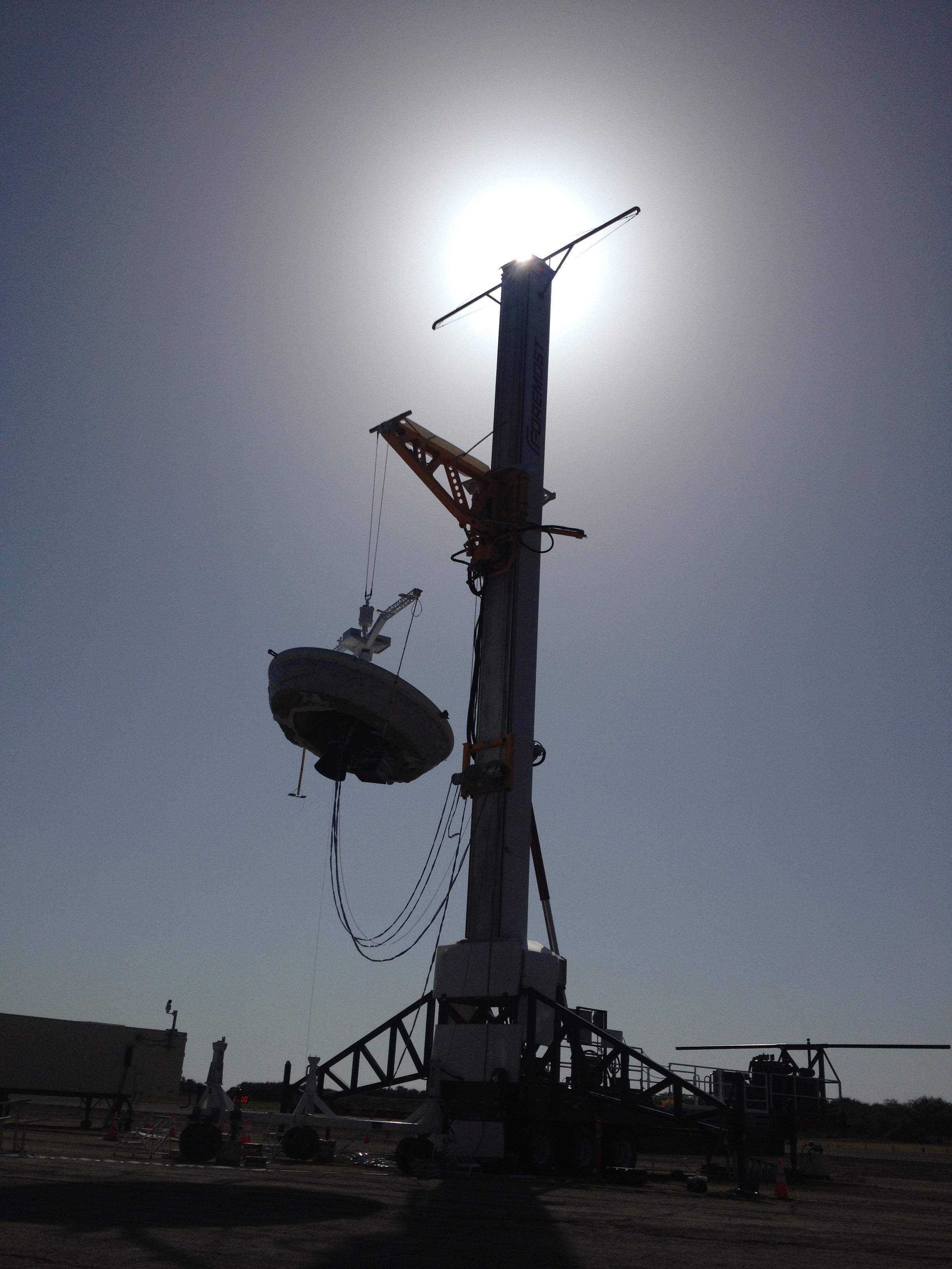
2014-06-04 |
Earth
|
LDSD
|
|
3264x2448x3 |

|
-
PIA18450:
-
Launch Tower for LDSD
Full Resolution:
TIFF
(23.98 MB)
JPEG
(658.3 kB)
|
|
|
2014-06-04 |
Earth
|
LDSD
|
|
3264x2448x3 |
|
-
PIA18019:
-
LDSD Team in Hawaii
Full Resolution:
TIFF
(23.98 MB)
JPEG
(634.1 kB)
|
|
|
2014-06-04 |
Mercury
|
MESSENGER
|
MDIS - Narrow Angle
|
983x1154x3 |
|
-
PIA18447:
-
Beyond the Wall
Full Resolution:
TIFF
(3.405 MB)
JPEG
(103.1 kB)
|
|
|
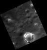
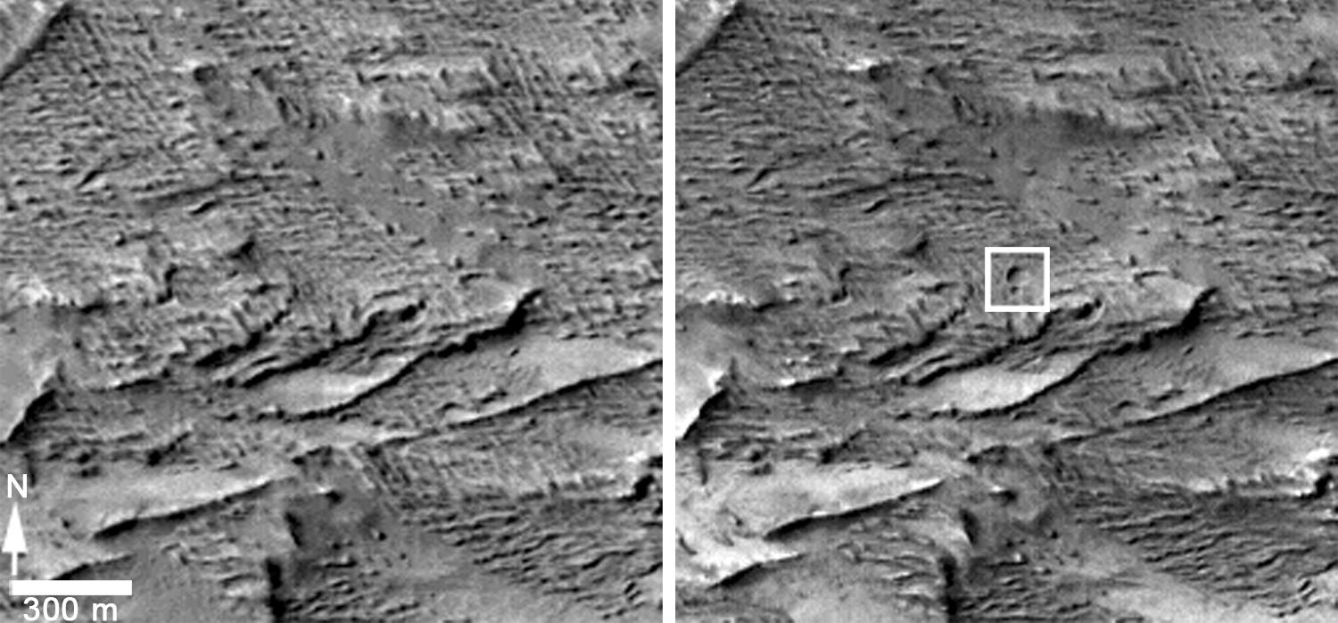
2014-06-04 |
Mars
|
Mars Reconnaissance Orbiter (MRO)
|
HiRISE
|
2880x1800x1 |

|
-
PIA18513:
-
An Alluvial Fan in a Low-Latitude Crater
Full Resolution:
TIFF
(5.191 MB)
JPEG
(646.5 kB)
|
|
|
2014-06-04 |
Mars
|
Mars Reconnaissance Orbiter (MRO)
|
HiRISE
|
2880x1800x3 |
|
-
PIA18512:
-
Touring a Dusty Region
Full Resolution:
TIFF
(15.56 MB)
JPEG
(623.1 kB)
|
|
|
2014-06-04 |
Mars
|
Mars Reconnaissance Orbiter (MRO)
|
HiRISE
|
840x333x1 |
|
-
PIA18511:
-
A Large Crater in Meridiani Planum
Full Resolution:
TIFF
(280.2 kB)
JPEG
(73.14 kB)
|
|
|
2014-06-04 |
|
Mars Reconnaissance Orbiter (MRO)
|
HiRISE
|
2880x1800x3 |

|
-
PIA18510:
-
The Draa of Mars
Full Resolution:
TIFF
(15.56 MB)
JPEG
(1.014 MB)
|
|
|
2014-06-04 |
Mars
|
2001 Mars Odyssey
|
THEMIS
|
1147x2939x1 |
|
-
PIA18267:
-
"Butterfly" Crater
Full Resolution:
TIFF
(3.375 MB)
JPEG
(571 kB)
|
|
|
2014-06-04 |
|
Spitzer Space Telescope
|
IRAC
|
986x1135x3 |

|
-
PIA18009:
-
Dissecting Dust from Detonation of Dead Star
Full Resolution:
TIFF
(3.359 MB)
JPEG
(103.6 kB)
|
|
|
2014-06-03 |
Mercury
|
MESSENGER
|
MDIS - Narrow Angle
|
664x635x1 |
|
-
PIA18446:
-
The Hills Have Eyes
Full Resolution:
TIFF
(422.3 kB)
JPEG
(49.03 kB)
|
|
|
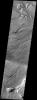
2014-06-03 |
Mars
|
2001 Mars Odyssey
|
THEMIS
|
320x1808x1 |
|
-
PIA18266:
-
"Butterfly" Crater
Full Resolution:
TIFF
(579.4 kB)
JPEG
(139.8 kB)
|
|
|
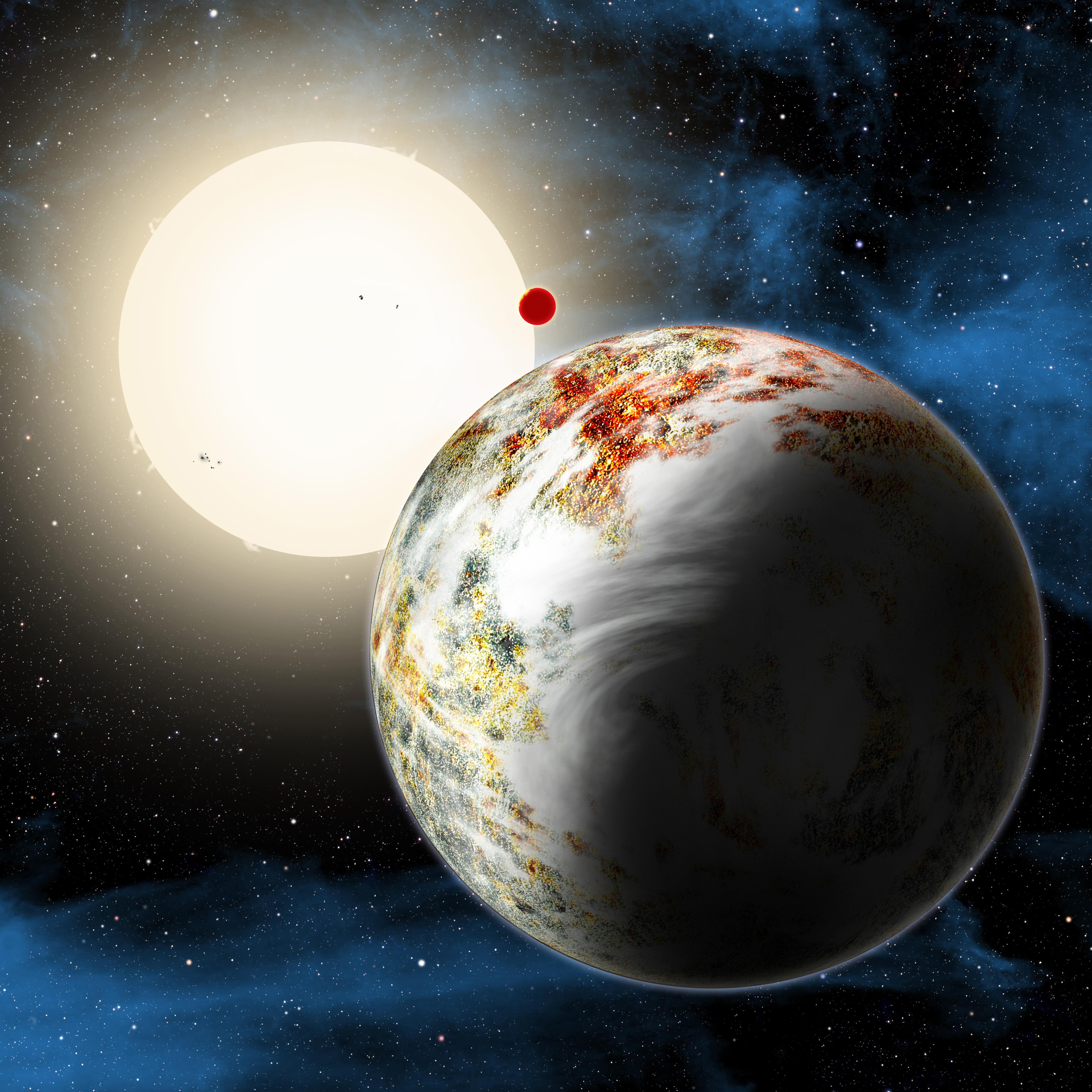
2014-06-02 |
|
Kepler
|
|
5400x5400x3 |
|
-
PIA18018:
-
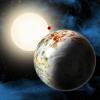
Kepler-10 System
Full Resolution:
TIFF
(87.52 MB)
JPEG
(1.904 MB)
|
|
|
2014-06-02 |
|
LDSD
|
|
2036x3060x3 |
|
-
PIA18017:
-
LDSD's Rocket-powered Test Vehicle
Full Resolution:
TIFF
(18.7 MB)
JPEG
(405.1 kB)
|
|
|
2014-06-02 |
Mars
|
2001 Mars Odyssey
|
THEMIS
|
1430x2924x1 |

|
-
PIA18265:
-
Crater Delta
Full Resolution:
TIFF
(4.186 MB)
JPEG
(434.3 kB)
|
|
|
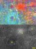
2014-06-02 |
Titan
|
Cassini-Huygens
|
ISS - Wide Angle
|
788x729x1 |
|
-
PIA17169:
-
High Vortex
Full Resolution:
TIFF
(575.3 kB)
JPEG
(11.53 kB)
|
|
|
2014-05-30 |
Mercury
|
MESSENGER
|
MDIS - Narrow Angle
|
1020x1024x1 |
|
-
PIA18445:
-
A Chance View Inside Ahmad Baba
Full Resolution:
TIFF
(1.046 MB)
JPEG
(118.4 kB)
|
|
|
2014-05-30 |
Mars
|
2001 Mars Odyssey
|
THEMIS
|
2560x3437x1 |

|
-
PIA18264:
-
Siton Undae
Full Resolution:
TIFF
(8.808 MB)
JPEG
(416.5 kB)
|
|
|
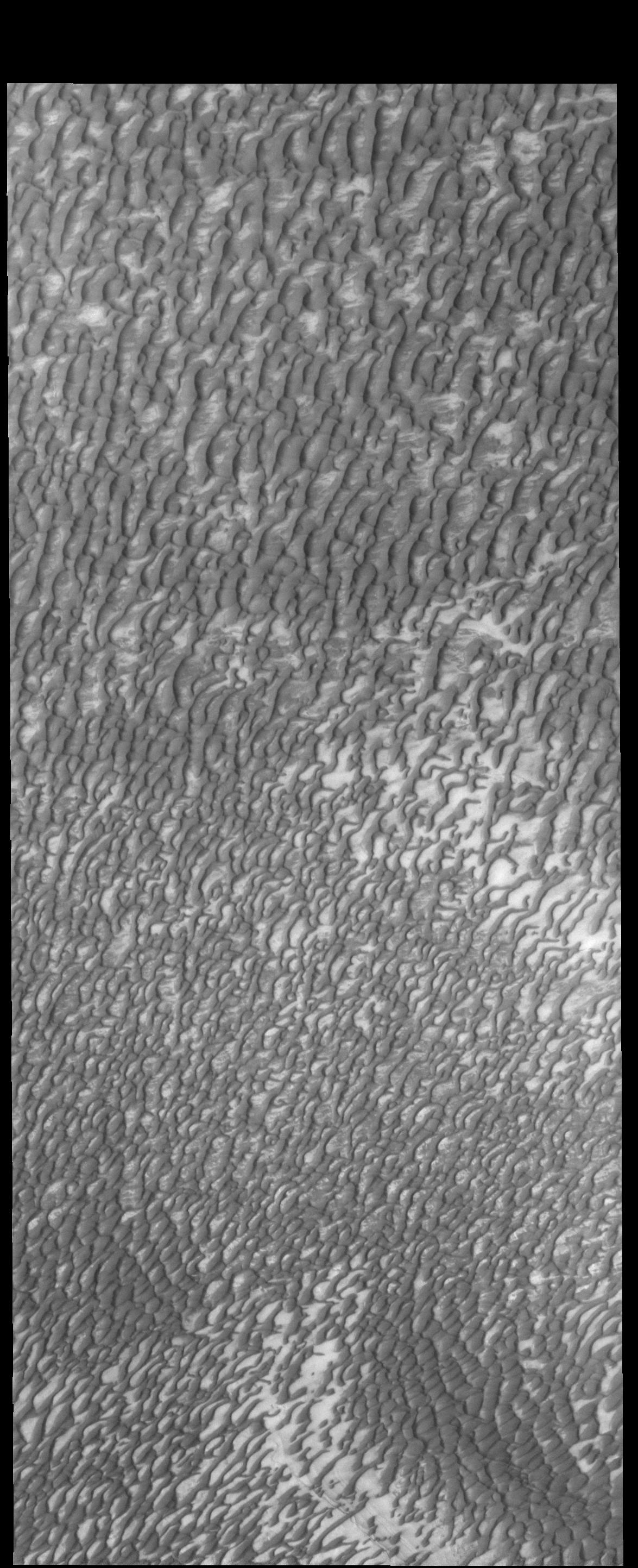
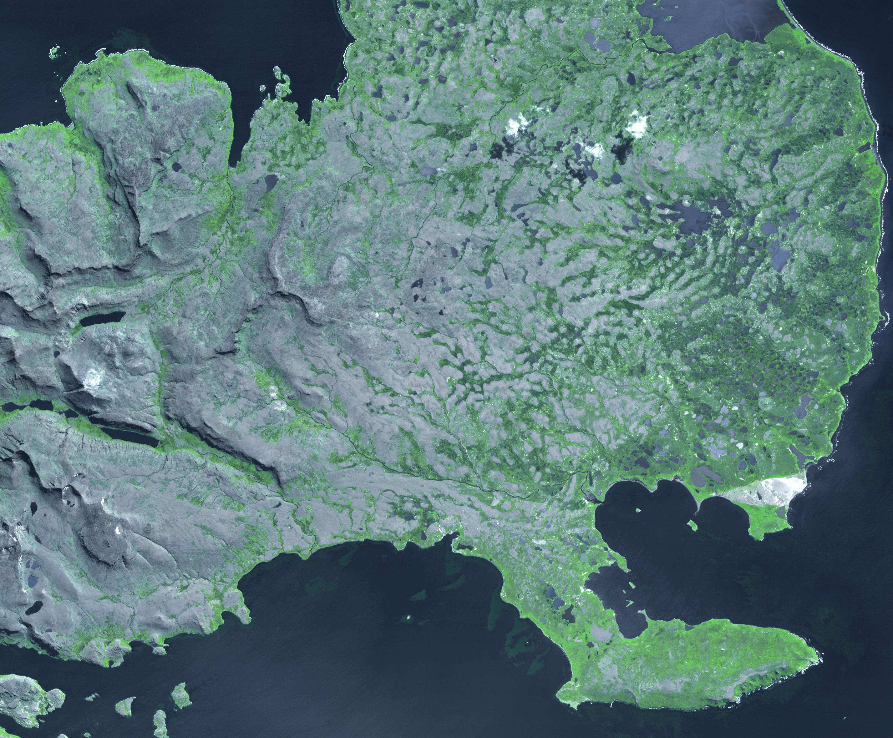
2014-05-29 |
Earth
|
Aqua
|
MODIS
|
7091x5556x1 |
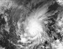
|
-
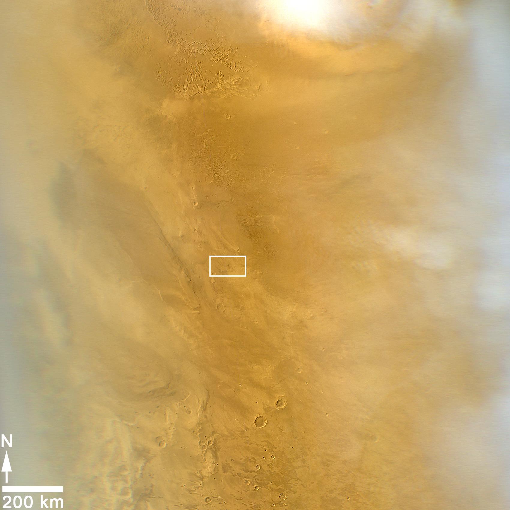
PIA18097:
-
Hurricane Amanda
Full Resolution:
TIFF
(39.44 MB)
JPEG
(4.125 MB)
|
|
|
2014-05-29 |
Mars
|
2001 Mars Odyssey
|
THEMIS
|
1514x2954x1 |
|
-
PIA18263:
-
Dust Devil Tracks
Full Resolution:
TIFF
(4.477 MB)
JPEG
(376.5 kB)
|
|
|
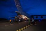
2014-05-28 |
|
LDSD
|
|
1019x680x3 |

|
-
PIA18016:
-
Unloading LDSD Test Device in Hawaii
Full Resolution:
TIFF
(2.08 MB)
JPEG
(71.82 kB)
|
|
|
2014-05-28 |
|
LDSD
|
|
1019x680x3 |
|
-
PIA18015:
-
LDSD Test Device Arrives in Hawaii
Full Resolution:
TIFF
(2.08 MB)
JPEG
(43.76 kB)
|
|
|
2014-05-28 |
|
Spitzer Space Telescope
|
IRAC
Two Micron All Sky Survey (2MASS)
|
2251x1476x3 |

|
-
PIA18014:
-
The 'Serpent' Star-Forming Cloud Spawns Stars
Full Resolution:
TIFF
(9.972 MB)
JPEG
(628.5 kB)
|
|
|
2014-05-28 |
Mercury
|
MESSENGER
|
MDIS - Narrow Angle
|
1193x1190x1 |
|
-
PIA18444:
-
Hollows in Balanchine Crater
Full Resolution:
TIFF
(1.421 MB)
JPEG
(116.9 kB)
|
|
|
2014-05-28 |
Mars
|
2001 Mars Odyssey
|
THEMIS
|
1416x2926x1 |
|
-
PIA18262:
-
Olympus Rupes
Full Resolution:
TIFF
(4.148 MB)
JPEG
(493.8 kB)
|
|
|
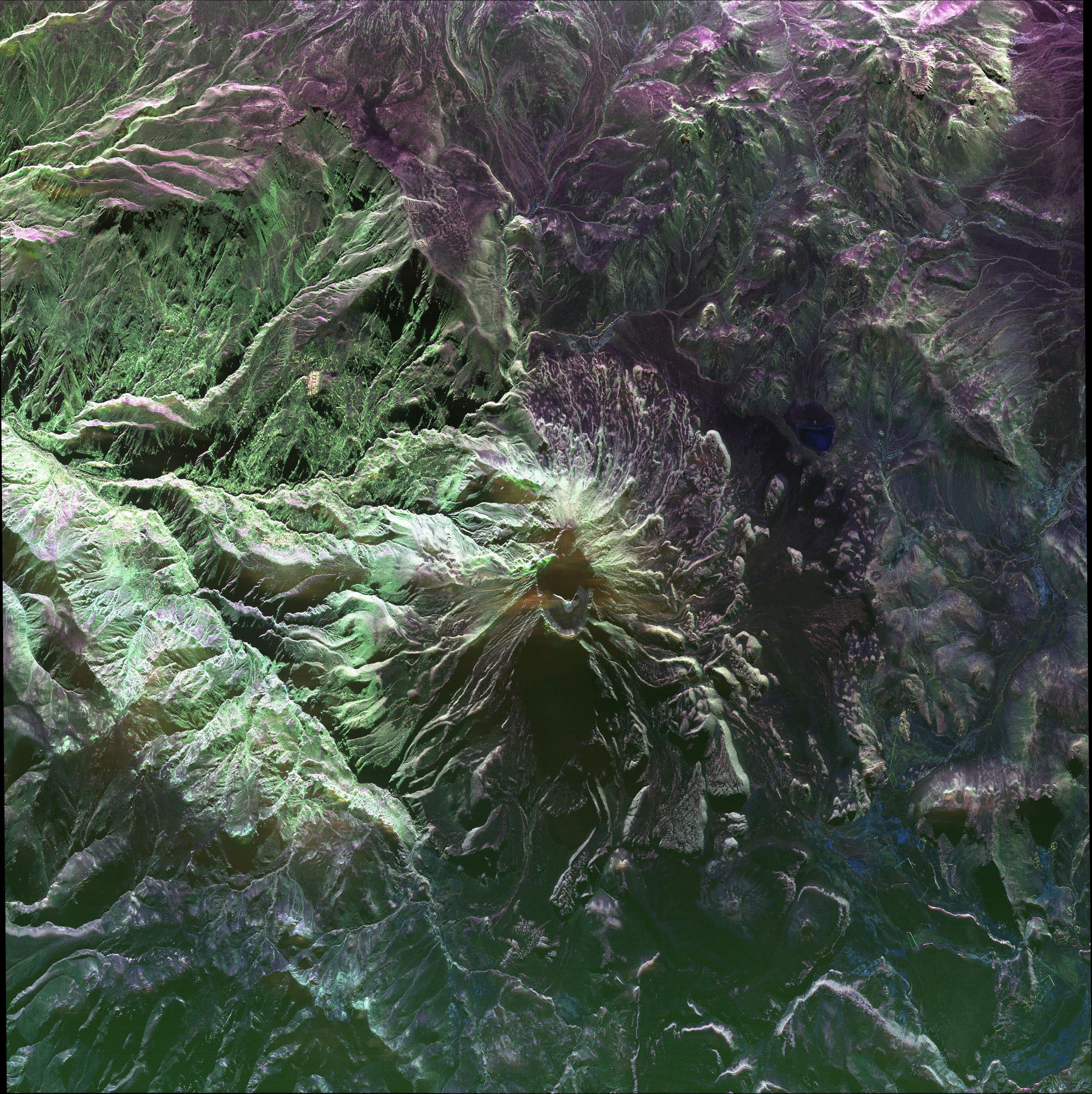
2014-05-27 |
Earth
|
UAVSAR
|
L-Band UAVSAR
|
3238x3244x3 |
|
-
PIA18049:
-
UAVSAR image of Ubinas Volcano
Full Resolution:
TIFF
(31.53 MB)
JPEG
(2.65 MB)
|
|
|
2014-05-27 |
Titan
|
Cassini-Huygens
|
Visual and Infrared Mapping Spectrometer
|
4600x4600x3 |
|
-
PIA18410:
-
Cassini Observes Sunsets on Titan (Artist's Rendering)
Full Resolution:
TIFF
(63.52 MB)
JPEG
(428.5 kB)
|
|
|
2014-05-27 |
Earth
|
Terra
|
ASTER
|
2855x2360x3 |

|
-
PIA18253:
-
Kerguelen Islands
Full Resolution:
TIFF
(20.22 MB)
JPEG
(997.1 kB)
|
|
|
2014-05-27 |
Mars
|
2001 Mars Odyssey
|
THEMIS
|
2411x3387x1 |
|
-
PIA18261:
-
More Siton Undae
Full Resolution:
TIFF
(8.175 MB)
JPEG
(403.1 kB)
|
|
|
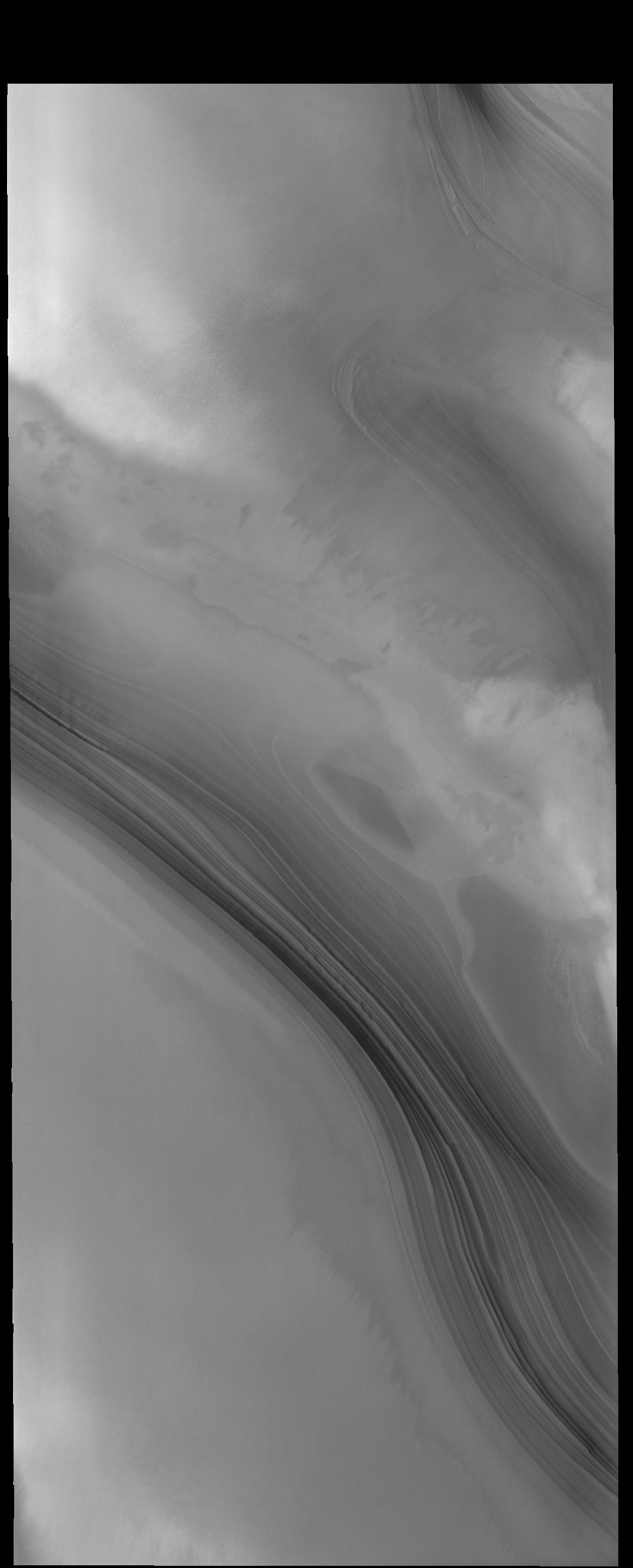
2014-05-26 |
Mercury
|
MESSENGER
|
MDIS - Narrow Angle
|
1020x1024x1 |

|
-
PIA18443:
-
Raditladi's Troughs
Full Resolution:
TIFF
(1.046 MB)
JPEG
(175.2 kB)
|
|
|
2014-05-26 |
Mars
|
2001 Mars Odyssey
|
THEMIS
|
2476x3416x1 |

|
-
PIA18260:
-
Siton Undae
Full Resolution:
TIFF
(8.467 MB)
JPEG
(561.3 kB)
|
|
|
2014-05-26 |
Dione
|
Cassini-Huygens
|
ISS - Narrow Angle
|
381x405x1 |
|
-
PIA17165:
-
Evander Half in Shadow
Full Resolution:
TIFF
(154.7 kB)
JPEG
(3.549 kB)
|
|
|
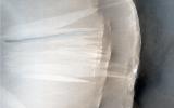
2014-05-23 |
Mercury
|
MESSENGER
|
MDIS - Narrow Angle
|
1094x1330x1 |

|
-
PIA18442:
-
The Madman and the Drunken Celestial
Full Resolution:
TIFF
(1.457 MB)
JPEG
(209.8 kB)
|
|
|
2014-05-23 |
Mars
|
2001 Mars Odyssey
|
THEMIS
|
1466x2931x1 |
|
-
PIA18259:
-
Channels
Full Resolution:
TIFF
(4.302 MB)
JPEG
(405.6 kB)
|
|
|
2014-05-22 |
|
Wide-field Infrared Survey Explorer (WISE)
|
|
2550x5500x3 |
|
-
PIA18013:
-
Unified, or 'Doughnut,' Theory of Active, Black Holes
Full Resolution:
TIFF
(42.09 MB)
JPEG
(1.276 MB)
|
|
|
2014-05-22 |
|
Wide-field Infrared Survey Explorer (WISE)
|
WISE Telescope
|
3467x1949x3 |
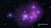
|
-
PIA18012:
-
The Clumping Behavior of Galaxies
Full Resolution:
TIFF
(20.28 MB)
JPEG
(1.191 MB)
|
|
|
2014-05-22 |
Mars
|
Mars Reconnaissance Orbiter (MRO)
|
HiRISE
|
741x493x3 |
|
-
PIA18385:
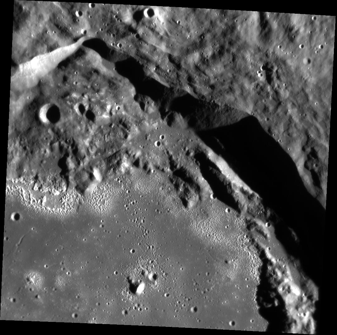
-
Landslides Near Fresh Crater on Mars
Full Resolution:
TIFF
(1.097 MB)
JPEG
(56.47 kB)
|
|
|
2014-05-22 |
Mars
|
Mars Reconnaissance Orbiter (MRO)
|
HiRISE
|
1413x951x3 |
|
-
PIA18384:
-
Large, Fresh Crater Surrounded by Smaller Craters
Full Resolution:
TIFF
(4.033 MB)
JPEG
(174.3 kB)
|
|
|
2014-05-22 |
Mars
|
Mars Reconnaissance Orbiter (MRO)
|
CTX
|
1500x699x1 |

|
-
PIA18383:
-
Before-and-After Views Confirm Fresh Craters
Full Resolution:
TIFF
(1.05 MB)
JPEG
(153.2 kB)
|
|
|
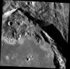
2014-05-22 |
Mars
|
Mars Reconnaissance Orbiter (MRO)
|
HiRISE
|
2880x1800x1 |

|
-
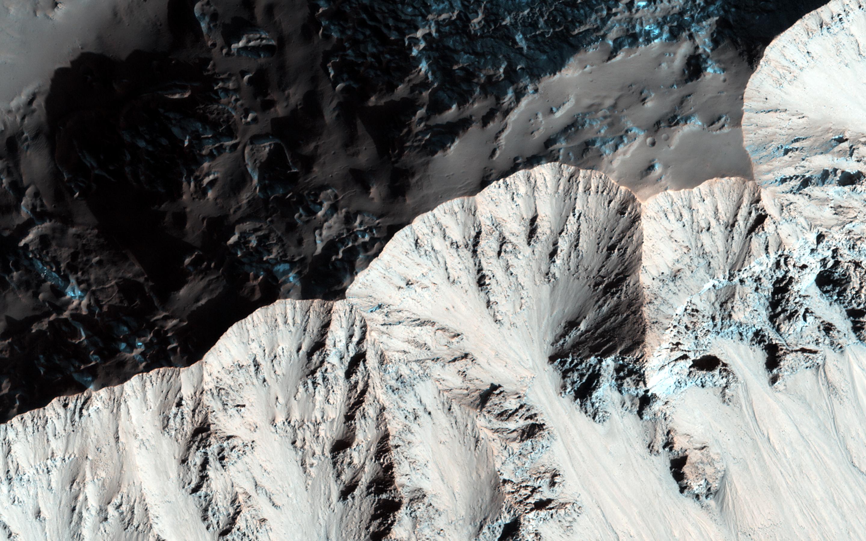
PIA18772:
-
Global Eyes on an Impact Prize
Full Resolution:
TIFF
(5.191 MB)
JPEG
(700.7 kB)
|
|
|
2014-05-22 |
Mars
|
Mars Reconnaissance Orbiter (MRO)
|
CTX
|
1980x2176x1 |
|
-
PIA18382:
-
Fresh Mars Crater Confirmed Within Impact Scar
Full Resolution:
TIFF
(4.313 MB)
JPEG
(1.148 MB)
|
|
|
2014-05-22 |
Mars
|
Mars Reconnaissance Orbiter (MRO)
|
HiRISE
|
2880x1800x3 |
|
-
PIA18771:
-
At the Edge of a Polar Cap
Full Resolution:
TIFF
(15.56 MB)
JPEG
(796.4 kB)
|
|
|
2014-05-22 |
Mars
|
Mars Reconnaissance Orbiter (MRO)
|
HiRISE
|
2880x1800x1 |
|
-
PIA18649:
-
The Busy Flank of Arsia Mons
Full Resolution:
TIFF
(5.191 MB)
JPEG
(682.4 kB)
|
|
|
2014-05-22 |
Mars
|
Mars Reconnaissance Orbiter (MRO)
|
MARCI
|
928x242x3 |
|
-
PIA18381:
Best-Ever Pinning Down When a Space Rock Hit Mars
Full Resolution:
TIFF
(674.2 kB)
JPEG
(28.52 kB)
|
|
|
2014-05-22 |
Mars
|
Mars Reconnaissance Orbiter (MRO)
|
MARCI
|
1700x1700x3 |

|
-
PIA18380:
-
Impact Scar Detected in Mars Weathercam Image
Full Resolution:
TIFF
(8.674 MB)
JPEG
(222.2 kB)
|
|
|
2014-05-22 |
Mars
|
Mars Reconnaissance Orbiter (MRO)
|
HiRISE
|
2880x1800x3 |
|
-
PIA18648:
-
What Gullies Can Say
Full Resolution:
TIFF
(15.56 MB)
JPEG
(696.7 kB)
|
|
|
2014-05-22 |
Mars
|
2001 Mars Odyssey
|
THEMIS
|
1504x2949x1 |
|
-
PIA18257:
-
Utopia Planitia
Full Resolution:
TIFF
(4.44 MB)
JPEG
(538.5 kB)
|
|
|
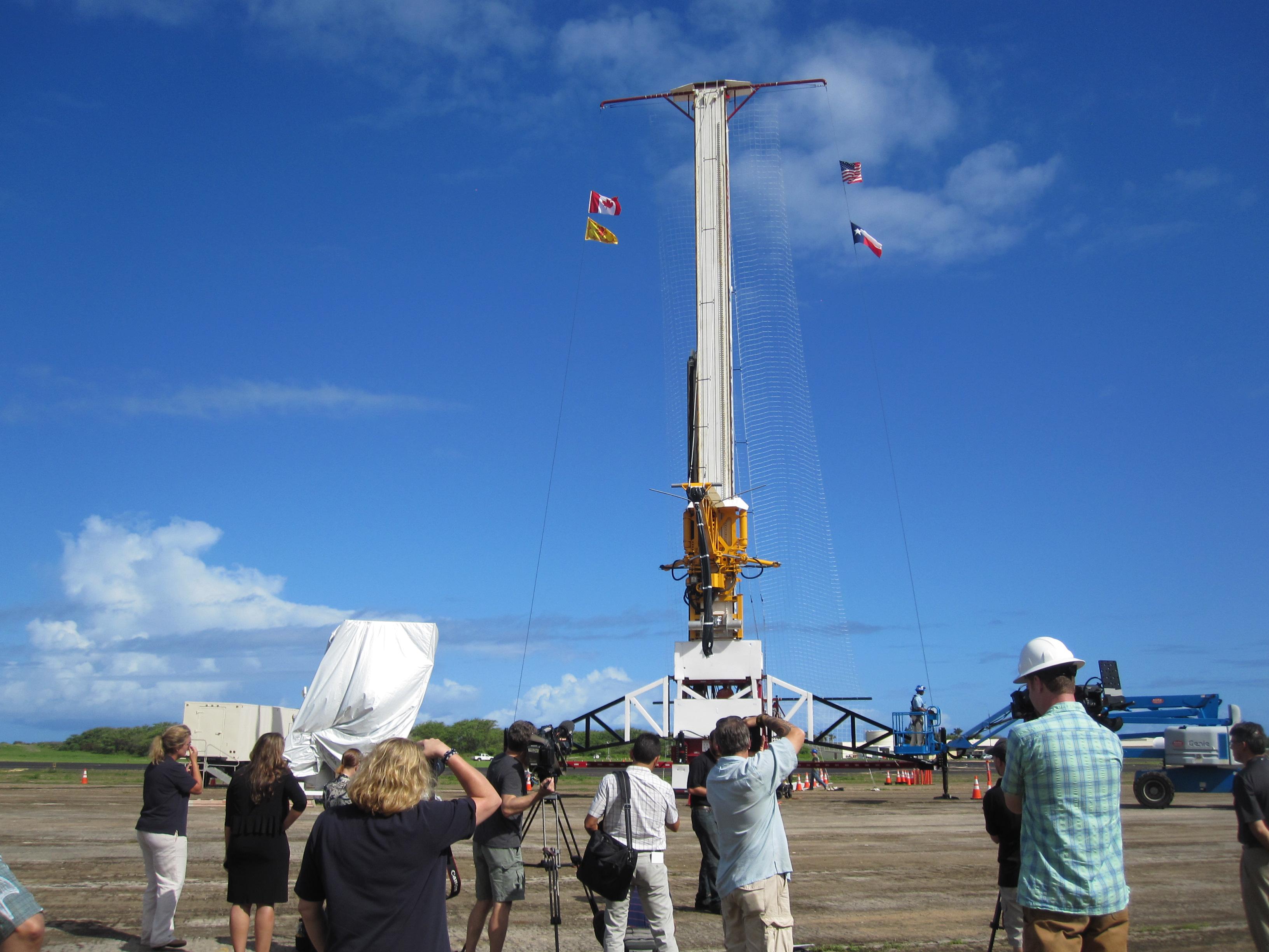
2014-05-21 |
|
LDSD
|
|
2448x3264x3 |
|
-
PIA18011:
-
Before the Drop: Engineers Ready Supersonic Decelerator
Full Resolution:
TIFF
(23.98 MB)
JPEG
(625.3 kB)
|
 Planetary Data System


